Embed Size (px)
Citation preview

The Tajik Pamirs - the people, their culture and historical connections to China © Robert Middleton 2013 1. Population and Physical Characteristics of the Tajik Pamirs The Tajik Pamirs are situated in the eastern part of Tajikistan (Gorno-Badakhshan Autonomous Oblast - GBAO) and cover nearly half of the total surface area of Tajikistan (approx. 64,000 square km, equal to 1.5 times the area of Switzerland). The western and southern frontiers of the Tajik Pamirs are determined by the Panj/Amu Darya (喷赤河 /
阿姆河) and Pamir rivers and are contiguous to Afghanistan. The eastern border is contiguous to the Kashgar prefecture of China (中国的喀什地区). GBAO was created in January 1925 and was attached to the Tajik Soviet Socialist Republic after the republic's creation in 1929.
Until the mid-20th century, human settlement in the Pamirs was insignificant: indeed, the high plateau of the Eastern Pamirs was - until relatively late in the Soviet period - inhabited almost exclusively by nomadic herders. As is the case with any other area inhabited by nomadic peoples, the Pamirs were far from virgin unexplored territory at the time European explorers began to make maps and surveys. Long before the time of miners of spinel, lapis and silver, silk road traders, Chinese Buddhist pilgrims, Jesuit missionaries, spies and military adventurers, the Pamirs had been criss-crossed by local nomadic herders since time immemorial. The earliest estimates of population in the Tajik Pamirs, however, were not made until the British and Russian Empires began to take an interest in the region as part of

2
their imperial rivalry known as the "Great Game". Estimates by British and Russian travellers indicate that until the Soviet period the population of the Tajik Pamirs did not exceed 20-25,000. However, it became declared Soviet policy to encourage human settlement in strategic border areas and the population began to grow steadily. Nomadic herders in the eastern Pamirs, for example, were forced to live in an urbanised environment, leaving their houses only in the spring and summer for their yurts and pastures. A heavily subsidised system of food deliveries was organised - especially during the winter months, when the road from the Tajik capital Dushanbe was closed for 4-5 months by snow, and deliveries had to be made along what is now known as "The Pamir Highway" from Osh in Kyrgyzstan.1 Best estimates of population2 show a growth from some 29,000 in 19263 to 45,000 in 1950, 128,000 in 1979 and approx. 200,000 at the end of the Soviet period. During the Tajik civil war (1992-1997) the population reached a peak of some 250,000 as a result of an influx of displaced persons from other parts of Tajikistan. The current population is estimated at 216,000 (approx. 3% of the total population of Tajikistan). The total area of arable land (i.e. available for cultivation) is only 240 square km (0.4% of the Tajikistan total). Human settlements are located at altitudes varying from 1,200m to 3,500m. GBAO is one of the poorest regions in Tajikistan and therefore one of the poorest in all Central Asia as well as worldwide. The average per capita income in Tajikistan in 2011 was around $2,000 per year (substantially lower in GBAO).4
The Eastern Pamirs (Murghab district, population approx. 16,000) are mainly inhabited by people of Kyrgyz extraction, although there is a significant minority in Murghab town originating from the Western Pamirs.
The Western Pamirs (Darvaz, Vanch, Rushan, Shughnan - including the regional capital Khorog - Roshtkala and Ishkashim districts, population approx. 200,000) are inhabited by
1 This strategic road, of which the section Osh-Murghab was opened in 1897, was completed a few years later and was fully asphalted and open to motor traffic by 1935. It regained significance as a military supply route during the Russian invasion and occupation of Afghanistan 1979-1989 (v. Kreutzmann Hermann, "The significance of geopolitical issues for internal development and intervention in mountainous areas of Crossroads Asia", Crossroads Asia, Working Paper Series 07, Bonn, January 2013). 2 Kreutzmann Hermann, Ethnizität im Entwicklungsprozess, Berlin 1996, p. 169. 3 By this time the anti-Bolshevik revolt in Central Asia, know as the Basmachi movement, had been finally put down and stability had returned. 4 World Bank (http://en.wikipedia.org/wiki/List_of_countries_by_GDP_%28PPP%29_per_capita)

3
people of Irano-European extraction. There are no tensions between the ethnic groups in the Pamirs.
The physical characteristics of the people of the Western Pamirs suggest that they are ethnically related to the original Saka/Scythian inhabitants of Central Asia who were driven westward by successive Mongol invasions from the 13th century CE onwards and ultimately found refuge in the inaccessible high mountain area of the Pamirs. There is general agreement among scholars that, from as early as the second millennium BCE, large areas of Siberia, Central Asia and Western China were inhabited by a group of peoples known collectively as Scythians (frequently referred to in Central Asian ethnography by their Persian name ‘Sakas’), a nomadic people who left no documentary and only fragmentary linguistic evidence of their existence, but about whom credible information is found in histories from the time of the Achaemenid dynasty in Persia (559-330 BCE) and in the Histories of Herodotus (5th century BCE).5 Anthropological, archaeological and linguistic evidence indicates that the Scythians were Europoids6, that they were fire- and sun-worshippers and that their language belonged to the Indo-Iranian group of the Indo-European linguistic family. Among modern languages,
5 Herodotus, The Histories, Penguin Classics, 2003, pp. 258-264 and passim. 6 History of the Civilizations of Central Asia, Vol. II, UNESCO Paris 1994, p. 315.

4
Ossetian and some dialects still spoken in the Pamirs are probably the closest to the original Scythian language.
Scythian ornament from the Jalauly Treasure – 5th to 3rd century BCE Central State Museum of Kazakhstan, Almaty
Ancient Chinese histories record that the Wusun (Asiani) who took Bactria from the Greeks were ‘blue-eyed and fair’ and that their allies, the Dingling, had blue eyes and red beards. Herodotus described them as having ‘long chins’ and the Chinese Buddhist traveller Xuanzang (玄 奘 - ?602-664 CE) noted that the Kashgaris had green eyes7 and that one of the peoples living on the upper Oxus had eyes “of a bluish-green tint, different from all other people.”8
7 Sally Hovey Wriggins, Xuanzang: A Buddhist Pilgrim On The Silk Road, Boulder 1996, p. 162. 8 Shaman Hwui Li, The Life of Huen-Tsiang (Translated by Samuel Beal), London 1911, Book V, p. 197 (Reprint Asian Educational Services, New Delhi 1998).

5
The Western Pamirs are characterised by narrow and long valleys, leading west into the Panj/Amu Darya. The eastern Pamirs are a high plateau (approx. 3,000m-3,500m) that contains several mountains over 6,000m:
Peak Somoni - formerly Pik Communism (7,495m) Independence Peak - formerly Peak Lenin (7,134m)
Peak Karl Marx (right - 6,723m) and Peak Engels (left - 6,510m)
Mustagh Ata (centre - 慕 士 塔 格 峰 - 7,546m) and Kongur Tagh (left - 公 格 尔 峰 - 7,649m) are just across the border in China.

6
The Fedchenko glacier, named after the Russian scientist and explorer Alexei Pavlovich Fedchenko (1844-1873), is the longest glacier in the world outside of the polar regions.
Nineteenth century explorers of the Pamirs concluded that the term ‘Pamir’ was used in Central Asia to describe any high mountain area of valleys and plateaux. The etymology and precise meaning of the name ‘Pamir’ are problematic. The name is encountered for the first time in Xuanzang's account of his journey in about 630 CE as “the valley of Bomilo”9 which corresponds to no known expression in modern Chinese and must have been Xuanzang’s attempt to transliterate the name then used by the local inhabitants. This designation was confirmed six hundred years later by Marco Polo, who recorded the name as ‘Pamier’. There are many theories of its etymology, of which the most poetic is from ancient Persian: ‘poye’-’mehr’ – the land at the foot of the sun. As in the case of ‘Pamir’, the name ‘Badakhshan’ occurs first in the travel narrative of Xuanzang, as the kingdom of "Po-to-chang-na", located by him in the Upper Oxus;10 it is also mentioned in the ‘Book of Kings’ by the Persian poet Firdowsi (Shahnameh, i, 24) composed in the tenth century. Much earlier, however, Greek and Roman historians and geographers wrote about the lands beyond the Oxus (Amu Darya) and Jaxartes (Syr Darya) and the people who inhabited them; their maps record contemporary ‘knowledge’ of the Pamirs. The southern extensions of the ‘Silk Road’ passed through the Pamirs and, from the second century BCE to the seventh century CE, traders and Buddhist pilgrims brought back accounts of the lands near the western frontiers of China. Following the Arab conquest of Bactria in the eighth century CE, Arab travellers and geographers also contributed records of the region. 2. Culture and Religion Language The Tajik Constitution states: “The state language of Tajikistan is Tajik. Russian is a language of communication between the nationalities.” In the Pamirs (and in the Yaghnob valley, a southern tributary of the upper Zarafshan river), however, a number of ancient Iranian languages survive. Ishkashim, Roshtkala, Rushan and Shughnan districts and the Yazgulam valley of Vanch district have their own (sometimes mutually incomprehensible) oral
9 Ta-T’ang-Si-Yu-Ki: translated by Samuel Beal in Buddhist Records of the Western World (London: Trubner & Co. Ltd., 1884), p. 291. (Reprint by Munshiram Manoharlal, New Delhi, 2004.) Part also available on the Silk Road Seattle website: http://depts.washington.edu/uwch/silkroad/texts/xuanzang.html. 10 Buddhist Records of the Western World, p. 297.

7
languages. Vanchi, spoken formerly in the Vanch valley, is now extinct and Tajik is the language spoken today in Darvaz district and Vanch valley. Many people in the Western Pamirs speak Tajik and Russian, as well as their local Pamiri language. The native language in the Eastern Pamirs (Murghab district) is Kyrgyz, although many people also speak at least some Russian. Religious identity The territory of present-day Tajikistan was part of the Iranian Empire, the religion of which – at least from the Achaemenid period (559-338 BCE) – was Zoroastrianism. There are several traces of fire temples in the Pamirs (Zoroastrian and probably pre-Zoroastrian). When the Iranian Sassanids were defeated by the Muslim Arab armies in 636 CE, Islam was gradually spread throughout Central Asia.
The religion of the vast majority of Tajikistan’s population today is Sunni Islam. In the Pamirs, however, a majority of the people profess the Ismaili faith, a branch of Shia Islam that considers Ismail, the eldest son of the Shia Imam Jafar al-Sadiq – d. 765 CE – as his successor; the spiritual leader of the Ismaili community is the Aga Khan, the 49th Imam of the community since the time of Ali. Until the 19th century, when the Emir of Bukhara imposed forcible conversions on the population of Darvaz and the Vanch and Yazgulam valleys, most of what is now Gorno-Badakhshan professed the Ismaili faith and there were large numbers of Ismailis in what is now Khatlon district. There are also substantial Ismaili communities in Gilgit, Hunza and Chitral in the Northern Areas of Pakistan, in Afghan Badakhshan and in Tashkurgan county in Xinjiang. The Shrines of the Pamirs Gorno-Badakhshan possesses a wealth of external manifestations of the Ismaili faith in the form of sacred sites (Oston) and shrines (Mazar). Most of these are dedicated to Ali, saints and other holy figures from antiquity and can be found in all districts where the majority of the population is Ismaili. There are also shrines in some remote villages in areas with predominantly Sunni population, evidence – as noted above – that the Ismaili faith once extended to these valleys. An example is Poi-Mazar at the top of the Vanch valley where there is, according to legend, the grave of Ali.

8
The shrines of Gorno-Badakhshan are characterised by the presence of sacred stones and the horns of ibex and Marco Polo sheep (Ovis Poli), symbols of purity under Aryan and Zoroastrian religious traditions, long before the introduction of Islam; they also show evidence of regular use for fire rituals, in which aromatic herbs (‘strachm’ or ‘yob’) and animal fat (‘roghan’) are burnt. The local traditions and legends attached to some shrines pre-date the introduction of Islam in the Pamirs.
The Symbolism of the Pamiri House One of the most important repositories of the culture of the Pamirs is the traditional Pamiri house, locally known as 'Chid' in the Shughni language. What to the untrained eye looks like a very basic – even primitive – structure, is, for the people who live in it, rich in religious and philosophical meaning. It embodies elements of ancient Aryan and Buddhist philosophy – some of which have since been assimilated into Pamiri traditions. The symbolism of specific structural features of the Pamiri house goes back over two and a half thousand years and its distinctive architectural elements are found in buildings in several other areas close to the Pamirs.
Other decorative elements in a Pamiri house - in addition to carved Aryan / Zoroastrian symbols - frequently include a combination of red and white, symbolising: § Red: the sun, blood (the source and essence of life) and fire and flame (the first thing
created by God);

9
§ White: light, milk (the source of human well-being).
At the Persian New Year ('Navruz'), a willow wreath (in the form of a circle containing a cross) is dipped in flour and used to draw figures and designs on the walls and columns of the main room. Stripped willow twigs are bound together (to resemble a vegetable stalk) and placed between the beams as a token of abundant crops in the new year. For the people of the Pamirs, willow is the symbol of new life, because in spring it is the first tree that “wakes up” after a long sleep. It plays a role in wedding ceremonies, when a willow twig is used to lift the bride's veil and when an arrow made of willow is shot through the skylight. In old times when a husband wanted to divorce his wife, he took a stick of willow and broke it above her head. At burials, a willow stick is used to measure the length of the body and determine the size of the grave to be dug. Music and Dancing Pamiri music is recognised today as belonging to a very ancient folk tradition, and is studied by musicologists from all over the world. Pamiri musical groups appear in western concert halls and on television and recordings of their music are readily available.
10
For Pamiris, music and dance are intimately linked; many Pamiri songs also contain both popular and religious elements, frequently referring to the Ismaili Imam. The pre-eminent vocal and instrumental genre of devotional music in the Pamirs is known as madoh, devotional songs of praise that can embody the spiritual power known as baraka. They serve several cultural functions and are also used with prayer and in the context of traditional healing.
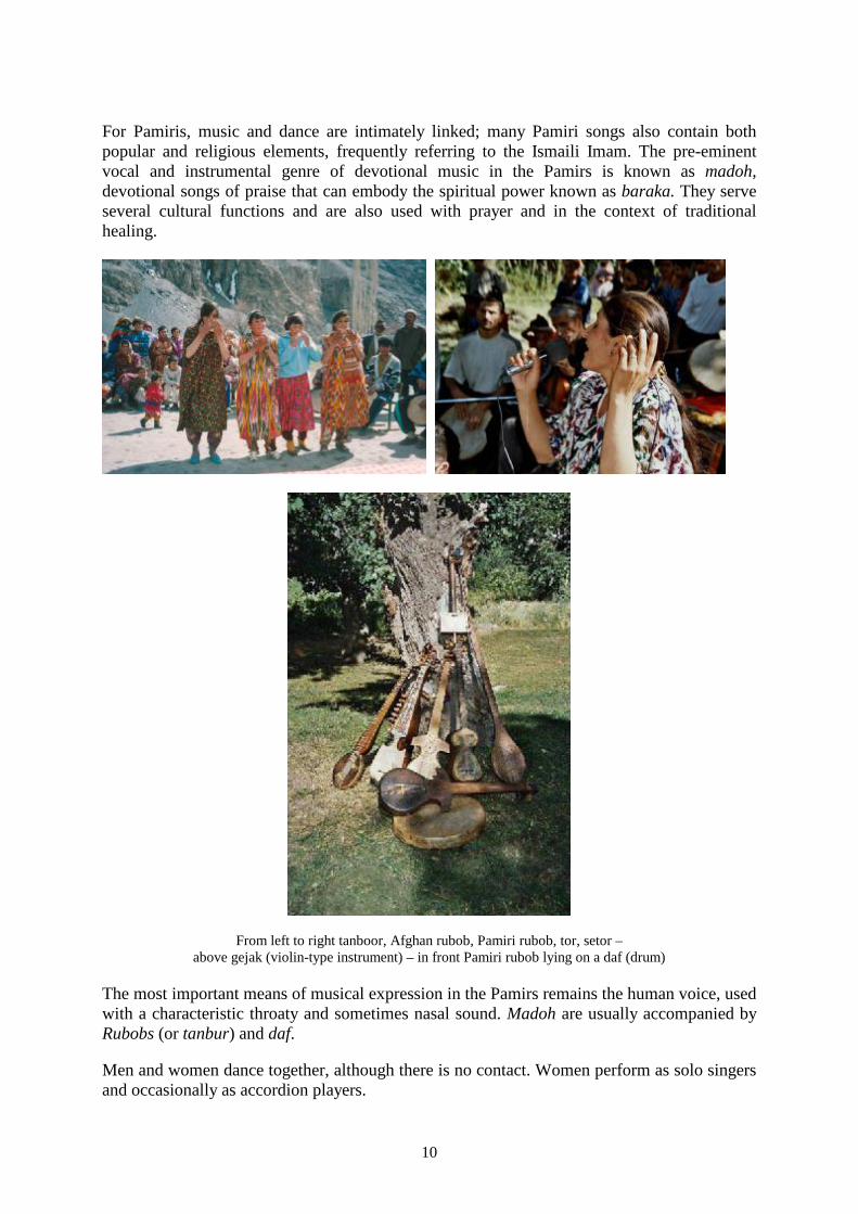
From left to right tanboor, Afghan rubob, Pamiri rubob, tor, setor – above gejak (violin-type instrument) – in front Pamiri rubob lying on a daf (drum)
The most important means of musical expression in the Pamirs remains the human voice, used with a characteristic throaty and sometimes nasal sound. Madoh are usually accompanied by Rubobs (or tanbur) and daf.
Men and women dance together, although there is no contact. Women perform as solo singers and occasionally as accordion players.
11
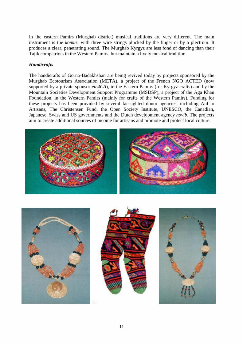
In the eastern Pamirs (Murghab district) musical traditions are very different. The main instrument is the komuz, with three wire strings plucked by the finger or by a plectrum. It produces a clear, penetrating sound. The Murghab Kyrgyz are less fond of dancing than their Tajik compatriots in the Western Pamirs, but maintain a lively musical tradition. Handicrafts The handicrafts of Gorno-Badakhshan are being revived today by projects sponsored by the Murghab Ecotourism Association (META), a project of the French NGO ACTED (now supported by a private sponsor etc4CA), in the Eastern Pamirs (for Kyrgyz crafts) and by the Mountain Societies Development Support Programme (MSDSP), a project of the Aga Khan Foundation, in the Western Pamirs (mainly for crafts of the Western Pamirs). Funding for these projects has been provided by several far-sighted donor agencies, including Aid to Artisans, The Christensen Fund, the Open Society Institute, UNESCO, the Canadian, Japanese, Swiss and US governments and the Dutch development agency novib. The projects aim to create additional sources of income for artisans and promote and protect local culture.
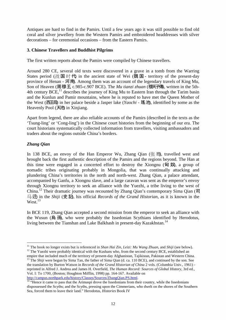
12
Antiques are hard to find in the Pamirs. Until a few years ago it was still possible to find old coral and silver jewellery from the Western Pamirs and embroidered headdresses with silver decorations – for ceremonial occasions – from the Eastern Pamirs. 3. Chinese Travellers and Buddhist Pilgrims The first written reports about the Pamirs were compiled by Chinese travellers. Around 280 CE, several old texts were discovered in a grave in a tomb from the Warring States period (战 国 时 代) in the ancient state of Wei (魏 国 - territory of the present-day province of Henan - 河 南). Among them was an account of the legendary travels of King Mu, Son of Heaven (周 穆 王, c.985-c.907 BCE). The Mu tianzi zhuan (穆天子傳), written in the 5th-4th century BCE,11 describes the journey of King Mu to Eastern Iran through the Tarim basin and the Kunlun and Pamir mountains, where he is reputed to have met the Queen Mother of the West (西王母) in her palace beside a Jasper lake (Yaochi - 瑤 池), identified by some as the Heavenly Pool (天池) in Xinjiang. Apart from legend, there are also reliable accounts of the Pamirs (described in the texts as the ‘Tsung-ling’ or ‘Cong-ling’) in the Chinese court histories from the beginning of our era. The court historians systematically collected information from travellers, visiting ambassadors and traders about the regions outside China’s borders. Zhang Qian In 138 BCE, an envoy of the Han Emperor Wu, Zhang Qian (张 骞), travelled west and brought back the first authentic description of the Pamirs and the regions beyond. The Han at this time were engaged in a concerted effort to destroy the Xiongnu (匈 奴), a group of nomadic tribes originating probably in Mongolia, that was continually attacking and plundering China’s territories in the north and north-west. Zhang Qian, a palace attendant, accompanied by Ganfu, a Xiongnu slave, and a large caravan was sent as the emperor’s envoy through Xiongnu territory to seek an alliance with the Yuezhi, a tribe living to the west of China.12 Their dramatic journey was recounted by Zhang Qian’s contemporary Sima Qian (司 马 迁) in the Shiji (史 記), his official Records of the Grand Historian, as it is known in the West.13 In BCE 119, Zhang Qian accepted a second mission from the emperor to seek an alliance with the Wusun (烏 孫), who were probably the Issedonian Scythians identified by Herodotus, living between the Tianshan and Lake Balkhash in present-day Kazakhstan.14
11 The book no longer exists but is referenced in Shan Hai Zin, Leizi: Mu Wang Zhuan, and Shiji (see below). 12 The Yuezhi were probably identical with the Kushans who, from the second century BCE, established an empire that included much of the territory of present-day Afghanistan, Tajikistan, Pakistan and Western China. 13 The Shiji were begun by Sima Tan, the father of Sima Qian (d. ca. 110 BCE), and continued by the son. See the translation by Burton Watson in Records of the Grand Historian of China 2 vols. (Columbia Univ., 1961) - reprinted in Alfred J. Andrea and James H. Overfield, The Human Record: Sources of Global History, 3rd ed., Vol. I: To 1700, (Boston; Houghton Mifflin, 1998) pp. 164-167. Available on http://campus.northpark.edu/history/Classes/Sources/ZhangQian.PS.html. 14 “Hence it came to pass that the Arimaspi drove the Issedonians from their country, while the Issedonians dispossessed the Scyths; and the Scyths, pressing upon the Cimmerians, who dwelt on the shores of the Southern Sea, forced them to leave their land.” Herodotus, Histories Book IV

13
Zhang Qian set off again to the west with 300 men, 10,000 sheep, a large number of horses and much gold and silk. The Wusun, however, also refused alliance with the Han emperor. Zhang Qian then split up his delegation and sent several exploratory missions to other kingdoms, one of which travelled as far as Persia and was received with pomp by the Parthian king between BCE 115 and 105 BCE. The exchange of gifts led to silk becoming known in the West and this second mission can be said to have laid the basis for the development of the silk trade between China and Persia.
Zhang Qian leaving for his expedition
(Mogao Caves, high Tang Dynasty, circa 8th century CE).15 Histories of the Han and Wei dynasties The “Description of the Western Regions” in the History of the Han Dynasty (209-220 CE), contains a section on the Da Yuezhi (月 氏 - Kushans) who also left traces of their presence in the Pamirs, mainly in the Wakhan.16
Yu Huan (魚豢 - fl. 239-265 CE), in his account of the Wei dynasty (Weilüe -魏略),17 collected travellers’ tales and provided a record of contemporary Chinese knowledge of the lands to the West. The original text of the Weilüe has been lost but a key chapter on the ‘Peoples of the West’ was quoted in a footnote to a work by Pei Songzhi (裴松之 - 420-479 CE). Much of Yu Huan’s information had reached China well before his time and dates mostly from the late second and early third centuries CE; some can also be found in the sections dealing with the ‘Western Regions’ of the Shiji (‘Records of the Grand Historian’), the Hanshu (汉 书 - ‘Book of Former Han’), and the Hou Hanshu (后 汉 书 - 'Book of the later
15 http://en.wikipedia.org/wiki/Image:ZhangQianTravels.jpg. 16 Han Shu, as translated by A. Wylie in the Journal of the Anthropological Institute of Great Britain and Ireland, Vols. III (1874), pp. 401-452, V (1876), pp. 41-80, and X (1881), pp. 20-73, and XI (1882), pp. 83-115, accessible on http://depts.washington.edu/uwch/silkroad/texts/hantxt1.html#yueshi 17 The Peoples of the West from the Weilüe by Yu Huan: A Third Century Chinese Account Composed between 239 and 265 CE; Quoted in zhuan 30 of the Sanguozhi, Published in 429 CE, draft English translation by John E. Hill, September, 2004, on http://depts.washington.edu/uwch/silkroad/texts/weilue/weilue.html

14
Han').18 Yu Huan describes the three routes to the West known to the Chinese, two of which passed through the Pamirs. Buddhist Pilgrims With the growth of Buddhism in China and neighbouring regions, a new type of traveller emerged: the Buddhist pilgrim. According to legend, Ming Di (汉 明 帝), the second emperor (ruled 57/58–75/76 CE) of the Eastern Han dynasty, had a dream which led him to send his agents to bring him information about regions to the west. They returned with a picture of the Buddha and a copy of the Sutra that was translated in 67 CE, thus becoming the first Buddhist text in Chinese. Several Chinese Buddhist pilgrims are known to have travelled subsequently to western lands. Shi Dao'an (釋 道 安 - d. 385 CE) wrote a work on his travels to India, which is lost,19 and, in 399 CE, Faxian (法 顯) travelled to the edge of the Pamirs and then over the Hindu Kush to India. His account of his travels, the Foguo Ji (佛 國 記),20 is short and he has only the following reference to the Pamirs
In Ts’ung-ling there is snow both in winter and summer. Moreover there are poison-dragons, who when evil-purposed spit poison, winds, rain, snow, drifting sand, and gravel stones; not one of ten thousand meeting these calamities, escapes. The people of that land are also called Snowy-mountain men.
In 518 CE, Huishen (慧 深) and Songyun (宋 雲) were sent by the Queen of the northern Wei dynasty (胡, ?-528 CE) across the Pamirs to India to collect books and relics. The account of their travels21 is also short but echoes the experience of the earlier Chinese travellers of the high mountain regions they crossed on their way.
During the first decade of the 8th month we entered the limits of the country of the Hanbanduo [Tashkurgan], and going west six days, we ascended the Tsung-ling mountains; advancing yet three days to the west, we arrived at the city of Jueyu [the home of a Turkic tribe, probably the Huns]; and after three days more, to the Buheyi mountains [Mustagh range?]. This spot is extremely cold. The snow accumulates both by winter and summer. In the midst of the mountain is a lake in which dwells a mischievous dragon. ….From this spot westward, the road is one continuous ascent of the most precipitous character; for a thousand li22 there are overhanging crags, 10,000 fathoms high, towering up to the very heavens. … After entering the Congling mountains, step by step, we crept upwards for four days, and then reached the highest part of the range. From this point as a centre, looking downwards, it seems just as though one was poised in mid-air. The kingdom of Hanbanduo stretches as far as the crest of these mountains. Men say that this is the middle point of heaven and earth. The people of this region use the water of the rivers for irrigating their lands; and when they were told that in the middle country [China] the fields were watered by the rain, they laughed and said “How could heaven provide enough for all?”
At another point on their journey, Songyun gives what is probably the first description of snow-blindness: 18 Hill, John. Through the Jade Gate to Rome, An annotated translation of the Chronicle of the Western Regions in the Hou Hanshu, Booksurge 2009. 19 Yule Henry, Cathay and the Way Thither, London 1915, Vol. 1, p.75. 20 The text was discovered by Heinrich Julius Klaproth in 1816 and published in a French translation by Jean Pierre Abel Remusat in 1836, in which Klaproth collaborated. An English translation (The Travels of Fah-Hian) was made by Samuel Beal and published in London in 1869 (and, in a revised version, in 1884) – included in Buddhist Records of the Western World, Munshiram Manoharlal Publishers, New Delhi 2004. 21 The Mission of Sung-Yun and Hwei-Sang to obtain Buddhist books in the West (518 AD). Translated by Samuel Beal, London 1884 - also included in Buddhist Records of the Western World, Munshiram Manoharlal Publishers, New Delhi 2004. 22 The li corresponds to 415.8 metres (see the note on measurements in John Hill’s translation of the Weilüe on http://depts.washington.edu/uwch/silkroad/texts/weilue/weilue.html).

15
A mischievous dragon took up his residence here and caused many calamities. In the summer he
rejoiced to dry up the rain, and in the winter to pile up the snow. Travellers by his influence are subjected to all sorts of inconveniences. The snow is so brilliant that it dazzles the sight; men have to cover their eyes, or they would be blinded by it; but if they pay some religious service to the dragon, they find less difficulty afterwards.
After a journey lasting three years, Huishen and Songyun returned with 175 holy texts. The first account of the other major affliction of travellers at high altitudes, altitude sickness, was given by Tu Jin, a Chinese official, in 37-32 BCE, and also related to travel in the Pamirs. Chinese travellers on the Silk road were warned that there were certain passes designated as “big headache” and “little headache”23 and, in 1900, manuscripts were found by a Taoist monk in a cave in Dunhuang, in Chinese Central Asia, that included military reports about altitude sickness among soldiers fighting in the Pamirs.24 Xuanzang Xuanzang is probably the best known of the Buddhist travellers. After many years of study, he concluded that there were major defects in the Chinese translations of the sacred books and decided in 629 CE to go to India in search of uncorrupted Buddhist texts in Sanskrit. His journey took him sixteen years and covered some 15,000 km. On return to Xi'an in 645 CE, Xuanzang wrote the Record of the Western Regions, a detailed description of his travels.25
Xuanzang returning to China Fujita Art Museum
Travel outside China was forbidden at the time and Xuanzang had to leave clandestinely on his mission. Reports differ on whether he disguised himself and joined a group of Central Asian merchants heading West along the Silk Road or moved west in search of food with groups of emigrants at a time of famine in China.
23 Ward Michael, "Mountain Medicine and Physiology: A Short History", in High Altitude - an exploration of human adaptation ("Lung Biology in Health and Disease" No 161), 2001, p.191. (http://www.ncbi.nlm.nih.gov/pubmed/6351209) 24 See and http://capra.group.shef.ac.uk/4/treasures.html. 25 Ta-t’ang-si-yu-ki: translated by Samuel Beal in Buddhist Records of the Western World (London: Trubner & Co. Ltd., 1884), available on the Silk Road Seattle website:. http://depts.washington.edu/uwch/silkroad/texts/xuanzang.html

16
On the way to Samarkand, he crossed the Tianshan range into the territory of modern-day Kyrgyzstan, near Lake Issyk-kul, where he met by chance the Great Khan of the Western Türks who received him royally. From Samarkand he travelled to India where he stayed more than 10 years. On his way back, he took the southern route through the Pamirs to Kashgar and noted the existence of a great Dragon Lake. We have seen that Songyun also noted that “in the midst of a mountain is a lake, in which dwells a mischievous dragon”; his and Xuanzang’s mention of a ‘Dragon Lake’ has given rise to much speculation: the lake has been variously identified as Karakul, Rangkul, Chakmaktynkul or Zorkul.26 I am a firm believer that names do not change much over time and that folk memory – in the form of names passed down from generation to generation – should have at least equal standing with scholarly speculation. There is indeed a ‘Dragon Lake’ (in Kyrgyz ‘Ajdarkel’) in the valley of the Aksu just north of the village of Shaimak, close to the cliff known as Aktash. At normal times, Ajdarkel is much smaller than the lake described by Xuanzang; it is, however – like Rangkul and several other lakes in the Pamirs – ‘intermittent’ and in the early summer, after the first major snow-melt, it increases in size. In years – such as 2005 – when much snow has fallen in the winter and there is a sudden rise in temperature in early summer (the time when Xuanzang passed there), the lake would appear to fill the whole valley of the Aksu.
Ajdarkel in late summer The Emperor Gaozong (唐 高 宗) authorised a translation of the new Sanskrit texts brought back by Xuanzang and built the "Big Wild Goose" Pagoda (大 雁 塔) to store them, a reconstruction of which still stands in Xi'an. In China, Xuanzang is better known than Marco Polo and his travels have provided inspiration for much popular literature, including The Monkey King or Journey to the West (孙 悟 空 - 西 游 记), the story of a monkey who travels west to retrieve Buddhist sutras from India, published anonymously by Wu Chengen (西 遊 記) in the 16th century. 26 For a lively account of the conflicting theories, see Curzon The Pamirs and the Source of the Oxus.

17
"Big Wild Goose" pagoda in Xi'an Sun Wukong and Xuanzang - from an 1864 edition of Journey to the West
Tang Dynasty In 618 CE, the Tang dynasty (唐 朝) came to power and expanded China’s territory to the west, incorporating almost all of what was known in the 19th century as East Turkestan. In the last quarter of the seventh century, however, the T’ang empire started to clash in the west with the Tibetans, whose influence in the region was rapidly expanding. By the beginning of the eighth century, Tibetan power extended over large parts of eastern Central Asia, including the Pamirs, Gilgit and Baltistan: Tibet controlled access from Kashgar through the Mintaka pass to Kashmir and the Indus valley and established alliances with the Turkic tribes in the Tarim area and the Arabs in Central Asia.27 The Tibetans’ route to their Arab allies passed through Baltistan to Gilgit and Yasin, and from there to the Wakhan across the Darkot and Baroghil passes. Baltistan fell to the Tibetans in 722 CE and in the years that followed they subjugated many kingdoms and petty principalities in the Hindu Kush and Upper Oxus. In 747 CE, faced with this threat, the Chinese Emperor entrusted Gao Xianzhi, a general of Korean extraction commanding the military forces in the Tarim basin, with the difficult mission of dislodging the Tibetans and cutting their communications to the Arabs. The Annals of the Tang Dynasty (新 唐 書) describe the Chinese military expedition into the Pamirs in 747 CE that is one of the most remarkable on record. In 1923, Aurel Stein published
27 History of the Civilizations of Central Asia, Vol. III, UNESCO Paris 1996, p. 362. The authors (Mu Shun-ying and Wang Yao) also note that, according to some records “the Tibetans may also have invaded India in search of relics of the Buddha in Magadha and set up an iron column on the Ganges.”
18
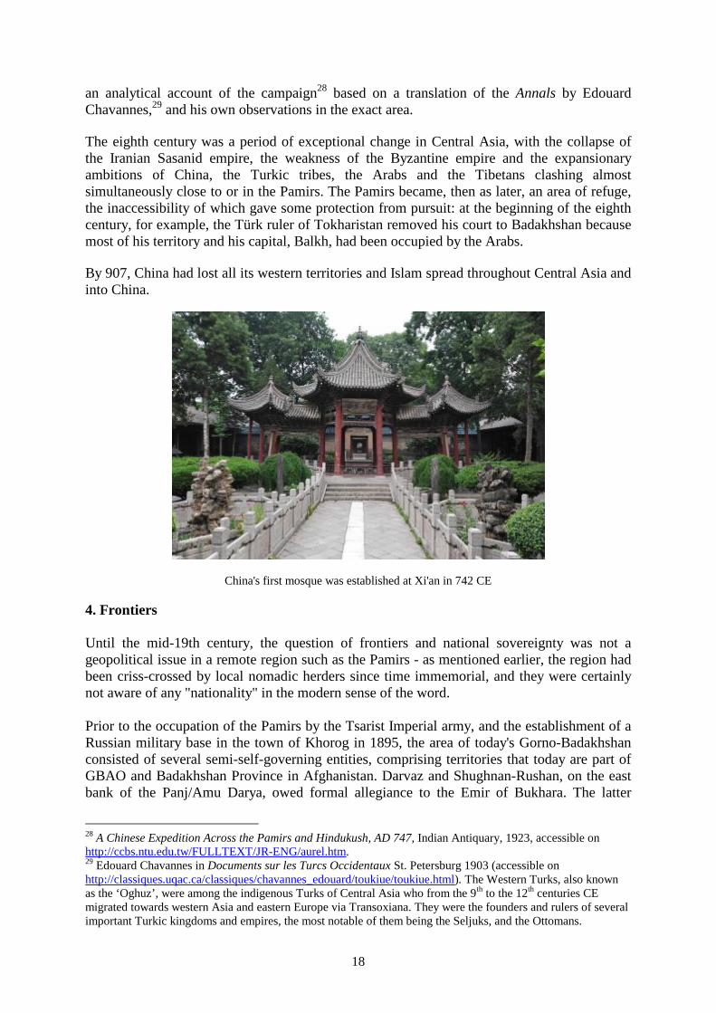
an analytical account of the campaign28 based on a translation of the Annals by Edouard Chavannes,29 and his own observations in the exact area. The eighth century was a period of exceptional change in Central Asia, with the collapse of the Iranian Sasanid empire, the weakness of the Byzantine empire and the expansionary ambitions of China, the Turkic tribes, the Arabs and the Tibetans clashing almost simultaneously close to or in the Pamirs. The Pamirs became, then as later, an area of refuge, the inaccessibility of which gave some protection from pursuit: at the beginning of the eighth century, for example, the Türk ruler of Tokharistan removed his court to Badakhshan because most of his territory and his capital, Balkh, had been occupied by the Arabs. By 907, China had lost all its western territories and Islam spread throughout Central Asia and into China.
China's first mosque was established at Xi'an in 742 CE
4. Frontiers Until the mid-19th century, the question of frontiers and national sovereignty was not a geopolitical issue in a remote region such as the Pamirs - as mentioned earlier, the region had been criss-crossed by local nomadic herders since time immemorial, and they were certainly not aware of any "nationality" in the modern sense of the word. Prior to the occupation of the Pamirs by the Tsarist Imperial army, and the establishment of a Russian military base in the town of Khorog in 1895, the area of today's Gorno-Badakhshan consisted of several semi-self-governing entities, comprising territories that today are part of GBAO and Badakhshan Province in Afghanistan. Darvaz and Shughnan-Rushan, on the east bank of the Panj/Amu Darya, owed formal allegiance to the Emir of Bukhara. The latter
28 A Chinese Expedition Across the Pamirs and Hindukush, AD 747, Indian Antiquary, 1923, accessible on http://ccbs.ntu.edu.tw/FULLTEXT/JR-ENG/aurel.htm. 29 Edouard Chavannes in Documents sur les Turcs Occidentaux St. Petersburg 1903 (accessible on http://classiques.uqac.ca/classiques/chavannes_edouard/toukiue/toukiue.html). The Western Turks, also known as the ‘Oghuz’, were among the indigenous Turks of Central Asia who from the 9th to the 12th centuries CE migrated towards western Asia and eastern Europe via Transoxiana. They were the founders and rulers of several important Turkic kingdoms and empires, the most notable of them being the Seljuks, and the Ottomans.

19
territories were also claimed by Afghanistan, as was Wakhan, in the south. The Qing (清朝) rulers of China also claimed control of the entire Pamir Mountains, but Qing military units only effectively controlled the passes just west of the town of Tashkurgan (塔什库尔干镇). The story of the "Sumantash stone" is relevant in this context.
The Sumantash Stone
Kyrgyz tombs at the Sumantash site (photo Surat Toimastov) Sumantash, on the northern bank of the Alichur river, just east of Yashilkul lake, is the site of two brief – but important – military skirmishes: the first, in 1759, ended with the rout by the Chinese of the Khoja (Muslim) rulers of Kashgar, who fled to Afghan Badakhshan. The Chinese commemorated this by a carved rock known as the Sumantash stone. This stone has a long slit on the top that is believed to have served as a primitive letterbox; according to the British adventurer Lord Dunmore who saw it in 1892 at the time of a Russian campaign to expel the Afghans from the Pamirs, it originally carried a panel in Chinese with the following text (Dunmore’s translation): “On the crest of the mountains 10,000 men laid down their arms. The Chinese soldiers, coming from the four points of the compass, then went unopposed as if penetrating into an uninhabited country. The two ringleaders, therefore, seeing that further efforts would be in vain, took to flight, whilst our soldiers in pursuit resembled tigers and leopards, chasing hares and foxes. Before our soldiers had advanced far after them, and when they were still crossing the mountains, our men were in good fighting order.”
The two Muslim leaders reached Badakhshan but were subsequently killed by Sultan Shah, the ruler there. A legend arose that, in their death throes, they laid a curse on Badakhshan and prayed that it might be three times depopulated. As Sir Henry Yule points out in his account of the incident, “in fact, since then it has been at least three times ravaged; first, a few years after the outrage by Ahmed Shah Durani of Kabul, when the treacherous Sultan Shah was put to death; in the beginning of this [19th] century by Kokan Beg of Kunduz; and again in 1829 by his successor Murad Beg, who swept away the bulk of the remaining inhabitants, and set them down to die in the marshy plains of Kunduz.”

20
Some years before Dunmore was in Sumantash, another British explorer, T.E. Gordon, reported that the fleeing Muslims “are said to have driven their women and children, mounted on camels and horses, into the lake, to meet their death by drowning rather than that they should fall into the hands of the enemy. The Kirghiz have a legend that the sounds of lamentation, and of people and animals in terror of death, are often heard near the lake.” Lord Dunmore writes that he saw the inscription in a museum in Tashkent and it must have been separated from the stone by the Russian ‘Flying Pamir Detachment’ under Colonel Mikhail Ionov and taken there after the 1892 campaign that put the Afghans to flight (the stone itself being too heavy to transport easily).
The Chinese army defeats the Khoja brothers (Burhān al-Dīn and Khwāja-i Jahān) in Yesil-Kol-Nor 1759 (Source: http://en.wikipedia.org/wiki/Battle_of_Yesil_Kol_Nor and http://www.battle-of-qurman.com.cn/e/hist.htm)
References: Dunmore Earl Charles Adolphus Murray, The Pamirs; being a Narrative of a Year’s Expedition on Horseback and Foot through Kashmir, Western Tibet, Chinese Tartary and Russian Central Asia, John Murray, London 1893, Vol. II p.167. Yule Henry (Ed. and Trans.), The Book of Ser Marco Polo the Venetian concerning the Kingdoms and Marvels of the East, 3rd ed. revised by Henri Cordier, London: John Murray 1903, Chapter XXIX Note 8. Gordon T.E., The Roof of the World, London 1876, p.158.

21
The British government in London and its extension in India watched with concern the progressive Russian expansion into Central Asia. In 1865, the Russians took Tashkent and, in 1867, General Konstantin Kaufmann was instated there as Governor-General of a new province of Turkestan. By 1868, Bukhara, Khodjent and Samarkand were in the hands of the Russians. Ghulja (Yining - 伊 宁), in Chinese territory, was occupied in 1871 (it was vacated in 1881, but the Russians obtained the right to establish a consulate there); Khiva fell to the Russians in May 1873 and Kokand was annexed in February 1876. The British trained a network of native surveyors, known as "Pundits", who were sent as unobtrusively as possible to report on the territories on the edge of the expanding Russian zone of influence. Subsequently, British officers were sent from India for "shooting holidays" in the Pamirs to make further explorations. It was of particular importance for the British to attempt to prove Chinese sovereignty over the eastern Pamirs in the hope of checking Russian expansion. In 1889 the British Viceroy, the Marquess of Lansdowne, sent Francis Younghusband, an enthusiastic participant in the "Great Game", to determine the extent of Chinese authority in the region in the hope that the Chinese would help to hold back the Russians. There he played hide-and-seek with Russian patrols and attempted (unsuccessfully) to motivate the Chinese and Afghans to make claims of sovereignty in the area. The British Ambassador in St. Petersburg wrote to the Foreign Secretary in January 1892:
I perceive from the correspondence that the Indian government seems desirous to induce the Chinese and Afghans to meet north of Lake Victoria on the Alichur Pamir, and that it would appear that Captain Younghusband actually invited the Afghans to occupy Yashil Kul. Now, it appears to me that this would be a most dangerous policy to follow. It would be acting in flagrant disregard of the engagement of 1872-73; it would give a most legitimate “casus belli” to the Russians against Afghanistan, and we could not honourably encourage the Afghans to carry out such a plan unless we were ready to give them physical support. It seems to me absolutely necessary, if we are to enter upon these negotiations, that we should rigidly adhere to the binding character of the Agreement of 1872-73.30
In correspondence with the Foreign Secretary a month earlier, the Ambassador had also confirmed that the Russians were aware that Younghusband and his companion, Davison, were fishing in troubled waters:
I ought to say that in the course of conversation M. de Giers [the Russian Foreign Minister] mentioned in explanation of Colonel Yonow’s [Ionov’s] high-handed treatment of Captain Younghusband, that he had come across, almost everywhere he went, the traces of that officer’s handiwork in exciting the Chinese against Russia. A statement made by Mr. Davison to Mr. Eliot at Margilan would seem to a certain extent to corroborate this assertion. Mr. Davison said that Captain Younghusband had in the first instance invited the Afghans to take possession of the Alichur Pamir, but on meeting with no response to his overtures had urged the Chinese to strengthen themselves there in view of a possible invasion by the Afghans.31
Although he had invaded and subjugated trans-Oxus Shughnan and Rushan in 1883, even the new Afghan Amir, Abdur Rahman Khan, was uncertain about the actual limits of his territory. To the embarrassment of the Indian and British authorities, Younghusband had exceeded his instructions in the Pamirs: in addition to attempting to mobilise a Chinese presence in the 30 Quoted in Postnikov A.V., Сxватка на «Крыше Мире» - Политики, разведчики и географы в борьбе за Памир в XIX веке [Struggle on the ‘Roof of the World’: Politicians, spies and geographers in the contest for the Pamirs in the 19th century], Moscow 2001, p. 251. 31 Postnikov, p. 248.

22
Pamirs, he had written to the Afghan governor in Shughnan saying that the Chinese had heard he had occupied Sumantash and wished him to withdraw. As a result, in October 1891, the Amir requested “the exalted Government of India to send me a correct map, which may have been prepared with the inquiries and surveys of the English Surveyors made in those regions, showing how far the limits of the Afghan territory extend and how far those of the Chinese and Russians, so that I might be able to know about it, and with due knowledge, be able to send instructions to the Sarhaddar [governor] of Shighnan.”32 In March 1895, Britain and Russia agreed on the basis for a final boundary settlement and a new commission was formed to draw the exact line and place the marking pillars. The “Agreement on the Sphere of Influence between Russia and Great Britain”, in addition to the technical boundary issues, contained, inter alia, the following political provision:
The Commission shall also be charged to report any facts which can be ascertained on the spot bearing on the situation of the Chinese frontier, with a view to enable the two Governments to come to an agreement with the Chinese Government as to the limits of Chinese territory in the vicinity of the line, in such manner as may be found most convenient.
As a result of the work of this commission, the Chinese, Russian, British and Afghan governments signed a series of agreements that divided Badakhshan, but the border with China was not finally settled until an agreement reached in 2002 between the governments of China and Tajikistan, that was ratified in 2011.
32 Postnikov, p. 232.