Embed Size (px)
Citation preview

The Sustainable Urban Forest
A Step-by-Step Approach
Michael Leff
The Davey Institute / USDA Forest Service USFS Philadelphia Field Station March 22, 2015
To provide feedback on this document, email [email protected] or call 215-988-1635.

SUSTAINABLE URBAN FOREST GUIDE Page 1
M. Leff (3/22/15 v5)
The Sustainable Urban Forest: A Step-by-Step Approach
– Table of Contents – Page
PART I – EXPLORING THE URBAN FOREST ................................................................... 4
Overview ....................................................................................................................... 4 Vibrant Cities & Urban Forests ..................................................................................... 4 Sidebar: Recommendations from Vibrant Cities & Urban Forests ......................... 5 How to Use This Guide .................................................................................................. 5
PART II – SETTING THE STAGE ...................................................................................... 7
What Is a “Sustainable Urban Forest”? ........................................................................ 7 Sidebar: Sample Sustainability Initiatives ............................................................... 7 Sidebar: What Is a Sustainable Community? .......................................................... 8 Understanding Tree Benefits – or “Ecosystem Services” ............................................. 8 Sidebar: What Are Ecosystem Services? ............................................................... 10 Green Infrastructure in the Urban Forest ................................................................... 11 Sidebar: Trees as Green Infrastructure BMPs....................................................... 13 Refining Your Focus ..................................................................................................... 13
PART III – COVERING THE CANOPY ............................................................................ 15
Why Consider Canopy Cover? ..................................................................................... 15 Sidebar: What Is ‘Tree Canopy’? ........................................................................... 15
What Is an ‘Optimal Canopy Cover Level’? ................................................................ 15 Sidebar: Tree Canopy Cover Levels and Goals for Selected Cities........................ 16 Sidebar: Search for Urban Forest Data ................................................................. 18
Setting Your Canopy Cover Goals ............................................................................... 18 Pursuing Your Canopy Cover Goals ............................................................................. 19
PART IV – GATHERING THE INFORMATION ................................................................ 21
Taking Stock ................................................................................................................ 21 Sidebar: Key Ingredients ....................................................................................... 22 Forest Resource Assessments ..................................................................................... 23
Bottom-Up: Field-Based Assessments .................................................................. 23 Complete inventories ...................................................................................... 23 Sample-based assessments ............................................................................ 24
Sidebar: Tree Inventories and Routine Management Software ........................... 24 Top-Down: Tree Canopy Assessments .................................................................. 25
National Land Cover Database (NLCD) satellite imagery ................................ 25 Aerial photo interpretation ............................................................................. 26 High-resolution aerial or satellite imagery ..................................................... 27
Other Key Ingredients ................................................................................................. 28 Plans, Practices, Programs, and Policies ............................................................... 28 Databases and Other Information ........................................................................ 29

SUSTAINABLE URBAN FOREST GUIDE Page 2
M. Leff (3/22/15 v5)
PART V – CONSTRUCTING THE COMMUNITY FRAMEWORK ....................................... 30
Sidebar: “We cannot separate urban forests from the people…” ....................... 30 Why Collaborate? ....................................................................................................... 30
Sidebar: “Independent action is inadequate…”.................................................... 30 Sidebar: Possible Stakeholders – and Collaborators – to Consider ...................... 32
Internal City Stakeholders and Relationships ............................................................. 34 Sidebar: Planning for Trees ................................................................................... 36
Cross-Sector Stakeholders .......................................................................................... 36 Sidebar: General Principle 3: Seek out Private and Civic Partners ...................... 38 Sidebar: Citizen Foresters in Clovis ....................................................................... 39 Sidebar: Environmental Justice: Ensuring Equitable Distribution of Resources .. 40
STEW-MAP: Visualizing – and Engaging – Stewardship across the Urban Landscape 40 Sidebar: How to STEW-MAP ................................................................................. 42 Sidebar: Communicating Your Message: “Trees Are the Key” Online Toolkit ..... 43
Regional Collaboration: Developing a Strategy across Borders ................................. 43 Chicago Region Trees Initiative for the Seven-County Metropolitan Area .......... 44 Sacramento Greenprint ........................................................................................ 46 Sidebar: Greenprint Goals for Growth ............................................................ 47 Wisconsin Statewide Urban Forest Strategy ........................................................ 47 Sidebar: Working Well in Wisconsin ............................................................... 48
PART VI – CONDUCTING THE EVALUATION & MEASURING SUCCESS [N/A] ................. 49
Aim for These Targets ................................................................................................. 49
Trees and Forest Vegetation T1 – Relative tree canopy cover T2 – Age diversity (Size class distribution) T3 – Species diversity T4 – Species suitability T5 – Publicly owned trees (trees managed “intensively”) T6 – Publicly owned natural areas (trees managed “extensively”) T7 – Trees on private property T8 – Environmental justice and equity
Community Framework C1 – Municipal agency cooperation C2 – Involvement of large private and institutional landholders C3 – Green industry cooperation C4 – Citizen involvement and neighborhood action C5 – Cross-sector interaction C6 – General appreciation of trees as a community resource C7 – Regional collaboration
Resource Management Approach R1 – Tree inventory R2 – Canopy cover assessment
SUSTAINABLE URBAN FOREST GUIDE Page 3
M. Leff (3/22/15 v5)
R3 – Municipality-wide urban forest management plan R4 – Municipality-wide urban forest funding R5 – Municipal urban forestry staffing and training R6 – Tree establishment planning and implementation R7 – Planting site suitability R8 – Tree protection policy development and enforcement R9 – Maintenance of publicly owned, “intensively” managed trees R10 – Management of publicly owned natural areas R11 – Tree risk management R12 – Urban wood and green waste utilization R13 – Native vegetation
PART VII – DEVELOPING & IMPLEMENTING THE PLAN ............................................... 51
Setting Priorities and Creating an Action Plan ........................................................... 51 Assessing Risk and Planning for Change ..................................................................... 51
Climate change...................................................................................................... 51 Sea level rise ......................................................................................................... 52 Wildfire ................................................................................................................. 53 Pests, disease, and invasive plants ....................................................................... 54 Natural lifecycle changes ...................................................................................... 54 Budget cycles and other economic considerations .............................................. 54
Sidebar: The Financially Stable Sustainable Urban Forest.............................. 55 Changing demographics ........................................................................................ 55
Sidebar: Taking No Chances with Risks ........................................................... 57 Monitoring for Urban Forest Change and Program Performance .............................. 57
Why monitor ......................................................................................................... 58 Ways to monitor ................................................................................................... 59 Linking monitoring to community outreach ......................................................... 60 Planning ahead for data management and analysis ............................................. 60
APPENDIX A –RESOURCES (“Other Key Ingredients,” referenced in Part IV)
Plans, Practices, Programs, and Policies ............................................................... 62 Databases and Other Information ........................................................................ 67

PART I – EXPLORING THE URBAN FOREST Page 4
M. Leff (3/22/15 v5)
PART I – EXPLORING THE URBAN FOREST Overview
Increasingly, cities and communities of all sizes recognize the importance of their tree cover and
the need for plans to manage that natural resource. Far fewer actually have such plans in place,
and where they do exist, many of those plans fall short in one way or another. This guide is
designed primarily to help municipalities assess the state of their urban forest, identify issues,
and chart a path forward, step by step, toward long-term sustainability. It can also be adapted by
any “community” – broadly defined to encompass any large public or private landowner or
manager – that seeks to pursue a similar path in its realm of responsibility.
Vibrant Cities & Urban Forests
In April 2011, the U.S. Forest Service convened an intensive three-day meeting “to explore the
implications of integrated natural and built urban environments and their possibilities for the
future.” With peer input, the Forest Service had assembled a national task force to guide the
process, including 25 visionary and respected municipal and state officials, national and local
nonprofit leaders, researchers, urban planners, and foundation and industry representatives.
According to the definition set forth in the resulting report, Vibrant Cities & Urban Forests – A
National Call to Action:
Urban forests are systems of trees, other vegetation, and water within any urban area. They can be understood as dynamic green infrastructure that provides cities and municipalities with
environmental, economic, and social benefits. Urban forests are forests for people.
As that definition makes clear, there’s more to the urban forest than just trees. Unlike a lone
specimen in a highly manicured landscape, the urban forest is a system of vegetation – including
trees, shrubs, and herbaceous plants – as well as water and overall hydrology – and in fact, the
surrounding air and certainly the underlying soil – on both public and private property. For that
matter, wildlife, people, and the built environment are part of that forest system, too.
An urbanized area may not be a natural ecosystem, but it is nevertheless an ecosystem – defined
as “a system involving the interactions between a community of living organisms in a particular
area and its nonliving environment.”1 In many places, the urban forest is perhaps the most
important component of what characterizes the “urban ecosystem” and assures its viability.
The Vibrant Cities report outlines a dozen recommendations, along with suggested action steps
for each one. The need for municipal “how to” guidance on achieving a sustainable urban forest
evolved from Recommendation #12. (See sidebar [BELOW] for a list of all recommendations and
more information on the initiative.)
To move forward toward that goal, the U.S. Forest Service Northern Research Station set about
developing this step-by-step guide for municipal managers and others who are involved in the
planning and management of the urban forest. In addition to trees on public land, this guide also

PART I – EXPLORING THE URBAN FOREST Page 5
M. Leff (3/22/15 v5)
covers trees on private property, which represents the majority of land area in most
municipalities and as such is a critical component of the urban forest.
How to Use This Guide
Each municipality has its own array of assets, liabilities, goals, and concerns, as well as a great
deal of regional variation. The approach outlined here is intended to be straightforward,
methodical, and comprehensive, yet flexible enough that any community can use. In addition to
this introductory section, the basic structure of the guide is as follows:
Part II, Setting the Stage, provides background on several key concepts: a definition of the
“sustainable urban forest,” and how that fits in the context of a sustainable community; the value
of tree benefits, or “ecosystem services”; an introduction to “green infrastructure”; and guidance
on how to define your overall scope.
Part III, Covering the Canopy, addresses the issue of “optimal tree canopy cover” – showing how
that varies from place to place, explaining the importance of quality of canopy cover in addition
to overall quantity, and discussing how to set and achieve a canopy cover goal that suits your
needs and location.
Recommendations from Vibrant Cities & Urban Forests: A National Call to Action
1. Create a national education and awareness campaign.
2. Foster urban forestry and natural resources stewardship and volunteerism.
3. Create sustainable jobs in urban forestry and green infrastructure.
4. Cultivate partnerships between public and private sectors.
5. Develop new public administration models for urban ecosystems.
6. Create comprehensive, multi-jurisdictional Urban Regional Natural Resource Plans.
7. Integrate federal agencies’ green infrastructure goals.
8. Establish energy efficiency programs that emphasize the use of trees.
9. Ensure equal access to urban forestry and green infrastructure resources.
10. Support collaborative urban ecosystem-focused research.
11. Encourage open access to and use of social assessment tools.
12. Establish national Vibrant Cities Standards.
For more information on the Vibrant Cities & Urban Forests initiative and to access the final report, go to http://treesarethekey.org. That online resource center provides a communications toolkit developed by the Sustainable Urban Forests Coalition (SUFC) as the culmination of the original process, now under the broader banner of “Vibrant Communities.”

PART I – EXPLORING THE URBAN FOREST Page 6
M. Leff (3/22/15 v5)
Part IV, Gathering the Information, presents the items you’ll need to consider and assemble to
develop a plan suited to the particulars of your situation. This part includes the essential baseline
assessments of the forest resource itself, as well as a wide range of tools – plans, practices,
programs, and policies – to guide your efforts and help you reach your goals.
Part V, Constructing the Community Framework, identifies key partners you’ll need to engage
for a successful outcome, including representatives from all sectors – government agencies,
nonprofit organizations, private industry, utilities, large landholders, and diverse community
groups and local neighborhood activists.
Part VI, Conducting the Evaluation & Measuring Success, uses the elements assembled above to
evaluate your current standing – assets and liabilities – and track progress on numerous targets
within three broad categories: (1) Trees and Forest Vegetation, including such factors as canopy
cover, age distribution, and species mix, (2) Community Framework, such as collaboration
across public agencies and cross-sector partnerships, and (3) Resource Management Approach, such as funding, staffing, and assorted policies.
Part VII, Developing & Implementing the Plan, will provide an overview of the many
considerations involved in setting and prioritizing specific goals based on the self-evaluation you
performed in Part VI, helping you develop strategies for reaching those goals. Additional
essential elements to be covered here include ongoing risk assessment, planning for change, and
monitoring performance.
Appendix A, Resources, includes links to many helpful resources that match the list of “Key Ingredients” outlined in Part IV.
PART II – SETTING THE STAGE Page 7
M. Leff (3/22/15 v5)
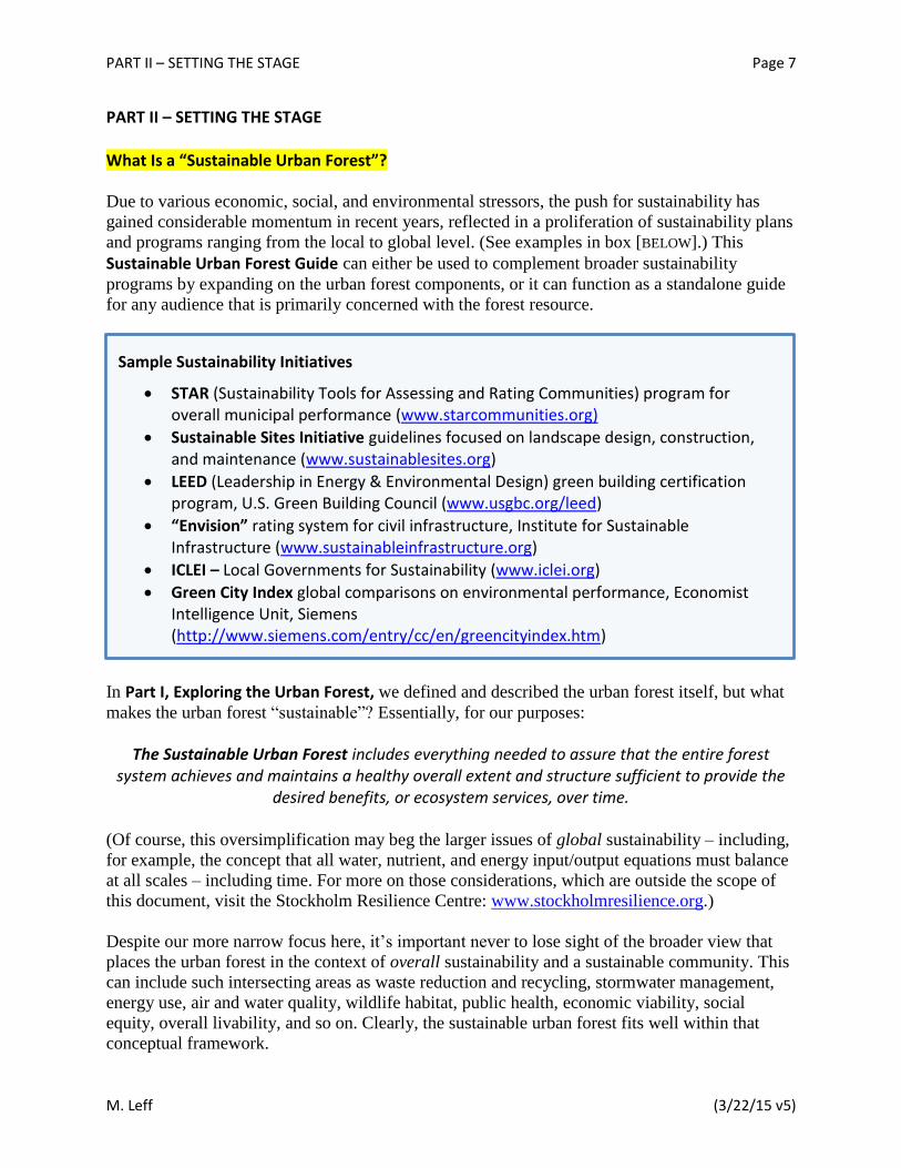
PART II – SETTING THE STAGE What Is a “Sustainable Urban Forest”?
Due to various economic, social, and environmental stressors, the push for sustainability has
gained considerable momentum in recent years, reflected in a proliferation of sustainability plans
and programs ranging from the local to global level. (See examples in box [BELOW].) This
Sustainable Urban Forest Guide can either be used to complement broader sustainability
programs by expanding on the urban forest components, or it can function as a standalone guide
for any audience that is primarily concerned with the forest resource.
In Part I, Exploring the Urban Forest, we defined and described the urban forest itself, but what
makes the urban forest “sustainable”? Essentially, for our purposes:
The Sustainable Urban Forest includes everything needed to assure that the entire forest system achieves and maintains a healthy overall extent and structure sufficient to provide the
desired benefits, or ecosystem services, over time. (Of course, this oversimplification may beg the larger issues of global sustainability – including,
for example, the concept that all water, nutrient, and energy input/output equations must balance
at all scales – including time. For more on those considerations, which are outside the scope of
this document, visit the Stockholm Resilience Centre: www.stockholmresilience.org.)
Despite our more narrow focus here, it’s important never to lose sight of the broader view that
places the urban forest in the context of overall sustainability and a sustainable community. This
can include such intersecting areas as waste reduction and recycling, stormwater management,
energy use, air and water quality, wildlife habitat, public health, economic viability, social
equity, overall livability, and so on. Clearly, the sustainable urban forest fits well within that
conceptual framework.
Sample Sustainability Initiatives
STAR (Sustainability Tools for Assessing and Rating Communities) program for overall municipal performance (www.starcommunities.org)
Sustainable Sites Initiative guidelines focused on landscape design, construction, and maintenance (www.sustainablesites.org)
LEED (Leadership in Energy & Environmental Design) green building certification program, U.S. Green Building Council (www.usgbc.org/leed)
“Envision” rating system for civil infrastructure, Institute for Sustainable Infrastructure (www.sustainableinfrastructure.org)
ICLEI – Local Governments for Sustainability (www.iclei.org)
Green City Index global comparisons on environmental performance, Economist Intelligence Unit, Siemens (http://www.siemens.com/entry/cc/en/greencityindex.htm)

PART II – SETTING THE STAGE Page 8
M. Leff (3/22/15 v5)
At the local municipal level, of course, the underpinning financial resources themselves are often
in great need of a sustainable supply. Historically, when budgets are strained or shrinking, many
municipalities have viewed adequate care of the urban forest, beyond essential tree risk
management, as a luxury they can’t afford. But that picture is changing with increased awareness
of the wide-ranging benefits of trees, especially when a dollar value is placed on those benefits.
Recognizing and valuing the tangible services provided by the urban forest, it’s clear that there’s
much to be gained by a healthy forest – and real, measurable, and inevitable costs if the
investment is not made to maintain it.
Fortunately, whereas other forms of municipal “grey” infrastructure – such as treatment plants or
stormwater systems – often address a single functional purpose, green infrastructure, including
the urban forest, can play a role in advancing numerous sustainability goals.
Consider Philadelphia’s “Greenworks” sustainability framework, which includes 15 specific
targets in five broad areas: Energy, Environment, Equity, Economy, and Engagement. One of
those targets in particular – #11 – states “increase tree coverage toward 30 percent canopy in all
neighborhoods” (up from the current citywide canopy cover of about 20 percent). Meeting that
single Greenworks target would help advance half of all the other targets in all five categories.
For example, by planting more trees on school grounds – just one of more than a dozen
actions planned to meet Target #11 – the City will also help reduce citywide building energy
use (Target #2), reduce greenhouse gas emissions (#5), improve air quality (#6), enhance
green infrastructure (#8), provide outdoor amenities (#9), and create green jobs (#14). Not
surprisingly, the only other individual actions in the plan that stand to benefit as many other
targets as increased tree canopy cover does are those involving parks and other green space.2
Understanding Tree Benefits – or “Ecosystem Services”
Many urban dwellers can name the downside of trees, ranging from lifted sidewalks to storm
damage. There is often less awareness and appreciation of the many benefits of trees, other than
their natural beauty. Those benefits are varied and substantial, and impact all three areas of the
so-called “triple bottom-line” – economic, environmental, and social. For example, consider this
comprehensive though by no means exhaustive array of benefits:
What Is a Sustainable Community?
The path to sustainability is different for every community – but the common elements are a healthy environment, a strong economy, and the well-being of the people living in the community. When sustainability areas are addressed in tandem with each other, they have a powerful, positive effect on the quality of life and future of a community. By overlapping work in these areas, efficiencies emerge and better results are achieved.
– STAR (Sustainability Tools for Assessing and Rating Communities), www.starcommunities.org

PART II – SETTING THE STAGE Page 9
M. Leff (3/22/15 v5)
Economic benefits
Save energy and cut costs for summer cooling (shade) and winter heating (windbreak).
Supply wood products – including urban areas, when trees are removed.
Increase property values, benefiting homeowners and increasing local tax revenues.
Boost commercial district activity.
Support green industry jobs.
Reduce costs to taxpayers for traditional “grey” infrastructure.
Environmental benefits
Improve air quality by absorbing and filtering pollutants and providing oxygen.
Reduce greenhouse gases by capturing carbon as well as saving energy.
Help manage stormwater, reduce flooding, and improve water quality.
Mitigate air temperature extremes and reduce urban “heat island” effect.
Support wildlife populations and overall biodiversity.
Reduce ultraviolet radiation levels.
Social benefits
Promote public health and well-being
Encourage physical activity by creating attractive, shaded outdoor spaces.
Discourage crime and create safe places to gather.
Strengthen community engagement and revitalize neighborhoods.
Promote social equity and environmental justice for neglected communities.
Supply healthy edibles – fruit and nuts.
Provide solace, spiritual sustenance, and a sense of place.
Those myriad tree benefits can all be considered “ecosystem services,” an important concept that
has gained prominence for its ability to reveal the hidden value of trees and other forms of
“natural capital.”
(See sidebar [BELOW].)

PART II – SETTING THE STAGE Page 10
M. Leff (3/22/15 v5)
Of course, many of those ecosystem services are not strictly for people – though benefits to other
living creatures also benefit people, as we all depend on a complex and interconnected living
Earth. Moreover, the natural capital that supplies those ecosystem goods and services must not
be treated merely as resources that can be depleted faster than they’re created – a mandate that
essentially defines sustainability.
Identifying and appreciating the ecosystem services provided by the urban forest is a start. But
putting a dollar value on those services can help turn appreciation into action. For that reason,
various analysis and assessment tools have gained traction in recent years – in particular the i-Tree tools (www.itreetools.org) developed by the U.S. Forest Service, to be discussed in more
detail in Part IV, Gathering the Information. Because budget constraints are often a major
obstacle to sustainable urban forest management, anything that can help secure adequate and
stable funding is a huge boon. The i-Tree tools can provide the data needed to quantify both the
state of the urban forest (in terms of tree count, canopy, condition, etc.) and – potentially even
more important from a budgeting perspective – the economic value of the ecosystem services
provided by the urban forest, now and in the future, depending on management actions taken.
By putting a dollar value on such ecosystem services as energy savings, carbon reduction, air
quality, stormwater management, and various health benefits, i-Tree assessments can help
persuade decision-makers that maintaining and growing the urban forest is not an optional
amenity for flush times, but an integral element of the city’s basic infrastructure to sustain human
health and well-being. Based on an i-Tree assessment, for example, the 2012 Pittsburgh Urban
Forest Master Plan put the annual economic benefit from the city’s trees at more than $7.2-
What Are Ecosystem Services?
Ecosystem services are often defined as the direct and indirect contributions of natural systems to human well-being.
Four categories of ecosystem services:
1. Provisioning services describe the material or energy outputs from ecosystems. These include food, water, various raw materials, and medicinal resources.
2. Regulating services create and maintain healthy environmental conditions by influencing such things as climate, weather extremes, pests, disease, air and water quality, soil fertility, and many others.
3. Supporting services provide habitat for plants and animals, and maintain genetic biodiversity, which is essential to the health and adaptability of species.
4. Cultural services connect people with ecosystems. Cultural services include spiritual, recreational, educational, emotional, and physical benefits, as well as economic benefits through cultural and eco-tourism.
– Source: United Nations Environment Programme (UNEP), The Economics of Ecosystems and Biodiversity (TEEB), http://www.teebweb.org/resources/ecosystem-services/
PART II – SETTING THE STAGE Page 11
M. Leff (3/22/15 v5)
million. By comparing that to overall tree-related expenditures, the calculation was used to
demonstrate that every dollar invested in street tree care actually yields a net financial gain of
nearly twice that amount.3 Using a similar analysis, New York City put that return at $5.60 in
benefits for every dollar spent on tree planting and care.4 In addition, many urban trees are not
planted, but regenerate naturally in many locations, substantially reducing planting costs.
Monetary valuation of ecosystem services shows that trees and other components of green
infrastructure can reduce expenditures on the conventional grey infrastructure that would
otherwise be necessary to meet clean air and water standards. Those mandated standards can be
achieved with trees more efficiently and cost effectively than through some traditional methods.
While trees alone are not sufficient, they are a key piece of the solution and can yield significant
returns on investment.
Green Infrastructure in the Urban Forest
Green infrastructure utilizes vegetation to provide some of the functions of conventional grey
infrastructure, such as water treatment plants and stormwater management systems, but with
additional environmental, economic, and social benefits. Broadly defined, every tree and the
entire urban forest can be considered green infrastructure, because they offer benefits across that
“triple bottom line.” (It’s worth noting that we often turn to green infrastructure to compensate
for natural resources that have been compromised by human development and only partially
remedied by grey infrastructure in the first place.)
In the environmental realm, green infrastructure is often designed to address urban stormwater
issues. The goals of those installations – often referred to as stormwater best management
practices (BMPs) – are to capture runoff, allow infiltration, promote evapotranspiration, and
otherwise reduce or eliminate stormwater flow to waterways or sewage treatment plants.
Trees can contribute to those goals in a number of ways:
Trees reduce stormwater runoff by capturing and storing rainfall in their canopy and releasing water into the atmosphere.
Trees draw moisture from the soil ground surface, thereby increasing soil water storage potential.
Tree roots and leaf litter create soil conditions that promote the infiltration of rainwater into the soil.
Trees help slow down and temporarily store runoff and reduce pollutants by taking up nutrients and other pollutants from soils and water through their roots.
Trees transform pollutants into less harmful substances.
Despite those stormwater benefits, most BMPs that incorporate vegetation have relied primarily
on herbaceous vegetation with few trees and shrubs. Some engineers and designers have been
concerned that tree roots, branches, and leaves will compromise the effectiveness or stability of
the installation. To address those concerns, the Center for Watershed Protection and the USDA
Forest Service collaborated with stormwater engineers, foresters, arborists, soil scientists,
PART II – SETTING THE STAGE Page 12
M. Leff (3/22/15 v5)
landscape architects, and other experts to develop improved designs for stormwater management
practices including trees, or so-called “stormwater forestry practices.” A major goal of these
designs is to harness the numerous environmental benefits of trees to increase the effectiveness
of stormwater practices, while providing other benefits to the community, such as cleaner air,
cooling and shade, aesthetics, wildlife habitat, and public safety and health improvements. The
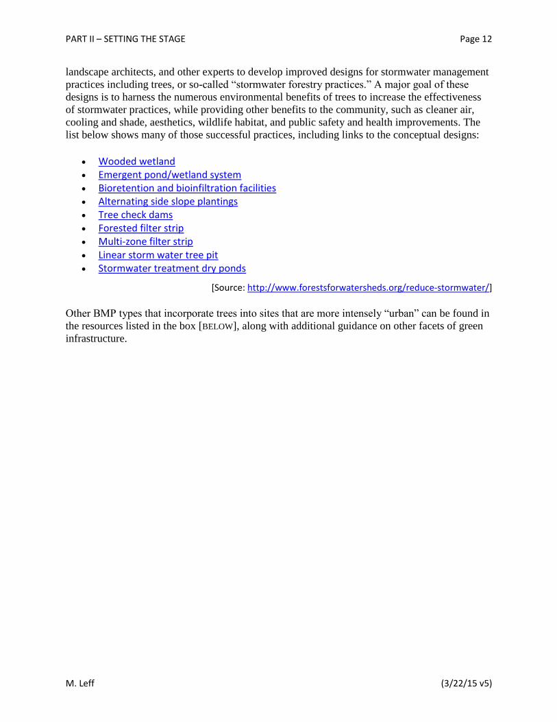
list below shows many of those successful practices, including links to the conceptual designs:
Wooded wetland Emergent pond/wetland system Bioretention and bioinfiltration facilities Alternating side slope plantings Tree check dams Forested filter strip Multi-zone filter strip Linear storm water tree pit Stormwater treatment dry ponds
[Source: http://www.forestsforwatersheds.org/reduce-stormwater/]
Other BMP types that incorporate trees into sites that are more intensely “urban” can be found in
the resources listed in the box [BELOW], along with additional guidance on other facets of green
infrastructure.
PART II – SETTING THE STAGE Page 13
M. Leff (3/22/15 v5)
Refining Your Focus
In the broadest sense, there is no hard and fast boundary to define the outer edge of the typical
urban forest. The surrounding regional landscape impacts the same ecosystem services supplied
within the urban core. Moreover, pests, diseases, and invasive species spread easily across the
entire rural-to-urban gradient unrestricted by property boundaries. For those reasons, planning
must always occur in the context of the larger landscape, and urban forest managers should take
every opportunity to engage and collaborate with their counterparts in the surrounding region, as
will be discussed in more detail in Part V, Constructing the Community Framework.
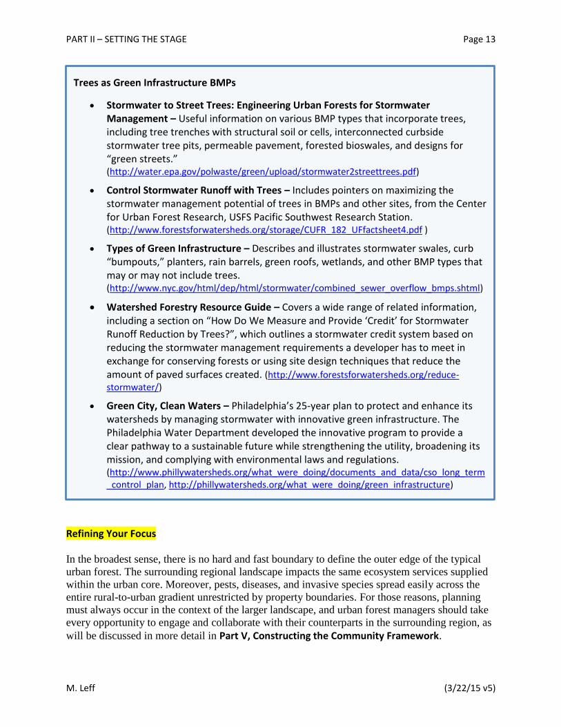
Trees as Green Infrastructure BMPs
Stormwater to Street Trees: Engineering Urban Forests for Stormwater Management – Useful information on various BMP types that incorporate trees, including tree trenches with structural soil or cells, interconnected curbside stormwater tree pits, permeable pavement, forested bioswales, and designs for “green streets.” (http://water.epa.gov/polwaste/green/upload/stormwater2streettrees.pdf)
Control Stormwater Runoff with Trees – Includes pointers on maximizing the stormwater management potential of trees in BMPs and other sites, from the Center for Urban Forest Research, USFS Pacific Southwest Research Station. (http://www.forestsforwatersheds.org/storage/CUFR_182_UFfactsheet4.pdf )
Types of Green Infrastructure – Describes and illustrates stormwater swales, curb “bumpouts,” planters, rain barrels, green roofs, wetlands, and other BMP types that may or may not include trees. (http://www.nyc.gov/html/dep/html/stormwater/combined_sewer_overflow_bmps.shtml)
Watershed Forestry Resource Guide – Covers a wide range of related information, including a section on “How Do We Measure and Provide ‘Credit’ for Stormwater Runoff Reduction by Trees?”, which outlines a stormwater credit system based on reducing the stormwater management requirements a developer has to meet in exchange for conserving forests or using site design techniques that reduce the amount of paved surfaces created. (http://www.forestsforwatersheds.org/reduce-stormwater/)
Green City, Clean Waters – Philadelphia’s 25-year plan to protect and enhance its watersheds by managing stormwater with innovative green infrastructure. The Philadelphia Water Department developed the innovative program to provide a clear pathway to a sustainable future while strengthening the utility, broadening its mission, and complying with environmental laws and regulations. (http://www.phillywatersheds.org/what_were_doing/documents_and_data/cso_long_term_control_plan, http://phillywatersheds.org/what_were_doing/green_infrastructure)

PART II – SETTING THE STAGE Page 14
M. Leff (3/22/15 v5)
In practical terms, however, those who are responsible for urban forest management must
prioritize their focus to the area or sites they can influence most directly – whether at a county,
municipality, or neighborhood level, or even just within the bounds of a college campus or some
other large property.
Notice the emphasis on influence, not control. To hope to achieve genuine sustainability – that is,
the ability to reach and sustain a vigorous and extensive urban forest – you need to consider all
of the trees and forest resources within the defined area, not just street trees or even all public
trees. So municipal urban forest programs must include goals and actions targeting private
property as well, which is often where the majority of trees and amount of urban land cover are
located. Collaborative partnerships are extremely important in this respect. Within any
community, there are typically individuals, groups, and organizations that can influence private
property owners. That doesn’t let the municipality off the hook, however; there are many other
measures – outreach, incentives, regulations – that it can take to build support for the urban
forest and guide actions on private property.
In any case, the first step toward a sustainable urban forest is to define your focus area – and
mark it on a map.

PART III – COVERING THE CANOPY Page 15
M. Leff (3/22/15 v5)
PART III – COVERING THE CANOPY Why Consider Canopy Cover?
Tree canopy cover represents the “footprint” of the urban forest. As many forest ecosystem
services (discussed in Part II, Setting the Stage) are directly related to the amount of healthy and
functioning leaves, the proportion of land covered by tree canopies – typically expressed as
percent canopy cover – serves as a simple measure of the extent of the urban forest and the
magnitude of services it provides. It’s an imperfect measure, to be sure, but it can be readily
assessed, easily communicated, and highly useful for setting goals, prioritizing actions, and
tracking progress.
It’s important to consider all trees and forest resources in your area of interest. If your focus
encompasses the entire urban area within a municipality, that means not just public trees on
streets, in parks, and at municipal facilities, but those on private property as well. Assessing,
mapping, and analyzing percent canopy cover – in total and by selected focus areas – allows you
to capture and share that full picture. The information that can be gleaned from such efforts
serves multiple purposes, including:
Adopting an overall tree canopy cover goal for the municipality.
Setting finer canopy goals for individual neighborhoods or other management areas.
Quantifying tree benefits, or ecosystem services.
Prioritizing locations where tree canopy cover can be strategically increased to enhance those services.
Identifying critical canopy cover for preservation or protection from development.
What Is an ‘Optimal Canopy Cover Level’?
This is a difficult question, as there is no set tree canopy cover level that would be considered
“optimal” everywhere. Each municipality must adopt its own goals, depending on a number of
considerations that are unique to its particular circumstances, including climate, geography,
specific needs, community preferences, desired ecosystem services, land cover and land use
patterns, resources, and other factors. (For a range of canopy cover levels and goals, see table
[BELOW].)
What Is ‘Tree Canopy’?
An individual tree’s “canopy” is the total amount of leaves and branches on its stems or trunk – which would intercept rainfall, for example. Collectively, “tree canopy cover” is the footprint of land covered by the combined leaves, branches, and trunks of all standing trees in a given area when viewed from above. In the latter context, which is the focus of our concern, an area’s tree canopy cover is often called simply “tree canopy.” In an urban setting, it’s usually referred to as urban tree canopy.

PART III – COVERING THE CANOPY Page 16
M. Leff (3/22/15 v5)
Of course, it’s not always done that way. In many cases, tree canopy cover goals have been set
by political fiat or educated guess, rather than methodical analysis. Setting ambitious canopy
cover goals does have its advantages – such as communicating a simple message, engaging the
public, motivating officials, securing funding, and encouraging stewardship. And more canopy
cover is generally better, provided you have the means to maintain it – not to be underestimated,
since tree planting is in a sense only the beginning of the cycle of costs involved.
However, it’s far better to base those canopy cover goals on a solid understanding of two things:
the current status of the urban forest and the desired future state – that is, what you hope to gain
by achieving those goals. In Part IV, Gathering the Information, we’ll present the main options
for assessing the forest resource, including field-based assessments and aerial imagery. In the
discussion below, we’ll focus on the second part of that equation – what you hope to gain, and
the various considerations involved.
Always remember that the canopy cover goal itself is not the be-all and end-all of sustainable
urban forestry. Equally important are the many elements that go into setting that goal and the
steps that are taken not only to achieve and maintain it, but even just to strive for it. In addition,
bear in mind that the most meaningful measure of tree canopy cover in a given area at any given
time may be its relative canopy cover – that is, the extent of canopy cover relative to the desired
amount, or the particular goal for that area based on its optimal potential. There are no simple
answers to these complex questions. But it’s worth embarking on the quest.
City, State/Province5
Initial Canopy Cover Level Canopy Cover Goal
UTC Cover Year Assessed UTC Cover Target Date
Annapolis, MD 42.0% 2006 50% 30-year plan (2036)
Asbury Park, NJ 22.6% 2013 Increase Ongoing
Atlanta, GA 47.9% 2008 Increase Ongoing
Austin, TX 32.0% 2006 40% Ongoing
Baltimore, MD 20.0% 2007 40% 2036
Boston, MA 29.0% 2006 49% 10-year plan (2016)
Cambridge, Ontario 27.0% 2013 N/A 2050
Cedar Lake, IN 33.8% 2011 Increase Ongoing
Chicago, IL 17.2% 2007 25% Ongoing
Denver, CO 16.4% 2010 31% 20-year plan (2025)
Detroit, MI 22.5% 2008 40% Ongoing
Tree Canopy Cover Levels and Goals for Selected Cities
The table below illustrates existing canopy cover levels for various U.S. and two Canadian cities, as well as citywide canopy cover goals where available. According to one recent study, national results indicate that urban tree canopy (UTC) in the United States is on the decline at a rate of about 4 million trees per year.1 A comparable loss of urban forests has become a growing concern for municipalities worldwide as urbanization has led to land-use conversion, compounded by other pressures, such as pests and climate change. Setting ambitious but realistic canopy cover goals and developing the programs to support them are essential steps in reversing that downward trend.

PART III – COVERING THE CANOPY Page 17
M. Leff (3/22/15 v5)
Easton, MD 27.0% 2014 40% Ongoing
Evanston, IL 36.9% 2010 Increase Ongoing
Fort Bragg, NC 67.1% 2011 70% Ongoing
Fort Wayne, IN 29.0% 2011 Increase Ongoing
Goshen, IN 22.0% 2012 30% Ongoing
Howard Beach, NY 8.5% 2013 Increase Ongoing
Indianapolis, IN 13.8% 2008 19% 10-year plan (2018)
Hartford, CT 25.1% 2013 35% Ongoing
Holyoke, MA 26.5% 2014 30% Ongoing
Las Vegas, NV 8.6% 2012 20% 2035
Leesburg, VA 27.0% 2006 40% 25-year plan (2031)
Lexington, KY 24.6% 2013 30% Ongoing
Los Angeles, CA 21.0% 2006 28% 2040
Louisville, KY 37.1% 2013 40% Ongoing
Macedonia, OH 39.0% 2013 Increase Ongoing
Milwaukee, WI 21.6% 2008 40% Ongoing
New Haven, CT 38.0% 2009 Add 10K trees 5-year plan (2014)
New Orleans, LA 23.3% 2009 Increase Ongoing
New York, NY 24.0% 2006 30% 2036
Philadelphia, PA 20.0% 2011 30% 15-year plan (2025)
Phoenix, AZ 8.0-10.0% 2007 25% 2030
Pittsburgh, PA 40.0% 2011 60% 20-year plan (2031)
Port Angels, WA 27.3% 2011 40% Ongoing
Portland, OR 29.9% 2014 33% Ongoing
Providence, RI 23.0% 2007 30% 10-year plan (2020)
Richfield, OH 58.0% 2013 Increase Ongoing
Sacramento, CA 5.2-15.4% 1998 35% Ongoing
San Francisco, CA 13.7% 2012 20% 20-year plan (2034)
Seattle, WA 23.0% 2007 30% 30-year plan (2037)
Stow, OH 41.1% 2013 Increase Ongoing
Tacoma, WA 19.0% 2010 30% 20-year plan (2030)
Vancouver, BC 18.6% 2010 28% 20-year plan (2030)
Washington, DC 35.0% 2009 40% 20-year plan (2029)
West Memphis, AR 18.1% 2012 24% Ongoing
Whitpain, PA 43.0% 2012 Increase Ongoing
Winnetka, IL 52.7% 2010 Increase Ongoing
Ypsilanti, MI 36.6% 2012 Increase Ongoing
Note: Assessment and target dates may not match length of plans due to timing of goal establishment.
PART III – COVERING THE CANOPY Page 18
M. Leff (3/22/15 v5)
Setting Your Canopy Cover Goals
Whatever tree canopy cover goal you set for your community must be attainable and sustainable.
“Ambitious” and “inspirational” are important traits. But if a goal is impossibly beyond reach, it
leads only to public disappointment, staff frustration, volunteer burnout, funder fatigue, and the
like.
The first consideration in setting challenging but reasonable goals should be the local or regional
geographic framework. That means working within the natural limits of the environment. It
doesn’t mean that the “natural” regional landscape should dictate your decisions; in fact, in
historically non-forested areas, urbanization can actually lead to increased canopy cover. Still,
geography should certainly inform the decision-making process. Similarly, you need to consider
the interrelations of the forest resource across the full rural-suburban-urban gradient, or whatever
spectrum characterizes your locale.
The distribution of tree canopy cover is generally not – and needn’t be – uniform across a
municipality or even identical in every neighborhood. A single overarching canopy goal has its
merits; for one thing, it is easier to communicate and promote. But at a functional level, it’s more
important to break that down into more meaningful pieces, through a finer-scale analysis – by
census tract, parcel, land ownership, sub-watershed, or other boundaries or land-use
designations.
Always remember that whatever percent canopy cover goals you set – and whether municipality-
wide or at a single block level – those are only stand-in metrics for the actual benefits or
ecosystem services you hope to gain from that tree cover. So at root, the quality of the urban
forest is as important as the number of trees that comprise it. “Quality” in that sense covers tree
health, age and species diversity, strategic location, and other such factors – all intended to
maximize the desired ecosystem services, whatever they may be.
To set meaningful canopy cover goals, you’ll need to consider your municipality’s particular
needs, which can vary widely. Depending on the setting, you may be most concerned about heat
reduction, energy savings, stormwater runoff, air quality, public health, economic development,
environmental justice, social well-being, or some combination of those and other factors. That
“needs assessment” could influence how many trees must be added, what kind of trees, and
where to situate them. For example, to cut energy use for cooling a building, large trees must be
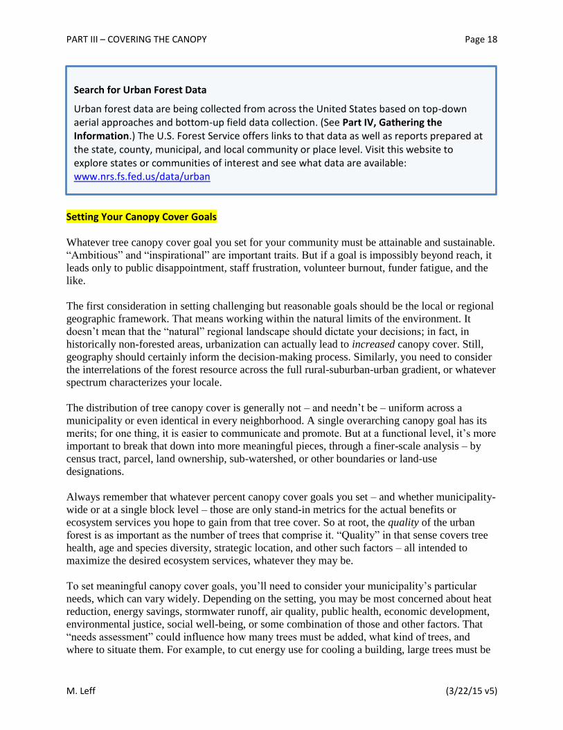
Search for Urban Forest Data
Urban forest data are being collected from across the United States based on top-down aerial approaches and bottom-up field data collection. (See Part IV, Gathering the Information.) The U.S. Forest Service offers links to that data as well as reports prepared at the state, county, municipal, and local community or place level. Visit this website to explore states or communities of interest and see what data are available: www.nrs.fs.fed.us/data/urban
PART III – COVERING THE CANOPY Page 19
M. Leff (3/22/15 v5)
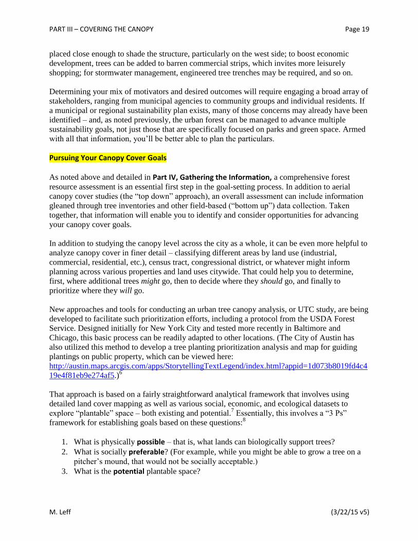
placed close enough to shade the structure, particularly on the west side; to boost economic
development, trees can be added to barren commercial strips, which invites more leisurely
shopping; for stormwater management, engineered tree trenches may be required, and so on.
Determining your mix of motivators and desired outcomes will require engaging a broad array of
stakeholders, ranging from municipal agencies to community groups and individual residents. If
a municipal or regional sustainability plan exists, many of those concerns may already have been
identified – and, as noted previously, the urban forest can be managed to advance multiple
sustainability goals, not just those that are specifically focused on parks and green space. Armed
with all that information, you’ll be better able to plan the particulars.
Pursuing Your Canopy Cover Goals
As noted above and detailed in Part IV, Gathering the Information, a comprehensive forest
resource assessment is an essential first step in the goal-setting process. In addition to aerial
canopy cover studies (the “top down” approach), an overall assessment can include information
gleaned through tree inventories and other field-based (“bottom up”) data collection. Taken
together, that information will enable you to identify and consider opportunities for advancing
your canopy cover goals.
In addition to studying the canopy level across the city as a whole, it can be even more helpful to
analyze canopy cover in finer detail – classifying different areas by land use (industrial,
commercial, residential, etc.), census tract, congressional district, or whatever might inform
planning across various properties and land uses citywide. That could help you to determine,
first, where additional trees might go, then to decide where they should go, and finally to
prioritize where they will go.
New approaches and tools for conducting an urban tree canopy analysis, or UTC study, are being
developed to facilitate such prioritization efforts, including a protocol from the USDA Forest
Service. Designed initially for New York City and tested more recently in Baltimore and
Chicago, this basic process can be readily adapted to other locations. (The City of Austin has
also utilized this method to develop a tree planting prioritization analysis and map for guiding
plantings on public property, which can be viewed here:
http://austin.maps.arcgis.com/apps/StorytellingTextLegend/index.html?appid=1d073b8019fd4c4
19e4f81eb9e274af5.)6
That approach is based on a fairly straightforward analytical framework that involves using
detailed land cover mapping as well as various social, economic, and ecological datasets to
explore “plantable” space – both existing and potential.7 Essentially, this involves a “3 Ps”
framework for establishing goals based on these questions:8
1. What is physically possible – that is, what lands can biologically support trees?
2. What is socially preferable? (For example, while you might be able to grow a tree on a
pitcher’s mound, that would not be socially acceptable.)
3. What is the potential plantable space?

PART III – COVERING THE CANOPY Page 20
M. Leff (3/22/15 v5)
Arriving at the ultimate “potential” plantable space is not simply a matter of taking the
“possible” and subtracting what’s not “preferable.” For one thing, land cover can change – in
either direction: Buildings can be razed, pavement can be removed; fields and forests can be
developed, and so on. For that matter, while a tree may never be at home on a pitcher’s mound,
other social preferences can change as well. Most importantly, fiscal resources are limited and
will inevitably place limits on what can reasonably be considered true “potential” – which
requires careful consideration of how and where to focus those resources for maximum – and
equitable – impact.
Whatever tools or methods you use to tease apart the overall tree canopy, the resulting
information can guide decisions aimed at increasing tree benefits on all lands, including private
as well as public property, based on flexible parameters of your own choosing. While that
process may be primarily intended to find optimal places to add trees, it’s equally useful for
identifying high-priority locations for tree protection and stewardship, which are just as
important to preserving and growing the urban forest. After all, there’s no way to grow the
overall canopy cover if you’re losing trees as fast as you’re planting them. (Obviously, losses
from normal mortality and routine removals can also be expected and must be factored into the
equation.)
The kind of parameters you might choose to guide your analysis can include anything that can be
mapped – such as floodplain zones, impervious surfaces, open space, underserved communities,
owner-occupied housing, heat island hot spots, etc. And the decisions you reach will reflect your
municipality’s particular needs and preferences, including desired ecosystem services, as
described above. As you work in finer detail, you will be able to use all that information in
determining specifics such as species selection, age distribution, tree placement, even
development of possible ordinances and other policies, as well as many other such decisions.
Be sure to take full advantage of data already collected by other entities that might play into this
decision-making process. In Chicago, for example, there’s the Chicago Wilderness Green
Infrastructure Vision, a map of high quality natural areas and opportunities for connectivity, and
the Oak Recovery Plan mapping initiative, which identifies existing oak stands of one acre or
more.9
But spatial and numerical data alone will not suffice. Any attempt to set priorities must involve
extensive input from diverse stakeholders – including individuals and organizations, across all
sectors – and seeking to find opportunities for collaboration among them. That approach is
covered in more detail in the Part V, Constructing the Community Framework. Further on, in
Part VII, Developing & Implementing the Plan, we’ll outline a process for considering how all
these pieces might fit into the design of your overall Sustainable Urban Forest Plan.

PART IV – GATHERING THE INFORMATION Page 21
M. Leff (3/22/15 v5)
PART IV – GATHERING THE INFORMATION Taking Stock
To plan where you want to go and how to get there, you must first know where you are. So the
first step toward a sustainable urban forest is to understand your municipality’s current situation,
both on the ground and on paper (or electronic equivalent).
The box below lists the key ingredients to assemble so that you can take stock of what you may
already have and what you may need to develop. In Part VI, Conducting the Evaluation & Measuring Success, you’ll use those ingredients to evaluate your municipality’s urban forest on
numerous targets in three broad categories: (1) Trees and Forest Vegetation, (2) Community Framework, and (3) Resource Management Approach. With that baseline information in hand,
you’ll be able to gauge your strengths, identify the most pressing or promising areas for
improvement, and then make the changes you choose as you move toward a sustainable urban
forestry program that suits your situation.

PART IV – GATHERING THE INFORMATION Page 22
M. Leff (3/22/15 v5)
Many of those ingredients are likely to be absent or inaccessible, and not all of them will be
needed in every setting. Nevertheless, by assembling a compendium with as many of those
elements as possible you will build the foundation for baseline evaluation, planning, action, and
monitoring. And you will also create a comprehensive multi-purpose reference for your team and
those who follow after you. For now, just round up the pieces, and make note of gaps to be filled
as opportunities arise.
Key Ingredients Forest Resource Assessments
□ Field-based inventories and assessments (“bottom-up” approach) Tree inventory options
Complete inventory Sample-based assessment
i-Tree Eco i-Tree Streets
□ Tree canopy assessments (“top-down” approach) National Land Cover Database (NLCD) satellite imagery
i-Tree Vue Aerial photo interpretation
i-Tree Canopy High-resolution aerial or satellite imagery
Urban Tree Canopy (UTC) study Plans, Practices, Programs, and Policies
□ Urban Forest Management Plan (UFMP)
□ Maintenance plans for street trees and other public trees
□ Natural areas management plans
□ Regional plans
□ Relevant previous or historic plans
□ Community tree programs
□ Private property tree programs
□ Educational materials, promotion and outreach
□ Municipal urban forestry policies
□ Municipal tree board/shade tree commission
□ Municipal urban forest budget
□ Municipal urban forest staff
□ Others Databases and Other Information
□ Comprehensive list of stakeholders
□ Funding sources
□ Maps
□ Citywide urban forest GIS
□ Others

PART IV – GATHERING THE INFORMATION Page 23
M. Leff (3/22/15 v5)
However, there are a few essential ingredients without which you won’t be able to proceed very
far – specifically, one or more of the “Forest Resource Assessments,” discussed in detail below.
If you are lacking that information, you should take steps to fill that gap right from the start.
After describing those assessments, we’ll provide references to useful resources on all the other
ingredients.
Forest Resource Assessments
There are many reasons to assess the urban forest. Here are a few:
Facilitate planning, management, and advocacy.
Understand “tree benefits” and quantify ecosystem services (as discussed in Part II, Setting the Stage).
Measure and monitor the extent of tree canopy cover (as defined in Part III, Covering the Canopy).
Identify and prioritize tree planting locations in areas of greatest need and/or with greatest potential to maximize desired benefits.
Promote public outreach and education.
Essentially, any assessment of the urban forest involves examining its structure and composition.
There are two basic strategies:
“Bottom-up” approach – uses field data collected “on the ground” to measure the physical structure of the forest.
“Top-down” approach – uses aerial or satellite images to analyze tree canopy and other land cover.
The two approaches provide different types of information; ideally, your overall forest resource
assessment will include some of both. There are a variety of options within the two approaches,
each with its own advantages and disadvantages, as outlined below. The best approach or
combination for your situation will depend on what sort of information you’re hoping to gain,
and how you plan to use it.
Bottom-Up: Field-Based Assessments
Based on either a complete inventory or sample-based assessment, this approach provides the
detailed information needed to support strategic resource management, planning, and advocacy.
It does that by collecting forest structure attributes (such as tree species, numbers, sizes,
locations, and conditions), calculating their associated ecosystem services and values, and
connecting that data with management costs, risks, and needs. In addition to providing details on
the current situation, these tools can be used for monitoring changes in forest composition and
values.
Complete inventories involve collecting data on every tree in an assessment area. Because
this can be time and labor intensive, and possibly costly, such an undertaking is generally
PART IV – GATHERING THE INFORMATION Page 24
M. Leff (3/22/15 v5)
reserved for circumstances that warrant that sort of investment – such as a complete
inventory of all street trees in a community or other individually managed public trees, or
where the defined assessment area is an arboretum, college campus, or other large property.
Sample-based assessments involve looking only at randomly selected portions of the tree
population in order to extrapolate findings to the overall area of interest. While they do not
assess every tree, they can actually collect more data than would be feasible with a complete
inventory. Moreover, a sample-based assessment may be all that’s needed to answer the
questions at hand, such as calculating the ecosystem services provided by the urban forest
citywide.
Two publicly available tools – i-Tree Eco and i-Tree Streets – were developed by the USDA
Forest Service and its partner organizations to aid in conducting complete inventories and
sample-based assessments of urban trees and forests, and for calculating their ecosystem services
and values. (Go to www.itreetools.org for more information on all i-Tree applications, which
range widely in the amount of training required, type of data provided, and features offered.)
i-Tree Eco can assess an entire urban forest using sample-based field assessments, or discrete
tree populations with complete inventory data. In either case, extensive technical data must
be collected on each tree. After incorporating meteorological inputs and other locally based
data, summary reports include detailed information on ecosystem services such as air
pollution removal, carbon storage capabilities, rainfall interception, impact on energy use in
adjacent buildings, overall structural value, and pest risk analysis. (www.itreetools.org/eco)
i-Tree Streets is designed for assessing the structure and benefits of street tree populations.
Because it requires less data on each tree, existing complete inventories or sample-based
assessments can often be successfully loaded into the program to analyze trees in a specific
area. In addition to providing basic management information, summary reports can be
generated that cover such ecosystem services as impacts on stormwater, property values, and
air quality. (www.itreetools.org/streets)
However, while the i-Tree tools are available for free, there are costs associated with collecting
the detailed data required. Volunteers, students, in-house crews, and hired consultants have all
been employed for collecting i-Tree data.
Tree Inventories and Routine Management Software
Tree inventories also support the day-to-day management of an urban forest, which is outside the scope of this guide. Along with asset-management software and other operations-based tools, complete inventories can be used to help track routine activities such as hazard inspection and tree maintenance. Various software programs are available for those purposes.
PART IV – GATHERING THE INFORMATION Page 25
M. Leff (3/22/15 v5)
As an example, the typical citywide i-Tree Eco assessment requires 200 randomly generated one-
tenth acre plots to achieve desirable statistical accuracy. At a contracted rate of $200-300 per plot
for data collection, a consultant might charge a total of $40-60,000 for the project10
– or more, if
including interpretation, reporting, and management recommendations. Data-collection costs
could be half that much using student labor or even less with volunteers, though greater oversight
will be necessary. Under good conditions, a 200-plot sample typically yields a relative standard
error of less than 15 percent for the total tree population estimate.11
Sampling intensity (i.e., the
number of plots) can be adjusted to suit the accuracy desired and resources available. (In
addition, it’s worth noting that by demonstrating the financial value of the ecosystem services
provided by the urban forest, such an assessment can result in increased financial support for the
urban forest – which also helps justify the up-front investment.)
Top-Down: Tree Canopy Assessments
The top-down approach is used to determine the amount and distribution of tree canopy cover,
potential planting space, and other land cover types. As it is aerial-based, it does not obtain data
on individual trees, such as species, size, and condition. So the top-down approach is valuable
for broad-scale mapping, planning, prioritizing, and monitoring land cover – but generally not as
well-suited to assessing ecosystem services.
There are three common methods for assessing urban tree canopy cover. While all three will map
estimated tree canopy and other cover types in an area, they differ greatly in process, resolution,
costs, and accuracy. As a result, there are various advantages and disadvantages to each method,
as outlined below, in order of increasing cost and accuracy.
1) National Land Cover Database (NLCD) satellite imagery – Free maps and data for entire
contiguous 48 states showing estimated percentage of tree canopy and impervious land
cover. (Note: As of this writing, NLCD utilizes 2001 data, although updated maps are being
developed.)
Advantages: Can be loaded into i-Tree Vue program (www.itreetools.org/vue) to map tree
cover distribution along with overall estimates of some ecosystem services.
Disadvantages: Low resolution (30-meter pixels, or segments) cannot detect individual trees.
Accuracy: Typically underestimates tree cover by about 10 percent, on average. However,
user can improve accuracy by adjusting canopy cover percentage resolution using i-Tree Vue.
Cost: None, other than small amount (one day or less) of staff time, if experienced with GIS.
Recommendation: Better suited for broad-scale state or regional analyses, rather than city
scale or smaller.
PART IV – GATHERING THE INFORMATION Page 26
M. Leff (3/22/15 v5)
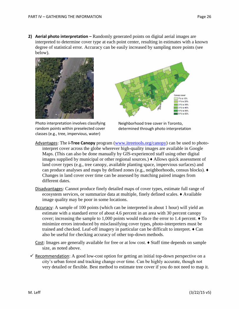
2) Aerial photo interpretation – Randomly generated points on digital aerial images are
interpreted to determine cover type at each point center, resulting in estimates with a known
degree of statistical error. Accuracy can be easily increased by sampling more points (see
below).
Advantages: The i-Tree Canopy program (www.itreetools.org/canopy) can be used to photo-
interpret cover across the globe wherever high-quality images are available in Google
Maps. (This can also be done manually by GIS-experienced staff using other digital
images supplied by municipal or other regional sources.) ♦ Allows quick assessment of
land cover types (e.g., tree canopy, available planting space, impervious surfaces) and
can produce analyses and maps by defined zones (e.g., neighborhoods, census blocks). ♦
Changes in land cover over time can be assessed by matching paired images from
different dates.
Disadvantages: Cannot produce finely detailed maps of cover types, estimate full range of
ecosystem services, or summarize data at multiple, finely defined scales. ♦ Available
image quality may be poor in some locations.
Accuracy: A sample of 100 points (which can be interpreted in about 1 hour) will yield an
estimate with a standard error of about 4.6 percent in an area with 30 percent canopy
cover; increasing the sample to 1,000 points would reduce the error to 1.4 percent. ♦ To
minimize errors introduced by misclassifying cover types, photo-interpreters must be
trained and checked. Leaf-off imagery in particular can be difficult to interpret. ♦ Can
also be useful for checking accuracy of other top-down methods.
Cost: Images are generally available for free or at low cost. ♦ Staff time depends on sample
size, as noted above.
Recommendation: A good low-cost option for getting an initial top-down perspective on a
city’s urban forest and tracking change over time. Can be highly accurate, though not
very detailed or flexible. Best method to estimate tree cover if you do not need to map it.
Neighborhood tree cover in Toronto, determined through photo interpretation
Photo interpretation involves classifying random points within preselected cover classes (e.g., tree, impervious, water)
PART IV – GATHERING THE INFORMATION Page 27
M. Leff (3/22/15 v5)
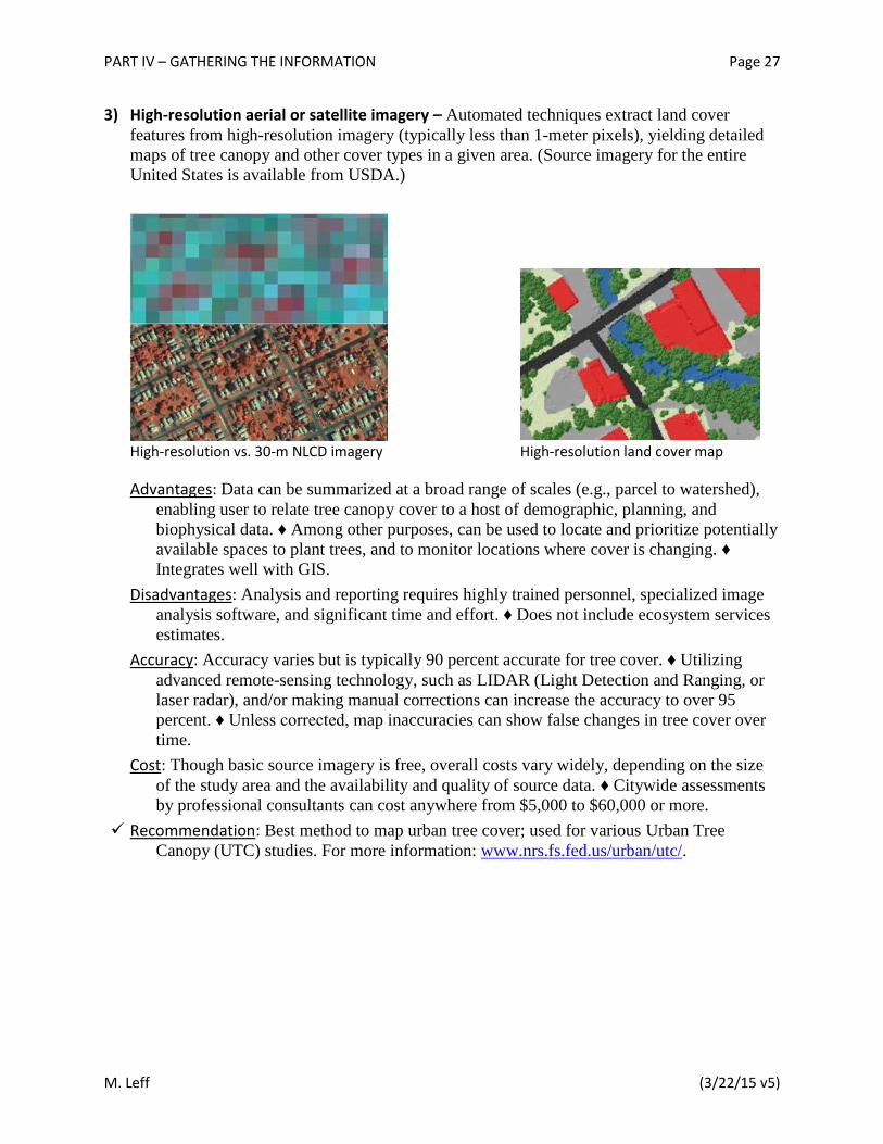
3) High-resolution aerial or satellite imagery – Automated techniques extract land cover
features from high-resolution imagery (typically less than 1-meter pixels), yielding detailed
maps of tree canopy and other cover types in a given area. (Source imagery for the entire
United States is available from USDA.)
High-resolution vs. 30-m NLCD imagery High-resolution land cover map
Advantages: Data can be summarized at a broad range of scales (e.g., parcel to watershed),
enabling user to relate tree canopy cover to a host of demographic, planning, and
biophysical data. ♦ Among other purposes, can be used to locate and prioritize potentially
available spaces to plant trees, and to monitor locations where cover is changing. ♦
Integrates well with GIS.
Disadvantages: Analysis and reporting requires highly trained personnel, specialized image
analysis software, and significant time and effort. ♦ Does not include ecosystem services
estimates.
Accuracy: Accuracy varies but is typically 90 percent accurate for tree cover. ♦ Utilizing
advanced remote-sensing technology, such as LIDAR (Light Detection and Ranging, or
laser radar), and/or making manual corrections can increase the accuracy to over 95
percent. ♦ Unless corrected, map inaccuracies can show false changes in tree cover over
time.
Cost: Though basic source imagery is free, overall costs vary widely, depending on the size
of the study area and the availability and quality of source data. ♦ Citywide assessments
by professional consultants can cost anywhere from $5,000 to $60,000 or more.
Recommendation: Best method to map urban tree cover; used for various Urban Tree
Canopy (UTC) studies. For more information: www.nrs.fs.fed.us/urban/utc/.

PART IV – GATHERING THE INFORMATION Page 28
M. Leff (3/22/15 v5)
Other Key Ingredients
To assemble the many other elements you’ll want to consider for your compilation, review the
descriptions below and explore the references listed for each item, which you will find in
Appendix A, Resources.
Plans, Practices, Programs, and Policies:
Urban Forest Management Plan (UFMP) – A comprehensive plan should address goals
and actions for the entire urban forest within the defined boundaries, on both public and
private property. Topics covered may include maintenance standards, tree inventories and
assessments, planting plans, tree selection standards, personnel training and development,
community engagement, and many other items.
Maintenance plans for street trees and other public trees – These plans address
operational processes involving individually managed trees on public property such as
streets, recreation centers, and other public places.
Natural areas management plans – Surveys and stewardship plans for publicly owned
natural areas include both broad and specific management goals for trees that are
managed as a group or population, as opposed to individually like street trees.
Regional plans – These could include existing plans or planning processes directly or
indirectly related to aspects of the broader urban forest, such as open space, recreation
trails, economic development, etc.
Relevant previous or historic plans – For purposes of comparison as well as to preserve
“institutional memory” and avoid reinventing the wheel, it can be important to collect all
previous planning efforts related to the urban forest.
Community tree programs – These can include planting, stewardship, and training
programs often managed by independent nonprofit organizations.
Private property tree programs – Including tree giveaways and other municipally or
independently managed incentive programs to promote tree planting and stewardship on
private property.
Educational materials, promotion and outreach – In addition to the general public, key
targets include large landholders, such as hospitals, schools, and other institutions or
individuals.
Municipal urban forestry policies – These can include a wide range of tools – guidelines,
ordinances, laws, regulations – concerning such things as public agency cooperation,
green industry collaboration, cooperative arrangements with utilities, protection and
preservation of large and/or private trees, use of native species, etc.

PART IV – GATHERING THE INFORMATION Page 29
M. Leff (3/22/15 v5)
Municipal tree board/shade tree commission – Depending on their structure, these
volunteer-based bodies may have advisory or even regulatory functions.
Municipal urban forest budget – Without line items in the city budget, urban forestry
activities are apt to be haphazard at best.
Municipal urban forest staff – With a budget in place and protected, adequate staffing is
essential for making progress toward a sustainable urban forest. Of course, municipal
capacity can get a tremendous boost from independent nonprofits, community groups,
and individual volunteers.
Others – Additional items to consider compiling include sources on green jobs training
programs, agroforestry (fruit and nuts), state urban and community forestry contacts and
resources, local nursery sources, contractors and arborist, etc.
Databases and Other Information:
Comprehensive list of stakeholders – To support your efforts, assemble a contact list of
all key players, partners, and stakeholders (e.g., government representatives and agencies,
nonprofit organizations, community groups, large or institutional landholders, utilities,
etc.) – as well as what they each bring to the table (e.g., resources, issues, regulations,
programs, etc.).
Funding sources – Even with a standing budget line, you’ll surely need supplemental
funding wherever you can find it.
Maps – Print and electronic maps at all scales – neighborhood, municipal, regional – are
essential tools for planning and management purposes.
Citywide urban forest GIS – To the fullest extent possible, seek to integrate urban
forestry information within the structure of overall municipal GIS (Geographic
Information System).
Note: An extensive array of sample materials for all of the above items can be found in Appendix A, along with hot links to the online resources.

PART V – CONSTRUCTING THE COMMUNITY FRAMEWORK Page 30
M. Leff (3/22/15 v5)
PART V – CONSTRUCTING THE COMMUNITY FRAMEWORK There is more to the urban forest than an assemblage of trees and other natural features. Focusing
exclusively on the management of those resources neglects the community setting, which is what
makes the forest “urban” – and what makes sustainability possible.
Why Collaborate?
One obvious reason to foster cross-sector collaboration is that the trees that are within a
municipality’s control typically represent only a portion of the overall urban forest. So if you’re
working toward a sustainable urban forest and not just managing trees you own or manage, it’s
essential to enlist others in the effort on their own turf.
For that matter, even just managing those portions of the urban forest that do fall under your
direct control – in the case of a municipality, street or park trees, for example – requires
widespread popular support and buy-in from decision makers. There are also compelling
arguments of resource equity, environmental justice, and basic democracy that demand broad
inclusion of community stakeholders as you shape your tree agenda.
Moreover, municipal capacity is limited and changes with the economy, the administration, and
other unpredictable factors – including the weather. Bridging the lean times and handling the
most demanding periods requires more than most municipality’s can provide without tapping
into external resources. That can include human resources in the form of volunteer labor as well
as outside financial support. In fact, volunteer labor itself should be considered an important
form of outside financial support, in the form of human resources.
Urban forestry stakeholders can be tapped in all sectors – public agencies and officials, private
citizens, nonprofits, commercial firms, academic institutions, and so on – with varied interests
spanning the full spectrum of social, economic, and environmental issues. Even just within the
“We cannot separate sustainable urban forests from the people who live in and around them. … [S]ustainable urban forests are not born, they are made. They do not arise at random, but result from a community-wide commitment to their creation and management. Obtaining the commitment of a broad community, of numerous constituencies, cannot be dictated or legislated. It must arise out of compromise and respect.”
– Clark et al, A Model of Urban Forest Sustainability, Journal of Arboriculture, 1997
“Independent action is inadequate: no agency, organization, single landowner, or business has sufficient funds or land to achieve a city’s [urban tree canopy] goal. Coordination and collaboration are needed and depend upon identifying common or complementary interests, categories of programs, or areas for action.”
– Locke et al, Cities and the Environment, 2013

PART V – CONSTRUCTING THE COMMUNITY FRAMEWORK Page 31
M. Leff (3/22/15 v5)
municipal realm, there is a broad range of agencies with vested interests in trees – whether by
means of regulations, programs, land holdings, or other areas of intersection. So don’t limit your
thinking exclusively to the urban forestry field.
The box [BELOW] lists numerous possible stakeholders to consider consulting or recruiting from
your community. Some are important by virtue of their direct control over properties which
enables them to manage trees and urban forest land; others exert their influence by influencing
others; some function in both roles.

PART V – CONSTRUCTING THE COMMUNITY FRAMEWORK Page 32
M. Leff (3/22/15 v5)
Possible Stakeholders – and Collaborators – to Consider
Whether you are simply reaching out for input from various parties or seeking to recruit a standing advisory or working group, you’ll have plenty of places to look. The list below is neither exhaustive nor mutually exclusive; the terminology may not match your locale, and you may think of many other possibilities. Any or all of these stakeholders may have an interest in urban forestry concerns; many will play an essential role. When striving for a sustainable urban forest, it’s better to err on the side of inclusivity. City Departments & Agencies
Forestry
Parks & Recreation
Natural Resources
Environment
Shade Tree Commission
Sustainability
Planning
Community Development
Economic Development
Housing
Transportation
Public Works
Public Utilities
Water
Energy
General Services
Police
Fire
Health
Education
Stakeholders in Other Sectors
Regional agencies
Regional planners
Park districts, forest preserves
Conservation districts
Transportation agencies
Landholders
Residential homeowners
Homeowner Associations
Institutional, commercial, and industrial
Public
General public
Community groups
Faith groups
Tree-planting volunteers
Elected officials
Private
Developers
Utility service companies
Arborists and tree care companies
Landscape architects
Design engineers
Contractors
Ecological restoration practitioners
Green industry employers
Small business associations
Corporate sponsors
NGOs
Tree advocacy groups
Bike trail coalitions
“Friends of” park groups
Watershed partnerships
Community development organizations
Other related nonprofits
Academia
Public and private schools
Universities and academic institutions

PART V – CONSTRUCTING THE COMMUNITY FRAMEWORK Page 33
M. Leff (3/22/15 v5)
That multiplicity of stakeholders is both an asset and a liability. On the one hand, it requires
extra effort; on the other, it builds added capacity. Good communication and coordination are the
keys to maximizing the opportunity. While you can never have too many enthusiastic “tree
champions,” all engaged in advancing the common cause in their individual and overlapping
spheres of influence, it’s important to form and empower a core group that can kickstart a
fledgling urban forestry initiative and help maintain the momentum of a program once it’s up
and running.12
Broad, cross-sector involvement allows input on diverse needs, opportunities, perspectives, and
preferences related to the urban forest. With that sort of engaged representation, you can identify
individual and common goals – economic, social, and environmental – and then undertake the
hard work of navigating sometimes competing interests and setting priorities. In fact, as noted in
the previous section, any successful attempt to set priorities must necessarily involve extensive
input from diverse stakeholders.
In its Guide to Community and Urban Forestry Programming, the Evergreen Communities
Partnership in Washington State observes that “a community – residents and businesses alike –
that is provided a clear picture of the priorities, scope, timing, and resources for achieving a
thriving urban forest is more likely to invest their energy and resources to help achieve that
vision.” That holds true for stakeholders in other sectors as well – and all the more so where all
stakeholders have had a hand in painting that picture.
Prioritizing action on tree planting and care involves many different though interrelated
parameters, which generally fall into two broad categories:
land use / land cover / locations / sites
tree benefits / ecosystem services In communities that have a comprehensive sustainability plan in place, some goals and priorities
related to the urban forest may already have been established with considerable stakeholder
input. That can provide a good foundation, but it does not eliminate the need for establishing
connections and maintaining ongoing relationships with key stakeholders – not just to garner
advance input, but to secure involvement and support over time.
There are a number of ways to get that initial input from diverse stakeholders and build upon the
foundation for future collaboration. Broad-based and targeted questionnaires and surveys (print
or online) can be an important step in the process – for example, providing information about the
commonalities and differences across the multiplicity of stakeholders, identifying opportunities
for communication and coordination, and spotting potential gaps in capacity as well as capacity
to spare – and to share. Still, there’s no substitute for actual in-person outreach in a variety of
settings, ranging from one-on-one professional interviews to large-scale public meetings.
Whatever the method, it’s important to strive for what the American Planning Association
describes in its report, Planning the Urban Forest: Ecology, Economy, and Community
Development, as “a planned and programmatic approach to the development and maintenance of
the urban forest, including all elements of green infrastructure within the community, in an effort
PART V – CONSTRUCTING THE COMMUNITY FRAMEWORK Page 34
M. Leff (3/22/15 v5)
to optimize the resulting benefits in social, environmental, public health, economic, and aesthetic
terms, especially when resulting from a community visioning and goal-setting process [emphasis
added].”
Internal City Stakeholders and Relationships As Washington’s Evergreen Communities Partnership points out, “Vital, livable communities
have a number of responsibilities and requirements to fulfill toward their citizens, both
residential and commercial. Community and urban forestry principles and practices should be
integrated into the land use, transportation, parks and open spaces, and capital facilities plans and
programs to maximize … ecosystem benefits ….”
Within the municipal sector itself, the ideal situation would be one where all city departments
cooperate and share common goals and objectives related to the urban forest. That may sound
unlikely, but on closer examination, unexpected commonalities may be revealed. In one
prioritization exercise conducted in Baltimore, U.S. Forest Service researchers noted that “the
interests among public agencies were varied.”
For instance, the Departments of Transportation and Public Works sought to
reduce the amount of impervious surfaces in the City. Housing and Community Development considered greening to be a strategy for community stabilization
and re-development. Public Health understood trees to be important for reducing
cases of heat-related stress and asthma. Education sought to create greener and
more attractive school campuses, while Planning considered trees to be important
to a variety of sustainability goals from reducing energy consumption to
improving water quality and reducing the severity of flood events.
One natural area of mutual interest across municipal departments in Baltimore that the
researchers identified involved finding common ground – literally:
Some agencies were “landowners,” such as Recreation and Parks, and
Transportation. These lands were often physically adjoining, which represents
opportunities for coordination and collaboration. In other cases, agencies were
“landless” such as Planning, Public Works, and Health. This fact represents an
opportunity for collaboration among “landless” agencies, [who need] technical
assistance and resources to meet their programmatic requirements, and landowner
agencies who are in deep need for resources and additional expertise to better
meet the City’s diverse sustainability goals.
– Locke et al, Cities and the Environment, 2013
There are often special collaborative opportunities just within the Planning Department in
particular. For example, in preparing an Urban Forest Management Plan for the City of Clovis,
California, the consultants found that while the Public Utilities Department has primary
responsibility for managing and caring for public trees, other City agencies play critical roles in
planning, preservation, and enhancement of the community’s urban forest – chief among them,
the Planning and Development Services Department, which is responsible for the planning,

PART V – CONSTRUCTING THE COMMUNITY FRAMEWORK Page 35
M. Leff (3/22/15 v5)
review, and acceptance of new development and redevelopment within the city.13
Here’s how
that department breaks down in Clovis:
The Review Unit reviews and influences plans for new development projects, including
the width of landscape strips and parkways, species selection, and number of trees per
dwelling unit.
The Planning Division directs the development of design code, specifications, and
guidelines for new development – which may include elements of tree preservation and a
parking lot shade ordinance as part of a Climate Action Plan.
The Capital Improvement Program is responsible for public projects, including facilities,
parks, and streetscapes that enhance the entire community and contribute to the quality of
life for all residents.
Different municipalities handle those responsibilities differently, but the upshot remains the
same: Integrating urban forestry concerns into community planning activities at all levels is an
opportunity not to be missed. (See box [BELOW] for more specifics on planning possibilities.)
All manner of municipal ordinances, by-laws, and other community regulations – ranging from
the establishment of a tree commission to the protection of a specific historic tree – can be useful
implements in the urban forestry toolkit. No single “model ordinance” or regulation can serve the
goals or other particulars of all communities. (Some general guidance and samples can be found
in the resources listed at the end of Part IV, Gathering the Information.) Most important to keep
in mind: Even the best ordinance, by-law, or regulation is worthless without enforcement muscle
to back it up.

PART V – CONSTRUCTING THE COMMUNITY FRAMEWORK Page 36
M. Leff (3/22/15 v5)
Of course, one powerful motivating force behind municipal action is the weight of regulatory
requirements. In particular, two sets of federal regulations – encompassed by the Clean Water
Act and the Clean Air Act – present opportunities for making urban forestry part of mandatory
compliance. In addition, the U.S. Army Corps of Engineers is now giving credits for
transpiration from trees.14
As discussed in Part II, Setting the Stage, green infrastructure
initiatives, including trees, can be incorporated into specific “best management practices”
designed to reduce nonpoint-source pollutants carried by stormwater runoff in order to secure
municipal stormwater permits. Enhancing the urban forest may also help attain air quality
standards as well as mitigate climate change. Especially in coastal areas, various habitat
protection regulations can support urban forestry initiatives.
Cross-Sector Stakeholders There are a number of creative ways to motivate stakeholders in the private sector to take up the
urban forestry cause – in addition to appealing to an altruistic sense of community involvement,
which is not to be minimized. Possible incentives include such things as stormwater utility
credits, certified wildlife habitat designation, building density or height bonuses, streamlined
permit review, adjusted setback or parking requirements, and property or impact fee reductions.
Planning for Trees
Below the macro policy level, planners have numerous opportunities to work with their urban forestry staff to implement [tree program] goals. … The success of tree programs tends to lie in the details, which can include collaboration between both groups on all of the following:
Requirements for detailing tree-planting plans in site plan submissions. Regulations regarding tree preservation procedures in the development process. Management of tree issues arising in the public hearing process on proposed
developments. Review of site plans, which can include having an arborist check the plans for
compliance on tree-related issues. Establishment of tree-planting and tree-preservation requirements in subdivision
regulations. Development and enforcement of standards for tree planting and maintenance
in parking lots. Monitoring of tree protection and proper planting during site development. Acquisition of open space or easements to preserve existing forest in urban
areas. Metrics to calculate the amount of pollution removed by urban trees and the
associated improvement in air quality.
– “Planning the Urban Forest,” American Planning Association (2009)

PART V – CONSTRUCTING THE COMMUNITY FRAMEWORK Page 37
M. Leff (3/22/15 v5)
Utility companies – including energy providers, but also telephone, cable television, internet,
and other service suppliers – present special challenges and opportunities for growing and
protecting the urban forest, whether working above or below ground. Proper siting and design of
that infrastructure – along with proper selection and maintenance of the trees beneath overhead
lines and above waterlines and other underground utilities – can minimize service interruptions,
reduce conflicts when repairs or replacements are needed, and avoid barren or unsightly
streetscapes.
For example, in the Village of Homer Glen just outside Chicago, long-deferred maintenance of
an underground petroleum pipeline resulted in the removal of hundreds of trees from residential
neighborhoods in 2007.15
On the other hand, utility corridors outside of residential areas, whether
conveying underground pipes or overhead wires, can afford utility companies opportunities for
urban forest stewardship in large and contiguous rights-of-way, which can sometimes double as
extensive recreation trails. Transportation corridors can present similar opportunities.
Another important way to enhance the urban environment while also greatly benefitting the
economic and social aspects of the “triple bottom line” is to develop a strong green jobs workforce. According to the Vibrant Cities & Urban Forests report:
Providing quality training, employment opportunities, and career pathways in areas
related to urban forestry and green infrastructure creates a mutually beneficial
situation that can bolster local and regional economies, improve individual and
public health and welfare, and promote lasting stewardship practices, even as new
public funding may be constrained due to economic and political forces.
There are many ways to generate additional job training, open doors and increase
employment opportunities in this sector. Reassessing and repurposing existing
programs and resources to expand their mandates to encompass efforts in urban
forestry and natural resources management have been proven successful. The
private sector can also be further encouraged to incorporate the multiple benefits
of trees and sustainability elements into development and redevelopment efforts –
necessitating a specialized workforce to create and maintain resulting assets. And,
any number of existing jobs can be redefined to emphasize or include better
stewardship practices for urban forests and green infrastructure.
Yet another motivational strategy involving multiple cross-sector players is to establish energy
efficiency programs that emphasize the use of trees as a best management practice for energy
conservation. As noted in the Vibrant Cities report, “a number of programs – including new
initiatives advocated and supported by municipalities and utilities in collaboration with the
Federal Energy Regulatory Commission and the U.S. Department of Energy, as well as state
regulatory agencies – are ongoing or anticipated in cities across the country.” The City of San
Antonio, Texas, for example, offers the Green Shade Tree Rebate Program – a public-private,
interagency partnership that rewards homeowners who plant qualified trees in strategic locations
with a reimbursement of $50 per tree, for up to three trees.16
Needless to say, elected officials can have a strong impact on any city program, and urban
forestry is no exception. Their influence may be most direct in terms of financial support, which

PART V – CONSTRUCTING THE COMMUNITY FRAMEWORK Page 38
M. Leff (3/22/15 v5)
can make or break any municipal initiative. So it’s important to build personal political
relationships where possible. And even more so, it’s essential to galvanize the popular support of
the general citizenry, which has obvious influence over its elected officials and to some degree
its appointed city officials as well, helping to shape public policy and strengthen political
backbone where needed.
As noted in the APA’s Planning the Urban Forest, “Effective urban forestry depends ultimately
on the public policy supporting it—financially, administratively, and legally. Mayors and council
members shape the programs and lines of authority within departments under which urban
forestry programs must operate.” By coming at the political realm from all sides, you’re more
likely to secure the kind of support that transcends a change in administrations, which can pull
the rug out from under many initiatives that are identified too closely with a predecessor.
Close connections and working relationships with nonprofit organizations and community or neighborhood groups may be the biggest boon of all, by way of boosting capacity and
maintaining the momentum of a popular urban forestry program. Not only can that supply a
cadre of energized volunteers and environmental stewards, but it can also provide access to and
influence over areas that are outside the direct control of municipal workers – especially in the
realm of private property, which typically encompasses most of the urban forest.
General Principle 3: Seek out Private and Civic Partners
“Ultimately, true success in maintaining the urban forest depends on the continuing support of homeowners, businesses, and leagues of dedicated volunteers in organizations such as local tree trusts. The most effective way to maximize the effectiveness of all private partners in combination is to develop and evolve a comprehensive strategy for programmatic relationships with them, knowing what strengths and capabilities each brings to the overall effort as well as their differences.”
Volunteers and property owners – “[At the] neighborhood level, such programs can enlist the active support of block clubs and community organizations interested in improving the livability of their city.”
Business partners – “One part of the business community that cannot be ignored is the media—in all forms. Print, broadcast, and electronic media all can play a part in disseminating information and cultivating public support.”
– “Planning the Urban Forest,” American Planning Association (2009)

PART V – CONSTRUCTING THE COMMUNITY FRAMEWORK Page 39
M. Leff (3/22/15 v5)
Large private landholders deserve special mention, as individuals can have a disproportionate
impact on the urban forest by virtue of their property ownership. Neglected, this sector can be a
huge deficit; but properly nurtured, it can become a significant asset. With adequate personal
attention, key individuals – people or entities – can be motivated to make decisions and take
actions that boost the urban forest in their domain. So it’s important to develop outreach that
encourages those landholders to embrace citywide goals and objectives through comprehensive
tree management plans on their properties. This outreach can involve technical advice,
educational materials, and financial incentives.
Citizen Foresters in Clovis “The Citizen Forester Program, which began in 2011, is intended to educate and promote involvement in urban forestry issues. The program is a collaboration between the City of Clovis, Tree Fresno, the San Joaquin Valley Urban Forests Council, CalFire, PG&E, and the Fresno County Master Gardeners. Participants in the program are educated in tree biology, tree and site selection, tree identification, proper planting and pruning techniques, and basic tree care. Once trained, Citizen Foresters are expected to provide leadership and assistance with tree planting projects and other community urban forest activities.”
– Source: City of Clovis (CA) Urban Forest Management Plan 2012

PART V – CONSTRUCTING THE COMMUNITY FRAMEWORK Page 40
M. Leff (3/22/15 v5)
STEW-MAP: Visualizing – and Engaging – Stewardship across the Urban Landscape
The Stewardship Mapping and Assessment Project (STEW-MAP) seeks to answer a big
question: In taking care of the urban environment, who is doing what, and where? More
specifically, what are the social and spatial interactions among civic groups who conserve,
manage, monitor, advocate for, and educate the public about their local surroundings?
Based on a protocol developed by U.S. Forest Service researchers, STEW-MAP yields
information-rich maps that display the presence, capacity, geographic turf, and social networks
of environmental stewardship groups in a given city. In this way, these social infrastructure data
are treated as part of a municipality’s green infrastructure asset mapping. The project highlights
existing stewardship gaps and overlaps in order to strengthen organizational capacities, enhance
Environmental Justice – Ensuring Equitable Distribution of Resources
As defined by the EPA,
“Environmental Justice is the fair treatment and meaningful involvement of all people regardless of race, color, national origin, or income with respect to the development, implementation, and enforcement of environmental laws,
regulations, and policies.
“It will be achieved when everyone enjoys the same degree of protection from environmental and health hazards and equal access to the decision-making
process to have a healthy environment in which to live, learn, and work.” An array of helpful resources on the subject can be found at http://www.epa.gov/environmentaljustice/. Urban forestry programs in particular necessarily impact highly diverse population groups across a city. To encompass that diversity requires a broader perspective and more deliberate outreach than might otherwise occur. The benefit to a successful and sustainable program, however, far exceeds the extra effort and results in a far more equitable distribution of natural resources and their ecosystem services. “Outreach Services: Strategies for All Communities,” a guidebook from the Alliance for Community Trees, is designed to help you work with diverse population groups in your community: http://actrees.org/resources/tools-for-nonprofits/community-outreach/. As stated on the ACTrees website, “Outreach is critical to sustain and expand programs and activities that engage all community members. New voices, new perspectives, and new populations of community residents bring life to any initiative. Take the opportunity to iden-tify, understand, and involve varied populations when planning and executing any community activity or service.”
PART V – CONSTRUCTING THE COMMUNITY FRAMEWORK Page 41
M. Leff (3/22/15 v5)
citizen monitoring, promote broader public engagement with on-the-ground environmental work,
and build effective partnerships between stakeholders involved in urban sustainability.
STEW-MAP is a tool for natural resource managers, funders, policymakers, stewardship groups,
and the public. For example, managers in New York City have queried STEW-MAP to find
stewards who are located near specific forest restoration projects run by MillionTreesNYC.17
Funders or community organizers can identify areas having the greatest or least presence of
stewardship groups, taking into account organization size and focus area. Those seeking to
disseminate policy information can target the most connected groups to quickly and effectively
reach an entire network or a subset. Members of the public who want to know who is working in
a particular neighborhood or who can provide technical resources for a project can search the
database, which displays results as a list or on a map.
There are four features that make STEW-MAP a unique tool for stewardship management;
1. Uses a broad definition of stewardship – conserving, managing, caring for, monitoring, advocating for, and educating the public about local environments – and invites participation from all types of environmental stewards, not just those who are formally trained, work with nonprofit groups, or focus on a specific type of stewardship activity.
2. Invites stewardship groups to map exactly where they work – whether in a community garden, on a municipal lot, in part of a public park, or in a larger “territory” like a neighborhood, city, county, or state.
3. Collects social network data about how stewardship groups are connected with other groups to collaborate on projects or receive funding or information.
4. The survey and related data analysis are scientifically rigorous and are guided and informed by an extensive literature review on urban environmental stewardship.
PART V – CONSTRUCTING THE COMMUNITY FRAMEWORK Page 42
M. Leff (3/22/15 v5)
How to STEW-MAP
There are two stages to implementing STEW-MAP. The first involves extensive data collection, in which the organizational population is inventoried, surveyed, and analyzed. This effort yields a database of stewardship organizations in the municipality, maps of where the organizations conduct stewardship activities, and social network analyses of the numbers and types of ties among groups. The second stage involves developing resources and tools to make that data easier to access and use. Collectively, this work is typically accomplished by collaboration among local partners from the study area, university partners, and Forest Service scientists.
To date, the model has been used by several cities to collect information from thousands of local stewardship groups – ranging from neighborhood block associations and kayak clubs, to tree planting groups and regional environmental coalitions, to nonprofit educational institutions and museums. To learn more about STEW-MAP, visit www.stewmap.net and browse these city sites – in particular, New York and Chicago, which are farthest along in the process so far:
Baltimore | Chicago Region | Los Angeles | New York City | Philadelphia | Seattle
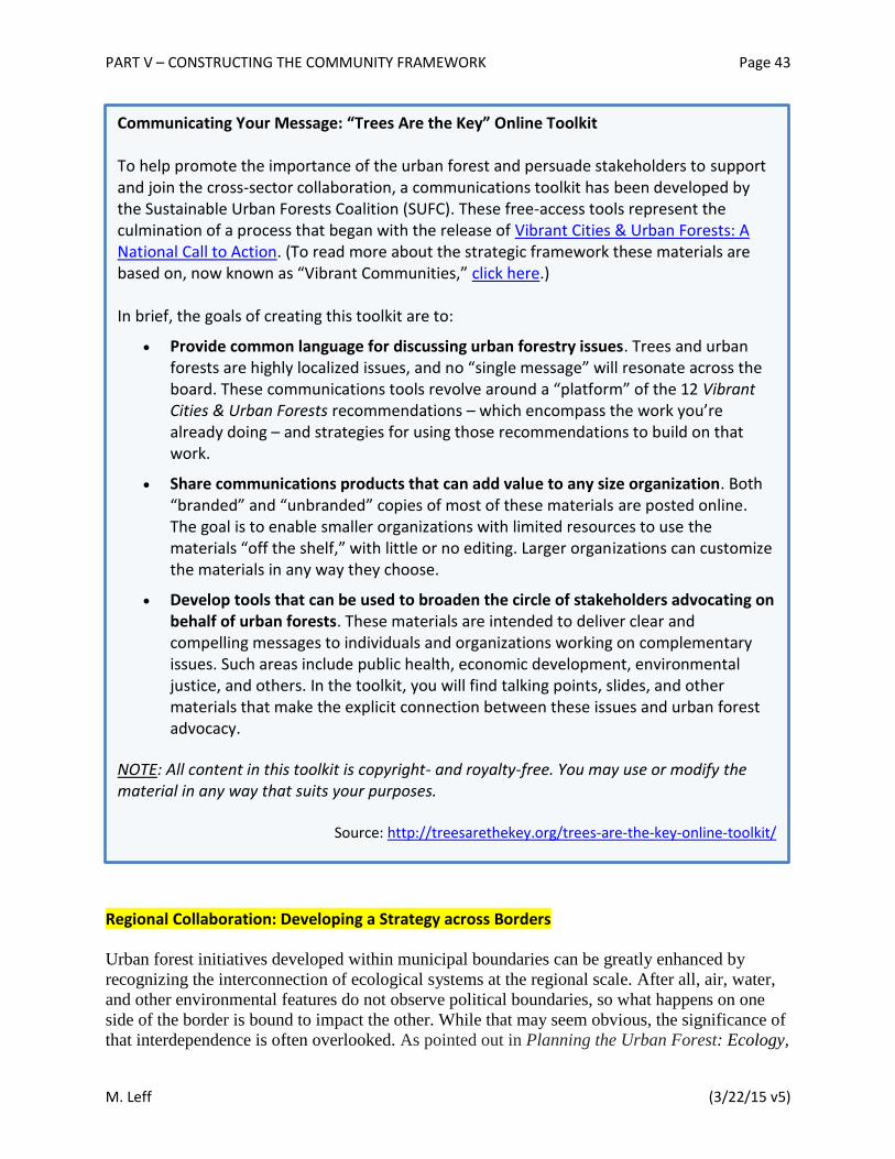
PART V – CONSTRUCTING THE COMMUNITY FRAMEWORK Page 43
M. Leff (3/22/15 v5)
Regional Collaboration: Developing a Strategy across Borders
Urban forest initiatives developed within municipal boundaries can be greatly enhanced by
recognizing the interconnection of ecological systems at the regional scale. After all, air, water,
and other environmental features do not observe political boundaries, so what happens on one
side of the border is bound to impact the other. While that may seem obvious, the significance of
that interdependence is often overlooked. As pointed out in Planning the Urban Forest: Ecology,
Communicating Your Message: “Trees Are the Key” Online Toolkit To help promote the importance of the urban forest and persuade stakeholders to support and join the cross-sector collaboration, a communications toolkit has been developed by the Sustainable Urban Forests Coalition (SUFC). These free-access tools represent the culmination of a process that began with the release of Vibrant Cities & Urban Forests: A National Call to Action. (To read more about the strategic framework these materials are based on, now known as “Vibrant Communities,” click here.) In brief, the goals of creating this toolkit are to:
Provide common language for discussing urban forestry issues. Trees and urban forests are highly localized issues, and no “single message” will resonate across the board. These communications tools revolve around a “platform” of the 12 Vibrant Cities & Urban Forests recommendations – which encompass the work you’re already doing – and strategies for using those recommendations to build on that work.
Share communications products that can add value to any size organization. Both “branded” and “unbranded” copies of most of these materials are posted online. The goal is to enable smaller organizations with limited resources to use the materials “off the shelf,” with little or no editing. Larger organizations can customize the materials in any way they choose.
Develop tools that can be used to broaden the circle of stakeholders advocating on behalf of urban forests. These materials are intended to deliver clear and compelling messages to individuals and organizations working on complementary issues. Such areas include public health, economic development, environmental justice, and others. In the toolkit, you will find talking points, slides, and other materials that make the explicit connection between these issues and urban forest advocacy.
NOTE: All content in this toolkit is copyright- and royalty-free. You may use or modify the material in any way that suits your purposes. Source: http://treesarethekey.org/trees-are-the-key-online-toolkit/

PART V – CONSTRUCTING THE COMMUNITY FRAMEWORK Page 44
M. Leff (3/22/15 v5)
Economy, and Community Development, this deficit “places added emphasis on the importance
of multijurisdictional, regional planning and cooperation for effective resource conservation.”18
Such a region-focused approach can have significant impact and potentially strengthen many
local acupunctural efforts that are compatible with regional goals. For example, where improving
water quality is a high priority, utilizing a watershed-wide systems approach can mean that
regional governmental networks (e.g., a Council of Governments or COG) plan collaboratively
to establish an overall tree canopy goal for the region – and to use that regional goal as a
framework to set local municipal goals.
In short, a comprehensive framework should reach across municipal, county, and even state
political jurisdictions to be most strategic, successful, and sustainable. The following are three
examples of regional initiatives that have defied political boundaries with goal-focused
prioritization.
Chicago Region Trees Initiative for the Seven-County Metropolitan Area
The Chicago Region Trees Initiative (CRTI) was formed to develop and implement a strategy for
a healthier urban forest by 2040 and was born out of the leading collaborative efforts of the
Morton Arboretum and Openlands, one of the nation’s oldest metropolitan conservation
organizations. In addition to those two organizations, the Executive Advisory Council of CRTI
includes the Chicago Metropolitan Agency for Planning (CMAP), U.S. Forest Service, U.S. Fish
and Wildlife Service, Metropolitan Mayors Caucus, Forest Preserve of Cook County, Illinois
Landscape Contractors Association, The Nature Conservancy, and Chicago Wilderness (a
regional alliance which itself comprises more than 300 organizations). Many other partners –
including public and private landowners and managers as well as interested organizations and
individuals – are collaborating on the development and implementation of the CRTI strategy and
goals.
In 2004, Chicago Wilderness developed a Green Infrastructure Vision with the goal of “having
green infrastructure considered on equal footing with traditional infrastructure and capital
improvements.” The alliance worked closely with CMAP to integrate that goal into the
development of the comprehensive regional plan known as GOTO2040, which was intended “to
help the seven counties and 284 communities plan together for sustainable prosperity.”19
Ultimately, that collaborative effort led to the inclusion of a proposed green infrastructure
network “that follows waterway corridors, expands existing preserves, and creates new preserves
in the region.”20
Another component of the GOTO2040 plan staged the framework for the Chicago Region Trees
Initiative.
“The urban forest of trees that grow in our cities and suburbs needs protection and
nurturing so we can harness its many benefits. But first, we need to understand it.
To that end, The Morton Arboretum, in cooperation with the U.S. Forest Service,
has conducted a tree census, or urban forestry assessment, in the seven-county
Chicago region.”21

PART V – CONSTRUCTING THE COMMUNITY FRAMEWORK Page 45
M. Leff (3/22/15 v5)
The results of the assessment, published in Urban Trees and Forests of the Chicago Region,
informed the development of an overall strategy and the management programs needed “to
integrate forests into plans to improve environmental quality in the Chicago region.”22
The emphasis on regional strategic visions to support and impact local effort is succinctly
captured in The Role of Our Urban Forest in the Chicago Metropolitan Region’s Future, which
points out that the shift to “a new, collaborative regional approach to urban and community
forestry is essential for preparing for 2.8 million new residents by 2040.”23
Here’s how the Morton Arboretum described the Chicago Region Trees Initiative, “a strategy to
improve the vitality and sustainability of the region’s trees,” at its summer 2014 launch:
“… the Arboretum has established a coalition of agency, industry, and community
representatives to expand the understanding of the value of the region's trees and to make
meaningful tree and forest improvements in the region. …
“The 5-year vision of the Regional Trees Initiative is to ensure that the region's tree
population is broadly understood, its collaborative management opportunities are
identified and enacted, and a 2040 goal for the population is clearly underway, with
interim actions understood and subscribed to by all partners.
“The desired outcome after five years is measurable improvements in the health and
vigor of the region's trees. Specific measures and targets will be developed for one- and
five-year goals.
“The myriad issues require considerable gathering, analysis and discussion in order to
develop a strategy that is pragmatic, actionable, and measurable. Stakeholders across the
region, both in the public and private sectors, including public and private landowners,
must engage and take ownership in the steps necessary to ensure a healthy forest for the
region.”24
In 2014, Chicago Wilderness and the Morton Arboretum developed the Oak Recovery Plan, an
18-county effort to map remaining oak stands, one acre or larger, and compare these stands to
pre-settlement oak populations in order to facilitate development of a strategy to improve the
health and vitality of oak ecosystems across this area.
The CRTI Forest Composition Work Group is now gathering public and private tree inventories
and Urban Tree Canopy data, and combining this information at the community scale with other
mapping and planning efforts, including those described above, to create a meaningful snapshot
of the forest composition of the seven-county Chicago region that will enable land managers and
owners to make effective decisions. Several other CRTI Work Groups – Tree Stewardship and
Planting; Industry and Associations; Trees and Green Infrastructure; Tree Risk Assessment and
Management; Education; Communication; Resources – are compiling and creating materials and
training programs to facilitate improved management and care for the regional forest.

PART V – CONSTRUCTING THE COMMUNITY FRAMEWORK Page 46
M. Leff (3/22/15 v5)
Sacramento Greenprint
An effective regional initiative requires not only developing a strategy that crosses jurisdictional
boundaries, but also fostering collaborative and complementary efforts by multiple fields of
expertise focused on achieving a mutually desirable outcome. In the instance of Sacramento,
California, improving the air – both air quality and temperature – was the key driver that
ultimately led to an exemplary urban forestry framework model. As reported by the Alliance for
Community Trees (ACTrees):
“Sacramento has consistently ranked poorly in air quality. Because of this and
many other benefits of a healthy urban forest, in 2005, Sacramento region elected
officials signed on to support the Sacramento Tree Foundation’s ‘Greenprint.’
This regional urban forest initiative seeks to galvanize the Sacramento region
around a goal of planting an additional five million trees for substantial
improvements in summer peak temperatures and air quality.”25
Subsequently funded by a $725,000 Federal Congestion Mitigation and Air Quality
Improvement (CMAQ) grant, the Sacramento Tree Foundation teamed up with the U.S. Forest
Service, the Sacramento Area Council of Governments and the Sacramento, El Dorado, Placer
and Feather River Air Districts to study the effect of trees on air pollution.26
The goal of
improving air quality has fostered collaboration across jurisdictions and agencies, where the
results of the scientific study grounded and emphasized the regional urban forestry approach,
Greenprint, for the Sacramento area.
Ultimately, the Greenprint was adopted by the 22 cities and six counties in the Greater
Sacramento Area, with the clear and ambitious vision of serving as “a regional framework
designed to build an optimal urban forest in every neighborhood, business district, park, school,
and street.”27
A few of the elements guiding implementation are:
“Our bold vision to enhance the quality of life in our region by expanding the urban
forest and maximizing the benefits of trees.
“Our roadmap for mobilizing and empowering community partners and volunteers to
plant 5 million trees in the Sacramento region.
“Our proud partnerships with elected officials, service and faith groups, businesses,
youth, and everyone who will help us reach our goal.”
Fundamental to the Sacramento Greenprint, and likely any regional strategic initiative, is the
recognition of specific challenges that each jurisdiction may encounter. For that reason, the
Sacramento model introduced the creative guiding concept known as Growth Rings, which
“represent increasing levels of commitment and benchmarks for progress. There is built-in
flexibility for each city and county to determine their particular pathway for achieving progress
in each of the growth rings.”28
The provision of incremental stages along the path for each locale
allows for emphasis to be placed locally within the context of the regional goal.
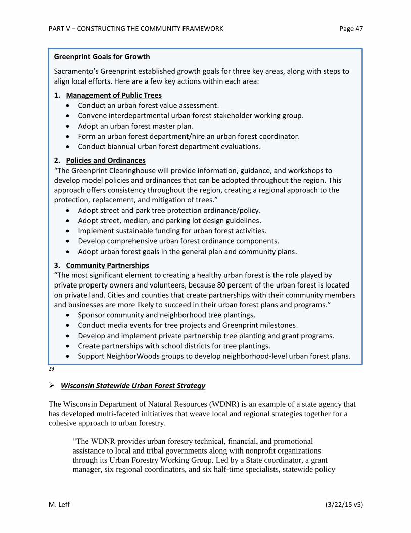
PART V – CONSTRUCTING THE COMMUNITY FRAMEWORK Page 47
M. Leff (3/22/15 v5)
29
Wisconsin Statewide Urban Forest Strategy
The Wisconsin Department of Natural Resources (WDNR) is an example of a state agency that
has developed multi-faceted initiatives that weave local and regional strategies together for a
cohesive approach to urban forestry.
“The WDNR provides urban forestry technical, financial, and promotional
assistance to local and tribal governments along with nonprofit organizations
through its Urban Forestry Working Group. Led by a State coordinator, a grant
manager, six regional coordinators, and six half-time specialists, statewide policy
Greenprint Goals for Growth
Sacramento’s Greenprint established growth goals for three key areas, along with steps to align local efforts. Here are a few key actions within each area:
1. Management of Public Trees
Conduct an urban forest value assessment.
Convene interdepartmental urban forest stakeholder working group.
Adopt an urban forest master plan.
Form an urban forest department/hire an urban forest coordinator.
Conduct biannual urban forest department evaluations.
2. Policies and Ordinances “The Greenprint Clearinghouse will provide information, guidance, and workshops to develop model policies and ordinances that can be adopted throughout the region. This approach offers consistency throughout the region, creating a regional approach to the protection, replacement, and mitigation of trees.”
Adopt street and park tree protection ordinance/policy.
Adopt street, median, and parking lot design guidelines.
Implement sustainable funding for urban forest activities.
Develop comprehensive urban forest ordinance components.
Adopt urban forest goals in the general plan and community plans.
3. Community Partnerships “The most significant element to creating a healthy urban forest is the role played by private property owners and volunteers, because 80 percent of the urban forest is located on private land. Cities and counties that create partnerships with their community members and businesses are more likely to succeed in their urban forest plans and programs.”
Sponsor community and neighborhood tree plantings.
Conduct media events for tree projects and Greenprint milestones.
Develop and implement private partnership tree planting and grant programs.
Create partnerships with school districts for tree plantings.
Support NeighborWoods groups to develop neighborhood-level urban forest plans.
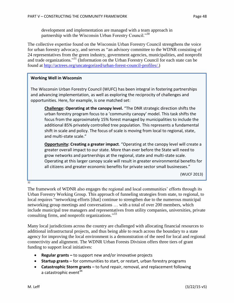
PART V – CONSTRUCTING THE COMMUNITY FRAMEWORK Page 48
M. Leff (3/22/15 v5)
development and implementation are managed with a team approach in
partnership with the Wisconsin Urban Forestry Council.”30
The collective expertise found on the Wisconsin Urban Forestry Council strengthens the voice
for urban forestry advocacy, and serves as “an advisory committee to the WDNR consisting of
24 representatives from the green industry, government agencies, municipalities, and nonprofit
and trade organizations.”31
(Information on the Urban Forestry Council for each state can be
found at http://actrees.org/uncategorized/urban-forest-council-profiles/.)
32 The framework of WDNR also engages the regional and local communities’ efforts through its
Urban Forestry Working Group. This approach of funneling strategies from state, to regional, to
local requires “networking efforts [that] continue to strengthen due to the numerous municipal
networking group meetings and conversations … with a total of over 200 members, which
include municipal tree managers and representatives from utility companies, universities, private
consulting firms, and nonprofit organizations.”33
Many local jurisdictions across the country are challenged with allocating financial resources to
additional infrastructural projects, and thus being able to reach across the boundary to a state
agency for improving the local environment is a demonstration of the need for local and regional
connectivity and alignment. The WDNR Urban Forests Division offers three tiers of grant
funding to support local initiatives:
Regular grants – to support new and/or innovative projects
Startup grants – for communities to start, or restart, urban forestry programs
Catastrophic Storm grants – to fund repair, removal, and replacement following a catastrophic event34
Working Well in Wisconsin The Wisconsin Urban Forestry Council (WUFC) has been integral in fostering partnerships and advancing implementation, as well as exploring the reciprocity of challenges and opportunities. Here, for example, is one matched set:
Challenge: Operating at the canopy level. “The DNR strategic direction shifts the urban forestry program focus to a ‘community canopy’ model. This task shifts the focus from the approximately 15% forest managed by municipalities to include the additional 85% privately controlled tree population. This represents a fundamental shift in scale and policy. The focus of scale is moving from local to regional, state, and multi-state scale.”
Opportunity: Creating a greater impact. “Operating at the canopy level will create a greater overall impact to our state. More than ever before the State will need to grow networks and partnerships at the regional, state and multi-state scale. Operating at this larger canopy scale will result in greater environmental benefits for all citizens and greater economic benefits for private sector small businesses.”
(WUCF 2013)
PART VI – CONDUCTING THE EVALUATION & MEASURING SUCCESS Page 49
M. Leff (3/22/15 v5)
PART VI – CONDUCTING THE EVALUATION & MEASURING SUCCESS
[Note: This portion of document under development by Targets & Metrics Workgroup.] Aim for these targets
In order to move toward a more sustainable urban forest, it’s important to periodically assess
your municipality’s performance on a number of criteria, or “targets.” As detailed below, those
targets are arranged in three categories:
1) Trees and Forest Vegetation 2) Community Framework 3) Resource Management Approach
In the material that follows, you’ll find a brief discussion of each target, including information
on how to evaluate your current status. The evaluation process involves measuring each target’s
key objective against four performance indicators – ranked Low, Fair, Good, and Optimal. Of
course, in practice, many things may not fit perfectly within each rating or you may not be able
to get the level of detailed data specified. In those cases, don’t get too hung up on precise
indicator metrics; rather, focus on the basic concept and the overall level of performance each
rating represents.
In conducting this evaluation, remember that the goal is to set a baseline position on each target,
in order to identify gaps as well as assets and areas of achievement. The evaluation process can
then be repeated periodically to track progress over time. While extensive, the process is
intended to be easily conducted, based on readily available information wherever possible. The
approach also allows for flexibility on goals and actions, and is intended for use by communities
of any size and in any location.
35
Category: Trees and Forest Vegetation
Targets: T1 – Relative tree canopy cover T2 – Age diversity (Size class distribution) T3 – Species diversity T4 – Species suitability T5 – Publicly owned trees (trees managed “intensively”) T6 – Publicly owned natural areas (trees managed “extensively”)
Acknowledgement: The targets and assessment method presented here are built upon the seminal work of James Clark and colleagues in 1997, as well as revisions made by Kenney et al in 2011. Specifics have been modified extensively throughout, and other targets have been added to the mix as well.

PART VI – CONDUCTING THE EVALUATION & MEASURING SUCCESS Page 50
M. Leff (3/22/15 v5)
T7 – Trees on private property T8 – Environmental justice and equity
Category: Community Framework
Targets: C1 – Municipal agency cooperation C2 – Involvement of large private and institutional landholders C3 – Green industry cooperation C4 – Citizen involvement and neighborhood action C5 – Cross-sector interaction C6 – General appreciation of trees as a community resource C7 – Regional collaboration
Category: Resource Management Approach
Targets: R1 – Tree inventory R2 – Canopy cover assessment R3 – Municipality-wide urban forest management plan R4 – Municipality-wide urban forest funding R5 – Municipal urban forestry staffing and training R6 – Tree establishment planning and implementation R7 – Planting site suitability R8 – Tree protection policy development and enforcement R9 – Maintenance of publicly owned, “intensively” managed trees R10 – Management of publicly owned natural areas R11 – Tree risk management R12 – Urban wood and green waste utilization R13 – Native vegetation
PART VII – DEVELOPING & IMPLEMENTING THE PLAN Page 51
M. Leff (3/22/15 v5)
PART VII – DEVELOPING & IMPLEMENTING THE PLAN Setting Priorities and Creating an Action Plan
After completing the comprehensive evaluation outlined in Part VI, there are decisions to be
made. To name a few:
What key components of a sustainable urban forest plan are you lacking?
Which gaps are worth the investment of time, money, and other resources that may be required to fill them?
What do you want to enhance or achieve?
What are your specific goals for tree benefits, or ecosystem services?
In the end, there is no defined straightforward path to a sustainable urban forest; rather, it’s one
that meanders with opportunities. That means you’ll need to stay nimble and work dynamically,
setting and then modifying prescribed strategies to suit your municipality’s needs and changing
circumstances. Several fundamental aspects of planning for the future are described in the
sections below: assessing risk, planning for change, and monitoring performance. All of those
areas will require ongoing attention – in order to revise the plan as needed over time.
[Note: Additional guidance to be developed by Targets & Metrics Workgroup.]
Assessing Risk and Planning for Change The urban forest exists in an environment that is undergoing constant change. Some of these
changes pose direct threats to the health of the urban forest and its ability to continue to provide
valuable benefits and services. The selected risks described below pose a particular threat or
challenge that should be considered when managing a sustainable urban forest.
Despite your best efforts, of course, bad things do happen to good people and their urban forests.
To improve your ability to bounce back from the inevitable setbacks, take care to engage the full
community as much and as often as possible in all your urban forestry efforts – during planning,
implementation, maintenance, monitoring, periodic reassessment, advocacy, celebration, every
step of the way. Time and again, involvement in urban greening has been shown to be one of the
most effective ways to build resilience into the social fabric that supports the urban forest and the
overall community in the aftermath of whatever disturbance may occur.36
Climate change
Climate change threatens the health of the urban forest by creating an environment that is less
hospitable to the plants and trees currently planted or naturally occurring in a given city. It will
be helpful to identify potential vulnerability by examining your current species diversity and
determining the adaptive capacity that your community has or needs in order to reduce impacts

PART VII – DEVELOPING & IMPLEMENTING THE PLAN Page 52
M. Leff (3/22/15 v5)
from climate change.37
Because the impacts of climate change are not uniform across the
landscape, it may also be helpful to establish localized levels of risk and the rate at which
response will be necessary by utilizing tools such as USGS’s NEX-DCP30
(http://www.usgs.gov/climate_landuse/clu_rd/nex-dcp30.asp), which generates county-level
projections of changes in temperature and precipitation, or NOAA’s U.S. Extreme Climate Index
(http://www.ncdc.noaa.gov/extremes/cei/graph/ne/2c/01-12), which captures recent regional
trends.
It is important to recognize that while trees can play a role in mitigating the impacts of climate
change, they are also susceptible to its effects. New York City’s PlanNYC is a comprehensive
sustainability plan that includes tree planting and greening initiatives to help reduce the impacts
of increased temperatures and better manage stormwater
(http://www.nyc.gov/html/planyc/html/sustainability/sustainability.shtml). To help create an
urban forest that will be adaptable to future conditions it may be necessary to include forest
adaptability in design protocols and policy – for example, Solutions for Sustainable Urban Forest
Governance and Management
(http://www.indiana.edu/~spea/faculty/policy_briefs/fischer_mincey_solutions_sustainable_urba
n_forest_gov_mgmt.pdf) and Climate Change Adaptation Options for Toronto’s Urban Forest
(http://www.cleanairpartnership.org/pdf/climate_change_adaptation.pdf).
One of the key responses to climate change is to ensure that the next generations of trees are
adaptable to future conditions. Tools such as the USDA Plant Hardiness Zone Map
(http://planthardiness.ars.usda.gov/PHZMWeb/#) updated in 2012, the USDA Forest Service
Climate Change Tree Atlas (http://www.nrs.fs.fed.us/atlas/tree/), and The ForeCast Project
(Forecasts of Climate-Associated Shifts in Tree Species;
http://www.geobabble.org/~hnw/global/treeranges3/climate_change/) can help identify species
whose ranges maybe shifting dramatically and identify potential replacements.
However, climate change occurs at broad scales over relatively long periods of time and its effect
on local, short-term weather and environment can be unpredictable. Best practices include
maintaining species and age diversity while increasing the number of trees appropriate for future
conditions. Proactive planning as recommended in Urban Forests: A Climate Adaptation Guide
(http://www.retooling.ca/_Library/docs/Urban_Forests_Guide.pdf) and the Template for
Assessing Climate Change Impacts and Management Options (TACCIMO;
http://www.taccimo.sgcp.ncsu.edu/) can help ensure the long-term health of the urban forest,
enabling it to both adapt to climate change and continue to provide benefits that help mitigate the
effects of climate change on an urban population.
As part of the Climate Change Response Framework, a pilot project is now being developed in
the Chicago area to help urban communities assess the vulnerability of their forests and to
identify and develop tools to assist in the adaptation of urban forests to climate change. To learn
more about or become involved in the project, explore http://www.forestadaptation.org/urban.38
Sea level rise
Many urban centers are located along the coast; in fact, 23 of the 25 most populous U.S. counties
are considered costal.39
NOAA predicts with “…very high confidence that global mean sea level
PART VII – DEVELOPING & IMPLEMENTING THE PLAN Page 53
M. Leff (3/22/15 v5)
will rise at least 0.2 meters and no more than 2.0 meters by 2100.”40
Such a rise in sea level has
the potential to inundate large amounts of urban forest.
Coastal communities can evaluate their level of vulnerability to sea level rise using tools such as
NOAA’s Sea Level Rise and Coast Flooding Viewer (http://coast.noaa.gov/slr/). The Nature
Conservancy’s Coastal Resilience project (http://www.coastalresilience.org/) also offers tools to
evaluate sea level rise around key urban areas including the ability to identify at-risk human
populations by social and economic factors as well as areas where conservation of current habitat
would be most beneficial. While it is possible to predict where sea level rise will threaten urban
forests, the ultimate impact is less certain. In many cases the urban forest lost to sea level rise
may represent a relatively small portion of a municipality’s overall area; however, coastal
forests, swamps, and other vegetation can play a key role in mitigating effects of stormwater
surge and protecting water quality. That’s why in coastal zones those “forest”-based water
resources are generally a key infrastructure consideration.
Best practices for mitigating the risks of sea level rise to urban forests can vary widely based on
the amount and type of forest likely to be affected. Low-lying coastal zones that are already
dealing with the threat of sea level rise demonstrate possible responses. For example, the
Virginia Beach Urban Forest Management Plan
(http://www.vbgov.com/government/departments/parks-recreation/landscape-
management/Documents/2013-ufmp.pdf) identifies several strategies, including setting aside
space for new forests to offset losses, conserving forest migration land adjacent to currently
threatened forest, minimizing forest fragmentation, and special focus on maintenance and
expansion of healthy forest buffers.
Wildfire
Wildfire rates have increased due to historic management regimes, climate change, extreme
weather events, and large-scale tree mortality due to pests such as bark beetles. Along with
increased incidence of wildfire, human population growth around urban centers has increased the
exposure of urban forests and residents to the risks of wildfire. In the U.S. there are significant
efforts to assess and mitigate the risks of wildfire, although most of these efforts are not focused
on urban forests. However, municipalities in wildfire affected areas may have to consider the
impact of wildfires on urban infrastructure, including fouling drinking water sources, reducing
recreation opportunities, and impact on transportation corridors. In Colorado, the municipal
water supplier Denver Water has partnered with the US Forest Service to restore burned lands
and manage forests to minimize the size and impact of future wildfires
(http://www.denverwater.org/SupplyPlanning/WaterSupply/PartnershipUSFS/).
There are a number of tools to assess long-term and short-term fire risk on a variety of scales
(e.g., www.wfas.net, www.coloradowildfirerisk.com and www.texaswildfirerisk.com).
Additionally, programs like Firewise Communities (http://www.firewise.org) provide tools and
examples of preventative planning for wildfire on scales from single homeowner to the
municipality. In managing urban forests for wildfire risk, focus efforts on fire prevention because
response following a wildfire will be focused on human and monetary impacts with the
rehabilitation of the urban forest lagging far behind.

PART VII – DEVELOPING & IMPLEMENTING THE PLAN Page 54
M. Leff (3/22/15 v5)
Pests, disease, and invasive plants
Urban trees are expected to be under increasing risk from all three of those threats. That’s due to
many factors, including increased globalization, increased wildland/urban interface, along with
increased tree stress and pest range expansion associated with climate change.41
Addressing the
risks from pests and diseases has the potential to keep pests out of the urban forest, reduce the
number of trees affected, and reduce costs associated with treatment and removal. Threats from
pests and diseases can be monitored at a range of scales. At large scales, the U.S. Forest Service
forest insect and disease reporting portal (http://foresthealth.fs.usda.gov/portal) along with the
ForWarn change detection system (http://forwarn.forestthreats.org/) provide many resources for
pest risk tracking. At more local scales, it can be useful to engage community groups and
engaged citizens to help identify new threats and monitor existing populations.
In recent decades a growing number of communities have been forced to address threats from
pests. In response, some communities and states have developed a “toolbox” to prepare and
respond to forest pests (e.g., in Vermont, http://www.vtinvasives.org/tree-
pests/communitypreparedness/toolbox, and in Wisconsin,
http://dnr.wi.gov/topic/urbanforests/eabtoolbox.html). Such toolboxes can help facilitate a rapid
response to pests and diseases and are readily adaptable for specific communities and threats.
Natural lifecycle changes
To ensure a healthy urban forest, it is necessary to consider the age distribution of a community’s
trees. As large older trees succumb to age, disease, and decay, they must be replaced. A newly
planted tree would require decades before approaching a comparable size and level of benefits.
The greatest risk associated with the natural life cycle of trees arises when a population is
dominated by trees of a similar age likely to die at a similar time. This issue has become more
prominent in recent years with large-scale tree planting campaigns juxtaposed against the
increasing evidence of the importance of large trees.42
Conducting and maintaining a tree
inventory is the best way to monitor and plan for the risks associated with the natural life cycles
of trees.
Budget cycles and other economic considerations
Budgets for urban forest management can be affected by a diverse set of factors including
macro-economic conditions, local budgetary priorities, changes in community support, and
changes in elected leadership. Predicting changes in these factors is generally not possible;
however, it is still necessary to prepare for such changes especially during periods of adequate
funding.
In order to be able to adapt to budgetary cycles, start with a realistic budget that includes all the
costs of managing an urban forest. Local or state urban forest coordinators can offer tools and
assistance to build an urban forest management budget (e.g.,
http://pubs.cas.psu.edu/freepubs/pdfs/uh114.pdf). While the goal of many urban forest advocates
is to increase the amount of urban tree canopy cover, it must be recognized that additional trees
come with additional costs for maintenance and management. Failing to plan for future
maintenance costs results in increased tree mortality as well as increased safety concerns when
resources are lacking to properly manage trees in decline.43
PART VII – DEVELOPING & IMPLEMENTING THE PLAN Page 55
M. Leff (3/22/15 v5)
In order to maintain a vibrant urban forest under changing budgetary conditions, it’s important to
prioritize staff resources and actions to ensure that the forest is well managed in lean times. And
of course, diversifying funding sources can help minimize the impacts of funding cuts in any one
source.44
Changing demographics
Among the most important factors influencing the urban forest in any community are the humans
who reside there. The latest U.S. census indicates a 12.1percent increase in the urban population
The Financially Stable Sustainable Urban Forest
“Urban forestry makes economic sense. Consequently, there is no reason not to put it on a sound financial footing. In the past, many tree programs have been viewed (and many still are) as cost centers, and the goal was to hold costs down while recognizing that such programs were politically popular because of their aesthetic value. The movement toward quantifying the economic benefits of trees at all levels (direct economic benefits but also indirect savings from environmental, health, and psychological benefits) suggests an entirely different model focused on trees as a wise public investment strategy—and through this lens, as a profit center. …
“Most urban forestry programs will probably always rely heavily on general fund allocations, but other options exist that can provide a revenue stream more clearly dedicated to the stewardship and management of urban forests.”
– “Planning the Urban Forest,” American Planning Association (2009)
Some examples of creative funding
Capital improvement plan fund derived from real estate taxes and utility taxes. Municipal portion of state motor fuel tax. Fines – for example, on motorists who damage trees in accidents. Entrepreneurial activities – such as the self-supporting yard waste recycling
center in Urbana, Illinois, which sells compost back to property owners. Donations for tree preservation funds. Partnering with nonprofit organizations to supplement tree funding – such as
the Sacramento Tree Foundation, which receives funding from the Municipal Utility District.
Development fees (including impact fees where legal) related to permit processing and enforcement – ideally written into zoning, subdivision, and landscaping codes, and then dedicated to benefit new development or redevelopment areas.
Revenue from a tax increment financing district allocated to urban forestry improvements, which add proven value to new economic development.

PART VII – DEVELOPING & IMPLEMENTING THE PLAN Page 56
M. Leff (3/22/15 v5)
from 2000 to 2010.45
To best understand how changing demographics affect the urban forest,
you need to look at the conditions of your own municipality.
Some cities such as New Orleans and Detroit, experienced large decreases in population over the
last decade. Such population decreases represent both opportunity and challenge for urban forest
management. Increased vacancy rates and abandoned housing may provide space for increasing
forested areas. However, without management it is possible that such areas may become
dominated by undesirable species and may ultimately create safety issues, unwanted change in
species composition, and a pathway for pests, disease, and invasive species. Managing large
tracts of new urban forest can also strain budgets at times that the tax base is decreasing.
Conversely, many communities are experiencing urban population growth, which can provide
both additional resources and additional demands for urban forests. Increasing populations can
lead to development pressures and decreasing physical space for the urban forest. In addition,
many municipalities are experiencing demographic shifts in race and ethnicity. Social and
cultural norms can impact the way various groups react to and treat the urban forest.
Evaluating the impacts of changing demographics begins with an understanding of how
demographics are changing locally. Much of this information is readily available from the U.S.
Census and local sources for any community. Adapting the urban forest to best serve a changing
community may require changes in the spatial distribution of the urban forest and prioritization
of tree management tasks. Outreach and education can help inform the public about the role of
the urban forest and how they can help unsure a vibrant and beneficial forest resource for their
city.
(See sidebar [BELOW].)
PART VII – DEVELOPING & IMPLEMENTING THE PLAN Page 57
M. Leff (3/22/15 v5)
Monitoring for Urban Forest Change and Program Performance Monitoring is a key element of sustainable urban forest management. As suggested by Clark and
colleagues,46
assessing the urban forest resource for sustainability entails “collect[ing]
information about the urban forest on a routine basis.” This is more than a static “snapshot”
inventory. A single, static inventory can be used to understand structure and function at a given
point in time, but can quickly become outdated in a dynamic urban landscape. Systematic
repeated inventories can serve as a city tree census. Similar to the U.S. Census which tracks
changes in the human population, a city tree census can be used to describe and predict patterns
in the urban forest over time. Indeed, recognizing the value of long-term field data, many
municipal arborists and urban greening nonprofits are already engaged in monitoring.47
Taking No Chances with Risks
New and unforeseen changes will inevitably emerge that threaten the health of the urban forest and its ability to provide benefits and ecosystem services. There are a wide variety of risks and changes that are already impacting the urban forest. In many cases, while the changes and risks are diverse, there are some common tools that can be used to improve the response to change and the resiliency of the urban forest.
The following principles can help identify and manage the risks to the urban forest:
1. Know your urban forest resource. Conducting a forest inventory will allow you to determine the extent and make-up of your urban forest and related susceptibility to risk. A forest inventory provides the baseline data for planning and management.
2. Understand your human capital. Establish the network of available experts, on-the-ground practitioners, and volunteer organizations you can draw on to determine the types of changes occurring in your urban forest, how best to respond to them, and how to mobilize people to enact your plans.
3. Manage your money. Lack of adequate funding not only reduces your ability to manage your urban forest but it also reduces your ability to respond to risk. A realistic urban forest budget must include realistic planning for the maintenance and management of existing forest as well as planned expansion of the forest resource. Urban forest managers can also help minimize funding shortages and obtain funds to combat specific risks by searching for a diversity of funding sources.
4. Establish a diverse and healthy forest. Maximizing the species, age, and spatial diversity of your urban forest can minimize the portion of the forest at risk to any one agent. Expenditures on improving forest health can help minimize susceptibility to risk. Both health and diversity increase forest resiliency and ensure that even in the face of increasing risk a vibrant urban forest can be maintained.
5. Think locally. Broad principles can be a good starting point, but be sure to consider uniquely local risks and seek out the resources to address them.

PART VII – DEVELOPING & IMPLEMENTING THE PLAN Page 58
M. Leff (3/22/15 v5)
Why monitor
Monitoring can serve several management goals, including:
Evaluating planting program performance. Tracking trees planted through a particular
program can yield information about growth, survival, and maintenance, and suggest
areas for program enhancement. For example, New York City Parks & Recreation
collected data on street tree survival in relation to biological, social, and stewardship
variables.48
Engaging local communities. Field data collection for urban tree monitoring can be an
excellent way to engage volunteers and local residents in urban forestry, or to provide
actionable feedback to those who maintain trees. For example, some nonprofits recruit
volunteers for tree-tracking field work, including Friends of the Urban Forest (San
Francisco, CA) and Canopy (Palo Alto, CA). More municipalities should take advantage
of such opportunities to extend that sort of training and collaboration with community
volunteers.49
Tracking population life cycles and managing tree risk. This is especially relevant for
the public street tree environment, which requires removals of aging and hazardous trees.
Repeated street tree inventories can be accomplished with a regular pruning cycle (for
example, prune a set portion of the town’s street trees each year, and update the inventory
with tree growth and mortality data at the same time). This kind of systematic inventory
cycle ensures that records are up-to-date and allows for analysis of mortality and tree risk
data.
Detecting emerging threats from pests and diseases. Monitoring for tree pests and
diseases in the urban environment can provide valuable early warnings about threats to
both urban and natural forest systems. Field methods designed for pest detection and tree
health monitoring are under development by the Healthy Trees, Healthy Cities initiative
of The Nature Conservancy (http://healthytreeshealthycities.org/). There is also an i-Tree module for recording pest detection data (http://pest.itreetools.org). [Other sources tbd]
Assessing progress towards canopy cover goals. Repeated canopy assessments allow for
evaluation of canopy cover change, which can demonstrate the extent to which canopy
cover goals are being met, or identify patterns related to canopy cover change. For
example, recent studies of canopy cover change in New York City50
and Massachusetts51
describe factors related to canopy losses and gains.
Each of the above goals has associated data inputs, and it is essential to link your particular
monitoring goals to data collection strategies. Neglecting to articulate up front clear monitoring
objectives, plans for data analysis, and ways you intend to use the information can lead to the
“data-rich but information-poor” scenario of environmental monitoring52
in which analysts
become “snowed by a blizzard of ecological details”.53
As an example of appropriate linkages between goals and methods, a neighborhood planting
program seeking to understand establishment-phase losses, and potential program alterations for
enhanced survival, could monitor mortality and stewardship of recently planted trees. For that
objective, additional field variables besides survival and maintenance should be used sparingly,

PART VII – DEVELOPING & IMPLEMENTING THE PLAN Page 59
M. Leff (3/22/15 v5)
especially if volunteers or interns with little prior experience are collecting the data. In another
example, a municipality seeking to assess progress made toward desired canopy cover goals, and
also concerned about invasive pests and diseases, could document change through LiDAR or
aerial photography, coupled with random plot data for tree pest detection.
A multifaceted monitoring approach might employ several goals and methods in tandem. The
state of Wisconsin is doing just that, using three levels of data to optimize management: plot-
based field monitoring using the Urban Forest Inventory & Analysis (UFIA) system of the U.S.
Forest Service,54
remote sensing data to evaluate canopy, and aggregated tree inventory data
from many municipalities. UFIA is the urban expansion of ongoing forest inventories and
monitoring across the U.S. through a national plot system, which until recently was limited to
non-urban areas. UFIA shares many variables with the i-Tree Eco method.
Ways to monitor
As discussed in Part IV, Gathering the Information, there are two distinct ways to gather urban
forest monitoring data: bottom-up (field-based) and top-down (canopy cover assessments). Top-
down monitoring is typically employed when managers want a city-, county-, or state-wide
perspective on tree canopy cover and distribution. The urban tree canopy (UTC) assessment
method utilizes LiDAR to produce a spatially explicit map of tree canopy cover. Aerial
photointerpretation can also document change over time, based on a sample of points across the
city. This method has been used to document canopy loss in 11 U.S. cities.55
The canopy change
studies from New York City and Massachusetts previously mentioned used Landsat imagery.56
Repeated canopy assessments can assist managers evaluating progress towards canopy cover
goals.
Field-based monitoring requires trained crews and potentially substantial staff time, but can
provide detailed information on tree condition, site characteristics, and maintenance. Within
field-based methods, there are several options. A tree census approach can be used for
systematic repeated inventories, such as repeated street tree inventories or plot-based inventories.
In contrast, a planting cohort monitoring approach is for tracking trees planted or distributed
through a specific program. The term “cohort” refers to the collection of trees planted around the
same time, and a program may wish to track a sample of trees planted each year.
A framework for field-based monitoring has been developed by the Urban Tree Growth &
Longevity (UTGL) Working Group (www.urbantreegrowth.org), a network of researchers and
practitioners that is affiliated with the International Society of Arboriculture, Arboriculture
Research & Education Academy. A committee of researchers, municipal arborists, nonprofit
leaders, and students devised a framework of monitoring protocols designed to be customized
based on manager needs and available staffing (see Figure 1). These protocols are intended to
generate data to evaluate trends in tree growth, mortality, and longevity. There is a minimum
data set with the core variables necessary for any long-term monitoring project – such as tree
location, species, and diameter at breast height. The field guide for the minimum data set is
designed for novice users, such as minimally trained interns and volunteers. Supplemental data
sets can provide greater detail in four areas: Tree, Site, Management, and Community. These
supplemental data sets should be employed only when more highly trained staff and program

PART VII – DEVELOPING & IMPLEMENTING THE PLAN Page 60
M. Leff (3/22/15 v5)
resources are available. The minimum data set was pilot tested in summer 2014 to evaluate
consistency and error rates across field crews of varying experience levels. Additional resources
for field-based monitoring are listed in the “Resources for Field-based Monitoring” sidebar
below.
Figure 1. Framework and data sets for field-based urban tree monitoring developed by the Urban Tree Growth & Longevity (UTGL) Working Group.
Linking monitoring to community outreach
For urban forestry organizations that plant trees, monitoring may go hand in hand with ongoing
community outreach and stewardship. Some nonprofit tree planting programs utilize pruning
clubs and tree steward programs to maintain young trees, and these maintenance actions can be
done in tandem with data collection.57
By serving as field crews, local residents become citizen
scientists who contribute to knowledge production in the urban forest. Using volunteer or
neighborhood-based citizen scientists can also increase environmental awareness and create a
more informed constituency.58
For trees along streets and in front yards, observed maintenance
issues by citizen scientists can be used to create “report cards” for each property with feedback
on tree condition and recommendations for improved stewardship. Citizen science has been
successfully used for ecological monitoring in areas ranging from ornithology (www.ebird.org)
to plant phenology (www.usanpn.org). With appropriate training and quality control measures,
urban foresters can also effectively utilize citizen scientists.
Planning ahead for data management and analysis
Advance data management planning is extremely important for any successful monitoring
initiative, as data integrity and locational accuracy from baseline inventories and planting records
are essential. Problems can arise when baseline data are insufficient for monitoring purposes. For
example, an organization seeking to track mortality and growth uses planting records from years
past, but finds that location was only recorded in terms of address, lacking tree identification
tags, site maps, or GPS coordinates to distinguish multiple trees at the same property. In another

PART VII – DEVELOPING & IMPLEMENTING THE PLAN Page 61
M. Leff (3/22/15 v5)
example, a municipality used random plots throughout the city to evaluate urban forest structure
and ecosystem services using the i-Tree Eco model, and later wanted to revisit those plots to
evaluate change. However, because plot centers were not permanently referenced, field crews
could not reliably draw identical plot boundaries over the original plot locations. Another issue
that can arise is difficulty linking monitoring data tree-by-tree over time: Sometimes two or more
discrete inventories did not have unique tree identification numbers to facilitate connecting data
at the level of the individual tree. These issues can be avoided, but they require foresight at the
initial data collection stage (e.g., planting list, first plot measurements, utilizing unique tree
identification numbers) to ensure that monitoring goes smoothly.
Plans for data analysis should also be articulated at the beginning of a monitoring project. Some
assessments can be done with program staff, such as summarizing mortality rates by
neighborhood, species, and length of time after planting. However, for more advanced statistical
analysis, it is often helpful to partner with university students, professors, and U.S. Forest
Service researchers. Projects to collect and analyze urban forest monitoring data with a local
partner can be very appealing to thesis students at the undergraduate, masters, or doctoral levels.
Researchers can also advise on appropriate sample design and sample size to address monitoring
study objectives. These kinds of collaborations can yield scientifically rigorous analysis to assess
program performance and identify areas for improvement. Examples of such collaborations
include analysis of survival and growth in planting initiatives from Florida (Koeser et al. 2014)
and Indianapolis (Vogt et al. 2015), as well as tree giveaway program in Sacramento, California
(Roman et al. 2014).59

APPENDIX A – RESOURCES Page 62
M. Leff (3/22/15 v5)
APPENDIX A – RESOURCES The following resources match the list of “Key Ingredients” outlined in Part IV, Gathering the Information. Refer to that section for brief descriptions of each category where needed.
Plans, Practices, Programs, and Policies:
Urban Forest Management Plan (UFMP):
o Nationwide – i-Tree Assessment Reports, USDA Forest Service http://www.itreetools.org/resources/reports.php
o Ann Arbor, MI – “Urban & Community Forest Management Plan” (2014) http://www.a2gov.org/departments/field-operations/forestry/Pages/UFMP.aspx
o Austin, TX – “Austin’s Urban Forest Plan: A Master Plan for Public Property” (2014) http://austintexas.gov/page/urban-forest-plan60
o California Urban Forests Council and Inland Urban Forest Council – “Urban Forest Management Plan Toolkit” http://ufmptoolkit.com
o Charlottesville, VA – “Urban Forest Management Plan” (2009) http://www.charlottesville.org/Modules/ShowDocument.aspx?documentid=13979
o Grand Rapids, MI – “Urban Forestry Plan” (2009) http://grcity.us/public-services/Parks-Recreation-Forestry/Documents/Grand%20Rapids%20Urban%20Forest%20Plan%202009.pdf
o New York, NY – “Urban Forest Management Plans for NYC Communities and Parks” (2004-07) http://www.nycgovparks.org/trees (Scroll down to list at bottom of page.)
o Phoenix, AZ – “Tree and Shade Master Plan” (2010) https://www.phoenix.gov/parkssite/Documents/071957.pdf
o Pittsburgh, PA – “Urban Forest Master Plan” (2013) http://treepittsburgh.org/urban-forest-master-plan
o Portland, OR – “Urban Forest Management Plan” (2004) and “Urban Forest Action Plan” (2007) https://www.portlandoregon.gov/parks/60402
o Santa Monica, CA – “Urban Forest Master Plan” (2011) http://www.smgov.net/uploadedFiles/Portals/UrbanForest/Handout%206%20-%20Urban%20Forest%20Master%20Plan.pdf
o Seattle, WA – “Urban Forest Management Plan” (2007) http://www.seattle.gov/trees/docs/Final_UFMP.pdf
o Vancouver, WA – “Urban Forestry Management Plan” (2007) http://www.mrsc.org/govdocs/v35urbforestplan.pdf
APPENDIX A – RESOURCES Page 63
M. Leff (3/22/15 v5)
Maintenance plans for street trees and other public trees:
o Bloomington, IN – “Tree Care Manual: A Manual for the Care of Public Trees” (2012) http://issuu.com/bloomingtonparks/docs/tree_care_manual_2nd_edition_feb_2012
o New York, NY – “Tree Services” http://www.nycgovparks.org/services/forestry
o Oconomowoc, WI – “Tree Care and Maintenance” http://www.oconomowoc-wi.gov/index.aspx?nid=556
o U.S. Forest Service Northeastern Area – “Sample Urban & Community Forest Management Plan & Guidebook” (1998) http://www.na.fs.fed.us/urban/inforesources/mgmtplanguide/mgmtplanguide.shtml
o Waxhaw, NC – “Tree Management and Maintenance: A Plan for the Town of Waxhaw’s Public Trees for 2010-12” http://www.waxhaw.com/DocumentCenter/View/57
Natural areas management plans:
o Charlottesville, VA – “Invasive Plant Inventory” and “Invasive Species Removal Methods” (2007) http://www.charlottesville.org/Modules/ShowDocument.aspx?documentid=13978 http://www.charlottesville.org/Modules/ShowDocument.aspx?documentid=13975
o Louisville, KY – “Jefferson Memorial Forest Master Plan” (2009) http://www.louisvilleky.gov/NR/rdonlyres/C7D19169-5C61-4E99-8FF2-E9723E067AFB/0/JeffersonMemorialForestMP200resJuly09.pdf
o New York, NY – “Biodiversity Assessment Handbook for New York City” (2013) http://www.amnh.org/our-research/center-for-biodiversity-conservation/publications/general-interest/biodiversity-assessment-handbook-for-new-york-city
o New York, NY – “Social Assessment of Parks and Natural Areas” (tbd)
o Philadelphia, PA – “Parkland Forest Management Framework” (2013) http://www.phila.gov/ParksandRecreation/PDF/PPR_Parkland_Forest_Mgmt_Framework.pdf
Regional plans:
o Chicago, IL – “GO TO 2040 Comprehensive Regional Plan” (2010), Chicago Metropolitan Agency for Planning (CMAP) http://www.cmap.illinois.gov/about/2040/
o Chicago, IL – “Chicago Region Trees Initiative – Case Statement,” Morton Arboretum http://www.linktbd
o Philadelphia and Delaware County, PA – “Baltimore Avenue Corridor Revitalization Plan” (2007), Delaware Valley Regional Planning Commission http://www.dvrpc.org/reports/07051A.pdf

APPENDIX A – RESOURCES Page 64
M. Leff (3/22/15 v5)
Relevant previous or historic plans:
o New York, NY – “A Street Tree System for New York City” (1916) http://www.biodiversitylibrary.org/item/121416#page/11/mode/1up
o Philadelphia, PA – “Directions for the Planting and Care of Street Trees” (1913) https://archive.org/stream/directionsforpla00fair#page/n27/mode/2up
Community tree programs:
o Nationwide – “NeighborWoods Program,” Alliance for Community Trees http://neighborwoodsmonth.org
o Atlanta, GA – Trees Atlanta http://treesatlanta.org
o Chicago, IL – Chicago Region Trees Initiative http://www.mortonarb.org/science-conservation/chicago-region-trees-initiative
o Chicago, IL – “Community Trees Program,” The Morton Arboretum http://www.mortonarb.org/trees-plants/community-trees-program
o Philadelphia, PA – Philly Tree People http://phillytreepeople.org/
o Philadelphia, PA – “PHS Tree Tenders,” Pennsylvania Horticultural Society http://phsonline.org/greening/tree-tenders
o Philadelphia, PA – “Cooperative Community Greening,” UC Green http://ucgreen.org/
o Pittsburgh, PA – TreePittsburgh http://treepittsburgh.org
o Sacramento, CA – “Community Shade Program,” Sacramento Tree Foundation http://sactree.com/communityshade
o Seattle, WA – “Urban Forest Stewardship Plan” (2013) http://www.seattle.gov/trees/docs/2013%20Urban%20Fores%20Stewardship%20Plan%20091113.pdf
o Vancouver, WA – “NeighborWoods Stewards Program” http://www.cityofvancouver.us/publicworks/page/neighborwoods-stewards-program
Private property tree programs:
o Baltimore, MD – “Tree Keepers,” Tree Baltimore http://treebaltimore.org/get-a-free-tree/
o New York, NY – New York Restoration Project and MillionTreesNYC http://www.nyrp.org/Greening_Sustainability/MillionTreesNYC/Tree_Giveaways
o Philadelphia, PA – “TreePhilly Program,” Philadelphia Parks & Recreation http://treephilly.org/
o San Jose, CA – Our City Forest http://www.ourcityforest.org/programs
APPENDIX A – RESOURCES Page 65
M. Leff (3/22/15 v5)
o Washington, DC – Casey Trees http://caseytrees.org/programs/planting/rebate/
Educational materials, promotion and outreach:
o Nationwide – “tbd” (DATE), Arbor Day Foundation http://linktbd
o Nationwide – “Urban and Community Forestry – Outreach Services Strategies for All Communities” (2003), Alliance for Community Trees http://actrees.org/files/What_We_Do/OutreachStrategies.pdf
o Nationwide – “Healthy Trees, Healthy Cities,” The Nature Conservancy http://healthytreeshealthycities.org/training-resources
o Nationwide – “Trees Are the Key” (2013), Vibrant Communities & Urban Forests http://treesarethekey.org/trees-are-the-key-online-toolkit/
o Nationwide – “Tree Owner Information,” International Society of Arboriculture (ISA) http://www.treesaregood.com/treecare/treecareinfo.aspx
o Nationwide – Urban and Community Forestry, USDA Forest Service http://www.fs.fed.us/ucf/
o Nationwide – “tbd” (DATE), Missouri’s Trees Work http://linktbd
o Ann Arbor, MI – “Benefits of Urban Forests” and “What’s Wrong with My Tree?” http://www.a2gov.org/departments/field-operations/forestry/Pages/UrbanForestBenefits.aspx http://www.a2gov.org/departments/field-operations/forestry/Pages/tree%20care.aspx
o Baltimore, MD – “How to Plant a Tree,” Tree Baltimore http://treebaltimore.org/how-to-plant/
o Chicago, IL – “Retrofitting Large Landscapes for Sustainability” (2014), The Morton Arboretum http://www.mortonarb.org/trees-plants/community-trees-program/community-tree-resources/sustainable-large-landscapes
o Chicago, IL – “Selecting and Planting Trees” (2015), The Morton Arboretum http://www.mortonarb.org/
o Chicago, IL – “Tree Tools” (2012-2015), The Morton Arboretum http://www.mortonarb.org/treetools
o Chicago, IL – “Landowner’s Guide: Ravine and Tableland Preservation” (2013), Openlands http://www.greatlakes.org/document.doc?id=1380
o Oakland, CA – “Urban Forest Education & Stewardship Training Program” (2014), Urban ReLeaf http://www.urbanreleaf.org/our-programs/ufest-program
o New York, NY – MillionTreesNYC http://linktbd

APPENDIX A – RESOURCES Page 66
M. Leff (3/22/15 v5)
o Philadelphia, PA – “PHS Tree Tenders,” Pennsylvania Horticultural Society http://pennhort.libguides.com/content.php?pid=138497&sid=1185152
o Vancouver, WA – “Benefits of Trees” http://www.cityofvancouver.us/publicworks/page/benefits-trees
o Washington, DC – Casey Trees http://caseytrees.org/programs/education/curriculum/
Municipal urban forestry policies:
o Nationwide – “Urban Forestry Best Management Practices for Public Works Managers: Ordinances, Regulations, & Public Policies,” American Public Works Association https://www2.apwa.net/Documents/About/CoopAgreements/UrbanForestry/UrbanForestry-3.pdf
o Nationwide – “Guidelines for Developing and Evaluating Tree Ordinances” (2001), International Society of Arboriculture (ISA) http://www.isa-arbor.com/education/onlineResources/treeOrdinanceGuidelines.aspx
o Ann Arbor, MI – “Trees and Development” (2013) http://www.a2gov.org/departments/field-operations/forestry/Pages/StreetTreesDevelopment.aspx
o Charlottesville, VA – “Best Management Practices for Tree Preservation, Transplanting and Removal” (2009) http://www.charlottesville.org/Modules/ShowDocument.aspx?documentid=20614
o Culver City, CA – “Approved Street Tree Master Plan Criteria, Policies and Implementation Guide” (2002) http://www.culvercity.org/~/media/Files/PW/STMPGuidelines%20pdf.ashx
o Northbrook, IL – “Tree Protection and Preservation, Vegetation” (1999) https://www.municode.com/library/#!/il/northbrook/codes/code_of_ordinances?nodeId=MUCO_CH25TRPRPRVE
o San Francisco, CA – “Tree Maintenance Transfer Plan” (2014) http://www.sfdpw.org/index.aspx?page=1478
o Vancouver, WA – “Tree Permits” and “Heritage Trees” http://www.cityofvancouver.us/publicworks/page/tree-permits-0 http://www.cityofvancouver.us/publicworks/page/heritage-trees
o Georgia – “Tree Ordinance Development Guidebook” (2005) http://www.gatrees.org/community-forests/planning-policy/tree-ordinances/2005TreeOrdinance-100.pdf
Municipal tree board/shade tree commission:
o Charlottesville, VA – Tree Commission http://www.charlottesville.org/Index.aspx?page=3298
o Santa Monica, CA – Urban Forest Task Force http://www.smgov.net/Portals/UrbanForest/content.aspx?id=16692

APPENDIX A – RESOURCES Page 67
M. Leff (3/22/15 v5)
o Vancouver, WA – Urban Forestry Commission http://www.cityofvancouver.us/publicworks/page/urban-forestry-commission
Municipal urban forest budget:
o Nationwide – “Urban Forestry Best Management Practices for Public Works Managers: Budgeting and Funding,” American Public Works Association https://www2.apwa.net/Documents/About/CoopAgreements/UrbanForestry/UrbanForestry-1.pdf
o Charlottesville, VA – “Invasive Plant Inventory Budget” (2007) http://www.charlottesville.org/Modules/ShowDocument.aspx?documentid=17772
Municipal urban forest staff:
o Nationwide – “Urban Forestry Best Management Practices for Public Works Managers: Staffing,” American Public Works Association https://www2.apwa.net/Documents/About/CoopAgreements/UrbanForestry/UrbanForestry-2.pdf
Green jobs training:
o Detroit, MI – “Greening of Detroit,” tbd http://linktbd
o Philadelphia, PA – “Tree Keepers,” Philadelphia Parks & Recreation http://treephilly.org/treekeepers/
o Philadelphia, PA – “Roots to Re-Entry,” Pennsylvania Horticultural Society http://phsonline.org/greening/roots-to-re-entry
o University of Oregon – “A Quick Guide for Creating High-Quality Jobs through Restoration on National Forests” (2012), Ecosystem Workforce Program http://ewp.uoregon.edu/sites/ewp.uoregon.edu/files/WCF_JobCreation_QG.pdf
Agroforestry / Trees for food:
o Alliance for Community Trees – “Community Groves Guidebook” (2013) http://actrees.org/files/Publications/community_groves_guidebook.pdf
Urban & Community Forestry:
o Alliance for Community Trees – State guide for urban and community forestry contacts and resources http://actrees.org/resources/local-resources/whos-who-in-your-state/
Databases and Other Information:
Comprehensive list of stakeholders:
o Ann Arbor, MI – “Urban Forest Management Plan – Public Engagement Plan Summary” (2011)
APPENDIX A – RESOURCES Page 68
M. Leff (3/22/15 v5)
http://www.a2gov.org/departments/field-operations/forestry/Documents/Urban%20Forestry%20Management%20Plan/PEPsummary.pdf
o Select cities – “STEW-MAP: Stewardship Mapping & Assessment Project” http://www.stewmap.net/
Funding sources:
o Nationwide – “Donors Forum,” tbd http://donorsforum.org/
o Nationwide – “Fundraising Tools for Nonprofits,” Alliance for Community Trees http://actrees.org/resources/tools-for-nonprofits/fundraising-tools-for-nonprofits/
o Nationwide – “Urban & Community Challenge Cost Share Grants,” National Urban and Community Forestry Advisory Council (NUCFAC), USDA Forest Service http://www.fs.fed.us/ucf/nucfac.html
o Nationwide – “Urban Forestry Best Management Practices for Public Works Managers: Budgeting and Funding,” American Public Works Association https://www2.apwa.net/Documents/About/CoopAgreements/UrbanForestry/UrbanForestry-1.pdf
o Nationwide – Catalog of Federal Domestic Assistance (CFDA), U.S. Government https://www.cfda.gov/
o Nationwide – Foundation Directory Online, Foundation Center http://www.foundationcenter.org/
o Chicago, IL – ComEd Green Region Program, Openlands http://www.openlands.org/greenregion
o University of North Carolina – “Financing Urban Forestry” (2013), Environmental Finance Center http://efc.web.unc.edu/2013/08/09/financing-urban-forestry/
o San Francisco, CA – “Financing San Francisco’s Urban Forest” (2013) http://www.sf-planning.org/ftp/files/plans-and-programs/planning-for-the-city/urban-forest-plan/UFP_Financing_Study_Exec_Sum_131216.pdf
Maps: (tbd)
Citywide urban forest GIS:
o Grand Rapids, MI – “Urban Forest Ecological Services Assessment” (2008) http://grcity.us/public-services/Parks-Recreation-Forestry/Documents/Grand%20Rapids%20Urban%20Forest%20Ecological%20Services%20Assessment%202008.pdf

ENDNOTES
M. Leff (3/22/15 v5)
1
2
3
4
5
6
7
8
9
10
11
12
13
14
15
16
17
18
19
20
21
22
23
24
25
26
27
28
29
30
31
32
33
34
35
36
37
38
39
40
41
42
43
44
45
46
47
48
49

ENDNOTES
M. Leff (3/22/15 v5)
50
51
52
53
54
55
56
57
58
59
60