Embed Size (px)
Citation preview
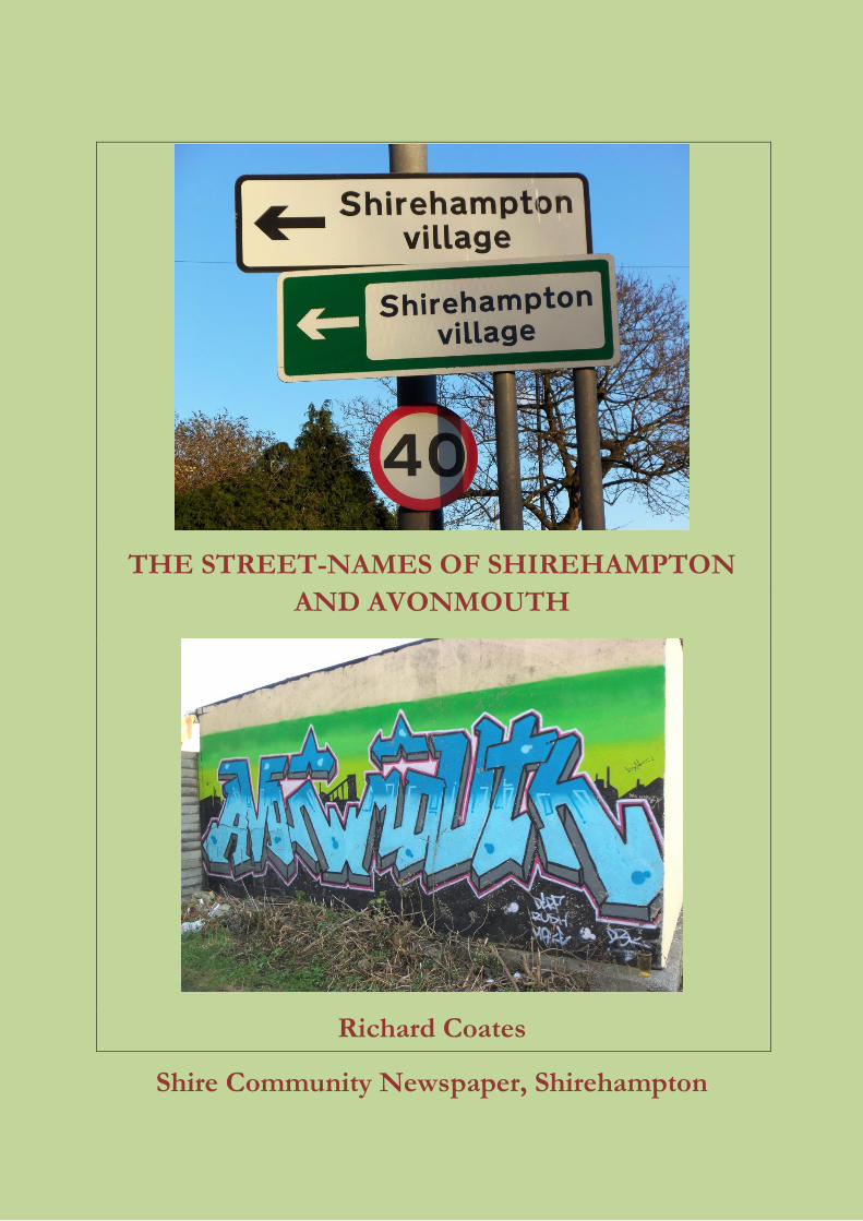
THE STREET-NAMES OF SHIREHAMPTON
AND AVONMOUTH
Richard Coates
Shire Community Newspaper, Shirehampton
1
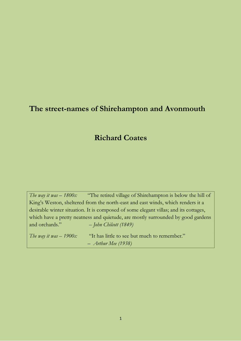
The street-names of Shirehampton and Avonmouth
Richard Coates
The way it was – 1800s: “The retired village of Shirehampton is below the hill of
King’s Weston, sheltered from the north-east and east winds, which renders it a
desirable winter situation. It is composed of some elegant villas; and its cottages,
which have a pretty neatness and quietude, are mostly surrounded by good gardens
and orchards.” – John Chilcott (1849)
The way it was – 1900s: “It has little to see but much to remember.”
– Arthur Mee (1938)
2
First published December 2011
Revision history
1: February 2012 (minor changes)
2: April 2013 (minor changes and corrections)
This electronic book can be read like an ordinary book by scrolling through, or it
can be searched using the search-engine provided on the web-site.
It may be freely downloaded or printed off and bound, on the sole condition of
including this page with this copyright notice:
Text © Richard Coates 2011, 2013
The moral right of Richard Coates to be identified as the author of The street-names
of Shirehampton and Avonmouth has been asserted.
The copyright in images rests with the author except where stated. Some old
images believed to be out of copyright have been used, and others are used by
courtesy of Shire newspaper and of persons mentioned adjacent to the image in
question. Images created as publicity material are presumed to be in the public
domain. The publisher is Shire Community Newspaper, Shirehampton.
3
Contents
Preface ..... 5
The main local place-names ..... 12
The street-names of Shirehampton ..... 18
Two ancient Shirehampton house-names ..... 49
The street-names of Avonmouth ..... 50
The street-names of the part of Lawrence Weston in Avonmouth ward ..... 70
Sources ..... 74
The last page (about the author) ..... 86
4
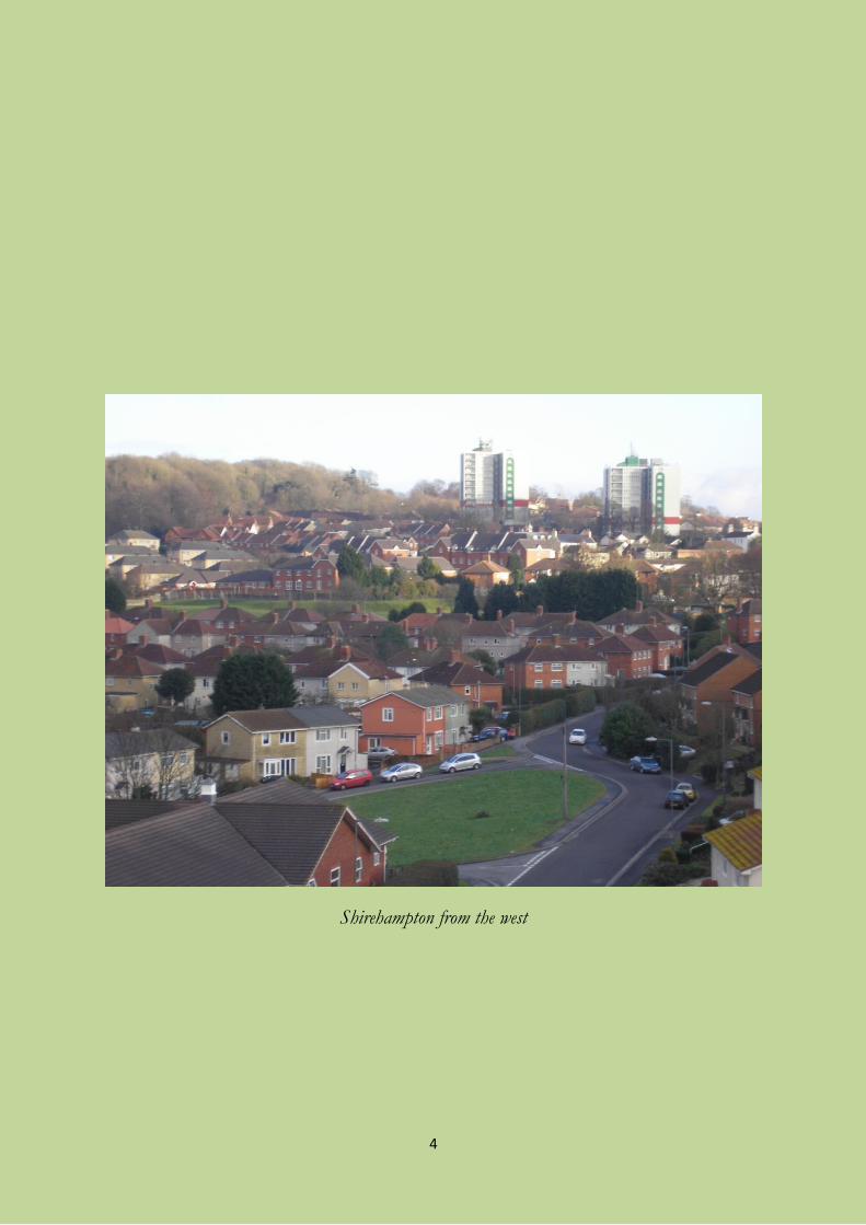
Shirehampton from the west
5
Preface to The street-names of Shirehampton and
Avonmouth
Many place-names in England are ancient, and many of the oldest ones have
become obscure as time has passed. This is partly because the English language has
changed a lot over the 1500 years during which it has been spoken in Britain, and
partly because the names have been recorded in documents written in French and
Latin as well as English, which has sometimes influenced the names themselves.
But it is often possible to get back to their original meaning through studying these
documents and collecting all the ancient recorded spellings together for
comparison, and we shall see some explanations of ancient names below.
As for more modern local names, which are what this book concentrates on, the
current Bristol City Council guidelines state that “it is the developer’s privilege to
propose a new street name. The developer is invited to propose a name that
should be distinct and have local/historical connections. But there should not be
any current commercial connection.” These principles have been followed for
some time, though some of the names dating from around 1900 in Shirehampton
and Avonmouth do have a hint of commercial interest about them, as will be seen,
and so do some names on private industrial estates. The names chosen reflect a
range of concerns, from religion and politics to history and local patriotism, via
accurate description of the place which is named. Even the blandest names have
something to say about their time or their namer.
This little book presents the fruit of the Survey of English Place-Names for
Gloucestershire, The place-names of Gloucestershire, vol. 3, by A. H. Smith, and
research of my own into the history of the community I now live in. That research
has also taken into account the work of some local writers, particularly Ethel
Thomas, Veronica Smith, and H. C. W. Harris. Their work is the necessary
starting-point, but it sometimes contains mistakes which need to be corrected.
Some historical background
Some words describing the sort of places we are dealing with need to be explained
first, because they crop up in the discussion of the local names. This background
knowledge, simplified here, is important for understanding the very complicated
situation in this corner of historic Gloucestershire, which has had an impact on
local naming.
6
A major basic unit of local organization throughout most of the history of England
has been the parish, a unit originally based on the possession of a church. Other
Christian places of worship within a parish were called chapels, and some of these
may in time become Church of England parish churches in their own right. In
modern times, Roman Catholic churches exist, within an alternative parish structure.
Other long-established denominations prefer to keep the term chapel.
A parish might be divided into units called tithings for some legal and practical
purposes like collecting the rates (taxes mainly to provide support for the poorest
people). Parishes existed alongside agricultural and legal units called manors. A
parish might contain more than one manor, and their boundaries are not
necessarily the same even where there is only one manor. Manors were responsible
for local justice and administration; and despite being a private house,
Shirehampton manor house was still being used for parish council meetings around
1900. Parishes were grouped together for some other purposes into larger units
called hundreds, which were the building-blocks of counties; and from the 19th to the
20th century, parishes were also grouped into Poor Law unions to provide
workhouses for the destitute.
A simplified version of our administrative history goes like this. The local parishes
were Henbury and Westbury-on-Trym, each with its own church. Together with
other parishes, they made up Henbury hundred, though parts of Henbury parish
bordering on Shirehampton were at some time in the Lower division of Berkeley
hundred, which otherwise consisted of Filton and Horfield parishes. Westbury
parish was divided into three tithings, one of which was Shirehampton, which was
completely separated from the rest of Westbury by a strip of Henbury. Henbury
included the tithings of King’s Weston and Lawrence Weston, and it was the
portion of King’s Weston that contains the modern Sea Mills estate which
separated Shirehampton from the rest of Westbury. Westbury also possessed
various small plots of land scattered through the enormous parish of Henbury.
This was because Westbury had once been the dominant parish, being controlled
by the bishop of Worcester from perhaps the ninth century onwards; but in the
Middle Ages most of Westbury was in the hands of Westbury College, a body of
priests (as opposed to monks), whilst the bishop had a palace and manor in his
own personal hands in Henbury in the early Middle Ages. That is probably why the
local hundred, which the bishop also owned, took the name of Henbury rather
than Westbury: he ran the hundred’s affairs from his manor. Shirehampton in
Westbury, like Lawrence Weston in Henbury, had its own chapel; Shirehampton
acquired one probably in the sixteenth century, and it became a separate parish in
7
the nineteenth (1844, to be exact, though it was still treated as part of Westbury for
electoral registration purposes in 1851). History repeated itself when a Church of
England chapel was established in the new settlement of Avonmouth late in the
nineteenth century, and this became a separate parish in the twentieth (1917). Both
places eventually became Roman Catholic parishes too after restrictions on
Catholics were lifted in the 19th century. Shirehampton tithing, including what was
to become Avonmouth, counted as a manor within Westbury by the sixteenth
century. Some small blocks of land in Lawrence Weston were once reckoned as
part of Shirehampton tithing, but I do not refer to them separately in this book.
Field-names have had quite a big impact on local naming. While Shirehampton was
still a tithing of Westbury, just before the separation, two documents were drawn
up which record the local names, especially field-names, current at that time. One
of these is the Enclosure (or Inclosure) Award of 1811, which permitted
landowners to make larger fields and to enclose common lands; that happened
around here in 1822. The other document is the Tithe Award of 1840-1, which is
an assessment of the cash value of the rent income that the tithe-owner (normally
the local Church of England clergyman) had previously received in the form of
one-tenth of the produce of local farms. The Award is accompanied by a large-
scale map. The names in these documents are often referred to in this book, but
the old field-names really deserve a separate work to analyse them.
The new Avonmouth Dock and the original nucleus of the settlement were
absorbed by the City of Bristol in 1894 (as part of Horfield ward), and both
Shirehampton and the rest of expanding Avonmouth became part of the City in
1904, with minor boundary adjustments since then. Both places are in postcode
area BS11. Both are now in the city council’s Avonmouth ward, which also
includes the southern end of Lawrence Weston. For historical reasons to do with
the responsibilities of the Port of Bristol Authority, the city also included the full
width of the river Avon from the historic harbour to the Severn. Below Horseshoe
Bend, the river and even the water and mud in the pills on the Somerset side are
currently reckoned as part of Avonmouth ward. The ward boundaries and
subdivisions can be seen on the City Council’s web-site at
www.bristol.gov.uk/WardFinder/pdfs/avonmouthmap-high.pdf.
This book deals with names in historic Shirehampton and Avonmouth, and those
areas west of the M5 which have been added in recent years to Avonmouth ward.
It also includes Lawrence Weston, but only the part which is presently (2011) in
Avonmouth ward, i.e. the area marked C on the map just mentioned.
8
Local geography and local words
The dominant landscape feature of the area is Penpole Ridge, which fittingly has
the most ancient name in the area. It has served as a quarry of limestone for
building from time immemorial, as a lookout point, and as a promenade for the
local rich people, namely the “squires” of King’s Weston. The great house at
King’s Weston, though outside Shirehampton, has had a huge effect on the area,
since its last private owners also owned much of the land, controlled much of the
available work, and gave support, land, and money for important ventures such as
the first Avonmouth docks, various parks, places of worship, public amenities, and
the Shirehampton war memorial.
The other main feature is mud, adjacent to the Avon and Severn. The oldest maps
of our area show Shirehampton surrounded, except on the north where Penpole
Ridge squats, by muddy riverbanks and marshland, and this is reflected in the local
place-names. Two words for land subject to saltwater flooding are very particular
to the Severn area, and we have had both of them: warth and dumble. Saltmarsh is
land that is overflowed twice a day by the high tide, and its plantlife is specially
adapted to saltwater conditions. There are no true saltmarshes in Shirehampton or
Avonmouth because of the peculiar tidal conditions in the Avon within its present
banks. The tide falls and rises so strongly that it would scour any saltmarsh plants
away. The original marshlands have been enclosed by sea-banks built over the
centuries so that they are no longer overflowed by the tide. Traces of these can
still be found on older local maps. Outside these banks there is grassland which
used to be used for grazing, and which is overflowed only by the highest of high
tides, not twice daily. The local name for this is (or was) warth or warthland,
sometimes confusingly called wharf, from the Old English word for ‘shore’, waroð,
and on old maps we find Shirehampton Warth, Great Warth and Hungroad Warth,
along the Severn and the Avon. In later documents these are often called moor. The
warthland has been enclosed by banks in stages, and there used to be a field called
Warth Ground in Avonmouth stranded between the older and the newer sea-bank.
There is potential for confusion because a wharf or landing-place for cargo might
well be on the warth, like the coal wharves along the Avon which supplied West
Town’s long-gone industries.
Another word local to the Severn estuary is dumble or dumball. This seems to have
meant land similar to the warthland, but subtly different in some way. In parishes
which have both, like Slimbridge, the dumble is mainly level ground extending
further out into the river, and it may include some true saltmarsh. Shirehampton
once had its Dumball Island. It is called The Dung ball Island on the first 1" Ordnance
9
Survey map in the early 19th century! This was once separated from the land called
Great Warth by the original deepwater channel of the Avon, and it disappeared
finally when the channel silted up and the Royal Edward Dock at Avonmouth was
built partly over its site, in the 1900s.
Other dialect words belong to the marshland, like pill ‘saltwater creek’, gout ‘sluice
or drain’, probably one which kept the sea out of ditches but allowed them to drain
into the sea when the tide was low, or ‘culvert’; and rhine/rhyne (pronounced
“reen”) ‘drainage ditch’. Inland, splott is a general word for ‘plot or small patch of
land’, and tyning is ‘enclosure’, often one made by fencing in part of the medieval
common fields. (Tine in meant ‘enclose’ locally into the 18th century.) Leaze is a
widespread local word for ‘pasture’, originally grassland for grazing as opposed to
mowing (but later used for both), and it has been used in street-names throughout
the Bristol area. On the coast, a swash is ‘a body of quickly or forcefully moving
water’, applied here to a new channel cut by the Avon.
Some local field-names: Wamps and Whores and Wars
Not all local names are easy to explain, then, and some contain local words which
are now lost. In the Shirehampton Tithe Award of 1840-1 there are quite a few
strange names, mostly field-names. The strangest and hardest of all to explain is
probably Wamp Hills. This was a strip of land on the bank of the Avon, on the
riverward side of the old artificial sea-bank, at West Town. The name was there in
1760 and now it has gone forever, but it was where the Avonbank Industrial Estate
now is, more or less under the motorway bridge. No hill is to be seen there, of
course, so what did it mean? Wamp does actually exist as an English word – an old-
fashioned word for ‘wasp’. But that is a regional word belonging to the Lake
District. There is an old West Country word want which means ‘mole’ – usually
called an unt or oont in Gloucestershire – and some people still say this. So ‘mole
hills’ looks like the answer to the name, but why it should turn out as wamp here
rather than want is a mystery. Since this land must have flooded occasionally with
the highest tides, any moles would have needed salt tolerance and flippers. There
was also a field called Wamp Hill in Henbury in the seventeenth century, so the
exact shape of the word may be a local dialect peculiarity.
There was land called Oars, next to Wamps. This was almost certainly from an Old
English word for ‘a bank’, ōra – it was also next to the old artificial bank of the
Avon, on the dry side – but in documents from 1687 to 1711 it turns up as The
Oare, The Wore and even, in 1687, The Whore (all pronounced the same, as “ ’ore” in
a traditional Gloucestershire accent).
10
Another possibly deceptive name is War Hills, a field close to the buildings of the
former Sunnyhill Farm where Clifford Gardens is now, appearing as Warr Hill in
1677. This may contain a lost word for ‘earthwork’. But the form Worralls found in
ratebooks of 1797 and 1800 may be an alteration of this, since the surname Worrall
is recorded locally.
Brief history of 20th-century development
Shirehampton had a very long history as a farming community, and then also as
something of a retreat for the moderately rich (as revealed in the quote from
Chilcott’s Descriptive history on the title-page). There was a small and isolated
industrial community at West Town by the later nineteenth century, producing
bricks and glass. The balance changed forever with the establishment of the docks
and the community of Avonmouth from 1877 onwards, and both places began to
expand. After 1900, Shirehampton was in the forefront of the Garden Suburb
movement aimed at creating decent and well-designed housing estates.
Shirehampton was to have been the first of this new type of planned place in
Britain. In the end, only Passage Leaze and a few nearby houses were built on
these worthy principles because the First World War intervened. After the war,
Bristol City Council was under pressure to provide many new housees, partly as
“homes for heroes” and partly because of slum clearance in the city centre. These
were less ambitiously planned than the pre-war ones, though still with a generous
amount of land per house, and a great deal of building took place at Sea Mills and
Shirehampton. There was further emergency expansion after World War II in the
form of prefabs and BISF steel-framed houses, in an area for a while locally called
Tin Town. The prefabs have, 65 years later, nearly all been cleared, but many steel
houses survive, sometimes in disguise.
Starting the book
Armed with these examples and fortified with these ideas, we can now explore the
wealth of local names to be found in Shirehampton and Avonmouth.
Headings for names in Shirehampton are in bold, those in Avonmouth are in bold
italic, and those in Lawrence Weston are in bold italic underlined. The boundary
between Shirehampton and Avonmouth is traditionally the line of West Town
Road, and on the north side of Avonmouth Road I have assumed the M5 is the
boundary. Except where noted, the area covered by both together is the same as
that of the ancient tithing of Shirehampton. Where this touches another built-up
area, the Lawrence Weston estate formerly in Henbury parish, the boundary
11
includes the point where King’s Weston Avenue becomes Long Cross. Cross-
references to other entries are also in bold, bold italic, or bold italic underlined.
Since 2009 it has been Bristol City Council’s policy to leave apostrophes out of
street-names wherever they are written in capital letters, and therefore on all street-
signs, on the grounds of “neatness”. I have ignored this decision mentally
throughout; but then I have not spelt the names in capital letters. (The only real
historical difficulty is King’s Weston versus the single-word form Kingsweston, both of
which have tradition behind them. Preferably never Kings Weston, but that’s what
we often meet!)
Acknowledgements
Thanks for information and/or access to documents are due to Bristol Record
Office, John Edwards, David Hoey, Professor Peter Malpass, Sid Nicholls, Gil
Osman, Cedric Rich, Nora Roberts, and Martin Ryan; to Dr Simon Draper for an
idea about the origin of Hampton; to Dr David Thomas for previous
encouragement; and, for permission to reproduce material from Shire newspaper
and web-site, to the Editors. Where copyright in illustrations is known, it is
acknowledged; all others are either the author’s own or of unknown copyright
status. This booklet is meant to be something for everyone’s interest, not an
academic work, so I have not put detailed references or footnotes in the text. It has
been properly researched, though, and all my sources are given discreetly in the
bibliography at the end.
I’m a relative newcomer to Shirehampton, having lived here only since 2006, and
other people must know its history better than I do. I’m a keen learner, and if I
have made any mistakes in this book, email me at [email protected].
Richard Coates
Shirehampton and the University of the West of England
13 November 2011
12
The main local place-names
Shirehampton
Shirehampton is recorded as Hampton in 1284, 1303, 1327 and 1455. This name is
almost certainly from Old English hām-tūn ‘home farm, major farm’, ‘one unit in a
large and complex agricultural estate with multiple functions’, the large estate in
this case being Westbury-on-Trym. Less probably, the first part could be hamm
‘land hemmed in on several sides’ (as Shirehampton is hemmed in by Penpole
Ridge, the river Avon and the marshland along the Severn); this word is the one
found in the name of Ham Green, situated between its streams near Pill on the
Somerset side of the Avon.
The original site of Shirehampton farmhouse may have been where the manor
house used to be in the High Street – roughly opposite where the Co-Op now is –
till its demolition in 1936-7, and it was sometimes known as the Farm House; but it
is known that the house now called The Priory (see Priory Road) was in later times
a major estate centre too. Both of these are candidates for the site of the original
farm complex, but not what was later called Shirehampton Farm at the bottom of
Lower High Street. The whole estate was a detached part of the parish of
Westbury-on-Trym, forming part of the lands once called Bishop’s Stoke (which also
included, as a separate estate, what is now called Stoke Bishop). Westbury had been a
royal estate in the time of king Offa of Mercia, and Offa granted Bishop’s Stoke to
the church (which eventually became the cathedral) of Worcester in about 795 A.D.
It reverted to royal hands, and then in slightly murky circumstances fell into the
hands of Berkeley abbey – or rather it fell back, because they had once owned it.
The Berkeley monks gave the Bishop’s Stoke estate, among others, to king Alfred
of Wessex in 883 in exchange for certain privileges, and the king entered into an
arrangement which eventually put the land back under the control of Worcester.
The name of Shirehampton does not appear in any of these transactions, but the
fragment of the document of 883 shown on p. 13 contains a description in Old
English of the boundaries of the land, which unmistakably include those of
Shirehampton: …. of afene streame eft uppe þæt in hricgleage þonn of
hrycgleage þæt on penpau of penpau þæt in sæferne stream …. (‘From the
river Avon again up to Ridge Wood, then from Ridge Wood to Penpole, from
Penpole to the river Severn’).
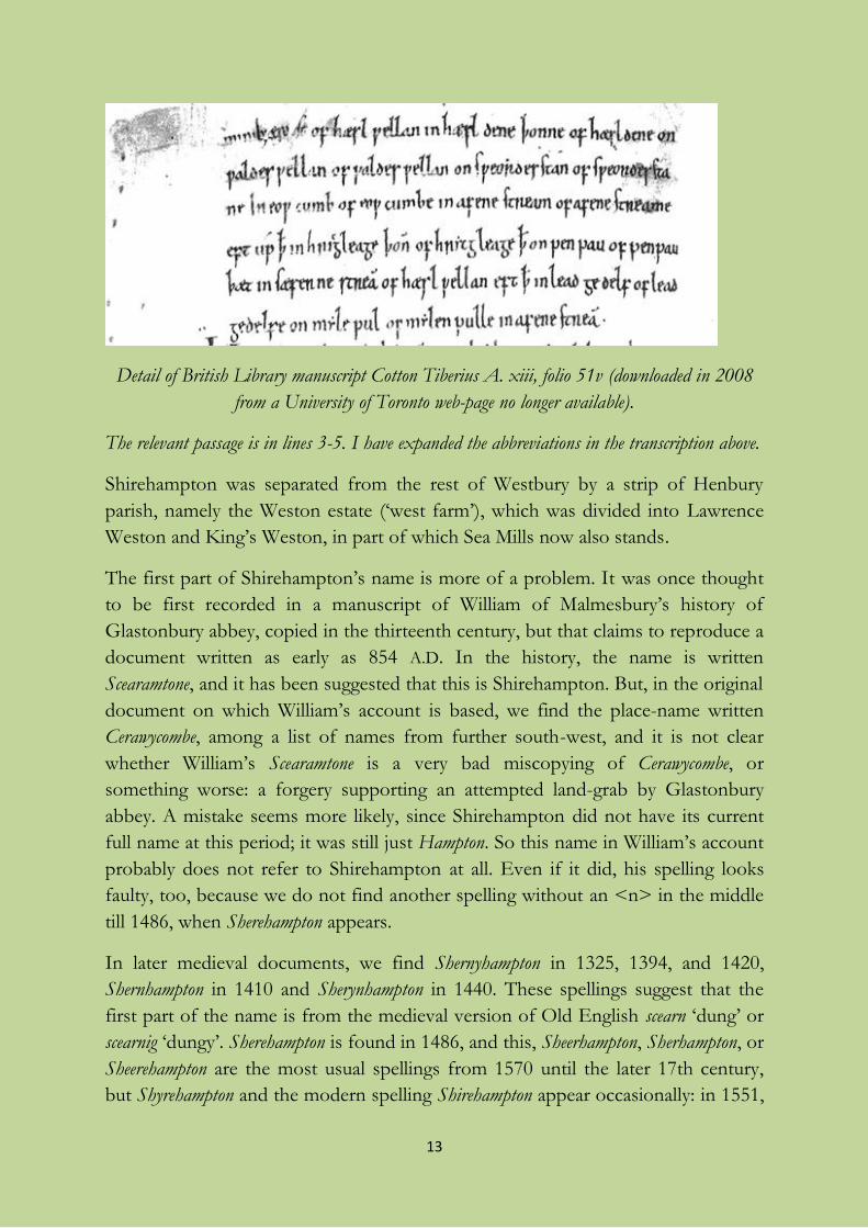
13
Detail of British Library manuscript Cotton Tiberius A. xiii, folio 51v (downloaded in 2008
from a University of Toronto web-page no longer available).
The relevant passage is in lines 3-5. I have expanded the abbreviations in the transcription above.
Shirehampton was separated from the rest of Westbury by a strip of Henbury
parish, namely the Weston estate (‘west farm’), which was divided into Lawrence
Weston and King’s Weston, in part of which Sea Mills now also stands.
The first part of Shirehampton’s name is more of a problem. It was once thought
to be first recorded in a manuscript of William of Malmesbury’s history of
Glastonbury abbey, copied in the thirteenth century, but that claims to reproduce a
document written as early as 854 A.D. In the history, the name is written
Scearamtone, and it has been suggested that this is Shirehampton. But, in the original
document on which William’s account is based, we find the place-name written
Cerawycombe, among a list of names from further south-west, and it is not clear
whether William’s Scearamtone is a very bad miscopying of Cerawycombe, or
something worse: a forgery supporting an attempted land-grab by Glastonbury
abbey. A mistake seems more likely, since Shirehampton did not have its current
full name at this period; it was still just Hampton. So this name in William’s account
probably does not refer to Shirehampton at all. Even if it did, his spelling looks
faulty, too, because we do not find another spelling without an <n> in the middle
till 1486, when Sherehampton appears.
In later medieval documents, we find Shernyhampton in 1325, 1394, and 1420,
Shernhampton in 1410 and Sherynhampton in 1440. These spellings suggest that the
first part of the name is from the medieval version of Old English scearn ‘dung’ or
scearnig ‘dungy’. Sherehampton is found in 1486, and this, Sheerhampton, Sherhampton, or
Sheerehampton are the most usual spellings from 1570 until the later 17th century,
but Shyrehampton and the modern spelling Shirehampton appear occasionally: in 1551,
14
1570 and 1672. Edward Creed wrote his will at Sheershampton in 1647. This all
makes it pretty clear that the new name of the place was pronounced “Sheer
Hampton”, and that the pronunciation with “Shire-” must be a more recent twist
in the story based on the minority of spellings in the record. It may be very local;
while Shirehampton was regularly being inscribed on memorials in the village in the
18th century, it was being written Shirhampton on those in Westbury church.
Taken all together, these spellings suggest that the name may have been
deliberately changed. The first word, which became sharn(y), was falling out of use
in 1500 or so. It is mainly confined to Scotland after the seventeenth century, and
it may have been replaced in our place-name because people came to consider it
both alien and unpleasant. The newly-developed form of the name seems to
include sheer, which people may have felt was an improvement, but this word did
not mean ‘thin and delicate’ or ‘clear or pure’ until nearly a century after the 1486
record, and it had no other meaning which was obviously applicable at that time.
Sheer in the sense of ‘steep’ (as in “a sheer drop”) is a new word dating only from
about 1800 and the poet Wordsworth is the first to have used it; so that is also not
what we find in the name. This opening part seems to have been changed to shire
‘county’, possibly by or on behalf of Henry VIII’s courtier Sir Ralph Sadle(i)r, into
whose sticky hands Shirehampton eventually fell after the dissolution of the
monasteries, in 1548. (It had previously belonged to Westbury College.) Although
parish clerks were still writing Sheer - or Shere- in 1700, Shire- is the form of the
name which has won out. Shire once, like sheer, also meant ‘clear or pure’, but in
that sense shire no longer existed by the sixteenth century except in some northern
and Scottish dialects.
Sharn originally meant ‘(cow-)dung’. Place-name scholars sometimes assume,
without any serious justification, that words like this could sometimes also mean
‘dirt’ more generally, or ‘mud’. If that applies here, Shirehampton could have been
named from its extensive coastal and riverside marshlands (including the site of the
later Avonmouth). Otherwise it may at some time in its history have been a farm
specialized for grazing cows, and required to provide a supply of dung to fertilize
the fields of some other manor, e.g. the main manor at Westbury, but that seems
unlikely. Carting dung for the lord of the manor was a customary service, which
means that tenants were obliged in common law to do it, so there would not have
been anything remarkable enough about doing it to create a name that referred to
it unless the stuff was to be taken somewhere else. Probably the name just meant
‘dungy’, but it may originally have implied ‘rich and fertile’ rather than ‘dirty’. Since
barnyard dung on a farm was enough to manure only about 6-10% of its land in
15
those cases where we have information, perhaps the lands of Shirehampton’s lord
of the manor were unusually well blessed among the Westbury lands in that
respect, by supporting many cattle (as well as sheep) on the marshland grazing.
When a place-name acquires a new extra element like this one, it is often to
contrast it with a nearby place in the same county that has a similar name. In this
case, the only serious candidates are Minchinhampton and Meysey Hampton, both
of which get their additions in the 13th century. By contrast, Rockhampton, a
parish only about 13 miles away, just north of Thornbury, had its “Rock” even in
its earliest mention, in Domesday book (1086), so it was less likely to provide the spur
for the renaming of our Hampton a couple of centuries later.
Shirehampton is now generally known to its inhabitants by the abbreviation Shire,
but the writer does not know since when. It may be relevant that there was a Shire
Farm in the Woodwell Road/St Bernard’s Road area in 1942. Shire Gardens
appears after World War II. The older simple form Hampton is revived in the name
of Hampton Corner.
Avonmouth
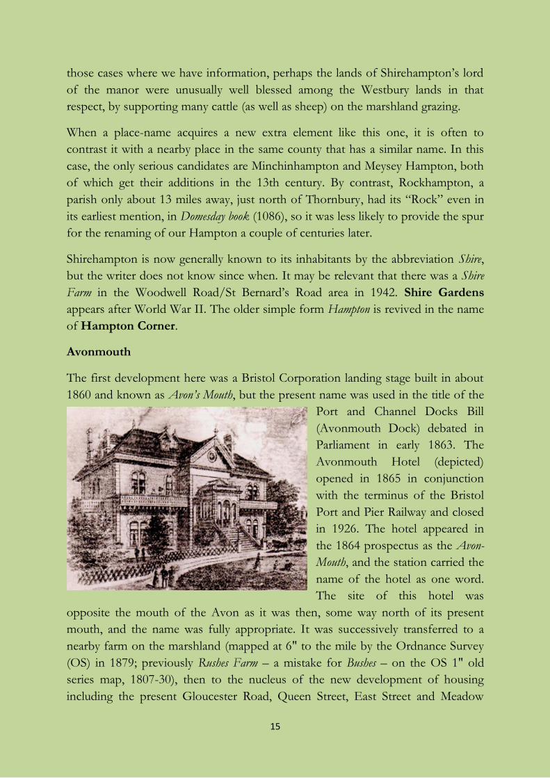
The first development here was a Bristol Corporation landing stage built in about
1860 and known as Avon’s Mouth, but the present name was used in the title of the
Port and Channel Docks Bill
(Avonmouth Dock) debated in
Parliament in early 1863. The
Avonmouth Hotel (depicted)
opened in 1865 in conjunction
with the terminus of the Bristol
Port and Pier Railway and closed
in 1926. The hotel appeared in
the 1864 prospectus as the Avon-
Mouth, and the station carried the
name of the hotel as one word.
The site of this hotel was
opposite the mouth of the Avon as it was then, some way north of its present
mouth, and the name was fully appropriate. It was successively transferred to a
nearby farm on the marshland (mapped at 6" to the mile by the Ordnance Survey
(OS) in 1879; previously Rushes Farm – a mistake for Bushes – on the OS 1" old
series map, 1807-30), then to the nucleus of the new development of housing
including the present Gloucester Road, Queen Street, East Street and Meadow
16
Street named on the 1880s OS 25" map. The new dock which was finally opened
in 1877, and this small new village, were transferred from Gloucestershire to the
City and County of Bristol in 1884, because the city owned the port. Dock workers
referred to the new place as The ’Mouth, and spoke of going from Bristol down the
’Mouth. An older hotel in this area had been called (Hooper’s) Marine Hotel at River’s
Mouth, but it was the railway’s hotel that won the battle of the names.
There are apparent mentions of Avonmouth in the Anglo-Saxon chronicle under the
years 915 or 918 (in different versions) and 1052, but the context makes clear that
the chronicler is simply referring to the mouth of the Avon, not to a named farm
or village. There is no connection with the later name except a shared accurate
description of the place.
Most of modern Avonmouth was carved out of Shirehampton parish, but along
the bank of the Severn it has expanded to include factories built in far-flung parts
of the former parishes of Henbury and Redwick & Northwick.
King’s Weston (or Kings Weston or Kingsweston) and Lawrence Weston
Within Henbury parish at the time of Domesday Book (1086) there was a settlement
in the west called Weston ‘west farm’, farmed for the king himself, which was
eventually divided into two holdings, King’s Weston and Lawrence Weston. King’s
Weston is first recorded in 1248; it still remained in the hands of the king of this
time, Henry III. Lawrence Weston appears in 1274, and was named from the
dedication of the church or chapel there, which itself was due to its connection
with the former St Lawrence’s leper hospital near Lawford’s Gate in Bristol. The
present Anglican parish church of Lawrence Weston is St Peter’s. Lawrence
Weston is widely known locally by the abbreviation El Dub.
Sea Mills
The name of Sea Mills has caused plenty of puzzlement. It would be easy to think
that it simply meant ‘sea mills’, watermills driven by the tide. There are some places
with the same name where the meaning is exactly that: by the river Camel in St
Issey in Cornwall, and on a creek close to Portsmouth. But if you wanted the tide
to turn your mill, you would not build it a quarter of a mile up such a narrow little
side-stream as the river Trym, which is where the mill was. The river Avon would
be a bad place to put a tidemill anyway because of the huge range of the tides – if
you built it in a place where the millhouse would not flood, your wheel would be
left high and dry for too much of the time, which would not be good for business:
17
unless you had one of a giant size that engineers could not have created in the
Middle Ages, and unless you could shift the Avon mud which would keep clogging
up the works. Worst of all, it is not really near the sea, even the Severn Sea. So we
should look for a different theory of the origin of the name.
Sea Mills is first recorded in a document in Latin in 1411 as molendin’ voc’ Semmille
meaning ‘mill called Semmille’, then a couple of times more in the fifteenth century
as Ceemulle and Ceemille. The most widespread idea, thanks to the place-name
specialist Hugh Smith, is that it might have meant ‘saye mill’, a mill where saye, a
kind of superior serge cloth, was made. This is what local books and web-sites now
say. Why Professor Smith, and all the other people who still support the same
suggestion, thought serge cloth was made in watermills, I have no idea. It wasn’t. It
was made in people’s living-rooms with family labour. The water-driven loom was
not invented till the late 1700s. If that were not bad enough for the theory, it is
only in 1779 that we find a spelling Say-Mills, and the earlier spellings just do not
point this way at all. The theory must be wrong.
By far the most likely is that is that the first word is seam, an old word for the load
that a single packhorse could carry. You could have a seam of grain, e.g. oats,
which in many places meant eight bushels, or a bit over 500 pounds (230 kilos), in
medieval English measures. So most probably this mill, driven by the river Trym,
was a place like most mills where grain was taken for grinding, but where there was
some limit on the amount that was taken on at one time: just one horseload.
There are some other names which seem to point in the same direction. Various
mills were called Peck Mill, including ones in Street and Charlton Adam in
Somerset. A peck was another measure, a quarter of a bushel, amounting to about
16 pounds (7 kilos) of grain.
Sea Mills was also the site of the Roman port and military station Abone (the early
form of the name of the Avon), and fields on its site had the name Portbury,
meaning something like ‘fortification by the port’ in Old English, just like Portbury
over the river in Somerset.
The River Avon
Avon is simply from the word for ‘river’ in British Celtic, the language spoken in
Britain before English. It gave its name, in the form Abone, to the Roman
settlement at Sea Mills, and it survives in the Welsh word afon, still meaning ‘river’.
Horseshoe Bend is a self-explanatory name for the great bend in the Avon south
of Shirehampton Park. For Hung Road, see below.
18
The street-names of Shirehampton
(including some other interesting local names)
A date given in a heading is a rough indication of the age of the street in question.
It may be the date of the adoption of the street by the Highways Department, and
not necessarily the date of the first buildings.
Alma Villas: see Station Road.
Antona Drive and Antona Way: see The Portway.
Austen Place (2002/3)
The reason for this name is no longer known to the agents for the developers of
these flats on the corner of The Ridge and The High Street. Perhaps it
commemorates Jane Austen because she mentions nearby King’s Weston House
and “Blaize Castle” in chapter 11 of her novel Northanger Abbey. One of her
characters calls Blaise Castle “the finest place in England”, a local compliment
worth immortalizing her here for. But there have also been ratepayers called Austin
in Westbury since at least the 17th century.
Avendall: see Barwick House.
Avonwood Close
A fancy name of about 1970 combining the river-name perhaps with that of
Woodwell Road, which runs parallel to it at its closed end.
Back Lane (lost): see St Mary’s Road.
Bank Cottages (lost): see Old Park Road.
Barracks Lane (1933)
The lane existed in the 19th century, but I have found no early name. It leads to
the former Barracks Cottages (whose site is now embedded in the trading estate in
Avonmouth Way near its junction with Third Way), which are marked by name
on an OS 6" map of 1903-4. That makes it virtually certain that the barracks in
question were those of soldiers manning the early-19th century battery close to the
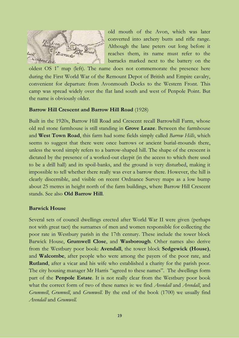
19
old mouth of the Avon, which was later
converted into archery butts and rifle range.
Although the lane peters out long before it
reaches them, its name must refer to the
barracks marked next to the battery on the
oldest OS 1 map (left). The name does not commemorate the presence here
during the First World War of the Remount Depot of British and Empire cavalry,
convenient for departure from Avonmouth Docks to the Western Front. This
camp was spread widely over the flat land south and west of Penpole Point. But
the name is obviously older.
Barrow Hill Crescent and Barrow Hill Road (1928)
Built in the 1920s, Barrow Hill Road and Crescent recall Barrowhill Farm, whose
old red stone farmhouse is still standing in Grove Leaze. Between the farmhouse
and West Town Road, this farm had some fields simply called Barrow Hills, which
seems to suggest that there were once barrows or ancient burial-mounds there,
unless the word simply refers to a barrow-shaped hill. The shape of the crescent is
dictated by the presence of a worked-out claypit (in the access to which there used
to be a drill hall) and its spoil-banks, and the ground is very disturbed, making it
impossible to tell whether there really was ever a barrow there. However, the hill is
clearly discernible, and visible on recent Ordnance Survey maps as a low bump
about 25 metres in height north of the farm buildings, where Barrow Hill Crescent
stands. See also Old Barrow Hill.
Barwick House
Several sets of council dwellings erected after World War II were given (perhaps
not with great tact) the surnames of men and women responsible for collecting the
poor rate in Westbury parish in the 17th century. These include the tower block
Barwick House, Grumwell Close, and Wasborough. Other names also derive
from the Westbury poor book: Avendall, the tower block Sedgewick (House),
and Walcombe, after people who were among the payers of the poor rate, and
Rutland, after a vicar and his wife who established a charity for the parish poor.
The city housing manager Mr Harris “agreed to these names”. The dwellings form
part of the Penpole Estate. It is not really clear from the Westbury poor book
what the correct form of two of these names is: we find Avendall and Arendall, and
Grummell, Grumnell, and Grumwell. By the end of the book (1700) we usually find
Avendall and Grumwell.
20
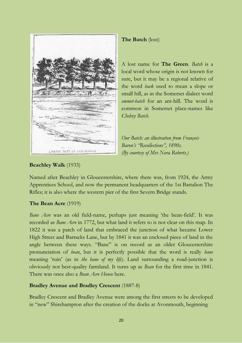
The Batch (lost)
A lost name for The Green. Batch is a
local word whose origin is not known for
sure, but it may be a regional relative of
the word back used to mean a slope or
small hill, as in the Somerset dialect word
emmet-batch for an ant-hill. The word is
common in Somerset place-names like
Chelvey Batch.
Our Batch: an illustration from François
Baron’s “Recollections”, 1890s.
(By courtesy of Mrs Nora Roberts.)
Beachley Walk (1933)
Named after Beachley in Gloucestershire, where there was, from 1924, the Army
Apprentices School, and now the permanent headquarters of the 1st Battalion The
Rifles; it is also where the western pier of the first Severn Bridge stands.
The Bean Acre (1919)
Bane Acre was an old field-name, perhaps just meaning ‘the bean-field’. It was
recorded as Bane Acre in 1772, but what land it refers to is not clear on this map. In
1822 it was a patch of land that embraced the junction of what became Lower
High Street and Barracks Lane, but by 1841 it was an enclosed piece of land in the
angle between these ways. “Bane” is on record as an older Gloucestershire
pronunciation of bean, but it is perfectly possible that the word is really bane
meaning ‘ruin’ (as in the bane of my life). Land surrounding a road-junction is
obviously not best-quality farmland. It turns up as Bean for the first time in 1841.
There was once also a Bean Acre House here.
Bradley Avenue and Bradley Crescent (1887-8)
Bradley Crescent and Bradley Avenue were among the first streets to be developed
in “new” Shirehampton after the creation of the docks at Avonmouth, beginning
21
in about 1887-8. They carry a continuation of a name that covered several old
fields (collectively called Great Bradley): Bradley, from the Old English *brād + lēah
meaning ‘broad glade or clearing’, ‘broad wood’, obviously dates from when space
for what became the Shirehampton manor farm was first established amid the
ancient woodland which once covered England. This name is recorded from 1720.
Bradley Crescent was for long, like the field, locally just called Bradley. The name
also survives in the 18th-century Bradley House, High Street. Part of Bradley was
once known as The Donkey Field because the donkeys from Weston-super-Mare
beach used to spend the winter here.
The twin terraces of Bradley Crescent are more or less straight. But it is called a
crescent because it originally included the part of what is now Springfield Avenue
that joined the new terraces to Station Road, before the full length of Springfield
Avenue was developed as a road.
Broadleaze (1997)
A modern name, apparently meaning ‘broad meadow’. But it is not on the site of
an old field of this name. The name seems to have been borrowed from Broad Leys,
recorded in the 1840-1 Tithe Award as part of the warthland next to Broad Pill in
what is now Avonmouth. That, or part of it, was also called Wamphills (see
Preface).
Bucklewell Close (2000): see Woodwell Road.
Burford Grove: see Cotswold Estate.
Burnham Road (1926)
Possibly named after Burnham-on-Sea in Somerset, though this is uncertain; for
another Somerset name, compare Portbury Grove.
Cedar Row
Built on the plot of the demolished Oldfield House near the top of Park Hill, and
named from a conspicuous tree which is still there (November 2011).
22
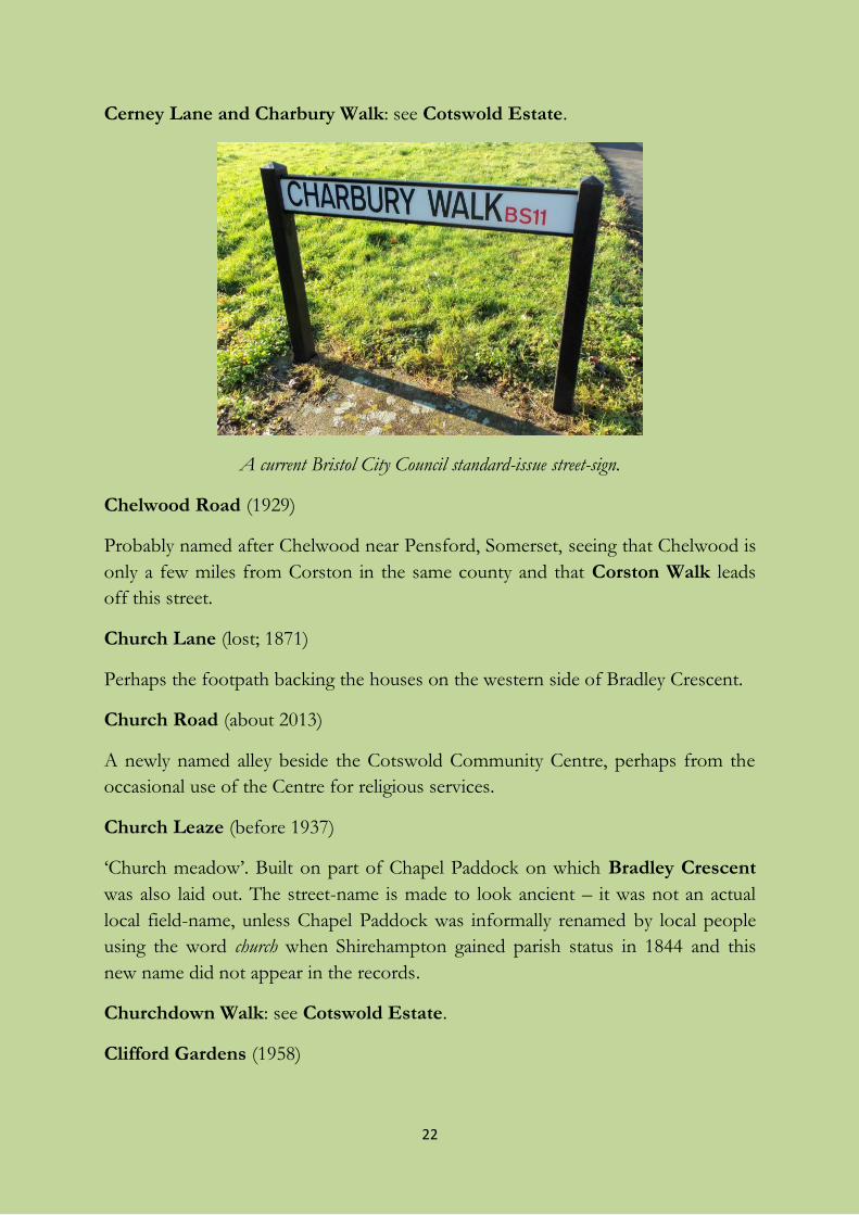
Cerney Lane and Charbury Walk: see Cotswold Estate.
A current Bristol City Council standard-issue street-sign.
Chelwood Road (1929)
Probably named after Chelwood near Pensford, Somerset, seeing that Chelwood is
only a few miles from Corston in the same county and that Corston Walk leads
off this street.
Church Lane (lost; 1871)
Perhaps the footpath backing the houses on the western side of Bradley Crescent.
Church Road (about 2013)
A newly named alley beside the Cotswold Community Centre, perhaps from the
occasional use of the Centre for religious services.
Church Leaze (before 1937)
‘Church meadow’. Built on part of Chapel Paddock on which Bradley Crescent
was also laid out. The street-name is made to look ancient – it was not an actual
local field-name, unless Chapel Paddock was informally renamed by local people
using the word church when Shirehampton gained parish status in 1844 and this
new name did not appear in the records.
Churchdown Walk: see Cotswold Estate.
Clifford Gardens (1958)
23
Named after the de Clifford family who were “squires” of King’s Weston, using
the revived ancient Baron de Clifford title, from 1776-1832, before the Miles
family. It was they who first enclosed Shirehampton Common to form the Park.
By an odd coincidence, Clifford was also the surname of the owner of Sunny Hill, at
the bottom of Park Hill, in the early 1900s.
Coaley Road (1927): see Cotswold Estate.
Corston Walk (1929): see Chelwood Road.
Cotswold Estate
Planners of 20th-century mass housing developments often used names of places
in their street-names. Those of Shirehampton contain many references to other
parts of the country. Most of these are on the Cotswold Estate (first mentioned by
that name in 1937), and they mainly commemorate places in the Gloucestershire
part of the Cotswolds: Cerney, Churchdown, Coaley, Dursley, Evenlode,
Kemble, Nibley, Northleach, Stow, Stroud, and Winchcombe, along with
Burford just over the county boundary in Oxfordshire. Charbury seems to be a
mistake for Charlbury, deeper into Oxfordshire and only on the very edge of the
Cotswolds. The earliest name is Dursley Road, dating from before the First World
War, and Coaley Road and Nibley Road, referring to places close to Dursley, were
added in the inter-war period. But much of the development has taken place since
World War II, with the most recent buildings at the eastern end of the estate
replacing prefabs. The other names are suggested by the earliest ones.
The “Gloucestershire” theme was also taken up during the first developments in
the Barrow Hills area: we find Beachley and Fairford. But this “local” theme was
widened to take in a couple of Somerset places in the Bath area, Chelwood and
Corston, not to mention the North Somerset Portbury and maybe the more
distant Burnham.
Cottonwick Close (2015)
This newly developed close behind The Lamplighters pub is named from a
description of the pub’s builder in Chilcott’s Bristol guide of 1851. Mr Toy is called
“a contractor for lighting half the parishes in Bristol”, and a “worthy distributor of
oil and cotton-wick” (for oil-lamps).
Crowley Park, houses in St Mary’s Road
Perhaps named after the same person as Crowley Way.
24
Crown Terrace: see West Town Road.
The Daisy Field
At the corner of The Portway and Station Road, this open space had spoil
deposited on it when the adjacent station goods yard was being excavated, hence
the steep bank part-way along it. The field was also used in the 1920s by the
contractor who built The Portway, and a siding from the station yard is shown
leading into it, across Station Road, connecting with the contractor’s own works
railway. Oddly, such a line still appears on an OS map of 1970 (6"), which I cannot
explain. The field is shown as a “recreation ground” on the corresponding map in
1974. It was politicized in 2010 when Bristol City Council wanted to sell off the
land for development and reverted to calling it Portway Tip, despite its own
signboard labelling it The Daisy Field (p. 23). I suppose it gained its current name
from the marguerites in the bank on its northern side. The favoured local name is
of uncertain age, but it was used by Ethel Thomas and others in 2002.
If the original plan for the Garden Suburb had been completed around 1910-4,
trim houses of the kind seen in Passage Leaze would have appeared on The
Daisy Field; see also Grove Leaze.
Dursley Road (1905-6): see Cotswold Estate.
Ellenborough Lane (lost; on some street-maps till 1998): see Pembroke Road.
Elm Villas: see Station Road.
Ermine Way: see The Portway.
Evenlode Gardens: see Cotswold Estate.
Fairford Road (1928)
From the east Gloucestershire market town.
25
Flowers Cottages, at the northern end of Meadow Grove (1900s or earlier?;
lost)
These cottages, close to the Bank Cottages or Row Houses, were there before
Meadow Grove existed as such. There was a family called Flower in Shirehampton
from the mid-19th century, so the name is probably from the surname.
Gas Lane (lost)
A street of this name at The Lamplighters is noted in a document of 1893. The gas
company owned land south of the railway and covering what is now the western
end of Dursley Road, and that is where I suspect Gas Lane was.
Gower Court
The reason for the name of this development near to the Powder House is not
known. Probably it recalls the peninsula in South Wales, a popular mass tourist
destination for Bristolians in the mid-20th century. (If so, does it also recall the
Campbell’s tourist paddle-steamer Glen Gower that used to ply on the river between
the wars, with its sisters the Glen Avon and the Glen Usk?) It could be from a
surname, but that is locally uncommon.
Grainger Court
Grainger Court, like the local Grainger Players, takes its name from Harry
Grainger, a well-known youth leader in
the 1940s and 50s.
The Green
A self-explanatory name for the heart of
the ancient village. On the southern side
was a terrace of four Georgian houses
simply called The Terrace, whose position
is now occupied by part of The
Parade. See also The Batch.
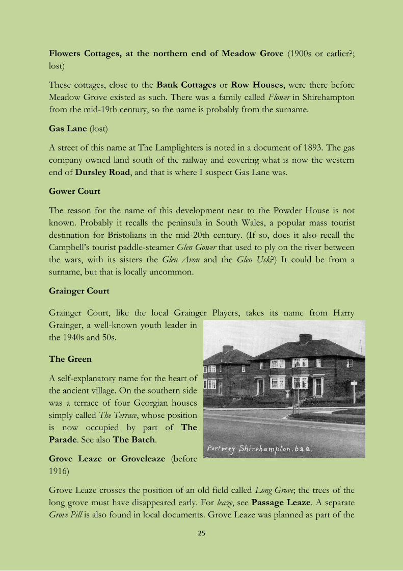
Grove Leaze or Groveleaze (before
1916)
Grove Leaze crosses the position of an old field called Long Grove; the trees of the
long grove must have disappeared early. For leaze, see Passage Leaze. A separate
Grove Pill is also found in local documents. Grove Leaze was planned as part of the
26
same estate as Passage Leaze, but the OS 25" map (1916) shows it forking into
North Grove Leaze and South Grove Leaze west of Passage Leaze. This was maybe
even staked out, but it never finally happened. Modern Grove Leaze runs straight
between the two intended “prongs”.
The image is from a Hepworth postcard showing the junction of Grove Leaze and Portway in the
late 1920s; note the white wooden “Grove Leaze” street-sign on its post.
Grumwell Close (1965; lost)
Now renamed Oaktree Court. See also Barwick House.
Hampton Corner
These flats stand on the plot of the former Priory House, demolished in 1972. The
name contains the older simple name of Shirehampton itself.
Hermitage Close (1966)
This commemorates the demolished house called The Hermitage and the adjacent
Hermitage Cottages, which fronted onto the High Street. It is not known for certain
when or why the house got its name. It was possibly suggested quite late in its
existence by the presence of the old tithe barn across the road, locally believed to
be associated with a priory and therefore vaguely religious and medieval, or by the
church directly opposite. Or perhaps the owner wanted to emphasize his or her
wish for privacy.
The house was apparently Victorian with an earlier core. If the name goes back to
the early 19th century like the lost house, as seems possible, it may be because
hermitages were fashionable in ideas about landscape at that period. They were put
in the wilder parts of private parklands as places of solitude where the owner and
his guests could “commune with the Forms of nature”, to use the poet
Wordsworth’s phrase. Wordsworth describes a meeting with a “solitary” or hermit,
he wrote a poem about a hermitage, solitude often features in his poems, and his
poem “The Prelude” was to have been a prelude to a longer poem called “The
Recluse”; is it too much to connect this house-name with his stay at Chapel House,
across the road, in 1798? Even if it is too much, Wordsworth’s ideas lasted long
enough to have influenced a later owner.
The High Street
27
A widespread name for a main commercial street. It is often uncertain when it was
first applied, but it is often found for the first time in the 15th-16th centuries, i.e.
after town guild records first began to be kept in English. Its age in Shirehampton
is uncertain; in 1701, the Bristol Corporation of the Poor acquired property in
“Shirehampton street”, so it did not get its present name till later. The part of it
below Old Barrow Hill, which descends towards Avonmouth, has become since
World War II (or earlier) Lower High Street. See also Shirehampton Road.
Home Ground (1999)
Home Ground was a field-name which recurred several times locally, always for the
enclosure closest to a farmhouse. Here, it was the large paddock closest to the
house called Wylam House after a place in Northumberland, which was renamed
with more local relevance as The Wyelands just before its rebuilding in 1904-5, and
is now called The Wylands.
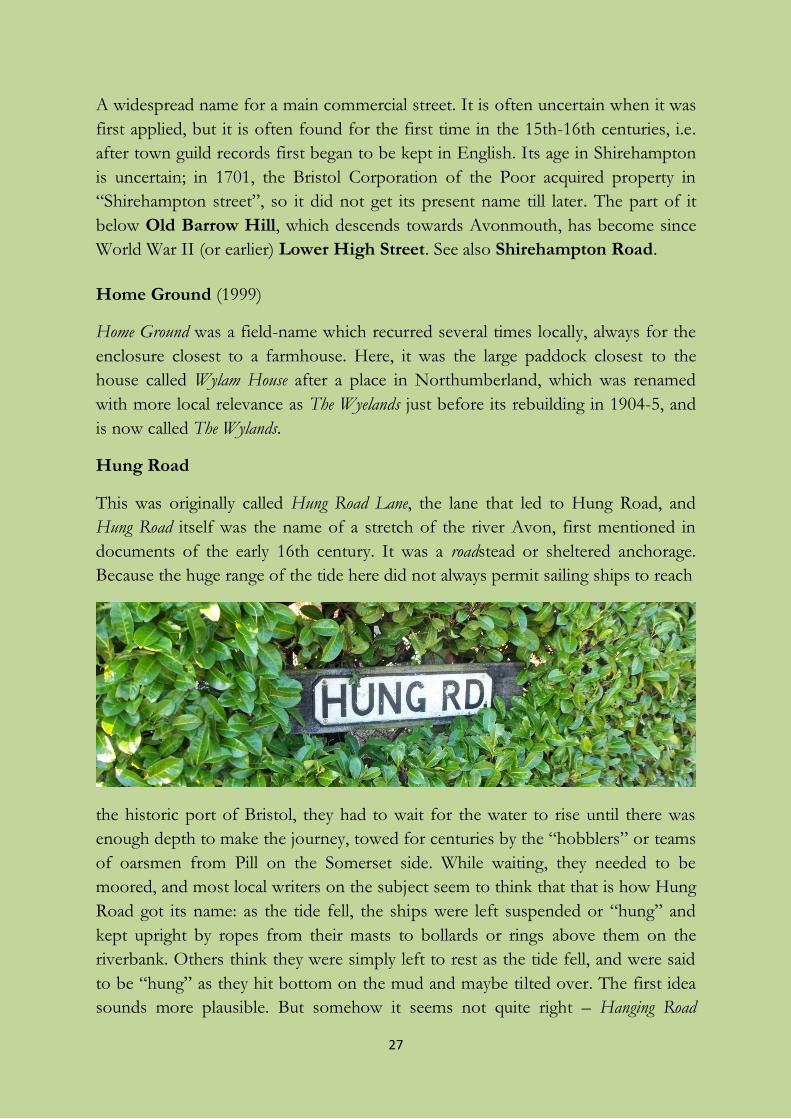
Hung Road
This was originally called Hung Road Lane, the lane that led to Hung Road, and
Hung Road itself was the name of a stretch of the river Avon, first mentioned in
documents of the early 16th century. It was a roadstead or sheltered anchorage.
Because the huge range of the tide here did not always permit sailing ships to reach
the historic port of Bristol, they had to wait for the water to rise until there was
enough depth to make the journey, towed for centuries by the “hobblers” or teams
of oarsmen from Pill on the Somerset side. While waiting, they needed to be
moored, and most local writers on the subject seem to think that that is how Hung
Road got its name: as the tide fell, the ships were left suspended or “hung” and
kept upright by ropes from their masts to bollards or rings above them on the
riverbank. Others think they were simply left to rest as the tide fell, and were said
to be “hung” as they hit bottom on the mud and maybe tilted over. The first idea
sounds more plausible. But somehow it seems not quite right – Hanging Road
28
would be expected; it was not the road which was hung but the ships. Perhaps the
best interpretation is ‘roadstead where ships need to be hung (rather than
anchored)’. The name contrasts with King Road (see King Road Avenue).
The long-gone Hung Road Cottages, by the river, included the Lamb and Flag public
house. They also seem to have been called Myrtle Cottages (see Myrtle Drive).
Jim O’Neil House: see Kilminster Road.
Kemble Gardens: see Cotswold Estate.
Kilminster Road
From the surname of a local farming family, originally deriving from
Kidderminster in Worcestershire. From the 19th century, they ran a small farm,
rather oddly called T Farm (apparently from the shape of the orchard plot
adjoining it). The site of the farmhouse is now buried under First Way. On one of
their fields was built Jim O’Neil House, sheltered accommodation named in 1979
after a Scot who worked at the former Portishead power station and was a
prominent union activist, a member of the executive of the Electrical Trades
Union who was later an elected local Labour city councillor.
King’s Weston Avenue or Kingsweston Avenue or Kings Weston Avenue
(1919)
An early example (soon after the First World War) of council building, named
from the estate of the local great house in Henbury parish, in the direction of
which this road leads. Much of the estate’s land was in Shirehampton and in what
became Avonmouth. The later squires were great benefactors of the area, and in
particular were responsible for developing the port of Avonmouth. The current
spelling varies between one word and two, even on street-signs opposite one
another.
29
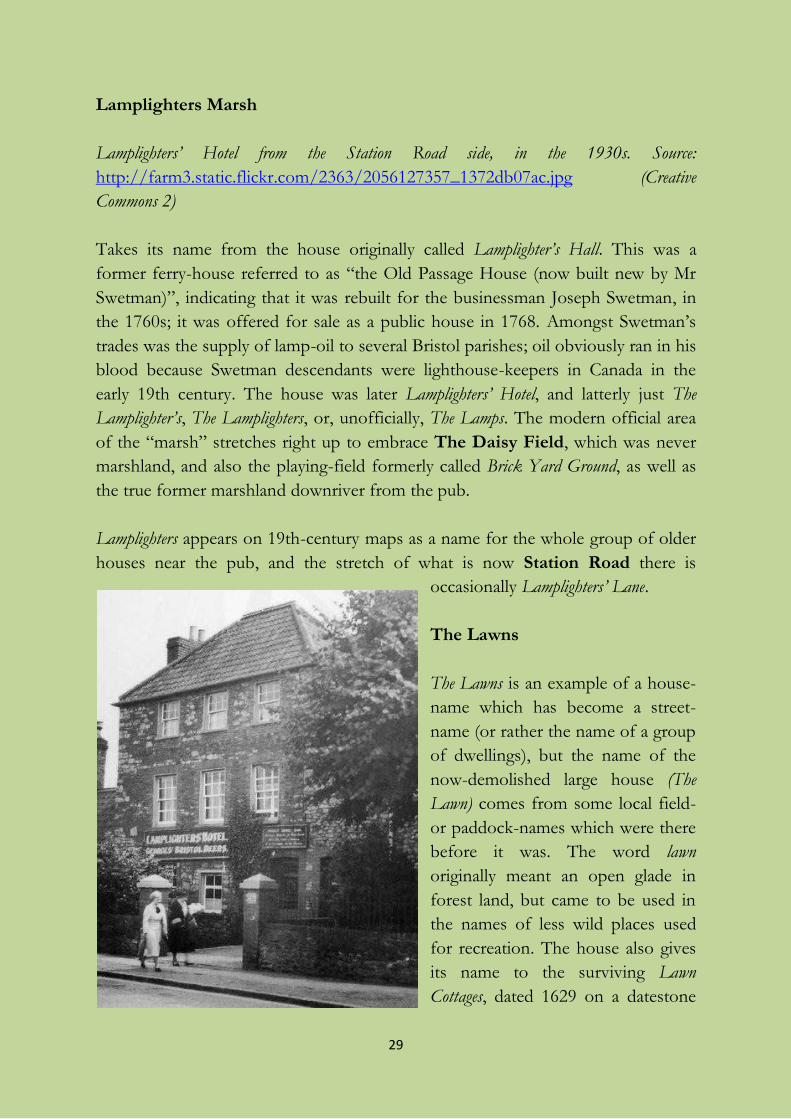
Lamplighters Marsh
Lamplighters’ Hotel from the Station Road side, in the 1930s. Source:
http://farm3.static.flickr.com/2363/2056127357_1372db07ac.jpg (Creative
Commons 2)
Takes its name from the house originally called Lamplighter’s Hall. This was a
former ferry-house referred to as “the Old Passage House (now built new by Mr
Swetman)”, indicating that it was rebuilt for the businessman Joseph Swetman, in
the 1760s; it was offered for sale as a public house in 1768. Amongst Swetman’s
trades was the supply of lamp-oil to several Bristol parishes; oil obviously ran in his
blood because Swetman descendants were lighthouse-keepers in Canada in the
early 19th century. The house was later Lamplighters’ Hotel, and latterly just The
Lamplighter’s, The Lamplighters, or, unofficially, The Lamps. The modern official area
of the “marsh” stretches right up to embrace The Daisy Field, which was never
marshland, and also the playing-field formerly called Brick Yard Ground, as well as
the true former marshland downriver from the pub.
Lamplighters appears on 19th-century maps as a name for the whole group of older
houses near the pub, and the stretch of what is now Station Road there is
occasionally Lamplighters’ Lane.
The Lawns
The Lawns is an example of a house-
name which has become a street-
name (or rather the name of a group
of dwellings), but the name of the
now-demolished large house (The
Lawn) comes from some local field-
or paddock-names which were there
before it was. The word lawn
originally meant an open glade in
forest land, but came to be used in
the names of less wild places used
for recreation. The house also gives
its name to the surviving Lawn
Cottages, dated 1629 on a datestone
30
but not looking their “age”.
Layfield Allotments
The name preserves or revives that of the Lay Common Field recorded in 1745,
Lays Field in the 1840-1 Tithe Award, though most of that lay north of where the
railway now runs, i.e. where Tynings Field now is and further north still. Lay
might be the old word meaning ‘fallow, uncultivated’.
Lower High Street
Self-explanatory. See High Street. First so named officially as late as the 1954
revision of the OS 25" map, but the words can be seen on a postcard of the early
1900s, maybe not as a name but just meaning ‘the lower part of High Street’.
Markham Close (1945)
A development of prefabs after the Second World War. Probably commemorating
Martcombe (also spelt Markham, as in Markham Farm) across the Avon between
Easton-in-Gordano and Abbots Leigh, which is visible above Pill from this site;
but there are other possibilities, including a surname. The prefabs were demolished
in 1979, and eventually replaced by a park-and-ride site.
Mead Close
A development off Penpole Place, said by Veronica Smith to be named after a
committee member of the Broadcasting Employees’ Housing Association who
built it.
Meadow Grove (1927)
There is a field called The Meadow along the Avon near here on the Tithe Award
map of 1841, but this street-name was probably chosen simply to sound pleasant.
It was mapped as Meadow Road in 1938, but that may just have been a mishearing.
Merriman’s Road (1919, but completed much later)
This surname is on record in Westbury, and known elsewhere in Gloucestershire,
but it is uncertain why it was used here.
Myrtle Drive
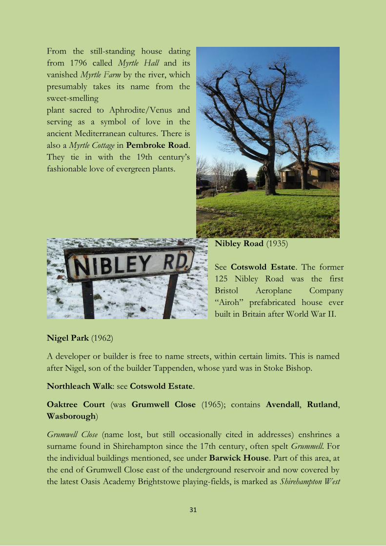
31
From the still-standing house dating
from 1796 called Myrtle Hall and its
vanished Myrtle Farm by the river, which
presumably takes its name from the
sweet-smelling
plant sacred to Aphrodite/Venus and
serving as a symbol of love in the
ancient Mediterranean cultures. There is
also a Myrtle Cottage in Pembroke Road.
They tie in with the 19th century’s
fashionable love of evergreen plants.
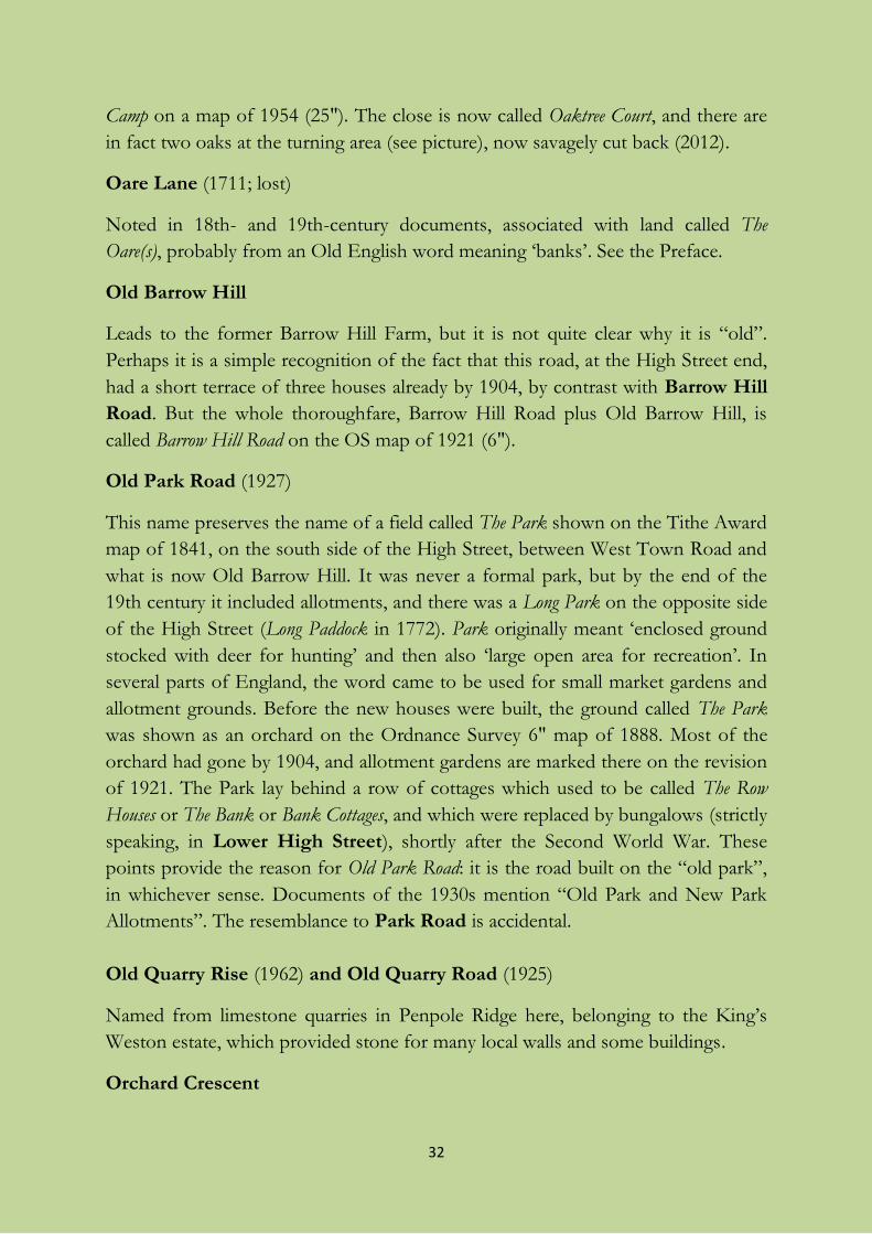
Nibley Road (1935)
See Cotswold Estate. The former
125 Nibley Road was the first
Bristol Aeroplane Company
“Airoh” prefabricated house ever
built in Britain after World War II.
Nigel Park (1962)
A developer or builder is free to name streets, within certain limits. This is named
after Nigel, son of the builder Tappenden, whose yard was in Stoke Bishop.
Northleach Walk: see Cotswold Estate.
Oaktree Court (was Grumwell Close (1965); contains Avendall, Rutland,
Wasborough)
Grumwell Close (name lost, but still occasionally cited in addresses) enshrines a
surname found in Shirehampton since the 17th century, often spelt Grummell. For
the individual buildings mentioned, see under Barwick House. Part of this area, at
the end of Grumwell Close east of the underground reservoir and now covered by
the latest Oasis Academy Brightstowe playing-fields, is marked as Shirehampton West
32
Camp on a map of 1954 (25"). The close is now called Oaktree Court, and there are
in fact two oaks at the turning area (see picture), now savagely cut back (2012).
Oare Lane (1711; lost)
Noted in 18th- and 19th-century documents, associated with land called The
Oare(s), probably from an Old English word meaning ‘banks’. See the Preface.
Old Barrow Hill
Leads to the former Barrow Hill Farm, but it is not quite clear why it is “old”.
Perhaps it is a simple recognition of the fact that this road, at the High Street end,
had a short terrace of three houses already by 1904, by contrast with Barrow Hill
Road. But the whole thoroughfare, Barrow Hill Road plus Old Barrow Hill, is
called Barrow Hill Road on the OS map of 1921 (6").
Old Park Road (1927)
This name preserves the name of a field called The Park shown on the Tithe Award
map of 1841, on the south side of the High Street, between West Town Road and
what is now Old Barrow Hill. It was never a formal park, but by the end of the
19th century it included allotments, and there was a Long Park on the opposite side
of the High Street (Long Paddock in 1772). Park originally meant ‘enclosed ground
stocked with deer for hunting’ and then also ‘large open area for recreation’. In
several parts of England, the word came to be used for small market gardens and
allotment grounds. Before the new houses were built, the ground called The Park
was shown as an orchard on the Ordnance Survey 6" map of 1888. Most of the
orchard had gone by 1904, and allotment gardens are marked there on the revision
of 1921. The Park lay behind a row of cottages which used to be called The Row
Houses or The Bank or Bank Cottages, and which were replaced by bungalows (strictly
speaking, in Lower High Street), shortly after the Second World War. These
points provide the reason for Old Park Road: it is the road built on the “old park”,
in whichever sense. Documents of the 1930s mention “Old Park and New Park
Allotments”. The resemblance to Park Road is accidental.
Old Quarry Rise (1962) and Old Quarry Road (1925)
Named from limestone quarries in Penpole Ridge here, belonging to the King’s
Weston estate, which provided stone for many local walls and some buildings.
Orchard Crescent
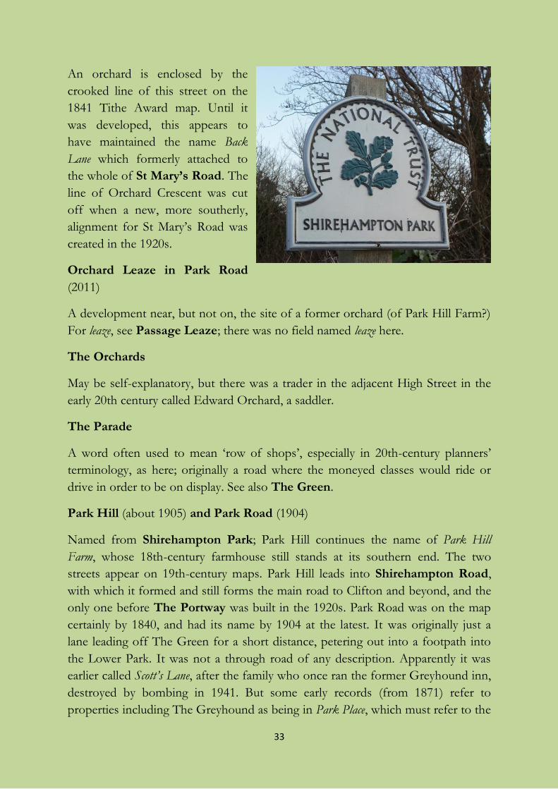
33
An orchard is enclosed by the
crooked line of this street on the
1841 Tithe Award map. Until it
was developed, this appears to
have maintained the name Back
Lane which formerly attached to
the whole of St Mary’s Road. The
line of Orchard Crescent was cut
off when a new, more southerly,
alignment for St Mary’s Road was
created in the 1920s.
Orchard Leaze in Park Road
(2011)
A development near, but not on, the site of a former orchard (of Park Hill Farm?)
For leaze, see Passage Leaze; there was no field named leaze here.
The Orchards
May be self-explanatory, but there was a trader in the adjacent High Street in the
early 20th century called Edward Orchard, a saddler.
The Parade
A word often used to mean ‘row of shops’, especially in 20th-century planners’
terminology, as here; originally a road where the moneyed classes would ride or
drive in order to be on display. See also The Green.
Park Hill (about 1905) and Park Road (1904)
Named from Shirehampton Park; Park Hill continues the name of Park Hill
Farm, whose 18th-century farmhouse still stands at its southern end. The two
streets appear on 19th-century maps. Park Hill leads into Shirehampton Road,
with which it formed and still forms the main road to Clifton and beyond, and the
only one before The Portway was built in the 1920s. Park Road was on the map
certainly by 1840, and had its name by 1904 at the latest. It was originally just a
lane leading off The Green for a short distance, petering out into a footpath into
the Lower Park. It was not a through road of any description. Apparently it was
earlier called Scott’s Lane, after the family who once ran the former Greyhound inn,
destroyed by bombing in 1941. But some early records (from 1871) refer to
properties including The Greyhound as being in Park Place, which must refer to the
34
group of early houses at the Green end of Park Road and other demolished ones.
The modern road was laid parallel with part of the original lane to connect with
The Portway in about 1926.
Park Hill includes a terrace of three dwellings once called Claremont Villas,
including a common Victorian name for houses. It commemorates a house in
Esher, Surrey, bought by the Earl of Clare in 1714 and named from his title, with a
punning reference to one of several places called Clermont in France. This house
was especially in the news in the early 19th century when occupied by Princess
Charlotte, and was much visited by her cousin the future Queen Victoria, who had
a life interest in it. The name was therefore often copied in street- and lesser
house-names in the 19th century.
Passage Leaze (1907)
There is a reference in 1794 to “Lower Passage Leaze in the common mead”, and
an earlier simpler reference in 1711. Passage Leaze was a large open area stretching
from the present Springfield Avenue towards the Avon. That accounts for its
name: it stretched as far as The Lamplighters Hall inn, where the ferry used to
cross to Pill, and passage was the word used in old Gloucestershire for ‘ferry’. Leaze
is also a local word, meaning ‘meadow’, and it appears in several local names which
have since become street-names, like Church Leaze, or have provided a model for
new street-names, like Grove Leaze. The street was one of the earliest expressions of
the “garden suburb” movement. Planning started in 1907, and building took place
1909-14; the houses have some features typical of the Arts and Crafts movement.
Pembroke Avenue (1932) and Pembroke Road
The older street, Pembroke Road, an ancient lane, was part of what was previously
called Back Lane, a typical name for an access lane parallel with a village high street.
In Pembroke Road there used to be a row of cottages called Ellenborough Place and
Ellenborough Lane, no doubt named after the first (and only) Earl of Ellenborough
who was a Tory politician and controversial Governor-General of India from
1842-4. Pembroke Road and Avenue themselves probably commemorate the
prominent Earls of Pembroke, but an actual Shirehampton connection is yet to be
discovered. The landowners of King’s Weston were Tories, and the street-name
probably commemorates the 13th or 14th Earl, both Tory politicians in late
Victorian and Edwardian times. (The dissolute and exiled 12th Earl is unlikely to
have inspired the name.) Ellenborough and Pembroke are also place-names, but it is
normally the aristocratic titles taken from them that inspire street- and house-
35
names before the general use of place-names for streets on new estates after the
First World War. There seems to be no connection with the Pembroke Colleges in
Oxford or Cambridge.
My best guess is that the name of Back Lane was replaced by that of a house
standing in it. Ethel Thomas mentions a Pembroke Villa, perhaps named after the
11th or 13th Earl, which is the present 2 Pembroke Road.
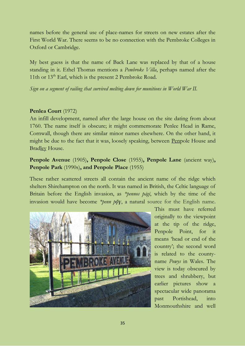
Sign on a segment of railing that survived melting down for munitions in World War II.
Penlea Court (1972)
An infill development, named after the large house on the site dating from about
1760. The name itself is obscure; it might commemorate Penlee Head in Rame,
Cornwall, though there are similar minor names elsewhere. On the other hand, it
might be due to the fact that it was, loosely speaking, between Penpole House and
Bradley House.
Penpole Avenue (1905), Penpole Close (1955), Penpole Lane (ancient way),
Penpole Park (1990s), and Penpole Place (1955)
These rather scattered streets all contain the ancient name of the ridge which
shelters Shirehampton on the north. It was named in British, the Celtic language of
Britain before the English invasion, as *pennos pāgī, which by the time of the
invasion would have become *penn pǭɣ, a natural source for the English name.
This must have referred
originally to the viewpoint
at the tip of the ridge,
Penpole Point, for it
means ‘head or end of the
country’; the second word
is related to the county-
name Powys in Wales. The
view is today obscured by
trees and shrubbery, but
earlier pictures show a
spectacular wide panorama
past Portishead, into
Monmouthshire and well
36
up the Severn. The name is the oldest-recorded name in the area, because it
appears as pen pau in a ninth-century document relating to the boundaries of a
detached part of Westbury parish (see Preface). Later, it seems the second part was
confused with the English word poll, also meaning ‘head’ (as in poll tax). Penpole
Lane skirts the ridge on its southern flank. Penpole Avenue is one of the earliest
streets in the late-19th century expansion of the village. Penpole Close is on the
site of a vanished large house called Pen Pole, which took its name directly from the
ridge and its end. Penpole Place may earlier have been called Steepy Fields, a
name currently attached to a modern house there. Penpole Park is a recent (post-
1992) street and name.
Penpole appears, through a common misunderstanding, as Pinfold or Penfold, in some
documents, e.g. one recording the beating of the bounds in 1790 and an act of
Parliament in 1811.
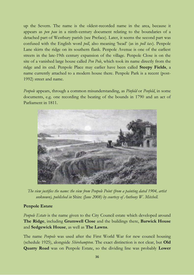
The view justifies the name: the view from Penpole Point (from a painting dated 1904, artist
unknown), published in Shire (June 2008) by courtesy of Anthony W. Mitchell.
Penpole Estate
Penpole Estate is the name given to the City Council estate which developed around
The Ridge, including Grumwell Close and the buildings there, Barwick House
and Sedgewick House, as well as The Lawns.
The name Penpole was used after the First World War for new council housing
(schedule 1925), alongside Shirehampton. The exact distinction is not clear, but Old
Quarry Road was on Penpole Estate, so the dividing line was probably Lower
37
High Street. More recently, Penpole seems to mean the area described above,
around The Ridge but still north of (Lower) High Street, which was developed 30
years later.
Portbury Grove (1927) and Portbury Walk (1927)
Named for Portbury in Somerset, just across the Avon from here and a little
downriver; compare Burnham Road. Portbury was also an ancient name for fields
in Sea Mills where foundations of Roman buildings were excavated in the 1920s
(see Preface), but I guess that that probably did not give rise to the street-names.
Portway or The Portway (1919)
Bristol’s planners had a neat idea when they conceived and built a new main road
connecting the city to the docks at Avonmouth between 1919 and 1926: they
called it The Portway, ‘the way to the port’. But in doing this, they reused a name
with a long history. Portway is a name of Anglo-Saxon origin meaning ‘the way to
the (market-) town’, which is used in various parts of England for important early
tracks serving as long-distance routes, especially Roman roads, and especially the
one from London to Dorchester and on to Weymouth. A factor influencing the
choice of name must have been the unearthing of the remains of the Roman dock
at Sea Mills by the construction work for The Portway, as well as the foundations
of a Roman building which can still be seen exposed on the corner of Sea Mills
Lane and The Portway.
Using an ancient name for a new road was an idea that could also be drawn on
when naming other local streets. So in the shadow of the elevated section of the
M5, and just off The Portway, we have Ermine Way, Watling Way, Stane Way,
Maiden Way, and Akeman Way – Ermine Way and Watling Way (1956) in
Shirehampton and the others in Avonmouth (1955). Following the Roman theme
of The Portway, they commemorate the Roman roads Ermin Way or Street
(Gloucester – Silchester in Hampshire) and maybe also Ermine Street (London –
York), Watling Street (A2 and A5 Dover – Wroxeter in Shropshire), Stane Street
(London – Chichester), Maiden Way (approaching Carvoran on Hadrian’s Wall in
Cumbria) and Akeman Street (London – Cirencester), and they are all tied together
by the theme word way, which replaces the original word in some of the names. In
the same group of streets is Pilgrims’ Way (commemorating the long-distance
track along the ridge of the North Downs). The reason for Leeming Way (1955)
is more obscure, but Leeming is a village in North Yorkshire astride a Roman road,
Dere Street, which forms part of the A1, which was locally called Leeming Lane or
38
Street. Antona Court and Antona Drive belong here too, but for the wrong
reason. Antona is a place-name found in one manuscript of the works of the
Roman historian Tacitus. In 1920, during the building of The Portway, the amateur
historian Arthur Savory published a book called Grain and chaff from an English
manor, in which he wrongly guessed that this Antona might be Aldington near
Evesham in Worcestershire, on a Roman road (Ryknild Street) which headed for
Bourton on the Water. So it was probably included among the “Roman” street-
names of Shirehampton simply because it was in the news.
Council development of the north side of The Portway itself took place from
1927-30, starting at the Avonmouth end, with private housing around 1930 on the
south side between Station Road and Valerian Close. Ermine Way, Watling Way,
Akeman Way, Leeming Way, Maiden Way, Pilgrims’ Way, Antona Drive, and Stane
Way are made up of BISF steel-framed houses built from 1947 onwards, and there
are some other houses of this type in Avonmouth Road, St Mary’s Road, West
Town Road, The Portway, Portview Road, Catherine Street, Page’s Mead and
Marsh Street. Where a street of BISF houses was entirely new, it was given a
“Roman” name.
See also the separate entry for Watling Way.
Powder House Court
A new (2009-10) development of houses on an old prefab site in Old Barrow
Hill. It commemorates the Merchant Venturers’ gunpowder store, built before
1769, whose cottage and quay still exist by the Avon just downriver from
Horseshoe Bend.
There is or was an old stone dated 1770, lost in the undergrowth on The Portway,
which reads “ ... P.H. Bristol” (the first letter is worn away and the <B> also lost).
It has been suggested that this may stand for “(???) Powder House”, and belong on
the boundary of the land originally associated with the Powder House. In that case,
it may well have been moved more than once because of railway and road
construction. However, I wonder if it is really “ST.P.H.” for St Peter’s Hospital, the
Bristol almshouse which owned land in Shirehampton in the late 18th century. A
raised <T> seems visible to me on the picture in Ethel Thomas’s The continuing story
of Shirehampton.
Priory Gardens and Priory Road (1906)
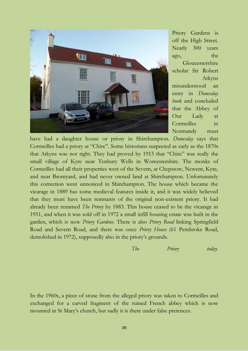
39
Priory Gardens is
off the High Street.
Nearly 300 years
ago, the
Gloucestershire
scholar Sir Robert
Atkyns
misunderstood an
entry in Domesday
book and concluded
that the Abbey of
Our Lady at
Cormeilles in
Normandy must
have had a daughter house or priory in Shirehampton. Domesday says that
Cormeilles had a priory at “Chire”. Some historians suspected as early as the 1870s
that Atkyns was not right. They had proved by 1913 that “Chire” was really the
small village of Kyre near Tenbury Wells in Worcestershire. The monks of
Cormeilles had all their properties west of the Severn, at Chepstow, Newent, Kyre,
and near Bromyard, and had never owned land at Shirehampton. Unfortunately
this correction went unnoticed in Shirehampton. The house which became the
vicarage in 1889 has some medieval features inside it, and it was widely believed
that they must have been remnants of the original non-existent priory. It had
already been renamed The Priory by 1883. This house ceased to be the vicarage in
1951, and when it was sold off in 1972 a small infill housing estate was built in the
garden, which is now Priory Gardens. There is also Priory Road linking Springfield
Road and Severn Road, and there was once Priory House (61 Pembroke Road,
demolished in 1972), supposedly also in the priory’s grounds.
The Priory today.
In the 1960s, a piece of stone from the alleged priory was taken to Cormeilles and
exchanged for a carved fragment of the ruined French abbey which is now
mounted in St Mary’s church, but sadly it is there under false pretences.
40
There is a local belief that the fifteenth-century converted Tithe Barn (“Tythe
Barn”) next to Priory Gardens is a building of the supposed priory, but it could
really just be the barn of the old manor of Shirehampton, whose farmhouse was no
doubt the Manor House on the opposite side of the High Street or perhaps The
Priory itself. If it really was a tithe barn, it would have been there to receive the
farm produce due to Westbury College, which owned the tithes of Shirehampton
until the Dissolution of the Monasteries in 1544. (The Sadleir family received the
tithes of Shirehampton after the Dissolution; they must have passed into other
private hands sometime after the Sadleir family’s interest ceased about 1664, but
they were in the hands of a clergyman in 1841.)
The story that the house called The Priory was an old religious house was probably
sparked off by the fact mentioned above that there is medieval structure within the
existing building. But there is nothing to connect it to a specific medieval religious
house. On Isaac Taylor’s map of 1772, the grounds of what became The Priory are
labelled St Peter’s Hospital, which evidently held land adjacent as well because
several fields are said to belong to St Peter’s, including the one containing the Tithe
Barn. This is St Peter’s Hospital in Bristol, also known as The (Bristol)
Corporation of the Poor, and also as The Mint, founded in 1696. The Corporation
acquired a “mansion house” in Shirehampton in 1701 from a private individual, Mr
Page, and if Taylor’s later map represents their interest correctly, the “mansion
house” is not the manor-house but The Priory, and the Tithe Barn must be
included among its “barns, stables, and out-houses”. St Peter’s must still have
owned it in 1790; lands in Shirehampton belonging to The Mint are mentioned
several times in documents of that year and 1797.
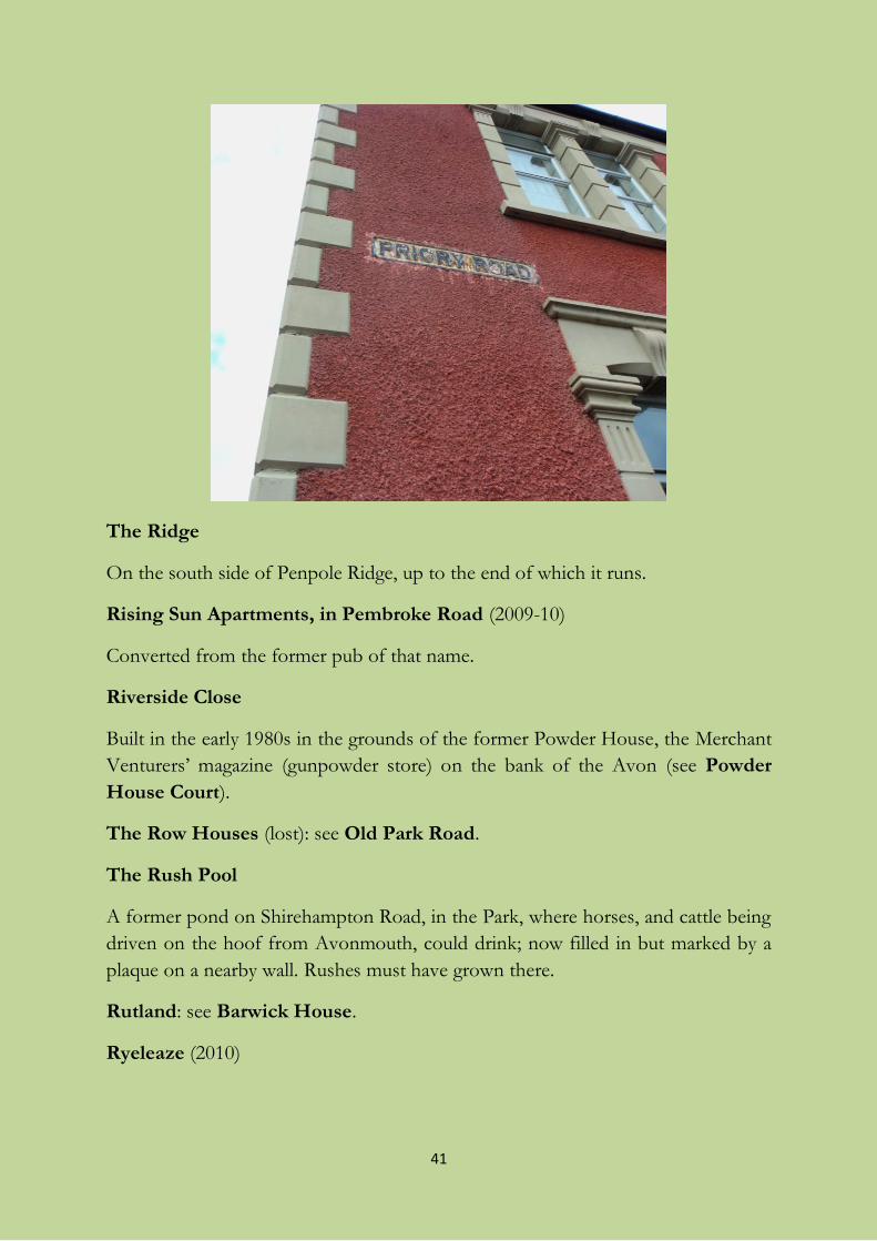
41
The Ridge
On the south side of Penpole Ridge, up to the end of which it runs.
Rising Sun Apartments, in Pembroke Road (2009-10)
Converted from the former pub of that name.
Riverside Close
Built in the early 1980s in the grounds of the former Powder House, the Merchant
Venturers’ magazine (gunpowder store) on the bank of the Avon (see Powder
House Court).
The Row Houses (lost): see Old Park Road.
The Rush Pool
A former pond on Shirehampton Road, in the Park, where horses, and cattle being
driven on the hoof from Avonmouth, could drink; now filled in but marked by a
plaque on a nearby wall. Rushes must have grown there.
Rutland: see Barwick House.
Ryeleaze (2010)
42
A name not directly continuing the ancient field-name on the spot as many names
in ‐leaze are: this was built on the fields Home and Lower Close of Myrtle Farm.
But there really was a Rye Leaze nearby: a pasture sown with rye-grass (Lolium
perenne), a rich fodder grass regarded as too coarse for modern lawns, but which
was highly regarded by the agricultural improvers of the 18th century.
St Bernard’s Road (1931)
A Roman Catholic parish of St Bernard (of Clairvaux) was established at
Shirehampton in 1903, and its dedication eventually became attached to St
Bernard’s Road and to the primary school in Station Road. St Bernard (1090-1153)
was a monastic reformer, initiated the cult of Mary, persecuted the scholar Peter
Abelard, and preached the Second Crusade.
St Mary’s Road (1931) and St Mary’s Walk (1929)
The former was previously part of – or most of – Back Lane, and it kept the old
name till the 1920s (see also Orchard Crescent and Pembroke Road). It is now
named from the church dedication. There had been a chapel in Shirehampton
since the 16th century and it became a full parish in 1844. The original chapel, in
existence by 1510, may have been dedicated to St Michael as it was in 1848
according to Samuel Lewis, but he may have been out of date by a few years. The
change of dedication to the Virgin Mary may have come with the building of the
new place of worship in 1827, or with full parish status in 1844.
The church’s previous status was remembered in Chapel House in the High Street,
which used to stand where the Co-Op now is and was rented by Dorothy and
William Wordsworth in 1798. The name of the meadow nearest the church was
picked up in the street-name Church Leaze, but the land was Chapel Paddock
before that.
St Tecla Close (2011)
The name of this newly-built street commemorates the small rock in the Severn off
Beachley which can more or less be seen from the site. It must be inspired by the
fact that Beachley Walk is nearby. The name of the rock has varied over time
between St Twrog, St Tryak and St Treacle. The Welsh saint’s name Tecla appears on
the rock for the first time as late as 1830.
The Savoy, in Station Road (2003)
43
A name for the flats built on the site of the old Savoy cinema. The name of this
chain commemorates the famous Savoy Theatre in London, which was built on a
site off The Strand originally granted to a 13th-century Duke of Savoy, on which
the Savoy Chapel still stands.
Scott’s Lane: see Park Road.
Sedgewick House: see Barwick House.
Severn Road (between 1904-20)
From the river, apparently for no special reason since it cannot be seen from here.
Severn Way
This is a national waymarked long-distance walking trail which meanders through
Shirehampton: along Penpole Ridge, down The Ridge and Lower High Street,
then along West Town Road, and finally along the north bank of the Avon in the
direction of Bristol city centre. It also enters Avonmouth from the north, and
follows the railway, eventually emerging into Lawrence Weston Road before
linking up on Penpole Ridge with the Shirehampton sector.
Shamrock Villas, in the High Street
A short terrace next to Waverley Road, named from the symbol of Ireland,
popularly thought to represent the Holy Trinity; there are three villas in the row.
Shire Gardens (1959)
Contains the present shortened name of the village used by many residents.
Despite its adoption by Bristol City Council in 1959, the earliest clear evidence for
the roadway I have seen is on a map labelled in Russian derived from Soviet spy
satellite imagery dating from 1974 (interesting also for being the earliest to mark
the nature reserve (zapovednik) here; unfortunately, that’s really the playing-fields
south of Avonmouth Road). The name Shire Gardens appears on maps after about
1970.
Shirehampton Park
Now also the name of the golf club which has its course in the southern half of the
Park. Partly in Shirehampton and partly in King’s Weston tithing of Henbury
parish, this park was originally the Little Park of King’s Weston House (the Great
Park being the one which sloped down to what is now the site of the Lawrence
Weston estate). The Little Park, bisected by Shirehampton Road, was created in
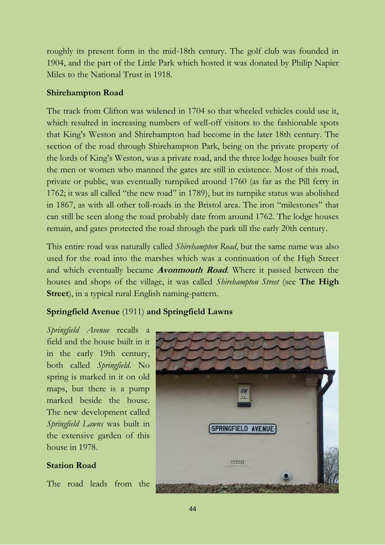
44
roughly its present form in the mid-18th century. The golf club was founded in
1904, and the part of the Little Park which hosted it was donated by Philip Napier
Miles to the National Trust in 1918.
Shirehampton Road
The track from Clifton was widened in 1704 so that wheeled vehicles could use it,
which resulted in increasing numbers of well-off visitors to the fashionable spots
that King’s Weston and Shirehampton had become in the later 18th century. The
section of the road through Shirehampton Park, being on the private property of
the lords of King’s Weston, was a private road, and the three lodge houses built for
the men or women who manned the gates are still in existence. Most of this road,
private or public, was eventually turnpiked around 1760 (as far as the Pill ferry in
1762; it was all called “the new road” in 1789), but its turnpike status was abolished
in 1867, as with all other toll-roads in the Bristol area. The iron “milestones” that
can still be seen along the road probably date from around 1762. The lodge houses
remain, and gates protected the road through the park till the early 20th century.
This entire road was naturally called Shirehampton Road, but the same name was also
used for the road into the marshes which was a continuation of the High Street
and which eventually became Avonmouth Road. Where it passed between the
houses and shops of the village, it was called Shirehampton Street (see The High
Street), in a typical rural English naming-pattern.
Springfield Avenue (1911) and Springfield Lawns
Springfield Avenue recalls a
field and the house built in it
in the early 19th century,
both called Springfield. No
spring is marked in it on old
maps, but there is a pump
marked beside the house.
The new development called
Springfield Lawns was built in
the extensive garden of this
house in 1978.
Station Road
The road leads from the
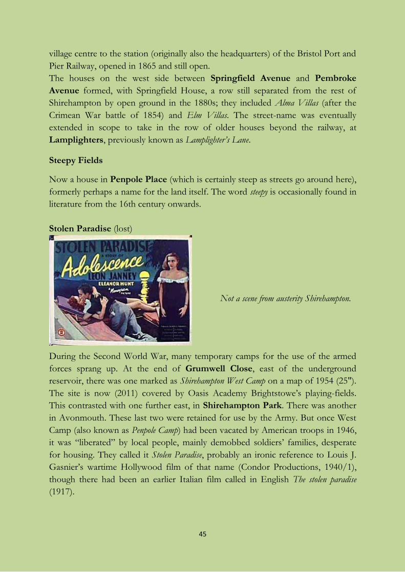
45
village centre to the station (originally also the headquarters) of the Bristol Port and
Pier Railway, opened in 1865 and still open.
The houses on the west side between Springfield Avenue and Pembroke
Avenue formed, with Springfield House, a row still separated from the rest of
Shirehampton by open ground in the 1880s; they included Alma Villas (after the
Crimean War battle of 1854) and Elm Villas. The street-name was eventually
extended in scope to take in the row of older houses beyond the railway, at
Lamplighters, previously known as Lamplighter’s Lane.
Steepy Fields
Now a house in Penpole Place (which is certainly steep as streets go around here),
formerly perhaps a name for the land itself. The word steepy is occasionally found in
literature from the 16th century onwards.
Stolen Paradise (lost)
Not a scene from austerity Shirehampton.
During the Second World War, many temporary camps for the use of the armed
forces sprang up. At the end of Grumwell Close, east of the underground
reservoir, there was one marked as Shirehampton West Camp on a map of 1954 (25").
The site is now (2011) covered by Oasis Academy Brightstowe’s playing-fields.
This contrasted with one further east, in Shirehampton Park. There was another
in Avonmouth. These last two were retained for use by the Army. But once West
Camp (also known as Penpole Camp) had been vacated by American troops in 1946,
it was “liberated” by local people, mainly demobbed soldiers’ families, desperate
for housing. They called it Stolen Paradise, probably an ironic reference to Louis J.
Gasnier’s wartime Hollywood film of that name (Condor Productions, 1940/1),
though there had been an earlier Italian film called in English The stolen paradise
(1917).
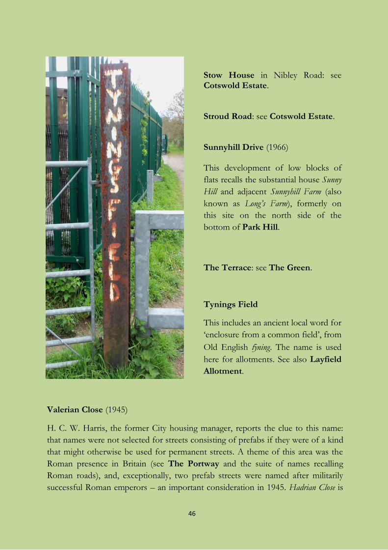
46
Stow House in Nibley Road: see Cotswold Estate. Stroud Road: see Cotswold Estate. Sunnyhill Drive (1966) This development of low blocks of
flats recalls the substantial house Sunny
Hill and adjacent Sunnyhill Farm (also
known as Long’s Farm), formerly on
this site on the north side of the
bottom of Park Hill.
The Terrace: see The Green.
Tynings Field
This includes an ancient local word for
‘enclosure from a common field’, from
Old English ty ning. The name is used
here for allotments. See also Layfield
Allotment.
Valerian Close (1945)
H. C. W. Harris, the former City housing manager, reports the clue to this name:
that names were not selected for streets consisting of prefabs if they were of a kind
that might otherwise be used for permanent streets. A theme of this area was the
Roman presence in Britain (see The Portway and the suite of names recalling
Roman roads), and, exceptionally, two prefab streets were named after militarily
successful Roman emperors – an important consideration in 1945. Hadrian Close is
47
off The Portway near Sea Mills station, opposite the exposed foundations of a
Roman building; it was named after the 2nd-century emperor whose lasting impact
on Britain was the Wall which bears his name. Valerian Close in Shirehampton, on
the other hand, commemorates a 3rd-century emperor who had no known
connection with Britain but spent his time fighting the Persians, and nobody has a
good word for him. But this name has a local appropriateness because red valerian is
the name of a red- or pink-flowered plant which escapes from gardens and grows
freely on walls and rough ground in this area.
Walcombe: see Barwick House.
Walton Road
Walton Cottage survives by the corner of Severn Road; judging by older maps, the
street-name was there well before the house. The nearest place it might recall is
Walton-in-Gordano on the outskirts of Clevedon in Somerset, though there are
many other candidates; it might also be from a surname. Prefabs were built on the
eastern side of this street after World War II.
A house next to The Terrace on The Green was called Walton House, but whether
there is any connection between it and this late-19th century street is not known.
The house is mentioned by that name in connection with a family called Walton in
an essay published in 1839, though it is not clear to what extent it is fiction. The
essay may have inspired the house-name, or vice versa.
Wasborough: see Barwick House.
Watling Way
See Portway. But Graham Weekes wrote to Shire newspaper in February 2008 to
say that Watling Way “was named after a man called Josser Watling who played
football for Avonmouth before he became a Rovers Player”.
Waverley Road (after 1870s?)
Waverley, the title of a novel by Sir Walter Scott (1814) and the surname of its hero,
often found its way into local names, especially house-names, through Scott’s huge
popularity. Scott’s influence is also responsible for the house called after another of
his English heroes, Ivanhoe, 23 Station Road. In Shirehampton, there was a house
called Waverley at the corner of Pembroke Road, maybe the one which appears on
the OS 6" map in 1883, and Waverley Road is called after it but not named on the
map. By 1903, the house seems to have been replaced by the terrace of three now
48
standing at the corner. Or the name might have been that of what is now a shop
on the opposite corner.
Wellington Mews
Originally named from the adjacent large house built for a local family with the
surname Willington. John Russell Willington, then of Fulligrove Cottage, is recorded
as “sometimes called John Russell Wellington” in the London Gazette in 1857. The
house-name, and therefore that of the Mews, has been altered as if patriotically
recalling the famous Duke, and the owner may have jumped on the bandwagon.
Mews originally meant ‘row of stables, usually with living-space for grooms above’.
West Town Road (sometimes and formerly West Town Lane)
West Town is ‘west settlement’, the westernmost hamlet in the original tithing of
Shirehampton before the creation of Avonmouth. It is a name of the same origin,
but of a later time, as the Weston in King’s Weston. In its known history, West Town
was an industrial settlement, including a brick- and tileworks in about 1840, and an
ill-recorded glassworks which was succeeded by a lead- and ironworks. Situated on
the bank of the Avon, it included Victoria Road, Victoria Terrace, Crown
Terrace, Glass Street and Avon View Terrace. The settlement was transferred to
the new parish of Avonmouth in 1917.
Concern was raised in the Shirehampton parish magazine of December 1890 that
this settlement suffered from “the want of a proper name”, and the imaginative
suggestion of Riverside was made. Nonetheless the place seems to have been known
as West Town in 1861, still by the time the West Town Mission was established in
1885, and always after that until most of West Town was flattened in the blitz of
16-17 January 1941 and never rebuilt as a community.
This road is the one by which West Town could be reached from the High Street.
The alternative name West Town Lane was sometimes used in mid-20th century
documents, at least for the end nearest the river, though not on Ordnance Survey
maps.
Winchcombe Grove: see Cotswold Estate.
Winchester Buildings (lost), in Station Road (1907)
An unexplained name for the row of shops by the Public Hall, mentioned by Janet
and Derek Fisher in one of their postcard captions, but no longer in use. The
architect of the buildings, Frederick Bligh Bond, was also an archaeologist and
49
occultist, and claimed to have had spirit contact with an early medieval sub-prior of
Winchester, “Brother Symon” (among other long-dead monks) when deciding
where to excavate at Glastonbury Abbey (1908). Might this account for the name,
and also for its dumping? A long shot. But the Church did not approve of Bligh
Bond’s ghostly doings when they tackled him about them in 1921, and dismissed
him from the excavations.
Woodview Close (after 1992)
Close to the now-wooded southern slope of Penpole Ridge.
Woodwell Road
There is a lot of confusion involving the well-name or spring-name from which
this street derives its own, and the one found in Bucklewell Close.
According to Ethel Thomas, Bucklewell Close contains the name of the spring from
which a stream flowed whose former course is followed by Woodwell Road. She
mentions a steel plate set into the pavement in Woodwell Road between St
Bernard’s Road and The Portway which once marked its position. But this
cannot be right. There were two separate wells (or springs), Wood Well and Buckle
Well. Wood Well was where Mrs Thomas states, and a well is clearly marked there
on 19th-century maps. Adjacent fields on both sides of the lane were called Wood
Well. But 19th-century maps show Buckwell as a place-name near Horseshoe Bend,
beyond the end of Woodwell Road, and Angela Thompson Smith calls the hidden
spring (actually two), in an almost inaccessible cave near here, the Buckle Well. The
spring is first mentioned by name in 1790; I have never found it marked on a map.
The researchers of the Bristol Springs and Wells Group also think that that the
hidden spring is the Buckle Well, and correspondence in Shire newspaper in 1976
and 2010 supports this.
These facts suggest that Buckle Well was originally just called Buckwell, which
became obscured in pronunciation to Buckle (just as original “Gorewell” in Devon
has come to be called Gorrell, and Cromwell in Nottinghamshire used to be
pronounced “Crummle”); and that it had an explanatory extra well added to it (as
early as a document of 1790 which contains other mistakes). It may have been
‘buck well’, i.e. a well associated with male fallow deer or roedeer, and we might
compare it with three places called Hartwell ‘stag well’ in other parts of England.
There was a hamlet called Buckwell, in Wellington, Somerset (and still others). So it
is unlikely that the local suggestion that you have to “buckle” to get into the cave
can be right.
50
(The) Yellow Brick Road
A name used by some local people for the concrete path across Lamplighters
Marsh, taken from Victor Fleming’s musical film The Wizard of Oz starring Judy
Garland (MGM, 1939).
*
Two ancient Shirehampton house-names: Avenhouse and Fulligrove
Shirehampton used to be a tithing of Westbury-on-Trym parish. In the 17th
century, payments to poor people of Shirehampton by the parish of Westbury were
recorded in the parish “poor book”. The names of those from whom the money
was collected were also recorded. Among the columns of donors in the
Shirehampton section, year after year, are not only named persons (see Barwick
House above), but Wirkhouse and Avenhouse. Why would money be due from a
workhouse (set up under a law of 1601), since these were lodgings for the poorest
of the poor, those unable to support themselves? It must have been because the
work of the inhabitants generated some revenue for the parish, usually amounting
to about £15 a year. Avenhouse is more of a puzzle. Was it ‘Avon House’, named
from the river, as seems most likely? If so, where and what was it, exactly, and how
did it make money for the parish? It is mentioned still in rent-books from around
1800, though with the modern spelling of the river-name. Was it the house so
called near Lamplighters? If so, on what basis did it pay rates? Or was it the place
involved in Avonhouse Grounds, at the later site of Avonmouth’s Marine Hotel? Or
was the name a reference to the place called Aven mentioned three times in the Old
Testament in a not very positive light (Ezekiel 30:17, Hosea 10:8 – “Aven, the sin
of Israel” – and Amos 1:5)? Typically, whatever it was, it contributed £16 a year to
the parish.
In the same “poor book”, we find a reference to Fulligrove in 1695, and there is an
even earlier reference in 1638. This property still exists, by the Woodwell Road
railway bridge. How old the present building is is not known. Apart from here I
have found the name only as a very rare surname, of unknown origin and extinct in
Britain, so the house-name may be from the lost surname. There the mystery rests.
51
The street-names of Avonmouth
(including some other interesting local names)
Most of modern Avonmouth is built within the old Shirehampton tithing, but at
the northern end small parts of the parishes of Henbury and Redwick &
Northwick have been annexed.
A date given in a heading is a rough indication of the age of the street in question.
It may be the date of the adoption of the street by the Highways Department, and
not necessarily the date of the first buildings. The roadways of the dock estate do
not seem to have ever had official names, though some of the lines and sites of the
former dock railway system had unofficial ones like The Smutter.
Ableton Lane
This road gets into the book by the skin of its teeth; the northern boundary of
Avonmouth runs along the middle of part of its southern end. It contains one of
the oldest place-names in the district, which belonged to a vanished farm (later
called a meadow) in Redwick & Northwick parish originally named Old English
*Apuldorhamm, ‘appletree water-meadow’, worn away and misunderstood till it
gains its present form. The industrial development of what became the
AstraZeneca works has obscured much of the lane, but the name is still found at
the northern end in Severn Beach, where the original farm was.
Akeman Way : see Portway.
Anthony Post (lost)
This object was recorded in 1610 near the mouth of the Avon. It has now
disappeared; it may have been Roman, and it may have been a milestone. Or not.
Atlantic Road (about 1975)
A reference to the ocean, or perhaps more specifically a tribute to the Atlantic
merchant convoys sailing from Avonmouth in World War II, as Veronica Smith
suggests.
Avon Gorge Industrial Estate, in Portview Road
Avon Riverside Estate, in Victoria Road
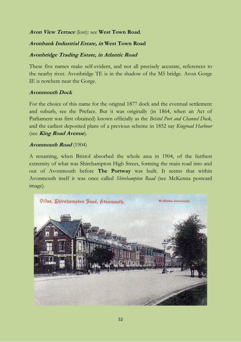
52
Avon View Terrace (lost): see West Town Road.
Avonbank Industrial Estate, in West Town Road
Avonbridge Trading Estate, in Atlantic Road
These five names make self-evident, and not all precisely accurate, references to
the nearby river. Avonbridge TE is in the shadow of the M5 bridge. Avon Gorge
IE is nowhere near the Gorge.
Avonmouth Dock
For the choice of this name for the original 1877 dock and the eventual settlement
and suburb, see the Preface. But it was originally (in 1864, when an Act of
Parliament was first obtained) known officially as the Bristol Port and Channel Dock,
and the earliest deposited plans of a previous scheme in 1852 say Kingroad Harbour
(see King Road Avenue).
Avonmouth Road (1904)
A renaming, when Bristol absorbed the whole area in 1904, of the furthest
extremity of what was Shirehampton High Street, forming the main road into and
out of Avonmouth before The Portway was built. It seems that within
Avonmouth itself it was once called Shirehampton Road (see McKenna postcard
image).
53
Avonmouth Trading Estate, in Fifth Way
Self-explanatory.
Avonmouth Way and Avonmouth Way West (1965)
Self-explanatory; but it also runs across the lands of the former Avonmouth Farm.
The original line has been partly absorbed by Crowley Way.
Ballast Lane
No easy explanation is available for this name, first on maps in 1903, especially
since it runs on the marshes, leading between the ditches called Kingsweston Rhine
and Shirehampton Rhine to a former pump house, rather than on the dock estate.
The marsh cannot have been a source of ballast (stones or crushed rock to stabilize
ships). Most likely the name just meant that the lane was laid with stone (of
whatever source) to keep walkers’ feet dry, and that that was unusual in the
marshes. But now it is just a track, and vehicle access is blocked off.
Barracks Cottages: see Barracks Lane.
Barton’s Lane (lost)
The lane leading to T Farm (Kilminster’s) in the early 1900s.
Bewys Cross or Bewy’s Cross
This historic, possibly 14th/15th-century, stone cross-shaft and plinth, stands in
the grounds of The House in the Garden at King’s Weston, but it belongs to
Avonmouth, being marked at a point south of Elbury Gout, the mouth of one of
the coastal rhines, on Donn’s map (1769). It is marked as Bevis Stone on Taylor’s
map of 1772, and we can pin down its position to a point now in Royal Edward
Dock. Local tradition says that, in the 12th century, sailors showed their gratitude
to God for their safe return by leaving donations to the church at the cross, and
there is a hole in one of the steps which is said to have received their coins. It was
moved to King’s Weston sometime after 1787. The name is obscure and has been
confused with Bewell’s Cross in St Michael’s, Bristol, but it may recall the medieval
legend of the knight Sir Bevis of Hampton – which is Southampton, not
Shirehampton.
Bonner’s Lane (lost)
Named after a local farmer (though it is not a local surname); out in the marshes
near where the Royal Edward Dock now is, and long gone.
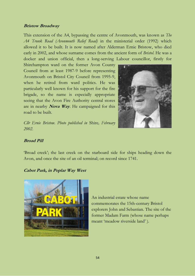
54
Bristow Broadway
This extension of the A4, bypassing the centre of Avonmouth, was known as The
A4 Trunk Road (Avonmouth Relief Road) in the ministerial order (1992) which
allowed it to be built. It is now named after Alderman Ernie Bristow, who died
early in 2002, and whose surname comes from the ancient form of Bristol. He was a
docker and union official, then a long-serving Labour councillor, firstly for
Shirehampton ward on the former Avon County
Council from at least 1987-9 before representing
Avonmouth on Bristol City Council from 1995-9,
when he retired from ward politics. He was
particularly well known for his support for the fire
brigade, so the name is especially appropriate
seeing that the Avon Fire Authority central stores
are in nearby Nova Way. He campaigned for this
road to be built.
Cllr Ernie Bristow. Photo published in Shire, February
2002.
Broad Pill
‘Broad creek’; the last creek on the starboard side for ships heading down the
Avon, and once the site of an oil terminal; on record since 1741.
Cabot Park, in Poplar Way West
An industrial estate whose name
commemorates the 15th-century Bristol
explorers John and Sebastian. The site of the
former Madam Farm (whose name perhaps
meant ‘meadow riverside land’ ).
55
Catherine Street It is not known who the Catherine of Catherine Street (built about 1920 somewhat
apart from the rest of Avonmouth) was, but it has been suggested that she had
some connection with Jefferies, the former Avonmouth ship repairers (a person
named Catherine Jefferies being buried in undated graveplot 1438 in the cemetery
in St Mary’s Road, Shirehampton). Another candidate might be the much-loved
district nurse Catherine Court, active from 1903 to 1937.
Chittening Road: see Chittening Trading Estate.
Chittening Trading (or Industrial) Estate, in Smoke Lane / Chittening
Road
The site of the First World War mustard gas factory, whose name incorporates a
place-name existing before industrial development, formerly in the parish of
Redwick & Northwick, which is recorded as Chitnend and Chitnends Warth (i.e.
Chittening Warth) in 1658. It seems to have meant ‘chit’s end’, where chit meant
‘the young of an animal, whelp, kitten’. It is also seen in Chittening Road.
The estate, on some of the fields of the former West House Farm, includes:
Bank Road
Parallel and close to the flood-bank or wall of the Severn.
Green Splott Road or Greensplott Road
Splott is a local word for ‘plot, small patch of land’; the name recalls Green Splott
Farm. Compare Red Splott Gout nearby in the marshes. (Gout means ‘culvert’ or
‘sluice’.)
Worthy Road
Worthy is a south-western word meaning ‘enclosure, smallholding’, and here it
recalls the name of a former nearby farm in Redwick & Northwick parish which
had been on record since 1241.
Chittening Warth
The warthland, or grazing-land overflowed from time to time by the Severn, at
Chittening; see Chittening Trading Estate.
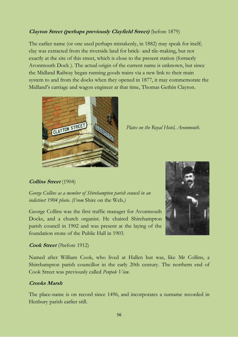
56
Clayton Street (perhaps previously Clayfield Street) (before 1879)
The earlier name (or one used perhaps mistakenly, in 1882) may speak for itself;
clay was extracted from the riverside land for brick- and tile-making, but not
exactly at the site of this street, which is close to the present station (formerly
Avonmouth Dock ). The actual origin of the current name is unknown, but since
the Midland Railway began running goods trains via a new link to their main
system to and from the docks when they opened in 1877, it may commemorate the
Midland’s carriage and wagon engineer at that time, Thomas Gethin Clayton.
Plates on the Royal Hotel, Avonmouth.
Collins Street (1904)
George Collins as a member of Shirehampton parish council in an
indistinct 1904 photo. (From Shire on the Web.)
George Collins was the first traffic manager for Avonmouth
Docks, and a church organist. He chaired Shirehampton
parish council in 1902 and was present at the laying of the
foundation stone of the Public Hall in 1903.
Cook Street (?before 1912)
Named after William Cook, who lived at Hallen but was, like Mr Collins, a
Shirehampton parish councillor in the early 20th century. The northern end of
Cook Street was previously called Penpole View.
Crooks Marsh
The place-name is on record since 1496, and incorporates a surname recorded in
Henbury parish earlier still.
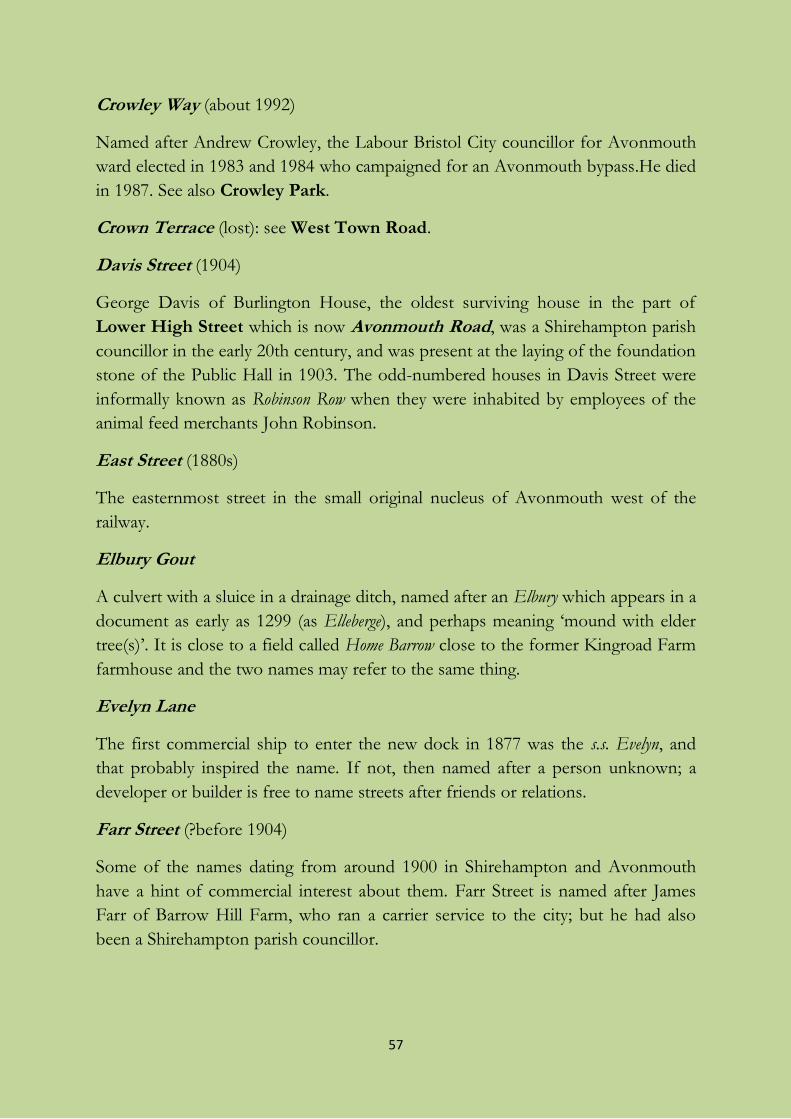
57
Crowley Way (about 1992)
Named after Andrew Crowley, the Labour Bristol City councillor for Avonmouth
ward elected in 1983 and 1984 who campaigned for an Avonmouth bypass.He died
in 1987. See also Crowley Park.
Crown Terrace (lost): see West Town Road.
Davis Street (1904)
George Davis of Burlington House, the oldest surviving house in the part of
Lower High Street which is now Avonmouth Road, was a Shirehampton parish
councillor in the early 20th century, and was present at the laying of the foundation
stone of the Public Hall in 1903. The odd-numbered houses in Davis Street were
informally known as Robinson Row when they were inhabited by employees of the
animal feed merchants John Robinson.
East Street (1880s)
The easternmost street in the small original nucleus of Avonmouth west of the
railway.
Elbury Gout
A culvert with a sluice in a drainage ditch, named after an Elbury which appears in a
document as early as 1299 (as Elleberge), and perhaps meaning ‘mound with elder
tree(s)’. It is close to a field called Home Barrow close to the former Kingroad Farm
farmhouse and the two names may refer to the same thing.
Evelyn Lane
The first commercial ship to enter the new dock in 1877 was the s.s. Evelyn, and
that probably inspired the name. If not, then named after a person unknown; a
developer or builder is free to name streets after friends or relations.
Farr Street (?before 1904)
Some of the names dating from around 1900 in Shirehampton and Avonmouth
have a hint of commercial interest about them. Farr Street is named after James
Farr of Barrow Hill Farm, who ran a carrier service to the city; but he had also
been a Shirehampton parish councillor.
58
Fifth Way, First Way, Fourth Way, Second Way and Third Way
American-style naming most common in England in the inter-war years, but post-
World War II here and without the typical American gridiron street pattern. First,
Second, and Third date from 1968-9, Fourth from 1979, and Fifth from 1981.
Fire Station Lane
Self-explanatory. The previous fire station was in Green Lane; the fire service
stores are in Nova Way.
First Way, Fourth Way : see Fifth Way.
Glass Street (lost): see West Town Road.
Gloucester Road (before 1879)
Local patriotism. Refers to the county in which Avonmouth sat before it was
incorporated into the port, city, and county of Bristol in 1884.
Green Lane (?before 1904)
The even-numbered houses were once called Elder Villas; they had been built for
officers employed by Elder, Dempster Lines, but a new name, reviving an old one
for an unmetalled track, was used when Elders sold off their interest.
Hallen Marsh
The village of Hallen is not within the present boundaries of Avonmouth, but the
marshland historically belonging to it is, and so is Hallen Farm. The name is on
record since 1498, in Halenende, which perhaps originally meant ‘end (of the parish)
at the hales’; hale has a number of meanings in place-names including ‘streamside
meadow’ and ‘corner of a parish’. It is nothing to do with the Welsh word for ‘salt’,
halen, as is sometimes said.
Haslemere Industrial Estate, in Third Way
Recalls Haslemere in Surrey, for unknown reasons. There are a number of such
estates nationwide with this name, but I do not know whether they are or were
linked commercially. I have been unable to establish any connection with the
former large independent property company Haslemere Estates (1958-86), which
in any case specialized in refurbishment and restoration; but Haslemere Estates is
now wholly owned by a Netherlands-based general commercial property company.
59
Hoar Gout
The name of a culvert with a sluice, in the drainage channel called Mere Bank Rhine;
it is now attached to some reservoirs near the sewage works. It might contain the
same word seen in the field-name The Oars, meaning ‘(sea-)bank’, found in
Shirehampton (see Preface); or it is possible that the first word is Old English hār
‘grey, lichen-covered’. It is a little way from the nearest of the sea-banks, so the
name may refer instead to the bank formed by the lane which crossed the rhine
here, or to Mere Bank itself (see Mere Bank Road).
I suspect that gouts were originally sluices allowing the marsh-water in rhines to
drain into the sea, but that some, like this one, became stranded inland as the
marshes were reclaimed bit by bit from the Severn.
Holes Mouth
The name for a small pill running across the foreshore at the end of the Mere Bank
(see Mere Bank Road), nearly lost in Avonmouth’s dockland reclamation. It is
recalled by Holesmouth Junction, on the railway north of St Andrew’s station, and it is
still marked on some large-scale maps close to Smoke Lane. Holes Mouth is the
point at which the local authority boundary swings out into the river Severn
towards Denny Island, as opposed to hugging the shoreline; in the time of the
mapmaker Donn (1769), the Avon flowed into the Severn as far north as this. The
name seems to have meant ‘mouth of or at the hollow’, but at this distance in time
it is not clear why.
Imperial Smelting Corporation estate, in St Andrew’s Road
The company had a complicated business history, but its estate road pattern with
several unusual names seems to have been laid down when it was trading under the
ISC name. The site finally closed in 2003. The estate incorporated land of the
former Cowley Farm.
Acid Road
A major by-product of zinc smelting is sulphuric acid.
Boundary Road
Cadmium Road
Cadmium is found in some zinc ores, from which it needs separating by industrial
processes.
60
I.S.F. Road
The Imperial Smelting Corporation Ltd had here an ISF Smelter complex. ISF is
from the initial letters of Imperial Smelting Furnace (a blast furnace for zinc
production), whose method produces ferro-silicate slag, used in asphalt.
Retort Road
A reference to retort furnaces. The company perfected its ISF vertical retort to
replace the previously standard horizontal retort.
Spar Road
Spar is a general word for zinc carbonate or calamine. Calamine was once mined
around Bristol (especially in the Mendips and Clifton Downs), which is the
historical reason why the zinc industry grew up in this area.
Stores Road and Workshop Road
Zinc Road
The company’s main product at this site was what it called primary zinc.
International Trading Estate, in Jubilee Way
Self-explanatory.
Ironchurch Road : see St Andrew’s Trading Estate.
Island Trade Park, in Neale Lane/Bristow Broadway
Perhaps this recalls the former Dumball Island (sometimes unflatteringly mapped
as Dungball), which was bought by Bristol Corporation in 1860. It was in the
process of being washed away by the sea when its position was incorporated into
the first Avonmouth Dock. It was still partly there in 1888 (OS 6" map), but
permission to reclaim the Old North Channel (the old mouth of the Avon) was
obtained from the Board of Trade in 1892, and this action absorbed the island into
the mainland. Despite this, the remnant of the island was still named on the OS 6"
map in 1903-4. This area was formerly the northernmost promontory of Somerset,
but the Avon broke through the adjacent marshland in the late 18th century to
create Swash Channel, which made Dumball into an island and eventually,
around 1875, united it with Gloucestershire.
61
Alternatively, the estate’s name may be a simple reference to its situation,
marooned between two M5 slip-roads and Bristow Broadway.
Jubilee Way
Named in the year of the Silver Jubilee of Elizabeth II, 1977.
Jutland Road
Recalls the indecisive naval battle of Jutland on 31 May – 1 June 1916, often
viewed as a British victory because it severely damaged the German high seas fleet
as well as the British one, and because the German fleet never engaged the British
fleet directly again.
King Road Avenue
This recalls King Road, the roadstead or anchorage in the Severn off the mouth off
the Avon. King Road looks straightforward – ‘king’s roadstead’ – but King’s Road
with -s might be expected, and this only occurs in three abnormal records. If the
name is really ancient, because of the way Old English grammar worked it could be
‘kings’ roadstead’, i.e. referring to more than one king, or to royalty in general.
It looks as though another consideration may have influenced the name of this
short dual carriageway. By historical accident, King Road provided a good name for
a grand approach to the new Royal Edward Dock complex.
Somewhere around this spot must have been the Aveneorde mentioned in Bristol’s
charter of incorporation (1373). This might have been “Avonroad”, perhaps an
older or alternative name for King Road, but it was more probably a name for a
vanished coastal feature, meaning ‘Avon Point’ in Old English (see Nelson Point).
King Street (by 1904)
It could not have been given this name before 1901 because we had a queen till
then, and it is adjacent to the Royal Edward Dock, opened in 1908. But it forms a
pair with the earlier Queen Street, which it meets at right-angles. It may not be
irrelevant that the future Edward VII had been a friend of Sir Philip Miles, cousin
of King’s Weston “squire” Philip Napier Miles and Conservative MP for East
Somerset (1878-85). There may also be a hint of an allusion to C. J. King and Sons,
the tugboat company operating in the docks.
62
King’s Weston Lane
Formerly the main way into the marshes from King’s Weston, now crossing the
M5 and M49 on a bridge.
Lawrence Weston Road
Formerly the main way into the marshes from Lawrence Weston, now crossing the
M5 on a footbridge and going under the M49 in a short tunnel.
Leeming Way : see The Portway.
Lescren Way
After Lescren Holdings Ltd, of Towcester, Northamptonshire, incorporated 1977,
a firm specializing in industrial property redevelopment and having interests in
Avonmouth.
Motorways still do not attract names, but the elevated section across the Avon,
opened in 1974, is called Avonmouth Bridge. >> Motorway Distribution Centre.
Maiden Way : see The Portway.
Marsh Street (1935-8)
Self-explanatory. The whole of Avonmouth is built on former marshland, both
saltmarsh and warthland.
McLaren Road
Martin McLaren was Conservative MP for Bristol North-West between 1959-66
and 1970-4, and the road is named after him.
Meadow Street (before 1879)
One of the earliest streets in Avonmouth, presumably from a use of the land it was
built on, though none of the fields hereabouts is named as a meadow in the Tithe
Award of 1840-1.
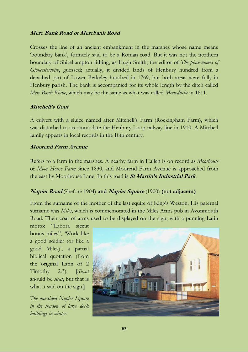
63
Mere Bank Road or Merebank Road
Crosses the line of an ancient embankment in the marshes whose name means
‘boundary bank’, formerly said to be a Roman road. But it was not the northern
boundary of Shirehampton tithing, as Hugh Smith, the editor of The place-names of
Gloucestershire, guessed; actually, it divided lands of Henbury hundred from a
detached part of Lower Berkeley hundred in 1769, but both areas were fully in
Henbury parish. The bank is accompanied for its whole length by the ditch called
Mere Bank Rhine, which may be the same as what was called Meereditche in 1611.
Mitchell’s Gout A culvert with a sluice named after Mitchell’s Farm (Rockingham Farm), which
was disturbed to accommodate the Henbury Loop railway line in 1910. A Mitchell
family appears in local records in the 18th century.
Moorend Farm Avenue
Refers to a farm in the marshes. A nearby farm in Hallen is on record as Moorhouse
or Moor House Farm since 1830, and Moorend Farm Avenue is approached from
the east by Moorhouse Lane. In this road is St Martin’s Industrial Park.
Napier Road (?before 1904) and Napier Square (1900) (not adjacent)
From the surname of the mother of the last squire of King’s Weston. His paternal
surname was Miles, which is commemorated in the Miles Arms pub in Avonmouth
Road. Their coat of arms used to be displayed on the sign, with a punning Latin
motto: “Labora siccut
bonus miles”, ‘Work like
a good soldier (or like a
good Miles)’, a partial
biblical quotation (from
the original Latin of 2
Timothy 2:3). [Siccut
should be sicut, but that is
what it said on the sign.]
The one-sided Napier Square
in the shadow of large dock
buildings in winter.
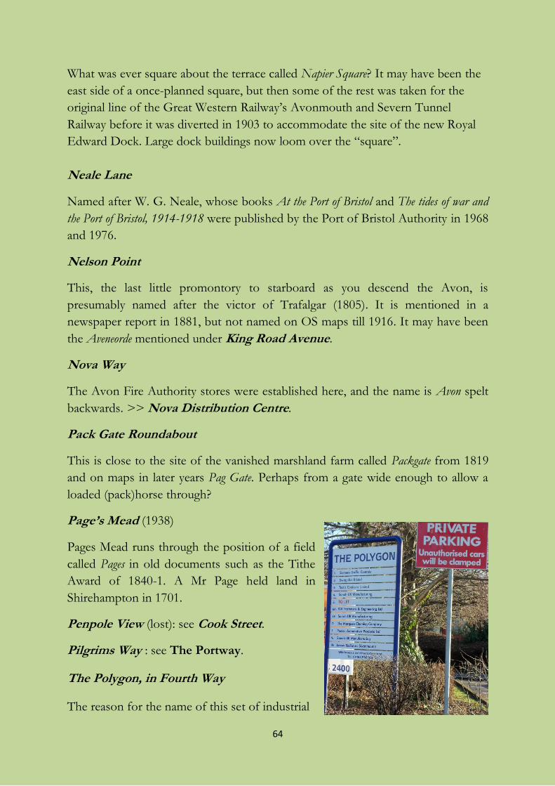
64
What was ever square about the terrace called Napier Square? It may have been the
east side of a once-planned square, but then some of the rest was taken for the
original line of the Great Western Railway’s Avonmouth and Severn Tunnel
Railway before it was diverted in 1903 to accommodate the site of the new Royal
Edward Dock. Large dock buildings now loom over the “square”.
Neale Lane
Named after W. G. Neale, whose books At the Port of Bristol and The tides of war and
the Port of Bristol, 1914-1918 were published by the Port of Bristol Authority in 1968
and 1976.
Nelson Point
This, the last little promontory to starboard as you descend the Avon, is
presumably named after the victor of Trafalgar (1805). It is mentioned in a
newspaper report in 1881, but not named on OS maps till 1916. It may have been
the Aveneorde mentioned under King Road Avenue.
Nova Way
The Avon Fire Authority stores were established here, and the name is Avon spelt
backwards. >> Nova Distribution Centre.
Pack Gate Roundabout
This is close to the site of the vanished marshland farm called Packgate from 1819
and on maps in later years Pag Gate. Perhaps from a gate wide enough to allow a
loaded (pack)horse through?
Page’s Mead (1938)
Pages Mead runs through the position of a field
called Pages in old documents such as the Tithe
Award of 1840-1. A Mr Page held land in
Shirehampton in 1701.
Penpole View (lost): see Cook Street.
Pilgrims Way : see The Portway.
The Polygon, in Fourth Way
The reason for the name of this set of industrial
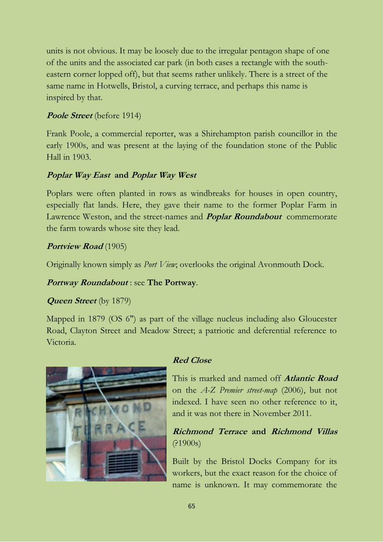
65
units is not obvious. It may be loosely due to the irregular pentagon shape of one
of the units and the associated car park (in both cases a rectangle with the south-
eastern corner lopped off), but that seems rather unlikely. There is a street of the
same name in Hotwells, Bristol, a curving terrace, and perhaps this name is
inspired by that.
Poole Street (before 1914)
Frank Poole, a commercial reporter, was a Shirehampton parish councillor in the
early 1900s, and was present at the laying of the foundation stone of the Public
Hall in 1903.
Poplar Way East and Poplar Way West
Poplars were often planted in rows as windbreaks for houses in open country,
especially flat lands. Here, they gave their name to the former Poplar Farm in
Lawrence Weston, and the street-names and Poplar Roundabout commemorate
the farm towards whose site they lead.
Portview Road (1905)
Originally known simply as Port View; overlooks the original Avonmouth Dock.
Portway Roundabout : see The Portway.
Queen Street (by 1879)
Mapped in 1879 (OS 6") as part of the village nucleus including also Gloucester
Road, Clayton Street and Meadow Street; a patriotic and deferential reference to
Victoria.
Red Close
This is marked and named off Atlantic Road
on the A-Z Premier street-map (2006), but not
indexed. I have seen no other reference to it,
and it was not there in November 2011.
Richmond Terrace and Richmond Villas
(?1900s)
Built by the Bristol Docks Company for its
workers, but the exact reason for the choice of
name is unknown. It may commemorate the
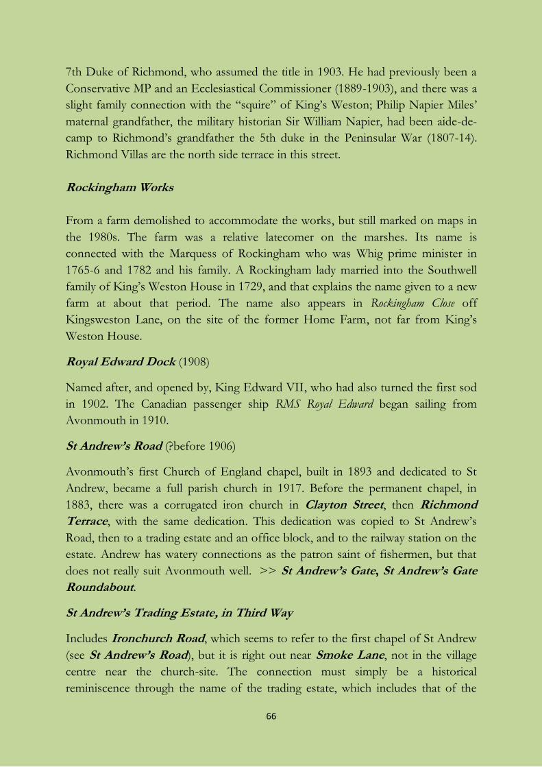
66
7th Duke of Richmond, who assumed the title in 1903. He had previously been a
Conservative MP and an Ecclesiastical Commissioner (1889-1903), and there was a
slight family connection with the “squire” of King’s Weston; Philip Napier Miles’
maternal grandfather, the military historian Sir William Napier, had been aide-de-
camp to Richmond’s grandfather the 5th duke in the Peninsular War (1807-14).
Richmond Villas are the north side terrace in this street.
Rockingham Works
From a farm demolished to accommodate the works, but still marked on maps in
the 1980s. The farm was a relative latecomer on the marshes. Its name is
connected with the Marquess of Rockingham who was Whig prime minister in
1765-6 and 1782 and his family. A Rockingham lady married into the Southwell
family of King’s Weston House in 1729, and that explains the name given to a new
farm at about that period. The name also appears in Rockingham Close off
Kingsweston Lane, on the site of the former Home Farm, not far from King’s
Weston House.
Royal Edward Dock (1908)
Named after, and opened by, King Edward VII, who had also turned the first sod
in 1902. The Canadian passenger ship RMS Royal Edward began sailing from
Avonmouth in 1910.
St Andrew’s Road (?before 1906)
Avonmouth’s first Church of England chapel, built in 1893 and dedicated to St
Andrew, became a full parish church in 1917. Before the permanent chapel, in
1883, there was a corrugated iron church in Clayton Street, then Richmond
Terrace, with the same dedication. This dedication was copied to St Andrew’s
Road, then to a trading estate and an office block, and to the railway station on the
estate. Andrew has watery connections as the patron saint of fishermen, but that
does not really suit Avonmouth well. >> St Andrew’s Gate, St Andrew’s Gate
Roundabout.
St Andrew’s Trading Estate, in Third Way
Includes Ironchurch Road, which seems to refer to the first chapel of St Andrew
(see St Andrew’s Road), but it is right out near Smoke Lane, not in the village
centre near the church-site. The connection must simply be a historical
reminiscence through the name of the trading estate, which includes that of the
67
local patron saint. There was another iron church, a mission chapel in West Town
Lane, but it has left no traces in names.
St Anthony’s Traveller Site (1999)
St Anthony of Padua (or Lisbon), a 13th-century Franciscan friar, is the patron
saint of all travellers – and lost articles.
St Brendan’s Court and St Brendan’s Way
From 1924 till 1956 Avonmouth’s Roman Catholics had a wooden church, and
from then till 2004 the permanent building of St Brendan’s, dedicated
appropriately to St Brendan of Clonfert – he is said to have navigated the Atlantic
in search of Paradise or the Isle of the Blessed. The name survives in those of a
trading estate and the new M49/M5/A403 roundabout, as well as in St Brendan’s
Way and Court. The church was demolished in 2009. >> St Brendan’s
Roundabout, St Brendan’s Trading Estate in Avonmouth Way West.
St George’s Industrial Estate, in St Andrew’s Road
Presumably just from the patron saint of England, as if in answer to Scotland’s St
Andrew, to whom Avonmouth Church of England parish is dedicated.
St Martin’s Industrial Park :see Moorend Farm Avenue.
Second Way : see Fifth Way.
Severn Road
Runs down from Hallen to the river, and appears as Chittening Street on the earliest
local OS map.
Severnside Trading Estate, in St Andrew’s Road
Self-explanatory. The estate includes the following streets:
Burcott Road and Dean Road
Both may be of local significance, witness Burcott near Wookey, Somerset, and
Dean House nearby in Redwick & Northwick parish. But the local reason for both
names is unknown; both might be surnames, and there are other places called
Burcott and Dean. (See image on next page.)
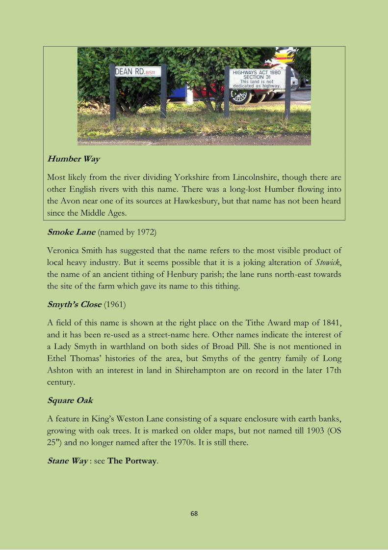
68
Humber Way
Most likely from the river dividing Yorkshire from Lincolnshire, though there are
other English rivers with this name. There was a long-lost Humber flowing into
the Avon near one of its sources at Hawkesbury, but that name has not been heard
since the Middle Ages.
Smoke Lane (named by 1972)
Veronica Smith has suggested that the name refers to the most visible product of
local heavy industry. But it seems possible that it is a joking alteration of Stowick,
the name of an ancient tithing of Henbury parish; the lane runs north-east towards
the site of the farm which gave its name to this tithing.
Smyth’s Close (1961)
A field of this name is shown at the right place on the Tithe Award map of 1841,
and it has been re-used as a street-name here. Other names indicate the interest of
a Lady Smyth in warthland on both sides of Broad Pill. She is not mentioned in
Ethel Thomas’ histories of the area, but Smyths of the gentry family of Long
Ashton with an interest in land in Shirehampton are on record in the later 17th
century.
Square Oak
A feature in King’s Weston Lane consisting of a square enclosure with earth banks,
growing with oak trees. It is marked on older maps, but not named till 1903 (OS
25") and no longer named after the 1970s. It is still there.
Stane Way : see The Portway.
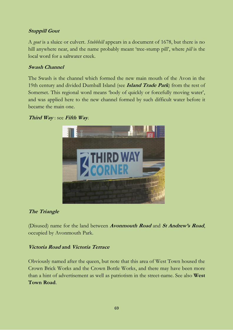
69
Stuppill Gout
A gout is a sluice or culvert. Stubbhill appears in a document of 1678, but there is no
hill anywhere near, and the name probably meant ‘tree-stump pill’, where pill is the
local word for a saltwater creek.
Swash Channel
The Swash is the channel which formed the new main mouth of the Avon in the
19th century and divided Dumball Island (see Island Trade Park) from the rest of
Somerset. This regional word means ‘body of quickly or forcefully moving water’,
and was applied here to the new channel formed by such difficult water before it
became the main one.
Third Way : see Fifth Way.
The Triangle
(Disused) name for the land between Avonmouth Road and St Andrew’s Road,
occupied by Avonmouth Park.
Victoria Road and Victoria Terrace
Obviously named after the queen, but note that this area of West Town housed the
Crown Brick Works and the Crown Bottle Works, and there may have been more
than a hint of advertisement as well as patriotism in the street-name. See also West
Town Road.
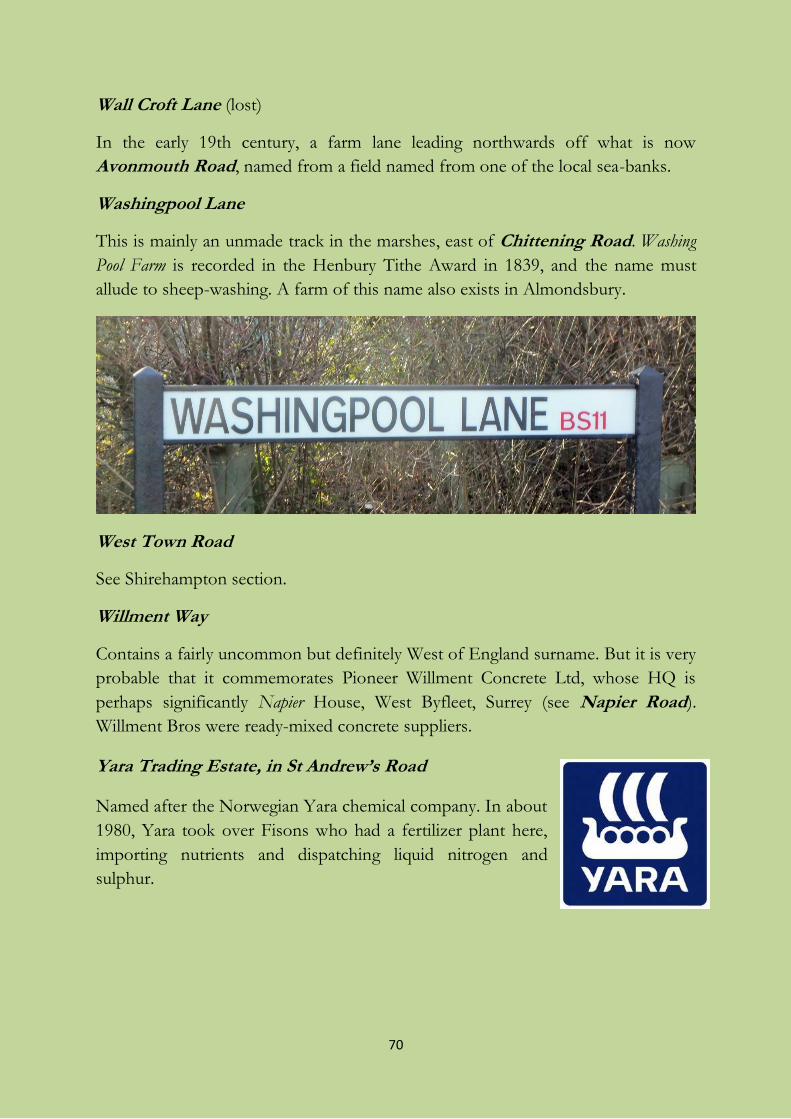
70
Wall Croft Lane (lost)
In the early 19th century, a farm lane leading northwards off what is now
Avonmouth Road, named from a field named from one of the local sea-banks.
Washingpool Lane
This is mainly an unmade track in the marshes, east of Chittening Road. Washing
Pool Farm is recorded in the Henbury Tithe Award in 1839, and the name must
allude to sheep-washing. A farm of this name also exists in Almondsbury.
West Town Road
See Shirehampton section.
Willment Way
Contains a fairly uncommon but definitely West of England surname. But it is very
probable that it commemorates Pioneer Willment Concrete Ltd, whose HQ is
perhaps significantly Napier House, West Byfleet, Surrey (see Napier Road).
Willment Bros were ready-mixed concrete suppliers.
Yara Trading Estate, in St Andrew’s Road
Named after the Norwegian Yara chemical company. In about
1980, Yara took over Fisons who had a fertilizer plant here,
importing nutrients and dispatching liquid nitrogen and
sulphur.
71
The street-names of the part of Lawrence Weston in
Avonmouth ward
(including some other interesting local names)
This area of the estate of Lawrence Weston was historically in the tithing of King’s
Weston in Henbury parish, not actually in the original Lawrence Weston which is
further north-east, centring on Lawrence Weston Road. The new estate was built
up on the south-east side of Long Cross first in the 1950s, and the flats north-west
of Long Cross from the 1970s. Most of its street-names are from around these
dates. Some of the smaller roads are later infills. It is locally known as El Dub.
Badenham Grove
Named after the family of Roger de Badenham, who was granted a manor at
King’s Weston by Henry III in 1222.
Bangrove Walk
I have not found any mention of Bangrove in old documents. There was a Banfield
and a Bangley Wood in the former Henbury parish, where Bangrove Walk was
situated, and that Banfield is used in a street-name elsewhere in Lawrence Weston.
If it is like the Bangrove in Teddington near Tewkesbury, it may be ‘berry wood’,
and the original pronunciation will have been “bane grove”; or it may actually be
copied from the Teddington name. Woodland near this site is marked on maps
throughout the period 1880-1970 until it disappears under sports fields and then
slip-roads for the M5/M49 junction.
Barrowmead Drive
From a field-name recorded in the Henbury parish enclosure award in 1822, Barrow
Mead, meaning ‘barrow or mound meadow’. The “barrow” or mound in question
must be The Tump.
72
Boon Villas
Named after the archaeologist George C. Boon. In 1948-50 he excavated the site
of the Roman villa whose foundations are exposed in Long Cross and which is
usually called King’s Weston Villa. The street-name is a double compliment.
Broxholme Walk
From a Lincolnshire surname. A man named John Broxholme, about whom
nothing else is known, was granted land in Lawrence Weston by Henry VIII in
1546.
Hallards Close
From a field- and orchard-name containing a surname, but the 19th-century
documents say Stallard rather than Hallard. The “St” does look rather like an “H”
in one clerk’s handwriting, but it really was Stallard and the current name is based
on a mistake. Stallard is well recorded in the Bristol area and Hallard is rarer.
Henacre Road
Appears to combine the names of the pre-war nearby fields Hencroft(s) and Nine
Acres, just beyond a small patch of moor where this street was built. Otherwise it
could be literally from a field called Henacre. I have found fields called Henacre in
old documents in other Gloucestershire villages, e.g. in Ham & Stone and
Minsterworth, but not here. Like Bangrove (Walk), the name seems to have been
copied from elsewhere in the county.
Hopewell Gardens
Hopewell is another field-name of 1822, possibly meaning ‘spring where hops were
found’; there is also a rare surname Hopewell , from the Nottingham area, which the
original field-name might include. There are two Old English words hop, meaning
‘enclosed valley’ and ‘enclosure in marshland’, but they do not apply here.
Humberstan Walk
From the surname (originating in the East Midlands) of Giles Humberstan, a 17th-
century resident of Henbury.
King’s Weston Lane : see Avonmouth section.
73
Long Cross
From a field-name, probably the same as the Long Croft ‘long houseplot and
enclosure’ recorded in 1803 and 1822. One copy of the 1822 document includes
Upper Long Cross along with Long Croft, and this clerk’s mistake must be the source
of the street-name.
Mancroft Avenue
From a field-name probably meaning ‘the plot/paddock used in common (i.e. by
everyone)’, recorded first in 1642. There was a field in Shirehampton with the
similar name Manlands on which no tithes were payable, presumably because it too
was used in common.
Middleton Road
This was built on land belonging to the manor of Bishop’s Stoke (i.e. Stoke
Bishop) in Westbury, which was inherited by Lord Middleton through the Smyths
of Ashton Court in the early 18th century.
Moor Grove and Moorend Gardens
These refer to the moor or marsh at the edge of which Lawrence Weston lies.
Moor Grove is recorded as woodland in 16th-century documents.
Playford Gardens
At least two poor women called Playford received charity from Westbury-on-Trym
parish in the 17th century. That does not look very relevant (the area was not in
Westbury), but H. C. W. Harris states that it is the source of the street-name, and
he probably suggested it, so we must believe him.
Sadlier Close (1966)
Commemorates the Tudor courtier and diplomat Sir Ralph Sadleir (as it is usually
spelt), who acquired a great deal of land in this area in the 1540s, including the
manors of Stoke Bishop, Henbury, Westbury and Shirehampton, after the
Dissolution of the Monasteries.
St Lawrence Court
After the saint of the long-vanished medieval leper hospital called St Lawrence’s
Hospital, near Lawford’s Gate, Bristol, which owned and gave its name to Lawrence
Weston and hence to this row of modern dwellings.
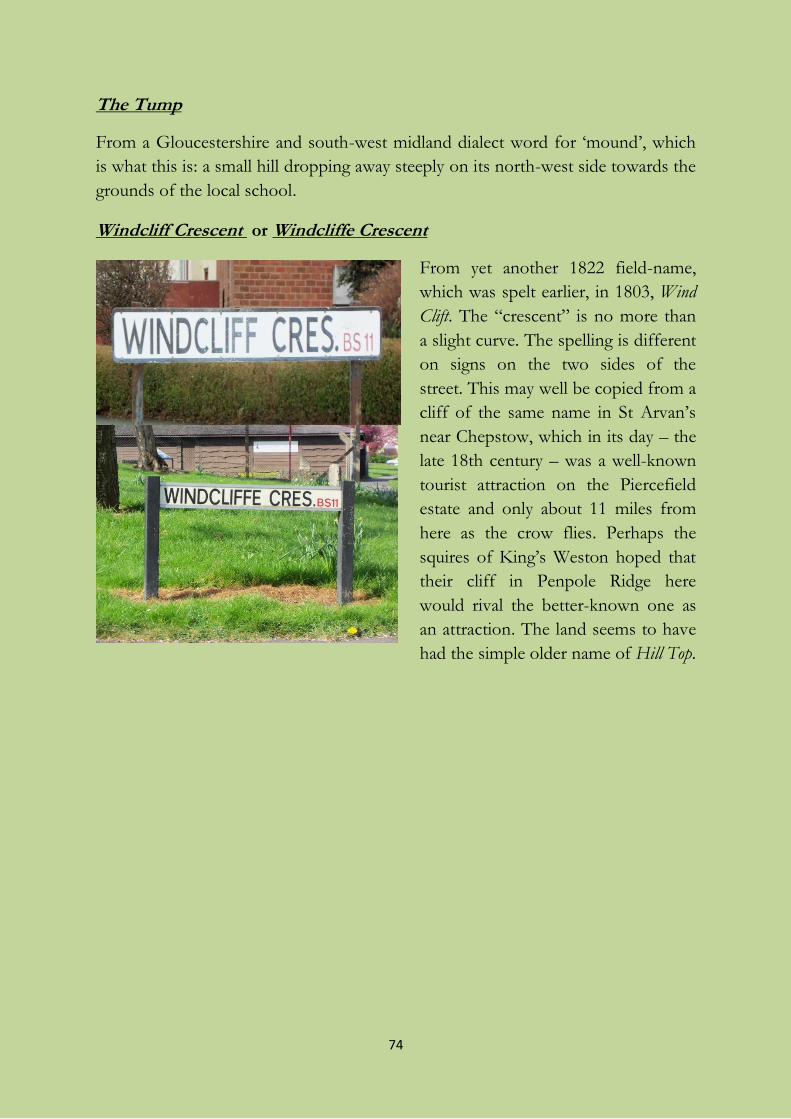
74
The Tump
From a Gloucestershire and south-west midland dialect word for ‘mound’, which
is what this is: a small hill dropping away steeply on its north-west side towards the
grounds of the local school.
Windcliff Crescent or Windcliffe Crescent
From yet another 1822 field-name,
which was spelt earlier, in 1803, Wind
Clift. The “crescent” is no more than
a slight curve. The spelling is different
on signs on the two sides of the
street. This may well be copied from a
cliff of the same name in St Arvan’s
near Chepstow, which in its day – the
late 18th century – was a well-known
tourist attraction on the Piercefield
estate and only about 11 miles from
here as the crow flies. Perhaps the
squires of King’s Weston hoped that
their cliff in Penpole Ridge here
would rival the better-known one as
an attraction. The land seems to have
had the simple older name of Hill Top.
75
Sources
Drafts of parts of this book were published as a series of articles in Shire newspaper
in most months from March 2008 to September 2009. The originals can be read
online via http://www.shire.org.uk. Some improvements have been made since
their first appearance.
All hyperlinks mentioned were successfully tested in August 2011, though some
sites are behind a paywall.
Paper and electronic publications (including items placed on the web after
paper publication)
Archer, Steve (2003 and updates) Surname atlas. CD-ROM. Dartford: Archer
Publications. [A mapping of the 1881 census data.]
Atkyns, [Sir] Robert (1712) The ancient and present state of Glostershire. London.
Barrett, William (1789) History and antiquities of the City of Bristol. Bristol: William
Pine.
Bettey, J. H. (2004, online 2009) Smyth family (per. c.1500–1680). Oxford Dictionary
of National Biography. Oxford: Oxford University Press, online at http://www.
oxforddnb.com/view/article/71874, accessed 28 January 2011.
Bigland, Ralph (1889), ed. Brian Frith (1995) Historical, monumental and genealogical
collections relative to the county of Gloucester, part 4: Uley-Yate, with introduction and
indexes. Bristol: Bristol and Gloucestershire Archaeological Society
(Gloucestershire records series 8). [Includes Westbury on Trym.]
Bone, Ian (2001) Community profile of Shirehampton, January 2001. Shirehampton:
Public Hall Community Association, online at http://hall.shire.org.uk/profile.htm,
accessed 19 July 2007.
Boon, George C. (1967) Kings Weston Roman Villa. Bristol: City of Bristol Museum
and Art Gallery. [Second edition 1976.]
76
Bristol & Avon Family History Society (undated) 1891 census index, vol. 2: Barton
Regis, Bristol North and East suburbs. CD-ROM. [Pieces 1987-1990 cover north-
west Bristol.]
Bristol City Council Planning Department (undated; 1977?) Shirehampton : a
conservation study. Bristol. [The brief history of the village is a disgrace.]
Bristol City Council (undated) Choosing a street name. In “Street naming and
numbering register”, available online at http://www.bristol.gov.uk/ccm
/navigation/housing/land-and-premises/street-naming-and-numbering-register/,
accessed 19 July 2010.
Bristol Mercury and Daily Post, 15/10/1881 [on wrecks in a storm at Avonmouth].
Bristol Times, weekly supplement of the Evening Post. [Contains images, reviews,
reminiscences and articles of historical interest not mentioned separately here.]
Butcher, E. E., ed. (1932) Bristol Corporation of the Poor, 1696-1834. Bristol: Bristol
Record Society (publication 3).
Byrne, Eugene (2011) Stolen Paradise: civilian squatters in military camps in and
around postwar Bristol. The Regional Historian: journal of The Regional History Centre,
University of the West of England, Bristol 23, 31-36 [including extracts from an
interview with Tom Kirk].
Chilcott, John (1849) Descriptive history of Bristol, 8th edn. Bristol: Chilcott, esp. 403-
405 and 416.
Coates, Richard (2007) South-West English dumball, dumble, dunball ‘pasture subject
to (occasional) tidal flooding’. Journal of the English Place-Name Society 39, 59-72.
Coates, Richard (2008) Correction to The place-names of Gloucestershire, vol. 3 (EPNS
Survey vol. 40). Journal of the English Place-Name Society 40, 129-130.
Dewer, Paul (1995) From Celtic gods to smugglers’ rum. Source (new series) 3, 17-
19. [About Bucklewell.]
Draper, Simon (forthcoming work on words in ancient place-names).
Farrell, S. M. (2004, online 2009) Herbert, George Augustus, eleventh earl of
Pembroke and eighth earl of Montgomery (1759–1827). Oxford Dictionary of
77
National Biography. Oxford: Oxford University Press, online at http://
www.oxforddnb.com/view/article/13026, accessed 23 December 2010.
Fisher, Janet, and Derek Fisher (1994) Shirehampton and Sea Mills on old postcards.
Bristol: Bygone Bristol.
Glass, Emily (2009) Archaeological watching brief of land at no. 38 Walton Road,
Shirehampton, Bristol, for Mr Philip Pinnell. Report No. 2060/2009. BHER No.
24645 Bristol: Bristol and Region Archaeological Services (report 24645), online at
http://ads.ahds.ac.uk/catalogue/adsdata/oasis_reports/bristola1/ahds/disseminat
ion/pdf/bristola1-49047_1.pdf, accessed 23 December 2010.
Gray, Les (1986) Down by the riverside. Published in Shire, March 2008, now on
the web at http://www.shire.org.uk/shire.php?edition=434. [Memoirs in two
parts.]
Green, John (2009) Bristol and the zinc industry. Newsletter of the Retired Professional
Engineers Club, Bristol (March), online at http://www.rpec.co.uk/news12.html,
accessed July 2009.
Hack, Ralph (1980) Penlea: a little history of an old house. Shire, January 1980.
Hack, Ralph (1998a) Building of the Public Hall. Shire, April 1998, now on the
web at http://www.shire.org.uk/index.php?page=building_public_hall, accessed
frequently. [Notes added on the web-page from other issues of Shire. There is also
a version at http://www.shirepubhall.org.uk/.]
Hack, Ralph (1998b) The Wordsworths in Shirehampton. Partially reprinted in
Shire, March 2009, now on the web at http://www.shire.org.uk/shire.php
?edition=446.
Hack, Ralph (1999, 2000) History of the George Inn. Shire, December 1999 and
February 2000, now on the web at http://www.shire.org.uk/index.php?page
=george_inn.
Hack, Ralph (2006) The Great War, Remount Camp 1914-1918. Shire, November
2006, now on the web at http://www.shire.org.uk/shire.php?edition=418.
Hanks, Nick (2007) Bewys Cross, the Bevis Stone and Sir Bevis of Hampton: an
exploration of possible connections. Bristol and Avon Archaeology 21, 87-90.
78
Harding, N. Dermott, ed. (1930) Bristol charters 1155-1373. Bristol: Bristol Record
Society (publication 1).
Harris H. C. W. (1969) Housing nomenclature in Bristol. Bristol: Bristol City Council
Housing Department. [See Harris also in Unpublished documents.]
Helme, Judy, and Sue Davies, eds (1999) A Mouthful of memories: an oral history of
Avonmouth. Privately published.
Helme, Judy, and Sue Davies, eds (2001) Another Mouthful of memories: an oral history
of Avonmouth. Privately published.
Helme, Judy (2004) Shirehampton Public Hall 1904-2004. Shirehampton:
Shirehampton Public Hall Committee.
Higgins, David H. (2002) The Anglo-Saxon charters of Stoke Bishop: a study of
the boundaries of Bisceopes stoc. Transactions of the Bristol and Gloucestershire
Archaeological Society 120, 107-131.
Higgins, David H. (2004) The Roman town of Abona and the Anglo-Saxon
charters of Stoke Bishop of AD 969 and 984. Bristol and Avon Archaeology 19, 75-86.
Hooper, Mike (2002) Shirehampton history. Shire, August 2002, now on the web at
http://www.shire.org.uk/shire.php?edition=367. [On the Garden Suburb.]
Hunt, J. M. (1990) Notes on the old stone crosses of the county of Avon. Avon
Past 15, 21-30. [Bewy’s Cross is depicted on the cover of this issue.]
Hunt, Stephen E. (2009) Yesterday’s tomorrow. Bristol’s garden suburbs. Bristol: Bristol
Radical History Group (pamphlet 8).
Johnson, James (1826) Transactions of the Corporation of the Poor, in the City of Bristol,
during a period of 126 years. Bristol: P. Rose [esp. 85-90 on the Shirehampton assets
of the Corporation].
Jordan, Spencer, Keith Ramsey and Matthew Woollard, compilers (1997) Abstract of
Bristol historical statistics, part 3: political representation and Bristol’s elections 1770-1997.
Bristol: University of the West of England. [Available in BRO, pamphlet 1693 (c).]
Latimer, John (1887) Annals of Bristol in the nineteenth century. Bristol: W. & F.
Morgan.
79
Lewis, Samuel, ed. (1848) A topographical dictionary of England, 7th edn. London: S.
Lewis & Co. [Also online at http://www.british-history.ac.uk/source.aspx ?pubid
=445, accessed frequently.]
Lomax, Frank, translator (1992) The antiquities of Glastonbury, by William of
Malmesbury. Llanerch: J.M.F. Books.
Macey, Mary (2009) Local people in street names. Shire, April 2009, now online at
http://www.shire.org.uk/shire.php?edition=447.
Maggs, Colin (undated [1975]) The Bristol Port Railway and Pier. Tarrant Hinton:
Oakwood Press (Oakwood Library 37).
Malpass, Peter, and Jennie Walmsley (2005) 100 years of council housing in Bristol.
Bristol: University of the West of England, Faculty of the Built Environment
Technical Report.
Mee, Arthur (1938) Gloucestershire. London: Hodder & Stoughton (The King’s
England).
Moore, John S. (1987) The Gloucestershire section of Domesday Book:
geographical problems of the text, part 1. Transactions of the Bristol and Gloucestershire
Archaeological Society 105, 109-32 [esp. 119-120, dealing with former opinions on
whether Chire in Domesday book is Shirehampton and crediting A.S. Ellis with the
correct solution].
Orme, Nicholas, and Jon Cannon, eds (2010) Westbury-on-Trym: Monastery, Minster
and College. Bristol: Bristol Record Society (publication 62).
Parsons, Richard (1988) The story of Kings [i.e. C. J. King and Sons Ltd, tugboat
company.] Bristol: White Tree Books.
Robertson, J. Drummond, ed. Lord Moreton (1890) Glossary of dialect and archaic
words used in the county of Gloucester. London: Kegan, Paul, Trench, Trübner, for
English Dialect Society (publication 61).
Rudder, Samuel (1779) A new history of Gloucestershire. Privately published. [Revision
of Atkyns (1712).]
Sawyer, P. H., editor (1968) Anglo-Saxon charters: an annotated list and bibliography.
London: Royal Historical Society. [Relevant for Shirehampton and Stoke Bishop
are document 218: British Library manuscript Cotton Tiberius A. xiii, folio 51v;
80
document 1317: British Library manuscript Cotton Tiberius A. xiii, folio 58rv;
document 1346: British Library manuscript Cotton Tiberius A. xiii, folios 57-58.
Revised edn now online at http://www.esawyer.org.uk, accessed frequently.]
Seyer, Samuel (1821, 1823) Memoirs historical and topographical of Bristol and its
neighbourhood, 2 vols. Bristol.
Shire, and Shire on the Web at http://www.shire.org.uk/. [Community newspaper.
Contains reminiscences and articles of historical interest apart from those
mentioned separately here.]
Skilleter, Keith J. (undated) Bristol’s garden suburbs: a history of housing reform,
town planning and the Corporation’s ‘cottage estates’ 1890-1939. Unpublished.
Smith, A. H. (1964) The place-names of Gloucestershire, vol. 3. Cambridge: Cambridge
University Press (Survey of English Place-Names vol. 40). [Note that Smith
mistakenly places Shirehampton in Henbury rather than in Westbury-on-Trym; see
Coates (2008) above.]
Smith, Veronica (2002) The street names of Bristol, 2nd edn. Bristol: Broadcast Books
“A solicitor” (1839) The benevolent madman (from “Curiosities of legal
experience”), anecdote in diary form, dates in “July”. Journal of Belles Lettres,
supplement to Waldie’s Select Circulating Library 14 (2).23-25 (3, 10, 17 December
1839), and previously in The Albion (October 1839). Available online through
Google Books. [Contains early mentions of events in Shirehampton centring on
Walton House by The Green.]
Sturge, Elizabeth, and Frederick A.S. Goodbody (1909) A garden suburb for Bristol.
Letchworth: Letchworth Garden City Press. [Promotional pamphlet.]
Taylor, C. S. (1913) Note on the entry in Domesday Book relating to Westbury-on-
Severn. Transactions of the Bristol and Gloucestershire Archaeological Society 36, 182-190.
Thomas, Ethel, ed. D. Archer (1977) The Avonmouth story. Dursley: Archer.
Thomas, Ethel (1981) Down the ’Mouth. Privately published.
Thomas, Ethel (1989) War story. Privately published. [The Second World War as it
affected Avonmouth.]
Thomas, Ethel (1993) Shirehampton story, 2nd edn. Privately published.
81
Thomas, Ethel (2002) The continuing story of Shirehampton. Privately published.
Thompson Smith, Angela (2006) Shire. Baltimore, MD: PublishAmerica.
Vincent, Mike (1979) Lines to Avonmouth. Oxford: Oxford Publishing Co.
Watts, Victor (2004) Cambridge dictionary of English place-names. Cambridge:
Cambridge University Press.
Wells, Charles (1909) A short history of the Port of Bristol. Bristol: J.W. Arrowsmith
and London: Simpkin, Marshall.
Wheeler, Anthony W. (1968 and other editions) The story of St Mary’s church,
Shirehampton. Privately published.
Wigan, Eve (1932) Portishead parish history. Taunton: Barnicott and Pearce, The
Wessex Press.
Wildwood, Annie (1995) The Source: Bristol Springs & Wells Group. Source (new
series) 4. Online at http://people.bath.ac.uk/liskmj/living-spring/sourcearchive
/ns4/ns4aw1.htm, accessed 22 December 2010.
Wilkins, H. J., ed. (1909) Transcription of the 'Poor Book' of the tithings of Westbury-on-
Trym, Stoke Bishop and Shirehampton from A.D. 1656-1698. Bristol: Arrowsmith.
Wilkins, H. J. (1920) The perambulation of the boundaries of the ancient parish of Westbury-
on-Trym in May, 1803. [Bound with other material, including Marmont’s map of
Henbury parish (1831).] Bristol: Arrowsmith.
[Wilkins also published other small pamphlets about historical documents of
Henbury and Westbury.]
Williams, Wadham Pigott, and William Arthur Jones (1873) A glossary of provincial
words and phrases in use in Somersetshire. Online at http://www.dr-
belair.com/Languages/English/Patois/Provincial-words-Pigott.htm, accessed 21
December 2010.
Winstone, Reece (1977) Bristol’s suburbs in the ’20s and ’30s. Privately published.
[Esp. images 3-27.]
Winstone, Reece (1985) Bristol’s suburbs long ago. Privately published. [Esp. images 4-
32 and 512.]
82
[Others of Winstone’s many picture-books have occasional historic photos
of Avonmouth and Shirehampton.]
Wood, James G. (1903, published 1905) The ‘Anthony Post’ at Avonmouth.
Transactions of the Woolhope Naturalists’ Field Club, 196-197.
Wreford, J.K.R. (1854) Curiosities of Bristol and its neighbourhood. Bristol: M. Mathews.
[Reprinted Stroud: The History Press (2010).]
Unpublished original documents
Bristol Record Office (BRO), catalogue at http://archives.bristol.gov.uk/dserve/,
especially the following documents or document groups:
scattered documents about Shirehampton chapel/parish church;
St Michael on the Mount Without parish, Bristol; BRO document references
P.St M/CH/21/a-b and AC/WO/12/85, dealing with land at
Shirehampton; also P.St M/D/1/l;
17th- and 18th-century personal documents , BRO document references
AC/WO/12 in the sequence beginning AC/WO/12/10 and esp.
AC/WO/12/30 onwards (Ashton Court archive);
scattered documents about St Peter’s Hospital (a.k.a. The Mint);
Westbury-on-Trym enclosure act (1811), BRO document reference
12151/175 (a Miles document);
Henbury and Westbury-on-Trym enclosure award, BRO document reference
40597/1; also Westbury enclosure map (1822), BRO 37959/40; and
Westbury enclosure map and extracts from award dealing with various rates
([1814] 1822), BRO P.Hen/SD/7;
Shirehampton Tithe Award (1840-1, with map), bishop’s copy, BRO
document reference EP/A/32/34;
Henbury Tithe Award (1841, with map), bishop’s copy, BRO document
reference EP/A/32/22;
lease of Dunball Island (1862), BRO document reference 32173/68;
various documents about Avonmouth docks and church;
Shirehampton Garden Suburb prospectus (1909), BRO document reference
MS BristolPlans/numbered/62; see also BristolPlans/arranged/116 (1911);
83
Barton Regis Rural District Council: Shirehampton Parish Council minute
books, 1894-1903, BRO document reference 05042;
various documents of The [City] Engineer’s Department, highway adoption
notices;
housing records, schedule by area of council houses built under the Housing
Act (1925), BRO document reference 42098/1/4, 604-614;
records of the Miles family, BRO document collection reference 12151, esp.
/94-/239;
note also: Harris, H. C. W. (c.1969) “Notebook compiled by the author of
Housing Nomenclature in Bristol, H.C.W. Harris, 1969 relating to work
done for that volume”, BRO document reference 40702;
the Ethel Thomas Avonmouth collection (uncatalogued and not fully
available to the public), BRO document reference 42242/1.
Gloucestershire Archives (GA), catalogue available online at
http://ww3.gloucestershire.gov.uk/DServe/DServe.exe?dsqApp=Archive&dsqC
md=Index.tcl, especially the following documents or document groups:
lease of Avenhouse (1679), GA document reference D2957/329/142;
Westbury enclosure award, with map (1822), GA document reference
Q/RI/154;
messuages and gardens at Park Place, Shirehampton, GA document
reference D1606/Box 22/Bundle 3;
papers relating to sale of King’s Weston estate, GA document reference
D1405/4/137.
Somerset Record Office (SRO), catalogue available online at
http://www1.somerset.gov.uk/archives/Catalogs.htm, especially the following
documents or document groups:
Gore family accounts, SRO document reference DD\GB/152/54 [note of
Broad Pill].
The National Archives (TNA) at Kew, catalogue available online at
http://www.nationalarchives.gov.uk/, search on Shirehampton:
84
note especially TNA chancery document C 131/44/10 (1394) referring to
John Weston of Shernyhampton;
Shirehampton Remount Depot: document WO95/69 Branches and
Services, Director of Remounts, 1914 August-1916 December;
many documents in BRO are also indexed and summarized on TNA web-
site.
For all of BRO, GA, SRO, and TNA, details are accessible online using Access to
Archives, http://www.nationalarchives.gov.uk/a2a/.
A few documents used are in the writer’s possession, in other private hands, or
cited or reproduced in other publications:
perambulations of the boundaries of Westbury-on-Trym, 1790 and 1803,
reproduced in Wilkins (1920);
Shirehampton rate books, 1797 and 1800;
Baron, François (1823-99) “Recollections of my early days and sketches of
village life”, extracts taken by Alison Mary Stanes;
Bristol City Council (no date; after 1984) “Background information on the
Avonmouth area”, an internal document of the Monitoring and Research
Section of the Council’s Environmental Health Department.
Maps, published and unpublished
1769 Benjamin Donn’s map of the country 11 miles round the City of
Bristol, copy displayed in the Bolland Library, University of the West of
England;
1772 Shirehampton, by Isaac Taylor, reproduced in Glass (2009), also in
next;
1772 maps of Southwell family estates, by Isaac Taylor, Bristol Record
Office document reference 26570, unpublished;
1817-1830 Ordnance Survey 1" old series sheets, reprojected and published
by Cassini (2007) as “Bristol and Bath”, matching Landranger sheet 172;
1822 Enclosure Award maps: see Unpublished documents above;
1831 Henbury parish, by J. Marmont, reproduced in Wilkins (1920);
85
1841 Shirehampton Tithe Award map, with schedule including field-names,
bishop’s copy, Bristol Record Office document reference EP/A/32/34,
unpublished;
1863 plan of route of Bristol Port and Pier Railway, Bristol Record Office
document reference SMV/6/4/10/9, unpublished;
1979 H. A. Lane’s map (not an exact copy) derived from the Tithe Award
Map with field names, appearing as the endpapers of Thomas’s book The
continuing story of Shirehampton (2002);
2006 A-Z Premier street-map of Bristol, 8th edn;
2008 Bristol City Council Avonmouth polling districts, online at
http://www.bristol.gov.uk/WardFinder/pdfs/avonmouthmap-high.pdf;
note that all areas marked except C and the most northerly parts of A are
part of ancient Shirehampton and Avonmouth.
Many old Ordnance Survey (OS) maps referred to in the text, especially at 6" to
the mile and 25" to the mile in various editions, have been accessed online using:
Old-Maps, http://www.old-maps.co.uk/maps.html.
Current maps showing most of the streets mentioned can be conveniently viewed
using:
Streetmap, http://www.streetmap.co.uk/.
Some of these maps, along with others, and with aerial photos, are available on the
ambitious and informative new historical web-site “Bristol: Know Your Place”,
http://maps.bristol.gov.uk/knowyourplace/ (2013), which also includes user-
provided local information and images.
Other web-pages
http://www.shire.org.uk/index.php?page=history (contains articles of
historical interest by Ralph Hack, David Hoey, Kate Pollard, and Ethel
Thomas);
http://www.locallearning.org.uk/Avonmouth/streets.html (small item on
local names);
http://www.dalmura.com.au/genealogy/Willington/ (on Willington
/Wellington family history);
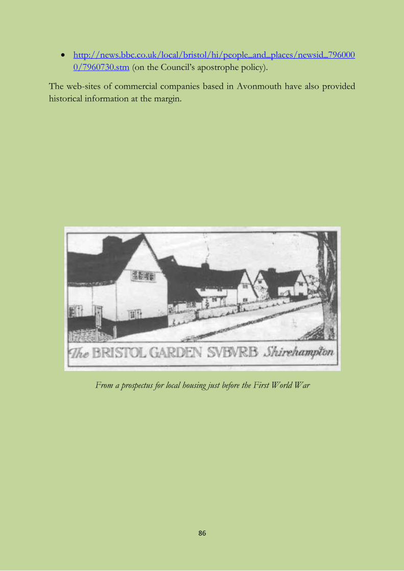
86
http://news.bbc.co.uk/local/bristol/hi/people_and_places/newsid_796000
0/7960730.stm (on the Council’s apostrophe policy).
The web-sites of commercial companies based in Avonmouth have also provided
historical information at the margin.
From a prospectus for local housing just before the First World War
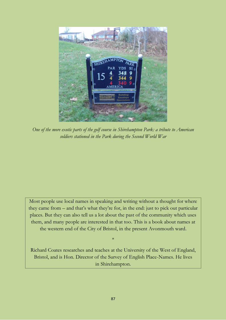
87
One of the more exotic parts of the golf course in Shirehampton Park: a tribute to American
soldiers stationed in the Park during the Second World War
Most people use local names in speaking and writing without a thought for where
they came from – and that’s what they’re for, in the end: just to pick out particular
places. But they can also tell us a lot about the past of the community which uses
them, and many people are interested in that too. This is a book about names at
the western end of the City of Bristol, in the present Avonmouth ward.
*
Richard Coates researches and teaches at the University of the West of England,
Bristol, and is Hon. Director of the Survey of English Place-Names. He lives
in Shirehampton.