Embed Size (px)
Citation preview
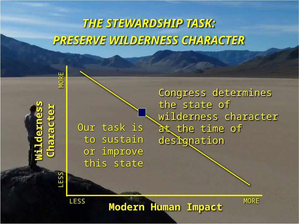
THE STEWARDSHIP TASK:
PRESERVE WILDERNESS CHARACTER
Modern Human Impact
Wil
der
nes
s C
har
acte
r
MORELESS
MO
RE
LES
S
Congress determines the state of wilderness character at the time of designation
Our task is to sustain or
improve this state
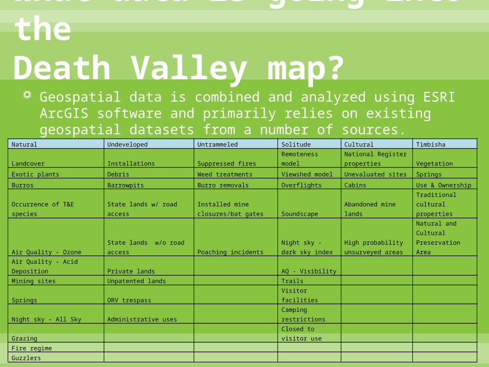
What data is going into the Death Valley map? Geospatial data is combined and analyzed using ESRI ArcGIS
software and primarily relies on existing geospatial datasets from a number of sources.
Natural Undeveloped Untrammeled Solitude Cultural Timbisha
Landcover Installations Suppressed fires Remoteness modelNational Register properties Vegetation
Exotic plants Debris Weed treatments Viewshed model Unevaluated sites Springs
Burros Barrowpits Burro removals Overflights Cabins Use & Ownership
Occurrence of T&E species State lands w/ road accessInstalled mine closures/bat gates Soundscape Abandoned mine lands
Traditional cultural properties
Air Quality - Ozone State lands w/o road access Poaching incidentsNight sky - dark sky index
High probability unsurveyed areas
Natural and Cultural Preservation Area
Air Quality - Acid Deposition Private lands AQ - Visibility
Mining sites Unpatented lands Trails
Springs ORV trespass Visitor facilities
Night sky – All Sky Administrative uses Camping restrictions
Grazing Closed to visitor use
Fire regime
Guzzlers