Embed Size (px)
Citation preview
The Route of the Castelli Walk
(or at least, my approximation to it, updated 2017)
Bishop Paul Hendricks
With the help of the sat-nav I can give names to the roads, which is an improvement on what we had in my time. It may also be useful to use it to put in a few distances for the various stages.
For those familiar with Palazzola, the path to Rocca di Papa is obviously well known. There are just two comments I'd make. Firstly, when I did the walk in 2008 I found I had to go up to the top of the drive, coming out of Palazzola, and around a couple of rather nasty bends in the Via dei Laghi. When Iwas a student there was a path through the woods that cut off the corner, but it became blocked when awood-yard was set up at that point on the road. When Iwalked back from Rocca one afternoon in 2017, I found thatthe old path was once more quite passable, even though alittle overgrown here and there. You may like to check it outand see if you'd prefer this to going around by the road.
My second comment is that I've always found the finalclimb up the road as you approach Rocca di Papa a bit of akiller. You think, ‘I’ve got another thirty-odd miles to goand I’m already knackered!’ I just mention this so that, ifanyone else has this experience, they’ll know they’re not theonly ones! The sat-nav gives Palazzola to Rocca as about1.7 miles.
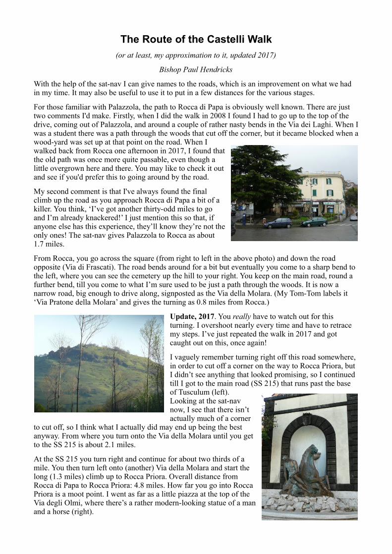
From Rocca, you go across the square (from right to left in the above photo) and down the road opposite (Via di Frascati). The road bends around for a bit but eventually you come to a sharp bend to the left, where you can see the cemetery up the hill to your right. You keep on the main road, round a further bend, till you come to what I’m sure used to be just a path through the woods. It is now a narrow road, big enough to drive along, signposted as the Via della Molara. (My Tom-Tom labels it ‘Via Pratone della Molara’ and gives the turning as 0.8 miles from Rocca.)
Update, 2017. You really have to watch out for this turning. I overshoot nearly every time and have to retrace my steps. I’ve just repeated the walk in 2017 and got caught out on this, once again!
I vaguely remember turning right off this road somewhere, in order to cut off a corner on the way to Rocca Priora, but I didn’t see anything that looked promising, so I continued till I got to the main road (SS 215) that runs past the base of Tusculum (left).Looking at the sat-navnow, I see that there isn’tactually much of a corner
to cut off, so I think what I actually did may end up being the bestanyway. From where you turn onto the Via della Molara until you getto the SS 215 is about 2.1 miles.
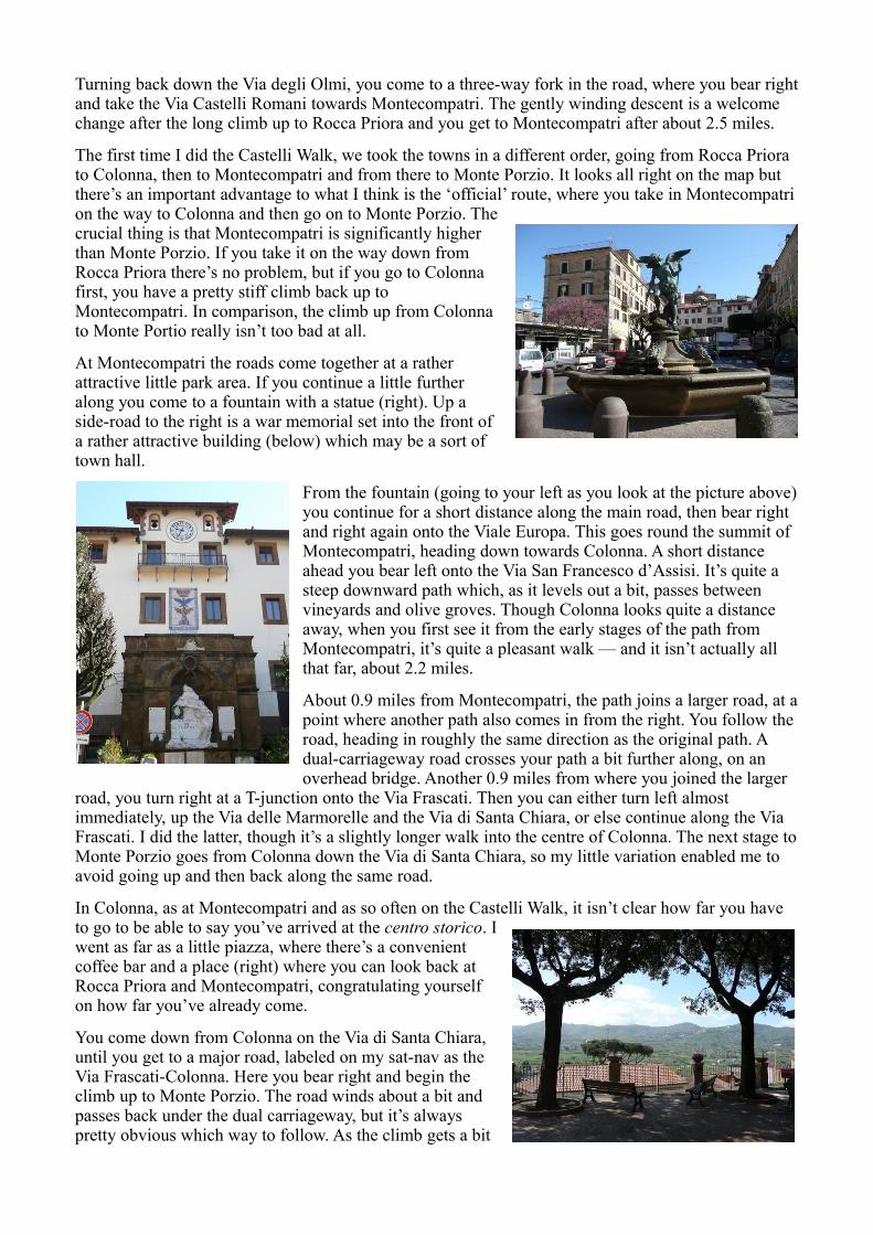
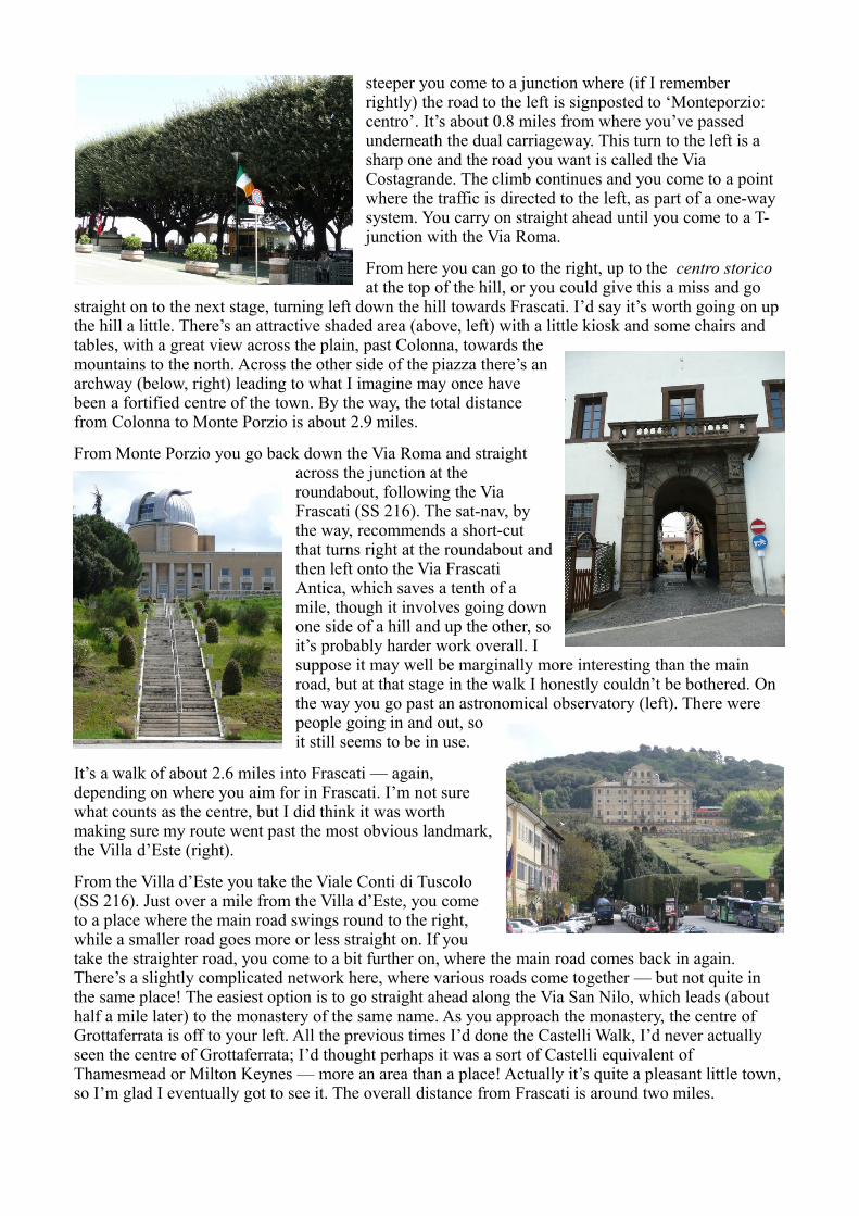
At the SS 215 you turn right and continue for about two thirds of amile. You then turn left onto (another) Via della Molara and start thelong (1.3 miles) climb up to Rocca Priora. Overall distance fromRocca di Papa to Rocca Priora: 4.8 miles. How far you go into RoccaPriora is a moot point. I went as far as a little piazza at the top of theVia degli Olmi, where there’s a rather modern-looking statue of a manand a horse (right).
Turning back down the Via degli Olmi, you come to a three-way fork in the road, where you bear rightand take the Via Castelli Romani towards Montecompatri. The gently winding descent is a welcome change after the long climb up to Rocca Priora and you get to Montecompatri after about 2.5 miles.
The first time I did the Castelli Walk, we took the towns in a different order, going from Rocca Priora to Colonna, then to Montecompatri and from there to Monte Porzio. It looks all right on the map but there’s an important advantage to what I think is the ‘official’ route, where you take in Montecompatrion the way to Colonna and then go on to Monte Porzio. Thecrucial thing is that Montecompatri is significantly higherthan Monte Porzio. If you take it on the way down fromRocca Priora there’s no problem, but if you go to Colonnafirst, you have a pretty stiff climb back up toMontecompatri. In comparison, the climb up from Colonnato Monte Portio really isn’t too bad at all.
At Montecompatri the roads come together at a ratherattractive little park area. If you continue a little furtheralong you come to a fountain with a statue (right). Up aside-road to the right is a war memorial set into the front ofa rather attractive building (below) which may be a sort oftown hall.
From the fountain (going to your left as you look at the picture above)you continue for a short distance along the main road, then bear right and right again onto the Viale Europa. This goes round the summit of Montecompatri, heading down towards Colonna. A short distance ahead you bear left onto the Via San Francesco d’Assisi. It’s quite a steep downward path which, as it levels out a bit, passes between vineyards and olive groves. Though Colonna looks quite a distance away, when you first see it from the early stages of the path from Montecompatri, it’s quite a pleasant walk — and it isn’t actually all that far, about 2.2 miles.
About 0.9 miles from Montecompatri, the path joins a larger road, at apoint where another path also comes in from the right. You follow the road, heading in roughly the same direction as the original path. A dual-carriageway road crosses your path a bit further along, on an overhead bridge. Another 0.9 miles from where you joined the larger
road, you turn right at a T-junction onto the Via Frascati. Then you can either turn left almost immediately, up the Via delle Marmorelle and the Via di Santa Chiara, or else continue along the Via Frascati. I did the latter, though it’s a slightly longer walk into the centre of Colonna. The next stage toMonte Porzio goes from Colonna down the Via di Santa Chiara, so my little variation enabled me to avoid going up and then back along the same road.
In Colonna, as at Montecompatri and as so often on the Castelli Walk, it isn’t clear how far you have to go to be able to say you’ve arrived at the centro storico. Iwent as far as a little piazza, where there’s a convenientcoffee bar and a place (right) where you can look back atRocca Priora and Montecompatri, congratulating yourselfon how far you’ve already come.
You come down from Colonna on the Via di Santa Chiara,until you get to a major road, labeled on my sat-nav as theVia Frascati-Colonna. Here you bear right and begin theclimb up to Monte Porzio. The road winds about a bit andpasses back under the dual carriageway, but it’s alwayspretty obvious which way to follow. As the climb gets a bit
steeper you come to a junction where (if I remember rightly) the road to the left is signposted to ‘Monteporzio: centro’. It’s about 0.8 miles from where you’ve passed underneath the dual carriageway. This turn to the left is a sharp one and the road you want is called the Via Costagrande. The climb continues and you come to a point where the traffic is directed to the left, as part of a one-way system. You carry on straight ahead until you come to a T-junction with the Via Roma.
From here you can go to the right, up to the centro storico at the top of the hill, or you could give this a miss and go
straight on to the next stage, turning left down the hill towards Frascati. I’d say it’s worth going on up the hill a little. There’s an attractive shaded area (above, left) with a little kiosk and some chairs and tables, with a great view across the plain, past Colonna, towards themountains to the north. Across the other side of the piazza there’s anarchway (below, right) leading to what I imagine may once havebeen a fortified centre of the town. By the way, the total distancefrom Colonna to Monte Porzio is about 2.9 miles.
From Monte Porzio you go back down the Via Roma and straightacross the junction at theroundabout, following the ViaFrascati (SS 216). The sat-nav, bythe way, recommends a short-cutthat turns right at the roundabout andthen left onto the Via FrascatiAntica, which saves a tenth of amile, though it involves going downone side of a hill and up the other, soit’s probably harder work overall. Isuppose it may well be marginally more interesting than the main road, but at that stage in the walk I honestly couldn’t be bothered. On the way you go past an astronomical observatory (left). There were people going in and out, soit still seems to be in use.
It’s a walk of about 2.6 miles into Frascati — again,depending on where you aim for in Frascati. I’m not surewhat counts as the centre, but I did think it was worthmaking sure my route went past the most obvious landmark,the Villa d’Este (right).
From the Villa d’Este you take the Viale Conti di Tuscolo(SS 216). Just over a mile from the Villa d’Este, you cometo a place where the main road swings round to the right,while a smaller road goes more or less straight on. If youtake the straighter road, you come to a bit further on, where the main road comes back in again. There’s a slightly complicated network here, where various roads come together — but not quite in the same place! The easiest option is to go straight ahead along the Via San Nilo, which leads (about half a mile later) to the monastery of the same name. As you approach the monastery, the centre of Grottaferrata is off to your left. All the previous times I’d done the Castelli Walk, I’d never actually seen the centre of Grottaferrata; I’d thought perhaps it was a sort of Castelli equivalent of Thamesmead or Milton Keynes — more an area than a place! Actually it’s quite a pleasant little town, so I’m glad I eventually got to see it. The overall distance from Frascati is around two miles.
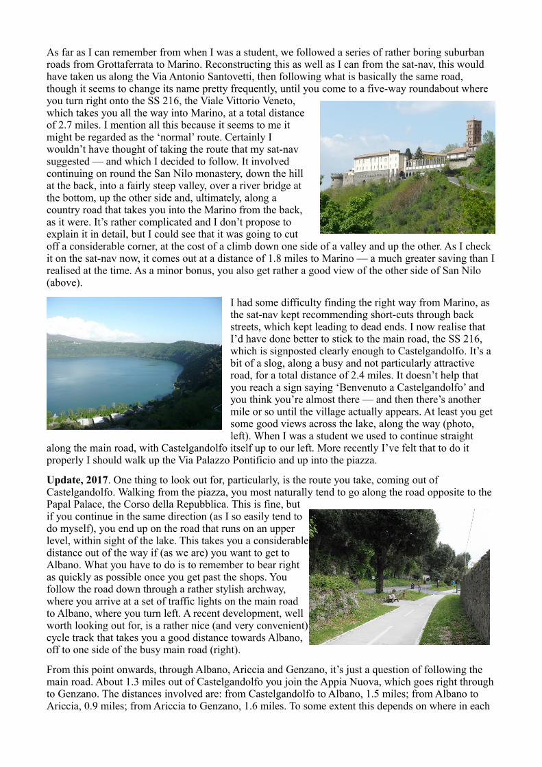
As far as I can remember from when I was a student, we followed a series of rather boring suburban roads from Grottaferrata to Marino. Reconstructing this as well as I can from the sat-nav, this would have taken us along the Via Antonio Santovetti, then following what is basically the same road, though it seems to change its name pretty frequently, until you come to a five-way roundabout where you turn right onto the SS 216, the Viale Vittorio Veneto,which takes you all the way into Marino, at a total distanceof 2.7 miles. I mention all this because it seems to me itmight be regarded as the ‘normal’ route. Certainly Iwouldn’t have thought of taking the route that my sat-navsuggested — and which I decided to follow. It involvedcontinuing on round the San Nilo monastery, down the hillat the back, into a fairly steep valley, over a river bridge atthe bottom, up the other side and, ultimately, along acountry road that takes you into the Marino from the back,as it were. It’s rather complicated and I don’t propose toexplain it in detail, but I could see that it was going to cutoff a considerable corner, at the cost of a climb down one side of a valley and up the other. As I check it on the sat-nav now, it comes out at a distance of 1.8 miles to Marino — a much greater saving than Irealised at the time. As a minor bonus, you also get rather a good view of the other side of San Nilo (above).
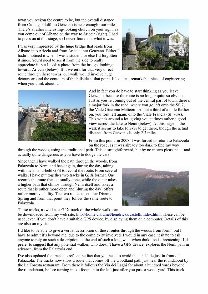
I had some difficulty finding the right way from Marino, as the sat-nav kept recommending short-cuts through back streets, which kept leading to dead ends. I now realise that I’d have done better to stick to the main road, the SS 216, which is signposted clearly enough to Castelgandolfo. It’s a bit of a slog, along a busy and not particularly attractive road, for a total distance of 2.4 miles. It doesn’t help that you reach a sign saying ‘Benvenuto a Castelgandolfo’ and you think you’re almost there — and then there’s another mile or so until the village actually appears. At least you get some good views across the lake, along the way (photo, left). When I was a student we used to continue straight
along the main road, with Castelgandolfo itself up to our left. More recently I’ve felt that to do it properly I should walk up the Via Palazzo Pontificio and up into the piazza.
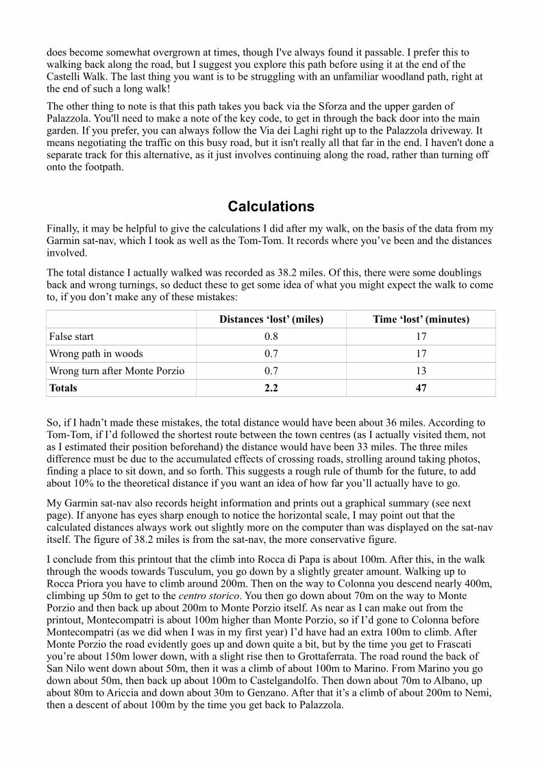
Update, 2017. One thing to look out for, particularly, is the route you take, coming out of Castelgandolfo. Walking from the piazza, you most naturally tend to go along the road opposite to the Papal Palace, the Corso della Repubblica. This is fine, butif you continue in the same direction (as I so easily tend todo myself), you end up on the road that runs on an upperlevel, within sight of the lake. This takes you a considerabledistance out of the way if (as we are) you want to get toAlbano. What you have to do is to remember to bear rightas quickly as possible once you get past the shops. Youfollow the road down through a rather stylish archway,where you arrive at a set of traffic lights on the main roadto Albano, where you turn left. A recent development, wellworth looking out for, is a rather nice (and very convenient)cycle track that takes you a good distance towards Albano,off to one side of the busy main road (right).
From this point onwards, through Albano, Ariccia and Genzano, it’s just a question of following the main road. About 1.3 miles out of Castelgandolfo you join the Appia Nuova, which goes right throughto Genzano. The distances involved are: from Castelgandolfo to Albano, 1.5 miles; from Albano to Ariccia, 0.9 miles; from Ariccia to Genzano, 1.6 miles. To some extent this depends on where in each
town you reckon the centre to be, but the overall distancefrom Castelgandolfo to Genzano is near enough four miles.There’s a rather interesting-looking church on your right, asyou come out of Albano on the way to Ariccia (right). I hadto press on at this stage, so I never found out what it was.
I was very impressed by the huge bridge that leads fromAlbano into Ariccia and from Ariccia into Genzano. Either Ihadn’t noticed it when I was a student, or else I’d forgottenit since. You’d need to see it from the side to reallyappreciate it, but I took a photo from the bridge, lookingtowards Ariccia (below). If it weren’t for that very directroute through these towns, our walk would involve hugedetours around the contours of the hillside at that point. It’s quite a remarkable piece of engineering when you think about it.
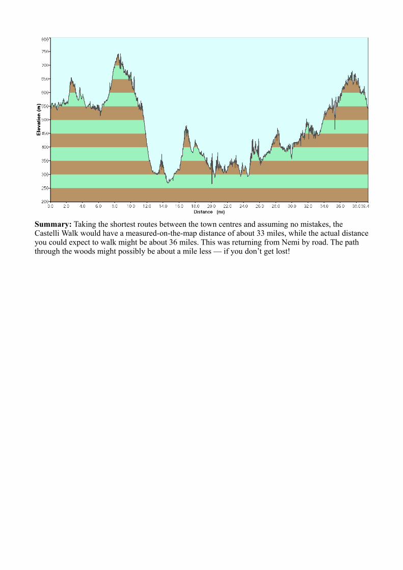
And in fact you do have to start thinking as you leave Genzano, because the route is no longer quite so obvious. Just as you’re coming out of the central part of town, there’sa major fork in the road, where you go left onto the SS 7, the Viale Giacomo Matteotti. About a third of a mile further on, you fork left again, onto the Viale Francia (SP 76A). This winds around a lot, giving you at times rather a good view across the lake to Nemi (below). At this stage in the walk it seems to take forever to get there, though the actual distance from Genzano is only 2.7 miles.
From this point, in 2008, I was forced to return to Palazzola on the road, as it was already too dark to find my way
through the woods, using the traditional path. This is straightforward, but by no means pleasant — andactually quite dangerous as you have to dodge the cars!
Since then I have walked the path through the woods, fromPalazzola to Nemi and back again, during the day, takingwith me a hand-held GPS to record the route. From severalwalks, I have put together two tracks in GPX format. Onerecords the route that is usually done, while the other takesa higher path that climbs through Nemi itself and takes aroute that is rather more open and (during the day) offersrather more visibility. The two routes meet near Diana'sSpring and from that point they follow the same route toPalazzola.
These tracks, as well as a GPX track of the whole walk, canbe downloaded from my web site: http://home.clara.net/hendricks/castelli/index.html. These can be used, even if you don’t have a suitable GPS device, by displaying them on a computer. Details of this are also on my site.
I’d like to be able to give a verbal description of these routes through the woods from Nemi, but I have to admit it’s beyond me, due to the complexity involved. I would in any case hesitate to ask anyone to rely on such a description, at the end of such a long walk when darkness is threatening! I’d prefer to suggest that any potential walker, who doesn’t have a GPS device, explores the Nemi path in advance, from the Palazzola end.
I've also updated the tracks to reflect the fact that you need to avoid the landslide just in front of Palazzola. The tracks now show a route that comes off the woodland path just near the roundabout by the La Foresta restaurant. From there it follows the Via dei Laghi for about a hundred yards beyond the roundabout, before turning into a footpath to the left just after you pass a wood-yard. This track
does become somewhat overgrown at times, though I've always found it passable. I prefer this to walking back along the road, but I suggest you explore this path before using it at the end of the Castelli Walk. The last thing you want is to be struggling with an unfamiliar woodland path, right at the end of such a long walk!
The other thing to note is that this path takes you back via the Sforza and the upper garden of Palazzola. You'll need to make a note of the key code, to get in through the back door into the main garden. If you prefer, you can always follow the Via dei Laghi right up to the Palazzola driveway. It means negotiating the traffic on this busy road, but it isn't really all that far in the end. I haven't done aseparate track for this alternative, as it just involves continuing along the road, rather than turning off onto the footpath.
Calculations
Finally, it may be helpful to give the calculations I did after my walk, on the basis of the data from myGarmin sat-nav, which I took as well as the Tom-Tom. It records where you’ve been and the distances involved.
The total distance I actually walked was recorded as 38.2 miles. Of this, there were some doublings back and wrong turnings, so deduct these to get some idea of what you might expect the walk to cometo, if you don’t make any of these mistakes:
Distances ‘lost’ (miles) Time ‘lost’ (minutes)
False start 0.8 17
Wrong path in woods 0.7 17
Wrong turn after Monte Porzio 0.7 13
Totals 2.2 47
So, if I hadn’t made these mistakes, the total distance would have been about 36 miles. According to Tom-Tom, if I’d followed the shortest route between the town centres (as I actually visited them, not as I estimated their position beforehand) the distance would have been 33 miles. The three miles difference must be due to the accumulated effects of crossing roads, strolling around taking photos, finding a place to sit down, and so forth. This suggests a rough rule of thumb for the future, to add about 10% to the theoretical distance if you want an idea of how far you’ll actually have to go.
My Garmin sat-nav also records height information and prints out a graphical summary (see next page). If anyone has eyes sharp enough to notice the horizontal scale, I may point out that the calculated distances always work out slightly more on the computer than was displayed on the sat-nav itself. The figure of 38.2 miles is from the sat-nav, the more conservative figure.
I conclude from this printout that the climb into Rocca di Papa is about 100m. After this, in the walk through the woods towards Tusculum, you go down by a slightly greater amount. Walking up to Rocca Priora you have to climb around 200m. Then on the way to Colonna you descend nearly 400m, climbing up 50m to get to the centro storico. You then go down about 70m on the way to Monte Porzio and then back up about 200m to Monte Porzio itself. As near as I can make out from the printout, Montecompatri is about 100m higher than Monte Porzio, so if I’d gone to Colonna before Montecompatri (as we did when I was in my first year) I’d have had an extra 100m to climb. After Monte Porzio the road evidently goes up and down quite a bit, but by the time you get to Frascati you’re about 150m lower down, with a slight rise then to Grottaferrata. The road round the back of San Nilo went down about 50m, then it was a climb of about 100m to Marino. From Marino you go down about 50m, then back up about 100m to Castelgandolfo. Then down about 70m to Albano, up about 80m to Ariccia and down about 30m to Genzano. After that it’s a climb of about 200m to Nemi, then a descent of about 100m by the time you get back to Palazzola.
Summary: Taking the shortest routes between the town centres and assuming no mistakes, the Castelli Walk would have a measured-on-the-map distance of about 33 miles, while the actual distanceyou could expect to walk might be about 36 miles. This was returning from Nemi by road. The path through the woods might possibly be about a mile less — if you don’t get lost!