Embed Size (px)
Citation preview

The Raven: A Stealthy Research Tool
Seeps in the Deep
Evaluating Offshore Structure Design Standards
Comparing Offshore Structural Standards
The Bottlenose Dolphin
Insights: Migrant Shorebirds and Atlantic Outer Continental Shelf Wind Energy
Update: Tracking Long-Distance Migrating Red Knots
Exploring the Atlantic Canyons: First Expedition
THE SCIENCE & TECHNOLOGY JOURNAL OF THE BUREAU OF OCEAN ENERGY MANAGEMENT,
REGULATION AND ENFORCEMENT
OCEAN VOLUME 8 ISSUE 3 JULY/AUGUST/SEPTEMBER 2011
SCIENCE
BOEMRE
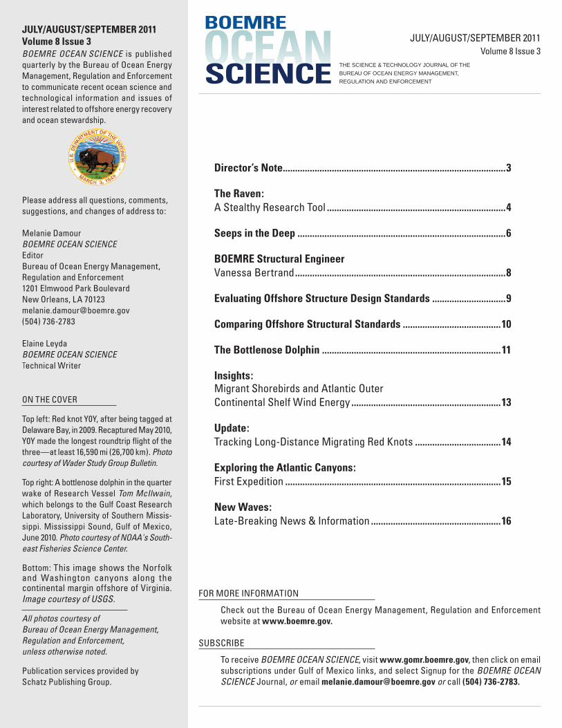
JULY/AUGUST/SEPTEMBER 2011Volume 8 Issue 3BOEMRE OCEAN SCIENCE is published quarterly by the Bureau of Ocean Energy Management, Regulation and Enforcement to communicate recent ocean science and technological information and issues of interest related to offshore energy recovery and ocean stewardship.
Please address all questions, comments, suggestions, and changes of address to:
Melanie DamourBOEMRE OCEAN SCIENCE Editor Bureau of Ocean Energy Management, Regulation and Enforcement 1201 Elmwood Park Boulevard New Orleans, LA [email protected](504) 736-2783
Elaine LeydaBOEMRE OCEAN SCIENCE Technical Writer
ON THE COVER
Top left: Red knot Y0Y, after being tagged at Delaware Bay, in 2009. Recaptured May 2010, Y0Y made the longest roundtrip flight of the three—at least 16,590 mi (26,700 km). Photo courtesy of Wader Study Group Bulletin.
Top right: A bottlenose dolphin in the quarter wake of Research Vessel Tom McIlwain, which belongs to the Gulf Coast Research Laboratory, University of Southern Missis-sippi. Mississippi Sound, Gulf of Mexico, June 2010. Photo courtesy of NOAA's South-east Fisheries Science Center.
Bottom: This image shows the Norfolk and Washington canyons along the continental margin offshore of Virginia. Image courtesy of USGS.
All photos courtesy of Bureau of Ocean Energy Management, Regulation and Enforcement, unless otherwise noted.
Publication services provided by Schatz Publishing Group.
OCEANSCIENCE THE SCIENCE & TECHNOLOGY JOURNAL OF THE
BUREAU OF OCEAN ENERGY MANAGEMENT,
REGULATION AND ENFORCEMENT
JULY/AUGUST/SEPTEMBER 2011Volume 8 Issue 3
Director’s Note ...........................................................................................3
The Raven: A Stealthy Research Tool .........................................................................4
Seeps in the Deep .....................................................................................6
BOEMRE Structural Engineer Vanessa Bertrand ......................................................................................8
Evaluating Offshore Structure Design Standards ..............................9
Comparing Offshore Structural Standards ........................................10
The Bottlenose Dolphin .........................................................................11
Insights: Migrant Shorebirds and Atlantic Outer Continental Shelf Wind Energy .............................................................13
Update: Tracking Long-Distance Migrating Red Knots ...................................14
Exploring the Atlantic Canyons: First Expedition ........................................................................................15
New Waves:Late-Breaking News & Information .....................................................16
FOR MORE INFORMATION
Check out the Bureau of Ocean Energy Management, Regulation and Enforcement website at www.boemre.gov.
SUBSCRIBE
To receive BOEMRE OCEAN SCIENCE, visit www.gomr.boemre.gov, then click on email subscriptions under Gulf of Mexico links, and select Signup for the BOEMRE OCEAN SCIENCE Journal, or email [email protected] or call (504) 736-2783.
BOEMRE
3VOLUME 8 ISSUE 3
INTRODUCTION
BUREAU OF OCEAN ENERGY MANAGEMENT, REGULATION AND ENFORCEMENT
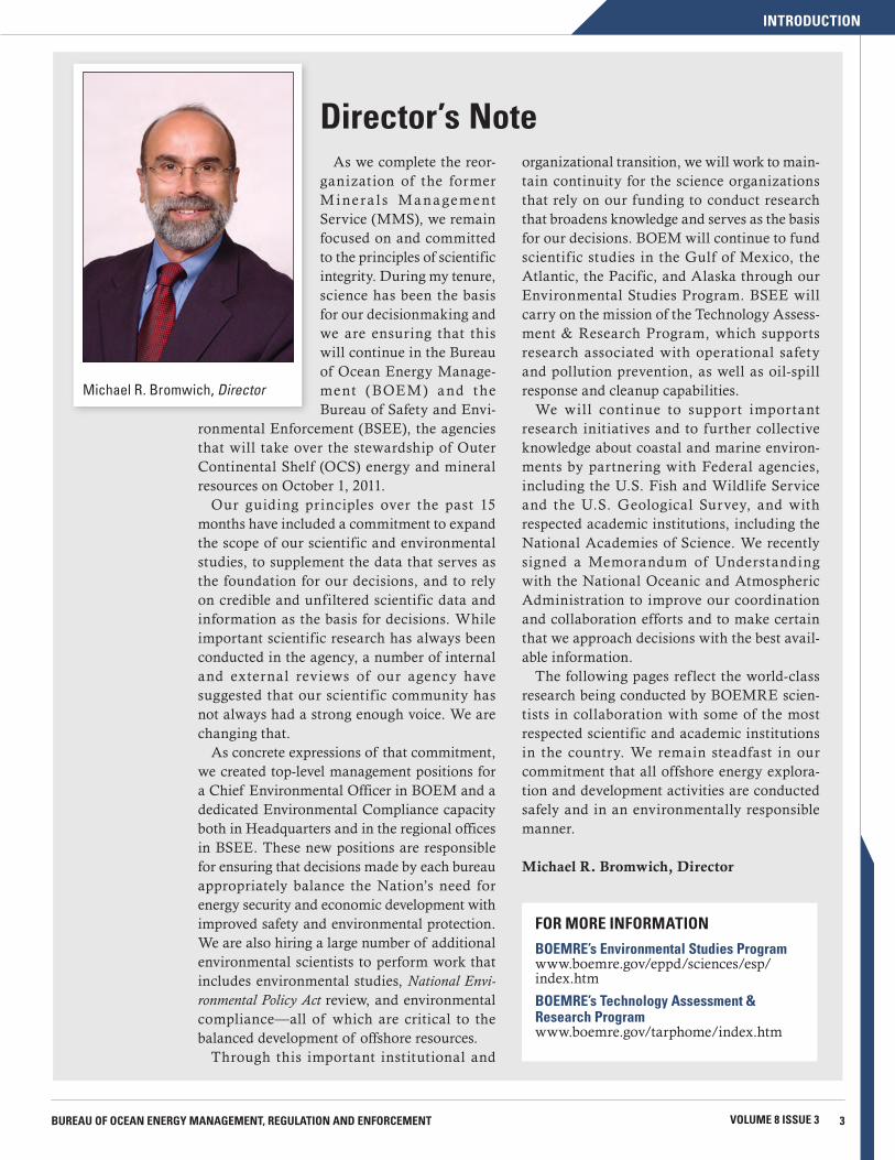
Director’s NoteAs we complete the reor-
ganization of the former M i nera l s Ma nagement Service (MMS), we remain focused on and committed to the principles of scientific integrity. During my tenure, science has been the basis for our decisionmaking and we are ensuring that this will continue in the Bureau of Ocean Energy Manage-ment (BOEM ) and the Bureau of Safety and Envi-
ronmental Enforcement (BSEE), the agencies that will take over the stewardship of Outer Continental Shelf (OCS) energy and mineral resources on October 1, 2011.
Our guiding principles over the past 15 months have included a commitment to expand the scope of our scientific and environmental studies, to supplement the data that serves as the foundation for our decisions, and to rely on credible and unfiltered scientific data and information as the basis for decisions. While important scientific research has always been conducted in the agency, a number of internal and external reviews of our agency have suggested that our scientific community has not always had a strong enough voice. We are changing that.
As concrete expressions of that commitment, we created top-level management positions for a Chief Environmental Officer in BOEM and a dedicated Environmental Compliance capacity both in Headquarters and in the regional offices in BSEE. These new positions are responsible for ensuring that decisions made by each bureau appropriately balance the Nation’s need for energy security and economic development with improved safety and environmental protection. We are also hiring a large number of additional environmental scientists to perform work that includes environmental studies, National Envi-ronmental Policy Act review, and environmental compliance—all of which are critical to the balanced development of offshore resources.
Through this important institutional and
organizational transition, we will work to main-tain continuity for the science organizations that rely on our funding to conduct research that broadens knowledge and serves as the basis for our decisions. BOEM will continue to fund scientific studies in the Gulf of Mexico, the Atlantic, the Pacific, and Alaska through our Environmental Studies Program. BSEE will carry on the mission of the Technology Assess-ment & Research Program, which supports research associated with operational safety and pollution prevention, as well as oil-spill response and cleanup capabilities.
We will continue to support important research initiatives and to further collective knowledge about coastal and marine environ-ments by partnering with Federal agencies, including the U.S. Fish and Wildlife Service and the U.S. Geological Survey, and with respected academic institutions, including the National Academies of Science. We recently signed a Memorandum of Understanding with the National Oceanic and Atmospheric Administration to improve our coordination and collaboration efforts and to make certain that we approach decisions with the best avail-able information.
The following pages ref lect the world-class research being conducted by BOEMRE scien-tists in collaboration with some of the most respected scientific and academic institutions in the country. We remain steadfast in our commitment that all offshore energy explora-tion and development activities are conducted safely and in an environmentally responsible manner.
Michael R. Bromwich, Director
FOR MORE INFORMATION
BOEMRE’s Environmental Studies Programwww.boemre.gov/eppd/sciences/esp/index.htm
BOEMRE’s Technology Assessment & Research Programwww.boemre.gov/tarphome/index.htm
Michael R. Bromwich, Director
4 BOEMRE OCEAN SCIENCE SCIENCE & TECHNOLOGY JOURNAL
TECHNOLOGY
The Raven:A Stealthy Research Tool
The raven is one of several species of the genus Corvus, the title of a well-known poem by Edgar Allen Poe, and a figure in Norse mythology that served the god Odin by f lying around the human world every day to observe and report the news back to him. But Raven is also the name of an unmanned aircraft system (UAS) that BOEMRE, along with other Department of the Interior (DOI) agencies, is integrating into its technological toolkit.
A stealthy, low-cost system, the RQ-11A Raven enables difficult field work without the risks associated with manned aircraft operations in remote and sensitive areas, such as Alaska.
The Raven improves our ability to collect remotely sensed data, to inventory and monitor dynamic events, and to conduct impact analyses over areas that present logistical difficulties.
In support of data-collecting activities, the U.S. Army gave five Raven UAS systems to the DOI’s U.S. Geological Survey (USGS) in 2009. This technology is transforming research methods and management techniques in several DOI bureaus.
To explore how to best integrate UAS’s into projects, the National Business Center’s Aviation Management Directorate (AMD) of the DOI teamed with the Aerodyne Corpora-tion and the USGS (which is leading the Department’s UAS adoption).
The USGS plans to use UAS technology for ecosystem surveys, firefighting, Geographic Information System (GIS) mapping, law enforcement, observing hard-to-reach or hazardous areas, oil spill reporting and monitoring, search
and rescue, and wildlife surveys and tracking. To date, three UAS training sessions have been sponsored
by the DOI. In May 2011, BOEMRE participated in one training session that was held in Anchorage, Alaska, and at Fort Richardson, Alaska; the training included approximately 80 hours of Raven classroom instruction by Aerodyne Corpo-ration, AMD, and Federal Aviation Administration (FAA) instructors.
Students were taught basic and advanced f light skills, airspace management, aviation safety, emergency procedures, crew coordination, DOI aviation policy and procedures, and mission planning. Each student also earned approximately three hours of f light time as pilot and three hours as mission controller.
Currently, there are 27 qualified Raven operators within the DOI. Of these, five are in Alaska: two in AMD and three in BOEMRE.
Proof of Concept: The Sandhill Crane Survey. The DOI’s first survey mission using the Raven in the National Airspace System was carried out this March at the U.S. Fish and Wild-life Service’s (USFWS) Monte Vista National Wildlife Refuge in Colorado.
What’s a Raven?The Raven, a small, lightweight unmanned aircraft
system (UAS), was designed for military, scientific, and commercial applications. With a wingspan of 4.5 ft (1.37 m) and weighing 4.2 lbs (1.9 kg), the hand-launched electric-powered Raven provides aerial observation, day or night, at line-of-sight ranges up to 6.2 mi (10 km).
Other features include a f light endurance of 80 minutes and a f lying speed of 28 mph (45 km/h) at typical operating altitude of 100–1000 ft Above Ground Level (30–300 m AGL).
A Raven transmits live aerial video images, compass headings, and location information to a ground control unit and remote video terminal. The system delivers real-time color or infrared video imagery via an electro-optical or infrared thermal camera. These onboard cameras transmit a running visual record to a Ground Control Unit where the data is recorded directly.
Portability is an important advantage; the Raven has only eight parts and can be assembled onsite. The system can also be connected to a Panasonic Tough-book laptop for mission planning, navigation, and flight operations. It is f lown using FalconView™ software with an add-on for flight operations. The software can read GIS-formatted data for seamless pref light plan-ning. A Raven is usually operated by two people (a pilot and a mission controller).
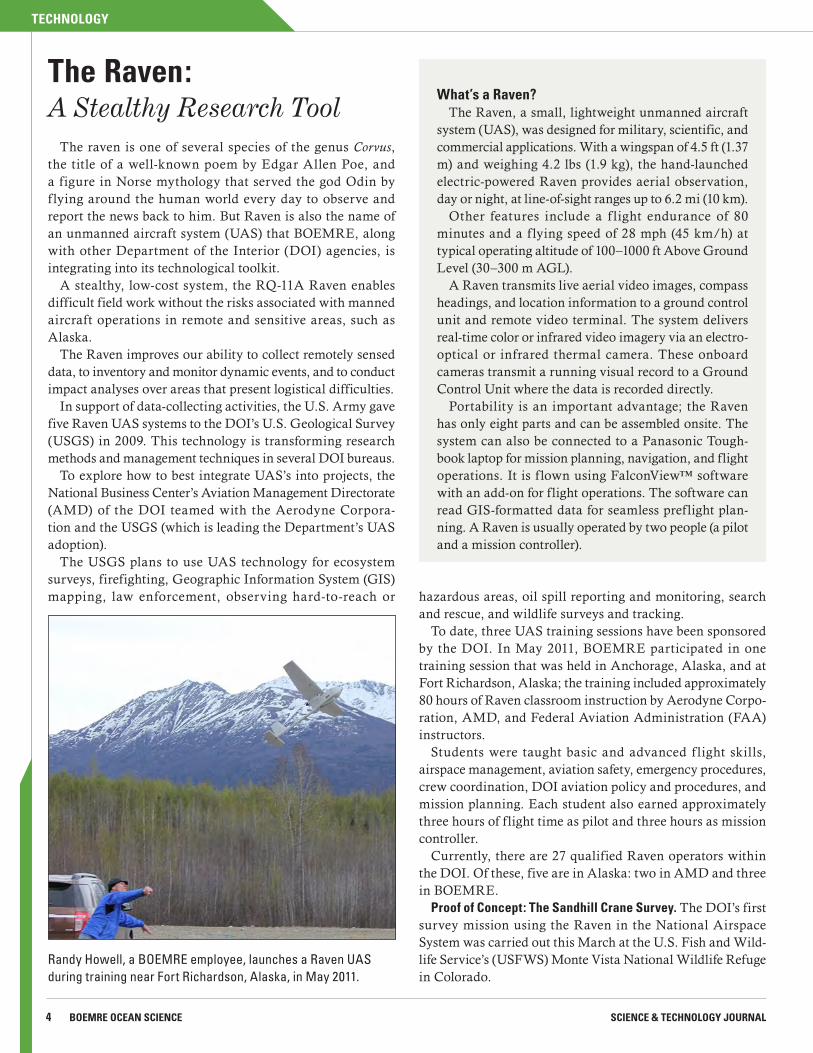
Randy Howell, a BOEMRE employee, launches a Raven UAS during training near Fort Richardson, Alaska, in May 2011.
TECHNOLOGY
5BUREAU OF OCEAN ENERGY MANAGEMENT, REGULATION AND ENFORCEMENT VOLUME 8 ISSUE 3
The mission had several objectives. As a proof of concept operation, it would determine the feasibility of using Ravens to capture videography of roosting sandhill cranes and of using that data to help estimate population abundance. It would also tell investigators how the cranes behave when the Raven flies over them at different altitudes (cranes are prey of eagles, and the Raven could be mistaken for an eagle, leading to a f lush).
Biologists worked out several logistical challenges—the small window of time between the cranes’ roosting and taking flight, FAA restrictions, and avoiding mid-air collisions.
The Raven’s sensor package successfully detected the cranes’ thermal signatures and collected videography. Analysts from USGS converted the analog data into digital format, reviewed the videos, and exported it into still images. Mosaics of these images helped them estimate crane abundance. The results were solid. Compared with USFWS ground counts, the Raven data count found a difference of only 4.6 percent.
The sandhill crane project demonstrated the Raven’s usefulness for collecting scientific data to improve wildlife and resource management and its direct benefit to scientific research.
Ravens in Alaska. In Alaska and the Arctic, UAS’s can help us fill current information gaps about remote and hazardous areas. This is critical to better scientific understanding of climate change; ecosystem, wildlife, and habitat monitoring; and oil-spill reporting and mitigation.
The Raven is a reliable, safe alternative to manned flights, especially during coastal Alaska’s frequent periods of low cloud cover. Manned aircraft f lights are often dangerous and expensive because of long transit times, hazardous weather conditions, and fuel and operations costs. Unlike manned
FOR MORE INFORMATION“Utilizing UAS Ravens to Estimate Sandhill Crane Abundance,” USGS (pdf 513 KB)http://rmgsc.cr.usgs.gov/uas/pdf/sandhillcranes/raven_information_sandhill_cranes_may_2011.pdf
“Raven RQ-11A sUAS: USGS Training Exercise” (video demonstration), USGShttp://gallery.usgs.gov/videos/403 Rick Raymond, a BOEMRE employee, piloting a Raven UAS in
“heads down mode” during training near Fort Richardson, Alaska.
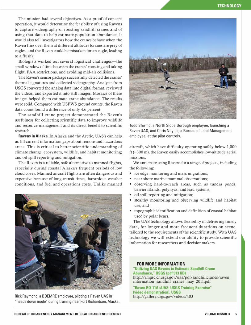
Todd Sformo, a North Slope Borough employee, launching a Raven UAS, and Chris Noyles, a Bureau of Land Management employee, at the pilot controls.
aircraft, which have difficulty operating safely below 1,000 ft (~300 m), the Raven easily accomplishes low-altitude aerial missions.
We anticipate using Ravens for a range of projects, including the following:
z ice edge monitoring and mass migrations; z near-shore marine mammal observations; z observing hard-to-reach areas, such as tundra ponds,
barrier islands, polynyas, and lead systems; z oil spill reporting and mitigation; z stealthy monitoring and observing wildlife and habitat
use; and z topographic identification and definition of coastal habitat
used by polar bears.The UAS technology allows flexibility in delivering timely
data, for longer and more frequent durations on scene, tailored to the requirements of the scientific study. With UAS technology we will extend our ability to provide scientific information for researchers and decisionmakers.

6 BOEMRE OCEAN SCIENCE SCIENCE & TECHNOLOGY JOURNAL
STUDIES
Seeps in the Deep
Our oceans absorb great quantities of oil (petroleum input) from various sources, such as spills, leaking ships, and natural seeps. Much of the petroleum input in U.S. waters comes from natural seeps and some of the largest of these are in the Gulf of Mexico.
Seeps are areas on the seafloor where hydrocarbons, such as oil and gas, escape from cracks or fractures in the deep subsurface geological strata. Some seeps host high-density chemosynthetic (using chemical energy to make food from the carbon in carbon dioxide) and coral communities, which BOEMRE has been studying for more than 25 years. Not all seeps have chemosynthetic and coral communities; some are inactive, historical sites or discourage colonization because they are covered by fine sediment.
Since 1998, we have used industry-collected 3-D seismic survey data and conducted dozens of cruises to identify and map more than 21,000 seafloor seismic amplitude anomalies in the deep water of the Gulf of Mexico. These anomalies are areas whose high or low reflectivity response over background response are unusual or outside the expected norm and may indicate the presence of seeps.
A total of 156,000 square miles (~404,000 square kilometers) of 3-D seismic survey data have been interpreted; most areas are covered by two or more overlapping surveys. Working with the
National Oceanic and Atmospheric Administration (NOAA), academia, and industry contractors, we have used submersibles, remotely operated vehicles, autonomous underwater vehicles, camera sled surveys, piston cores, and trawls to investigate more than 100 amplitude anomalies that represent active or historical seeps.
In April 2011, we made publicly available more than 21,000 geophysically-derived polygons that represent our interpretation of sites in the Gulf of Mexico that are seeping hydrocarbons. These zipped Shapefiles can be downloaded from our website and then viewed with commercially-available Geographic Infor-mation System (GIS) software. (In mapping terms, a polygon is a two-dimensional shape that is modeled and stored in a database.)
The term “Shapefile” is misleading because it refers not to a single file but to a collection of files that must remain grouped together to be functional. Used for making maps and analyzing geographic data, Shapefiles are data in digital vector formats for storing geometric location and associated attribute information. Created by ArcView, Shapefiles can be used by most commercial GIS software, such as ArcView, ARC/INFO, and ArcGIS.
Broad view of the locations of mapped positive, negative, and pockmark anomalies in the Gulf of Mexico.

STUDIES
7VOLUME 8 ISSUE 3BUREAU OF OCEAN ENERGY MANAGEMENT, REGULATION AND ENFORCEMENT
Three basic types of seeps are represented by the polygons:(1) positive anomalies (red): slow to moderate seepage with
carbonate hardgrounds and chemosynthetic and coral communities;
(2) negative anomalies (green): rapid seepage that results in mud volcanoes and vent fields; and
(3) pockmark anomalies (purple): explosive gas expulsion that creates pockmarks, or depressions, on the seafloor.
Positive anomalies show a high positive amplitude response in relation to the normal seafloor response. Most of these have a slow to moderate rate of hydrocarbon seepage. The positive amplitude response on the seismic data is caused by the pres-ence of carbonate hard grounds, which are created by bacteria that live off of the hydrocarbon in the sediments at the seeps and, in the process, produce calcium carbonate. Most of these sites, which have been visually observed, have thriving chemo-synthetic and hard and soft coral communities.
Negative anomalies show a low positive amplitude response on seismic data. These areas have rapid seepage, or rapid hydrocarbon flux. Usually when they are located on a seafloor with a low slope, these high flux vent sites, which expel sedi-ment and brine along with the hydrocarbons, build cones or mud volcanoes.
However, when the expulsion of the hydrocarbons, brine, and sediment takes place on steep slopes, flows of sediment downslope have been observed. Most of these flows have a relatively high positive amplitude response because of (1) an acoustically faster sediment type than the surrounding hemi-pelagic (deposited rather slowly) mud; (2) higher hydrocarbon saturations, resulting in bacterial lithification (hardening into rock) of the sediment; or (3) chemosynthetic clam populations.
At the actual expulsion sites, the rate of flux is often too fast for bacterial consumption to convert the hydrocarbon to carbonate hardgrounds, as it does with the slow to moderate seep rate of the positive anomalies. Sessile (permanently attached) chemosynthetic organisms and corals that require hard substrates are not found at these sites.
Pockmark anomalies are circular to oval depressions created when sediment is removed through rapid, and probably explo-sive, gas expulsion. This type of expulsion is interpreted to be gas only (no sediment, brine, or oil has been seen during direct observations). Because these anomalies lack continuous seepage and hard substrate, chemosynthetic organisms and corals are unlikely to be associated with them.
The positive outcomes of this ongoing seep-mapping project are multifold. A number of seep-related communities and
new species have been discovered, and we have advanced our identification of these protected sites where oil and gas industry activities are restricted.
In addition to providing chemosyn-thetic and coral community locations, the data are also valuable for other BOEMRE functions. Geoscientists use these data to study deep subsurface hydrocarbon systems when they evaluate the hydro-carbon potential of basins and lease blocks throughout the Gulf of Mexico.
During the evaluation of the monetary value of lease blocks that have been bid on in Federal lease sales, the data help geoscientists determine the likelihood of hydrocarbon charge in the identified subsurface prospects.
Over the past decade, Federal agen-cies such as the Department of Energy, NOAA, and the U.S. Geological Service have used these data to conduct a number of studies. Currently, these data are also important for evaluating how the Deep-
water Horizon oil spill may have impacted benthic communities.
By making these files available to the public, we hope that this information will be useful to other researchers.
Expanded view of an area of mapped anomalies, showing the locations of three anomaly types.
FOR MORE INFORMATION
Seismic Water Bottom Anomalies Map Gallery, BOEMREwww.boemre.gov/offshore/mapping/SeismicWaterBottomAnomalies.htm
BOEMRE Map Gallerywww.boemre.gov/offshore/mapping/gallery.htm
8 BOEMRE OCEAN SCIENCE SCIENCE & TECHNOLOGY JOURNAL
PEOPLE
How did you come to work for BOEMRE?I began my career as a structural engineer in the aerospace
industry at a time when the technological successes and pros-pects made aerospace an exciting industry to be in. However, after a few years, I wanted more responsibilities, to further develop my engineering and project management skills. So I looked at positions in industries where the projects were of relatively more modest size and scope. Since then, I’ve spent much of my engineering career doing structural design and project management working on industrial, municipal, and offshore projects.
Like many New Orleanians, after Hurricane Katrina I established a home and career in Houston. There, I worked on some really great offshore projects. However, after years of watching New Orleans’ recovery, I realized that I wanted to be a part of that.
When the opportunity to work with BOEMRE presented itself in 2009, I didn’t hesitate to apply. I was aware of the agency and its mission and believed that working with BOEMRE would provide further professional development, plus I could again be part of a community that’s given me so much.
What do you do, exactly?I work in the Office of Structural and Technical Support. Our
team is charged with assuring that offshore energy production-related structures throughout the U.S. are designed, fabricated, installed, and maintained in keeping with current design codes.
We oversee fixed and f loating platforms and subsea facili-ties and provide guidance to the development of renewable energy projects, such as the first offshore wind farm, the Cape Wind project.
What is the most exciting or satisfying aspect of what you do?
Generally speaking, the broad scope of my projects keeps things exciting. I’ve worked on permits, research, and investi-gations. In particular, I enjoy participating in the oversight of research. The researchers are very accomplished scientists and engineers from around the world. Most often, these exceptional colleagues are generous with their knowledge and modest in their dispositions. The experience is absolutely refreshing.
Have your background, family, education, and hobbies helped prepare you for this work/job?
Yes, I’m a product of a family and community that values education and hard work. My parents devoted much of their resources to providing my brothers and me with the best education they could afford, in spite of their modest means.
Like most parents in my neighborhood, they strongly encour-aged every kid not to accept limitations the world tried to impose on them.
Because of their hard work and encouragement, I had the chance to study at some of the top universities in the country. My parents chose Lafayette College, a small private liberal arts college in Pennsylvania. It took me a while to warm up to the idea. In hindsight, I believe it was a perfect choice for me. That’s where I earned my BS in civil engineering. A liberal arts education provides the foundation for developing a curious and disciplined mind. Mental and intellectual agility serve you well, regardless of the industry you’re in. And in today’s job market, that agility allows you to learn new skills and refine the skills you have.
When did you know you wanted to be an engineer? What led you to choose the specialty that you chose?
I’m not certain of that. My dad worked in the space program at Boeing. I think it was something that I was somewhat familiar with and I knew that an engineering degree would afford me lots of options in my professional life.
Civil/structural engineering is the most interesting engi-neering field to me because it’s very practical and is applicable to a majority of engineering solutions. Think about it: your home, your car, and even our spacecrafts all have elements of structural design associated with their proper functioning!
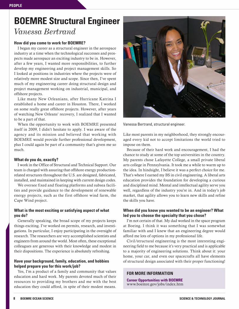
BOEMRE Structural EngineerVanessa Bertrand
Vanessa Bertrand, structural engineer.
FOR MORE INFORMATION
Career Opportunities with BOEMREwww.boemre.gov/jobs/index.htm
STUDIES
9VOLUME 8 ISSUE 3BUREAU OF OCEAN ENERGY MANAGEMENT, REGULATION AND ENFORCEMENT
To better assure the structural integrity of existing and new offshore structures, BOEMRE’s Technology Assessment & Research (TA&R) Program initiated several studies to identify and evaluate our current structural design and assessment standards and practices.
TA&R project #652, launched in early 2010, evaluated industry’s practice of using the mean (instead of minimum specified) yield strength of steel in the design and structural evaluation of offshore structures.
Yield strength is the stress point at which a material, like steel, is no longer elastic and begins to deform permanently; that is, when the stress is removed, the material does not return to its previous form.
Yield strength is also a designation given by a steel manufacturer to a batch of steel. It is based on tests run on a set of samples from that batch. This designation certifies that the batch, at its minimum, meets that designated yield strength. And the engineer knows that the steel of a designated yield strength will perform as predicted in the related analyses. Design engineers then use the designated yield strength to analyze and predict a structure’s performance.
Mean yield strength, however, is the mean of a certain range of test results done on the samples from a batch. Using mean yield strength in a structural analysis, instead of minimum yield strength, allows for consider-ation of the fact that some steel in a batch may have a yield strength that exceeds the batch’s minimum yield strength designated by the mill.
Exploiting the variance that may exist in yield strength batch tests increases the risk of underperformance. Such practice also fails to take into consideration other steel properties (such as critical flaw size and notch toughness) that are also important to the material’s structural performance.
To develop the best methods for assuring structural integrity of existing and new offshore structures, researchers reviewed technical, design, construction, and inspection issues related to the cause of structural failures of Gulf of Mexico facilities.
According to the study findings released in January 2011, using mean yield strength in place of the minimum specified yield strength in structural analyses significantly reduces the safety margins against overloads (by up to 25 percent).
For new structures, structural integrity and reliability can best be assured by implementing both Fracture Control and
Evaluating Offshore Structure Design Standards
Fatigue Failure Control Plans into the structures’ design, fabrication, construc-tion, and maintenance.
Another recommendation was to develop Fracture Control Plans and Fatigue Failure Control Plans. The Frac-ture Control Plan for offshore structures should consider elements of AASHTO/AWS D1.5M/D1.5 Bridge Welding Code.
The Fatigue Failure Control Plan could be modeled after the British Department of Energy’s “UK Offshore Installations: Guidance on Design and Construction – Fatigue of Welded Structures,” and the American Society of Mechanical Engineers Section VIII Division 2 Code on Fatigue Design Criteria.
In regard to materials, the study found that high perfor-mance steels are good candidates for critical elements of offshore structures because of their strength, superior weld-ability, notch toughness, and high tolerance for imperfections.
The study’s results will be taken into consideration, along with the results of other standards evaluations, as part of BOEMRE’s commitment to safety.
FOR MORE INFORMATION
TA&R project 652www.boemre.gov/tarprojects/652.htm
“The study underscored the important contribution of science to engineering.”
Vanessa Bertrand, BOEMRE Structural Engineer
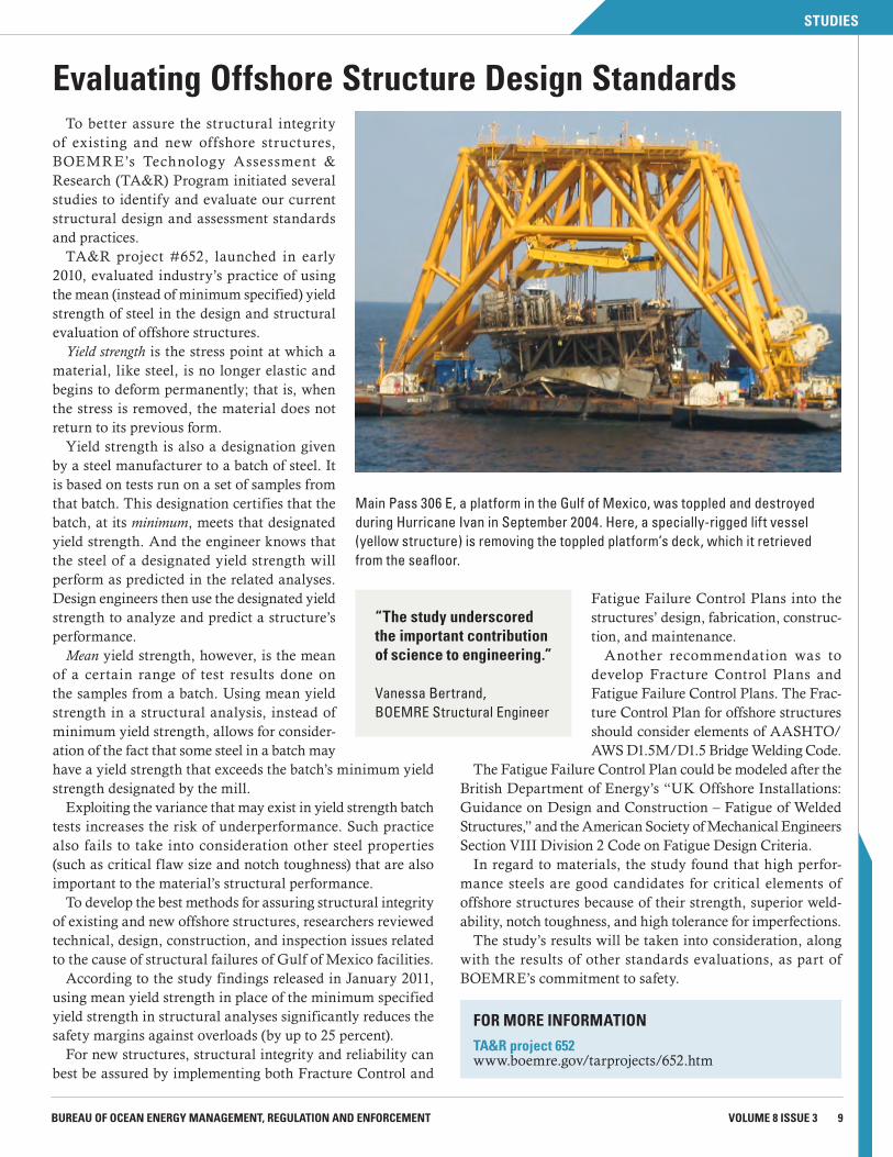
Main Pass 306 E, a platform in the Gulf of Mexico, was toppled and destroyed during Hurricane Ivan in September 2004. Here, a specially-rigged lift vessel (yellow structure) is removing the toppled platform’s deck, which it retrieved from the seafloor.
10 BOEMRE OCEAN SCIENCE SCIENCE & TECHNOLOGY JOURNAL
STUDIES
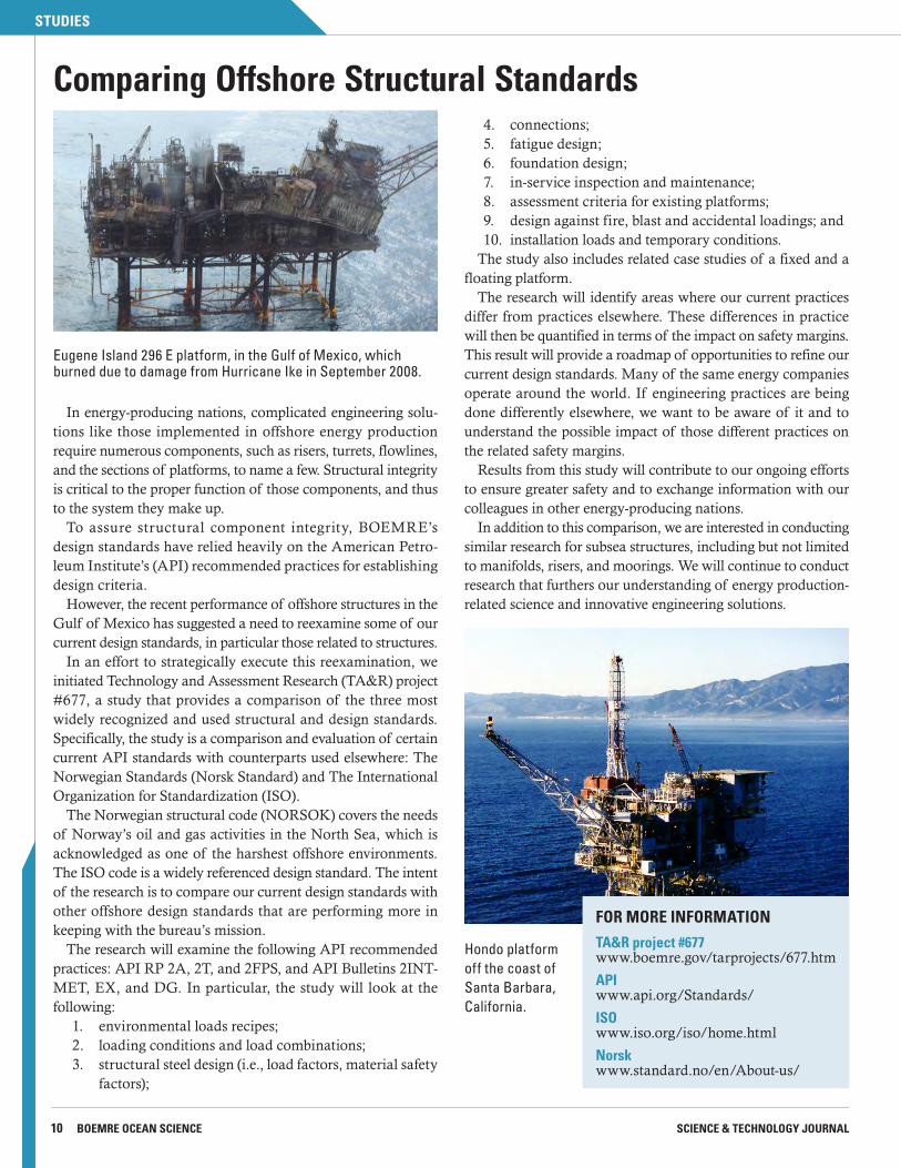
In energy-producing nations, complicated engineering solu-tions like those implemented in offshore energy production require numerous components, such as risers, turrets, flowlines, and the sections of platforms, to name a few. Structural integrity is critical to the proper function of those components, and thus to the system they make up.
To assure structural component integrity, BOEMRE’s design standards have relied heavily on the American Petro-leum Institute’s (API) recommended practices for establishing design criteria.
However, the recent performance of offshore structures in the Gulf of Mexico has suggested a need to reexamine some of our current design standards, in particular those related to structures.
In an effort to strategically execute this reexamination, we initiated Technology and Assessment Research (TA&R) project #677, a study that provides a comparison of the three most widely recognized and used structural and design standards. Specifically, the study is a comparison and evaluation of certain current API standards with counterparts used elsewhere: The Norwegian Standards (Norsk Standard) and The International Organization for Standardization (ISO).
The Norwegian structural code (NORSOK) covers the needs of Norway’s oil and gas activities in the North Sea, which is acknowledged as one of the harshest offshore environments. The ISO code is a widely referenced design standard. The intent of the research is to compare our current design standards with other offshore design standards that are performing more in keeping with the bureau’s mission.
The research will examine the following API recommended practices: API RP 2A, 2T, and 2FPS, and API Bulletins 2INT-MET, EX, and DG. In particular, the study will look at the following:
1. environmental loads recipes;2. loading conditions and load combinations;3. structural steel design (i.e., load factors, material safety
factors);
Comparing Offshore Structural Standards4. connections;5. fatigue design;6. foundation design;7. in-service inspection and maintenance;8. assessment criteria for existing platforms;9. design against fire, blast and accidental loadings; and10. installation loads and temporary conditions.
The study also includes related case studies of a fixed and a floating platform.
The research will identify areas where our current practices differ from practices elsewhere. These differences in practice will then be quantified in terms of the impact on safety margins. This result will provide a roadmap of opportunities to refine our current design standards. Many of the same energy companies operate around the world. If engineering practices are being done differently elsewhere, we want to be aware of it and to understand the possible impact of those different practices on the related safety margins.
Results from this study will contribute to our ongoing efforts to ensure greater safety and to exchange information with our colleagues in other energy-producing nations.
In addition to this comparison, we are interested in conducting similar research for subsea structures, including but not limited to manifolds, risers, and moorings. We will continue to conduct research that furthers our understanding of energy production- related science and innovative engineering solutions.
FOR MORE INFORMATION
TA&R project #677www.boemre.gov/tarprojects/677.htm
APIwww.api.org/Standards/
ISOwww.iso.org/iso/home.html
Norskwww.standard.no/en/About-us/
Eugene Island 296 E platform, in the Gulf of Mexico, which burned due to damage from Hurricane Ike in September 2008.
Hondo platform off the coast of Santa Barbara, California.
FEATURED SPECIES
11BUREAU OF OCEAN ENERGY MANAGEMENT, REGULATION AND ENFORCEMENT VOLUME 8 ISSUE 3
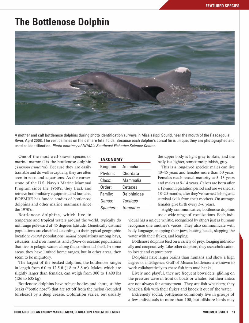
One of the most well-known species of marine mammal is the bottlenose dolphin (Tursiops truncatus). Because they are easily trainable and do well in captivity, they are often seen in zoos and aquariums. As the corner-stone of the U.S. Navy’s Marine Mammal Program since the 1960’s, they track and retrieve both military equipment and humans. BOEMRE has funded studies of bottlenose dolphins and other marine mammals since the 1970’s.
Bottlenose dolphins, which live in temperate and tropical waters around the world, typically do not range poleward of 45 degrees latitude. Genetically distinct populations are classified according to their typical geographic location: coastal populations; inland populations among bays, estuaries, and river mouths; and offshore or oceanic populations that live in pelagic waters along the continental shelf. In some areas, they have limited home ranges, but in other areas, they seem to be migratory.
The largest of the beaked dolphins, the bottlenose ranges in length from 6.0 to 12.5 ft (1.8 to 3.8 m). Males, which are slightly larger than females, can weigh from 300 to 1,400 lbs (136 to 635 kg).
Bottlenose dolphins have robust bodies and short, stubby beaks (“bottle nose”) that are set off from the melon (rounded forehead) by a deep crease. Coloration varies, but usually
The Bottlenose Dolphin
the upper body is light gray to slate, and the belly is a lighter, sometimes pinkish, grey.
This is a long-lived species: males can live 40–45 years and females more than 50 years. Females reach sexual maturity at 5–13 years and males at 9–14 years. Calves are born after a 12-month gestation period and are weaned at 18–20 months, after they’ve learned fishing and survival skills from their mothers. On average, females give birth every 3–6 years.
Highly communicative, bottlenose dophins use a wide range of vocalizations. Each indi-
vidual has a unique whistle, recognized by others just as humans recognize one another’s voices. They also communicate with body language, snapping their jaws, butting heads, slapping the water with their flukes, and leaping.
Bottlenose dolphins feed on a variety of prey, foraging individu-ally and cooperatively. Like other dolphins, they use echolocation to locate and capture prey.
Dolphins have larger brains than humans and show a high degree of intelligence. Gulf of Mexico bottlenose are known to work collaboratively to chase fish into mud banks.
Lively and playful, they are frequent bowriders, gliding on the pressure wave in front of boats or whales, but their antics are not always for amusement. They are fish-whackers; they whack a fish with their flukes and knock it out of the water.
Extremely social, bottlenose commonly live in groups of a few individuals to more than 100, but offshore herds may
A mother and calf bottlenose dolphins during photo identification surveys in Mississippi Sound, near the mouth of the Pascagoula River, April 2008. The vertical lines on the calf are fetal folds. Because each dolphin's dorsal fin is unique, they are photographed and used as identification. Photo courtesy of NOAA's Southeast Fisheries Science Center.
TAXONOMY
Kingdom: Animalia
Phylum: Chordata
Class: MammaliaOrder: CetaceaFamily: DelphinidaeGenus: TursiopsSpecies: truncatus
12 BOEMRE OCEAN SCIENCE SCIENCE & TECHNOLOGY JOURNAL
FEATURED SPECIES
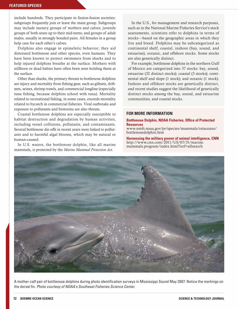
A mother-calf pair of bottlenose dolphins during photo identification surveys in Mississippi Sound May 2007. Notice the markings on the dorsal fin. Photo courtesy of NOAA's Southeast Fisheries Science Center.
include hundreds. They participate in fission-fusion societies: subgroups frequently join or leave the main group. Subgroups may include nursery groups of mothers and calves; juvenile groups of both sexes up to their mid-teens; and groups of adult males, usually in strongly bonded pairs. All females in a group help care for each other’s calves.
Dolphins also engage in epimeletic behavior; they aid distressed bottlenose and other species, even humans. They have been known to protect swimmers from sharks and to help injured dolphins breathe at the surface. Mothers with stillborn or dead babies have often been seen holding them at the surface.
Other than sharks, the primary threats to bottlenose dolphins are injury and mortality from fishing gear, such as gillnets, drift-nets, seines, shrimp trawls, and commercial longline (especially tuna fishing, because dolphins school with tuna). Mortality related to recreational fishing, in some cases, exceeds mortality related to bycatch in commercial fisheries. Viral outbreaks and exposure to pollutants and biotoxins are also threats.
Coastal bottlenose dolphins are especially susceptible to habitat destruction and degradation by human activities, including vessel collisions, pollutants, and contaminants. Several bottlenose die-offs in recent years were linked to pollut-ants and to harmful algal blooms, which may be natural or human-caused.
In U.S. waters, the bottlenose dolphin, like all marine mammals, is protected by the Marine Mammal Protection Act.
In the U.S., for management and research purposes, such as in the National Marine Fisheries Service’s stock assessments, scientists refer to dolphins in terms of stocks—based on the geographic areas in which they live and breed. Dolphins may be subcategorized as continental shelf, coastal, inshore (bay, sound, and estuarine), oceanic, and offshore stocks. Some stocks are also genetically distinct.
For example, bottlenose dolphins in the northern Gulf of Mexico are categorized into 37 stocks: bay, sound, estuarine (32 distinct stocks); coastal (3 stocks); conti-nental shelf and slope (1 stock); and oceanic (1 stock). Inshore and offshore stocks are genetically distinct, and recent studies suggest the likelihood of genetically distinct stocks among the bay, sound, and estuarine communities, and coastal stocks.
FOR MORE INFORMATION
Bottlenose Dolphin, NOAA Fisheries, Office of Protected Resourceswww.nmfs.noaa.gov/pr/species/mammals/cetaceans/bottlenosedolphin.htm
Harnessing the military power of animal intelligence, CNNhttp://www.cnn.com/2011/US/07/31/marine.mammals.program/index.html?iref=allsearch
STUDIES
13VOLUME 8 ISSUE 3BUREAU OF OCEAN ENERGY MANAGEMENT, REGULATION AND ENFORCEMENT
Anticipating wind energy development on the Atlantic Outer Continental Shelf (AOCS), BOEMRE has been building a solid foundation for balanced decisionmaking by funding research projects to identify information gaps and collect much-needed data about possible environmental impacts. Offshore wind energy is new territory, and in some cases, in order to address information gaps, we need to adapt or devise new methods and tools for gathering and analyzing the data.
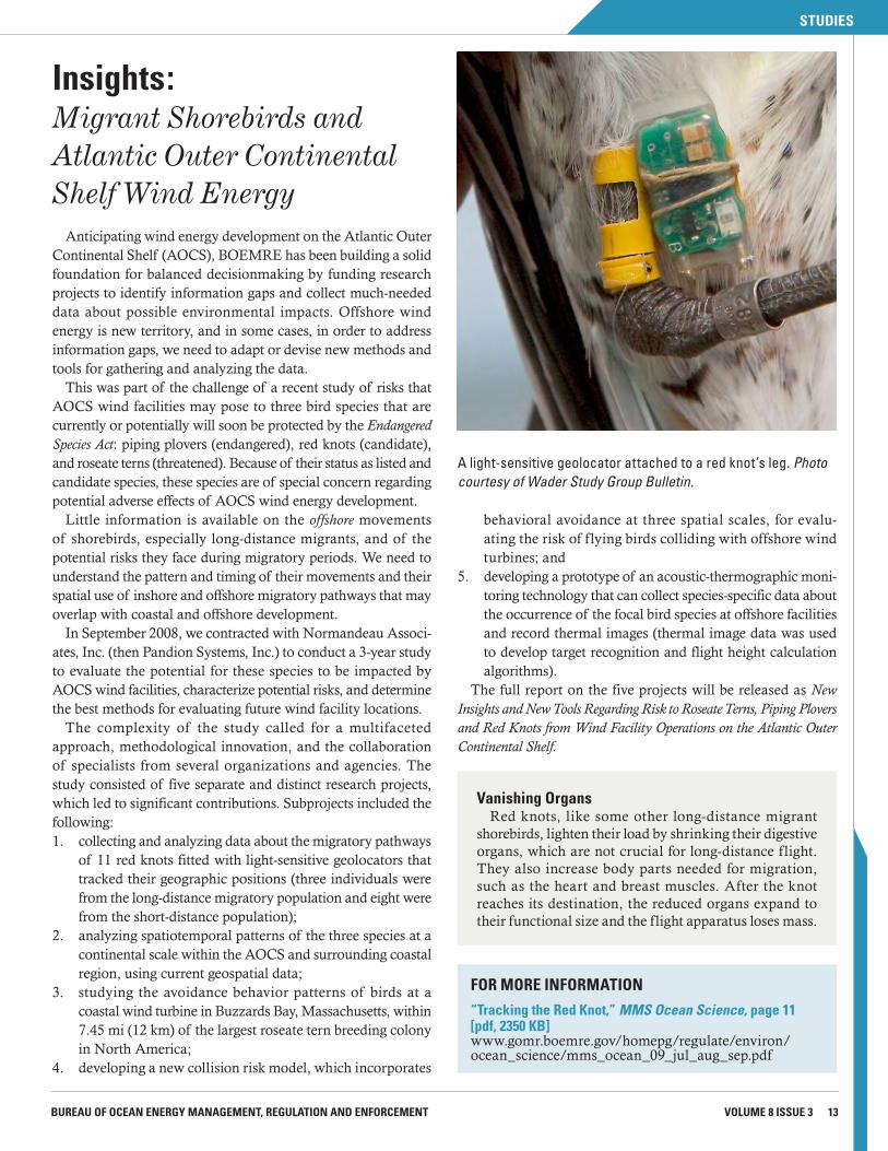
This was part of the challenge of a recent study of risks that AOCS wind facilities may pose to three bird species that are currently or potentially will soon be protected by the Endangered Species Act: piping plovers (endangered), red knots (candidate), and roseate terns (threatened). Because of their status as listed and candidate species, these species are of special concern regarding potential adverse effects of AOCS wind energy development.
Little information is available on the offshore movements of shorebirds, especially long-distance migrants, and of the potential risks they face during migratory periods. We need to understand the pattern and timing of their movements and their spatial use of inshore and offshore migratory pathways that may overlap with coastal and offshore development.
In September 2008, we contracted with Normandeau Associ-ates, Inc. (then Pandion Systems, Inc.) to conduct a 3-year study to evaluate the potential for these species to be impacted by AOCS wind facilities, characterize potential risks, and determine the best methods for evaluating future wind facility locations.
The complexity of the study called for a multifaceted approach, methodological innovation, and the collaboration of specialists from several organizations and agencies. The study consisted of five separate and distinct research projects, which led to significant contributions. Subprojects included the following:1. collecting and analyzing data about the migratory pathways
of 11 red knots fitted with light-sensitive geolocators that tracked their geographic positions (three individuals were from the long-distance migratory population and eight were from the short-distance population);
2. analyzing spatiotemporal patterns of the three species at a continental scale within the AOCS and surrounding coastal region, using current geospatial data;
3. studying the avoidance behavior patterns of birds at a coastal wind turbine in Buzzards Bay, Massachusetts, within 7.45 mi (12 km) of the largest roseate tern breeding colony in North America;
4. developing a new collision risk model, which incorporates
behavioral avoidance at three spatial scales, for evalu-ating the risk of flying birds colliding with offshore wind turbines; and
5. developing a prototype of an acoustic-thermographic moni-toring technology that can collect species-specific data about the occurrence of the focal bird species at offshore facilities and record thermal images (thermal image data was used to develop target recognition and flight height calculation algorithms).
The full report on the five projects will be released as New Insights and New Tools Regarding Risk to Roseate Terns, Piping Plovers and Red Knots from Wind Facility Operations on the Atlantic Outer Continental Shelf.
Insights:Migrant Shorebirds and Atlantic Outer Continental Shelf Wind Energy
A light-sensitive geolocator attached to a red knot’s leg. Photo courtesy of Wader Study Group Bulletin.
FOR MORE INFORMATION
“Tracking the Red Knot,” MMS Ocean Science, page 11 [pdf, 2350 KB]www.gomr.boemre.gov/homepg/regulate/environ/ocean_science/mms_ocean_09_jul_aug_sep.pdf
Vanishing OrgansRed knots, like some other long-distance migrant
shorebirds, lighten their load by shrinking their digestive organs, which are not crucial for long-distance flight. They also increase body parts needed for migration, such as the heart and breast muscles. After the knot reaches its destination, the reduced organs expand to their functional size and the flight apparatus loses mass.
14 BOEMRE OCEAN SCIENCE SCIENCE & TECHNOLOGY JOURNAL
STUDIES
Update: Tracking Long-Distance Migrating Red KnotsOne of the five wind energy-related research projects was
a pilot study focused on red knots (Calidris canutus rufa), a species of concern because of a major population decline over the past 25 years. Structures of some recent offshore drilling and proposed wind energy locations on the AOCS may pose a danger to migrant shorebirds, like the red knot. Balanced decisions can be made only with a thorough knowl-edge of the birds’ annual cycle, migration strategies, and the sites they use.
Lightweight (less than 10 g), light-sensitive geolocators attached to red knots’ legs would collect geographic data for up to 1 year and retain it for up to 20 years.
The pilot study would determine if the geolocators would work with red knots, and, if they did work, researchers would use the data to gain more insight into their annual movement patterns and patterns of macroscale exposure to wind facilities on the AOCS.
During their 2009 spring migratory stopover in Delaware Bay, New Jersey, 47 red knots were captured and fitted with geolocators. Three were recaptured in 2010 and the data in their geolocators was retrieved.
All three tagged birds flew to the Arctic, only one appar-ently bred, and all three wintered in South America.
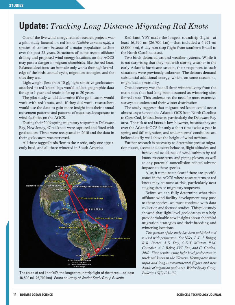
Red knot Y0Y made the longest roundtrip f light—at least 16,590 mi (26,700 km)—that included a 4,971-mi (8,000-km), 6-day non-stop flight from southern Brazil to the North Carolina coast.
Two birds detoured around weather systems. While it is not surprising that they met with stormy weather in the early Atlantic hurricane season, their responses to such situations were previously unknown. The detours demand substantial additional energy, which, on some occasions, might lead to mortality.
One discovery was that all three wintered away from the main sites that had long been assumed as wintering sites for red knots. This underscores the need for more extensive surveys to understand their winter distribution.
The study suggests that migrant red knots could occur almost anywhere on the Atlantic OCS from North Carolina to Cape Cod, Massachusetts, particularly the Delaware Bay area. The risk to red knots is low, however, because they are over the Atlantic OCS for only a short time twice a year in spring and fall migration, and under normal conditions are believed to fly well above the height of wind turbines.
Further research is necessary to determine precise migra-tion routes, ascent and descent behavior, flight altitudes, and
behavioral avoidance of wind turbines by red knots, roseate terns, and piping plovers, as well as any potential noncollision-related adverse impacts to these species.
Also, it remains unclear if there are specific zones in the AOCS where roseate terns or red knots may be most at risk, particularly near staging sites or migratory stopovers.
Before we can fully determine what risks offshore wind facility development may pose to these species, we must continue with data collection and focused studies. This pilot study showed that light-level geolocators can help provide valuable new insights about shorebird migration strategies and their breeding and wintering locations.
This portion of the study has been published and is used with permission. See Niles, L.J., J. Burger, R.R. Porter, A.D. Dey, C.D.T. Minton, P.M. Gonzalez, A.J. Baker, J.W. Fox, and C. Gordon. 2010. First results using light level geolocators to track red knots in the Western Hemisphere show rapid and long intercontinental f lights and new details of migration pathways. Wader Study Group Bulletin 117(2):123–130.The route of red knot Y0Y, the longest roundtrip flight of the three—at least
16,590 mi (26,700 km). Photo courtesy of Wader Study Group Bulletin.
PARTNERSHIPS
15BUREAU OF OCEAN ENERGY MANAGEMENT, REGULATION AND ENFORCEMENT VOLUME 8 ISSUE 3
Deepwater canyons are among the most striking features in the waters off the mid-Atlantic coast. Some of these canyons, which lie along the continental margin of the eastern U.S., are incredibly extensive and cut quite deeply into the seafloor.
Beginning north of Cape Hatteras, North Carolina, and continuing north beyond Cape Cod, Massachusetts, the canyons drop down thousands of feet before reaching the deep ocean bottom.
The hard bottom is habitat to deep-sea corals, such as Lophelia, gorgonian, and stony corals that have been growing for hundreds and maybe thousands of years, and also to sponges and anemones.
To explore and characterize these canyons, BOEMRE, the National Oceanic and Atmospheric Administration (NOAA), the U.S. Geological Survey (USGS), and scientists from several universities are engaged in a 4-year project: “Exploration and Research of Mid-Atlantic Deepwater Hard Bottom Habi-tats and Shipwrecks with Emphasis on Canyons and Coral Communities.” As part of its mission, BOEMRE will use the information acquired during this study to predict, assess, and manage impacts to natural and cultural resources from energy development.
The study is sponsored through the National Oceano-graphic Partnership Program, a collaboration of Federal agencies, academic institutions, and industry that supports and coordinates national oceanographic research, technology development, and education. The contractor, Continental Shelf Associates International, is funded by this interagency effort.
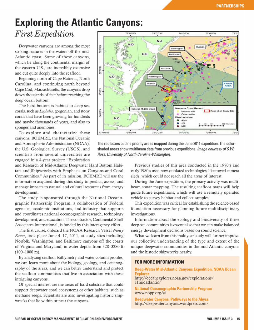
The first cruise, onboard the NOAA Research Vessel Nancy Foster, took place June 4–17, 2011, at study sites including Norfolk, Washington, and Baltimore canyons off the coasts of Virginia and Maryland, in water depths from 328–3280 ft (100–1000 m).
By analyzing seafloor bathymetry and water column profiles, we can learn more about the biology, geology, and oceanog-raphy of the areas, and we can better understand and protect the seafloor communities that live in association with these intriguing canyons.
Of special interest are the areas of hard substrate that could support deepwater coral ecosystems or other habitats, such as methane seeps. Scientists are also investigating historic ship-wrecks that lie within or near the canyons.
Previous studies of this area conducted in the 1970’s and early 1980’s used now-outdated technologies, like towed camera sleds, which could not reach all the areas of interest.
During the June expedition, the primary activity was multi-beam sonar mapping. The resulting seafloor maps will help guide future expeditions, which will use a remotely operated vehicle to survey habitat and collect samples.
This expedition was critical for establishing the science-based foundation necessary for planning future multidisciplinary investigations.
Information about the ecology and biodiversity of these deep-sea communities is essential so that we can make balanced energy development decisions based on sound science.
What we learn from this multiyear study will further improve our collective understanding of the type and extent of the unique deepwater communities in the mid-Atlantic canyons and the historic shipwrecks nearby.
Exploring the Atlantic Canyons: First Expedition
FOR MORE INFORMATION
Deep-Water Mid-Atlantic Canyons Expedition, NOAA Ocean Explorerhttp://oceanexplorer.noaa.gov/explorations/ 11midatlantic/
National Oceanographic Partnership Programwww.nopp.org/#
Deepwater Canyons: Pathways to the Abysshttp://deepwatercanyons.wordpress.com/
The red boxes outline priority areas mapped during the June 2011 expedition. The color-shaded areas show multibeam data from previous expeditions. Image courtesy of S.W. Ross, University of North Carolina-Wilmington.
boemre oCeAN SCIeNCeBureau of Ocean Energy Management, Regulation and Enforcement (BOEMRE)Mail Stop 54311201 Elmwood Park BoulevardNew Orleans, LA 70123
Prstd Std US Postage
PAIDNia. Falls, NY
Permit No. 28
BOEMRE: A steward of the ocean environment
New WavesLate-Breaking News & Information
Dr. James Kendall Named Regional Director of BOEMRE’s Alaska OCS Region
BOEMRE Director Michael R. Bromwich named Dr. James Kendall as the Regional Director of the Alaska OCS Region. Kendall will transition to become the head of the Alaska region for the Bureau of Ocean Energy Management when the new agency is functional in October.
“Jim embodies the principles of scientific integ-rity. He is committed to openness and transparency, and he is a dedicated public servant. The feedback I have received regarding Jim’s tenure over the last few months as acting regional director from envi-ronmental organizations, industry groups, and other stakeholders has been uniformly positive—they have praised Jim's openness, his accessibility, and his will-ingness to listen to all points of view,” Bromwich said.
Kendall joined BOEMRE (then the Minerals Management Service) in 1988 as an oceanogra-pher in the Gulf of Mexico OCS Region office. He became Chief of the Environmental Sciences Section in 1994 and held that position until 2000
when he moved to BOEMRE’s headquarters office to serve as Chief of the Environmental Sciences Branch.
In 2008, he became Chief of the Environmental Division where he oversaw BOEMRE’s $30 million applied environmental and socioeconomic research program, its responsibilities under the National Envi-ronmental Policy Act, its environmental compliance responsibilities, and the Coastal Impact Assistance Program.
The Alaska OCS Region office oversees the exploration and development of energy resources in Federal waters off Alaska. This includes resource assessments, environmental analyses and research, and coordination with local, state, tribal and Federal governments, and other interested parties.
“The Alaska OCS is both an environmental trea-sure and a vital, strategic national resource and I am committed to ensuring safe and environmentally sound stewardship of its resources,” Kendall said.