Embed Size (px)
Citation preview
The power of zoom: Spatial Data Infrastructures – Society’s transformation via location intelligence
Matt Gentile Geospatial Analytics Leader, Deloitte [email protected]
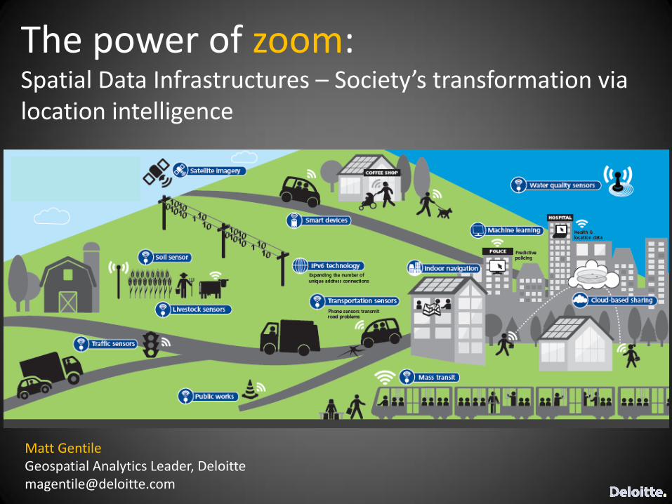
Three big trends…
…are changing the way we see and understand our world.
What is powering location enabled society?
Smart devices, physical sensors and the Internet are generating
an exponentially increasing amount of location data
Cloud processing can rapidly translate large amounts of
geospatial imagery and location-based data into insight
Maps have become dynamic, living platforms for shared
decision-making and real-time collaboration
Digital Exhaust Geospatial Technology Mapping Platforms

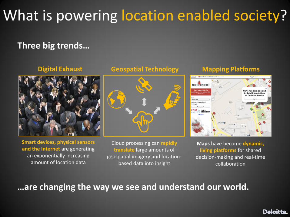
Visualizing what was once invisible…
“As the location reports from the tracked objects started coming in, we were fascinated to see an invisible infrastructure unfolding.” - Dietmar Offenhuber, Trash Track Project Leader at MIT Senseable City Lab
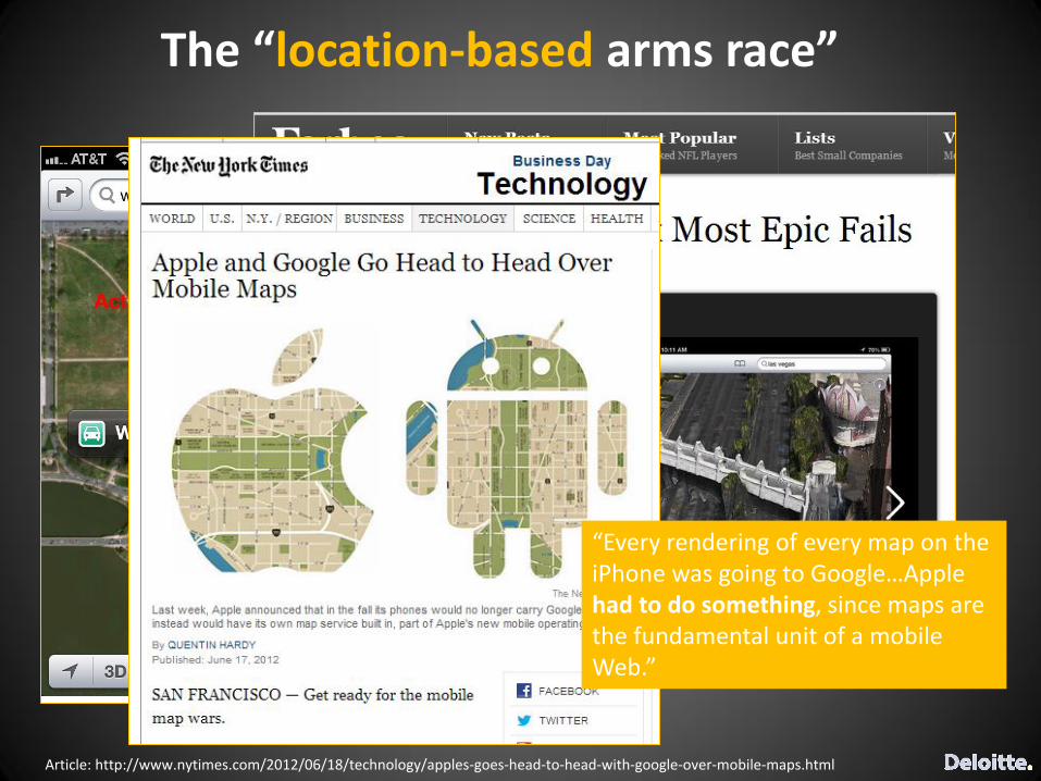
“Every rendering of every map on the iPhone was going to Google…Apple had to do something, since maps are the fundamental unit of a mobile Web.”
The “location-based arms race”
Article: http://www.nytimes.com/2012/06/18/technology/apples-goes-head-to-head-with-google-over-mobile-maps.html
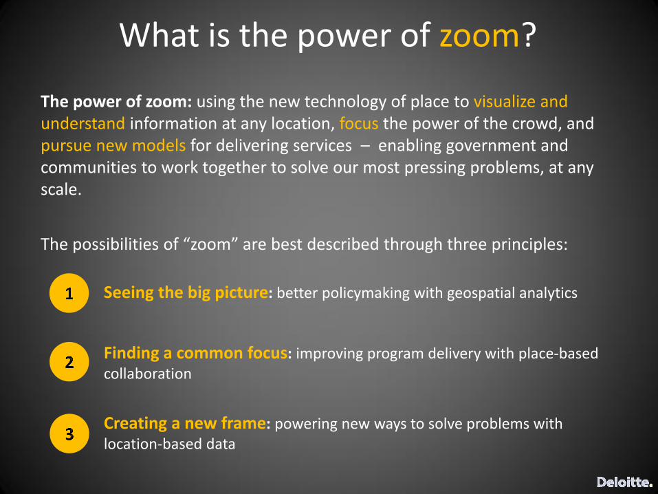
The power of zoom: using the new technology of place to visualize and understand information at any location, focus the power of the crowd, and pursue new models for delivering services – enabling government and communities to work together to solve our most pressing problems, at any scale.
The possibilities of “zoom” are best described through three principles:
What is the power of zoom?
Seeing the big picture: better policymaking with geospatial analytics
Finding a common focus: improving program delivery with place-based collaboration
Creating a new frame: powering new ways to solve problems with location-based data
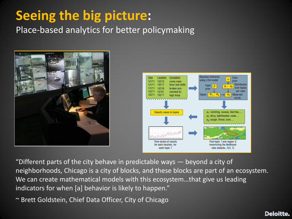
Seeing the big picture: Place-based analytics for better policymaking
“Different parts of the city behave in predictable ways — beyond a city of neighborhoods, Chicago is a city of blocks, and these blocks are part of an ecosystem. We can create mathematical models with this ecosystem…that give us leading indicators for when [a] behavior is likely to happen.”
~ Brett Goldstein, Chief Data Officer, City of Chicago
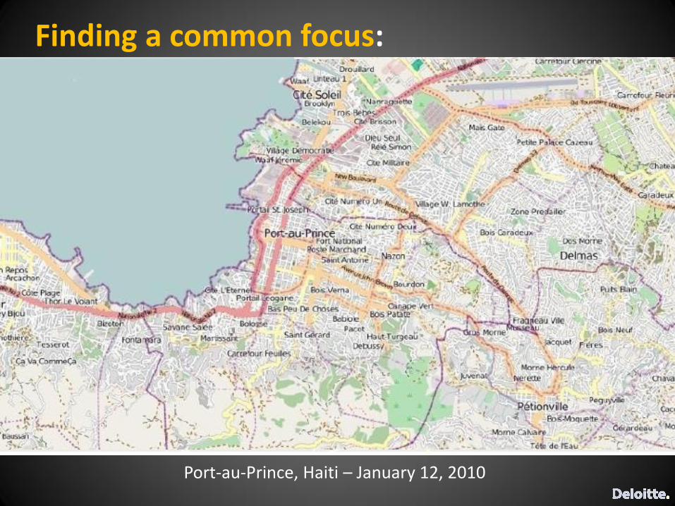
Port-au-Prince, Haiti – January 12, 2010
Finding a common focus:
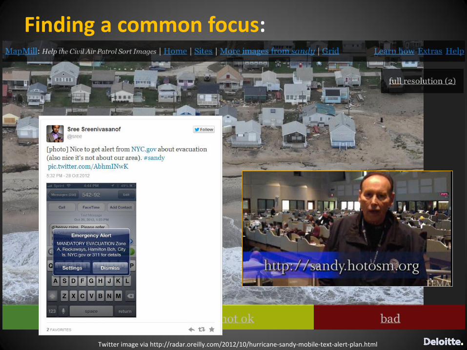
Finding a common focus:
Twitter image via http://radar.oreilly.com/2012/10/hurricane-sandy-mobile-text-alert-plan.html

www.strava.com


![Aritmética Elemental [Enzo R Gentile]](https://img.pdfslide.us/doc/110x75/55cf9904550346d0339b0fc8/aritmetica-elemental-enzo-r-gentile.jpg)