Embed Size (px)
Citation preview

125Miguel Ángel Sorroche Cuerva Th e Pacifi c Ocean and the Californias
The Pacific Ocean and the Californias.
Power relations and trade on the
periphery of the New Spain (-)
Miguel Ángel Sorroche Cuerva
University of Granada
Resumen: La defi nición de los extremos del itinerario que estableció
el galeón de Manila a partir de 1565, con especial atención al frente
norteamericano en el que las Californias se convirtieron desde inicios
del siglo xvii en un punto básico de la política internacional española
en el Pacífi co, corrobora el proceso de control territorial que se había
iniciado ciento cincuenta años antes, evidenciando la importancia que
adquirió el Mar del Sur como espacio de relación. Si bien no podrán
ser tratados todos los aspectos que consideramos implicados para
comprender el proceso analizado, en el caso de las Californias, su papel
fue paulatinamente más importante desde que se establecieron de un
modo defi nitivo los primeros asentamientos misionales.
Palabras clave: Pacífi co, Californias, poder, comercial, Nueva España.
Abstract: Th e defi nition of the itinerary poles that Manila´s galleon
established from 1565, with special attention to the North-American
front in which the Californias were a basic point for Spanish international
politics, confi rm the territorial controlling process that was started 150
years earlier, showing the importance that the southern sea acquired as
a connecting space. Although not all of the aspects that we consider to
be involved in the analysed process can be targeted to understand it, in
the case of the Californias, its role became gradually more important
from the establishment of the fi rst missionary settlements.
Keywords: Pacifi c, Californias, power, commercial, New Spain.
Recibido: 04-05-2013 | Evaluado: 20-05-2013
126 POTESTAS, No 6 2013 ISSN: 1888-9867 | DOI: http://dx.doi.org/10.6035/Potestas.2013.6.5 - pp. 125-142
Introduction
The discovery of the Pacifi c in 1513 marked a fundamental date in the
historical development of the events that were occurring at that time
in America. A vast scenario ensued within which the integral perception of
the planet would be completed, through which the possibilities of relations
between diff erent regions in the world were broadened and diversifi ed. Th is
event somehow invites us to consider the facts that were yet to occur from that
date on, constructing the pillars for the knowledge of Spanish history in these
territorial boundaries, as well as each of the territories that fl anked its coast.
Amongst these territories, the Californias stood out as a frontier area, with
two diff erent aspects in this condition, although integrated within its role as
a historical region. Its prominence as an exchange and relations area with the
Pacifi c background evidences its importance in consolidating this area of the
viceroyalty of New Spain, defi ning Spanish international politics as a result of
a long process which began in the 16th century.
Th e chronological spectrum chosen and defi ned in this article covers
the time between the establishment of the trip around Urdaneta, that will
periodically take the Manila galleon to these coasts, and the foundation of
San Francisco, the last settlement with a strong strategic value that showed
the Spanish interests in this region and where the religious, military and civil
components were the face of a system that was constructed and used since the
end of the 17th century. Its international dimension is perhaps another reason
to look back at this immense ocean, and rethink its role in the northwest front
of New Spain´s frontier between the 16th and the 18th centuries, and as a
main context of the power and commercial exchange relations between the
diff erent nations present there. Th e historical unfolding will show the need
to join the pieces of the disjointed jigsaw in order to understand not only the
relations within an area connected by two poles, but also to raise multiple
questions concerning the intermediate area.
The Pacific and its coasts
Th is is an area for exchange and relationships that has been questioned
because of its dimensions and the underestimation of human capabilities to
get along in it. Focus has swung between theoretical speculation concerning
the routes of human population groups in the American continent,1 and the
1. Its dimensions have always been behind the aim to explain theories about the movements of human
groups or along itself, or of the relationships between these putting in contact north and south American
contexts from its oriental coast and being essential to understand the development of some civilization
focus such as the case of the Andean region. Cf. Pablo Martínez del Río: Orígenes del hombre americano.
[1987], conaculta, México,1997; Diego Andrés Rocha: El origen de los indios. (José Alcina Franch ed.),
Historia 16, Madrid, 1998; y Paul Rivet: Los orígenes del hombre americano. [1943], fce, México, 1987.
127Miguel Ángel Sorroche Cuerva Th e Pacifi c Ocean and the Californias
evidence that relationships with European nations that fought for the control
of this area throughout the Modern Age resolved its potentiality.
Th e territories that constituted the Californias and that currently
conform the Mexican peninsula of Low California and the North American
California, were, between the 16th and the 18th centuries, the scenario of
conquest, occupation and evangelization politics determined by two fronts,
one terrestrial and one maritime. In the fi rst case, the terrestrial front, the
connection with the continental area will provide a long distance with the
decision-making areas that will be decisive, and also geography and climate
and the characteristics of the human groups and formed its population. In the
second case, the maritime front, this was open to an uncertain horizon that
will turn into a tremendously intense and dynamic one and, as in the fi rst case,
become conditioned by travelling distances.
Th e letter that father Piccolo sent to Juan Maria Salvatierra in 1699
describing an expedition to the Pacifi c Coast of the low California peninsula
is illuminating. It reveals how 134 years after Juan de Urbieta completed the
trip from the Philippines archipelago, there was not a safe area to which the
galleons could reach and avoid the English and Dutch assaults, showing some
aspects of a reality that would be defi ned over the passage of time.2
Th e 18th century was noticeable for the expulsion of the Jesuits from
the Hispanic territories under the reign of Carlos III, the arrival of the
Franciscans, its posterior relocation in North American California from 1769,
and the incorporation of the yearned for Camino de las Californias of the
Dominicans from 1573. In both cases the interest of the territorial control was
moved to the northern area that had been coveted since the 16th century. Th e
Russian presence, more evident towards the south coast in trying to secure
its fur factories, refl ects the incorporation of new protagonists in the process.
Somehow the importance of the commercial exchange of the Galleon was
aff ected by the profi tability of the transported goods, and thus the political
interests to control it were emphasized.
In the fi rst quarter of the 19th century (and in the middle of it), the
independence processes and the start of the frontier adjustments meant that
the last missionary foundations in this coastal area were the prelude to future
changes. Th e secularization of these missionary foundations ended a process
in which the religious orders had been participating since the end of the year
fi ve hundred and been responsible for the religious and the political aspects
of an action to consolidate a space that was unequally appreciated by the
crown. Th is was the end point of a long period during which the lack of power
emerged that, disabled to control a growing territory, used the most diverse
formulas to be present in the areas that were remote from the decision centre
2. Th e news is essential for understanding the origin of the presence of a variety of objects that
comprised the ecclesiastical goods, constituted by Asian Philippine or Japanese pieces and will corroborate
later the Jesuit Miguel del Barco.
128 POTESTAS, No 6 2013 ISSN: 1888-9867 | DOI: http://dx.doi.org/10.6035/Potestas.2013.6.5 - pp. 125-142
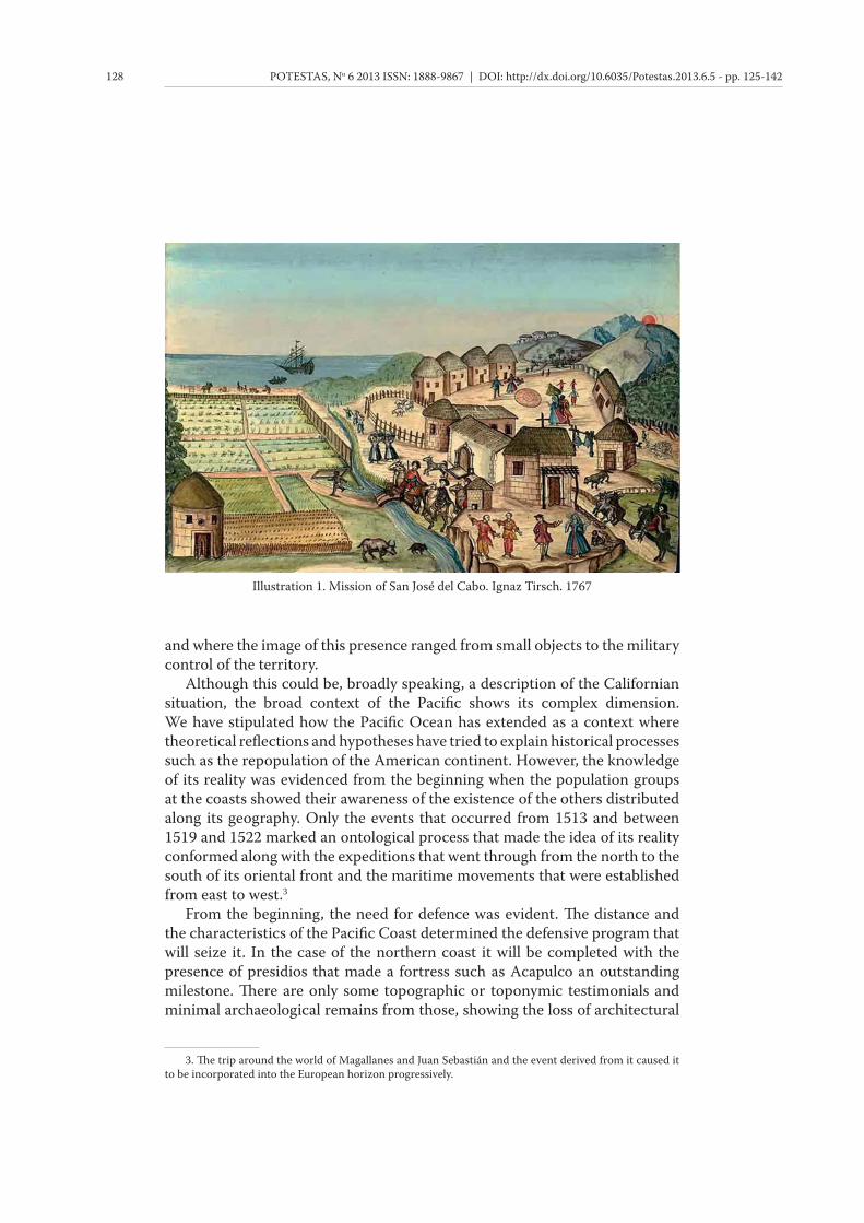
and where the image of this presence ranged from small objects to the military
control of the territory.
Although this could be, broadly speaking, a description of the Californian
situation, the broad context of the Pacifi c shows its complex dimension.
We have stipulated how the Pacifi c Ocean has extended as a context where
theoretical refl ections and hypotheses have tried to explain historical processes
such as the repopulation of the American continent. However, the knowledge
of its reality was evidenced from the beginning when the population groups
at the coasts showed their awareness of the existence of the others distributed
along its geography. Only the events that occurred from 1513 and between
1519 and 1522 marked an ontological process that made the idea of its reality
conformed along with the expeditions that went through from the north to the
south of its oriental front and the maritime movements that were established
from east to west.3
From the beginning, the need for defence was evident. Th e distance and
the characteristics of the Pacifi c Coast determined the defensive program that
will seize it. In the case of the northern coast it will be completed with the
presence of presidios that made a fortress such as Acapulco an outstanding
milestone. Th ere are only some topographic or toponymic testimonials and
minimal archaeological remains from those, showing the loss of architectural
3. Th e trip around the world of Magallanes and Juan Sebastián and the event derived from it caused it
to be incorporated into the European horizon progressively.
Illustration 1. Mission of San José del Cabo. Ignaz Tirsch. 1767
129Miguel Ángel Sorroche Cuerva Th e Pacifi c Ocean and the Californias
forcefulness but not of eff ectiveness in designing a program to control the
coast and the entries to the inland. In any case it systematically represents
the intention of the crown in this part of the empire, far removed from the
programs developed in the context of the South Pacifi c around Valdivia, nor
even near to the program designed in the Philippines, and indeed very distant
from the forcefulness of the Caribbean-Atlantic program.4
On the other hand, the western coast of the Pacifi c presented a dynamic
context in which the journeys between the diff erent territorial areas of the
southeast had been occurring during the past centuries and that was open to
the circuits of the Indian Ocean. Th is was an area with natural relationships
within contexts such as the African or Indian, it had been controlled by
cultures such as Muslim since the 7th century in diff erent periods if time, and
the commercial domain in the area was a refl ection of this. Th is area therefore
represented an historical reality suggestive of the links between the human
groups from the fi rst century A.C., in a progression that will be renowned in
the 15th century.5 In this reality we cannot forget the Portuguese presence
from the end of that century that made it a context known in Europe, and this
will become consolidated over the 16th century with the foundation of some
essential settlements such as Macao.6
Th at unbalanced situation (unlike the American coast where there were
no main centres for exchange) made it possible for cities such as Manila to
become a commercial reference in the region. Here Chinese, Indian and
Japanese products converged that went from one place to another along the
diff erent routes that used the Philippine capital as a compulsory exchange
and meeting point that will intensify from the 16th century. Th is strategic
importance, as well as the density of the movements and the geographical
characteristics of the narrow straits between the islands, made the new military
construction policies completely diff erent to those that had been in place up
until that moment. Th e British presence in Manila between 1762 and 1764
and the subsequent Dutch presence marked both moments as turning points
that was refl ected in a reconstruction of the military complex and an increase
of it in some sectors where the weight of the architectural work was carried
by the religious orders such as the Jesuits or the Augustinians, reproducing an
interesting multiplicity of roles that had been observed in other contexts.
4. In each of the three spheres described, the programs developed stand out as an example of the
continuity of the construction system on the other side of the Pacifi c, see María lourdes Díaz-Trechuelo
Spínola: Arquitectura española en Filipinas (1565-1800), EHH, Sevilla, 1959.
5. With respect to this subject cf. Luce Boulnois: La ruta de la seda. Dioses, guerreros y mercaderes,
Península, Barcelona, 2004.
6. Th e presence and competition of two of the Iberian powers in the Orient has been adressed by
diff erent authors, as well as the European expansion from the 15th century around territories far from
Europe. Evidently within this dynamic the American adventure has been included, that with another two
incidents will allow us to confi rm a real image of the spaces around that area. Cf. John H. Parry: Europa y
la expansión del mundo. 1415-1715. [1949], fce, México, 2003; J.R.S. Phillips. La expansión medieval de
Europa. [1988], fce, México, 1994; and Claude Cahen: Oriente y occidente en tiempos de las cruzadas.
[1983], fce, México, 2001.

130 POTESTAS, No 6 2013 ISSN: 1888-9867 | DOI: http://dx.doi.org/10.6035/Potestas.2013.6.5 - pp. 125-142
California in the American and European imaginary
Returning to the Californian territories, the perception about them was
related to their extreme position in New Spain. Th e limits of the known earth
have always been an open space for imagination due to a lack of awareness
about them. Th e Californias, remote areas located at the north of Anahuac,
were always associated with fantasist interpretations regarding their origin
and nature because of their remote position in the image of both the pre-
Hispanic populations and the subsequent European ones, and this determined
its representation through the 17th and 18th centuries.7
In pre-Hispanic cosmology, the image of the Californias was included
within the conception about the place where the Sun would set, Tonatiuh.
Th e belief that the Sun will go across the sky after travelling through Mictlan
and win the fi ght against the night forces became a representation of the
sphere into which two of the most respected social prototypes within the
pre-Hispanic world will go after death. On the one hand, the soldiers fallen
in combat will become the court that will escort the Sun from its rise until
the zenith, whereas from this point until the sunset, women who have fallen
while giving birth will escort it and will prepare it for its nocturnal fi ght. Th ese
cihuateotl, magestically represented in the sculptural complex in Zapotal,
are the feminine contribution that caused this coastal region to soon become
linked with a group of women that will live on an island, and constituted one
of the fi rst verifi cations of the cross between pre-Hispanic and Europeans that
occurred in the American context.8
On the other hand, for the Europeans, the same localization in the border
of the known earth captured many of the images that had been generated since
the antiquity, where the wild and incredible settled without problems, in spite
of the descriptions given to it from infernal to heavenly, mainly in the 18th
century.9
In this context we should include the Californian area, within the broader
context of the new Spanish North, in which Fray Marcos de Niza described
cities such as Quivira or Cibola, and that were represented and located in
some maps that incorporated them into the American imaginary thanks to
expeditions such as the one by Alvar Nuñez Cabeza de Vaca.
7. See one of the most complete repertoires of the representations in Low California, cf. Miguel León-
Portilla: Cartograf ía y crónicas de la antigua California, UNAM, México, 2001.
8. Miguel Ángel Sorroche Cuerva: «Tradición indígena y leyenda medieval: la representación gráfi ca
de lugares fantásticos», in Inmaculada Rodíguez Moya y Víctor Mínguez: Arte en los confi nes del Imperio,
Universitat Jaume I, Castellón de la Plana, 2011, 151-174.
9. «In this regard, the Greeks imagined mythic populations with wild qualities and barbarian features:
gryphon, cynocephalus, wild cálibes, savage amazons, lotófago, Gorgonas, etc., but also wonderful places
such as the island of Gereión, the islands of the Blessed and the Atlantis of Platón. Countries of Gods,
countries of the dead, in conclusion, wonderful countries». Salvador bernabéu Albert: «California, o
el poder de las imágenes en el discurso y las misiones jesuitas», Contrastes. Revista de Historia, 12 (2001-
2003), 159-185, specifi cally 164.
131Miguel Ángel Sorroche Cuerva Th e Pacifi c Ocean and the Californias
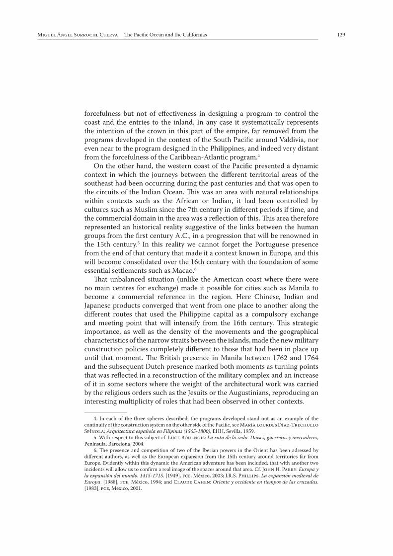
Th is imaginary representation will become more exact as a result of the
descriptions from the expeditions that will occur across its coast from the
beginning of the 17th century. Th is representation of its coast impeded a better
knowledge of the inland - this will have to wait for the incursion commanded
by religious groups such the Jesuits and the Franciscans during the last
quarter of the 17th and mainly during the 18th century. Th ese incursions were
supported in many cases by the native groups.10 Th is fact can be appreciated
in the representation of the peninsula, in that it shows it neither as a peninsula
nor an island. In any case, the North was a linked space with the unknown
that covered the image of this new Spanish northern sector, inheriting the pre-
Hispanic image of this point of the geography.
Power relationships in the Californias
Th e discovery of the South Sea in 1513 by Nuñez de Balboa did, without
a doubt, corroborate the suspicions surrounding these lands, as well as those
10. With respect to the confi rmation of these territories there is a variety of works: We refer to the
two that represent the characteristics of them. Íñigo Abbad y Lasierra: Descripción de las costas de
California, CSIC-Instituto Gonzalo Fernández de Oviedo, Madrid, 1981; and María Luisa Rodríguez
Sala: Exploraciones en Baja y Alta California, 1769-1775: escenarios y personajes, unam, México, 2002.
Illustration 2. Island of California. Johannes Vingboons. 1650

132 POTESTAS, No 6 2013 ISSN: 1888-9867 | DOI: http://dx.doi.org/10.6035/Potestas.2013.6.5 - pp. 125-142
concerning the true dimension of the endeavour that began at this time. Only
a few centuries later (in the 18th century) the scientifi c expeditions will not
only allow the technical control of the territory, when the members of the
expeditions were not only religious and military but also military engineers,
but also to have the perspective from the precise knowledge of its profi le
and conditions, as mentioned in the previous section.11 Th ese circumstances
were not supported by the crown, whose hesitation was refl ected in unequal
treatment from a defensive point of view compared to other sectors of the
Pacifi c Coast, unlike the system developed in other contexts.
Th e apathy in defending this vast fl ank was caused by the length and the
characteristics of its coasts. Historical evolution suggests the opposite. Th e
Spanish endeavour in this region was slowly undermined by the presence of
British and Dutch ships that would seriously impact the strategy developed
since the 16th century. Th e course of the Manila galleon in North American
coasts and its derivation towards the southern port of El Callao soon saw
how some of its galleons such as the Santa Ana were captured, proving their
vulnerability.12 Th is situation ultimately worried the viceroys, as demonstrated
in some of their memoirs in which the dimension of the factors playing a role
in the coastal sector of New Spain was explained.13
Th e enormous construction work carried out in the Caribbean was justifi ed
because this was the central point from which the commerce was organized
through the Carrera de Indias that reached the Iberian Peninsula. It served
as an agent of change for a series of tensions around its forks, including the
Pacifi c, and the added presence of other nations that wanted to control this
commerce, along with the presence of pirates. Facing this area the investments
in the Pacifi c, conditioned by the extension of its coast, were reduced to specifi c
spaces. Some of these spaces stood out because of their complexity, such as the
fort complex in Valdivia, Chile, but lacked the integrity of its previous one.
11. Cf. Guadalupe pinzón Ríos: «Una descripción de las costas del Pacífi co novohispano del siglo
xviii», ehn, 39 (julio-diciembre 2008), 157-182.
12. Th e awareness of the dimensions of the enterprise made the Spanish crown accept the presence of
ships from other powers such as France, that with the permits could sail around these areas complementing
the works that couldn't be controlled and that refl ects a constant in Spanish politics in America that can be
explained because of the impossibility of confronting such a vast enterprise on its own.
13. In relation to this, it is signifi cant that the signature of the viceroy Jose Miguel de Azanza (1798-
1800), even though outside of the period analysed here clearly shows the integrated components in the
whole process that we study, particularly the military and the commercial processes. From the naval station
of San Blas, I should speak about subjects concerning the military area. Nothing I will say to your Excellence
about the movement of those short naval forces to the port of Acapulco, a subject on which enough has
been written in the last two governments. Th e truth is that, whether in one or the other place, enough
ships are needed to carry the memories to the Californias, High and Low, and let´s hope so that were also
capable of protecting our commerce and navigation in the whole of the South Sea belonging to New Spain.
Nowadays that small marine is reduced to the corvettes Princesa and Concepción, brigantines Activo and
Valdés, sloop Horcasitas and schooners Sutil and Mexicana, with two gunboats. Th e corvette Aránzazu that
went to Manila has been rendered useless, and it is uncertain, as just as your Excellence will see according
to the correspondence from the general captain of those islands, if it will be replaced or not…». Ernesto
de la Torre Villar: Instrucciones y memorias de los Virreyes Novohispanos, T. II, Porrúa, México, 1991,
1366-1367.
133Miguel Ángel Sorroche Cuerva Th e Pacifi c Ocean and the Californias
In the Californian case, an enormous importance was given to both the
geographical determinants of the design of the structural program and to the
historical conditions of the region in which the support for the religious work
also played an important role. Not long after, the native populations started
insurrection actions and the pressure increased from the European powers
that were competing to control the riches that were generated from the strip
mining of the deposit and the commercial routes, both land and maritime, in
the region.14
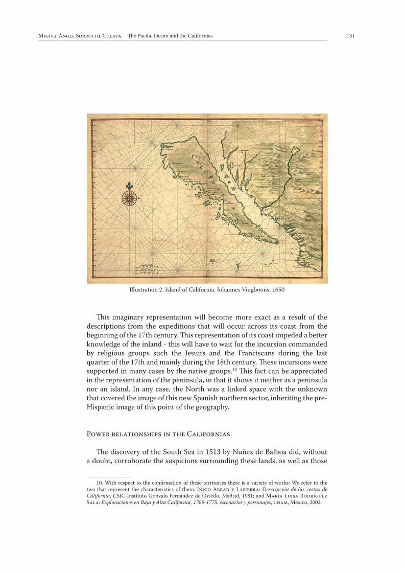
On the opposite side of the Pacifi c, the distance and the need to confront
a context with an intense traffi c that historically directed the products
that arrived to the Manila port from China, India, or Japan, resulted in the
concurrent foundation of the settlements; some of the most important forts
in the region were built, such the forts in San Fernando in Cebu, Santiago in
Manila, San Fernando in Taiwan as well as minor structures that controlled
the strategic crossing between the islands. In the same context we should
include the religious buildings that in the case of the Philippines acquired
characteristic physiognomies, where the structures of the towers were
integrated into components of the defensive system. Th ey enclose a complex
structural system of the territory, in which they stand out not only because of
its strategic location but also because of its dimensions, as in the case of the
Paoay and Laoay.
14. Th e complexity of the network that was established and that was partly dependent on the existing
pre-Hispanic has been treated in various occasions. However, we refer to Ramón María Serrera: Tráfi co
terrestre y red fl uvial en las Indias españolas, Ministerio del Interior-Lunwerg editores, Madrid-Barcelona,
1992.
Illustration 3. Fort of Santiago. Manila. 16th century

134 POTESTAS, No 6 2013 ISSN: 1888-9867 | DOI: http://dx.doi.org/10.6035/Potestas.2013.6.5 - pp. 125-142
In the light of this, the situation of the Californian coast was very
characteristic as an intermediate point within an itinerary in which it worked
as an infl exion area and the centre of a context already controlled in its ends,
but that was necessary to strengthen in the intermediate areas because of the
vulnerability of the galleons that arrived after their journey through the Pacifi c.
The Californias and the North West frontier of New Spain
Th e reason for its importance has been a subject of debate over recent years.
As we pointed out, in the case of the Californias the real and the mythical are
two sides of the coin, breathing life into the idea of its exceptional nature that
distinguishes it from other contexts.15
Th e territories of the north of New Spain conformed a broad space in which
a wide range of diff erent situations occurred due to its social, geographical
and frontier characteristics. Distant from the decision centres, the dynamics
characterized by the lack of control that caused a development that was
independent from the managing processes and made the presence of the power
visible that managed the new situation. From Florida to the Pacifi c coast, the
need for its control brought the proliferation of the duties of the institutions
involved that developed into specifi c regimes depending on the spheres and
that were particularly unique to the Californias.16 It was an adaptation process
to the new realities that the new protagonists of the colonization process faced
and that defi ned what would later become the very popular mission-presidio
structure in the New Vizcaya area at the end of the 16th century.17
In our specifi c case, from the end of the 17th century until the fi rst half
of the 19th century, the missions that Jesuits, Franciscan and Dominicans
founded from the far south of the peninsula of Low California to the San
Francisco Bay Area not only evangelized the native populations but also
acquired an integrated role in the international politics of the Spanish crown.
Th eir ambition was to secure their presence with an eff ective control over
the territory represented in the military component of the action. Th is was
initially refl ected in the participation of the military, whose eff ective presence
with the construction of presidios such as the Loreto, was a clear example of
15. Authors such as Salvador Bernabeu Albert say that: «As well as its geostrategic position in the
Northwest of North America, a territory wanted fi rst by the Russians and later by Anglo-Americans, the
California was an important peninsula because of its frontier use, similar to the hespérides in the Classic
Age. Th ese mythical islands were situated in the ends of occident in the habitat earth, the oikouméne of the
Greeks, and there were a garden of gold apples in it». Salvador Bernabéu Albert: «California, o el poder
de las imágenes…», op. cit., 159-185, specifi cally 164.
16. With respect to the characteristics that the government of Low California acquired from 1697,
referring to Ignacio del Río: El régimen jesuítico de la Antigua California, UNAM, México, 2003.
17. Patricia Osante: «El septentrión novohispano: una secular colonización hispana», in Salvador
Bernabéu Albert (Coord.): Poblar la inmensidad: sociedades, confl ictividad y representación en los
márgenes del Imperio Hispánico (siglos xv-xix), Ediciones Rubeo, Madrid, 2010, 43-106.
135Miguel Ángel Sorroche Cuerva Th e Pacifi c Ocean and the Californias
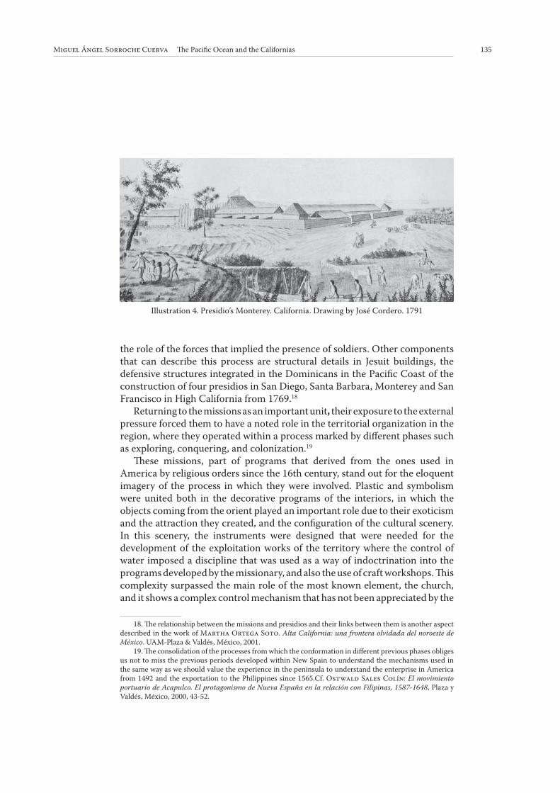
the role of the forces that implied the presence of soldiers. Other components
that can describe this process are structural details in Jesuit buildings, the
defensive structures integrated in the Dominicans in the Pacifi c Coast of the
construction of four presidios in San Diego, Santa Barbara, Monterey and San
Francisco in High California from 1769.18
Returning to the missions as an important unit, their exposure to the external
pressure forced them to have a noted role in the territorial organization in the
region, where they operated within a process marked by diff erent phases such
as exploring, conquering, and colonization.19
Th ese missions, part of programs that derived from the ones used in
America by religious orders since the 16th century, stand out for the eloquent
imagery of the process in which they were involved. Plastic and symbolism
were united both in the decorative programs of the interiors, in which the
objects coming from the orient played an important role due to their exoticism
and the attraction they created, and the confi guration of the cultural scenery.
In this scenery, the instruments were designed that were needed for the
development of the exploitation works of the territory where the control of
water imposed a discipline that was used as a way of indoctrination into the
programs developed by the missionary, and also the use of craft workshops. Th is
complexity surpassed the main role of the most known element, the church,
and it shows a complex control mechanism that has not been appreciated by the
18. Th e relationship between the missions and presidios and their links between them is another aspect
described in the work of Martha Ortega Soto. Alta California: una frontera olvidada del noroeste de
México. UAM-Plaza & Valdés, México, 2001.
19. Th e consolidation of the processes from which the conformation in diff erent previous phases obliges
us not to miss the previous periods developed within New Spain to understand the mechanisms used in
the same way as we should value the experience in the peninsula to understand the enterprise in America
from 1492 and the exportation to the Philippines since 1565.Cf. Ostwald Sales Colín: El movimiento
portuario de Acapulco. El protagonismo de Nueva España en la relación con Filipinas, 1587-1648, Plaza y
Valdés, México, 2000, 43-52.
Illustration 4. Presidio’s Monterey. California. Drawing by José Cordero. 1791

136 POTESTAS, No 6 2013 ISSN: 1888-9867 | DOI: http://dx.doi.org/10.6035/Potestas.2013.6.5 - pp. 125-142
historiography that centred its attention on the most prominent components.
Th e territorial dimension is therefore omitted as it is inserted in a bigger and
immaterial one.
Th e fi nal result was the necessary acceptance of the special circumstances
that were involved in that territory, which forced the design of an occupation
model in which the protagonists, the State, the Church, and the civil population,
delegated roles and generated a process of inequality.
Th e union of politics and religion was not new, but the conditions in which
the most tenacious order landed in that territory was defi ning a regime with
which it had full autonomy to accomplish some roles that lead to some confl icts
with the military elements present, and mainly with a civil component that
sometimes emerged from the military apparatus and that required equal
treatment for access to the exploitation of the riches in the territory.
During the process of confi guration two phases can be distinguished. Th e
fi rst phase was developed mainly in Low California between 1697 and 1767, in
which the occupation of the territory barely had military presence apart from
the construction of the Loreto prison as an evident element, and the second
phase between 1768 and 1776, during which the Jesuits and the San Francisco
mission were expelled, and in which the military component was developed
unequally both in the Low California and the High California territories. During
this second period we can identify a fi rst phase with the Dominican missions
that were founded between San Fernando de Velicata and San Diego from
1769, where the presence of defensive elements were noticed such as the fort
of the Santo Domingo mission and that complemented a strategic disposition
of the religious foundations that will be reconverted when the commerce with
otter skin developed by the Russians started. And the most evident phase from
1769, when the control of the coast is more direct, evidenced by the change in
Spanish politics facing the presence of the British and Russians. Th is aff ected
an articulation of the territory and the mission processes with the presence of
four main presidios, San Diego, Santa Barbara, Monterey and San Francisco.20
The control of the territory. A defined method
On October 7th 1699, Father Francisco Maria Piccolo was on a journey from
the Loreto mission to the Pacifi c Coast of the Low California peninsula in order
to, among other things, locate a favorable port in which the Manila Galleon could
layover. Th e extract of the letter that was addressed to Juan Maria Salvatierra
dated at the end of the month October and that can be found complete in the
20. Th e complexity of the group of elements that are involved in this frontier confi guration refl ects
the diff erent crossed interests that existed in the process. Cf. Luis Arnal: «El presidio. Instrumento de
población en el septentrión novohispano», in Salvador Bernabéu Albert (Coord.), Poblar la inmensidad:
sociedades, confl ictividad y representación en los márgenes del Imperio Hispánico (siglos xv-xix), Ediciones
Rubeo: Madrid, 2010, 117-124.
137Miguel Ángel Sorroche Cuerva Th e Pacifi c Ocean and the Californias
National Library of Mexico, is essential to our understanding of the method
developed by the Jesuits in Low California, sometimes describing the situations
that allow understanding of the general dynamic, the end of it being its most
signifi cant aspect.21
Th is epistolary information no only off ers a variety of descriptions that
allows us to have an idea of the reality of Low California but also conveys a
description of the constant contact with the native populations that are in many
cases new groups that approach the religious and that were fairly unknown. In
addition, this is an example of the two pillars that underlie the process, the
political and the religious, that in any case opens up questions concerning the
historical dynamic that was occurring and shows that it does not circumscribe
to the time of narration but is projected to past and future periods, allowing a
tremendously suggestive contextualization.22
Th e missionary journey was an excuse to off er contributions to various
aspects that we can apply to the whole of the Californian territory, given its
singularity as the periphery and frontier of New Spain, where the geographical
and population characteristics should be framed within the general context
of the so-called Aridoamerica, with the determinism that this implies in the
development processes of human groups that swarm in this areas.
Th e importance of the role that the Jesuit gave to the public ceremony and
sound, even the basic sound of bells, became a generalized habit and practised
by the natives in the early years such as 1699, which talks about the assimilation
of the evangelizing and indoctrination processes: «… the reception given to us
by the sons (that we have in this village) with various bows and bell ringing…»
as a sample of it.23 What is also in itself interesting is the reference to the
components to a mayfl y architecture that was present in diff erent levels of
complexity in New Spain from the 16th century, perhaps becoming more
important in the following centuries. It is interesting because it was a public
demonstration of representative elements and symbols of the community life
and of the educating role of the religious as a community activity that helped
to off er a higher signifi cance to the acts that it decorated.24
21. Ignacio del Río (ed.): Crónicas jesuíticas de la Antigua California. UNAM, México, 2000, 19-29.
22. Descriptions of ceremonies, dates about climatology and details about the territory, information
about church construction practices during its essential phases and descriptions of the diff erent populations
with which language, social behavior, etc., were crossed, are just an innumerable series of proposals for
approaches that are open for us, encouraging us to develop each one of them.
23. Ignacio del Río (ed.): Crónicas jesuíticas…, op. cit., 19.
24. An example of the mayfl y architecture that was carried out in Mexico in the 16th century is refl ected
in the work of Francisco Cervantes de Salazar: México en 1554 y Túmulo Imperial, Editorial Porrúa,
México, 1972.

138 POTESTAS, No 6 2013 ISSN: 1888-9867 | DOI: http://dx.doi.org/10.6035/Potestas.2013.6.5 - pp. 125-142
Illustration 5. Mission Church of San Francisco Javier Biaundó. 1756
Illustration 6. Mission Church of San Ignacio Kadakaamang. Low California. México. 1786
139Miguel Ángel Sorroche Cuerva Th e Pacifi c Ocean and the Californias
Th is letter is also an inestimable source to understand the mechanism
the religious groups used to enter into this inhospitable territory. Th e role of
the native in the journeys completed by the Jesuits as well as in the places
selected to found the mission was essential due to the speed with which the
foundations were created, and the strong symbolic role that they had in being
historic points for meetings or water supply integrated within a symbolic
geography that gives a special role to the landscape as the scenery of daily
nature.25 For this, the process of gathering information prior to the start of the
journey from San Francisco Javier to the countercoast is critical to understand
the occupation process.26
As mentioned earlier, the Evangelical work implied from the beginning
the availability of the necessary elements for it, where the construction of the
church was fundamental. Although the materials available are stone and earth
as well as vegetables for the construction of the roofs, the references to the
construction of the fi rst church in the San Francisco mission suggest the use
of adobe as a material that allows us to understand the system used in other
missions, given that this one was the second constructed in Low California. Th e
fact that the material used was adobe, and also the time taken was two days,
gives the impression that it was a well-known construction technique used
not only by the religious but also by the soldiers in charge of the protection
of these missions. In the military detachment number 14, the soldiers made
2500 adobes in two days to construct a chapel, seven yards long and four-and-
a-half yards wide, and two days was also the time they needed to construct a
residence for father Francisco Maria Piccolo and another two days to cover the
church with fodder.27
In addition to the religious, another sphere that shows the power
relationships established is that of the military. Addressing the awareness
of the presence of the Spanish power in a context such as the Pacifi c cannot
be separated from the general politics used in New Spain, from the military
component of it or from the territorial consequences that ensued in other
contexts and which became apparent as the frontier moved towards the north.
In this sense, the military organization of the region could barely adapt to the
programmed system. Th ese circumstances made the fi gure of the governor an
essential role in these territories along with the general captain. However, we
25. Rosa Elba Rodríguez Tomp: Los límites de la identidad. Los grupos indígenas de Baja California
ante el cambio cultural, Gobierno del Estado de Baja California Sur-Instituto Subcaliforniano de Cultura,
La Paz, 2006.
26. «while he was taking tongue and notice of the path and distance that was from this area to the sea
of the countercoast …». Ignacio del Río (ed.): Crónicas jesuíticas…, op. cit., 20
27. «…wanted the captain (Antonio García de) Mendoza with the soldiers to make some adobes for
the new chapel of San Francisco Javier. Divided in two teams of seven soldiers (each one), they made in two
days two thousand and fi ve hundred adobes. And the captain, who started the work, made with his partner
fi ve hundred adobes the fi rst morning, and the other team, in the evening, made six hundred adobes (…). In
conclusion, the colleagues made, in two days, the chapel of seven yards long and four yards wide. In another
two days they wanted to build for me, underserving, a settlement and a room, and in another two days they
covered the chapel that, even made of fodder, was beautiful». Ibídem, 20.
140 POTESTAS, No 6 2013 ISSN: 1888-9867 | DOI: http://dx.doi.org/10.6035/Potestas.2013.6.5 - pp. 125-142
assert that these characteristics were variable in each region of this vast area
to the extent that the link in the Californian case between religion and politics
forced a new solution to be found for the imposition of the reality that those
who wanted to control it had to face.28
In the light of this, the two fronts in the new sea that were open to the
Spanish domains required an integral policy based on a constructive program
in which the Spanish sovereign would instigate. Th e change from the Medieval
to the Modern Age brought a change in the attack systems that required an
improvement in the military structures used so far.29 Th e European approach
found that America was the setting to combine their static proposals with
the dynamics of a commercial fl eet that had to protect, in a combination of
components that made the American reality become complex were, as already
mentioned, not only piracy but also the pressure from powers such as England
and Holland which made its presence necessary.
In any case the complexity of the American reality made the defensive
typologies adapt to the diff erent cases, from the proposals to defend the coast
towns for layover and fl eet concentration to the one that will control the
internal frontiers both in disputes with the native groups and other European
powers. Th e techniques applied came from the experience with the Italian
and Dutch academies, of particular note being the formation of the Barcelona
Royal Group of Engineers and the Academy for Prospero Verboom.30
As we mentioned earlier, the Pacifi c front was recognized from the
perspective of its diffi cult access and its distance, although it was one of the
characteristics that aff ected the whole of the fl eets, including the Spanish one.
Th is situation created some doubts concerning the proceeding strategy, either
a dynamic defensive system using the fl oats or the static system using the forts,
without considering of using both, and in the case of California, none of them
being used in the end.
Th is did not avoid the inequality in the elements that will be constructed,
because although there was a program designed for the Chilean, Peruvian and
Ecuadorian coasts, the Mexican coast barely had elements from the Acapulco
fort and (from the 18th century) from the San Diego, Santa Barbara, Monterey
and San Francisco presidios, that, in 1775 would be the last intervention in this
northern region.
28. Virginia Guedua: «La organización militar», in Woodrow Borah: El gobierno provincial en la
Nueva España. 1570-1787, UNAM, México, 2002.
29. Th e dominant position of Spain in the Mediterranean context and its internal progression refl ected
in the development of the Granada war, brought about in the 16th century the conformation of a civil and
military architectural Academy that was suggested to be supported by Juan de Herrera. His links with Italy
meant that very soon the transalpine engineers served the King of Spain as in the case of Tiburcio Spanoqui,
who had a confirmed experience in constructing the forts in the Mediterranean against the Turkish.
Cf. Ramón Gutiérrez: Arquitectura y urbanismo en Iberoamérica, Cátedra, Madrid, 1983, 299-320.
30. Josep Soler Vidal: California: la aventura catalana del noroeste, FCE, México, 2012; J.O.
Moncada Maya: «Ingenieros militares en California. Siglo xviii» en J.O. Moncada. (Coord.): Fronteras
en movimiento. Expansión en territorios septentrionales de la Nueva España, Instituto de Geograf ía-
UNAM, México, 1999.
141Miguel Ángel Sorroche Cuerva Th e Pacifi c Ocean and the Californias
Th is contrasted with the eff ort to militarize the new open front in Asia.
Unlike California, the attention paid to the new spaces controlled in the
Philippine archipielago, (although we cannot forget others such as Guam or
the Marianas islands), depicts an intense construction process that can only be
explained in terms of the pressure of being a context perfectly defi ned by the
competition in the control for the diff erent commercial routes. Th e construc-
tion of forts such as the Cebu, Manila, Palawan or Taiwan and other minor
ones like the isle of Escarpada, would explain the concerns about potential
invasions in this other area.
Contrary to the Californian case, the existence of threats from the beginning,
where the native groups and the Asian and European powers were combined,
resulted in the occupying mechanisms then being incorporated more than in
the American context, the presence of the military structure being essential to
protect the population, and also where the religious orders participated during
the 18th century. Th e construction of fences is part of a methodology that was
practised since the beginning in America, to the extent that we cannot forget
that the Philippine context was the second occasion when the Spanish crown
had to confront the invasion of an insular area.
Undoubtedly, the perception of this region during the second half of the
16th century was more consistent. Th e politics developed by Felipe II in these
territories were marked by constant religious fi ghts, where the Jesuits certainly
had an impact on increasing the pressure on them, showing the contact but not
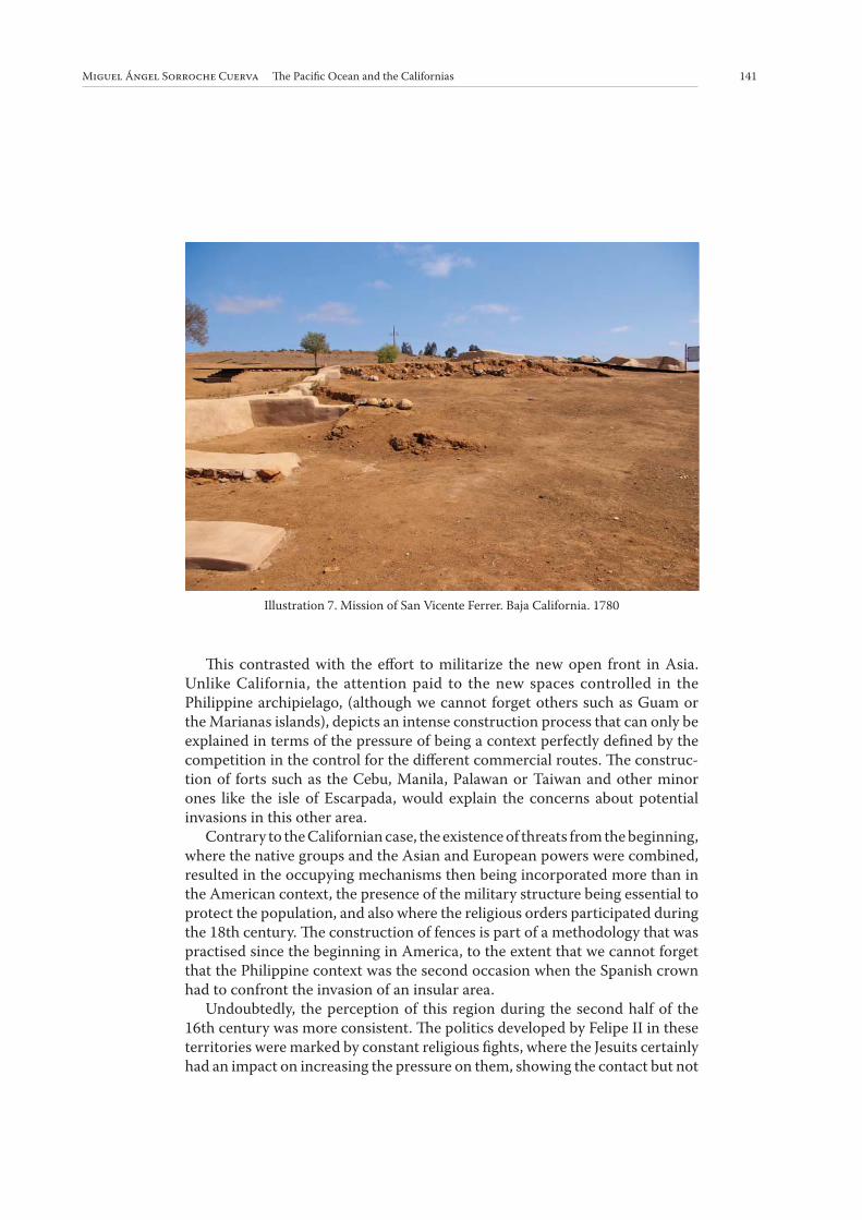
Illustration 7. Mission of San Vicente Ferrer. Baja California. 1780
142 POTESTAS, No 6 2013 ISSN: 1888-9867 | DOI: http://dx.doi.org/10.6035/Potestas.2013.6.5 - pp. 125-142
the exact knowledge of the Asian realities since their presence in these areas
since the decade of the 40s of the 16th century with San Francisco Javier.31
In all of this, the need to secure a pathway out for the ships from Manila
that had, since 1565, established regular contact with the Pacifi c countercoast,
resulted in this unequal development expressed in the complex buildings that
are currently a clear testimonial of this historical epoque.
31. Manel Ollé: La empresa de China. De la Armada Invencible al Galeón de Manila, Acantilado,
Barcelona, 2002.
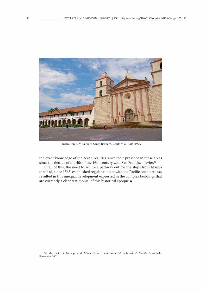
Illustration 8. Mission of Santa Bárbara. California. 1786-1925