Embed Size (px)
Citation preview
THE OSIRIS-REx LASER ALTIMETER (OLA). C. S. Dickinson1, M.G. Daly
2, O. Barnouin
3, C. Johnson
4, B.
Bierhaus5, J. Seabrook
2, T. Haltigin
6, D. Gaudreau
6, C. Brunet
6, G. Cunningham
7, D. S. Lauretta
8, E. B. Beshore
8,
W. V. Boynton8.
1MacDonald Dettwiler & Associates, ([email protected]),
2York Universi-
ty, 3Johns Hopkins University Applied Physics Laboratory.
4University of British Columbia 5Lockheed Martin Cor-
poration, 6Canadian Space Agency,
7Optech Inc.,
7University of Arizona.
Introduction: The NASA New Frontiers Origins
Spectral Interpretation Resource Identification Securi-
ty-Regolith Explorer (OSIRIS-REx) mission will visit
a carbonaceous (B-type) asteroid (101955 Bennu[1]) –
with the hope of returning a sample from one of the
solar system’s most primitive bodies. This will broad-
en our understanding of both the physical and geo-
chemical origin and evolution of carbonaceous aster-
oids, which are very likely related to CM and/or the
even more rare CI meteorites [2].
The OSIRIS-REx spacecraft will launch in Sep-
tember 2016, and arrive at Bennu in 2018. The
OSIRIS-REx Laser Altimeter (OLA) is a contribution
of the Canadian Space Agency to the OSIRIS-REx
Mission. OLA is part of suite of onboard instruments
[3] including cameras (OCAMS) [4], a visible and
near-infrared spectrometer (OVIRS) [5], a thermal
emission spectrometer (OTES), and an X-ray imaging
spectrometer (REXIS) [6].
OLA Mission Objectives: The OLA instrument
will provide several key data sets to the OSRISI mis-
sion. Firstly, it will be used to update the shape of
Bennu. Such measurements will aid in the understand-
ing of Bennu’s bulk density, and thus, it’s internal het-
erogeneity. This is facilitated by a campaign employ-
ing radio science data (to determine the exact position
of the OSIRIS REx spacecraft during dynamic maneu-
vers, and thus the asteroids mass) with OLA data
providing refined estimated of the relative spacecraft to
Bennu positions, and OCAMS data provide broad
scale, contextual data. The combination of these data
sets will serve to constrain estimates of Bennu’s inter-
nal density structure, and hence provide further clues
to its geological origin and subsequent collisional evo-
lution over the eons.
The OLA instrument will also provide global aster-
oid maps of slopes, elevation relative to the asteroid
geoid. Quantitative insights on how local-regional sur-
faces on Bennu evolved subsequent to the formation of
the asteroid will be inferred from OLA derived vertical
roughness measurements.
Finally, OLA will assist in providing context for
the selected sample location on Bennu. This will con-
sist of:
• Investigating Geological and Geophysical
Processes – OLA will provide contextual data
to assess the influence of the surface regolith
at scales relevant to the collected sample size.
• Measuring Surface Topographic Slopes -
High resolution (meter-scale) spatial meas-
urements of slopes within the sample ellipse
(i.e. center-of-mass referenced elevation, and
vertical roughness) will provide quantitative
data on regolith processes such as surface
granular flows that could have displaced the
regolith sampled by OSIRIS-REx spacecraft.
• Support to Sample Site Assessment: Safety &
Mission Assurance – The OLA system will
also be provide data for assessing hazards at
any proposed sample site. Specifically, the
OLA system will measure the slope distribu-
tion within the sample ellipse and characterize
surface roughness at or below the scale of the
OSIRIS REx sample head.
Figure 1. OLA EM during system calibration.
OLA Technical Specifications: The OLA system
is comprised (See Figure 1) of two lasers: a “low ener-
gy” Nd:YAG operating at 10kHz, 10µJ and a “high
energy” Nd:YAG (based on the Phoenix Mars mission
lidar system [7]) operating at 100Hz, 1mJ. Both lasers
operate at their fundamental frequency of 1064nm. The
laser beams are directed onto a flexure mounted scan-
ning flat mirror, driven by Electro-Magnetic Actuators,
and employing high accuracy readout electronics for
determination of OLA pointing knowledge on the sur-
face of Bennu. The system performance specifications
are as follows:
High Energy Laser Operational
Range for Bennu (4% albedo) 1.0 - 7.5 km
Low Energy Laser Operational
Range for Bennu (4% albedo) 0.150 – 1.5 km
Range Accuracy 5 – 20 cm
Range Resolution < 4 cm
Scanner Field of Regard ±7o (each axis)
Laser Spot Size (on surface) 0.015 - 2 m
Pointing Knowledge (Absolute) <1.5 mrad
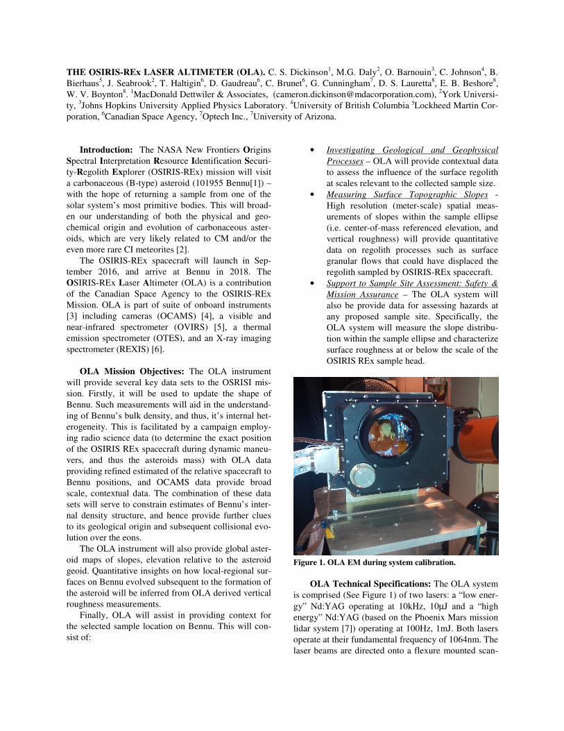
OLA Testing: A successful EM test campaign was
conducted through spring and summer of 2014. (See
Figure 2).
Figure 2. OLA EM during TVAC testing (Note: red laser
safety cover in place over OLA window).
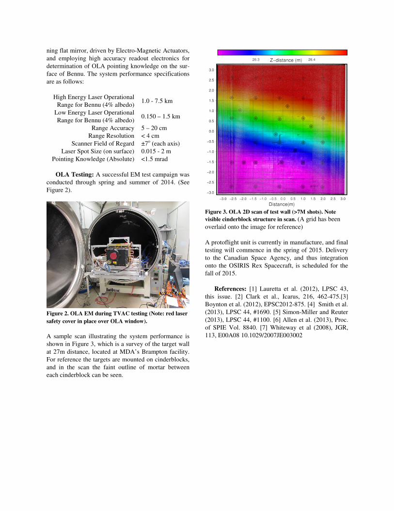
A sample scan illustrating the system performance is
shown in Figure 3, which is a survey of the target wall
at 27m distance, located at MDA’s Brampton facility.
For reference the targets are mounted on cinderblocks,
and in the scan the faint outline of mortar between
each cinderblock can be seen.
Figure 3. OLA 2D scan of test wall (>7M shots). Note
visible cinderblock structure in scan. (A grid has been
overlaid onto the image for reference)
A protoflight unit is currently in manufacture, and final
testing will commence in the spring of 2015. Delivery
to the Canadian Space Agency, and thus integration
onto the OSIRIS Rex Spacecraft, is scheduled for the
fall of 2015.
References: [1] Lauretta et al. (2012), LPSC 43,
this issue. [2] Clark et al., Icarus, 216, 462-475.[3]
Boynton et al. (2012), EPSC2012-875. [4] Smith et al.
(2013), LPSC 44, #1690. [5] Simon-Miller and Reuter
(2013), LPSC 44, #1100. [6] Allen et al. (2013), Proc.
of SPIE Vol. 8840. [7] Whiteway et al (2008), JGR,
113, E00A08 10.1029/2007JE003002