Embed Size (px)
Citation preview
THE MINNEAPOLIS MILLING DISTRICT ARCHIVE
A THESIS
SUBMITTED TO THE FACULTY OF THE GRADUATE SCHOOL
OF THE UNIVERSITY OF MINNESOTA
BY
MICHAEL ALLYN CHRISTENSON
IN PARTIAL FULFILLMENT OF THE REQUIREMENTS
FOR THE DEGREE OF
MASTER OF ARCHITECTURE
December, 1997

© Michael Allyn Christenson 1997
UNIVERSITY OF MINNESOTA
This is to certify that I have examined this copy of a master’s thesis by
MICHAEL ALLYN CHRISTENSON
and that I have found that it is complete and satisfactory in all respects,
and that any and all revisions required by the final
examining committee have been made.
LEE ANDERSON
ANDRZEJ PIOTROWSKI
KATHERINE SOLOMONSON
December, 1997
GRADUATE SCHOOL
C O N T E N T S
INTRODUCTION 5
THESIS 6
BUILDING 7
PROCESS 23
CONCLUSION 47
APPENDIX: COMPUTER ILLUSTRATIONS 48
NOTES AND BIBLIOGRAPHY 50
ACKNOWLEDGEMENTS 51
i
5
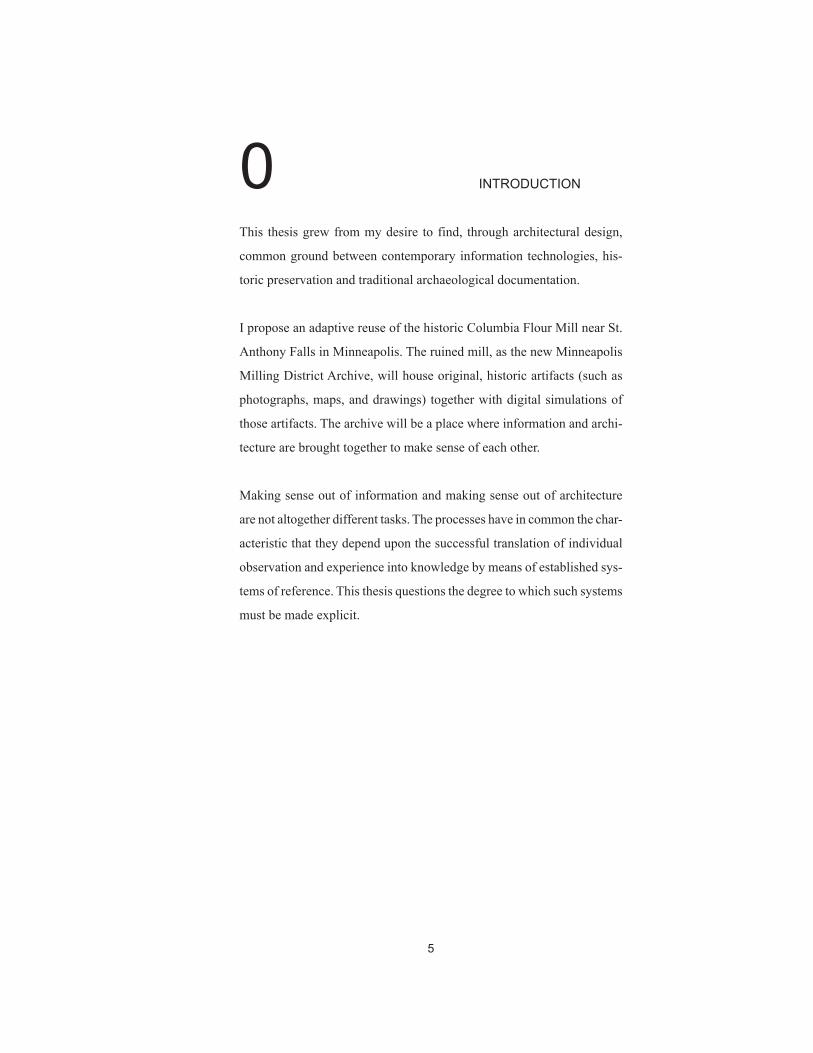
0 INTRODUCTION
This thesis grew from my desire to find, through architectural design,
common ground between contemporary information technologies, his-
toric preservation and traditional archaeological documentation.
I propose an adaptive reuse of the historic Columbia Flour Mill near St.
Anthony Falls in Minneapolis. The ruined mill, as the new Minneapolis
Milling District Archive, will house original, historic artifacts (such as
photographs, maps, and drawings) together with digital simulations of
those artifacts. The archive will be a place where information and archi-
tecture are brought together to make sense of each other.
Making sense out of information and making sense out of architecture
are not altogether different tasks. The processes have in common the char-
acteristic that they depend upon the successful translation of individual
observation and experience into knowledge by means of established sys-
tems of reference. This thesis questions the degree to which such systems
must be made explicit.
6
1 T H E S I S
For a scholar to make intelligent use of information, the information must
be physically grounded within a specific referential system; it must be
ordered. Architecture, by providing the possibility for memorable rela-
tionships to exist between information and site, has the capability to ground
a particular collection of site-specific information. In so doing, it estab-
lishes reference and assists scholars in making intelligent use of the in-
formation in the collection.
7
2 B U I L D I N G
I propose an archive for original historical drawings and record artifacts
of the Minneapolis Milling District. The archive will be built inside the
foundations of an abandoned flour mill at the periphery of the district. It
is a small research institution devoted to the preservation of the artifacts
and to the development of interpretive computer simulations based on
the artifacts.
The Minneapolis Milling District surrounds St. Anthony Falls on both
banks of the Mississippi River, and is named for the waterpowered saw-
and flour mills built near the falls prior to the turn of the century. An
important site in the historical development of the city, the Milling Dis-
trict is the appropriate setting for the Minneapolis History Center, pro-
posed in 1994 as the subject of an architectural design studio project at
the University of Minnesota. The archive is a small research annex to that
proposed nearby larger institution.
The majority of the Minneapolis mills were demolished in the 1930s sev-
eral years after the peak of the flour- and sawmilling industries.1 Mills on
the west bank of the Mississippi were concentrated along a now-filled-in
power canal underneath First Street. Buried foundations and partially
exposed ruins of the demolished West Bank mills exist directly adjacent
to the site of the proposed Minneapolis History Center. One of these aban-
doned mills, the Columbia Flour Mill, is currently the site of the vacant
Fuji-Ya Restaurant. Its stone foundations provide the site for the Minne-
apolis Milling District Archive.*
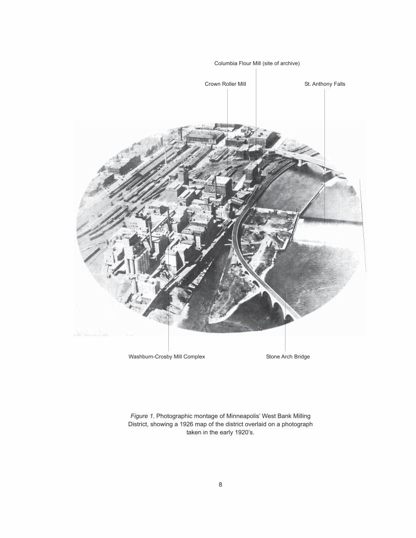
Figures 1-2
*Also see text accompanying Figures 20-23.
8
Figure 1. Photographic montage of Minneapolis’ West Bank MillingDistrict, showing a 1926 map of the district overlaid on a photograph
taken in the early 1920’s.
Crown Roller Mill
Washburn-Crosby Mill Complex
St. Anthony Falls
Stone Arch Bridge
Columbia Flour Mill (site of archive)

9
Figure 2. Present condition (1996) of the West Bank Milling District,shown in a montage of a contour map, an aerial photograph, and a
three-dimensional computer model of existing buildings.
Crown Roller Mill
Washburn-Crosby Mill Complex(site of proposed Minneapolis
History Center)
St. Anthony Falls
Stone Arch Bridge
Columbia Flour Mill (site of archive)
10
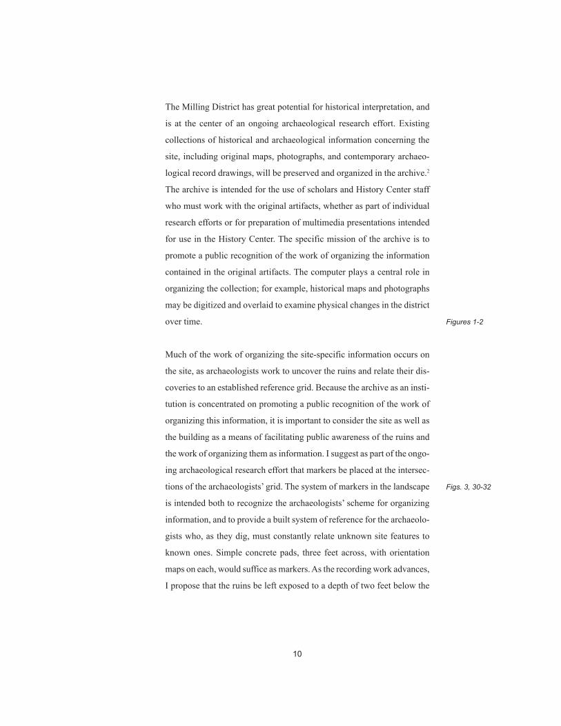
The Milling District has great potential for historical interpretation, and
is at the center of an ongoing archaeological research effort. Existing
collections of historical and archaeological information concerning the
site, including original maps, photographs, and contemporary archaeo-
logical record drawings, will be preserved and organized in the archive.2
The archive is intended for the use of scholars and History Center staff
who must work with the original artifacts, whether as part of individual
research efforts or for preparation of multimedia presentations intended
for use in the History Center. The specific mission of the archive is to
promote a public recognition of the work of organizing the information
contained in the original artifacts. The computer plays a central role in
organizing the collection; for example, historical maps and photographs
may be digitized and overlaid to examine physical changes in the district
over time.
Much of the work of organizing the site-specific information occurs on
the site, as archaeologists work to uncover the ruins and relate their dis-
coveries to an established reference grid. Because the archive as an insti-
tution is concentrated on promoting a public recognition of the work of
organizing this information, it is important to consider the site as well as
the building as a means of facilitating public awareness of the ruins and
the work of organizing them as information. I suggest as part of the ongo-
ing archaeological research effort that markers be placed at the intersec-
tions of the archaeologists’ grid. The system of markers in the landscape
is intended both to recognize the archaeologists’ scheme for organizing
information, and to provide a built system of reference for the archaeolo-
gists who, as they dig, must constantly relate unknown site features to
known ones. Simple concrete pads, three feet across, with orientation
maps on each, would suffice as markers. As the recording work advances,
I propose that the ruins be left exposed to a depth of two feet below the
Figures 1-2
Figs. 3, 30-32
11
surface, allowing visitors to see traces of the location and size of the old
mills and power canal.
Visitors approach the site along West River Parkway or off of the pedes-
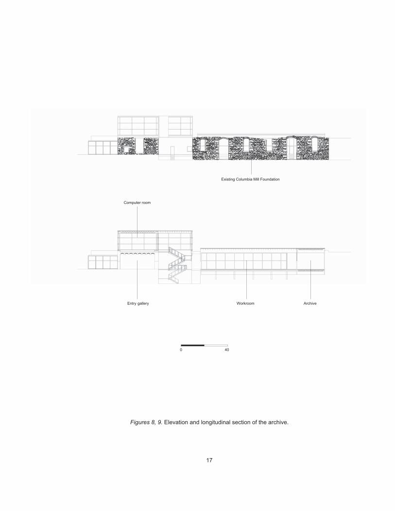
trian Stone Arch Bridge through the field of ruins. The archive, at the
upriver terminus of that field, appears first as a solid block of stone with
a glass and steel room on top. In general, the building is laid out within
and atop the old foundations with more public rooms at the near (or
downriver) end — an entry gallery on the first floor, one level below First
Street, and at street level, a glass-and-steel computer room. More private
rooms are located at the far (upriver) end of the old foundation — a staff
workroom and at the end, the archival storage room.
Stepping into the first room of the archive, the entry gallery, is the first
time that visitors step inside of old mill foundations. The walls are three-
foot-thick local limestone, the floor is existing poured concrete, and the
ceiling is an existing historical steel-beam and tile-arch system. The en-
try gallery is used by archive staff to display work in progress; overlaid
digitized maps and photographs are typical of the work displayed. Visi-
tors and scholars can gain a sense from this public display of the kind of
work produced at the archive from the raw material of the original arti-
facts, kept elsewhere in the building. The reception desk is staffed full-
time by an assistant who can answer questions if necessary.
Figure 4
Figures 5-14
12
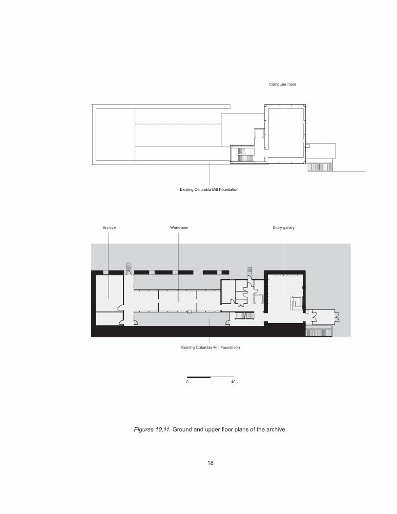
The visitor or scholar steps out of the solid stone box of the entry room
into a glass-and-steel stair tower. The elevator is to the right through an
opening in a new wall. The openness of the construction permits a long
view into the existing historic foundation of the Columbia Flour Mill —
now just a stone shell. View is also up above the horizon of that stone
shell to the sky.
As visitors ascend the stairs and come to the landing, the view of the
horizon of the Columbia Flour Mill foundation is ever more apparent.
The stairs turn at the landing to complete the climb to the upper, or street
level. In the last few steps, the visitor begins to regain some long views of
the site. At the top of the stairs, directly above the entry room, is a glass-
and-steel computer room. This room contains five high-end computers
which allow digital access through a computerized catalog to all of the
artifacts in the archive. This permits on-screen viewing and comparing of
computerized scans and photographs of the original pieces, a process far
more public than viewing the original, fragile artifacts stored elsewhere
in the building. This is a room where what is seen on the computer screen
can be related visually to the site — the site that people walked through
and drove through to get to the building. The whole room is a place where
the collection of artifacts can be related through the medium of the com-
puter and the medium of the building back to the site. I expect the room to
be used by scholars who need a place to organize information, to gain a
sense of the collection as a whole, to relate that collection visually to the
site, and to prepare, if necessary, requests to access the original artifacts.
I expect further that any visitors with casual scholarly interests who have
come this far into the building would spend at least half an hour search-
ing for and viewing artifacts, and comparing what they see on the screen
to what is visible on the site below and beyond them.
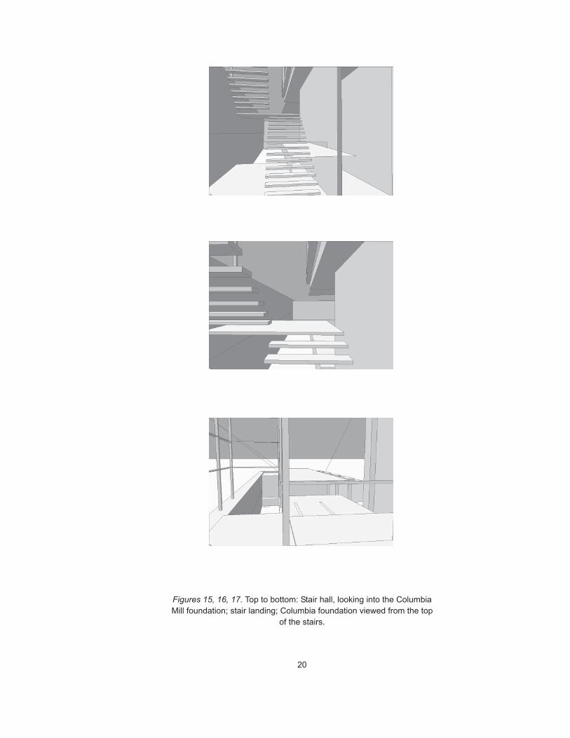
Figure 15
Figure 16
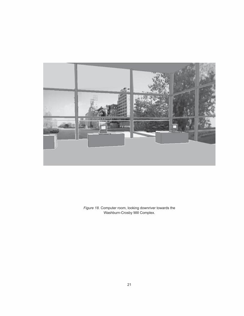
Figure 18
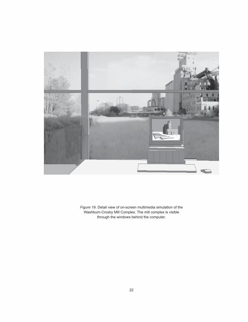
Figure 19
13
Leaving this room requires turning back, away from the site, to the view
over the top of the Columbia Flour Mill foundation. Within this founda-
tion, and visible from above, is a long glass-and-steel staff and scholarly
workroom and a storage room for artifacts at the far end of the shell foun-
dation. Entering this considerably more private space requires descend-
ing the stairs, turning away from the main entry space through a com-
paratively darker, closed hallway, past the service block containing the
archive office, mechanical rooms, and bathrooms.
Being inside the workroom is once again to be within the old foundation,
but unlike the entry room, which is simply the occupiable basement of an
old mill, the workroom is suspended within the empty, roofless space of
the old foundation. The old foundation can be seen to the left and right
beyond the glass wall of the workroom. The workroom is that place in the
archive which is the most directly about the ongoing process of record-
ing, researching, and organizing the original records of the site. The work-
room is staffed by three or four part-time research assistants or student
interns hired to work on a by-project basis. The archive’s permanent full-
time director has an office located in the service block at the near end of
the workroom. The room includes workspace for the collation of archaeo-
logical field notes and the production of archaeological record drawings
which are added to the existing collection as work progresses. The work-
room includes high-end computer equipment for the production of multi-
media interpretations of the district and for the maintenance of the com-
puterized catalog. It includes the facility to scan or otherwise digitally
record all artifacts in the archive into a computerized database. This facil-
ity, along with the artifacts themselves, is located in the new stone-veneer
box at the far end of the workroom which is strictly light- and climate-
controlled.
Figure 17
Figure 12
14
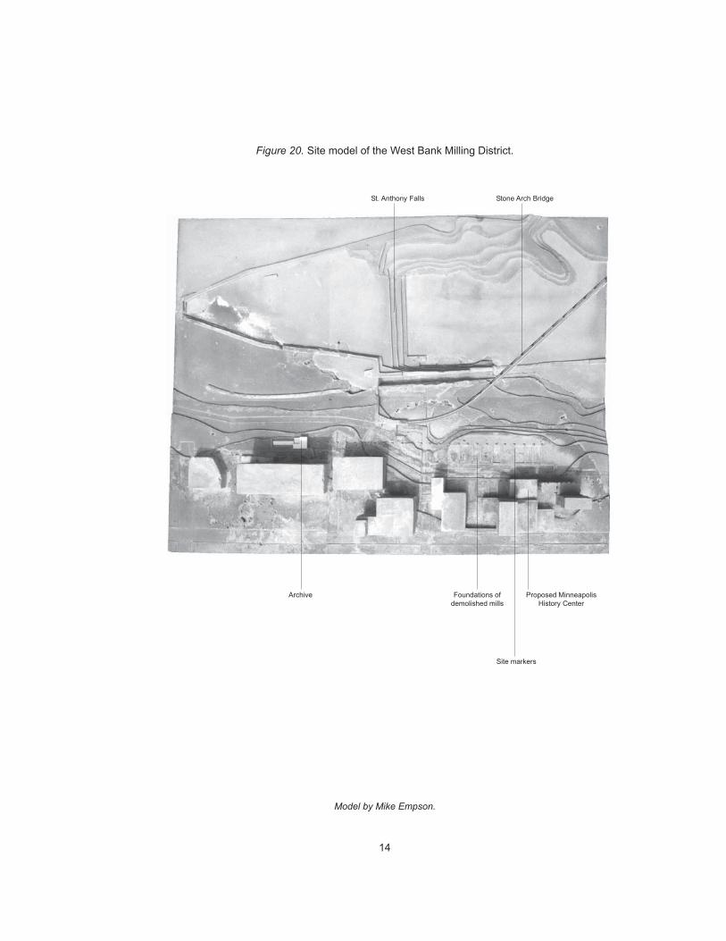
Archive Proposed MinneapolisHistory Center
Stone Arch BridgeSt. Anthony Falls
Figure 20. Site model of the West Bank Milling District.
Foundations ofdemolished mills
Site markers
Model by Mike Empson.
15
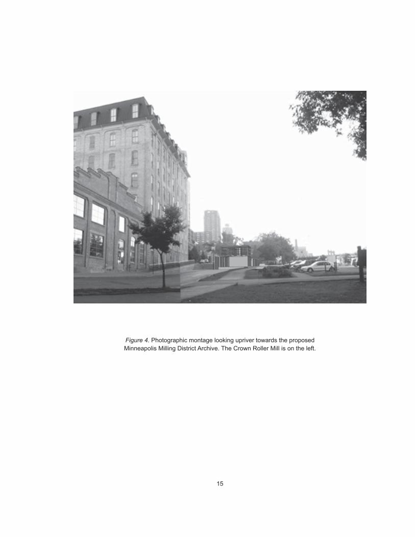
Figure 4. Photographic montage looking upriver towards the proposedMinneapolis Milling District Archive. The Crown Roller Mill is on the left.
16
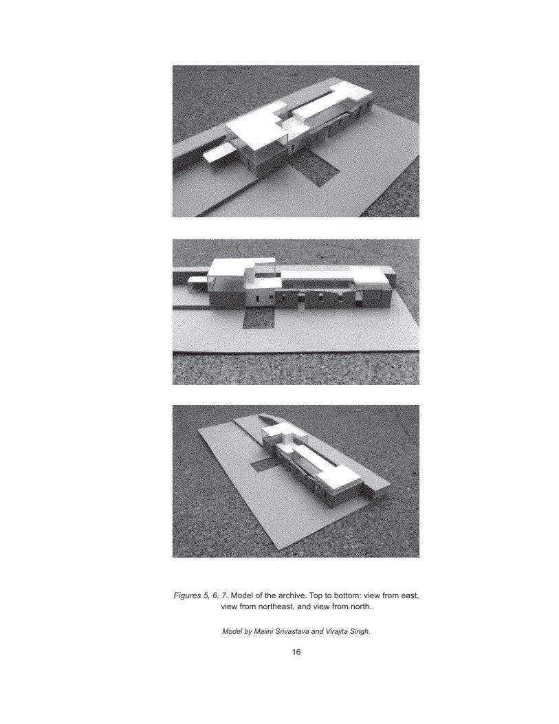
Figures 5, 6, 7. Model of the archive. Top to bottom: view from east,view from northeast, and view from north.
Model by Malini Srivastava and Virajita Singh.
17
Figures 8, 9. Elevation and longitudinal section of the archive.
Computer room
Workroom Archive
Existing Columbia Mill Foundation
Entry gallery
0 40
18
0 40
Figures 10,11. Ground and upper floor plans of the archive.
Computer room
Existing Columbia Mill Foundation
Archive Workroom Entry gallery
Existing Columbia Mill Foundation
19
0 40
Figure 12: Transverse section through workroom
Figure 13: Transverse section through stair
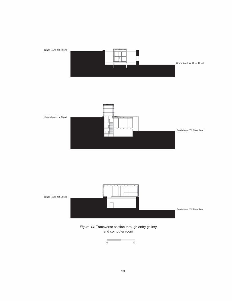
Figure 14: Transverse section through entry galleryand computer room
Grade level: W. River Road
Grade level: 1st Street
Grade level: W. River Road
Grade level: 1st Street
Grade level: W. River Road
Grade level: 1st Street
20
Figures 15, 16, 17. Top to bottom: Stair hall, looking into the ColumbiaMill foundation; stair landing; Columbia foundation viewed from the top
of the stairs.
21
Figure 18. Computer room, looking downriver towards theWashburn-Crosby Mill Complex.
22
Figure 19. Detail view of on-screen multimedia simulation of theWashburn-Crosby Mill Complex. The mill complex is visible
through the windows behind the computer.

23
3 P R O C E S S
The design process presented me with two opportunities. First, to iden-
tify potential referential connections that could exist between the collec-
tion and the site. Second, to design a building and site which could make
certain of those relationships more apparent or visible to scholars and
visitors. I intended to establish references to the site, through the medium
of the building, which would aid scholars in making intelligent use of the
information in the archive’s collection.
I began the design process in summer 1996 by carefully documenting the
history of the existing Fuji-Ya/Columbia Mill building and the history of
the West Bank Milling District site. The artifacts I produced while docu-
menting the site are typical of the artifacts which would be produced in
the archive, in that they consist of digitized historical artifacts, brought
into relation with each other and with new artifacts by means of the com-
puter. As a means of documenting the history of the site, I constructed on
computer a series of layered historical and contemporary maps. The most
important aspect of the site revealed by these maps is that the site itself is
an artifact -- that is to say, there is little if any of the site’s surface (and
subsurface) which has not been rebuilt at some time in the last 120 years.
As I worked through the site documentation process, certain relation-
ships became evident. The position of the building with reference to the
field of ruins suggested a path the visitor would follow to arrive at the
building. This in turn suggested an entry location and the possibility of a
linear spatial organization to build a continuation of this site path into the
building.
Figures 20-23
24
I documented the existing Fuji-Ya building archaeologically by building
a complete and accurate three-dimensional computer model based on origi-
nal architect’s plans and my own site observations. I coded elements in
the computer model according to their material and age such that I could
generate views of the building showing its built condition at several de-
fined points in its history, or show only those elements made of stone,
concrete, wood, or steel. This method allowed me to experiment with
selective removal of building elements added since 1968 (the date of the
first Fuji-Ya addition onto the historic foundations), and ultimately to
envision the building at its minimum: the simple stone shell of the Co-
lumbia Mill foundation.
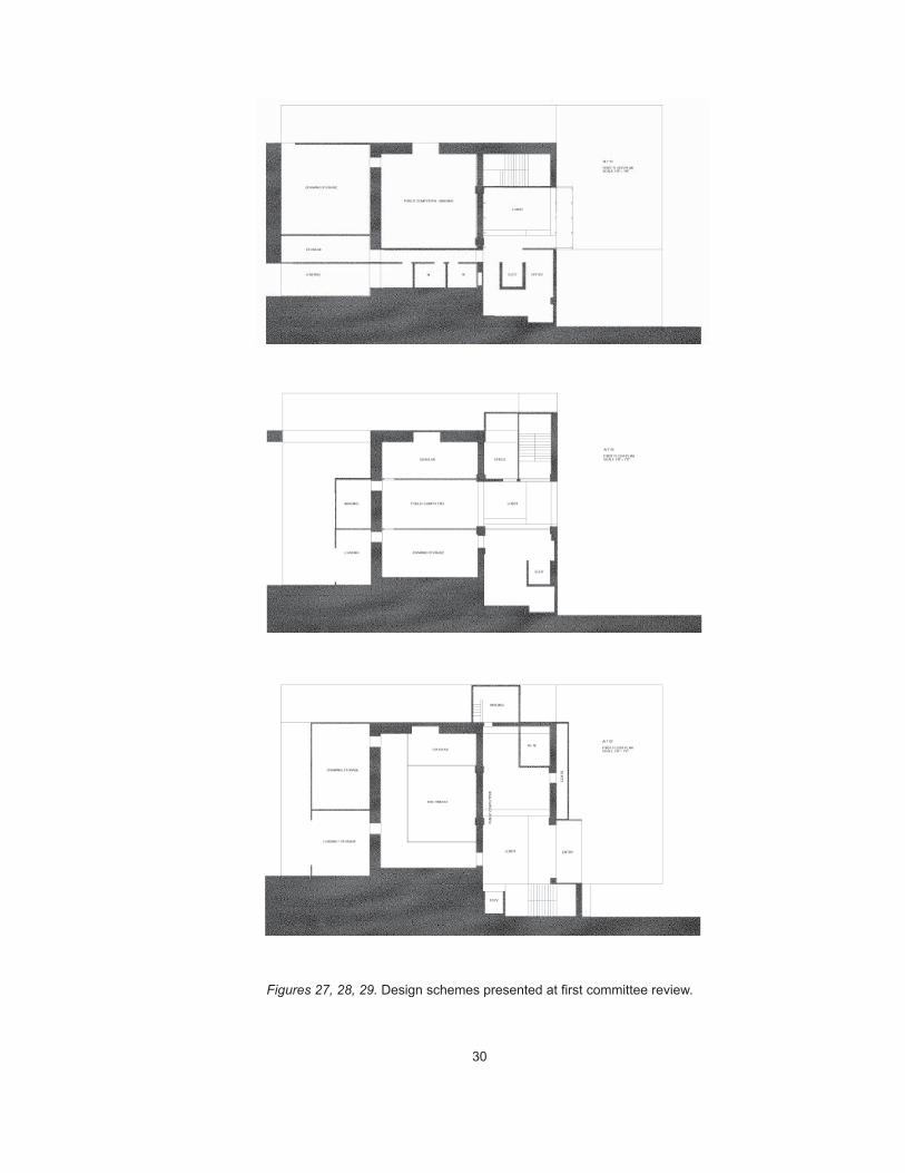
I developed three design alternatives using the computer model of the
Fuji-Ya as a base. All three schemes have a linear spatial organization: a
series of rooms or a circulation spine leads from downriver to upriver
through the building. All three schemes also contained a “wall of draw-
ings,” or a public display of reproduced archaeological record drawings.
I had some ideas about how such a display could mediate between visi-
tors’ memory of walking through the site and their work with the original
artifacts in the archive, or with their reproductions.
I presented my building and site research, along with my three design
schemes, at a juried review on October 14. The review was attended by
my advisory committee chair, Andrzej Piotrowski, committee members
Kate Solomonson and Lee Anderson, and thesis studio director Todd
Rhoades.
Figures 24, 25
Figures 27-29
25
Canal gatehouse Coveredwaterpower canal
Columbia Flour Mill(site of archive)
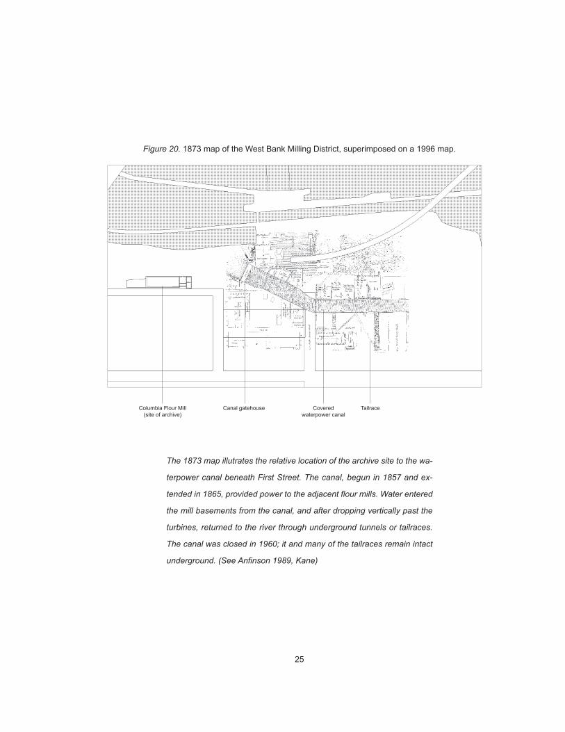
Figure 20. 1873 map of the West Bank Milling District, superimposed on a 1996 map.
The 1873 map illutrates the relative location of the archive site to the wa-
terpower canal beneath First Street. The canal, begun in 1857 and ex-
tended in 1865, provided power to the adjacent flour mills. Water entered
the mill basements from the canal, and after dropping vertically past the
turbines, returned to the river through underground tunnels or tailraces.
The canal was closed in 1960; it and many of the tailraces remain intact
underground. (See Anfinson 1989, Kane)
Tailrace
26
Crown Roller Mill
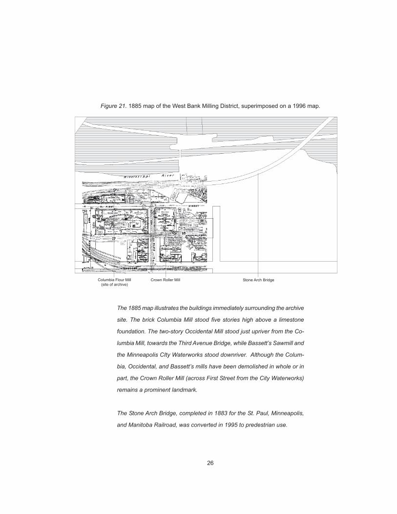
Figure 21. 1885 map of the West Bank Milling District, superimposed on a 1996 map.
Columbia Flour Mill(site of archive)
The 1885 map illustrates the buildings immediately surrounding the archive
site. The brick Columbia Mill stood five stories high above a limestone
foundation. The two-story Occidental Mill stood just upriver from the Co-
lumbia Mill, towards the Third Avenue Bridge, while Bassett’s Sawmill and
the Minneapolis CIty Waterworks stood downriver. Although the Colum-
bia, Occidental, and Bassett’s mills have been demolished in whole or in
part, the Crown Roller Mill (across First Street from the City Waterworks)
remains a prominent landmark.
The Stone Arch Bridge, completed in 1883 for the St. Paul, Minneapolis,
and Manitoba Railroad, was converted in 1995 to predestrian use.
Stone Arch Bridge
27
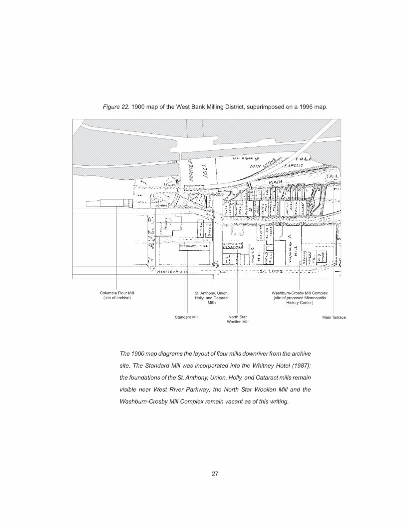
Figure 22. 1900 map of the West Bank Milling District, superimposed on a 1996 map.
Washburn-Crosby Mill Complex(site of proposed Minneapolis
History Center)
Columbia Flour Mill(site of archive)
The 1900 map diagrams the layout of flour mills downriver from the archive
site. The Standard Mill was incorporated into the Whitney Hotel (1987);
the foundations of the St. Anthony, Union, Holly, and Cataract mills remain
visible near West River Parkway; the North Star Woollen Mill and the
Washburn-Crosby Mill Complex remain vacant as of this writing.
St. Anthony, Union,Holly, and Cataract
Mills
Standard Mill North StarWoollen Mill
Main Tailrace
28
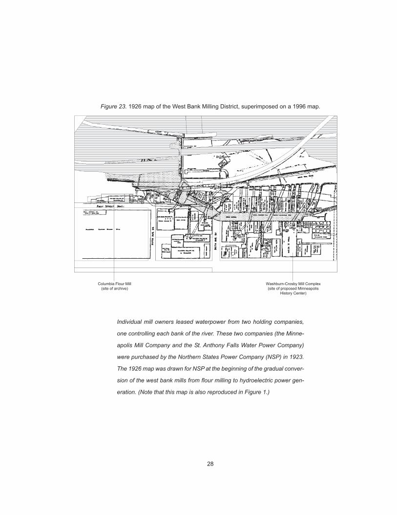
Figure 23. 1926 map of the West Bank Milling District, superimposed on a 1996 map.
Washburn-Crosby Mill Complex(site of proposed Minneapolis
History Center)
Columbia Flour Mill(site of archive)
Individual mill owners leased waterpower from two holding companies,
one controlling each bank of the river. These two companies (the Minne-
apolis Mill Company and the St. Anthony Falls Water Power Company)
were purchased by the Northern States Power Company (NSP) in 1923.
The 1926 map was drawn for NSP at the beginning of the gradual conver-
sion of the west bank mills from flour milling to hydroelectric power gen-
eration. (Note that this map is also reproduced in Figure 1.)
29
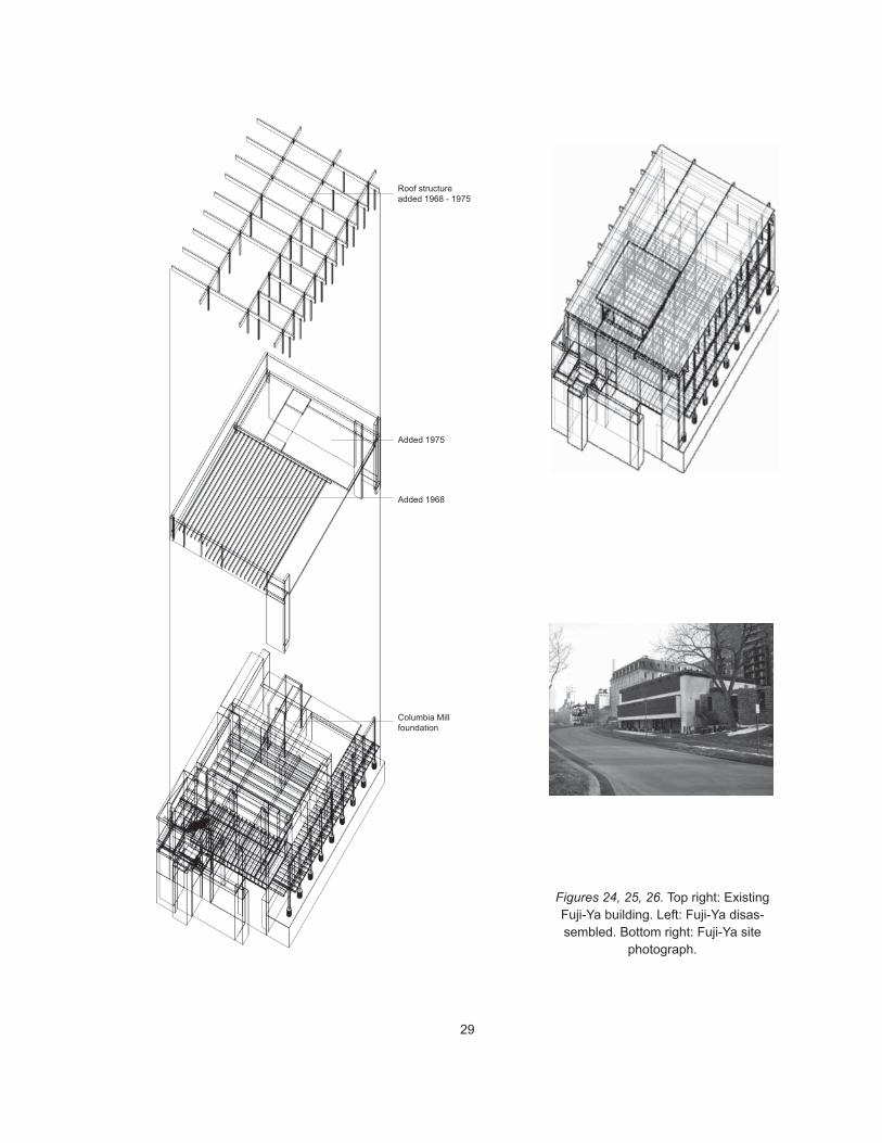
Figures 24, 25, 26. Top right: ExistingFuji-Ya building. Left: Fuji-Ya disas-sembled. Bottom right: Fuji-Ya site
photograph.
Roof structureadded 1968 - 1975
Added 1968
Added 1975
Columbia Millfoundation
30
Figures 27, 28, 29. Design schemes presented at first committee review.
31
The jury commented on this presentation as follows:
Kate Solomonson: To what degree is your project about literally teach-ing or explaining the morphology of the site and/or archaeological re-search methodology? To what degree is it about making people awareof the ongoing processes involved in the making of the site and its sub-sequent recording? Do you propose to fix a moment of historical sig-nificance as part of the design?
Andrzej Piotrowski: You should explicitly state your intention to designthe site. Think about designing the site not as an archaeologist, butinstead ask how should the site be left after the archaeologist has fin-ished work. How will your project take into account the perceived his-torical value of pieces in the site and of the site itself? To what degree isit about explaining the urban machine of the site?
Lee Anderson: Your introduction of the computer into the domain ofthe museum moves the design into a new area of questioning. What isyour attitude about housing reproductions within an original, materialbuilding? How does your project propose to educate people throughthe use of material?
Todd Rhoades: What are the boundaries of the site? Where does it end?What are the key site issues you want or need to make apparent? Yourdrawings overall require a greater degree of clarity. Also, consider push-ing what you can do with the computer in terms of pulling drawingsapart into layers; think of drawing datum lines and grids. Draw in sec-tion as well as in plan and consider the role (and size) of text within oron the drawings. Finally, look at Scarpa’s drawings, especially regard-ing his distinctions between old and new building elements. Considerhis attitude toward demolishing pieces of old buildings.
Following the juried review, I developed a specific site design. This de-
sign directly influenced the design of the archive. During this phase of
the project, I developed the idea of forwarding site references to assist
scholars in making intelligent use of the information in the collection.
32
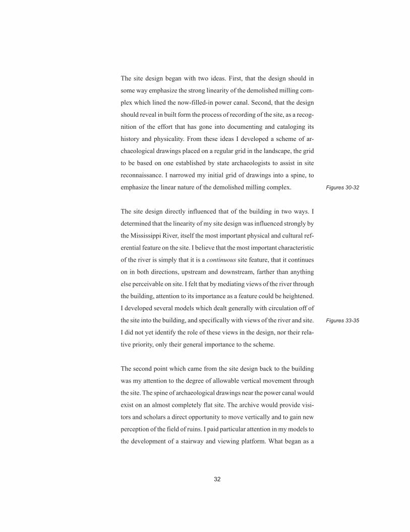
The site design began with two ideas. First, that the design should in
some way emphasize the strong linearity of the demolished milling com-
plex which lined the now-filled-in power canal. Second, that the design
should reveal in built form the process of recording of the site, as a recog-
nition of the effort that has gone into documenting and cataloging its
history and physicality. From these ideas I developed a scheme of ar-
chaeological drawings placed on a regular grid in the landscape, the grid
to be based on one established by state archaeologists to assist in site
reconnaissance. I narrowed my initial grid of drawings into a spine, to
emphasize the linear nature of the demolished milling complex.
The site design directly influenced that of the building in two ways. I
determined that the linearity of my site design was influenced strongly by
the Mississippi River, itself the most important physical and cultural ref-
erential feature on the site. I believe that the most important characteristic
of the river is simply that it is a continuous site feature, that it continues
on in both directions, upstream and downstream, farther than anything
else perceivable on site. I felt that by mediating views of the river through
the building, attention to its importance as a feature could be heightened.
I developed several models which dealt generally with circulation off of
the site into the building, and specifically with views of the river and site.
I did not yet identify the role of these views in the design, nor their rela-
tive priority, only their general importance to the scheme.
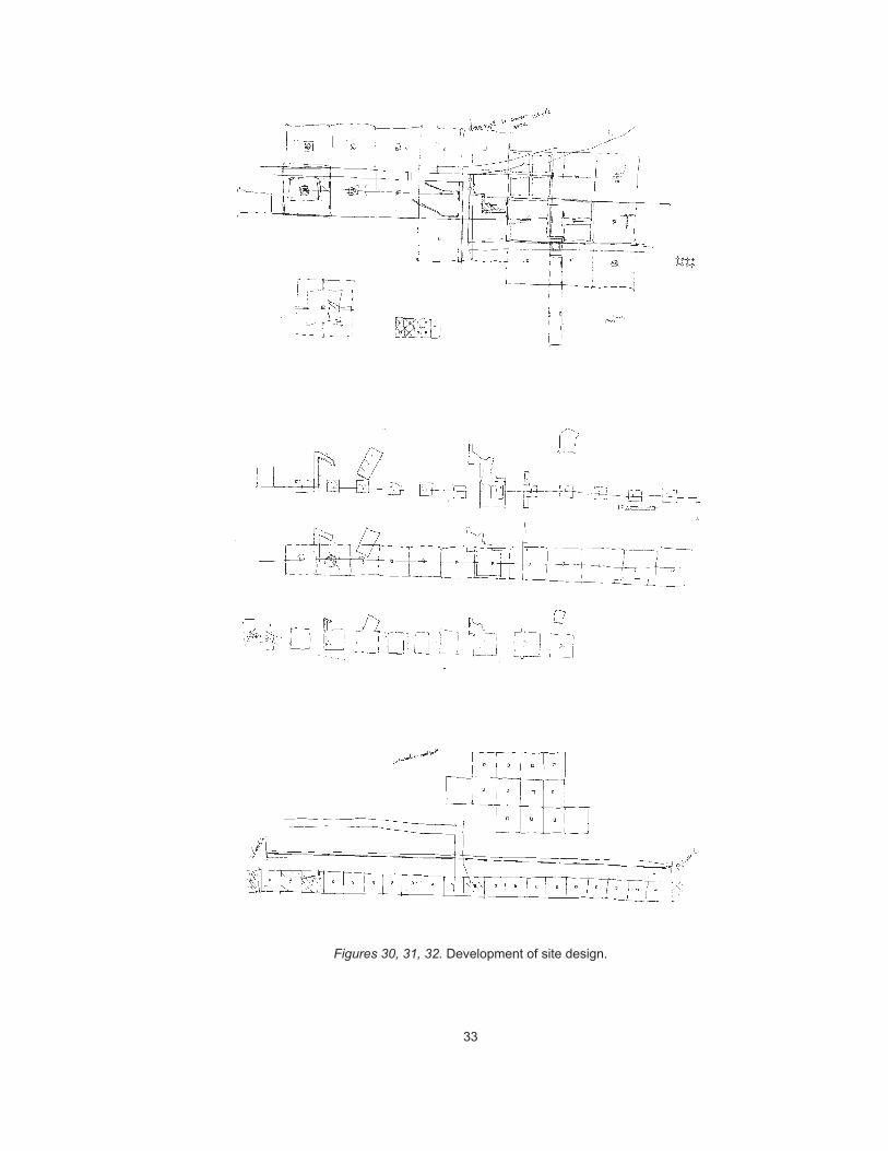
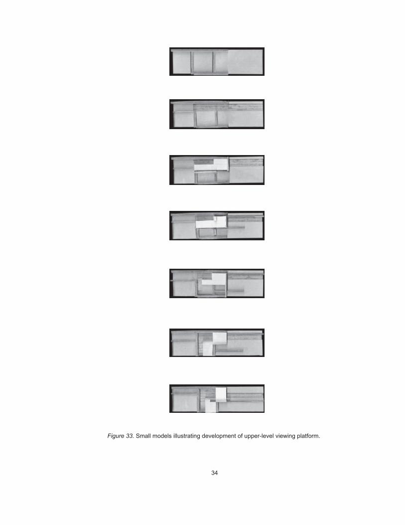
The second point which came from the site design back to the building
was my attention to the degree of allowable vertical movement through
the site. The spine of archaeological drawings near the power canal would
exist on an almost completely flat site. The archive would provide visi-
tors and scholars a direct opportunity to move vertically and to gain new
perception of the field of ruins. I paid particular attention in my models to
the development of a stairway and viewing platform. What began as a
Figures 30-32
Figures 33-35
33
Figures 30, 31, 32. Development of site design.
34
Figure 33. Small models illustrating development of upper-level viewing platform.
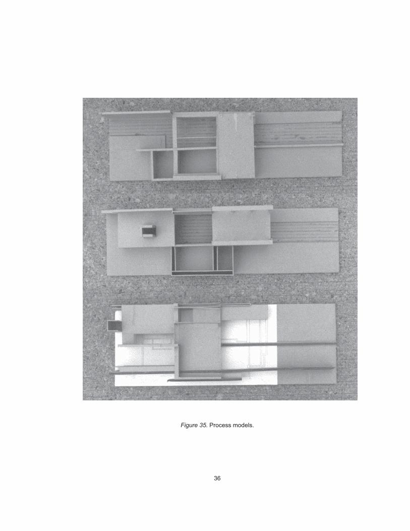
35
Figure 34. Process models.
36
Figure 35. Process models.
37
simple idea — entering the building, climbing stairs and turning around,
and then arriving at a high point from which the site could be seen in its
entirety — proved ultimately to be promising in terms of providing built,
referential ground for the information in the archive.
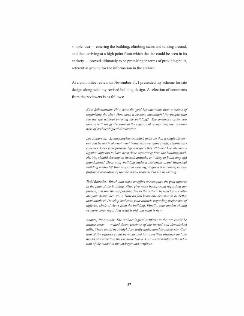
At a committee review on November 11, I presented my scheme for site
design along with my revised building design. A selection of comments
from the reviewers is as follows:
Kate Solomonson: How does the grid become more than a means oforganizing the site? How does it become meaningful for people whosee the site without entering the building? The arbitrary order youimpose with the grid is done at the expense of recognizing the random-ness of archaeological discoveries.
Lee Anderson: Archaeologists establish grids so that a single discov-ery can be made of what would otherwise be many small, chaotic dis-coveries. Does your proposed grid respect this attitude? The site inves-tigation appears to have been done separately from the building mod-els. You should develop an overall attitude: is it okay to build atop oldfoundations? Does your building make a statement about historicalbuilding methods? Your proposed viewing platform is not an especiallyprofound resolution of the ideas you proposed to me in writing.
Todd Rhoades: You should make an effort to recognize the grid squaresin the plan of the building. Also, give more background regarding ap-proach, and specifically parking. Tell us the criteria by which you evalu-ate your design decisions. How do you know one decision to be betterthan another? Develop and state your attitude regarding preference ofdifferent kinds of views from the building. Finally, your models shouldbe more clear regarding what is old and what is new.
Andrzej Piotrowski: The archaeological artifacts in the site could bebronze casts — scaled-down versions of the buried and demolishedmills. These could be straightforwardly understood by passersby. Cer-tain of the squares could be excavated to a specified distance and themodel placed within the excavated area. This would reinforce the rela-tion of the model to the underground artifacts.
38
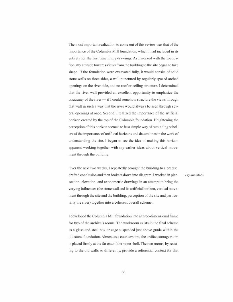
The most important realization to come out of this review was that of the
importance of the Columbia Mill foundation, which I had included in its
entirety for the first time in my drawings. As I worked with the founda-
tion, my attitude towards views from the building to the site began to take
shape. If the foundation were excavated fully, it would consist of solid
stone walls on three sides, a wall punctured by regularly spaced arched
openings on the river side, and no roof or ceiling structure. I determined
that the river wall provided an excellent opportunity to emphasize the
continuity of the river — if I could somehow structure the views through
that wall in such a way that the river would always be seen through sev-
eral openings at once. Second, I realized the importance of the artificial
horizon created by the top of the Columbia foundation. Heightening the
perception of this horizon seemed to be a simple way of reminding schol-
ars of the importance of artificial horizons and datum lines in the work of
understanding the site. I began to see the idea of making this horizon
apparent working together with my earlier ideas about vertical move-
ment through the building.
Over the next two weeks, I repeatedly brought the building to a precise,
drafted conclusion and then broke it down into diagram. I worked in plan,
section, elevation, and axonometric drawings in an attempt to bring the
varying influences (the stone wall and its artificial horizon, vertical move-
ment through the site and the building, perception of the site and particu-
larly the river) together into a coherent overall scheme.
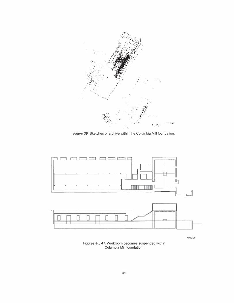
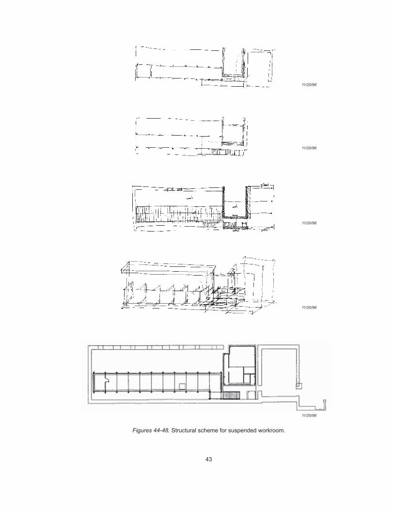
I developed the Columbia Mill foundation into a three-dimensional frame
for two of the archive’s rooms. The workroom exists in the final scheme
as a glass-and-steel box or cage suspended just above grade within the
old stone foundation. Almost as a counterpoint, the artifact storage room
is placed firmly at the far end of the stone shell. The two rooms, by react-
ing to the old walls so differently, provide a referential context for that
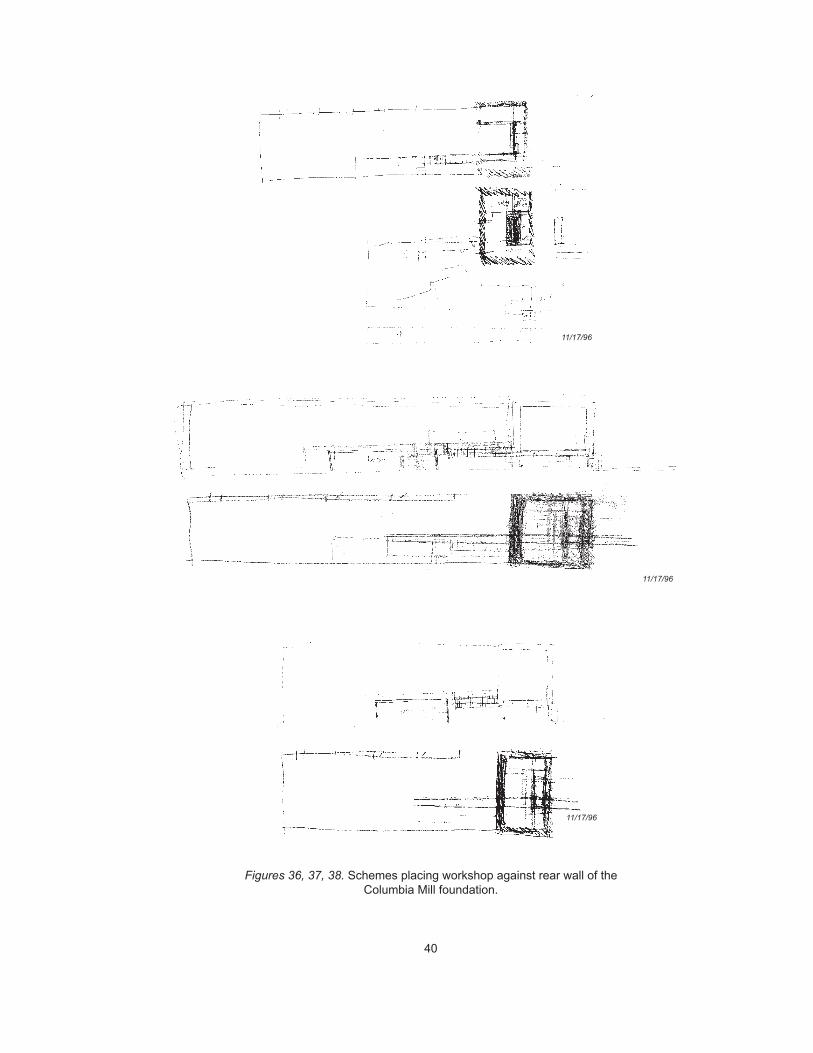
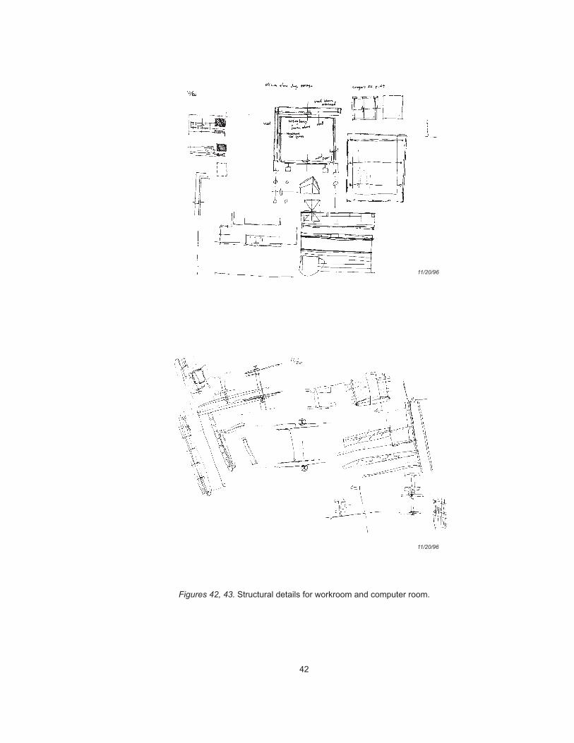
Figures 36-56
39
type of scholarly work which will directly address the issue of adding
onto historic buildings in the milling district. The idea is not to educate
scholars about a correct way to add on to old buildings, but simply to
raise the question.
The final weeks of the quarter were spent crafting the presentation itself,
the presented text of which is given in this volume relatively unaltered as
chapter 2. The final drawings appear in a finished form throughout the
present volume. The project was formally reviewed by the full commit-
tee, along with Arthur Chen, Gunter Dittmar, Steve Weeks, and Tom Fisher.
Following the presentation, I received written comments from two of the
jury members.
I am fascinated with your thesis. It is really getting into issues thatare at the forefront of architecture and which architecture will have toget into. As I understand it you are dealing with 3 issues that need tobe resolved: (1) the physical reality represented by the ruins, (2) thescientific/technical reality of exploring and understanding the past,and (3) the new dimension brought by the computer — allowing us tocreate a new reality, both through simulation (virtual reality) and bybreaking open the reality of a chronological linear reality, and howthis new reality finds a physical, architectural order. What I don’tunderstand is why this ends up in a Miesian building inserted into theremaining walls of an old building, that is, a more or less conven-tional building in an old envelope?
Polished, logical, clear presentation — raises and resolves goodquestions regarding site relationships and the production of knowl-edge. Excellent use of computer as medium as well as object ofinquiry.
Figs. 1, 2, 8-19
40
Figures 36, 37, 38. Schemes placing workshop against rear wall of theColumbia Mill foundation.
11/17/96
11/17/96
11/17/96
41
Figure 39. Sketches of archive within the Columbia Mill foundation.
Figures 40, 41. Workroom becomes suspended withinColumbia Mill foundation.
11/17/96
11/19/96
42
Figures 42, 43. Structural details for workroom and computer room.
11/20/96
11/20/96
43
Figures 44-48. Structural scheme for suspended workroom.
11/20/96
11/20/96
11/20/96
11/20/96
11/20/96
44
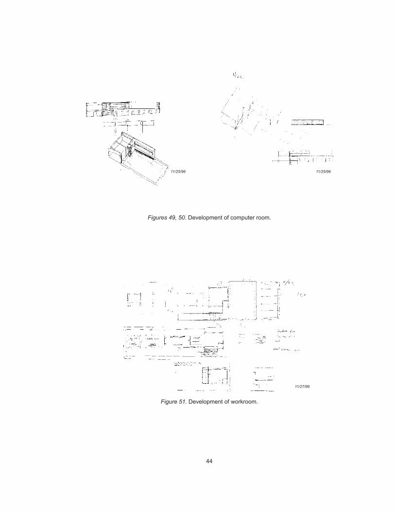
Figures 49, 50. Development of computer room.
Figure 51. Development of workroom.
11/25/9611/25/96
11/27/96
45
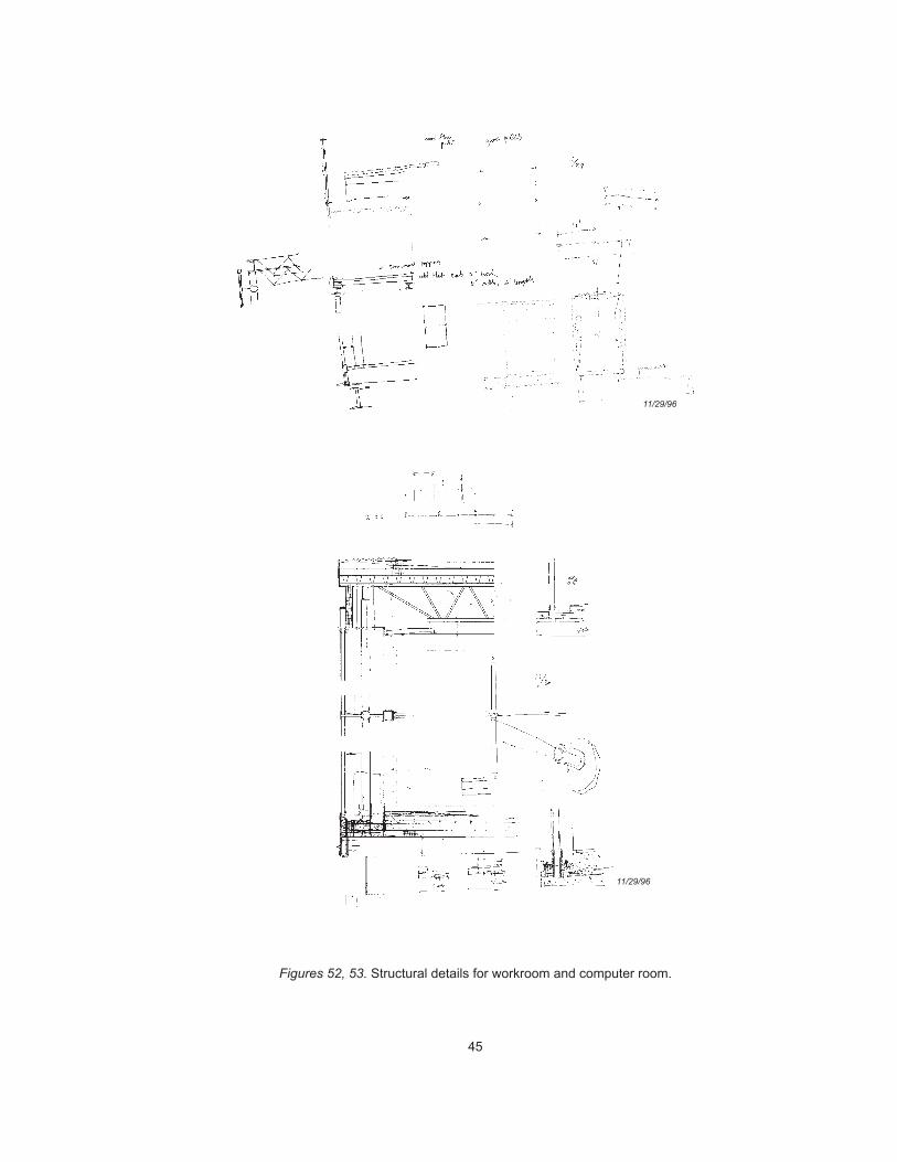
Figures 52, 53. Structural details for workroom and computer room.
11/29/96
11/29/96
46
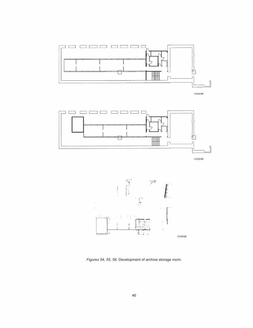
Figures 54, 55, 56. Development of archive storage room.
12/04/96
12/05/96
12/08/96
47
4 C O N C L U S I O N
Scholars come to the Minneapolis Milling District Archive to make sense
of information. That information resides in the original, historic artifacts,
it resides in the site, and it resides in digital artifacts.
The archive does not provide an explicit, didactic system of reference
between site and information. It rather promotes simple recognition of
ground, sky, horizon, and the river; of linearity and movement; of stone,
glass, and steel; of computers and computer simulations as part of an
overall site experience mediated through architecture. Its architecture pro-
vides a site-focused context within which well-informed decisions can be
made about the use of the digitized and original historic artifacts stored
within. Architecture is the medium through which sense is made of infor-
mation.
48
APPENDIX :NCOMPUTER- ILLUSTRATIONS
Figure 1. I scanned the photograph and map from Anfinson (1989, 1990). I openedthe photograph in Photoshop and set up a second layer, into which I imported thescanned map. I distorted the map (using Photoshop’s Distort command) to alignwith the photograph. For this and all other images reproduced in this book, Ireduced the overall image sizes and converted the grayscales to bitmaps usingPhotoshop’s Diffusion Dither method.
Figure 2. I scanned the aerial photograph from Anfinson (1990). This was anorthogonal map and I distorted it to align with the oblique photograph in theprevious figure. Onto this, in a separate layer, I imported a contour map drawn inCanvas (saved as a TIFF for export to Photoshop). In a third layer, I imported anexported PICT bitmap from upFRONT. To align the perspective correctly, I usedthe Photoshop image as a background in upFRONT and then used the tumble toolto set up a specific view.
Figure 3. I took four photographs (quadrants) from directly above the site model.I scanned the photographs and assembled them in Photoshop. The Stone ArchBridge -- itself not built as part of the site model -- was scanned from an aerialphotograph and superimposed on the composite photographs of the site model.
Figure 4. I built a model of the archive in form-Z and upFRONT, then exporteda PICT bitmap view of the model at an angle approximating that of an existingsite photograph. I superimposed the bitmap view of the upFRONT model ontothe site photograph in Photoshop.
Figures 5, 6, 7. Scanned photographs of the final model, taken in the back yardof the Architecture Building on a rainy Saturday in April.
Figures 8-14. I produced the final drawings in AutoCAD and exported them as2D DXF files. I crossed to the Macintosh platform to import the DXF files intoCanvas 3.5.4. I converted the DXF files into 600 dpi TIFF files in Canvas 5.0 andthen into PICT files using Photoshop. I added poche in Photoshop; the text isfrom PageMaker.
Figures 15-17. The model was built in form-Z and upFRONT; views were gen-erated in upFRONT and exported as PICT bitmaps.
Figure 18. I exported the model view as a PICT bitmap and brought it intoPhotoshop. I pasted a scanned site photograph of the Washburn-Crosby Mill Com-plex into the empty spaces in the bitmap image corresponding to windows.
Figure 19. I exported the model view as a PICT bitmap from upFRONT. InPhotoshop, I pasted onto this view the scanned Washburn-Crosby Mill Complex
49
photograph, and then I pasted a view of the upFRONT model of the complex ontothe computer screen.
Figures 20-23. I scanned the maps from Anfinson (1989, 1990) and importedthem into Canvas 3.5.4 as separate layers. I brought a contour map drawn inCanvas into an additional layer. For inclusion in this book, Canvas maps wereexported as 600 dpi TIFF files.
Figures 24, 25. I built the 3d model in AutoCAD and form-Z. I exported theaxonometric views as PICT bitmaps from form-Z. I used Canvas to combineseveral PICTs of the building elements. For inclusion in this book, I exported theCanvas drawings as 600 dpi TIFF files and opened them in Photoshop, where Isaved them as PICT files.
Figure 26. Scan of a site photograph.
Figures 27-29. I used form-Z to cut plans of a 3D model. I exported them asdrawPICT files and opened them in Canvas, where I underlaid them with pocheproduced in Photoshop.
Figures 30-32. I scanned ink-on-trace originals as 300 dpi, 50% scale, black-and-white drawings (bitmaps).
Figure 33. I placed the small models face-down on a flatbed scanner and scannedthem as 72 dpi PICT files.
Figures 34-35. Scanned photographs of the models.
Figures 36-56. I scanned all ink-on-trace sketches as 300 dpi bitmaps at 50%original size; pencil-on-trace sketches as 300 dpi grayscale PICT files, changedto black-and-white bitmaps using Photoshop’s Diffusion Dither method. I drewthe building sections and plans in AutoCAD r13, printed them at 1” = 40’, andscanned them in as 300 dpi PICT files. This method proved more efficient thanconverting each file to a DXF and subsequently to a TIFF or PICT bitmap (as Idid for figures 8-14).
Computer equipment and software used in the production of this thesis: Photoshop3.0.4, PageMaker 6.0, Word 6.0.1, Canvas 3.5.4, Canvas 5.0.1b, form-Z 2.8,upFRONT 2.0.1, running on Macintosh Quadra 700s and PowerMacintosh 7500sand 8500s at CALA, and my PowerMacintosh 7600 and PowerBook 180, all us-ing MacOS 7.5.5. I also used AutoCAD r13c5, form-Z 2.8, Word 6.0.1, andPhotoshop 3.0.5 on several Dell Dimension 120 MHz Pentium machines runningWindows NT Workstation 3.51. All scans were done with a Hewlett-PackardScanJet 4c.
50
N O T E S N A N D N B I B L I O G R A P H Y
1 This design studio was led by Andrzej Piotrowski. Several of the ideaswhich made their way into the design for the Minneapolis Milling District Archivewere initially discussed as part of the Minneapolis History Center project.
2 Several excellent discussions of the history of the Minneapolis MillingDistrict are available. Anfinson (1989, 1990), Berman (1980), and Kane (1987)are particularly notable.
3 I assume for purposes of the present project that items in the collectionsof the Minnesota Historical Society would be transferred to the new archive forstorage. These include an existing collection of archaeological record drawingsof the Milling District, some of which are reproduced in Anfinson (1990).
Anfinson, Scott F. (1989) “Archaeology of the Central Minneapolis RiverfrontPart 1: Historical Overview and Archaeological Potentials” In The MinnesotaArchaeologist, v. 48, nos. 1-2.
Anfinson, Scott F. (1990) “Archaeology of the Central Minneapolis RiverfrontPart 2: Archaeological Explorations and Interpretive Potentials” In The Minne-sota Archaeologist, v. 49, nos. 1-2.
Berman, James, ed. (1980) Saint Anthony Falls Rediscovered: The ArchitecturalHeritage of Minneapolis’s St. Anthony Falls Historic District. Minneapolis: Min-neapolis Riverfront Development Coordination Board.
Feather, John (1994) The Information Society: A Study of Continuity and Change.London: Library Association Publishing Ltd.
Kane, Lucile M. (1987) The Falls of St. Anthony: The Waterfall That Built Min-neapolis. St. Paul: The Minnesota Historical Society Press.
Lowenthal, David (1981) “Conclusion: Dilemmas of Preservation” In Our PastBefore Us: Why Do We Save It? (David Lowenthal and Marcus Binney, eds.)London: Temple Smith.
Lowenthal, David and Marcus Binney, eds. (1981)Our Past Before Us: Why DoWe Save It? London: Temple Smith.
Mitchell, William J. (1995) City of Bits: Space, Place, and the Infobahn. Cam-bridge: The MIT Press.
Quimby, Ian M. G., ed. (1978)Material Culture and the Study of American Life.New York: W. W. Norton & Company, Inc.
51
A C K N O W L E D G E M E N T S
Special thanks to Malini Srivastava for all.
Thanks to Lee Anderson, Andrzej Piotrowski, Kate Solomonson, Steve Weeks,and Todd Rhoades, for advice and support throughout the project. To Mike Empsonfor building an exceptional site model, and to Virajita Singh for helping out withthe final model on the eve of my presentation.
Thanks to my fellow thesis students, especially Nancy Kidd, who provided wel-come criticism, and Jian Shen, who gave me access to his 3D computer model ofour mutual site.
Thanks to Tom Meyer, who suggested the site and provided me with access toextensive documentation of the Fuji-Ya building. Thanks to Bruno Franck formuch-needed structural advice.
Thanks to Jeffrey Tordoff and Robert Clouse at the Minnesota Historical Society,who provided me with access to their archaeological work concerning the Minne-apolis Milling District.
Finally, thanks to everyone on staff at the CALA Computing Center, particularlyRichard Schunn and Kari Gullixson.