Embed Size (px)
Citation preview
The mining industry’s management through adaptation of the
informatics MDB GIS system, simulation for the mining area Baia
Mare Maramures
VIRGIL MIHAI GH.M. RĂDULESCU, CORINA RĂDULESCU Department of Resourses, Geodesy and Mining
Technical University of Cluj Napoca CUNBM, str.dr.Victor Babes, nr.62A, 430183 Baia Mare
ROMANIA [email protected] http://www.utcn.ro
Abstract: - The management activity of a mining organization is characterized, as in most cases when operating with spatial data, by the speed at which a decision must be made. Intervention in an accident in a mine is an extreme case, but not the only one that can represent an argument of the previous statement. The decision (s) will be taken on the basis of a managerial policy related to information (data) available when needed. This paper aims to present a general concept regarding the establishment of adaptable and reconfigurable mining data banks which would represent a first step towards new conceptual guidelines on the management of the mine. MDB GIS (Mining Data Bank Geographical Information System) concept develops the better known MGIS (MiningGIS), a relatively new concept that precisely addresses the issue of mining computerization, having two layers of reference: the general plan of the mine, for underground and the surface topography plan of the mine. All data entered into the system are geo-referenced. MDB GIS retains these advantages but develops the information system by including specialized software on production management, the financial and accounting records of the work, the design, planning and coordination of production. Solutions for concrete cases may come later on, as this will be the next stage of our research and that of the team wee belong to. Case study is: Opportunities for implementing the MDB GIS computer system in Romania’s mining activity. Analysis of data from the National Company of Precious and Nonferrous Metals "REMIN" Baia Mare for the computerization of activities through the MDB GIS system.
Key-Words: - MDB GIS, mining databases, mining industry, management of mining activity, computerization of the mining activity
1 Introduction Compared to the previous analysis of data banks it can be said that GIS is the most modern territorial database being the current management concept in running any organization. That is why the author believes that research should focus on defining a new concept for creating mining databases on the analysis, configuration, definition and customization of GIS databases, for mining, given that information comes from an organization, and the systematization of data as a database is aimed at a better view of all relevant information on the organization’s activities. This makes the establishment of the current relation between information in the field of mining and the Geographical Information System-GIS, and the ways of integrating data from the mining field into the GIS, crucial. Currently, no industrial sector can progress without a management system based increasingly on the computerization of business and
its management and coordination. As the leader of the world’s economy, the extractive mining industry cannot be an exception to this rule in any part of it, from the exploration phase to the delivery of extracted materials to processing industries. One can see that the largest mining companies use specialized software for certain activities, that very few companies have implemented a GIS system, including only some activities, that there is mining software, some very powerful and widely recognized by major companies in the industry and that, at conceptual level, large GIS software manufacturers are prepared to enter the mining market, to the extent that it is ready for major changes in organization management. The degree of computerization of mining companies is extremely varied from mine to mine, but the before mentioned transnational nature of the extractive industry paradoxically makes some mines in Africa, Senegal,
Recent Researches in Applied Economics and Management - Volume II
ISBN: 978-960-474-324-7 276
Ghana, South Africa, Botswana or Latin America, Chile, Peru to have a higher rate of computerization compared to mining organizations in countries with a centuries old mining activity like the ones in Europe. The computerization ways are different, with some companies opting for mining software, others developing GIS platforms. Others, very rare, have combined the two methods and most have developed custom general software, tailored for the field.
2 The MDB GIS Concept The new concept of MDB GIS mining databases (MINING DATA BANK GIS) is a summary of the author's view on data making up the 'life'' of a mining company, the way it collects, selects, handles, manages, updates in order to computerize its activity as much as possible, in a permanent action and desire for efficient management. The new concept, according to the author, is modulated starting from a trunk which defines the initiated information system in minimalist terms. The system will allow the addition of an infinite number of modules at the "data" level, relational" level, "programs-software applications", "processing equipment", but also at the level of the components in the "database management system" and last but not least at the "users" level. In the MDB GIS design the author has included: 1. Databases, 2. The general operating platform which is GIS, 3. The general rectangular coordinate system in which it operates, GSRC (Generalized System of Rectangular Coordinates), 4. The GSRC integration and georeferencing system in 4D + DS (3D + Time + Dynamic Simulation) of all data entered into MDB GIS, 5. The general operating and computing system, 6. The general link system of all networks, 7. Processing equipment, 8. Database management system, 9. Software applications, 10. System users. The whole system can be managed as "web applications with databases" by creating a professional website entitled www.mdbgis.ro in which the entire information system can be accessed. The geospatial solution, basic idea of the MDB GIS concept of georeferencing all information entered into the system, is the skeleton upon which specialized interfaces shall be developed for data loading / consultation and loading / association from existing applications. This solution is the first step in a process in which all administrative sectors of
the unit will contribute with local information to the central database, creating all the prerequisites for an objective justification of decisions regarding short-term, medium-term and long-term strategies for spatial development of the mining institution. The result is a system which provides geospatial data collection from several perspectives, processing and organizing thereof into a single database and provides georeferenced information in a centralized way that represents the basis for making the most appropriate decisions in terms of realistic management for mining. Project objectives: � Creating a unified information system to
automate all daily work flows which involves accessing or generating geospatial information across the whole institution,
� Unifying all data managed by the mining institution in a single database, called Banca de Date Miniere de tip Sistem InformaŃional Geografic-Mining Data Bank Geografical Informational System (BDG SIG-MDB GIS), in short MDB GIS.
� Creating a correct and updated information support to facilitate rapid and informed decisions in the strategic management of the institution.
3 Designing a Romanian strategy for
the, implementation of GIS in the
mining basins When designing a national strategy for the implementation of the geographic information systems in the mining basins of Romania, the following should be considered:
1. A strategy of applying the GIS in the territorial management of some global issues is outlined at national level,
2. The specific of the mining basins, surface or underground pits should be taken into account in the information system implementation,
3. Following the EU directives, the mining activity is in the process of closing and conservation, at national level,
4. This process is temporary, until fining some adequate operation methods and business investors to make mining profitable,
5. The global crisis of raw materials will expedite this process
6. Properly addressing the most effective methods for managing the entire process of exploitation cannot be made without complete, available, accurate, current, thematically sorted and
Recent Researches in Applied Economics and Management - Volume II
ISBN: 978-960-474-324-7 277
georeferenced information, with a single reporting support: the overall situation of the area,
GIS is the only tool that can provide information to the mentioned conditions
4 Overview of the national company
of precious and nonferrous metals
"Remin" Baia Mare, general
information about the company The National Company of Precious and
Nonferrous Metals "REMIN" S.A. is located in Baia Mare, was established by Government Decision no. 832 of 17 December 1997, is organized and runs on economic management and financial autonomy, according to legal provisions and its status, is a Romanian legal entity, owned by the state, with the legal form of a joint stock company and it operates under the Romanian law. The company’s aim was to meet the national strategy established for the extraction of minerals by performing, in compliance with Romanian legislation, acts of trade corresponding to its activity. The company's main activity (in compliance with NACE codes of classification in Government Decision no. 656*/1997): 1320 - Extraction and preparation of nonferrous and rare ores (excluding radioactive ores).
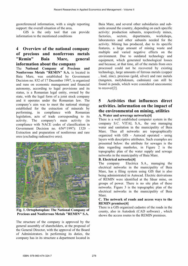
Fig. 1. Ortophotoplan: The National Company of
Precious and Nonferrous Metals "REMIN" S.A.
The structure of the company is approved by the general assembly of shareholders, at the proposal of the General Director, with the approval of the Board of Administrators. In performing its duties, the company has in its structure a department located in
Baia Mare, and several other subsidiaries and sub-units around the country, depending on each specific activity: production subunits, respectively mines, factories, sectors, departments, workshops, laboratories and other subunits needed for the activity. Mining has produced, due to its specific features, a large amount of mining waste and multiple and varied negative effects on the environment. Due to outdated technology and equipment, which generated technological losses and because, at that time, all of the metals from ores processed could not be recovered by existing technology, large amounts of ferrous metals (copper , lead, zinc), precious (gold, silver) and rare metals (tungsten, molybdenum, cadmium) can still be found in ponds, which were considered uneconomic to recover[2].
5 Activities that influences direct
activities. information on the impact of
the environmental on mining, utilities A. Water and sewerage networks[4]
There is a well established computer system in the company S.C. VITAL S.A,. the one managing water and sanitation in the municipality of Baia Mare. Thus all networks are topographically organized with GIS - Autocad operated - using layers with descriptive attributes. Such examples are presented below: the attribute for sewages is the data regarding manholes, in Figure 2 is the topographic plan of the water supply and sewage networks in the municipality of Baia Mare. B. Electrical networks[4]
The company Electrica S.A., managing the electrical networks in the municipality of Baia Mare, has a filing system using GIS that is also being administrated in Autocad. Electric derivations of REMIN were identified at the Săsar mine, on groups of power. There is no site plan of these networks. Figure 3 is the topographic plan of the electrical networks in the municipality of Baia Mare. C. The network of roads and access ways to the
REMIN premises[4]
There is a GIS organized cadastre of the roads in the county, also in Autodesk (CAD software) , which shows the access routes to the REMIN premises.
Recent Researches in Applied Economics and Management - Volume II
ISBN: 978-960-474-324-7 278

Fig. 2 The topographic plan of the water supply
and sewage networks in the municipality of Baia
Mare[4].
6 Evaluation of the information
system within C.N. Remin Baia Mare Basically the only software used in C.N. Remin Baia Mare was the one related to solving accounting and financial-supply-sale problems. Although there had been a Surpac software present, it was never used. For technical services, engineering, production planning, there was CAD software that had also been used for the few underground digitized plans[2]. The level of technical equipment was limited to a few networked computers and the Internet. There was no Intranet, taking into account the fact that the decline of the organization took place since the beginning of the 2000s. The management's concern for better computerization of work was average, compared to similar institutions in the country. There was and still is a computer service concerned only with the current issues regarding the operation of existing computers. In the background created, but also in similar cases, our proposal is to design a qestionaire which could facilitate the implementatiopn of the information system in the organization. 5. MDB GIS, SWOT ANALYSIS[2]
Performing a SWOT analysis on the implementation of an information system, be it even MDB GIS, for a company that is in liquidation, is difficult. It is therefore necessary, in these circumstances, to create a framework in which presumably one would implement, apply and develop the information system. C.N. "Remin" Baia Mare is a state owned unit coordinated by the Ministry of Economy, coordinating several mines, each with one or several
mines exploiting non-ferrous metalliferous ores. Initial data is a follows: some mining software is being used in the company, also, some economic ERP-type software, there are digital cartographic materials and part of the information is digital. The company also holds GIS licenses and has used them experimentally for certain topo-cadastral documentations. Because the unit is operating at capacity, unit leadership is concerned with streamlining its activity by using computers and is willing to invest in such projects. In this respect, the SWOT analysis of Mining GIS would look like the one in Matrix 1.
Matrix 1. SWOT Analysis of MDB GIS for
"Remin STRENGTHS
� High level of concern from management to use MDB GIS technology to solve problems of informatization in the company;
� Basic GIS files already created; � Many of the topographic plans are already
digitized; � The widespread use of digital mapping methods; � There is some basic understanding and experience
in MDB GIS in several departments of the company; � The power of MDB GIS to visually present all
information entered into the system; � Integration of all information flowing into the
organization in a single, homogeneous system with a unique way of accepting and analyzing data;
� Ability to implement the system in stages, in modules, based on the cost-funds ratio;
� The use of ERP-type production planning software was a success;
� The successful use of the SURPAC software for coordinating production activity.
OPPORTUNITIES
� Create a GIS project portfolio to improve services and reduce costs;
� Facilitate collaboration and knowledge sharing between departments;
� Contribute to the city's green agenda by participating in environmental protection;
� Possibility for some of the information to circulate in multi-media;
� The cost of software used is decreasing; � The cost of hardware systems used is decreasing; � Better collaboration, exchange of information
between the company and the Ministry of Economy; � Better collaboration, exchange of information
between the company and the mines; � Better collaboration, exchange of information
between mines; � Better collaboration, exchange of information
between services, departments, corporate offices, mines; � Ability to qualify for certain discounts for software
purchased under a larger operation regarding the computerization of the organization;
� A company / mine that is entirely or mostly computer-based is easier and more efficient to run and control;
WEAKNESSES
Recent Researches in Applied Economics and Management - Volume II
ISBN: 978-960-474-324-7 279

� The potential for GIS development is missing, in order to reduce costs and improve services, because this policy is not in line with the current business strategy;
� Limited technical skills in using MDB GIS among company personnel;
� Existing hardware and software infrastructure are obsolete; � Clear misunderstanding of the potential benefits of MDB
GIS among most of the company's decision makers (board members for example);
� The complexity of the system; it is very complex and its operation requires multidisciplinary knowledge;
� High cost of the maximum rank of implementation; � Not knowing how the modularization of the information
system is taking place; not knowing how to implement the computer system in stages, on modules;
� Weak computer links between the company and component units, i.e. between mining operations and mines.
THREATS � Competition for funding with other new technological
initiatives; � The effects of implementation are not immediate and
results may not correspond to initial expectations; � Possible major changes in the company's development
strategy due to prices decreasing for metals resulting from processing;
� Mining software become more efficient and can cover, with lower costs, certain chapters in the computerization of the company;
� Low return of the mining activity due to low concentrations of ore in the area;
� Low demand for raw materials of the type operated by the company;
� Decreased prices for raw material in the international specialized market;
� Competition from potential producers in the Asian region of raw materials of the type operated by the company;
� The upgrading of acquired software is faster than the rate of depreciation, which will lead to a decrease in unit competitiveness through technical gap, or will require new investments before the depreciation of the original purchase.
7 Conclusion I believe that from the foregoing analysis and presentations results much of the benefits of MGIS and of the management process that may rely on it as a leading provider of information, compared with traditional management methods based largely on the analysis of written reports. I think the biggest advantage offered is the possibility of viewing virtually any information in a graphically digital manner, and then the possibility of simulation and study of the alleged situation’s effects. Another huge advantage is the actuality of data, if the system is working properly, because information can be analyzed after a few moments from running it. In case of underground accidents, knowledge of the effects, if the MGIS system is doubled by a sensory system monitoring the processes and activities underground, can be made
spontaneously, and the system will provide the most current and complete information on the organization and coordination of the emergency situation. But, by currently using MGIS, we do not have to reach such events as the system provides sufficient data to prevent them. The biggest gain will be for the daily activity of all those using the information in the current activity, from sector heads to the unit manager, not to mention the managers of upper structures who will be able to oversee the entire activity of all subordinate institutions from their offices. Another big advantage is the possibility of having synchronous data for important information regarding: state of underground railway, air, gases, dust, water infiltration, situation of perforations and directed explosions, operation of machinery, mining machine, and many other events, obviously depending on the equipment and specific of each mine, but also in relation to the possibilities and willingness to invest in monitoring the underground mining environment. Analyzing the informational levels that MINING SURVEYING offers, we can see that practically, starting from the support layer, which would be the general plan of the mine, for the underground, and the topographic site plan for the surface, all the information is geographically labeled, so that everything mentioned below corresponds to the same condition. As such, GIS may have great ramifications for the mining industry, the exploration and development phases of a mine's life span, nor does it deal with sub-surface aspects of an underground mine. Rather, it concentrates on the processing of a mine's output, its disposal, and the ultimate closure and reclamation of the mine site. Our paper aims at setting up a concept for creating modular re-configurable and adaptable mining databases to represent a step towards new conceptual guidelines for mine management, through computerization.
References:
[1] Aronoff, S.(2000) – Geographic Information Systems: A Management Perspective, WDL Publications, Ottawa, Canada, [2] Cowen, D.J., J.R. Jensen., P.J. Bresnahan., G.B. Ehler., D. Graves., X. Huang, C. Wiesner., and H.E. Mackey (Jr.). (1995). The design and
implementation of an integrated geographic
information system for environmental applications. Photogrammetric Engineering and Remote Sensing 61 (11): 1393-1404.
Recent Researches in Applied Economics and Management - Volume II
ISBN: 978-960-474-324-7 280
[3] Date, C. J. (1995) – An Introduction to Database Systems, Addison-Wesley, Reading, Massachussets, [4] Dima N., Herbei O., Veres I.,(2006), Construirea unui sistem informatic geografic folosind programul
AutoCAD Map, Revista de cadastru, nr.6, 2006 ISSN 1583 -2279 [5] Radulescu A.T.G., Rădulescu M.V.G., Bădescu G. , (2010), GIS Applications in the Field of Nord Vest of Romanian Mining, 2010 ESRI International User Conference, 12-16 IULIE, 2010, San Diego, California, SUA, lucrarea a fost prezentată în cadrul secŃiunii , Survey and Construction GIS Case Studies,http://proceedings.esri.com/library/userconf/proc 10/vc/papers/pap_1880.pdf-WIE
[6] Rădulescu M.V.G., Radulescu A.T.G. , Radulescu G.M.T., (2009), GIS in mining & exploration, as a tool to based mining revenue
management system, THE NATIONAL TECHNICAL-SCIENTIFIC CONFERENCE „Modern technologies for the 3RD Millenium” – ORADEA, 2009, Analele Universitatii din Oradea, fascicula Constructii si Instalatii hidroedilitare, ISSN 1454-4067, Vol.XII, Cod CNCSIS 877 [7] Rădulescu M.V.G., (2012), Contributions to the realisation of a concept of creating data mining
bank, PHD Thesys, The Petrosani Unversity, Romania, [8] Rădulescu C., Rădulescu M.V.G.,(2011),Approaches of the management informational systems regarding the implementation of the Geographic Information Systems (GIS) in the mining basins of Romania International Multidisciplinary Scientific GeoConference & expo SGEM, the 12th international geoconference SGEM 2011, 17 - 23 june, 2011,. paper 92, Section 7. "Geodesy and Mine Surveying" http://www.sgem.org/sche_pub_schedule.php, scientific data based indexing ISI Web of Science, Web of Knowledge, CrossRef and Scopus. [9] MIS-MINERAL INFORMATION SYSTEM(2011), Indian Bureau of Mines, http://ibm.nic.in/reportch7.13.pdf, accesed at 12.02.2012. [10] http://lex.justice.md/index.php?action=view&view=doc&lang=1&id=336563, , site accesat la 2 mai 2011 [11] Virgil Mihai Rădulescu, Corina Radulescu „ Mining Data Bank GIS as Part of an Efficient
System in Mining „ , 196 de pagini, LAP LAMBERT Academic Publishing, AV Akademikerverlag GmbH & Co. KG, Saarbrücken ,Germania, ISBN 978-3-659-40968-4 [12] RĂDULESCU M.G. Virgil, DIMA Nicolae, RĂDULESCU M.E.E. Corina, Mining surveying as
a basis for GIS applications , Conferinta nationala
tehnico-stiintifica (cu participare internationala), editia a VIII-A , "TEHNOLOGII MODERNE PENTRU MILENIUL III", 5 – 6 noiembrie 2010, lucrare publicată în Analele UniversităŃii din Oradea, fascicula „ConstrucŃii şi InstalaŃii Hidroedilitare”, Revistă cotată B+.
Recent Researches in Applied Economics and Management - Volume II
ISBN: 978-960-474-324-7 281