Embed Size (px)
Citation preview
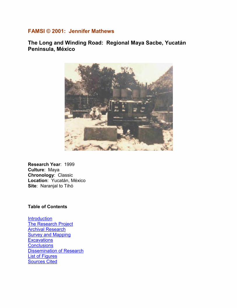
FAMSI © 2001: Jennifer Mathews
The Long and Winding Road: Regional Maya Sacbe, Yucatán Peninsula, México
Research Year: 1999 Culture: Maya Chronology: Classic Location: Yucatán, México Site: Naranjal to Tihó
Table of Contents
Introduction The Research Project Archival Research Survey and Mapping Excavations Conclusions Dissemination of Research List of Figures Sources Cited
2
Introduction
This is a report on the research conducted by Jennifer Mathews during the summer of 1999 (between the period of May 1 - June 23, 1999) with funding from the Foundation for the Advancement of Mesoamerican Studies, Inc. (FAMSI), and under a permit from the Instituto Nacional de Antropología e Historia. The following is a summary of the overall research project, and the activities conducted during this summer field season.
Submitted 02/01/2000 by: Jennifer Mathews, Ph.D. Department of Sociology and Anthropology Trinity University [email protected]
The Research Project
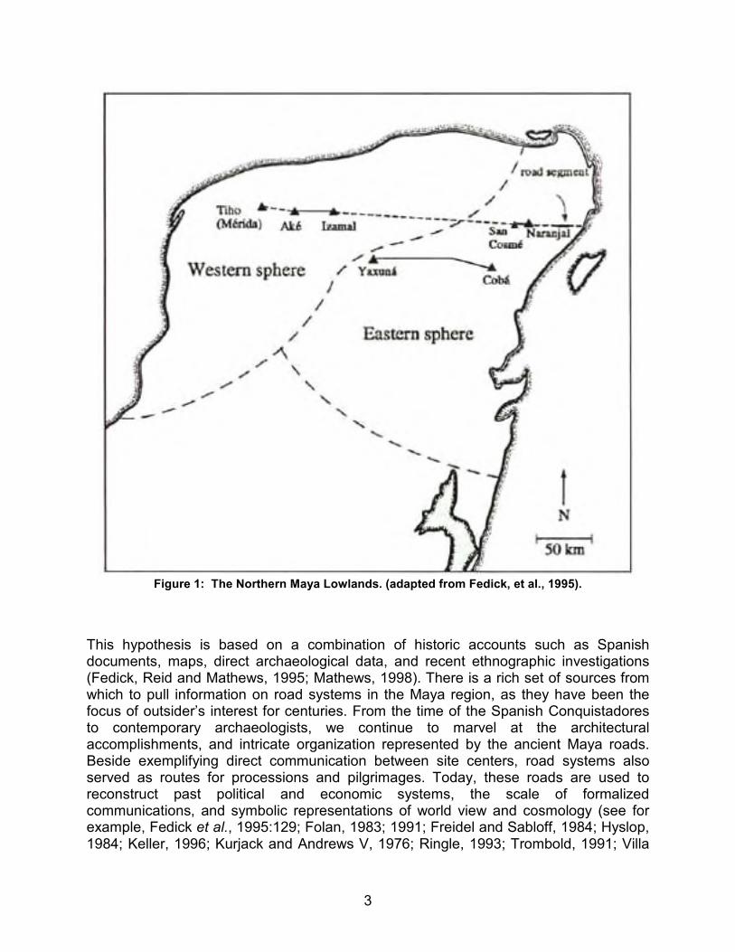
This archaeological investigation argues for the existence of a peninsular-wide road, running for approximately 300 km from the ancient city of Tihó (where modern Mérida is today) to the east coast at or near Puerto Morelos, Quintana Roo (see Figure 1).
3
Figure 1: The Northern Maya Lowlands. (adapted from Fedick, et al., 1995).
This hypothesis is based on a combination of historic accounts such as Spanish documents, maps, direct archaeological data, and recent ethnographic investigations (Fedick, Reid and Mathews, 1995; Mathews, 1998). There is a rich set of sources from which to pull information on road systems in the Maya region, as they have been the focus of outsider’s interest for centuries. From the time of the Spanish Conquistadores to contemporary archaeologists, we continue to marvel at the architectural accomplishments, and intricate organization represented by the ancient Maya roads. Beside exemplifying direct communication between site centers, road systems also served as routes for processions and pilgrimages. Today, these roads are used to reconstruct past political and economic systems, the scale of formalized communications, and symbolic representations of world view and cosmology (see for example, Fedick et al., 1995:129; Folan, 1983; 1991; Freidel and Sabloff, 1984; Hyslop, 1984; Keller, 1996; Kurjack and Andrews V, 1976; Ringle, 1993; Trombold, 1991; Villa
4
Rojas, 1934:208). These combined factors clearly signify the importance of delineating a regional road system linking the interaction spheres in the Yucatán Peninsula.
Reports from the sixteenth and seventeenth centuries state that Spanish chroniclers knew of the existence of ancient roads that connected the cities of the northern Yucatán Peninsula (see translation in Tozzer, 1941). In 1688, Diego López Cogolludo declared, "there are remains of paved highways which traverse all this kingdom and they say they ended in the east on the seashore…so that they might arrive at Cozumel for the fulfillment of their vows, to offer their sacrifice, to ask for help in their needs, and for the mistaken adoration of their false gods" (in Tozzer, 1941:109). In addition to Cogolludo’s account, Diego de Landa also noted that there was a road segment that connected the ancient city of Tihó to the ruins at Izamal, a site that is located about 65 kilometers to the east. Interestingly, along this same eastern route, a thirty-two kilometer segment of sacbe has been documented from the site of Izamal to Aké (Roys and Shook, 1966:43-45; Maldonado, 1979a; 1979b; 1995). The possibility that this causeway continued even further east, is strengthened by the information supplied by one of the earliest Maya archaeologists, Désiré Charnay. In 1883, Charnay noted that, "we have also found marks of a cement road, from Izamal to the sea, facing the island of Cozumel" (Charnay, 1883:308).
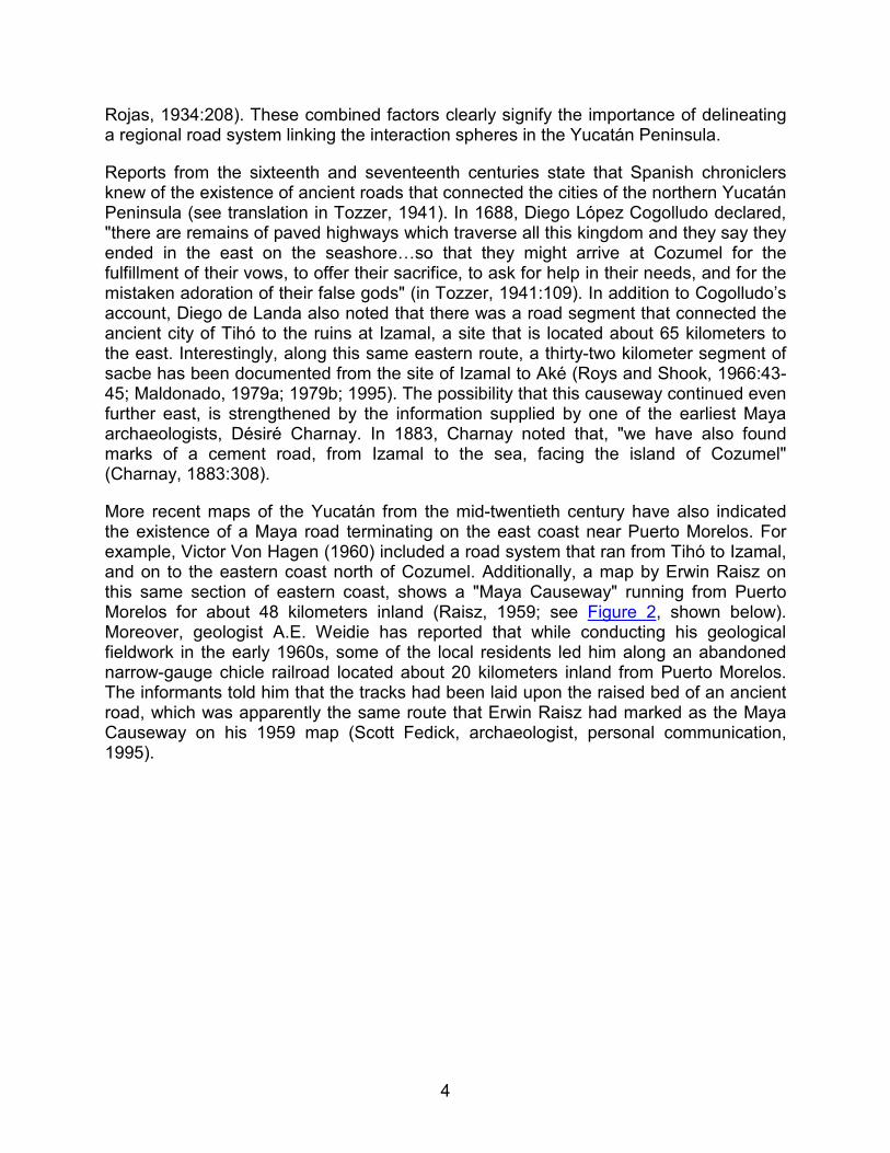
More recent maps of the Yucatán from the mid-twentieth century have also indicated the existence of a Maya road terminating on the east coast near Puerto Morelos. For example, Victor Von Hagen (1960) included a road system that ran from Tihó to Izamal, and on to the eastern coast north of Cozumel. Additionally, a map by Erwin Raisz on this same section of eastern coast, shows a "Maya Causeway" running from Puerto Morelos for about 48 kilometers inland (Raisz, 1959; see Figure 2, shown below). Moreover, geologist A.E. Weidie has reported that while conducting his geological fieldwork in the early 1960s, some of the local residents led him along an abandoned narrow-gauge chicle railroad located about 20 kilometers inland from Puerto Morelos. The informants told him that the tracks had been laid upon the raised bed of an ancient road, which was apparently the same route that Erwin Raisz had marked as the Maya Causeway on his 1959 map (Scott Fedick, archaeologist, personal communication, 1995).
5
Figure 2: The 1959 Raisz map. Note the "Maya Causeway" designation.
6
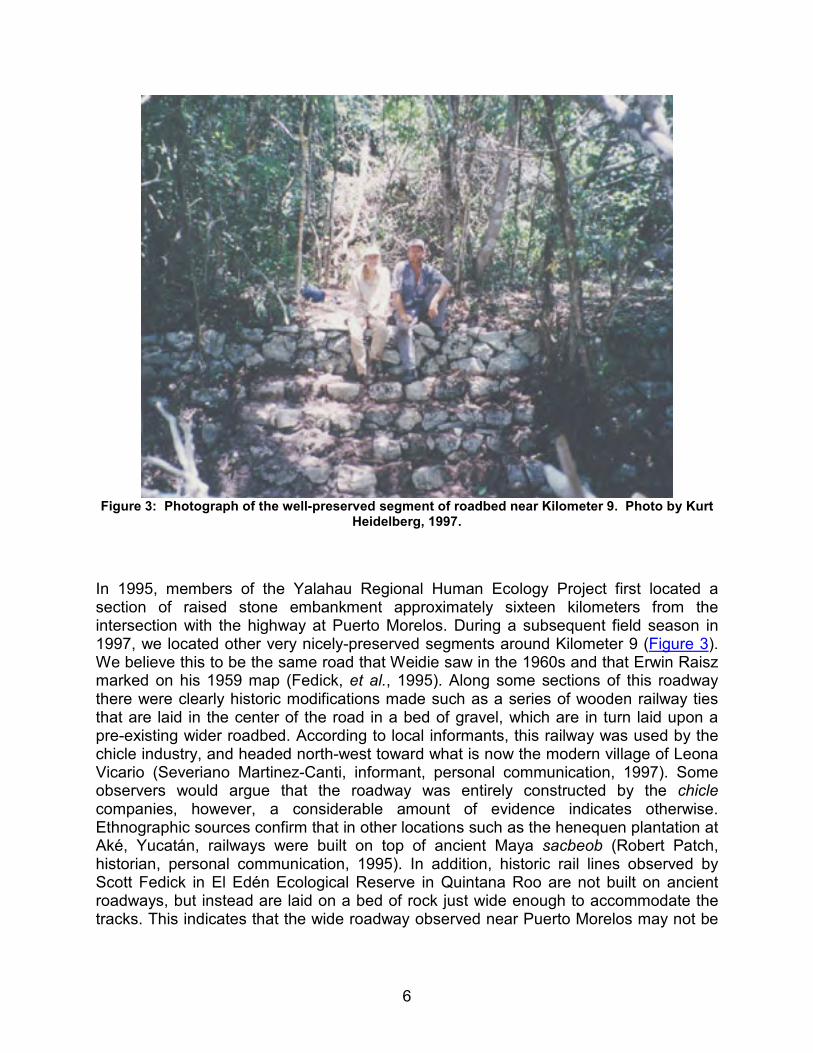
Figure 3: Photograph of the well-preserved segment of roadbed near Kilometer 9. Photo by Kurt
Heidelberg, 1997.
In 1995, members of the Yalahau Regional Human Ecology Project first located a section of raised stone embankment approximately sixteen kilometers from the intersection with the highway at Puerto Morelos. During a subsequent field season in 1997, we located other very nicely-preserved segments around Kilometer 9 (Figure 3). We believe this to be the same road that Weidie saw in the 1960s and that Erwin Raisz marked on his 1959 map (Fedick, et al., 1995). Along some sections of this roadway there were clearly historic modifications made such as a series of wooden railway ties that are laid in the center of the road in a bed of gravel, which are in turn laid upon a pre-existing wider roadbed. According to local informants, this railway was used by the chicle industry, and headed north-west toward what is now the modern village of Leona Vicario (Severiano Martinez-Canti, informant, personal communication, 1997). Some observers would argue that the roadway was entirely constructed by the chicle companies, however, a considerable amount of evidence indicates otherwise. Ethnographic sources confirm that in other locations such as the henequen plantation at Aké, Yucatán, railways were built on top of ancient Maya sacbeob (Robert Patch, historian, personal communication, 1995). In addition, historic rail lines observed by Scott Fedick in El Edén Ecological Reserve in Quintana Roo are not built on ancient roadways, but instead are laid on a bed of rock just wide enough to accommodate the tracks. This indicates that the wide roadway observed near Puerto Morelos may not be
7
a recent construction, but instead an efficient integration of existing materials by the chicle companies (Fedick et al., 1995).
Other evidence that this causeway is not completely of historic origin, include sections of road near Puerto Morelos not associated with the rail line. As mentioned above, the rail line is documented as branching off from its western path and heading north-west toward Leona Vicario. We believe the ancient causeway probably continued to head due west. Although it was difficult to trace, we did find one section of road during the 1997 season that lacked any evidence of tracks or rail ties, and that had a massive chico zapote tree growing in the center of it. This was significant because according to the local residents, the rail line was in use up until the 1970s. The tree has a diameter at the base of the trunk measuring 2.35 m, and a height of approximately 20 m. According to botanists working in the Yucatán, the diameter and size of this tree indicates that it has been growing for at least 70-80 years (Gillian Schultz, botanist, personal communication, 1997). Local chicleros estimate that the tree is probably about 150 years old (Severiano Canti, informant, personal communication, 1997). Regardless, if the rail line was in use until a few decades ago, it could not have been on this section of the roadbed, once again indicating that it was constructed prior to the development of the regional chicle industry in the early 1900s.
We have conducted short research seasons during the summers of 1995 and 1997 in an attempt to establish the argument that this is in fact a prehistoric road system. The 1999 field season (funded by FAMSI) intended to build upon this information with the use of a research design that included several components: archival research, ethnographic interviews, survey and mapping, and excavation.
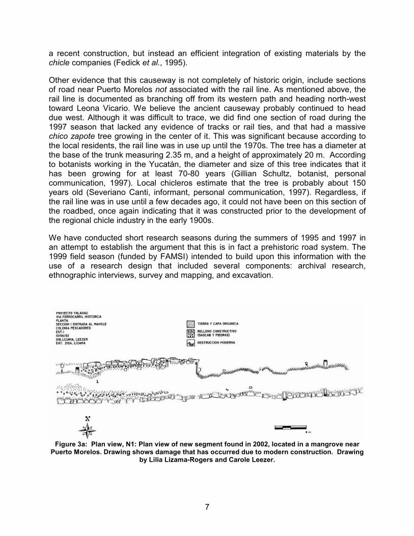
Figure 3a: Plan view, N1: Plan view of new segment found in 2002, located in a mangrove near
Puerto Morelos. Drawing shows damage that has occurred due to modern construction. Drawing by Lilia Lizama-Rogers and Carole Leezer.
8
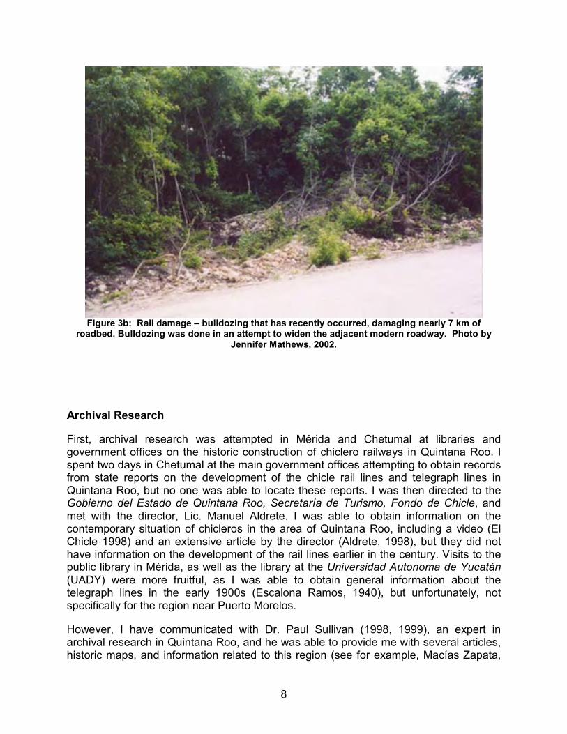
Figure 3b: Rail damage – bulldozing that has recently occurred, damaging nearly 7 km of
roadbed. Bulldozing was done in an attempt to widen the adjacent modern roadway. Photo by Jennifer Mathews, 2002.
Archival Research
First, archival research was attempted in Mérida and Chetumal at libraries and government offices on the historic construction of chiclero railways in Quintana Roo. I spent two days in Chetumal at the main government offices attempting to obtain records from state reports on the development of the chicle rail lines and telegraph lines in Quintana Roo, but no one was able to locate these reports. I was then directed to the Gobierno del Estado de Quintana Roo, Secretaría de Turismo, Fondo de Chicle, and met with the director, Lic. Manuel Aldrete. I was able to obtain information on the contemporary situation of chicleros in the area of Quintana Roo, including a video (El Chicle 1998) and an extensive article by the director (Aldrete, 1998), but they did not have information on the development of the rail lines earlier in the century. Visits to the public library in Mérida, as well as the library at the Universidad Autonoma de Yucatán (UADY) were more fruitful, as I was able to obtain general information about the telegraph lines in the early 1900s (Escalona Ramos, 1940), but unfortunately, not specifically for the region near Puerto Morelos.
However, I have communicated with Dr. Paul Sullivan (1998, 1999), an expert in archival research in Quintana Roo, and he was able to provide me with several articles, historic maps, and information related to this region (see for example, Macías Zapata,
9
1992; Villalobos González, 1993). Both Dr. Sullivan and an ethnographic informant indicated that the land where the railway was constructed was once owned by the Bank of London (Paul Sullivan, anthropologist, personal communication, 1998; José Montoya, informant, personal communication, 1999). I obtained a volume entitled, "A Century of Banking in Latin America to Commemorate the Centenary in 1962 of the Bank of London and South America Limited" (1964), however, there was no information related to the state of Quintana Roo, or the chicle industry. Nonetheless, I have also learned from Dr. Sullivan that the archives of the Bank of London/ Banco de Londres y México are deposited in the Special Collections at the University of London, so I am in the process of communicating with them about obtaining any relevant information. He has also suggested communicating with Banco Serafin, as this is the modern incarnate of the Banco de Londres y México, and they may have retained corporate archives (Paul Sullivan, personal communication, 1998). Any new information obtained after the submission of this 1999 report will be included in a subsequent report to FAMSI.
In addition to the archival research, several ethnographic interviews were conducted with local chicleros and residents of the small pueblo of Vallarta during the 1999 field season. This community continues to collect chicle on a small scale, but was considerably more involved in the chicle industry and the construction of the chicle rail line between the 1930s and 1970s. Several men in the community are familiar with the local history and the locations of historic and ancient features and have proven to be a great resource. While conducting archaeological fieldwork, I was able to arrange for several ethnographic interviews with the men I was working with, and some of the older men in the community. Most informants were very happy to talk about their knowledge of the roads and features, and confirmed the information that we had previously received. Several informants affirmed that they believed the historic railway was constructed on top of an ancient causeway, and indicated that while the historic railway continued northwest toward Leona Vicario, the ancient road continued due west. One informant told me that he believed the railway to be entirely historic, and said that there had never been an ancient roadway in this area. However, he also indicated that other than one Maya site known as "Veinte", there were no other prehistoric ruins in the area. As this is contrary to what we know about the ruins in the area (numerous prehistoric sites are known for the region) I believe that he was uncomfortable with archaeologists working in the area and was reluctant to discuss this information. The information gathered thus far (including the test pits conducted in 1999) causes me to be inclined to believe the several other informants who indicate that the road is prehistoric.
10
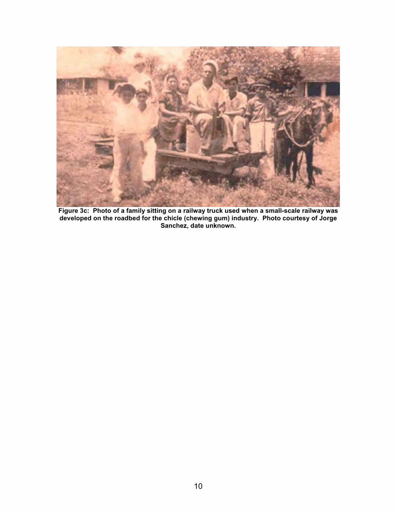
Figure 3c: Photo of a family sitting on a railway truck used when a small-scale railway was developed on the roadbed for the chicle (chewing gum) industry. Photo courtesy of Jorge
Sanchez, date unknown.
11
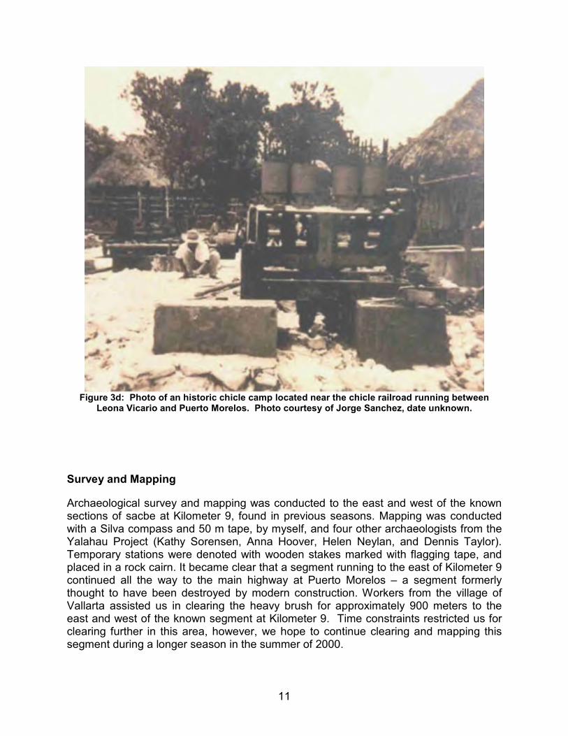
Figure 3d: Photo of an historic chicle camp located near the chicle railroad running between
Leona Vicario and Puerto Morelos. Photo courtesy of Jorge Sanchez, date unknown.
Survey and Mapping
Archaeological survey and mapping was conducted to the east and west of the known sections of sacbe at Kilometer 9, found in previous seasons. Mapping was conducted with a Silva compass and 50 m tape, by myself, and four other archaeologists from the Yalahau Project (Kathy Sorensen, Anna Hoover, Helen Neylan, and Dennis Taylor). Temporary stations were denoted with wooden stakes marked with flagging tape, and placed in a rock cairn. It became clear that a segment running to the east of Kilometer 9 continued all the way to the main highway at Puerto Morelos – a segment formerly thought to have been destroyed by modern construction. Workers from the village of Vallarta assisted us in clearing the heavy brush for approximately 900 meters to the east and west of the known segment at Kilometer 9. Time constraints restricted us for clearing further in this area, however, we hope to continue clearing and mapping this segment during a longer season in the summer of 2000.
12
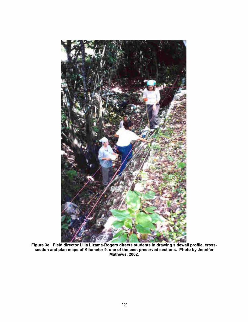
Figure 3e: Field director Lilia Lizama-Rogers directs students in drawing sidewall profile, cross-section and plan maps of Kilometer 9, one of the best preserved sections. Photo by Jennifer
Mathews, 2002.
13
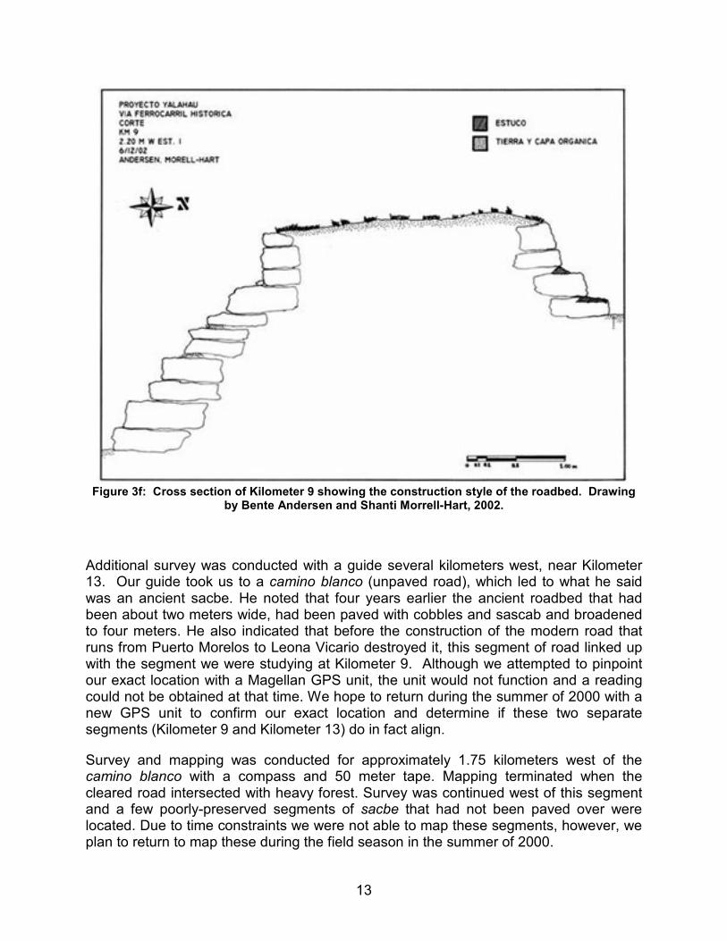
Figure 3f: Cross section of Kilometer 9 showing the construction style of the roadbed. Drawing
by Bente Andersen and Shanti Morrell-Hart, 2002.
Additional survey was conducted with a guide several kilometers west, near Kilometer 13. Our guide took us to a camino blanco (unpaved road), which led to what he said was an ancient sacbe. He noted that four years earlier the ancient roadbed that had been about two meters wide, had been paved with cobbles and sascab and broadened to four meters. He also indicated that before the construction of the modern road that runs from Puerto Morelos to Leona Vicario destroyed it, this segment of road linked up with the segment we were studying at Kilometer 9. Although we attempted to pinpoint our exact location with a Magellan GPS unit, the unit would not function and a reading could not be obtained at that time. We hope to return during the summer of 2000 with a new GPS unit to confirm our exact location and determine if these two separate segments (Kilometer 9 and Kilometer 13) do in fact align.
Survey and mapping was conducted for approximately 1.75 kilometers west of the camino blanco with a compass and 50 meter tape. Mapping terminated when the cleared road intersected with heavy forest. Survey was continued west of this segment and a few poorly-preserved segments of sacbe that had not been paved over were located. Due to time constraints we were not able to map these segments, however, we plan to return to map these during the field season in the summer of 2000.
14
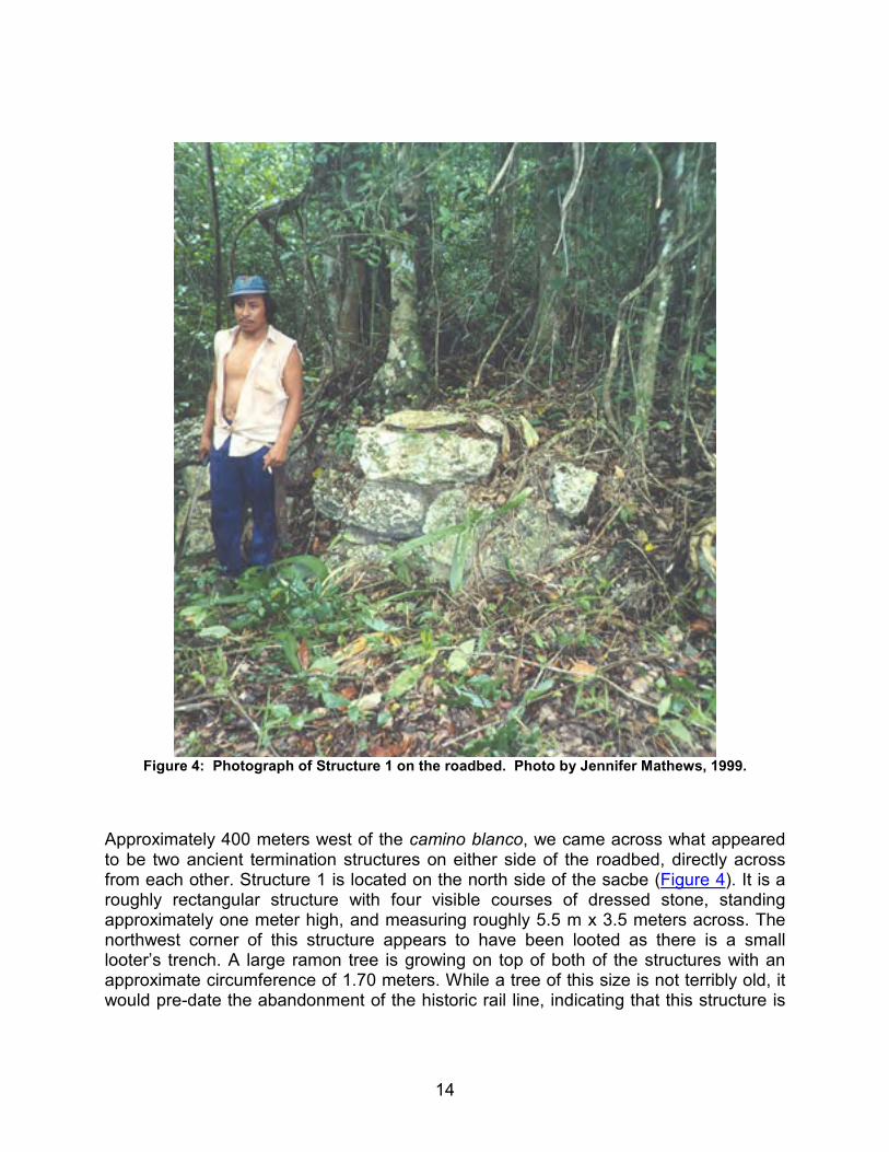
Figure 4: Photograph of Structure 1 on the roadbed. Photo by Jennifer Mathews, 1999.
Approximately 400 meters west of the camino blanco, we came across what appeared to be two ancient termination structures on either side of the roadbed, directly across from each other. Structure 1 is located on the north side of the sacbe (Figure 4). It is a roughly rectangular structure with four visible courses of dressed stone, standing approximately one meter high, and measuring roughly 5.5 m x 3.5 meters across. The northwest corner of this structure appears to have been looted as there is a small looter’s trench. A large ramon tree is growing on top of both of the structures with an approximate circumference of 1.70 meters. While a tree of this size is not terribly old, it would pre-date the abandonment of the historic rail line, indicating that this structure is
15
not a historic construction. Additionally, a relatively large amount of ancient ceramics were located around and on top of the structure.
Structure 2 is located on the southern side of the roadbed, and is more poorly preserved than Structure 1. Three courses of stone are visible, measuring 70 cm at the highest point, and the structure is also roughly 5.5 meters x 3.5 meters across. A large ramon tree is located in the center of the structure with a circumference of about 1.20 meters, again indicating a prehistoric origin. Surface ceramics were also found on top of, and around the structure.
Excavations
Three test pits were placed in various locations next to the roadbed in an attempt to obtain associated artifacts. All excavation work was conducted over a five day period by myself, and archaeologists Kathy Sorensen and Anna Hoover (from the Yalahau Project), and paid workers from the local communities of Vallarta and Puerto Morelos. All pits were laid out with a tape and compass, and excavations were conducted with a round nose shovel, trowels, and 1/4" screens. The first two test pits were placed on either side of the roadbed along the nicest-preserved section at Kilometer 9. The location of the pits was based primarily on the fact that this was the best-preserved section of the roadbed, that there was surface soil deeper than a fill centimeters, and that it had not been covered by modern road construction. These criteria did not prove fruitful, other than that it determined that there were no cultural remains in this area.
16
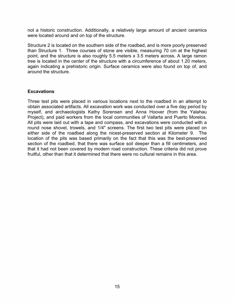
Figure 5: Unit 1, southern side of roadbed, excavation conducted during the 1999 season. Photo
by Jennifer Mathews, 1999.
The first pit is a 1 x 2 m unit, placed on the southern side of the road, about a meter from the base (see Figure 5). The soil was shallow here and no natural stratigraphy was evident. Layers were excavated in 10 cm, and it soon became evident that a large amount of sascab (soft limestone) had been dumped in this area during the construction of the modern road just south of the test pit. We excavated through the fill to the soil and continued to bedrock at about 65 cm. All excavated soil was screened, however no artifacts were found.
17
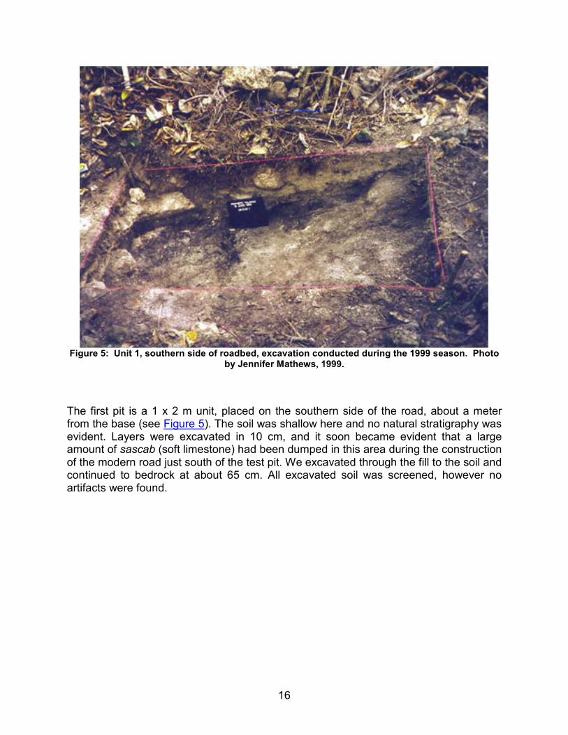
Figure 6: Unit 2, northern side of roadbed, excavation conducted during the 1999 season. Photo
by Jennifer Mathews, 1999.
18
The second pit measured 1 x 1 m, and was placed to the north of the roadbed, about a meter from the base (Figure 6). Again the soil was shallow, and no natural stratigraphy was evident. Layers were excavated in 10 cm levels and all soil was screened. We excavated to about 40 cm and found no artifacts, historic or otherwise. Both of these excavations were conducted before the segment of road near Kilometer 13, and the surface ceramics had been located – otherwise, we would have concentrated our efforts in this area.
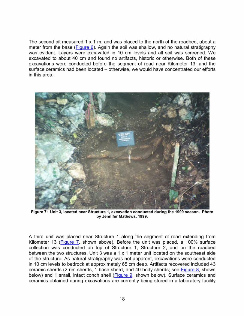
Figure 7: Unit 3, located near Structure 1, excavation conducted during the 1999 season. Photo
by Jennifer Mathews, 1999.
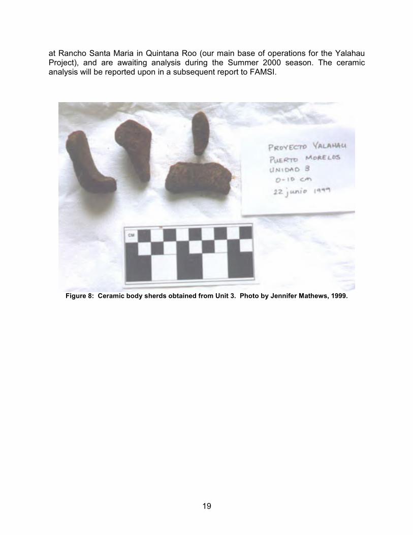
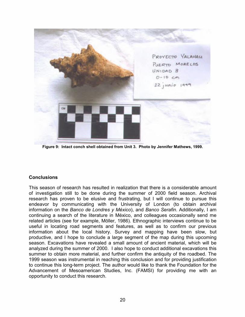
A third unit was placed near Structure 1 along the segment of road extending from Kilometer 13 (Figure 7, shown above). Before the unit was placed, a 100% surface collection was conducted on top of Structure 1, Structure 2, and on the roadbed between the two structures. Unit 3 was a 1 x 1 meter unit located on the southeast side of the structure. As natural stratigraphy was not apparent, excavations were conducted in 10 cm levels to bedrock at approximately 65 cm deep. Artifacts recovered included 43 ceramic sherds (2 rim sherds, 1 base sherd, and 40 body sherds; see Figure 8, shown below) and 1 small, intact conch shell (Figure 9, shown below). Surface ceramics and ceramics obtained during excavations are currently being stored in a laboratory facility
19
at Rancho Santa Maria in Quintana Roo (our main base of operations for the Yalahau Project), and are awaiting analysis during the Summer 2000 season. The ceramic analysis will be reported upon in a subsequent report to FAMSI.
Figure 8: Ceramic body sherds obtained from Unit 3. Photo by Jennifer Mathews, 1999.
20
Figure 9: Intact conch shell obtained from Unit 3. Photo by Jennifer Mathews, 1999.
Conclusions
This season of research has resulted in realization that there is a considerable amount of investigation still to be done during the summer of 2000 field season. Archival research has proven to be elusive and frustrating, but I will continue to pursue this endeavor by communicating with the University of London (to obtain archival information on the Banco de Londres y México), and Banco Serafin. Additionally, I am continuing a search of the literature in México, and colleagues occasionally send me related articles (see for example, Möller, 1986). Ethnographic interviews continue to be useful in locating road segments and features, as well as to confirm our previous information about the local history. Survey and mapping have been slow, but productive, and I hope to conclude a large segment of the map during this upcoming season. Excavations have revealed a small amount of ancient material, which will be analyzed during the summer of 2000. I also hope to conduct additional excavations this summer to obtain more material, and further confirm the antiquity of the roadbed. The 1999 season was instrumental in reaching this conclusion and for providing justification to continue this long-term project. The author would like to thank the Foundation for the Advancement of Mesoamerican Studies, Inc. (FAMSI) for providing me with an opportunity to conduct this research.
21
Dissemination of Research
Dissemination of this research has included a chapter of my dissertation (Mathews, 1998a), two papers presented at national conferences (Society for American Archaeology and American Anthropological Association) in 1998 and 1999 (Mathews, 1998b; 1999), research reports in English and Spanish to the National Institute of Archaeology and History in México (Mathews, 2000; 1998c) and presentations at several universities and archaeological societies around the country (Trinity University, University of North Texas, University of Vermont, University of California Riverside, and the American Institute of Archaeology, Southwest Division). In all cases, the contribution of FAMSI was acknowledged verbally and in text.
List of Figures
Figure 1: The Northern Maya Lowlands. (adapted from Fedick, et al., 1995).
Figure 2: The 1959 Raisz map. Note the "Maya Causeway" designation.
Figure 3: Photograph of the well-preserved segment of roadbed near Kilometer 9. Photo by Kurt Heidelberg, 1997.
Figure 3a: Plan view, N1: Plan view of new segment found in 2002, located in a mangrove near Puerto Morelos. Drawing shows damage that has occurred due to modern construction. Drawing by Lilia Lizama-Rogers and Carole Leezer.
Figure 3b: Rail damage – bulldozing that has recently occurred, damaging nearly 7 km of roadbed. Bulldozing was done in an attempt to widen the adjacent modern roadway. Photo by Jennifer Mathews, 2002.
Figure 3c: Photo of a family sitting on a railway truck used when a small-scale railway was developed on the roadbed for the chicle (chewing gum) industry. Photo courtesy of Jorge Sanchez, date unknown.
Figure 3d: Photo of an historic chicle camp located near the chicle railroad running between Leona Vicario and Puerto Morelos. Photo courtesy of Jorge Sanchez, date unknown.
Figure 3e: Field director Lilia Lizama-Rogers directs students in drawing sidewall profile, cross-section and plan maps of Kilometer 9, one of the best preserved sections. Photo by Jennifer Mathews, 2002.
22
Figure 3f: Cross section of Kilometer 9 showing the construction style of the roadbed. Drawing by Bente Andersen and Shanti Morrell-Hart, 2002.
Figure 4: Photograph of Structure 1 on the roadbed. Photo by Jennifer Mathews, 1999.
Figure 5: Unit 1, southern side of roadbed, excavation conducted during the 1999 season. Photo by Jennifer Mathews, 1999.
Figure 6: Unit 2, northern side of roadbed, excavation conducted during the 1999 season. Photo by Jennifer Mathews, 1999.
Figure 7: Unit 3, located near Structure 1, excavation conducted during the 1999 season. Photo by Jennifer Mathews, 1999.
Figure 8: Ceramic body sherds obtained from Unit 3. Photo by Jennifer Mathews, 1999.
Figure 9: Intact conch shell obtained from Unit 3. Photo by Jennifer Mathews, 1999.
Sources Cited
Aldrete, Manuel
1998 Desarollo Institucional Chicle/Miel en la Comunidad de Señor, Ejido X-Maben y Anexos en el Municipio de Felipe Carrillo Puerto, Quintana Roo. Unpublished report on file at Gobierno del Estado de Quintana Roo Secretaría de Turismo, Fondo de Chicle, Chetumal, Quintana Roo, México.
Benavides Castillo, Antonio
1981 Los Caminos de Cobá y Sus Implicaciones Sociales. Instituto Nacional de Antropología e Historia, México.
Charnay, Désiré
1883 Ancient Cities of the New World. New York.
Derechos Reservados, México
1998 El Chicle. Promotional video for the Plan Piloto Chiclero de Quintana Roo y Campeche.
Escalona-Ramos, Alberto
1940 Las vías de comunicacíon en Quintana Roo. Revista Mexicana de Geografía 1:207-229.
23
Fedick, Scott L., Dawn M. Reid, and Jennifer Mathews
1995 Road Systems. In The View from Yalahau: 1993 Archaeological Investigations in Northern Quintana Roo, México, edited by Scott Fedick and Karl Taube. Latin American Studies Program, Field Report Series, no. 2. University of California, Riverside Press.
Folan, William
1983 The Ruins of Cobá. In Cobá: A Classic Maya Metropolis. Folan, William J., Ellen R. Kintz and L.A. Fletcher, editors, pp. 65-87. Academic Press, New York.
1991 Sacbes of the Northern Maya. In Ancient Road Networks and Settlement Hierarchies in the New World, edited by Charles D. Trombold, pp. 222-229. Cambridge University Press, Cambridge.
Freidel, David A. and Jeremy A. Sabloff
1984 Cozumel: Late Maya Settlement Patterns. Academic Press, New York.
Hyslop, John
1984 The Inka Road System. Academic Press, Orlando.
Joslin, David
1963 A Century of Banking in Latin America; to commemorate the centenary in 1962 of the Bank of London and South America Limited. Oxford University Press, London.
Keller, Angela
1996 Roads to Understanding: Language and Lowland Maya "Sacbes" of the Classic Period. Paper presented at the 61st Annual Meeting of the Society for American Archaeology, New Orleans.
Kurjack, Edward B. and E. Wyllys Andrews V.
1976 Early Boundary Maintenance in Northwest Yucatán, México. American Antiquity41:318-325.
Macías Zapata, Gabriel
1992 Soldados, indios y libre comercio en Quintana Roo, 1893-1903. Relaciones: Estudios de historia y sociedad, Vol. 49:invierno.
24
Maldonado, Rubén
1979a Izamal-Aké, Cansahcab-Ucí, Sistemas Prehispánicos del Norte de Yucatán. Boletín de la Escuela de Ciencias Antropologícas de la Universidad de Yucatán 6(36):33-44.
1979b Los Sacbeob de Izamal-Aké y Ucí, Cansahcab en el Noroeste de Yucatán.Antropología e Historia: Boletín del Instituto Nacional de Antropología e Historia 27:23-29.
1995 Los Sistemas de Caminos del Norte de Yucatán. In Seis Ensayos Sobre Antiguos Patrones de Asentamiento en el Área Maya, Ernesto Vargas Pacheco, editor, pp. 68-92. Universidad Nacional Autónoma de México, México City.
Mathews, Jennifer P.
2000 Proyecto de investigaciones de una histórica vía de ferrocarril y posible sacbéantiguos cerca del Puerto Morelos: Informe para las investigaciones arqueológicas de 1999 en el norte de Quintana Roo. Research report on file with the Consejo de Arqueología del Instituto Nacional de Antropología e Historia, México. (Research report in English and Spanish).
1999 "On the Road to the Past: the Use of Ethnographic and Historic Sources to Locate an Ancient Maya Causeway in the Yucatán Peninsula". Paper presented at the 98thAnnual Meeting for the American Anthropological Association, Chicago, Illinois.
1998a The Ties That Bind: The Ancient Maya Interaction Spheres of the Late Preclassic and Early Classic Periods in the Northern Yucatán Peninsula. Doctoral dissertation on file at the University of California, Riverside and UMI.
1998b The Interaction Spheres of the Late Preclassic to Early Classic Maya in the Yucatán Peninsula. Paper presented at the 63rd Annual Meeting for the Society of American Archaeology, Seattle, Washington.
1998c Results of Radiocarbon Dating, Documenting the Megalithic Style, and Tracing the Regional Sacbe at Puerto Morelos. The Yalahau Project: Preliminary Technical Report on 1997 Archaeological Investigations in Northern Quintana Roo, México. On file with the Consejo de Arqueología del Instituto Nacional de Antropología e Historia, México. (Research report in English and Spanish).
25
Möller, Harry
1986 Un Ferrocarril que Nadie Quiere Recordar. México Desconocido, No. 111:36-40.
Plan Piloto Chiclero
1998 El Chicle. Promotional video, Chetumal, Quintana Roo.
Raisz, Erwin
1959 Landforms of México. Map prepared for the Geography Branch of the Office of Naval Research, Cambridge, Mass.
Ringle, William M.
1993 Preclassic Cityscapes: Ritual Politics Among Early Lowland Maya. Paper presented at Dumbarton Oaks Symposium on Ritual Behavior, Social Identity, and Cosmology in Pre-Classic Mesoamerica. Washington, D.C.
Roys, Lawrence and Edwin M. Shook
1966 Preliminary Report on the Ruins of Aké, Yucatán. Society for American Archaeology Memoirs 20, vol. 31(3):1-54.
Tozzer, Alfred M.
1941 Landa’s Relación de las Cosas de Yucatán, A Translation. Papers of the Peabody Museum of American Archaeology and Ethnology, Harvard University, Cambridge.
Trombold, Charles D., editor
1991 Ancient Road Networks and Settlement Hierarchies in the New World. Cambridge University Press, Cambridge.
Villalobos González, Martha H.
1993 Las concesiones forestales en Quintana Roo a fines del porfiriato. Relaciones: Estudios de historia y sociedad, Vol. 53:invierno.
Villa Rojas, Alfonso
1934 The Yaxuná-Cobá Causeway. Carnegie Institution of Washington 9(2):187-208.
Von Hagen, Victor W.
1960 The World of the Maya. The New American Library.