Embed Size (px)
Citation preview
The Landsat Data Continuity Mission(LDCM):Landsat 8
Not your fathers Landsat
John R Schott, Aaron Gerace and Nima PahlevanSponsor: United States Geological Survey (USGS) and NASA/Goddard
January 2012
2
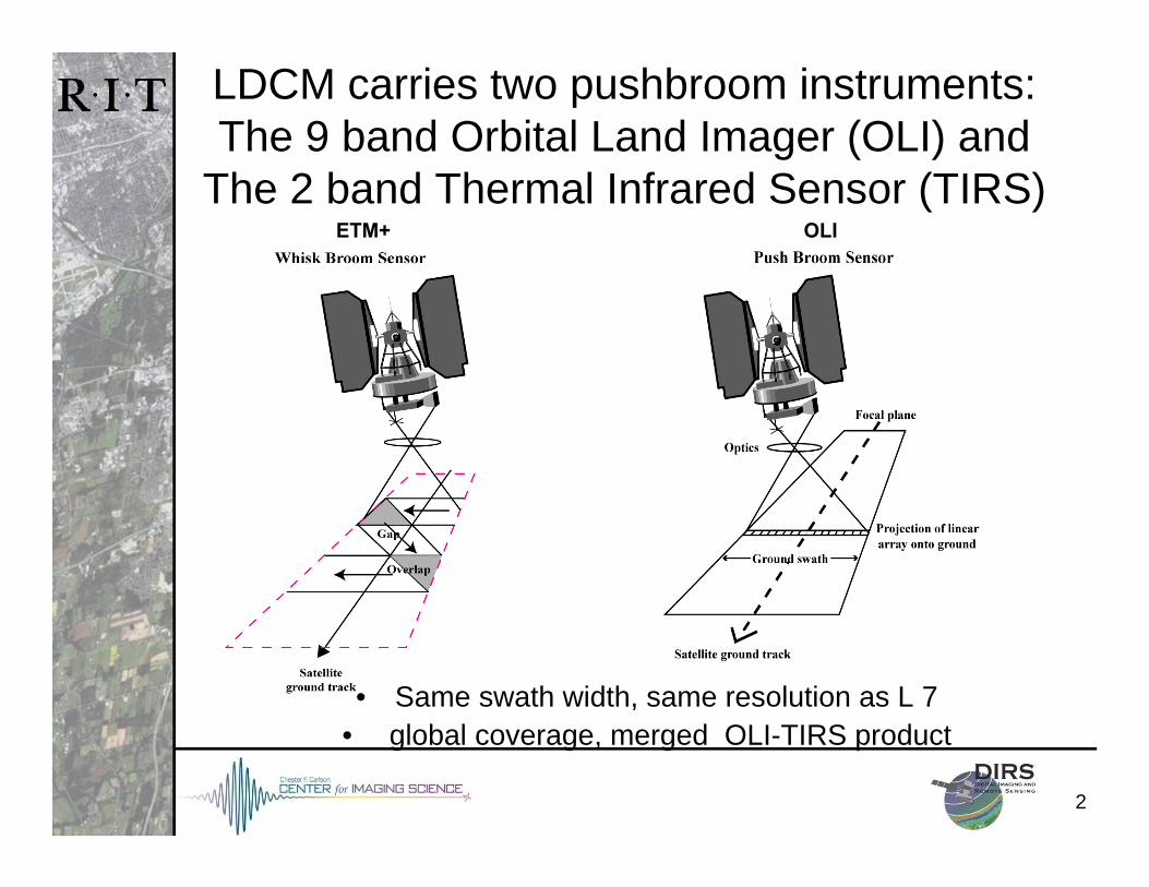
LDCM carries two pushbroom instruments:The 9 band Orbital Land Imager (OLI) and
The 2 band Thermal Infrared Sensor (TIRS) ETM+ OLI
• Same swath width, same resolution as L 7• global coverage, merged OLI-TIRS product
33
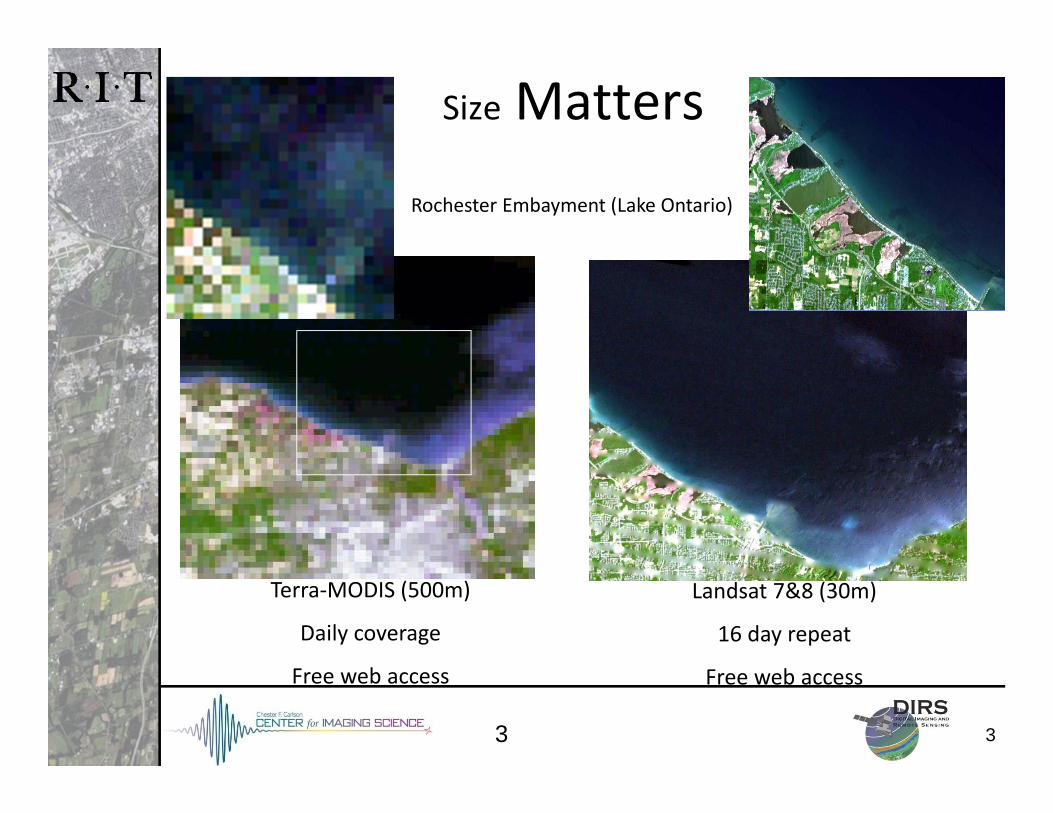
Size Matters
Landsat 7&8 (30m)
16 day repeat
Free web access
Terra‐MODIS (500m)
Daily coverage
Free web access
Rochester Embayment (Lake Ontario)
4
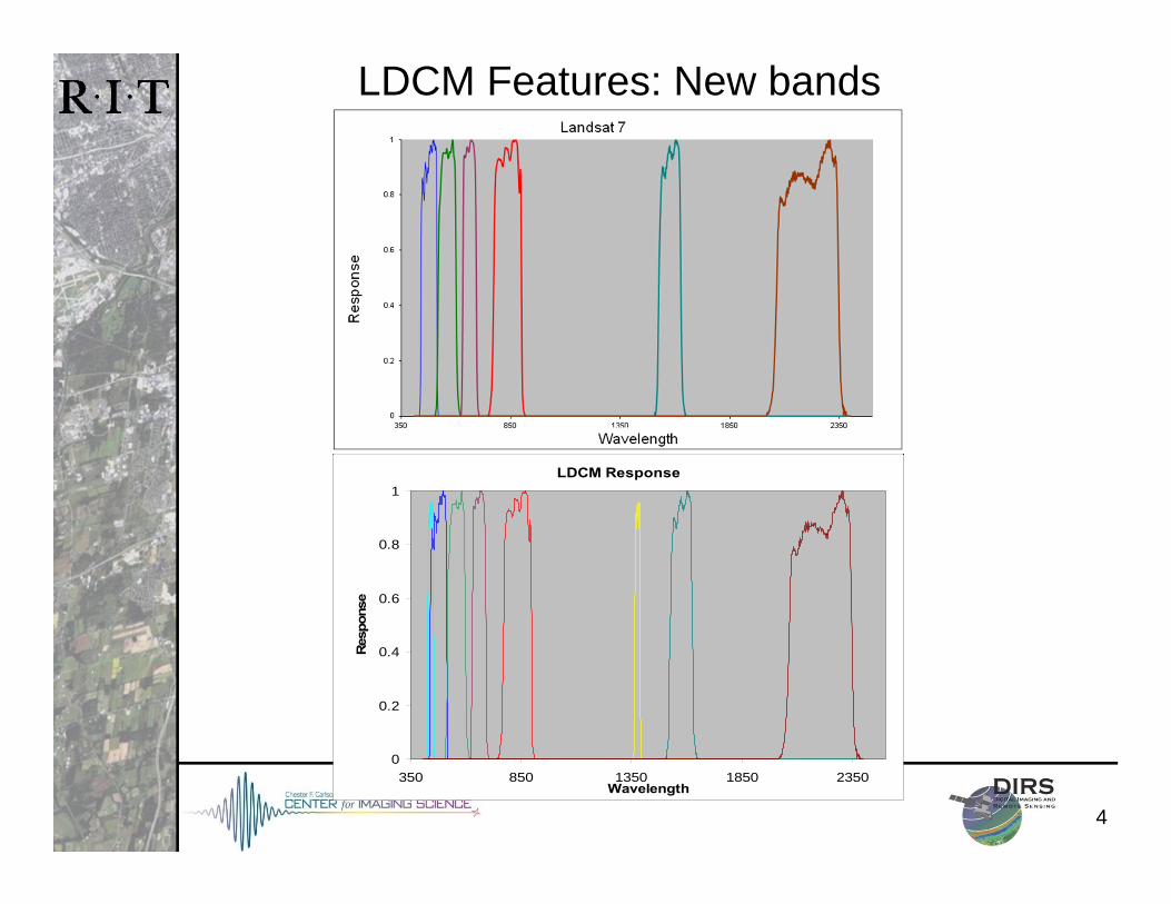
LDCM Features: New bands
LDCM Response
0
0.2
0.4
0.6
0.8
1
350 850 1350 1850 2350Wavelength
Resp
onse
5
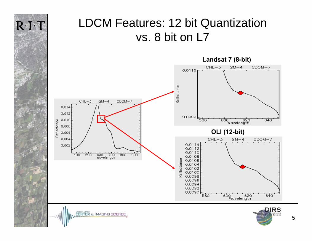
LDCM Features: 12 bit Quantizationvs. 8 bit on L7
OLI (12-bit)
Landsat 7 (8-bit)
6
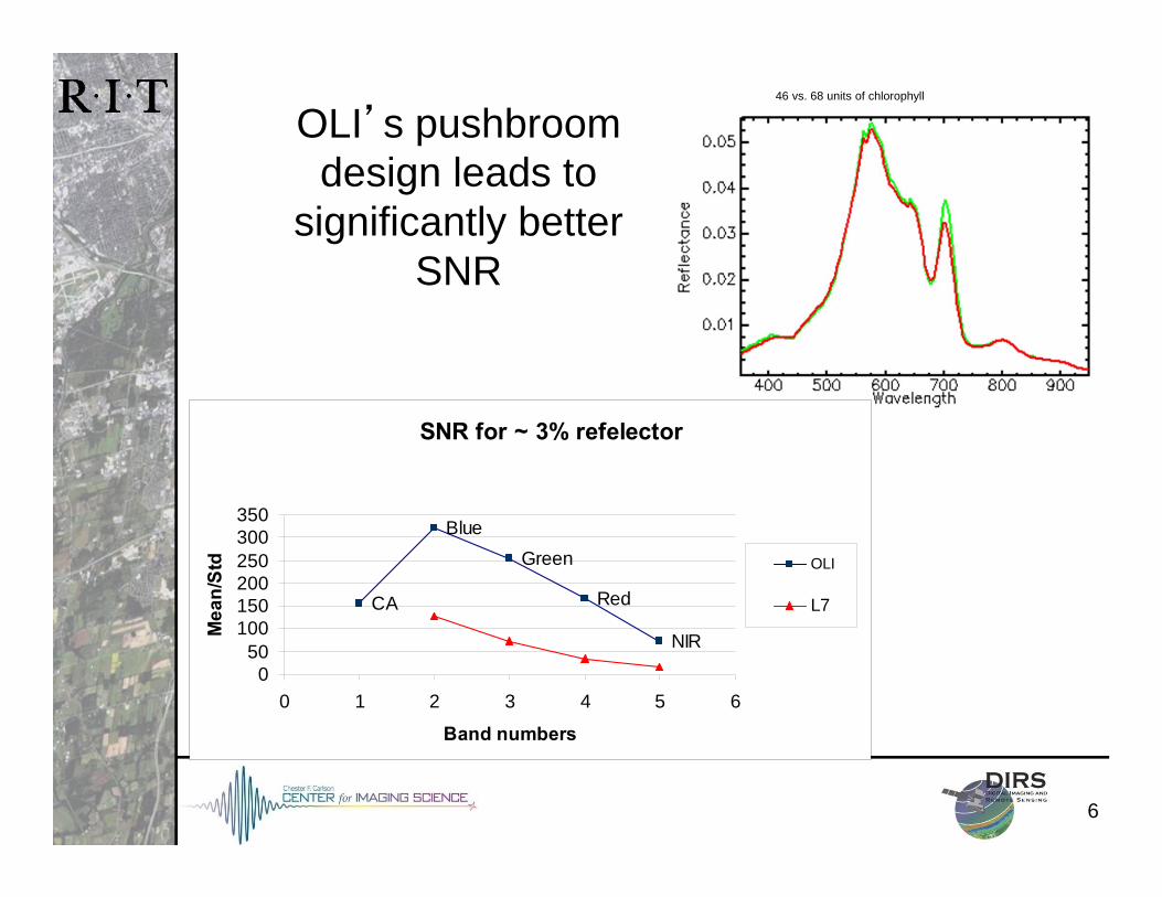
46 vs. 68 units of chlorophyll
OLI’s pushbroom design leads to
significantly better SNR
SNR for ~ 3% refelector
CA
BlueGreen
Red
NIR
050
100150200250300350
0 1 2 3 4 5 6
Band numbers
Mea
n/St
d OLI
L7
7
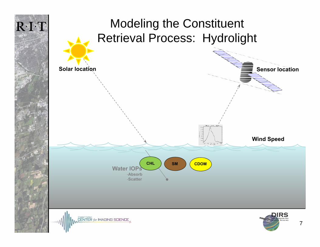
Water IOPs-Absorb-Scatter
Modeling the Constituent Retrieval Process: Hydrolight
Wind Speed
Sensor locationSolar location
CHL SM CDOM
8
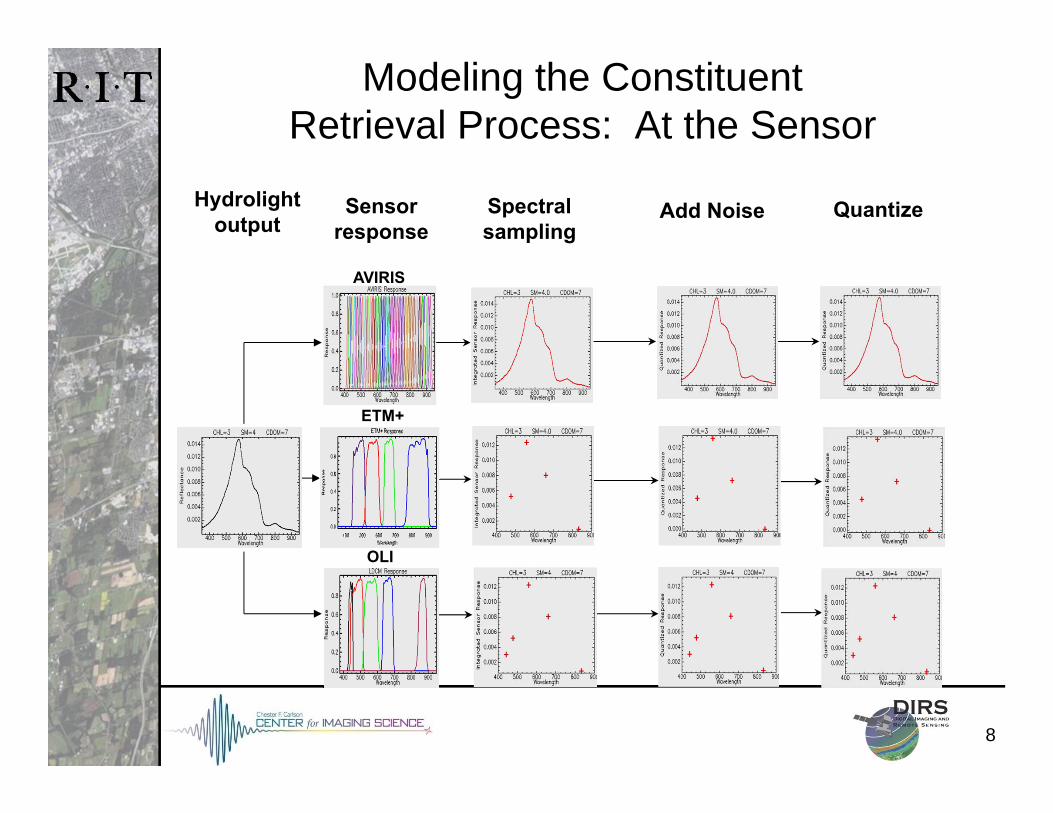
Spectralsampling
Quantize
AVIRIS
ETM+
OLI
Add Noise
Modeling the Constituent Retrieval Process: At the Sensor
Sensorresponse
Hydrolightoutput
9
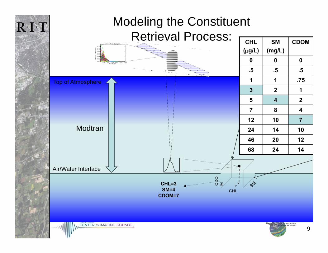
Modeling the Constituent Retrieval Process:
M
CD
OM
CHL
Top of Atmosphere
Air/Water Interface
CHL=3SM=4
CDOM=7
CHL(g/L)
SM(mg/L)
CDOM
0 0 0.5 .5 .51 1 .753 2 15 4 27 8 4
12 10 724 14 1046 20 1268 24 14
Modtran
10
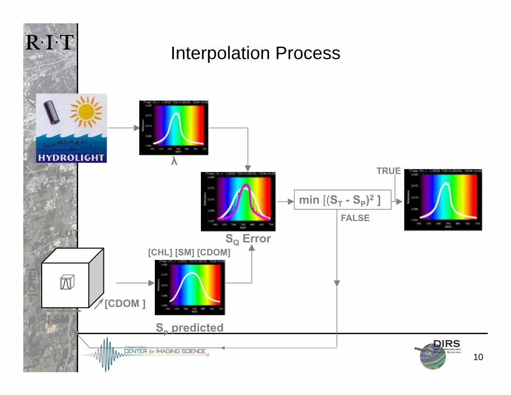
Interpolation Process
min [(ST - SP)2 ]
λ
Sp predicted
SQ Error[CHL] [SM] [CDOM]
TRUE
FALSE
[ SM ][CDOM ]
LUT
[CH
L]
11
AVIRIS
ETM+
OLI
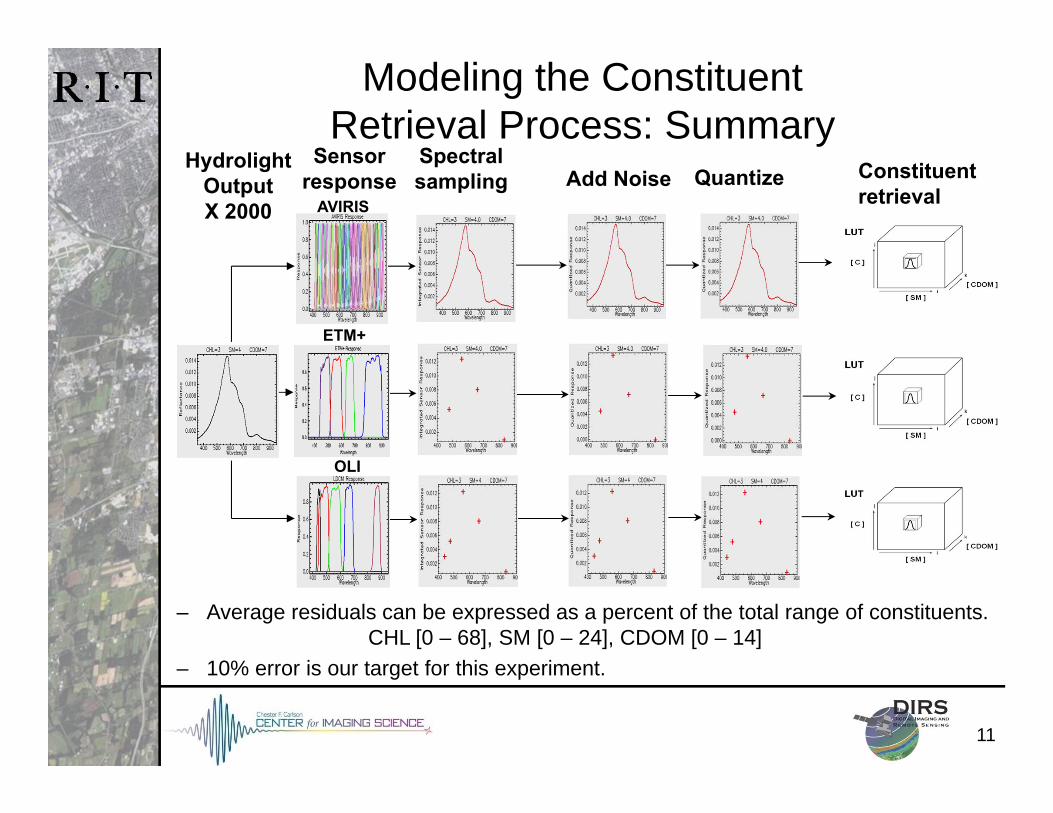
Modeling the Constituent Retrieval Process: Summary
– Average residuals can be expressed as a percent of the total range of constituents. CHL [0 – 68], SM [0 – 24], CDOM [0 – 14]
– 10% error is our target for this experiment.
Spectralsampling QuantizeAdd Noise
Sensorresponse
HydrolightOutputX 2000
Constituentretrieval
12
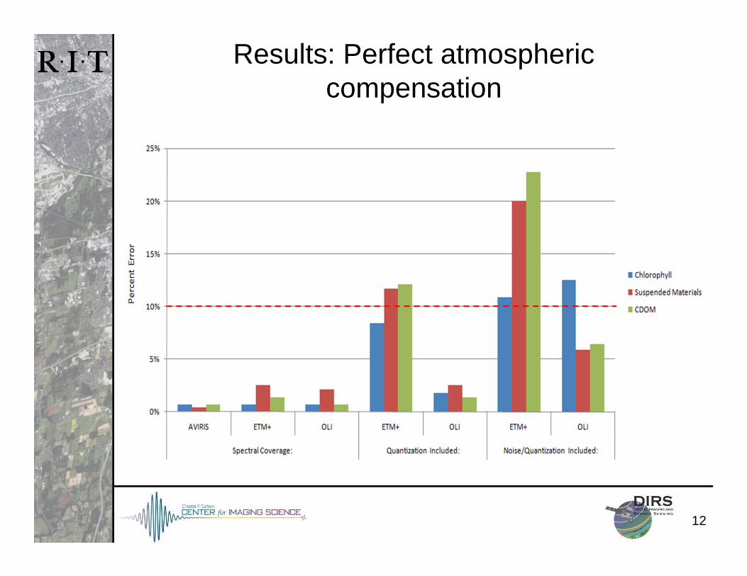
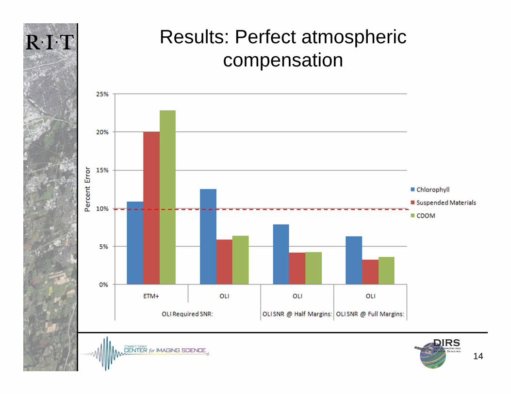
Results: Perfect atmospheric compensation
13
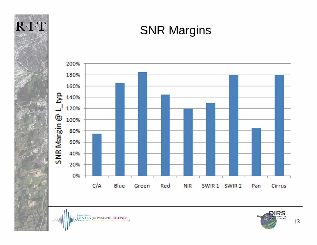
SNR Margins
14
Results: Perfect atmospheric compensation
15
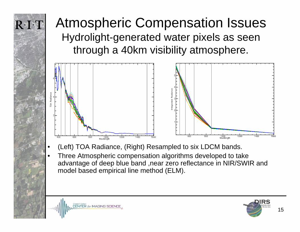
Atmospheric Compensation IssuesHydrolight-generated water pixels as seen
through a 40km visibility atmosphere.
• (Left) TOA Radiance, (Right) Resampled to six LDCM bands.• Three Atmospheric compensation algorithms developed to take
advantage of deep blue band ,near zero reflectance in NIR/SWIR and model based empirical line method (ELM).
16
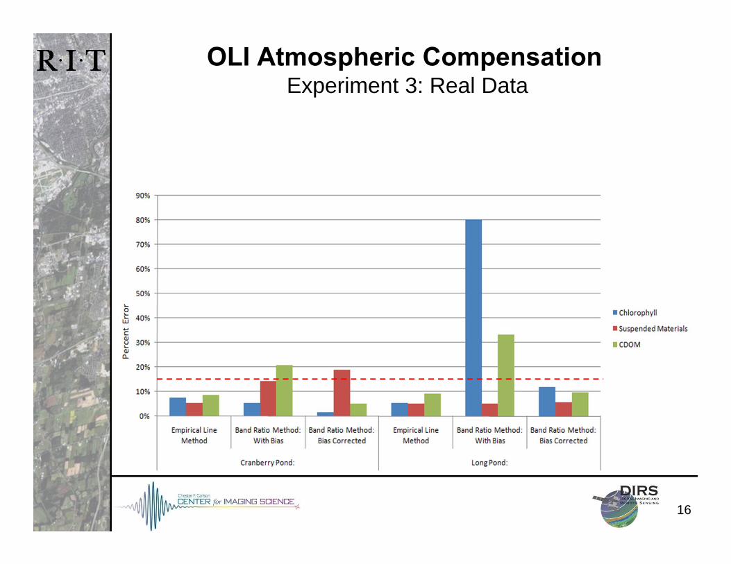
OLI Atmospheric CompensationExperiment 3: Real Data
17
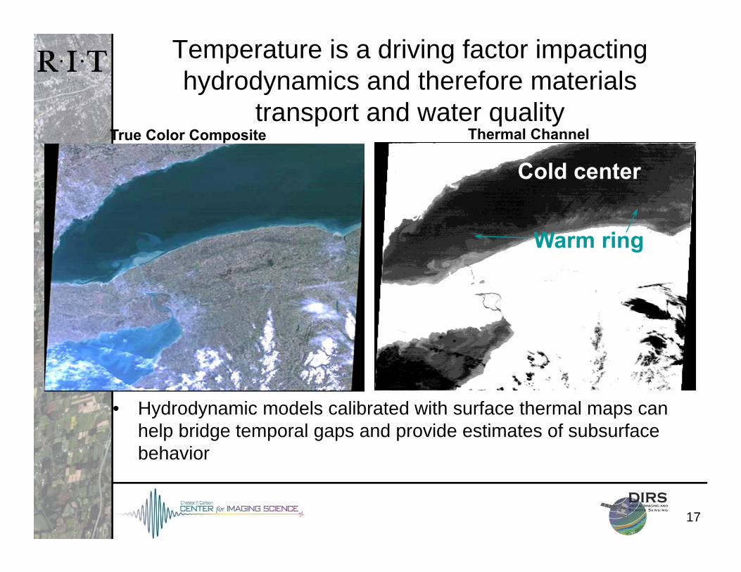
Temperature is a driving factor impacting hydrodynamics and therefore materials
transport and water qualityTrue Color Composite Thermal Channel
Cold center
Warm ring
• Hydrodynamic models calibrated with surface thermal maps can help bridge temporal gaps and provide estimates of subsurface behavior
1818
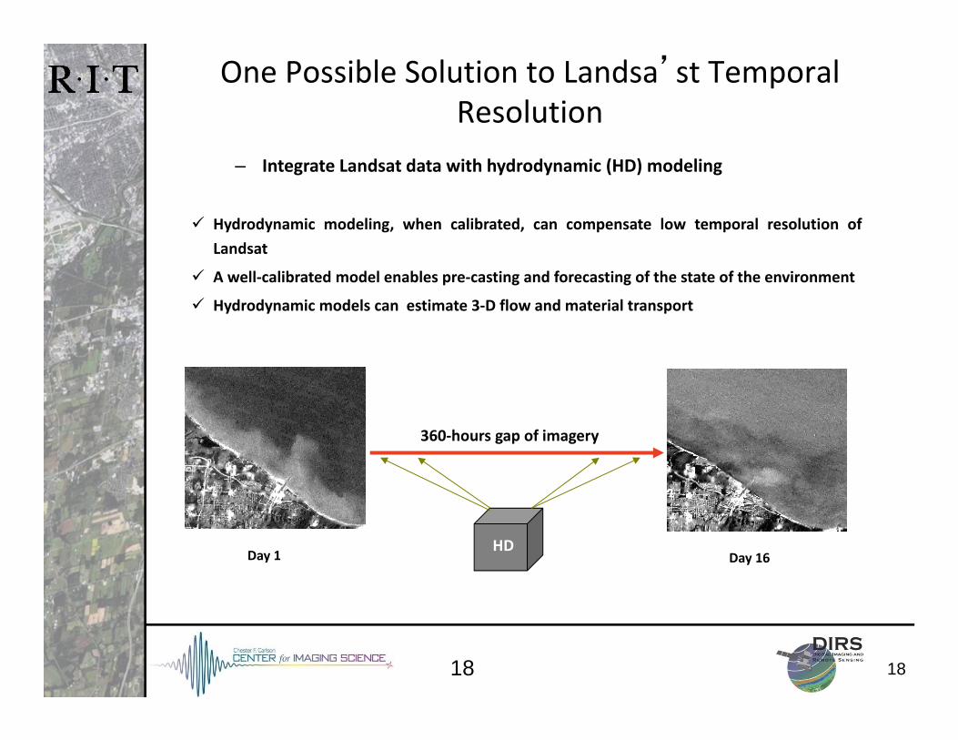
One Possible Solution to Landsa’st Temporal Resolution
Hydrodynamic modeling, when calibrated, can compensate low temporal resolution ofLandsat
A well‐calibrated model enables pre‐casting and forecasting of the state of the environment
Hydrodynamic models can estimate 3‐D flow and material transport
– Integrate Landsat data with hydrodynamic (HD) modeling
Day 1 Day 16HD
360‐hours gap of imagery
19
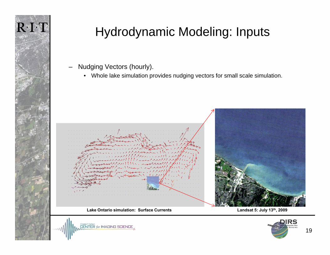
Hydrodynamic Modeling: Inputs
ALGE Hydrodynamic Model
– Nudging Vectors (hourly).• Whole lake simulation provides nudging vectors for small scale simulation.
Landsat 5: July 13th, 2009Lake Ontario simulation: Surface Currents
20
Collaborations for 2012, 2013 & 2014 Field Seasons