Embed Size (px)
Citation preview
'DOCID: 3928690
I
UNCLASSIFIED
Vera Filby @'pp roved for release by NSA on 12-01-2011 , Transparency Case# 6385J
The History of Friendship The local history of rhe area that is
the home of the Annexes
Groups of NSA people have been moving into Friendship Annex since 1967. Not so long before that. the land our buildings now occupy was farm and woodland; now it sometimes takes us 10 minutes to make a left turn into it. If you came to the Baltimore-Washington area from elewhere, as most of us did, you probably know little about the place where you spend most of your working days; so next time you find yourself waitin_g in traffic to make that turn. you might like to relieve the tedium by thinkin,i.: about where you are and what was here before you.
Well, where are you? The location of this place on earth is approximately
39°11 '45NN 76°41 'IO .. W and it lies about 100 feet above sea level. The property is on Elkridge Landing Road, Linthicum, and our name for it is based on its proximity to Friendship Airport. The names preserve some of the story of the land for those who understand them. Friendship, for example: where did the name come from? If you are a newcomer and were asked to guess. you would probably make up a plausible and attractive story; bur you would be wrong. The airport was named for Friendship Methodist Church. which stood in about the middle of the site acquired for the airport. The church cemetery is still there, and when the airport was new it was a local lovers lane and a place to visit on summer evenings ro watch the airplanes come and go.
Elkridge Landini! Road: what does its name signify? We think of its traffic morning and evening and we see the continual construction; but once it was a rolling road. and down it hogsheads of tobacco were rolled to the wharves at Elkridge Landing for shipment in sailing vessels to ports in England. During our days at work here we have little awareness of the nearness of sale water, but from the air you can see how close it is and understand why the re~ion
14 UNCLASSIFIED
developed as it did. In the early days. Elkridge Landing was the port for this roadless hinterland, and through it and because of it the region was settled.
Friendship Cemetery
When the European settlers first came they found a fine, broad estuary. and at the head of it a beautiful stream tumbling through a long gorge. In colonial times a tide of five or six feet washed the port at Elkridge Landing. Now the river is shrunken away. sunk in foulness. and nearly dead.
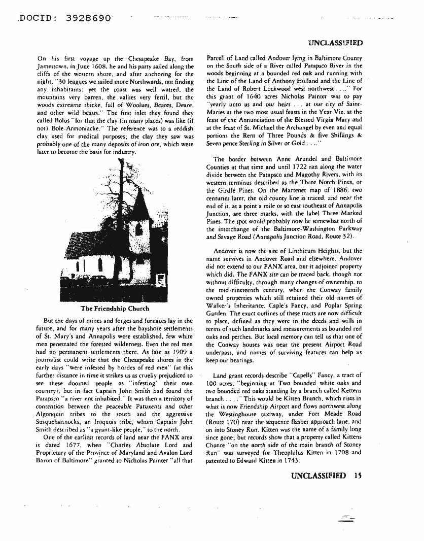
We call the river Patapsco. a corruption of the Indian name, which some authorities interpret as .. back water" and others as "at the rocky point,.. a reference co the limestone rocks in the river at the mouth of Rock Creek, On the earliest maps it is shown as Bolus flu, a name given by the first explorer to record his visit, Captain John Smith.
.DOC ID: 3928690
On his firsc voyage up the Chesapeake Bay. from Jamestown, in June 1608, he and his party sailed alonR the cliffs of the western shore. and after anchoring for the night, "30 leagues we sailed more Northwards, nor finding any inhabitams: yt-t the coast was well watred, the mountains very barren. the vallies very fertil, bU[ the woods C'Xtreame thicke. full of Woolues. &ares, Deare. and other wild beasts." The first inlet they found they called Bolus "for that the clay (in many places) was like (if not) Bole-Armoniacke." The reference was to a reddish clay used for medical purposes; the clay they saw was probably one of the many deposits of iron ore, which were larer to become the basis for industry.
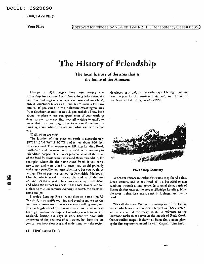
The Friendship Church
But the days of mines and forRes and furnaces lay in the future, and for many years after the bayshore settlemencs of St. Mar(s and Annapolis were established. few white men penetrated the foreste<l wilderness. Even the red men had no permanent settlements there. As late as 1909 a journalist could write that the Chesapeake shores in the early days "were infested by hordes of red men" (at this further distance in time it strikes us as cruelly prejudiced w see these doomed people as "infesting" their own country). but in fact Captain John Smith had found the Pacapsco "a river not inhabited. " It was then a territory of contention be-tween the peaceable Patuxenu and other Al~onquin tribes to the south and the a~~ressive
Susquehannocks, an Iroquois tribe, whom Captain John Smith described as .. a ~yam-like people, .. to the north .
One of the earliest records of land near the FANX area is dated 1677. when "Charles Absolute Lord and Proprietary of the Province of Maryland and Avalon Lord Baron of Baltimore" ,g~anted to Nicholas Painter "all chat
UNCLASS!JFIED
Parcell of Land called Andover lying in Baltimore Coumy on the South side of a River called Patapsco River in the woods be,l(inniniz at a bounded red oak and runnin,it with the Line of the Land of Anthony Holland and the Line of the Land of Robert Lockwood west northwest .... " For this ~rant of 1640 acres Nicholas Painter was co pay "yearly unto us and our heirs ... at our ciry of SaimMaries at the two most usual feasts in the Year Viz. at the feast of the Annunciation of the Blessed Vir,1?in Mary and at the: feast of St. Michael the Archan.l?el by even and equal portions the Rent of Three Pounds & five Shillings &
Seven pence Sterlin,1? in Silver or Gold .... "
The border between Anne Arundel and Baltimore Counties at that time and until 1722 ran along the water divide between the Patapsco and Ma>:othy Rivers. with its western terminus described as the Three Notch Pines, or the Girdle Pines. On the Manenet map of 1886, two centuries lacer, the old county line is rraced. and near the end of it. at a point a mile or so east southeast of Annapolis Junction. are three marks. with the label Three Marked . Pines. The spot would probably now be somewhat north of the interchange of the Baltimore-Washington Parkway and Sava,l(e Road (Annapolis Junction Road. Route 32).
Andover is now the site of Linthicum Hei,1?hrs. but the name survives in Andover Road and elsewhere. Andover did not extend to our FANX area, but it adjoined property which did. The FANX sice can be: traced back. though not without difficulty. through many changes of ownership. to the mid-nineteenth century. when the Conway family owned properties which still retained their old names of Walkers Inheritance, Caple"s Fancy. and Poplar Spriniz Garden . The exact outlines of these tracts are now difficult to place, defined as they were in the deeds and wills in terms of such landmarks and measurements as bounded red oaks and perches. But local memory can tell us that one of the Conway houses was near the present Airport Road underpass, and names of survivini.: features can help us keep our bearings.
Land J'1rant records describe .. Capells" Fancy, a tract of 100 acres. "be~inning at Two bounded white oaks and two bounded red oaks standing by a branch called Kettens branch .... " This would be Ki teen Branch. which rises in what is now Friendship Airport and flows northwest alon,: che Westinghouse taxiway, under Fort Meade Road (Route 170) near the sequence flasher approach lane. and on into Stoney Run. Kitten was the name of a family Ion~ since gone; but records show that a property called Kittens Chance "on the north side of the main branch of Stoney Run·· was surveyed for Theophilus Kitten in 1708 and patented to Edward Kitten in 1743.
UNCLASSIFIED 15
Th~ Map
of
Capt.John Smith
16 UNCLASSlflED UNCLASSIFIED 17
·oocro: 3928690
UNCLASSIFIED
Walker's Inheritance, "Lying and being in Ann Arrundell County upon the south side of Patilpsco River & on both sides of th~ Drafts of Patapsco River caUed Deep Run & Stoney Run," was a resurvey for Dr.James Walker of older tracts "to correct the original surveys and add vacant land." Dr. Walker acquirecl these properitics in I 75 5 and sold them, along with part of Andover and other properties on the south side of the Patapsco as far cast as Curtis Creek, to Thomas Harrison in 1758, at the same time acquiring from him a property called Scott's Folly on Elk Ridge. Walker's Inheritance contained 1730 acres and included Cupola Hill, Maccubbin'sDiscovcry, and Mineral Ridge. Cupola Hill, which lay between Deep Run and Stoney Run, was granted in 1743 "unto James Macubbin of Annarundell County Gent." Maccubbin's Discovery was surveyed in 1744; its 41 acres adjoined a tract called Stoney Run. Mineral Ridge was a resurvey of tracts called Old Man's Folly and Neglect. With vacancies it comprised 660 acres, about 30 cleared, and its "improvements" included "l Old Loghouse 18 foot by 12 / 400 panels old fence most of them saplin poles and Very rotten/ 12 old scrub apple trees." This was part of the granite ridge which runs south from E.lkridge Landing toward what is now Laurel, and in later years it was to become a summering place for wealthy families from the Landing and Annapolis.
Walker's Inheritance has had a confused history complicated by several lawsuits, and some of the transfers of all or parts of it, possibly including the earliest and certainly the latest, were for speculation. ·
In 1753, John Worthington paid four shillings a year rent for Cappells Fancy. In 1802, "certain lands being part of Walker"s Inheritance" were sold for 17 shilJings an acre. In 1833. Andrew Ellicott bought Caple's Fancy, Walker's Inheritance, and Poplar Spring Garden for S3.00 an acre. And in 1 %7, a parcel of that land cost S50,000 an acre.
In between, the land has been logged, farmed, and probably mined, and now it is being very rapidly industralized. The probability of mining, though not necessarily for iron, is shown by the name Mineral Ridge, and evidence appears in the indenture for the sale of the properties to Jesse Conway immediately after their purchase in 1833 "reserving nevertheless to the said Andrew Ellirott Junior his heirs, executors, administrators and assigns being proprietors of the Iron works now owned and used by the said Andrew Elicott Junior at or near Elkridge Landing the absolute right and propriety in all sands and other earths in said lands which may be suitable and proper for mouldings."
18 UNO.ASSIFIED
Underlying much of the area is the Arundel formation, which was and still is rich in iron deposits. The importance of iron in the Elkridge region is still reflected in placenames like Furnace Road and Furnace Avenue, at the bottom of Elkridge Landing Road, and local people can still tell you where traces of iron workings are to be found. Iron ore, with its bulk and weight, made a good companion cargo with tobacco, which was the basis of Maryland's economy even in regions where the soil was not really suitable for growing it. Tobacco was the cash crop. Tobacco was wealth. Tobacco was currency: fees and salaries were paid in tobacco; goods could be bought with tobacco. The Assembly in 1696 authorized four rolling roads to be marked and cleared for the rolling of tobacco to the ports of Ann Arundel County. In 1763 more than half the county's tobacco crop was shipped from the wharves of Elkridge Landing.
One of the few records of Elkridge as a seaport is a log kept by Charles Dorsey, master of the snow (a squarcrigged ship) &Jtimore Town, on a voyage from London to Virginia and Maryland in 1757. She had called at Hampton Roads, Annapolis, Hawkins Point, and Baltimore and had delivered the last of her cargo. Here are a few of the December entries:
Remarks on Munday Ikccmbr 19th l n 7 Stton,1t frosty weather had 4 hands Rattlin,1t the Shrouds fore and aft took in two Oau Loads with Iron one with 9 tuns and the other with 8 tuns the Oatt Returned Back: without tobacco the River Being frose up and we have lee all Round us but not fast yet had 4 carpenters & rwo hired man at work
Rcmarlts on Satturday Dcccmbr 24th 17";7 sent a Oart and four hands to town carpenters came on board with 98Y2 pounds Bolts and Spikes Received on board 20 hhds of Tobacco had 4 carpenters at work Better than half a Day a fresh 1tale of wind abow: SW - Elkridite frose up
Rcmarlts on Munday Dccemb' 26th 17~ 7 all hands at work sum stowing in the hold won Spinning Spunn yarn old patrick on shore carpenters finish the fore Top got him over the mast head had one hired man Half a Day in the hould Elkridge Open
Remarks on Wednesday Dcccmlf 28th I T5 7 fine mOderate weather got the furick [ futtock? ] shrouds up Revcd most of our Guning Ropes .about the fore yard had 2 carpenters most of a Day and three hired men all Day 1tot 10 hhds of tobacco from town and ei~ht from Elkridge came on board about 9 or 10 clock at Night
·ooCID: 3928690
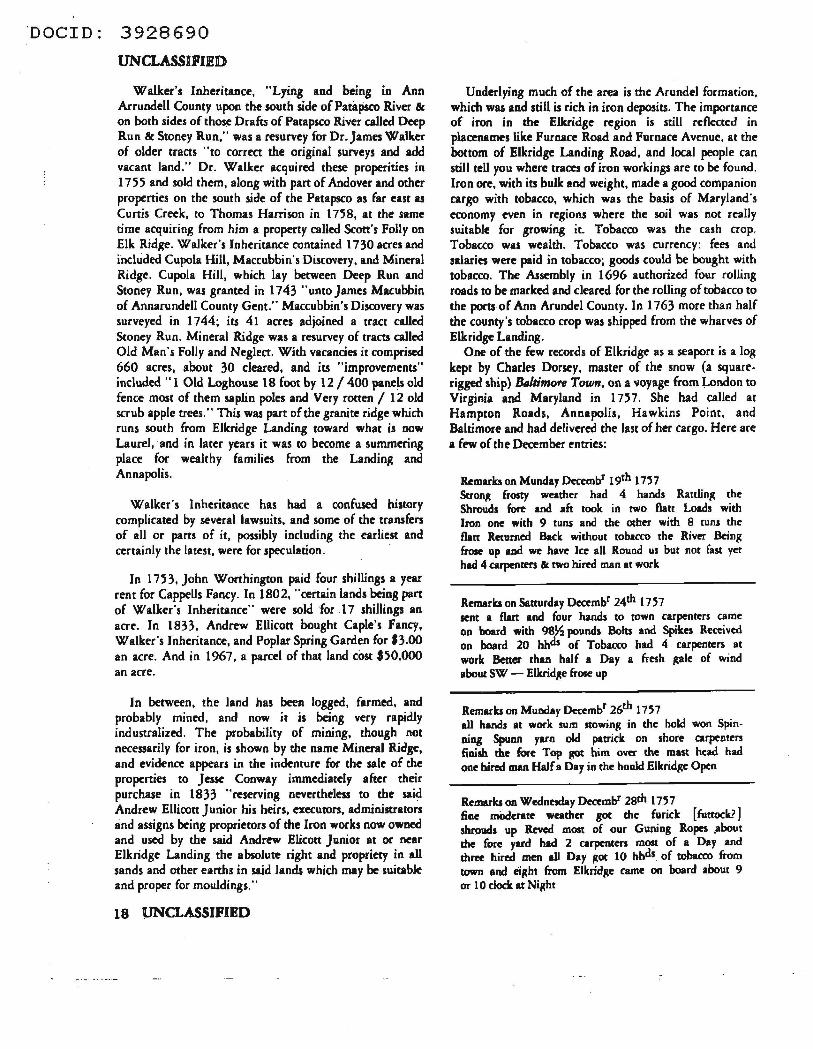
The Friendship Annex area
The hogsheads of tobacco were hauled down the rolling roads to the Landing. In earlier days, when the plantations were near the river and had their own wharves, sailors from the English merchant ships had to move the planter's tobacco and load it aboard . This was no hardship then, but as new plantations were established farther from navigable water, the system became burdensome, and in 1727, in response to the complaints of the London merchants, the · Assembly passed a Jaw requiring the planters to deliver their tobacco to a convenient wharf. Thereafter the planters used slaves or indentured servants or muleteams to
roll the heavy hogsheads down the rolling roads to the river. .
Tobacco and iron, then, built the port of Elkridge Landing. And tobacco and iron killed it.
Tobacco is a ruinously greedy crop. and so is corn, which the planters also grew. The soils of the region soon became depleted, and runoff from the cultivated fields began to wash down into the streams and the river. Timber was cut to make charcoal for the iron foundries, and rhe cutover hillsides eroded . To the increasing accumulatio,ls of silt in the river was added ballast dumped overboacd from the merchant ships. Many of them came from England carrying brick, which was cheap there and made a steady
UNCLASSIFIED
ballast, and many a colonial house was built of English brick. But often the ships had to take on sand or stone for ballast after unloading cargo. By mid -century the river was dwindling and the channel filling with silt. In an effort to control the deterioration the Assembly in 1763 decreed that "No earth, sand or dirt was to be thrown into or put upon the beach or shore of the Patapsco or any navigable branch thereof below high water mark except when secured by stone wall or dove-tailed log-pen from washing into the river . Under a penalty of five pounds current money." (No doubt some of the merchants did what some do today-they continued to pollute and when caught paid the fine, since it was trivial compared to the profits.)
The pattern of agriculture began to change in 1774 with the arrival of the Ellicott brothers. Joseph. John, and Andrew, Quakers from Pennsylvania, who planned to establish a flour mill at one of the rapids in the gorge of the Patapsco. Like other settlers before and after them, they arrived at Elkridge Landing, the only port of entry for upper Anne Arundel County, and they had their machinery and other equipment shipped in to the Landing and then carried over the rough trails to the mill site. The brothers encouraged the shift from tobacco to wheat so successfully that by l 783 they began to export flour. They shipped it, however, from Baltimore, which was growing rapidly, while Elkridge was declining.
The Landing had reached the climax of its development before and during the Revolution. The Ellicous had found a prosperous town. Beautiful manor houses, some of which survive, had been built in the surrounding hills, and a wealthy gentry supported a trade in fine English linen, silk, furniture, chinawarc, tea, and other luxury goods. With the Revolution, the English factors went home, but a wartime economy kept the port busy. After the war a trade developed with Germany, but soon there were willow thickets and swampy ground and meadows where formerly . ships had sailed, and Elkridge Landing died as a port.
(Continued next is.rue)
Vera Filby served with the U.S. Navy and, as a civilian, worked as an analyst, translator and reporter. Since 1964 she bas been teaching Sigint Reporting. In 1970 she was NCScb Teacher of the Year; in 1972 she received the NSA Meritorious Civilian Ser¥ice Award.
UNCLASSIFJED 19
·oocro: 3928690
f'Olt OfflCIAL U:§f ONLY
Vera Filby
The History of Friendship
By the early and middle eighteenth century the country south of che Patapsco was a sparsely seuled region of large farms. some of them poor, some abandoned. A picture of what part of it must have been like emerges from a traveler's diary in 1864. Isaac Van Bibber. a Baltimore lawyer. was on a journey through Maryland co collect money to build a church in Westminster. In his entry for Thursday. 1-1 March, he wrote:
"Ahout 9 o'clock I again started upon my way, having picked up about $40.00 at Ellicotts Mills. I rode along the romantic bank of the Patapsco as far as Elkridge Landing. about 8 miles. where I knocked at the door of Dr. Worthington's house. to inquire for the Episcopal clergyman residing there. No one coming to the door after I had knocked repeatedly, I rode on two miles further. when finding it 12 o'clock. I stopped at a tavern co have my horse fed. and co take a little snack on my own account. Here I was told that the road to Annapolis was very difficult to find. but that I could obtain conveyance for my self and horse upon the rail-road. about IO miles distant. Thither. I repaired after a slight meal of eggs and crackers. When arrived at the relay house. I was told that there was no car suitable for transporri l'tg horses, but that I might send a hoy from Annapolis & have my mare ridden down by the country road. This plan being the only one left me, I sec out in the car for Annapolis and reached it. though distant twenty miles, in less than an hour. The rail-road appears to be very well constructed; but passes through one of the dreariest and mosc poverty stricken countries I ever saw. The appearance of an abundance of pebbles in the soil. between this & Elk-ridge, shows that this part of the country was originally under water . _ . " And he then proceeded co indulge in the geological speculation that interested so many educated gentlemen of his day.
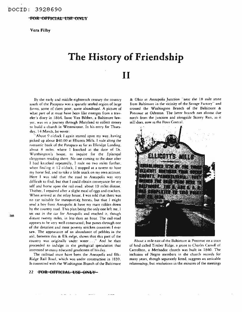
The railroad must have been the Annapolis and ElkRidge Rail Road, which was under construction in 1839. It connected with the Washington Brl!-nch of the Baltimore
22 FOR OFFIClhL USE ONLY
II
& Ohio at Annapolis Junction .. near the 18 mi le scone from Baltimore in the vicinity of the Savage Factory" and crossed the Washington Branch of the Baltimore &
Potomac at Odenton. The latter branch ran almost due north from the junction and alongside Stoney Run, as it still does, now as the Penn Central.
Abouc a mile ease of 1he Baltimore & Potomac on a tract of land called Timber Rid,i;te. a >trant to Charles Carroll of Carrollton, a Methodisc church was builc in 1840. The inclusion of Negro members in the church records for many years, Chough separately listed, suggem an amicable relationship. but resolutions in the minutes of the meetings
·oocro: 3928690
by the l 860"s begin tu reflect the split that later tore apart the church, the community, the state, and the nation . The Civil War and Reconstruction completed the rupture. and some of the members of the Timber Ridge Church withdrew and established their own group. which came to be known as Friendship Methodist Episcopal Church. South. It was the presiding elder who had suggested the name Friendship. because of the friendliness and congeniality oi the membership . For a time the congregation met in a tent while they erected their first building across Telegraph Road from Timber Ridge Methodist Episcopal Church, whose congregation later moved to Patapsco Methodist Church . Jn 1900 the Friendship congregation built its second church, where they worshipped nearly half a century. uniil construction of the airport began. The last service was held on Easter Sunday 1948. By then the three branches of the Methodist Church. Northern, Southern, and Methodist Episcopal, had united. and at last the Timber Ridge and Friendship congregations were reunited as Wesley Grove . A new church building. incorporating the stained glass windows from Friendship. was built on Dorsey Road near Ridge Road and was consecrated in November 19') I . Installed in the foundations were the cornerstones of the old Friendship churches, one dated l 866 and the other 1900.
Throughout most of its years. the Friendship Church had served a mainly farming community. The countryside thereabouts was not rich. as Isaac Van Bibber had observed. Some glimpse of the lifestyle of the region is reflected in the inventory in 1919 of an Elkri<lge Landing
FOR OFFICIAL USE OULY
Road farmer who had died. h included a safe. a walnut stand, IO chairs, a watch, guns, farming implements, marker wagons, a harness, a mowing machine, a hotbed sash. one horse, and two mules. These last, together worth $100. were the most valuable property listed.
Though tobacco continued to be raised. the nearness of the expanding Baltimore urban market favored che development of truck gardening, a form of agriculture better suited to the variegated sands and clavs. Sassafras loams. and Norfolk sand of the region. An apparencly effective and mutually satisfactory urban-rural system for harvesting the market garden crops developed by the l 870's and continued inro the I 930's. Farmers drove their wagons, later their trucks, to the Polish neighborhoods of Baltimore to fetch che women, children. and older men who had been recruited to work on the farms. where che~· were housed in "shanties ... with maw for bedding. The younger men stayed at their jobs on the docks and elsewhere in the city. but on Sundays they came out by train to visit their families. and there was feasting and music and dancing. In time some of these people acquired land and became farmers themselves .
In a system perhaps unique to northern Anne Arundel County the farmers paid the pickers in brass tokens railed picker checks . About the size of a penny. they were engraved with the farmer's initials on one side and a denomination on the other representing the amount picked, in quarts or pecks or bushels. Often rhe shapes of the tokens indicated the crop-round for peas, octagonal for beans. scalloped for strawberries. among others. The
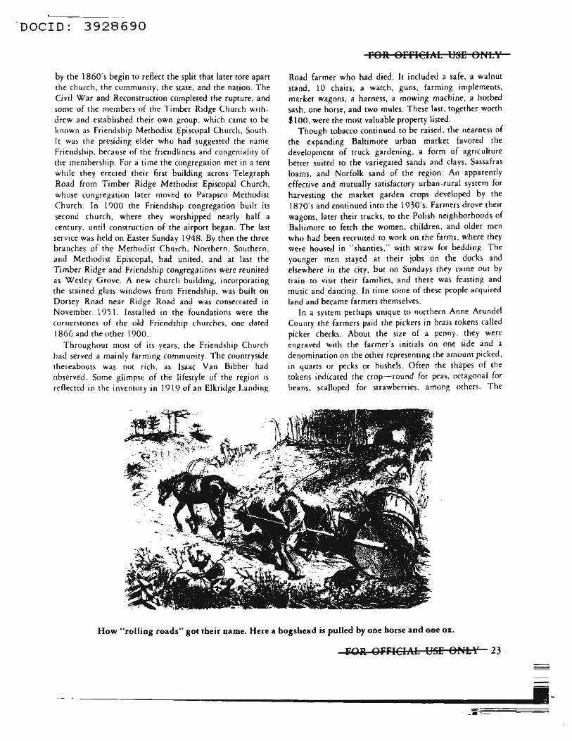
How "rolling roads" got their name. Here a hogshead is pulled by one horse and one ox.
fOR OFFICIA:b USE ONLY 23
·~~~~~-------------------------•=
DOCID: 3928690 l'Olt OPPICIAL U~E ONL I
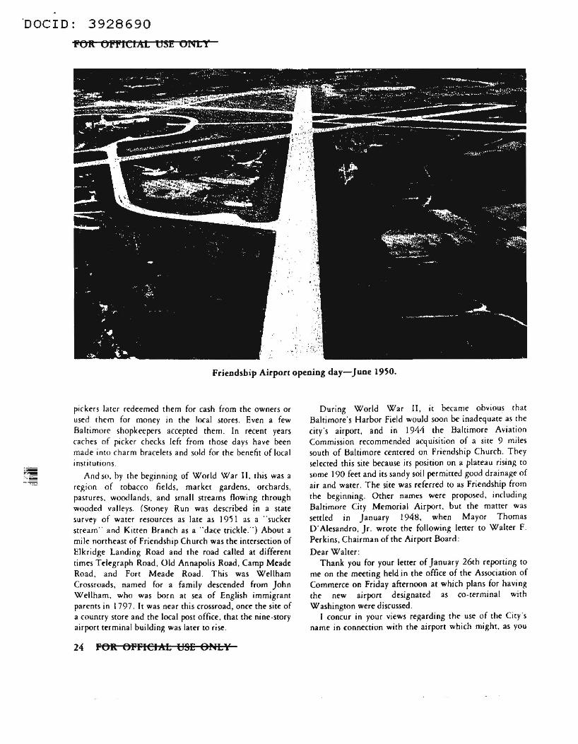
Friendship Airport opening day-June 19SO.
pickers later redeemed them for cash from the owners or used them for money in the local stores. Even a few Baltimore shopkeepers accepted them . In recent years caches of picker checks left from those days have been made into charm bracelets and sold for the b~nefit of local institutions .
And so. by the beginning of World War II, this was a region of tobacco fields. market gardens, orchards, pastures. wood lands . and small streams flowing through wooded valleys. (Sroney Run was described in a state survey of water resources as late as 19'5 l as a ··sucker stream" and Kitten Branch as a "dace trickle.") About a mile northeast of Friendship Church was the intersection of Elkridge Landing Road and the road called at different times Telegraph Road , Old Annapolis Road, Camp Meade Road, and Fort Meade Road. This was Wellham Crossroads, named for a family descended from John Wellharn. who was born at sea of English immigrant parents in l 797 . It was near this crossroad, once the site of a country score and the local post office. that the nine-story airport terminal building was later to rise .
24 fOR OfflCIAL USE ONLY
During World War II, it became obvious that Baltimore's Harbor Field would soon be inadequate as che city's airport. and in 1944 the Baltimore Aviation Commission recommended acquisition of a site 9 miles south of Baltimore centered on Friendship Church. They selected this site because its position on a plateau rising co some 190 feet and its sandy soil permitted good drainage of air and water. The site was referred co as Friendship from the beginning. Other names were proposed, including Baltimore City Memorial Airport, but the matter was settled in January 1948, when Mayor Thomas D'Alesandro, Jr. wrote the following letter to Walter F. Perkins. Chairman of the Airport Board :
Dear Walter : Thank you for your letter of January 26th reporting tO
me on the meeting held in the office of the Association of Commerce on Friday afternoon at which plans for having the new airport designated as co-terminal with Washington were discussed.
I concur in your views regarding the use of the City's name in connection with the airport which might, as you
·oocro: 3928690
say, jeopardize and perhaps cause opposition to the efforts to secure co-cerminal status. To me the name Friendship International Airport is ideal and I heartily approve of it.
With warmest personal regard, I remain,
Sincerely yours, (signed) Tommy
In 1947 a contract was let for relocation of Fort Meade Road . Soon clearing of the runways began, and aerial photographs in November and December show great, broad, pale, star-shaped smudges across the landscape, as if an immense stamp had been slammed down to mark it CANCELLED. Elkridge Landing Road, which had wandered across the countryside eventually to become 5th Street in Glen Burnie, disappeared into one smear and reappeared out of another. Wellham Crossroads had been obliterated . The houses scattered over the 3,300 acres of the airport property, some of local historical interest, had to be removed ; a few were reestablished elsewhere, but most were destroyed.
The airport acreage also contained I 7 cemeteries, most of them the small family graveyards so typical of the area . (You have probably seen them on your way to work, whether at FANX or the Operations Building. A pathetic memento in one tiny woodland burial plot beside Savage Road not far from the Operations Building is a rough stone with che letters MOTHER crudely scratched on it.) By spring of 1949 only two were left. One was Friendship Cemetery, which is still there. The other, situated beside Kitten Branch between the west and northwest runway ends, was Holy Trinity, a Russian cemetery. The city of Baltimore moved it to a new site off Elibank Road in Howard County, where only a few years later it was again threatened, this time by construction of Interstate 95 . It was spared, however, and remains there on a grassy hill surrounded by thick woods, Cyrillic inscriptions on many of the gravestones, photographs of the dead on some.
When the airport was finished, at a cost of S 12, 758,000, it was 4 times the size of LaGuardia, 5 times the size of National, and considered by Engineering NewJ-Record .. the world's best airport ... It was officially opened by President Truman in June 1950. A month later, on the first day of scheduled flights, hordes of spectators 80,000 strong turned out and created traffic jams backing up for miles.
Since then the story of Elkridge Landing Road has been one of accelerating industrial and business development. For a time a Nike site crowned the hill where the Marriott
POR: OFFICIM: USE ONI:¥
establishment is now, but Nikes proved to be ephemeral features of the landscape. With che construction of the Baltimore Beltway, which opened in 1962, the road was further segmented, and now you can't get to Elkridge Landing on Elkridge Landing Road. Since then what has sprung up along the road are small plants and multipurpose buildings like ours at the Baltimore-Washington Science Industry Center (35 Science Drive, though hardly anyone but the Linthicum post office seems to know the address), with a more recent trend to high-rise office buildings. The FANX buildings and some of their neighbors are investment properties of the Dickinson enterprises.) There seems to be every reason to expect continuing growth and construction, with the airport and its sateJlite installations as a focus. The airport itself is a major employer, and its val uc: by 1970 had increased to S 150 million.
And so we have scanned the story of 300 years from forest to incipient megalopolis. But immense though the changes have been, the one basic fact remains unchanged, here and everywhere, that the land's peoples must try to solve the same problem of how to get a living from it-whether directly as did the Indians, the subsistence farmers and early iron makers. or increasingly indirectly as we do today in ~usiness and government-without destroying it. The small population of Indians in the region lived as best a Stone Age people could in a tidewater woodland environment. Destructive enough in their own way, they were probably as nearly a natural part of the climax forest as the elk whose presence is recorded in Maryland names like Elk Ridge, Elk Neck and Head of Elk. They hunted the deer and small game and waterfowl. They caught the herring and shad during the spring runs and all the other abundant fish at all seasons. They dug clams and oysters. Some of them built houses of bark in palisaded villages and planted corn in burnt clearings. To us it seems they must have lived a happy-go-lucky life, when they weren't fighting, rather like a perpetual camping trip. But happy or not, that life was doomed when the white man came. And the Patapsco was doomed too. In the Indians' time the effects of floods were mitigated by the capacity of the natural vegetation to absorb and hold water . But with settlement and cultivation much of this cover was lost, as the surviving islands of field and forest are being destroyed today. The great flood of 1868 washed out what little had remained of the port at Elkridge Landing. The ravages of tropical storm Agnes in June I 97 2 leh the low areas along the streams even more vulnerable and subject to flash flooding than they were before. So our numbers continue to increase, we know we are part of the conflict that must some day be resolved. but few of us have any idea how the resolution will come about.
lPOR Off'iCIM. USE ONLY 25
'DOCID: 3928690
PO.It OPPICJA1: tJS2 ONLY
If& lmowkdgments
For the sources of information used in this article I am indebted to . the files, collcaions, and services of several institutions, mainly the Anne Arundel County Counhouse and the Hall of Records in Annapolis, the Maryland
· Historical Society and the· Pran Library in Baltimore, and Frien<lship International Airport, and io the generosity and reminiscences of a num~r of local people, especially Mrs. Ora Smith of Severn. Much of the information on the
26 POR OFFICIM: USE ONI:.¥
history of the Friendship Church is from " Friendship Methodist Episcopal Church, South," by Mrs. Nora Hawkins.
Vera Filby sened with the U.S. NayY and, as . a ci•i~ worked .. an analyst. ttansJaror and · reporter. Since 19" 1be has been teaching Siginr Reporting. Do 1970 the was NCSch Teacher of the Year, in 1972 1he recei•ecl the NSA Meritorious Ci•iliaa Semce Award.