Embed Size (px)
Citation preview
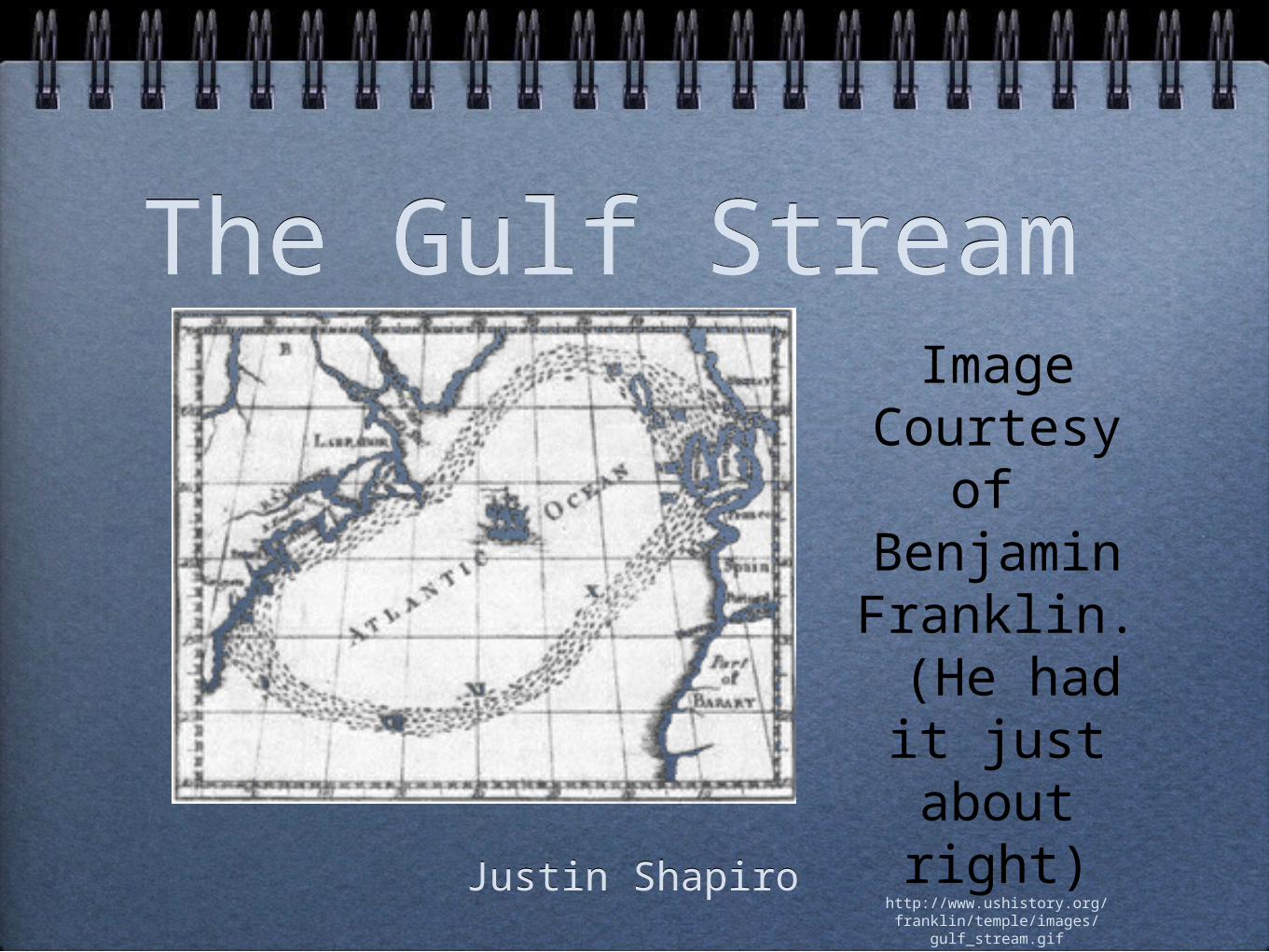
The Gulf StreamThe Gulf Stream
Justin ShapiroJustin Shapiro
Image Courtesy
of Benjamin Franklin. (He had it just about
right)http://www.ushistory.org/franklin/
temple/images/gulf_stream.gif
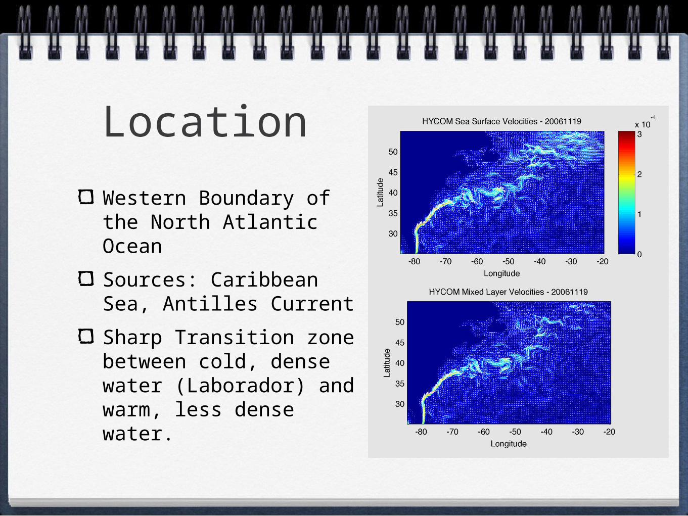
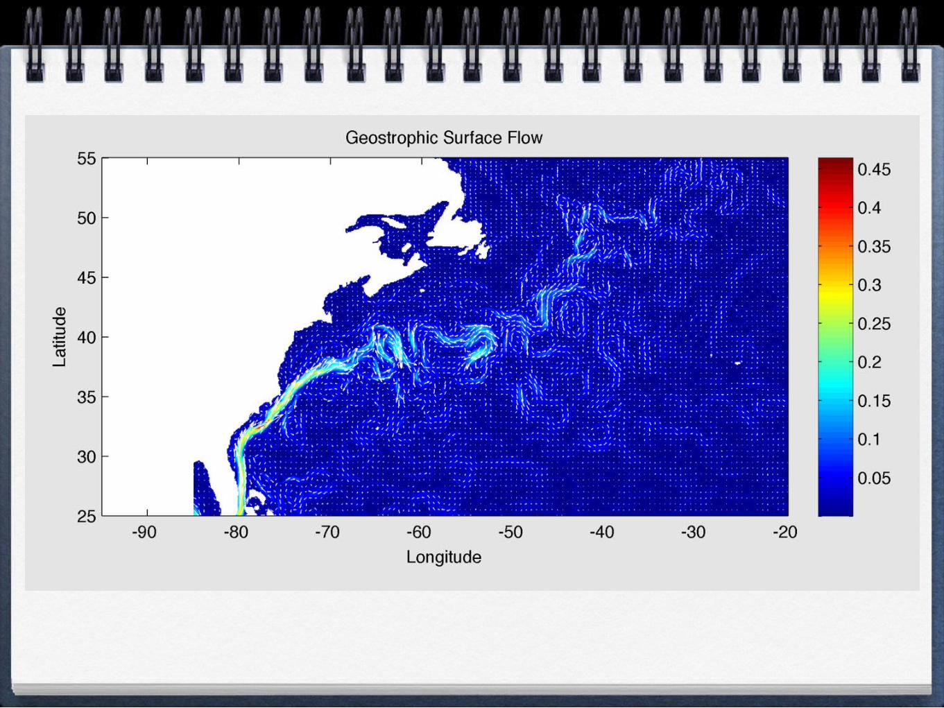
LocationWestern Boundary of the North Atlantic Ocean
Sources: Caribbean Sea, Antilles Current
Sharp Transition zone between cold, dense water (Laborador) and warm, less dense water.
Transport: Heat
Heat: 1.4 petawatts of heat
In conjunction with the Hadley Circulation, this heat transport moderates the climate of Europe.
Some argue that the atmosphere plays a larger role here: Mid-latitude Cyclones
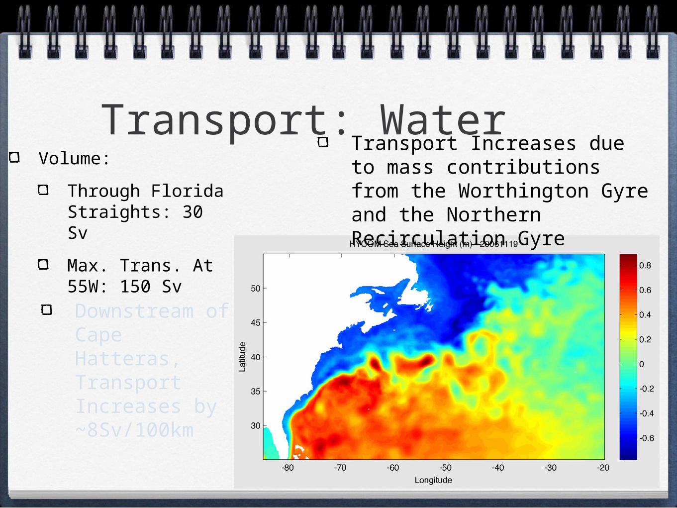
Transport: WaterVolume:
Through Florida Straights: 30 Sv
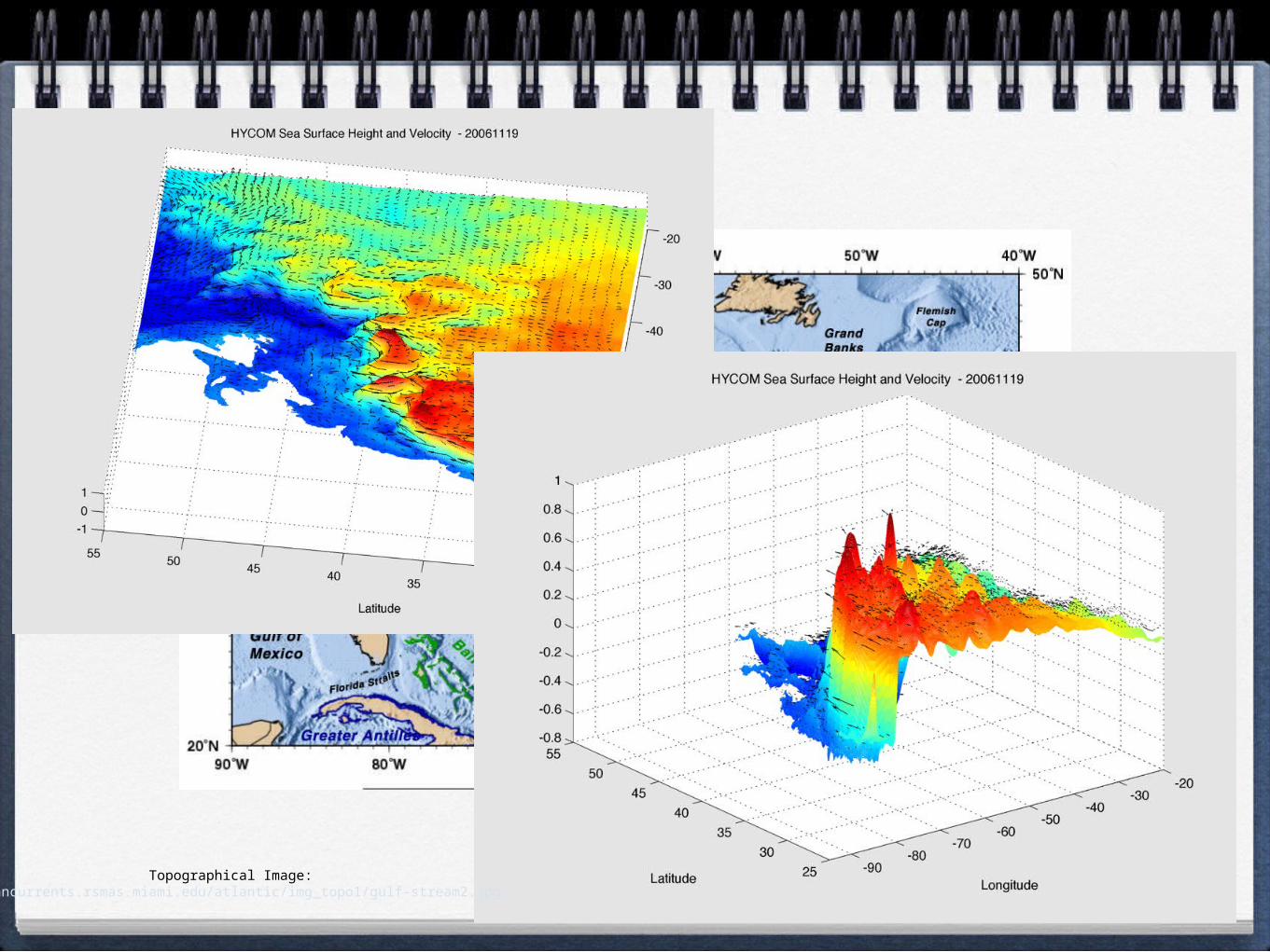
Max. Trans. At 55W: 150 Sv
Transport Increases due to mass contributions from the Worthington Gyre and the Northern Recirculation Gyre
Downstream of Cape Hatteras, Transport Increases by ~8Sv/100km
QuickTime™ and aCinepak decompressor
are needed to see this picture.
Topographical Image: oceancurrents.rsmas.miami.edu/atlantic/img_topo1/gulf-stream2.jpg
Gulf Stream’s Sink
Near 38N 44W: Flow Diverges
Toward Mid-Atlantic Ridge:
Azores Current (cold)(southward)
Following north along the continental slope
North Atlantic Current (warm)(Eastward)
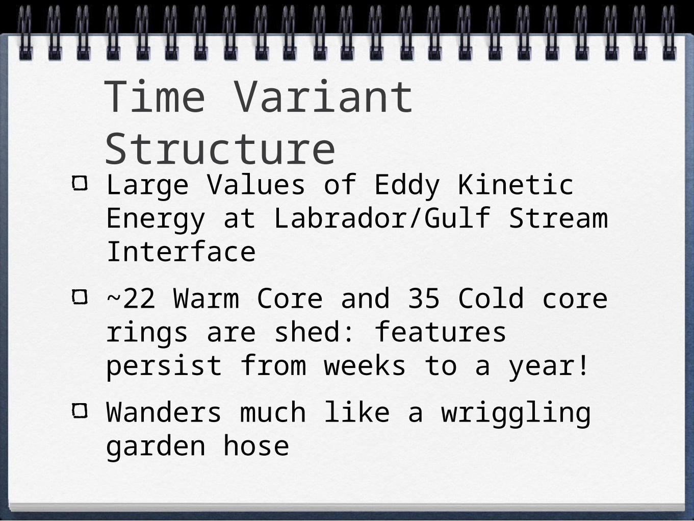
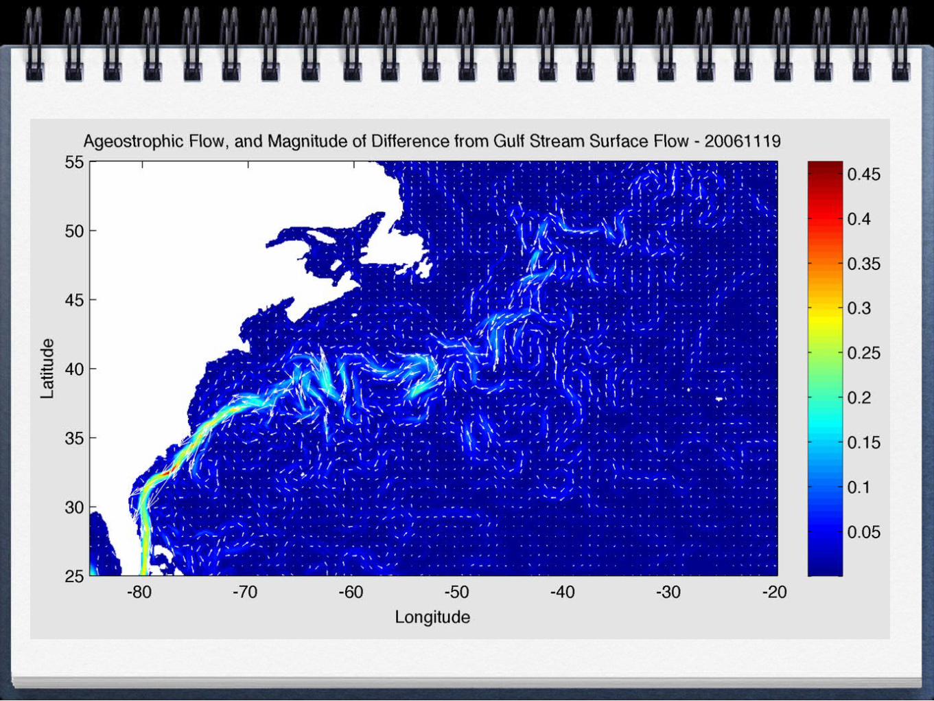
Time Variant Structure
Large Values of Eddy Kinetic Energy at Labrador/Gulf Stream Interface
~22 Warm Core and 35 Cold core rings are shed: features persist from weeks to a year!
Wanders much like a wriggling garden hose
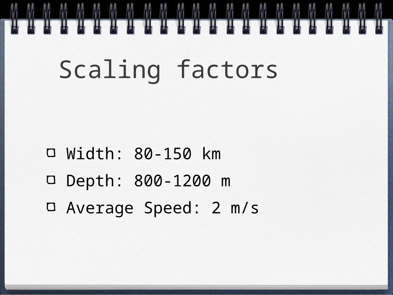
Scaling factors
Width: 80-150 km
Depth: 800-1200 m
Average Speed: 2 m/s
Reference
• HYCOM Consortium, Live Access Data Server, http://hycom.coaps.fsu.edu/thredds/dodsC/atl_ops.html
• Joanna Gyory, Arthur J. Mariano, Edward H. Ryan. "The Gulf Stream." Ocean Surface Currents. http://oceancurrents.rsmas.miami.edu/atlantic/gulf-stream.html.
• Lee, Hoyle, “A Gulf Stream Synthetic Geoid for the TOPEX Altimeter,” 1997.


