Embed Size (px)
Citation preview
1
The Group on Earth Observations and LCLUC
Presentation for the LCLUC Science TeamApril 4, 2007
Ed Sheffner forDr. Teresa Fryberger, Applied Sciences Program Earth Science Division NASA Science Mission Directorate
2
Topics
• International: GEOSS/GEO• US: IEOS/USGEO• NASA and GEO/USGEO• GEO and LCLUC• Issues
3
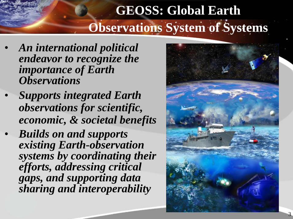
GEOSS: Global Earth Observations System of Systems
• An international political endeavor to recognize the importance of Earth Observations
• Supports integrated Earth observations for scientific, economic, & societal benefits
• Builds on and supports existing Earth-observation systems by coordinating their efforts, addressing critical gaps, and supporting data sharing and interoperability

4
The Premise Behind GEOSS

5
The Global Framework
A distributed system of systems:– Improves coordination of strategies
and observation systems– Links all platforms: in situ, aircraft,
and satellite networks– Identifies gaps in our global
capacity– Facilitates exchange of data and
information – Improves decision-makers’ abilities
to address pressing policy issues
6
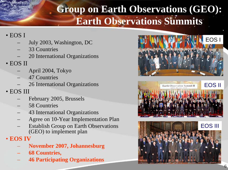
Group on Earth Observations (GEO): Earth Observations Summits
• EOS I– July 2003, Washington, DC– 33 Countries– 20 International Organizations
• EOS II– April 2004, Tokyo– 47 Countries– 26 International Organizations
• EOS III – February 2005, Brussels– 58 Countries– 43 International Organizations– Agree on 10-Year Implementation Plan– Establish Group on Earth Observations
(GEO) to implement plan• EOS IV
– November 2007, Johannesburg– 68 Countries, – 46 Participating Organizations
EOS III
EOS II
EOS I
7
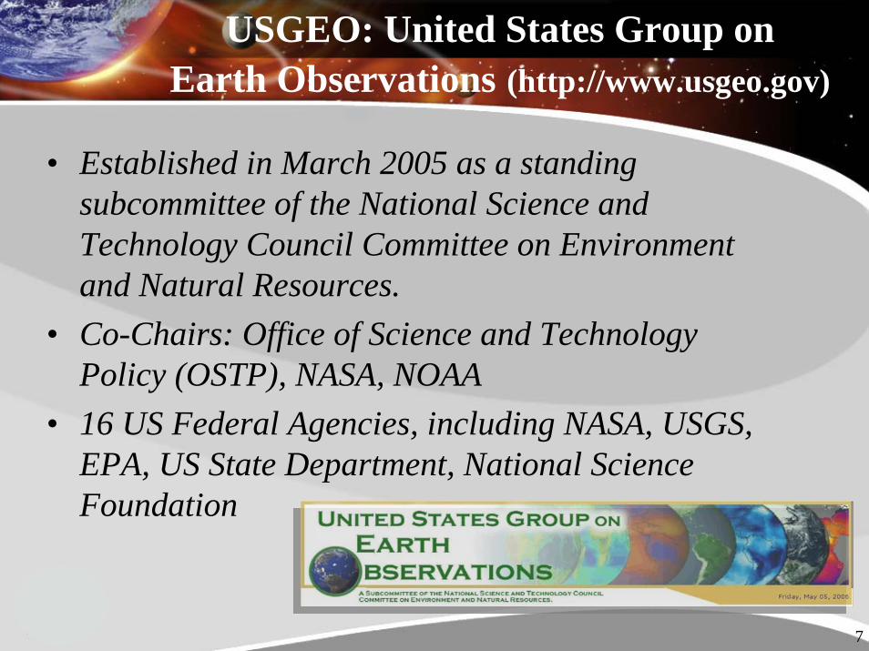
USGEO: United States Group on Earth Observations (http://www.usgeo.gov)
• Established in March 2005 as a standing subcommittee of the National Science and Technology Council Committee on Environment and Natural Resources.
• Co-Chairs: Office of Science and Technology Policy (OSTP), NASA, NOAA
• 16 US Federal Agencies, including NASA, USGS, EPA, US State Department, National Science Foundation
8
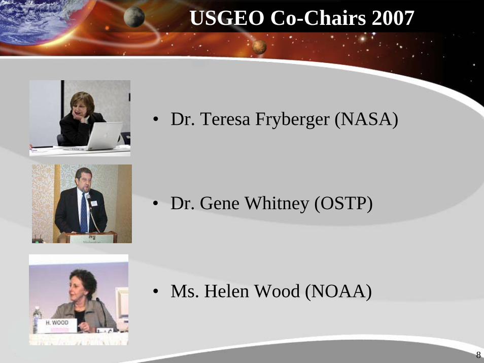
USGEO Co-Chairs 2007
• Dr. Teresa Fryberger (NASA)
• Dr. Gene Whitney (OSTP)
• Ms. Helen Wood (NOAA)
9
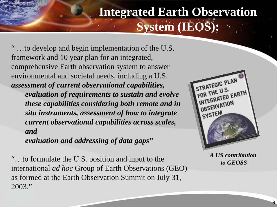
Integrated Earth Observation System (IEOS):
“ …to develop and begin implementation of the U.S. framework and 10 year plan for an integrated, comprehensive Earth observation system to answer environmental and societal needs, including a U.S. assessment of current observational capabilities,
evaluation of requirements to sustain and evolve these capabilities considering both remote and in situ instruments, assessment of how to integrate current observational capabilities across scales, and evaluation and addressing of data gaps”
“…to formulate the U.S. position and input to the international ad hoc Group of Earth Observations (GEO) as formed at the Earth Observation Summit on July 31, 2003.”
A US contribution to GEOSS
10
Six Near-Term Opportunities
Implementing the IEOS Strategic Plan:
Near term opportunities are systems that • Leverage/build on/integrate existing systems or
components• Have tangible, near-term results• Demonstrate the utility of integration and allow for learning • Meet high priority national needs and crosscut societal
benefit areas
Improved Observations for Disaster Reduction September 2006
National Integrated Drought Information System September 2006
Air Quality Assessment and Forecast System September 2006
Global Land Observation System Under development
Sea Level Observation System Under development
Architecture and Data Management Under development
11
U.S. IEOS
GEOSS
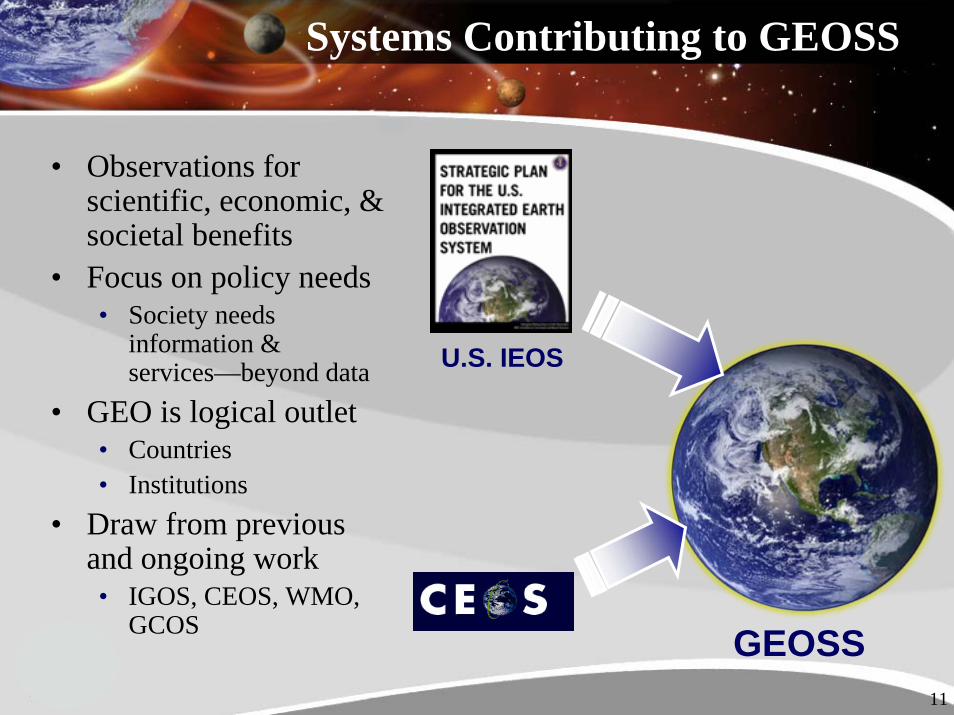
Systems Contributing to GEOSS
• Observations for scientific, economic, & societal benefits
• Focus on policy needs• Society needs
information & services—beyond data
• GEO is logical outlet • Countries• Institutions
• Draw from previous and ongoing work• IGOS, CEOS, WMO,
GCOS

12
Future Interaction Between CEOS and GEO
• The GEOSS Implementation Plan provides a framework for enhanced cooperation efforts between space agencies
• GEOSS provides a venue for CEOS principles, activities, and plans to be communicated to a broad, global community
• CEOS strives at building its own Long-Term Implementation Plan for the space component of GEOSS, with a view to support the targets of the nine GEO Societal Benefit Areas
13
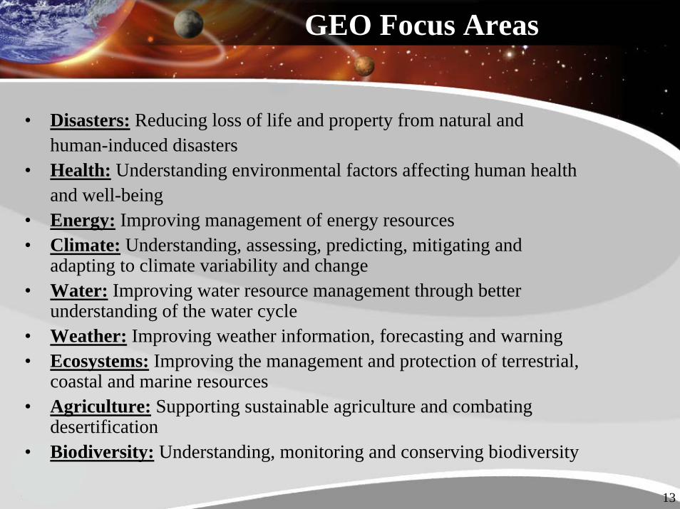
GEO Focus Areas
• Disasters: Reducing loss of life and property from natural and human-induced disasters
• Health: Understanding environmental factors affecting human health and well-being
• Energy: Improving management of energy resources• Climate: Understanding, assessing, predicting, mitigating and
adapting to climate variability and change• Water: Improving water resource management through better
understanding of the water cycle • Weather: Improving weather information, forecasting and warning• Ecosystems: Improving the management and protection of terrestrial,
coastal and marine resources• Agriculture: Supporting sustainable agriculture and combating
desertification• Biodiversity: Understanding, monitoring and conserving biodiversity

14
• Climate– CL-06-02: Key terrestrial observations for climate
• Ecosystems– EC-06-01: Integrated global carbon observation (IGCO)– EC-07-01: Global ecosystem observation and monitoring network
• Agriculture– AG-06-04: Forest mapping and change monitoring– AG-07-03: Operational agricultural monitoring system
• Biodiversity– BI-07-01: Biodiversity observation and monitoring network– BI-07-02: Invasive species monitoring system
GEO Element Tasks related to LCLUC

15
Linking Earth Observations to Societal Benefits
16
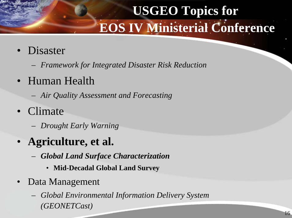
• Disaster– Framework for Integrated Disaster Risk Reduction
• Human Health– Air Quality Assessment and Forecasting
• Climate– Drought Early Warning
• Agriculture, et al.– Global Land Surface Characterization
• Mid-Decadal Global Land Survey
• Data Management– Global Environmental Information Delivery System
(GEONETCast)
USGEO Topics for EOS IV Ministerial Conference
17
Contact Information
Dr. Teresa FrybergerAssociate Director
NASA Applied Sciences ProgramScience Mission [email protected]
202-358-7200
18
Backup Slides
19
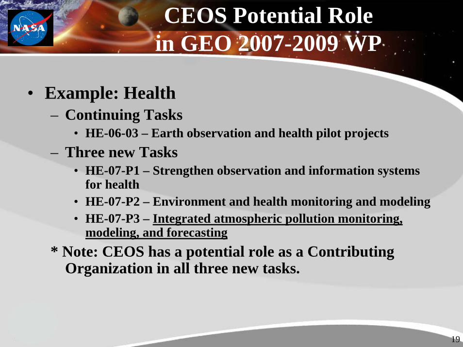
CEOS Potential Rolein GEO 2007-2009 WP
• Example: Health– Continuing Tasks
• HE-06-03 – Earth observation and health pilot projects– Three new Tasks
• HE-07-P1 – Strengthen observation and information systems for health
• HE-07-P2 – Environment and health monitoring and modeling• HE-07-P3 – Integrated atmospheric pollution monitoring,
modeling, and forecasting* Note: CEOS has a potential role as a Contributing
Organization in all three new tasks.

20
CEOS Potential Rolein GEO 2007-2009 WP
• Example: Climate– Continuing Tasks
• CL-06-01 – Sustained reprocessing and reanalysis efforts• CL-06-02 – Key data from satellite systems (CEOS Lead and
POC)• CL-06-03 – Intergovernmental mechanisms for terrestrial
observations• CL-06-05 – GEOSS IPY contribution• CL-06-06 – Global ocean observation system (postponed)
– CEOS has a potential co-Lead role in CL-06-06 with GCOS.
– New Task• CL-07-P1 – Seamless weather and climate prediction system
21
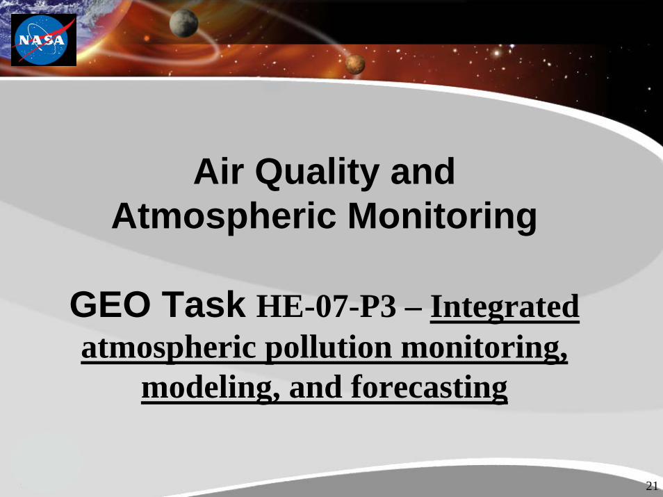
Air Quality andAtmospheric Monitoring
GEO Task HE-07-P3 – Integrated atmospheric pollution monitoring,
modeling, and forecasting

22
Products (Near Real Time)
Products
State & Local
CanadianProvidences
NOAA NASALangley
SSEC/CIMSSUniv. of Wisc.Madison
(MIPPS)
Direct Broadcast
DB Aerosol Optical Depth(MOD04_L2)DB Cloud Optical Thickness (MOD06_L2)
TERRA MODISAQUA-1 MODIS
ProductsEDAS Forecast Data
US EPAAIRNow
ProductsAIRNow Hourly PM2.5 Data
EPA AIRNow Use of NASA MODIS Data
ProductsMODIS/AIRNow Data FusionSite Static Data
AIRNowForecasters
~10:30 local overpass~1:30 local overpass
Algorithms
NASAGoddard
Science Team
NASAGoddard
Data Center
Products Aerosol Optical Depth(MOD04_L2)Cloud Optical Thickness (MOD06_L2)
Terra & Aqua Satellite Direct Broadcast of
MODIS instrument
data via commercially
available ground station

23
NASA Initiatives--Using Real-time Aqua/MODIS data to avoid Aura/TES Cloud-Obscured Measurements
MODIS FOV
Nominal 15 minutes orbital separation
TES Targeted Measurement
• Integration of Research Capabilities
• Transition to Operations
24
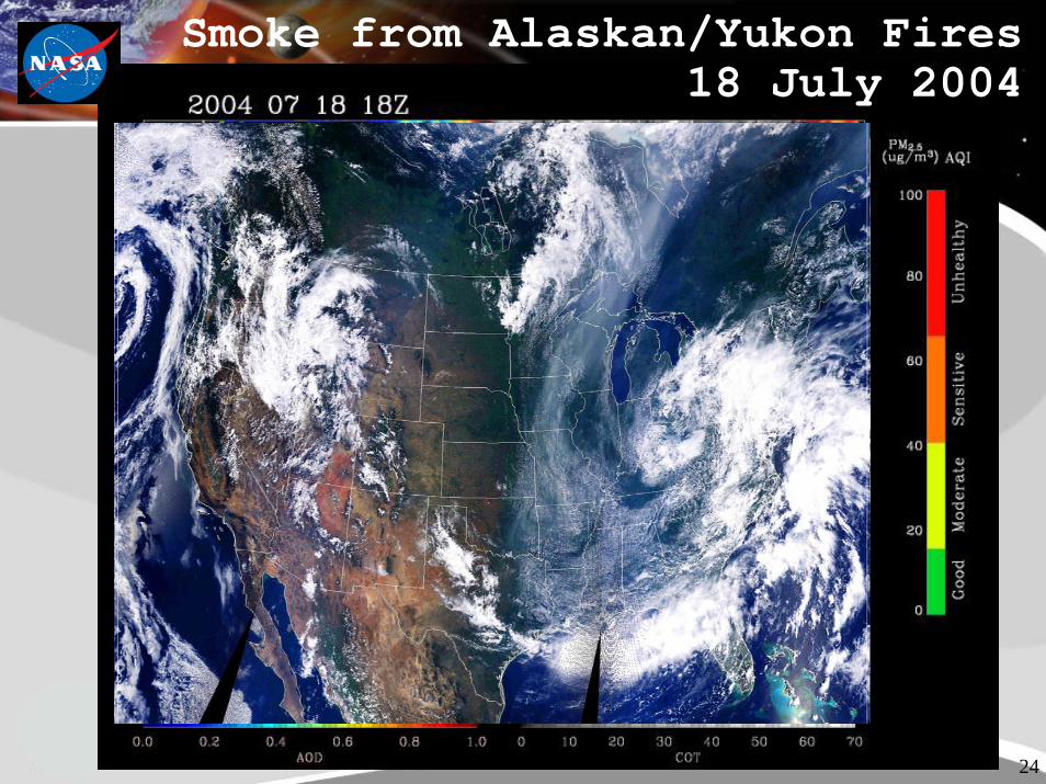
Smoke from Alaskan/Yukon Fires 18 July 2004
25
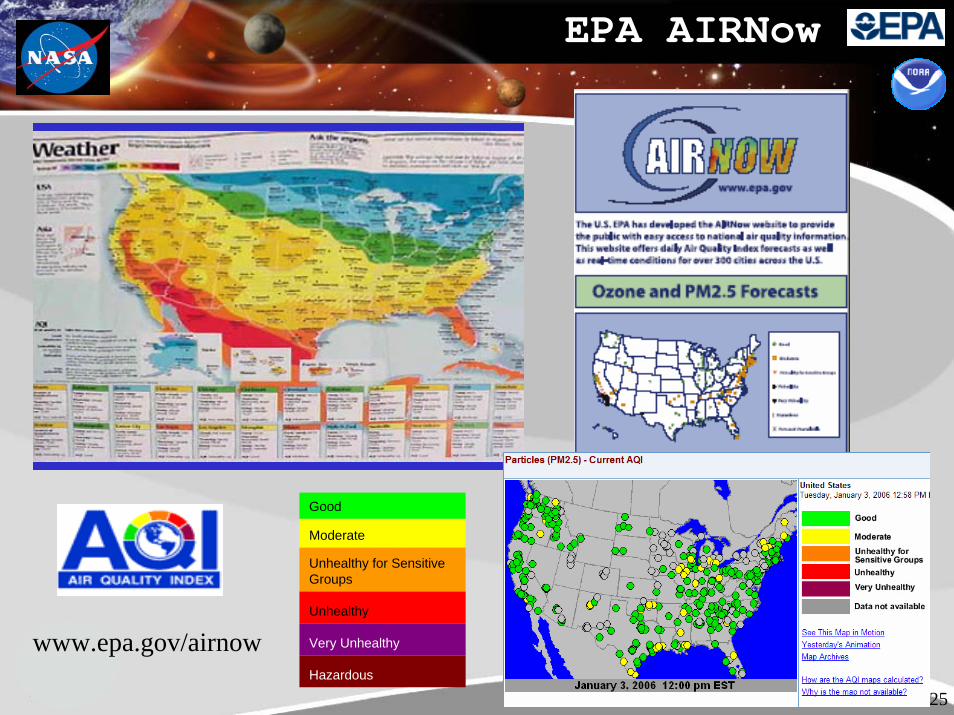
EPA AIRNow
Good
Moderate
Unhealthy for Sensitive Groups
Unhealthy
Very Unhealthy
Hazardous
www.epa.gov/airnow
26
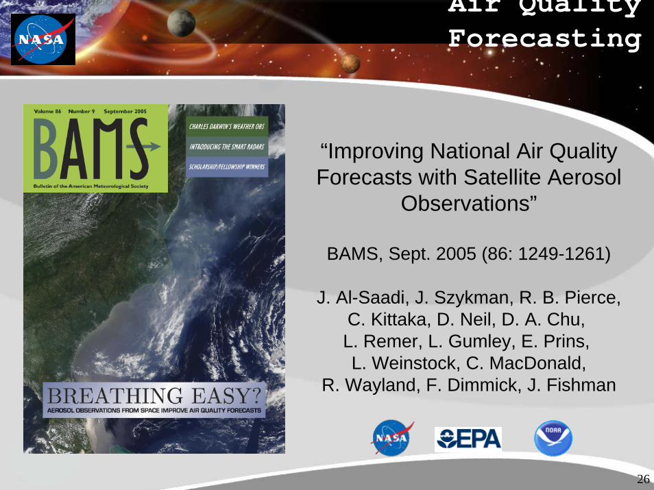
Air Quality Forecasting
“Improving National Air Quality Forecasts with Satellite Aerosol
Observations”
BAMS, Sept. 2005 (86: 1249-1261)
J. Al-Saadi, J. Szykman, R. B. Pierce, C. Kittaka, D. Neil, D. A. Chu,L. Remer, L. Gumley, E. Prins,L. Weinstock, C. MacDonald,
R. Wayland, F. Dimmick, J. Fishman
27
The 2007 GEO Ministerial Summit• Cape Town, South Africa, on 28-29 November
2007 immediately followed, on 30 November, by the 4th Earth Observation Summit.
• Preparation for the Summit: Report on Progress: will be approximately 20 pages in length and will describe the progress of GEO since the last Earth Observation Summit. Will include 3-5 major themes for discussionDeclaration: A one page document that will provide a record of the Ministerial Summit and set clear milestones for the future.
• 68 country ministers, 46 participating organizations,

28