Embed Size (px)
Citation preview
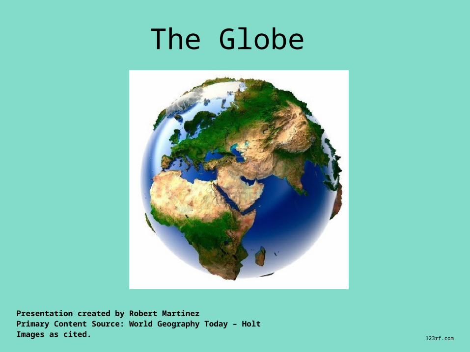
The Globe
Presentation created by Robert MartinezPrimary Content Source: World Geography Today – HoltImages as cited.
123rf.com
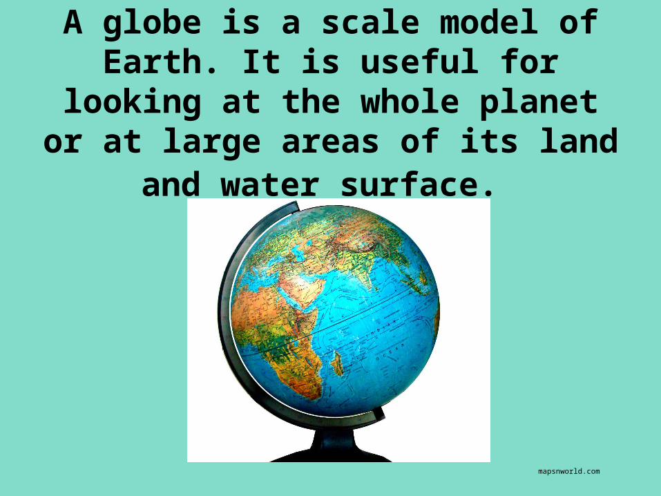
A globe is a scale model of Earth. It is useful for looking at the whole planet or at large areas of its land
and water surface.
mapsnworld.com
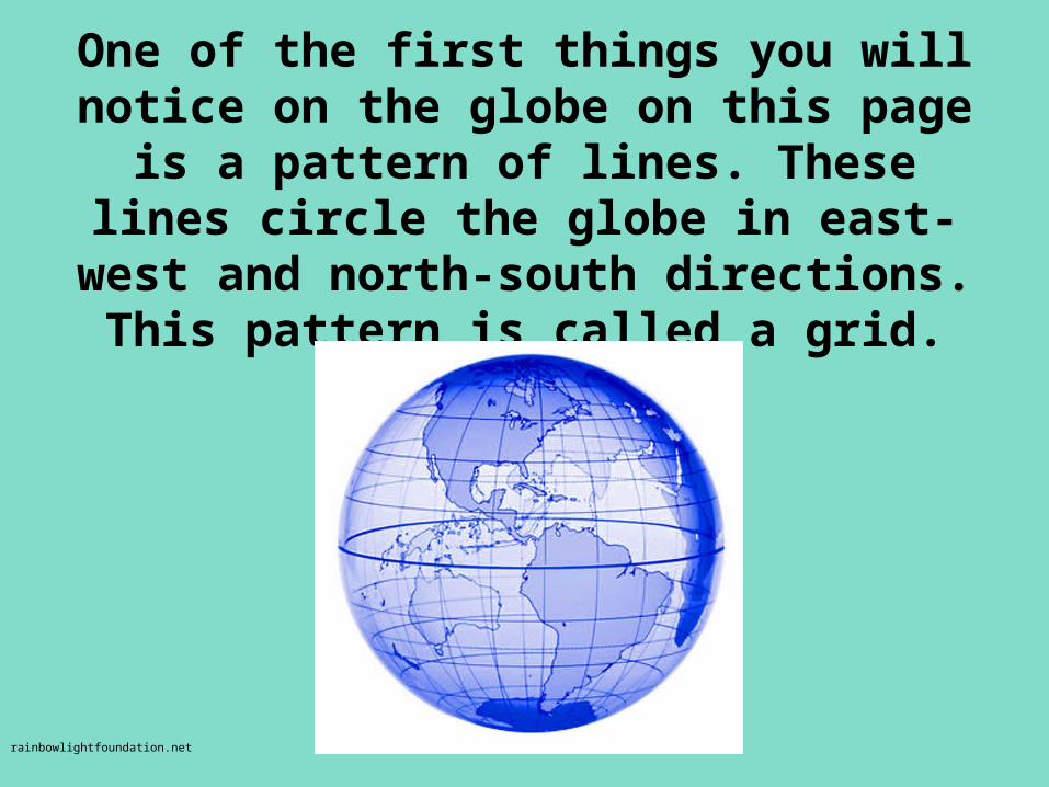
One of the first things you will notice on the globe on this page is a pattern of
lines. These lines circle the globe in east-west and north-south directions. This
pattern is called a grid.
rainbowlightfoundation.net
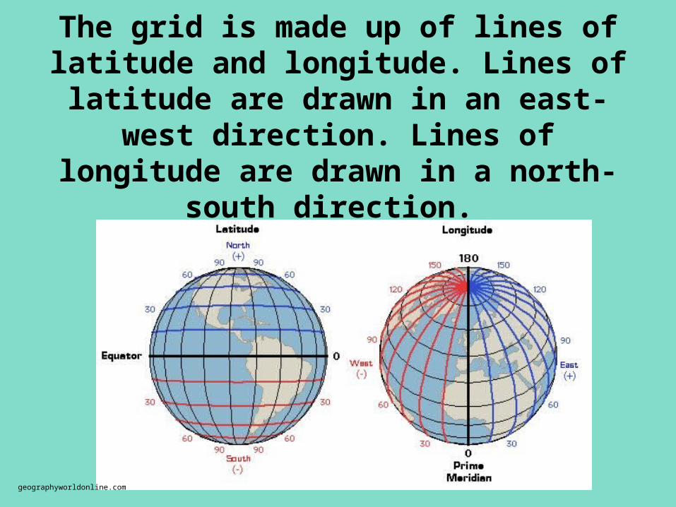
The grid is made up of lines of latitude and longitude. Lines of latitude are drawn
in an east-west direction. Lines of longitude are drawn in a north-south
direction.
geographyworldonline.com
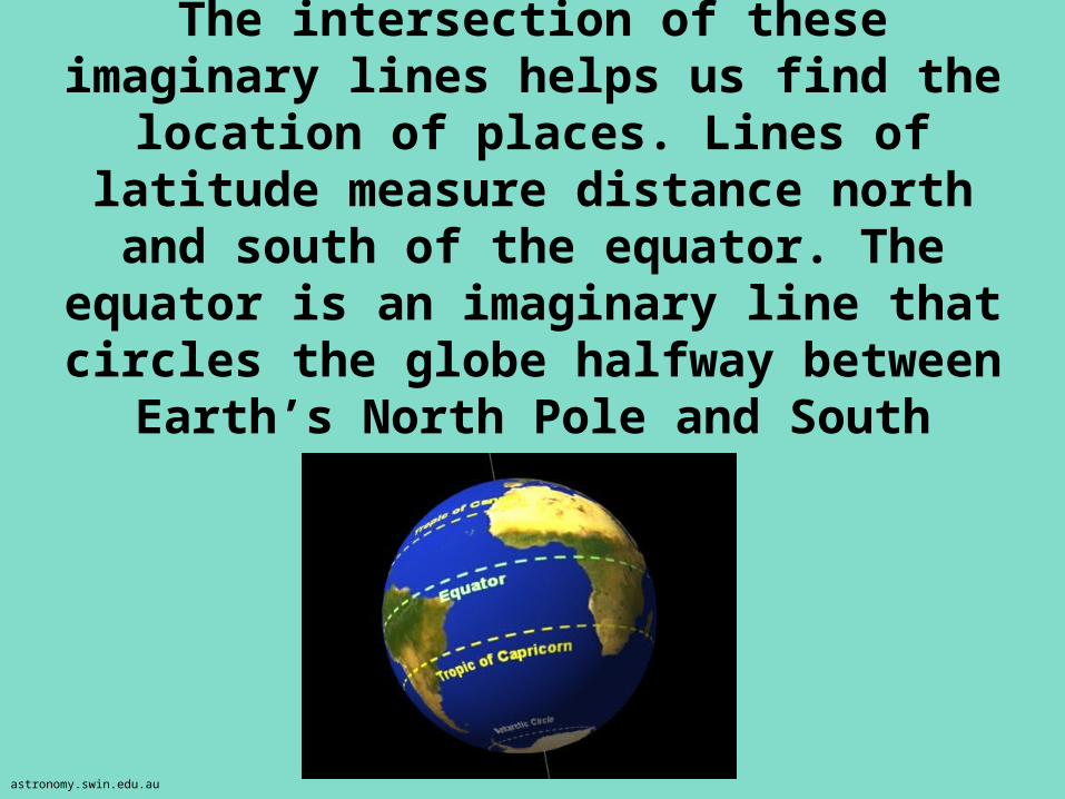
The intersection of these imaginary lines helps us find the location of places.
Lines of latitude measure distance north and south of the equator. The equator is an imaginary line that circles the globe
halfway between Earth’s North Pole and South Pole.
astronomy.swin.edu.au
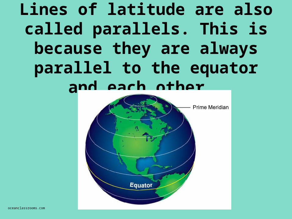
Lines of latitude are also called parallels. This is because they
are always parallel to the equator and each other.
oceanclassrooms.com
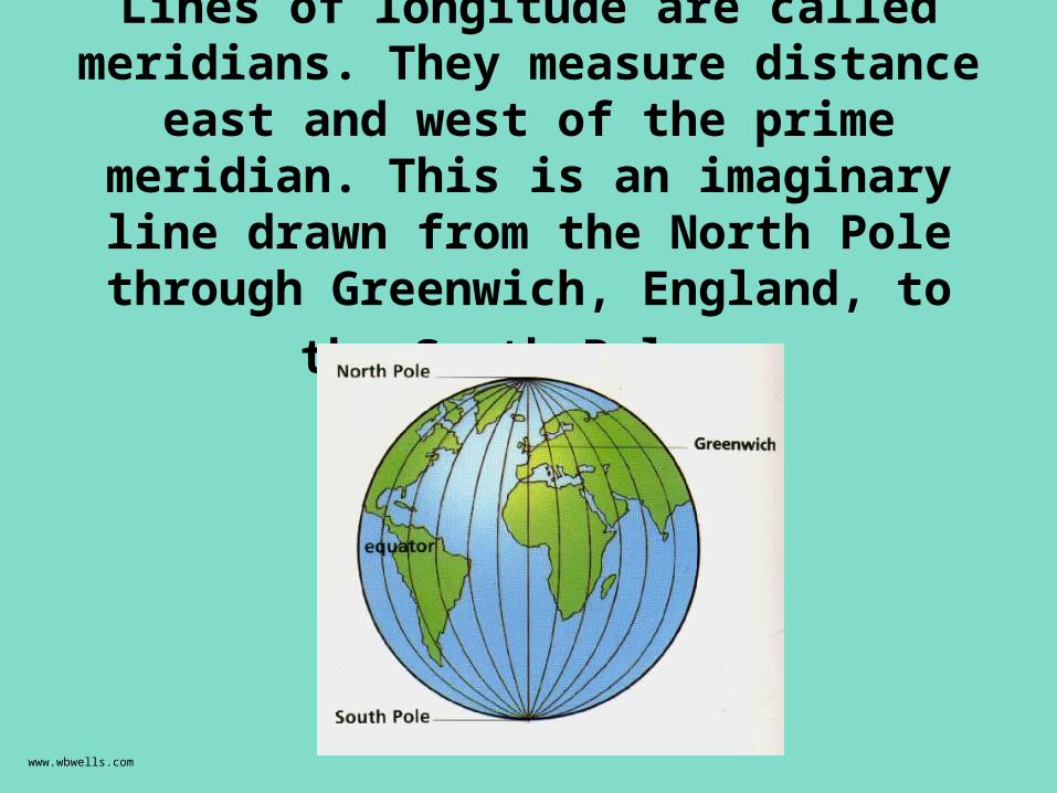
Lines of longitude are called meridians. They measure distance east and west of the prime meridian. This is an imaginary line drawn from the North Pole through
Greenwich, England, to the South Pole.
www.wbwells.com
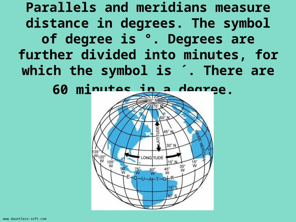
Parallels and meridians measure distance in degrees. The symbol of
degree is °. Degrees are further divided into minutes, for which the symbol is ´.
There are 60 minutes in a degree.
www.dauntless-soft.com
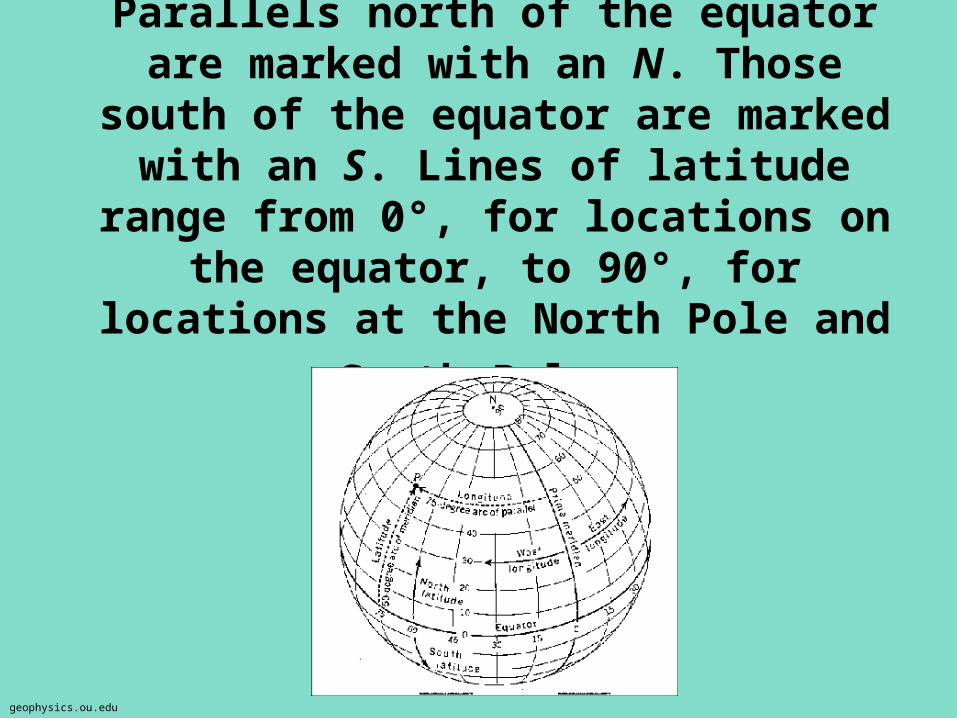
Parallels north of the equator are marked with an N. Those south of the equator are marked with an S. Lines of latitude range from 0°, for locations on the equator, to 90°, for locations at the North Pole and
South Pole.
geophysics.ou.edu
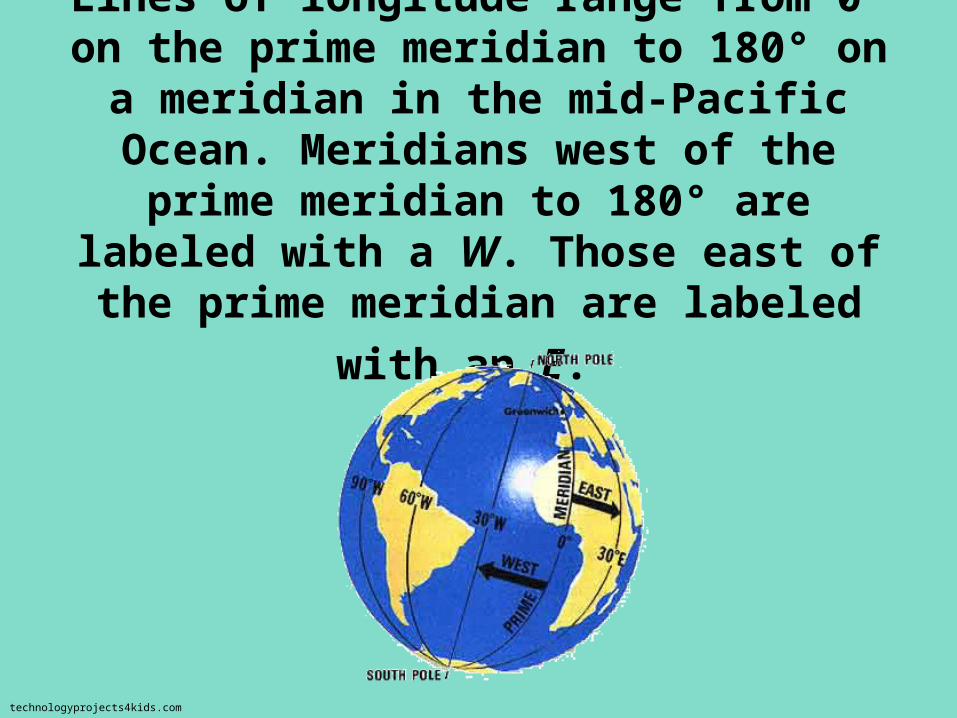
Lines of longitude range from 0° on the prime meridian to 180° on a meridian in
the mid-Pacific Ocean. Meridians west of the prime meridian to 180° are labeled
with a W. Those east of the prime
meridian are labeled with an E.
technologyprojects4kids.com
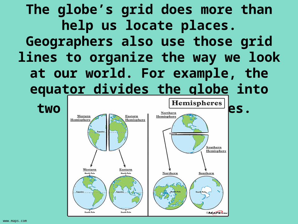
The globe’s grid does more than help us locate places. Geographers also use
those grid lines to organize the way we look at our world. For example, the equator divides the globe into two
halves, or hemispheres.
www.maps.com
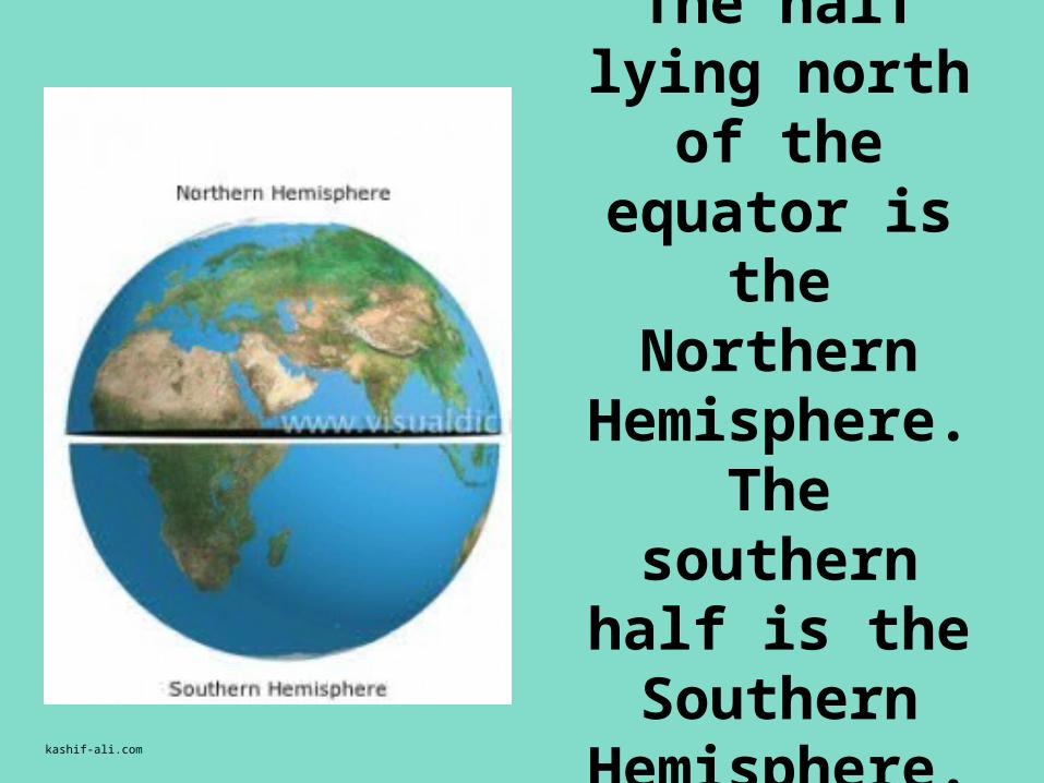
The half lying north of the
equator is the Northern
Hemisphere. The southern
half is the Southern
Hemisphere. kashif-ali.com
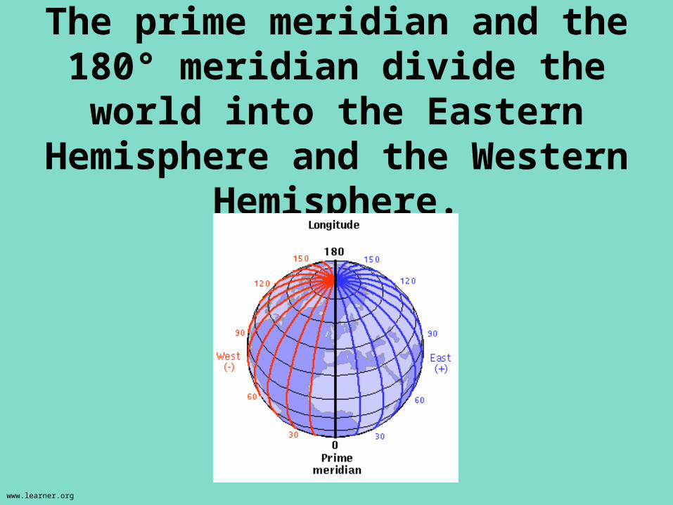
The prime meridian and the 180° meridian divide the world into
the Eastern Hemisphere and the Western Hemisphere.
www.learner.org
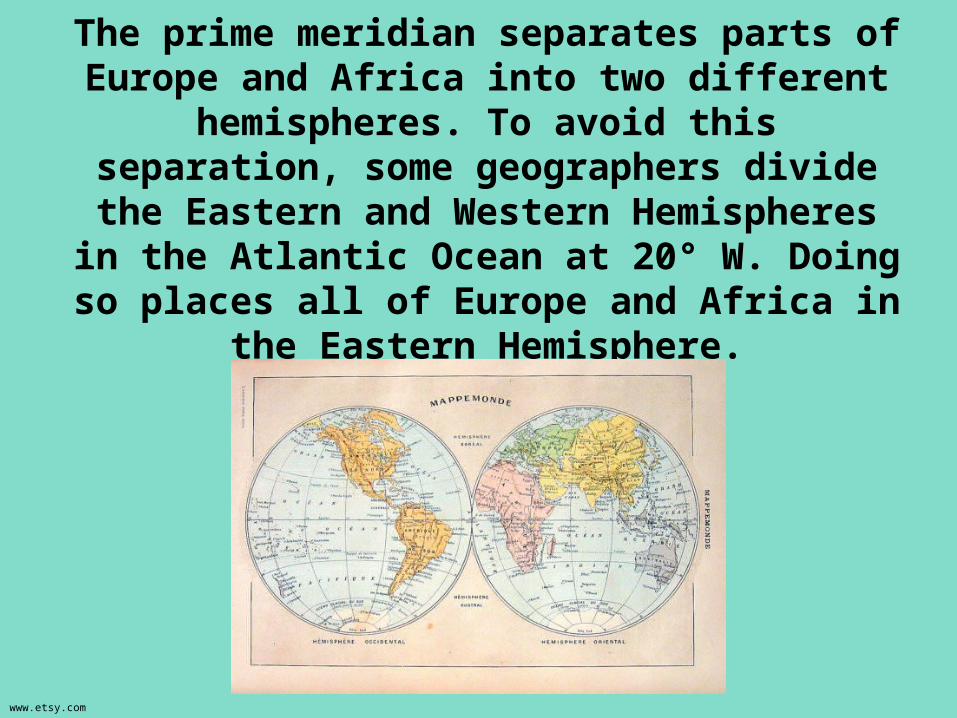
The prime meridian separates parts of Europe and Africa into two different hemispheres. To
avoid this separation, some geographers divide the Eastern and Western Hemispheres in the Atlantic Ocean at 20° W. Doing so places all
of Europe and Africa in the Eastern Hemisphere.
www.etsy.com
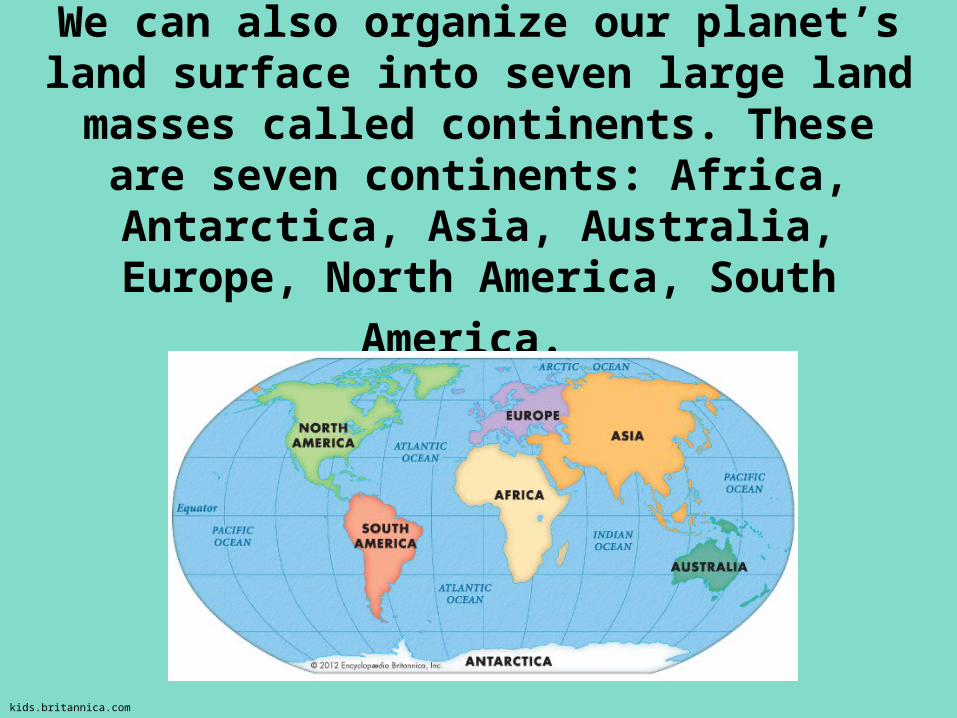
We can also organize our planet’s land surface into seven large land masses
called continents. These are seven continents: Africa, Antarctica, Asia,
Australia, Europe, North America, South
America.
kids.britannica.com
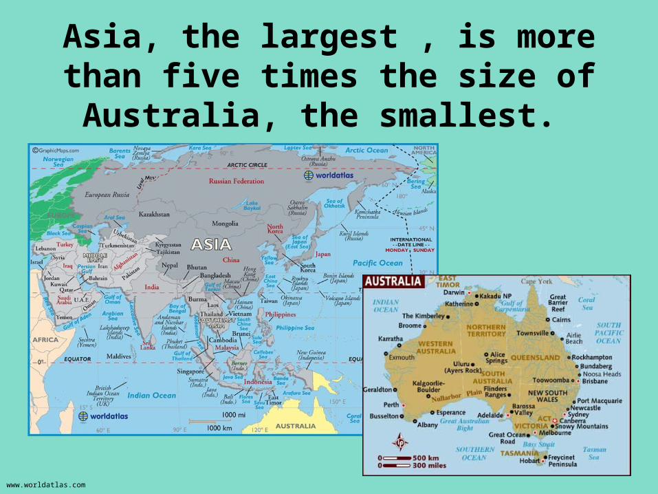
Asia, the largest , is more than five times the size of Australia, the
smallest.
www.worldatlas.com
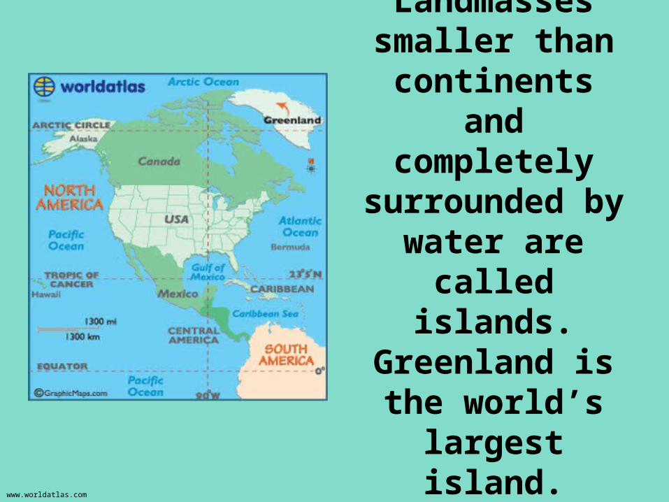
Landmasses smaller than
continents and completely
surrounded by water are called
islands. Greenland is the world’s largest
island.
www.worldatlas.com
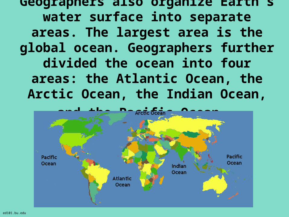
Geographers also organize Earth’s water surface into separate areas. The largest area is the global ocean. Geographers
further divided the ocean into four areas: the Atlantic Ocean, the Arctic Ocean, the
Indian Ocean, and the Pacific Ocean.
ed101.bu.edu
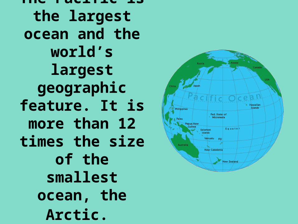
The Pacific is the largest ocean and the world’s largest
geographic feature. It is more than 12 times the
size of the smallest ocean,
the Arctic.
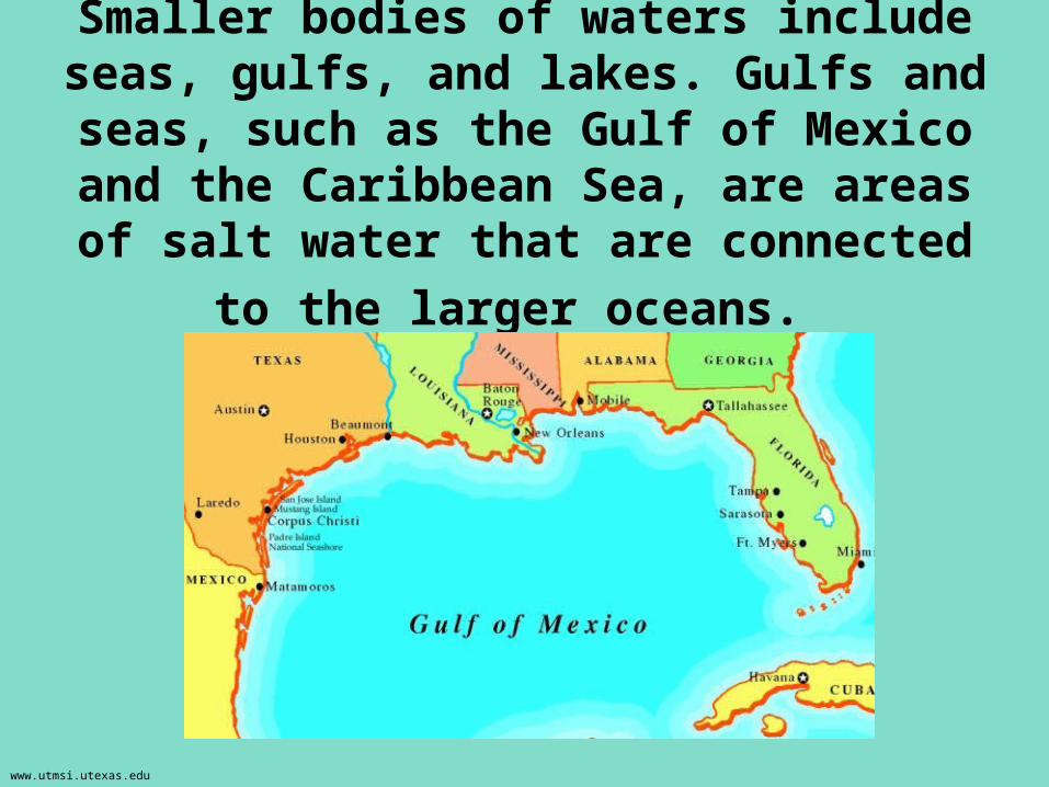
Smaller bodies of waters include seas, gulfs, and lakes. Gulfs and seas, such as
the Gulf of Mexico and the Caribbean Sea, are areas of salt water that are
connected to the larger oceans.
www.utmsi.utexas.edu
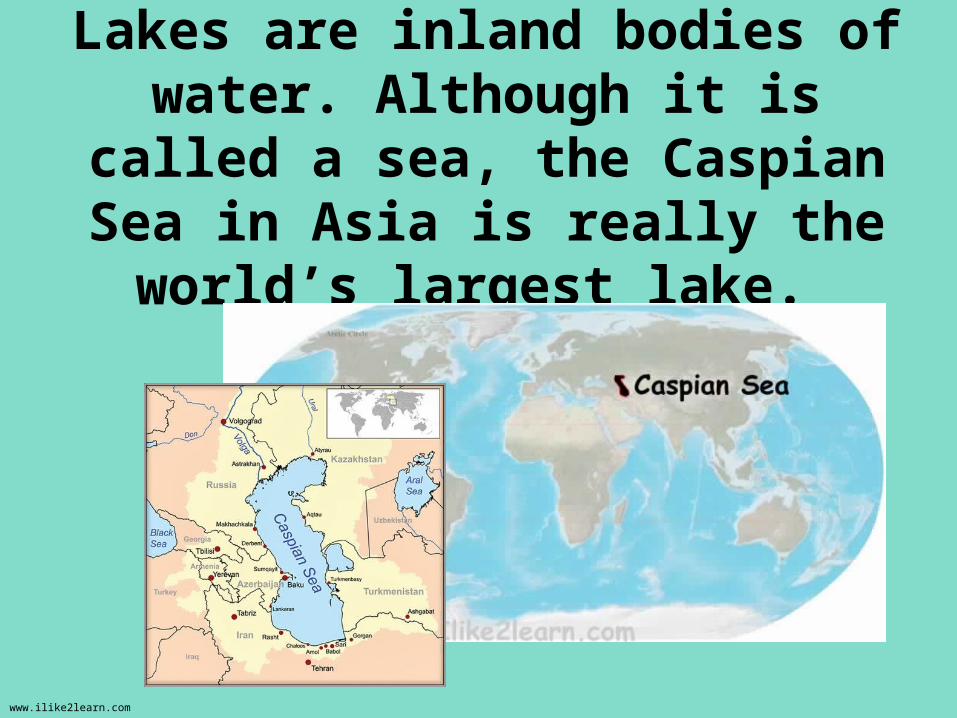
Lakes are inland bodies of water. Although it is called a sea, the
Caspian Sea in Asia is really the world’s largest lake.
www.ilike2learn.com