Embed Size (px)
Citation preview
The Global Positioning System
Advanced Tools
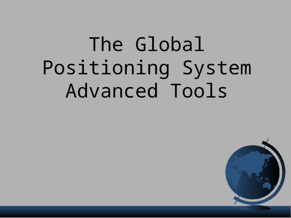
Sources of GPS Error• Standard Positioning Service (SPS ):
• Selective Availability: 0 to 100 meters• Ionosphere: 5.0 to 7.0 meters• Troposphere: 0.5 to 0.7 meters• Satellite clocks: < 1 to 3.6 meters• Orbital errors: < 1 meter• Receiver noise: 0.3 to 1.5 meters• Multipath: undetermined• User error: Up to a kilometer or more
• Errors are cumulative!
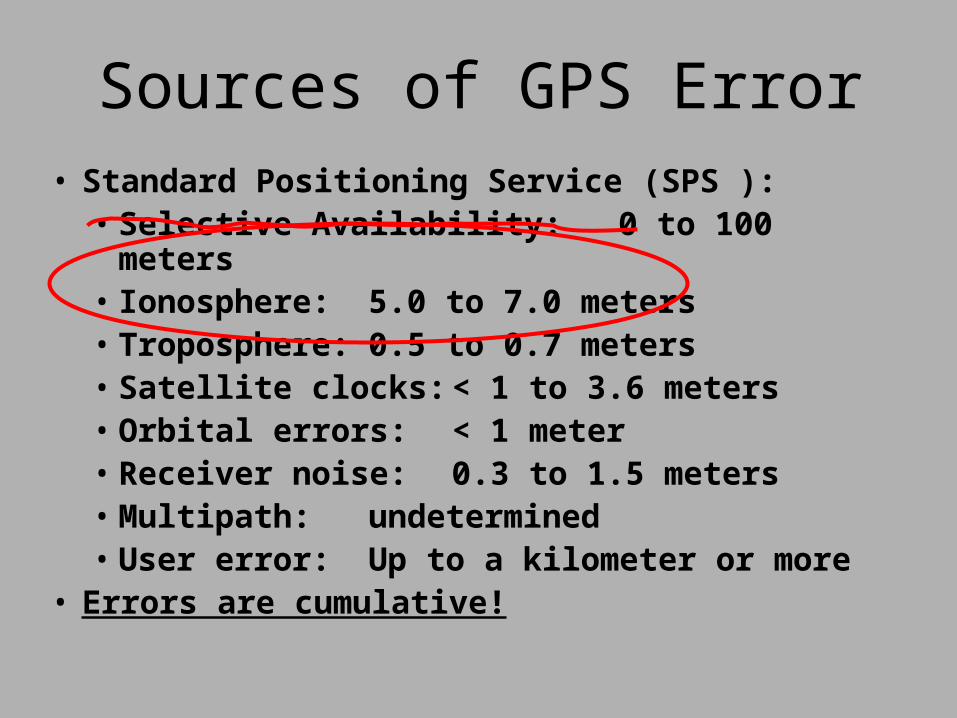
L1C/A Code
This time difference can be calculated and used to correct for Ionospheric and Tropospheric created errors.
L2P(Y) Code
Dual Frequency PositioningSignal propagates through atmosphere at different rates due to different frequencies.
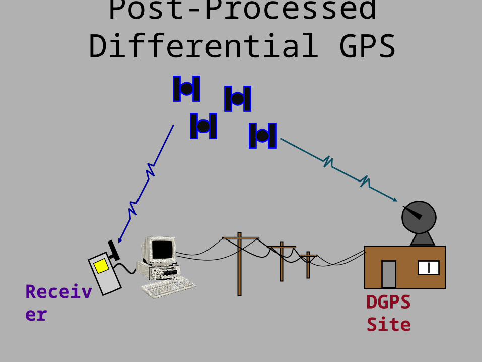
DGPS SiteReceiver
Post-Processed Differential GPS
Post-Processed Differential GPS
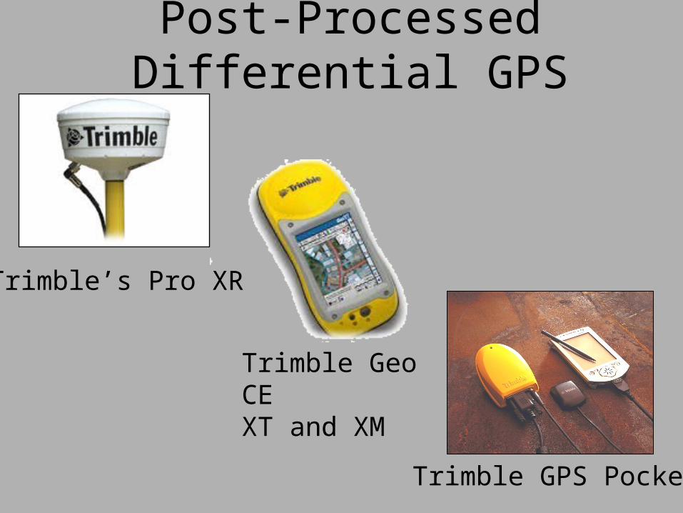
Trimble’s Pro XR
Trimble Geo CEXT and XM
Trimble GPS Pocket
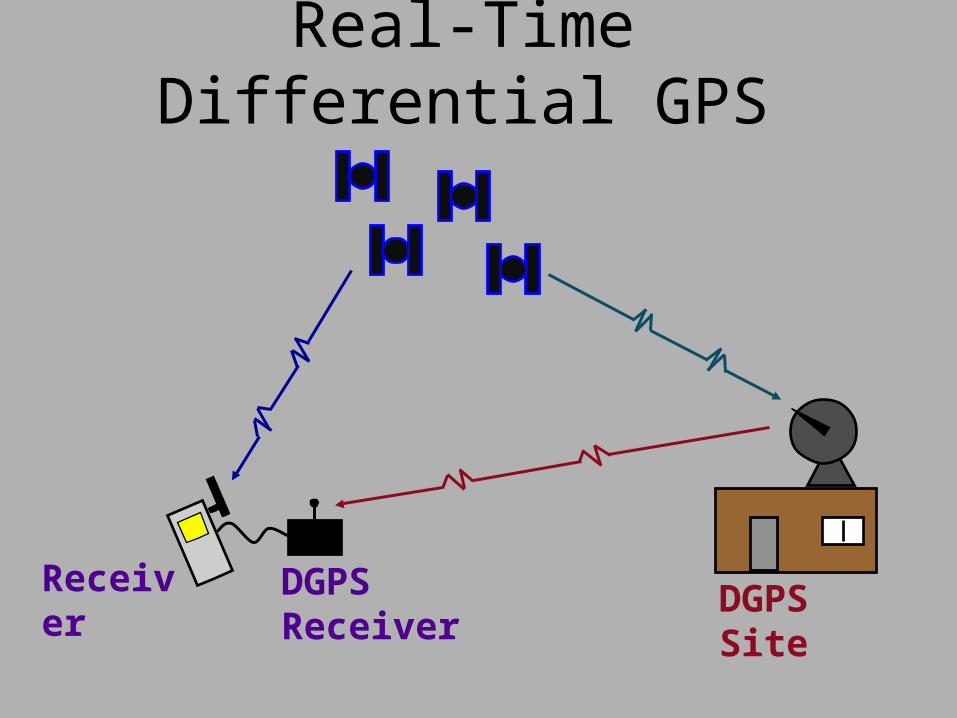
DGPS SiteDGPS ReceiverReceiver
Real-Time Differential GPS
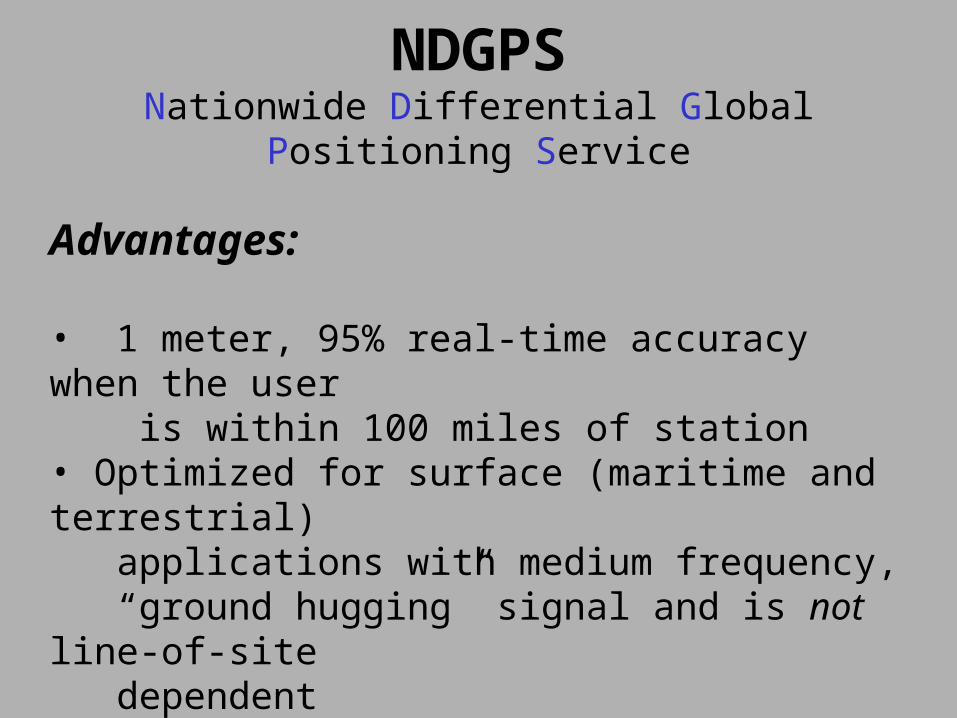
NDGPSNationwide Differential Global Positioning Service
Advantages:
• 1 meter, 95% real-time accuracy when the user is within 100 miles of station• Optimized for surface (maritime and terrestrial) applications with medium frequency, “ground hugging” signal and is not line-of-site dependent• Fully operational in areas of coverage
NDGPSNationwide Differential Global Positioning Service
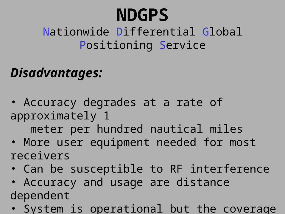
Disadvantages:
• Accuracy degrades at a rate of approximately 1 meter per hundred nautical miles • More user equipment needed for most receivers• Can be susceptible to RF interference• Accuracy and usage are distance dependent• System is operational but the coverage not completed yet
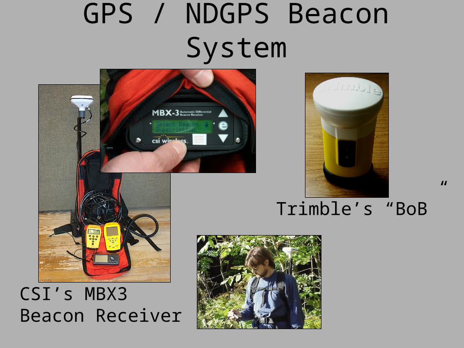
GPS / NDGPS Beacon System
Trimble’s “BoB”
CSI’s MBX3 Beacon Receiver
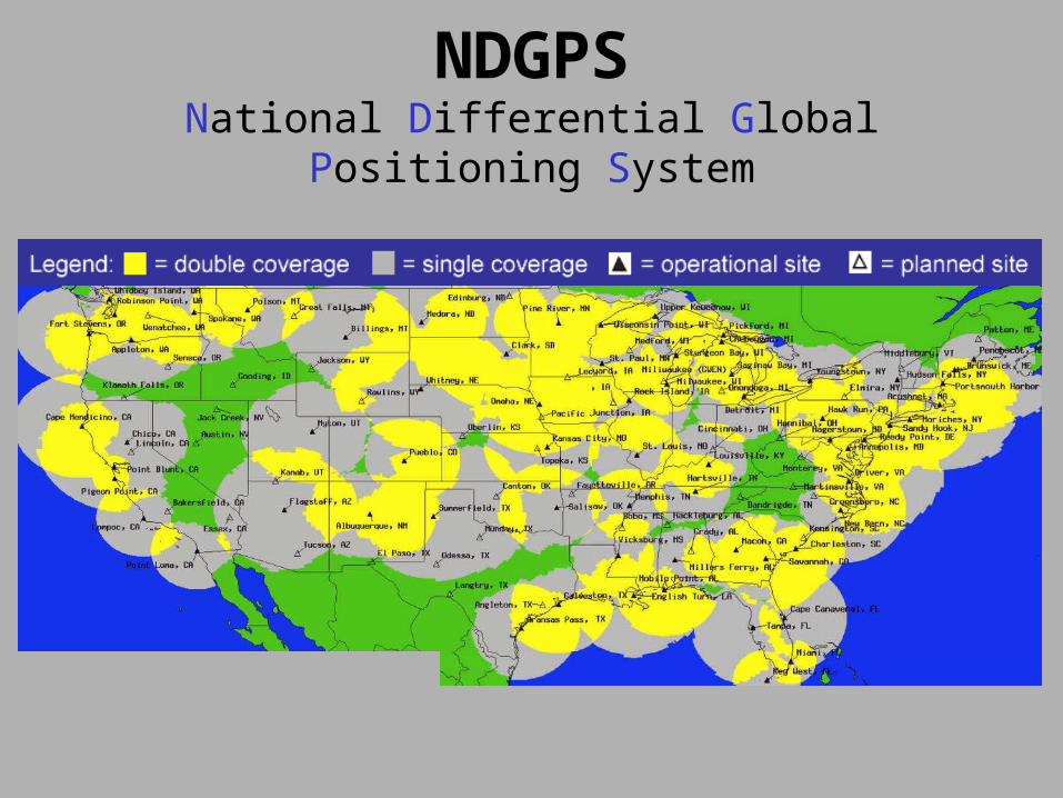
NDGPSNational Differential Global Positioning System
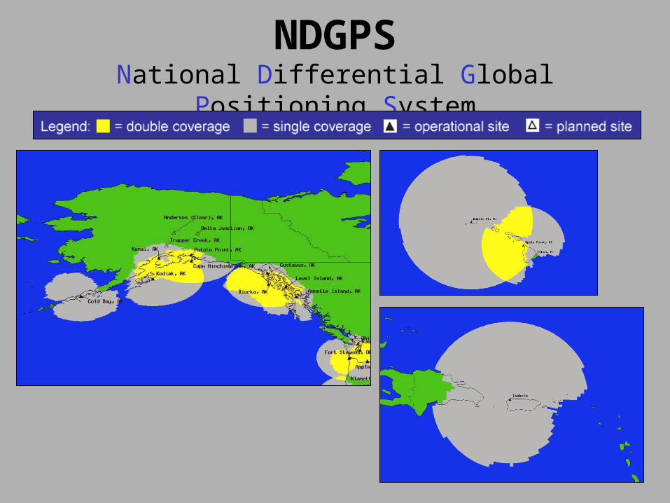
NDGPSNational Differential Global Positioning System
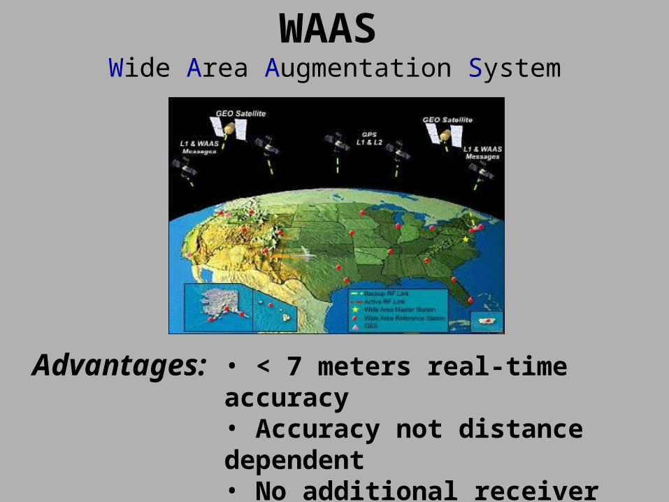
WAAS
Wide Area Augmentation System
• < 7 meters real-time accuracy• Accuracy not distance dependent• No additional receiver needed• Inexpensive
Advantages:
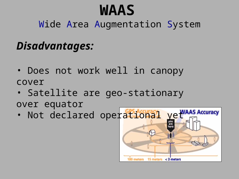
WAAS
Wide Area Augmentation System
Disadvantages:
• Does not work well in canopy cover• Satellite are geo-stationary over equator• Not declared operational yet
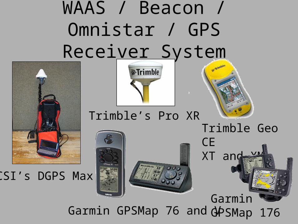
WAAS / Beacon / Omnistar / GPS Receiver System
CSI’s DGPS Max
Garmin GPSMap 76 and V
Trimble’s Pro XRTrimble Geo CEXT and XM
Garmin GPSMap 176
Why Should You Do Differential Corrections?
• Improved Accuracy ( still have atmospheric degradation of sv signals )
• Positional Integrity ( Are you where you say you are? )
• Geodetic Tie to NGS Monumentation Network
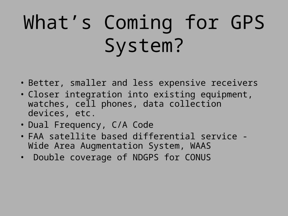
What’s Coming for GPS System?
• Better, smaller and less expensive receivers• Closer integration into existing equipment, watches,
cell phones, data collection devices, etc.• Dual Frequency, C/A Code• FAA satellite based differential service - Wide Area
Augmentation System, WAAS• Double coverage of NDGPS for CONUS
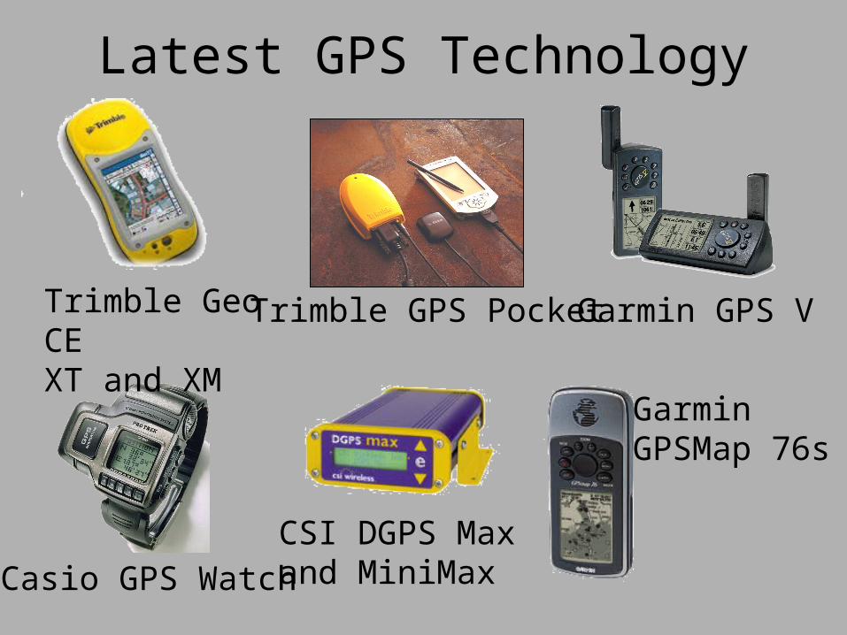
Latest GPS Technology
Casio GPS Watch
Trimble GPS PocketTrimble Geo CEXT and XM
Garmin GPS V
CSI DGPS Max and MiniMax
GarminGPSMap 76s
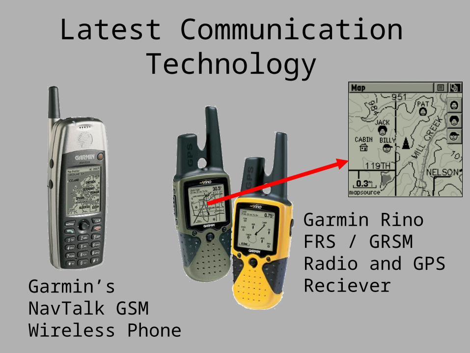
Latest Communication Technology
Garmin’sNavTalk GSMWireless Phone
Garmin RinoFRS / GRSMRadio and GPSReciever
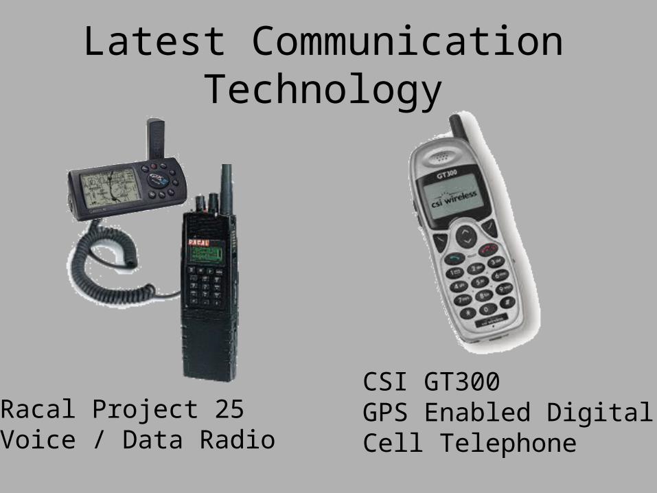
Latest Communication Technology
Racal Project 25 Voice / Data Radio
CSI GT300GPS Enabled DigitalCell Telephone
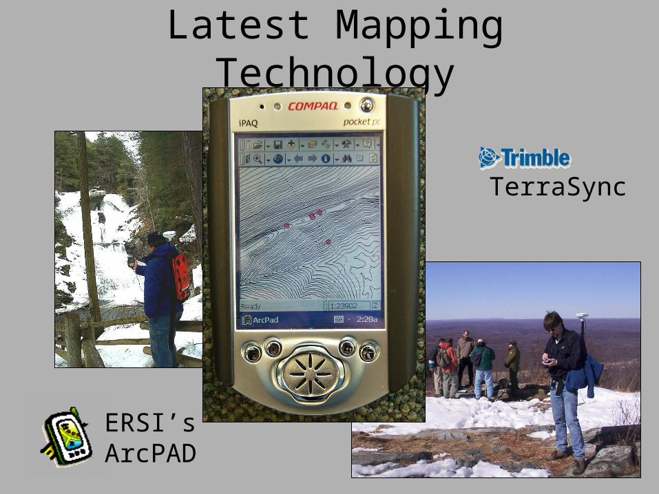
Latest Mapping Technology
ERSI’sArcPAD
TerraSync
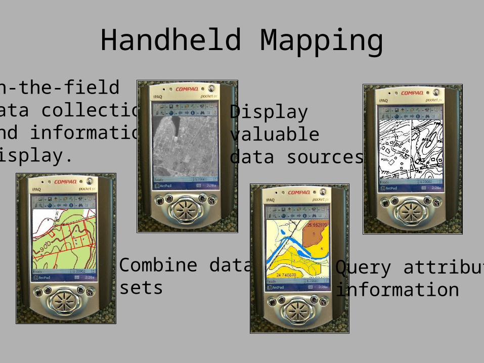
Handheld Mapping
In-the-fielddata collectionand informationdisplay.
Combine datasets
Display valuabledata sources
Query attributeinformation
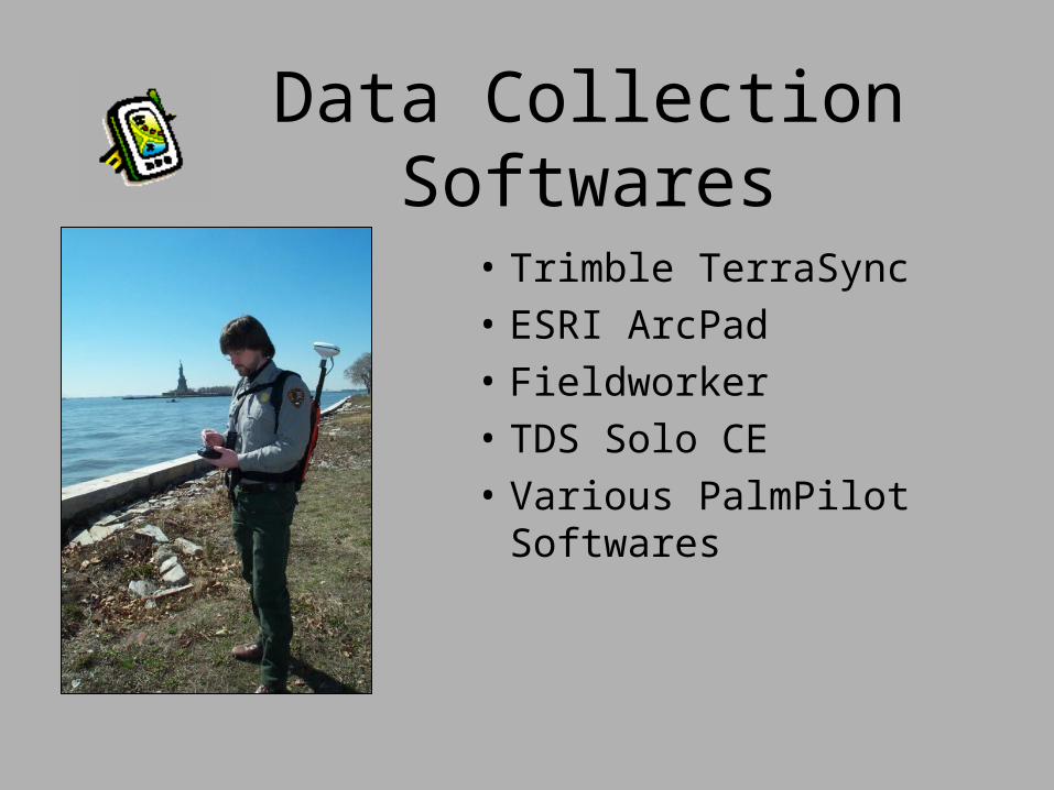
Data Collection Softwares
• Trimble TerraSync
• ESRI ArcPad
• Fieldworker
• TDS Solo CE
• Various PalmPilot Softwares
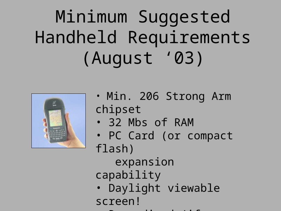
Minimum Suggested Handheld Requirements (August ‘03)
• Min. 206 Strong Arm chipset• 32 Mbs of RAM • PC Card (or compact flash) expansion capability• Daylight viewable screen!• Ruggedized (if possible)
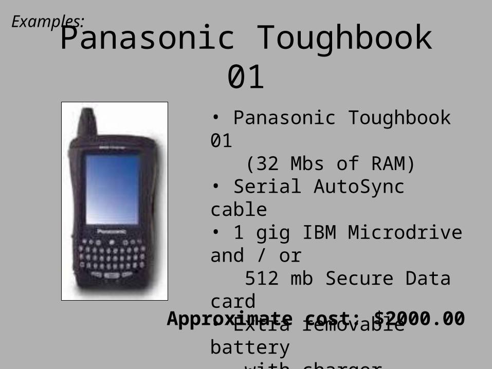
Panasonic Toughbook 01Examples:
• Panasonic Toughbook 01 (32 Mbs of RAM)• Serial AutoSync cable• 1 gig IBM Microdrive and / or 512 mb Secure Data card• Extra removable battery with charger
Approximate cost: $2000.00
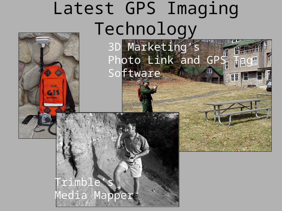
Latest GPS Imaging Technology
3D Marketing’sPhoto Link and GPS TagSoftware
Trimble’sMedia Mapper
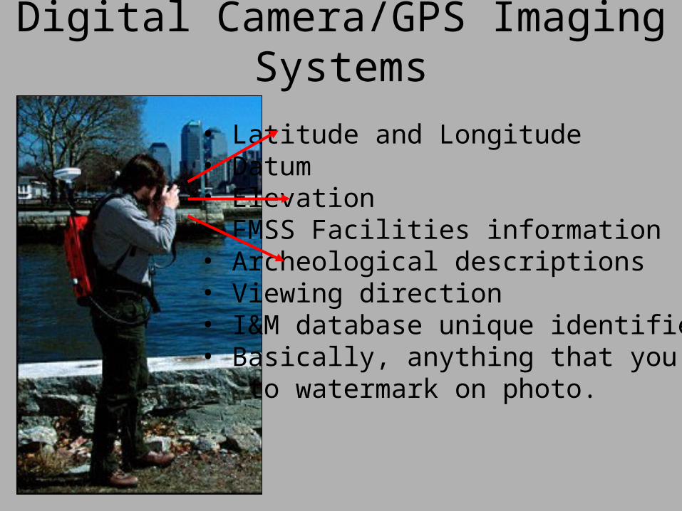
Digital Camera/GPS Imaging Systems
• Latitude and Longitude• Datum• Elevation• FMSS Facilities information• Archeological descriptions• Viewing direction• I&M database unique identifiers • Basically, anything that you want to watermark on photo.
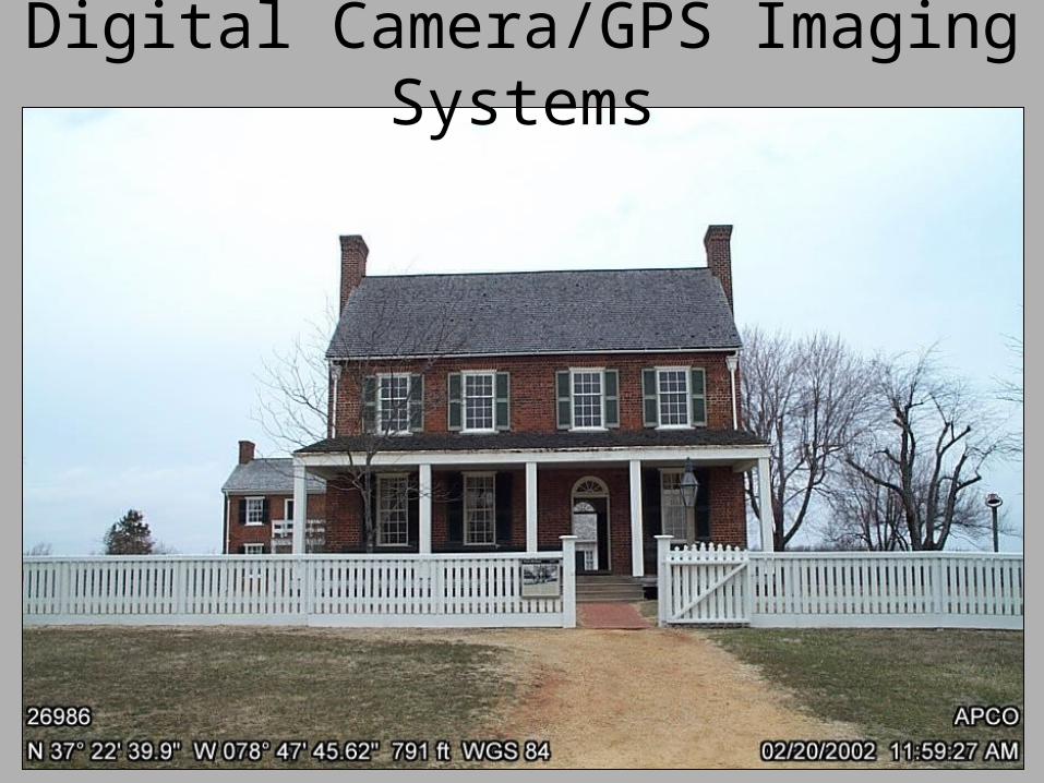
Digital Camera/GPS Imaging Systems