Embed Size (px)
Citation preview
theGIS ProfeSSIonalA publication of the Urban and Regional Information Systems Association Issue 251 • November/December 2012
IN THIS ISSUE
5 President’s Column
6 3D GIS: Mapping the Future with High Resolution 3D Buildings
8 “Disruptive” ~ What’s that all about?
10 URISA Initiatives for Young Professionals
14 Welcome New URISA Members
16 2012 Sponsor Directory
continued on page 2
…find out by taking a unique environmental tour!
The Charlotte Green Tour tells the Charlotte and Mecklenburg County envi-ronmental and sustainability story. The City of Charlotte, North Carolina, released the Charlotte Green Tour ap-plication this past summer. Any user may walk through the story of environmental sustainability investments in Charlotte and Mecklenburg their own way. The idea is simple: highlight “green” assets for the public. The only challenge encountered was how to share so many initiatives in a user friendly, interesting, and interactive manner, with limited re-sources and time. The City of Charlotte’s GIS Enterprise Team had an interest to uti-lize ArcGIS Online as their online mapping solution for public and internal mapping applications. The Green Tour was one of the first proof-of-concept applications gener-ated to show how interactive maps enhance communica-tion and services. The Green
Tour supports the “Environ-ment” focus area that is part of the City’s balanced score-card strategy:
“The City of Charlotte recognizes that environ-mental stewardship is fun-damentally important to quality of life and essential to maintaining a vibrant economy. Protecting our natural resources, promot-ing conservation, and im-proving the environment all enhance the City’s mis-sion to preserve the qual-ity of life of its citizens.” (Charlotte Environment Focus Area, CharlotteNC.gov)
The Map ContentThe Charlotte Green Tour presents the environmental story in six categories: 1) Energy, 2) Water, 3) Solid Waste, 4) Air & Transpor-tation, 5) Parks & Green Space, 6) Envision Charlotte Program Sites. This allows users to choose assets that they are most interested in.
An assemblage of
various services and programs with “green” assets allow the public to explore this information spatially. The asset types are listed with a brief description below.The “Green” Tour asset list:
B-Cycle Station – this bike share pro-gram provides an
alternative to vehicle trans-portation which will reduce carbons emissions. The clean air and exercise will improve the health of Charlotte citi-zens and visitors. Learn more at bcycle.com
Big Belly Station – The City of Char-lotte Solid Waste Ser-
vices has installed five “BigBelly” solar waste sta-tions in Uptown as a pilot to further reduce litter, encour-age recycling and enable the City to deliver essential ser-vices at a reduced cost. Learn more at curbit.charlot-tenc.gov.
What’s So Green about Charlotte, NC?By: Keri Shearer, Rob Phocas, and Twyla McDermott – City of Charlotte

Center City on Street Recycling – City crews make
approximately 25 special trips to the County’s recy-cling facility per year to spe-cifically dump the uptown recycled materials. Since 2010, 24.46 tons of recycla-ble materials have been col-lected in the Center City recycling receptacles. Learn more at curbit.charlottenc.gov.
Community Gar-den –provide green space, improve ac-
cess to healthy food, in-crease property value, shorten the supply chain, reduce the energy involved in the production of pro-duce, and provide a recre-ational activity focused on environmental stewardship.
EECBG - Funded by a grant from the US Department of En-
ergy, The Commercial Build-ing Energy Efficiency Retrofit Program is one of 17 City of Charlotte projects to receive funding through the Energy Efficiency and Conservation Block Grant Program, part of the American Resource and Recovery Act. To learn more about Charlotte’s en-ergy strategy, visit www.Power2Charlotte.com (Com-mercial Building Retrofit Grant)
Electric Vehicle Charging Station - Charlotte’s electric
vehicle project aims to make transportation more sustain-able. The project includes the purchase of 8 electric vehicles for the City’s fleet, and the installation of 26
charging stations at 7 loca-tions around the City.
Energy Star – Busi-ness locations listed as Energy Star, A
joint program of the U.S. Environmental Protection Agency and the U.S. De-partment of Energy helping us all save money and pro-tect the environment through energy efficient products and practices. http://www.energystar.gov/
Farmer’s Market - Farmer’s Markets are especially impor-
tant in cities because they give residents and visitors access to locally grown food. Not only does this promote local farmers but it reduces the carbon footprint of food transportation.
Geothermal Heat-ing System – Geo-thermal systems heat
and cool a facility by circu-lating fluids through a net-work of buried pipe loops exchange heat energy with the surrounding soil. Learn more at Power2Charlotte.com (Charlotte’s Energy Strategy)
Green Roof - Cover parking garages and roof tops that would
normally be impervious sur-face. Adding vegetation is a great way to increase the amount of green space within a city. Green space helps to improve air quality, mitigate the heat island ef-fect, and reduce the amount of runoff that flows into streams.
Green Building – LEED certified building locations.
Learn more at usgbc.org.
Greenway/Trail - Greenways are veg-etated natural buf-
fers that improve water quality, reduce the impacts of flooding, and provide wildlife habitat. Greenway trails provide recreation, transportation, fitness, and economic benefits for all to enjoy. Learn more at char-meck.org (Mecklenburg County Park & Recreation Department).
Envision Char-lotte - is a unique public-private collabora-
tion that is leading Charlotte to become a global model for environmental sustain-ability and measurable com-munity results. Smart Energy Now®, is a big part of the Envision Charlotte ini-tiative sponsored by Duke Energy. The goal of the pro-gram is to reduce energy consumption in Uptown. Employees are encouraged to take simple actions such as turning off computer monitors, and energy con-sumption is reported on a kiosk in the lobby of each office building. Learn more at smartenergycharlotte.com
Parks and Green Space –parks and green space provide
recreation, education, and positive environmental ex-periences for the region. Learn more at charmeck.org (Mecklenburg County Park & Recreation Department)
Solar – Photovoltaic energy from the sun is a good energy
source in the sunny Char-lotte region. Learn more at Power2Charlotte.org (Cata-lyst Projects)
Green Star - A special “Green Star” theme highlights
environmentally-friendly fea-tures along Tryon Street in the Charlotte center city. Visitors and residents taking the Green Star tour will visit sites such as LEED-certified buildings, electric vehicle charging stations, and recy-cling locations.
Representatives from The City’s Office of the Chief Information Officer (OCIO), the City Manager’s office, and Mecklenburg County planned the data collection effort to help support the Green Tour story maps. This effort was to support multiple programs with a central database, thus using multiple views and one GIS data source. The resulting database contains 643 green assets countywide. Data was collected in two ways. 1) Photos were collected with a smart phone by an intern from Davidson College, a spreadsheet, and GIS dataset were set up to enter supportive information for the story map. These photos have GPS coordinates embedded in their .EXIF file. Using a Python script, we were able to transform the pictures into a GIS point feature class. 2) Data was gathered from more traditional methods: program liaisons using an address within a
Green continued from page 1
The GIS Professional • NoVEMBER/dECEMBER 2012 • Page 2

spreadsheet, existing GIS data, existing images, and from website downloads. The data was loaded into the following schema to support this and future story maps.
The “Green” Tour multi-Purpose data schema:GTID - Unique ID field for
each Green Tour point feature. Used as a map id for cartographic purposes when labeling does not work well and should be support a general start to end path.
Priority – Used internally to communicate which planned priorities (A,B,C) had been captured by the intern.
Highlight - Used to indicate locations that are “Green Star.”
Category - ArcGIS Online “My Map” map tab. This indicates which maps this feature should be included in and is separated by “;”. (Values will be a combination of 1 to 6. 1=Energy, 2=Water, 3=Solid Waste, 4=Air, 5 = Transportation, 6=Green Space). (Example: 1;3 …which means that this feature is in Energy and Solid Waste maps)
Theme - Feature reference, like greenway, park, green building, LEED Light, stream, project, Smart Energy Now, to aid in further filtering the data by its source.
Topic - Similar to Category, but more specific than the 6 Categories listed above and less specific than the Theme. Example: we will have
Greenways and Carolina Thread Trail combined would be Paths.
Feature Name -Name of the feature. (Example: Bird House, Community Garden, Little Sugar Creek Green Way Entrance, LEED Light, UNC-Charlotte City Center)
Feature Location -An address, intersection or general street and block location of the featured point.
Feature Description - Story description of the featured point. Answers the question:Why is this a significant stop on the Green Tour?
Image1 Name - This is the name of the first image taken for this point feature. (Example: Parks and Greenways 152.jpg)
Image1 Description - Is a description of the image. (Example: UNCC Center City location green roof on the western side of the property)
Image1 Path -Is the image’s URL (Example: http://carstations.com/wp-content/uploads/Bank-of-America-East-7th-St-EV-Charging-Station-Charlotte-NC-1-e1328327327435.jpeg)
Image2 Name - Is the name of a second image taken for this point feature. (Example: Parks and Greenways 153.jpg)
Image2 Description - Is a description of the image. (Example: UNCC Center City location green roof shown from Oblique Photography on the eastern side of the building)
Image2 Path - Is the image’s URL
Link1 Name - Is the common name for the website or organization.(Example: Power2Charlotte or UNCC Main Page)
Link1 Description - Is a description of Link 1. (Example: Go to the Power2Charlotte site to learn more)
Link1 Image - Generally this should be a logo.
Link1 Path - Is the URL to the site that either a hyperlink in the popup will jump to or when clicking on the Link1Image this will take the user to the URL.
Link2 Name - Allows for a 2nd link like Link1Name
Link2 Description - Is the description that tells what the 2nd link is.
Link2 Image - Is an image that is significant for the 2nd link. Like a logo.
Link2 Path - Is a path that the 2nd link will jump to another website of significance from the Link2 Image.
General Notes - Used to communicate internally about the feature. For instance we had to move the UNCC Center City point up a few blocks because the GPS coordinate was off when the image was taken. That would be noted here.
Once compiled, the data was filtered with ArcMap and published to the City’s map REST services; then imported into ArcGIS Online maps to share as “map services.” The following definition queries were used for the
Map Services (Buttons on the mobile app. and Tabs on the desktop application). Because a point on the tour can be in more than one Category like Energy (1) and Water (2) it would look like this “1;2” in the field.
Energy Tab: Category LIKE ‘%1%’
Water Tab: Category LIKE ‘%2%’
Solid Waste Tab: Category LIKE ‘%3%’
Air and Transportation Tab: Category LIKE ‘%4%’ or Category LIKE ‘%5%’
Green Space Tab: Category LIKE ‘%6%’
Green Star (VIP’s) Tab: Highlight = ‘VIP’
The “map services” were then published using templates provided by Esri and enhanced by Esri and the City’s GIS Developer. To learn more about these types of “map services” visit ArcGISonline.com.
The Walking and Desktop ToursThe Green Tour application is available as a mobile tour (Figure 1.) that generates a walking route, using the sidewalk network in Uptown Charlotte, or as desktop computer story map (Figure 2.). The application detects the type of device from which the link is accessed and presents either the desktop or mobile version.
SummaryThe power of GIS made the Charlotte Green Tour come to life. The user is able to explore and experience the green assets within Char-lotte and Mecklenburg in
continued on page 4
The GIS Professional • NoVEMBER/dECEMBER 2012 • Page 3

their own way. The data generated for the story map is multi-purpose and easy to update with a central-ized data source. And the City of Charlotte GIS Enter-prise Team had a successful proof-of-concept using this application with ArcGIS Online as the mapping plat-form. This will also allow the existing environmental pro-grams that participated to have an application to show where their green assets are. This opportunity was made possible by partnering
Figure 1. This mobile app is device-independent. The app was developed by Esri for the City of Charlotte using our Enterprise License Agreement and credits. This view shows how a user chooses a category of Energy (A.) , then clicks on the Route button to set a navigation pattern using the sidewalk
(B.), and click a location on the screen to learn more about an asset (C.)The direct link to the Charlotte Green Tour mobile version is: http://maps.charlottenc.gov/greentour/m.
Figure 2. In this more traditional desktop view, the user chooses a tab via their desktop PC to learn about the Duke Energy Building in Uptown Charlotte. ArcGIS Online has provides simple configuration of popups,
including images, hyperlinks, charts and graphs dynamically drawn from Charlotte’s map REST services.
The direct link to the Charlotte Green Tour desktop version is: http://maps.charlottenc.gov/greentour.
with several departments, agencies, and programs, including: City of Charlotte, Mecklenburg County, Duke Energy, Bank of America, Davidson College and Esri. Take the tour, either virtually or on foot, of our environ-mental and energy features to see why Charlotte is a national leader in environ-mental and energy sustain-ability. The tour can be seen from the comfort of your computer or on the go with your smartphone or tablet.
This application has set a precedent for the creation of many more online mapping applications. Such applica-tions were displayed to relay event related traffic informa-tion during the Democratic National Convention in Sep-tember of 2012, to commu-nicate Storm Water Active Capital Project Status, and Power2Charlotte energy ini-tiatives. Others are planned in the future using ArcGIS Online.
To learn more about energy and the environment in Charlotte
and Mecklenburg, please visit www.power2charlotte.com and www.charmeck.org. You may also contact Rob Phocas, Energy and Sustainability Manager for the City of Charlotte at [email protected]. If you have questions about the CharlotteGreen Tour application or GIS in general at the City of Charlotte contact Keri Shearer at [email protected] or Twyla McDermott [email protected].
Green continued from page 4
The GIS Professional • NoVEMBER/dECEMBER 2012 • Page 4

LEARN MORE: gis.jhu.edu
> Earn your Master of Science degree part-time and completely online.
> Develop GIS infrastructure and learn spatial analytics using cloud computing.
MS IN GEOGRAPHICINFORMATION SYSTEMS
NEW OFFERING!
Krieger School of Arts & Sciences | Advanced Academic Programs
President’s Column
We just finished our GIS Pro Conference in Portland—the 50th of our existence—and can report that attendance was the highest we have seen in several years. The experi-ence shows that a quality product will be successful. My thanks go to the many volunteers and URISA staff who were instrumental in organizing and carrying out the conference program. In particular, I want to recognize the leaders of the conference gang, Claudia Paskauskas (Conference Chair), Al Little (Program Chair), and Amy Esnard (Associate Program Chair) for their outstanding leadership and dedication.
We have put photos of the event on our website at http://www.urisa.org/gispro2012.
Part of the reason for our successful conference was our partnering with the Northwest GIS Users Group with support from the Oregon Chapter of URISA. I want this to be a practice we carry into the future to the extent that our annual and specialty conferences, URISA Leadership Academy events, and our proposed URISA University workshop sessions are conducted in cooperation with a URISA chapter. Together, URISA and the chapters should
strive to provide a consistent and quality membership experience.
It’s a cliché to say you get out of an organization what you put into it but it is nevertheless true. I am going to assume by the mere
fact you are a member of URISA that you are hard core, that you care about getting something done. I say this because, let’s face it, URISA is not an organization that let’s us just sit back and read the monthly magazine in order to get value from the dues you pay. You have to do something to get value out of your URISA membership. We all need to pull together to make URISA’s tagline ring true: we are The Association for GIS Professionals.
Al Butler, [email protected]
Al Butler
The GIS Professional • NoVEMBER/dECEMBER 2012 • Page 5
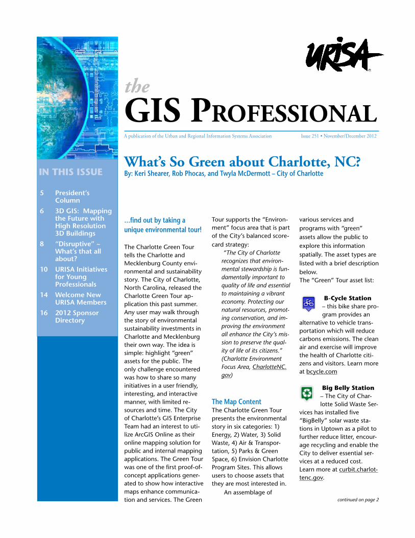
3D Geographical Informa-tion Systems (GIS) have made great strides in recent years in the mapping com-munity, becoming a game-changer in a multitude of public and private arenas. Much of that is due to the fact that GIS is moving from the 2D world into the ‘new’ frontier of 3D, offering users a wealth of information that makes analysis, communica-tion, and implementation of projects ‘virtually’ clear.
3D GIS buildings need to be generated from diverse data capturing systems, preferably photogrammetric systems over others due to their accuracy. In CyberCity 3D’s case, the data is created from proprietary, automated modeling processes that allow for the delivery of areas of up to 100,000+ structures. These 3D GIS buildings contain various data that can be migrated to other systems, either as graphics files or file geo-databases. This highly efficient production
methodology results in both data enhancement and cost savings.
Below: 3D GIS data as part of a Geodesign information platform
The company optimizes 3D geospatial analysis by mapping modeled areas from aerial, oblique, or satellite imagery to gather an abundance of statistical information. Each roof polygon features a broad range of automated measurements such as line-of-sight and building footprints, with up to six-inch accuracy. Line-of-sight
information, an essential element in development, allows planners to be forewarned about potential obstructions in the view of the proposed project as
well as existing structures. More precise building footprints enable GIS and mapping departments with the ability to better prepare for zoning and easements.
Enhanced visualization, made possible with CyberCity 3D’s building models, gives both private and governmental entities the ability to communicate with stakeholders and the public more effectively as they can virtually ‘see’ the targeted urban environment. If a 2D picture is worth a thousand words, then a 3D ‘picture’ is priceless. The company can amplify that ‘picture’ upon request, creating non-textured or textured buildings per the client’s needs.
3D buildings can now be even more effective
in the marketplace; for example, CyberCity 3D models integrate into the new Esri® CityEngine® platform, a stand-alone software product that turns 2D GIS data into smart 3D city models. With CyberCity 3D’s accurate building measurement data fields, the company streamlines CityEngine’s workflow by eliminating the need to transform 2D GIS footprints (which many cities do not possess) into 3D.
Civil Engineering sustainability programs also reap benefits from new 3D technology, modeling natural and built environments as a GIS resource. Models featuring accurate measurements from each roof section or ‘polygon,’ along with the orientation ‘azimuth’ stand apart from most modeling-- which doesn’t include this essential information. Whereas satellite ortho or oblique images tend to cause distortions in these measurement results, the high resolution, stereo aerial imagery utilized by CyberCity 3D calculates the roof area precisely. The generation of multiple polygonal measurements per rooftop allows for more effective analysis of storm water and solar potential from measured rooftops.
Cities with ample rainfall increasingly find
3D GIS: Mapping the Future with High Resolution 3D Buildings
Slide screen view of 3D building scenes in CityEngine®
The GIS Professional • NoVEMBER/dECEMBER 2012 • Page 6
this specific data helpful in harvesting rainfall scores to determine billing for storm water services; significant revenue can be generated through these fees. The attained information also allows for better servicing, in addition to more effective
assessments of impervious surfaces on buildings.
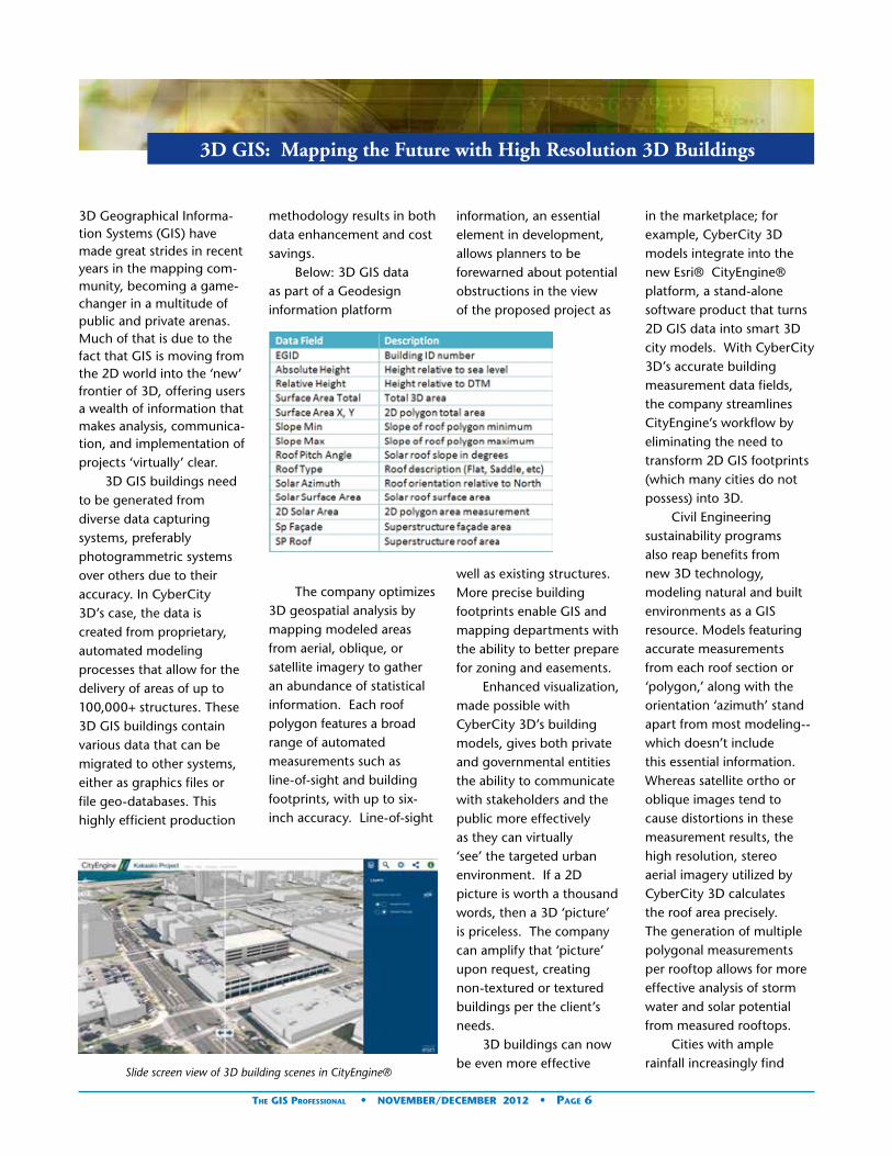
Solar maps produced using these roof measurements move the nation another step toward smart, renewable energy, with households and businesses adding
Solar mapping with CityCity 3D GIS Buildings
new doors to the future solar potential of cities.
3D GIS is mapping the future—in ways only dreamed of until recently. Companies like CyberCity 3D are paving the way to a greater understanding of the geospatial environment, leading both the public and private sectors to a more accurate, 3D vision of what ‘is’—and what is possible.
CyberCity 3D™, specializing in emerging GIS and visualization solutions, is one of the first movers in this geographic technology. The southern California Company offers large scale, high resolution, 3D city models for geospatial analysis, enhanced visualization, and civil engineering. It is an Esri® partner and one of Google Earth and Maps™ largest contributors of 3D models.
Contributed by: Rae DeVito, CyberCity 3D www.cyber-city3D.com
rooftop solar emerging into increasingly self-sufficient micro-utilities. CyberCity 3D’s high-resolution data provides the foundation for incorporating variables such as solar panel output, financial incentives, and shading modules—opening
We wish you a safe, healthy, and joyful
holiday season and a wonderful 2013!
The GIS Professional • NoVEMBER/dECEMBER 2012 • Page 7
Former URISA President ~Greg Babinski said it like this,
“. . . GIS-Pro is like being in an intellectual nuclear reactor, where smart people come into close contact, ideas collide, thought processes acceler-ate, new ideas are formed, and then those ideas spin off around the world as we return home to shake things up . . .The results are often unexpected and very disruptive!”
Greg Babinski- URISA President
URISA International certainly got “disruptive” in Portland Oregon, and produced an extraordinary event that brought together a signifi-cant and vibrant assembly of “spatial” people who gathered together to impart a wealth of knowledge and wisdom; inspire, share, and embrace ideas and strate-
“Disruptive” ~ What’s that all about?
gies; form alliances and spe-cial friendships; and move forward together with a common vision ~ our future!
This milestone conference was indeed packed with evidence of a legacy of achievement. What took place inside the Hilton Portland was certainly a Golden Opportunity. I was among an impressive body of knowledge, and a witness to a reunion of URISA pioneers who shared their testimonies of the past 50 years of successful longevity. It was indeed a stroll down memory lane that filled me with a new sense of profound pride and gratitude, and really brought home an awareness of my incredible good fortune! My opportunity to be the Geographic Information System professional that I am today is attributed to the efforts of URISA for so many astounding reasons. From the very year I was born, URISA began building a foundation for MY personal future. They reached for the stars; paving the way, building bridges, breaking
down barriers, challenging the norm, laying new foundations, opening doors, and leaving a trail . . . (you get my point, right?) They’ve been “disruptive” for fifty years on MY behalf. And for fifty years they have organized various venues to captivate, motivate, and inspire every attendee.
It was surely evident, as hundreds assembled in the banquet rooms, and together we glided through space with Dr. Michael F. Goodchild and his vision of “Digital Earth,” then we took a walk in the “Cloud” with Johannes Kebeck of Microsoft, and finally caught a glimpse of “GIS Technology in Transition” from the eyes of Jack Dangermond, President of ESRI.
Leaders and professionals of all levels and disciplines, and even those in-training, were
there not only to gather up knowledge and foresight, but they also came to advance the mission of URISA by making a personal contribution. These people are a very reliable and loyal resource that URISA has managed to maintain for over five decades. Volunteers with an appreciation and respect for URISA’s impact on the ever-changing world of information were present for an opportunity, or better yet in my opinion, “a privilege” ~ to partner with URISA in a most satisfying and rewarding way.
Rewards? You bet! URISA not only brings educational value, but it also fosters relationships. They know how to balance the atmosphere and pace by hosting some fantastic social events and networking opportunities throughout the course
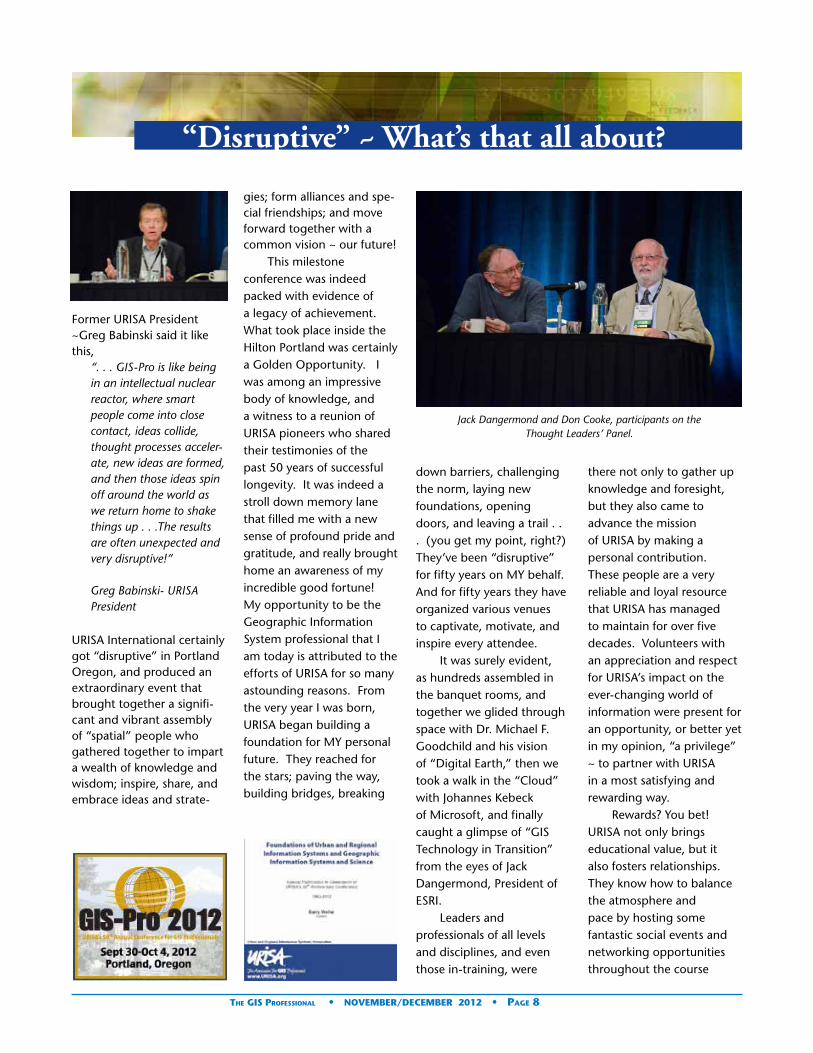
Jack Dangermond and Don Cooke, participants on the Thought Leaders’ Panel.
The GIS Professional • NoVEMBER/dECEMBER 2012 • Page 8
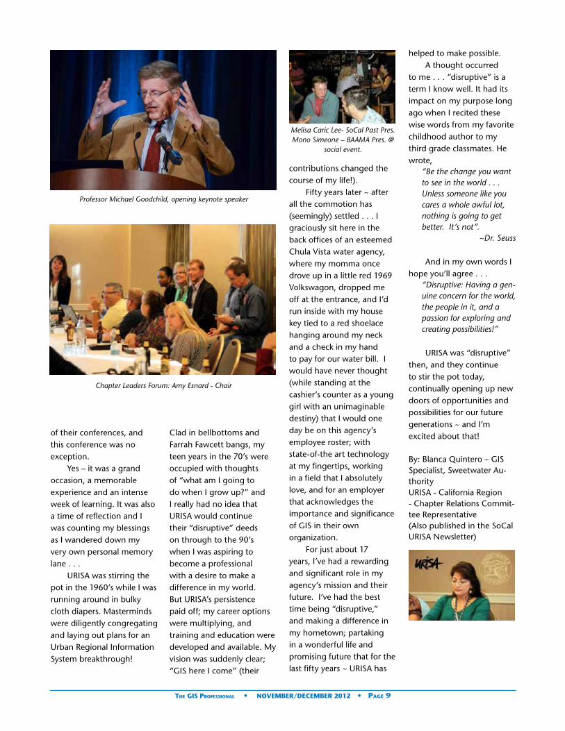
Professor Michael Goodchild, opening keynote speaker
Chapter Leaders Forum: Amy Esnard - Chair
of their conferences, and this conference was no exception.
Yes – it was a grand occasion, a memorable experience and an intense week of learning. It was also a time of reflection and I was counting my blessings as I wandered down my very own personal memory lane . . .
URISA was stirring the pot in the 1960’s while I was running around in bulky cloth diapers. Masterminds were diligently congregating and laying out plans for an Urban Regional Information System breakthrough!
Clad in bellbottoms and Farrah Fawcett bangs, my teen years in the 70’s were occupied with thoughts of “what am I going to do when I grow up?” and I really had no idea that URISA would continue their “disruptive” deeds on through to the 90’s when I was aspiring to become a professional with a desire to make a difference in my world. But URISA’s persistence paid off; my career options were multiplying, and training and education were developed and available. My vision was suddenly clear; “GIS here I come” (their
contributions changed the course of my life!).
Fifty years later ~ after all the commotion has (seemingly) settled . . . I graciously sit here in the back offices of an esteemed Chula Vista water agency, where my momma once drove up in a little red 1969 Volkswagon, dropped me off at the entrance, and I’d run inside with my house key tied to a red shoelace hanging around my neck and a check in my hand to pay for our water bill. I would have never thought (while standing at the cashier’s counter as a young girl with an unimaginable destiny) that I would one day be on this agency’s employee roster; with state-of-the art technology at my fingertips, working in a field that I absolutely love, and for an employer that acknowledges the importance and significance of GIS in their own organization.
For just about 17 years, I’ve had a rewarding and significant role in my agency’s mission and their future. I’ve had the best time being “disruptive,” and making a difference in my hometown; partaking in a wonderful life and promising future that for the last fifty years ~ URISA has
helped to make possible. A thought occurred
to me . . . “disruptive” is a term I know well. It had its impact on my purpose long ago when I recited these wise words from my favorite childhood author to my third grade classmates. He wrote,
“Be the change you want to see in the world . . . Unless someone like you cares a whole awful lot, nothing is going to get better. It’s not”.
~Dr. Seuss
And in my own words I hope you’ll agree . . .
“Disruptive: Having a gen-uine concern for the world, the people in it, and a passion for exploring and creating possibilities!”
URISA was “disruptive” then, and they continue to stir the pot today, continually opening up new doors of opportunities and possibilities for our future generations ~ and I’m excited about that!
By: Blanca Quintero – GIS Specialist, Sweetwater Au-thorityURISA - California Region - Chapter Relations Commit-tee Representative(Also published in the SoCal URISA Newsletter)
Melisa Caric Lee- SoCal Past Pres.Mono Simeone – BAAMA Pres. @
social event.
The GIS Professional • NoVEMBER/dECEMBER 2012 • Page 9
Meet the URISA Vanguard CabinetThe Vanguard Cabinet (VC) was formed in January, 2011 to engage young GIS professionals, increase their numbers in the organiza-tion, and better understand the concerns facing the future leaders of the GIS community. The VC is made up of ten representatives under the age of 35. Each member serves a two year appointment.
One initiative we are working on is to compile and create resources of interest to young professionals in the geospatial field in partnership with EmergingGISLeaders.org. There are many people and organizations
generating fantastic material related to GIS professional development. However, this information is often distributed between many different websites, making it difficult for a “newbie” to find and prioritize what is most applicable. The EGL website helps bring all of the best resources into one place. We are also creating a crowd-sourced “Young GIS Professional Hall of Fame” to educate individuals about the top ten best resources for young professionals. Nominate your favorites at www.emerginggisleaders.org/hall-of-fame
Another challenge for young professionals is that many GIS professional development resources are created with mid-level
professionals in mind. New-comers that have yet to land their first GIS job or internship may have a hard time understanding the value of these resources or may be unsure of specific next steps to apply the information. For example, many students in GIS programs have never attended a GIS conference, aren’t aware of the major national GIS professional organizations, and may not have a professional LinkedIn profile or GIS portfolio. The Vanguard Cabinet is working with Emerging GIS Leaders to help new-comers translate existing professional development resources into actionable information. For example, we’re creating worksheets to create personalized career development plans using the Geospatial Technology Competency Model (GTCM) and requirements for GIS certification programs. We’re also working to compile and showcase examples of model GIS portfolios, career profiles, and LinkedIn profiles created by students and entry level professionals. Our goal is to create a platform where young professionals can learn from one another and connect with their peers.
Highlights from the 2012 GIS – Pro Conference, Portland, OregonThe Vanguard Cabinet also works with the URISA leadership teams to host events of interest to young professionals at the annual GIS-Pro conference. We planned two major events at the recent conference in Portland, OR. The Young Professionals’ Meet & Greet provided a venue to meet peers, learn about their professional devel-opment goals, and speak candidly about topics like starting salaries and how to get promoted. The participants ranged from students to mid-career GIS professionals. Betsy Breyer, a student from Portland State University (PSU) com-mented, “I thoroughly enjoyed the YP networking event at GIS-Pro. I recon-nected with colleagues I hadn’t seen in months and also made some great con-tacts from both near and far.” Madeline Steele, also a student at PSU said, “The networking event for young professionals was one of the highlights of a great conference for me. It gave me a chance to compare notes with people in my age group from all over the country, which was both fun and inspiring.”
Professional Development Conference SessionThe Vanguard Cabinet also organized a session named “Professional Development
By Rachel Kornak, GISP
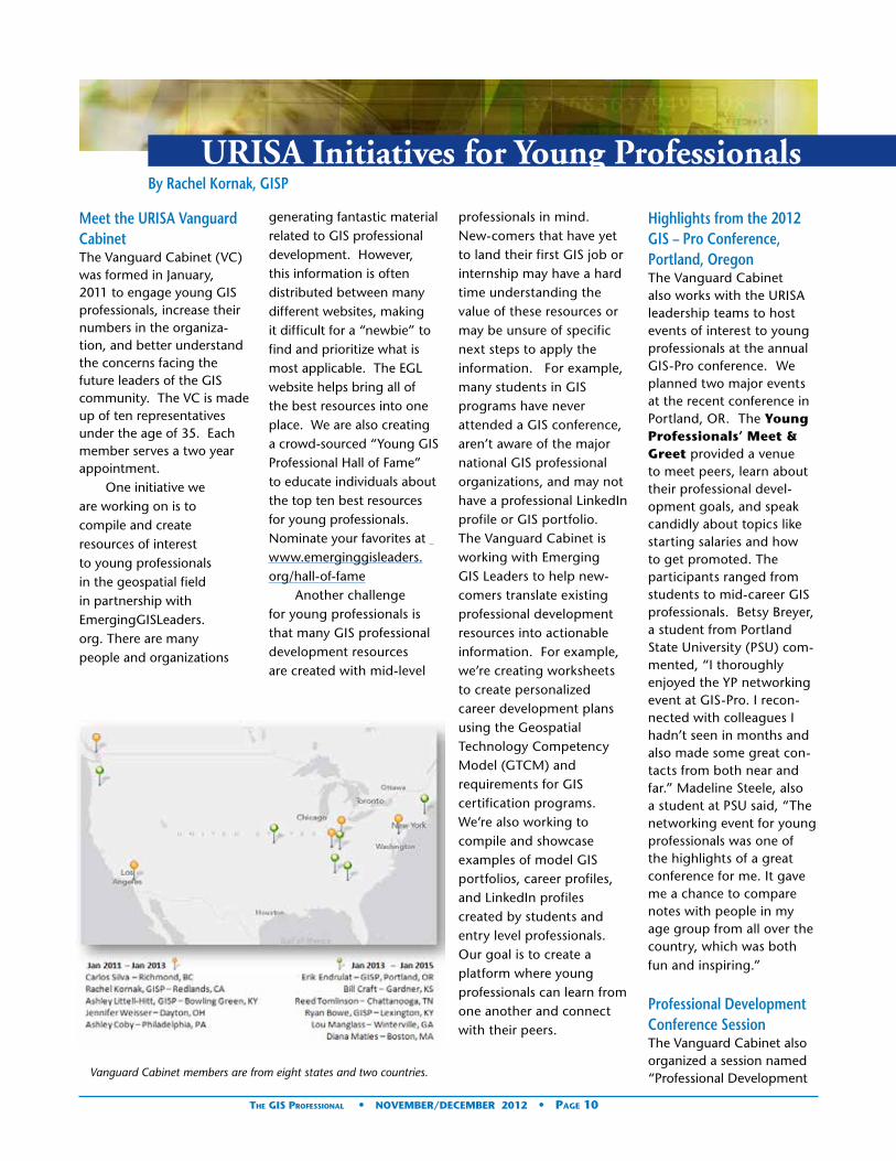
Vanguard Cabinet members are from eight states and two countries.
URISA Initiatives for Young Professionals
The GIS Professional • NoVEMBER/dECEMBER 2012 • Page 10

and Certification.” Erik Endrulat, GISP moderated the panel, which included four speakers. Copies of the presentations are available online at www.emerginggis-leaders.org/presentations.
Ashley Littell Hitt, GISP outlined options for GIS certification through the GIS Certification Institute (GISCI), the American Society for Photogrammetry and Remote Sensing (ASPRS), and Esri. She also demonstrated how the Geospatial Technology Competency Model (GTCM) can be used to plan professional development goals.
The networking event brought together young professionals with similar interests.
Vanguard Cabinet members pose with the winner of the Twitter challenge.
Rachel Kornak, GISP presented tips and tricks to create a GIS Portfolio using free mapping, presentation, and website creation tools like Prezi, ArcGIS Online, Esri’s Story Map templates, Weebly, and Word Press. She contrasted the effectiveness of crafting stories about the value of each GIS project vs. reporting detailed methodologies and technical details.
Anthony Robinson, Phd advised about the range of options for continuing education, benefits and costs, setting realistic expectations, and
selecting the best program for your needs. He also spoke about the importance of researching potential schools by talking to alumni and faculty, reviewing content and curricula, and visiting campuses in person, even if the educational program is offered online.
diana Maties showcased the Vanguard Cabinet’s recent efforts to create an online resource that links potential mentors with mentees based on similar profiles and shared interests. The program also provides workflow templates and suggested milestones to help participants maximize
productivity. The website is still in beta testing. Stay tuned for more details. The effort to create a new mentoring resource was motivated by discussions in a session organized by the VC at the 2011 GIS-Pro Conference entitled, “Mentorships - Challenges & Opportunities.”
What’s Next?The Vanguard Cabinet’s goals for next year are to 1) develop and launch the mentor-matching program, 2) increase collaboration with local URISA chapters and other GIS professional organizations, 3) continue to create resources and plan events for young GIS profes-sionals, 3) increase outreach efforts to students in GIS programs to educate them about the value of joining professional organizations, attending conferences, and volunteering, and 4) de-velop and promote specific ways for young professionals to get involved in URISA.
In January, 2013, the Vanguard Cabinet will welcome five new members. At the same time, the two -year terms of the original members will come to an end. We’d like to thank the team for all of their hard work and great ideas along the way. Several of the members will continue to be involved in URISA’s initiatives for young professionals.
How Can You Get Involved?You can help make a differ-ence by volunteering even just a few hours of your time. Please contact us at [email protected] or emerging-
continued on page 12
The GIS Professional • NoVEMBER/dECEMBER 2012 • Page 11

Session attendees learn about GIS professional development opportunities.
[email protected] if you are interested in supporting initiatives for young profes-sionals. We currently need help with the following:• Emerging GIS Leaders
Website: www.emergingisleaders.org=
• Nominate resources for the Young Professionals Hall of Fame. (These are resources you wish you knew about earlier and are instrumental to being successful in the GIS field).
• Review a GIS book or article of special interest to YPs.
• Suggest new resources such as job listing sites, career development plan advice, and other tips and tricks.
• Lead or participate in a social media round table.
• Share your success story to inspire other YPs by writing a blog post, creating a short video, or interactive map story using meograph.com, ArcGIS online, or other multimedia tool.
• Share lessons you learned from attending conferences on the EGL blog.
• Create best practices and examples of great GIS Portfolios, Interactive Video Resumes, and Social Media Profiles.
• Research and profile national, regional, and local GIS professional groups. Help YPs understand why they should choose one over
the other.• Create an interactive
map and directory of GIS organizations with young professional groups.
Outreach • Follow us on Twitter @
gisleaders and retweet messages.
• Join and participate in our Facebook (https://www.facebook.com/emerginggisleaders ) and LinkedIn groups (http://www.linkedin.com/groups/Emerging-GIS-Leaders-3923049).
• Organize or participate in events to recruit GIS students into our community.
• Spread the word about our initiatives for young professionals using social media, word of mouth, posting flyers on campus, etc.
• Start a local GIS meet-up or discussion group.
About the Author: Rachel Kornak is a Certified GIS Professional and has been a member of URISA’s Vanguard Cabinet since January, 2011. She created Emerging GIS Leaders to help aspiring GIS profession-als find a path to success. Rachel is the GIS Program Development Manager for The Redlands Institute, an applied GIS research center at the University of Red-lands. She is also the lead instructor of Environmental Applications of GIS, an elec-tive in Penn State Univer-sity’s online MGIS and GIS Certificate Programs.
We help you putGIS to work!
206-263-5220www.kingcounty.gov/gis/training
Professional GIS training in our Seattle facility or at your site.Professional GIS training in our Seattle facility or at your site.
GIS TRAININGEXPRESS ™
✔ URISA’s Pacific Northwest Education Center
✔ ESRI®-Authorized Classes
✔ Custom Classes Created and taught by working GIS professionals
✔ GIS Academy“Beyond the Basics”
✔ GIS Certification Institute Qualified Earn GISCI points
✔ Veterans’ GI Bill BenefitsSelected programs of study at the King County GIS Center are approved for those eligible to receive benefits under Title 38 and Title 10, USC.
Young Professionals continued from page 11
The GIS Professional • NoVEMBER/dECEMBER 2012 • Page 12

Your Decisions Affect TheirsGovernment decisions affect more than 300
million Americans a year. With Esri® Technology,
you can connect with your entire constituency.
Esri helps you demonstrate accountability, foster
collaboration, and make the effective decisions
that keep your constituents happy.
Copyright © 2011 Esri. All rights reserved.
Learn more at esri.com/urisatgp
URISATheGISProf_March2012.indd 1 2/28/12 4:51 PM

Welcome New URISA Members
Marna Alejandre — MSJC — Corona, CA
Bret Allphin GISP — Buckeye Hills- Hocking Valley Regional Dist — Reno, OH
Pam Bell — Ross & Baruzzini, Inc. — Bellevue, WA
Jenn Bisson — Kitchener, ON Canada
Jack Booher — ESEA — Los Altos, CA
Joey Bryan — ESEA — Los Altos, CA
Donald Buckwalter — Indiana University of Pennsylvania — Indiana, PA
Caroline Carl — Hawaii Energy — Kailua Kona, HI
Maggie Cawley — Baltimore, MD
Leroy Charles — Turks & Caicos Islands — Grand Turk, Turks and Caicos Islands
Jay Clark — City of Shoreline — Shoreline, WA
Ernest Dankwah — The University of Akron — Akron, OH
Heather Dauel, GISP — US Air Force — Fairbanks, AK
Sara Dilbert — Austin Community College — Austin, TX
Rebecca Doherty — University of Lethbridge — Spruce Grove, AB Canada
Elizabeth Donahue — Chicago Transit Authority — Chicago, IL
Matt Dressler — Matt Dressler — Seattle, WA
Jeffrey Ellis— Vicksburg, MS
Reba Franklin, GISP — Colorado State University at Eglin AFB — Eglin AFB, FL
Brian Randy Funk — Raleigh, NC
Teri Gerhardt — City of Cupertino — Cupertino, CA
Corey Gillum, GISP — The Chickasaw Nation — Ada, OK
Sirikarn Hall, GISP — Chevron North Exploration America Production — Houston, TX
Michael Harberson — Portland State University — Portland, OR
Van Hare, GISP — Pacific States Marine Fisheries Commission — Portland, OR
Carrie Hatcher — Chatsworth, GA
Richard Heinonen — Palmdale Water District — Lancaster, CA
Carlyn Hiller, GISP — CH2M Hill — Jacksonville Beach, FL
Kevin Hills — County of Orange — Santa Ana, CA
Adam Hinely — CALIBRE Systems, Inc. — Martinez, GA
Martin Hopkins — Alabama Power Company — Birmingham, AL
John Hurd — CH2M HILL — Cincinnati, OH
Justin Jobin — The Town of Jamestown — Jamestown, RI
Paul Karolczyk — Lakewood, WA
David King — Jacobs — Santa Ana CA
Lukasz Kowalski — Jagiellonian University — Krakow, Poland
Michael Krimmer — Northern Virginia Community College — Reston, VA
Mark Lattner — City of Rockford — Rockford, IL
Samantha Levine — Davie, FL
Andrea Lewis — Chicago, IL
David Manning — Morgan County, Utah — Morgan, UT
Muriel Marseille — Graduate Student — Homewood, IL
Brendon McHugh, GISP — Lowe Engineers — Atlanta, GA
James Meyer, GISP — Arizona Department of Transportation — Phoenix, AZ
Sean William Morrish — University College Dublin — Newport Beach, CA
Charlene Nielsen — University of Alberta — Edmonton, AB Canada
Mei O’Halloran — EWU — West Des Moines, IA
Andrew Panjic — Georgia811 — Atlanta, GA
Skip Parker — Nokia — Plano, TX
Joel Perkins — Reno, NV
Ashley Peters, GISP — Alabama Dept. of Conservation and Natural Resources — Prattville, AL
David Peters — City of Rockford — Rockford, IL
Orest Pilskalns — MapWith.Us — Vancouver, WA
Michael Plante, GISP — Leggette, Brashears & Graham, Inc. — Minneapolis, MN
David Ramirez — Water Resource Associates — Tampa, FL
Dan Reid — Gateway Engineers Inc — Brockport, PA
Robert Rishchynski — Esri Canada — Toronto, ON Canada
Laura Rose — Portland Community College — Portland, OR
Mark Safran, GISP — BAE SYSTEMS — Mt. Laurel, NJ
Mollie Safran — University Park, PA
Kyle Saunders — City of Rockford — Rockford, IL
Jason Scott, GISP — Municipality of Leamington — Leamington, ON Canada
Stacey Sekkes, GISP — Chester County — West Chester, PA
Elsa Sexton — Monroe Fire District #3 — Monroe, WA
Laura Simpson — NAVTEQ — Chicago, IL
Tamatha Sisson — Reynolds, Smith and Hills — Atlanta, GA
Anjolette Spradling — City of Huntington Beach — Huntington Beach, CA
Betty Stephens, GISP — Washington Dept. of Natural Resources — Olympia, WA
Michael Stys — Chantilly VA
Dan Teodor — Dearborn Heights MI
Josh Thompson, GISP — Mc Lean County — Washington, IL
Jackson Trappett, GISP — City of Grand Junction — Grand Junction, CO
Jeff Truscott, GISP — Govt. of Canada, Parks Canada Agency — Miller Lake, ON Canada
Maulik Vaishnav — Chicago Transit Authority — Chicago, IL
Mukesh Vyas, GISP — Active Tree Services Pyt Ltd — West Ryde, NSW Australia
Lindsay Wallace — Doraville GA
Suzanne Wechsler — CSU Long Beach — Long Beach, CA
Ivan Weichert — State of Kansas — Topeka, KS
Steven Welebny — Keystone Aerial Surveys — Philadelphia, PA
Michael Whelan — SAIC — Antelope, CA
Michelle Wilson, GISP — Bay County Board of County Commissioners — Panama City, FL
Jason Winoker, GISP — Sarasota County — Tampa, FL
The GIS Professional • NoVEMBER/dECEMBER 2012 • Page 14
ESEA280 2nd Street Suite 270 Los Altos CA 94022 (650) 941-4175Primary Contact: Jack Booher
ESEA is the leading provider of map conflation software that simplifies the process of producing and updating vector maps. MapMerger is used worldwide by organizations small and large to build and maintain GIS data.
Transfer attributes between two overlapping maps.Densify a map by adding and connecting features from an-other overlapping map.
Bring two maps into alignment.Synchronize a map with a newer map update.Rapidly identify geometry and attribute differences between two versions of the same map.
For more information, please visit www.mapmerger.com.
MapWith.US5512 NE 109th CT Ste J Vancouver, WA 9866 (360) 718-8120 [email protected] Contact: Orest Pilskalos
MapWith.Us GIS provides mobile reporting tools for map-ping field data directly from your Smartphone or iPad. Efficency and Productivity Using MapWith.Us GIS, you can acquire and report data such as photos, video, text and custom fields, directly from your mobile phone - and in real time. MapWith.Us GIS maps your geotagged content on our secure, online mapping sys-tem, providing a platform for visualization and sharing.
Mobile Workers MapWith.Us GIS provides an easy to use, complete solution for field personnel who need to geotag data, post and share it online. No GIS expertise or training is needed and no ad-ditional equipment is required. If you have a GPS-enabled Smartphone*, you are ready to go!
Simplify & Save No longer do mobile workers require multiple devices (GPS, PC, phone, pen/paper) in order to collect and manage their location-based data. Instead, MapWith.Us GIS on a Smart-phone provides a simple, low cost solution that is always available.
Use MapWith.Us GIS for:• Inventory Management Projects• Asset Management• Risk Management Documentation• Construction Project ManagementCongratulations!
Recently, the Minnesota GIS/LIS Consortium, granted
Lifetime Achievement Awards to david Arbeit and
Randy Johnson. The Lifetime Achievement Award
was established in 1993 to recognize persons who have
made a significant contribution in the field of GIS/LIS
in Minnesota and whose contributions in this field have
improved the quality of life for the people of the state. Renew your 2013 URISA Membership!
Welcome New URISA Business Members
The GIS Professional • NoVEMBER/dECEMBER 2012 • Page 15

2012 Sponsor Directory
Platinum CorporateSponsor
Esri
380 New York St, Redlands, CA 92373 Phone: (909) 793-2853 [email protected]
Since 1969, Esri® has been helping organizations map and model our world. Esri’s GIS software tools and methodolo-gies enable them to effectively analyze and manage their geographic informa-tion and make better decisions. They are supported by our experienced and knowledgeable staff and extensive network of business partners and inter-national distributors.
A full-service GIS company, Esri supports the implementation of GIS technology on the desktop, servers, online services, and mobile devices. These GIS solutions are flexible, customizable, and easy to use.
Esri software is used by hundreds of thousands of organizations who apply GIS to solve problems and make our world a better place to live. We pay close attention to our users to ensure they have the best tools possible to accomplish their missions. A compre-hensive suite of training options offered worldwide helps our users fully leverage their GIS. Esri is a socially conscious busi-ness, actively supporting organizations involved in education, conservation, sustainable development, and humani-tarian affairs.
Gold Corporate Sponsor
CDM Smith
50 Hampshire Street, One Cambridge Place Cambridge, MA 02139 Phone: (617) 452-6000 [email protected]
What began in February 2011 with join-ing of two industry forces has culminated in a fully integrated provider of compre-hensive water, environment, transporta-tion, energy and facilities services united under the new brand CDM Smith.
One promise: doing what is right for our clients and communities
One partner: providing integrated water, environment, transportation, energy and facilities solutions
One passion: creating a better future, together
At CDM Smith, we are committed to building strong and lasting relationships with our clients and each other. To-gether, we are solving the world’s water, environment, transportation, energy and facilities challenges with smart, inte-grated solutions. As your trusted partner, we are shaping tomorrow while deliver-ing the services you need today. Proving every day—in every way—we’re better together.
Silver Corporate Sponsors
Data Transfer Solutions
3680 Avalon Park Blvd East, Suite 200, Orlando, FL 32828 Phone: (407) 382-5222 [email protected]
Headquartered in Orlando, DTS is a leader in asset management, geographic information systems, and transporta-tion planning. We specialize in creating solutions to help clients automate their worlds, reduce their workload and organize their data through customized technology.
DTS is comprised of seven divisions, each with its own scope of services. Often however, a single project spans several divisions before completion because we uniquely offer all the necessary cutting-edge services, integrated within one company.
Pictometry International
100 Town Centre Dr, Suite A, Rochester, NY 14623 Phone: (585) 739-1854 [email protected]
Pictometry International Corp. is a lead-ing provider of geo-referenced, aerial image libraries and related software. Pictometry has captured nearly 130 million digital aerial images which represent more than 80 percent of the United States population and all major U.S. markets.
Using its proprietary imaging process, Pictometry captures geo-referenced,
high-resolution orthogonal (straight down view) and oblique (captured at an angle) imagery within which structures and land features can be measured. Pictometry customizes and markets these technologies for government and commercial applications. Pictometry’s standard oblique imagery includes second order visualization tools that do not produce authoritative or definitive information (surveying).
Bronze Corporate Sponsors
Archon Information Systems
935 Gravier Street, Suite 1700, New Or-leans, LA 70112 Phone: (504) 267-0065 [email protected]
We provide all levels of government and governmental agencies with comprehen-sive, progressive tax related and treasury management solutions. Let Archon bring your state, city or municipality to the forefront of the intersection of govern-ment and technology.
British Columbia As-sessment
400 - 3450 Uptown Blvd. Victoria BC V8Z 0B9 (250) 595.6211
BC Assessment produces independent, uniform and efficient property assess-ments on an annual basis for all property owners in the province.
The GIS Professional • NoVEMBER/dECEMBER 2012 • Page 16

Thank you to all of URISA’s sponsors
Geographic Technologies Group
Corporate Office 1202 Parkway Drive Goldsboro, North Carolina 27534 Tel: 919.759.9214 Toll Free: 1.888.757.4222 Fax: 919.759.0410 Primary Contact: Curtis Hinton, GISP
GTG is a full-service local government GIS consulting company offering specialized experience in the planning, design, imple-mentation, and procurement of geo-technologies. GTG develops GIS products that spatially enable various enterprise solutions and integrates an organization’s IT investment via a common interface. GTG also offers stand-alone products for land management, public safety, public access, touch screen technology, and utilities.
Manatron Inc.
510 East Milham Ave., Portage, MI 49002 Phone: (800) 666-5300 [email protected]
Manatron, a Thomson Reuters business, is a global leader in providing integrated prop-erty tax and land administration software for governments worldwide. With unparal-leled experience and history in property recording, land registry, GIS tax assessment, billing and collection,
Manatron has been at the forefront of innovative product and service develop-ment since 1969. Manatron currently provides 1600+ customers with the power to manage over 45 million parcels.
Property Assessment Land Records Cadastral Mapping Tax Billing and Collection eGovernment
Merrick & Company
2450 South Peoria Street, Aurora, CO 80014 Phone: (303) 751-0741 [email protected]
Merrick & Company provides compre-hensive, client-focused land information services, including image acquisition (aerial and satellite), GPS Surveying, digital photogrammetry, Light Detection and Ranging (LIDAR), digital imaging, digital orthophotography processing, LiDAR software tools (MARS®), GIS da-tabase design and application program-ming. Merrick’s primary markets include city/county, federal government, electric utilities, engineering design firms and pipeline operators.
Milsoft Utility Solutions Inc
4400 Buffalo Gap Rd Ste 5150, Abilene, TX 79606 Phone: (800) 344-5647 [email protected]
Get the most out of your GIS by fully in-tegrating the best electrical grid analysis into your Esri GIS environment.
Nokia
Location & Commerce is a Nokia business unit established to build and monetize location experiences for mobile prod-ucts, the navigation industry and the automotive market. A focus on Content (including NAVTEQ® Maps), Social Location Services (Platform, Apps), and Local Commerce aims to complement hardware, software and services with “smart” location data.
Sanborn
1935 Jamboree Drive, Suite 100, Colorado Springs, CO 80920
Phone: (719) 593-0093 Toll-Free: 1.866.SANBORN (1.866.726-2676) [email protected]
With a rich tradition of mapping dating back to 1866, Sanborn is a compre-hensive geospatial solutions com-pany. Sanborn provides geographic and location-based information from data capture through design and develop-ment of custom applications including; systems integration, spatial analysis, and modeling.
Valtus Imagery Services
212, 5438-11th St NE, Calgary, AB T2E 7E9 Canada Phone: (403) 295-0694 Toll Free: (800) 661-6782 [email protected]
Valtus Imagery Services provides best in class solutions for the storage, manage-ment and delivery of geospatial informa-tion in the form of ortho-imagery and elevation data through web delivery systems.
VESTRA Resources
5300 Aviation Drive, Redding, CA 96002 Phone: (530) 223-2585 [email protected]
As a leader in GIS/IT, Environmental Solu-tions, Engineering, and Surveying, VESTRA has the depth of know-how and experience to help clients achieve success. VESTRA, an employee-owned corporation dating back to 1988, prides itself on our local presence and commitment to the community. Our mission is to be our clients’ most-valued consultant by providing cost-effective, innovative, and technically superior project solutions. What-ever your current or future needs, VESTRA’s full-service resources are available to sup-port you on your next critical project.
Business Sponsors
ELYON International, Inc.
1111 Main Street, Suite 220, Vancouver, WA 98660 (360) 696-5892 [email protected]
ELYON International Inc. is an informa-tion technology company that provides innovative, best-in-class consulting, IT solutions and Professional Staffing services. Our current core competency solutions span the entire software life cycle in the areas of system integration, e-business, enterprise resource planning (ERP), client/server, project outsourcing and network support. In addition, ELYON services other Professional, Technical and other Specialized Staffing requirements.
WELCOME NEWBUSINESS SPONSOR
ESEA
280 2nd Street Suite 270 Los Altos CA 94022 (650) 941-4175 Primary Contact: Jack Booher
ESEA is the leading provider of map conflation software that simplifies the process of producing and updat-ing vector maps. MapMerger is used worldwide by organizations small and large to build and maintain GIS data.
geographic Data Base Management Systems, Inc.
41 E. 4th Avenue, Collegeville, PA 19426-2341 (610) 489-0353 [email protected]
gDBMS Services include: Technical reviews and ongoing evalua-tions of existing GIS programs. Making sure GIS is all that it can be in your jurisdiction.
The GIS Professional • NoVEMBER/dECEMBER 2012 • Page 17
GeoPlanning Services, LLC
3564 Avalon Park Blvd E., Suite 1, #243, Orlando, FL 32828 Phone: (407) 608-4186 [email protected]
GeoPlanning Services, LLC of Orlando, FL was founded in early 2009 is a full service provider of geospatial tools and analysis to support urban planning, logistics, real estate and economic development organizations.
GeoTechVision Enterprises Limited
Unit #8A Seymour Park, 2 Seymour Park Avenue Kingston 6, Jamaica, W.I. Phone: (876) 620-4513 [email protected]
Based in Jamaica, GeoTechVision Enter-prises Limited is a team of qualified pro-fessionals who specialize in innovative spatial technology and provide clients with high-end geospatial products and services, practical advice and solutions. GeoTechVision Enterprise specializes in, among other services, GIS Consultancy, GIS Training, Personal and Vehicle Track-
ing and Mapping Solutions.
GIS Services
4870 W. McElroy Drive, Tucson AZ 85745 (520) 991-0727 [email protected] GIS Services is committed to finding the best solution(s) for the client’s require-ments while anticipating future needs, in a world of a rapidly expanding range of geospatial tools. GIS Services provides commodities, services, and training for implementing and integrating solutions with GIS, GPS, and imagery.
GPC Global Information Solutions LLC
P O Box 129060, Abu Dhabi, United Arab Emirates Tel: + 971 2 666 6574 [email protected]
Based in Abu Dhabi, UAE, GPC Global Information Solutions LLC (GPC-GIS), was launched in 2008 by the Geographic Planning Collaborative, Inc. (GPC) to specialize in the delivery of geospatial information services to the MENA Region. By harnessing more than 25 years experience of GPC partners, we provide consulting services in Geospatial Information Technology and Services (GITS), Spatial Data Infrastructure (SDI), Geospatial Education, Location Based Services and Information Management for a wide variety of organizations and projects in the region.
Kessler GIS
20414 W Baker Rd., Cheney, WA 99004 509-235-5500 [email protected]
Bruce Kessler founded Kessler GIS in the spring of 2001. He emphasizes educa-tion, consulting and map production in ArcGIS, Workstation ArcInfo, and ArcView 3.x and uses his broad-based GIS experi-ence starting in 1985 to help clients understand the basics and work through complex GIS procedures.
WELCOME NEWBUSINESS SPONSOR
MapWith.US
5512 NE 109th CT Ste J Vancouver, WA 9866 (360) 718-8120 [email protected] Primary Contact: Orest Pilskalos
MapWith.Us GIS provides mobile reporting tools for mapping field data directly from your Smartphone or iPad.
North River Geographic Systems, Inc.
215 Jarnigan Ave, Chattanooga, TN 37405 Phone: (423) 653-3611 [email protected]
North River Geographic Systems, Inc. is a Geographic Information Systems and Services Company located in southeast Tennessee. Although in business for just over two years, we bring over 15 years experience in the GIS/Mapping industry. NRGS has provided an array of services such as GIS consulting, spatial analysis, and cartography to an array of public and private organizations. Being a small company and Esri business partner gives us the ability to keep costs low and solu-tions innovative. Please give us a call/email if you have any questions.
Open Spatial Corporation
5701 Lonetree Blvd, Suite 109 Rocklin, CA 95765 (800) 696-1238 [email protected] Contact: Colin Hobson
Planning Communities, LLC
9131 Anson Way, Suite 304 Raleigh, North Carolina 27615 919-803-6862 (Office) 919-882-1206 (Fax) [email protected] [email protected]
Planning Communities, LLC provides a wide range of multi-disciplinary planning services for local, state and federal agencies, tribal nations and community organizations. Community, transportation, environmental and GIS services include local/regional planning, visioning/scenario planning, land use, socioeconomic, market and cost-benefit analysis, community asset mapping, tool/application support and develop-ment, process improvement/integration, consensus-building and facilitation.
Headquartered in Raleigh, North Carolina, Planning Communities has additional offices in Charlotte (NC) and Seattle (WA). Planning Communities is a North Carolina certified Small Professional Service Firm (SPSF) and is certified as a DBE in North Carolina, Tennessee, Florida and Delaware.
Spatial Focus, Inc.
6813 40th Ave, University Park, MD 20782 Phone: (301) 277-6212 [email protected]
Spatial Focus, Inc. is an independent consulting firm, specializing in planning, design, implementation and technical services in the field of geographic infor-mation systems.
Spatial Focus, Inc. was formed to offer a new standard for vendor-independent technical and consulting services in geographic information of all kinds. Organized in 1998, Spatial Focus, Inc. specializes in integrating geographic in-formation throughout public and private enterprises, giving them spatial focus.
2012 Sponsor Directory (continued)
The GIS Professional • NoVEMBER/dECEMBER 2012 • Page 18

Spatiax Infosystems
P.O. Box 81546 Lafayette, LA USA 70508 855-SPATIAX (855.772.8429) Contact Lloyd Charlier
SpatiaX is a software company special-izing in the design, development and marketing of information solutions for the enterprise.
Leveraging key technologies such as content management, computer-aided design (CAD), geographical information systems (GIS), workflow and collabora-tion, SpatiaX solutions enable users to easily access disparate data sources and applications across the enterprise in new and powerful ways.
The SpatiaX team is comprised of tal-ented professionals bringing to bear ex-tensive industry experience in software development, engineering, surveying, global positioning, web design, work-flow and document management for one purpose: the delivery of customer-focused solutions enabling enterprise clients to work more productively.
Wellar Consulting
Ottawa, ON Canada Phone: (613) 728-3483 [email protected]
Wellar Consulting services include design and evaluation of education and train-
Just Announced!
2013 URISA Leadership AcademyMay 13-17, 2013
San Antonio, TexasHyatt Regency on the Riverwalk
2013 URISA GIS in PublicHealth Conference
June 17-20, 2013Miami, Florida
Mark Your Calendar!
ing courses and currricula for GISystems and GIScience programs; advice and workshops on the development of quan-titative measures to assess information system and transportation system per-formance; critical reviews of IS and GIS RFPs; seminars on the safety and security aspects of interdependent infrastruc-tures; professional opinion on land use planning and zoning issues; and, expert opinion on liability for safety-related incidents involving pedestrians, cyclists, and motor vehicle operators.
For information about URISA Sponsorship, please visit: http://www.urisa.org/sponsorship or contact Wendy Nelson at URISA Headquarters.
Federal Agency Sponsor
U.S. Census Bureau 4600 Silver Hill Road, Washington, DC 20233
The Census Bureau serves as the leading source of quality data about the nation’s people and economy. We honor privacy, protect confidentiality, share our expertise globally, and conduct our work openly. We are guided on this mission by our strong and capable workforce, our readiness to innovate, and our abiding commitment to our customers.
The GIS Professional • NoVEMBER/dECEMBER 2012 • Page 19

Mark Your Calendar!
March 4-7, 2013GIS/CAMA Technologies ConferenceAlbuquerque, New Mexico
May 13-17, 2013URISA Leadership AcademySan Antonio, Texas
June 17-20, 2013URISA’s GIS in Public Health ConferenceMiami, Florida
Stay tuned for the dates/locations for:• GIS-Pro 2013: URISA’s 51st
Annual Conference for GIS Professionals
• 2013 GIS in Transit Conference
• 2013 Addressing Conference
PRESIDENTAl Butler, GISP, AICP – City of Ocoee (FL)[email protected]
PRESIDENT-ELECTAllen Ibaugh, AICP, GISP–Data Transfer [email protected]
IMMEDIATE PAST-PRESIDENTGreg Babinski, GISP–King County GIS [email protected]
SECRETARYDanielle Ayan, GISP–Georgia Tech Research [email protected]
TREASURERDoug Adams–Baltimore County (MD)[email protected]
Tom Conry–Fairfax County (VA)[email protected]
Tripp Corbin, GISP–eGIS Associates (GA)[email protected]
Claudia Paskauskas, GISP–East Central Florida Regional Planning [email protected]
Cindy Post–University of [email protected]
Nancy Obermeyer, GISP–Indiana State [email protected]
Christopher Thomas–Esri (CA)[email protected]
Teresa Townsend–Planning Communities LLC (NC)[email protected]
THE GIS PROFESSIONALA publication of URISA – The Association for GIS Professionals.URISA is a non-profit professional and educational association that promotes the effective and ethical use of spatial information and information technologies for the understanding and management of urban and regional systems. It is a multidisciplinary association where professionals from all parts of the spatial data community can come together and share concerns and ideas.
URISA Headquarters701 Lee Street, Suite 680Des Plaines, IL 60016Phone (847) 824-6300Fax (847) 824-6363 [email protected]
SubmissionsManaging Editor – Wendy Nelson, Executive Director, [email protected] Editor – Comfort Manyame, GISP, [email protected] Editor – Keri Shearer, GISP, [email protected]
RFP Distribution
URISA members, remember that URISA will distribute your RFP/RFQ announcements to our corporate and business members at no charge. Simply email your announcement to [email protected] (Subject: RFP Service) and we’ll send it right out for you!