Embed Size (px)
Citation preview
The Footprint of the Oil and Gas Industry in the Russian Landscape
Moscow, 27 April 2006
The Footprint of the Oil and Gas Industry in the Russian Landscape
Moscow, 27 April 2006
The World Resources Institute
• The World Resources Institute is an environmental think tank that goes beyond research to create practical ways to protect the Earth and improve people’s lives.
The World Resources Institute
• Founded in 1982 in Washington, DC, USA• Non-governmental, non-profit, non-advocacy• Approx. 130 staff• Broad scope – 4 major programs
• People and ecosystems• Institutions and governance• Sustainable business• Climate
• Global reach through partnerships• Works with many sectors: government, business, NGO, research, etc.
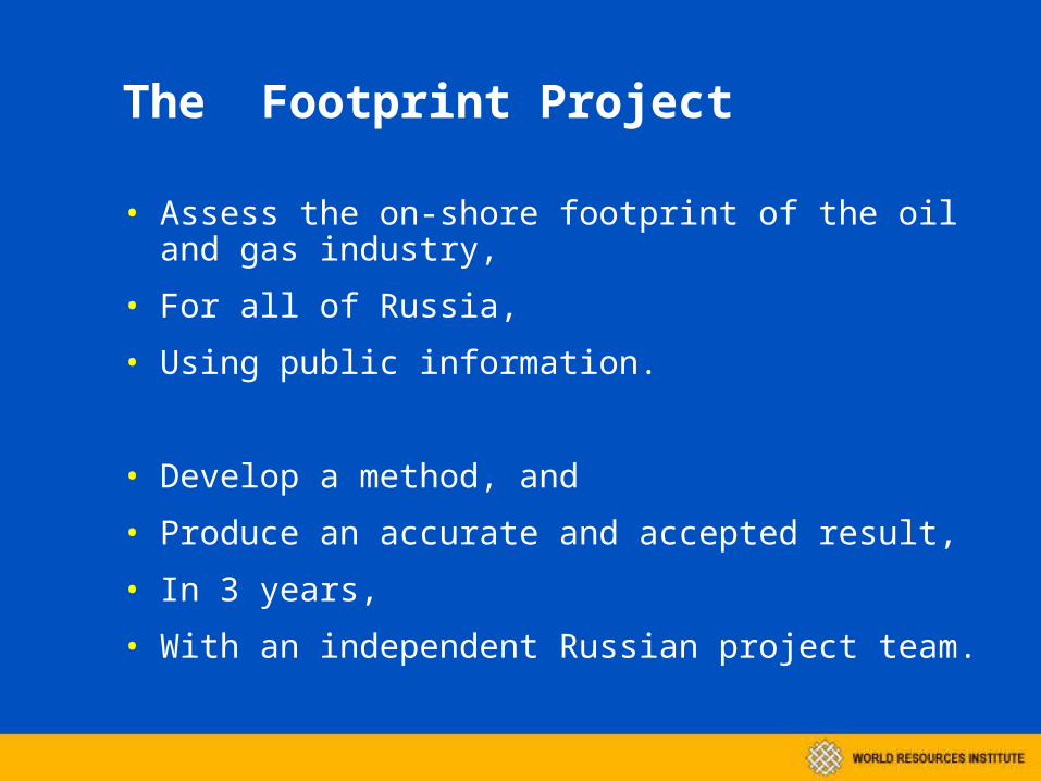
The Footprint Project
• Assess the on-shore footprint of the oil and gas industry,
• For all of Russia,
• Using public information.
• Develop a method, and
• Produce an accurate and accepted result,
• In 3 years,
• With an independent Russian project team.

Conditions of cooperation with TNK-BP
• Resources from TNK-BP – money, access, information
• Independence – no control of the result by TNK-BP
• No advertising of the project without mutual agreement
• No quid pro quo – participating groups have no obligation of loyalty to TNK-BP
• Constructive collaboration – regular informal contact, try to be useful
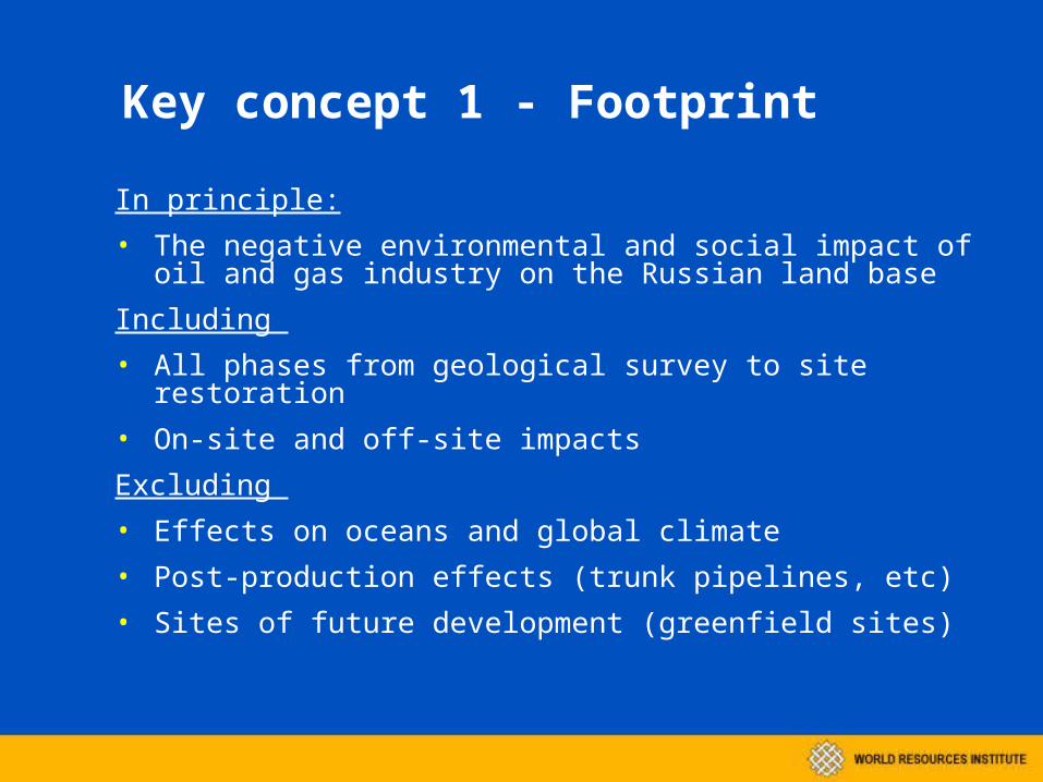
Key concept 1 - Footprint
In principle:• The negative environmental and social impact of oil and gas industry on the
Russian land base
Including • All phases from geological survey to site restoration• On-site and off-site impacts
Excluding • Effects on oceans and global climate• Post-production effects (trunk pipelines, etc)• Sites of future development (greenfield sites)
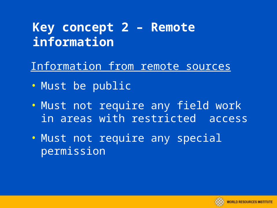
Key concept 2 – Remote information
Information from remote sources
• Must be public
• Must not require any field work in areas with restricted access
• Must not require any special permission
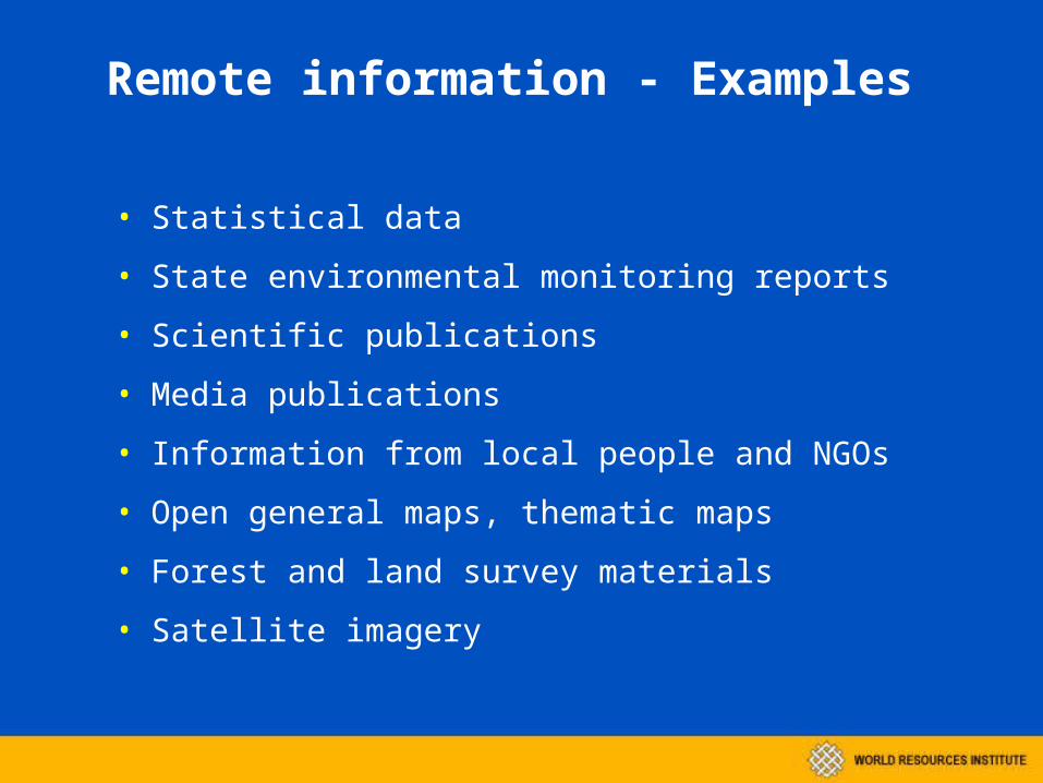
Remote information - Examples
• Statistical data
• State environmental monitoring reports
• Scientific publications
• Media publications
• Information from local people and NGOs
• Open general maps, thematic maps
• Forest and land survey materials
• Satellite imagery
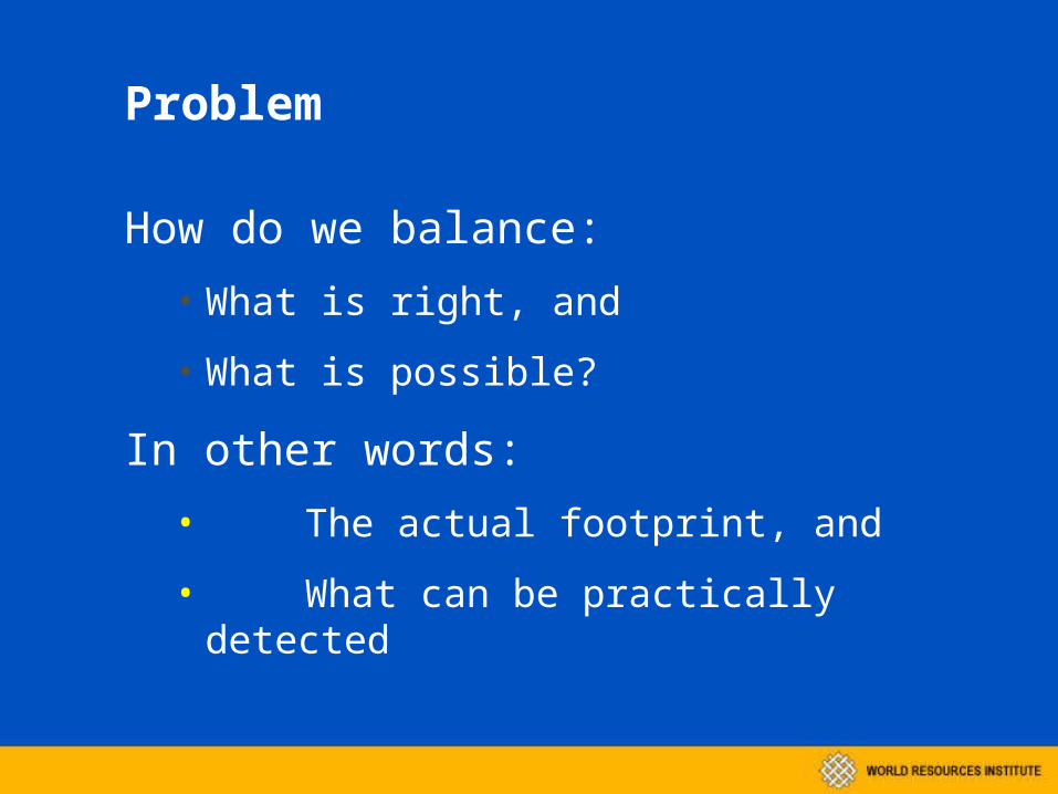
Problem
How do we balance:• What is right, and
• What is possible?
In other words:• The actual footprint, and
• What can be practically detected
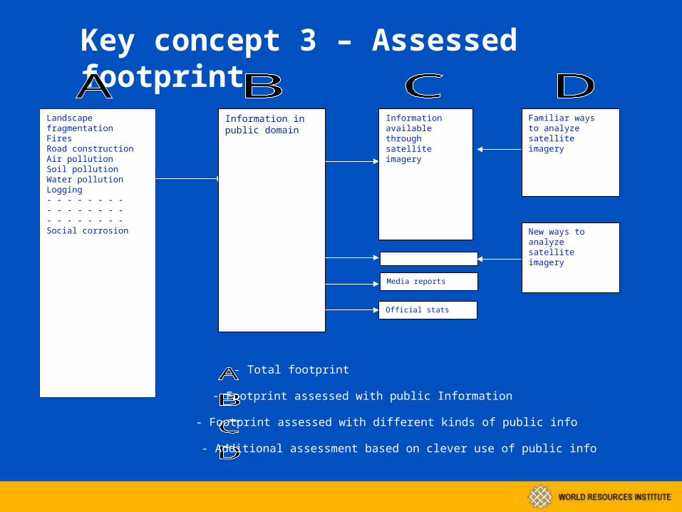
Key concept 3 – Assessed footprint
Landscape fragmentationFiresRoad constructionAir pollutionSoil pollutionWater pollutionLogging- - - - - - - -- - - - - - - -- - - - - - - - Social corrosion
Information in public domain
Information available through satellite imagery
Media reports
Official stats
Familiar ways to analyze satellite imagery
New ways to analyze satellite imagery
- Total footprint
- Footprint assessed with public Information
- Footprint assessed with different kinds of public info
- Additional assessment based on clever use of public info
QuestionsQuestions
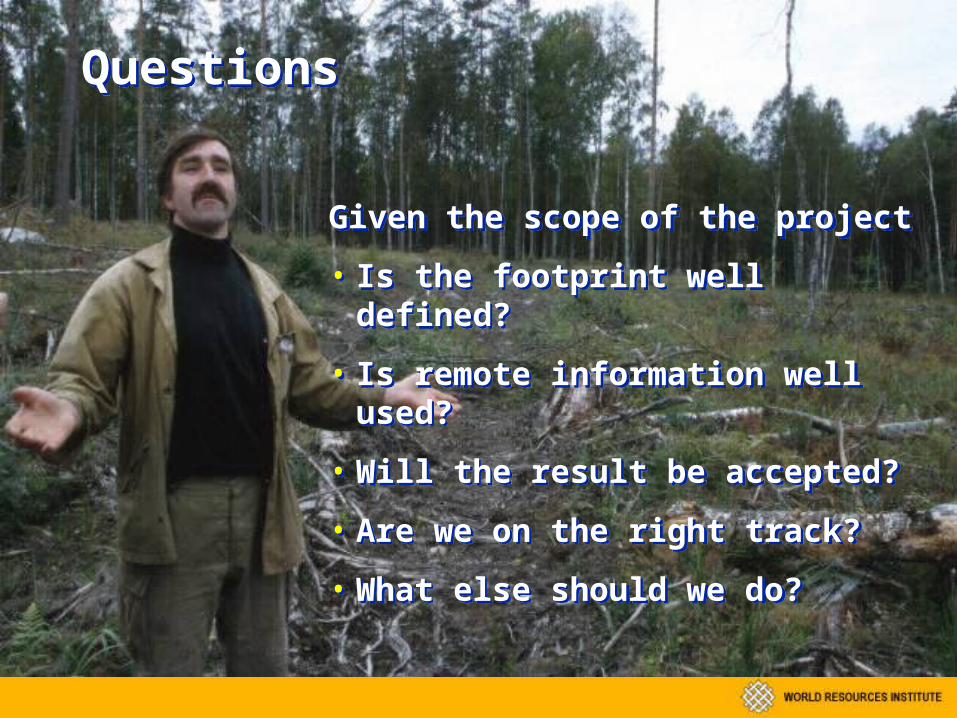
Given the scope of the project
• Is the footprint well defined?
• Is remote information well used?
• Will the result be accepted?
• Are we on the right track?
• What else should we do?
Given the scope of the project
• Is the footprint well defined?
• Is remote information well used?
• Will the result be accepted?
• Are we on the right track?
• What else should we do?
Спасибо!