Embed Size (px)
Citation preview
174
MA
RIJ
US
GR
IGA
LIŪ
NA
S
The
Fir
st P
alae
olit
hic
and
Mes
olit
hic
Set
tlem
ents
in
Auk
štum
ala,
Šil
utė
Dis
tric
t, th
e N
emun
as R
iver
Del
ta
In t roduc t ion
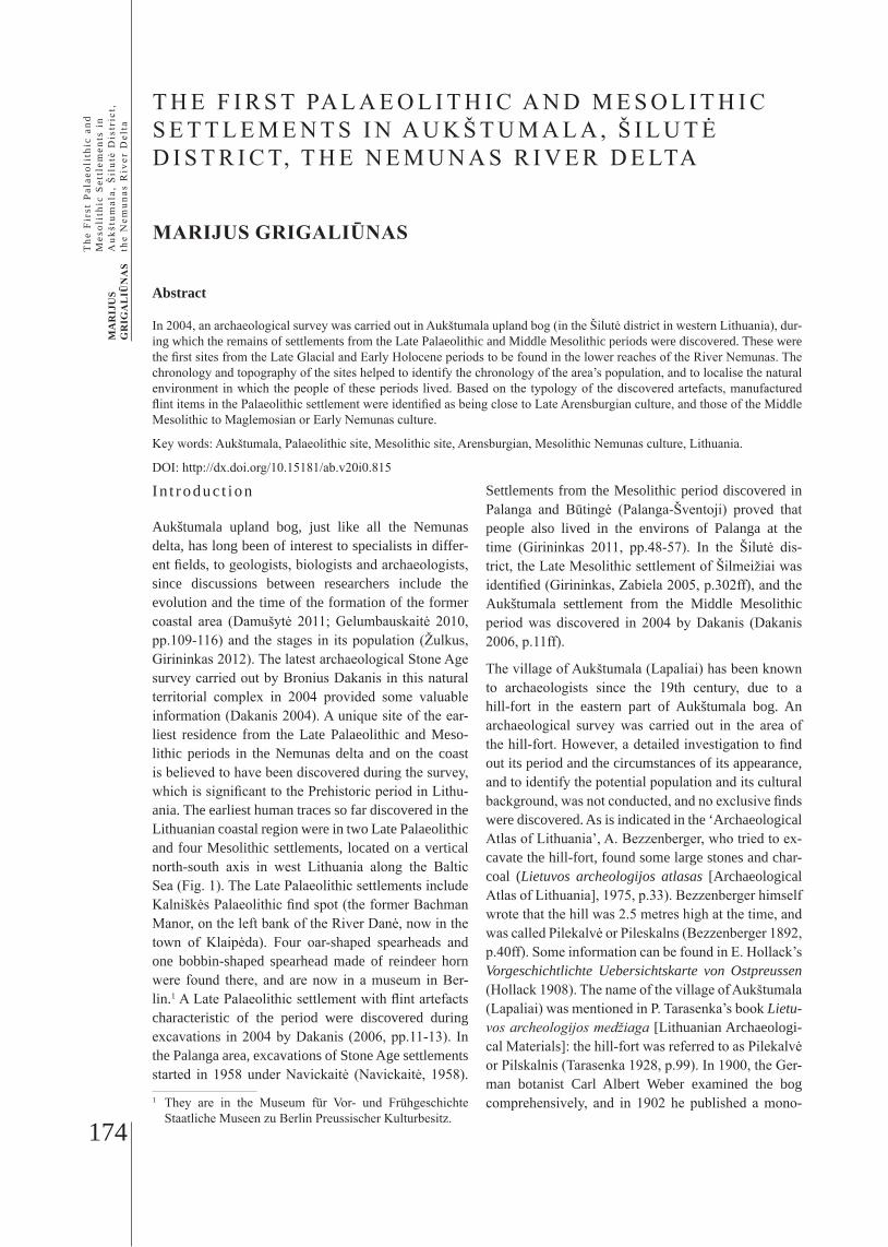
Aukštumala upland bog, just like all the Nemunas delta, has long been of interest to specialists in differ-ent fields, to geologists, biologists and archaeologists, since discussions between researchers include the evolution and the time of the formation of the former coastal area (Damušytė 2011; Gelumbauskaitė 2010, pp.109-116) and the stages in its population (Žulkus, Girininkas 2012). The latest archaeological Stone Age survey carried out by Bronius Dakanis in this natural territorial complex in 2004 provided some valuable information (Dakanis 2004). A unique site of the ear-liest residence from the Late Palaeolithic and Meso-lithic periods in the Nemunas delta and on the coast is believed to have been discovered during the survey, which is significant to the Prehistoric period in Lithu-ania. The earliest human traces so far discovered in the Lithuanian coastal region were in two Late Palaeolithic and four Mesolithic settlements, located on a vertical north-south axis in west Lithuania along the Baltic Sea (Fig. 1). The Late Palaeolithic settlements include Kalniškės Palaeolithic find spot (the former Bachman Manor, on the left bank of the River Danė, now in the town of Klaipėda). Four oar-shaped spearheads and one bobbin-shaped spearhead made of reindeer horn were found there, and are now in a museum in Ber-lin.1 A Late Palaeolithic settlement with flint artefacts characteristic of the period were discovered during excavations in 2004 by Dakanis (2006, pp.11-13). In the Palanga area, excavations of Stone Age settlements started in 1958 under Navickaitė (Navickaitė, 1958). 1 They are in the Museum für Vor- und Frühgeschichte
Staatliche Museen zu Berlin Preussischer Kulturbesitz.
Settlements from the Mesolithic period discovered in Palanga and Būtingė (Palanga-Šventoji) proved that people also lived in the environs of Palanga at the time (Girininkas 2011, pp.48-57). In the Šilutė dis-trict, the Late Mesolithic settlement of Šilmeižiai was identified (Girininkas, Zabiela 2005, p.302ff), and the Aukštumala settlement from the Middle Mesolithic period was discovered in 2004 by Dakanis (Dakanis 2006, p.11ff).
The village of Aukštumala (Lapaliai) has been known to archaeologists since the 19th century, due to a hill-fort in the eastern part of Aukštumala bog. An archaeological survey was carried out in the area of the hill-fort. However, a detailed investigation to find out its period and the circumstances of its appearance, and to identify the potential population and its cultural background, was not conducted, and no exclusive finds were discovered. As is indicated in the ‘Archaeological Atlas of Lithuania’, A. Bezzenberger, who tried to ex-cavate the hill-fort, found some large stones and char-coal (Lietuvos archeologijos atlasas [Archaeological Atlas of Lithuania], 1975, p.33). Bezzenberger himself wrote that the hill was 2.5 metres high at the time, and was called Pilekalvė or Pileskalns (Bezzenberger 1892, p.40ff). Some information can be found in E. Hollack’s Vorgeschichtlichte Uebersichtskarte von Ostpreussen (Hollack 1908). The name of the village of Aukštumala (Lapaliai) was mentioned in P. Tarasenka’s book Lietu-vos archeologijos medžiaga [Lithuanian Archaeologi-cal Materials]: the hill-fort was referred to as Pilekalvė or Pilskalnis (Tarasenka 1928, p.99). In 1900, the Ger-man botanist Carl Albert Weber examined the bog comprehensively, and in 1902 he published a mono-
T H E F I R S T PA L A E O L I T H I C A N D M E S O L I T H I C S E T T L E M E N T S I N A U K Š T U M A L A , Š I L U T Ė D I S T R I C T, T H E N E M U N A S R I V E R D E LTA
MARIJUS GRIGALIŪNAS
Abstract
In 2004, an archaeological survey was carried out in Aukštumala upland bog (in the Šilutė district in western Lithuania), dur-ing which the remains of settlements from the Late Palaeolithic and Middle Mesolithic periods were discovered. These were the first sites from the Late Glacial and Early Holocene periods to be found in the lower reaches of the River Nemunas. The chronology and topography of the sites helped to identify the chronology of the area’s population, and to localise the natural environment in which the people of these periods lived. Based on the typology of the discovered artefacts, manufactured flint items in the Palaeolithic settlement were identified as being close to Late Arensburgian culture, and those of the Middle Mesolithic to Maglemosian or Early Nemunas culture.
Key words: Aukštumala, Palaeolithic site, Mesolithic site, Arensburgian, Mesolithic Nemunas culture, Lithuania.
DOI: http://dx.doi.org/10.15181/ab.v20i0.815
175
AR
CH
AEO
LOG
IAB
ALT
ICA
20
IIIPREHISTORIC MATERIAL STUDIES IN LABORATORIES AT KLAIPĖDA UNIVERSITY
graph, the first book on bog studies in the world, Veg-etation und Entstehung des Hochmoors von Augstumal (Webber 1902). Therefore, the Aukštumala bog may be said to have been the cradle of bog studies. In 1938, the hill-fort was referred to in H. Crome’s Verzeichnis der Wehranlagen Ostprussens (Crome 1938, 173-209). In 1972, the hill-fort was surveyed by researchers from
the Lithuanian Institute of History. In the ‘Archaeo-logical Atlas of Lithuania’, the hill-fort was identified in the eastern part of Aukštumala bog, west of the vil-lage of Lapaliai. It was a sandy hill in the bog, rising to about 0.5 metres high, extending in a north-south direction, about 40 by 20 metres in size. The islet had been destroyed by digging and by economic activity. Before 2004, there had been no information about the latest archaeological surveys of Stone Age settlements in Aukštumala upland bog.
The su rvey o f t he Aukš tumala s e t t l emen t : t he excava t ion o f t r ench No 4 o f t he f i r s t s e t t l emen t
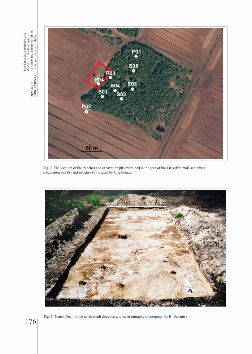
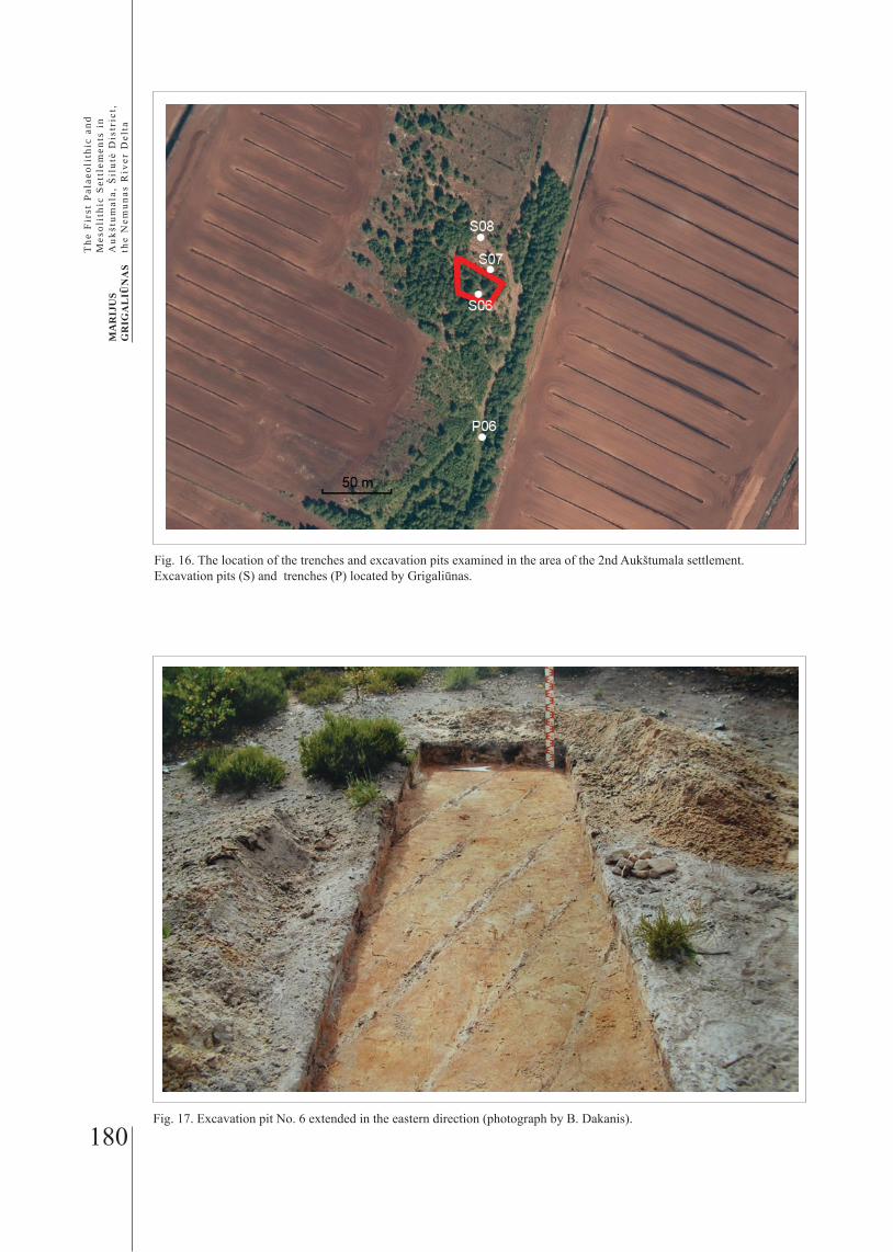
A thorough archaeological excavation was carried out in 2004, after an application to reduce the protected area and the buffer zone. Four trenches and five test ex-cavations were made (Fig. 2) in the area of Aukštumala (Lapaliai) ancient settlement. Flint finds dating from the Stone Age were found in trench No 4, ten square metres in a north-south direction, in partly open sands, on a 0.3-metre elevation, in the area along the north-west edge of a grove frequently used by peat-digging machinery. Further east, the elevation rose to one me-tre. By carefully prospecting the surface of the sandy elevation and the environs of the trench, six flint arte-facts were found (Nos 29-34). In trench No 4, under a thin two-to-six-centimetre peat layer, a layer (two to six to ten centimetres) of greyish white sand with grey argil inserts was discovered. After the sand layer began the subsoil, totally white sand with grey sand inserts (Fig. 3). In trench No 4, in the sand layer, 28 flint finds (Nos 1-28) were discovered at a depth of one to 28 centimetres.
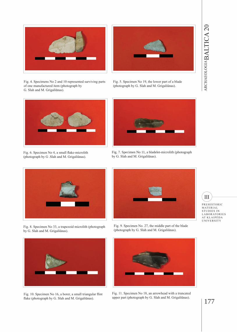
Thirty-four flint artefacts were discovered in trench No 4: four blades, four cores, 15 flakes and small flakes, and nine manufactured items made of double-ended cores. Specimens No 2 and 10 represented surviving parts of one manufactured item, the upper blade part of a white flint covered with a light patina, possibly an arrowhead (Fig. 4). Specimen No 19 was the lower part of a blade, greyish white flint with a patina, the tang part of an arrowhead (Fig. 5). Specimen No 4 was a small flake-microlith, of white flint with a light patina (Fig. 6). Specimen No 11 was a bladelet-microlith; the flint was dark grey with light inserts (Fig. 7). Specimen No 33 was a trapezoid microlith made of black flint, and covered with a white-grey cortex (Fig. 8). Speci-men No 27 was the middle part of the blade of a white flint covered with a light yellow patina (Fig. 9). Speci-men No 16 was a borer, a small triangular white flint flake with a light yellow patina (Fig. 10). Specimen No 18 was an arrowhead made of a dark-grey flint blade
Fig. 1. The locations of the settlements of the Palaeolithic and Mesolithic periods in the Lithuanian seaside area (the map designed by A. Girininkas).
176
MA
RIJ
US
GR
IGA
LIŪ
NA
S
The
Fir
st P
alae
olit
hic
and
Mes
olit
hic
Set
tlem
ents
in
Auk
štum
ala,
Šil
utė
Dis
tric
t, th
e N
emun
as R
iver
Del
ta
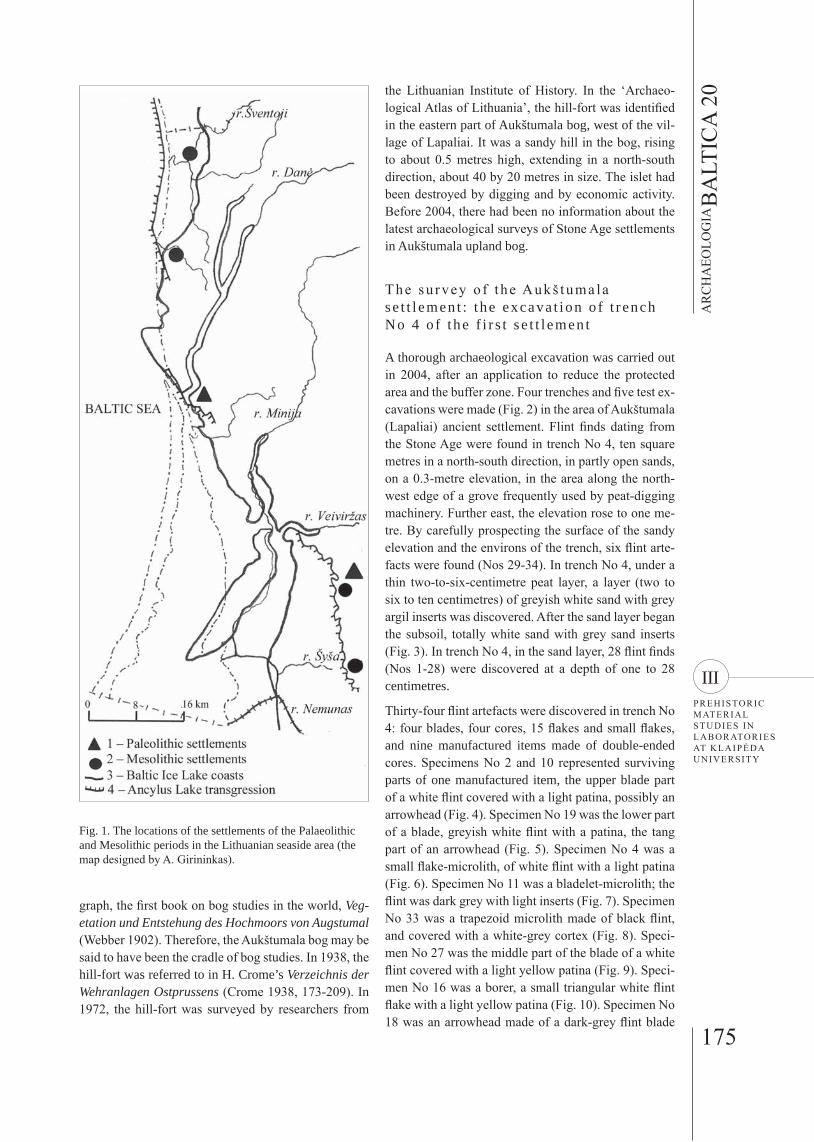
Fig. 2. The location of the trenches and excavation pits examined in the area of the 1st Aukštumala settlement. Excavation pits (S) and trenches (P) located by Grigaliūnas.
Fig. 3. Trench No. 4 in the north-south direction and its stratigraphy (photograph by B. Dakanis).
177
AR
CH
AEO
LOG
IAB
ALT
ICA
20
IIIPREHISTORIC MATERIAL STUDIES IN LABORATORIES AT KLAIPĖDA UNIVERSITY
Fig. 10. Specimen No 16, a borer, a small triangular flint flake (photograph by G. Slah and M. Grigaliūnas).
Fig. 4. Specimens No 2 and 10 represented surviving parts of one manufactured item (photograph by G. Slah and M. Grigaliūnas).
Fig. 5. Specimen No 19, the lower part of a blade (photograph by G. Slah and M. Grigaliūnas).
Fig. 6. Specimen No 4, a small flake-microlith (photograph by G .Slah and M. Grigaliūnas).
Fig. 7. Specimen No 11, a bladelet-microlith (photograph by G. Slah and M. Grigaliūnas).
Fig. 8. Specimen No 33, a trapezoid microlith (photograph by G. Slah and M. Grigaliūnas).
Fig. 9. Specimen No. 27, the middle part of the blade (photograph by G. Slah and M. Grigaliūnas).
Fig. 11. Specimen No 18, an arrowhead with a truncated upper part (photograph by G. Slah and M. Grigaliūnas).
178
MA
RIJ
US
GR
IGA
LIŪ
NA
S
The
Fir
st P
alae
olit
hic
and
Mes
olit
hic
Set
tlem
ents
in
Auk
štum
ala,
Šil
utė
Dis
tric
t, th
e N
emun
as R
iver
Del
ta
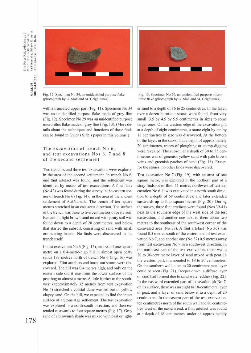
Fig. 12. Specimen No 34, an unidentified purpose flake (photograph by G. Slah and M. Grigaliūnas).
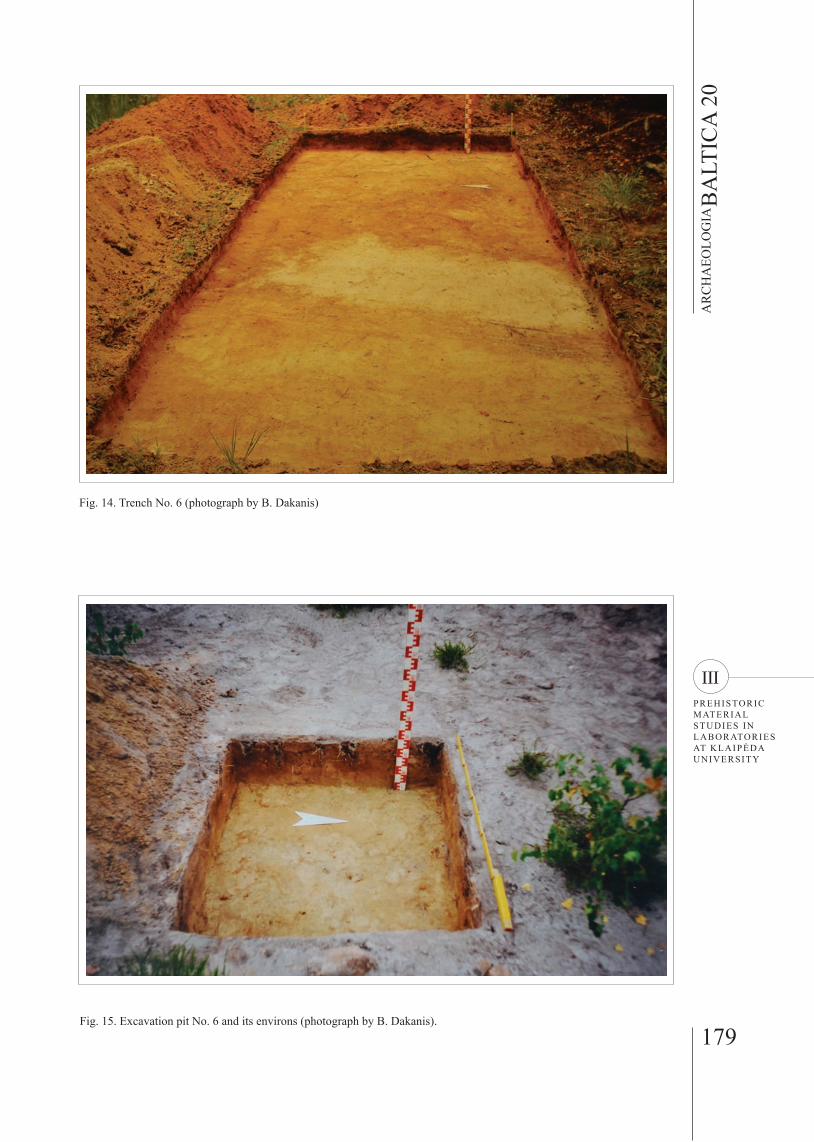
Fig. 13. Specimen No 29, an unidentified purpose micro-lithic flake (photograph by G. Slah and M. Grigaliūnas).
with a truncated upper part (Fig. 11). Specimen No 34 was an unidentified purpose flake made of grey flint (Fig. 12). Specimen No 29 was an unidentified purpose microlithic flake made of grey flint (Fig. 13). (More de-tails about the techniques and functions of these finds can be found in Gvidas Slah’s paper in this volume.)
The excava t ion o f t r ench No 6 , and t e s t excava t ions Nos 6 , 7 and 8 o f t he second se t t l emen t
Two trenches and three test excavations were explored in the area of the second settlement. In trench No 6, one flint artefact was found, and the settlement was identified by means of test excavations. A flint flake (No 42) was found during the survey in the eastern cor-ner of trench No 6 (Fig. 14), in the area of the ancient settlement of Aukštumala. The trench of ten square metres stretched in an east-west direction. The surface of the trench was three to five centimetres of peaty soil. Beneath it, light brown sand mixed with peaty soil was found down to a depth of 20 centimetres; and below that started the subsoil, consisting of sand with small ore-bearing inserts. No finds were discovered in the trench itself.
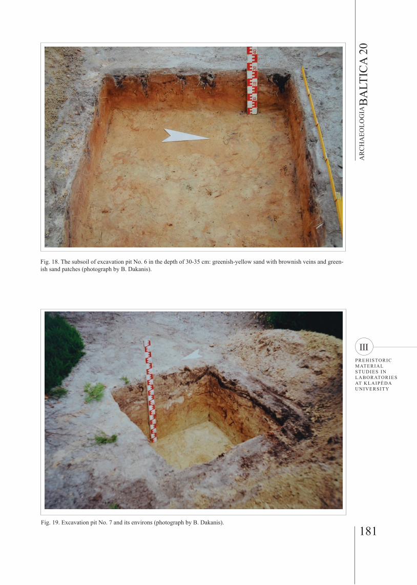
In test excavation No 6 (Fig. 15), an area of one square metre on a 0.4-metre-high hill in almost open peaty sands 193 metres north of trench No 6 (Fig. 16) was explored. Flint artefacts and burnt-out stones were dis-covered. The hill was 0.4 metres high, and only on the eastern side did it rise from the lower surface of the peat bog to almost a metre. A little further to the south-west (approximately 32 metres from test excavation No 6) stretched a coastal dune washed out of yellow clayey sand. On the hill, we expected to find the intact surface of a Stone Age settlement. The test excavation was explored in a north-south direction, and then ex-tended eastwards to four square metres (Fig. 17). Grey sand of a brownish shade was mixed with peat or light-
er sand to a depth of 16 to 25 centimetres. In the layer, over a dozen burnt-out stones were found, from very small (3.5 by 4.5 by 5.5 centimetres in size) to some larger ones. On the western edge of the excavation pit, at a depth of eight centimetres, a stone eight by ten by 18 centimetres in size was discovered. At the bottom of the layer, in the subsoil, at a depth of approximately 20 centimetres, traces of ploughing or stump-digging were revealed. The subsoil at a depth of 30 to 35 cen-timetres was of greenish yellow sand with pale brown veins and greenish patches of sand (Fig. 18). Except for the stones, no other finds were discovered.
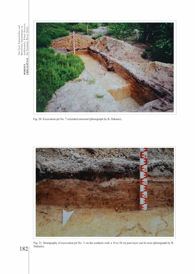
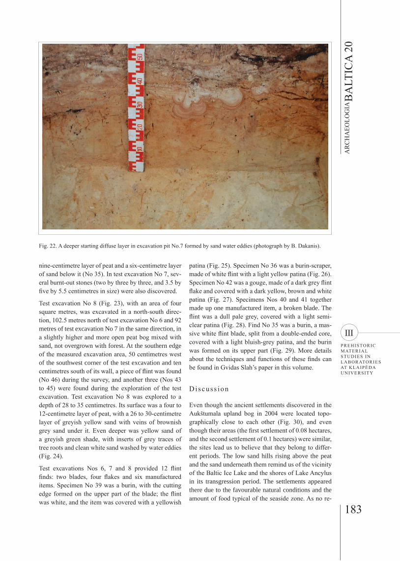
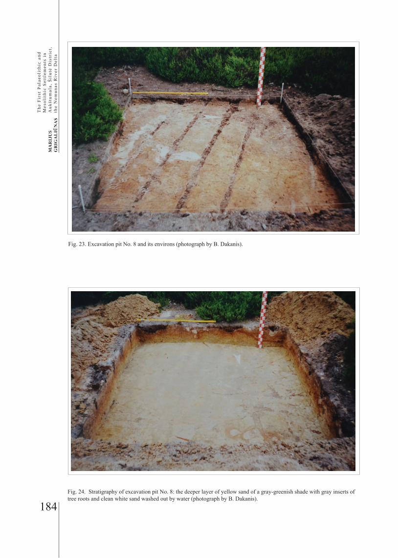
Test excavation No 7 (Fig. 19), with an area of one square metre, was explored in the northern part of a stray findspot of flint, 11 metres northwest of test ex-cavation No 6. It was excavated in a north-south direc-tion to a depth of 68 centimetres, and later extended eastwards up to four square metres (Fig. 20). During the survey, three flint artefacts were found (Nos 39-41) next to the southern edge of the west side of the test excavation, and another one next to them about two metres to the southeast of the southwest corner of the excavated area (No 38). A flint artefact (No 36) was found 0.5 metres south of the eastern end of test exca-vation No 7, and another one (No 37) 0.5 metres away from test excavation No 7 in a southwest direction. In the northeast part of the test excavation, there was a 20 to 30-centimetre layer of sand mixed with peat. In the western part, it amounted to 18 to 20 centimetres. On the southern wall, a ten to 20-centimetre peat layer could be seen (Fig. 21). Deeper down, a diffuse layer of sand had formed due to sand water eddies (Fig. 22). In the eastward extended part of excavation pit No 7, on its surface, there was an eight to 18-centimetre layer of peat, and a layer of sand below it to a depth of 20 centimetres. In the eastern part of the test excavation, ten centimetres north of the south wall and 80 centime-tres west of the eastern end, a flint artefact was found at a depth of 18 centimetres, under an approximately
179
AR
CH
AEO
LOG
IAB
ALT
ICA
20
IIIPREHISTORIC MATERIAL STUDIES IN LABORATORIES AT KLAIPĖDA UNIVERSITY
Fig. 14. Trench No. 6 (photograph by B. Dakanis)
Fig. 15. Excavation pit No. 6 and its environs (photograph by B. Dakanis).
180
MA
RIJ
US
GR
IGA
LIŪ
NA
S
The
Fir
st P
alae
olit
hic
and
Mes
olit
hic
Set
tlem
ents
in
Auk
štum
ala,
Šil
utė
Dis
tric
t, th
e N
emun
as R
iver
Del
ta
Fig. 17. Excavation pit No. 6 extended in the eastern direction (photograph by B. Dakanis).
Fig. 16. The location of the trenches and excavation pits examined in the area of the 2nd Aukštumala settlement. Excavation pits (S) and trenches (P) located by Grigaliūnas.
181
AR
CH
AEO
LOG
IAB
ALT
ICA
20
IIIPREHISTORIC MATERIAL STUDIES IN LABORATORIES AT KLAIPĖDA UNIVERSITY
Fig. 19. Excavation pit No. 7 and its environs (photograph by B. Dakanis).
Fig. 18. The subsoil of excavation pit No. 6 in the depth of 30-35 cm: greenish-yellow sand with brownish veins and green-ish sand patches (photograph by B. Dakanis).
182
MA
RIJ
US
GR
IGA
LIŪ
NA
S
The
Fir
st P
alae
olit
hic
and
Mes
olit
hic
Set
tlem
ents
in
Auk
štum
ala,
Šil
utė
Dis
tric
t, th
e N
emun
as R
iver
Del
ta
Fig. 21. Stratigraphy of excavation pit No. 7; on the southern wall, a 10 to 20 cm peat layer can be seen (photograph by B. Dakanis).
Fig. 20. Excavation pit No. 7 extended eastward (photograph by B. Dakanis).
183
AR
CH
AEO
LOG
IAB
ALT
ICA
20
IIIPREHISTORIC MATERIAL STUDIES IN LABORATORIES AT KLAIPĖDA UNIVERSITY
nine-centimetre layer of peat and a six-centimetre layer of sand below it (No 35). In test excavation No 7, sev-eral burnt-out stones (two by three by three, and 3.5 by five by 5.5 centimetres in size) were also discovered.
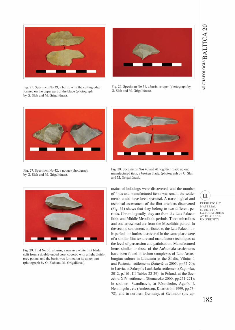
Test excavation No 8 (Fig. 23), with an area of four square metres, was excavated in a north-south direc-tion, 102.5 metres north of test excavation No 6 and 92 metres of test excavation No 7 in the same direction, in a slightly higher and more open peat bog mixed with sand, not overgrown with forest. At the southern edge of the measured excavation area, 50 centimetres west of the southwest corner of the test excavation and ten centimetres south of its wall, a piece of flint was found (No 46) during the survey, and another three (Nos 43 to 45) were found during the exploration of the test excavation. Test excavation No 8 was explored to a depth of 28 to 35 centimetres. Its surface was a four to 12-centimetre layer of peat, with a 26 to 30-centimetre layer of greyish yellow sand with veins of brownish grey sand under it. Even deeper was yellow sand of a greyish green shade, with inserts of grey traces of tree roots and clean white sand washed by water eddies (Fig. 24).
Test excavations Nos 6, 7 and 8 provided 12 flint finds: two blades, four flakes and six manufactured items. Specimen No 39 was a burin, with the cutting edge formed on the upper part of the blade; the flint was white, and the item was covered with a yellowish
Fig. 22. A deeper starting diffuse layer in excavation pit No.7 formed by sand water eddies (photograph by B. Dakanis).
patina (Fig. 25). Specimen No 36 was a burin-scraper, made of white flint with a light yellow patina (Fig. 26). Specimen No 42 was a gouge, made of a dark grey flint flake and covered with a dark yellow, brown and white patina (Fig. 27). Specimens Nos 40 and 41 together made up one manufactured item, a broken blade. The flint was a dull pale grey, covered with a light semi-clear patina (Fig. 28). Find No 35 was a burin, a mas-sive white flint blade, split from a double-ended core, covered with a light bluish-grey patina, and the burin was formed on its upper part (Fig. 29). More details about the techniques and functions of these finds can be found in Gvidas Slah’s paper in this volume.
Di scuss ion
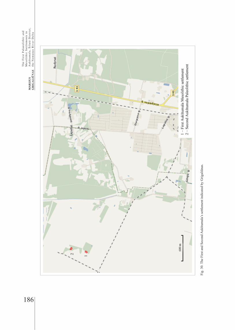
Even though the ancient settlements discovered in the Aukštumala upland bog in 2004 were located topo-graphically close to each other (Fig. 30), and even though their areas (the first settlement of 0.08 hectares, and the second settlement of 0.1 hectares) were similar, the sites lead us to believe that they belong to differ-ent periods. The low sand hills rising above the peat and the sand underneath them remind us of the vicinity of the Baltic Ice Lake and the shores of Lake Ancylus in its transgression period. The settlements appeared there due to the favourable natural conditions and the amount of food typical of the seaside zone. As no re-
184
MA
RIJ
US
GR
IGA
LIŪ
NA
S
The
Fir
st P
alae
olit
hic
and
Mes
olit
hic
Set
tlem
ents
in
Auk
štum
ala,
Šil
utė
Dis
tric
t, th
e N
emun
as R
iver
Del
ta
Fig. 24. Stratigraphy of excavation pit No. 8: the deeper layer of yellow sand of a gray-greenish shade with gray inserts of tree roots and clean white sand washed out by water (photograph by B. Dakanis).
Fig. 23. Excavation pit No. 8 and its environs (photograph by B. Dakanis).
185
AR
CH
AEO
LOG
IAB
ALT
ICA
20
IIIPREHISTORIC MATERIAL STUDIES IN LABORATORIES AT KLAIPĖDA UNIVERSITY
Fig. 29. Find No 35, a burin; a massive white flint blade, split from a double-ended core, covered with a light bluish-grey patina, and the burin was formed on its upper part (photograph by G. Slah and M. Grigaliūnas).
Fig. 25. Specimen No 39, a burin, with the cutting edge formed on the upper part of the blade (photograph by G. Slah and M. Grigaliūnas).
Fig. 26. Specimen No 36, a burin-scraper (photograph by G. Slah and M. Grigaliūnas).
Fig. 27. Specimen No 42, a gouge (photograph by G. Slah and M. Grigaliūnas).
Fig. 28. Specimens Nos 40 and 41 together made up one manufactured item, a broken blade. (photograph by G. Slah and M. Grigaliūnas).
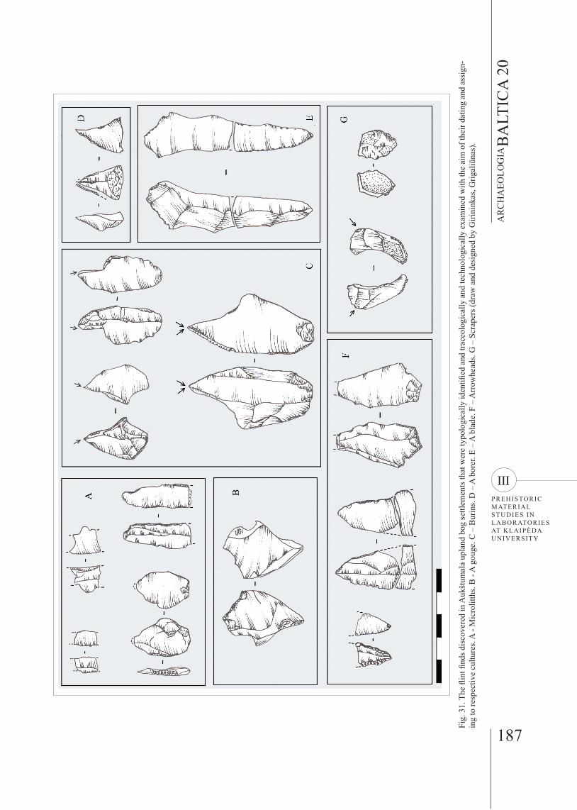
mains of buildings were discovered, and the number of finds and manufactured items was small, the settle-ments could have been seasonal. A traceological and technical assessment of the flint artefacts discovered (Fig. 31) shows that they belong to two different pe-riods. Chronologically, they are from the Late Palaeo-lithic and Middle Mesolithic periods. Three microliths and one arrowhead are from the Mesolithic period. In the second settlement, attributed to the Late Palaeolith-ic period, the burins discovered in the same place were of a similar flint texture and manufacture technique: at the level of percussion and patinisation. Manufactured items similar to those of the Auštumala settlements have been found in techno-complexes of Late Arens-burgian culture in Lithuania at the Šilelis, Vilnius 1 and Pasieniai settlements (Šatavičius 2005, pp.67-70); in Latvia, at Salaspils Laukskola settlement (Zagorska, 2012, p.161, III Tables 22-29); in Poland, at the Szc-zebra XIV settlement (Siemaszko 2000, pp.251-271); in southern Scandinavia, at Rönneholm, Ageröd I, Henningebr , etc (Andersson, Knarrström 1999, pp.73-78); and in northern Germany, at Stellmoor (the up-
186
MA
RIJ
US
GR
IGA
LIŪ
NA
S
The
Fir
st P
alae
olit
hic
and
Mes
olit
hic
Set
tlem
ents
in
Auk
štum
ala,
Šil
utė
Dis
tric
t, th
e N
emun
as R
iver
Del
ta
Fig.
30.
The
Firs
t and
Sec
ond
Auk
štum
ala’
s set
tlem
ent i
ndic
ated
by
Grig
aliū
nas.
187
AR
CH
AEO
LOG
IAB
ALT
ICA
20
IIIPREHISTORIC MATERIAL STUDIES IN LABORATORIES AT KLAIPĖDA UNIVERSITY
Fig.
31.
The
flin
t find
s dis
cove
red
in A
ukšt
umal
a up
land
bog
settl
emen
ts th
at w
ere
typo
logi
cally
iden
tified
and
trac
eolo
gica
lly a
nd te
chno
logi
cally
exa
min
ed w
ith th
e ai
m o
f the
ir da
ting
and
assi
gn-
ing
to re
spec
tive
cultu
res.
A -
Mic
rolit
ths.
B -
A g
ouge
. C –
Bur
ins.
D –
A b
orer
. E –
A b
lade
. F –
Arr
owhe
ads.
G –
Scr
aper
s (dr
aw a
nd d
esig
ned
by G
irini
nkas
, Grig
aliū
nas)
.
188
MA
RIJ
US
GR
IGA
LIŪ
NA
S
The
Fir
st P
alae
olit
hic
and
Mes
olit
hic
Set
tlem
ents
in
Auk
štum
ala,
Šil
utė
Dis
tric
t, th
e N
emun
as R
iver
Del
ta
per cultural layer), Steinbeck, Immenbeck, and others (Fischer, Tauber 1986, pp.7-13). Manufactured items from the Palaeolithic period found in these areas, just like the ones found in the Aukštumala settlements, are characterised by double-ended cores. Most of the items are made of blades, and the points have distinctive tangs, which stand out thanks to the bifacial perpen-dicular retouch of the blade. Next to angle burins, quite a few middle burins were also found in the Aukštumala settlement. The scrapers were made of rather broad blades, and the end scrapers were frequently com-bined with other items, such as burins (in the case of the Aukštumala artefacts). Undoubtedly, many of the manufactured items were used for processing bone and horn, such as reindeer horn. In the Third Dryas Period, there were quite a few by the Baltic Ice Lake (Daugno-ra, Girininkas 2005, pp.119-132).
Of the Mesolithic manufactured items, the microliths-bladelets with a perpendicular retouch on their side stand out. Most of them were made from single-ended cores. The pieces of flint from which the blades were formed were narrow, and made by truncating. Simi-lar artefacts from the Mesolithic period were found in Lithuania in settlements of the Paštuva, Kabeliai and Pypliai type (Girininkas 2009, p.92ff), which, just like the Aukštumala artefacts, have been dated to the Mid-dle Mesolithic period.
Conc lus ions
During archaeological excavations of the Aukštumala upland bog in 2008, two unique ancient settlements were discovered, localised, and assigned to the Late Palaeolithic and Middle-Mesolithic periods. Topo-graphically, they might be Late Palaeolithic and Mid-dle Mesolithic settlements that were on the shores of the former Baltic Ice Lake and a lake that had existed at the time of the Ancylus transgression. In the first Aukštumala upland bog settlement from the Middle Mesolithic period, flint articles were found which, ac-cording to their function, traceological examination and the technique of flint percussion, may be attributed to the Mesolithic period, to Early Nemunas culture. In the second Aukštumala upland bog settlement from the Late Palaeolithic period, finds were discovered which, according to their function, percussion technique and typology, may be considered Late Palaeolithic manu-factured items used by a community of Late Arensbur-gian culture.
Acknowledgemen t s
The author is very grateful to the archaeologist Bronius Dakanis for the opportunity to use and publish Stone Age material discovered in the Aukštumala bog area. I would also like to thank Professor Algirdas Girininkas for his constructive comments in the process of writing this article.
Re fe rences
Manusc r ip t s
NAVICKAITĖ, O., 1958. Palangos akmens-žalvario amžių gyvenvietės tyrinėjimų dienoraštis. 1958 m. liepos mėn. 21 – rugpjūčio mėn. 4 d. [Survey Diary of Palanga Set-tlement of the Stone – Bronze Ages. 21 July - 4 August 1958]. In: Lithuanian Institute of History, Manuscript De-partment, file, 75.
DAKANIS, B., 2004. Aukštumalos, Lapalių senovės gy-venvietės (A487; Šilutės r.) ir jos aplinkos žvalgomųjų archeologijos tyrimų ataskaita. [Excavation Report of Aukštumala, Lapaliai Ancient Settlement (A487; Šilutė district) and its Environs]. Vilnius.
Li te ra tu re
BEZZENBERGER, A., Der Schlossberg im Augstumaller Moor. Sitzungsberichte der Altertumsgesellschaft Prussia, 17, 40-43.
DAKANIS, B., 2006. Lapalių (Aukštumalos) gyvenvietės. In: ATL 2004 metais. Vilnius: Diemedis, 11-13.
DAUGNORA, L., GIRININKAS, A., 2005. Šiaurės elnių ke-liai ir jų paplitimas Lietuvoje vėlyvajame paleolite. Lietu-vos archeologija, 29, 119-132.
DAMUŠYTĖ, A. 2011. Post-Glacial geological history of the Lithuanian coastal area. Summary of doctoral disser-tation Physical sciences, geology (05P), Vilnius Univer-sity.
FISCHER, A., TAUBER, H., 1986. New C-14 Datings of Late Palaeolithic Cultures from Northwestern Europe. Journal of Danish Archaeology, 5, 7-14.
GELUMBAUSKAITĖ, L. Ž. 2010. Palaeo-Nemunas delta history during the Holocene time. Baltica, 23(2), 109-116.
GIRININKAS, A. 2009. Lietuvos archeologija. Akmens amžius. 1. Vilnius: Versus Aureus.
GIRININKAS, A., ZABIELA, G., 2005. Žvalgomieji tyri-nėjimai Žemaičių Naumiesčio apylinkėse. In: ATL 2002 metais. Vilnius: Diemedis, 302-307.
GIRININKAS, A., 2011. New data on Palanga Stone Age Settlement. Archaeologia Baltica, 16, 48-57.
HOLLACK, E., 1908. Erlāuterungen zur Vorgeschich-tlichte Uebersichtskarte von Ostpreussen. Glogau-Berlin: Flemming.
SIEMASZKO, J., 2000. The Szczebra 14 Site. A Key to Understanding the Palaeolithic in the North Eastern Part of Europe or Another Mystery? Lietuvos arche-ologija, 19, 251-271.
ŠATAVIČIUS, E., 2005. Lietuvos vėlyvojo paleolito kultūrų periodizacija. Archaeologia Lituana, 6, 49-82.
TARASENKA, P., 1928. Lietuvos archeologijos medžiaga. Kaunas: Švietimo ministerijos Knygų leidimo komisijos leidinys.
189
AR
CH
AEO
LOG
IAB
ALT
ICA
20
IIIPREHISTORIC MATERIAL STUDIES IN LABORATORIES AT KLAIPĖDA UNIVERSITY
WEBER, C.A 1902. Über die vegetation und entstehung des hochmoors von Augstumal– im memeldelta mit ver-gleichenden ausblicken auf andere hochmoore der erde; eine formationsbiologisch-historische und geologische studie. Berlin: P. Parey.
ZAGORSKA, I. 2012. Senie ziemeļbriežu mednieki Latvijā. Rīga: Zinātne.
ŽULKUS, V., GIRININKAS, A. 2012. Baltijos jūros krantai prieš 10000 metų „Yoldia“. Klaipėda: Klaipėdos univer-siteto leidykla.
Received: 25 February 2013; Revised: 2 August 2013; Accepted: 8 August 2013.
Marijus Grigaliūnas BA student Klaipėda University Herkaus Manto 84 LT-92294, Klaipėda Lithuania E-mail: [email protected]
P I R M O S I O S N E M U N O D E LT O S A U K Š T U M A L O S , Š I L U T Ė S R . , PA L E O L I T I N Ė S I R M E Z O L I T I N Ė S G Y V E N V I E T Ė S
MARIJUS GRIGALIŪNAS
San t rauka
Apžvelgus ir įvertinus svarbią 2004 m. atliktų Aukš-tumalos aukštapelkės archeologinių tyrimų, kuriuos atliko B. Dakanis, informaciją, Lietuvos vėlyvojo paleolito ir mezolito gyvenviečių sąrašas papildytas dviem svarbiais naujais atradimais. Tai I Aukštumalos vidurinio mezolito ir II Aukštumalos vėlyvojo paleoli-to gyvenvietės, kurios patvirtintos išanalizavus tirtose perkasose bei šurfuose rastus dirbinius (1–30 pav.). Jų iš viso aptikta 46. Iš nuoskalų ir skelčių išskyrus 15 titnago dirbinių ir nustačius jų technologines ypa-tybes, tipologiją, įvertinus trasiologiškai, patvirtinta, kad dirbiniai yra dviejų skirtingų laikotarpių: vėlyvojo paleolito ir mezolito (31 pav.). Paleolito laikotarpio ti-tnaginiai dirbiniai tipologiškai galėtų būti priskiriami vėlyvajai Arensburgo kultūrai, nes panašių analogų ga-lime aptikti Lietuvos, Lenkijos, Pietų Skandinavijos, Šiaurės Vokietijos teritorijose esančiose gyvenvietėse. Mezolito laikotarpio titnago dirbiniai gaminti čia gyve-nusių ankstyvosios Nemuno kultūros bendruomenių.
Abi senovės gyvenvietės buvo sezoninės, jų kūrimąsi dabartinės aukštapelkės teritorijoje galėjo nulemti Bal-tijos ledyninio ežero ir Ancyliaus ežero transgresijos laikotarpiu netoli gyvenviečių buvęs pajūris, prie kurio gyvenusios bendruomenės turėjo pakankamai mais-
to: žuvų, ruonių, paukščių, o pajūrio miškuose galėjo sėkmingai medžioti. Įvertinus geologinę informaciją, vėlyvojo paleolito laikotarpiu – driaso III klimatiniu periodu – netoli gyvenvietės telkšojo Baltijos ledyni-nis ežeras, o mezolito laikotarpiu buvo Ancyliaus eže-ro krantai. Šios dvi Aukštumalos radavietės byloja apie pirmųjų gyventojų Lietuvos teritorijoje pasirodymą ir gyvenseną vėlyvojo ledynmečio ir ankstyvojo holoce-no laikotarpiais.