Embed Size (px)
Citation preview
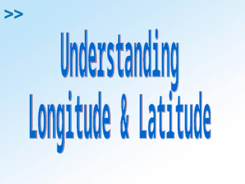
The Earth’s Invisible Lines
hThe X axis is called the Equator.
hThe Y axis is called the Prime Meridian or sometimes the Greewich Meridian because itruns through the town of Greenwich outside of London.
hLat/Long are the 2 grid points by which you can locate any point on earth.
Y
X
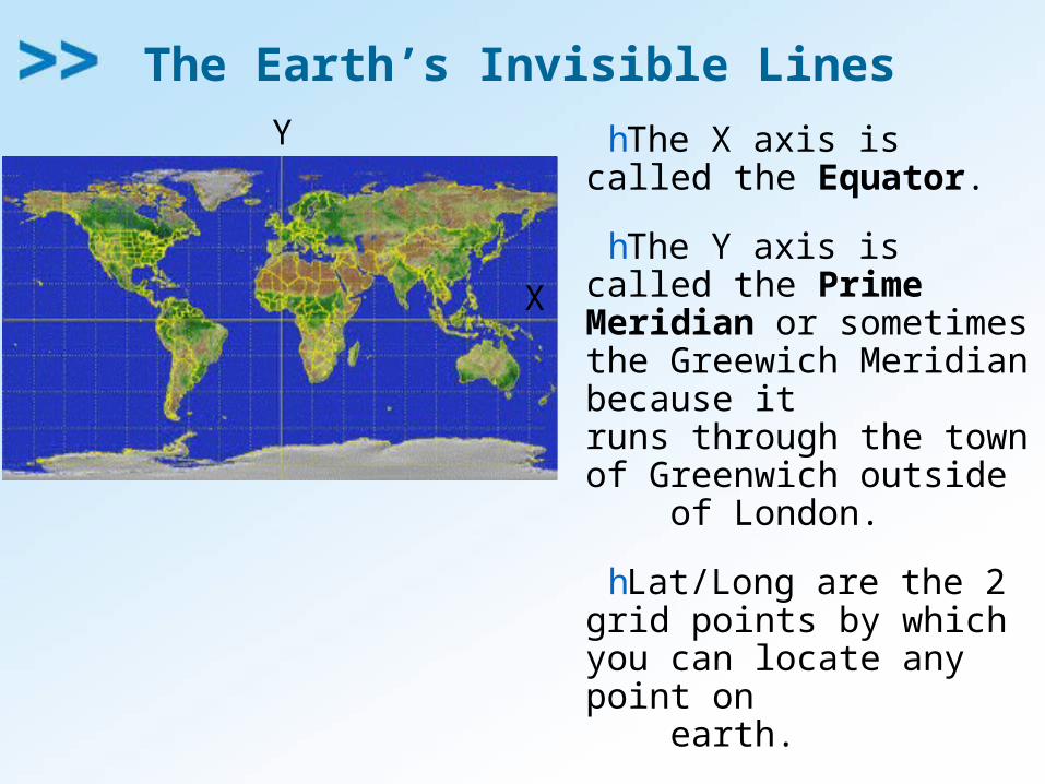
East West, North South on the Earth
hLet each of the four quarters then be designated by North or South and East or West.
N
S
EW
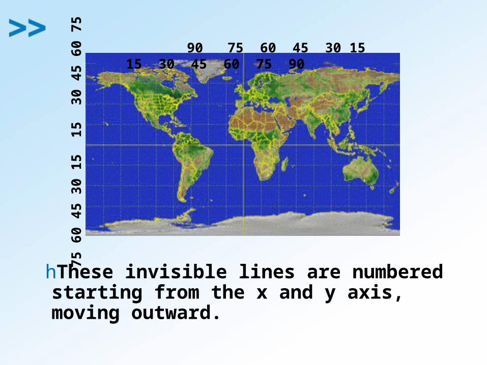
hThese invisible lines are numbered starting from the x and y axis, moving outward.
90 75 60 45 30 15 15 30 45 60 75 90
7
5 6
0 4
5 3
0 1
5 1
5 3
0 4
5 6
0 7
5
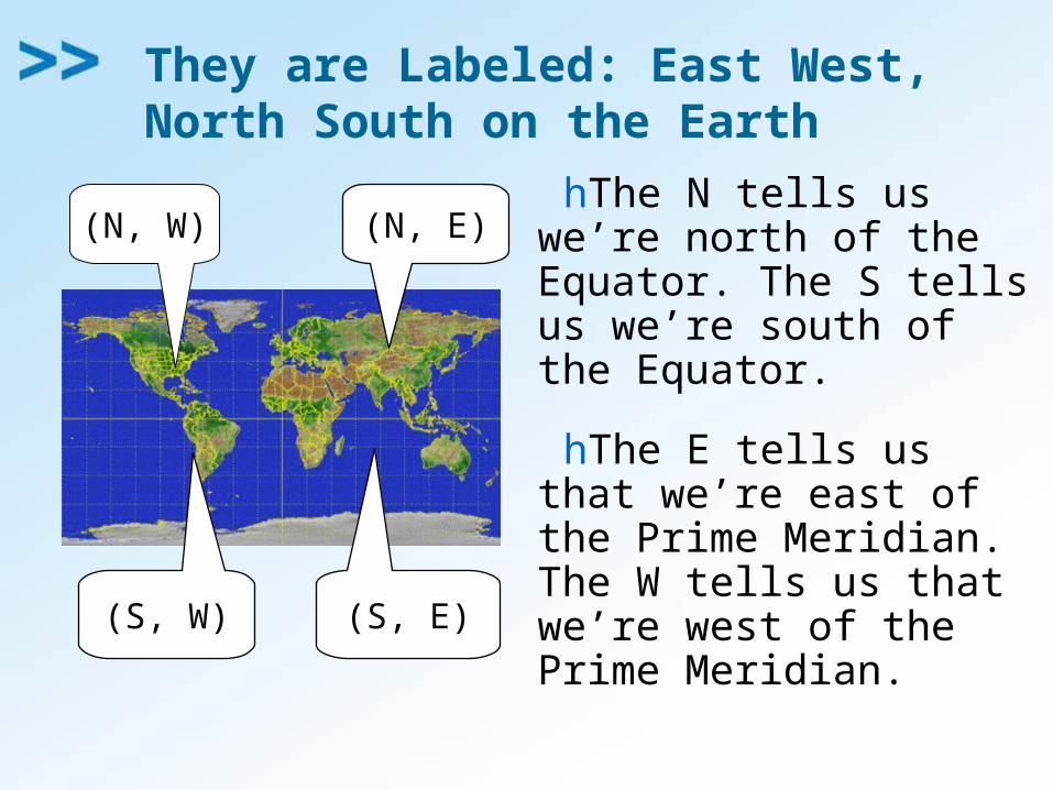
They are Labeled: East West, North South on the Earth
hThe N tells us we’re north of the Equator. The S tells us we’re south of the Equator.
hThe E tells us that we’re east of the Prime Meridian. The W tells us that we’re west of the Prime Meridian.
(N, W) (N, E)
(S, W) (S, E)
East West, North South on the Earth
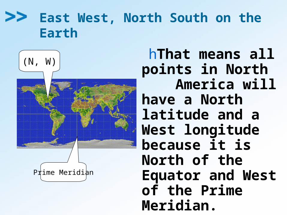
hThat means all points in North America will have a North latitude and a West longitude because it is North of the Equator and West of the Prime Meridian.
(N, W)
Prime Meridian
East West, North South on the Earth
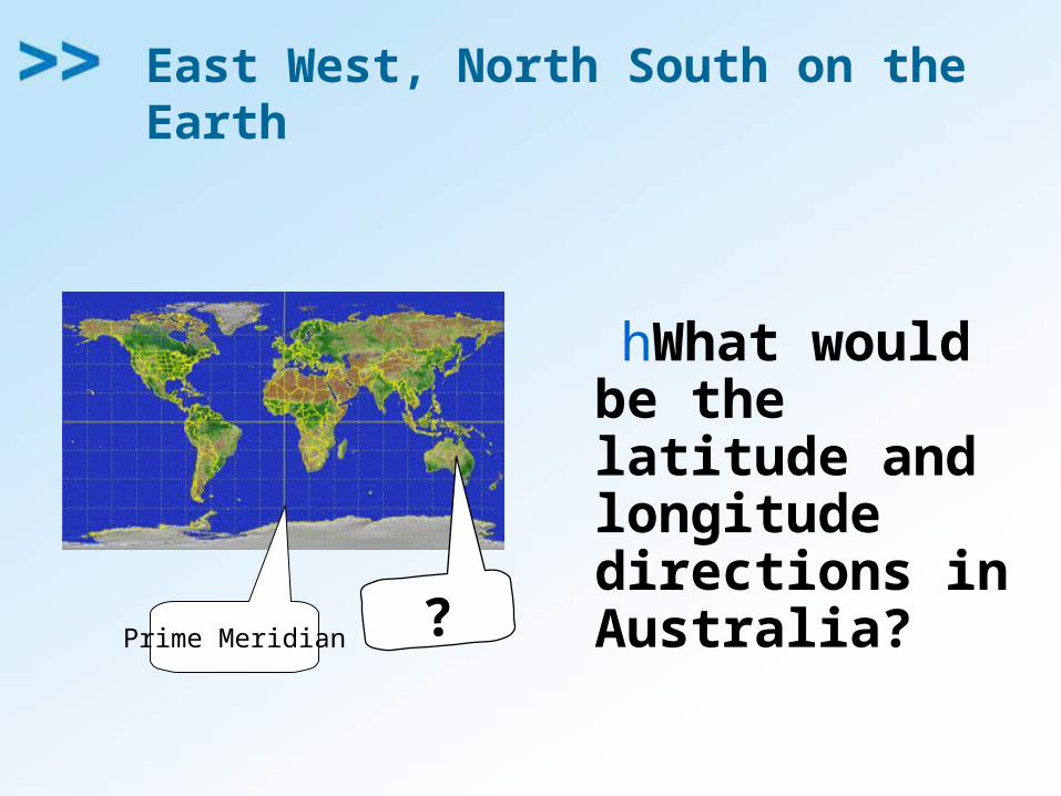
hWhat would be the latitude and longitude directions in Australia?
Prime Meridian ?
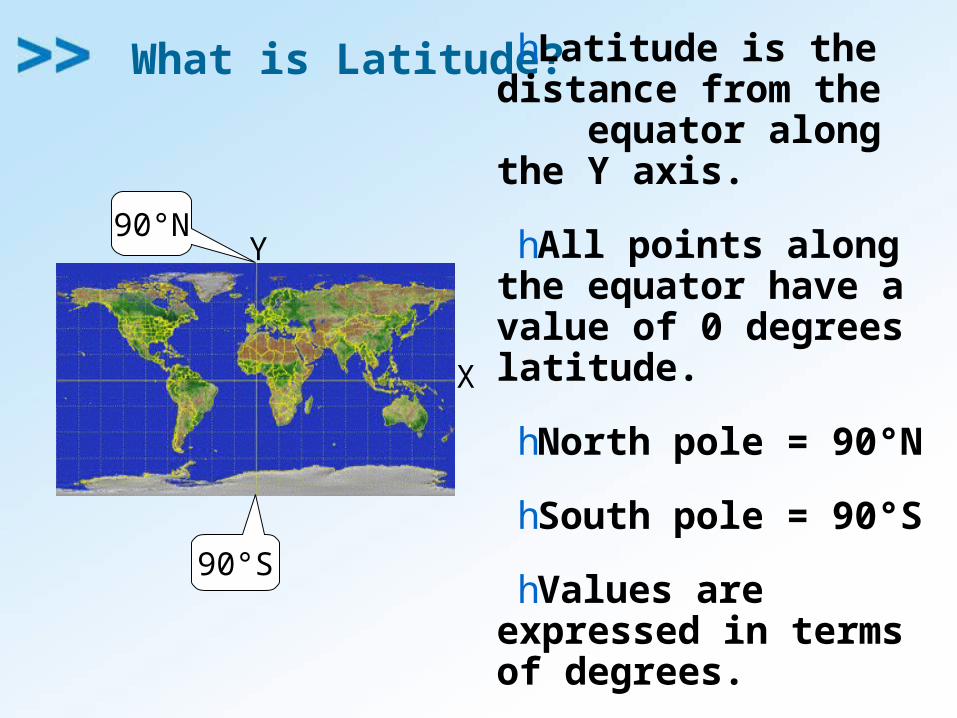
What is Latitude? hLatitude is the distance from the equator along the Y axis.
hAll points along the equator have a value of 0 degrees latitude.
hNorth pole = 90°N
hSouth pole = 90°S
hValues are expressed in terms of degrees.
Y
X
90°S
90°N
Latitude
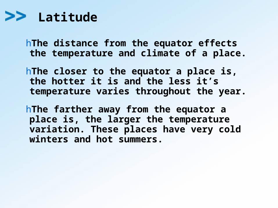
hThe distance from the equator effects the temperature and climate of a place.
hThe closer to the equator a place is, the hotter it is and the less it’s temperature varies throughout the year.
hThe farther away from the equator a place is, the larger the temperature variation. These places have very cold winters and hot summers.
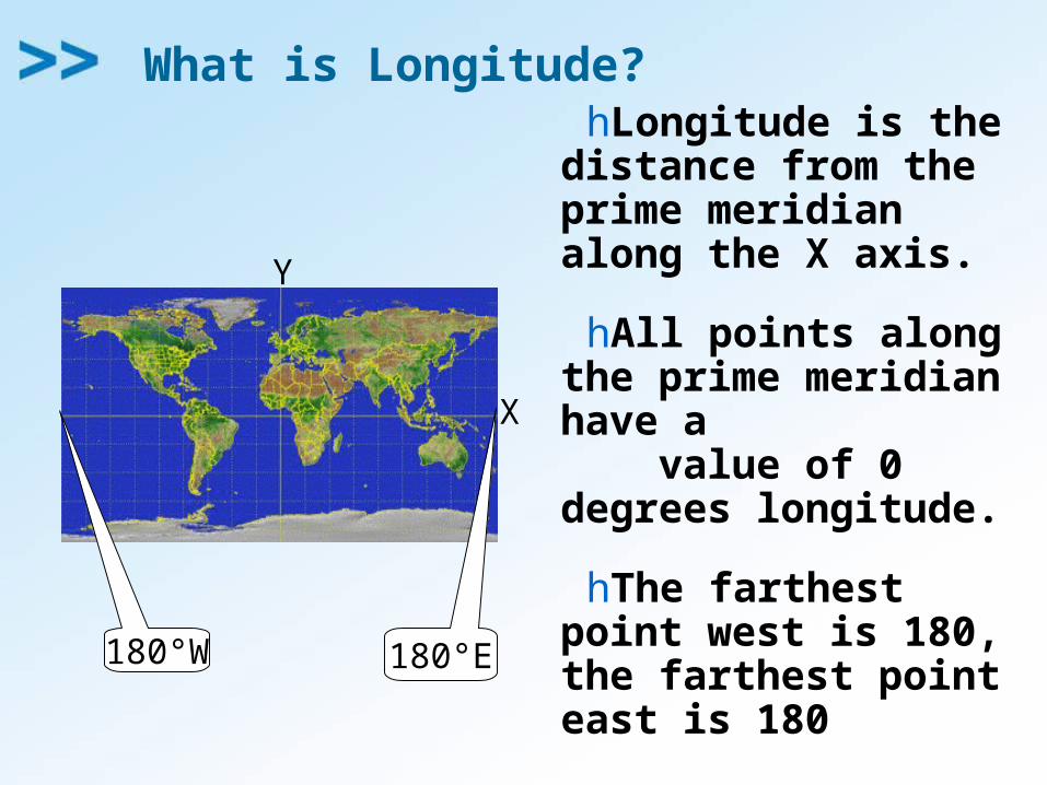
What is Longitude?hLongitude is the
distance from the prime meridian along the X axis.
hAll points along the prime meridian have a value of 0 degrees longitude.
hThe farthest point west is 180, the farthest point east is 180
Y
X
180°W 180°E

Time Zones
hThe longitude of a place effects it’s time.

So Where is (0,0)?hThe origin
point (0,0) is where the equator intersects the prime meridian.
h(0,0) is off the western coast of Africa in the Atlantic Ocean.
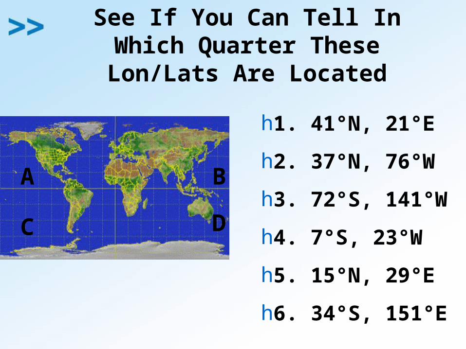
See If You Can Tell In Which Quarter These Lon/Lats Are
Located
h1. 41°N, 21°E
h2. 37°N, 76°W
h3. 72°S, 141°W
h4. 7°S, 23°W
h5. 15°N, 29°E
h6. 34°S, 151°E
A B
C D
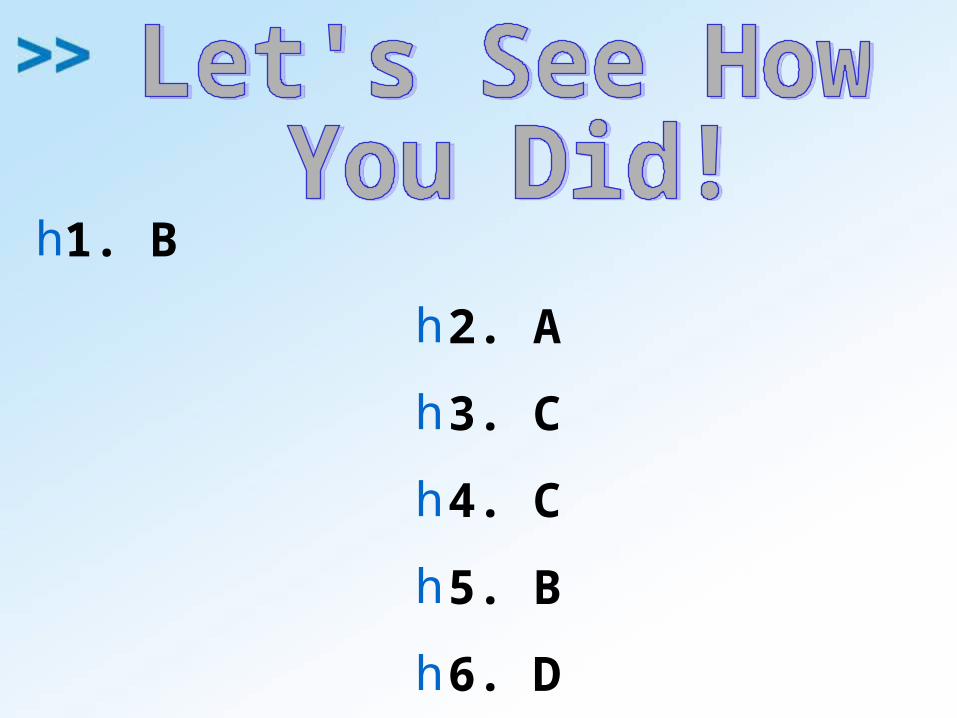
h1. B
h2. A
h3. C
h4. C
h5. B
h6. D
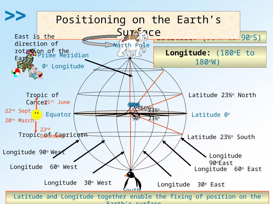
Equator Latitude 0o
Latitude: (90oN to 90oS)
Latitude 23½o NorthTropic of Cancer
Latitude 23½o SouthTropic of Capricorn
Longitude 30o East
Longitude 60o East
Longitude 30o West
Longitude 60o West
Positioning on the Earth’s SurfaceEast is the direction of rotation of the Earth North Pole
South Pole
23½o 23½o
66½o 90o
900
21st June
22nd December
22nd Sept
20th March
30oE60oE90oE90oW30oW60oW
Longitude 90oEastLongitude 90o West
Prime Meridian
0o Longitude
Longitude: (180oE to 180oW)
Latitude and Longitude together enable the fixing of position on the Earth’s surface.
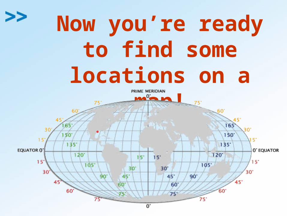
Now you’re ready to find some locations on
a map!