Embed Size (px)
Citation preview

[1]
CORONERS COURT NEW SOUTH WALES
Inquiry: Inquiry into fire at Wambelong Camp Ground, Warrumbungles National Park, New South Wales January 2013
Hearing dates: 25-29 August 2014; 11-13 November 2014
Date of findings: 28 September 2015
Place of findings: State Coroner’s Court, Glebe
Findings of: Deputy State Coroner HCB Dillon
Catchwords: CORONERS – General fire inquiry – Unprecedented catastrophic wildfire in Warrumbungles National Park – Cause and origin of fire – Whether deliberately lit – Whether hazard reduction plans and operations appropriate – Whether fire appropriately classified at relevant times – Problems with accuracy of fire prediction models – Fire behaviour in extreme conditions – Whether fire management was reasonable in circumstances – Whether back burning operations were appropriate – Whether emergency warnings to local area were timely – Lessons learned
File number: 2013/00052575
Representation: Dr K Stern SC with Mr A Casselden (Counsel Assisting) instructed by Ms B Haider, Office of General Counsel, Department of Justice
Mr J Agius SC with Mr D Mallon and Mr N Newton instructed by Ms H Allison, Crown Solicitor’s Office (NPWS and Rural Fire Service)
Mr K Odgers instructed by Mr W Allen (Coonabarabran Property Owners’ Alliance)

[2]
Findings as to cause and origin of the fire:
I find that the fire that broke out at the Wambelong Camp Ground on 12 January 2013 probably originated to the west of the camping ground on one of the banks of the Wambelong Creek. The evidence does not enable me to determine the cause of the fire.

[3]
Recommendations: To the Minister for Emergency Services I make the following recommendations:
1. That the Rural Fire Service consider proposing an arrangement with the Bureau of Meteorology to deploy weather balloons specifically for the purpose of assessing atmospheric instability during periods of severe to catastrophic fire danger in locations most likely to be severely affected, for example, areas in which a very high C-Haines index reading is registered and local fires have been identified.
2. Alternatively, I recommend that the RFS consider developing such capacity to deploy weather balloons itself, in conjunction with mobile weather stations, for this purpose.
3. That the Rural Fire Service consider redrafting the disclaimer in its fire predictions to make abundantly clear where the potential errors or omissions may affect the prediction and how to detect them if they are there (for example, by comparing them with linescans) and what other factors (such as VLS) may affect the predictions and in what way.
4. That the Rural Fire Service consider amending its fire prediction reports to include a checklist of significant factors that have not been able to be considered in the prediction model and a warning to be alert for them and seek intelligence on them from fire ground managers.
5. That in Class 3 fire-fighting operations, the Rural Fire Service consider including a fire behaviour analyst in the incident management team if feasible.
6. That the Rural Fire Service consider extending pre-emptive section 44 to whole of Castlereagh RFS/Warrumbungle Shire area.
7. That the Rural Fire Service together with other land managers develop a program whereby local stakeholders come together regularly (every 2 months during non-fire season and monthly during the fire season) to share intelligence and to consider hazard and incident management measures for implementation.
To the Minister for Emergency Services and the Minister for the Environment I recommend that:
8. That the Rural Fire Service and National Parks and Wildlife Service consider adopting the approach to fire classification suggested by Mr Conway that “classification and resourcing of the fire ground response and incident management capability should reflect the potential of the fire rather than observed fire behaviour.”1
1 Report [42] p.7

[4]
9. That the Rural Fire Service and National Parks and Wildlife Service introduce training, exercises or information packages, or other suitable forms of professional development, for operational fire fighters and analysts concerning the potential l effects of atmospheric instability and vorticity-driven lateral spread on fire behaviours in severe-catastrophic fire danger conditions.
10. That the Rural Fire Service and National Parks and Wildlife Service consider developing a land management policy that requires active engagement with property owners adjoining the Park to ensure that hazard reduction and asset protection is encouraged and undertaken before the bush fire season commences.
11. That the Rural Fire Service and National Parks and Wildlife Service consider amending their protocols for upgrading advices to higher levels to emphasise the significance and urgency of raising warning levels as soon as the potential dangers of fire to lives or property materially increase.
12. That the Rural Fire Service and National Parks and Wildlife Service review the procedures for requesting aerial support in ‘severe’ or worse fire conditions to ensure that delays in providing it are reduced to the minimum time possible.
To the Minister for the Environment I recommend that:
13. That the National Parks and Wildlife Service, in consultation with the relevant local Council(s), devise a policy that enables the John Renshaw Parkway to be closed at either end of the Warrumbungle National Park during a bush fire in such a way that its closure would not impede access by emergency services vehicles into the park.
14. That the National Parks and Wildlife Service consider incorporating “worst-case scenario” training, as proposed in Mr Conway’s report, in its suite of fire-fighting protocols, exercises and training packages for senior incident controllers and other senior managers.
15. That the National Parks and Wildlife Service consider reviewing its guidelines and protocols in respect of hazard reduction planning and burning-off operations in the light of the evidence from experts witnesses in these proceedings that the incidence of, and intensity of, major fires is increasing and in the light of expert evidence given in these proceedings concerning the dangers of vorticity-driven lateral spread.
16. That the National Parks and Wildlife Service review its protocols for control of Class 1 fires under its control to ensure that incident controllers managing fires in ‘severe’ or worse fire conditions receive as much incident management planning support as is reasonably practicable in the circumstances.

[5]
[6]
17. That the National Parks and Wildlife Service review its procedures for monitoring Class 1 fires occurring in ‘severe’ or worse fire conditions that cannot be reconnoitred at ground level adequately due to terrain or dangerous conditions, and consider including aerial surveillance (if reasonably practicable) as a standard procedure in such circumstances.
18. That during periods of ‘severe’ or worse fire conditions, that the National Parks and Wildlife Service consider adopting a posture of pre-emptive planning and deployment of incident management teams in national parks similar to the manner in which the Rural Fire Service does.
19. That as part of the adoption of such a posture in ‘severe’ or worse fire conditions, the National Parks and Wildlife Service consider alerting, at an early stage, all relevant persons and organisations, such as shire councils, heavy plant operators, the local RFS captains, Fire & Rescue NSW and other emergency services, that it is doing so, and that their assistance may be required at short notice.
20. That the National Park and Wildlife Service review its fire weather training regime and consider adopting or adapting the fire weather training courses introduced in Victoria following the 2009 bushfire disaster.
21. That National Parks and Wildlife Service conduct a review of its hazard reduction policies to ensure all assets within and on the boundary of the Park are clearly identified and an adequate policy or management plan exists for the protection of all assets, including a procedure pursuant to which progress in meeting hazard reduction targets is regularly and comprehensively assessed. We note that the Parliamentary Inquiry included a recommendation as to funding to be made available for prescribed burning.
22. The National Parks and Wildlife Service conduct a review of its prescribed burns program to ensure, as far as reasonably practicable, that all necessary managerial approvals for a prescribed burn are provided as promptly as possible.
23. The National Parks and Wildlife Service consider developing a land management policy that requires hazard reduction around identified assets within the Park and the clearing of fire trials within the Park before the bush fire season commences. Consideration should also be given to developing additional fire trails in the Park, bearing in mind the lack of available fire trails to the south of the John Renshaw Parkway in the park.

[7]
TABLE OF CONTENTS Introduction………………………………………………………………………………………………………………………. 7
The coroner’s functions...............................................................……………………………………………………….. 8
The factual background…………………………………………………………………………………………………….. 9
The issues..…………………………………………………………………………………………………………………………. 25
Cause and origin of the fire…………………..……………………………………………………………………………. 25
Hazard reduction……………………………………………………………………………………………………………….. 26
Fire classification……………………………………........................................................................................................ 27
Fire prediction and fire behaviour…………………............................................................................................. 30
Response to the fire…………………………………………………................................................................................. 33
Emergency notifications………………………………………………………………...………………………………….. 39
What more can be done?............................................................................................................................................ 41
Conclusions………………………………………………………………………………………………………………………… 43
Findings s 81 Coroners Act 2009………………………………………………………………………………………. 44
Recommendations s 82 Coroners Act 2009………………………………………………………………………. 44
[8]
REASONS FOR DECISION
Introduction
This is an inquiry under s 30(3) of the Coroners Act 2009 into a catastrophic bushfire that started on 12 January 2013 at the Wambelong campground which forms part of the Warrumbungle National Park. The fire continued to burn out of control for approximately the next week with parts of the fire burning but contained for a further two weeks.
Associate Professor Jason Sharples2, an independent expert bushfire scientist who provided a report for this inquiry, described the event as follows:
The Wambelong fire was a clear case of a fire developing into its most catastrophic state. The fire developed into a fully fledged fire thunderstorm, which when viewed as a contiguous event involved tens of thousands of cubic kilometres of atmosphere in addition to the large surface area consumed by the fire.
As a result of the fire, 56,280.55 hectares (139,072.2678 acres) of National Park and private lands were burned out. Within this area, 53 houses and 113 other buildings were destroyed and most of the infrastructure in the burned out area was destroyed or damaged. Approximately 95 per cent of the Warrumbungle National Park was burned out.
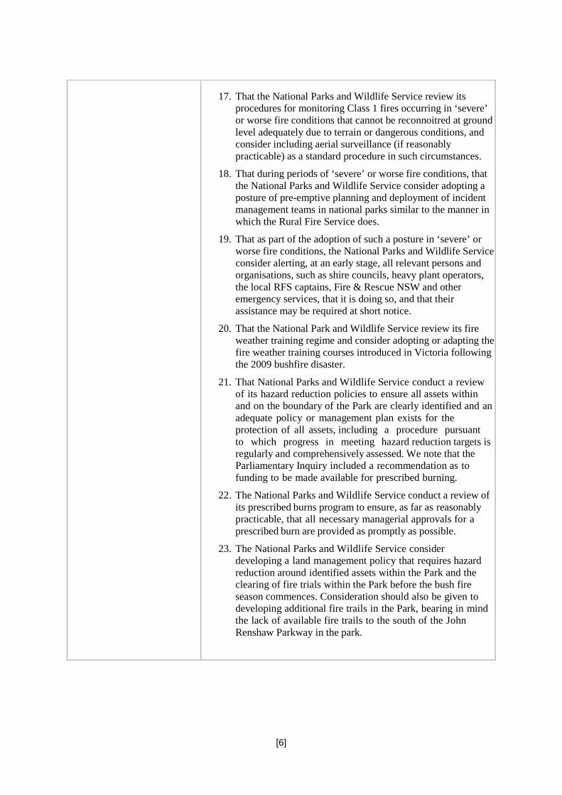
Map 1: From NPWS Fire Management Plan Warrumbungle National Park 2001-2006
At the time, the fire was described by the Deputy Commissioner of the Rural Fire Service, Mr Bob Rogers, as “absolutely ferocious”.3 The devastation wreaked by this inferno was not only on the park and private properties neighbouring it. Farmers lost large numbers of animals and countless wild creatures, including those of threatened and endangered species, must have died as well. Miraculously, although a significant number of people were injured, no human lives were lost. But the 2 Associate Professor of Mathematics, School of Physical, Environmental & Mathematical Sciences, UNSW Canberra 3 http://www.abc.net.au/local/stories/2013/01/14/3669191.htm

[9]
fire and the losses it caused have traumatised those who lost property and livestock, and left many in financial jeopardy. I am unaware of the monetary value of losses but it must be a huge sum.
The National Parks and Wildlife Service initially sought to suppress the fire with the assistance of some Rural Fire Service crews. The following day, at 11am, the Commissioner of the Rural Fire Service took control of the fire-fighting operation pursuant to s 44 of the Rural Fires Act.
After the fire, the performance of the fire-fighting services, especially of the NPWS, was questioned or criticised, especially by members of the local community who lost property and stock in the blaze. Because a fire of this size and ferocity was, in the Warrumbungles National Park, unprecedented, and because the way it was managed raised questions of public concern and public interest, I decided to hold an inquiry into the circumstances surrounding the cause and origin and management of the fire.
The Coonabarabran Property Owners' Alliance’s allegations
The preparation for the possible outbreak of a fire, the initial response to the fire by the NPWS and the strategic approach to fighting the fire on 13 January 2013 were heavily criticised by the Coonabarabran Property Owners' Alliance. The Alliance contended that “the activities of the NPWS during the days and hours leading up to the fire had the effect of enhancing the likelihood of the occurrence of a fire and to increase the danger of the spread of bushfire on and from the lands under its management”.4
In summary, the Alliance made the following allegations against the NPWS:
• The NPWS staff failed to apply their own training, experience and guidelines;
• That the NPWS failed to prepare adequately for the possible outbreak of the fire;
• That the National Park was not sufficiently well staffed to enforce the closure of the park and the total fire ban in force when the fire broke out;
• That the response on 12 January was not rapid nor sufficient to bring the fire under control at an early stage;
• That the RFS was not involved early enough;
• That the back burn operation was ill-advised and carried out in an inappropriate fashion;
• That aerial operations on 13 January started too late;
• That notification of fire danger was too slow; and
• That the NPWS staff failed to act in ‘good faith’ or were ‘slapdash in the execution of their duties’.
The most important of these allegations or grievances relate to the preparation for outbreak of the fire; the response to the fire; the back burn operation; and community notification. Before the inquiry began, a detailed issues list was circulated to interested parties. It covered (in different form) these issues. That list provides the framework for this report. I will deal with the ‘good faith’ allegation separately in my conclusions.
The coroner’s functions in this inquiry
This is a general inquiry pursuant to s 30(3) of the Coroners Act. Ordering a general inquiry has enabled the team assisting me to investigate all the relevant circumstances concerning the fire 4 Submission of the Coonabarabran Property Owners' Alliance 21 May 2015

[10]
(including, but not limited to, an examination of its cause and origin). The NPWS, the RFS and the Coonabarabran Property Owners Alliance were all represented at the inquiry and have made submissions as to the findings I should make.
In this report I have read and taken into account the material in the brief of evidence, the oral evidence from witnesses who were called to appear at this inquiry, and the voluminous submissions made by Counsel Assisting and interested parties. Due to the volume of that material, however, I have referred only to those issues, evidence and submissions that I consider are most significant.
A coronial fire inquiry is a search for truth. It is intended to be an independent, objective, fair examination of the available evidence relating to the fire. It follows that a proper inquiry is neither a witch-hunt nor a whitewash. One of the general purposes of holding coronial inquiries such as this one is to address the suspicions and fears of members of the community who have been harmed by events such as this one. Civilised societies are concerned about catastrophic harm caused to their members and try to understand those events. This may help those harmed but also enables the community to learn from their traumatic experience.
It is critical to emphasise from the outset that these proceedings have been an inquiry, not a trial or a contest. Although arguments have been put on both sides of various questions and issues, and the Alliance has not resiled from its criticisms of the NPWS, these proceedings are by definition inquisitorial in nature, not adversarial. The primary concern and focus, therefore, in this (and all coronial proceedings) has been to ascertain the facts. For this reason, there are no formal "parties", as such, in these proceedings, with rights and interests to be adjudicated upon after they present their respective cases. Nor is it the function of this inquiry to apportion blame, although, of course, it is necessary to make findings as to the appropriateness of what was done.
I also emphasise that it is not my function to make findings or enter judgment concerning questions of law relating to such matters as duty of care, breach of that duty or liability for damages. Such issues are for other courts.
A coroner may also make recommendations that he or she considers necessary or appropriate. I will make a number of recommendations to the relevant authorities.
The factual background
The Warrumbungle National Park
The Warrumbungle National Park lies approximately 30 kilometres west of the township of Coonabarabran, a town of approximately 3000 residents. The park is about 23,311 hectares in size and has a public road (John Renshaw Parkway also known for some of its length as Timor Rd) running through the park east-west. This road is not controlled by gates and is used as a public thoroughfare. The National Park is managed and supervised by staff from the National Parks and Wildlife Service whose office is located at Coonabarabran. Within the park are a number of camping grounds, a visitors centre, walking trails, other buildings and infrastructure.
The Warrumbungle National Park lies within three council areas: Gilgandra Shire; Coonamble Shire; and Warrumbungle Shire. The majority of the Warrumbungle National Park is located in the Warrumbungle Shire (Coonabarabran). A number of properties, including agricultural landholdings, back onto the park.

[11]
Map 2: A Google satellite image of the same area clearly showing clear land (farming) against forest/wooded areas.
The park’s beautiful volcanic terrain is rare in Australia. The National Park and Wildlife Service Fire Management Plan Warrumbungle National Park 2001-2006, states:
The Warrumbungle Range is the most westerly extension of the Great Dividing Range in New South Wales. The elevation ranges from 400 metres to 1200 metres. The geology of the park is dominated by a variety of igneous rocks that were associated with the Warrumbungle Volcano. The higher elevations are characterised by volcanic landscapes. Erosion has exposed volcanic domes, lava flows, dykes and necks, which have resulted in one of the more distinctive volcanic landscapes in Australia.

[12]
Map 3: A Google maps image of the same area showing the terrain of the area.
Bordering the National Park to the east at about 1100 metres above sea level is the large Siding Springs Observatory site which consists of a number of telescopes, a visitors centre, lodge, administration building and residence. The observatory is Australia’s largest optical astronomy research facility. This facility is used by the Australian Astronomical Observatory, the Australian National University and many other smaller organisations. It is an almost pricelessly valuable national asset.
Google image of Siding Springs 2013.
[13]
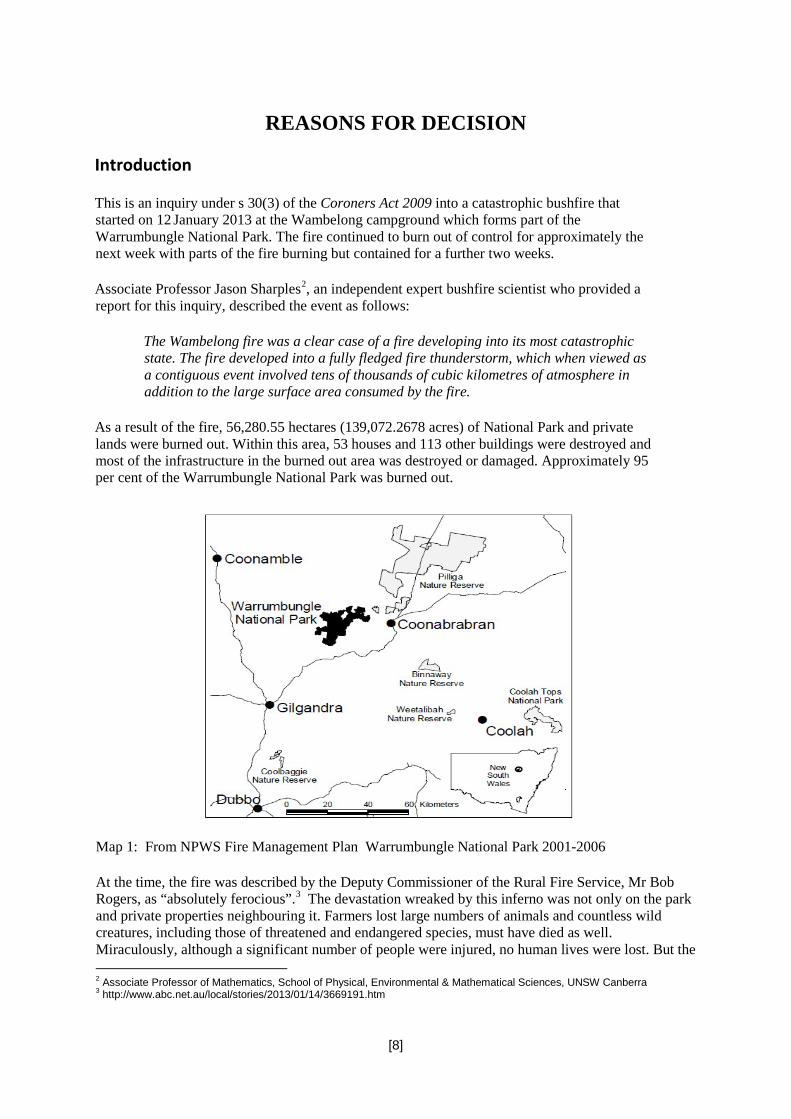
Sketch of Siding Spring – source: Australian National University.
The Needle Mountain Communications tower is also located adjacent to the park. This provides vital communications services for the area.
The landscape contains many volcanic rock features such as the “Bread Knife” and “Split Rock” a tall volcanic rock feature south of camp Wambelong. The terrain of the park is steep with the majority of the park being sloped land. The vegetation is predominantly Dry Sclerophyll Shrub Forest, White Box, White Pine and Ironbark woodlands.
Climate
Between 2010 and midway through 2012 the region experienced above average rainfall followed by high volumes of vegetation growth. This period of growth was followed by below average rainfall and dry conditions from around mid-2012. In the week leading up to the fire the region experienced hot and dry conditions. Between 1st and 12th January 2013 the average maximum temperature for Coonabarabran was 36.6 degrees Celsius. No rain fell. The Warrumbungle National Park was dry.
By reason of the high rainfall between 2010 and 2012, there was considerable fuel load in the region of the National Park. In the area where the fire first spread, the Brown’s Creek section of the park, the fuel hazard had been estimated in 2011 as being high. In the Southern High Tops area, where the fire ultimately spread, the fuel load was estimated in 2011 as being high to very high.
Fire history
Unlike the neighbouring Pilliga Scrub, until January 2013, fires in the Warrumbungle National Park had historically been small and less frequent. In the last 50 years there have been less than 30 fires in the national park. The largest recorded fire prior to 2013 was in 1967 when about 5,000 hectares was burnt. More recently, in 2001 a wildfire burnt approximately 3,000 hectares around Mount Exmouth. According to NPWS, before the January 2013 fire, there had been no listed fires in the National Park since January 2002. This history of contained, comparatively small fires was one of the factors that coloured the assessment of risk by the NPWS officers in January 2013.

[14]
Fire management
The national park falls within the jurisdiction of two Bush Fire Management Committees (BFMC) established under the Rural Fires Act 1997 (NSW): The Castlereagh Bush Fire Management Committee whose members include representatives of the Warrumbungle and Gilgandra Shire Councils, and the North West Bush Fire Management Committee which includes, amongst others, representatives of the Coonamble Shire Council.
Representatives of the NPWS would regularly attend meetings of these two BFMC. Each BFMC has its own “Operations Co-ordination Plan” and “Bush Fire Risk Management Plan”. The roles and actions undertaken by NPWS in incident management are primarily outlined in those documents and its “Northern Plains Region - Regional Incident Procedures 2012 – 2013” which details the procedures and co-operative arrangements required for incident management on lands managed by the NPWS in the Northern Plains Region.
Incident Controllers dealing with wildfires on NPWS lands are appointed as follows:
Class 1 Fires – NPWS
Class 2 Fires – BFMC
Class 3 Fires – the Commissioner of the Rural Fire Service
Class 1 bushfires are normally small scale and of short duration and are managed with a limited number of resources and by a single agency. Class 2 bushfires are normally medium scale, have several sectors and are managed over one to a few shifts or burn over several different land tenures, or both. Class 3 bushfires include the largest scale bushfires, where there are multiple bushfires being managed at the same time, over several days to weeks and may involve multiple land tenures.
The Wambelong fire was originally classified as a Class 1 fire. That classification was not altered until 11 am on 13 January when it was reclassified as a Class 3 fire and a declaration was made under s 44 of the Rural Fires Act 1997. That section provides that:
(1) The Commissioner is to take charge of bush fire-fighting operations and bush fire prevention measures and to take such measures as the Commissioner considers necessary to control or suppress any bush fire in any part of the State if, in the opinion of the Commissioner:
(a) a bush fire has assumed or is likely to assume such proportions as to be incapable of control or suppression by the fire-fighting authority or authorities in whose area or locality it is burning, or
(b) the prevailing conditions are conducive to the outbreak of a bush fire likely to assume such proportions, or
(c) a bush fire is not being effectively controlled or suppressed by the fire-fighting authority or authorities in whose area or locality it is burning, or
(d) a bush fire is burning in a place that is not the responsibility of any fire-fighting authority.
In practice, a s 44 declaration enables the Commissioner of the RFS to take over management of major fires and to use the full resources available to the service to fight them.
[15]
A Rural Fire Service fire control officer for a district has various statutory duties, responsibilities and powers. These include, at s 38(2)(d) of the Rural Fires Act an obligation to “take or cause to be taken all necessary measures for suppressing fires in the rural fire district and protecting and saving life and property in case of fire”.
This is, however, subject to compliance with any relevant bush fire management plan or other relevant plan of the authority responsible for the managed land of which the fire control officer is aware (s 38(4)). That shows the significance of such plans.
As at January 2013 the NPWS was responsible for the implementation of the “NPWS Warrumbungle National Park Fire Management Plan” and the “NPWS Prescribed Burn Program Northern Plains Region 2011 – 2014”. Each of these documents provided a comprehensive strategy for managing fuels in the Warrumbungle National Park.
The “Prescribed Burn Program Northern Plains Region” included, amongst other things, prescribed burns for Browns Creek West and East. Browns Creek is immediately north of the Wambelong campground. Browns Creek and the Southern High Tops were both programmed for hazard reduction burns within the period 2011 to 2014.
The map of the area that was proposed to be burned in the Brown’s Creek hazard reduction burn is strikingly similar to the area that burned in the period up to around 1 pm on 13 January 2013.
In a report prepared by John Whittall, Area Manager NPWS, and tabled on 30 March 2010 at the Castlereagh BFMC, the NPWS indicated in relation to Hazard Reduction that 40ha of burns were planned in the Warrumbungle National Park. It seems however that by January 2013 no prescribed burns had been carried out for the Browns Creek region notwithstanding the fact that Mr Steven Tucker, a NPWS ranger, had in January 2012 proposed and submitted a plan for a burn at Browns Creek for “Autumn 2012 – Spring 2012”. According to that document the Browns Creek region had not been burnt for over 40 years. At the time of Mr Tucker’s assessment he estimated the “overall fuel hazard” for the Browns Creek region to be 11.0 tonnes per hectare.
Likewise the Southern High Tops region, which included Needle Mountain, had not been burnt for more than 44 years. As at 3 September 2011, when they completed a “Hazard Reduction Certificate Assessment Check Sheet”, the “overall fuel hazard” for this area had been assessed by Peter Brookhouse and Scott Filmer to be from 10 T/ha to 18 T/ha.
Saturday, 12th January 2013
During the week leading up to the Wambelong fire the fire rating for the region was listed as Very High to Extreme. On 8th, 10th and 11th January, the fire danger rating in the National Park was ‘Extreme’ and it was closed with all services suspended including camping and the visitors’ centre.
On 12 January 2013, there was an extreme fire danger warning for the area with temperatures on the Bureau of Meteorology daily weather observations reported at 30.3°C at 9:00am and 40.8°C at 3:00pm. The wind was also strong with northerly winds blowing at 35kph at 9:00am and north to north-westerly winds at 20kph at 3:00pm. Due to the severe weather conditions, the national park was closed with all services suspended. The road was not, however, blocked.
The BOM fire information available on 12 January indicated a number of matters of potential further relevance. The published BOM information includes a range of information as to fire danger, including what is described as a Continuous Haines index. The C-Haines index is a measure reflecting
[16]
atmospheric instability.5 For around 50 years atmospheric instability has been recognized as having a significant influence on fire behaviour. In particular, it is known that unstable atmospheres increase the probability that large scale convection columns will occur, resulting in increased surface wind speeds. When the atmosphere is unstable fires typically burn with higher rates of spread, higher intensities and longer range spotting than would otherwise be expected. That is obviously potentially significant information in assessing the potential behaviour of a wildfire.
The C-Haines index has a scale of 1 to a maximum of 13. On 12-13 January 2013 the C-Haines index for the area around the Warrumbungle National Park was rated at 12-13 on the scale.
The outbreak of the fire was first detected at around 3.30pm when Jason Clarke observed smoke coming from the Park. Mr Clarke, a serving RFS member at the time, called his team captain Ron Nash at about 3.50pm to report the fire. At that time Mr Nash was unaware of any fire in the Park. Mr Clarke continued driving towards the smoke until he was about 200 metres west of Wambelong campground. At that point he observed the fire creeping up towards John Renshaw Parkway. Mr Clarke again contacted Mr Nash to report his observations of the fire.
A number of local people either saw or smelt the fire in the National Park before 4.00pm. For example, at about 3.55pm Patricia and Stephen Fergusson observed a fire north of Wambelong Creek as they approached Wambelong campground from the east. At 4.06pm Mr Fergusson made the first ‘000’ call to report the fire. John Whittall and May Fleming, both NPWS personnel, also saw a fire at the Wambelong campground and reported their observations to other NPWS staff including Rebecca Cass who was the NPWS ranger responsible for patrolling the National Park that day. Indeed, it was Rebecca Cass’s report that led Mr Whittall to drive to the Wambelong Camp Ground to look for the fire in the first place.
By around 4.30pm crews from the NPWS, RFS, NSW Police and volunteers had attended the fire at Wambelong campground. Other than Jason Clarke, the first RFS officer to arrive was Mr Tony Webb from the Warrumbungles brigade. The fire at this time was classified as a Class 1 fire. It therefore came under the control of the NPWS. Mr Mervyn Starr, the most senior NPWS field officer in attendance, was appointed the Forward Controller for the fire and was responsible for co-ordinating the response by NPWS staff and the RFS. Mr Mark Fosdick, District Manager of the NPWS, was appointed as the Incident Controller for the fire.
He was stationed in the Incident Control Centre at the NPWS Coonabarabran office. As this had only been classified as a Class 1 Fire there was no requirement under the BFMC Operations Coordination Plan that the Incident Management Team include a Local Knowledge Representative.
Between around 4 and 5 pm on 12 January the fire was estimated as being between one and five hectares in size, starting at the Wambelong campground, and moving in a generally east to northeast direction over steep and rocky terrain. The precise point of origin was not clear then and remains unidentified. The general location of the point of origin was Mr Clarke identified it as being on the northern side of the John Renshaw Parkway approximately 50 metres west of the Wambelong campsite. He saw the fire as creeping along the edge of the road. He also described spot fires spreading in the campground area. He was then joined by John Whittall of the NPWS and the two of them fought the fire with hoses on the western side. At about 4.30pm, Mr Mr Tony Webb (RFS
5 Haines Index (also known as Lower Atmosphere Severity Index) is a weather index developed by meteorologist Donald Haines in 1988 that measures the potential for dry, unstable air to contribute to the development of large or erratic wildland fires. The index is derived from the stability (temperature difference between different levels of the atmosphere) and moisture content (dew point depression) of the lower atmosphere. This data may be acquired with a radiosonde or simulated by a numerical weather prediction model. The index is calculated over three ranges of atmospheric pressure: low elevation (950-850 millibars (mb)), mid elevation (850-700 mb), and high elevation (700-500 mb). https://en.wikipedia.org/wiki/Haines_Index

[17]
Warrumbungles) was another fire fighter at the scene. He assessed the fire as moving at a ‘fair pace’ but thought that it was not a ‘raging fire’. Nevertheless, given the very steep terrain, he thought it would be impossible to fight the fire from the side.
That afternoon and evening, the initial response was to attempt to control and slow the fire, not to extinguish it, by trying to keep it north of Wambelong Creek on the southern flank as the fire travelled in an easterly direction and to stop the fire crossing John Renshaw Parkway on the western flank.
At around 5:35pm, Mr Starr contacted Mr Fosdick and informed him that he thought the fire on the eastern flank was unmanageable due to the very steep and rocky terrain it was moving over. He also thought that the fire on the western flank may be manageable but he was uncertain of this as he was unable to see the top of the hill where the head of the fire was. At this time Mr Starr was not prepared to send crews up the steep flanks into the fire ground due to the potential danger to them and the limited impact such action may have had. Mr Fosdick agreed with Mr Starr’s assessment.
At about 5.35pm Mr Starr also informed Mr Fosdick of the prevailing weather conditions. The ‘Kestrel’ weather meter reported the temperature as being 42.9 degrees Celsius, the humidity as 19% and westerly winds with a maximum of 13.3kph averaging 2.5kph with 50% cloud cover.
The eastern and western flanks of the fire were in very steep terrain and were unable to be accessed by foot. Ground crews monitored the fire. Shortly after 6.00pm a Rapid Air Response Team helicopter with a RFS crew of six arrived at the fire ground.
There were also 10 RFS and NPWS crews on the ground and two-fixed wing planes in the air assisting with water bombing. A crew in a helicopter also attended, with some members clearing a fire line by foot and the helicopter bucketing the fire with water. The aerial crews treated the northern side of the fire with water bombing and gel as well as targeting hot spots on the fire ground. The aerial crew of one plane identified a secondary fire about 200 to 500 metres east of the original fire moving up a heavily wooded hill. Mr Starr was of the view, at around 6.30pm, that there was little the crews could do overnight beyond patrolling the area due to the steep and dangerous terrain. The air crew left sometime around 7 pm.
Many at the fire on that afternoon and evening noticed that there were two spot fires some distance from the main fire, one of which was in a log jam some distance from the main fire in the creek. The precise distance is difficult to determine, although Mr Webb estimated it as being some 500 metres from the main fire. Because winds were very light on that afternoon, and it was thought that they were not capable of carrying embers that distance from the main fire, this raised some suspicions that the fire had been deliberately lit.
NPWS and RFS personnel monitored the fire until about 8:00pm when a decision was made by Mr Fosdick, in consultation with Mr Starr, to leave two RFS crews overnight to monitor fire behaviour and spread, and to prevent it crossing John Renshaw Parkway to the south. These two crews were from Timor RFS and Warrumbungle RFS. Shortly after 8.00pm the remaining NPWS and RFS staff left the fire ground. NPWS personnel returned to the NPWS office at Coonabarabran to develop an Incident Action Plan (IAP). At around the same time Mr Webb informed Mr Fosdick that the weather was reported as 35.4 degrees Celsius, 1-knot winds from the west, 29% humidity and “things were fairly calm and everything was okay”.
The Second NPWS Situation Report completed at 8.00pm on the 12th noted that the potential threat in the next two to six hours were expected to be very low but also noted that those potential threats could increase “tomorrow pm (Sunday) with Temps to 38, Rh <25%, Winds N/NW to 25-30kph”. At that time the control strategy was for a “direct attack tomorrow (Sunday) with RAFT teams, supported by

[18]
a couple of fire units along John Renshaw Parkway”. The area burnt at this time was estimated to be 20 hectares.
A RFS Fire Spread Report prepared at 8.30pm on 12 January indicated that fire activity would increase markedly after 8.00am the next day with increasing northwest winds changing to predominantly southwest winds by late afternoon with potential for a large increase in rate of spread and spotting. This report noted an opportunity for early morning suppression activities on the Sunday to retard fire progression. It also stated that winds would pick up in the afternoon, making suppression and containment more difficult. It was cautioned that if suppression was not successful, the visitors centre and other assets may come under threat in the afternoon.
A fire prediction reported was completed in the early evening on 12 January and communicated to Wayne Dornbusch and Mark Fosdick at around 9 pm. This particular fire spread prediction was based on an assumed overall fuel load between 7 and 12T/ha based on, it seems, vegetation and fuel mapping and aerial photographs. The prediction relied upon containment being provided by roads such as the John Renshaw Parkway. This report was uploaded to the ICON computer system at around 9 pm. Mr McCoy, the RFS officer who supervised the preparation of the fire prediction report, notified the NPWS team to expect it.
The RFS prediction team also provided a fire prediction map. It predicted fire progression primarily to the East and North, with the fire not crossing the John Renshaw Parkway. These two documents seem to have featured very heavily in the incident planning from the moment of their receipt. The prediction bore little resemblance to the development of the fire from around 8 am on 13 January onwards. Two maps illustrate this. Fire prediction methodology remains an inexact science, especially in relation to fires burning in highly unstable atmospheres.
Because the conditions over the past few seasons had encouraged growth of vegetation, and because hazard reduction burns had not been conducted, it seems likely that by 12 January 2013 the overall fuel loads for the region would have exceeded the estimate of 11.0T/ha made by Mr Tucker in 2012. Some support for this comes from Mr Peter Brookhouse, NPWS who, at about 10.30am on the Sunday, is reported to have told Laurence McCoy of the RFS that “the fuel loads were 5T/Ha in the vegetation on the northern slopes of the park and 12 T/Ha in other vegetation types”. He was also reported to have said, on Sunday at about 1.00pm, to Naomi Stephens of the NPWS that the area near the fire had “very high overall fuel hazard levels”.
The next RFS Fire Spread Prediction Report prepared on Sunday at 10.54am assumed an overall fuel load of about 20T/Ha in the creeks and drainage lines and 15T/Ha for the ranges. These figures were based on GIS (Geographical Information Systems) fuel layers and not, it seems, on any local knowledge. The RFS Fire Spread Prediction Report prepared on Sunday at 1.33pm assumed overall fuel load to be about 15T/H. This was based on a field report and a discussion between Mr McCoy and Peter Brookhouse. These new fuel load figures were obviously a significant increase from the earlier fuel load assumptions made at 8.30pm the night before.
The C-Haines Index of atmospheric stability is used on a routine basis throughout the fire season in NSW as part of the Fire Weather Forecast by the Bureau of Meteorology. Atmospheric instability increases the probability that large scale fire convection columns will develop resulting in enhanced surface wind speeds, the drawing down of low relative humidity air from higher altitudes and the possibility of downdrafts causing abrupt changes in wind speed, wind direction and fire behaviour.6 These events are frequently observed when the C-Haines Index exceeds about 8, with marked increases in severity when the C-Haines Index exceeds about 10. The C-Haines rating in the region on 12 January was, as we have noted previously, 12-13 on the scale.
6 See Dr Jon Marsden-Smedley report “Wambelong Fire: Warrumbungle National Park January 2013” (2014) [1.4.4.12]

[19]
The Special Fire Weather Forecast Report prepared at 6.00pm on 12 January predicted a Forest Fire Danger Index7 between 1pm and 4pm on 13 January to be between about 50 and 60, that is, in the ‘severe’ fire conditions range.
At around 8:45pm on Saturday, before receipt of the fire prediction, Mr Fosdick decided, in consultation with other NPWS staff (Messrs Starr, Dornbusch and Tucker), that a direct attack control option would be implemented the following morning. A direct attack on the fire involved air support and remote area fire crews. A major problem with the direct attack option was that the eastern and western flanks could not be accessed on foot because of the terrain and therefore water bombing would be the only means of containment on those flanks. Water bombing would also be used to assist control of the northern flank. The degree to which water bombing was capable of reducing the fire was also considered. Generally water bombing by itself is insufficient to extinguish fires completely. Staff safety was obviously given highest priority in this decision-making process.
The alternative option discussed was an indirect attack which involved falling back to existing fire trails and containing the fire within those specified areas. This strategy involved using machinery to improve the fire trails and to back burn if required.
Mr Peter Brookhouse has given evidence that NPWS fire fighters are trained to maintain situational awareness at all times. This requires regular updating of fire behaviour and weather, and fire predictions. It would appear to have been critical for weather information to have been regularly accessed, including information relating to wind direction, instability, and wind behaviour. Further, the Regional Incident Procedures for the North West Plains area at 263/4024 emphasise that weather forecasts should be monitored using sites such as the Bureau of Meteorology.
Notwithstanding this, the first spot weather forecast requested from the BOM was made shortly after midnight on 13 January, and was thus not available at the time of the critical strategic decision-making.
At about 9:30pm Mr Dornbusch obtained the Fire Spread Progression Map from the RFS and promptly discussed this with Mr Fosdick. According to Mr Dornbusch, the fire progression map showed that without any controls being placed on it, the fire had the potential to grow to a significant size overnight and by 8.00am on Sunday morning the fire had the potential to be 1.5km by 1km in size. Mr Fosdick also reviewed the fire spread prediction map and thought that it indicated a rate of spread that would compromise crew safety and make the success of the direct attack strategy unlikely.
At about 10.00pm, given these concerns, Mr Fosdick and Mr Dornbusch jointly decided to change the Incident Action Plan from a direct attack to an indirect attack involving back burning along the southern flank of the fire with the aim of removing fuel loads in front of the fire before it reached the John Renshaw Parkway containment line.
According to Mr Fosdick the intention of the back burn was to keep it just in front of the wild fire but not too far in front in order to avoid creating another fire. The objective of the back burn was to prevent the flank of the fire crossing John Renshaw Parkway and if possible to keep the main fire west of the northern fire trail, that is prevent easterly and southerly runs.
Whilst Mr Fosdick’s description might suggest a close containment strategy, the Incident Action Plan as prepared by Mr Dornbusch gives a different impression. This indicates that the objective was to undertake back burning operations from the John Renshaw Parkway, Canyon Picnic Access road, Camp Blackman access road and the eastern side of the northern fire trail north of Camp Blackman and secure those lines. The stated objective was to reach grid reference 895400 on the northern fire 7 The FFDI takes into account dryness, wind speed, temperature and humidity to provide a fire danger rating.

[20]
trail by 1pm. This entailed about four kilometres of back burning. This plan did not appear to require that the back burn be kept in close proximity to the actual fire, and indeed its success depended upon the back burn being carried out at some distance from the fire. The instruction to crews was to back burn according to this plan to reach the end point on the northern fire Trail by 1pm, and that the crews should be commencing back burning on the northern fire trial by midday. This was all premised on weather being predicted to deteriorate from around midday or 1pm with a north-west wind at 30-45 mph, temp 38, and relative humidity at 13%. In fact the weather performed very much as predicted in this Incident Action Plan, which in turn reflected the Spot Weather Forecast at 1253 am.
Another feature of the Incident Action Plan is that it recognized that an alternative objective would be to focus upon the southern containment line which was where the fire broke out at around 1 pm. Further, it recognized that if the northern fire trail did not contain the fire, fall back containment lines would be very large and could encompass private lands. Other considerations for changing to an indirect attack were that the crews could only access two sides of the fire on foot, and that there was potentially two to three kilometres of perimeter to contain by 8.00am the following day in remote and difficulty terrain.
As a result of the new Incident Action Plan two extra crews were arranged to come from Narrabri and Baradine.
At about 10:45pm Mr Dornbusch relieved Mr Fosdick as Incident Controller. Overnight Mr Dornbusch completed a Situation Report, Incident Action Plan and Field Incident Action Plan. Two helicopters had already been arranged by Mr Fosdick for the following day, and it appears that Mr Whittall had already asked one grader driver, Mr Glen Humphries, to attend with his grader from 8 am. At 6 am the following morning a request was made for two RFS crews to attend.
At about 11.00pm on 12 January Steve Tucker (NPWS) and Rebecca Cass (NPWS) returned to the fire ground to assess the suitability of the northern fire Trial as a containment line. The fact that this had not been assessed previously does not appear to have influenced the decision to use the northern fire Trail as a containment line. At 11.36pm Tony Webb provided Mr Dornbusch with an update from the fire ground. Mr Webb described the eastern side of the fire at Wambelong as being reasonably quiet and still on the northern side of the creek. On the western side he described a fair bit of flame up on the ridges which had spotted across the creek. He reported that the temperature was 32 degrees, relative humidity 34% with winds from the east-south-east at 2-5 kph. Overnight Mr Webb thought the weather was “fairly calm”.
In the morning of 13 January there were approximately eight NPWS ground crew at the fire ground, all of whom were involved in the back burning operation. There were also two RFS crews assisting in the back burn. That left only one RFS crew consisting of three fire fighters to monitor the John Renshaw Parkway, the key containment line. Prior to 11 am only one grader was present and he was assisting in the back burning operation. A second council grader arrived at around 11.20 am.
Sunday, 13th January 2013
At about 12:55am Mr Tucker radioed in advising that the western side of the northern fire Trial would need a ‘very big brush up’ to a standard suitable for back burning and that the fire was still pushing to the west . At around the same time Wayne Dornbusch received a “Spot Fire Weather Forecast for Wambelong”. This special forecast predicted a change in wind speed and direction after 10.00am and importantly predicted severe temperatures and winds by 1.00pm namely, temperatures reaching 38 degrees, 13% relative humidity with winds changing from the north to northwest at 45kph. By 4.00pm that forecast predicted temperatures topping 39 degrees Celsius, 12% relative humidity with wind gusts up to 50kph in a west northwesterly direction.
[21]
At 1.45am Tony Webb radioed the Incident Control Centre and indicated that there was a log jam on fire in the creek about 500m to the east of where the fire started causing a major problem in the Wambelong Creek line. Mr Webb and his son put over 3000 litres of water into it and were still unable to extinguish it.
At 2.30am Steve Tucker advised Wayne Dornbusch that the northern fire Trial was trafficable as an escape route but would need a brush off with heavy machinery to be a safe back burning and containment line.
At about 5.00am Mr Dornbusch completed the Incident Action Plan which relevantly recorded the following:
“Situation – Predicted
For -- Field IAP
The fire could take major runs to the East/North east, particularly from midday onwards, with predicted wind and weather conditions. Fire activity will markedly increase after 0900 with N/NW winds. These will swing around to WNW/SSW in early evening. Potential rates of spread could be up to 1200 metres/hr with spotting up to 3 kms in late afternoon. Temperatures expected to reach 38. Under these conditions, the Canyon Picnic Area, Camp Blackman and Camp Walaay assets (along with power/water assets) could be threatened. If back burning from the John Renshaw Parkway and northern fire trail do not contain the fire, fallback containment lines will be very large and may encompass private lands adjoining the Park.”
Notwithstanding this prediction no emergency alerts or community advice messages were disseminated on Saturday evening or Sunday morning indicating the presence of the fire and the potential for the fire to spread based on the predictions prepared by the RFS on Saturday evening. There was no reference in the Incident Action Plan to a public information strategy nor were resources put in place for this aspect of incident management.
On 12 January, the RFS had been asked to make one RAFT crew available for 13 January but had not otherwise been asked to make crews available At around 6 am, however, Mr Dornbusch contacted Mr Garry Wilson of the RFS seeking RFS assistance with the back burn. Mr Wilson arranged for two brigades to assist.
Throughout the early hours of 13th January the fire burnt on the generally south-facing slopes north of the Wambelong Campground until the back-burning operations commenced. Between 4:00am and 5:00am, at Wayne Dornbusch’s request, NPWS operators Steve Tucker and Rebecca Cass carried out two small back burns between the Wambelong Creek and John Renshaw Parkway. These were fully blacked out.
At 7:40am Mervyn Starr attended the site and at about 8.00am NPWS officers commenced the main back burning operation in an area to the east of the original fire working in an easterly direction along the southern boundary of the fire. At this time there were three NPWS crews (seven staff) with Merv Starr as the Forward Controller/Commander and two RFS Crews (five staff) at the fire ground. The RFS Crews were from Timor (three staff and onetruck) and Warrumbungle RFS (two staff and one truck).
[22]
At around 8.29 am Mr Starr radioed to Mark Fosdick and told him, “… we haven’t got enough crews to look after what we have lit so that’s what’s slowing down the back burning.” Additional crews were allocated to the back burn operation.
At this time Mr Fosdick, and later John Whittall, who arrived at 10am, ran operations from the Incident Control Centre at Coonabarabran. The original fire at this stage was about 800 to 1200 metres from east to west running along the Wambelong Creek. It was hoped that this back burn would make a line of about 2500 to 3500 meters from east to west along Wambelong Creek.
At around 9 or 9.30am a further NPWS crew of three arrived at the back burn. At 11.00am a council-operated grader that had first been requested at around 8.00am arrived on the scene of the back burn.
The plan to back burn to the east of the original fire continued until grid reference 899382 was reached when the strategy changed so that back burning was only performed immediately in front of the fire to ensure that the back burn was kept as small as possible.
During the morning to around lunchtime RFS crews assisted the NPWS with the back burning operation. Initially two RFS crews monitored the original fire front from the start of the back burn at around 8.00am and after that RFS numbers increased during the day. The NPWS crews did the back burning and mopping up.
The Wambelong fire was linescanned by the RFS at 9:50am on 13 January 2013. According to the expert opinion of Dr Sharples this linescan image indicates that the back burn travelled northwards up the south-facing slopes to the east of the Wambelong fire. The back burn also burnt across the slope towards the east. Dr Marsden-Smedley’s opinion is that the fire was, at this time, 46 ha in size and was spreading as a flank fire in an easterly direction.
At 10.10am Mr John Cook completed the First RFS Situation Report recording that the strategy had changed to an indirect attack based on weather and predicted fire spread. The weather prediction at 10:10am was for temperatures to be up to 45 degrees Celsius, relative humidity at 10% with winds to be north to north-westerly at 50kph gusting to 80kph. At around this time, control of this emergency was moved from the NPWS office to the RFS Control Centre.
A second RFS Situation Report was completed at 10.54am on 13 January. At this time resources were listed as 15 NPWS staff, 11 RFS staff and one other staff member. Only one aircraft was made available on 13 January before 11.00am. By about 9.00am, however, there seem to have been at least four aircraft, perhaps five, on standby at Dubbo Airport and another three on standby at Tamworth and Gunnedah Airports with many more on standby throughout the state. Incidentally between 11.00am and 4.40pm, 17 aircraft had been tasked and by the end of Sunday at least 22 aircraft had been utilised.
As predicted, the weather conditions did deteriorate and the fire began to become more active. The RFS Acting Area Manager, Mr Stuart Green, a trained helicopter controller, was responsible for conducting aerial observations of the fire for RFS. He watched the progression of the fire and observed the wind changes. Shortly before 11.00am, Mr Green contacted the RFS State Operations Centre based in Sydney requesting a section 44 Declaration be made due to the fire activity at the time, the weather forecast and his concerns that there were insufficient local resources to manage and suppress the fire.
At about 11.00 am on 13 January 2013 a declaration was made under section 44 of the Rural Fires Act 1997 (NSW) authorising the Commissioner of the NSW Rural Fire Service to take charge of the bush fire-fighting operations and bush fire prevention measures within the Warrumbungle National

[23]
Park and surrounding areas. The fire then came under the control of the RFS with Mr Allyn Purkiss appointed as Incident Controller. Unfortunately, he was some distance away and took a little time to arrive. Mark Fosdick, Garry Wilson and John Whittall were selected to assist Mr Purkiss as Deputy Incident Controllers.
At around 11.00am the RFS called for an immediate stop to all back burning operations. Notwithstanding this direction it seems that back burning continued after 11.00am. Mr Fosdick’s logbook records that back burning finished at 11.37am and Mr Starr’s logbook at 11.40am.
At about 1.25pm the fire spotted onto the John Renshaw Parkway in the vicinity of Canyon Creek at the western end of the Wambelong fire. Due to the terrain, crews were unable to extinguish this spot over fire. The fire had therefore jumped the containment line and headed in a southerly direction. This was west and upwind of any back burning and in Dr Marsden-Smedley’s expert opinion would have come from the main fire.
The spot over fire was identified by an observer who alerted the RFS crews that it was taking place or would shortly take place. There was an immediate call for air support which was not, at that time, available. Mr Chris McCowage, who was monitoring this strip of road, estimated that there were three RFS fire fighters monitoring approximately 2.5 km of road.
The fire escalated from there. Several spot overs across the southern boundary of the fire at the eastern end followed shortly after 1.25pm. Dr Marsden-Smedley expressed an opinion that due to the limited back burning that was performed in the lead up to these fire escapes these spot overs are most likely to have come from the original fire, although he accepts it is possible that they could have come from a combination of the original fire and the back burn. Professor Sharples considered that at least some probably came from the back burn.
Sometime after 1.00pm Mr Rodney MacCullam observed the fire on the Split Rock side (or southern side) of John Renshaw Parkway. He formed the view that it was out of control with 100 foot [33m] flames and smoke. From his observations it was moving quickly in a southerly direction.
The fire predictions did not envisage the fire crossing the John Renshaw Parkway. The breakout obviously undermined the ongoing validity or usefulness of those predictions. This illustrates both the inexactitude of the science and the potential difficulties for those who attempt such predictions.
By this time, the Warrumbungle Visitors Centre was under direct threat from the larger spot fire. The Visitors Centre was about 300 metres south of that spot fire and at 1.56pm aerial support was requested to assist with the protection of the Centre. NPWS and RFS crews had retreated to the Visitors Centre for protection. The Visitors Centre was considered a safe place because there was no fuel left to burn as the fire had already travelled through this part of the park. At this stage the crews’ main focus was on self-preservation as they had become trapped by the fire. Quite properly, safety was the number one priority.
By 3.50pm when a multispectral linescan was taken the fire has escalated significantly. The western most part of the fire had blown downwind about five kms at a rate of about 3.7kph. The fire also made a run to the east and south around the northern end of Split Rock. This fire moved towards the south and merged with the two spot fires. The large merged fire moved into the rugged terrain to the southeast of the flatlands. At the same time a significant spot fire developed to the east of the back burn. The winds continue to shift to the west throughout this part of the fire development.
[24]
At about this time the Volunteer Rescue Association (VRA) and the NSW Police commenced evacuations to the east of the fire including Siding Springs. At about 4.06pm telephone emergency warning messages were also issued for these areas.
A further composite linescan was taken at about 4.30pm. Two separate fires were now burning. The original fire had spotted and travelled south over Split Rock. This fire was then moving in an easterly direction. The spot fire to the east of the back burn had grown in size significantly and was spotting some distance ahead. It was moving east and threatening Siding Springs. It had become the main front of the fire.
As the fire progressed east toward Coonabarabran further resources were deployed by the RFS. Many of those crews were tasked with the protection of life and property. According to the RFS Situation Report late that afternoon there were 30 RFS, 14 NPWS and four FRNSW fire-fighting crews deployed, seven RFS tankers, six NPWS and two RFS strikers8 in operation. These fire-fighting crews were assisted throughout the course of the day by 22 water-bombing aircraft.
Further emergency telephone messages/alerts continued with RFS, Police and VRA completing evacuations. At around 5.30pm on the Sunday, the Coonabarabran Bowling Club was nominated as the Emergency Evacuation Centre for all evacuees.
While this was going on, fire prediction staff worked to update their analysis and predictions. Modified weather mapping and fire prediction maps were completed by RFS personnel upon to take into account the southerly change was expected later that evening. At about 5.56pm further Emergency Alerts were sent out to areas north of the fire including the village of Bugaldie.
At about 6pm permission was given for some of NPWS and RFS members who had been trapped at the Visitors Centre to leave in a westerly direction. This was done with the assistance of a grader. Some staff remained in the area of the Visitor Centre.
At some time between 6.00pm and 8.00pm the southerly change arrived, resulting in an increase in wind speed and strong gusts up to 50 kph. This strong southerly converted the northern flank of the fire into the new head fire which was then propelled in a northerly direction, placing further properties at risk.
As the fire pushed north the RFS, Police and VRA completed evacuations. Areas north of Bugaldie including Baradine were placed on standby. An evacuation centre was established at Baradine for all people cut off by road from Coonabarabran. Numerous road blocks were set up and they remained in place during the fire. The RFS organised further crews from around the area and further afield to attend the fire overnight. The efforts were then concentrated on three fronts, the north, east-northeast and west. Further requests were sent for RFS crews (state-wide) to attend the following day.
The fire continued to travel predominately north throughout the night with its movement gradually slowing. Further RFS resources were deployed to save life and property. The RFS, Police and VRA continued to evacuate people from the north and north east of the fire.
On the western side of the Warrumbungle National Park the fire was moving in a westerly direction. Members from the Warrumbungle RFS crew together with local residents put in a number of back burns which prevented the fire travelling further west. The back burns to the west continued for the next few days with only one back burn being breached by the fire. This strategy prevented significant loss of property on the western side.
8 A ‘striker’ is a small truck with a single crew member.
[25]
Monday, 14 January 2014
The fire continued on the morning of 14th January 2013 under less severe conditions. The wind turned to a south-easterly, slowly pushing the fire in a north-westerly direction, threatening Bugaldie. The fire was held out of Bugaldie overnight but the village remained under threat.
Evacuations continued overnight with numerous media and telecommunications networks utilised to disseminate warnings.
At around 3am, it was reported that Siding Springs had been damaged. Fortunately, this damage was relatively minor with the main telescope surviving.
At 9.00am the weather for Coonabarabran was recorded as 22 degrees, relative humidity 63% and wind from the south – southeast at 22 kms per hour. Shortly after 9.00am reports were received that 12 properties on John Renshaw Parkway had been destroyed by the fire.
During the morning of 14th January 2013 further Emergency Warnings were broadcast or distributed informing residents that it remained unsafe for them to return to their homes and that the fire was still burning. Further RFS resources were sent from the Northern Rivers, Oberon, Campbelltown, Newcastle and the Blue Mountains.
By about midday, reports indicated that 28 houses, 4 bunkhouses and over 40 outbuildings were destroyed. A short time after 12.00pm the fire was updated to reflect that fire fighters were establishing containment lines but it was still considered unsafe at that time for residents to return to their homes as the fire continued to remain uncontained.
On the afternoon of 14th January, a RFS Fire Impact Analysis Team arrived at Coonabarabran from Sydney and aerial reconnaissance commenced to evaluate the property loss. Aerial observations were conducted in the area that was burnt on the Sunday concentrating on John Renshaw Parkway, Siding Springs and the area burnt out to the north.
With the fire being propelled by a south to south-east wind, it continued in a north to north-west direction at a speed of about 1kph, threatening Baraldine. Arrangements were made for the village to be placed on stand-by for evacuation. As a precaution Baradine Hospital was evacuated with patients moved to other nearby hospitals.
By this time the fire fronts causing most concern for the RFS were the northern front and the western front. Resources from various parts of NSW continued to be deployed to assist local RFS crews tasked with property protection.
Post 14 January 2013
The fire continued to burn and, due to changing weather and fuel conditions, the response to the fire moved to the south-west, south and south-east fronts. Located to the south of the fire were the region’s main telecommunication and power supplies. Accordingly measures were implemented for the protection of these crucial assets at Needle Mountain and Bingie Grumble Mountain.
By 15 January 2013, the fire had claimed at least 40 identified houses and 110 outbuildings. Due to the size of the fire, operations were divided into sectors to deal with the individual needs of each area.

[26]
Aerial support, emergency housing, community meetings, food/logistics, road blocks and property protection continued to be organised until deemed no longer necessary by the local council, NPWS, RFS, Police and other interested parties.
From 16 January 2013 some residents, with the assistance of police, were allowed to return to their homes in areas no longer under any evacuation order. At this stage crews were still identifying damaged and destroyed properties.
On the afternoon of 16 January, RFS commenced a hazard reduction burn using incendiary devices and retardant around Needle Mountain. Although about 9000 hectares were burnt out as result, this measure successfully secured a containment line around the communication tower on top of Needle Mountain.
From 18 January emergency fire-fighting efforts were concentrated on the southern sector which included the large properties of Tannabar station and Balmerah Homesteads below Needle Mountain.
On the evening of 18 and 19 January severe electrical storms were experienced over the fire ground but brought insufficient rain to extinguish the fire. On 19 January, 18 aerial response aircraft were still in operation. The main objective from 19 January until the end of January was to create containment lines around the fire and identify and suppress any hotspots.
The fire remained uncontained for about two weeks. During this time, the RFS continued to control the fire through an indirect strategy. On 28 January 2013 the s 44 Declaration was revoked and on 21 February 2013 the fire was finally listed as extinguished.
The police investigation
The NSW Police Force Arson Unit formed Strike Force Flower and immediately commenced an investigation into the fire. Detective Senior Constable Waldron was responsible for managing the strike force and received assistance from detectives attached to NSW State Crime Command, Mudgee Local Area Command and Western Region, as well as from the RFS who allocated an investigator. The strike force, despite an intensive effort, was unable to determine the exact ignition cause of the Wambelong fire or its starting location.
No strong evidence of deliberate lighting, accelerant use, lightning or electrical fault was found by any of the investigators. However, on the available evidence, investigators were of the opinion that the fire most likely started at the western end of the Wambelong campground on the northern side of the Wambelong creek, outside the picnic grounds of Camp Wambelong. It is possible that there was a secondary ignition point or points in log heaps about 500 metres east of the western end of the Wambelong campground.
The issues
In this report, I will deal with the issues under the following categories:
• Cause and origin
• Hazard reduction
• Fire classification

[27]
• Fire prediction and fire behaviour
• Fire management
• Back burn operations
• Emergency notification
Cause and origin of the fire
In my view, there is insufficient evidence to identify the precise cause of the fire. The NSW Police Arson Unit and RFS carried out a very thorough and expert investigation but were unable to conclusively determine the cause of ignition or the precise point of origin of the fire.
It was submitted on behalf of the RFS and NPWS that there is a cogent argument, based on a number of circumstances, that the fire was deliberately lit. While I accept that this is a possible explanation, I disagree that a finding can be made on the balance of probabilities that this is the likely cause of the fire.
Although some theoretically possible causes, such as arcing of electrical lines, can be eliminated from consideration, there is insufficient positive, circumstantial evidence to construct an hypothesis that is more than speculative. It is possible that an unobserved lightning strike (or strikes) caused the ignition. A fire in the Pillaga Scrub was caused this way at about the same time as the Wambelong fire. But there is no evidence of lightning strike in the National Park at the relevant time.
If human activity was involved, it may have been accidental, such as failing to extinguish a cigarette butt, or deliberate. The one piece of evidence most strongly suggestive of deliberate ignition is that there appear to have been two (or possibly three) ignition points, one to the west of the camp ground and another in a log jam in the creek some distance apart. Since the winds at the time were light, the suggestion is that the second is unlikely to have been caused by embers from the first. In my view, this can only lead to further speculation, not a finding of fact.
The fire originated to the west of the Wambelong camp ground between the John Renshaw Parkway and Wambelong Creek. Where exactly it started remains unclear, although the fire investigators thought that it was most likely on the northern side of Wambelong Creek. On the other hand, the evidence of the first known witness of the fire, Mr Clarke, suggests the possibility that the fire may have started on the southern bank of the creek. In practical terms, the difference is insignificant.
Hazard reduction plans
In the week before the fire, conditions in the National Park and the surrounding region were hot and dry. Between 1 and 12 January 2013 the average maximum temperature for Coonabarabran was 36.6 degrees Celsius. No rain fell. There can be little doubt that as at 12 January 2013 the park was very dry. Further, by reason of the high rainfall between 2010 and 2012, there was, in certain parts of the park, a considerable fuel load.
In the area around Browns Creek where the fire first spread, the overall fuel hazard had been estimated in 2011 as high. In the Southern High Tops area, where the fire ultimately spread, the fuel load was estimated in 2011 as being ‘high’ to ‘very high’. Mr Brookhouse and Ms Naomi Stephens
[28]
both considered that the load was in that range. Drs Marsden-Smedley and Heemstra considered that the loads throughout the park varied from moderate to high. The Browns Creek area had not been subjected to a hazard-reduction burn for about 40 years, but a wildfire had occurred in 1990. Twenty-years of uninterrupted growth led to a high fuel load accumulating in this area.
There can be little doubt that had the planned burn for Browns Creek taken place in effective fashion in the autumn or spring of 2012, it would have significantly reduced fuel loads on the plateau near Wambelong Creek. In Mr Brookhouse’s opinion, this would have made the ridge top “very, very quiet and very manageable”. It seems likely that the rate of spread would also have been much slower and that the fire may have even extinguished itself on the ridge if such a burn had taken place.
Why then did the prescribed burn not take place? The explanation given by Mr Tucker, Mr Brookhouse and Mr Fosdick was, in essence, that the opportunity did not arise because (a) there had been a delay in receiving final approval from the Regional Manager, Mr Rob Smith, and (b) the conditions for conducting a prescribed burn were unfavourable due to heavy rains. In their view, the burn would therefore have been ineffective in achieving its object of significant fuel reduction. Mr Brookhouse explained that in autumn 2012 the park was experiencing wet conditions. A prescribed burn for the Southern High Tops area was also postponed in that autumn because the wetter conditions experienced earlier in the year would, it was thought, retard an effective burn. Mr Fosdick and Mr Tucker gave evidence in similar vein.
With the benefit of hindsight, however, Dr Marsden-Smedley was of the opinion that a probable window of opportunity for the hazard reduction burn in the Browns Creek area had opened up between 14 and 22 May 2012. This, of course, depended on NPWS being ready to proceed at that time with the required resources and approvals.
In assessing the appropriateness of the decisions made by NPWS officers concerning the planned burn, it is important to note that this inquiry has the benefit of hindsight and is applying that benefit. In 2012, no one knew or anticipated that a fire of the magnitude and ferocity of the January 2013 fire was in the offing. If thought had been given to such an event at all, it would have seemed a remote possibility because of the previous history of fires in the park. But, as this fire tells us, there can always be a first time.
Another element that probably played a significant role in the decision-making process was the fact that the Browns Creek area was not regarded as a particularly high priority sector for hazard reduction because it was in the middle of the national park; it was surrounded by fire trails; fire typically slows down when it reaches non-sandstone area, such as those around Browns Creek; the boundaries and ridge tops had higher priority; and it was not in a Strategic or Asset Protection Zone.
I accept Dr Marsden-Smedley’s evidence that a window of opportunity may have arisen for a period of about eight days in May 2012. It is difficult, however, to be critical of the individual officers who, at that time, did not seize it. In their professional views, the conditions were not sufficiently favourable to carry out a successful burn during the whole period. It is true that they showed no particular urgency in searching for windows of opportunity. This was not carelessness on their part. Their approach, in the circumstances as they perceived them to be, is explicable on the basis of their aggregated experience as NPWS officers with local knowledge that catastrophic fires had not previously broken out in the park. Nevertheless, with the benefit of hindsight, it seems that any hazard reduction burns carried out in the window of opportunity identified by Dr Marsden-Smedley may have been beneficial although not as effective as NPWS was aiming for.

[29]
Expert evidence was given by Mr Geoff Conway, an expert in emergency incident management and bushfire-fighting, that the planning and preparation for hazard reduction was in accordance with good land management practice.9
Again with the benefit of hindsight, and with this new body of experience, lessons should be learned concerning the primary importance of timely hazard reduction and preparation for fire suppression activities and of the importance of resources being allocated towards hazard reduction to reduce the likelihood and impact of catastrophic fire activity.
While, as Mr Conway pointed out, it is true that in extreme conditions even light fuels can result in fire intensity beyond the capacity of fire fighters to control it, fuel reduction can make a significant difference in the protection of assets in a localised area upon which fire fighters can concentrate.10 To take one particular example of the effectiveness of such an approach: the Siding Springs Observatory survived largely as a result of effective targeted hazard reduction that had been carried out in that area.
Fire Classification
When it was first identified, the fire was appropriately classified as a Class 1 fire and therefore was to be managed by NPWS locally. The real question is whether that classification ought to have be raised earlier as it progressed.
Mr Conway described the three-level Australasian Inter-service Incident Management System which governed the classification of wildfires in 2013. Class 1 incidents “are those that can be resolved through the use of local initial response. They are typically managed without an incident controller… and are generally resolved within 24 to 36 hours of the event starting.” Class 2 incidents require the deployment of resources beyond initial response and an incident controller is needed with others being delegated to carry out aspects of the operation. Class 3 incidents “are characterised by a higher degree of complexity or scale that may require the establishment of divisions for the effective management of the incident”.11
In Mr Conway’s opinion, the classification of this fire ought to have been raised to Class 2 on the Saturday evening as more information became available, especially as the fire predictions and weather forecasts came in.12 That opinion seems to me to be very well-founded. While the fire appeared to be fairly quiet during the night of 12-13 January, it quickly became clear that more resources would be needed in the morning and during the day. Nevertheless, although the fire remained under the local control of NPWS staff in Coonabarabran, extra resources were in fact deployed and there was some degree of delegation of control. There may have been little practical difference between what was actually done and what would have been done had the fire been classified as a Class 2 incident on the evening of 12 January. The main advantages would probably have been to raise general levels of alertness and to provide greater support to the NPWS incident controllers.
Should the fire have been classified earlier as a Class 3 incident and a s 44 declaration made? With the clarity of hindsight, this seems a common sense proposition. A s 44 declaration places a fire under the control of the RFS, requires a full incident management team to be assembled, and provides access to a greater range of resources than are available locally. The principal advantage of making an earlier s 44 declaration would have been to enlarge the incident management group and to expand the options available to the incident controllers. Whether either or both additions
9 Report [28] p.4 10 Report [32] p.5 11 Report [33]-[36] pp.5-6 12 Report [38] p.6
[30]
would have altered the outcome is a separate question.
Enlarging the incident management group on the Saturday night and early Sunday morning is likely to have improved the group’s overall capacity to analyse and manage the situation as it was developing. Mr Conway laid emphasis on the advantages of providing planning support for the incident controllers. A planning officer or planning team would have provided support for the incident controller by collecting and evaluating information on the current and forecast situation; preparing and disseminating plans and strategies; collecting and updating information about resources being used or obtained; and other support services as required.13
Mr Conway pointed out that, while it is not possible to predict what incident managers would have done if they had pursued this course earlier, some possibilities would have been opened up for them. He stated in his report:
If the incident managers had access to additional fire ground resources including tankers, loaders, graders and bulldozers, supported by aerial bombing capacity, there would have been opportunities to undertake the following response activities:
a. More intensive patrolling of the southern control line, including the John Renshaw Parkway;
b. Greater capacity to attack spot fires outside the control lines with both heavy plant and tankers;
c. Support ground crew attacking spot fires with aerial bombing, which reduces fire intensity, allowing ground crews to work closer to the fire edge.14
Superintendent Allyn Purkiss of the RFS gave evidence that one of the principal lessons to be learned from this fire was “Certainly with the weather that was forecast for certainly the 13th, I would have been throwing everything and anything, including the kitchen sink, at that fire on the 12th.” While he qualified this evidence by saying that he would not have done anything to place crews at risk of harm, the thrust of this evidence is that the strategic approach to managing such a fire developing in such inauspicious circumstances ought to be one of maximum effort to quell it as quickly as is reasonably possible.
In the light of what has been learned in this fire and others about the difficulty and limitations of fire prediction, this seems to be very appropriate advice. By about 6.30pm on Sunday there were 30 RFS, 14 NPWS and four Fire & Rescue NSW fire-fighting crews deployed, seven RFS tankers, six NPWS and two RFS strikers in operation. Assisting these fire-fighting crews at different times throughout Sunday were 22 water bombing aircraft. By that time, of course, control of the fire had been lost. Had those resources been available early on the morning of 13 January, they may have made a significant difference.
That said, I acknowledge that this broad strategic approach is more easily stated than applied in practice. Professor Sharples noted in his report that “the rapidity at which a dynamically driven fire can escalate makes the declaration of a section 44 a difficult issue… A VLS driven fire can transition from a relatively benign fire (for which a section 44 would hardly seem necessary) to a fire of such a scale that suppression efforts are ineffective, even with the declaration of a section 44.”15
Professor Sharples also observed:
13 Report [47]-[49] p.7-8 14 Report [44]-[45] pp.7 15 Report p.32

[31]
It is also important to note in this context that assigning resources to a fire must be a ‘balanced’ task, which takes into account a number of competing factors such as the current and predicted behaviour of the fire, the likelihood of resources being required at other locations (eg, where new fires may start), and the cost and effectiveness of applying different resources. 16
Whether an earlier s 44 declaration would have made a difference to the outcome is very difficult to say with any certainty. Indeed, none of the independent experts was willing to make this suggestion. Professor Sharples was of the opinion that, with sufficient resources (ground crews, aerial bombing, heavy plant) devoted to the operation on the afternoon of 12 January when the fire was first seen, it was suppressible. But after that he was by no means confident that an earlier s 44 declaration would have resulted in a different outcome. Indeed, he cautioned that an earlier s 44 declaration may even have resulted in fire fighters being caught on very dangerous parts of the fire ground, those prone to VLS events when the northerly winds arrived.17
Although Mr Conway thought an earlier s 44 declaration should have been made, he was equally lacking in confidence that it would have altered the ultimate result. He thought that the extra resources may have reduced the spread of the fire to the south but that they were “unlikely to have influenced the overall progress of the fire, given the potential for spotting generated by the [north-west] wind that was influencing the fire ground from approximately 1200 hours.”18 In the early afternoon, he thought that it was “unlikely that any level of resourcing would have made an impact on the spread of the fire.” 19
Fire prediction and fire behaviour
During his evidence, Mr Laurence McCoy, senior fire behaviour analyst at the RFS, accepted that when making assumptions for their fire predictions, the RFS had not factored in the possibility of the fire crossing the John Renshaw Parkway on 12 or 13 January. Mr McCoy conceded that no modelling was done based on the assumption that the fire may cross the John Renshaw Parkway prior to his prediction at 11.57am on 13 January. Similarly, no consideration was given to the potential for spotting over the John Renshaw Parkway by reason of the strong north-westerly winds predicted to come through about midday on 13 January. In retrospect, Mr McCoy conceded, it would have been advisable to do so.
As it turned out, the fire prediction reports and maps provided by RFS from the evening of 12 January 2013 until about 1.00pm on 13 January 2013 were inaccurate in that they over-predicted the overnight spread of the fire on 12 January; did not predict potential spotting across the John Renshaw Parkway to the south and the subsequent breakout of the fire to the south; and significantly under-predicted the subsequent spread and direction of the fire.
Mr Brookhouse, referring in his evidence to the fire behaviour overnight on 12-13 January, noted a marked difference between what had been predicted and the actual fire perimeter in the morning of 13 January, and emphasized that forecasts need to be monitored all the time against what is actually happening on the ground, and “also you should seek reconnaissance of that fire perimeter and that sort of reconnaissance is something that always modifies or validates the strategies that you propose”. Whilst this is referring to a different issue with the prediction map, it reinforces the
16 Report p.32. 17 Report p.32 18 Report [46] p.7 19 Report [46] p.7

[32]
underlying significance of observation and intelligence in relation to the fire behaviour, tempering the reliance upon fire prediction maps.
The Wambelong fire was, in fact, the first time that the NSW RFS State Operations centre had used its fire prediction systems. Before this fire there had only been two wet years of trialling the process. Prior to the 2013 fire season, Dr Heemstra and Mr McCoy had given a number of presentations throughout the State on the new fire prediction system. As part of those presentations Incident Controllers were warned not to rely solely on fire prediction maps and reports as there was a risk of inaccuracy but were told instead to rely upon their own judgment. As Dr Heemstra said in evidence the technology “is a tool that is not the answer.”
The problem with this approach is that the people on the ground then are caught between two stools: do they rely on their own judgment or do they rely on the prediction? What if the prediction casts doubt on their own judgments? In this, as in other fields, such as psychiatric risk assessment tools, the presumed predictive value of the tool may lead to over-reliance or complacency or, on the other hand, may lead to complete distrust of such tools. Defining what the predictive tools can and cannot do is of critical importance, especially in extreme situations. One of the vital lessons to be learned in this inquiry is that the limits of the predictive tools that are available to fire-fighting services in this country need to be clearly understood by all involved in using them.
This lesson was emphasised in the evidence of Mr Dornbusch who said that he had been given no specific briefing or training on how to use a fire prediction map or report. Given that this fire appears to have been the first time the prediction system had been used for a major fire, this was perhaps not surprising. It was, in effect, still in its trial stage. Mr Dornbusch said that he had relied on the accuracy on the fire prediction map and report when making his operational decisions on 12 and 13 January. Mr Fosdick, likewise, had never received a fire prediction map or fire prediction report before nor had he received any training in the interpretation of those documents.
The situation at the fire ground and in the Coonabarabran control centre was made even more complicated, paradoxically, by the prediction reports because, as Dr Heemstra said in his oral evidence, expert judgment needs to be used in responding to fire prediction maps. The people in charge of managing the fire did not have the experience or expertise to use the predictions optimally and with appropriate reservations. Despite the fact that there was considerable spotting activity in the morning of 13 January, and that much of that was towards the south, it seems that, absent a better alternative available to the controllers, the fire prediction map remained a key determinant of the strategy adopted in relation to this fire until around 1 pm on 13 January. Whilst the fire prediction report does contain a disclaimer that the fire prediction maps and reports should not be relied upon in isolation when making operational decisions as they may contain errors and omissions, the disclaimer does not provide guidance as to the practical limits of the prediction report and was therefore likely to be ignored in practice by those reading it.
Due to the novelty of the prediction system, the controllers certainly, and perhaps also the people running the prediction modelling, did not fully understand the vulnerabilities of the methodology especially in extreme weather conditions or where extreme fire behaviour was being experienced.
It follows from all this that one finding of this inquiry that must be emphasised is that fire prediction science and methodology is imperfect and is still in its development stage. Because so many variables are involved in these calculations, many of which are difficult to measure, there is a constant and recognised risk of inaccurate prediction. This is especially the case in relation to extreme fire behaviour in extreme weather conditions. The more extreme the combination of circumstances, the greater the tendency to over- or under-predict future fire behaviours and therefore the less accurate fire predictions can be. The accuracy of predictions depends both on the accuracy of the data fed into the model and the sophistication and capacity of the model(s) to deal with the data and analyse them.
[33]
The more extreme the conditions, the more extreme the variables at play become and therefore the more difficult it is to predict how each will interact with the others and what synergies will develop. Moreover, the more extreme the conditions, the more quickly these interactions develop and cause flow-on effects. The speed of these developments can outpace the ability of the predictors to keep up with them.
Both Dr Marsden-Smedley and Professor Sharples agreed that the fire prediction reports and maps provided by RFS in the evening of 12 January 2013 for the period to about 1.00pm on 13 January 2013 were inaccurate. The other bushfire experts came to similar conclusions. Dr Heemstra, for example, also gave evidence that this was a very difficult fire to predict because the winds were changing so frequently during the day.
Professor Sharples thought that the most glaring inaccuracy in the model prediction was the fact that it did not predict the south-west breakout of the fire. This came about primarily because that breakout was driven by a process which, at that time, nobody at the RFS was likely to know anything about and which was not incorporated in the modelling framework, namely a ‘vorticity-driven lateral spread’.
‘Vorticity-driven lateral spread’ of wildfires is a phenomenon characterised by rapid spread of a fire across a lee-facing slope in a direction that is nearly perpendicular to the prevailing winds; with fire spread constrained on the upwind edge by a significant break in topographic slope; dense spotting and downwind extension of the flaming zone (for up to several kilometres); and dark, turbulent smoke (with a cauliflower-like texture) on the advancing flank. Research following the 2003 Canberra bushfires found that “the key driver of the phenomenon was the generation of pyrogenic voriticity’; that is, the interaction of the winds, the terrain and fire causes the generation of significant fire whirls on the lee-facing slopes, which carry the fire laterally.”20
Research completed only in 2014 found that the vorticity-driven lateral spread phenomenon will occur only in certain environmental conditions. It will only occur in certain types of landscape or certain parts of that landscape, and then only when fire weather conditions are suitable for its development. In particular, slopes of more than about 25o and a terrain that faces within about 40o into the direction of the wind are required for vorticity-driven lateral spread to occur.21
Bushfire scientists are continuing to conduct research into this phenomenon, investigating such variables as wind speed and fuel properties in particular. Fuel loads must be able to generate sufficient heat to drive the interaction of the smoke plume and the terrain-modified winds. So, researchers expect to find that dry, high fuel loads are threshold conditions for the production of vorticity-driven lateral spread in wildfires.22 While, to the layperson, this may seem to be common sense, the science is in empirically quantifying the ‘tipping points’ and measuring the interaction of the variables – no easy task.
In Professor Sharples’s view, no standard type of fire-prediction modelling would have predicted what actually occurred. Vorticity-driven lateral spread factors were not incorporated in the RFS prediction models and could not have been at the time. In his report he stated the general problem of fire prediction in Australia now:
The recent spate of extreme wildfires has cast some doubt upon the traditional approaches used to understand and predict bushfire behaviour. It seems that in the case of extreme wildfires, many of the rules established as valid on smaller fires simply no longer apply.
20 Sharples report p.7 21 Sharples report p.7 22 Sharples report p.7

[34]
There are an increasing number of fire fighters that will avow that fires are becoming larger and more difficult to suppress. Many fire fighters are reporting the worst fire behaviour they have ever witnessed.23
Given that the climate change is a reality, and that, as a consequence, extreme heat and drought and other climatic conditions conducive to extreme fire events are likely to develop in Australia more often, the advance of bushfire science, and its application to fire-fighting operations for organisations such as the NPWS and the RFS, is clearly a high priority for regional Australia.
23 Apart from being a bushfire scientist, Associate Professor Sharples is also an ACT Rural Fire Service volunteer fire fighter.
[35]
Response to the fire
Preparation for fire
Mr Conway was critical of a number of aspects of the strategic planning for a fire in the Warrumbungle National Park. He found no evidence that the ‘Fire Classification Decision Support Tool’ had been used by NPWS on the Saturday night. In his view, this may have led to an upgrading of the fire to a Class 2 incident that night.
He also identified shortcomings in the Castlereagh BMC’s Operations Co-ordination Plan. He found in it “no discussion of joint agency actions to escalate readiness, particular incident management readiness, in response to elevated fire danger ratings or the potential for fire spread”. He noted that escalation of control arrangements was reactive, based on the classification of the fire, rather than on the potential for fire spread. He also observed that the plan did not discuss “pre-deploying incident management capability in response to forecast fire danger or the presence of uncontrolled fire in the landscape.” As a consequence, a lack of acute readiness, “leaves those who inherit incident management roles in catch up mode”.24
In Mr Conway’s view:
Classification and resourcing of the fire ground response and incident management capability should reflect potential for fire rather than observed fire behaviour. In particular, preparedness should reflect the forecast fire danger as described by the fire danger index with severe, extreme and catastrophic indices prompting capacity for immediate response of crews and pre-deployment of incident management personnel. This allows those managing the response to the fire to rapidly build situational awareness, provides the time to reflect more deeply on the potential for fire spread, and allows for analysis of community consequence. This should result in incident objectives and strategies that reflect a greater understanding of fire potential.25
Mr Conway’s views were subjected to sustained attack in cross-examination and in the submissions of the NPWS and RFS. In my opinion, however, he was fair in his assessment of the incident controllers, made reasonable concessions and provided a strong foundation for his views. He emerged as an impressive witness. The robustness of the cross-examination to which he was subjected, and his fair and unshaken reaction to it, strengthened my impression that his report and oral evidence concerning the preparation for the fire (and other aspects of the incident) were cogent and persuasive.
Mr Conway stated, among other things, in his oral evidence that:
The experience of fire and emergency services over the last 10 to 12 years has been that fire fighters have consistently been surprised about the intensity of the fires they’ve had to manage… There’s a clear message for the whole of the industry and many people in the industry have taken note of this, that our experience of fire behaviour in the past in any particular landscape is not the only indicator of what might be the potential in the immediate future…26
24 Report [39]-[40] p.6; see also Final Report of 2009 Victorian Bushfires Royal Commission Vol 2, Section 2.2.1 Melbourne, 2010 http://www.royalcommission.vic.gov.au/Commission-Reports/Final-Report/Volume-2/Chapters/Emergency-and-Incident-Management.html (cited by Mr Conway at [39]). 25 Report [41] p. 26 Transcript 13 November 2014 p.63

[36]
In my view, his suggestions concerning pre-deployment for potential fire in severe-catastrophic fire conditions demonstrate an eminently sound approach and ought to be given the closest consideration by the NPWS, the RFS and others involved in bushfire management in NSW. Adopting such a strategic policy would reduce the risk of wildfire ‘Pearl Harbours’ – sudden, rapidly developing catastrophes caused by VLS events and atmospheric instability taking managers and fire fighters by surprise.
Dr Heemstra’s evidence, however, introduced a note of practical caution on this point. He said that the RFS already has a practice of establishing pre-emptive incident management teams ready for rapid deployment when the conditions necessitate this. On bad weather days, however, large parts of NSW are affected and the RFS does not have the resources to be everywhere at the same time.
The evidence strongly indicates that pre-emptive planning and deployment of resources is, in principle, a very sound policy to adopt when fire conditions are bad. If the RFS cannot be everywhere, it therefore seems to fall to organisations such as the NPWS and Bushfire Management Committees to adopt policies of pre-emptive planning and deployment.
The initial response on Saturday afternoon
In his report, Mr Conway approved the way the NPWS responded in the early stages. He noted that “there is always a period of uncertainty in the early stages of response to any fire” where information is being gathered and it is not possible to do anything other than carry out any pre-planned operations. “Given the time of day that the fire started, and the travel distances involved for both NPWS and RFS, the resourcing of the fire on the Saturday evening is considered appropriate. It reflects the advice that was being provided by fire ground personnel to the incident controller.”27 He also noted that communication between the fire ground and the incident controller was effective and appropriate at that time. Given the danger to crews, he also approved the decision to withdraw them from the direct attack and to maintain a stance of monitoring the fire overnight. Dr Marsden-Smedley was in accord with these assessments. All the available evidence supports these conclusions.
Strategic planning overnight
The strategic planning undertaken on the night of 12-13 January by the NPWS was closely scrutinised by the independent experts and in the examination of the witnesses who gave oral evidence. A number of observations must be made about the planning that was done overnight.
First, the previous history of fire in the National Park was a factor taken into account by the NPWS officers managing it. This was not unreasonable at the time. Nevertheless, it was a factor that probably lowered their index of suspicion that the fire would develop into a catastrophic blaze.
Second, this meant that although the officers involved in fighting the fire in the National Park had good local knowledge, they did not have experience of seeing or managing a catastrophic fire in the park.
Third, all the experts who gave evidence are agreed that the incidence of major fires appears to be growing. Anecdotal and, it seems, research evidence suggests that fire intensity is taking experienced fire fighters by surprise with increasing regularity. A lesson to be learned from this and other fires is that history is not a reliable guide to fire prediction or behaviour in the 21st 27 Report [65] p.10.

[37]
century. Experience and developments in the science are undermining conventional wisdom based on history.
Fourth, the usefulness of current fire predictions in extreme conditions is debatable. Dr Sharples was doubtful that any significant reliance should be placed on the current models (the MacArthur and Vesta models) at all because of their inaccuracy under extreme conditions. Dr Heemstra gave evidence that the pragmatic approach taken at the RFS prediction unit is, when time and conditions allow, to run both models and compare the results with linescans to see which appears to be working more reliably. It is clear that much excellent scientific research is being carried out to improve fire prediction modelling but the new developments concerning VLS and atmospheric instability have not yet been built into the models available to organisations like the RFS.
It is, of course, important that a disclaimer attaches to fire predictions. But because the disclaimer does not, and cannot, provide guidance as to the margin of possible error it is, in practical terms, probably of little assistance to incident controllers in assessing the usefulness of the predictions themselves. This makes learning from experience and applying local knowledge – with the proviso that experience can be misleading -- all the more important.
Fifth, only a small group was available overnight to plan the next day’s operations. Mr Fosdick and Mr Dornbusch bore that responsibility almost entirely by themselves. Mr Conway’s report and evidence emphasised the great value to incident controllers of having more support, especially the assistance of a planning officer, than was available to them that night.28 In my view, NPWS should closely consider ensuring that in future incidents of a similar nature, incident controllers are provided greater planning support.
Sixth, however the fire is examined, the options available to the controllers on the night of 12-13 January were limited. Although there are different views about the appropriateness of the back burn operation, once a direct attack was ruled out because of the potential risk to fire crews, especially when the weather turned, the controllers had a hard choice of doing nothing or taking a chance that the back burn operation might achieve a worthwhile result. At that stage they had no information about the possibility of a VLS event blowing up. If they took account of the C-Haines index, all that would have told them was that there was an unstable atmosphere that may affect the fire-fighting effort in some unpredictable way.
Finally, overnight efforts were made to obtain extra resources to commence operations early in the morning. Aircraft were requested for 7 am and a grader was sought. Neither turned up until much later that morning. This was unfortunate. But, on the basis of the expert evidence concerning the fire’s behaviour, it now seems likely that unless sufficient reinforcements had arrived early to suppress the fire, the day was lost from the outset.
The back burn operation
Until about 7pm on 12 January 2013, only relatively minor tactical fire-fighting in the area around Wambelong Creek took place. During the night, the controllers discussed and planned the best ways to attack the fire the following day. As we have seen, their initial preference was for a direct attack. As they gathered more information, however, they altered the strategy to one of indirect attack – back burning along the fire front to starve the advancing fire of fuel.
The back burning strategy was heavily criticised after the fire in some quarters and the decision remains somewhat controversial. It was criticised at the inquiry by the Alliance who submitted that the NPWS failed to comply with its own guidelines concerning back burning. In particular, 28 Report [47]-[51] pp.7-8.
[38]
the Alliance contended that back burning should not have been carried out as the primary strategy because the weather conditions forecast for 13 January, including hot north-westerly winds were unsuitable; the burn was lit without sufficient time to contain it before the winds arrived and was conducted with insufficient resources; and, given the forecast winds, long-distance spotting was likely.
In his report, Dr Marsden-Smedley stated that the initial fire escape that occurred at about 1.25pm was west and upwind of any back burning and therefore was likely to have been caused by the main fire. Several spot overs then occurred. Dr Marsden-Smedley’s opinion was that these were also likely to have come from the main fire although he thought it also possible that they were caused by a combination of the main fire and back burn. His conclusion was that:
This means that… in my opinion, the back burning performed during the Wambelong fire on the morning of 13 January 2013 had no material influence on the likelihood that the fire would jump its containment lines, the fire’s level of fire behaviour or the spread of the fire once it escaped.29
Professor Sharples’s analysis, on the other hand, indicated that in fact the back burn was implicated in starting two large spot fires north-east of Split Rock. His ultimate conclusion, however, was that:
… the formation of these two spot fires had little effect on the overall extent and impact of the Wambelong fire complex, due to the (somewhat fortuitous) fact that the spot fires formed to the north of the main Wambelong run. This meant that as the wind changed to the south later in the afternoon, the main Wambelong fire merged with the spot fires and would have burned the land consumed by the spot fires in any case.30
Mr Conway also concluded that the back burn “did not contribute substantively to the area affected by the fire” on 13 January31 because spot fires caused by the back burn were overrun by the main fire, but he criticised the decision to conduct the back burn on a number of grounds.
First, in his view, there were insufficient resources available to the NPWS controllers to carry out a back burn safely.32
Second, “there was always going to be potential for the back burn to escape beyond the control lines that they had identified.”33
Third, with a southerly wind change expected for the Sunday afternoon, in his opinion “the potential for the back burn to get all the way around the notional perimeter of the fire was never realistic.”34
Fourth, he noted that the Warrumbungle National Park Fire Management Strategy indicated that where the FFDI is at ‘severe’ or higher rating, back burning was to be avoided in steep terrain ‘until fire fronts are within proximity of control lines’ so as to ‘minimise the length of fire run and spotting potential’. In his view, this was not how the back burn operation had been conducted.35 . At one point, during his cross-examination by counsel for the NPWS the following exchange took
29 Report 20 June 2014 p45 [4.3.13] 30 Report summary p (i) 31 Report [122] p.17 32 Report [103] – [107] p.15; transcript 13 November 2014 p.66, 77ff 33 Transcript 13 November 2014 p.67 34 Transcript 13 November 2014 p.67 35 Report [110] – [111] p.16

[39]
place on this point:
Q: Now in your report you indicate at [115] p16 that the burn line put in place … “could in no way be considered to be in proximity to the fire front”. I put it to you that you are wrong about that and that it was indeed in proximity to the fire front?
A: On what do you base that observation?
Q: No, no sorry, the position is reversed. I’m asking the questions, you’re answering them. I put it to you that you are wrong about that?
A: Your Honour, may I step down and make a reference on the map?
His Honour: Yes, please.
Witness: This is the fire front here. The active fire edge at 9 o’clock come around here. The back burn at 9 o’clock is down here. How is that in proximity to the fire front? We are nearly two kilometres away.
Counsel: This is in proximity to the fire front because it was commenced immediately adjacent to the fire front and it was commenced in a position where it would take out fuel immediately in front of the fire front?
A: That’s not my view of what the fire management strategy for the park indicates your Honour.
In my view, Mr Conway was correct on this point. While the back burn started off in close proximity to the fire front, it was not continued in that fashion.
Fifth, the guidelines for conducting a back burn stated that those carrying out the burn should, “keep one foot in the black”; “work into the wind”; work down the slope”; and “work towards safe ground”. The back burn on 13 January was undertaken from unburnt ground, was lit across the wind and the crew were working across the slope.36
Sixth, in his view, the resources concentrating on the back burn might have been applied more usefully elsewhere.
It is true that the weather conditions for conducting a back burn operation were far less than ideal. This is not in contest. The difficulties I have with the argument that the back burn operation should not have been conducted are two-fold: first, while it appears to be common sense that in such conditions additional fires should not be lit, the independent expert evidence from eminent bushfire scientists is to the effect that the back burn operation is unlikely to have made any difference to the ultimate break out of the fire. Second, if direct attack was considered too dangerous for fire fighters, the controllers were faced with Hobson’s choice.
In the end result, the decision to conduct a back burn operation appears to have made little or no difference to the size or intensity of the fire. On the night of 12-13 January, the NPWS incident controllers had (if they had only known it) the invidious choice of doing virtually nothing or attempting what turned out to be the impossible. Had they pulled off a miraculous save, they would have been local heroes. Had they attempted nothing, the criticism that would have
36 Report [113] – [114] p.16

[40]
undoubtedly have followed would have been blistering and perhaps justifiably so.
Mr Conway thoughtfully pointed out that they had a third, very unpalatable option – worst case scenario planning.
Worst case scenarios
In an important exchange during his evidence Mr Conway discussed with Counsel Assisting the question of what could have been done instead of back burning:
Q: The evidence we have heard during the course of this week is that south of the John Renshaw Parkway in particular in this region, there is simply no feasible containment line in the whole of the Warrumbungle National Park and that the only option [once the John Renshaw Parkway was breached to the south] is to try to contact private property owners south of the park and try to arrange some sort of containment there…
A: … I’m aware of the nature of that countryside and the fact that there are very limited opportunities. But what you are suggesting is in my view one of the things that would have been worthwhile considering had the incident controller had the resources to do that, to look at the worst case potential for this particular fire and start thinking about how they would manage the impact of fire on that private property and property further to the east. It’s never something than an incident controller wants to openly consider, we all like to be optimistic and think we’ll be able to contain it, but I think our experience in recent years needs to prompt us to think, well, if all else fails and we do end up with a worst case, where is this going to end up and what possible constructive activities can we do to protect lives, livelihoods and community infrastructure.
Q: … if you don’t go down the back burning strategy, what strategy was there that was a realistic strategy for Mr Dornbusch or Mr Fosdick to adopt given the weather, given what was known about the fire and the spread overnight and given the concerns that persons like yourself have identified in relation to the back burning?
A: … There was a view expressed in the evidence that we had two strategic options. Direct attack on the fire or indirect attack on the fire. The reality is in circumstances like this there is a third option and that is acknowledgment that there are going to be some circumstances where we’ll try and hold this fire, but we probably won’t and in that case what is an appropriate strategy for incident managers and fire ground managers to adopt. But what is being discussed quite openly in our industry now and amongst the more experienced incident managers is there are times we’re going to accept that despite our best efforts we’re going to get significant fire extension from this particular event that we’ve got. We need to adopt a strategy that prepares all those people who could potentially be impacted by this fire, so, again the strong principle of primacy of life which has always been paramount in the minds of fire fighters. Advice to those properties that are potentially affected, giving them as much opportunity as they can to prepare, preparing fall-back lines, wherever that might be achievable, briefing fire ground crews to be more flexible in their approach…
… So what does a fire ground manager do? They take opportunity, they look for opportunities to protect individual assets… You take advantage of lulls in fire behaviour… and you stitch up little bits of fire edge wherever you can... through direct attack, using tankers and equipment. Do we contain the whole fire edge? No, but we contain short parts of the fire edge which we can then go back and consolidate when the
[41]
weather moderates. 37
In fighting major fires, Mr Conway urged the need for flexibility in tactical choices on the fire ground. He noted that during the Wambelong fire, there were areas in which “stitching up” the fire edge was impossible:
So that’s not where [crews] would work and that’s why fire ground managers in these circumstances need to be very flexible in the tactical choices they make and it’s also one of the reasons why fire and emergency services really hammer the principle of deploying local knowledge onto the fire grounds nowadays to make sure that there is guidance available to incoming crews… there are 101 things that the fire ground crews can do that make a difference to the outcome in the end in protecting individual properties or structures or some community assets that’s been appropriately prepared. 38
Evidence was given by Dr Heemstra that the RFS is familiar with and practises worst-case scenario planning. Whether the NPWS does is not so clear. In any event, possibly for the reasons outlined by Mr Conway, no consideration was given to it by the NPWS controllers on the night of 12-13 January. At that stage, the fire remained a Class 1 fire and the controllers were apparently reasonably confident that they could contain it the next day (otherwise they would, presumably, have sought a s 44 declaration overnight).
All fires start from small beginnings. We are now entering a period when, due to climate change or other factors, it appears that there will be a continuation of the trend towards increasingly intense fires. It would therefore seem advisable that the NPWS gives close consideration to worst-case scenario planning, not so that it become an emergency service itself but so that it is more closely aligned with the science and policy applications of fire prediction being developed by the RFS, CSIRO and other agencies conducting research and developing fire-fighting policy in respect of major fires.
Emergency notification
One of the major grievances of the Alliance and others who were affected by the fire in the region was that emergency notification came far too late to enable them to take action to save their property.
Dr Marsden-Smedley was not prepared to offer specific comment on NSW systems but he emphasised the importance of the public being pre-prepared during the fire season. He noted that “during major fires, the time period between fires starting and/or breaking containment lines may be very short. That means that there is typically insufficient time to do fire preparation (eg remove fuels from around assets and, in some situations, relocate to safe zones) once the emergency notification has been made.”39 He referred to programs such as the HotSpots Fire Project in NSW40 and the Red Hot Tips program in Tasmania41 as good examples of public education concerning these matters.
Emergency warnings and advice in Australia concerning bushfires are issued at three levels:
• Emergency warnings requiring immediate action because of imminent danger due to fire;
37 Transcript 13 November 2014 pp 69-70 38Transcript 13 November 2014 p 70 39 Report 20 June 2014 p.58 40 See http://hotspotsfireproject.org.au/ 41 See http://www.sfmc.tas.gov.au/red-hot-tips
[42]
• Watch and Act messages which alert people in affected areas that conditions are changing and that there is a heightened threat level developing. It is a warning to prepare for immediate action;
• Advice that a fire has started. It conveys that there is no immediate danger but that people should stay alert in case of further developments.
In NSW, community advice and warnings are placed on the RFS website and are meant to be updated as situation reports come in. The RFS also uses social media such as Twitter and Facebook, traditional media such as radio and television, a 1800 information line, the Emergency Alert Warning System and on ground activities such as door knocking.
Mr Conway carefully analysed the warnings and advice given during the Wambelong fire and was critical of how they had been managed. He observed, firstly, that the Castlereagh BFMC Operations Co-ordination Plan made no mention of community warnings, nor did it identify personnel who would be responsible for public information in an incident management team.
The first advice to the community issued through the RFS system was at 4.05pm on Saturday 12 January as a result of Situation Report No 1. It simply advised that there was a bushfire burning in the area and that fire units were responding. It also offered the standard advice, “Monitor conditions in your area. Follow your bushfire survival plan. If you do not have a plan decide what you will do if the situation changes. Leaving early is your safest option.”
Situation reports issued at 8pm on Saturday, at 3.45 am on Sunday, at 10.10 am on Sunday, at 10.55 am on Sunday, even at 3.56 pm on Sunday did not amend the advice first given although the fire had crossed the John Renshaw Parkway at about 1.25 pm. It was only at 3.57 pm that the incident controller decided to issue an Emergency Warning to residents with properties along the Timor Rd to the east of the park. That warning was broadcast at 3.59 pm. The eighth situation report was issued at 4.08 pm upgrading the advice on the RFS website to Emergency Warning status.
In that report and subsequent reports, local people were warned that the fire was burning in severe weather conditions and was “uncontrollable, unpredictable and fast-moving.” It warned that embers were being pushed up to four kilometres ahead and blowing in different directions. Properties and lives were in immediate danger.
In Mr Conway’s view, the advice to the community on Sunday morning and Sunday afternoon before the Emergency Warning was issued were not timely and, in relation to the advice given at 3.56 pm, was “wholly inaccurate”.42
The NPWS contend that Mr Conway, relying on hindsight, has overstated the situation and that his criticisms concerning the situation up to 1.25 pm have no foundation. I disagree with that argument. Attacking Mr Conway’s evidence on the basis that it was given with the benefit of hindsight misses the point. The whole inquiry is being conducted with the benefit of hindsight. With the benefit of hindsight, it can easily be seen that Mr Conway is right for the following reasons.
A Class 1 fire is one that should be able to be reasonably quickly suppressed with local resources. The fire history of the park and the fire predictions that the controllers received, and their expectations that they would receive reinforcements in the morning may have given them a false sense of security. But, as Dr Marsden-Smedley and Professor Sharples have pointed out, and Dr
42 Report [157] p.22.
[43]
Heemstra has agreed, fire situations can change very rapidly. Luckily, no one was killed in this fire but in other well-known fires many people have been caught by the surprising rapidity with which fires have engulfed them.
In my view, once it became clear to the controllers that a direct attack could not, for safety reasons, be carried out the next day, and that an indirect attack would be made in conditions unfavourable for back burning generally, that raised the risk of the fire breaking out. Given the rapidity with which Australian fires can develop into catastrophes, it would have been prudent to issue a Watch and Act alert on the Sunday morning.
I find it surprising to receive a submission from the NPWS and the RFS that “it is only with the benefit of hindsight that it can be said that [an Emergency Warning] should have been sent” when the fire jumped the John Renshaw Parkway. The Incident Action Plan which had been implemented specifically recognised that private property could be affected if fire crossed the John Renshaw Parkway to the south. It may be true, as the agencies submit, that the Incident Management Team only appreciated the danger to lives and properties outside the park between 3pm and 3.30 pm but this tells us only what they thought at the time. It says nothing about what ought to have been foreseeable once the containment line was broken and fire started spotting over into territory where there were no containment lines or possibility of inserting them. Notwithstanding the history of the park, they had lost control of the fire and had no prospect of getting it under control in the conditions.
While the agencies, through their legal representatives, are prepared now, in their submissions, to concede that an Emergency Warning “could have been sent” at the time the fire broke out across the John Renshaw Parkway, their dogged refusal to make any greater concessions is disappointing given the distress and loss suffered by the local people.
What more can be done?
A number of draft recommendations were circulated by Counsel Assisting before submissions were received from interested parties. I have also given further thought to the topic of learning lessons from this catastrophe. The agencies as organisations have taken a resistant approach that, in my view, does not flatter them.
While I accept that as organisations they have made significant efforts to learn and incorporate many of the lessons that can be drawn from this fire, I have the strong impression that they regard coronial recommendations as implied criticisms which they are disinclined to accept. If so, they are mistaken as to the intent underlying the proposed recommendations. (On the other hand, individual officers from both the NPWS and RFS who gave evidence struck me as generally open-minded and willing to learn and make reasonable and practicable changes to policy and practice.)
I propose to make the following recommendations to the Ministers for Emergency Services and the Environment as the case may be:
1. That the Rural Fire Service consider proposing an arrangement with the Bureau of Meteorology to deploy weather balloons specifically for the purpose of assessing atmospheric instability during periods of severe to catastrophic fire danger in locations most likely to be severely affected, for example, areas in which a very high C-Haines index reading is registered and local fires have been identified.
2. Alternatively, I recommend that the RFS consider developing such capacity to deploy weather balloons itself, in conjunction with mobile weather stations, for this purpose.

[44]
3. That the Rural Fire Service consider redrafting the disclaimer in its fire predictions to make abundantly clear where the potential errors or omissions may affect the prediction and how to detect them if they are there (for example, by comparing them with linescans) and what other factors (such as VLS) may affect the predictions and in what way.
4. That the Rural Fire Service consider amending its fire prediction reports to include a checklist of significant factors that have not been able to be considered in the prediction model and a warning to be alert for them and seek intelligence on them from fire ground managers.
5. That in Class 3 fire-fighting operations, the Rural Fire Service consider including a fire behaviour analyst in the incident management team if feasible.
6. That the Rural Fire Service consider extending pre-emptive section 44 to whole of Castlereagh RFS/Warrumbungle Shire area.
7. That the Rural Fire Service together with other land managers develop a program whereby local stakeholders come together regularly (every 2 months during non-fire season and monthly during the fire season) to share intelligence and to consider hazard and incident management measures for implementation.
8. That the Rural Fire Service and National Parks and Wildlife Service consider adopting the approach to fire classification suggested by Mr Conway that “classification and resourcing of the fire ground response and incident management capability should reflect the potential of the fire rather than observed fire behaviour.”43
9. That the Rural Fire Service and National Parks and Wildlife Service introduce training, exercises or information packages, or other suitable forms of professional development, for operational fire fighters and analysts concerning the potential effects of atmospheric instability and vorticity-driven lateral spread on fire behaviours in severe-catastrophic fire danger conditions.
10. That NPWS and the RFS consider developing a land management policy that requires active engagement with property owners adjoining the Park to ensure that hazard reduction and asset protection is encouraged and undertaken before the bush fire season commences
11. That the Rural Fire Service and National Parks and Wildlife Service consider amending their protocols for upgrading advices to higher levels to emphasise the significance and urgency of raising warning levels as soon as the potential dangers of fire to lives or property materially increase.
12. That the Rural Fire Service and National Parks and Wildlife Service review the procedures for requesting aerial support in ‘severe’ or worse fire conditions to ensure that delays in providing it are reduced to the minimum time possible.
13. That the National Parks and Wildlife Service, in consultation with the relevant local Council(s), devise a policy that enables the John Renshaw Parkway to be closed at either end of the Warrumbungle National Park during a bush fire in such a way that its closure would not impede access by emergency services vehicles into the park.
14. That the National Parks and Wildlife Service consider incorporating “worst-case scenario” training, as proposed in Mr Conway’s report, in its suite of fire-fighting protocols, exercises and training packages for senior incident controllers and other senior managers.
15. That the National Parks and Wildlife Service consider reviewing its guidelines and protocols in respect of hazard reduction planning and burning-off operations in the light of the evidence from experts witnesses in these proceedings that the incidence of, and intensity of, major fires is increasing and in the light of expert evidence given in these proceedings concerning the dangers of vorticity-driven lateral spread.
43 Report [42] p.7

[45]
16. That the National Parks and Wildlife Service review its protocols for control of Class 1 fires under its control to ensure that incident controllers managing fires in ‘severe’ or worse fire conditions receive as much incident management planning support as is reasonably practicable in the circumstances.
17. That the National Parks and Wildlife Service review its procedures for monitoring Class 1 fires occurring in ‘severe’ or worse fire conditions that cannot be reconnoitred at ground level adequately due to terrain or dangerous conditions, and consider including aerial surveillance (if reasonably practicable) as a standard procedure in such circumstances.
18. That during periods of ‘severe’ or worse fire conditions, that the National Parks and Wildlife Service consider adopting a posture of pre-emptive planning and deployment of incident management teams in national parks similar to the manner in which the Rural Fire Service does.
19. That as part of the adoption of such a posture in ‘severe’ or worse fire conditions, the National Parks and Wildlife Service consider alerting, at an early stage, all relevant persons and organisations, such as shire councils, heavy plant operators, the local RFS captains, Fire & Rescue NSW and other emergency services, that it is doing so, and that their assistance may be required at short notice.
20. That the National Park and Wildlife Service review its fire weather training regime and consider adopting or adapting the fire weather training courses introduced in Victoria following the 2009 bushfire disaster.
21. That NPWS conduct a review of its hazard reduction policies to ensure all assets within and on the boundary of the Park are clearly identified and an adequate policy or management plan exists for the protection of all assets, including a procedure pursuant to which progress in meeting hazard reduction targets is regularly and comprehensively assessed.
22. The NPWS conduct a review of its prescribed burns program to ensure, as far as reasonably
practicable, that all necessary managerial approvals for a prescribed burn are provided as promptly as possible.
23. The NPWS to consider developing a land management policy that requires hazard reduction around identified assets within the Park and the clearing of fire trials within the Park before the bush fire season commences. Consideration should also be given to developing additional fire trails in the Park, bearing in mind the lack of available fire trails to the south of the John Renshaw Parkway in the park.
Conclusions
The devastation the fire caused literally had to be seen to believed. Viewing the landscape from the lookout at Siding Springs gave the coronial team a sense of the enormous scale of the fire that reports and maps and photographs cannot give. But it remains very difficult for those of us who were not there to imagine the desperate experience of the people who fought that fire and who lost so much in it.
Although they did not realise it on the Saturday night the incident controllers were facing a situation very few people in the world ever have. Although, with the magnificent 20/20 vision hindsight gives us, it appears to me that a number of aspects of the fire could have been managed better, I have no doubt that the NPWS officers involved in this fire acted with utmost good faith and to the best of their ability in the most difficult of circumstances.
While I know it is of little or no comfort to those shattered people who lost properties and stock, that terrible fire will teach lessons that may save human and animal lives in future, and with luck, will
[46]
reduce the risk of others suffering as badly as the hundreds of people who have been traumatised by this disaster.
I hope that the property owners who have suffered so much loss and distress and hardship will accept from me the very sincere respects of the whole coronial team with our best wishes for the recovery of their lives and prospects.
Before concluding, may I publicly express my thanks to Det Sen Con Ben Waldron, a tireless and extremely thorough investigator, and my legal team of Dr Kristina Stern SC, Adam Casselden and Benish Haider who worked astonishingly hard to master and present a vast amount of complex evidence.
I now turn to my formal findings and recommendations under the Coroners Act.
Findings at cause and origin of the fire: s 81 Coroners Act 2009
I find that the fire that broke out at the Wambelong Camp Ground in the Warrumbungle National Park on 12 January 2013 probably originated to the west of the camping ground on one of the banks of the Wambelong Creek. The evidence does not enable me to determine the cause of the fire.
Recommendations: s 82 Coroners Act 2009
To the Minister for Emergency Services I make the following recommendations:
1. That the Rural Fire Service consider proposing an arrangement with the Bureau of Meteorology to deploy weather balloons specifically for the purpose of assessing atmospheric instability during periods of severe to catastrophic fire danger in locations most likely to be severely affected, for example, areas in which a very high C-Haines index reading is registered and local fires have been identified.
2. Alternatively, I recommend that the RFS consider developing such capacity to deploy weather balloons itself, in conjunction with mobile weather stations, for this purpose.
3. That the Rural Fire Service consider redrafting the disclaimer in its fire predictions to make abundantly clear where the potential errors or omissions may affect the prediction and how to detect them if they are there (for example, by comparing them with linescans) and what other factors (such as VLS) may affect the predictions and in what way.
4. That the Rural Fire Service consider amending its fire prediction reports to include a checklist of significant factors that have not been able to be considered in the prediction model and a warning to be alert for them and seek intelligence on them from fire ground managers.
5. That in Class 3 fire-fighting operations, the Rural Fire Service consider including a fire behaviour analyst in the incident management team if feasible.
6. That the Rural Fire Service consider extending pre-emptive section 44 to whole of Castlereagh RFS/Warrumbungle Shire area.
7. That the Rural Fire Service together with other land managers develop a program whereby local stakeholders come together regularly (every 2 months during non-fire season and monthly during the fire season) to share intelligence and to consider hazard and incident management measures for implementation.
To the Minister for Emergency Services and the Minister for the Environment I recommend that:

[47]
8. That the Rural Fire Service and National Parks and Wildlife Service consider adopting the approach to fire classification suggested by Mr Conway that “classification and resourcing of the fire ground response and incident management capability should reflect the potential of the fire rather than observed fire behaviour.”44
9. That the Rural Fire Service and National Parks and Wildlife Service introduce training, exercises or information packages, or other suitable forms of professional development, for operational fire fighters and analysts concerning the potential effects of atmospheric instability and vorticity-driven lateral spread on fire behaviours in severe-catastrophic fire danger conditions.
10. That the Rural Fire Service and National Parks and Wildlife Service consider developing a land management policy that requires active engagement with property owners adjoining the park to ensure that hazard reduction and asset protection is encouraged and undertaken before the bush fire season commences.
11. That the Rural Fire Service and National Parks and Wildlife Service consider amending their protocols for upgrading advices to higher levels to emphasise the significance and urgency of raising warning levels as soon as the potential dangers of fire to lives or property materially increase.
12. That the Rural Fire Service and National Parks and Wildlife Service review the procedures for requesting aerial support in ‘severe’ or worse fire conditions to ensure that delays in providing it are reduced to the minimum time possible.
To the Minister for the Environment I recommend that:
13. That the National Parks and Wildlife Service, in consultation with the relevant local Council(s), devise a policy that enables the John Renshaw Parkway to be closed at either end of the Warrumbungle National Park during a bush fire in such a way that its closure would not impede access by emergency services vehicles into the park.
14. That the National Parks and Wildlife Service consider incorporating “worst-case scenario” training, as proposed in Mr Conway’s report, in its suite of fire-fighting protocols, exercises and training packages for senior incident controllers and other senior managers.
15. That the National Parks and Wildlife Service consider reviewing its guidelines and protocols in respect of hazard reduction planning and burning-off operations in the light of the evidence from expert witnesses in these proceedings that the incidence of, and intensity of, major fires is increasing and in the light of expert evidence given in these proceedings concerning the dangers of vorticity-driven lateral spread.
16. That the National Parks and Wildlife Service review its protocols for control of Class 1 fires under its control to ensure that incident controllers managing fires in ‘severe’ or worse fire conditions receive as much incident management planning support as is reasonably practicable in the circumstances.
17. That the National Parks and Wildlife Service review its procedures for monitoring Class 1 fires occurring in ‘severe’ or worse fire conditions that cannot be reconnoitred at ground level adequately due to terrain or dangerous conditions, and consider including aerial surveillance (if reasonably practicable) as a standard procedure in such circumstances.
18. That during periods of ‘severe’ or worse fire conditions, that the National Parks and Wildlife Service consider adopting a posture of pre-emptive planning and deployment of incident management teams in national parks similar to the manner in which the Rural Fire Service does.
19. That as part of the adoption of such a posture in ‘severe’ or worse fire conditions, the National Parks and Wildlife Service consider alerting, at an early stage, all relevant persons and
44 Report [42] p.7

[48]
organisations, such as shire councils, heavy plant operators, the local RFS captains, Fire & Rescue NSW and other emergency services, that it is doing so, and that their assistance may be required at short notice.
20. That the National Park and Wildlife Service review its fire weather training regime and consider adopting or adapting the fire weather training courses introduced in Victoria following the 2009 bushfire disaster.
21. That National Parks and Wildlife Service conduct a review of its hazard reduction policies to ensure all assets within and on the boundary of the Park are clearly identified and an adequate policy or management plan exists for the protection of all assets, including a procedure pursuant to which progress in meeting hazard reduction targets is regularly and comprehensively assessed.
22. That the National Parks and Wildlife Service conduct a review of its prescribed burns program to ensure, as far as reasonably practicable, that all necessary managerial approvals for a prescribed burn are provided as promptly as possible.
23. That the National Parks and Wildlife Service consider developing a land management policy that requires hazard reduction around identified assets within the Park and the clearing of fire trails within the Park before the bush fire season commences. Consideration should also be given to developing additional fire trails in the Park, bearing in mind the lack of available fire trails to the south of the John Renshaw Parkway in the park.
Magistrate Hugh Dillon Deputy State Coroner