Embed Size (px)
Citation preview
PMO
The Code Of Practice For Conducting
ECDIS Course (Operational Level)
DOC. No. :P6-W 12 Revision Comment on approving endorsing
No. Date of revision revision
provider amendments amendments authority authority
02 04.AUG.2014 STCW N. Alipour, H. Mirzaei, S. A. Estiri, Convention, as
Head of Director General p 's Deputy amended
Seafarers' of Seafarers' for Maritime Standards' Affairs Affairs Directorate
/\ 1 .
') . '--
J I
'
I l
fo.gt 1 of J'f
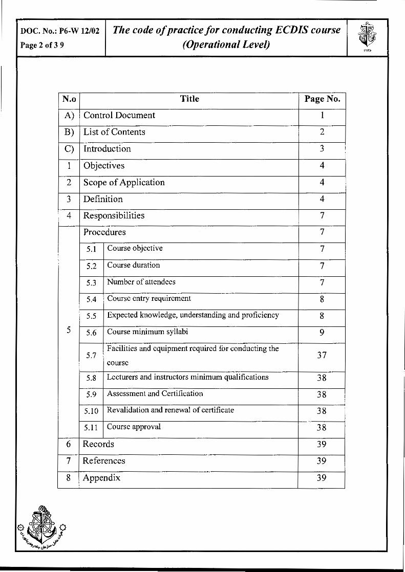
DOC. No.: P6-W 12/02 The code of practice for conducting ECDIS course • Page 2 of3 9 (Operational Level) PMU
N.o Title Page No.
A) Control Document I
B) List of Contents 2
C) Introduction 3
1 Objectives 4
2 Scope of Application 4
3 Definition 4
4 Responsibilities 7
Procedures 7
5.1 Course objective 7
5.2 Course duration 7
5.3 Number of attendees 7
5.4 Course entry requirement 8
5.5 Expected knowledge, understanding and proficiency 8
5 5.6 Course minimum syllabi 9
5.7 Facilities and equipment required for conducting the
37 course
5.8 Lecturers and instructors minimum qualifications 38
5.9 Assessment and Certification 38
5.10 Revalidation and renewal of certificate 38
5.11 Course approval 38
6 Records 39
7 References 39
8 Appendix 39
a~o ~ . } "'< ' ~.J..llo,.ov.P:?
DOC. No.: P6-W 12102 The code of practice for conducting ECDIS course Page 3 of 3 9 (Operational Level)
PMO
Introduction
Ports and Maritime organization (P.M.O) of the Islamic republic of Iran in
performing its duty and in exercising its prerogative resulting from article 192 of the
Islamic republic of Iran maritime code , 1964 and paragraph 10 of article 3 of PMO
manifesto, 1970 enabling it to issue any document , certificate or license for ships ,
masters, officers and other ship personnel and also in accordance with the provisions
of the international convention on standards of training, certification and watch
keeping for seafarers (STCW) 1978, as amended, adopted by the Islamic consultative
assembly in 1996 and taking into account table A-1111 ofthe STCW Code, develops
this "code of practice for conducting ECDIS course (operational level)" which is
applicable after endorsement by the board of executives of Ports & Maritime
Organization.
NOTE: the title of Ports and Shipping Organization changed to Ports and Maritime
Organization dated 29.04.2008 through parliamentary act and approved by Islamic
council assembly.
DOC. No.: P6-W 12/02
Page 4 of3 9
1. Objective:
The code of practice for conducting ECDIS course (Operational Level)
The objective of this code of practice is to specify the minimum requirements for conducting
ECDIS (Electronic Chart Display and Information System) training course at operational level.
2. Scope of Application:
This code of practice applies to all approved training centers that conduct ECDIS training course at
operational level.
3. Definition:
For tbe purpose of tbis code of practice, unless expressly provided otberwise,
3.1 Ability
The mental or physical capacity, power or skill required to do something.
3.2 Central Monitoring Office
Central monitoring office which is responsible for approving and monitoring
training courses is the Seafarer's standard directorate of the PMO.
3.3 Code of Practice
Means all national rules, regulations and requirements specified in this document which
have been drafted by the PMO's General Directorate of Maritime affairs and endorsed by
the PMO's board of executive.
3.4 Certificate of Competency (COC)
Means a certificate issued and endorsed for masters, officers and GMDSS radio
operators in accordance witb tbe provisions of chapters II, III, IV or VII of the
STCW Convention and entitling tbe lawful holder thereof to serve in the capacity
and perform tbe functions involved at the level of responsibility specified therein.
3.5 Certificate of Proficiency (COP)
Means a certificate, other than a certificate of competency issued to a seafarer,
stating that the relevant requirements of training, competencies or seagoing service
in the STCW Convention have been met.
DOC. No.: P6-W 12/02
Page 5 of3 9
The code of practice for conducting ECDIS course (Operational Level)
3.6 Course Completion Certificate or Documentary Evidence
Means a certificate issued through the training center, after successfully completion of
training program by the applicants
3. 7 Deck Officer
Means an officer qualified in accordance with the provisions of chapter II of the
STCW Convention.
3.8 Demonstration
An act of showing something by giving proof or evidence or explaining how something
works or is done.
3.9 Exercise
To perform some kind of physical exercise or to involve somebody/something in physical
or mental effort or activity.
3.10 Familiarity
Having a good knowledge of something.
3.11 Knowledge
Knowledge is a familiarity with someone or something, which can include facts,
information, descriptions, or skills acquired through experience or education. It can refer
to the theoretical or practical understanding of a subject
3.12 Master
Means the person having command of a ship
3.13 Medical Fitness Certificate
Means a certificate issued by the PMO's recognized medical practitioner to the
candidates who found to be medically fit.
3.14 Near-Coastal Voyages (NCV)
Means voyages between ports situated in the Persian Gulf and Gulf of Oman
(positions from LAT 22 0 32' N 0590 48' E to 25 0 04' N 061 0 22' E) or between
Caspian Sea ports.
'""
DOC. No.: P6-W 12102
Page 6 of3 9
3.15 Officer
The code of practice for conducting ECDIS course (Operational Level)
Means a member of the crew, other than the master, designated as such by national
law or regulations or, in the absence of such designation, by collective agreement
or custom.
3.16 PMO
Means Ports & Maritime Organization (PMO) of the Islamic Republic ofiran.
3.17 Port's Monitoring Office
Means the deputy of general directorate in ports in which the directorate of
examinations & seafarers' documents is included and on behalf of seafarers'
standards directorate is responsible for approving and monitoring training courses
conducted in the province that port is situated.
3.18 Practical
Concerned with reality and action rather than theory and ideas which is likely to
work in real circumstances.
3.19 Regulations
Means regulations contained in the annex to the STCW Convention
3.20 STCW Convention
Means international convention on standards of training, certification and watch
keeping for Seafarers, 1978, as amended.
3.21 STCW Code
Means the seafarers' training, certification and watchkeeping (STCW ) code as
adopted by the 1995 conference resolution 2,as it may be amended by the
international maritime organization.
3.22 Training center
Means maritime university/center/ directorate/ department/company and/or any
organization conducting maritime training course approved by PMO.
3.23 Theory
A set of properly argued ideas intended to explain facts or events or the principles
on which a subject of study is based.
PMO
DOC. No.: P6-W 12102
Page 7 of3 9
The code of practice for conducting ECDIS course (Operational Level)
3.24 Understanding
Understanding is a psychological process related to an abstract or physical object,
such as a person, situation, or message whereby one is able to think about it and
use concepts to deal adequately with that object. Understanding is a relation
between the knower and an object of understanding. Understanding implies
abilities and dispositions with respect to an object of knowledge sufficient to
support intelligent behavior.
3.25 Unlimited Voyages
Means voyages not limited to the near coastal voyages.
4. Responsibilities
4.1 Central Monitoring Office is responsible for revising this code of practice.
4.2 General Director of seafarers' Affairs is responsible for approving amendments to
this code of practice.
4.3 Deputy Of Maritime Affairs is responsible to endorse amendments to this code of
practice on behalf of PMO's board of executives.
4.4 Training centers are to conduct training course in accordance with this Code of
practice.
4.5 Central Monitoring Office is responsible for supervising on the implementation of
this code of practice in training centers.
5. Procedure:
5.1 Course Objective:
P~IO
The objective of this course is to prepare trainees to achieve " Maintain the safety of
navigation through the use of ECDIS and competency set out in the table A-II/I of the
STCWCode.
5.2 Course Duration:
5.2.1 A minimum of practice & lecture 28 hrs, Solo ECDIS navigation: 9.0 hrs and Solo
evaluation & Exam: 3 hrs (total of 40 hours).
5.3 Number of Attendees:
The maximum number of trainees should depend on the facilities and equipment available.
In particular, class size should be limited to I trainee per ECDIS workstation. Where a
classroom training environment has 12 ECDIS workstations, the maximum class size is 12
DOC. No.: P6-W 12/02
Page 8 of3 9
The code of practice for conducting ECDIS course (Operational Level)
PMO
trainees. Where there is an additional ECDIS-equipped multiple ownship labs, those ECDIS
installations should not be used as substitutions for classroom instruction, nor should it be
used to augment the number of trainees taken into the course.
5.3 .2 The ratio for lecturing in an open classroom setting and for practical exercises in an
Integrated Navigation Lab should be limited to 12:1. When a class size exceeds 12 trainees,
an assistant instructor is required in both settings, qualified to the satisfaction of the lead
instructor.
5.3.3 Simulation lab -The number of trainees to develop and demonstrate proficiencies in an
Integrated Navigation Lab (INL) setting is no more than two persons in a semi-isolation
Bridge.
5.4 Course Entry Requirement:
The course trainees shall, at least;
5.4.1 hold a valid medical fitness certificate issued by a medical practitioner recognized by
thePMO;
5.4.2 hold course completion certificate for RADAR & ARPA at operational level
5.4.3 have 3 months seagoing service as part of bridge navigational watch on ships fitted
withECDIS.
5.5 Expected Knowledge, Understanding And Proficiency:
5.5 .I Knowledge of the capability and limitations of ECDIS operations, and all indicated
sub-topics.
5.5.2 Proficiency in operation, interpretation, and analysis of information obtained from
ECDIS, and all indicated sub-topics.
5.5.3 Management of operational procedures, system files and data, and all indicated sub
topics.
5.5.4 A thorough understanding of Electronic Navigational Chart (ENC) data, data
accuracy, presentation rules, display options and other chart data formats
5.5.5 The dangers of over-reliance.
5.5.6 Familiarity with the functions ofECDIS required by performance standards in force
Proficiency in operation, interpretation, and analysis of information obtained from
ECDIS, including:
DOC. No.: P6-W 12/02
Page 9 of3 9
The code of practice for conducting ECDIS course (Operational Level)
PMO
5.5.7 Use of functions that are integrated with other navigation systems m varwus
installations, including proper functioning and adjustment to desired settings
5.5.8 Safe monitoring and adjustment of information, including own position, sea area
display, mode and orientation, chart data displayed, route monitoring, user-created
information layers,contacts (when interfaced with AIS and/or radar tracking) and
radar overlay functions (when interfaced).
5.5.9 Confirmation of vessel position by alternative means
5.5.10 Efficient use of settings to ensure conformance to operational procedures,
including
alarm parameters for anti-grounding, proximity to contacts and special areas,
completeness of chart data and chart update status, and backup arrangements
5.5.11 Adjustment of settings and values to suit the present conditions
5.5.12 Situational awareness while using ECDIS including safe water and proximity of
hazards set and drift, chart data and scale selection, suitability of route, contact
detection and management, and integrity of sensors.
5.6 Course Minimum Syllabi:
5.6.1 Lesson Plans: Elements ofECDIS (11 hours)
5.6.1.1 Introduction & familiarization plan (0.5 hrs)
A thorough understanding of ENC data and familiarization with the goals of the 40-hour
course; and becomes familiar with the layout of the ECDIS equipment at the workstations
and on the bridge simulator.
5.6.1.1.1 General introductions: Knowladge of the goals of the course and course
certification, Verify that all trainees have basic computer skills (objective
assessment). Understanding the course structure, attendance requirements
and the evaluation process. The trainees will achieve an understanding of
type-approved ECDIS in general, and proficiency specifically in the use
of system in use in the course
5.6.1.1.2 Administration: Issue study guides and other reference material, Review
5.6.1.1.3
course syllabus
Familiarization with ECDIS learning environment .Work station power
up and ECDIS software start and stop. Demonstrate how to get
DOC. No.: P6-W 12/02
Page 10 of3 9
The code of practice for conducting ECDIS course (Operational Level)
PMO
information from the ECDIS User Manuals and help structure within
ECDIS software package, and briefly tour classroom and lab used for
ECDIS navigation training to see navigation and control equipment.
5.6.1.2 Purpose of ECDIS (1.0 hrs)
Demoastrate the main characteristics of ECDIS data display, accuracy, presentation rules
and the information which is constantly displayed by ECDIS and which is selectable.
5.6.1.2.1 Familiarity with revised IMO Performance Standards for ECDIS (June 2006,
Resolution ECDIS definition). Capability of displaying all chart information
necessary for safe and efficient navigation, Swiftly enables positioning, route
monitoring and route planning, Provides appropriate alarms and indications.
5.6.1.2.2 Differentiate between display options: Electronic navigational chart (ENC)
and system ENC (SENC), Standard display and display base. Display of
information other than ENC data.
5.6.1.2.3 Ability to identify information types and areas on navigation display:
Electronic chart area, Information area, Task panels, other menu options,
Automatic displays for monitoring ship's safety including position, gyro
heading, speed log, time,and safety values, course over ground and speed
over ground.
5.6.1.2.4 Apply presentation of ECDIS data: Major rules of presentation library,
Automatic presentation, such as scale, display category, day/night, modes,
such as true motion and North-up.
5.6.1.3 Value to Navigation (0.5 hrs)
Ability to recognizes that safe navigation with ECDIS requires the selection and analysis
of displayed information, display options, data format that is relevant to the prevailing
situation.
5.6.1.3.1 Recognize factors that characterize and modify chart presentation, projection,
colors, symbols,
5.6.1.3.2 Recognize factors that characterize and modify the data quality: Accuracy,
resolution, completeness and ssessment of differences.
5.6.1.3.3 Manually change scale, area & position of ownship, chart area and scale,
Position of own hip relative to display edge
DOC. No.: P6-W 12/02
Page 11 of3 9
The code of practice for conducting ECDIS course (Operational Level)
PMO
5.6.1.3.4 Demostrae the route monitoring mode ofECDIS operation
5.6.1.3.5 Understanding the value of ECDIS to navigation: Own ship position with
respect to route, shipping lanes, acquired targets, depth contours, soundings,
and predicted tides and currents, Multi-chart loading, scaling, on-chart object
information. Centralized information station for navigational bridge team,
including ERBL, user layers, radar target tracking, SAR, Navtex, AIS,
climate, and port information.
5.6.1.4 Correct & Incorrect Use (0.5 hrs)
The ECDIS is as a tool which aids but does not replace proper navigational watchkeeping and
dangers of over-reliance always exist.
5.6.1.4.1 Use ECDIS within the prevailing navigation situation:
Name the principles of navigation and operational guidance for officers in
charge of a navigational watch (STCW, SOLAS), Familiarity with the
many areas of bridge operations to which ECDIS may be applied,
Situational awareness includes the functioning of navigational aids and the
reliability of sensors, ECDIS is only a tool designed to support the mariner
performing navigational tasks, A navigational watch is not to be performed
on only one system
5.6.1.4.2 Understanding of the ways to avoid over-reliance on ECDIS. A system
malfunction and data inaccuracy is always a potential.The displayed
hydrographic data are not more reliable than the survey data they are based
on, The displayed sensor data are not more reliable than the respective
originating sensor system. Errors I inaccuracies in one subsystem may
degrade others and can potentially render ECDIS useless.
5.6.1.4.3 Proficiency in the use of ECDIS includes assessing the integrity of the
system and all data at all times, such use should be integrated into standing
a normal watch including a competent visual lookout, and the continued
maintenance of good situational awareness. One method is to overcome
the problem of partial use - the less thoroughly the ECDIS is used and
applied, the less willing the users become to apply ECDIS to navigation,
resulting less familiarity and less trust.
DOC. No.: P6-W 12/02
Page 12 of3 9
The code of practice for conducting ECDIS course (Operational Level)
5.6.1.5 Work Station Start, Stop & Layout (1.0 hrs)
PMO
Familiarity, analyzes and assessing the proper functioning of ECDIS during the booting
up process and normal operation
5 .6.1.5.1 Perform standard PC start: Understaning that some sensor feeds may need to
be off or disconnected to PC com ports, and tha the PC is subject to all normal
limitations of hardware, operating system, and memory. ECDIS 1s a
navigation aid (not a general use PC) and has: Potential limitations in hard
drive storage, RAM size, power supply interruptions, hardware malfunctions,
and overall system lockup. Operating system boot-up procedures and internal
tests. A pre-programmed "dongle" installed in the parallel printer port which
enables the registration and use of the ECDIS manufacturer's products. The
potential to fail due to incorrect use of OS and ECDIS software.
5.6.1.5.2 Familiarity with the ECDIS start windows for sensors requested, sensors
found, and selected chart data. Understanding the significance of the ECDIS
Activator Key (dongle) and associated license files. The ECDIS software
boots up with: A small indicator window against the desktop background, then
a full screen panel indication of initialization, then the ECDIS basic display
with alarm indicators (if any) requiring acknowledgement.
5.6.1.5.3 Familiarity with alarms and determine initial conditions of ECDIS readiness
for navigation
5.6.1.5.4 The ECDIS initialization screen indicates on-line tests: For date/time,
position, heading, and speed log, Displays "Received" when these inputs
match expected protocols ("Received" status is not a check on data accuracy),
Displays "Aborted" when these inputs are missing or corrupt, Boot-up without
inputs will continue, with alarms on ECDIS display and ENC data will be
loaded from the chart files as licensed.
5.6.1.6 Vessel position (0.5 hrs)
To operate basic navigational functions proficiently and settings pertaining to vessel
position information, Mouse I trackball and device buttons, Keyboard and hotkeys,
Control of standard cursor and free mouse cursor, Use of cursor and ERBL on the
display.
DOC. No.: P6-W 12/02
Page 13 of3 9
The code of practice for conducting ECDIS course (Operational Level)
PMO
5.6.1.6.1 Review display of vessel's position: Shift the vessel on the display in
navigation mode Familiarity with vessel's symbols, GPS position
information, Track of vessel's position.
5.6.1.6.2 Understanding position information in the display panels: System (tidal
height, current, sounding, set and drift at position), Route (vessel position on
the route), Pilot (position relative to next WP as per route schedule data).
5 .6.1.6.3 Determine a position fix on the ECDIS chart display panel: Manually draw
and move bearing lines (LOPs), Manually mark position on the display.
5.6.1.7 Position source (1.0 hrs)
Knowledge of the principle features ofDGPS as the primary vessel position source
5.6.1.7.1 Review basics of GPS: Satellite constellation, theory, atmospheric
interference, Signal quality indication, HDOP, data age, station ID, Accuracy
(2drms probability), USCG's beacons for differential corrections (DGPS).
5.6.1.7.2 Coordinate GPS antenna position settings: Set GPS antenna locations from
amidships and off centerline, Switch on primary and secondary position
sources by assigning ports for NMEA data feed
5.6.1.7.3 Select position system: Primary or PSI, Secondary or PS2, Auto change
(automatic switching to dead reckoning position).
5.6.1.7.4 Determine fix quality (status) of GPS: Position information, Alarms and
indications of disruptions of GPS data feed, Tracking the discrepancy between
PSI and PS2, Monitoring the GPS data port, Check ship's position by a
second independent means.
5.6.1.8 Basic navigation (1.0 hrs)
Ability to operate many of the basic navigational functions and settings and interprate,
analysis information obtained from instruments.
5.6.1.8.1 Activate display categories and information layers: Base, Standard, All and
Custom Spot soundings limit (depths <= safe setting are displayed as bold),
Channel limits, fairways, landmarks, special areas, warnmgs, Message
"Layers Lost" when any are turned off.
5 .6.1.8.2 Monitor vessel safety: Recognize position, gyro, speed log, COG, SOG, time,
Set a safe depth value from sea level with regards to Isolated Dangers, Set a
DOC. No.: P6-W 12/02
Page 14 of3 9
The code of practice for conducting ECDIS course (Operational Level)
PMO
safe depth contour, Identify contours shown in Base Display, Identify other
Base Display information that cannot be turned off.
5.6.1.8.3 Activate route monitoring features: Track, log, drift summary, sensor status,
target tracks, scale, route information, contours, isolated dangers, special
areas, alarm limits, Activate day/night color sets, track display, scale bar,
vessel symbol, Set voyage recording (Logbook) track period, precision, color,
history, routing info, filters.
5.6.1.9 Heading & drift vectors (0.5 hrs)
Ability to operates basic navigational functions and settings pertaining to ownship's
heading vector, course over ground vector, and guard ring
5.6.1.9.1 Activate vessel's motion vectors: Tum either or both vectors on or off,
Alignment of vessel contour, set vector length.
5.6.1.9.2 Obtain vessels' course and speed from the positioning system: COG & SOG
may be from position system or from ARPA reference, HDG is true or
undefined (manual entry only when in DR), LOG may be bottom, water,
ARPA, or position system referenced.
5.6.1.9.3 Interpret the movement of the vessel: The graphical difference between the
COG/SOG and the HDG/LOG vectors is the drift angle, Display of drift angle
reveals vessel momentum in a tum, Drift angle in steady state reveals sum of
wind and current on vessel.
5.6.1.9.4 Recognize the effects of gyro error: Drift angle results from gyro data without
any provision for correction, Gyro precession due to high-speed turns
produces an unreliable HDG display on ECDIS.
5.6.1.9.5 Graphically monitor ownship's approach to isolated dangers by means of a
guard ring
5.6.EX .1. Simulation exercise- open sea (2.5 hours)
The proficiency to operates specific functions constituting task groups for route monitoring
in an open sea area, and obtains all relevant information for basic safe integrated navigation.
Demonstrate the following task groups on ECDIS while navigating safely in an open sea
setting with non-threatening ARPA targets:
Monitor sea area, Use pre-defined route, Check position with pre-defined fix, Select pre
defined user layers, Check settings such as vector time, display reset, information layers,
alarms, track, sensors, and ownship configurations. 9 0 ., }
' ·* ..... '!g~ty.,pj>".:r
DOC. No.: P6-W 12/02
Page 15 of3 9
The code of practice for conducting ECDIS course (Operational Level)
5.6.1.10 Understanding chart data (1.0 hrs)
PMO
Understanding the types of electronic charts, and the characteristics of ECDIS data or
system electronic navigational chart (SENC)
5.6.1.10.1 Define the relevant terminology ofECDIS.
5.6.1.10.2 Name the differences between electronic chart systems and ECDIS: Different
ECDIS systems, ECDIS and ECS, Vector and raster charts.
5.6.1.10.3 Familiarirty with the various electronic chart data formats: Vector data, Raster
data.
5.6.1.10.4 Understanding the relationship between ECDIS data and the information
presented on the display: ECDIS database and its structure, ENC data and the
SENC, How manual updates are stored m the database, Steps and
responsibilities during ENC creation.
5 .6.1.1 0.5 Understanding that only information stored as objects with corresponding
attributes in the database is available for display.
5.6.1.10.6 Familiarity with the chart data selected for display.
5.6.1.11 Chart quality & accuracy (0.5 hrs)
The ability to assesse all errors, inaccuracies and ambiguities, chart data in the SENC
caused by improper data management.
5.6.1.11.1 Knowledge of what the accuracy of chart data is dependent upon: Accuracy of
survey and all hydrographic data, Shifting of buoys, Coverage and
completeness of chart data.
5.6.1.11.2 Knowledge of the problems m ECDIS associated with variant datums:
Different reference systems used for positioning (time, direction, speed), The
effects of datum (horizontal, vertical), Different geodetic coordinate systems.
5.6.1.11.3 Ability to assess all errors, inaccuracies and ambiguities caused by improper
data management.
5.6.1.11.4 Understanding the need and requirement that electronic chart data must be
systematically updated for safe navigation.
DOC. No.: P6-W 12/02
Page 16 of3 9
Tlte code of practice for conducting ECDIS course (Operational Level)
l>"\10
5.6.1.11.5 Demonstrate issues pertaining to computer monitor display resolution:
Potential distortions in chart scale, The amount of information that appears on
the screen, Display adapter and the Desktop Area Setting, Troubleshooting
display problems.
5.6.1.12 Chart organization (0.5 hrs)
The ability to handles ECDIS data at the workstation
5.6.1.12.1 Introduce the organization of chart data distribution: Demonstrating the
organization of chart data by the processes of procurement (downloading),
installation (also applies to updates), selection of chart type (format),
initialization, and loading (autoload by position), Demonstrate the chart data
manager application associated with the type approved ECDIS, Familiarity
with the chart data file structure associated with the type approved ECDIS.
5.6.1.12.2 Demonstrate the loading (retrieval) of ECDIS data: Automatically from the
directory of available chart data for the vessel's position, Automatically from
the directory of available chart data for the cursor location, Manually by chart
(cell) name from the directory of available data
5.6.2 Lesson Plans: Watchstanding with ECDIS (8.0 hours)
5.6.2.1 Sensors (0.5 hrs)
Understanding the performance limits of sensors and assesses their impact on the safe use
ofECDIS.
5.6.2.1.1 Familiarity with the performance limits of devices for position, course over
ground, heading, speed, depth, radar, and AIS, especially concerning:
Availability, Accuracy, Integrity.
5.6.2.1.2 Understanding the need for selecting sensor data displayed in ECDIS that is
appropriate and unambiguous, and accurate.
Demostrate the impairment ofECDIS when sensor performance deteriorates.
DOC. No.: P6-W 12/02
Page 17 of3 9
The code of practice for conducting ECDIS course (Operational Level)
i'MO
5.6.2.1.4 Demostrae and analyze various sensor alarms and indications: Activated when
ECDIS receives no data from the external output device, Displayed in the
second line of the Information Area as they occur,Use Alarm button or free
cursor on 2nd-line message to disable the sound and message from the
display, Alarm submenu function remains orange parameter returns to set
limits, or when function is deliberately turned off, Correct response is to check
the operation and connection of the relevant sensor.
5.6.2.2 Ports & data feeds (0.5 hrs)
Knowledge of selecting data ports, and assesses sensor input values and use of functions
that are integrated with other navigational systems.
5.6.2.2.1 Select between primary and secondary position source.
5.6.2.2.2 Observe automatic change over to secondary position source.
5.6.2.2.3 Familiarity with the data reference system of each connected sensor:
Geodetic system, Antenna position, Transducer position, Clock or time source
5.6.2.2.4 Knowledge of the data port assigned to each connected sensor
5.6.2.2.5 Monitor, identify and to a limited extent decode the data stream for each
attached sensor:
Select a sensor and monitor the data stream (live or simulated), generally
recognize the sentence syntax associated with the sensor, Where possible,
associate data with displayed navigational information
5.6.2.2.6 Assess the plausibility of sensor input values to ECDIS.
5.6.2.2.7 Assess the impact on displayed information when a sensor port is improperly
selected.
5.6.2.3 Chart selection (0.5 hrs)
Demonstrates manual and automatic selection of charts, and explains the potential error
of the ECDIS display due to improper chart selection.
5.6.2.3.1 Demonstrate the variety of methods that chart data can be loaded and
changed: Automatically, Manually for the presently loaded route, manually
from the total portfolio, Manually displayed by the cursor position, during the
activity of the operator using the graphics cursor
DOC. No.: P6-W 12102
Page 18 of3 9
The code of practice for conducting ECDIS course (Operational Level)
PMO
5.6.2.3.2 Assess the inaccuracies and ambiguities caused by improper selection of a
chart for display: When ownship position is on display, chart data list is sorted
by scale, When ownship position is not on display (viewing elsewhere), chart
data Jist is sorted by name( alpha), ECDIS displays largest scale data (smallest
area) on the topmost layer, but the user may prioritize by format, especially
ENC to keep ECDIS in the ECDIS mode, Automatic chart loading may be
switched on or off or held to a user-selected chart (fixed)
5.6.2.3.3 Display updates in order to review content and to establish their inclusion in
the SENC:
Review their contents, Determine that they have been included in the SENC
5.6.2.3 .4 Dmostrae and analyze the data and chart alarms resulting from overscaling
(zooming in) and underscaling (zooming out)
5.6.2.3.5 Demostrate and analyze the data and chart alarms resulting from use of a non
WGS 84 geodetic datum
5.6.2.4 Chart information (1.0 brs)
Knowledge of how to matches presentation to situation, and demonstrates how to get the
information about the chart and chart objects
5.6.2.4.1 Select the task panel and apply the functions suitable for position monitoring,
route monitoring, route creation and editing, trial maneuver, creating and
accessing user layers:
Continuous positioning while monitoring navigation, Trial maneuvers,
Route planning and scheduling, Creating User Charts, Other functions
5.6.2.4.2 Demostrae who to obtain information on charted objects: For vector charts,
use the Info button and position the acquisition marker box on the object,
Navtex symbol, line, zone, free space, or chart frame corner and cycle through
information, Window, For raster charts information is available only for the
same frame size of a matching vector chart as described above.
5 .6.2.4.3 Demonstrate how the presentation of navigation marks is changed according
to ownship's position
DOC. No.: P6-W 12/02
Page 19 of3 9
The code of practice for conducting ECDIS course (Operational Level)
PMO
5.6.2.4.4 Demonstrate errors of interpretation by the incorrect selection of display
categories.
5.6.2.5 Changing the settings (0.5 hrs)
Efficient use of setting to demonstrates how to verify the operational settings and to
assess that the navigational process is safe and confirm to operational procedures.
5.6.2.5.1 Manually test the major functions of hardware, keyboard, mouse I trackball,
sensor data, and chart data.
5.6.2.5.2 primary information panel: Primary task panels, Primary information panel,
Ship, Alarm, Chart, Logbook, ARPA, Configuration, Add Info (user layers),
Route
5.6.2.5.3 Demonstrate alarm and function status indications: Alarms, time, position
update, heading and speed log, Route keeping, heading vectors, chart scale,
track, logbook functions
5.6.2.5.4 Demonstrate errors of interpretation by the incorrect selection of safety
values: Safety depth; Safety contour; Least depth alarm; anti -grounding
alarms, Alarms for sailing along a route
5.6.2.5.5 Adjust track length and precision
5.6.2.5.6 Familiarity with the range of information recorded in the log table (voyage
recording):
Check navigational conditions (ownship progress, charts displayed, etc.),
Check routing events (including manual notations), Check system events,
Display additional data groups
5.6.2.6 Chart scaling (0.5 hrs)
Demonstrates the use of chart scaling and explains and avoids interpretation errors due
scale
5.6.2.6.1 Demonstrate scaling of electronic chart display:
5.6.2.6.2 Apply the automatic changing of chart scale ratio: Use a value from -5 to +5
to reset the scale from larger to smaller respectively from the original chart
scale (0), Use to display electronic chart on the same scale as the original
paper chart
DOC. No.: P6-W 12/02
Page 20 of3 9
The code of practice for conducting ECDIS course (Operational Level)
I'MO
5.6.2.6.3 Apply additional chart scale information: Horizontal screen span, Display of
chart scale, scale bar, and bold-thin scale angle, calculated range across screen
display for scale in use, Warning messages associated with scale choice
5.6.2.6.4 Knowledge of interpretation errors due to scaling:
Overscale of the display will spread out chart and user information with the
possible loss of familiar cues for estimating distance, Underscale of the
display may cause some information to be hidden, Underscale with SCAMIN
off will result in unacceptable clutter due to data density, Verify the selection
ofthe appropriate scale
5.6.2.7 Information layers (0.5 hrs)
Understanding and proficient use of information layers.
5.6.2.7.1 Observe effect on information layers and status indications when chart data is
loaded and when chart area is underscaled:
Determine native scale of chart data as it is loaded, Observe function of
SCAMIN on and off when a chart area is underscaled (zoomed too far out),
Observe indication of scale value
5.6.2.7.2 Review and apply appropriate display mode: Day or night presentation, Scale,
Display category
5.6.2.7.3 Practice selecting information options m display category of "All other
information".
5.6.2.7.4 Differentiate between information layers, User Chart layers, and Event
graphic: Information layers (chart display categories) and User Chart layers,
The addition and removal of own chart entries such as manual corrections and
voyage planning notes, The addition of Event on the display and notations
made in Logbook
5.6.2.7.5 Respond to the indicators representing the loss of displayed information:
Layers Lost, Position Dropped
5.6.EX .2. Simulation exercise- open sea (2.5 hours)
DOC. No.: P6-W 12/02
Page 21 of3 9
The code of practice for conducting ECDIS course (Operational Level)
PM()
The ability to operate specific functions constituting task groups for route monitoring
in an open sea area, and obtains all relevant information for basic safe integrated
navigation.
Demonstrate the following task groups on ECDIS while navigating safely in an open
sea setting with non-threatening ARPA targets.
Monitor sea area, Use pre-defined route, Check position with pre-defined fix, Select
pre-defined user layers, Check settings such as vector time, display reset, information
layers, alarms, track, sensors, and ownship configurations.
5.6.2.8 System & position alarms (0.5 hrs)
Familiarity with the status indications and alarms pertaining to system and position, and
Demonstrates the proper responses
5 .6.2.8.1 Familiarity with and respond to alarms for primary and secondary positioning
systems, such as: Primary (Secondary) Failure, Prim. (Secondary) Diff. Mode
Loss, Prim/Sec Pos Diverge, Echo Ref. Loss, Primary (Secondary) Data not
WGS84, Primary (Secondary) Unreliable Position
5.6.2.8.2 Identify and respond to chart related alarms, such as: Off Chart, No Official
Data, Datum Unknown, AG (Anti-grounding) Monitoring Off
5.6.2.8.3 Knowledge and respond to ECDIS alarms from autopilot in Track Control,
such as: Autochange, Autochange restore.
5.6.2.9 Depth & contour alarms (1.0 hrs)
Familiarity with the situational awareness and status indications and alarms pertaining to
depth and contours in route planning and monitoring, and demonstrates the proper
responses
5.6.2.9.1 Knowledge of route monitoring alarms, such as: Crossing a safety contour,
Prohibited or other area, Track error allowance (XTE), Waypoint arrival
circle,Safety Contour changed, See Sounder Reading
5.6.2.9.2 Familiarity with depth-related information, such as: Safe water depth, charted
obstruction, Depth sounder related alarms, Depth from sounder, Depth value
of Safety Contour
Knowledge of the safety values for route monitoring: Safety Contour will only
utilize an existing depth contour in the chart data, Set the value for a Safety
DOC. No.: P6-W 12/02
Page 22 of3 9
The code of practice for conducting ECDIS course (Operational Level)
PMO
Contour to represent preferred underkeel clearance, Set the value for Safety
Depth, Set the value for spot sounding display category
5.6.2.9.4 Setting the limits pertaining to safe water, such as: Apply the ENC option of
four shades, Nav. Danger, Depth sounder limit, Set an advance time for
approaching the set safety contour.
5.6.3 Lesson Plans: ECDIS Route Planning (7.0 hours)
5.6.3.1 Vessel maneuvering characteristics (0.5 hrs)
Demonstrates safe monitoring and adjustment of information with the use of ship's
particulars in the display of route planning and maneuvering information, and knowledge
of the possible errors of interpretation
5 .6.3 .1.1 Select appropriate turning criteria for efficient and effective use of Autopilot
in heading control mode: Autopilot parameters for turn radius and for turn rate
govern the movement of the vessel with results viewable on ECDIS,
Maneuvers measured on ECDIS may require adjustments in the Autopilot.
5.6.3.1.2 Correlate rudder limits in Autopilot with turning radii and rates of turn for
curved track planning on ECDIS,turning radius for curved track planning (all
waypoints ), Maneuver data for steering to next route segment when underway
using safe speed and wheel, over point settings
5.6.3.1.3 Familiarity with methods of alert for wheel over, when approaching
waypoints, such as:
Turn radius maneuvering characteristics of ownship apply to curved track in
ECDIS route planning. Arrival circle centered on waypoint with
circumference intersecting wheel over point on ECDIS route.
5.6.3.1.4 The navigator must verify positioning especially when ECDIS is connected to
auto pilot
Generally, only the "observed position" is controlled. An ECDIS curved
predictor may only project a momentary rate of turn, rather than sophisticated
hydrodynamic calculations, and therefore have limited accuracy.
Route planning by table (0.5 hrs)
DOC. No.: P6-W 12/02
Page 23 of3 9
The code of practice for conducting ECDIS course (Operational Level)
Knowledge of how to operate all specific functions and obtains all relevant information
for route planning by table.
5.6.3.2.1 Retrieve a stored route plan: For use in route monitoring, for planning and
review. Rename as working route to allow ad hoc changes while underway,
Obtain track courses and distances from list of waypoints as displayed in the
table.
5.6.3.2.2 Approve an existing route for planning, safety review and monitoring. Apply
systematic methods of examination, Utilize appropriate chart data intended for
use along the route, Set alarm parameters, Adjust cross track zones, Scale in
on charts for safety check analysis
5.6.3.2.3 Select the sea areas and the required waters for planning the whole passage.
5.6.3.2.4 Construct a route plan by inputting waypoint data alphanumerically into a
route-planning table.
5.6.3.2.5 Adjust the route plan by editing, adding and deleting waypoints inside the
table.
5.6.3.2.6 Review curved track planning and wheel over indication: Ownship
maneuvenng characteristics, Requirements of planning a safe passage
including waypoint spacing.
5.6.3.2. 7 Establish procedures to name, link, rename, archive, retrieve and delete route
files:
Naming, linking and re-naming techniques for Route files, Archiving route
plans, Deleting route plans.
5.6.3.3 Route planning by chart (1.0 hrs)
Familiarity with the operation of all specific functions and obtains all relevant
information for route planning graphically by chart.
5.6.3.3.1 Select the sea areas and the required waters for planning the whole passage.
5.6.3.3.2 Construct a route by inputting waypoints directly on the ECDIS display. Fine
tune the waypoint positions, track zones and tum radii using practical
navigation considerations, such as for radar and visual navigation, traffic
patterns, and ENC data quality indicators.
5.6.3.3.3 Adjust the route by graphically editing waypoints.
DOC. No.: P6-W 12/02
Page 24 of3 9
The code ofpracticefor conducting ECDIS course (Operational Level)
PMO
5.6.3.3.4 Obtain track courses and distances from the chart: Cursor position, Selection
of route segment
5.6.3.3.5 Obtain relevant route planning information, such as: Ocean wind, wave and
surface current information, Tidal heights and currents, Sailing directions
(port information), for special situations (anchoring, chart data quality, special
areas, pilotage, quarantine, etc.)
5.6.3.4 Track limits (0.5 hrs)
Knowledge of operating all specific functions and obtains all relevant information for
setting track limits in route planning.
5.6.3.4.1 Reviewing the alarm settings used as vessel is proceeding along a monitored
route: Deviation of the current course angle as set in the planned route, XTE
(cross track error) exceeds the value set in the route data table, Guard vector
for crossing safety contour, Guard vector for entering special purpose areas,
Guard ring for crossing an isolated danger.
5.6.3.4.2 Modify the setting ofXTE in a previously saved route: Re-check the route for
crossing dangers of navigation according to the setting of XTE zones, Observe
the alarm triggering while proceeding along the modified route leg, Examine
results graphically on appropriate scale chart data
5.6.3.5 Checking plan for safety (0.5 hrs)
The ability to operate all specific functions and obtains all relevant information for
checking a route for the presence of dangers to navigation.
5.6.3.5.1 Check a previously created and saved route for crossing dangers of navigation
according to the setting of cross-track distance: Safety contours, Isolated
dangers, Limits of Special Purpose Areas.
5.6.3.5.2 Check the route as it is being created for dangers as listed above and use
Safety Check while adding a waypoint and leg along a route, Use Safety
Check while modifying an existing leg or waypoint
5.6.3.5.3 Assess a route plan based on a safety check: Consider all predictable hazards
along the track and assess if it is reliably safe, Assess which route should
finally be taken, Assess which areas and points of the passage are critical.
DOC. No.: P6-W 12102
Page 25 of3 9
The code of practice for conducting ECDIS course (Operational Level)
5.6.3.6 Embedded tide, current & climate almanac (0.5 hrs)
Proficiency to operate specific functions pertaining tidal height, currents, and wind and
wave calculations pertinent to specific situations such as route selection, anchoring and
drifting
5.6.3.6.1 Determine the force and direction of the true wind: Observe relative wind
speed and direction and ownship's heading and SOG, Enable display of wind
vector and assess its graphic validity
5.6.3.6.2 Display the ocean climate wind vectors and lines of equal wave height,
selected by month.
5.6.3.6.3 Display the dynamics of surface currents: Zoom out to large area view to
locate surface current reference points, Load by month.
5.6.3.6.4 Determine the tidal rise and tidal currents: At the reference station nearest to
ownship position (up to 30 nm). At a reference station selected by name or by
cursor, Use chart display features to predict values.
5.6.3.6.5 Use Current option in calculating a Route Plan Schedule.
5.6.3.6.6 Determine bottom type and assess anchor holding ground from information
obtained on an appropriately scaled chart.
5.6.3.7 Route schedule (0.5 hrs)
Demostrate how to operate all specific functions and obtains all relevant information for
route scheduling.
5.6.3.7.1 Dmostrate any deviation from the route schedule setting in use as vessel is
proceeding along a Route.
5.6.3.7.2 Determine expected passage times: Use route schedule table for proceeding
along a route,
Apply effects of surface and tidal currents in calculations, Calculate schedule
from starting ETD and ETA's for waypoints, Calculate schedule from starting
ETD and Log speeds for waypoints, Edit input data as required
5.6.3.7.3 Observe calculations of progress along the planned route: Load a route and the
route schedule created for that route, Monitor the route, Display route
monitoring data on ECDIS information panel, Display schedule information
on ECDIS information panel.
DOC. No.: P6-W 12/02
Page 26 of3 9
The code of practice for conducting ECDIS course (Operational Level)
'""
5.6.3.7.4 Using the ETA application in ECDIS, calculate time or speed at a selected
waypoint on a
monitored route: Speed to make good (STG) for the indicated waypoint,
Estimated time of arrival (ETA) at any waypoint
5.6.3.8 User charts in route planning (1.0 hr)
Knowledge of all navigational functions pertaining to own (user) chart entries and the use
of planning notes.
5.6.3.8.1 Review the ECDIS function for creating mariner's notes (User Chart). A User
Chart is vector editor for creating added graphic and textual layers with
specified attributes m the SENC, Display of User Chart objects 1s
superimposed (layered) on any chart data without changing it, There can be
many User Charts maintained in the system directory, but usually only one or
two displayed at a time,Voyage planning notes and objects called into one
layer may be merged into a file called into the other layer, and resaved with or
without a new name, to construct a composite file, A User Chart may also
consist of a symbol providing a link to extensive notes and hyperlinked files
including photos and documents.
5.6.3.8.2 Knowledge of effective policy regarding User Charts: Purpose of particular
file or chart or layer (correction, note, reference, etc.), Content with regard to
visible data and links to data files, Naming with regard to purpose and
geographic location, Value for using one or both layers (AlB) separately or
simultaneously
5.6.3.8.3 Proficiency to Select User Chart for display: Load and unload various user
charts already stored in the appropriate directory, Select specific information
layers for display, Save, re-save, and re-name user charts (observe naming
techniques)
5.6.3.8.4 Use the graphic editor for creating and modifying a User Chart: Add the many
various types of new objects in the required position with care as pertains to
use of scale, Edit objects and information, Shift objects
5.6.3.8.5 Create, save and move an anchor circle guard zone as a User Chart.
An anchor circle can include a "danger" attribute triggered by the ECDIS
Consistent Common Reference Point (CCRP).The diameter should represent
DOC. No.: P6-W 12/02
Page 27 of3 9
The code of practice for conducting ECDIS course (Operational Level)
P'>IO
the maximum swing circle of the vessel The User Chart anchor circle should
be positioned on the vessel's hawse pipe at the moment the anchor is let go,
Anchor Guard Zone functions provided on ECDIS (as on GPS units)
generally do not reference the position of the vessel's anchor or the vessel's
swing circle
5.6.EX.3 Simulation exercise- coastal waters (2.0 hours)
Knowledge of how to operate specific functions constituting task groups for route
monitoring in an open sea area, and obtains all relevant information for basic safe
integrated navigation. Demonstrate the following task groups on ECDIS while
navigating safely in coastal setting with non-threatening ARPA targets: Monitor sea
area, Use route created by trainee including route schedule, Select user layers created
by trainee, Validate own ship's position by alternate means, Check settings such as
vector time, display reset, information layers, alarms, track, sensors, and ownship
configurations, Assess environmental conditions such as tide, current, wind, waves,
ModifY the selected route as instructed, check for safety, adjust route schedule.
5.6.4 Lesson Plans: ECDIS Targets, Charts & System (8.0 hours)
5.6.4.1 ARPA tracked target overlay (0.5 hrs)
To demonstrate the use of ARPA operations in ECDIS and radar overlay founctions.
5.6.4.1.1 Knowledge of sensor setup requirements for ARPA tracked targets: Correct
location of sensor reference.
5.6.4.1.2 Determine speed and heading inputs used m ARPA tracked target data
calculations
5.6.4.1.3 Access target info display: Cursor,Target table, with sorting options for data
fields, Target name field in table may provide direct display link on chart
5.6.4.1.4 Interpret target symbol features: IdentifY by number from ARPA-A or ARPA-
8, or by writing an alias into target table, Vector and green circle at radar
determined position, Alarm can be set when both CPA and TCPA approach
limitations are exceeded, Vector length the same as set for ownship.Target
tracks are saved in daily files, and selectable for viewing on display.
AIS functions (0.5 hrs)
DOC. No.: P6-W 12/02
Page 28 of3 9
The code of practice for conducting ECDIS course (Operational Level)
i'MO
Knowledge of the use of Automatic Identification Systems in ECDIS.The demonstration
will be through the slide show including all information which can be received or
transmitted.
5.6.4.3 Radar overlay (RIB) functions (0.5 hrs)
Familiriazation with the display of radar signal input, and demonstrating the use of radar
image in ECDIS.
5.6.4.3.1 Familiarity with the technical function of the radar integrator board (RIB)
hardware , the RIB gain, filters, scaling, and target tracking function
independently of the radar transceiver delivering the raw video and trigger, Is
displayed in the SENC as a layer over chart data, RIB functions on ECDIS
permit the continuous recording in the ECDIS PC of the radar picture and
motion of tracked targets.
5.6.4.3.2 Familiriazation with the main functions of the radar integrator board require
sensor setups and involve numerous interfaces on the ECDIS task panel,
Radar signal input, Radar target selection, Formation of a radar image, Target
functions, Radar operation functions independent from radar transceiver
5.6.4.3.3 Operateing the user interface controls for radar overlay, Target tracking,
Image recording. The overlay image can be removed from the display by a
single interface option
5.6.4.3.4 Demonstrating sources of image offset: A mismatch can develop between
chart and radar data, Sensor position setup, Input of radar data heading
misalignment, Position sensor error, Uncharted and/or incorrectly charted
objects, and chart datum error
5.6.4.3.5 knowledge of source of ECDIS-tracked target data calculations: ECDIS speed
and heading inputs are used in ECDIS-tracked target data calculations, Radar
motion vector may be through the water rather than over ground, CPA &
TCP A are derived from the ECDIS independently from the radar
5.6.4.4 Procuring & installing chart data (1.0 hr)
Demonstrate how to install chart license software and chart data of various formats and
'
chart up date.
e o " } "" :? """!t.,~.;PJ'
DOC. No.: P6-W 12/02
Page 29 of3 9
The code of practice for conducting ECDIS course (Operational Level)
l'MO
5.6.4.4.1 Review chart data structure, terminology, and installation procedures: SENC,
and various formats, DNC format corresponds with American MIL-STD-2407
standards, which are based on the"Feature/ Attribute Coding Catalogue
(FACC)'' normative document.The operator procures, installs I updates,
selects; the ECDIS unit initializes, loads
5.6.4.4.2 Review chart format requirements for ECDIS.
5.6.4.4.3 Examine data distribution sources for ENC: Regional/global coordinating
centers (RENC) which are engaged in the distribution of ENC data.
5.6.4.4.4 Examine data distribution sources for SENC conversions
5.6.4.4.5 Examine license structure for various formats, and practice installation
License I permit structure depends on the chart data format, License I permit
installation generally occurs through the chart data management utility,
associated with the ECDIS:
5.6.4.4.6 Extract information on installation history.History includes the addition and
deletion of individual charts/cells and history file is generally accessible
through the chart data management utility associated with the ECDIS.
5.6.4.5 Installing chart corrections (1.0 hrs)
Kowledge of manual and automatic updates (corrections) to electronic charts, and assess
the importances of updating
5.6.4.5 .I Electronic chart data is to be maintained with up-to-date corrections: The
safety of navigation reqmres data that is maintained with up-to-date
corrections
5.6.4.5.2 Add or modify a chart object using Manual Correction task: Using the Manual
Correction task in ECDIS, a chart object layer may be added or modified. The
manual correction may include attributes and links, may be concealed, may be
made timeactive, and may be deleted
5.6.4.5.3 Fami!irity with production license options for accessibility of automatic
updates: Chart data licensing options may include services for automatic
updating, sometimes referred to as maintenance in reference to proprietary
chart data
5.6.4.5.4 Install various automatic update formats using various methods using chart
managing utility associated with the ECDIS program, install the following
DOC. No.: P6-W 12/02
Page 30 of3 9
The code of practice for conducting ECDIS course (Operational Level)
MIO
depending on availability: Procured or downloaded update files for proprietary
chart data, Procured or downloaded ENC updates, Downloaded DNC update
patch files, Procured or downloaded BSB and NDI raster update patch files,
Procured or downloaded ARCS update patch files
5.6.4.5.5 Extract information on update history Installation history is retained during
updating, History includes the addition and deletion of individual charts/cells,
History file is generally accessible through the chart data management utility
associated with the ECDIS.
5.6.EX. 4 Simulation exercise- confined waters (2.0 hours)
Proficiency in btainning all relevant information for safe navigation and
operates specific functions for collision avoidance while route monitoring in
confined waters. Demonstrate the following task groups on ECDIS while
navigating safely in a confined waters setting with threatening targets in
specified waters.Monitor sea area, Use route created by trainee including route
schedule, Select user layers created by trainee, Validate own ship's position by
alternate means, Check settings such as vector time, display reset, information
layers, alarms, track, sensors and ownship configurations.
Use ECDIS features to assess target threats and execute course and/or speed
alterations to avoid collision (or advise conn if working in 2-person team in
SAR exercise, where ECDIS operator is advising the conn) Comply with
COLREGS, Comply with bridge procedures established by trainee and/or
instructor Instructor guidelines
5.6.4.6 System reset & backup (0.5 hrs)
The knowledge of performing the basic troubleshooting and uses the back-up system in the
case of ECDIS failure
5.6.4.6.1 Familiriazation with the regulations on ECDIS back-up arrangements.The
regulations on ECDIS back-up arrangements intend that backup is ensured
through electronic and/or paper chart options, The installation of a duplicate
set of ECDIS equipment combined in a single computer network where each
ECDIS PC is connected to the navigational sensors and assigned "Master" or
"Slave" status, guarantees interchangeability without loss of data in case of
DOC. No.: P6-W 12/02
Page31 of3 9
The code ofpracticefor conducting ECDIS course (Operational Level)
PMO
failure of one of the systems.The availability of an updated paper chart
collection is required where a single set of ECDIS equipment is installed
(standalone), or when ENC coverage for the intended route is unavailable,
such as when raster or proprietary chart data is provided instead ofENC data
5.6.4.6.2 Perform back-up procedures in standalone ECDIS failure event: Charts
include the planned route Regular plotting of ship's position when navigating
within restricted waters
5.6.4.6.3 Perform back-up procedures in (Master) ECDIS failure event: Includes prior
equalizing of route, chart data and user data
5.6.4.6.4 Perform troubleshooting routines m ECDIS, such as for: Damaged
initialization and configuration files, Integrity of cables and com ports
integrity, Sensor assignment and configuration
5.6.4.6.5 Fami!iaritiy with consequences to navigation safety while troubleshooting
including,track display, autopilot functions and other systems deriving data
feed from ECDIS
5.6.4.6.6 Knowledge of consequences to data storage while ECDIS PC is down:
Despite continuous functioning of sensors, the consequence while ECDIS PC
is down is that all data storage ceases.
5.6.4.7 Archiving with ECDIS data management utility (0.5 hrs)
Knowledge of storing and retrieving files on the same workstation and transfers certain
files between workstations.
5.6.4.7.1 Use ECDIS data management utility to work with files associated with ECDIS
operations:
Select many groups of navigational data files (logbook, ownship tracks, target
tracks, user charts, routes, ship model, system log, S57 log), Convert from
binary to text (can be subsequently opened in word processing programs for
formatting, printing or archiving), View and print various converted data files
directly within utility.
5.6.4.7.2 Use ECDIS data management utility to transfer select data files between
storage media:
DOC. No.: P6-W 12/02
Page 32 of3 9
The code of practice for conducting ECDIS course (Operational Level)
Recognize ECDIS directory structure for file retrieval and storage, Recognize
which files can be copied or moved to other directories or drives, Copying
files into the ECDIS program via Data Tool Would normally be done only for
user layer files and route plan files created in another ECDIS installation (such
as on another vessel), require familiarity with the directory structure in
ECDIS,
5.6.4.8 Data logging and logbook (1.0 hrs)
Understanding the meaning of voyage recording
5.6.4.8.1 Familiarity with requirements and functions of logbook task in ECDIS, such
as: Voyage recording consists of 24-hour data files, changing dates at GMT
midnight, A complete status check of all alarm functions and many setup
conditions upon date change, Collection of all fields upon: Waypoint and
Watch change (basic), Manually triggered Event, Screen coordinates change
due to display reset (true and relative motion) and scale change, Change in
chart data displayed, Change in alarm status and condition, Chart data field
includes displayed chart number (if ENC, also source, edition, date and cell)
5.6.4.8.2 Demonstrate display functions of ownship track and tracks of ARPA and RIB
targets:
Includes position and heading data up to every second, but possibly less
frequent depending on the ECDIS and its settings, No matter what track date
is displayed, current track for six minutes will be displayed targets tracked on
ARPA, radar overlay and will be included in track file
5.6.4.8.3 Perform various hard copy print outs, such as: Direct from ECDIS logbook
task, Direct from ECDIS route planning and route schedule task
5.6.4.9 Playback (0.5 hrs)
Demonstrate the operation of the functions pertaining to voyage recording, specifically the
reconstruction and playback of selected situations.
5.6.4.9.1 Knowing the disruption of ECDIS when operating Playback utility, Operating
Playback utility runs all normal ECDIS functions but also bypasses all inputs,
Results in the complete disruption of all route monitoring and data logging
DOC. No.: P6-W 12/02
Page 33 of3 9
The code of practice for conducting ECDIS course (Operational Level)
PMO
5.6.4.9.2 Knowing that no route or route plan is securely associated with any playback.
No route or route plan is securely associated with any playback; there will be
no indication of any route plan(s) in the track files.
5.6.4.9.3 Knowing that no chart data is securely associated with any playback. No chart
data is securely associated with any playback; there may be no record of chart
formats enable or disabled in system setup. During playback, the chart data
displayed is captured in logbook with every entry, Chart data available at the
time of the selected track file can only be deduced by reviewing chart
installation and update history file.
5.6.4.9.4 Perform a playback of an event or passage specified by date and time. Select a
previous exercise or real vessel track file for review, In Playback utility, select
date for file to observe, start then pause, then advance to desired time by
moving cursor, Observe the construction of the past track, including tracked
target data through targets task
5.6.4.9.5 Closely observe the position and heading update interval in Playback.During
playback, analyze the updating interval for position and heading
5.6.4.9.6 During playback, analyze the logbook for the quality of navigation: Alarms
and responses, Chart data in use, Operational settings in use
5.6.5 Lesson Plans: ECDIS Responsibility & Assessment (6.0 honrs)
5.6.5.1 Responsibility (1.5 brs)
Knowledge of the essential legal aspects and responsibilities in the use ofECDIS
5.6.5.1.1 Re-examine COLREGS- implicit
There is no specific mention of ECDIS (in the COLREGS, yet however,
ECDIS use is implied in the phrase "all available means" (Lookout (5), Risk
of Collision (7)) occurring in Conduct of Vessels in Any Condition of
Visibility - Rules 4-10
5.6.5.1.2 Re-examine SOLAS, as amended- explicit
Operating ECS and ECDIS without complete or updated chart data has been
considered a contributing factor in several recent casualties. SO LAS V /2,
V /19 & V /27 regulations address the carriage of charts. The equivalency of
DOC. No.: P6-W 12/02
Page 34 of3 9
The code of practice for conducting ECDIS course (Operational Level)
PMO
ENC format vector charts and paper charts, The non-equivalency of any other
format.
5.6.5.1.3 Re-examine IMO approval of equipment and installations equipment and
installations are specified in IEC 61174 ed. 3.0, ECDIS operational and
performance requirements, methods of testing and required test results. Other
references to installations include: IMO's revised ECDIS Performance
Standards, MSC.232(82), See also SN.l!Circ.266/Rev.l (12/2010) on ECDIS
software maintenance and also SN.l!Circ.265 (1 0/2007) on bridge design
5.6.5.1.4 Re-examine IMO carriage requirements SO LAS ch. V Reg. 19 .2.1 0 and
19.2.11 as amended by resolution Annex 1 of MSC 86/26), adopted 6/2009,
(also MSC.282(86)) makes the carriage of ECDIS mandatory in a phase-in
schedule from 7/2012 through7/2018. See also details from the recent
International ECDIS Conference, (Singapore, 1 0/09).
5.6.5.1.5 Re-examine STCW Code, as amended International ECDIS training
requirements are now included in STCW 2010 Part A (Code) through the
Manila Amendments of 6/2010, effective 112012 with a 5-year grace period.
The basic STCW competence requires maintaining the safety of navigation
using ECDIS, with differences in application between junior and senior deck
officers:
5.6.5.1.6 Re-examine flag state (maritime) implementation.A detailed outline for
training and assessment in the operational use of ECDIS is now included in
the STCW 2010 Manila amendments, Part B and see also
SN.l/Circ.207/Rev.l "Differences between RCDS and ECDIS";
5.6.5.1.7 Re-examine ISM requirements of ship owners & operators under the terms of
the ISM Code, the ship owner or operator has a responsibility to ensure that
personnel are given proper familiarization with their duties.If a ship is
equipped with a compliant ECDIS as the primary means of navigation at sea,
the shipowner has to provide ECDIS training to ensure that ECDIS users are
both properly trained and familiar with the shipboard equipment before it is
used.
5.6.5.2 Effective navigation with ECDIS (1.5 hrs)
DOC. No.: P6-W 12/02
Page 35 of3 9
The code of practice for conducting ECDIS course (Operational Level)
rMO
Proficiency in how ECDIS is used effectively in navigation with situatinal awareness
including safe water, proximity of hazards, set and drift, chart data and scale selection.
5.6.5.2.1 knowledge of bridge functions incorporating ECDIS. ECDIS can be used in
support of many important bridge functions, but such support requires its own
skill and knowledge facility, and constitutes an additional bridge function.
Visual monitoring- effective lookout, verify visual contact, Planning- charts,
updates, routes, weather forecasts, weather routing, Piloting - course changes,
dead reckoning, vessel position, radar overlay, position history, alarm history,
Maneuvers - conditions (wind, tide, current, 1ce, climate data), vessel
characteristics, docking, anchoring lightering, canal transit, Traffic - collision
threat analysis, target data (ARPA, overlay tracking), verify ARPA, target
presentation, trial maneuver, COLREGS application, track history, At anchor
-monitor position, monitor other traffic, tidal current trends
5.6.5.2.2 Re-examine sample bridge operating procedures addressing ECDIS.
Simplified bridge operating procedures addressing ECDIS should include (but
should not be limited to) the following:
Maintain visual lookout supplemented by ARPA & ECDIS, Validate correct
functioning of electronic instruments at regular intervals, Manage chart
database and updates, Maintain voyage plans & files (consistent with
approved and filed copies).
5.6.5.2.3 Define safe and practical navigation with ECDIS. Safe and practical
navigation with ECDIS should include (but should not be limited to) the
following: Use of ECDIS unit itself, Make setup choices for specific
conditions, Recognize that bridge team members may be viewing the ECDIS
for widely differing purposes, therefore setups should be accommodating,
Perform visual scanning techniques applied to ECDIS pages/screens, Use of
instruments integrated with the ECDIS, Cross check displayed information by
all other available means, Verify settings and functions of sensors connected to
ECDIS, Acknowledgement of the "Problem of Partial Use" (unfamiliarity
with the unit and/or procedures may lead to distracting problem solving
attempts at inopportune times, or to a disuse of the unit altogether, neither of
which improves the safety of navigation). Therefore navigators should know
DOC. No.: P6-W 12/02
Page 36 of3 9
The code of practice for conducting ECDIS course (Operational Level)
PMO
what can and cannot be accomplished before the need anses, Know that
limited or restricted use results in unverified and unintended settings, Perform
on ECDIS anything done on a paper chart Perform on ECDIS things that
cannot be otherwise done as effectively or efficiently.
5.6.5.2.4 Examine evolving concepts of e-navigation with regards to ECDIS.With
regards to ECDIS, the evolving concepts of e-navigation appear to be leading
toward a thorough and uniform level of competence, reliability and usage of
ECDIS in all aspects of navigation. The e-navigation strategy implementation
also depends upon ENC availability, coverage, consistency and quality (NA V
56/8/7).Comprehensive practice with ECDIS is essential for achieving one of
the stated purposes of e-navigation, namely, to prevent the overburdening and
distraction of the seafarer.
"The vision behind the e-navigation strategy . . . is to integrate existing and new
navigational tools, in particular electronic tools, in an all-embracing transparent,
user-friendly, cost-effective and compatible system that will contribute to enhanced
navigational safety while simultaneously reducing the burden on the navigator."
5.6.EX. 5.1 Written evaluation (1.0 hr)
Knowledge and comprehension in the learning areas of ECDIS that could not be
otherwise demonstrated by workstation tasks or in simulation exercises.Correctly
answer questions. Each written evaluation will consist of at least 25 questions. The
selection of questions cover all segments of the course requiring assessment in
leaning dimensions of knowledge and comprehension.Each evaluation will reflect a
similar distribution of questions drawn from the learning objectives listed above.
Passing marks shall be set at 70 percent.
5.6.EX . 5.2. Simulation evaluation- coastal & confined waters (2 hrs)
To operate specific functions for route monitoring in coastal and confined waters,
and obtains all relevant information for safe navigation.Demonstrate the following
task groups on ECDIS while navigating safely in coastal & confined setting with
potentially threatening targets in specified waters.Monitor sea area, Use route created
by trainee including route schedule, Select user layers created by trainee, Validate
own ship's position by altenate means, Check settings such as vector time, display
reset, information layers, alarms, track, sensors, and ownship configurations. Use
DOC. No.: P6-W 12/02
Page 37 of3 9
The code of practice for conducting ECDIS course (Operational Level)
1~10
ECDIS features to assess target threats and execute course and/or speed alterations to
avoid collision, Modify route as instructed, checking for safety and adjusting
schedule, Assess tide and current, adjust ETA for timed arrival at waypoint as
instructed, Comply with COLREGS, Comply with bridge procedur established by
trainee and/ or instructor
5.7 Facilities and equipment required for conducting the course:
Apart from requirements mentioned in Code of practice for approval and monitoring of
maritime training courses, followings also to be provided.
5.7.1 A classroom with audio-visual facilities, air condition, Screen projection through PC
and document reader, CBT and PC presentations, hard-copy handouts, and sample
ECDIS interfaces on CD.
5.7.2 Lecturing with practical demonstration is conducted in an ECDIS classroom (Open
Lab) setting, where each trainee has sole use of a PC workstation with a resident
installation of type-approved ECDIS; An ECDIS simulator system with real or
simulated input for position, course, speed and depth. Own ship must be able to
move along the chart and simulator system and should comply with the requirements
of section A-I/12 of the STCW.
5.7.3 all workstations should be networked to an Instructor Station running an integrated
navigation simulation application that delivers to each workstation high-fidelity own
ship conrung controls, navigational aids including GPS, track control-capable
Autopilot, AIS and radar/ ARPA, and a visual scene, all of which are interfaced to the
ECDIS. Lecturing without demonstration is conducted in the same ECDIS classroom
with the workstations powered down.
5.7.4 An Integrated Navigation Lab (INL) setting, where each trainee has use (either alone
or in groups of no more than two) of an own ship in semi-isolation (Bridge).
5.7.5 The Integrated Navigation Lab (INL) should run the same simulation application as
in the ECDIS classroom, except that each bridge consists of four uniquely dedicated
PCs: ECDIS with trackball and keyboard, conning and control, radar/ARPA, and
visualization channel displayed on a large flat screen. As in the ECDIS classroom, all
navigation functions should be integrated and interfaced to the ECDIS. There should
also be a provision in each Bridge for plotting on standard paper charts.
DOC. No.: P6-W 12/02
Page 38 of3 9
The code of practice for conducting ECDIS course (Operational Level)
P:'\-10
5.7.6 VHF radio, either type-approved or de-amplified, or digitally embedded in the
simulation software to be available.
5.7.7 The particular brand and software version of the ECDIS used in the classroom (open
lab) environment should match that which is used in the simulation lab. (Trainees
will benefit from gaining some familiarity with the approaches taken by different
manufacturers to the ECDIS Performance Standards, especially with regards to menu
structures and value-added options. Achievement of competency in safe navigation
with ECDIS should occur through prolonged and in-depth practice with one
particular ECDIS common to both training environments)
5.7.8 The integrated navigation simulation application installed in the ECDIS classroom
and Integrated Navigation Lab as outlined above should include type-approved
ECDIS software to which the simulation delivers sensor input in an underway
context. Assessment and evaluation systems built into the simulation software offer
considerable benefits, especially by unobtrusive and objective measure of "safe
navigation" parameters; its inclusion and application especially in route monitoring
exercises is encouraged.
5.8 Lecturers and Instructors Minimum Qualifications:
Lecturers and instructors shall have completed a course in instructional techniques (TFT) in
one ofthe training centers approved by the PMO, and:
5.8.1 Hold a Master certificate GT;:::3000 unlimited voyages and 12 months of sea service
in that capacity and 12 months of related lecturer exprience.
5.8.2 Have successful completion of an approved ECDIS training course (operational
level).
5.9 Assessment and Certification:
Upon successful completion of the assessment which is carried out during and at the end
of the course, the trainees will be awarded course completion certificate issued by the
approved training center.
5.10 Revalidation/Renewal of Certificates:
Course completion certificates do not require revalidation or renewal.
5.11 Course Approval:
It ':"i~l be carried out as per code of practice for approval and monitoring of maritime ~ O trammg courses.
} '\,.. :!'
"~.:PF'
DOC. No.: P6-W 12102 The code of practice for conducting ECDIS course Page 39 of3 9 (Operational Level)
6. Records: All records showing compliance with the provisions of this code of practice
7. References:
7.1 STCW-78 convention, STCW code. 7.2 IMO Model course on Operational use of Electronic Chart Display and Information
Systems (ECDIS) 7.3 Code of practice for approval and monitoring of maritime training courses.
8. Appendix: Nil
P:l-10