Embed Size (px)
Citation preview
11
The Application of SpaceTechnology on
Establishment of Indonesia’s Tsunami Early Warning System
Presented ByDelegation of Indonesia
22
33
44
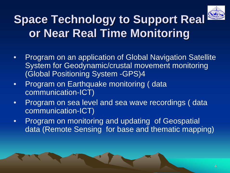
Space Technology to Support Real Space Technology to Support Real or Near Real Time Monitoringor Near Real Time Monitoring
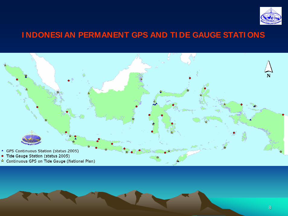
• Program on an application of Global Navigation Satellite System for Geodynamic/crustal movement monitoring (Global Positioning System -GPS)4
• Program on Earthquake monitoring ( data communication-ICT)
• Program on sea level and sea wave recordings ( data communication-ICT)
• Program on monitoring and updating of Geospatial data (Remote Sensing for base and thematic mapping)
55
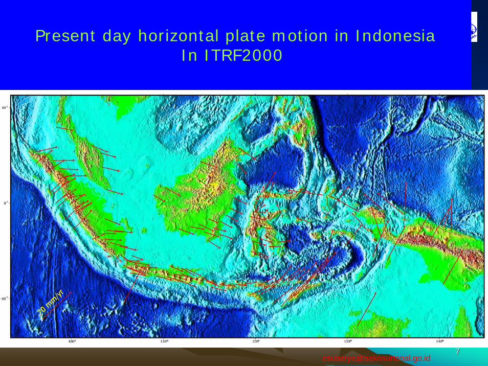
Program on Global Positioning System (GPS)An application of Global Navigation Satellite
System
88
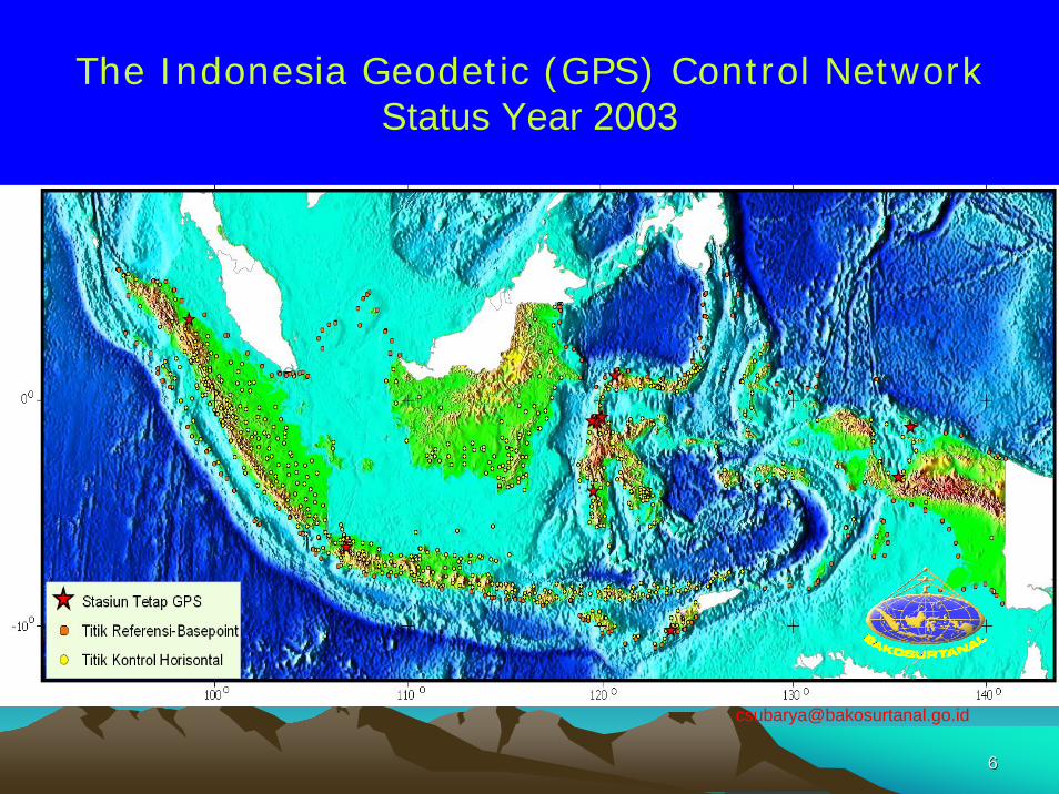
INDONESIAN PERMANENT GPS AND TIDE GAUGE STATIONS

99
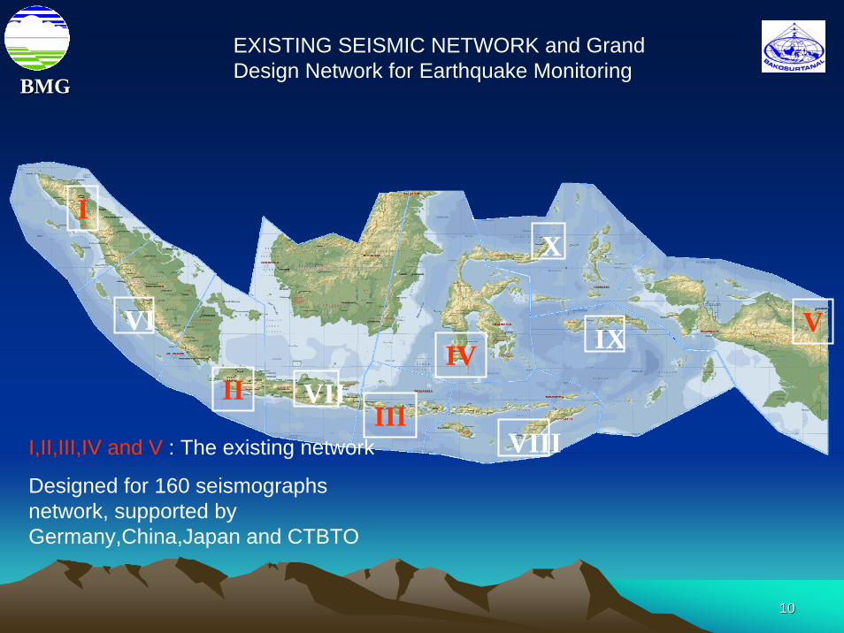
Program on Earthquake Monitoring System
1010
BMGBMG
I
IIIII
IVVVI
VII
VIII
IX
X
I,II,III,IV and V : The existing network
Designed for 160 seismographs network, supported by Germany,China,Japan and CTBTO
EXISTING SEISMIC NETWORK and Grand Design Network for Earthquake Monitoring
1111
Banda AcehBireun
Calang Takengon
Meulaboh
Sinabang
TebingTinggi
TapaktuanTuntungan
Prapat
Singkil
GunungSitoli
Tanahbala
Kotapinang
PadangSidempuan Dumai
Mandailing
MEDAN
Lhokseumawe
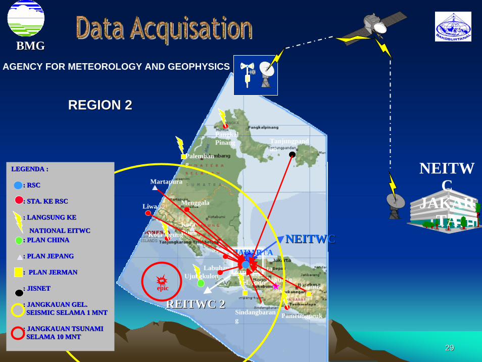
BMGBMG
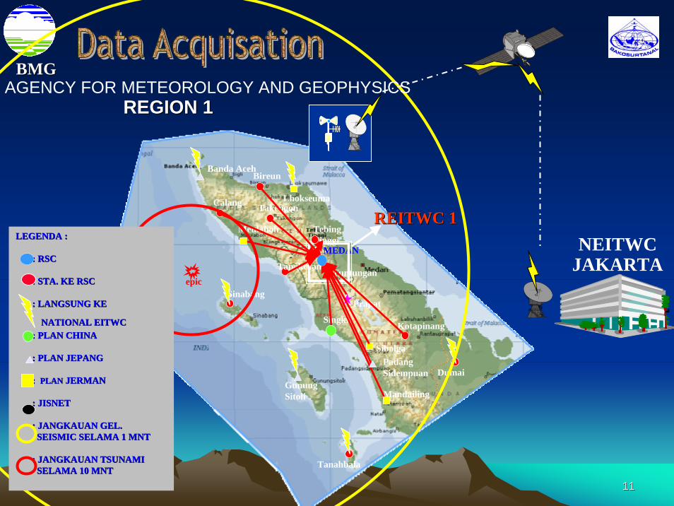
REITWC 1REITWC 1
REGION 1REGION 1
NEITWCJAKARTA
epic
LEGENDA :LEGENDA :
: RSC: RSC
: STA. KE RSC: STA. KE RSC
: LANGSUNG KE : LANGSUNG KE
NATIONAL EITWCNATIONAL EITWC: PLAN CHINA: PLAN CHINA
: PLAN JEPANG: PLAN JEPANG
: : PLANPLAN JERMANJERMAN
: JISNET: JISNET
: JANGKAUAN GEL.: JANGKAUAN GEL.SEISMIC SELAMA 1 MNTSEISMIC SELAMA 1 MNT
: JANGKAUAN TSUNAMI: JANGKAUAN TSUNAMISELAMA 10 MNTSELAMA 10 MNT
Sibolga
AGENCY FOR METEOROLOGY AND GEOPHYSICS
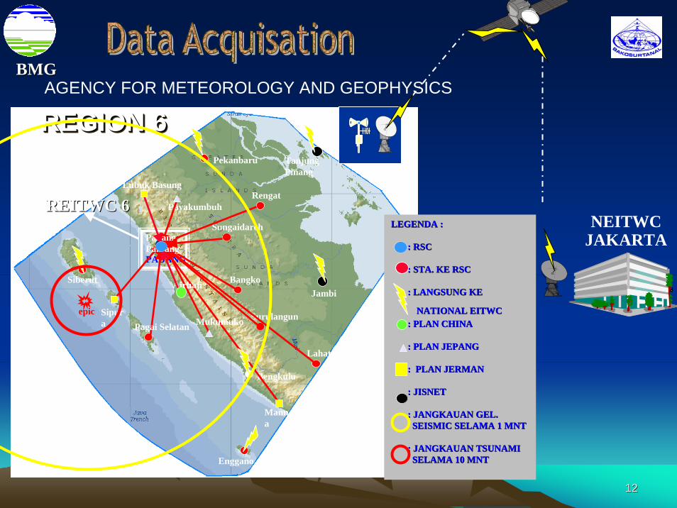
1212
Siberut
Sipura
Lubuk Basung
Payakumbuh
Sungaidareh
Pekanbaru
Jambi
Rengat
Bangko
Surulangun
Lahat
Manna
Bengkulu
PADANG
Enggano
TanjungPinang
REITWC 6REITWC 6
PadangPanjang
Airhaji
MukumukoPagai Selatan
REGION 6REGION 6REGION 6
NEITWCJAKARTA
epic
BMGBMG
LEGENDA :LEGENDA :
: RSC: RSC
: STA. KE RSC: STA. KE RSC
: LANGSUNG KE : LANGSUNG KE
NATIONAL EITWCNATIONAL EITWC: PLAN CHINA: PLAN CHINA
: PLAN JEPANG: PLAN JEPANG
: PLAN JERMAN: PLAN JERMAN
: JISNET: JISNET
: JANGKAUAN GEL.: JANGKAUAN GEL.SEISMIC SELAMA 1 MNTSEISMIC SELAMA 1 MNT
: JANGKAUAN TSUNAMI: JANGKAUAN TSUNAMISELAMA 10 MNTSELAMA 10 MNT
AGENCY FOR METEOROLOGY AND GEOPHYSICS
1313
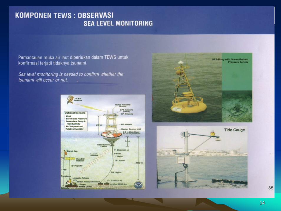
Program on Sea Level and Wave Monitoring
1414
1515
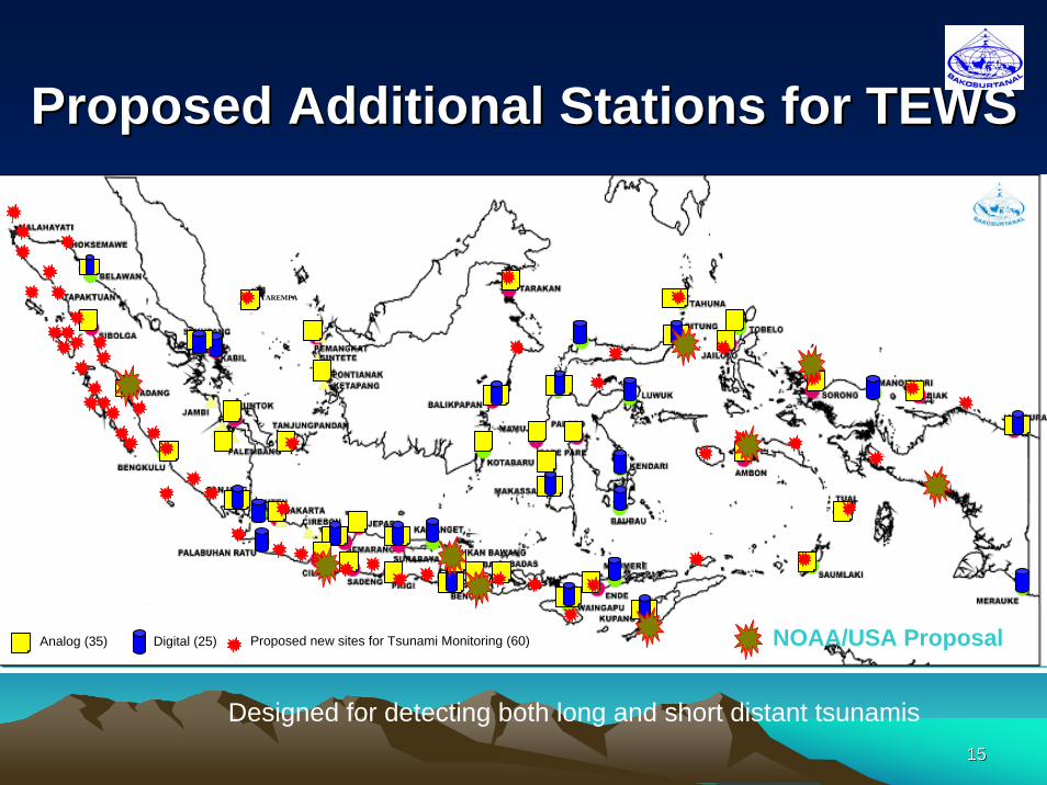
Proposed Additional Stations for TEWSProposed Additional Stations for TEWS
Pantoloan
Toli Toli
Tarempa
TAREMPA
Analog (35) Digital (25) Proposed new sites for Tsunami Monitoring (60) NOAA/USA Proposal
Designed for detecting both long and short distant tsunamis
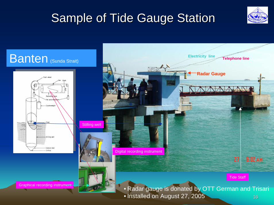
1616
Sample of Tide Gauge StationSample of Tide Gauge Station
Stilling well
Tide Staff
Graphical recording instrument
Digital recording instrument
Telephone lineElectricity lineBanten (Sunda Strait)
Radar Gauge
• Radar gauge is donated by OTT German and Trisari• Installed on August 27, 2005
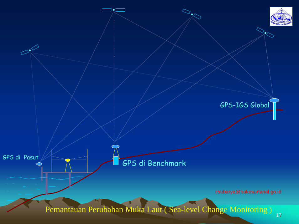
1717
GPS di Pasut
GPS-IGS Global
GPS di Benchmark
•
•
••
Pemantauan Perubahan Muka Laut ( Sea-level Change Monitoring )
1818
Number of instruments requiredNumber of instruments required• Based on GLOSS/IOC technical requirements• New stations (60), each equipped with both
pressure & radar gauges• Up grade for the existing analogue stations (40
pressure gauges) • Back up for the existing digital stations (25 pressure
gauges) • Real time data communication (60 Vsat or GTS)
1919
Implementation in 2005Implementation in 2005
• Cooperation with NOAA/UHSLC and GLOSS/IOC– 22 April 2005, installed one station in Sibolga– Expected on September 2005: i) Padang, ii)
Sabang, iii) Benoa (Bali)• Cooperation with Germany
– Possible 20 stations along the coastline of Indian Ocean; some would be installed before Dec 2005
2020
Program on Geospatial Data
2121
$T$T
$T
$T
$T$T$T
$T
$T
$T
$T
$T
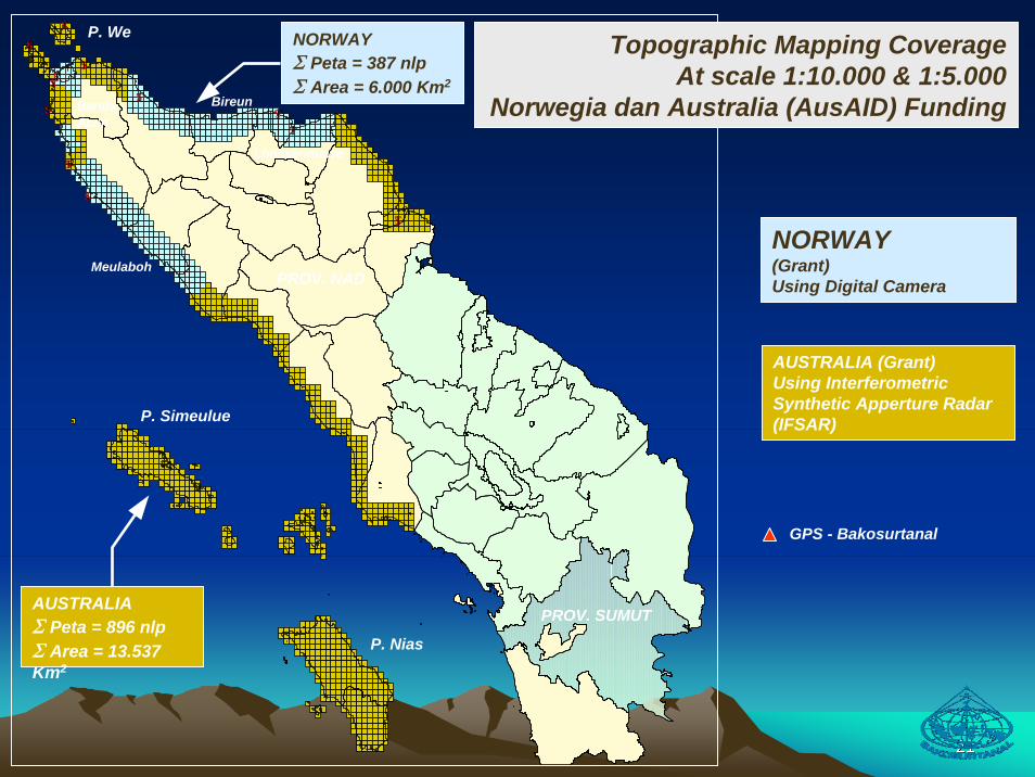
NORWAYΣ Peta = 387 nlpΣ Area = 6.000 Km2
Topographic Mapping CoverageAt scale 1:10.000 & 1:5.000
Norwegia dan Australia (AusAID) Funding
AUSTRALIAΣ Peta = 896 nlpΣ Area = 13.537 Km2
NORWAY(Grant)Using Digital Camera
AUSTRALIA (Grant)Using InterferometricSynthetic Apperture Radar (IFSAR)P. Simeulue
P. Nias
P. We
PROV. NAD
PROV. SUMUT
Meulaboh
Lhokseumawe
BandaAceh
Bireun
GPS - Bakosurtanal
2222
2323
Java
Indian OceanBali
Sumatra
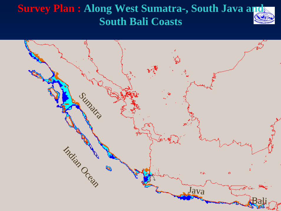
Survey Plan : Along West Sumatra-, South Java and South Bali Coasts
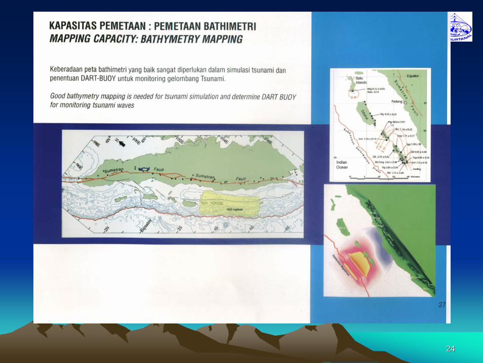
2424
2525
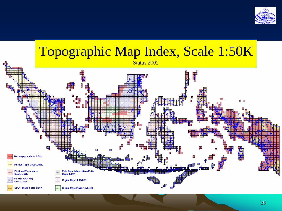
Topographic Map Index, Scale 1:50KStatus 2002
Not mapp, scale of 1:50K
Printed Topo Mapp 1:50K
Digitised Topo MapsScale 1:50K
Printed SAR Map Scale 1:50K
SPOT Image Scale 1:50K
Peta Foto Udara Hitam-Putih Skala 1:50K
Digital Mapp 1:25.000
Digital Map (Insar) 1:50.000
2626
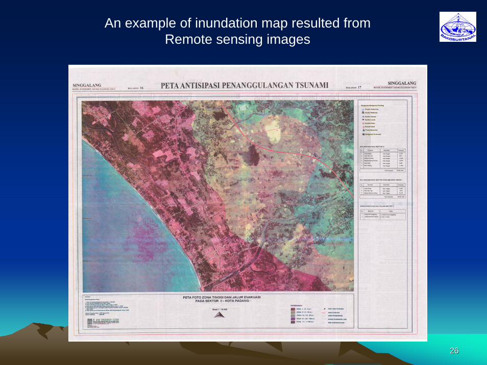
An example of inundation map resulted from Remote sensing images
2727
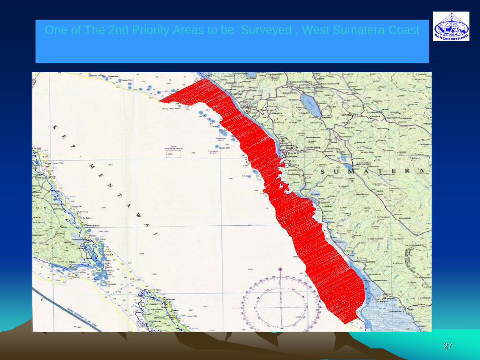
One of The 2nd Priority Areas to be Surveyed , West Sumatera Coast
2828
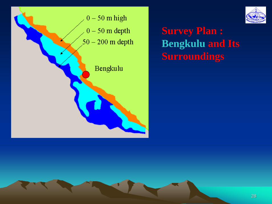
Survey Plan : Bengkulu and Its Surroundings
2929
Palembang
PangkalPinang Tanjungpand
an
Menggala
Martapura
Kota Bumi
Liwa
Kota Agung
Merak
UjungkulonLabuhan
BandungCiamisPel. Ratu
PameungpeukSindangbarang
JakartaCIPUTAT
JAKARTA
REITWC 2REITWC 2
NEITWCNEITWC
REGION 2REGION 2
NEITWC
JAKARTA
epic
BMGBMG
LEGENDA :LEGENDA :
: RSC: RSC
: STA. KE RSC: STA. KE RSC
: LANGSUNG KE : LANGSUNG KE
NATIONAL EITWCNATIONAL EITWC: PLAN CHINA: PLAN CHINA
: PLAN JEPANG: PLAN JEPANG
: PLAN JERMAN: PLAN JERMAN
: JISNET: JISNET
: JANGKAUAN GEL.: JANGKAUAN GEL.SEISMIC SELAMA 1 MNTSEISMIC SELAMA 1 MNT
: JANGKAUAN TSUNAMI: JANGKAUAN TSUNAMISELAMA 10 MNTSELAMA 10 MNT
AGENCY FOR METEOROLOGY AND GEOPHYSICS
3030
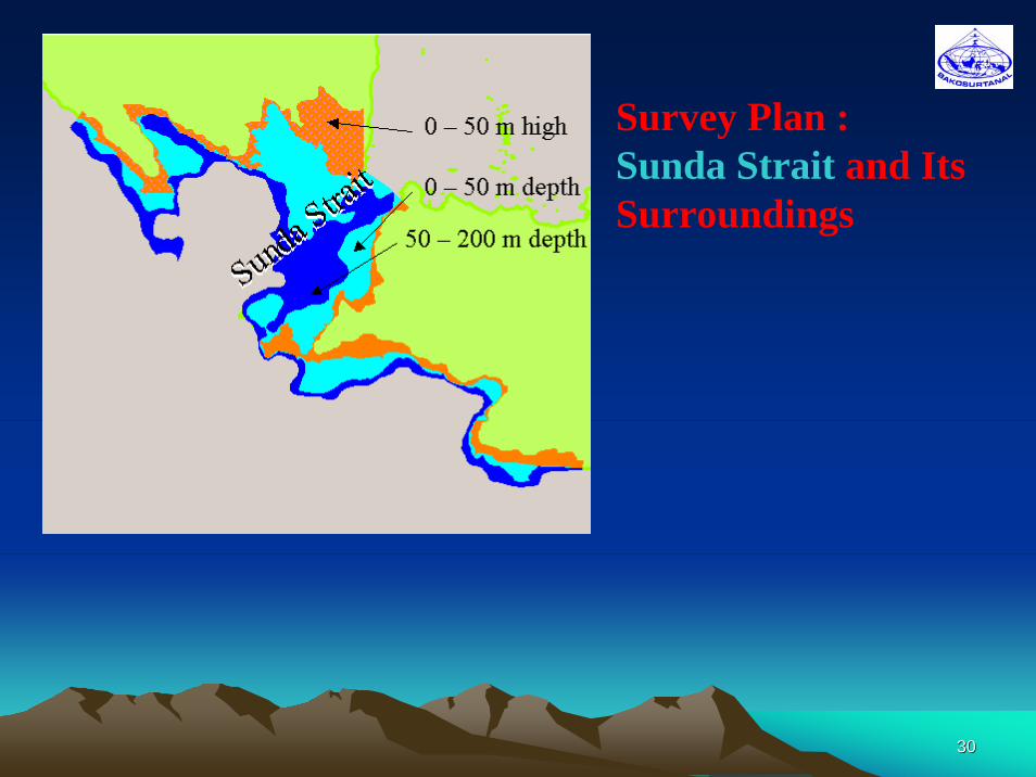
Survey Plan : Sunda Strait and Its Surroundings
3131
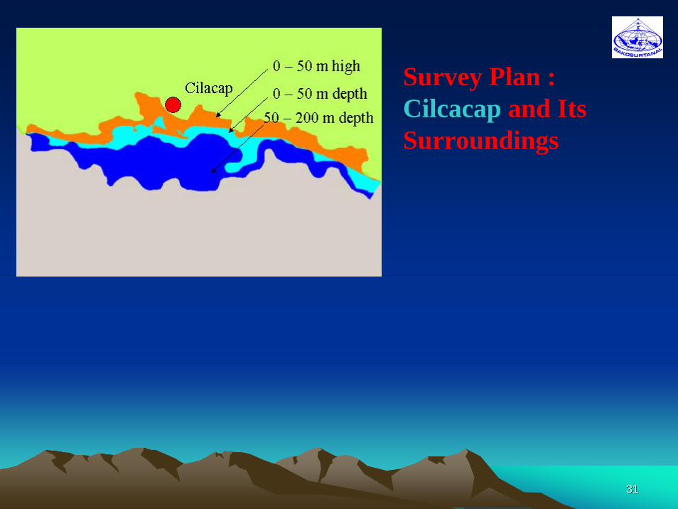
Survey Plan : Cilcacap and Its Surroundings
3232
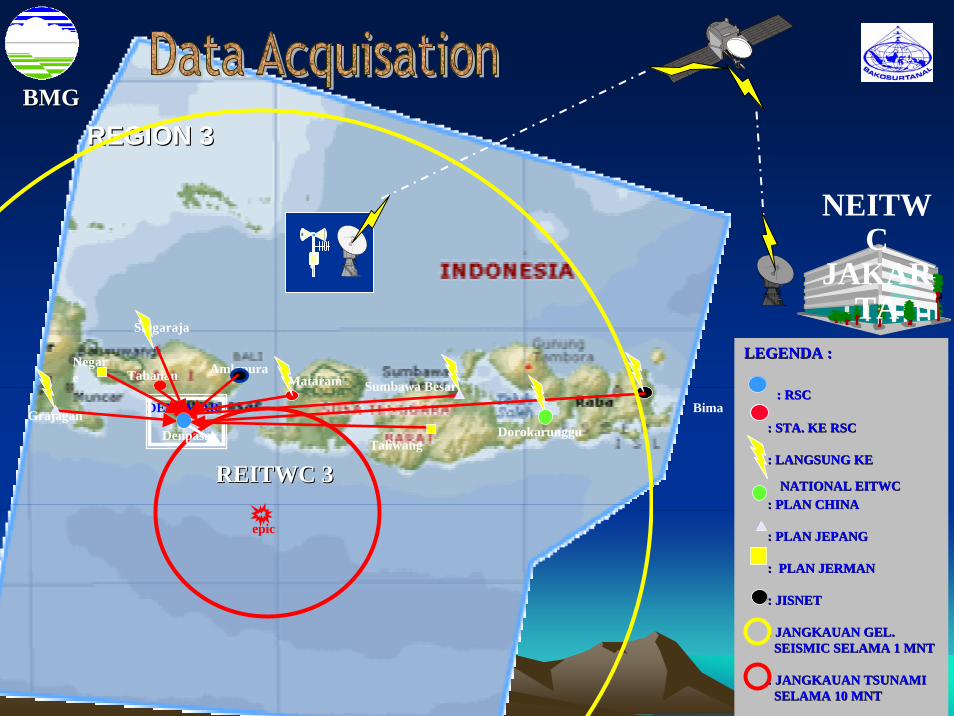
Grajagan
MataramNegare
Singaraja
Bima
TaliwangDorokarunggu
DENPASAR
Tabanan Amlapura
REGION 3REGION 3
Sumbawa Besar
NEITWC
JAKARTA
Denpasar
REITWC 3REITWC 3
epic
BMGBMG
LEGENDA :LEGENDA :
: RSC: RSC
: STA. KE RSC: STA. KE RSC
: LANGSUNG KE : LANGSUNG KE
NATIONAL EITWCNATIONAL EITWC: PLAN CHINA: PLAN CHINA
: PLAN JEPANG: PLAN JEPANG
: PLAN JERMAN: PLAN JERMAN
: JISNET: JISNET
: JANGKAUAN GEL.: JANGKAUAN GEL.SEISMIC SELAMA 1 MNTSEISMIC SELAMA 1 MNT
: JANGKAUAN TSUNAMI: JANGKAUAN TSUNAMISELAMA 10 MNTSELAMA 10 MNT
3333
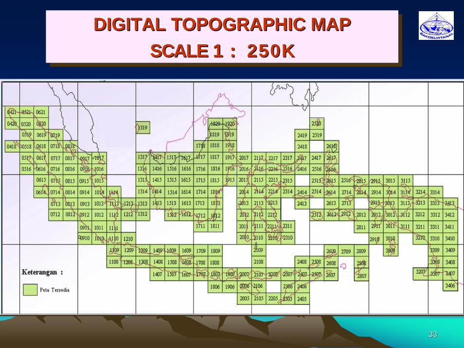
DIGITAL TOPOGRAPHIC MAPSCALE 1 : 250K
DIGITAL TOPOGRAPHIC MAPDIGITAL TOPOGRAPHIC MAPSCALE 1 : 250KSCALE 1 : 250K
3434
General Issues and Looking ForwardGeneral Issues and Looking Forward
• How to implement the system operational on 24/7 basis with high reliability
• Sustainability:– Excellent national and international cooperation to maintain level
of investment– Aimed at multi hazard approach and multi purpose utilisations – Encouraging regional R&D focus
• The System should be capable of covering possible tsunami sources in Indian Ocean and Indonesia Internal Waters
• More resources for Geospatial data of coastal line and near shore bathymetric maps along the Indian Ocean for modeling and inundation map

3535
Thank you for your kindly attention
3636
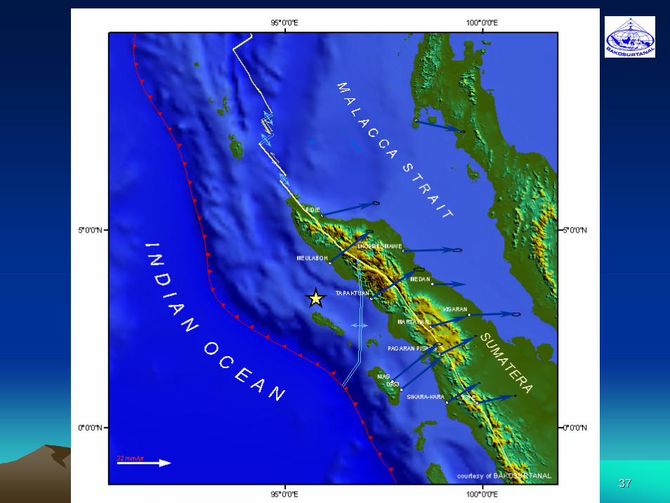
3737
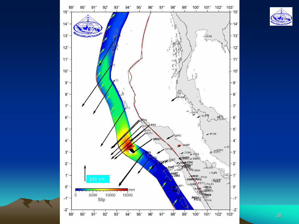
3838
100 cm
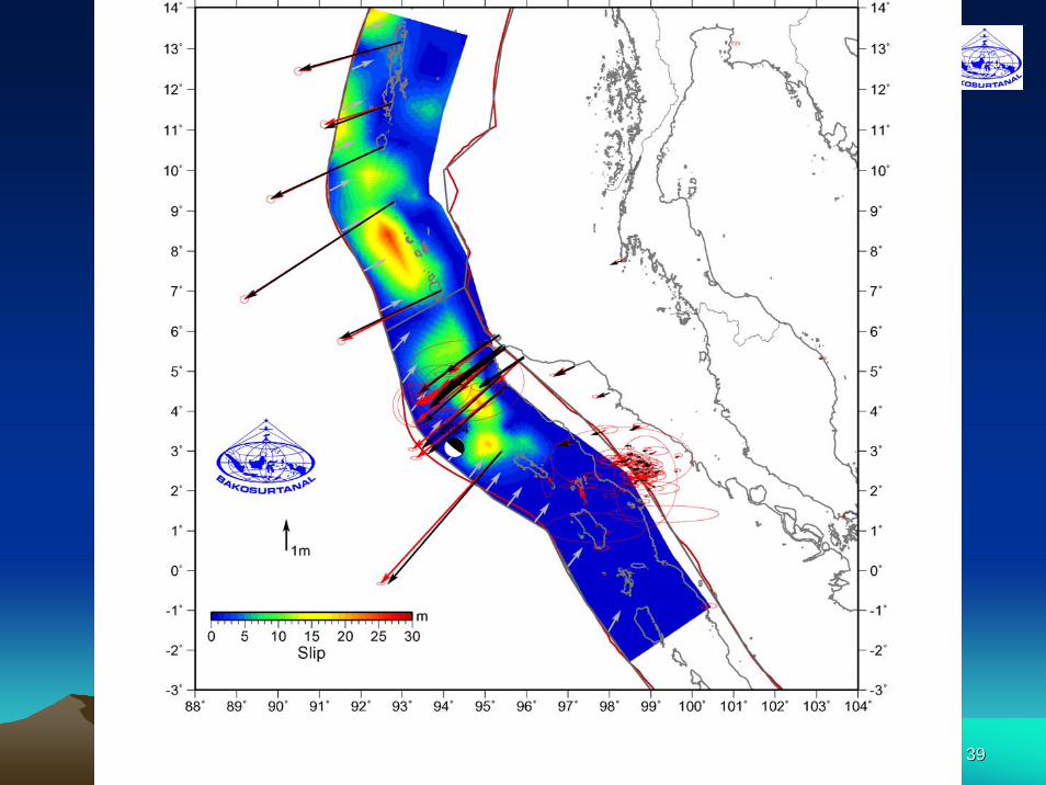
3939