Embed Size (px)
Citation preview
The ALOS Kyoto & Carbon Initiative -- an overview
A. Rosenqvist
Japan Aerospace Exploration Agency Earth Observation Research and Applications Center
September, 2004
The ALOS Kyoto & Carbon Initiative
Presentation outline
1. Heritage and objectives2. Project organization3. Data- and information requirements4. K&C products5. The Systematic Observation Strategy6. Summary7. References
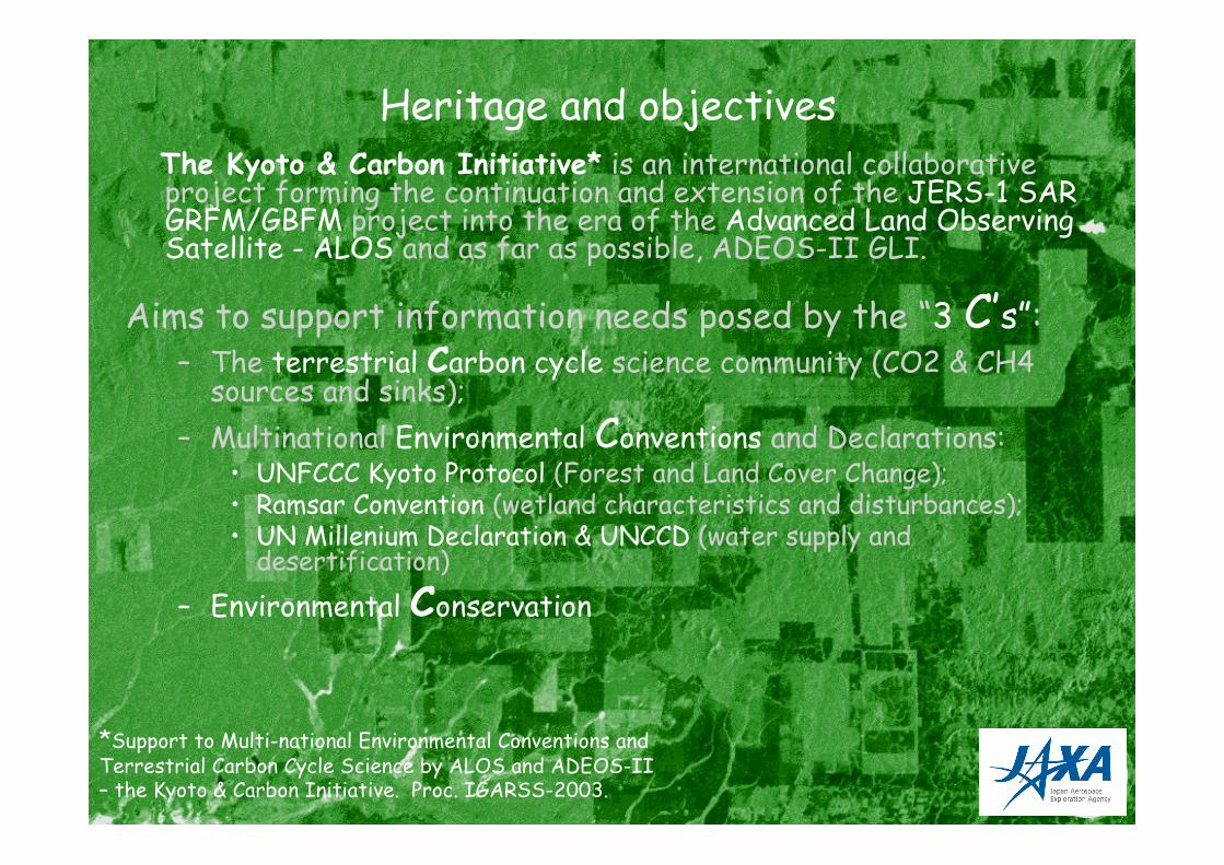
Heritage and objectives The Kyoto & Carbon Initiative* is an international collaborative
project forming the continuation and extension of the JERS-1 SARGRFM/GBFM project into the era of the Advanced Land ObservingSatellite - ALOS and as far as possible, ADEOS-II GLI.
Aims to support information needs posed by the “3 C’s”:– The terrestrial Carbon cycle science community (CO2 & CH4
sources and sinks);
– Multinational Environmental Conventions and Declarations:• UNFCCC Kyoto Protocol (Forest and Land Cover Change);• Ramsar Convention (wetland characteristics and disturbances);• UN Millenium Declaration & UNCCD (water supply and
desertification)
– Environmental Conservation
*Support to Multi-national Environmental Conventions andTerrestrial Carbon Cycle Science by ALOS and ADEOS-II– the Kyoto & Carbon Initiative. Proc. IGARSS-2003.
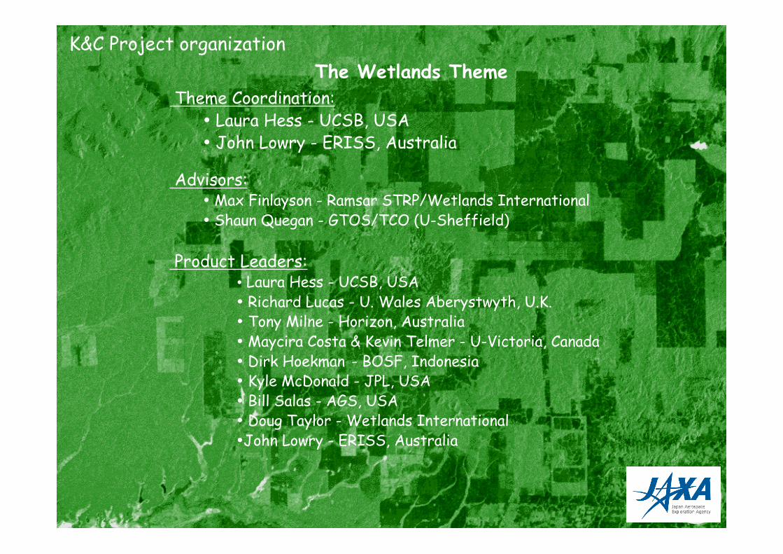
Theme Coordination: • Laura Hess - UCSB, USA• John Lowry - ERISS, Australia
Advisors: • Max Finlayson - Ramsar STRP/Wetlands International• Shaun Quegan - GTOS/TCO (U-Sheffield)
Product Leaders: • Laura Hess - UCSB, USA• Richard Lucas - U. Wales Aberystwyth, U.K.• Tony Milne - Horizon, Australia• Maycira Costa & Kevin Telmer - U-Victoria, Canada• Dirk Hoekman - BOSF, Indonesia• Kyle McDonald - JPL, USA• Bill Salas - AGS, USA• Doug Taylor - Wetlands International•John Lowry - ERISS, Australia
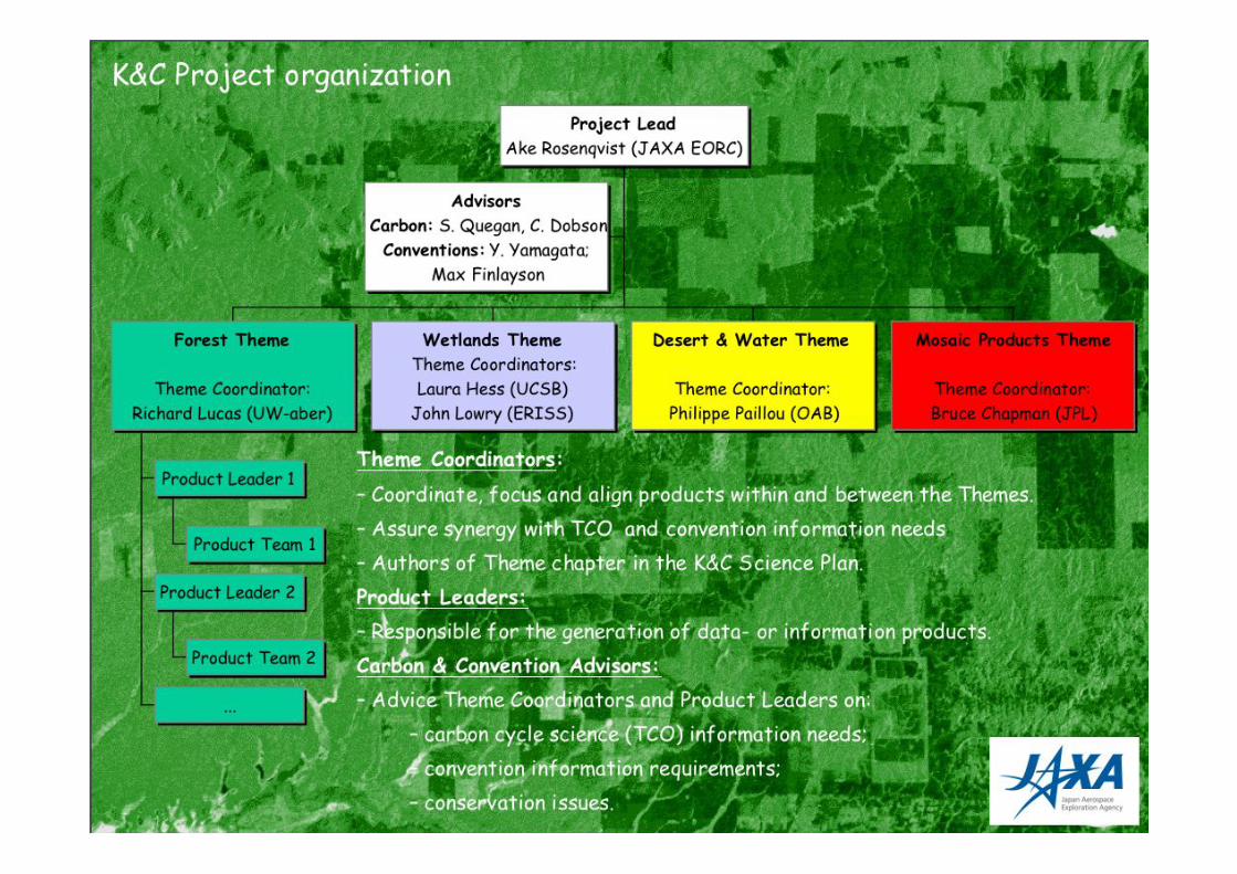
K&C Project organization
The Wetlands Theme
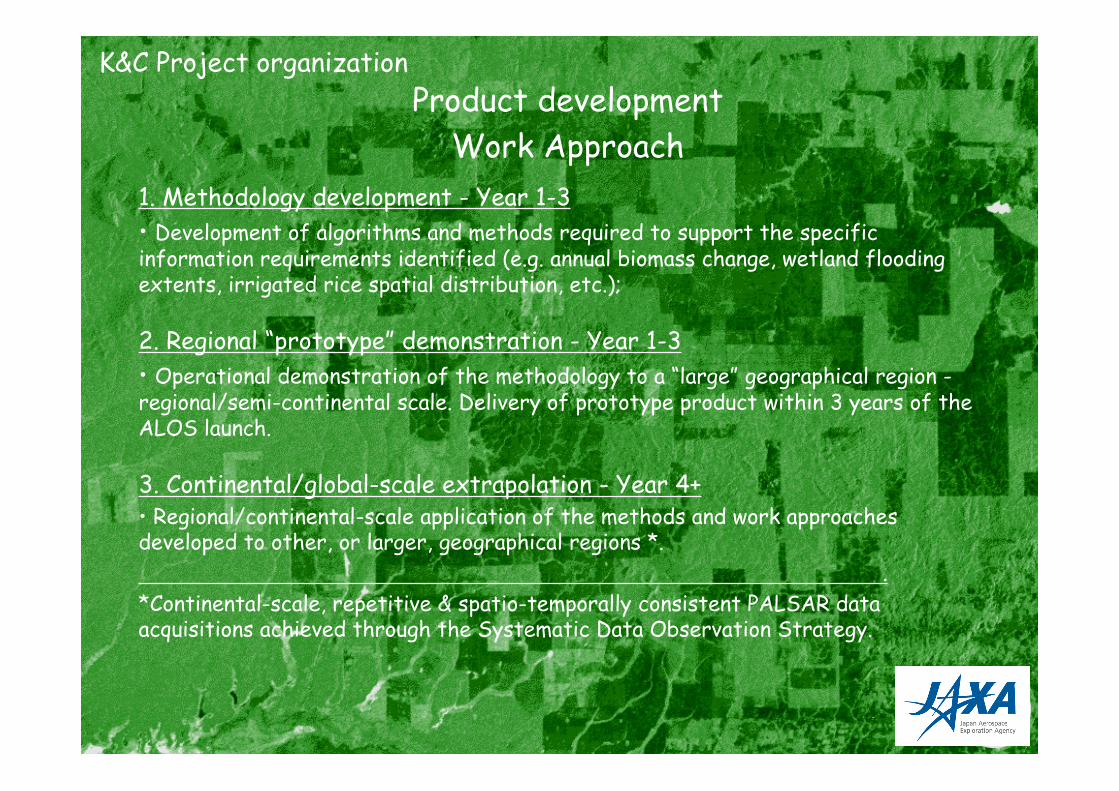
Product development
Work Approach
1. Methodology development - Year 1-3
• Development of algorithms and methods required to support the specificinformation requirements identified (e.g. annual biomass change, wetland floodingextents, irrigated rice spatial distribution, etc.);
2. Regional “prototype” demonstration - Year 1-3
• Operational demonstration of the methodology to a “large” geographical region -regional/semi-continental scale. Delivery of prototype product within 3 years of theALOS launch.
3. Continental/global-scale extrapolation - Year 4+• Regional/continental-scale application of the methods and work approachesdeveloped to other, or larger, geographical regions *.
.
*Continental-scale, repetitive & spatio-temporally consistent PALSAR dataacquisitions achieved through the Systematic Data Observation Strategy.
K&C Project organization
9
Data- and information requirements
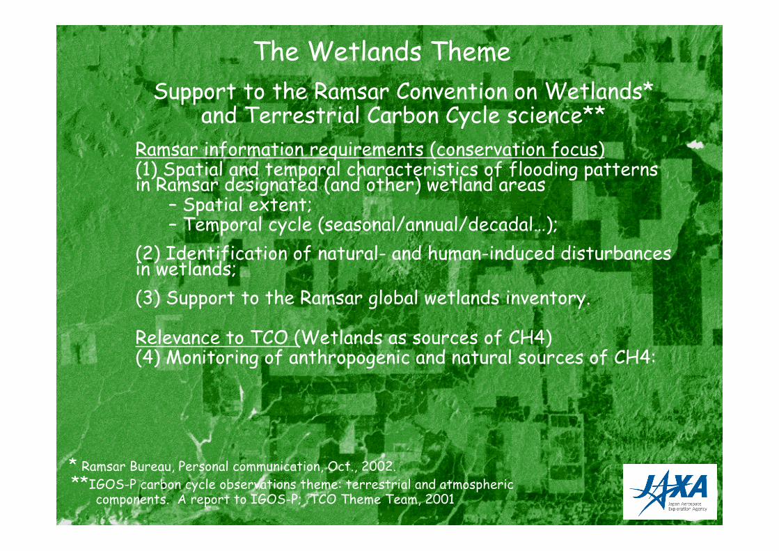
Support to the Ramsar Convention on Wetlands*and Terrestrial Carbon Cycle science**
Ramsar information requirements (conservation focus)(1) Spatial and temporal characteristics of flooding patternsin Ramsar designated (and other) wetland areas
– Spatial extent;– Temporal cycle (seasonal/annual/decadal…);
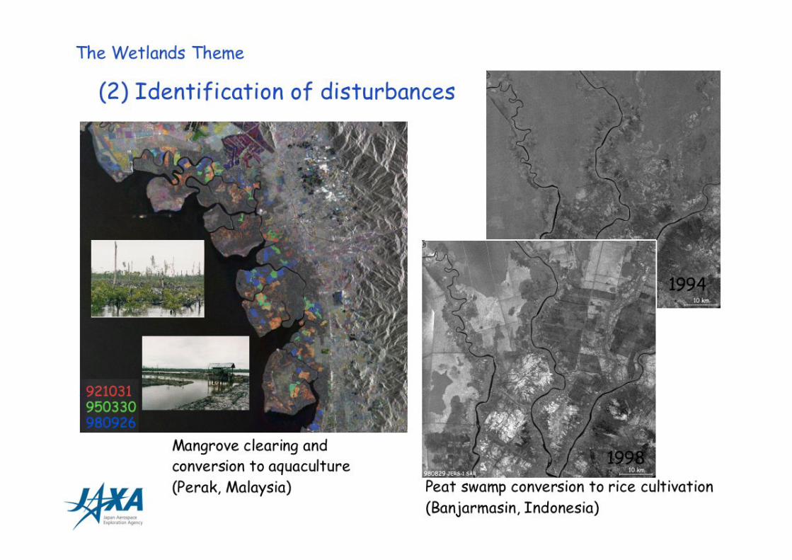
(2) Identification of natural- and human-induced disturbancesin wetlands;
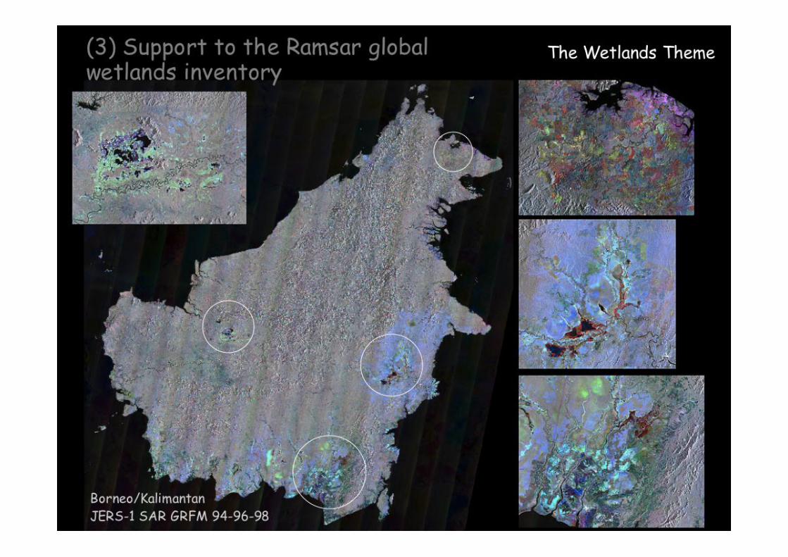
(3) Support to the Ramsar global wetlands inventory.
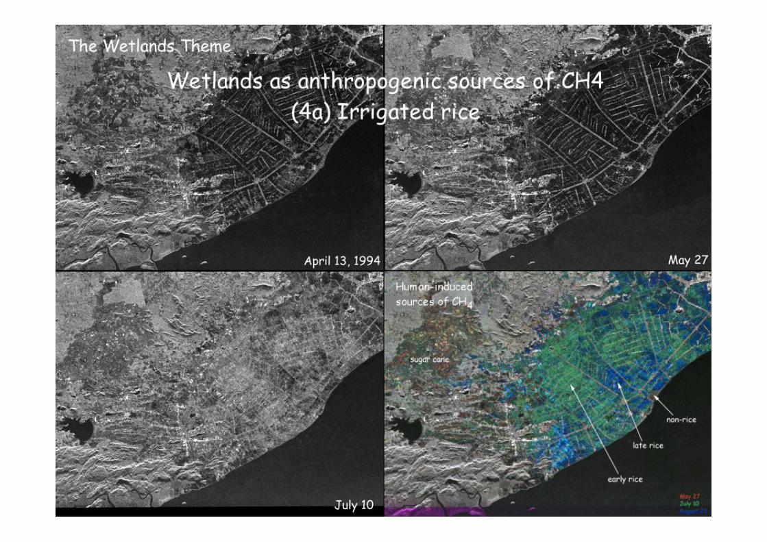
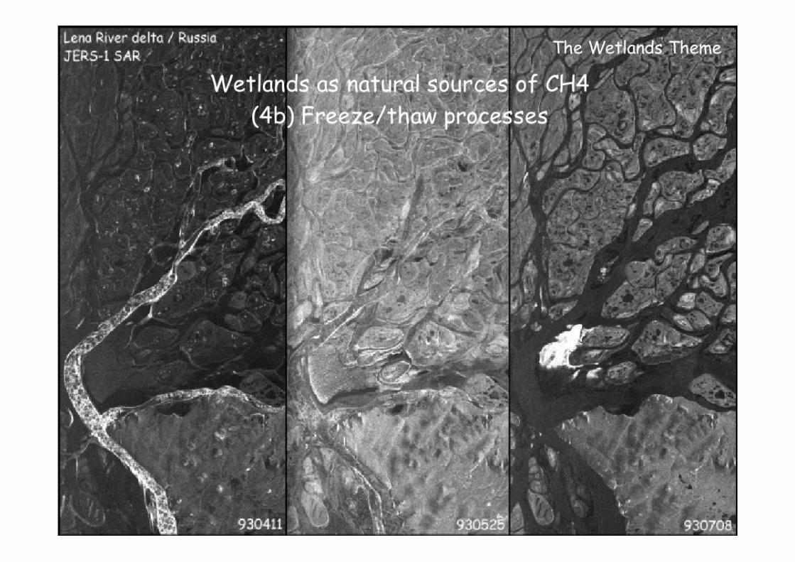
Relevance to TCO (Wetlands as sources of CH4)(4) Monitoring of anthropogenic and natural sources of CH4:
The Wetlands Theme
* Ramsar Bureau, Personal communication, Oct., 2002.
**IGOS-P carbon cycle observations theme: terrestrial and atmospheric components. A report to IGOS-P; TCO Theme Team, 2001
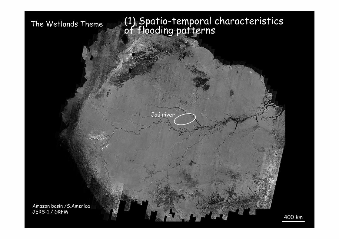
Amazon basin /S.AmericaJERS-1 / GRFM
Jaú river
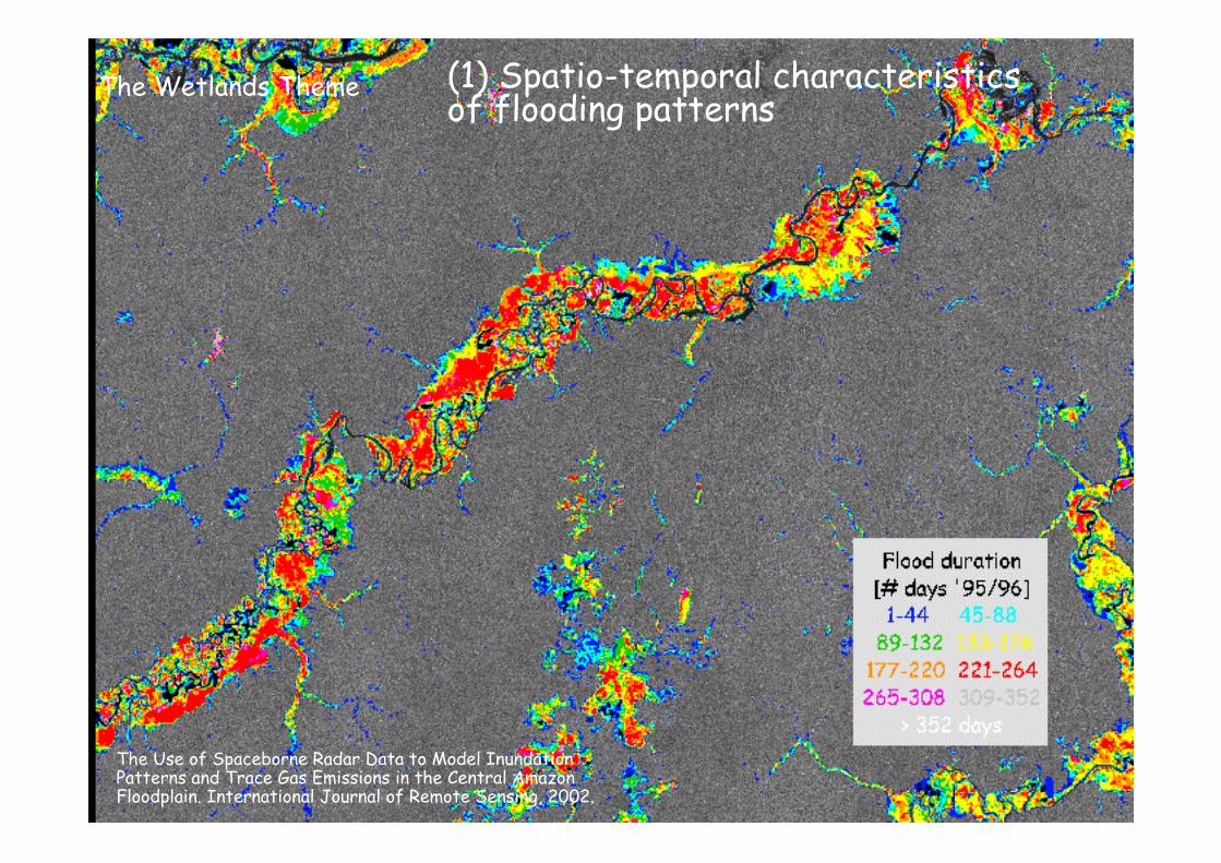
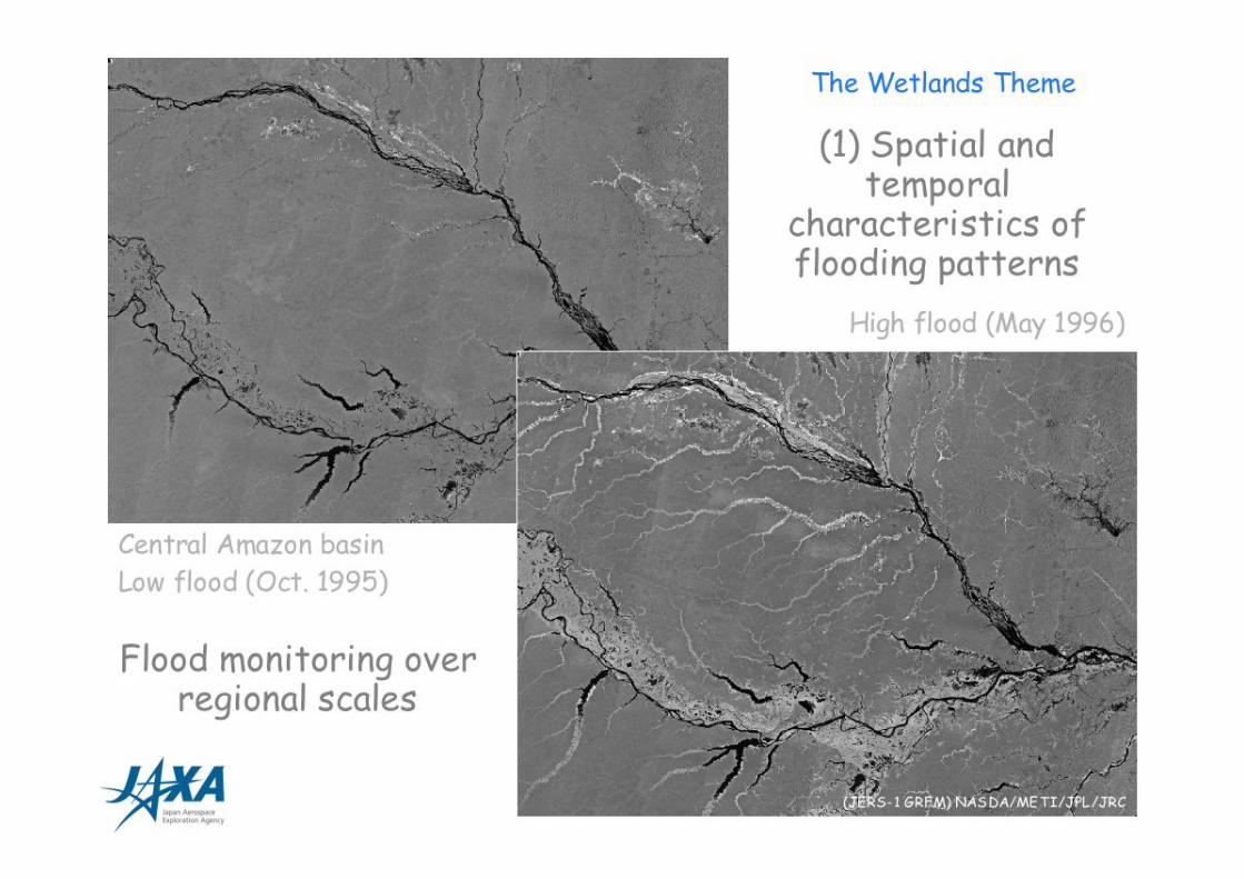
(1) Spatio-temporal characteristicsof flooding patterns
The Wetlands Theme
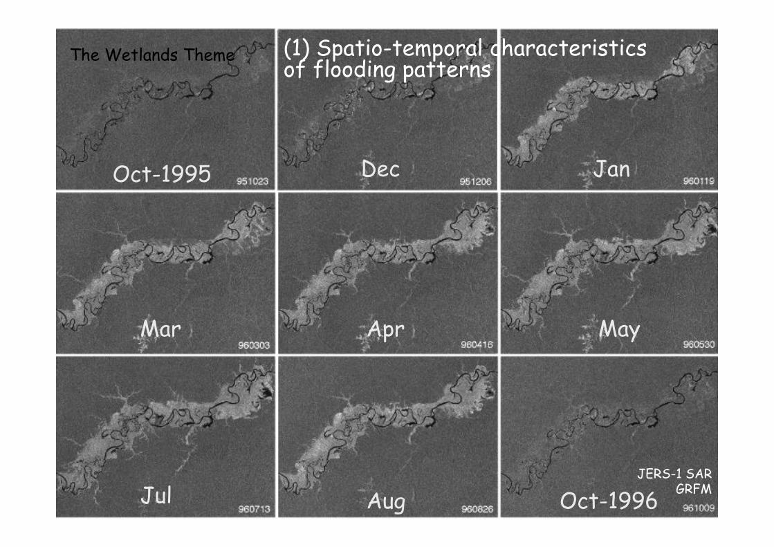
Oct-1995 Dec Jan
Mar Apr May
Jul Aug Oct-1996
(1) Spatio-temporal characteristicsof flooding patterns
The Wetlands Theme
JERS-1 SARGRFM
(1) Spatio-temporal characteristicsof flooding patterns
The Wetlands Theme
The Use of Spaceborne Radar Data to Model InundationPatterns and Trace Gas Emissions in the Central AmazonFloodplain. International Journal of Remote Sensing, 2002.
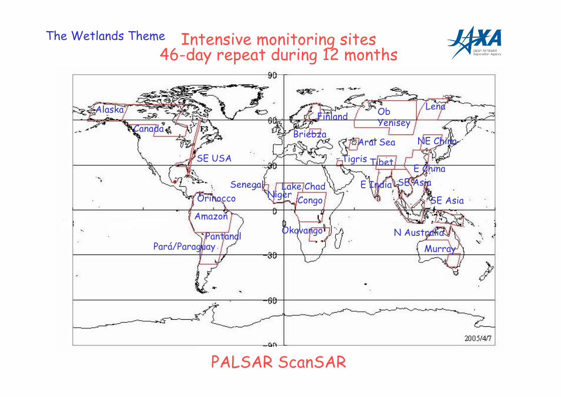
Intensive monitoring sites46-day repeat during 12 months
PALSAR ScanSAR
The Wetlands Theme
Alaska
Canada
SE USA
Orinocco
Amazon
Pantanal
Senegal
Pará/Paraguay
Lake ChadNiger
Congo
Okavango
Finland
BriebzaAral Sea
Tigris
Ob Yenisey
Lena
NE China
E China
E India SE Asia
SE Asia
N Australia
Murray
Tibet
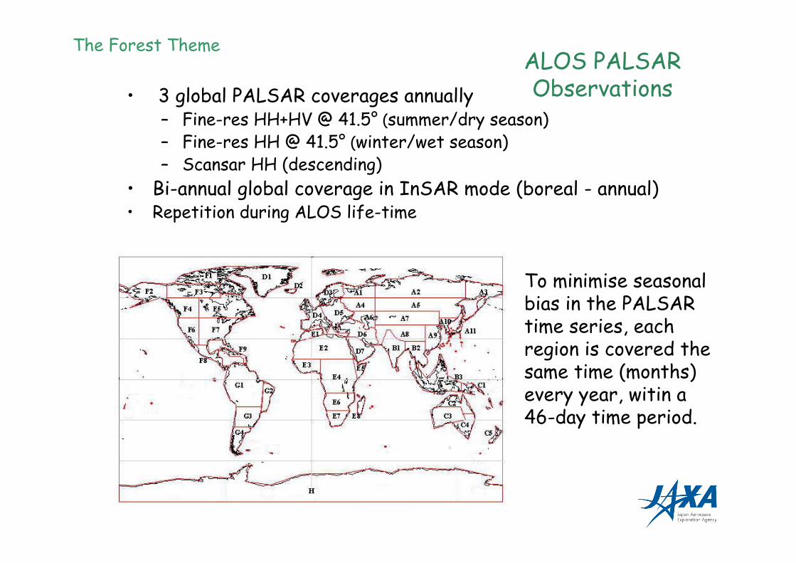
• 3 global PALSAR coverages annually– Fine-res HH+HV @ 41.5° (summer/dry season)– Fine-res HH @ 41.5° (winter/wet season)– Scansar HH (descending)
• Bi-annual global coverage in InSAR mode (boreal - annual)• Repetition during ALOS life-time
Forest &LCC
The Forest ThemeALOS PALSARObservations
To minimise seasonalbias in the PALSARtime series, eachregion is covered thesame time (months)every year, witin a46-day time period.
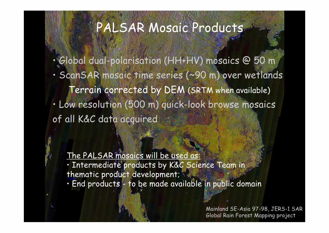
• Global dual-polarisation (HH+HV) mosaics @ 50 m
• ScanSAR mosaic time series (~90 m) over wetlands
Terrain corrected by DEM (SRTM when available)
• Low resolution (500 m) quick-look browse mosaics
of all K&C data acquired
PALSAR Mosaic Products
Mainland SE-Asia 97-98, JERS-1 SARGlobal Rain Forest Mapping project
The PALSAR mosaics will be used as:• Intermediate products by K&C Science Team inthematic product development;• End products - to be made available in public domain
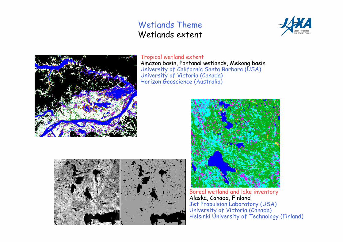
Wetlands ThemeWetlands extent
Tropical wetland extentAmazon basin, Pantanal wetlands, Mekong basinUniversity of California Santa Barbara (USA)University of Victoria (Canada)Horizon Geoscience (Australia)
Boreal wetland and lake inventoryAlaska, Canada, FinlandJet Propulsion Laboratory (USA)University of Victoria (Canada)Helsinki University of Technology (Finland)
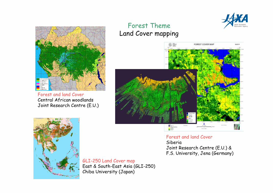
Forest ThemeLand Cover mapping
Forest and land CoverCentral African woodlandsJoint Research Centre (E.U.)
GLI-250 Land Cover mapEast & South-East Asia (GLI-250)Chiba University (Japan)
Forest and land CoverSiberiaJoint Research Centre (E.U.) &F.S. University, Jena (Germany)
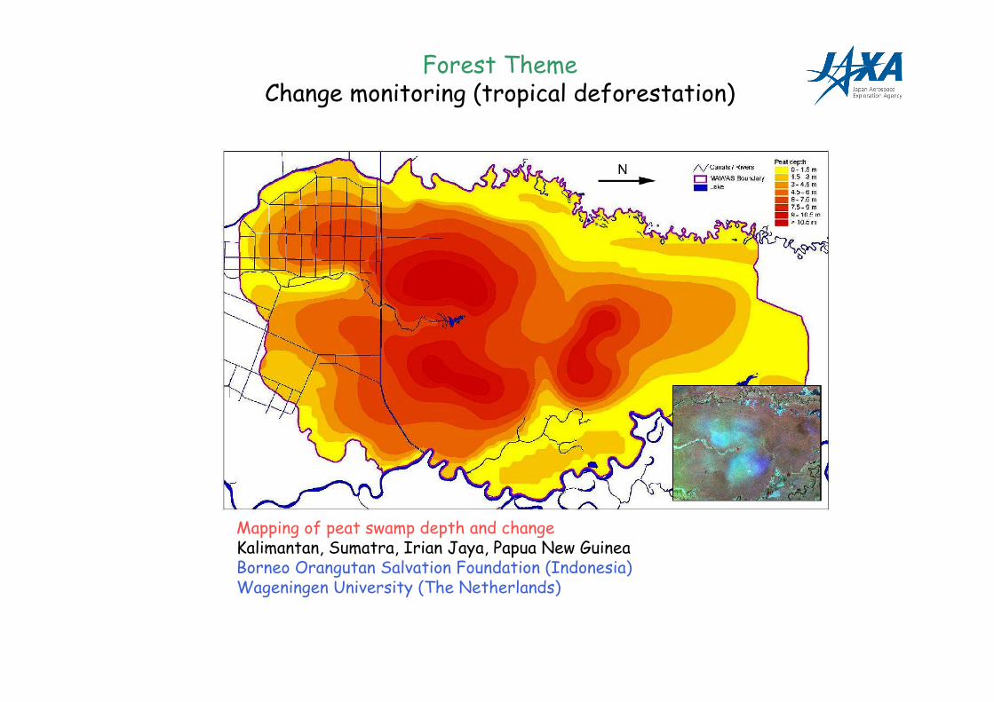
Mapping of peat swamp depth and changeKalimantan, Sumatra, Irian Jaya, Papua New GuineaBorneo Orangutan Salvation Foundation (Indonesia)Wageningen University (The Netherlands)
Forest ThemeChange monitoring (tropical deforestation)
References
Systematic Data Acquisitions - A Pre-requisite for Meaningful Biophysical Parameter Retrieval?Rosenqvist, A., Milne A.K. and Zimmermann, R., 2003. Communications, IEEE Transactions onGeoscience and Remote Sensing, Vol. 41, No. 7, pp. 1709-1711, July, 2003.
Initiating the ALOS Kyoto & Carbon Initiative. Rosenqvist, A., Ogawa T., Shimada M. and IgarashiT. Proc. IGARSS’01, Sydney, Australia. July 9-13, 2001.
Support to Multi-national Environmental Conventions and Terrestrial Carbon Cycle Science byALOS and ADEOS-II – the Kyoto & Carbon Initiative. Rosenqvist A., M. Shimada, T. Igarashi, M.Watanabe, T. Tadono and H. Yamamoto. Proc. IGARSS’03, Toulouse, France. July 21-25, 2003.
IGOS-P Carbon Cycle Observation Theme: Terrestrial and atmospheric components. Cihlar J., etal. (Eds.). Report to IGOS-P by the Terrestrial Carbon Theme Team, IGOS-P, 2001.
Remote Sensing and the Kyoto Protocol: A Review of Available and Future Technology forMonitoring Treaty Compliance. Rosenqvist, A., Imhoff, M., Milne A.K. and Dobson C. (Eds.). ISPRSWorkshop Report (159 pp.). Ann Arbor, MI, USA, Oct. 20-22, 1999.
A review of remote sensing technology in support of the Kyoto Protocol. Rosenqvist, A., Milne A.K.,Lucas R., Imhoff, M. and Dobson C , Environmental Science & Policy, Vol. 6, No. 5, pp 441-455, Oct.2003.
The SAHARASAR project: Potential support to water prospecting in arid Africa by SAR. PaillouP., and Rosenqvist A. Proc. IGARSS’03, Toulouse, France. July 21-25, 2003.
The Use of Spaceborne Radar Data to Model Inundation Patterns and Trace Gas Emissions inthe Central Amazon Floodplain. Rosenqvist, A., Forsberg, B, Pimentel, T., Rauste Y. and Richey J.,International Journal of Remote Sensing, Vol. 23, No. 7, pp. 1303-1328, 2002.
Temporal and Spatial Characteristics of Irrigated Rice in JERS-1 L-band SAR Data. RosenqvistA., International Journal of Remote Sensing, Vol. 20, No. 8, pp. 1567-1587, 1999.
ALOS Kyoto & Carbon Initiative homepage:http://www.eorc.jaxa.jp/ALOS/kyoto/kyoto_index.htm