Embed Size (px)
Citation preview
Tuesday January 19, 2021
Chicago Metro Snow Squall
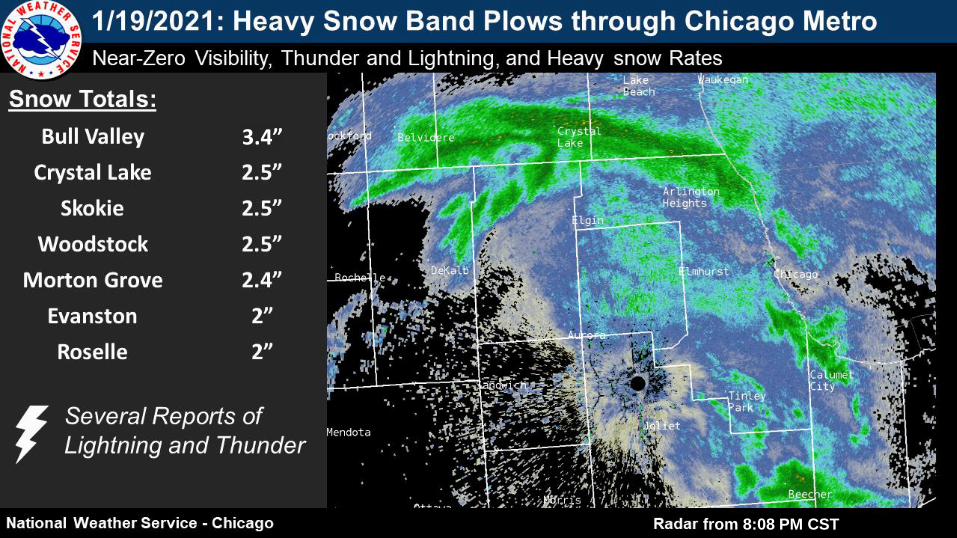
from 8:08 PM CST
3.4”
Fast Facts
● Snow squall rushed through northeastern Illinois
during the evening of 1/19/2021
● Under the band, visibility dropped to 1/4 mi, surface
pressure rose 6 mb, and an abrupt northwesterly
wind shift with gusts over 25 mph occurred
● Observed snow rates well exceeded 1”/hr, with an
airline official at ORD estimating 1” fell in just 10
minutes
● Snow totals ranged from 1-4” across parts of
Boone, McHenry, Lake (IL), northeast DuPage, and
Cook counties
● Lightning & thunder were reported numerous times
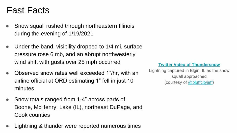
Twitter Video of Thundersnow
Lightning captured in Elgin, IL as the snow
squall approached
(courtesy of @bluffcityjeff)
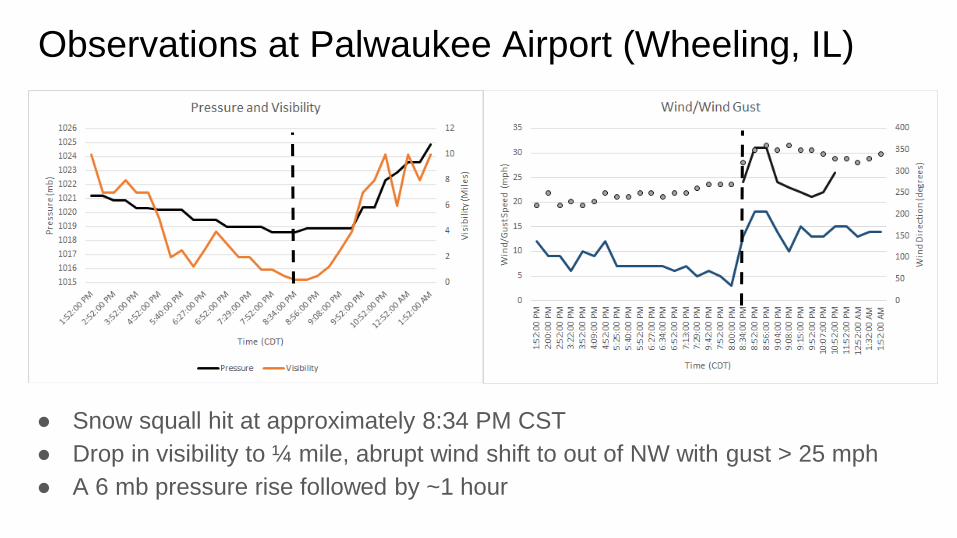
● Snow squall hit at approximately 8:34 PM CST
● Drop in visibility to ¼ mile, abrupt wind shift to out of NW with gust > 25 mph
● A 6 mb pressure rise followed by ~1 hour
Observations at Palwaukee Airport (Wheeling, IL)

40+kt (>45 mph winds) ~1600 feet above ground (from KLOT)
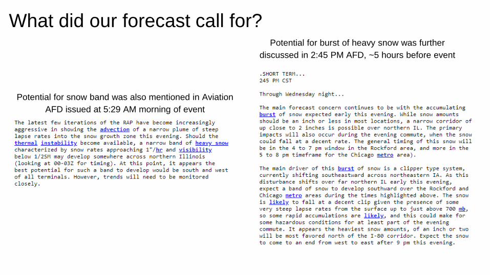
What did our forecast call for? Potential for burst of heavy snow was further
discussed in 2:45 PM AFD, ~5 hours before event
Potential for snow band was also mentioned in Aviation
AFD issued at 5:29 AM morning of event
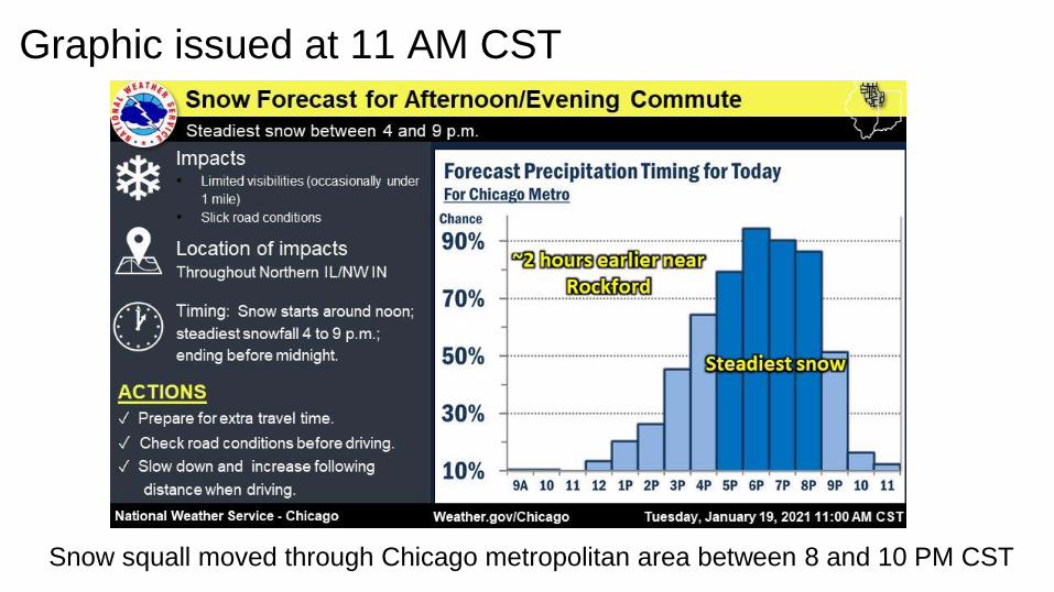
Graphic issued at 11 AM CST
Snow squall moved through Chicago metropolitan area between 8 and 10 PM CST
Brief Environmental
Assessment of the Snow Squall

Snow Squall Parameter Approached Max. Values (SPC Mesoanalysis from 8pm CST 1/19)
Intent of the snow squall parameter is to identify areas with low-level instability (often noted by steep low
level lapse rates), sufficient moisture, and strong winds to support snow squall development.
The instability with the snow squall on 1/19 was enough to produce thundersnow! (pretty rare)
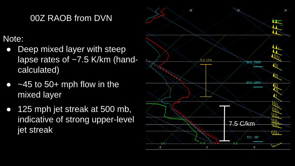
00Z RAOB from DVN
Note:
● Deep mixed layer with steep
lapse rates of ~7.5 K/km (hand-
calculated)
● ~45 to 50+ mph flow in the
mixed layer
● 125 mph jet streak at 500 mb,
indicative of strong upper-level
jet streak7.5 C/km
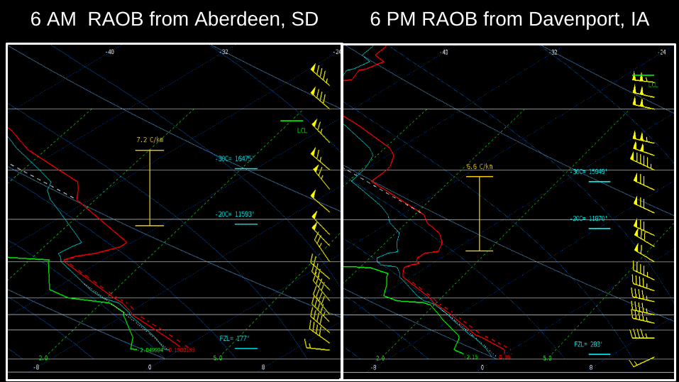
6 PM RAOB from Davenport, IA6 AM RAOB from Aberdeen, SD
00Z RAOB from DVN12Z RAOB from ABR
The low-level air mass was transported
from South Dakota. They were nearly
identical profiles, but with stronger
upper-level support by evening in Iowa
for development of narrow band(s) of
moderate to heavy snow that formed
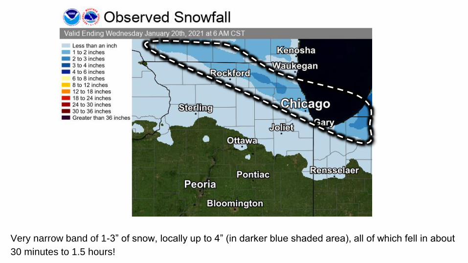
Very narrow band of 1-3” of snow, locally up to 4” (in darker blue shaded area), all of which fell in about
30 minutes to 1.5 hours!