Embed Size (px)
Citation preview
The 10.5 things you need to know about
What’s New in ArcGIS Enterprise

1 Starting at 10.5, ArcGIS Enterprise is the new name
for the ArcGIS for Server product line.
ArcSDE
ArcGIS
Server
Map
Objects
IMS ArcGIS
EnterpriseArcGIS for
Server
ArcIMSArcView
IMS
That said, we are leaving the names of the products pre-10.5
exactly as they have always been.

Portal
for
ArcGIS
ArcGIS
Server
ArcGIS
Data
Store
ArcGIS
Web
Adaptor
All of these components existed in the software pre-10.5
2 ArcGIS Enterprise is comprised of 4 software components.

Portal
for
ArcGIS
ArcGIS
ServerArcGIS
Data
Store
ArcGIS
Web
Adaptor
The base ArcGIS Enterprise deployment is how you
deploy Web GIS in your infrastructure.
2 These 4 components configured together create what is called
the base ArcGIS Enterprise deployment.

2 A base ArcGIS Enterprise deployment can be configured:
With all
components
on a single
machine
With components
configured on different
machines in a multitier
configuration
With high availability

ArcGIS
Server
3 We are introducing 5 capability based server licensing roles for
the ArcGIS Server component of ArcGIS Enterprise.
ArcGIS GIS Server
ArcGIS Image Server
ArcGIS GeoAnalytics Server
ArcGIS GeoEvent Server
ArcGIS Business Analyst Server

4 A base ArcGIS Enterprise deployment is required to utilize
many of the new server capabilities such as:
• GeoAnalytics Server
• Business Analyst Server
• Raster Analytics within the
Image Server
• Using the spatiotemporal
data store with GeoEvent
Server

5 Living Atlas content is now available within Portal for ArcGIS.
This content can be accessed by applications that are
connected to your portal, such as Insights for ArcGIS.

6 There is a new named user level available -- the Level 1.
• Can view portal content including maps,
apps, and data.
• Cannot create or own content.
• Equivalent to the Esri built-in role of
Viewer
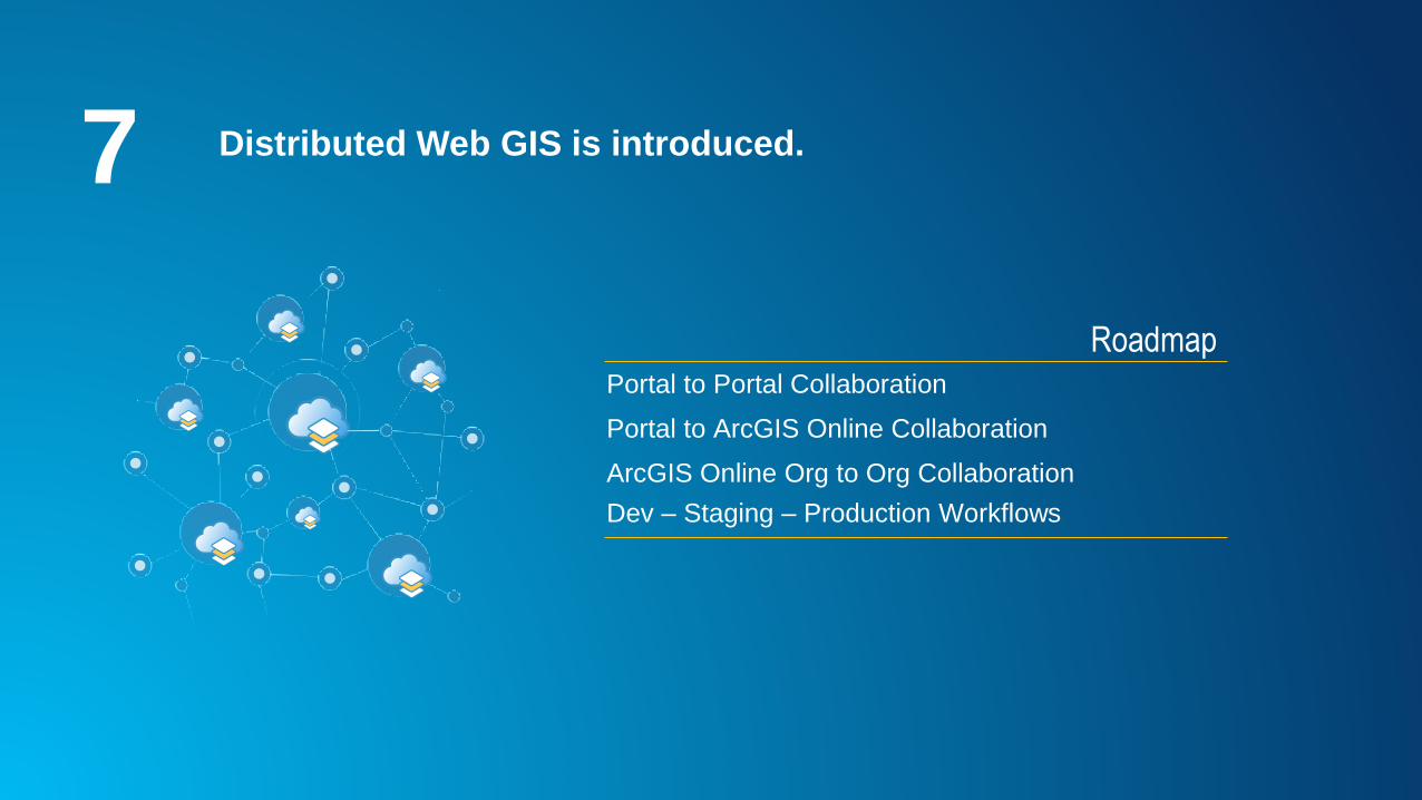
7 Distributed Web GIS is introduced.
RoadmapPortal to Portal Collaboration
Portal to ArcGIS Online Collaboration
ArcGIS Online Org to Org Collaboration
Dev – Staging – Production Workflows

7 Distributed Web GIS is introduced.
RoadmapPortal to Portal Collaboration available at 10.5

7 Distributed Web GIS is introduced.
Portal to Portal
Centralized
Collaboration Hub
Portal to Portal
Interdepartmental
Collaboration

8 Script your Web GIS with the ArcGIS Python API.
• Automate workflows and perform
repetitive tasks using scripts
• Perform analysis and big data
analytics
The ArcGIS Python API integrates
well with the Jupyter Notebook and
SciPy stack. It enables academics,
data scientists, and GIS analysts to
share programs and reproducible
research with others.
• Update content
• Script ArcGIS for Portal Administration

9 We have continued to upgrade and improve the Web GIS
experience:
• Enhanced smart mapping
• New configurable app
templates
• Redesigned item details
pages incl. Data view
• New features in story maps
• New themes for Web App
Builder

10When you upgrade your existing ArcGIS for Server
software to ArcGIS Enterprise 10.5 you must visit My Esri
for a new software authorization file.

10.5For more information on ArcGIS Enterprise including the
Functionality Matrix, architecture recommendations,
tutorials, and more; check out the ArcGIS Enterprise
documentation available through the Esri website.


![[Arcgis] Riset ArcGIS JS & Flex](https://img.pdfslide.us/doc/110x75/55cf96d7550346d0338e2017/arcgis-riset-arcgis-js-flex.jpg)

