Embed Size (px)
Citation preview
0 0 0 0 0 0 0 0 0 0 0 0 ~ 0 C G 0 0 0 0 0 0 0 0 0 0 0 0 0 0 b 0 0 0 0 C 0 0 0 0 0 0 0 D 0 D 0 0 0 0 0 0 D 0 0 0 = 0 D 0 0
0
0
0
0
0
0
0
0
0
0
0
0
0
0
0
0
0
0
u
0
0
0
0
0
0
0
0
0
0
0
0
0
0
0
0
0
0
0
0
0
0
0
0
0
0
0
0
u
0
0
0
0
0
0
0
0
0
0
0
0
0
iJ
0
0
0
D
0
D
0
0
D
0
']
0
0
D
0
0
0
Texas-Mexico
International Bridges and Border Crossings
Existing and Proposed
2001
0 0 0 C ~ 0 0 0 0 0 0 D ~ 0 0 = 0 0 D 0 0 0 0 D 0 0 D 0 0 C ~ 0 C D 0 0 0 0 0 0 0 0 0 0 0 0 0 0 0 0 C C 0 0 0 0 ~ ~ 0 "
0
0
0
0
']
0
0
0
0
0
0
D
D
0
0
0
0
0
iJ
0
0
0
0
0
0
0
0
0
0
0
0
0
0
0
0
0
0
0
0
0
0
0
0
0
0
0
0
u
D
D
0
0
0
0
0
[]
0
0
0
0
0
0
0
0
0
0
0
0
0
0
0
0
0
0
0
0
0
0
0
[]
2001 Texas-Mexico
International Bridges and Border Crossings Existing and Proposed
Table of Contents
Overview ........................................................................................................................................................................ i
Legend ........................................................................................................................................................................ iii
Summary ..................................................................................................................................................................... iv
Veterans International Bridge at Los Tomates ......................................................................................................... 1
Gateway International Bridge .................................................................................................................................... 4
B & M Bridge ............................................................................................................................................................... 7
Free Trade Bridge ....................................................................................................................................................... 9
Progreso International Bridge .................................................................................................................................. 11
Pharr-Reynosa International Bridge on the Rise ................................................................................................... 14
McAllen-Hidalgo-Reynosa Bridge ........................................................................................................................... 17
Los Ebanos Ferry ....................................................................................................................................................... 20
Rio Grande City-Camargo Bridge ........................................................................................................................... 22
Roma-Ciudad Miguel Aleman Bridge ...................................................................................................................... 24
Lake Falcon Dam Crossing ....................................................................................................................................... 26
Juarez-Lincoln Bridge ............................................................................................................................................... 28
Gateway to the Americas Bridge .............................................................................................................................. 30
World Trade Bridge .................................................................................................................................................. 32
Laredo-Colombia Solidarity Bridge ......................................................................................................................... 35
Camino Real International Bridge ........................................................................................................................... 37
Eagle Pass Bridge I .................................................................................................................................................... 40
Del Rio-Ciudad Acuna International Bridge ...............•.......................................................................................... 42
Lake Amistad Dam Crossing .................................................................................................................................... 44
Presidio Bridge ........................................................................................................................................................... 46
Fort Hancock-EI Porvenir Bridge ............................................................................................................................ 48
Fabens-Caseta Bridge ................................................................................................................................................ SO
Y sleta-Zaragoza Bridge ............................................................................................................................................. 52
Bridge of the Americas .............................................................................................................................................. 55
Good Neighbor Bridge .............................................................................................................................................. 58
Paso Del Norte Bridge ............................................................................................................................................... 60
Appendix I - Proposed Bridges ................................................................................................................................. 62
Port of Brownsville Bridge .................................................................................................................................. 63 Donna International Bridge ................................................................................................................................ 65 Anzalduas International Bridge ........................................................................................................................... 66 Mission International Bridge ............................................................................................................................... 68 Los Ebanos International Bridge ......................................................................................................................... 69
Appendix II - Inactive Bridges ................................................................................................................................. 70
Rom a International Suspension Bridge ............................................................................................................... 71 La Linda Bridge ................................................................................................................................................... 73
Appendix III - Texas, U.S. and Mexican Bridge Approval Processes ................................................................... 75
Appendix IV - Traffic Counts ................................................................................................................................... 82
2000- Northbound Truck Monthly Traffic Figures ............................................................................................. 83 2000- Northbound Buses Monthly Traffic Figures ............................................................................................. 84 2000- Northbound Povs Monthly Traffic Figures .............................................................................................. 85 2000- Northbound Pedestrian Monthly Traffic Figures ..................................................................................... 86
Appendix V- Detailed Area Maps ........................................................................................................................... 87
Legend ................................................................................................................................................................. 88 Maps .................................................................................................................................................................... 89
Appendix VI - Glossary ............................................................................................................................................. 99
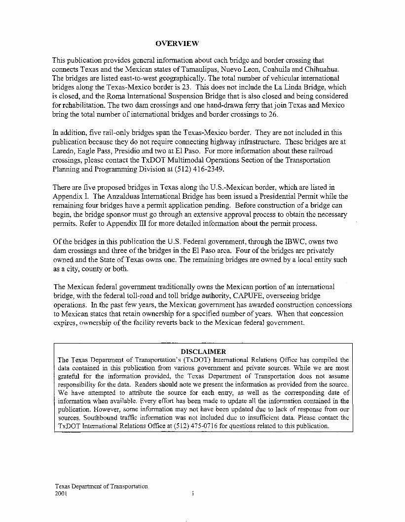
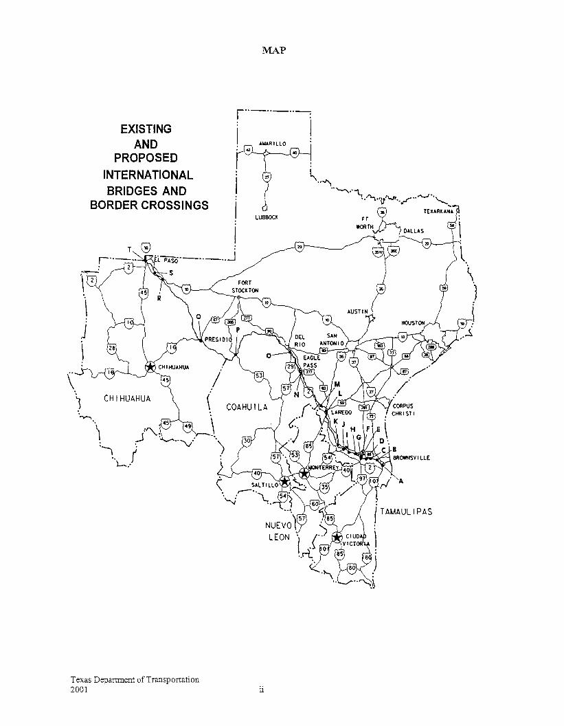
OVERVIEW
This publication provides general information about each bridge and border crossing that connects Texas and the Mexican states ofTamaulipas, Nuevo Leon, Coahuila and Chihuahua. The bridges are listed east-to-west geographically. The total number of vehicular international bridges along the Texas-Mexico border is 23. This does not include the La Linda Bridge, which is closed, and the Roma International Suspension Bridge that is also closed and being considered for rehabilitation. The two dam crossings and one hand-drawn ferry that join Texas and Mexico bring the total number of international bridges and border crossings to 26.
In addition, five rail-only bridges span the Texas-Mexico border. They are not included in this publication because they do not require connecting highway infrastructure. These bridges are at Laredo, Eagle Pass, Presidio and two at El Paso. For more information about these railroad crossings, please contact the TxDOT Multimodal Operations Section of the Transportation Planning and Programming Division at (512) 416-2349.
There are five proposed bridges in Texas along the U.S.-Mexican border, which are listed in Appendix I. The Anzalduas International Bridge has been issued a Presidential Permit while the remaining four bridges have a permit application pending. Before construction of a bridge can begin, the bridge sponsor must go through an extensive approval process to obtain the necessary permits. Refer to Appendix III for more detailed information about the permit process.
Of the bridges in this publication the U.S. Federal government, through the IBWC, owns two dam crossings and three of the bridges in the E1 Paso area. Four of the bridges are privately owned and the State of Texas owns one. The remaining bridges are owned by a local entity such as a city, county or both.
The Mexican federal government traditionally owns the Mexican portion of an international bridge, with the federal toll-road and toll bridge authority, CAPUFE, overseeing bridge operations. In the past few years, the Mexican government has awarded construction concessions to Mexican states that retain ownership for a specified number of years. When that concession expires, ownership of the facility reverts back to the Mexican federal government.
DISCLAIMER The Texas Department of Transportation's (TxDOT) International Relations Office has compiled the data contained in this publication from various government and private sources. While we are most grateful for the information provided, the Texas Department of Transportation does not assume responsibility for the data. Readers should note we present the information as provided from the source. We have attempted to attribute the source for each entry, as well as the corresponding date of information when available. Every effort has been made to update all the information contained in the publication. However, some information may not have been updated due to lack of response from our sources. Southbound traffic information was not included due to insufficient data. Please contact the TxDOT International Relations Office at (512) 475-0716 for questions related to this publication.
Texas Department of Transportation 2001
EXISTING AND
PROPOSED INTERNATIONAL BRIDGES AND
BORDER CROSSINGS
CHIHUAHUA
Texas Department of Transportation 2001
MAP
r··-··-··-:
i I
11
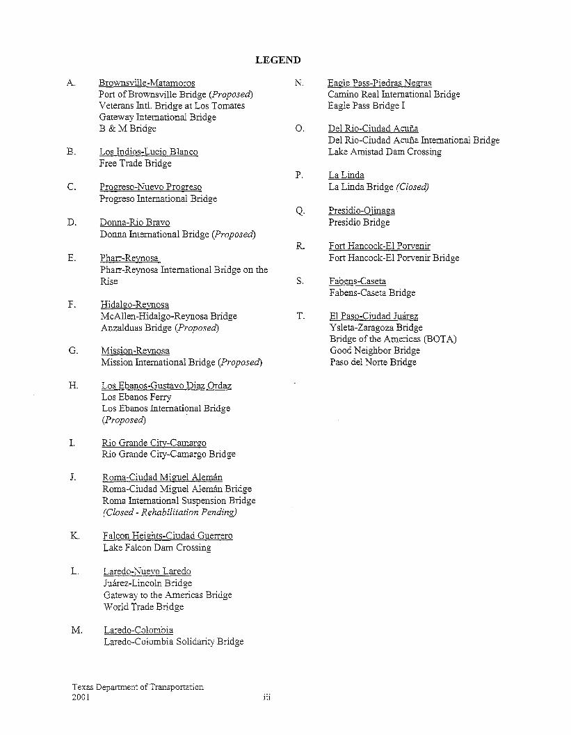
LEGEND
A.
B.
C.
D.
E.
Brovvnsville-Matamoros Port ofBrownsville Bridge (Proposed) Veterans Intl. Bridge at Los Tomates Gateway International Bridge B & M Bridge
Los Indios-Lucio Blanco Free Trade Bridge
Pro!ITeso-Nuevo Pro!rreso Progreso International Bridge
Donna-Rio Bravo Donna International Bridge (Proposed)
Pharr-Reynosa Pharr-Reynosa International Bridge on the Rise
F.
G.
Hidalgo-Revnosa McAllen-Hidalgo-Reynosa Bridge Anzalduas Bridge (Proposed)
Mission -Reynosa Mission International Bridge (Proposed)
H. Los Ebanos-Gustave Diaz Ordaz Los Ebanos Ferry Los Ebanos International Bridge (Proposed) ·
I. Rio Grande Citv-Camanw Rio Grande City-Camargo Bridge
J. Roma-Ciudad Miguel Aleman Roma-Ciudad Miguel Aleman Bridge Roma International Suspension Bridge (Closed- Rehabilitation Pending)
K. Falcon Hei£hts-Ciudad Guerrero Lake Falcon Dam Crossing
L. Laredo-Nuevo Laredo Juarez-Lincoln Bridge Gateway to the Americas Bridge World Trade Bridge
M. Laredo-Colombia Laredo-Colombia Solidarity Bridge
Texas Department of Transportation 2001 iii
N.
0.
P.
Q.
Eagle Pass-Piedras Ne!rras Camino Real International Bridge Eagle Pass Bridge I
Del Rio-Ciudad Acuna Del Rio-Ciudad Acufia International Bridge Lake Amistad Dam Crossing
La Linda La Linda Bridge (Closed)
Presidio-Ojina!la Presidio Bridge
R. Fort Hancock-El Porvenir
s.
T.
Fort Hancock-El Porvenir Bridge
Fabens-Caseta Fabens-Caseta Bridge
El Paso-Ciudad Juarez Y sleta-Zaragoza Bridge Bridge of the Americas (BOTA) Good Neighbor Bridge Paso del Norte Bridge
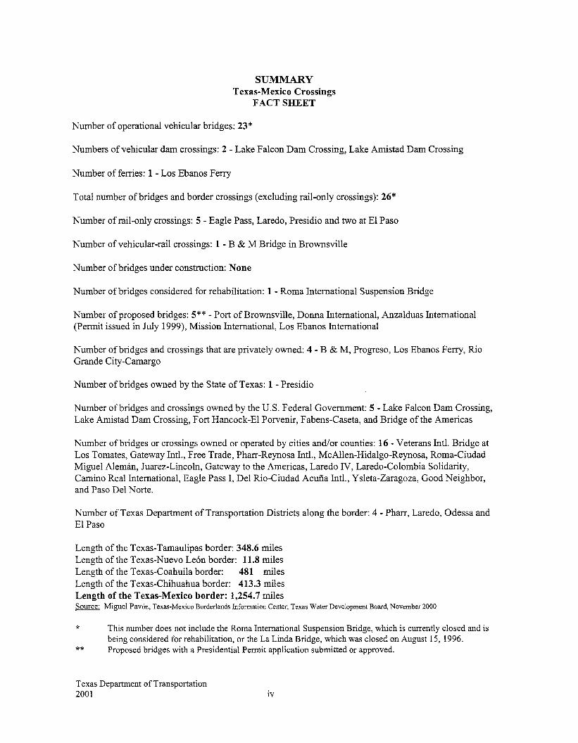
SUMMARY Texas-Mexico Crossings
FACT SHEET
Number of operational vehicular bridges: 23 *
Numbers of vehicular dam crossings: 2- Lake Falcon Dam Crossing, Lake Amistad Dam Crossing
Number of ferries: 1 - Los Ebanos Ferry
Total number ofbridges and border crossings (excluding rail-only crossings): 26*
Number of rail-only crossings: 5- Eagle Pass, Laredo, Presidio and two at El Paso
Number of vehicular-rail crossings: 1- B & M Bridge in Brownsville
Number of bridges under construction: None
Number of bridges considered for rehabilitation: 1 - Roma International Suspension Bridge
Number of proposed bridges: 5**- Port of Brownsville, Donna International, Anzalduas International (Permit issued in July 1999), Mission International, Los Ebanos International
Number of bridges and crossings that are privately owned: 4- B & M, Progreso, Los Ebanos Ferry, Rio Grande City-Camargo
Number of bridges owned by the State of Texas: 1 -Presidio
Number of bridges and crossings owned by the U.S. Federal Government: 5- Lake Falcon Dam Crossing, Lake Amistad Dam Crossing, Fort Hancock-El Porvenir, Fabens-Caseta, and Bridge of the Americas
Number ofbridges or crossings owned or operated by cities and/or counties: 16- Veterans Intl. Bridge at Los Tomates, Gateway Intl., Free Trade, Pharr-Reynosa Intl., McAllen-Hidalgo-Reynosa, Roma-Ciudad Miguel Aleman, Juarez-Lincoln, Gateway to the Americas, Laredo N, Laredo-Colombia Solidarity, Camino Real International, Eagle Pass I, Del Rio-Ciudad Acufia Intl., Ysleta-Zaragoza, Good Neighbor, and Paso Del Norte.
Number of Texas Department of Transportation Districts along the border: 4- Pharr, Laredo, Odessa and El Paso
Length of the Texas-Tamaulipas border: 348.6 miles Length of the Texas-Nuevo Leon border: 11.8 miles Length of the Texas-Coahuila border: 481 miles Length of the Texas-Chihuahua border: 413.3 miles Length of the Texas-Mexico border: 1,254. 7 miles Source: Miguel Pavon, Texas-Mexico Borderlands Information Center. Texas Water Development Board, November 2000
*
**
This number does not include the Roma International Suspension Bridge, which is currently closed and is being considered for rehabilitation, or the La Linda Bridge, which was closed on August 15, 1996. Proposed bridges with a Presidential Permit application submitted or approved.
Texas Department of Transportation 2001 iv
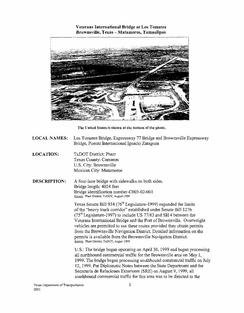
Veterans International Bridge at Los Tomates Brownsville, Texas -Matamoros, Tamaulipas
The United States is shown at the bottom of the photo.
LOCAL NAMES: Los Tomates Bridge, Expressway 77 Bridge and Brownsville Expressway Bridge, Puente Internacional Ignacio Zaragoza
LOCATION: TxDOT District: Pharr Texas County: Cameron U.S. City: Brownsville ~exicanCity: ~atamoros
DESCRIPTION: A four-lane bridge with sidewalks on both sides. Bridge length: 4024 feet Bridge identification number-C003-02-001 Source: Pharr District, TxDOT, August 1999
Texas Senate Bi11934 (76th Legislature-1999) expanded the limits of the "heavy truck corridor" established under Senate Bill1276 (75thLegislature-1997) to include US 77/83 and SH 4 between the Veterans International Bridge and the Port ofBrownsville. Overweight vehicles are permitted to use these routes provided they obtain permits from the Brownsville Navigation District. Detailed information on the permits is available from the Brownsville Navigation District. Source: Pharr District, TxDOT, August 1999
U.S.: The bridge began operating on April30, 1999 and began processing all northbound commercial traffic for the Brownsville area on ~ay 1, 1999. The bridge began processing southbound commercial traffic on July 12, 1999. Per Diplomatic Notes between the State Department and the Secretaria de Relaciones Exteriores (SRE) on August 9, 1999, all southbound commercial traffic for this area was to be directed to the
Texas Department of Transportation 2001
1
bridge by December 30, 1999. However, there was a delay and effective March 1, 2001, all trucks (loaded/empty) in the area began to be redirected for processing to the Veterans International Bridge. Source: Pete Sepulveda, Cameron County International Bridge System, June 2001 Source: Pharr District, TxDOT, June 2001
Mexico: The construction of a new international bridge in the Brownsville/Matamoros area was necessary because of the need to move vehicular traffic from the city to outlying areas. The heavy congestion not only impacts the roadway systems ofboth border communities, but also the environment. A private consultant hired by Cameron County developed the design for the bridge, which was reviewed and approved by the Secretaria de Comunicaciones y Transportes (SCT). Source: SRE, December 1996 Source: Pharr District, TxDOT, November 2000
BRIDGE OWNER OR OPERATOR: U.S. Owner: Cameron County and City of Brownsville U.S. Operator: Cameron County International Bridge System Mexican Owner: Government of Mexico Mexican Operator: Caminos y Puentes Federales de Ingresos y Servicios Conexos (CAPUFE)
YEAR OF CONSTRUCTION: U.S.: Construction of the bridge began in June 1997 and was completed in April 1999. Source: Pharr District, TxDOT, August 1999
Mexico: The contract for the Mexican portion of bridgework was awarded in January 1998. The Government ofthe State ofTamaulipas obtained right of way for the bridge and its attendant structures on May 8, 1998. In accordance with the Inter-institutional Contract signed by the Secretaria de Comunicaciones y Transportes (SCT), Cameron County and the City of Brownsville, the bridge was constructed and the inaugural ribbon cutting ceremony was held on April30, 1999. Source: Pharr District, TxDOT, August 1999
FUNDING/COST: U.S.: $19.3 million
TOLL:
GSA: $16.2 million (Border Station) Source: General Services Administration, August 1999
Mexico: The Mexican federal government financed the project. Source: CAPUFE, January 1999
$1.40 for passenger vehicles (effective October 1, 1999) $3.00 per axle for commercial vehicles (effective October 1, 2000) Source: Pete Sepulveda, Cameron County International Bridge System, June 2001
Texas Department of Transportation 2001
2
HOURS: 6 a.m.- Midnight (POV- M-Sun) 7 a.m.- 11 p.m. (Commercial/Cargo- M-Fri) 10 a.m. - 6 p.m. (Commercial/Cargo - Sat/Sun) Source: Secretaria de Relaciones Exteriores, November 2000 Source: South Texas Customs Management Center, November 2000 Source: Pharr District, TxDOT, June 2001
BORDER STATION: U.S.: The General Services Administration (GSA) owns the border station, which became operational on April30, 1999. Source: Pharr District, TxDOT, August 1999 Source: General Services Administration, August 1999
Mexico: The border station became operational on April 30, 1999. Source: Pete Sepulveda, Cameron County lntemational Bridge System, August 1999
CONNECTING ROADWAY: U.S.: US 77/83 Expressway extension to the Los Tomates International Bridge. This project was done in two phases at an estimated cost of$32.7 million and opened to traffic in March 2000. Source: Pharr District, TxDOT, November 2000
Phase I of the extension, from SH4 to the GSA Complex at the bridge, was let in September 1997. Project cost was $17.8 million. A mostly 4-lane elevated section, the project provides direct access from the port of entry to International Blvd. and serves as part of the Brownsville truck route. This project was completed in December 1999. Source: Pharr District, TxDOT, November 2000
Phase II included the completion of the overpass over International Boulevard, with a direct connection to the US 77/83 Expressway. The overpasses over 14th Street as well as the on-off ramps were widened in order to carry the expected traffic. This section was let in April of 1999 at a cost of$14.9 million. Construction began July 7, 1999 and the project was completely finished in July 2000. The project opened to traffic in June 2000.
Source: Pharr District, TxDOT, November 2000
Mexico: Boulevard Luis Donalda Colossio that connects to the highway to Ciudad Victoria and to Reynosa is complete. Source: Centro S.C.T. Tamaulipas, June 2001
PLANNED IMPROVEMENTS: U.S.: U.S. Customs installed a fixed-site truck x-ray system that x-rays a vehicle in approximately 10 minutes. A mobile x-ray unit also became operational at this port in November 1999. An outbound canopy is under construction and is 60% complete. Source: Pharr District, TxDOT, June 2001
Texas Department of Transportation 2001
3
Gateway International Bridge Brownsville, Texas- Matamoros, Tamaulipas
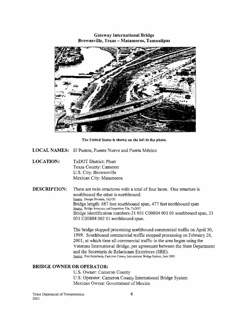
The United States is shown on the left in the photo.
LOCAL NAMES: El Puente, Puente Nuevo and Puerta Mexico
LOCATION: TxDOT District: Pharr Texas County: Cam~ron U.S. City: Brownsville Mexican City: Matamoros
DESCRIPTION: There are twin structures with a total of four lanes. One structure is southbound the other is northbound. Source: Design Division, TxDOT
Bridge length: 687 feet southbound span, 477 feet northbound span Source: Bridge Inventory and Inspection File, TxDOT
Bridge identification nurnbers-21 031 C00804 001 01 southbound span, 21 031 C00804 002 01 northbound span.
The bridge stopped processing northbound commercial traffic on April30, 1999. Southbound commercial traffic stopped processing on February 28, 2001, at which time all commercial traffic in the area began using the Veterans Internatior,al Bridge, per agreement between the State Department and the Secretaria de Relaciones Exteriores (SRE). Source: Pete Sepulveda, Cam~ron County International Bridge System, June 2001
BRIDGE OWNER OR OPERATOR: U.S. Owner: Cameron County U.S. Operator: Cameron County International Bridge System Mexican Owner: Government of Mexico
Texas Department ofTransportation 2001
4
Mexican Operator: Caminos y Puentes Federales de Ingresos y Servicios Conexos (CAPUFE)
YEAR OF CONSTRUCTION:
HOURS:
TOLL:
One span of the bridge was completed in 1969, the other in 1970. Source: Bridge inspection report provided by Jose Galvan, February 1995
24 hours (POV only) Source: Secretaria de Relaciones Exteriores, November 2000 Source: South Texas Customs Management Center, November 2000
$1.40 for passenger vehicles (effective October 1, 1999) $3.00 per axle for commercial vehicles (effective October 1, 2000) Source: Pete Sepulveda, Cameron County International Bridge System, June 2001
STATUS OF U.S. PERMITS AND MEXICAN APPROVALS: Presidential Permits were not required for bridges built before 1972.
BORDER STATION: U.S.: The border station was completed in 1969. The renovation and expansion was completed in March 1994. Source: General Services Administration, Summary of Existing and Proposed Border Stations, May 1995
Mexico: The border station has been operational since 1961 and was remodeled in 1968. The station has been outfitted with traffic signals to use for random checks to help speed up vehicular traffic. Source: Centro S.C.T. Tamaulipas, June 2001
CONNECTING ROADWAY: U.S.: International Boulevard (SH 4) interconnects US 83/77
Mexico: Av. Alvaro Obregon connects with MEX 2 and MEX 1011180
PLANNED IMPROVEMENTS: U.S.: Texas State Senate Bi111276 (75th Legislature, 1997) permitted TxDOT to grant the Brownsville Navigation District (BND) the authority to issue permits for the movement of oversize or overweight vehicles carrying cargo between the Gateway International Bridge and the entrance to the Port of Brownsville. The Texas Transportation Commission on February 17, 1998 approved the BND's permit-issuing authority. By December 15, 1998, the Port of Brownsville had issued 23,713 such permits. Overweight and oversize trucks issued permits by the Port of Brownsville are restricted to a designated truck route between the Port and Bridge. Money charged for the permits is used for TxDOT maintenance costs along the designated truck route. TxDOT installed weigh-in-motion sensors and vehicle classifiers along the corridor as the basis for a comparative study on the effects of overloaded trucks. Source: Port of Brownsville, December 1998 Source: Pharr District, TxDOT, September 1998
Texas Department of Transportation 2001
5
TxDOT has completed the SH 4 connection to the bridge, estimated at a cost of $750,000, by realigning and upgrading it to a four lane divided highway. Source: Pharr District, TxDOT, February 1999
Customs is in the process of constructing an outbound canopy, which is 20% complete. Source: Centro S.C.T. Tamaulipas, June 2001
Texas Department of Transportation 2001
6
B & MBridge Brownsville, Texas -Matamoros, Tamaulipas
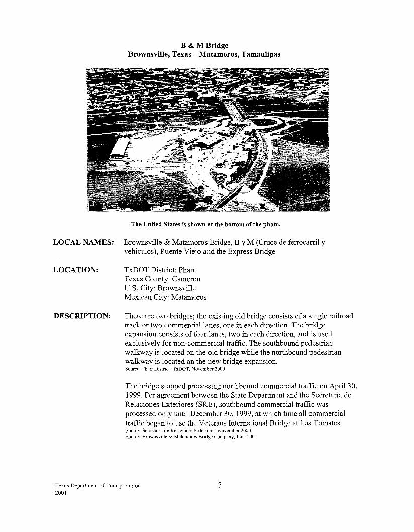
The United States is shown at the bottom of the photo.
LOCAL NAMES: Brownsville & Matamoros Bridge, By M (Cruce de ferrocarril y vehiculos), Puente Viejo and the Express Bridge
LOCATION: TxDOT District: Pharr Texas County: Cameron U.S. City: Brownsville Mexican City: Matamoros
DESCRIPTION: There are two bridges; the existing old bridge consists of a single railroad track or two commercial lanes, one in each direction. The bridge expansion consists of four lanes, two in each direction, and is used exclusively for non-commercial traffic. The southbound pedestrian walkway is located on the old bridge while the northbound pedestrian walkway is located on the new bridge expansion. Source: Pharr District, TxDOT, November 2000
The bridge stopped processing northbound commercial traffic on April 30, 1999. Per agreement between the State Department and the Secretaria de Relaciones Exteriores (SRE), southbound commercial traffic was processed only until December 30, 1999, at which time all commercial traffic began to use the Veterans International Bridge at Los Tomates. Source: Secretaria de Relaciones Exteriores, November 2000 Source: Brownsville & Matamoros Bridge Company, June 2001
Texas Department of Transportation 2001
7
BRIDGE OWNER OR OPERA TOR: The U.S. and Mexican sides of the bridge are owned and operated by the Brownsville & Matamoros Bridge Company, a subsidiary of the Union Pacific Railroad and the Federal Government of Mexico.
FUNDING/COST: U.S.: The cost of the bridge expansion was $5 million. Source: M.E. Barrera, Assistant General Manager, B&M Bridge Co., June 1997
YEAR OF CONSTRUCTION:
HOURS:
TOLL:
The original bridge was constructed in 1909 and reconstructed in 1953. The bridge expansion was inaugurated on May 14, 1997. Source· Centro S.C.T. Tarnaulipas, June 2001
24 hours (POV only) Source: Secretaria de Relaciones Exteriores, November 2000 Source: South Texas Customs Management Center, November 2000
$1.35- Southbound $1.70- Northbound Source· Pharr District, TxDOT, June 2001
STATUS OF U.S. PERMITS AND MEXICAN APPROVALS: U.S.: Presidential Permits were not required for bridges built before 1972.
BRIDGE CONSTRUCTION STATUS: U.S.: Construction on the bridge expansion began November 1995 and was completed on May 14, 1997. Source: Office of Bridge Administration, U.S. Coast Guard, May 1998
BORDER STATION: U.S.: The new border station was completed in 1992, and is owned by the General Services Administration. Source: M.E. Barrera, Assistant General Manager, B&M Bridge Co., June 1997
Mexico: The border station facility for tourist traffic was completed on May 14, 1997. The old border station is used for the inspection and dispatching of commercial and railroad traffic. The Brownsville & Matamoros Bridge Company owns all of the facilities. Source· SEDICOT, Gobierno del Estado de Tamaulipas, July 1997 Source: B&M Bridge Co., March 2000
CONNECTING ROADWAY: U.S.: 12th Street and Mexico Street interconnect US B77 Mexico: Las Americas Avenue via MEX-101. Source: SED! COT, Gobierno del Estado de Tamaulipas, July 1997
Texas Department of Transportation 2001
8
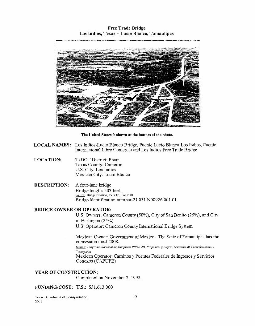
Free Trade Bridge Los Indios, Texas -Lucio Blanco, Tamaulipas
The United States is shown at the bottom of the photo.
LOCAL NAMES: Los Indios-Lucio Blanco Bridge, Puente Lucio Blanco-Los Indios, Puente Internacional Libre Comercio and Los Indios Free Trade Bridge
LOCATION: TxDOT District: Pharr Texas County: Cameron U.S. City: Los Indios Mexican City: Lucio Blanco
DESCRIPTION: A four-lane bridge Bridge length: 503 feet Source: Bridge Division, TxDOT, June 2001
Bridge identification number-21 031 N00926 001 01
BRIDGE OWNER OR OPERATOR: U.S. Owners: Cameron County (50%), City of San Benito (25%), and City of Harlingen (25%) U.S. Operator: Cameron County International Bridge System
Mexican Owner: Government of Mexico. The State ofTamaulipas has the concession until 2008. Source: Programa Nacional de Autopistas 1989-1994, Prop6sitos y Logros, Secretaria de Comunicaciones y
Transportes
Mexican Operator: Caminos y Puentes F ederales de Ingresos y Servicios Conexos (CAPUFE)
YEAR OF CONSTRUCTION: Completed on November 2, 1992.
FUNDING/COST: U.S.: $31,613,000
Texas Department of Transportation 2001
9
HOURS:
TOLL:
6 a.m.- Midnight (POV- M-Sun) 7 a.m.- 11 p.m. (Commercial/Cargo- M-Fri) 10 a.m.- 6 p.m. (Commercial/Cargo -Sat/Sun) Source: South Texas Customs Management Center, November 2000
$1.40 for passenger vehicles (effective October 1, 1999) Source: Pete Sepulveda, Cameron County International Bridge System, April2000
STATUS OF U.S. PERMITS AND MEXICAN APPROVALS: U.S.: Cameron County and the cities of San Benito and Harlingen submitted a Presidential Permit application January 18, 1974, which was approved November 30, 1990.
USCG approved a bridge permit on Aprill2, 1991. Source: Nick Mpras, USCG
BORDER STATION: U.S.: The border station was completed on November 2, 1992, and is owned by the General Services Administration.
Mexico: The border station has been operational since November 1992. Source: Centro S.C.T. Tamaulipas, June 2001
CONNECTING ROADWAY: U.S.: FM 509, from US 83/77 Expressway South to GSA facilities at Los Indios Free Trade Bridge; Length: 8.3 miles; Cost: $7.8 million. Source: Pharr District, TxDOT, June 1997
PLANNED IMPROVEMENTS: U.S.: Customs is constructing an outbound canopy, which is 90% complete. Source: Pharr District, TxDOT, June 2001
Mexico: The new state road that interconnects with MEX 2 is complete. The toll road to Monterrey also connects with this road. The development of an industrial and residential zone is being planned near the bridge. Source: Cameron County International Bridge System, September 1999 Source: Centro S.C.T. Tamaulipas, June 2001
Texas Department of Transportation 2001
10
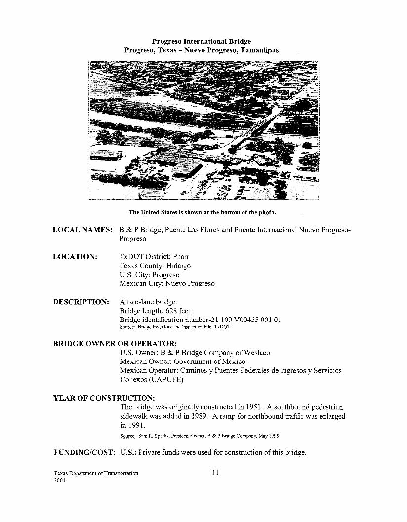
Progreso International Bridge Progreso, Texas -Nuevo Progreso, Tamaulipas
The United States is shown at the bottom of the photo.
LOCAL NAMES: B & P Bridge, Puente Las Flores and Puente Intemacional Nuevo ProgresoProgreso
LOCATION: TxDOT District: Pharr Texas County: Hidalgo U.S. City: Progreso Mexican City: Nuevo Progreso
DESCRIPTION: A two-lane bridge. Bridge length: 628 feet Bridge identification number-21 109 V00455 001 01 Source: Bridge Inventory and Inspection File, TxDOT
BRIDGE OWNER OR OPERA TOR: U.S. Owner: B & P Bridge Company of Weslaco Mexican Owner: Government of Mexico Mexican Operator: Caminos y Puentes Federales de Ingresos y Servicios Conexos (CAPUFE)
YEAR OF CONSTRUCTION: The bridge was originally constructed in 1951. A southbound pedestrian sidewalk was added in 1989. A ramp for northbound traffic was enlarged in 1991. Source: Sam R. Sparks, President/Owner, B & P Bridge Company, May 1995
FUNDING/COST: U.S.: Private funds were used for construction of this bridge.
Texas Department of Transportation 2001
11
HOURS: 24 hours (POV) 9 a.m.- 5 p.m. (Commercial/Cargo- M-Fri) Source: South Texas Customs Management Center, November 2000
TOLL: Yes
STATUS OF U.S. PERMITS AND MEXICAN APPROVALS: U.S.: Presidential Permits were not required for bridges built before 1972. The State Department determined that the owner does not need to secure a Presidential Permit to build the planned replacement bridge. Source: U.S. State Department, February 1995
A Coast Guard bridge permit (7 -00-8) approving the location and plans of the replacement project was issued on March 20, 2000 to the B & P Bridge Company. Source: Office of Bridge Administration, U.S. Coast Guard, March 2000
Mexico: The Government of the State ofTamaulipas has taken steps to forward project plans and designs and obtain the necessary approval from CILA, CAPUFE, and the SCT. Source: SEDICOT, Gobiemo del Estado de Tamaulipas, May 1998
BORDER STATION: U.S.: The existing border station facility was completed in 1983. The B&P Bridge Company owns the U.S. border station facility.
The import lot expansion is progressing with the x-ray equipment installation complete. The U.S. border station is operational to receive all types of cargo entering from Mexico. A new bypass road to allow Mexican trucks to exit north of the station is 80% complete with a completion date set for September 1, 2001. Source: General Services Administration, June 2001 Source: Sam R. Sparks, President/Owner, B & P Bridge Company, June 2001
Mexico: The border station has been in operation since 1951. Source: Centro S.C.T. Tamaulipas, June 2001
CONNECTING ROADWAY: U.S.: FM 1015, connects to US 281 and to US 83 Mexico: Carretera Estatal Nuevo Progreso connects to MEX 2
PLANNED IMPROVEMENTS: U.S.: The plans for construction of a new bridge are complete on the U.S. and Mexican side. The cost is approximately $3.5 million for the U.S. side to build the replacement bridge and demolish the existing structure, and an estimated total cost of $8 million. The owner of the bridge will finance the construction costs, which will include a new import lot and separate truck and auto lanes. Construction is expected to begin by the end of 2001 pending Mexican approval. Source: Sam R. Sparks, President/Owner, B & P Bridge Company, June 2001 Source: Pharr District, TxDOT, June 2001
Texas Department of Transportation 2001
12
A gamma-ray state of the art machine has been added to the import lot, and has reduced the number of examination docks needed in the future. Source: Pharr District, TxDOT, June 2001_ Source: Centro S.C.T. Tamaulipas, June 2001
FM 1015, from US 83 south to US 281. Several projects have been completed at a cost of $6.1 million. Improvements include a 5-lane curb and gutter section from US 83 south to the floodway and a bypass (2 lanes with shoulders) around Progreso. Source: Pharr District, TxDOT, March 2000
FM 1015, from US 83 North to SH 186. Several projects completed provide a minimum two-lane road with shoulders from the Progreso International Bridge to local grain elevators and citrus facilities. Source: Pharr District, March 2000
FM 1015 from U.S. 281 to the Progreso International was expanded from 2 lanes to a 5-lane curb and gutter. The project was let in July 1999 at an estimated cost of $2.1 million and was the final phase of the improvements planned for FM 1015. This project, completed in July 2000, has improved and facilitated the traffic movements to and from the Progreso Bridge. Source: Pharr District, TxDOT, November 2000
A project funded with CBI program funds that will add a commercial vehicle access road from FM 1015 to the import lot was let in February 2001. The total cost is $534,790. Eighty per cent of the funding will come from federal funds and 20% will come from the Progreso International Port ofEntry. Construction on this project is 95% complete. Source: Pharr District, TxDOT, June 2001
Texas Department of Transportation 2001
13
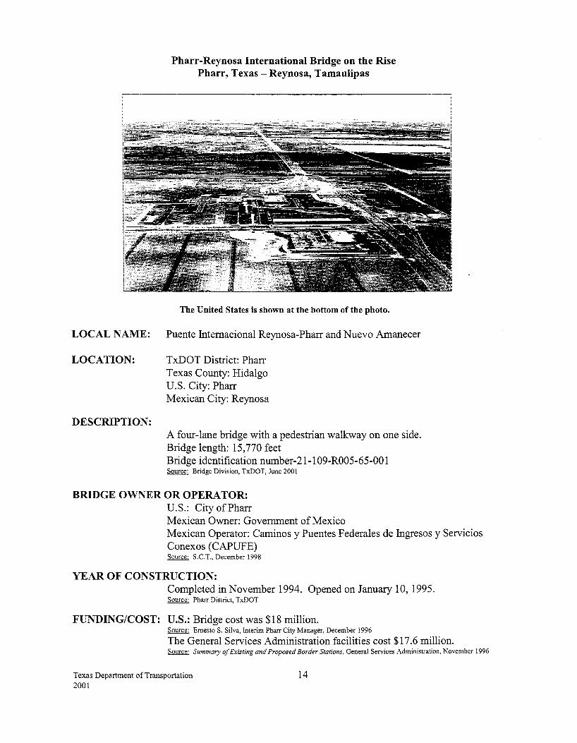
Pharr-Reynosa International Bridge on the Rise Pharr, Texas- Reynosa, Tamaulipas
The United States is shown at the bottom of the photo.
LOCAL NAME: Puente Intemacional Reynosa-Pharr and Nuevo Amanecer
LOCATION: TxDOT District: Pharr Texas County: Hidalgo U.S. City: Pharr Mexican City: Reynosa
DESCRIPTION: A four-lane bridge with a pedestrian walkway on one side. Bridge length: 15,770 feet Bridge identification number-21-1 09-R005-65-00 1 Source: Bridge Division, TxDOT, June 2001
BRIDGE OWNER OR OPERA TOR: U.S.: City of Pharr Mexican Owner: Government of Mexico Mexican Operator: Caminos y Puentes Federales de lngresos y Servicios Conexos ( CAPUFE) Source: S.C.T., December 1998
YEAR OF CONSTRUCTION: Completed in November 1994. Opened on January 10, 1995. Source: Pharr District, TxDOT
FUNDING/COST: U.S.: Bridge cost was $18 million. Source: Emesto S. Silva, interim Pharr City Manager, December 1996
The General Services Administration facilities cost $17.6 million. Source: Summary of Existing and Proposed Border Stations, General Services Administration, November 1996
Texas Department of Transportation 2001
14
HOURS:
TOLL:
6 a.m. -Midnight (POV- M-Sun) 6 a.m.- 10 p.m. (Commercial/Cargo- M-Fri) 8 a.m. - 4 p.m. (Commercial/Cargo- Sat/Sun) Source: South Texas Customs Management Center, November 2000
Yes, an automated toll collection system is used.
STATUS OF U.S. PERMITS AND MEXICAN APPROVALS: U.S.: The City of Pharr submitted a Presidential Permit application, which was approved December 20, 1978. United States Coast Guard bridge permit was approved December 10, 1991. Source: Nick Mpras, USCG
BORDER STATION: U.S.: The permanent facilities were completed in March 1996 and were opened to traffic in Aprill996. The facilities are equipped with a fixed-site truck x-ray system that enables them to x-ray an entire truck in about 10 minutes. The system became operational in October 1997. Source: General Services Administration, June 1996 Source: U.S. Customs Service, U.S. Department of Treasury, June 1998
Mexico: The station has been outfitted with traffic signals for use in random checks to help speed up vehicular traffic. Source: Centro S.C.T. Tamaulipas, June 2001
CONNECTING ROADWAY: U.S.: Spur 600, a six-lane facility, connects from US 281 to the GSA facilities. Source: Pharr District, Tx.DOT, February 1997
Mexico: A loop connects with MEX 2 and MEX 40. Source: SEDICOT, Gobiemo del Estado de Tamaulipas, February 1997
PLANNED IMPROVEMENTS: U.S.: The City of Pharr made the following improvements: 1) Constructed an additional southbound lane for oversized loads just east to the main tollbooth; 2) re-striped the bridge to add an additional northbound lane for commercial vehicles; and 3) constructed an additional northbound lane from the bridge to the import building for commercial vehicles. The cost was approximately $350,000. Source: Pharr District, Tx.DOT, February 1999
Several projects from US 281 to US 83 South to the GSA facilities at the bridge (approx. seven miles) were completed at an estimated cost of $15.9 million. Among the projects was the widening ofUS 281 to a four-lane divided urban section and the construction of a structure over the main floodway channel. The floodway channel project was let in February 1999 at an estimated cost of$6.6 million, and was completed by August 2000. Source: Pharr District, Tx.DOT, November 2000
US 83 Expressway, from "I" Road East to FM 2557 in San Juan. This project let in June 1996 for $14.2 million and was completed in March 1999. This segment provides a six-lane expressway facility with new overpasses and ramps. This corridor serves international traffic accessing
Texas Department of Transportation 15 2001
US 281 and commercial zones within the metropolitan area. Source: Pharr District, TxDOT, August 1999
US 83 Expressway, from Ware Road East to Sugar Road in McAllen-Pharr area. Completed in September 1999, this project let in April1997 for $38.9 million and is open to traffic. This project provides a six-lane divided highway, illumination, and additional access to commercial zones in the frontage road areas, etc. This section of road is widely used by NAFTA truck traffic in and out of the International Trade Zone south of McAllen. Source: Pharr District, TxDOT, October 1999
FM 1016, from SP 115 (23rd Street) to Bentsen Road South ofMcAllen. This project let in August 1998 and was completed in December 1998. This project let for $2.7 million and provides a 4-lane divided urban curb and gutter section with a flush median (continuous left tum lane). This segment is adjacent to and within the International Trade Zone and serves international truck traffic accessing this area. Source: Pharr District, TxDOT, August 1999
SP 241, from US 281 to SH 336. This 5-lane curb and gutter expansion project was let in July 1999 for $3.6 million and was completed in July 2000. The project provides an improved connection to the International Trade Zone. Source: Pharr District, TxDOT, November 2000
US 281/SP 241 overpass. This new overpass (US~81 over SP 241) will improve safety and circulation by separating international traffic from local east west through traffic. The project was let in March 2001 at a cost of $6.6 million. Source: Pharr District, TxDOT, June 2001
Beginning September 1, 1996, all northbound commercial traffic was directed from the Hidalgo-Reynosa Bridge to the Pharr Bridge. Southbound commercial traffic was permitted to use either the Hidalgo or Pharr Bridge to return to Mexico. Source: U.S. Customs Service, August 1996
The Hidalgo County Metropolitan Planning Organization requested funding from the Transportation Equity Act for 2001 (TEA-21) to construct additional import dock space. Partial funding has been approved and the General Services Administration is acquiring the additional funds necessary. The estimated cost is $1.8 million. GSA plans to let this contract for a July 2001 letting. Source: Pharr District, TxDOT, June 2001
Mexico: Construction is planned for a bypass that will connect the Reynosa-Matamoros highway to the Reynosa-Monterrey highway. The bypass will also connect to the A venida Puente Pharr. Source: Centro S.C. I. Tamau1ipas, June 2001
Texas Department of Transportation 2001
16
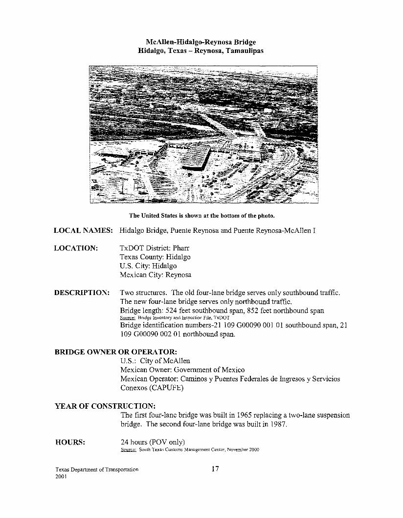
McAllen-Hidalgo-Reynosa Bridge Hidalgo, Texas- Reynosa, Tamaulipas
The United States is shown at the bottom of the photo.
LOCAL NAMES: Hidalgo Bridge, Puente Reynosa and Puente Reynosa-McAllen I
LOCATION: TxDOT District: Pharr Texas County: Hidalgo U.S. City: Hidalgo Mexican City: Reynosa
DESCRIPTION: Two structures. The old four-lane bridge serves only southbound traffic. The new four-lane bridge serves only northbound traffic. Bridge length: 524 feet southbound span, 852 feet northbound span Source: Bridge Inventory and Inspection File, TxDOT
Bridge identification numbers-21 109 000090 001 01 southbound span, 21 109 000090 002 0 1 northbound span.
BRIDGE OWNER OR OPERA TOR: U.S.: City ofMcAllen Mexican Owner: Government of Mexico Mexican Operator: Caminos y Puentes F ederales de Ingresos y Servicios Conexos (CAPUFE)
YEAR OF CONSTRUCTION:
HOURS:
The first four-lane bridge was built in 1965 replacing a two-lane suspension bridge. The second four-lane bridge was built in 1987.
24 hours (POV only) Source: South Texas Customs Management Center, November 2000
Texas Department of Transportation 2001
17
TOLL: $1.50 (southbound) Source: Pharr District, TxDOT, June 2001
STATUS OF U.S. PERMITS AND MEXICAN APPROVALS: U.S.: The City of McAllen submitted a Presidential Permit application, which was approved in August 1985.
BORDER STATION: U.S.: The City of McAllen owns the border station, which was completed in 1982. The General Services Administration's lease expires April27, 2002. Source: General Services Administration, Summary of Existing and Proposed Border Stations, May 1995
Mexico: The border station, which has been in operation since 1965 was remodeled in 1988. Source: Centro S.C.T. Tamaulipas, June 2001
CONNECTING ROADWAY: U.S.: Spur 600 from the bridge connects to Spur 241 which connects to US 281 and SH 336. Spur 115 connects from US 281 to US 83 Expressway.
Mexico: Near MEX 2, MEX 97 and MEX 40
PLANNED IMPROVEMENTS: U.S.: US 83 Expressway, from "I" Road East to FM 2557 in San Juan. This project let in June 1996 for $14.2 million and was completed in March 1999. This segment provides a six-lane expressway facility with new overpasses and ramps. This corridor serves international traffic accessing US 281 and commercial zones within the metropolitan area. Source: Pharr District, TxDOT, August 1999
US 83 Expressway, from Ware Road East to Sugar Road in McAllen-Pharr area. Completed in September 1999, this project let in April1997 for $38.9 million and is now open to traffic. This project provides a six-lane divided highway, illumination, and additional access to commercial zones in the frontage road areas, etc. This section of road is widely used by NAFT A truck traffic in and out of the International Trade Zone south ofMcAllen. Source: Pharr District, TxDOT, October 1999
FM 1016, from SP 115 (23rd Street) to Bentsen Road South ofMcAllen. This project let in August 1998 and was completed in December 1998. This project let for $2.7 million and provides a 4-lane divided urban (C&G) section with a flush median (continuous left tum lane). This segment is adjacent to and within the International Trade Zone and serves international truck traffic accessing this area. Source: Pharr District, TxDOT, August 1999
Beginning September 1, 1996, all northbound commercial traffic was directed from the Hidalgo-Reynosa Bridge to the Pharr Bridge. Southbound commercial traffic was permitted to use either the Hidalgo or Pharr Bridge to enter Mexico. Source: Phone conversation with David Higgerson, U.S. Customs Service, August 1996
Texas Department of Transportation 2001
18
The design for border station improvements to include an enforcement facility with canopy and expansion of the southbound toll plaza to include 3 additional southbound lanes is complete and is estimated to cost $2.35 million. Eighty per cent will come from federal funds and 20% will come from the City of McAllen. Agreements are complete and construction is scheduled to begin in late 2001 depending on GSA scheduling. Source: Charles Walper, Director, Pharr International Bridge, June 2001 Source: George Ramon, Bridge Superintendent, June 2001 Source: Pharr District, TxDOT, June 2001
A dedicated northbound commuter lane, Secure Electronic Network for Travelers' Rapid Inspection (SENTRI) has been approved by the U.S. Congress and is pending approval by Mexico. Source: George Ramon, Bridge Superintendent, June 2001 Source: Pharr District, TxDOT, June 2001
Mexico: A study to analyze the possibility of installing the SENTRI commuter lane is underway. Source: Centro S.C.T. Tamau1ipas, June 2001
Texas Department of Transportation 2001
19
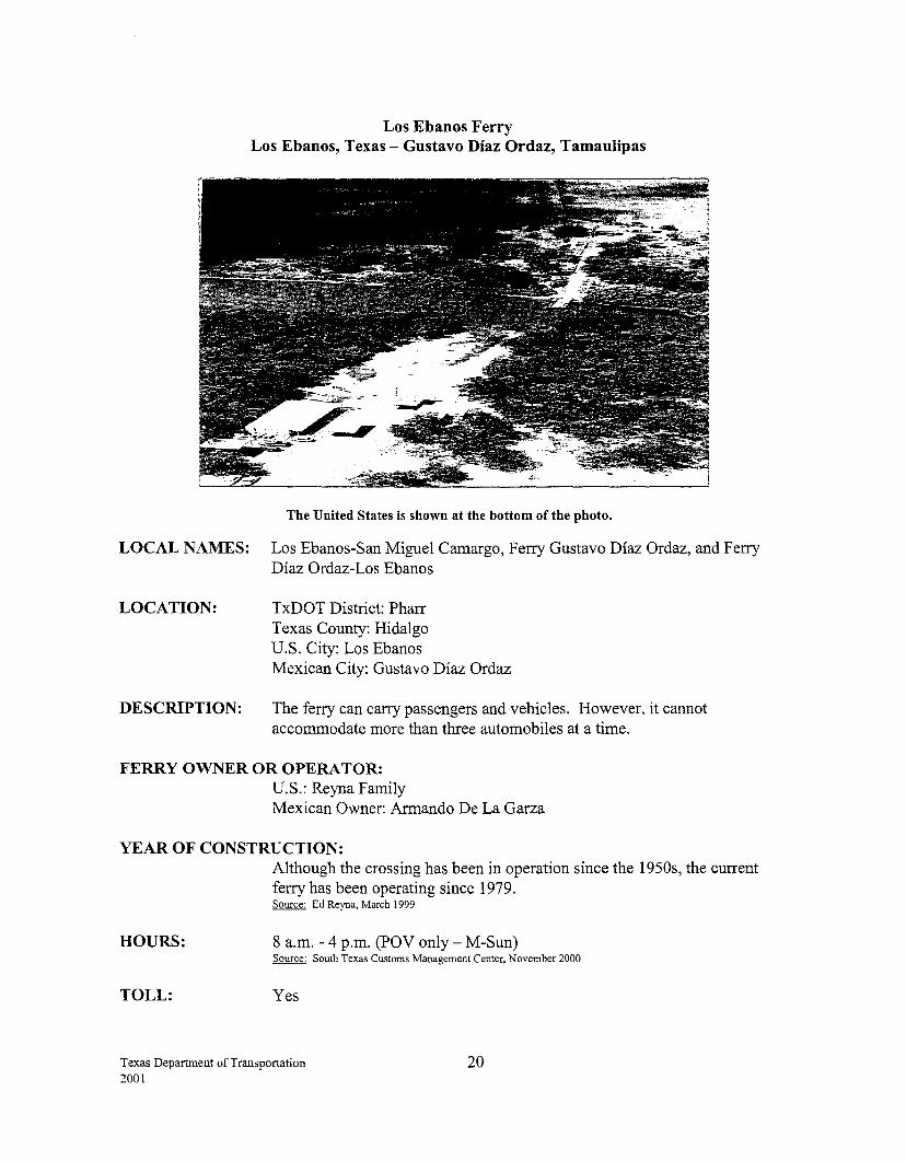
Los Ebanos Ferry Los Ebanos, Texas- Gustavo Diaz Ordaz, Tamaulipas
The United States is shown at the bottom of the photo.
LOCAL NAMES: Los Ebanos-San Miguel Camargo, Ferry Gustavo Diaz Ordaz, and Ferry Diaz Ordaz-Los Ebanos
LOCATION: TxDOT District: Pharr Texas County: Hidalgo U.S. City: Los Ebanos
DESCRIPTION:
Mexican City: Gustavo Diaz Ordaz
The ferry can carry passengers and vehicles. However, it cannot accommodate more than three automobiles at a time.
FERRY OWNER OR OPERATOR: U.S.: Reyna Family Mexican Owner: Armando De La Garza
YEAR OF CONSTRUCTION:
HOURS:
TOLL:
Although the crossing has been in operation since the 1950s, the current ferry has been operating since 1979. Source: Ed Reyna, March 1999
8 a.m. - 4 p.m. (POV only- M-Sun) Source: South Texas Customs Management Center, November 2000
Yes
Texas Department of Transportation 2001
20
BORDER STATION: The U.S. border station was completed in Aprill992 and is owned by the Immigration and Naturalization Service. The bridge owner owns the land. Source: General Services Administration, Summary of Existing and Proposed Border Stations, May 1995
CONNECTING ROADWAY: U.S.: Near FM 886 to US 83. Mexico: NearMEX2
Texas Department of Transportation 2001
21
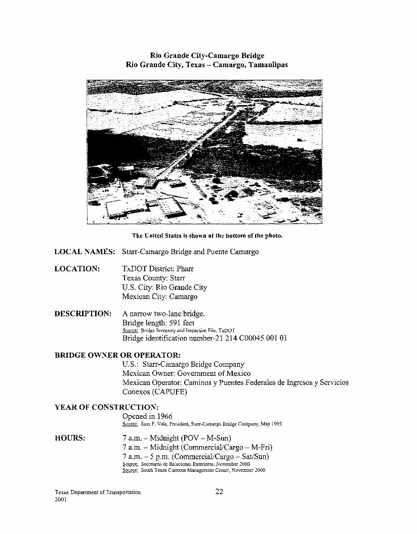
Rio Grande City-Camargo Bridge Rio Grande City, Texas -Camargo, Tamaulipas
The United States is shown at the bottom of the photo.
LOCAL NAMES: Starr-Camargo Bridge and Puente Camargo
LOCATION: TxDOT District: Pharr Texas County: Starr U.S. City: Rio Grande City Mexican City: Camargo
DESCRIPTION: A narrow two-lane bridge. Bridge length: 591 feet Source: Bridge Inventory and Inspection File, TxDOT
Bridge identification number-21 214 C00045 001 01
BRIDGE OWNER OR OPERATOR: U.S.: Starr-Camargo Bridge Company Mexican Owner: Government of Mexico Mexican Operator: Caminos y Puentes F ederales de Ingresos y Servicios Conexos (CAPUFE)
YEAR OF CONSTRUCTION:
HOURS:
Opened in 1966 Source: Sam F. Vale, President, Starr-Camargo Bridge Company, May 1995
7 a.m.- Midnight (POV- M-Sun) 7 a.m.- Midnight (Commercial/Cargo- M-Fri) 7 a.m.- 5 p.m. (Commercial/Cargo- Sat/Sun) Source: Secretaria de Relaciones Exteriores, November 2000 Source: South Texas Customs Management Center, November 2000
Texas Department of Transportation 2001
22

TOLL: Yes
STATUS OF U.S. PERMITS AND MEXICAN APPROVALS: U.S.: Presidential Permits are not required for bridges built before 1972. The permit authority for this facility was issued on September 21, 1959, pursuant to Public Law 86-343, 86th Congress, H.R. 8694. Source: Sam F. Vale, President, Starr-Camargo Bridge Company, May 1995
BORDER STATION: U.S.: The border station was constructed in 1969. Current dock facilities were completed in 1978. The Starr-Camargo Bridge Company owns the U.S. border station. Groundbreaking ceremonies for a new facility for the General Services Administration were held in July 1999. The building increased border station space from approximately 2,500 square feet to 8,000 square feet. It also included a 1 0-truck dock, which is expandable to 15 docks. The actual border station construction began on September 1, 1999. A new lease was signed on April 1, 1999, which called for two new tollbooths and an eight-acre port facility to be constructed. Northbound passenger lanes will increase from one to two, with a third lane dedicated to extra wide conveyances like buses and other recreational vehicles. Southbound lanes will increase from one to two toll stations. There will be a dedicated commercial vehicle inspection area outside of the normal traffic lanes for southbound trucks. The new state-of-the-art port facility will be completed in phases. The new administration building and automobile inspection areas will be operational in late June 2001. The import lot and inspection booths will be operational in late 2001. Source: General Services Administration, June 2001
Mexico: The border station has been in operation since 1968. There are plans to expand and remodel the Customs facilities. Source: Centro S.C.T. Tamaulipas, June 2001
CONNECTING ROADWAY: U.S.: FM 755 to US 83 and US 281
Mexico: Carretera Puente Internacional connects to MEX 2, MEX 54 and MEX40
Texas Department of Transportation 2001
23
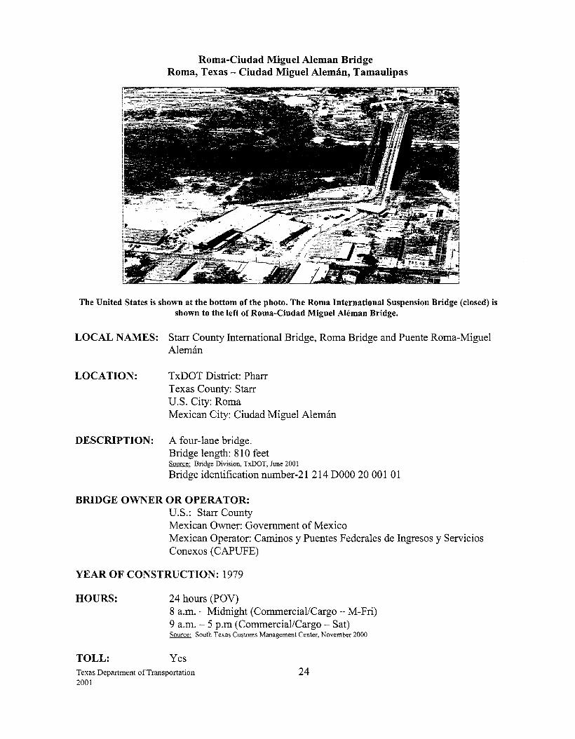
Roma-Ciudad Miguel Aleman Bridge Roma, Texas- Ciudad Miguel Aleman, Tamaulipas
The United States is shown at the bottom ofthe photo. The Roma International Suspension Bridge (closed) is shown to the left of Roma-Ciudad Miguel Aleman Bridge.
LOCAL NAMES: Starr County International Bridge, Roma Bridge and Puente Roma-Miguel Aleman
LOCATION: TxDOT District: Pharr Texas County: Starr U.S. City: Roma Mexican City: Ciudad Miguel Aleman
DESCRIPTION: A four-lane bridge. Bridge length: 81 0 feet Source: Bridge Division, TxDOT, June 2001
Bridge identification number-21 214 DOOO 20 001 01
BRIDGE OWNER OR OPERATOR: U.S.: Starr County Mexican Owner: Government of Mexico Mexican Operator: Caminos y Puentes Federales de Ingresos y Servicios Conexos (CAPUFE)
YEAR OF CONSTRUCTION: 1979
HOURS:
TOLL:
24 hours (POV) 8 a.m.- Midnight (Commercial/Cargo- M-Fri) 9 a.m.- 5 p.m (Commercial/Cargo- Sat) Source: South Texas Customs Management Center, November 2000
Yes Texas Department of Transportation 2001
24
STATUS OF U.S. PERMITS AND MEXICAN APPROVALS: U.S.: Starr County submitted a Presidential Permit application, which was approved on April6, 1977. Source: Pharr District, TxDOT
BORDER STATION: U.S.: Starr County owns the border station, which was completed in 1988. The General Services Administration's lease expires April28, 2009. Source: General Services Administration, Summary of Existing and Proposed Border Stations, May !995
Mexico: There are plans to expand and modernize the Customs facilities. Source: Centro S.C.T. Tamaulipas, June 2001
CONNECTING ROADWAY: U.S.: Spur 200 from the bridge connects to US 83 Mexico: Near MEX 2
PLANNED IMPROVEMENTS: U.S.: US 83 loop. A feasibility study to construct a four-lane divided rural section loop around the city as well as construct a pair of one-way streets along the existing US 83 and Garcia Street was completed in January 1999. The loop will start just east of Rio Grande City and go to just north of the City ofRoma. Proposed letting date for the pair of one-way streets is August 2003, at an estimated cost of $2.5 million. Source: Pharr District, TxDOT, June 2001
Proposed improvements to US 83 from Garcia Street to Lorna Blanca are being planned for an August 2002 letting. This project will provide a 4-lane divided urban facility with curb and gutter throughout this corridor. Source: Pharr District, TxDOT, June 2001
Texas Department of Transportation 2001
25
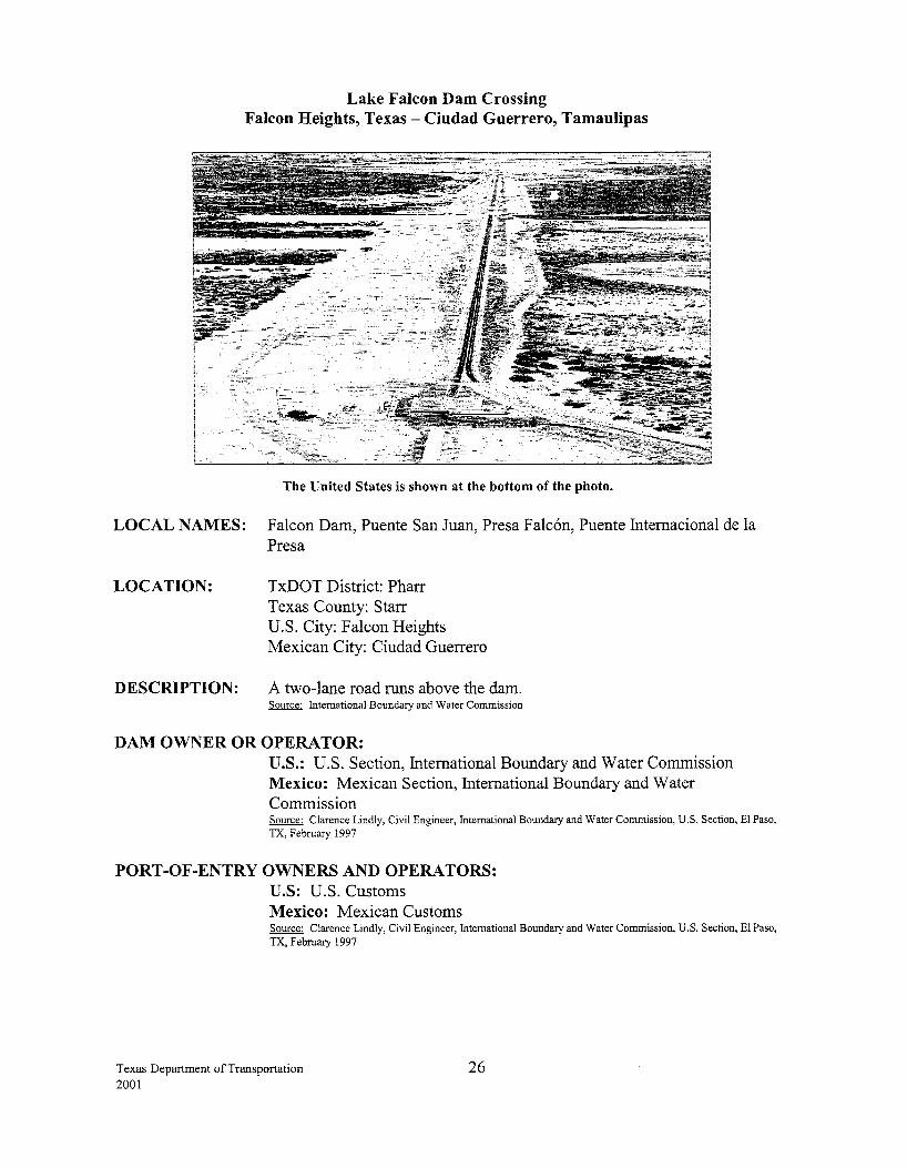
Lake Falcon Dam Crossing Falcon Heights, Texas - Ciudad Guerrero, Tamaulipas
The United States is shown at the bottom of the photo.
LOCAL NAMES: Falcon Dam, Puente San Juan, Presa Falcon, Puente Internacional de la Pres a
LOCATION: TxDOT District: Pharr Texas County: Starr
DESCRIPTION:
U.S. City: Falcon Heights Mexican City: Ciudad Guerrero
A two-lane road runs above the dam. Source: International Boundary and Water Commission
DAM OWNER OR OPERATOR: U.S.: U.S. Section, International Boundary and Water Commission Mexico: Mexican Section, International Boundary and Water Commission Source: Clarence Lindly, Civil Engineer, International Boundary and Water Commission, U.S. Section, El Paso, TX, February 1997
PORT -OF-ENTRY OWNERS AND OPERATORS: U.S: U.S. Customs Mexico: Mexican Customs Source: Clarence Lindly, Civil Engineer, International Boundary and Water Commission, U.S. Section, El Paso, TX, February 1997
Texas Department of Transportation 2001
26
YEAR OF CONSTRUCTION: 1953
HOURS:
TOLL:
Source: Clarence Lindly, Civil Engineer, International Boundary and Water Commission, U.S. Section, El Paso, TX, November 1996
6 a.m.- 10 p.m. (M- Sun) Source: Secretaria de Relaciones Exteriores, November 2000 Source: South Texas Customs Management Center, November 2000
No
STATUS OF U.S. PERMITS AND MEXICAN APPROVALS: U.S.: Presidential Permits are not required for structures built before 1972.
BORDER STATION: The U.S. border station was constructed in 1960. The building was expanded in 1977 and 1989. The border station was transferred from the IBWC to U.S. Customs after construction of the dam. Source: General Services Administration, Summary of Existing and Proposed Border Stations, May 1995
CONNECTING ROADWAY: U.S.: FM 2098 to US 83
Mexico: MEX 2
Texas Department of Transportation 2001
27
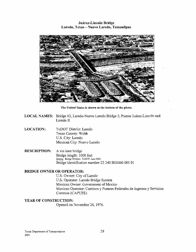
Jmirez-Lincoln Bridge Laredo, Texas- Nuevo Laredo, Tamaulipas
The United States is shown at the bottom of the photo.
LOCAL NAMES: Bridge #2, Laredo-Nuevo Laredo Bridge 2, Puente Jmirez-Lincoln and Laredo II
LOCATION: TxDOT District: Laredo Texas County: Webb U.S. City: Laredo Mexican City: Nuevo Laredo
DESCRIPTION: A six-lane bridge Bridge length: 1008 feet Source: Bridge Division, TxDOT, June 2001
Bridge identification number-22 240 B01060 001 01
BRIDGE OWNER OR OPERATOR: U.S. Owner: City of Laredo U.S. Operator: Laredo Bridge System Mexican Owner: Government of Mexico Mexican Operator: Caminos y Puentes F ederales de Ingresos y Servicios Conexos (CAPUFE)
YEAR OF CONSTRUCTION: Opened on November 26, 1976.
Texas Department of Transportation 2001
28
FUNDING/COST: The City of Laredo financed the estimated $8 million cost through revenue bonds. Approximately $2 million in bonds were issued in October 1974 and $6 million were issued in April 1980. Source: Joe Arranda, Director of Transportation, City of Laredo, May 1995
HOURS: 24 hours (POV only) Source: South Texas Customs Management Center, November 2000
TOLL: Yes
STATUS OF U.S. PERMITS AND MEXICAN APPROVALS: U.S.: Built using permit of bridge #1 (Circa 1950s). Source: Laredo District, TxDOT
BORDER STATION: U.S.: The General Services Administration owns the U.S. border station, which was completed in 1982. The import lot was modernized in 1993. Source: General Services Administration, Summary of Existing and Proposed Border Stations, May 1995
Mexico: The border station became operational in November 1976. Source: Centro S.C.T. Tamaulipas, June 2001
CONNECTING ROADWAY: U.S.: IH-35, near US 83 (Matamoros St. and Houston St.) IH-35 connects with US 59 and Loop 20. US 83 connects with Loop 20 and SH 359.
Mexico: Near MEX 85 and MEX 2 Source: Laredo District, TxDOT, June 2001
PLANNED IMPROVEMENTS: U.S.: A project widening IH 35 to six lanes from the Four Block Area to Shiloh and including a overpass is complete. Source: Laredo District, TxDOT, June 2001
IH-35 frontage road (southbound) reconstruction from Scott Street to Del Mar Blvd. is complete at an estimated cost of $8.5 million. The IH 35 (northbound) frontage road is to be completed by September 2001. Source: Laredo District, TxDOT, June 2001
IH-35 from Hidalgo St. to Loop 20 consisting of the replacement and interconnection of traffic signals is expected to be completed by August 2001, at an estimated cost of $1.1 million. Source: Laredo District, TxDOT, June 2001
Texas Department of Transportation 2001
29
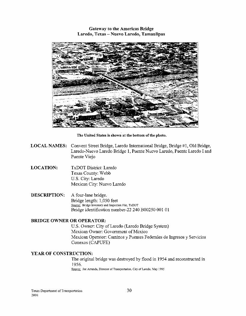
Gateway to the Americas Bridge Laredo, Texas -Nuevo Laredo, Tamaulipas
The United States is shown at the bottom of the photo.
LOCAL NAMES: Convent Street Bridge, Laredo International Bridge, Bridge #1, Old Bridge, Laredo-Nuevo Laredo Bridge 1, Puente Nuevo Laredo, Puente Laredo I and Puente Viejo
LOCATION: TxDOT District: Laredo Texas County: Webb U.S. City: Laredo Mexican City: Nuevo Laredo
DESCRIPTION: A four-lane bridge. Bridge length: 1,050 feet Source: Bridge Inventory and Inspection File, TxDOT
Bridge identification number-22 240 B00250 001 01
BRIDGE OWNER OR OPERA TOR: U.S. Owner: City of Laredo (Laredo Bridge System) Mexican Owner: Government of Mexico Mexican Operator: Caminos y Puentes Federales de Ingresos y Servicios Conexos ( CAPUFE)
YEAR OF CONSTRUCTION: The original bridge was destroyed by flood in 1954 and reconstructed in 1956. Source: Joe Arranda, Director of Transportation, City of Laredo, May 1995
Texas Department of Transportation 2001
30
FUNDING/COST: U.S.: This bridge was originally purchased from a private owner in 1946 for $695,000. In 1954 floods resulting from a hurricane in the Gulf of Mexico destroyed the bridge. The city's flood damage insurance paid the bulk ofthe reconstruction cost of the U.S. side of the bridge. Records do not reflect the amount. The City of Laredo fmanced $300,000 of the reconstruction amount (a portion not covered by insurance) through revenue bonds. Source: Joe Arranda, Director of Transportation, City of Laredo, May 1995
HOURS: 24 hours (POV only) Source: South Texas Customs Management Center, November 2000
TOLL: Yes
STATUS OF U.S. PERMITS AND MEXICAN APPROVALS: U.S.: Presidential Permits are not required for bridges built before 1972.
BORDER STATION: U.S.: The General Services Administration owns the border station, which was constructed in 1940 and renovated in 1990-91. Source: General Services Administration, Summary of Existing and Proposed Border Stations, May 1995
Mexico: The border station was constructed in 1954 and renovated in 1956. Source: Centro S.C.T. Tamaulipas, June 2001
CONNECTING ROADWAY: U.S.: BI-35 (Convent St. and Salinas St.) near IH-35 and US 83 (Matamoros St. and Houston St.) Source: Laredo District, TxDOT, June 2001
Mexico: Near MEX 2, MEX 85 or MEX 1
PLANNED IMPROVEMENTS: U.S.: The project widening US 83 to a four-lane divided highway is complete.
The overlay ofiH-35 main lanes is complete. This project let for $2.7 million in September 1998. Source: Laredo District, TxDOT, June 2001
Texas Department of Transportation 2001
31
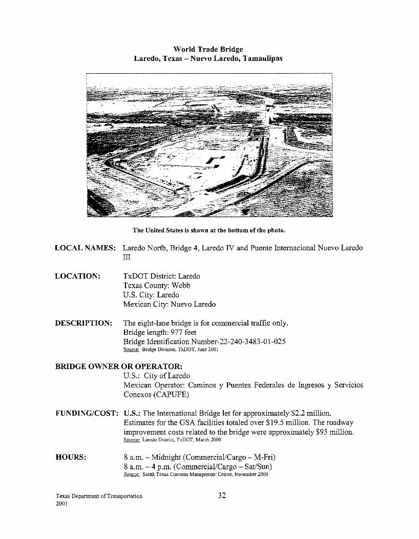
World Trade Bridge Laredo, Texas- Nuevo Laredo, Tamaulipas
The United States is shown at the bottom of the photo.
LOCAL NAMES: Laredo North, Bridge 4, Laredo IV and Puente Intemacional Nuevo Laredo III
LOCATION: TxDOT District: Laredo Texas County: Webb U.S. City: Laredo Mexican City: Nuevo Laredo
DESCRIPTION: The eight-lane bridge is for commercial traffic only. Bridge length: 977 feet Bridge Identification Number-22-240-3483-0 1-025 Source: Bridge Division, TxDOT, June 2001
BRIDGE OWNER OR OPERATOR: U.S.: City of Laredo Mexican Operator: Caminos y Puentes Federales de Ingresos y Servicios Conexos (CAPUFE)
FUNDING/COST: U.S.: The International Bridge let for approximately $2.2 million. Estimates for the GSA facilities totaled over $19.5 million. The roadway improvement costs related to the bridge were approximately $93 million. Source: Laredo District, TxDOT, March 2000
HOURS: 8 a.m. -Midnight (Commercial/Cargo- M-Fri) 8 a.m.- 4 p.m. (Commercial/Cargo- Sat/Sun) Source: South Texas Customs Management Center, November 2000
Texas Department of Transportation 2001
32
TOLL: Yes
STATUS OF U.S. PERMITS AND MEXICAN APPROVALS: U.S.: The City of Laredo submitted a Presidential Permit application in 1991; the permit was issued inN ovember 1994. Source: Office of Mexican Affairs, U.S. Department of State, February 1997
USCG Bridge permit was approved on February 12, 1996. Source: Nick Mpras, USCG
A FONSI was issued by the FHW A on March 26, 1998. Source: Laredo District, TxDOT, December 1998
Mexico: The exchange of diplomatic notes committing both nations to the construction of the new crossing took place on March 10, 1998.
BORDER STATION: U.S.: The bid for the border station was awarded in January 1999. The project was let for approximately $29 million and the facility became operational on April 15, 2000. Source: General Services Administration, June 2001
Mexico: Plans for the border station were approved by CABIN on December 17, 1997. Source: SEDICOT, Gobiemo del Estado de Tamaulipas, May 1998
BRIDGE CONSTRUCTION STATUS: U.S.: Groundbreaking occurred on September 30, 1998, and the bridge officially opened on April15, 2000. Source: Laredo District, TxDOT, November 2000
Mexico: The bridge officially opened on April 15, 2000. Source: Laredo District, TxDOT, November 2000
CONNECTING ROADWAY: U.S.: Loop 20, near FM 1472 and IH-35. Loop 20 connects the International Bridge with FM 1472 and IH-35._ Source: Laredo District, TxDOT, June 2001
Mexico: SCT constructed a 32 km loop that connects at Kilometer 22 south of Nuevo Laredo on MEX 85 to Kilometer 12 on MEX 2, northwest ofNuevo Laredo. The project was completed in December 1997. Source: SEDICOT, Gobiemo del Estado de Tamaulipas, May 1998
Texas Department of Transportation 2001
33
PLANNED IMPROVEMENTS: U.S.: A new controlled access facility constructed from lli 35 to the international bridge with an overpass and direct connector at FM 14 72 is complete at an estimated cost of $32.8 million. Source: Laredo District, TxDOT, June 2001
The interchange construction at the intersection of Loop 20 and lli-35 is 70% complete. The project will consist of overpass bridges, reconstruction of frontage roads and two direct connectors. Source: Laredo District, TxDOT, June 2001
A new direct connector will be constructed at the intersection of Loop 20 and lli-35, which will connect from lli-35 North to Loop 20 West. Letting is scheduled for January 2002 at an estimated cost of $1.1 million. Source: Laredo District, TxDOT, June 2001
Loop 20 will be widened from a two-lane rural roadway to a five-lane section starting 1.6 miles north of US 59 to McPherson Road. The project is scheduled to let in August 2001 at an estimated cost of$14.7 million. Source: Laredo District, TxDOT, June 2001
Texas Department of Transportation
2001 34
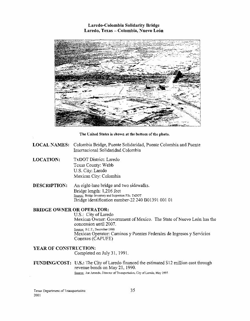
Laredo-Colombia Solidarity Bridge Laredo, Texas- Colombia, Nuevo Leon
The United States is shown at the bottom of the photo.
LOCAL NAMES: Colombia Bridge, Puente Solidaridad, Puente Colombia and Puente Internacional Solidaridad Colombia
LOCATION: TxDOT District: Laredo Texas County: Webb U.S. City: Laredo Mexican City: Colombia
DESCRIPTION: An eight-lane bridge and two sidewalks. Bridge length: 1,216 feet Source: Bridge Inventory and Inspection File. TxDOT
Bridge identification number-22 240 B01391 001 01
BRIDGE OWNER OR OPERATOR: U.S.: City of Laredo Mexican Owner: Government of Mexico. The State ofNuevo Leon has the concession until 2007. Source: S.C.T., December 1998
Mexican Operator: Caminos y Puentes Federales de Ingresos y Servicios Conexos (CAPUFE)
YEAR OF CONSTRUCTION: Completed on July 31, 1991.
FUNDING/COST: U.S.: The City of Laredo financed the estimated $12 million cost through revenue bonds on May 21, 1990. Source: Joe Arranda, Director of Transportation, City of Laredo, May 1995
Texas Department of Transportation 2001
35
HOURS:
TOLL:
8 a.m. -Midnight (POV- M-Sun) 8 a.m.- Midnight (Commercial/Cargo- M-Fri) 8 a.m. - 4 p.m. (Commercial/Cargo- Sat/Sun) Source: Secretaria de Relaciones Exteriores, November 2000
Source: South Texas Customs Management Center, November 2000
Yes
STATUS OF U.S. PERMITS AND MEXICAN APPROVALS: U.S.: The City of Laredo and Webb County submitted a Presidential Permit application in 1989, which was approved March 28, 1990.
USCG Bridge permit approved May 8, 1990. Source: Nick Mpras, USCG
BORDER STATION: The General Services Administration owns the U.S. border station, which was constructed in 1991.
The U.S. Customs Service constructed a fixed-site truck x-ray facility at this port in early 1999. Source: General Services Administration, August 1999
CONNECTING ROADWAY: U.S.: FM 255, which connects to Camino Colombia (toll road) and FM 14 72 (Mines Road) Source: Laredo District, TxDOT, June 2001
Mexico: MEX 2 (La Riberefia) will be expanded from Kilometer 12 to the Colombia Bridge. Source: S.C.T., February 1999
PLANNED IMPROVEMENTS: U.S.: Construction of the $85 million two-lane privately owned toll roadway project was let in March 1999 and opened on October 19, 2000. The toll-road is approximately 22 miles long. Source: Laredo District, TxDOT, June 2001
GSA plans to expand the track lanes at the terminal of the bridge to alleviate congestion, and has requested TEA-21 funding for this project. Source: General Services Administration, June 2001
Mexico: Construction of the $8.36 million four-lane privately owned roadway project was let in May 1990 and opened in August 1991. MEX 2 (La Riberefia) will be expanded to four lanes in the corresponding part of Nuevo Le6n from kilometer 5 to 34, this project will be completed in October 2001 at a cost of $117 million. Source: S.C.T. Nuevo Leon, July 2001
Texas Department of Transportation 2001
36
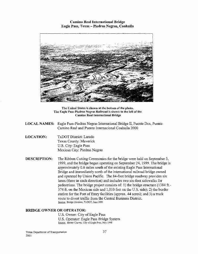
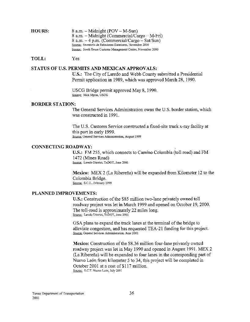
Camino Real International Bridge Eagle Pass, Texas- Piedras Negras, Coahuila
The United States is shown at the bottom of the photo. The Eagle Pass-Piedras Negras Railroad is shown to the left of the
Camino Real International Bridge
LOCAL NAMES: Eagle Pass-Piedras Negras International Bridge II, Puente Dos, Puente Camino Real and Puente Internacional Coahuila 2000
LOCATION: TxDOT District: Laredo Texas County: Maverick U.S.City: Eagle Pass Mexican City: Piedras Negras
DESCRIPTION: The Ribbon Cutting Ceremonies for the bridge were held on September 3, 1999, and the bridge began operating on September 24, 1999. The bridge is approximately 0.6 miles south of the existing Eagle Pass International Bridge and immediately north of the international railroad bridge owned and operated by Union Pacific. The 84-foot bridge roadway provides six lanes (three in each direction) and includes two six-foot sidewalks for pedestrians. The bridge project consists of: 1) the bridge structure (1384 ft.-374ft. on the Mexican side and 1,010 feet on the U.S. side); 2) the border station for the Port of Entry facilities (approx. 44 acres); and 3) a truck route to divert traffic from the Central Business District. Source: Bridge Division, TxDOT, June 2001
BRIDGE OWNER OR OPERATOR: U.S. Owner: City of Eagle Pass U.S. Operator: Eagle Pass Bridge System Source: Hector Chavez, City ofEag1e Pass, May 1998
Texas Department of Transportation 2001
37
Mexican Owner: Government ofMexico. The State of Coahuila was granted the concession on August 9, 1991, for a period of20 years. Source: Direcci6n General de Carninos SCOPE, Gobierno de Coahuila, September 1998
Mexican Operator: Caminos y Puentes Federales de Ingresos y Servicios Conexos ( CAPUFE)
FUNDING/COST: The City of Eagle Pass provided funding for the $30 million project.
HOURS:
TOLL:
24 hours (POV) 7 a.m.- 11 p.m. (Commercial/Cargo- M-Fri) 7 a.m. - 5 p.m. (Commercial/Cargo - Sat) Source: South Texas Customs Management Center, November 2000
Yes
STATUS OF U.S. PERMITS AND MEXICAN APPROVALS: U.S.: The Department of State issued the Presidential Permit to the City of Eagle Pass in May 1996. The Coast Guard Bridge Permit was issued in August 1996. Final Diplomatic notes authorizing the construction of the bridge were exchanged between the U.S. and Mexican governments in November 1997. A construction agreement between the City ofEagle Pass and the Mexican federal government detailing construction responsibilities was executed in February 1998. Source: City of Eagle Pass, March 1999
Mexico: The State of Coahuila constructed and operates the bridge and facilities. Source: S.C.T., November 1999
BORDER STATION: U.S.: The City of Eagle Pass and GSA have jointly developed a master plan for phased construction of the border station. The border station plans were completed in December 1997 and construction began on Phase I in May 1998, which was completed in August 1999. This phase of the border station facilities cost a total of $6.0 million. A total of 14 tollbooths are included in the new facility. Source: City of Eagle Pass, March 1999_ Source: General Services Adrrilnistration, August 1999 Source: Eagle Pass Business Journal, September 2, 1999
The GSA has requested 2002 funding for the design of permanent border station facilities. Source: General Services Administration, June 200 I
Mexico: Construction of the border station began in July 1998 and was completed in August of 1999. Source: SCT, November 1999
Texas Department of Transportation 2001
38
BRIDGE CONSTRUCTION STATUS: U.S.: Construction of the bridge began in April1998 and was completed in January 1999. The Ribbon Cutting Ceremonies were held on September 3, 1999, and the bridge began operating on September 24, 1999. Source: Laredo District, TxDOT, September 1999
Mexico: Construction of the bridge began on December 10, 1997, and was completed on August 15, 1999. Source: S.C.T., November 1999
CONNECTING ROADWAY: U.S.: Construction for the Truck Route has been divided into two phases. Phase 1A was completed in April 1999 at a cost of $1.1 million and is approximately 1/2 mile long, connecting at FM 1021-Wilson Street and ending at the Camino Real International Bridge. The plans and specifications for Phase lB were presented to the City of Eagle Pass in March 1999. TxDOT is working with the City of Eagle Pass to update the plans. Phase lB will be approximately 2 miles, starting at the Camino Real International Bridge and ending at FM 375. Estimated cost for phase 1B is $5.6 million, which includes 2 lanes with shoulders on both sides. The tentative project letting date is November 2002. Source: Laredo District, TxDOT, June 2001
Customs will build an outbound canopy in 2001. Source: U.S. Customs Service, South Texas, November 2000
Mexico: Expansion and improvement of 10.5-km, one of several connections with MEX 2 and MEX 57, was completed at a cost of 30 million pesos. Source: S.C.T., November 1999
PLANNED IMPROVEMENTS: U.S.: TxDOT engaged the services of Turner, Collie, and Braden to study the development of an outer loop in Eagle Pass. A public hearing on the project took place in January 2001, and the project is scheduled for letting in November 2002. Source: Laredo District, TxDOT, June 2001
Mexico: The State of Coahuila and SCT continue the improvement and construction of the Mexico-Piedras Negras Transport Corridor to the new port of entry. A number of projects planned in the short to medium term, include the construction of two road sections, La Muralla (10.0 km) and Saltillo bypass (36.0 km) at a cost of 327 million pesos. Construction was to have been completed by mid 2000. Source: S.C.T., November 1999
Texas Department of Transportation 2001
39
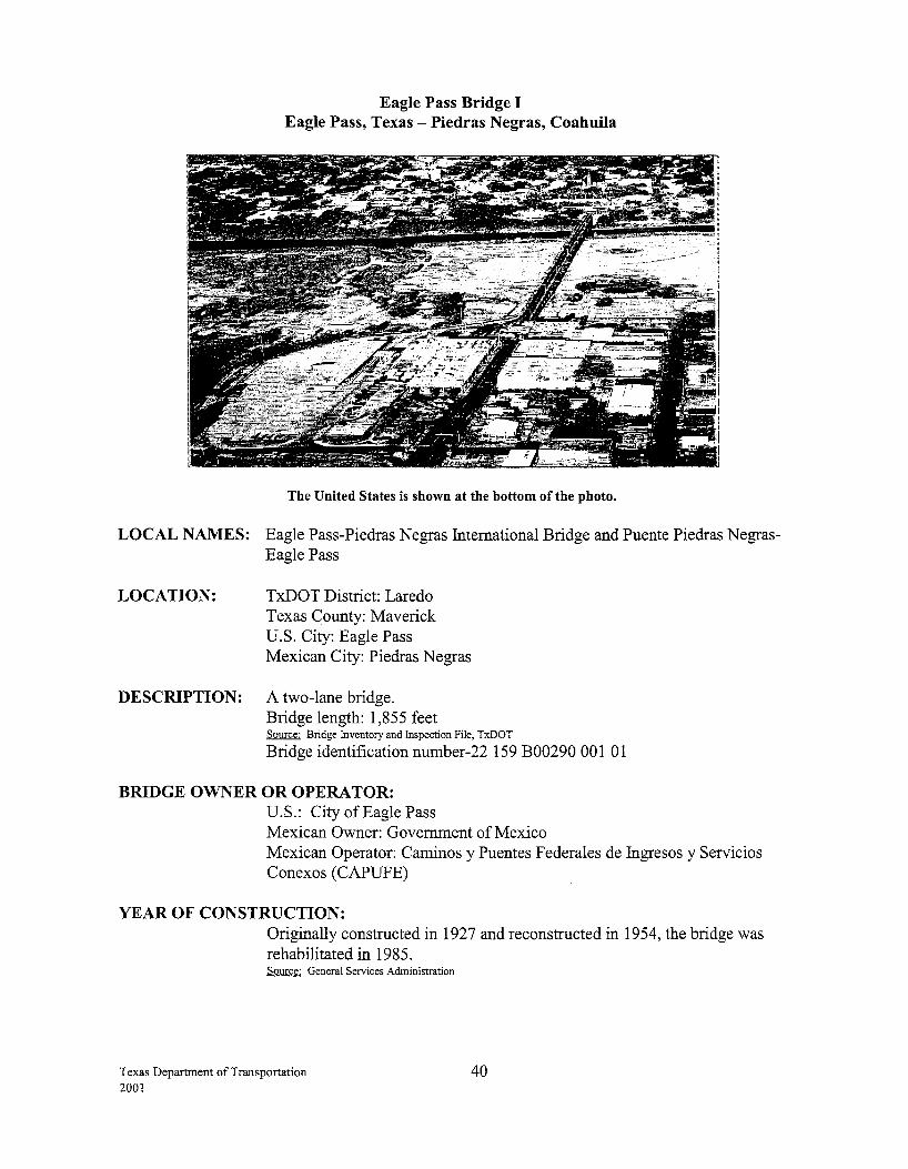
Eagle Pass Bridge I Eagle Pass, Texas -Piedras Negras, Coahuila
The United States is shown at the bottom of the photo.
LOCAL NAMES: Eagle Pass-Piedras Negras International Bridge and Puente Piedras NegrasEagle Pass
LOCATION: TxDOT District: Laredo Texas County: Maverick U.S. City: Eagle Pass Mexican City: Piedras Negras
DESCRIPTION: A two-lane bridge. Bridge length: 1,855 feet Source: Bridge Inventory and Inspection File, TxDOT
Bridge identification number-22 159 B00290 001 01
BRIDGE OWNER OR OPERA TOR: U.S.: City of Eagle Pass Mexican Owner: Government of Mexico Mexican Operator: Caminos y Puentes Federales de Ingresos y Servicios Conexos (CAPUFE)
YEAR OF CONSTRUCTION: Originally constructed in 1927 and reconstructed in 1954, the bridge was rehabilitated in 1985. Source: General Services Administration
Texas Department of Transportation 2001
40
FUNDING/COST: The City of Eagle Pass purchased the bridge on March 17, 1947, from Francisco Estrada for $320,000.
HOURS:
TOLL:
Source: Laredo District, TxDOT
7 a.m. - 11 p.m. (POV- M-Sun) Source: Secretaria de Relaciones Exteriores, November 2000 Source: South Texas Customs Management Center, November 2000
Yes
STATUS OF U.S. PERMITS AND MEXICAN APPROVALS: U.S.: Presidential Permits were not required for bridges built before 1972.
BORDER STATION: The U.S. border station, owned by the General Services Administration, was completed in 1960 and expanded in 1991. Source: General Services Administration, Summary of Existing and Proposed Border Stations, May 1995
CONNECTING ROADWAY: U.S.: US 57 connects to US 277 Mexico: Near MEX 2 and MEX 57
PLANNED IMPROVEMENTS: U.S.: US 57 was widened from 2 lanes to a four-lane roadway at a cost of $2.4 million in FY 2000. The project started approximately 8 miles NE of US 277 to 0.3 miles NE ofFM 481, with a total length of 4.2 miles. Source: Laredo District, TxDOT, June 2001
A US 277 (Business) reconstruction and widening project let for $3.8 million was completed in May 1999. A reconstruction on US 277 (Business) consisting of the reconstruction of the roadway from Ceylon St. to US 57 let in May 2001 at an estimated cost of $2.03 million. Source: Laredo District, TxDOT, June 2001
Texas Department of Transportation 2001
41
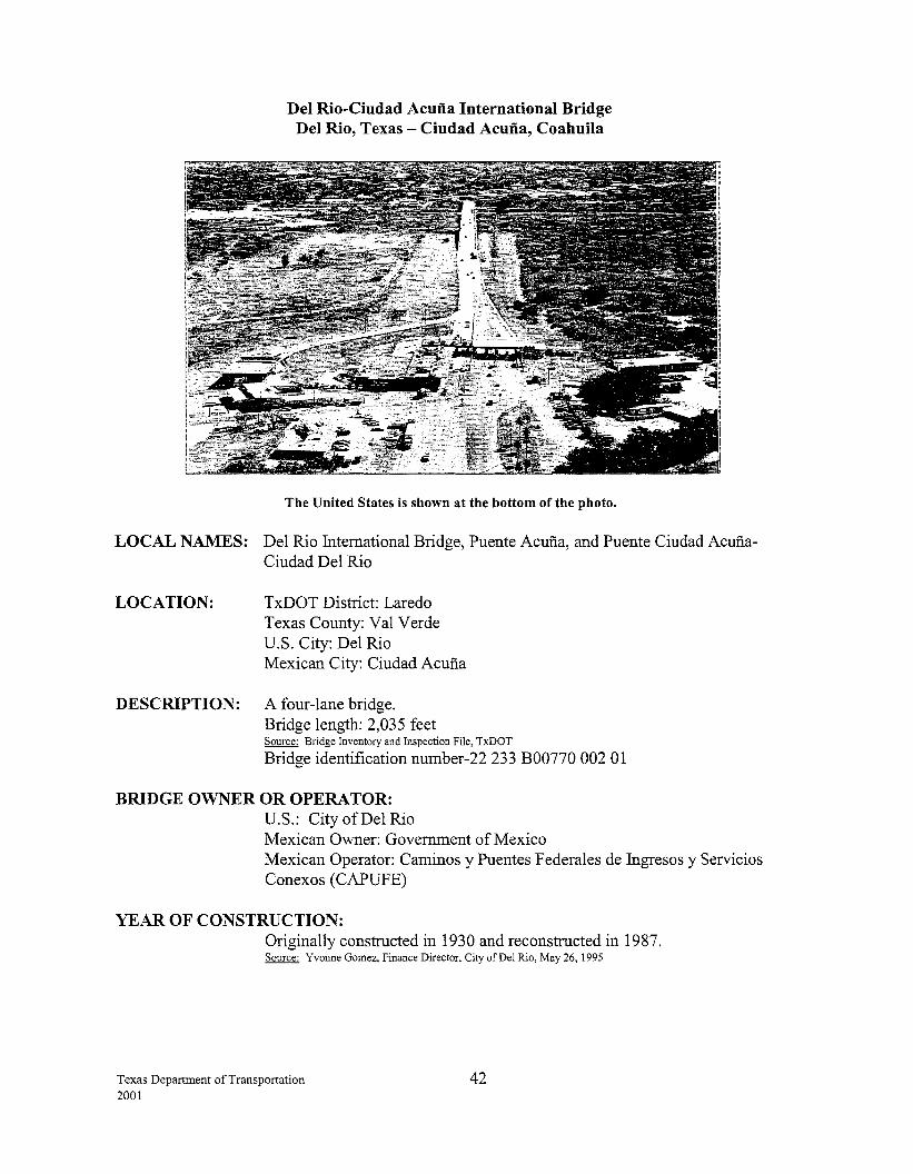
Del Rio-Ciudad Acuna International Bridge Del Rio, Texas - Ciudad Acuna, Coahuila
The United States is shown at the bottom of the photo.
LOCAL NAMES: Del Rio International Bridge, Puente Acuna, and Puente Ciudad AcufiaCiudad Del Rio
LOCATION: TxDOT District: Laredo Texas County: Val Verde U.S. City: Del Rio Mexican City: Ciudad Acuna
DESCRIPTION: A four-lane bridge. Bridge length: 2,035 feet Source: Bridge Inventory and Inspection File, TxDOT
Bridge identification number-22 233 B00770 002 01
BRIDGE OWNER OR OPERATOR: U.S.: City of Del Rio Mexican Owner: Government of Mexico Mexican Operator: Caminos y Puentes Federales de Ingresos y Servicios Conexos ( CAPUFE)
YEAR OF CONSTRUCTION: Originally constructed in 1930 and reconstructed in 1987. Source: Yvonne Gomez, Finance Director, City of Del Rio, May 26, 1995
Texas Department of Transportation 2001
42
HOURS:
TOLL:
24 hours (POV) 8 a.m.- 9 p.m. (Commercial/Cargo- M-Fri) 9 a.m.- 5 p.m. (Commercial/Cargo- Sat) Source: South Texas Customs Management Center, November 2000
Yes
STATUS OF U.S. PERMITS AND MEXICAN APPROVALS: U.S.: The City of Del Rio submitted a Presidential Permit application, which was approved in 1986.
BORDER STATION: U.S.: The U.S. border station was constructed in 1967, and the City of Del Rio's portion was reconstructed in 1995. The General Services Administration, which owns the border station, prepared a master plan for a major three-phase expansion of the border station. The first phase was completed in 1990; the second phase, a new import lot, was completed in May 1999; and for the third phase, a request has been submitted for design funding of a new administration building in 200 1. Source: General Services Administration, April 2000
Mexico: The border station was to be completed in three phases. The first two phases are complete, while the third phase has not yet been clearly defmed. Source: SCT, January 1999
CONNECTING ROADWAY: U.S.: US 277/Spur 239 connecting with US 90
Mexico: Near MEX 2, Coahuila State Highway 29 connecting with MEX57
PLANNED IMPROVEMENTS: U.S: US 90: Section 1.58 mi. east of Bedell Ave., to Bedell Ave., including reconstruction of grading, structure, base, plus widening and rehabilitation ofbridges and section from Gibbs St. to 17th St. The project let in December 1996 for $4.7 million and was completed in early 1999. Source: Laredo District, TxDOT, February 1999
A second US 90 reconstruction project from Avenue F to Bedell Ave., and from the Laughlin AFB to 1.5 miles east of Bedell Ave., relet in September 1999. The estimated cost is $4.5 million, with an estimated completion date ofNovember 2001. Source: Laredo District, TxDOT, June 2001
Texas Department of Transportation 2001
43
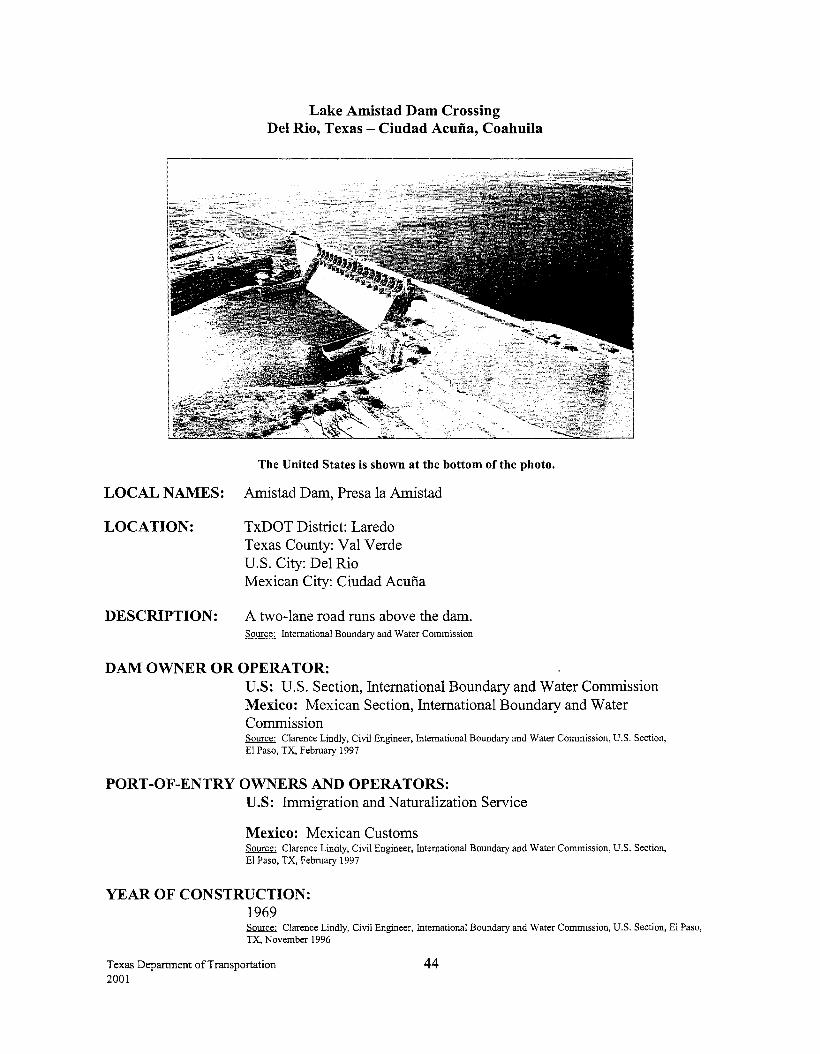
Lake Amistad Dam Crossing Del Rio, Texas- Ciudad Acuna, Coahuila
The United States is shown at the bottom of the photo.
LOCAL NAMES: Amistad Dam, Presa la Amistad
LOCATION: TxDOT District: Laredo Texas County: Val Verde U.S. City: Del Rio Mexican City: Ciudad Acu:fia
DESCRIPTION: A two-lane road runs above the dam. Source: International Boundary and Water Commission
DAM OWNER OR OPERATOR: U.S: U.S. Section, International Boundary and Water Commission Mexico: Mexican Section, International Boundary and Water Commission Source: Clarence Lindly, Civil Engineer, International Boundary and Water Commission, U.S. Section, El Paso, TX, February 1997
PORT-OF-ENTRY OWNERS AND OPERATORS: U.S: Immigration and Naturalization Service
Mexico: Mexican Customs Source: Clarence Lindly, Civil Engineer, International Boundary and Water Commission, U.S. Section, El Paso, TX, February 1997
YEAR OF CONSTRUCTION: 1969 Source: Clarence Lindly, Civil Engineer, International Boundary and Water Commission, U.S. Section, El Paso, TX, November 1996
Texas Department of Transportation 2001
44
HOURS:
TOLL:
24 hours (POV only) Source: Secretaria de Relaciones Exteriores, November 2000 Source: South Texas Customs Management Center, November 2000
No
STATUS OF U.S. PERMITS AND MEXICAN APPROVALS: U.S.: Presidential Permits are not required for structures built before 1972.
BORDER STATION: The U.S. border station, owned by the hnmigration and Naturalization Service, was completed in 1969. Source: General Services Administration, Summary of Existing and Proposed Border Stations, May 1995
CONNECTING ROADWAY: U.S.: Spur 349 connects to US 90
Mexico: NearMEX2
Texas Department of Transportation 2001
45
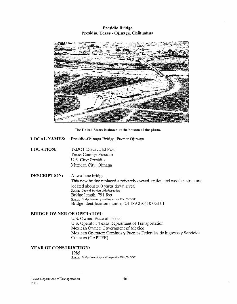
Presidio Bridge Presidio, Texas - Ojinaga, Chihuahua
The United States is shown at the bottom of the photo.
LOCAL NAMES: Presidio-Ojinaga Bridge, Puente Ojinaga
LOCATION: TxDOT District: El Paso Texas County: Presidio U.S. City: Presidio Mexican City: Ojinaga
DESCRIPTION: A two-lane bridge This new bridge replaced a privately owned, antiquated wooden structure located about 500 yards down river. Source: General Services Administration
Bridge length: 791 feet Source: Bridge Inventory and Inspection File, TxDOT
Bridge identification number-24 189 010410 053 01
BRIDGE OWNER OR OPERATOR: U.S. Owner: State ofTexas U.S. Operator: Texas Department of Transportation Mexican Owner: Government of Mexico Mexican Operator: Caminos y Puentes Federales de Ingresos y Servicios Conexos (CAPUFE)
YEAR OF CONSTRUCTION: 1985 Source: Bridge Inventory and Inspection File, TxDOT
Texas Department of Transportation 2001
46
FUNDING/COST: U.S.: $869,113 for bridge and approach. Half of this seven span bridge was paid for by Mexico. Since there were an odd number of spans, Mexico paid for the superstructure of the middle span and the U.S. paid for the substructure.
HOURS:
TOLL:
Source: Design Division, TxDOT
24 hours (POV) 8 a.m.- 5 p.m. (Commercial/Cargo) Source: West Texas Customs Management Center, June 2001
No toll southbound Northbound toll- $1.80 (POV)
$3.80 (Commercial Trucks) Source: West Texas Customs Management Center, June 2001
STATUS OF U.S. PERMITS AND MEXICAN APPROVALS: U.S.: Presidio County submitted a Presidential Permit application, which was approved on July 2, 1976. The permit was amended and transferred to the State of Texas on May 4, 1982. Source: U.S. State Department
BORDER STATION: U.S.: The U.S. border station was completed in 1987. A private individual (Richard Slack) owns the U.S. border station, which is leased to the General Services Administration (GSA). GSA's lease expires January 30, 2007. Source: General Services Administration, Summary of Existing and Proposed Border Stations, May 1995
Mexico: The Government of Mexico, Customs and Immigration operate the border station. Source: Centro S.C.T. Chihuahua, June 2001
CONNECTING ROADWAY: U.S.: US 67 and FM 170
Mexico: MEX 16 and CHili 18 Source: Centro S.C.T. Chihuahua, June 2001
PLANNED IMPROVEMENTS: Mexico: Construction of state highway Coyame- Potrero del Llano connecting MEX 16 and CHili 18 is underway at a cost of 105 million pesos. This project is part of the long-term plans to develop the tourist/industrial corridor from the port city ofTopolobampo, Sinaloa to Ojinaga, Chihuahua, and to Dallas-Ft. Worth. With the construction ofthis highway, travelers will be able to avoid the winding and steep sloped Canon del Peguis highway. Source: Centro S.C.T. Chihuahua, June 2001
Texas Department of Transportation 2001
47
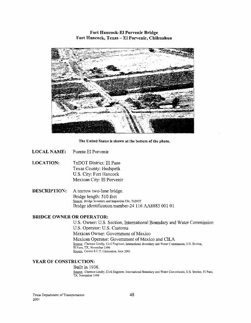
LOCAL NAME:
LOCATION:
Fort Hancock-El Porvenir Bridge Fort Hancock, Texas- El Porvenir, Chihuahua
The United States is shown at the bottom of the photo.
Puente El Porvenir
TxDOT District: El Paso Texas County: Hudspeth U.S. City: Fort Hancock Mexican City: El Porvenir
DESCRIPTION: A narrow two-lane bridge. Bridge length: 510 feet Source: Bridge Inventory and Inspection File, TxDOT
Bridge identification nurnber-24 116 AA8883 001 01
BRIDGE OWNER OR OPERA TOR: U.S. Owner: U.S. Section, International Boundary and Water Commission U.S. Operator: U.S. Customs Mexican Owner: Government of Mexico Mexican Operator: Government of Mexico and CILA Source: Clarence Lindly, Civil Engineer, International Boundary and Water Commission, U.S. Section, El Paso, TX, November 1996 Source: Centro S.C.T. Chihuahua, June 2001
YEAR OF CONSTRUCTION: Built in 1936. Source: Clarence Lindly, Civil Engineer, International Boundary and Water Commission, U.S. Section, El Paso, TX, November 1996
Texas Department of Transportation 2001
48
This is one of three small, light-duty bridges built by the International Boundary and Water Commission as part ofU.S.-Mexico, Rio Grande Rectification Project. Source: U.S. Section, International Boundary and Water Commission, November 2000
FUNDING/COST: Built using U.S. and Mexican federal funds.
HOURS: 6 a.m. - 9 p.m. (POV !Light Truck) Source: West Texas Customs Management Center, June 2001
TOLL: None Source: West Texas Customs Management Center, June 2001
STATUS OF U.S. PERMITS AND MEXICAN APPROVALS: U.S.: Presidential Permits are not required for bridges built before 1972.
BORDER STATION: U.S.: The border station is a small facility that was constructed in 1955 and is owned by the Immigration and Naturalization Service. Source: General Services Administration, Summary of Existing and Proposed Border Stations, May 1995
GSA received funds in 2000 to design a new border station at this location. The design is scheduled for completion in August 2001 and GSA has requested construction funding in 2002. Source: General Services Administration, June 2001
Mexico: The Mexican Government operates the border station. Source: Centro S.C.T. Chihuahua, June 2001
CONNECTING ROADWAY: U.S.: FM 1088 connects with Texas 20
Mexico: Connects to MEX 2
Texas Department of Transportation 2001
49
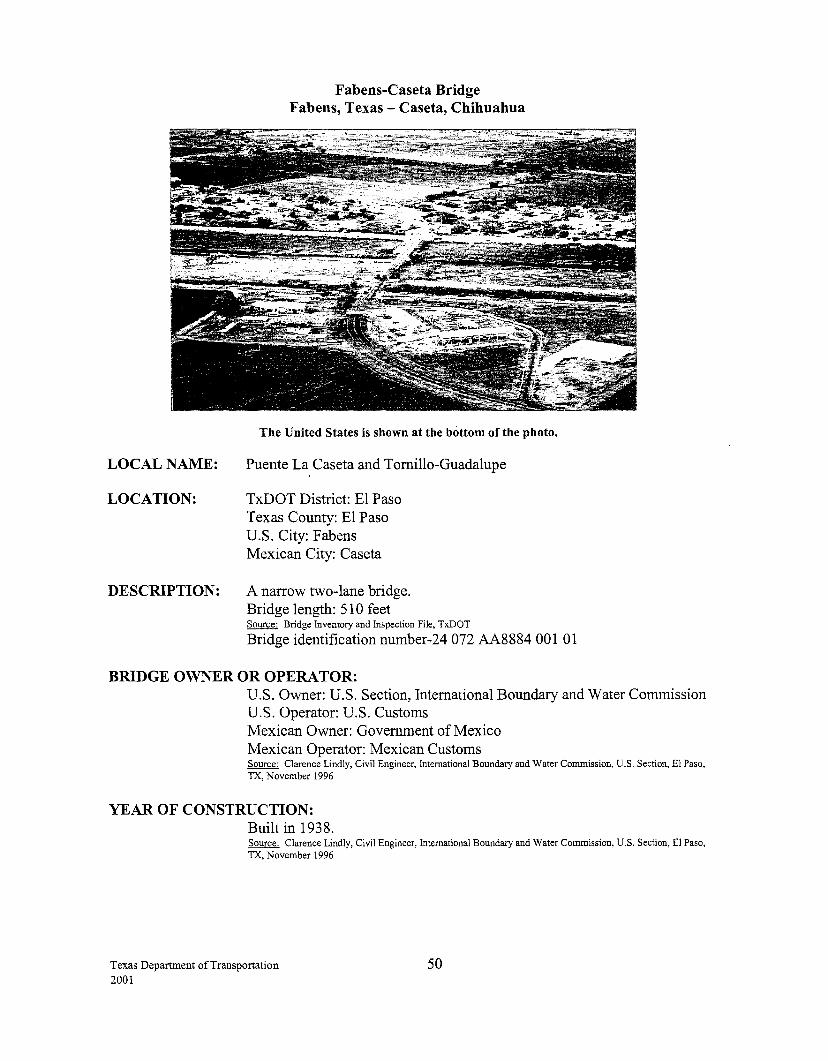
LOCAL NAME:
LOCATION:
DESCRIPTION:
Fabens-Caseta Bridge Fabens, Texas- Caseta, Chihuahua
The United States is shown at the bottom of the photo.
Puente La Caseta and Tornillo-Guadalupe
TxDOT District: El Paso Texas County: El Paso U.S. City: Fabens Mexican City: Caseta
A narrow two-lane bridge. Bridge length: 51 0 feet Source: Bridge Inventory and Inspection File, TxDOT
Bridge identification number-24 072 AA8884 001 01
BRIDGE OWNER OR OPERATOR: U.S. Owner: U.S. Section, International Boundary and Water Commission U.S. Operator: U.S. Customs Mexican Owner: Government of Mexico Mexican Operator: Mexican Customs Source: Clarence Lindly, Civil Engineer, International Boundary and Water Commission, U.S. Section, El Paso, TX, November 1996
YEAR OF CONSTRUCTION: Built in 1938. Source: Clarence Lindly, Civil Engineer, International Boundary and Water Commission, U.S. Section, El Paso, TX, November 1996
Texas Department of Transportation 2001
50
This is one of three small, light-duty bridges built by the International Boundary and Water Commission as part ofU.S.-Mexico, Rio Grande Rectification Project. Source: U.S. Section, International Boundary and Water Commission, November 2000
FUNDING/COST: Built using U.S. and Mexican federal funds.
HOURS: 6 a.m.- 10 p.m. (POV/Light Truck) Source: West Texas Customs Management Center, June 2001
TOLL: None Source: West Texas Customs Management Center, June 2001
STATUS OF U.S. PERMITS AND MEXICAN APPROVALS: U.S.: Presidential Permits are not required for bridges built before 1972.
BORDER STATION: A United States temporary border station was constructed on six acres of land northwest of the existing Port of Entry. This facility includes additional inspection lanes, parking and modular office trailer units. This $962,000 project was completed in October 1996 and will serve the agencies until a new bridge is constructed._ Source: General Services Administration, January 1999
CONNECTING ROADWAY: U.S.: FM 1109 connects with Texas 20, FM 76 and FM 793, which connect to I-10. Island Guadalupe and Tornillo-Guadalupe roads run concurrently with FM 1109.
Mexico: A state road connects with MEX 2
PLANNED IMPROVEMENTS: U.S.: TheEl Paso MPO paid a consultant to conduct a feasibility study which evaluated if a new location was necessary for a new commercial port of entry at Fabens. The $150,000 study, completed in February 1997, recommended that a new toll facility be built about a quarter mile west of the present location. This location will line up better with FM 1109 and not affect the town of Cas eta. If El Paso County decides to proceed with the study's recommendation, they will be responsible for following through with the Texas bridge approval process and for requesting the U.S. Presidential Permit. Source: El Paso District, TxDOT, March 1999
Texas Department of Transportation 2001
51
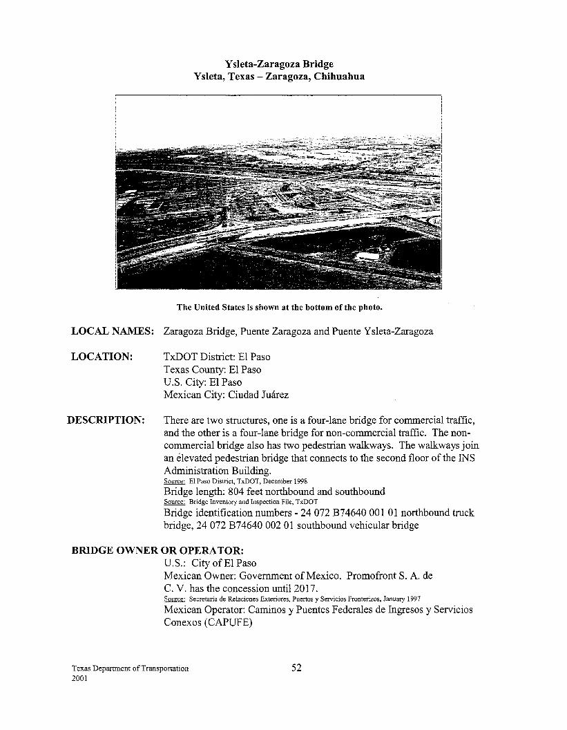
Y sleta-Zaragoza Bridge Ysleta, Texas- Zaragoza, Chihuahua
The United States is shown at the bottom of the photo.
LOCAL NAMES: Zaragoza Bridge, Puente Zaragoza and Puente Y sleta-Zaragoza
LOCATION:
DESCRIPTION:
TxDOT District: El Paso Texas County: El Paso U.S. City: El Paso Mexican City: Ciudad Juarez
There are two structures, one is a four-lane bridge for commercial traffic, and the other is a four-lane bridge for non-commercial traffic. The noncommercial bridge also has two pedestrian walkways. The walkways join an elevated pedestrian bridge that connects to the second floor of the INS Administration Building. Source: El Paso District, TxDOT, December 1998
Bridge length: 804 feet northbound and southbound Source: Bridge Inventory and Inspection File, TxDOT
Bridge identification numbers- 24 072 B74640 001 01 northbound truck bridge, 24 072 B74640 002 01 southbound vehicular bridge
BRIDGE OWNER OR OPERA TOR: U.S.: City ofEl Paso Mexican Owner: Government of Mexico. Promofront S. A. de C. V. has the concession until 2017. Source: Secretaria de Relaciones Exteriores, Puertos y Servicios Fronterizos, January 1997
Mexican Operator: Caminos y Puentes F ederales de Ingresos y Servicios Conexos (CAPUFE)
Texas Department of Transportation 2001
52
YEAR OF CONSTRUCTION: The original bridge was constructed in 1938 as part of the U.S.-Mexico River rectification project. Source: Telephone conversation with Bob Ybarra, Secretary, U.S. Section, International Boundary and Water Commission, July 1994
Rebuilt in 1955 and rebuilt again in 1990. Source: El Paso District, TxDOT
FUNDING/COST: U.S.: $3.54 million
HOURS:
TOLL:
Source: El Paso District
24 hours (POV) Commercial/Cargo: 8 a.m.- Midnight (M-F)
9 a.m. - 5 p.m. (Saturday) Closed Sunday
Source: South Texas Customs Management Center, June 2001
Southbound: $1.25 (POV) $2.30 per axle (Commercial)
Northbound: $1.75 (POV) $3.00 per axle (Commercial)
Source: South Texas Customs Management Center, June 2001
STATUS OF U.S. PERMITS AND MEXICAN APPROVALS: U.S.: The City ofEl Paso submitted a Presidential Permit application for the replacement bridges, which was approved on June 30, 1987. Source: U.S. State Department
BORDER STATION: U.S.: The border station was completed in August 1992. The General Services Administration owns the U.S. border station and 61 acres of the border station's land area. The city operates truck tollbooths on the GSA property. The GSA expanded the facility in 1998. The expansion facilities include two-bay empty truck inspection, HAZMA T containment area, narcotic storage building, additional truck staging, and miscellaneous site improvements. The project was completed in January 1998. Source: General Services Administration, August 1999
U. S. Customs installed a fixed-site truck x-ray system that enables them to x-ray an entire truck in about 10 minutes. Completion date was January 1998. Source: U.S. Customs Service, U.S. Department of Treasury, June 1998
North American Trade Automation Prototype dedicated short-range testing equipment was installed in July 1997. For more information on the NATAP program on the Internet, see http://www.itds.treas.gov Source: Federal Highway Administration, Texas Division, August 1997
Texas Department of Transportation 2001
53
CONNECTING ROADWAY: U.S.: Near State Loop 375, Border Highway, and Americas Avenue. Connects to I-1 0.
Mexico: A state road connects with MEX 2 and continues to MEX 45.
PLANNED IMPROVEMENTS: U.S.: The City ofEl Paso delegation appeared before the Texas Transportation Commission in May 1996 to request funding for a project that would add four main lanes to the existing frontage roads of Loop 3 7 5 from the Zaragoza Port of Entry to IH 10. The Commission approved this $25 million dollar project, which was let in March 1999. Source: El Paso District, TxDOT, October 1999
TxDOT is working with bridge officials to design a second commercial exit leading to Loop 375, connecting to IH 10. Four main lanes are under construction from IH 10 to Zaragoza. The city ofEl Paso proposed an update to the existing toll collection system. Source: El Paso District, TxDOT, October 1999
A consultant firm conducted a feasibility study for the extension of the Border Highway from the Zaragoza Port of Entry to the Fabens Port of Entry. The $1 million study began during the summer of 1995 and was completed in February 1997. The study recommended the extension, and it is on the Long-Range Plan. Source: El Paso District, TxDOT, October 1999
Mexico: The access roads to the bridge are both state and city owned. The City of Juarez is in the process of modernizing the system of city roads that lead up to the bridge. Boulevard Francisco Villareal, joining MEX 45 with MEX 2 in a more direct manner, was recently completed. Source: Centro S.C.T. Chihuahua, June 2001
Texas Department of Transportation 2001
54
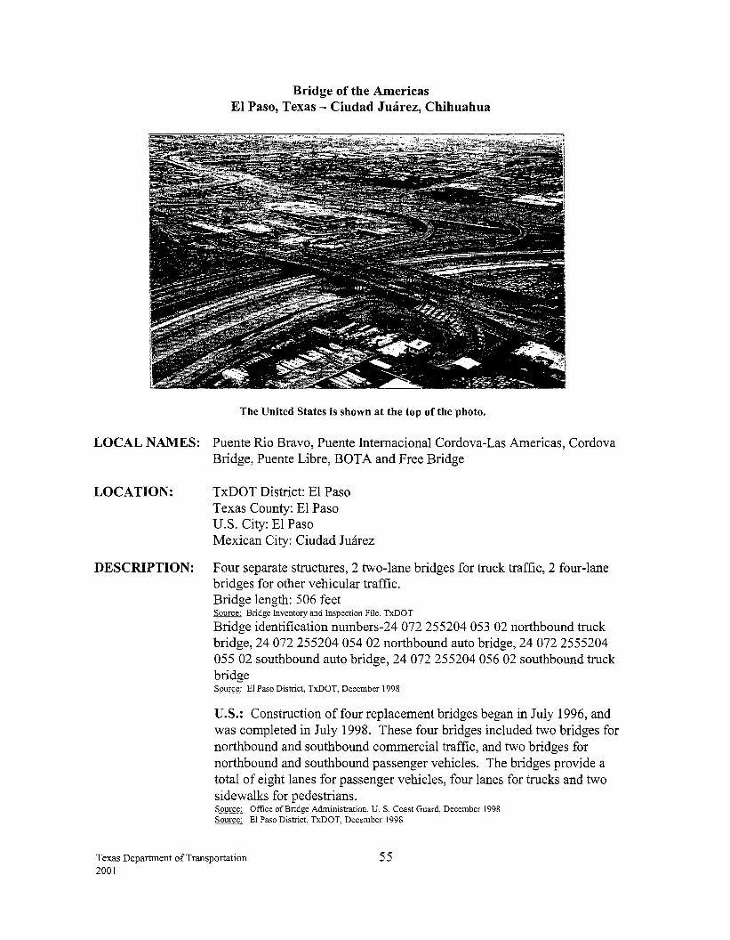
Bridge of the Americas El Paso, Texas- Ciudad Juarez, Chihuahua
The United States is shown at the top of the photo.
LOCAL NAMES: Puente Rio Bravo, Puente Intemacional Cordova-Las Americas, Cordova Bridge, Puente Libre, BOTA and Free Bridge
LOCATION: TxDOT District: El Paso Texas County: El Paso U.S. City: El Paso Mexican City: Ciudad Juarez
DESCRIPTION: Four separate structures, 2 two-lane bridges for truck traffic, 2 four-lane bridges for other vehicular traffic. Bridge length: 506 feet Source: Bridge Inventory and Inspection File, TxDOT
Bridge identification numbers-24 072 255204 053 02 northbound truck bridge, 24 072 255204 054 02 northbound auto bridge, 24 072 2555204 055 02 southbound auto bridge, 24 072 255204 056 02 southbound truck bridge Source: El Paso District, TxDOT, December 1998
U.S.: Construction of four replacement bridges began in July 1996, and was completed in July 1998. These four bridges included two bridges for northbound and southbound commercial traffic, and two bridges for northbound and southbound passenger vehicles. The bridges provide a total of eight lanes for passenger vehicles, four lanes for trucks and two sidewalks for pedestrians. Source: Office of Bridge Administration, U.S. Coast Guard, December 1998 Source: El Paso District, TxDOT, December 1998
Texas Department of Transportation 2001
55
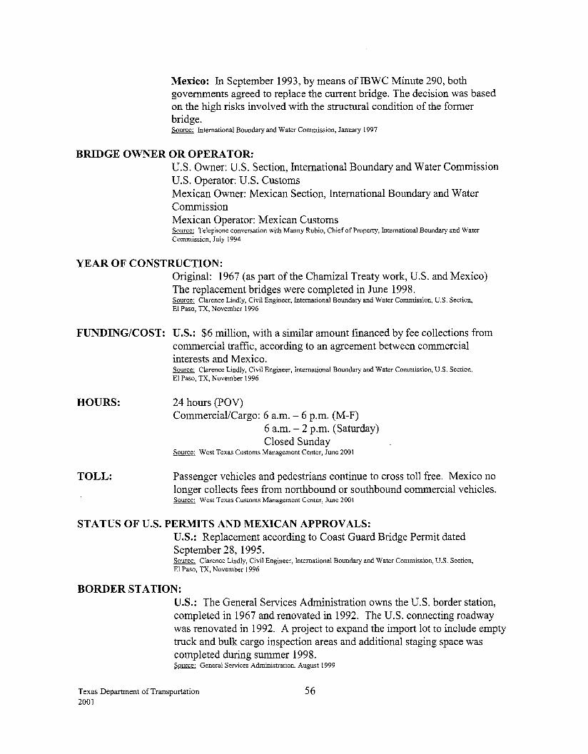
Mexico: In September 1993, by means ofiBWC Minute 290, both governments agreed to replace the current bridge. The decision was based on the high risks involved with the structural condition of the former bridge. Source: International Boundary and Water Commission, January 1997
BRIDGE OWNER OR OPERATOR: U.S. Owner: U.S. Section, International Boundary and Water Commission U.S. Operator: U.S. Customs Mexican Owner: Mexican Section, International Boundary and Water Commission Mexican Operator: Mexican Customs Source: Telephone conversation with Manny Rubio, Chief of Property, International Boundary and Water Commission, July 1994
YEAR OF CONSTRUCTION: Original: 1967 (as part of the Chamizal Treaty work, U.S. and Mexico) The replacement bridges were completed in June 1998. Source: Clarence Lindly, Civil Engineer, International Boundary and Water Commission, U.S. Section, El Paso, TX, November 1996
FUNDING/COST: U.S.: $6 million, with a similar amount financed by fee collections from commercial traffic, according to an agreement between commercial interests and Mexico.
HOURS:
TOLL:
Source: Clarence Lindly, Civil Engineer, International Boundary and Water Commission, U.S. Section, El Paso, TX, November 1996
24 hours (POV) Commercial/Cargo: 6 a.m.- 6 p.m. (M-F)
6 a.m. - 2 p.m. (Saturday) Closed Sunday
Source: West Texas Customs Management Center, June 2001
Passenger vehicles and pedestrians continue to cross toll free. Mexico no longer collects fees from northbound or southbound commercial vehicles. Source: West Texas Customs Management Center, June 2001
STATUS OF U.S. PERMITS AND MEXICAN APPROVALS: U.S.: Replacement according to Coast Guard Bridge Permit dated September 28, 1995. Source: Clarence Lindly, Civil Engineer, International Boundary and Water Commission, U.S. Section, El Paso, TX, November 1996
BORDER STATION: U.S.: The General Services Administration owns the U.S. border station, completed in 1967 and renovated in 1992. The U.S. connecting roadway was renovated in 1992. A project to expand the import lot to include empty truck and bulk cargo inspection areas and additional staging space was completed during summer 1998. Source: General Services Administration, August 1999
Texas Department of Transportation 2001
56
CONNECTING ROADWAY: U.S.: 1-110 to US 62 and US 54, which connect to 1-10 Mexico: Near MEX 45
PLANNED IMPROVEMENTS: An amount of$2.4 million has been approved through the TEA-21 program for relocation of the Federal Inspection Services (FIS), headhouse and construction of four additional non-commercial inspection lanes. The contract for the construction of these projects is expected to be signed by September 1, 2001, with construction beginning shortly thereafter. The total cost for the projects will exceed $3 million with the remaining funds provided by GSA, Customs, INS and USDA. Source: General Services Administration, June 2001 Source: West Texas Customs Management Center, June 2001
Texas Department of Transportation 2001
57
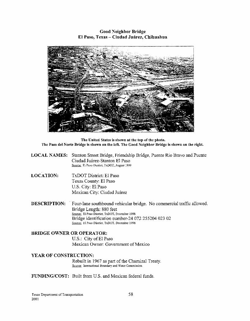
Good Neighbor Bridge El Paso, Texas - Ciudad Juarez, Chihuahua
The United States is shown at the top of the photo. The Paso del Norte Bridge is shown on the left. The Good Neighbor Bridge is shown on the right.
LOCAL NAMES: Stanton Street Bridge, Friendship Bridge, Puente Rio Bravo and Puente Ciudad Juarez-Stanton El Paso
LOCATION:
Source: El Paso District, TxDOT, August 1999
TxDOT District: El Paso Texas County: El Paso U.S. City: El Paso Mexican City: Ciudad Juarez
DESCRIPTION: Four-lane southbound vehicular bridge. No commercial traffic allowed. Bridge Length: 880 feet Source: E1 Paso District, TxDOT, December 1998
Bridge identification number-24 072 255204 023 02 Source: El Paso District, TxDOT, December 1998
BRIDGE OWNER OR OPERATOR: U.S.: City ofEl Paso Mexican Owner: Government ofMexico
YEAR OF CONSTRUCTION: Rebuilt in 1967 as part of the Chamizal Treaty. Source: International Boundary and Water Commission
FUNDING/COST: Built from U.S. and Mexican federal funds.
Texas Department of Transportation 2001
58
HOURS: 24 hours (POV only) Source: West Texas Customs Management Center, June 2001
TOLL: $1.25 Source: West Texas Customs Management Center, June 2001
STATUS OF U.S. PERMITS AND MEXICAN APPROVALS: U.S.: Presidential Permits are not required for bridges built before 1972.
BORDER STATION: The U.S. border station, owned by the General Services Administration, was completed in 1967. This is not a border station in the normal sense in that there are no pedestrians or inbound traffic. Source: General Services Administration, April2000
A northbound Dedicated Commuter Lane (DCL), which utilizes the SENTRI system, became operational on September 7, 1999. One lane of the bridge was converted for northbound traffic to allow for the DCL into El Paso. A new DCL prqcessing facility was constructed adjacent to the bridge to the west and is currently staffed by the Federal Inspection Services. The DCL is open from 6 a.m. to 10 p.m., Monday through Friday; and from 10 a.m. to 10 p.m. on Saturday. The DCL is closed on Sunday. Source: West Texas Customs Management Center, June 2001
CONNECTING ROADWAY: U.S.: US 62 Stanton Street runs concurrently with US 62.
Mexico: Near MEX 2, MEX 45
PLANNED IMPROVEMENTS: U.S.: The city ofEl Paso proposed rehabilitation of the existing bridge and updating of the toll collection systems at a cost of approximately $8.9 million. The city ofEl Paso is working on getting a SIB loan for the rehabilitation. Source: El Paso District, TxDOT, October 1999
Texas Department of Transportation 2001
59
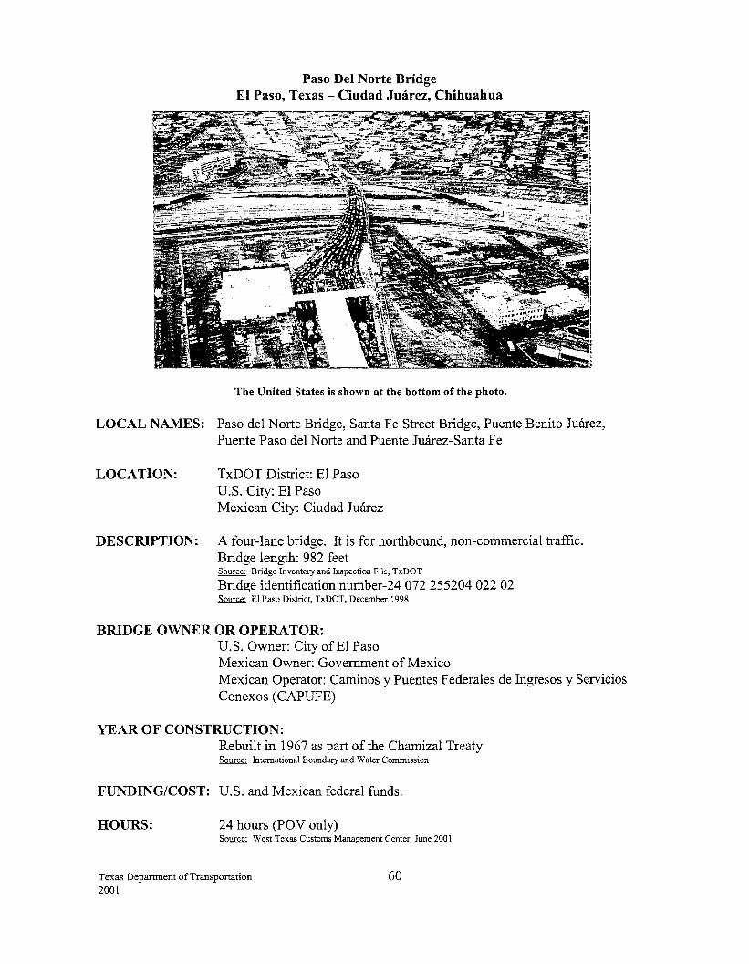
Paso Del Norte Bridge El Paso, Texas - Ciudad Juarez, Chihuahua
The United States is shown at the bottom o.fthe photo.
LOCAL NAMES: Paso del Norte Bridge, Santa Fe Street Bridge, Puente Benito Juarez, Puente Paso del Norte and Puente Juarez-Santa Fe
LOCATION: TxDOT District: E1 Paso U.S. City: El Paso Mexican City: Ciudad Juarez
DESCRIPTION: A four-lane bridge. It is for northbound, non-commercial traffic. Bridge length: 982 feet Source: Bridge Inventory and Inspection File, TxDOT
Bridge identification number-24 072 255204 022 02 Source: El Paso District, TxDOT, December 1998
BRIDGE OWNER OR OPERATOR: U.S. Owner: City ofEl Paso Mexican Owner: Government of Mexico Mexican Operator: Caminos y Puentes Federales de Ingresos y Servicios Conexos (CAPUFE)
YEAR OF CONSTRUCTION: Rebuilt in 1967 as part of the Chamizal Treaty Source: International Boundary and Water Commission
FUNDING/COST: U.S. and Mexican federal funds.
HOURS: 24 hours (POV only) Source: West Texas Customs Management Center, June 2001
Texas Department of Transportation 2001
60
TOLL: $1.80 Source: West Texas Customs Management Center, June 2001
STATUS OF U.S. PERMITS AND MEXICAN APPROVALS: U.S.: Presidential Permits are not required for bridges built before 1972.
BORDER STATION: U.S.: The U.S. border station was completed in 1967 as a result of the Chamizal Treaty when the channel of the Rio Grande River was moved. The General Services Administration owns the U.S. border station - which was renovated in 1991. Source: Border Station Task Force Book, November 1996
GSA and the Federal Inspection Services are planning to upgrade and expand the facilities. The project will expand the administration building, relocate the headhouse, expand the number of primary inspection lanes and reconfigure the secondary inspection area. GSA has received some funding from the TEA-21 program and will request the remaining funds in future years. Source: General Services Administration, June 200 I
CONNECTING ROADWAY: U.S.: US 85, El Paso Street runs concurrently with US 85. Mexico: Near MEX 2
PLANNED IMPROVEMENTS: U.S.: The city ofEl Paso proposes rehabilitation of the existing bridge and updating the toll collection systems. The city ofEl Paso and TxDOT propose aesthetic enhancements to the existing bridge once the rehabilitation is completed. Enhancements include covered pedestrian walkways, landscaping and improvements to the park area on the U.S. side. The city ofEl Paso is working on getting a SIB loan for the rehabilitation. Source: El Paso District, TxDOT, October 1999
Texas Department of Transportation 2001
61
Texas Department of Transportation 2001
Appendix I Proposed Bridges
62
Port of Brownsville Bridge Brownsville, Texas- Matamoros, Tamaulipas
LOCAL NAMES: Port ofBrownsville-Matamoros Bridge and Puente Intemacional del Puerto de Brownsville
LOCATION: TxDOT District: Pharr Texas County: Cameron U.S. City: Brownsville Mexican City: Matamoros
DESCRIPTION: A four-lane vehicular bridge. A single-track railroad bridge to be developed at a later date. The sponsor has requested that the crossing be used exclusively for commercial traffic. Source: U.S. Department of State, December 1996
BRIDGE OWNER OR OPERA TOR: U.S.: Port of Brownsville
FUNDING/COST: U.S.: The $31 million for bridge, federal facilities and connecting roads is to be funded completely by the Port of Brownsville through General Obligation Bonds, if project financing does not become available. Source: Pharr District, Tx.DOT, March 1999
Source: Raul Besteiro, CEO/Port Director, Port of Brownsville, November 1999
TOLL: Yes
STATUS OF U.S. PERMITS AND MEXICAN APPROVALS: U.S.: The Brownsville Navigation District (BND)/Port of Brownsville submitted an amended Presidential Permit application and environmental assessment on August 14, 1995. The U.S. Department of State has received all information requested from the Port of Brownsville and on October 9, 1997, the Department of State made a finding that two international bridges sponsored by the Brownsville Navigation District (BND) would have no significant impact on the environment. The BND's Presidential Permit was signed on October 12, 1997, and issued on November 3, 1997. The Port has obtained a Section 404 Wetlands Permit and a Section 401 Water Quality Certification from the Texas Natural Resource Conservation Commission (TNRCC). Source: Pharr District, TxDOT, March 1999
Source: Raul Besteiro, CEO/Port Director, Port of Brownsville, November 1999
No Coast Guard permit application yet received. Source: Office of Bridge Administration, U.S. Coast Guard, June 2001
Texas Department of Transportation 2001
63
CONNECTING ROADWAY: U.S.: The Port will construct a new road to connect South Port Road to the bridge and will extend the port railroad to the bridge site crossing State Highway (SH) 4. The connecting roadway will be funded 100 percent by the Port. Source: Pharr District, TxDOT, March 1999
BRIDGE CONSTRUCTION STATUS: U.S.: The Board and Administration continue to pursue the Diplomatic Notes from the Mexican government to begin the preliminary construction of the span between Brownsville and Matamoros. Coordination with the SCT and SRE are ongoing in an effort to gain their support for the diplomatic notes requested. Coordination for the state of Tamaulipas' support of the project is also ongoing. Source: Raul Besteiro, CEO/Port Director, Port of Brownsville, June 2001
Texas Department of Transportation 2001
64
Donna International Bridge Donna, Texas - Rio Bravo, Tamaulipas
LOCAL NAMES: Donna/Rio Bravo Bridge, Puente Rio Bravo-Donna
LOCATION: TxDOT District: Pharr Texas County: Hidalgo U.S. City: Donna Mexican City: Rio Bravo
DESCRIPTION: An eight-lane bridge is proposed. Source: Pharr District, TxDOT
Bridge will be approximately 2700 feet long. Source: Robert Diaz de Leon, City Manager, December 1996
BRIDGE OWNER OR OPERATOR: U.S.: City of Donna
FUNDING/COST: U.S.: $13 million for bridge, land acquisition, and access roads. In 1993, the City of Donna awarded a management contract to the Christie Bridge Corporation. This contract allows the corporation to build and manage the bridge for a 20-year period. Source: Roberto Diaz de Le6n, Donna City Manager, February 1995
TOLL: Yes
STATUS OF U.S. PERMITS AND MEXICAN APPROVALS: U.S.: The City of Donna submitted a Presidential Permit application, which was approved on August 22, 1979.
Mexico: The City of Rio Bravo is funding the studies to obtain the appropriate permit. Source: Centro S.C.T. Chihuahua, June 2001
BRIDGE CONSTRUCTION STATUS: U.S.: Pending
Mexico: Pending, subject to permit. Source: Centro S.C.T. Chihuahua, June 2001
CONNECTING ROADWAY: U.S.: FM493
Mexico: Highway 112 Source: Centro S.C.T. Chihuahua, June 2001
Texas Department of Transportation 2001
65
Anzalduas International Bridge Hidalgo, Texas -Reynosa, Tamaulipas
LOCAL NAMES: Sharyland Bridge, Anzalduas International Crossing and Puente Internacional Reynosa-McAllen
LOCATION: TxDOT District: Pharr Texas County: Hidalgo U.S. City: Hidalgo Mexican City: Reynosa
DESCRIPTION: A four-lane vehicular undivided bridge would be constructed initially with sufficient right-of-way for expansion to an eight-lane divided bridge. Source: Anzalduas International Crossings, Road and Rail, Halff Associates, Inc. Prepared for the McAllen, Hidalgo, Mission International Bridge Board, December 1993.
BRIDGE OWNER OR OPERATOR: U.S.: Cities of Hidalgo, McAllen and Mission
FUNDING/COST: U.S.: $2.8 million for city toll booths, $12.9 million for bridge and international road, $5.8 million for access road
TOLL:
Source: Anzalduas International Crossings, Martin Molloy, Halff Associates, Inc. Border Walk, February 1995
Yes
STATUS OF U.S. PERMITS AND MEXICAN APPROVALS: U.S.: The cities of Hidalgo, Mission and McAllen submitted a revised application for a Presidential Permit dated March 1996 to the State Department for review. In September 1998, the sponsors provided the "1998 Anzalduas Bridge Traffic Study" and supplemental information related to the Presidential Permit to the Department of State for review. The Presidential Permit, which was issued in July 1999, includes caveats outlining minimum traffic volumes at the Pharr/Reynosa Bridge with specific timelines before the bridge can be let to contract. Source: Presidential Permit, Number 99-01, Department of State, July 1999 Source: Pharr District, TxDOT, August 1999
Mexico: In the process of being approved by CABIN. Source: Centro S.C.T. Chihuahua, June 2001
BRIDGE CONSTRUCTION STATUS: Construction of the bridge will not begin sooner than April1, 2003 and the bridge will not open sooner than January 1, 2005. Source: Presidential Permit, Number 99-01, Department of State, July 1999
CONNECTING ROADWAY: U.S.: TxDOT is committed to a connection from FM 494 to the proposed bridge. Estimated cost is $5.8 million. Source: Pharr District, TxDOT, February 1997
Texas Department of Transportation 2001
66
PLANNED IMPROVEMENTS: U.S.: FM 2220 (Ware Rd.), From US 83 Expressway South to FM1016; Length: 4.8 km.; Cost: an estimated $5.1 million. This project extended the five-lane urban divided project south from the US 83 Expressway to the McAllen International Trade Zone along FM 1016. This facility will provide the international truck traffic a direct connector to the US 83 Expressway and includes a bridge at the pilot channel. Phase I (US 83 to Yuma St.) was let in March 1999, and phase II (Yuma St. to FM 1016) was let in August 1999. Both project phases were completed by September 2000. Source: Pharr District, TxDOT, November 2000
FM 494, from FM 1016 to FM 1016 (South Loop) through the city of Granjeno. The project, let in May 1999 for $1.4 million and completed in December 1999, upgraded this section to two lanes with shoulders and a curb and gutter section. Source: Pharr District, TxDOT, March 2000
FM 1016, from US 83 to Bentsen Road. Roadway will be widened to four lanes with shoulders. Cost is estimated at $5.0 million. Phase I (Bentsen Rd. to Madero) was let in August 2000 and is 50% complete. Phase II (Madero to US 83) is scheduled for FY 2004. Source: Pharr District, TxDOT, June 2001
Texas Department of Transportation 2001
67
Mission International Bridge Mission, Texas- Reynosa, Tamaulipas
LOCAL NAMES: Mission Bridge, Puente Internacional Reynosa-Mission, and MissionMadera Bridge
LOCATION: TxDOT District: Pharr Texas County: Hidalgo U.S. City: Mission Mexican City: Reynosa
DESCRIPTION: A four-lane vehicular and railroad bridge is proposed. Source: Design Division, TxDOT
BRIDGE OWNER OR OPERA TOR: U.S.: City of Mission
TOLL: Yes
STATUS OF U.S. PERMITS AND MEXICAN APPROVALS: U.S.: The City of Mission submitted a Presidential Permit application, which was approved December 29, 1978. A USCG bridge permit issued in 1980 became null and void because construction was not commenced in a timely manner. The City of Mission needs to apply for another permit before beginning construction. Source: Pat Townsend, Jr., Mission City Manager Source: Office of Bridge Administration, U.S. Coast Guard, November 2000
BRIDGE CONSTRUCTION STATUS: Pending
CONNECTING ROADWAY: U.S.: New road to interconnect FM 1016
Texas Department of Transportation 2001
68
Los Ebanos International Bridge Los Ebanos, Texas -Gustavo Diaz Ordaz, Tamaulipas
LOCAL NAMES: Los Ebanos Bridge, Puente Intemacional Diaz Ordaz-Los Ebanos
LOCATION: TxDOT District: Pharr Texas County: Hidalgo U.S. City: Los Ebanos Mexican City: Gustavo Diaz Ordaz
DESCRIPTION: A four-lane bridge is proposed to replace the Los Ebanos Ferry. Source: Design Division, TxDOT
BRIDGE OWNER OR OPERA TOR: U.S.: Reyna Family
FUNDING/COST: U.S.: The estimated cost would be $5 million for the structure. Total project cost is $6.5 million.
TOLL: Yes
STATUS OF U.S. PERMITS AND MEXICAN APPROVALS: U.S.: Presidential Permit pending. Updating environmental assessment. Source: Randolph DeLay, Consultant
Mexico: A committee determined that the permit for the existing crossing could be used. Source: Centro S.C.T. Chihuahua, June 2001
BRIDGE CONSTRUCTION STATUS: Pending
CONNECTING ROADWAY: U.S.: FM 886 to US 83 Mexico: Near MEX 2
Texas Department of Transportation 2001
69
Texas Department of Transportation 2001
Appendix II Inactive Bridges
70
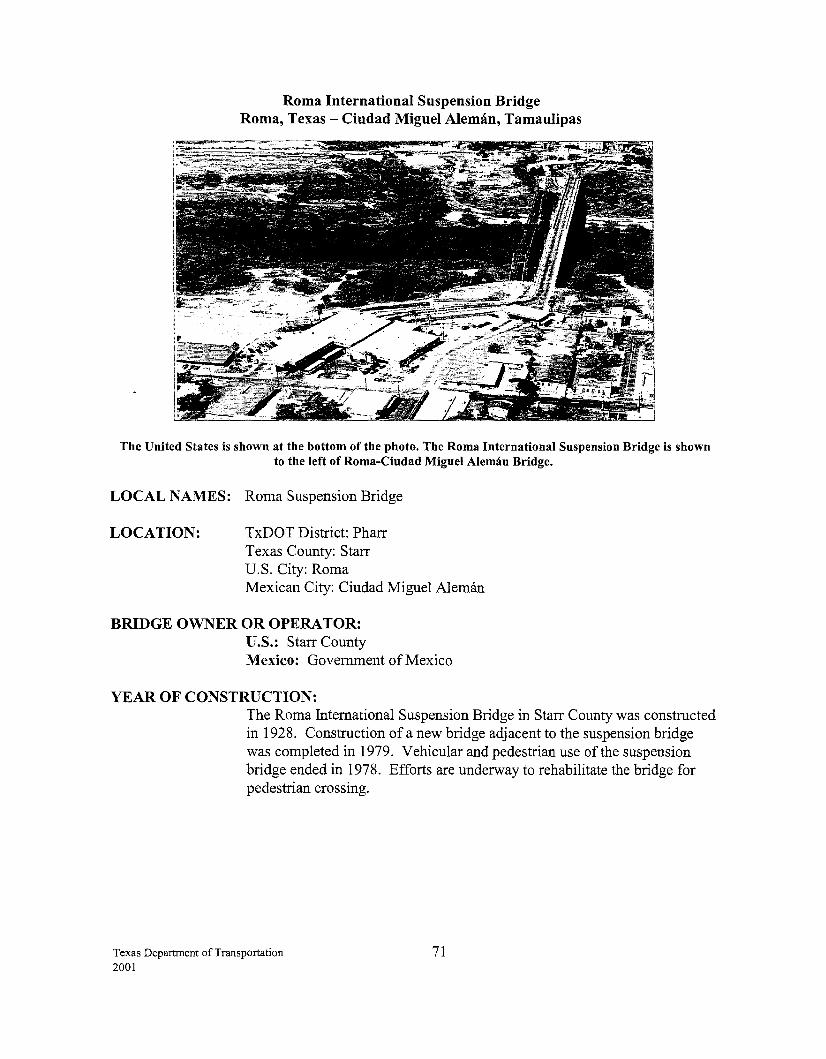
Roma International Suspension Bridge Roma, Texas - Ciudad Miguel Aleman, Tamaulipas
The United States is shown at the bottom of the photo. The Roma International Suspension Bridge is shown to the left of Roma-Ciudad Miguel Aleman Bridge.
LOCAL NAMES: Roma Suspension Bridge
LOCATION: TxDOT District: Pharr Texas County: Starr U.S. City: Roma Mexican City: Ciudad Miguel Aleman
BRIDGE OWNER OR OPERATOR: U.S.: Starr County Mexico: Government ofMexico
YEAR OF CONSTRUCTION: The Roma International Suspension Bridge in Starr County was constructed in 1928. Construction of a new bridge adjacent to the suspension bridge was completed in 1979. Vehicular and pedestrian use of the suspension bridge ended in 1978. Efforts are underway to rehabilitate the bridge for pedestrian crossing.
Texas Department ofTransportation 2001
71
FUNDING/COST: U.S.: Estimated construction costs are $1.2 million for the U.S. portion and $1.1 million for the Mexican portion. Through a Transportation Enhancement Project, the U.S. portion will be constructed using 80% federal funds and 20% local funds. Starr County and the City of Roma will fund the local 20% match as well as all costs above those approved under the Transportation Enhancement Program. Source: Pharr District, TxDOT, August 1999
Since it is beyond TxDOT's statutory authority to perform contracted work outside the boundary of the United States, only the portion of the suspension bridge on the Texas side of the river is eligible for U.S. federal funds. However, state and federal dollars have been spent to perform the inspection, structure analysis and design on the entire structure. Source: Pharr District, June 2001
Mexico: Approximately $200,000 of the ~eeded funds is available for the project. Source: Centro S.C.T. Chihuahua, June 2001
PLANNED IMPROVEMENTS: Because of its unique construction and historical significance, many want to preserve the Roma International Suspension Bridge for pedestrian use. It is one of the historical sites in the Caminos del Rio Heritage Corridor being jointly developed by Texas, U.S. and Mexican agencies. In 1993, the U.S. portion of the bridge was designated a National Historic Landmark-- the highest recognition for an historic property in the U.S. Source: Mario Sanchez, Texas Historical Commission, January 10, 1995
This is the last of many suspension bridges built across the Rio Grande in the early 20th century and in recent years concerns have been raised regarding the bridge's structural integrity. Source: Pharr District, TxDOT, August 1_998.
STATUS OF PROJECT: U.S.: Plans for rehabilitation of the Mexican half of the bridge were completed and provided to Mexico in December 1998. Plans for the U.S. portion were completed in February 1999. Source: Pharr District, TxDOT, August 1999
Mexico: The bridge has been declared a state historical landmark and national landmark recognition is being sought in order to receive federal funds for the rehabilitation. Source: Centro S.C.T. Chihuahua, June 2001
Texas Department of Transportation 2001
72
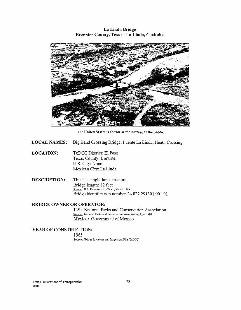
La Linda Bridge Brewster County, Texas -La Linda, Coahuila
The United States is shown at the bottom of the photo.
LOCAL NAMES: Big Bend Crossing Bridge, Puente La Linda, Heath Crossing
LOCATION: TxDOT District: El Paso Texas County: Brewster U.S. City: None Mexican City: La Linda
DESCRIPTION: This is a single-lane structure. Bridge length: 82 feet Source: U.S. Department of State, March 1999
Bridge identification number-24 022 291301 001 01
BRIDGE OWNER OR OPERATOR: U.S: National Parks and Conservation Association Source: National Parks and Conservation Association, April 1997
Mexico: Government ofMexico
YEAR OF CONSTRUCTION: 1965 Source: Bridge Inventory and Inspection File, TxDOT
Texas Department of Transportation 2001
73
HOURS: The La Linda Bridge has been closed to land traffic since July 30, 1997. The present bridge owner, the National Parks and Conservation Association, has been granted an extension of a removal order if they can adequately demonstrate an economic plan of action which satisfies the concerns ofthe U.S. inspection services. Source: U.S. Department of State, March 1999
The Government of Mexico responded via diplomatic note in December 1998 for a three-year extension of the removal order to launch an economic/eco-tourism feasibility study of the surrounding border area. Source: U.S. Department of State, March 1999 Source: S.C.T., December 1998
STATUS OF U.S. PERMITS AND MEXICAN APPROVALS: U.S.: Presidential Permits are not required for bridges built before 1972.
BORDER STATION: There is a border station on the Mexican side only and is owned by the Mexican government. Source: E1 Paso District, TxDOT
CONNECTING ROADWAY: U.S.: FM 2627 interconnects US 385.
Texas Department of Transportation 2001
74
Appendix III Texas, U.S. and Mexican Bridge Approval Processes
Texas Department of Transportation 2001
75
STATE OF TEXAS APPROVAL PROCESS FOR CONSTRUCTING INTERNATIONAL BRIDGES
BETWEEN TEXAS AND MEXICO
Senate Bill 1633, enacted by the 74th Texas Legislature (1995), requires a political subdivision or private entity to obtain approval from the Texas Transportation Commission for the construction of the bridge before requesting a Presidential Permit. TxDOT's Transportation Planning and Programming Division (TPP) is responsible for accepting and analyzing the applications submitted to the state by entities requesting permission to construct an international bridge across the Rio Grande. In making its determination, TPP consults with various divisions within TxDOT and various other agencies the TxDOT commission deems appropriate. Factors that are considered by the Commission include the local sponsor's fmancial resources, whether the bridge is consistent with the state and regional transportation plans, the facility's potential impact on the economy of the region, the environri:tent, traffic congestion and free flow of trade.
The process is initiated when the potential applicant(s) request(s) the standardized application forms from TxDOT. Immediately upon receipt of the completed application and the requisite 20 copies, TPP forwards one copy of the application to the designated points of contact at the following TxDOT divisions and office to determine if the application is complete:
+ Design Division (DES) + Environmental Affairs Division (ENV) + Finance Division (FIN) + Right of Way Division (ROW) + International Relations Office (IRO)
If the application is deemed incomplete, it is returned and the process is repeated when the application is resubmitted. Once it has been determined that the application is complete or that the resubmitted application is no longer deficient, TPP notifies the applicant and the Governor's Office, in writing, that the application meets the requirements of Title 43 TAC, Section 15.74 and begins the analysis.
TPP is responsible for the following actions: + Sends a copy of the application to the following agencies and local government entities,
requesting their comments:
• • • • • • •
Department of Public Safety Natural Resource Conservation Commission Department of Agriculture Historical Commission Alcoholic Beverage Commission Texas Department of Economic Development; General Land Office; and Other agencies the Commission deems appropriate .
+ Sends a copy of the application to the Governor's Office, requesting comments.
+ Requests analysis and the written results of that analysis from each TxDOT division and office mentioned above.
+ Sends an application and requests analysis and the written results of that analysis from the appropriate district(s) and Metropolitan Planning Organization(s) (MPOs).
Texas Department of Transportation 2001
76
+ Coordinates with Tx:DOT's General Counsel Office (OGC) to accomplish the following:
• Schedule public hearing • Advertise public hearing • Conduct public hearing
+ Compiles and summarizes public hearing comments.
+ Analyzes compliance with the state transportation plan and, if appropriate, with the regional transportation plan developed by the metropolitan planning organization having jurisdiction over the project.
+ Compiles and summarizes responses form state agencies, division, district(s), MPOs and /or local government entities.
+ Prepares and sends staff response along with recommendation for commission action to the Executive Director through the Deputy Executive Director for Transportation Planning and Development.
+ Coordinates with OGC to prepare documents and include on the commission meeting agenda recommended action.
+ Notifies applicants and the Governor's Office in writing of commission action.
For more detailed information about the TxDOT permit process, please contact the Tx:DOT Transportation Planning and Programming Division at (512) 486-5038.
Texas Department of Transportation 2001
77
FEDERAL APPROVAL PROCESS FOR CONSTRUCTING INTERNATIONAL BRIDGES BETWEEN the UNITED STATES and MEXICO
United States: The U.S. federal approval process begins with the application for a Presidential Permit. The process is based on the International Bridges Act of 1972, (33 U.S.C. 535 et seq.) and Executive Order (E.O.) 11423, 33 FR 11741 (1968) as amended by E.O. 12847, 58 FR 96 (1993). The law authorizes the President to issue permits for construction of international bridges and to issue a Presidential Permit for a bridge if construction is deemed to be in the national interest. The responsibility for issuing Presidential Permits has been delegated to the Department of State. Prior to the International Bridges Act, approval to construct an international bridge was granted by individual Acts of Congress.
The Presidential Permit process involves the collaboration of both federal and Texas State agencies and may take several years due to environmental and other issues involved. Federal agencies participating in this permitting process are: Department of the Treasury (U.S. Customs Service), Department of Justice (U.S. Immigration and Naturalization Service), Agriculture (Animal and Plant Health Inspection Service), Food and Drug Administration, Department of Transportation (Federal Highway Administration, Federal Railroad Administration, U.S. Coast Guard), Department of Commerce, Environmental Protection Agency, Department of the Interior (U.S. Fish and Wildlife Service), and the Department of Defense. These agencies are invited by the Department of State to comment on the permit application and on the environmental and other documentation submitted by the sponsor.
The Secretary of State or the Secretary's designee, after receiving the comments of the various agencies and after resolving questions that may arise during the consultative process, decides whether or not the construction of the proposed bridge is in the national interest. If a Finding of No Significant Impact (FONSI) is made, the Department of State proceeds to issue a Presidential Permit.
After the Presidential Permit is issued, the sponsor must get a permit from the U.S. Coast Guard. The International Boundary and Water Commission (IBWC) must grant its approval as well. If the site of the proposed crossing is owned by the IBWC, the sponsor must obtain a license from the Commission. If the land is privately owned, the sponsor must get the IBWC's approval. Approval is based on the design criteria of the bridge and must meet the terms specified in the 1970 Boundary Treaty.
Once the United States and Mexican governments concur on the construction of an international bridge, understanding on points of contact how to move forward with construction and other matters are reached through an exchange of diplomatic notes. For further information about the Presidential Permit process contact the Coordinator for US-Mexico Border Affairs at (202) 647-8529. Source: US-Mexico Border Affairs, U.S. Department of State, March 1999
Mexico: The Mexican approval process for constructing international bridges is similar to that of the United States. The flowcharts on the following pages provide the detailed procedures and requirements. Source: SCT, February 1999
Texas Department of Transportation 2001
78
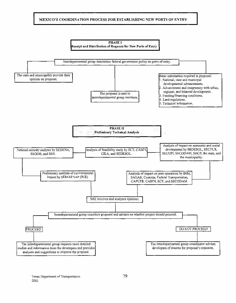
I
MEXICO'S COORDINATION PROCESS FOR ESTABLISHING NEW PORTS OF ENTRY
PHASE I Receipt and Distribution of Requests for New Ports of Entry
I Interdepartmental group determines federal government policy on ports of entry. I
I The state an~ :nunicipality provide their J opm10n on proposal.
National security analysis by SEDENA, I SEGOB, and SRE. J
The proposal is sent to interdepartmental group members.
PHASE II Preliminary Technical Analysis
jAnalysis of feasibility study by SCT, CABIN~ I CILA, and SEDESOL. _1
Basic information required in proposal: 1. National, state and municipal
developmental advancements. 2. Advancement and congruency with urban,
regional, and bilateral development. B. Funding/financing conditions. ~- Land regulations. 5. Technical information.
Analysis of impact on economic and social development by SEDESOL, SECTUR,
SECOFI, SECODAM, SHCP, the state, and the municipality.
I Preliminary analysis of environmental Analysis of impact on port operations by INM,
l impact by SEMARNAP (INE). SAGAR, Customs, Federal Transportation, CAPUFE, CABIN, SCT, and SECODAM.
I SRE receives and analyzes opinions. I I
J Interdepartmental group considers proposal and advises on whether project should proceed. I I
!PROCEED I
The interdepartmental group requests more detailed studies and information from the developers and provides
analyses and suggestions to improve the proposal.
Texas Department of Transportation 2001
I DO NOT PROCEED
The interdepartmental group coordinator advises developers of reasons for proposal's rejection.
79
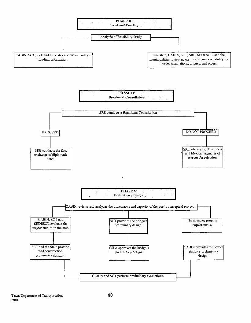
I
CABIN, SCT, SRE and the states review and analyze funding information.
I
I PROCEED I
SRE conducts the first exchange of diplomatic
notes.
PHASE ill Land and Funding
Analysis of Feasibility Study
PHASE IV Binational Consultation
The state, CABIN, SCT, SRE, SEDESOL, and the municipalities review guarantees of!and availability for
border installations, bridges, and access.
SRE conducts a Binational Consultation I
PHASEV Preliminary Design
DO NOT PROCEED j
SRE advises the developers and Mexican agencies of
reasons for rejection.
I 1cABIN reviews and analyzes the dimensions and capacity of the port's conceptual project. I
CABIN, SCT and SEDESOL evaluate the
impact studies in the area.
SCT and the State provide road construction
preliminary designs.
Texas Department of Transportation 2001
I I
SCT provides the bridge's The agencies propose preliminary design. requirements.
CILA approves the bridge's CABIN provides the borde
preliminary design. station's preliminary design.
CABIN and SCT perform preliminary evaluations. I I
80
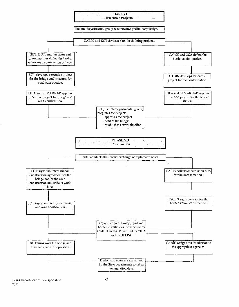
PHASE VI Executive Projects
flbe interdepartmental group recommends preliminary design.
J J CABIN and SCT devise a plan for defining projects.
SCT, DOT, and the states and municipalities define the bridge
and/or road construction projects.
SCT develops executive project for the bridge and/or access for
road construction.
CILA and SEMARNAP approve executive project for bridge and
road construction.
SCT signs the International Construction agreement for the
bridge and/or the road construction and solicits work
bids.
SCT signs contract for the bridge and road construction.
SCT turns over the bridge and finished roads for operation.
Texas Department of Transportation 2001
I
SRE, the interdepartmental group, !integrates the project:
-approves the project -defines the budget -establishes a work timeline
PHASE VII Construction
SRE conducts the second exchange of diplomatic notes
Construction ofbridge, road and border installations. Supervised by CABIN and SCT; verified by CILA
and PROFEP A.
Diplomatic notes are exchanged by the State departments to set an
inauguration date.
81
I I
I CABIN and GSA defme the
border station project.
CABIN develops executive project for the border station.
I CILA and SEMARNAP approve executive project for the border
station.
CABIN solicits construction bids for the border station.
CABIN signs contract for the border station construction.
CABIN assigns the installation to the appropriate agencies.
I

Texas Department of Transportation 2001
Appendix IV Traffic Counts
82
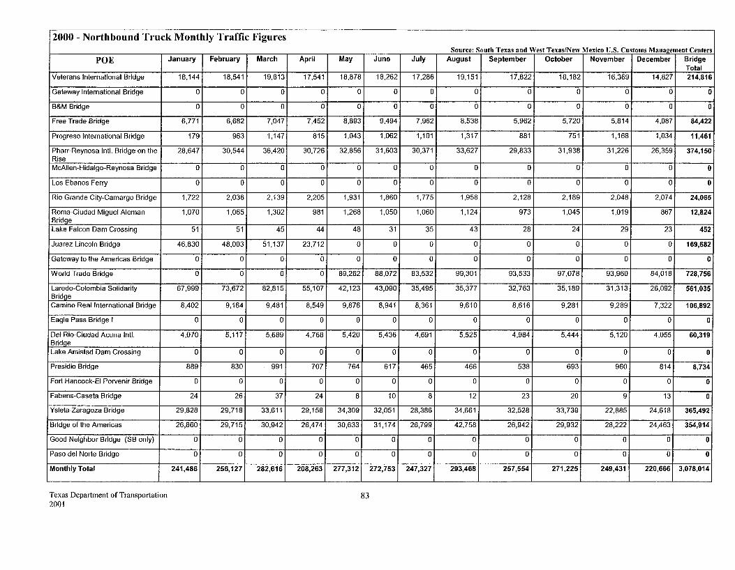
2000- Northbound Truck Monthly Traffic Figures
POE
Veterans International Bridge
Gateway International Bridge
B&M Bridge
Free Trade Bridge
Progreso International Bridge
Pharr-Reynosa Inti. Bridge on the Rise McAIIen-Hidalgo-Reynosa Bridge
Los Ebanos Ferry
Rio Grande City-Camargo Bridge
Roma-Ciudad Miguel Aleman Bridqe Lake Falcon Dam Crossing
Juarez-Lincoln Bridge
Gateway to the Americas Bridge
World Trade Bridge
Laredo-Colombia Solidarity Bridge Camino Real International Bridge
Eagle Pass Bridge I
Del Rio-Ciudad Acuna Inti. Bridqe Lake Amistad Dam Crossing
Presidio Bridge
Fort Hancock-EI Porvenir Bridge
Fabens-Caseta Bridge
Ysleta-Zaragoza Bridge
Bridge of the Americas
Good Neighbor Bridge (SB only)
Paso del Norte Bridge
Monthly Total
Texas Department of Transportation 2001
January
18,144
0
0
6,771
179
28,647
0
0
1,722
1,070
51
46,830
0
0
67,999
8,402
0
4,070
0
889
0
24
29,828
26,860
0
0
241,486
February March
18,541 19,813
0 0
0 0
6,682 7,047
963 1,147
30,544 36,420
0 0
0 0
2,036 2,139
1,065 1,302
51 45
48,003 51,137
0 0
0 0
73,672 82,815
9,164 9,481
0 0
5,117 5,689
0 0
830 991
0 0
26 37
29,718 33,611
29,715 30,942
0 0
0 0
256,127 282,616
April May June
17,541 18,878 18,262
0 0 0
0 0 0
7,452 8,893 9,494
815 1,043 1,062
30,726 32,856 31,603
0 0 0
0 0 0
2,205 1,931 1,860
981 1,268 1,050
44 48 31
23,712 0 0
0 0 0
0 89,262 88,072
55,107 42,123 43,090
8,549 9,876 8,941
0 0 0
4,768 5,420 5,436
0 0 0
707 764 617
0 0 0
24 8 10
29,158 34,309 32,051
26,474 30,633 31,174
0 0 0
0 0 0
208,263 277,312 272,753
83
Source: South Texas and West Texas/New Mexico U.S. Customs Management Centers July August September October November December Bridge
Total 17,286 19,151 17,822 18,182 16,369 14,827 214,816
0 0 0 0 0 0 0
0 0 0 0 0 0 0
7,962 8,538 5,962 5,720 5,814 4,087 84,422
1,101 1,317 881 751 1,168 1,034 11,461
30,371 33,627 29,833 31,938 31,226 26,359 374,150
0 0 0 0 0 0 0
0 0 0 0 0 0 0
1,775 1,958 2,128 2,189 2,048 2,074 24,065
1,060 1,124 973 1,045 1,019 867 12,824
35 43 28 24 29 23 452
0 0 0 0 0 0 169,682
0 0 0 0 0 0 0
83,532 99,301 93,533 97,078 93,960 84,018 728,756
35,495 35,377 32,763 35,189 31,313 26,092 561,035
8,361 9,610 8,616 9,281 9,289 7,322 106,892
0 0 0 0 0 0 0
4,691 5,525 4,984 5,444 5,120 4,055 60,319
0 0 0 0 0 0 0
465 466 538 693 960 814 8,734
0 0 0 0 0 0 0
8 12 23 20 9 13 0
28,386 34,661 32,528 33,739 22,885 24,618 365,492
26,799 42,758 26,942 29,932 28,222 24,463 354,914
0 0 0 0 0 0 0
0 0 0 0 0 0 0
247,327 293,468 257,554 271,225 249,431 220,666 3,078,014
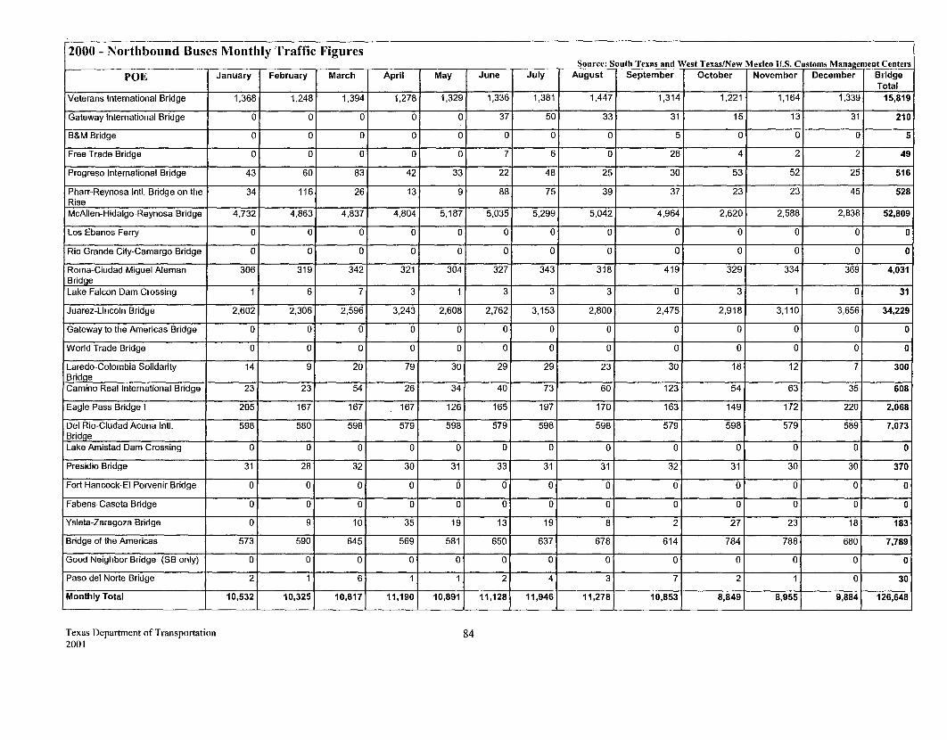
2000 - Northbound Buses Monthly Traffic Figures
POE
Veterans International Bridge
Gateway International Bridge
B&M Bridge
Free Trade Bridge
Progreso International Bridge
Pharr-Reynosa Inti. Bridge on the Rise McAIIen-Hidalgo-Reynosa Bridge
Los Ebanos Ferry
Rio Grande City-Camargo Bridge
Roma-Ciudad Miguel Aleman Bridge Lake Falcon Dam Crossing
Juarez-Lincoln Bridge
Gateway to the Americas Bridge
World Trade Bridge
Laredo-Colombia Solidarity Bridge Camino Real International Bridge
Eagle Pass Bridge I
Del Rio-Ciudad Acuna Inti. Bridge Lake Amistad Dam Crossing
Presidio Bridge
Fort Hancock-EI Porvenir Bridge
Fabens-Caseta Bridge
Ysleta-Zaragoza Bridge
Bridge of the Americas
Good Neighbor Bridge (SB only)
Paso del Norte Bridge
Monthly Total
Texas Department ofTranspo1tation 2001
January
1,368
0
0
0
43
34
4,732
0
0
306
1
2,602
0
0
14
23
205
598
0
31
0
0
0
573
0
2
10,532
February March
1,248 1,394
0 0
0 0
0 0
60 83
116 26
4,863 4,837
0 0
0 0
319 342
6 7
2,306 2,596
0 0
0 0
9 20
23 54
167 167
580 598
0 0
28 32
0 0
0 0
9 10
590 645
0 0
1 6
10,325 10,817
April May June
1,278 1,329 1,336
0 0 37
0 0 0
0 0 7
42 33 22
13 9 88
4,804 5,187 5,035
0 0 0
0 0 0
321 304 327
3 1 3
3,243 2,608 2,762
0 0 0
0 0 0
79 30 29
26 34 40
167 126 165
579 598 579
0 0 0
30 31 33
0 0 0
0 0 0
35 19 13
569 581 650
0 0 0
1 1 2
11,190 10,891 11,128
84
Source: South Texas and West Texas/New Mexico U.S. Customs Mana~ement Centers July August September October November December Bridge
Total 1,381 1,447 1,314 1,221 1,164 1,339 15,819
50 33 31 15 13 31 210
0 0 5 0 0 0 5
6 0 28 4 2 2 49
48 25 30 53 52 25 516
75 39 37 23 23 45 528
5,299 5,042 4,964 2,620 2,588 2,838 52,809
0 0 0 0 0 0 0
0 0 0 0 0 0 0
343 318 419 329 334 369 4,031
3 3 0 3 1 0 31
3,153 2,800 2,475 2,918 3,110 3,656 34,229
0 0 0 0 0 0 0
0 0 0 0 0 0 0
29 23 30 18 12 7 300
73 60 123 54 63 35 608
197 170 163 149 172 220 2,068
598 598 579 598 579 589 7,073
0 0 0 0 0 0 0
31 31 32 31 30 30 370
0 0 0 0 0 0 0
0 0 0 0 0 0 0
19 8 2 27 23 18 183
637 678 614 784 788 680 7,789
0 0 0 0 0 0 0
4 3 7 2 1 0 30
11,946 11,278 10,853 8,849 8,955 9,884 126,648
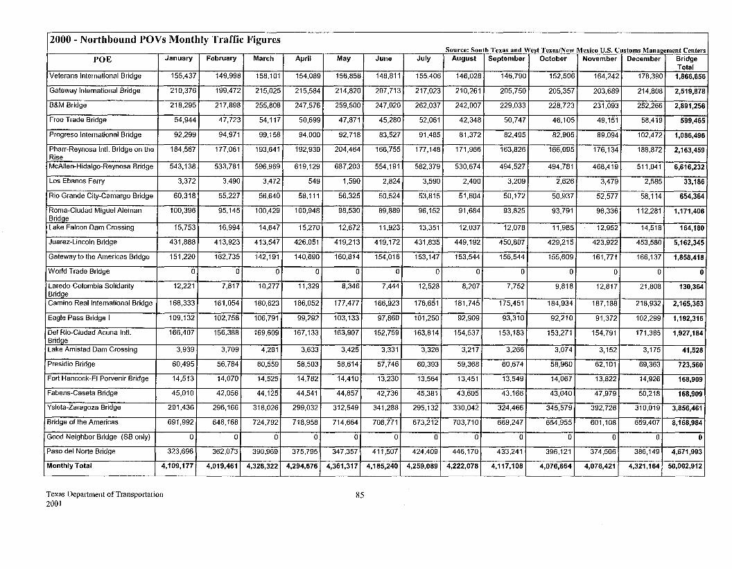
2000- Northbound POVs Monthly Traffic Figures
POE January
Veterans International Bridge 155,437
Gateway International Bridge 210,376
B&M Bridge 218,295
Free Trade Bridge 54,944
Progreso International Bridge 92,299
Pharr-Reynosa Inti. Bridge on the 184,567 Rise McAIIen-Hidalgo-Reynosa Bridge 543,138
Los Ebanos Ferry 3,372
Rio Grande City-Camargo Bridge 60,318
Roma-Ciudad Miguel Aleman 100,396 Bridge Lake Falcon Dam Crossing 15,753
Juarez-Lincoln Bridge 431,888
Gateway to the Americas Bridge 151,220
World Trade Bridge 0
Laredo-Colombia Solidarity 12,221 Bridge Camino Real International Bridge 168,333
Eagle Pass Bridge I 109,132
Del Rio-Ciudad Acuna Inti. 166,407 Bridqe Lake Amistad Dam Crossing 3,939
Presidio Bridge 60,495
Fort Hancock-EI Porvenir Bridge 14,513
Fabens-Caseta Bridge 45,010
Ysleta-Zaragoza Bridge 291,436
Bridge of the Americas 691,992
Good Neighbor Bridge (SB only) 0
Paso del Norte Bridge 323,696
Monthly Total 4,109,177
Texas Department of Transportation 2001
February March
149,998 158,101
199,472 215,025
217,898 255,808
47,723 54,117
94,971 99,158
177,061 193,641
533,781 596,969
3,490 3,472
55,227 56,640
95,145 100,429
16,994 14,647
413,923 413,547
162,735 142,191
0 0
7,817 10,277
161,054 180,623
102,758 106,791
156,388 169,609
3,709 4,281
56,784 60,559
14,070 14,525
42,056 44,125
296,166 318,026
648,168 724,792
0 0
362,073 390,969
4,019,461 4,328,322
April May June
154,089 156,858 148,811
215,584 214,820 207,713
247,576 259,500 247,020
50,699 47,871 45,280
94,000 92,718 83,527
192,930 204,464 166,755
619,129 687,203 554,191
549 1,590 2,824
58,111 56,325 50,524
100,948 98,530 89,889
15,270 12,672 11,923
426,051 419,213 419,172
140,690 160,814 154,016
0 0 0
11,329 8,346 7,444
186,052 177,477 166,923
99,292 103,133 97,860
167,133 163,907 152,759
3,633 3,425 3,331
58,503 58,614 57,746
14,782 14,410 13,230
44,541 44,857 42,736
299,032 312,549 341,288
718,958 714,664 708,771
0 0 0
375,795 347,357 411,507
4,294,676 4,361,317 4,185,240
85
Source: South Texas and West Texas/New Mexico U.S. Customs Management Centers July August September October November December Bridge
Total 155,406 146,028 146,790 152,506 164,242 178,390 1,866,656
217,023 210,261 205,750 205,357 203,689 214,808 2,519,878
262,037 242,007 229,033 228,723 231,093 252,266 2,891,256
52,061 42,348 50,747 46,105 49,151 58,419 599,465
91,485 81,372 82,495 82,905 89,094 102,472 1,086,496
177,148 171,966 163,826 166,095 176,134 188,872 2,163,459
582,379 530,674 494,527 494,781 468,419 511,041 6,616,232
3,590 2,400 3,209 2.626 3,479 2,585 33,186
53,815 51,604 50,172 50,937 52,577 58,114 654,364
96,152 91,684 93,825 93,791 98,336 112,281 1,171,406
13,351 12,037 12,078 11,985 12,952 14,518 164,180
431,835 449,192 450,807 429,215 423,922 453,580 5,162,345
153,147 153,544 156,544 155,609 161,771 166,137 1,858,418
0 0 0 0 0 0 0
12,528 8,207 7,752 9,818 12,817 21,808 130,364
176,651 181,745 175,451 184,934 187,188 218,932 2,165,363
101,250 92,909 93,310 92,210 91,372 102,299 1,192,316
163,814 154,537 153,183 153,271 154,791 171,385 1,927,184
3,326 3,217 3,266 3,074 3,152 3,175 41,528
60,393 59,368 60,674 58,960 62,101 69,363 723,560
13,564 13,451 13,549 14,067 13,822 14,926 168,909
45,381 43,605 43,166 43,040 47,979 50,218 168,909
295,132 330,042 324,466 345,579 392,726 310,019 3,856,461
673,212 703,710 669,247 654,955 601,108 659,407 8,168,984
0 0 0 0 0 0 0
424.409 446,170 433,241 396,121 374,506 386,149 4,671,993
4,259,089 4,222,078 4,117,108 4,076,664 4,076,421 4,321,164 50,002,912
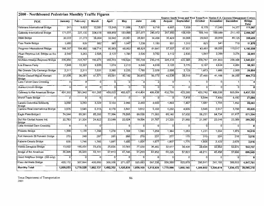
2000- Northbound Pedestrian Monthly Traffic Figures
POE January
Veterans International Bridge 241
Gateway International Bridge 171,031
B&M Bridge 30,033
Free Trade Bridge 1,080
Progreso International Bridge 166,397
Pharr-Reynosa Inti. Bridge on the 2,540 Rise McAIIen-Hidalgo-Reynosa Bridge 235,850
Los Ebanos Ferry 7,848
Rio Grande City-Camargo Bridge 2,311
Roma-Ciudad Miguel Aleman 37,526 BridQe Lake Falcon Dam Crossing 0
Juarez-Lincoln Bridge 0
Gateway to the Americas Bridge 404,302
World Trade Bridge 0
Laredo-Colombia Solidarity 3,058 Bridge Camino Real International Bridge 3,926
Eagle Pass Bridge I 74,544
Del Rio-Ciudad Acuna Inti. 22,783 Bridge Lake Amistad Dam Crossing 0
Presidio Bridge 1,399
Fort Hancock-EI Porvenir Bridge 272
Fabens-Caseta Bridge 830
Ysleta-Zaragoza Bridge 13,502
Bridge of the Americas 35,308
Good Neighbor Bridge (SB only) 0
Paso del Norte Bridge 455,172
Monthly Total 1,669,953
Texas Department of Transportation 2001
February March April
9,623 12,581 13,348
227,132 334,418 168,959
31,273 38,864 32,042
839 982 961
194,992 188,714 90,963
3,263 2,525 2,131
222,767 199,474 180,343
12,307 9,839 1,074
2,311 2,531 2,385
36,291 41 ,571 49,591
0 0 0
0 0 0
381,942 461,265 455,033
0 0 0
3,283 3,329 3,133
3,540 5,313 4,178
85,391 85,295 77,394
21,324 24,622 23,544
0 0
1 '138 1,298 1,278
248 297 281
1,746 1,765 1,891
195,454 23,433 25,624
36,320 43,141 57,813
0 0 0
307,844 400,880 300,336
1,779,028 1,882,137 1,492,302
May June
11,596 7,821
193,999 201,577
28,961 28,891
1,047 1,238
68,953 68,924
1,784 3,530
159,624 185,708
2,213 3,546
2,235 1,780
42,192 39,975
0 0
0 0
455,821 414,404
0 0
2,096 2,340
3,841 3,612
76,285 69,028
22,024 19,504
0 0
1,169 1,093
266 219
1,695 1,504
32,065 27,539
47,746 51,253
0 0
271,027 525,683
1,426,639 1,659,169
86
Source: South Texas and West Texas/New Mexico U.S. Customs Management Centers July August September October November December Bridge
Total 9,716 6,607 7,939 6,178 11,040 14,377 111,067
245,972 207,950 158,460 169,149 199,580 217,140 2,495,367
34,456 35,424 30,868 29,643 30,849 48,125 399,429
1,190 951 1,310 821 541 710 11,670
81,641 57,557 47,921 43,461 68,550 115,517 1,193,590
3,792 3,112 2,830 1,941 2,269 3,274 32,991
215,215 225,416 222,366 205,757 231,803 258,308 2,542,631
4,819 3,120 3,770 3,187 4,634 4,004 60,361
2,029 2,026 2,123 1,873 1,980 2,300 25,884
50,773 42,539 39,310 37,490 41,166 36,289 494,713
2 0 1 0 0 1 4
0 0 0 0 0 0 0
496,438 432,750 423,305 420,742 486,036 605,064 5,437,102
0 0 7,418 6,544 7,450 6,192 27,604
2,650 1,864 1,467 1,687 1,704 1,452 28,063
5,150 4,202 4,905 3,946 2,917 3,290 48,820
71,383 69,140 57,932 58,251 64,734 81,917 871,294
21,767 21,320 21,892 21,087 22,016 23,369 265,252
0 0 0 0 0 0 0
1,259 1,364 1,263 1,231 1,554 1,973 16,019
231 277 175 310 224 216 3,016
1,677 1,807 1,775 1,906 2,123 2,078 3,016
36,482 32,977 39,408 29,696 32,853 53,674 542,707
64,952 64,225 57,823 48,211 45,458 57,699 609,949
0 0 0 0 0 0 0
567,335 556,268 525,879 296,541 241,193 399,603 4,847,761
1,918,929 1,770,896 1,660,140 1,389,652 1,500,674 1,936,572 20,068,310

Texas Department of Transportation 2001
Appendix V Detailed Area Maps
87
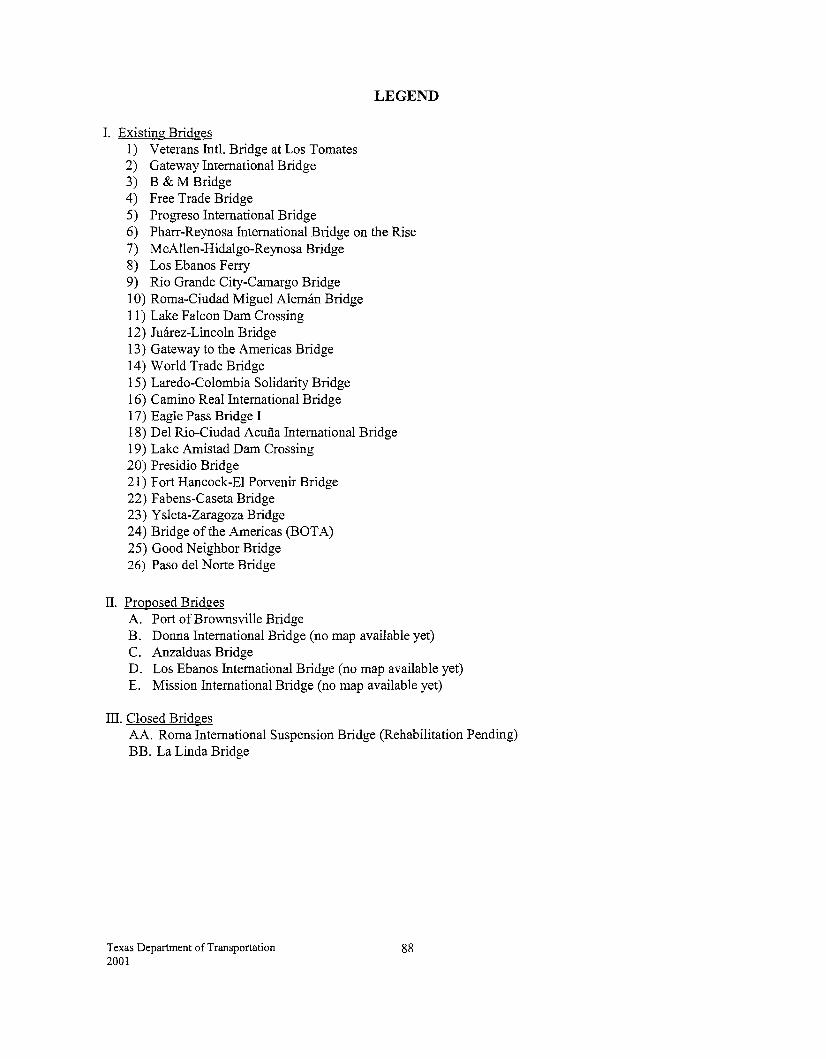
LEGEND
I. Existing Bridges 1) Veterans Intl. Bridge at Los Tomates 2) Gateway International Bridge 3) B & M Bridge 4) Free Trade Bridge 5) Progreso International Bridge 6) Pharr-Reynosa International Bridge on the Rise 7) McAllen-Hidalgo-Reynosa Bridge 8) Los Ebanos Ferry 9) Rio Grande City-Camargo Bridge 1 0) Roma-Ciudad Miguel Aleman Bridge 11) Lake Falcon Dam Crossing 12) Juarez-Lincoln Bridge 13) Gateway to the Americas Bridge 14) World Trade Bridge 15) Laredo-Colombia Solidarity Bridge 16) Camino Real International Bridge 1 7) Eagle Pass Bridge I 18) Del Rio-Ciudad Acuna International Bridge 19) Lake Amistad Dam Crossing 20) Presidio Bridge 21) Fort Hancock-El Porvenir Bridge 22) F abens-Caseta Bridge 23) Ysleta-Zaragoza Bridge 24) Bridge ofthe Americas (BOTA) 25) Good Neighbor Bridge 26) Paso del Norte Bridge
II. Proposed Bridges A. Port of Brownsville Bridge B. Donna International Bridge (no map available yet) C. Anzalduas Bridge D. Los Ebanos International Bridge (no map available yet) E. Mission International Bridge (no map available yet)
III. Closed Bridges AA. Roma International Suspension Bridge (Rehabilitation Pending) BB. La Linda Bridge
Texas Department of Transportation 2001
88
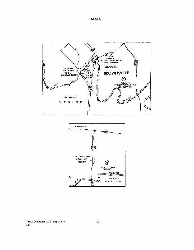
MAPS
MATAMOROS
MEXICO
Texas Department of Transportation 2001
LOS INDIOS
US CUSTOMS PORT OF +
ENTRY
89
US OJ&TOMS P'Oftt' OF ENll'Y
BROWNSVILLE
G) VETERANS
INTERNATIONAL BRIDGE
FREE TRADE BRIDGE
LOS TOMATES
Gll.ANDE
LUCIO BUWOO
MEXICO
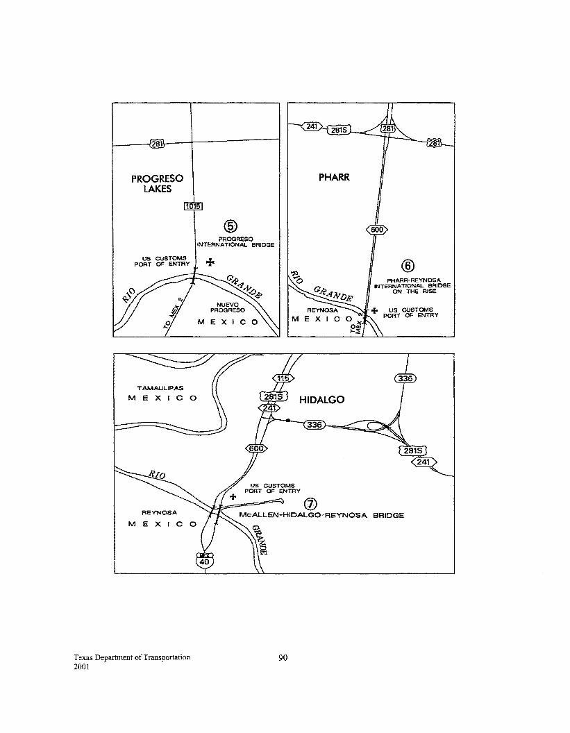
l------f281il.---l-------l
PROGRESO LAKES
1015
US CUSTOMS PORT OF ENTRY
REYNOSA
ME X I C
Texas Department of Transportation 2001
® PROGRESO
INTERNATIONAL BRIDGE
+
90
PHARR
® PHARR-REYNOSA
INTERNATIONAL BRIDGE ON THE RISE
+ US CUSTOMS PORT OF ENTRY
BRIDGE
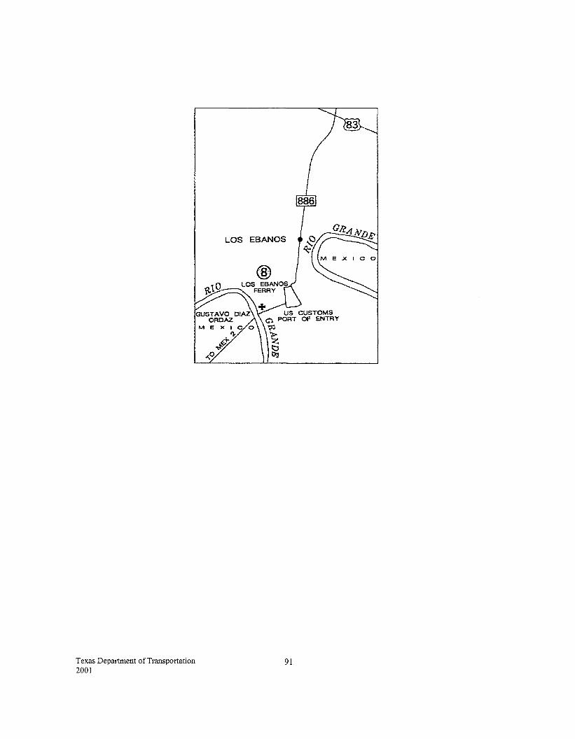
Texas Department of Transportation 2001
LOS EBANOS
®
US CUSTOMS 0 PORT OF ENTRY
~
~ t::J ttJ
91
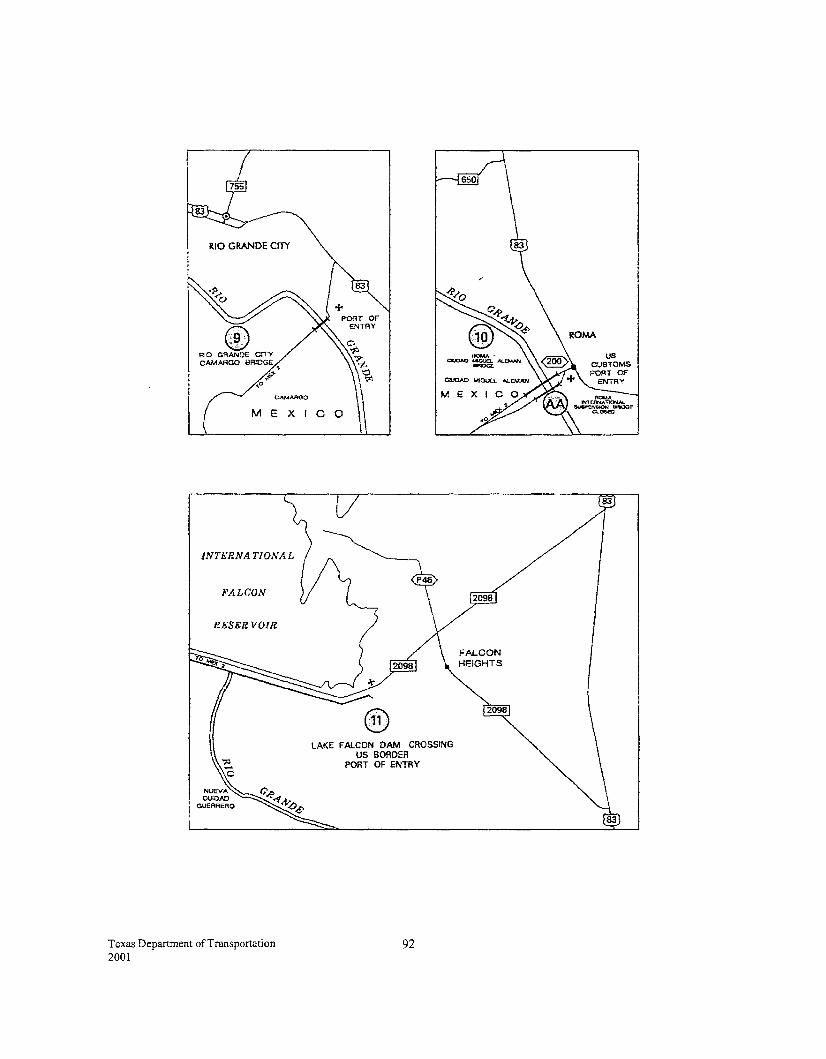
0 RIO GRANDE CI1'Y CAMARGO BRIDGE
~· ,o
CAMARGO
MEXICO
INTERNATIONAL
FALCON
Rh..SERVO!R
Texas Department of Transportation 2001
lAKE FALCON DAM CROSSING US BORDER
PORT OF ENTRY
92
2098
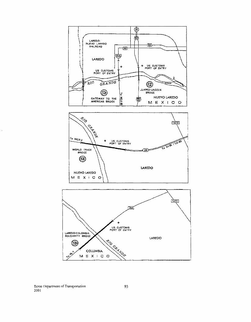
LAREDO· NUEVO LAREDO
RAILROAD
lAREDO
GATEWAY TO THE AMERICAS BR!OGE
+ US CUSTOMS PORT OF ENTRY
JUAREZ-LINCOLN BRIDGE
NUEVO lAREDO
MEXICO
WORLD TRADE 20 BRIDGE
NUEVO LAR.EOO
M E X I C
COLUMBIA
M EX I C
Texas Department of Transportation 2001
+ US CUSTOMS
PORT OF !:NTRY
93
lAREDO
lAREDO
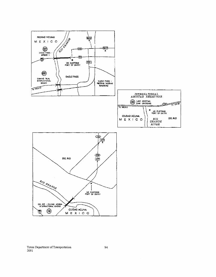
PIEDAAS NEGAAS
ME X l
US CUSTOMS PORT OF ENTRY
EAGLE PASS
Texas Department of Transportation 2001
EAGtE PASS • PIEDRAS NEGRAS
RAilROAD
94
INTERN A TJONAL AMISTAD RESER VOIR
@ LA1CE AMISTAD ~· DAM CROSSING ~
~~~~========~========~~3~~~~~~~0 u~~ rro MEX·2 \\
CIUOAOACUNA MEXICO
+ US CUSTOMS PORT OF ENTRY
RIO GRANDE RIVER
DELRIO
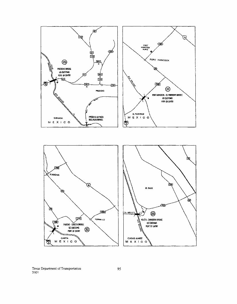
I'I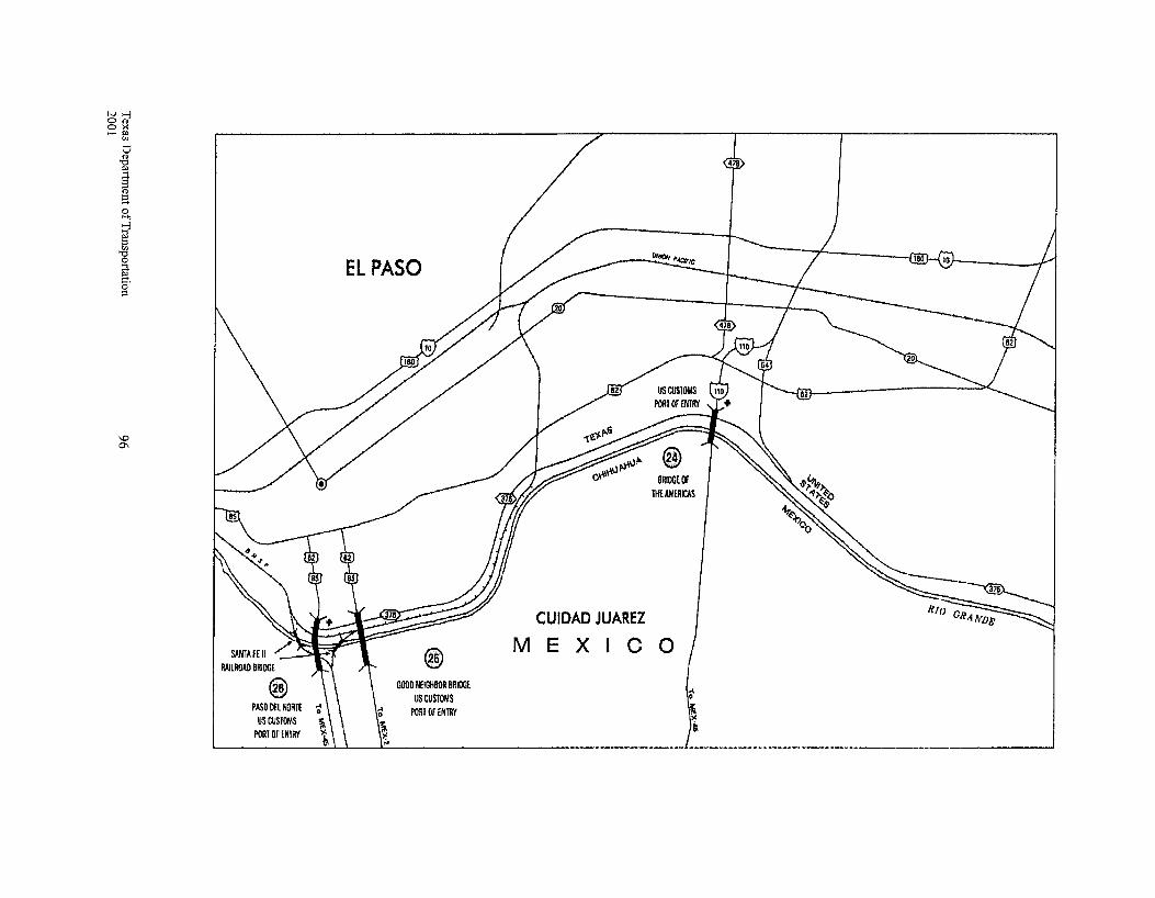
N>-j 0<1> ox _.,.,
en
PASO DEL NORTE US CUStOr.'S
PORT Of ENl!ff
EL PASO
@ GOOO NE!GHI!Ofl BRIDGE
US CUSTOMS PORI Or ENTAY
BmoGEOF lliEA.\IERICAS
CUIDAD JUAREZ
MEXICO
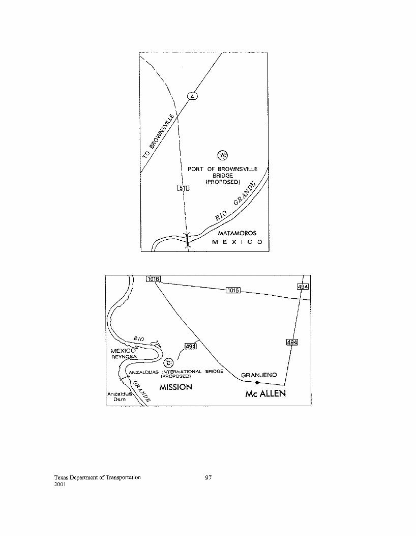
'
Texas Department of Transportation 2001
""' \ \ \
\
\ @ \ PORT OF BROWNSVILLE
~ \
\
BRIDGE (PROPOSED) ~
~'V ~~
0
MEXICO
BRIDGE
MISSION Me ALLEN
97
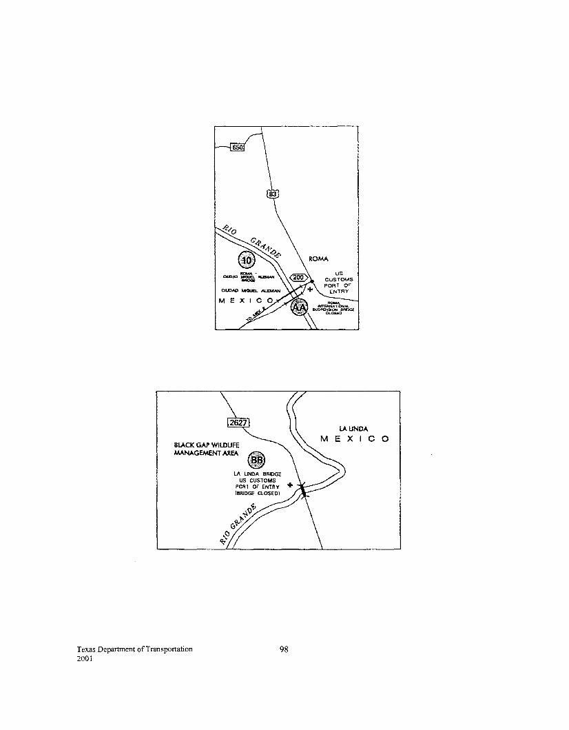
BLACK GAP WllDUfE MANAGEMENT AREA
Texas Department of Transportation 2001
98
LAUNDA MEXICO
Texas Department of Transportation 2001
Appendix VI Glossary
99
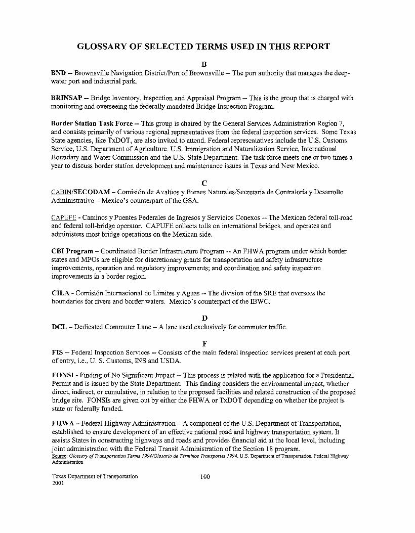
GLOSSARY OF SELECTED TERMS USED IN THIS REPORT
B BND --Brownsville Navigation District/Port of Brownsville-- The port authority that manages the deepwater port and industrial park.
BRINSAP -- Bridge Inventory, Inspection and Appraisal Program-- This is the group that is charged with monitoring and overseeing the federally mandated Bridge Inspection Program.
Border Station Task Force - This group is chaired by the General Services Administration Region 7, and consists primarily of various regional representatives from the federal inspection services. Some Texas State agencies, like TxDOT, are also invited to attend. Federal representatives include the U.S. Customs Service, U.S. Department of Agriculture, U.S. Immigration and Naturalization Service, International Boundary and Water Commission and the U.S. State Department. The task force meets one or two times a year to discuss border station development and maintenance issues in Texas and New Mexico.
c CABIN/SECODAM- Comisi6n de Avaluos y Bienes Naturales/Secretaria de Contraloria y Desarrollo Administrative- Mexico's counterpart of the GSA.
CAPUFE- Caminos y Puentes Federales de Ingresos y Servicios Conexos-- The Mexican federal toll-road and federal toll-bridge operator. CAPUFE collects tolls on international bridges, and operates and administers most bridge operations on the Mexican side.
CBI Program - Coordinated Border Infrastructure Program -- An FHW A program under which border states and MPOs are eligible for discretionary grants for transportation and safety infrastructure improvements, operation and regulatory improvements; and coordination and safety inspection improvements in a border region.
CILA - Comisi6n Internacional de Limites y Aguas -- The division of the SRE that oversees the boundaries for rivers and border waters. Mexico's counterpart of the IBWC.
D DCL - Dedicated Commuter Lane - A lane used exclusively for commuter traffic.
F FIS --Federal Inspection Services-- Consists of the main federal inspection services present at each port of entry, i.e., U. S. Customs, INS and USDA.
FONSI- Finding of No Significant Impact-- This process is related with the application for a Presidential Permit and is issued by the State Department. This fmding considers the environmental impact, whether direct, indirect, or cumulative, in relation to the proposed facilities and related construction of the proposed bridge site. FONSis are given out by either the FHW A or TxDOT depending on whether the project is state or federally funded.
FHWA- Federal Highway Administration- A component of the U.S. Department of Transportation, established to ensure development of an effective national road and highway transportation system. It assists States in constructing highways and roads and provides fmancial aid at the local level, including joint administration with the Federal Transit Administration of the Section 18 program. Source: Glossary of Transportation Terms 1994/G/osario de Terminos Transportes 1994, U.S. Department of Transportation, Federal Highway Administration
Texas Department of Transportation 2001
100
G GSA -General Services Administration-- The U.S. federal agency whose responsibilities include design, construction and maintenance of border station facilities leased to federal inspection services.
General Services Administration Southwest Border Station Improvement Program, January 1, 1994-An inventory of planned improvements for existing border stations, as well as appropriations, along the U.S.-Mexican border. Published by the General Services Administration.
H HAZMA T- Hazardous Material
I IBWC- International Boundary and Water Commission, United States and Mexico-- A joint U.S.Mexican commission that is charged with resolving problems relating to border water issues and to the sovereignty of lands incidental to changes in the courses of river boundaries.
INM- Instituto Nacional de Migraci6n --A division of SEGOB responsible for immigration. The Mexican counterpart of the INS.
INS-- Immigration and Naturalization Service-- The U.S. federal agency responsible for enforcement of immigration law. This agency is an element of the Department of Justice.
M MPO - Metropolitan Planning Organization - An organization designated by the governor to administer the federally required transportation planning process in a metropolitan area. An MPO must be in place in every urbanized area over 50,000 population.
N NAFTA- North American Free Trade Agreement
p POV- Privately Owned Vehicle
PS&E -Plans, Specifications and Estimates -- The detailed plans and accompanying specifications and construction cost estimates which serve as documents for construction contract letting purposes.
Presidential Permit- The first step in the federal permit process for a U.S. sponsor of a proposed bridge to begin construction. By presidential delegation, the Presidential Permit is issued by the U.S. State Department. No Presidential Permit is issued in Mexico although similar fmal approval is given by the federal government to the Mexican sponsor to begin construction.
Programa Nacional de Autopistas 1989-1994, Propositos y Logros --A book published by the Secretaria de Comunicaciones y Transportes that highlights selected highway projects in Mexico. Information contained in the book includes photographs, descriptions of projects, costs and information about the owner or concessionaire. Published in July 1994.
Promofront S.A. de C.V. --A Mexican construction company.
Texas Department of Transportation 2001
101
s SAGAR - Secretaria de Agricultura y Ganaderia -- Responsible for inspecting imported ranching and agricultural products. The Mexican counterpart of the U.S. Department of Agriculture.
SCT - Secretaria de Comunicaciones y Transportes -- Ministry of Communications and Transportation. The Mexican federal agency responsible for construction, operation and maintenance of the federal highway system, including federal toll roads and bridges. Mexico's counterpart to the U.S. Department of Transportation.
SECODAM /CABIN -- Secretaria de Contraloria y Desarrollo Administrativo/Comision de A valuos de Bienes Naturales. The Mexican counterpart of the GSA.
SECOFT- Secretaria de Comercio y Fomento Industrial- Mexican federal agency that oversees NAFTA negotiations.
SECTUR- Secretaria de Turismo- Mexico's Ministry of Tourism
SEDENA- Secretaria de la Defensa Nacional- Mexican federal agency that authorizes locations for new bridges and border crossings.
SEDESOL- Secretaria de Desarrollo Social- Mexican federal agency responsible for urban planning in border cities.
SEDICOT- Secretaria de Desarrollo Industrial, Comercial y Turistico --The Tamaulipas state agency responsible for industrial, commercial and tourism development.
SEGOB - Secretaria de Gobemacion -- Ministry of Government
SEMARNAT - Secretaria del Media Ambiente Recursos Naturales y Pesca -- Authorizes Environmental Impact Studies. The Mexican counterpart ofthe EPA.
SENTRT --Secure Electronic Network for Travelers' Rapid Inspection
SHCP - Secretaria de Hacienda y Credito Publico - One of its offices (Administracion General de Aduanas) is responsible for controlling and reviewing merchandise that is imported and exported. The Mexican counterpart of the U.S. Customs.
SIB Loan - State Infrastructure Bank Loan
SRE- Secretaria de Relaciones Exteriores --The Ministry of Foreign Relations. The Mexican counterpart of the U.S. State Department.
Summary of Existing and Proposed Border Stations, May 1994 -- An inventory of existing and proposed border stations in Texas and New Mexico, with general information and traffic data. Published by the General Services Administration.
Texas Department of Transportation 2001
102
T TNRCC- Texas Natural Resource Conservation Commission
TPP- The Transportation Planning and Programming Division of TxDOT
TxDOT --Texas Department of Transportation
TxDOT District-- The State of Texas is divided into 25 TxDOT districts
u USCG- United States Coast Guard
USDA- United States Department of Agriculture
U.S. Coast Guard Permit- The Coast Guard's authority regarding international bridges stems from the International Bridge Act of 1972. Under the provisions of the Act, the Coast Guard has jurisdiction pertaining to the construction, operation and maintenance of any bridge connecting the United States with a foreign country.
U.S. Customs Service-- The federal agency that is responsible for enforcing laws, regulating import and export of goods, and collecting duties. This agency is part of the Department of Treasury.
Texas Department of Transportation 2001
103
FOR FURTHER INFORMATION
Additional information regarding border crossings in Texas can be obtained from the following TxDOT individuals and divisions:
Mr. Ed Wueste Assistant Executive Director for Border Trade Transportation 125 E. 11th Street Austin, TX 78701-2483 (817) 370-6512
International Relations Office Texas Department of Transportation 125 E. 11th Street Austin, TX 78701-2483 (512) 475-0716
Transportation Planning and Programming Division Texas Department of Transportation 125 E. ll th Street Austin, TX 78701-2483 (512) 465-7346
Ms. Maribel Chavez, P.E. District Engineer, El Paso District Texas Department of Transportation 13301 Gateway Blvd. West El Paso, TX 79928-5410 (915) 790-4200
Mr. Luis A. Ramirez, P .E. District Engineer, Laredo District Texas Department of Transportation 1817 Bob Bullock Loop Laredo, TX 78043 (956) 712-7400
Mr. Amadeo Saenz, Jr., P.E. District Engineer, Pharr District Texas Department of Transportation 600 West U.S. Expressway 83 Pharr, TX 78577-1231 (956) 702-6101
Copies of this publication are available through the International Relations Office. Please contact the numbers below for information about the cost of the document. General comments and suggestions for improvements are welcomed and may be addressed to the following:
Texas Department of Transportation 2001
International Relations Office Texas Department of Transportation 125 E. 11th Street Austin, TX 78701-2483 Phone (512) 475-0716 Fax (512) 475-0715
104