Embed Size (px)
Citation preview
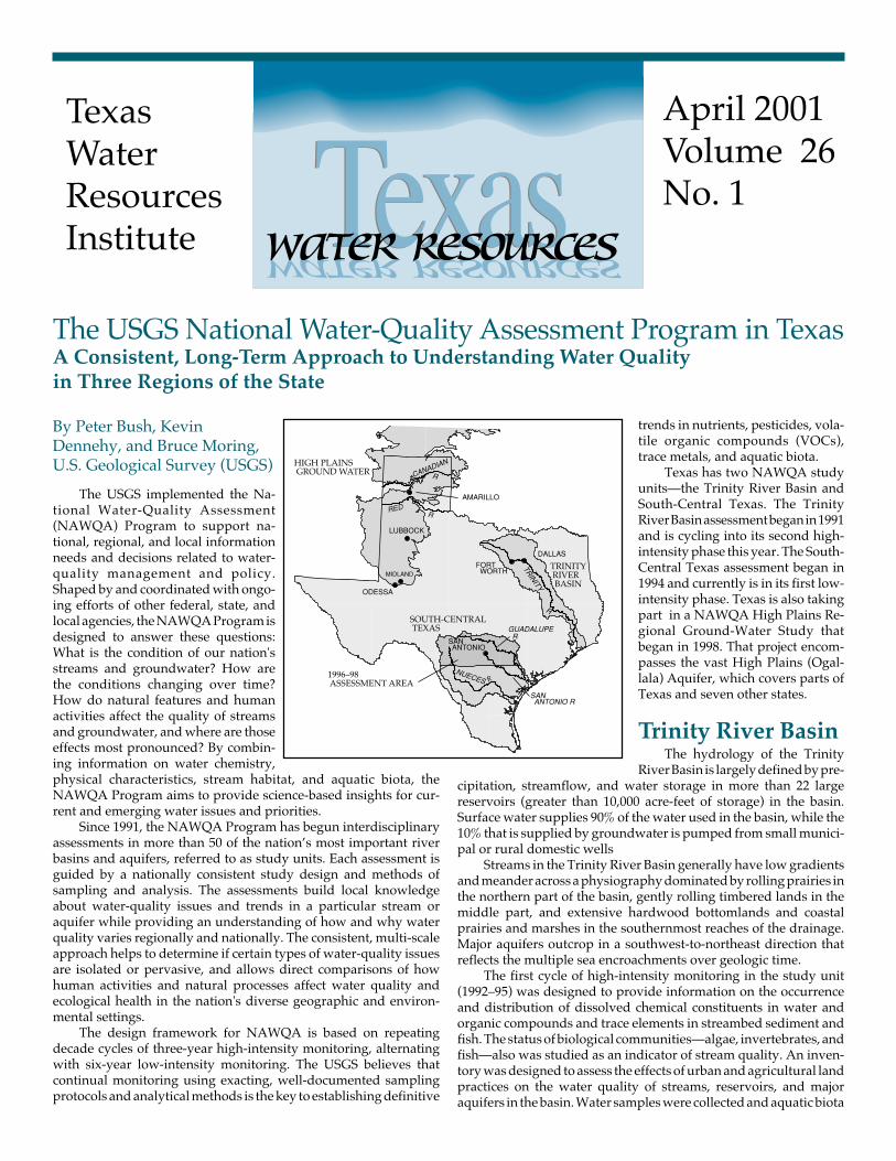
April 2001Volume 26No. 1
TexasWaterResourcesInstitute
A Consistent, Long-Term Approach to Understanding Water Qualityin Three Regions of the State
The USGS National Water-Quality Assessment Program in Texas
By Peter Bush, KevinDennehy, and Bruce Moring,U.S. Geological Survey (USGS)
The USGS implemented the Na-tional Water-Quality Assessment(NAWQA) Program to support na-tional, regional, and local informationneeds and decisions related to water-quality management and policy.Shaped by and coordinated with ongo-ing efforts of other federal, state, andlocal agencies, the NAWQA Program isdesigned to answer these questions:What is the condition of our nation'sstreams and groundwater? How arethe conditions changing over time?How do natural features and humanactivities affect the quality of streamsand groundwater, and where are thoseeffects most pronounced? By combin-ing information on water chemistry,physical characteristics, stream habitat, and aquatic biota, theNAWQA Program aims to provide science-based insights for cur-rent and emerging water issues and priorities.
Since 1991, the NAWQA Program has begun interdisciplinaryassessments in more than 50 of the nation’s most important riverbasins and aquifers, referred to as study units. Each assessment isguided by a nationally consistent study design and methods ofsampling and analysis. The assessments build local knowledgeabout water-quality issues and trends in a particular stream oraquifer while providing an understanding of how and why waterquality varies regionally and nationally. The consistent, multi-scaleapproach helps to determine if certain types of water-quality issuesare isolated or pervasive, and allows direct comparisons of howhuman activities and natural processes affect water quality andecological health in the nation's diverse geographic and environ-mental settings.
The design framework for NAWQA is based on repeatingdecade cycles of three-year high-intensity monitoring, alternatingwith six-year low-intensity monitoring. The USGS believes thatcontinual monitoring using exacting, well-documented samplingprotocols and analytical methods is the key to establishing definitive
trends in nutrients, pesticides, vola-tile organic compounds (VOCs),trace metals, and aquatic biota.
Texas has two NAWQA studyunits—the Trinity River Basin andSouth-Central Texas. The TrinityRiver Basin assessment began in 1991and is cycling into its second high-intensity phase this year. The South-Central Texas assessment began in1994 and currently is in its first low-intensity phase. Texas is also takingpart in a NAWQA High Plains Re-gional Ground-Water Study thatbegan in 1998. That project encom-passes the vast High Plains (Ogal-lala) Aquifer, which covers parts ofTexas and seven other states.
Trinity River BasinThe hydrology of the Trinity
River Basin is largely defined by pre-cipitation, streamflow, and water storage in more than 22 largereservoirs (greater than 10,000 acre-feet of storage) in the basin.Surface water supplies 90% of the water used in the basin, while the10% that is supplied by groundwater is pumped from small munici-pal or rural domestic wells
Streams in the Trinity River Basin generally have low gradientsand meander across a physiography dominated by rolling prairies inthe northern part of the basin, gently rolling timbered lands in themiddle part, and extensive hardwood bottomlands and coastalprairies and marshes in the southernmost reaches of the drainage.Major aquifers outcrop in a southwest-to-northeast direction thatreflects the multiple sea encroachments over geologic time.
The first cycle of high-intensity monitoring in the study unit(1992–95) was designed to provide information on the occurrenceand distribution of dissolved chemical constituents in water andorganic compounds and trace elements in streambed sediment andfish. The status of biological communities—algae, invertebrates, andfish—also was studied as an indicator of stream quality. An inven-tory was designed to assess the effects of urban and agricultural landpractices on the water quality of streams, reservoirs, and majoraquifers in the basin. Water samples were collected and aquatic biota
o
g
were assessed throughout the basin. Most of the monitoring duringthe first high-intensity phase took place in the upper part of the basinin the vicinity of the Dallas-Fort Worth metropolitan area.
During the high-intensity monitoring, 480 water samples werecollected from streams in the Trinity River Basin. The majority ofthese samples were collected at four "intensive" sites on a weekly-to-monthly basis and during some storms. Several stream synopticstudies were done to obtain greater spatial coverage of the basin thanthe intensive sites provided.
Findings indicate that total nitrogen concentrations in urbanand agricultural streams are very similar and are larger than concen-trations in streams in rangeland and forested areas. Only two of the480 samples from streams had nitrate con-centrations that exceeded the U.S. Environ-mental Protection Agency (EPA) maximumcontaminant level (MCL) of 10 milligramsper liter. The largest nutrient concentrationswere from streams downstream from urbanwastewater discharges, and the smallestwere from streams immediately downstreamfrom reservoirs. Pesticides were analyzed in277 water samples from streams, and moreherbicides than insecticides were detectedin urban and agricultural streams.
Atrazine was the most commonly de-tected pesticide, and all of the samples fromurban streams had detections of atrazine.Atrazine concentrations generally were high-est in agricultural streams.
The occurrence and distribution of or-ganochlorine pesticides and polychlorinatedbiphenols (PCBs) in streambed sediment andtissues of fish and clams were surveyed at 16sites in the Trinity River Basin. Sedimentconcentrations of chlordane, dieldrin, andthe DDT breakdown products DDD andDDE were larger in streams draining urbanareas than agricultural areas. Concentrationsof these organochlorines in sediment com-monly exceeded the Texas Natural ResourceConservation Commission (TNRCC) screen-ing criteria for these compounds. More or-ganochlorines were detected in sediment than in fish and clamtissues. Chlordane, DDT, and PCBs were more frequently detectedin fish tissue in streams draining urban areas than agricultural areas.
Fish communities in urban and agricultural streams of theTrinity River Basin were more degraded than those in forested areasand were dominated by tolerant species that adapt to a human-altered environment. The urban and agricultural streams had morevariable and "flashy" streamflows, less diverse physical habitat, andfewer meanders than streams in forested areas. One urban brightspot was the finding that the fish communities in the Trinity Riverdownstream from major wastewater discharges in the Dallas-FortWorth area have improved since the mid-1970s. Changes in waste-water treatment that result in less ammonia and organic nitrogenbeing discharged into the river have increased dissolved oxygenconcentrations, thus creating a more favorable environment for fish.
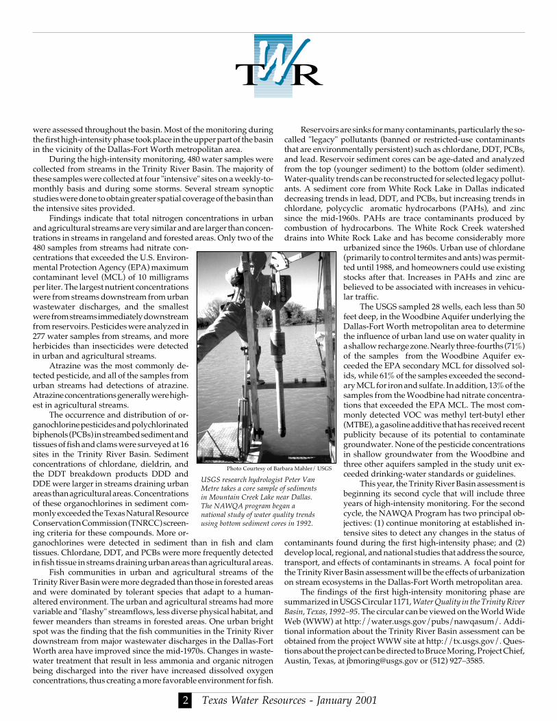
Photo Courtesy of Ba
USGS research hydrologisMetre takes a core sample in Mountain Creek Lake nThe NAWQA program benational study of water quusing bottom sediment cor
Texas Water Reso2
Reservoirs are sinks for many contaminants, particularly the so-called "legacy" pollutants (banned or restricted-use contaminantsthat are environmentally persistent) such as chlordane, DDT, PCBs,and lead. Reservoir sediment cores can be age-dated and analyzedfrom the top (younger sediment) to the bottom (older sediment).Water-quality trends can be reconstructed for selected legacy pollut-ants. A sediment core from White Rock Lake in Dallas indicateddecreasing trends in lead, DDT, and PCBs, but increasing trends inchlordane, polycyclic aromatic hydrocarbons (PAHs), and zincsince the mid-1960s. PAHs are trace contaminants produced bycombustion of hydrocarbons. The White Rock Creek watersheddrains into White Rock Lake and has become considerably more
urbanized since the 1960s. Urban use of chlordane(primarily to control termites and ants) was permit-ted until 1988, and homeowners could use existingstocks after that. Increases in PAHs and zinc arebelieved to be associated with increases in vehicu-lar traffic.
The USGS sampled 28 wells, each less than 50feet deep, in the Woodbine Aquifer underlying theDallas-Fort Worth metropolitan area to determinethe influence of urban land use on water quality ina shallow recharge zone. Nearly three-fourths (71%)of the samples from the Woodbine Aquifer ex-ceeded the EPA secondary MCL for dissolved sol-ids, while 61% of the samples exceeded the second-ary MCL for iron and sulfate. In addition, 13% of thesamples from the Woodbine had nitrate concentra-tions that exceeded the EPA MCL. The most com-monly detected VOC was methyl tert-butyl ether(MTBE), a gasoline additive that has received recentpublicity because of its potential to contaminategroundwater. None of the pesticide concentrationsin shallow groundwater from the Woodbine andthree other aquifers sampled in the study unit ex-ceeded drinking-water standards or guidelines.
This year, the Trinity River Basin assessment isbeginning its second cycle that will include threeyears of high-intensity monitoring. For the secondcycle, the NAWQA Program has two principal ob-jectives: (1) continue monitoring at established in-tensive sites to detect any changes in the status of
contaminants found during the first high-intensity phase; and (2)develop local, regional, and national studies that address the source,transport, and effects of contaminants in streams. A focal point forthe Trinity River Basin assessment will be the effects of urbanizationon stream ecosystems in the Dallas-Fort Worth metropolitan area.
The findings of the first high-intensity monitoring phase aresummarized in USGS Circular 1171, Water Quality in the Trinity RiverBasin, Texas, 1992–95. The circular can be viewed on the World WideWeb (WWW) at http://water.usgs.gov/pubs/nawqasum/. Addi-tional information about the Trinity River Basin assessment can beobtained from the project WWW site at http://tx.usgs.gov/. Ques-tions about the project can be directed to Bruce Moring, Project Chief,Austin, Texas, at [email protected] or (512) 927–3585.
rbara Mahler/ USGS
t Peter Vanf sediments
ear Dallas.an a
ality trendses in 1992.
urces - January 2001
e
South-Central TexasThe first high-intensity monitoring phase in the South-Central
Texas Study Unit (1996–98) focused on the upper part of the studyunit, which comprises parts of the topographically rugged EdwardsPlateau and the comparatively flat Gulf Coastal Plain physiographicregions. The upper part of the study unit contains the EdwardsAquifer in the Balcones Fault Zone and the Trinity Aquifer in theTexas Hill Country.
Surface and ground water in the upper part of the study unit areuniquely interrelated. Streams deeply incised into the rocks of theEdwards Plateau often gain water as they flow south-southeastwardfrom headwaters in the higher elevations of the plateau. As the majorstreams flow across the faulted and fractured Edwards Aquiferoutcrop (recharge zone), they lose substantial amounts of flowdirectly into the aquifer. The highly permeable rocks that composethe Edwards Aquifer recharge zone, as well as increasing develop-ment in the watersheds of major streams in the Edwards Plateau andthe recharge zone, make this aquifer vulnerable to contamination.
Single water samples from 88 Edwards Aquifer wells and 31Trinity Aquifer wells were analyzed for natural constituents (includ-ing nutrients), pesticides, VOCs, and trace metals. Numerous con-taminants were detected in Edwards Aquifer samples, while fewerwere found in Trinity Aquifer samples. Concentrations were low(fractions of a part per billion) and well below all current EPAdrinking-water standards and guidelines.
Although the findings in South-Central Texas do not imply anycurrent health risk, they are an early warning that human activitiesare having an effect on regional ground- and surface-water quality.Pesticides and VOCs in the Edwards Aquifer were detected mostfrequently in wells in urbanized parts of the recharge zone. Detec-tions were less frequent in Edwards Aquifer wells in undevelopedparts of the recharge zone, and also in wells in the confined zone,where the aquifer is buried under rocks that restrict the downwardmovement of water and contaminants.
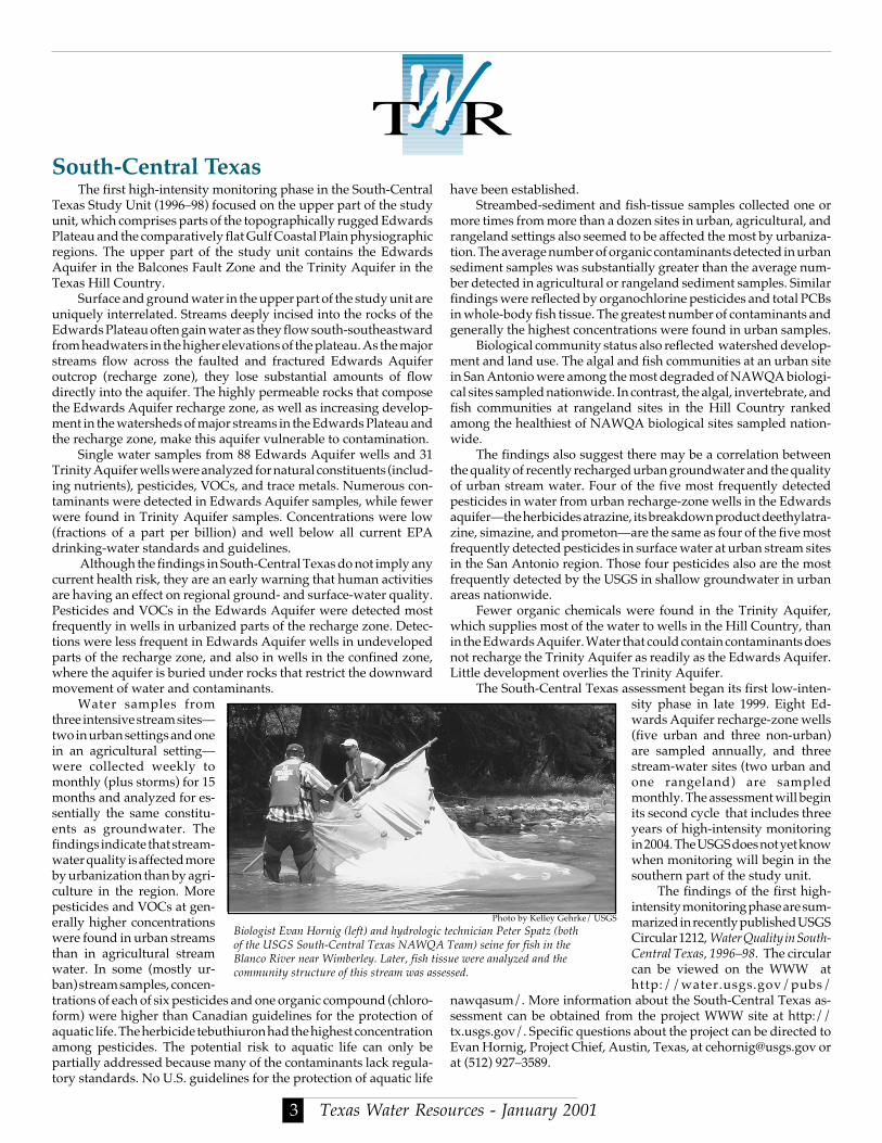
Water samples fromthree intensive stream sites—two in urban settings and onein an agricultural setting—were collected weekly tomonthly (plus storms) for 15months and analyzed for es-sentially the same constitu-ents as groundwater. Thefindings indicate that stream-water quality is affected moreby urbanization than by agri-culture in the region. Morepesticides and VOCs at gen-erally higher concentrationswere found in urban streamsthan in agricultural streamwater. In some (mostly ur-ban) stream samples, concen-trations of each of six pesticides and one organic compound (chloro-form) were higher than Canadian guidelines for the protection ofaquatic life. The herbicide tebuthiuron had the highest concentrationamong pesticides. The potential risk to aquatic life can only bepartially addressed because many of the contaminants lack regula-tory standards. No U.S. guidelines for the protection of aquatic life
Biologist Evan Hornig (left) and hydrologicof the USGS South-Central Texas NAWQABlanco River near Wimberley. Later, fish tiscommunity structure of this stream was ass
Texas Water Reso3
have been established.Streambed-sediment and fish-tissue samples collected one or
more times from more than a dozen sites in urban, agricultural, andrangeland settings also seemed to be affected the most by urbaniza-tion. The average number of organic contaminants detected in urbansediment samples was substantially greater than the average num-ber detected in agricultural or rangeland sediment samples. Similarfindings were reflected by organochlorine pesticides and total PCBsin whole-body fish tissue. The greatest number of contaminants andgenerally the highest concentrations were found in urban samples.
Biological community status also reflected watershed develop-ment and land use. The algal and fish communities at an urban sitein San Antonio were among the most degraded of NAWQA biologi-cal sites sampled nationwide. In contrast, the algal, invertebrate, andfish communities at rangeland sites in the Hill Country rankedamong the healthiest of NAWQA biological sites sampled nation-wide.
The findings also suggest there may be a correlation betweenthe quality of recently recharged urban groundwater and the qualityof urban stream water. Four of the five most frequently detectedpesticides in water from urban recharge-zone wells in the Edwardsaquifer—the herbicides atrazine, its breakdown product deethylatra-zine, simazine, and prometon—are the same as four of the five mostfrequently detected pesticides in surface water at urban stream sitesin the San Antonio region. Those four pesticides also are the mostfrequently detected by the USGS in shallow groundwater in urbanareas nationwide.
Fewer organic chemicals were found in the Trinity Aquifer,which supplies most of the water to wells in the Hill Country, thanin the Edwards Aquifer. Water that could contain contaminants doesnot recharge the Trinity Aquifer as readily as the Edwards Aquifer.Little development overlies the Trinity Aquifer.
The South-Central Texas assessment began its first low-inten-sity phase in late 1999. Eight Ed-wards Aquifer recharge-zone wells(five urban and three non-urban)are sampled annually, and threestream-water sites (two urban andone rangeland) are sampledmonthly. The assessment will beginits second cycle that includes threeyears of high-intensity monitoringin 2004. The USGS does not yet knowwhen monitoring will begin in thesouthern part of the study unit.
The findings of the first high-intensity monitoring phase are sum-marized in recently published USGSCircular 1212, Water Quality in South-Central Texas, 1996–98. The circularcan be viewed on the WWW athttp://water.usgs.gov/pubs/
nawqasum/. More information about the South-Central Texas as-sessment can be obtained from the project WWW site at http://tx.usgs.gov/. Specific questions about the project can be directed toEvan Hornig, Project Chief, Austin, Texas, at [email protected] orat (512) 927–3589.
technician Peter Spatz (both Team) seine for fish in thesue were analyzed and thessed.
Photo by Kelley Gehrke/ USGS
urces - January 2001
T
P
High Plains Regional Ground WaterThe High Plains Aquifer (also known as the Ogallala) is the most
abundant source of groundwater in any agricultural region of theUnited States. Use of the High Plains aquifer has transformed thearea into one of the major agricultural regions of the world. During1995, water use in the eight-state area covered by the High PlainsAquifer was estimated to be 19.9 billion gallons per day. Of thisamount, 81% was pumped from the aquifer, while 19% was with-drawn from rivers and streams. About 96% of water pumped fromthe aquifer is used to irrigate crops on about 27% of the irrigated landin the United States. Withdrawals account for about 30% of thegroundwater used for irrigation nationwide.
The High Plains Regional Ground-Water Study is differentfrom traditional NAWQA study units in three ways. First, theoriginal NAWQA Program plan delineated study units in the HighPlains area of the United States that corresponded primarily tosurface-water drainages and, to a lesser ex-tent, aquifer boundaries. Water use and hy-drologic considerations indicated that it wasbetter to assess water resources in the HighPlains on the basis of groundwater resourcesand to define the study area by the aquiferboundary. Second, the focus of the water-quality investigation within the High Plainsstudy area is groundwater. The High Plainsassessment also investigates major rivers thatare hydrologically connected with the HighPlains Aquifer, where appropriate. Third, theHigh Plains Regional Ground-Water Studywas designed with a 10-year initial phase thatcontains 6 years of high-intensity water-qual-ity monitoring, due to the complexity ofgroundwater monitoring and the large geo-graphic area. High-intensity monitoring is in years three througheight, with two years each being spent in the central, southern, andnorthern High Plains regions. About one-third of the central HighPlains and two-thirds of the southern High Plains are in Texas. Initialhigh-intensity monitoring during 1999–2000 focused on the centralHigh Plains. In 2001, the investigation shifted to the southern HighPlains for two years and will end with a 2-year intensive effort in thenorthern High Plains. The final two years of the study will culminatewith a series of technical and non-technical reports describing theresults of the high-intensity data-collection activities across the HighPlains Aquifer system.
A series of studies is planned for each region of the High Plainsto determine the occurrence and distribution of chemical constitu-ents in the aquifer, and to develop an understanding of the processesthat currently influence water quality in the aquifer. The goal of thisassessment is to characterize, in a nationally consistent manner, thebroad-scale geographic distribution of water-quality conditions inrelation to major contaminant sources and background conditions.To accomplish this goal, studies of the primary hydrogeologic unitsthat compose the aquifer (the Ogallala Formation in the central andsouthern High Plains in Texas) and land use studies are planned.Hydrogeologic unit studies characterize water quality without tar-geting specific land uses. Domestic wells are randomly selected forsampling in each major hydrogeologic unit in the study area.
Land-use studies attempt to characterize the quality of recently
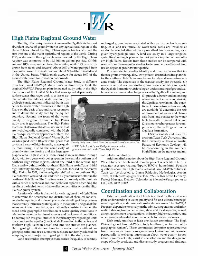
USGS hydrologist Lynnegroundwater well on the
Photo by Lindy Harris/ South
Texas Water Reso4
recharged groundwater associated with a particular land-use set-ting. In a land-use study, 30 water-table wells are installed atrandomly selected sites within a prescribed land-use setting for agiven hydrogeologic unit. A land-use study in a large irrigatedagricultural setting is planned in the Ogallala Aquifer in the south-ern High Plains. Results from these studies can be compared withresults from major-aquifer studies to determine the effects of landuse on regional groundwater quality.
Process-oriented studies identify and quantify factors that in-fluence groundwater quality. Two process-oriented studies plannedfor the southern High Plains are a transect study and an unsaturated-zone study. The objectives of the transect study are threefold: (1)measure vertical gradients in the groundwater chemistry and age inthe Ogallala Formation; (2) develop an understanding of groundwa-ter residence times and recharge rates in the Ogallala Formation; and
(3) provide a better understandingof contaminant sources and sinks inthe Ogallala Formation. The objec-tives of the unsaturated-zone studyare twofold: (1) determine the rateof movement of water and chemi-cals from land surface to the watertable beneath irrigated fields; and(2) estimate recharge rates for com-parison to other settings across theOgallala Formation.
USGS scientists and research-ers from Texas Tech University andthe University of Texas at AustinBureau of Economic Geology willbe collaborating in the southernHigh Plains on the transect and un-
saturated-zone studies.Additional information about the High Plains Regional Ground-
Water Study can be obtained from the project WWW site at http://co.water.usgs.gov/nawqa/hpgw/HPGW_home.html. Specificquestions about the High Plains Regional Ground-Water Study inTexas can be directed to Lynne Fahlquist, Hydrologist, Austin,Texas, at [email protected] or at (512) 927–3508 or Kevin Dennehy,Project Manager, Denver, Colorado, at [email protected] or at(303) 236–4882, x 312.
Coordination and CollaborationExternal coordination at all levels is critical for the most com-
plete understanding of water quality and for cost-effective manage-ment, regulation, and conservation of water resources. The NAWQAProgram depends extensively on the advice, cooperation, and infor-mation sharing from other federal, state, and local agencies, as wellas non-government organizations, industry, higher education, andother groups interested in or responsible for water resources.
Each study unit has at least one liaison committee. The HighPlains Regional Ground-Water Study has three (one for each of itsgeographic regions). These committees comprise representativesfrom many water resources organizations. Liaison committees meetperiodically to exchange information about water-quality issues,identify sources of data, assist in site selection and the design andscope of study products, and discuss study progress and findings.
Fahlquist examines thisexas High Plains.
lains Underground Water Conservation Dist.
urces - January 2001
The Trinity River Basin Study Unit is reestablishing its liaisoncommittee as preparations begin for the second high-intensity moni-toring phase. A meeting is planned for Fall 2001. Because the South-Central Texas Study Unit is in its low-intensity phase, no liaisoncommittee meeting currently is planned. The first and second HighPlains Regional Ground-Water Study liaison committee meetings(held in March 1999 and February 2000) focused on the central HighPlains. Current plans call for the next regional liaison committeemeeting to be held in the southern High Plains in Fall 2001. The HighPlains Regional Ground-Water Study communicates and coordi-nates activities through local meetings and forums, where appropri-ate, to reach those who are unable to participate in regional liaisoncommittee meetings.
Note: For details about liaison committee activities for a particu-lar assessment, contact the respective project chief or manager notedpreviously in this article. The Texas Water Resources Institute isfunded in part by the USGS.
For More InformationBush, P.W., Ardis, A.F., Fahlquist, L., Ging, P.B., Hornig, C.E.,
Lanning-Rush, J., 2000, Water Quality in South-Central Texas, 1996–98, USGS Circular 1212.
Dennehy, K.F., 2000, High Plains regional ground-water study,USGS Fact Sheet FS-091-00.
Ging, P.B., 1999, Water-quality assessment of south-central Texas—Comparison of water quality in surface-water samples collected manuallyand by automated samplers, USGS Fact Sheet FS–172–99.
Texas Water Reso5
TWRI Funds 11 Research Projects a
xcye
Ging, P.B., 1999, Quality of stormwater runoff from an urbanizingwatershed and a rangeland watershed in the Edwards aquifer recharge zone,Bexar and Uvalde Counties, Texas, 1966–98, USGS Open-File Report99–245.
Ging, P.B., 1999, Water-quality assessment of south-central Texas—Descriptions and comparisons of nutrients, pesticides, and volatile organiccompounds at three intensive fixed sites, 1996–98, USGS Water-Re-sources Investigations Report 99–4155.
Land, L.F., Moring, J. B., Van Metre, P.C., Reutter, D.C., Mahler,B.J., Shipp, A.A., and Ulery, R.L., 1998, Water quality in the TrinityRiver Basin, Texas, 1992-95, USGS Circular 1171.
Land, L.F., 1997, Water-quality assessment of the Trinity RiverBasin, Texas — Nutrients and pesticides in the watersheds of Richland andChambers Creeks, 1993-95, USGS Water-Resources InvestigationsReport 97-4132.
McMahon, P.B., 2000, A reconnaissance study of the effect of irri-gated agriculture on water quality in the Ogallala Formation, central HighPlains aquifer, USGS Fact Sheet FS-009-00.
Moring, J.B., 1997, Occurrence and distribution of organochlorinecompounds in biological tissue and bed sediment from streams in theTrinity River Basin, Texas, 1992-93, USGS Water-Resources Investiga-tions Report 97-4057.
Moring, J.B., and Rose, D.R., 1997, “Occurrence and concentra-tions of polycyclic aromatic hydrocarbons in semipermeable mem-brane devices and clams in three urban streams of the Dallas-FortWorth metropolitan area, Texas,” Chemosphere, Vol. 34, no. 3, pp. 551-566.
t 7 Universities
The Texas Water Resources Institute (TWRI) has selected 11 researchprojects it will fund during 2001–2002. The projects will explore a wideassortment of topics. Research projects were selected at Texas A&M Univer-sity (TAMU), Texas Tech University (TTU), the University of Texas at Austin(UT), Texas A&M University–Corpus Christi, the University of North Texas(UNT), the University of Texas at Austin Marine Science Institute at PortAransas (UT MSI), and Texas A&M University–Galveston.
TWRI received 35 submissions in response to this year’s request forproposals. The research program is funded by the United States GeologicalSurvey. Research projects were developed bygraduate students in collaboration with facultymembers. Projects were evaluated by TWRI staffas well as key TAMU faculty. Each project will beawarded a $5,000 grant. Matching funds are pro-vided by each cooperating university. The projectswill start March 1, 2001 and run through February28, 2002. At the conclusion of these studies, TWRIwill publish a scientific paper or technical reportdescribing the research.
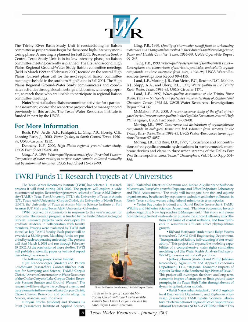
The following projects were funded:• Jill Brandenberger (student) and Patrick
Louchouarn (researcher), Conrad Blucher Insti-tute for Surveying and Science, TAMU–CorpusChristi, “Arsenic Concentration in Water Resourcesof the Choke Canyon/Lake Corpus Christi Reser-voir System: Surface and Ground Waters.” Theresearch will investigate the cycling of arsenic andtrace elements in the waters of Lake Corpus Christi,Choke Canyon Reservoir, and points along theNueces, Atascosa, and Frio rivers.
• Bryan Brooks (student) and Thomas LaPoint (researcher), Institute of Applied Science,
Jill Brandenberger of TeCorpus Christi will collesamples from Choke CanLake Corpus Christi Res
Photo By Patrick Louchoua
UNT, “Sublethal Effects of Cadmium and Linear Alkylbenzene SulfonateMixtures on Pimephales promelas Exposure and Effect Endpoints: Laboratoryand Field Assessments.” The study will investigate how fish and aquaticorganisms may be affected by exposure to cadmium and other pollutants inNorth Texas surface waters using fathead minnows as a test species.
• Yesim Buyukates (student) and Daniel Roelke (researcher), TAMUWildlife and Fisheries Sciences Department, “Plankton Succession: Investi-gation Regarding New Approaches to Management.” This study will assesshow releasing treated wastewater in pulses to the Rincon Delta may affect the
flora and fauna of coastal wetlands, and how nutri-ents in wastewater effluents affect phytoplanktongrowth.
• Richard Hoffpauir (student) and Ralph Wurbs(researcher), TAMU Civil Engineering Department,“Incorporation of Salinity in Evaluating Water Avail-ability.” This project will expand the modeling capa-bilities of a comprehensive water rights simulationmodeling tool (the Water Rights Analysis Package orWRAP), to assess natural salt pollution.
• Jeffrey Johnson (student) and Phillip Johnson(researcher), Agricultural and Applied EconomicsDepartment, TTU, “Regional Economic Impacts ofAquifer Decline in the Southern High Plains of Texas.”This project will investigate the short- and long-termeconomic impact of strategies to limit groundwaterpumping in the Texas High Plains through the use ofdynamic optimization models.
• Balaji Narasimhan (student), TAMU Agricul-tural Engineering Department, and Raghavan Srini-vasan (researcher), TAMU Spatial Sciences Labora-tory, “Determination of Regional Scale Evapotranspi-ration of Texas from a NOAA-AVHRR Satellite.” This
as A&M–t water qualityon Lake and thervoir.
rn/ A&M–Corpus Christi
urces - January 2001
Tell Us How You Feel About TexasWater Resources and Win a Book!
As Editor of Texas Water Resources, I want to know whatreaders think about the newsletter. Please take a few momentsand fill out this survey form. Fax your answers, along withyour name and address, to TWRI at (979) 845-8554. We will conduct a random drawing of those who respond.
Two technical reports were recently published by TWRI. Brush Manage-ment/ Water Yield Feasibility Studies for Eight Watersheds in Texas (TR-182) wasdeveloped by the TAES Blackland Research Center (BRC) in Temple, TX inconjunction with the Texas A&M University Rangeland Ecology and Man-agement and Agricultural Economics Departments. The report was pub-lished for the Texas State Soil and Water Conservation Board. Ecological,Economic, and Policy Alternatives for Texas Rice Agriculture was published byTWRI as TR-181. The report was produced by the George Bush School’sInstitute for Science, Technology and Public Policy (ISTPP). To order eitherreport, contact TWRI at (979) 845-8571 or [email protected].
TWRI Produces 2 New Technical Reports
study will use an advanced high-resolution radiometer (AVHRR) sensorwhich is aboard an orbiting earth satellite to develop more accurate estimatesof evapotranspiration (ET) from various land uses.
• Rafael Perez (student) and G. Joan Holt (researcher), UT MSI PortAransas, “Fluctuating Environmental Parameters in Red Drum NurseryHabitats: The Influence of Habitat Quality on Larval Growth and EndocrineFunction.” The goal is to examine how natural variations in temperaturesand storm cycles may affect the growth of larval stages of red drum usinglaboratory studies.
• Andres Salazar (student) and Ralph Wurbs, (researcher), TAMU CivilEngineering Department, “Conditional Reliability Modeling to SupportShort-Term River Basin Management Decisions.” Case studies will be con-ducted of the San Antonio, Guadalupe, and Nueces River basins to identifyhow the WRAP computer modeling software can estimate water reliabilityat specific sites.
• Daniel Stein (student) and David Eaton (researcher), the Lyndon B.Johnson School for Public Affairs, UT, “Texas Groundwater Managementand Global Applications.” This study will carry out a comparative analysisof how multiple political jurisdictions have tried to manage transboundarygroundwater supplies.
• Kevin Yeager (student) and Bruce Herbert, TAMU Geosciences andGeophysics Department and Peter Santschi, TAMU–Galveston (research-ers), “Resolution of Fluvial Sediment Sources, Residence Times and Resus-pension Using Lithogenic, Atmospheric and Cosmogenic Radionuclides,Bayou Loco, Texas.” This study will use radionuclide fingerprinting toinvestigate sediment production, transport, and deposition within BayouLoco near Galveston Bay.
• Biswaranjan Das (student) and David B. Willis (researcher), Agricul-
Texas Water Resources Institute301 Scoates HallTexas A&M UniversityCollege Station, Texas 77843-2118
ADDRESS CORRECTION REQUESTED
Mention of a trademark or proprietary product does not constitute aguarantee or a warranty of the product by the cooperating agencies and doesnot imply its approval to the exclusion of other products that may be suitable. All programs and information of the cooperating agencies are available toevery one without regard to race, ethnic origin, religion, sex, or age.
is published quarterly bythe Texas Water Resources Institute.
C. Allan Jones, DirectorRic Jensen, Editor and Graphic Design
TWRI is supported by funds provided in part by the U.S. Geological Survey,U.S. Department of the Interior, as authorized by the Water ResourcesResearch Act of 1984. Subscriptions are available free upon request. Fordetails, call TWRI at 979-845-8571. The fax number is 979-845-8554; e-mail:[email protected]. The WWW address is http://twri.tamu.edu.
tural and Applied Economics Department, TTU, “Towards an IntegratedWater Planning Model for the Texas High Plains.” The project will developa water policy planning model that can be used to evaluate proposed waterresources policies.
To learn more about any of these projects, contact TWRI at (979) 845-1851 or [email protected].
NON-PROFIT ORG.U.S. POSTAGE PAID
COLLEGE STATION, TEXASPERMIT NO. 215
The winner will receive a free copy of Isaac’s Storm, a bookabout the Galveston flood of 1900. The winner of the lastdrawing was Lawrence Wilson of Dallas, TX. Ric Jensen, Editor, Texas Water Resources1. Do you read Texas Water Resources? (Y/N)2. Do you think TWRI should continue (Y/N) publishing Texas Water Resources ?3. Do you circulate Texas Water Resources (Y/N) to colleagues? If so, how many?4. If Texas Water Resources were published only (Y/N) on the World Wide Web (not printed) would you still read it?5. Which topics should be discussed in future issues of this newsletter?