Embed Size (px)
Citation preview

Sofija Naod, Sanja Grekulović, Violeta Vasilić
Oleg Odalović, Dragan Blagojević
Department of Geodesy and Geoinformatics
Faculty for Civil Engineering, Belgrade, Serbia
Session: GNSS networks in the region
3th CROPOS Conference
October 24-25, 2013, Opatija, Croatia
Terrestrial Reference Frame of Serbia
and its temporal rate
Belgrade University
Faculty of
Civil Engineering

Introduction
Organized applications of GNNS in Serbia dates from 1998 when was performed EUREF GPS Campaign BALKAN98.
Creating the network of permanent stations of Serbia – AGROS was finished in Dec. of 2005 and since then begins its use as a geodetic service.
According to the general rules expressed in the Law on the State Survey and Real Estate Cadastre, European Terrestrial System 1989 (ETRS89) was adopted as a basis of national geodetic system.
Within the National EUREF densification project the GPS measurements campaign was realized in Republic of Serbia in 2010.
The campaign included 20 EPN stations, 48 stations from national permanent networks (Serbia, Former Yugoslav Republic of Macedonia, Bulgaria and Hungary) and 19 field points (Figure 1).

Figure 1: Disposition of sites in EUREF Serbia 2010 Campaign.
Station coordinates were computed and expressed as Local GPS network, and then aligned to ITRF2005 using EPN stations of high quality in the region of the Eurasian plate that were included in GPS processing.
By applying of Memo transformation formulae, this network solution was transformed into ETRF2000. The minimum constraints approach has been applied.
To obtain the optimal estimate, criteria selection for EPN stations were applied as recommended by Z. Altamimi (Altamimi, 2003) for aligning a regional/local solution to the ITRF:
A. A certain number of ITRF stations of high quality, surrounding the implied network, should be included in the GPS processing;
B. The ITRF residuals should be less than 5 mm for positions and 3 mm/y for velocities for at least 3 different solutions contributed to ITRF generation;
C. Long observing history (at least 3 years).
Criteria C could not be applied, so that for practical geo-referencing applications ETRF2000 as the basic frame of the ETRS89 realization was adopted as recommended by Z. Altamimi (Altamimi, 2009).

In addition to the above criteria, optimal estimate was carried out in accordance with the Guidelines for EUREF Densification (Bruyninx at all., 2010) and EPN station categorization (Kenyeres, 2009).
ETRS89 Definition and Realization
ETRS89 was defined and adopted by EUREF in 1990 and since then has been largely used by most European countries as the basis of their national geodetic systems.
Advantage of adoption of the ETRS2000 as a conventional frame of the ETRS89 realization is to minimize the coordinate shifts at epochs posterior to 1989.0 between different implementations of the ETRS89 in Europe (Bruyninx et all., 2010).

ETRS89 definition consists of two conditions (Altamimi, 2009):
1. The ETRS89 should coincide with the ITRS at epoch 1989.0. This condition implies that (a) the ETRS89 is defined at epoch 1989.0 and
(b) its 7 transformation parameters with respect to the ITRS are zeros at 1989.0 epoch.
2. The ETRS89 should be fixed to the stable part of the Eurasian tectonic plate. This conditions implies also two consequences:
(a) the ETRS89 is co-moving with the Eurasian plate, defining so its time evolution, and (b) the time derivatives of the 7 parameters are zeros, except the three rotation rates. These rotation rates correspond in fact to the Eurasia angular velocity in the ITRFyy frames.
• The ETRS89 has been realized through the transformation formulae from ITRFyy to ETRFyy which means that we change the frame parameters of the departure frame (ITRFyy) to define the parameters (origin, scale, orientation) of the target frame (ETRFyy).

The ETRS89 definition allows to specify rigorously the mathematical transformation formulae between the two systems:
The campaign in Republic of Serbia, “EUREF Serbia 2010 Campaign”, and some neighboring countries was realized as an extension of EUREF by Republic Geodetic Authority (RGA).
The campaign included 20 EPN stations, 48 stations from national permanent networks (Serbia, FYRO Macedonia, Bulgaria and Hungary) and 19 field points, total 87 stations. Local network is within a radius of about 600 km in the N-S direction for area Serbia and FYRO Macedonia (Figure 2).
1989.0ttX
01R2R
1R03R
2R3R0
TtXtX ccIyy
yyyy
yyyy
yyyy
yycIyyc
E
..
..
..
EUREF Serbia 2010 Campaign

The network processing was carried out with the Bernese Software v. 5.0 following the Guidelines for EPN Analysis Centers.
For the final network solution the minimum constraints was applied to the translation parameters on the fiducial EPN stations. The EUREF campaign in Serbia 2010 was accepted as densification of EUREF, categorized as class B (Veljković and Lazić, 2011).
Figure 2: The main radius of the Local network.
For a datum definition 18 EPN stations were used but due to the lack of EPN stations surrounding of network the stations BAIA, BUCU, DEVA, ISTA, SRJV were not excluded from processing, although they didn`t satisfied above criteria.
SOFI and WTZR have antenna replacements so they were processed but not used for a datum definition. Datum definition was provided in ITRF2005 with coordinates of the EPN stations at the time of the computing.
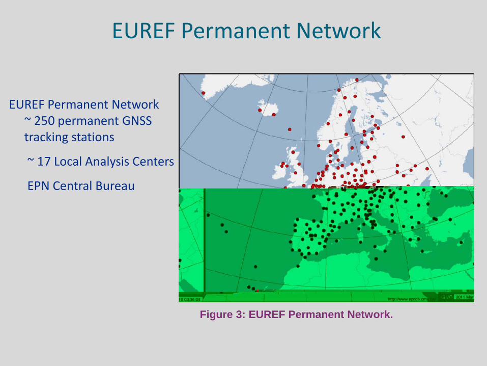
EUREF Permanent Network ~ 250 permanent GNSS tracking stations
~ 17 Local Analysis Centers
EPN Central Bureau
EUREF Permanent Network
Figure 3: EUREF Permanent Network.
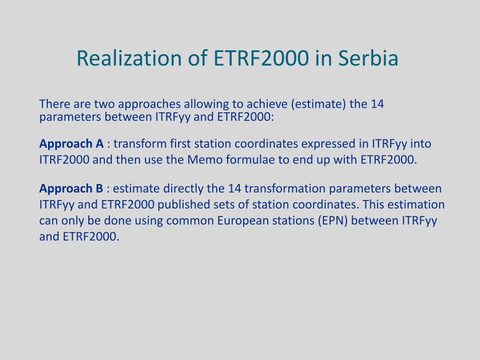
There are two approaches allowing to achieve (estimate) the 14
parameters between ITRFyy and ETRF2000:
Approach A : transform first station coordinates expressed in ITRFyy into ITRF2000 and then use the Memo formulae to end up with ETRF2000.
Approach B : estimate directly the 14 transformation parameters between ITRFyy and ETRF2000 published sets of station coordinates. This estimation can only be done using common European stations (EPN) between ITRFyy and ETRF2000.
Realization of ETRF2000 in Serbia
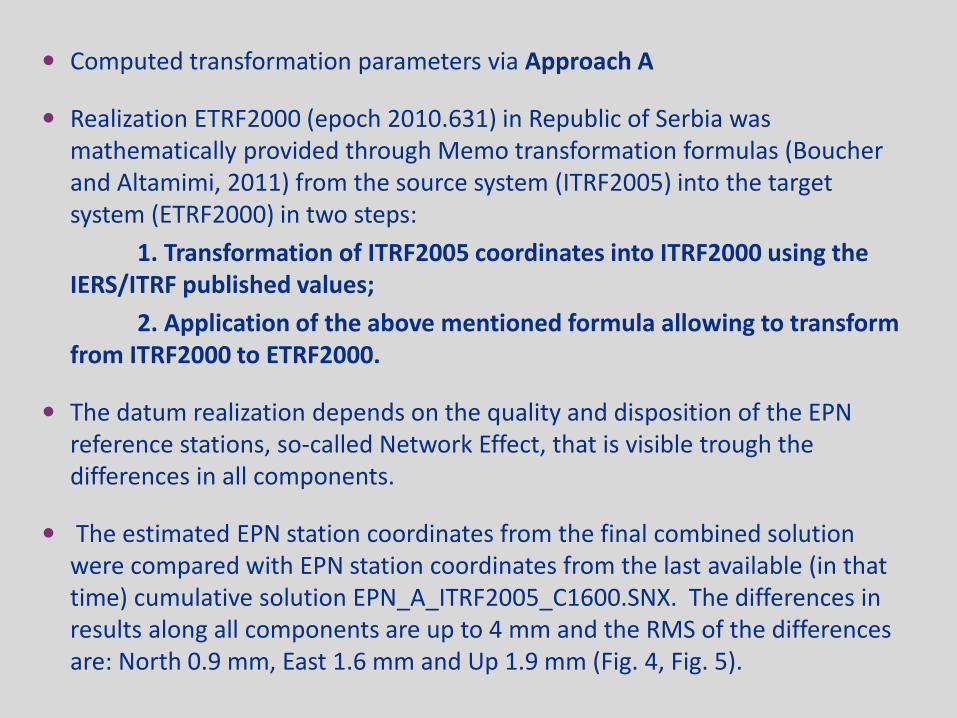
Computed transformation parameters via Approach A
Realization ETRF2000 (epoch 2010.631) in Republic of Serbia was mathematically provided through Memo transformation formulas (Boucher and Altamimi, 2011) from the source system (ITRF2005) into the target system (ETRF2000) in two steps:
1. Transformation of ITRF2005 coordinates into ITRF2000 using the IERS/ITRF published values;
2. Application of the above mentioned formula allowing to transform from ITRF2000 to ETRF2000.
The datum realization depends on the quality and disposition of the EPN reference stations, so-called Network Effect, that is visible trough the differences in all components.
The estimated EPN station coordinates from the final combined solution were compared with EPN station coordinates from the last available (in that time) cumulative solution EPN_A_ITRF2005_C1600.SNX. The differences in results along all components are up to 4 mm and the RMS of the differences are: North 0.9 mm, East 1.6 mm and Up 1.9 mm (Fig. 4, Fig. 5).
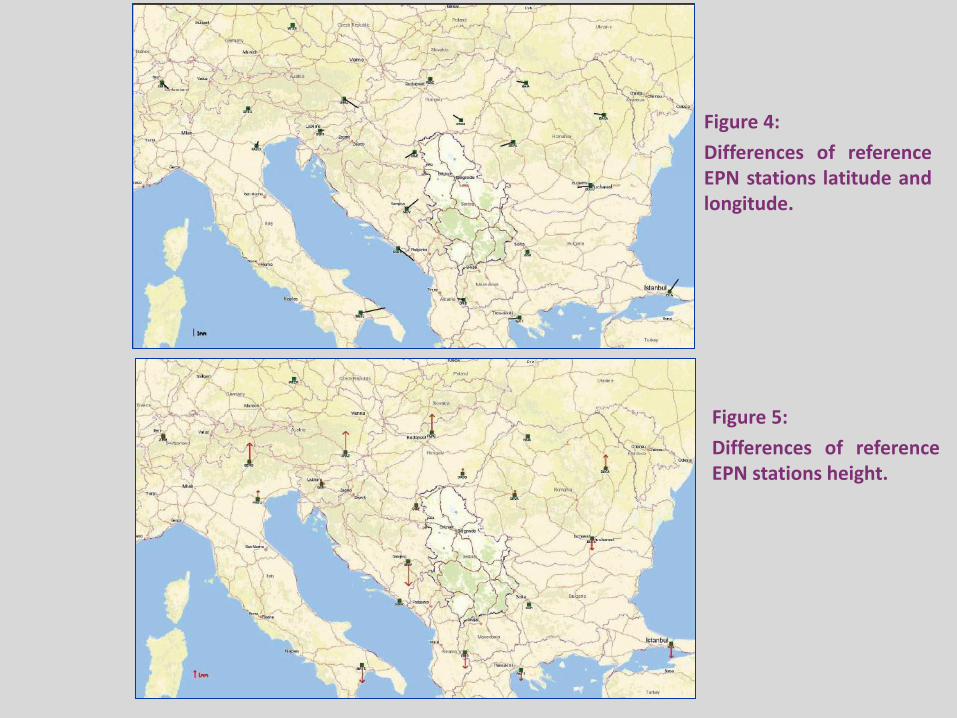
Figure 4:
Differences of reference EPN stations latitude and longitude.
Figure 5:
Differences of reference EPN stations height.

To provide Long-term solution RF in case of GPS, necessary minimum time-span is 2.5 years (Blewitt and Lavallée, 2002).
Isolating, detecting and further investigating all sorts of deformations in station movements could not be easily achieved without the availability of station position time series. For this purpose, station coordinates were determined in the form of weekly solutions. Keeping station SUBO fixed, coordinates were obtained referring to ITRF2005 for the time span of about 1.4 year.
Firstly, the data series were detrended and outliers were removed using three sigma criterion. Secondly, Lomb periodograms were calculated based on clean data sets. Annual and semiannual periods could clearly be identified in every periodogram. Station movements along north and east direction, x(t), were modeled relative to station SUBO situated in the northern part of Serbia. Relative velocity vectors for every network station are graphically depicted in Figure 6.
Station velocities

Fig. 6: AGROS station relative velocities with respect to station SUBO.

For combining individual SINEX solutions in CATREF software (Altamimi et all. 2007b), the combined frame has to be defined by specifying the 14 parameters that corresponding to the datum definition. The combined frame could be defined by using minimum constraint equation over a selected set of stations of a Reference Frame solution ITRF2008. To have TRF expressed in the same frame as Reference Frame ITRF2008 the values of unknowns are equal zero.
• Application of Minimum Constraints (MC) approach based on theoretical works by many authors, has main goals: - “Best“ TRF datum definition - TRF internal consistency: no distortion - Preserve actual quality of space geodesy observations
WRMS for Position is amount up to 0.4 mm and WRMS for Velocity is amount up to 0.1 mm/y, it can be said that for a total of 8 datum stations (BUCU, GRAZ, ISTA, MATE, SOFI, WTZR, ZIMM, and DUBR) the combined frame expressed in the global frame has good agreement.
Datum Definition in ITRF2008: MC approach

Fig. 7: The station position velocities of the Combined Frame expressed in the ITRF2008.
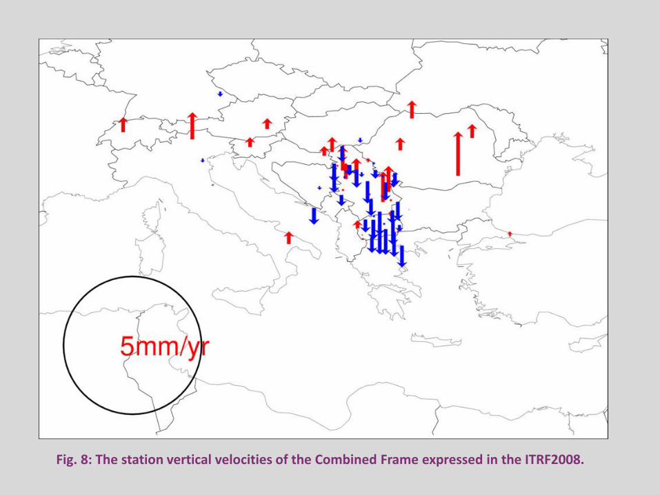
Fig. 8: The station vertical velocities of the Combined Frame expressed in the ITRF2008.

Conclusions • For optimally expression a Local GPS solution in a Reference Frame ETRF2000, the minimum constraints approach was applied which at the same time to reduces the network effect.
EUREF Serbia 2010 Campaign was accepted by EUREF TWG as the European reference framework densifications in Class B.
The quality of ETRF2000 realization depends on the quality and disposition of the EPN reference sites as well as observational history.
To improve and assess the stability of Serbian RF, irregularities in GPS coordinate time series should be carefully investigated and causes of jumps, especially for Continuous Permanent Network of Serbia, should be determined.
In order to get more reliable information on Long-term solution of Reference Frame, various activities are planned to be performed: 1) First of all, much longer data sets will be analyzed, 2) Station velocities were additionally estimated by CATREF software with an option to remove all kinds of irregularities in GPS coordinate time series, 3) Finally, the velocities pattern will be correlated with available seismic, tectonic, geologic and gravity data, and the impact on official Serbian reference frame stability will be assessed.

* Altamimi Z. (2003) Discussion on How to Express a Regional GPS Solution in the ITRF, EUREF Publication No. 12.
* Altamimi Z. , P. Sillard, C. Boucher (2007b) CATREF Software: Combination and Analysis of Terrestrial Reference Frame. LAREG Technical, Institut Géographique National, Paris, France.
* Altamimi Z. (2009) ETRS89 realization: Current status, ETRF2005 and Future Development, Bulletin of Geodesy and Geomatics, Vol. LXVIII, No. 3.
* Altamimi Z. at all. (2013) ITRF Combination: Theoretical and Practical Considerations and Lessons from ITRF2008, Reference Frames for Applications in Geosciences, IAG Symposia 138.
* Blewit G., Lavallée D. (2002) Effect of annual signals on geodetic velocity,
J Geophys Res 107:B7.
* Boucher C., Altamimi Z. (2011) Memo: Specifications for reference frame fixing in the analysis of a EUREF GPS campaign, V. 8, http://etrs89.ensg.ign.fr/.
* Bruyninx C. at all. (2010) Guidelines for EUREF Densifications, ftp://epncb.oma.be/pub/general.
* Kenyeres A. (2009) Maintenance of the EPN ETRS89 Coordinates, EUREF TWG Meeting, Budapest, Hungary, 2009.
* Veljković Z., Lazić S. (2011) EUREF Serbia 2010 – Final report, XIX EUREF Symposium, Chisinau, Moldova, 2011.
References

Thank you for your attention!
E-mail addresses of the authors: [email protected]; [email protected];


![Intellectuals as spokespersons for the nation in the post ... fileSerbia sample Anojčić, I., (2008, February 17). Naši interesi [Our interests]. Politika . [S01] Original text (1)](https://img.pdfslide.us/doc/110x75/5e02f552d9e2ea2f2041168b/intellectuals-as-spokespersons-for-the-nation-in-the-post-sample-anoji.jpg)