Embed Size (px)
Citation preview
Terrain reconstruction through the contour lines of the scanned topographic maps
Meir Tseitlin2007
Overview
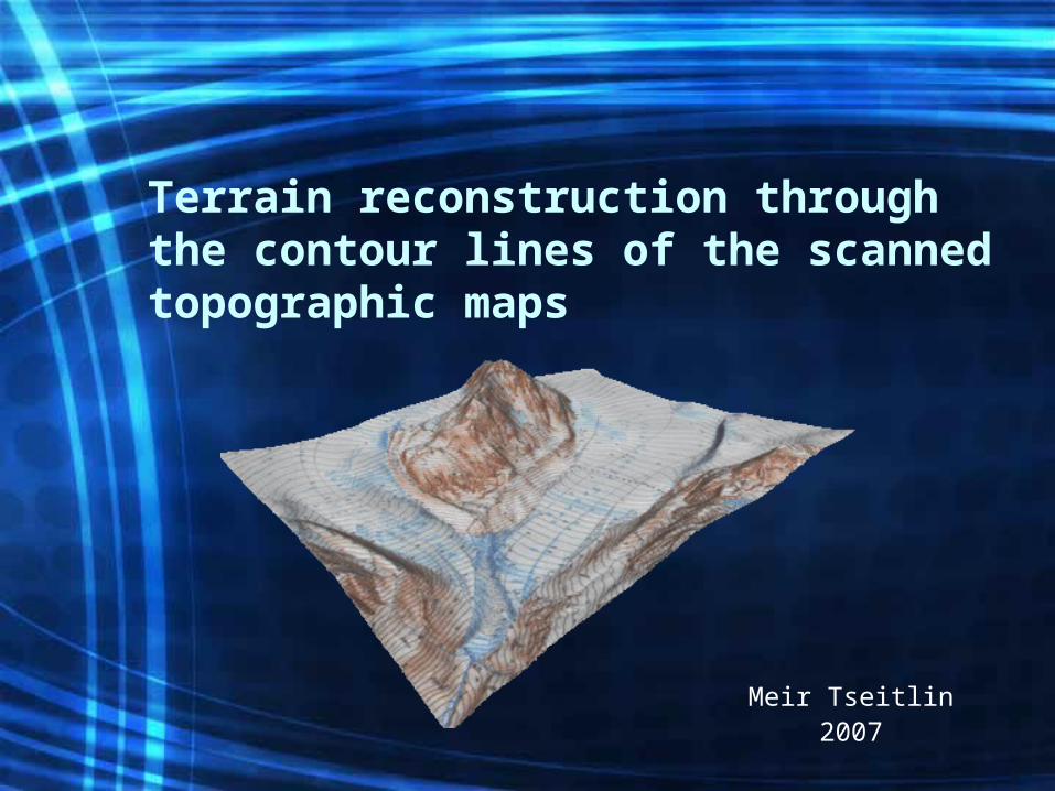
• Motivation• Background• Phase 1 – Extracting contour information• Phase 2 – Reconstructing sparse contour lines• Phase 3 – Estimating contour lines heights• Phase 4 – 3D terrain interpolation• Eliminating phase 2 (an attempt) • Results and conclusions• Bibliography
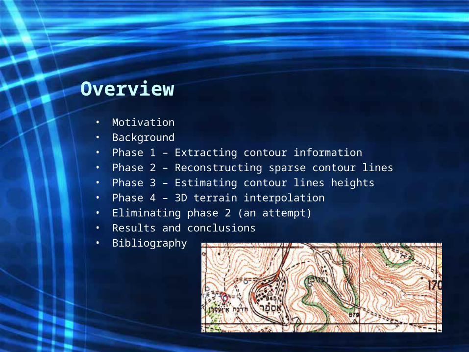
Motivation
• The growing need of 3D terrain simulations• The cost of height measurements from airplanes or
satellites• GBs of precise height measurements are not required• Wide spread of topographic maps
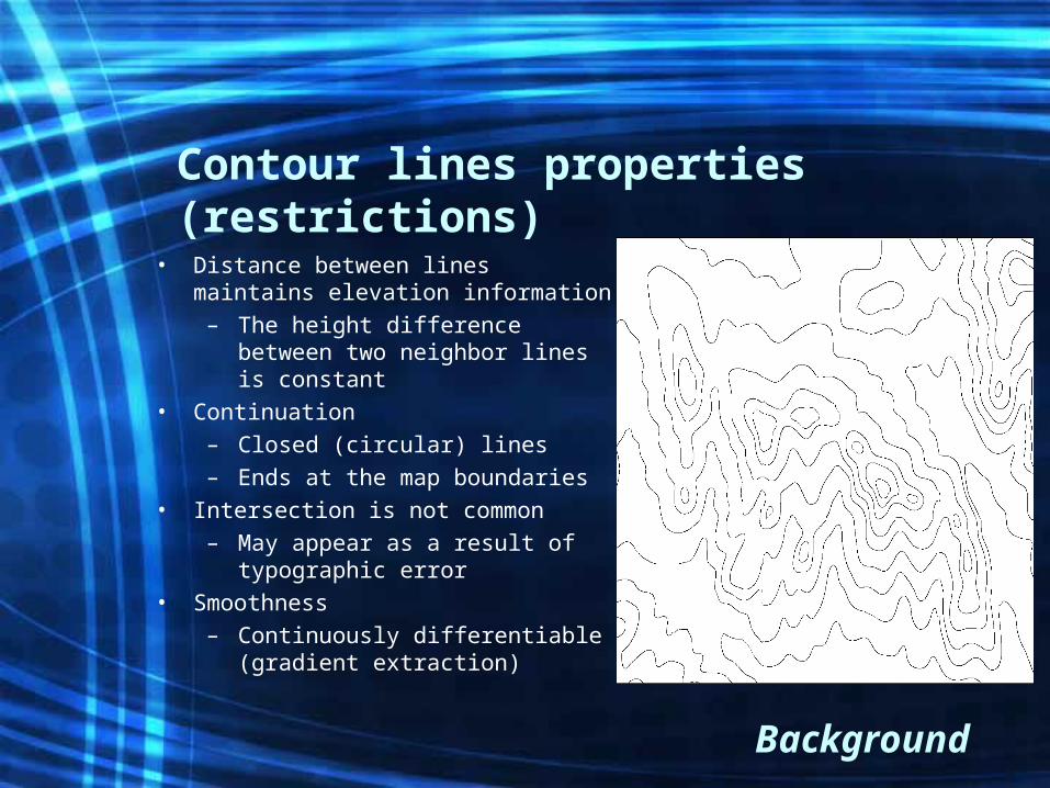
Contour lines properties (restrictions)
• Distance between lines maintains elevation information– The height difference between
two neighbor lines is constant• Continuation
– Closed (circular) lines– Ends at the map boundaries
• Intersection is not common– May appear as a result of
typographic error• Smoothness
– Continuously differentiable (gradient extraction)
Background
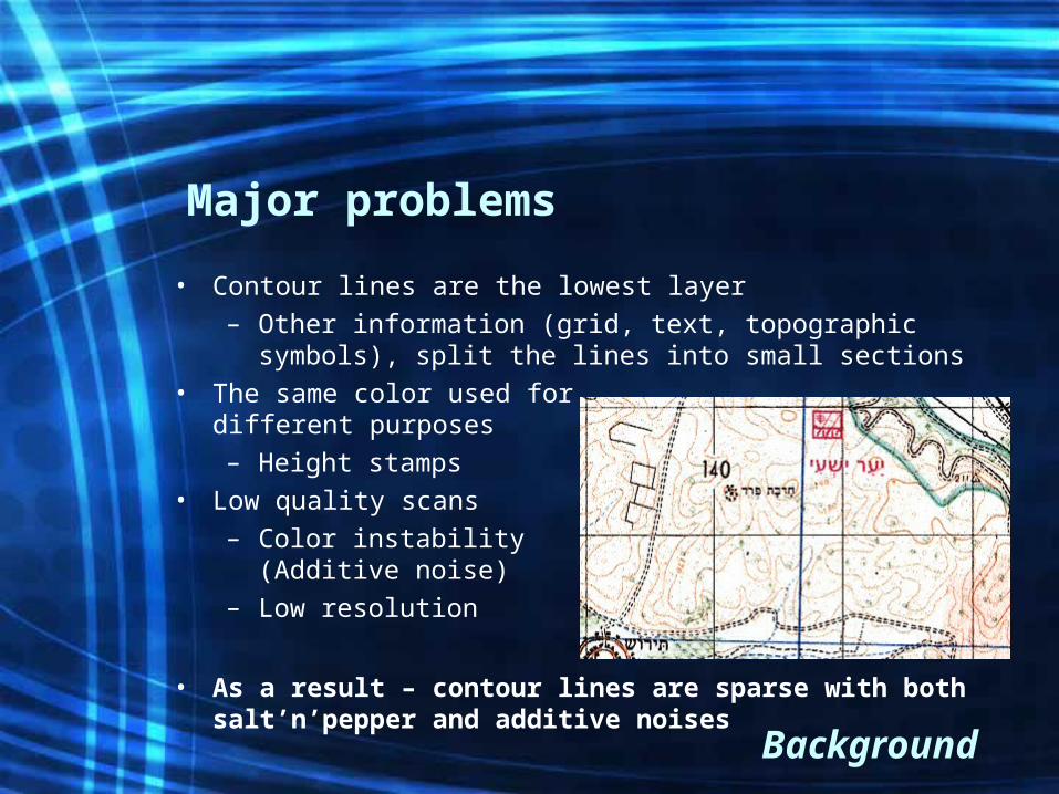
Major problems
• Contour lines are the lowest layer– Other information (grid, text, topographic symbols),
split the lines into small sections• The same color used for
different purposes– Height stamps
• Low quality scans– Color instability
(Additive noise)– Low resolution
• As a result – contour lines are sparse with both salt’n’pepper and additive noises
Background
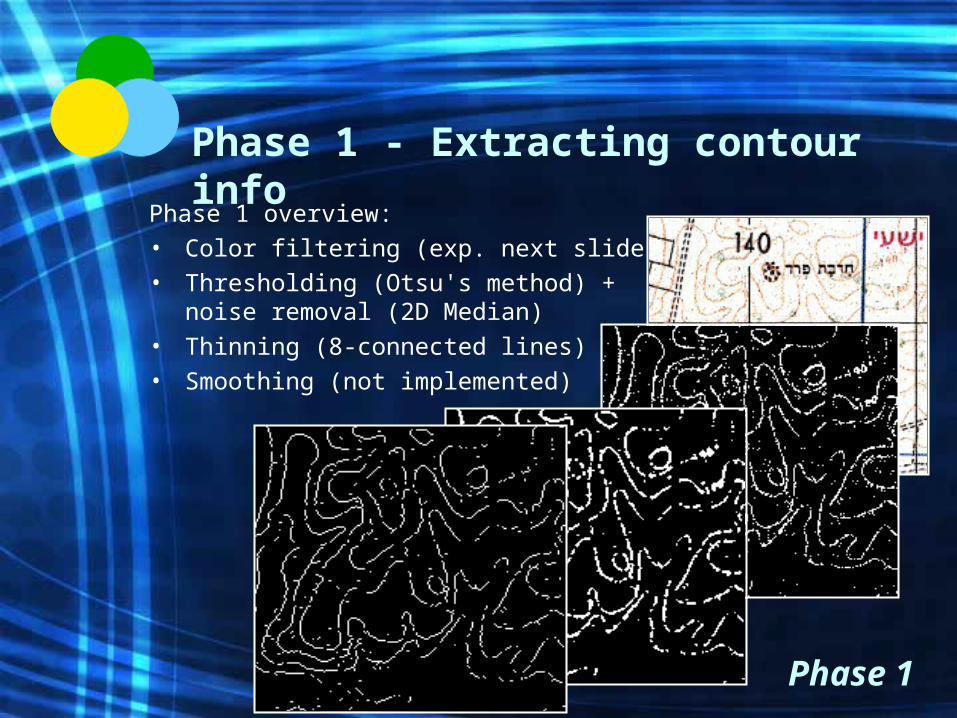
Phase 1 - Extracting contour info
Phase 1 overview:• Color filtering (exp. next slide)• Thresholding (Otsu's method) +
noise removal (2D Median)• Thinning (8-connected lines)• Smoothing (not implemented)
Phase 1
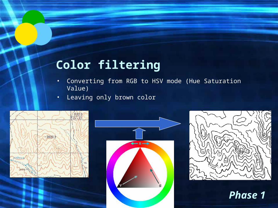
Color filtering• Converting from RGB to HSV mode (Hue Saturation
Value)• Leaving only brown color
Phase 1
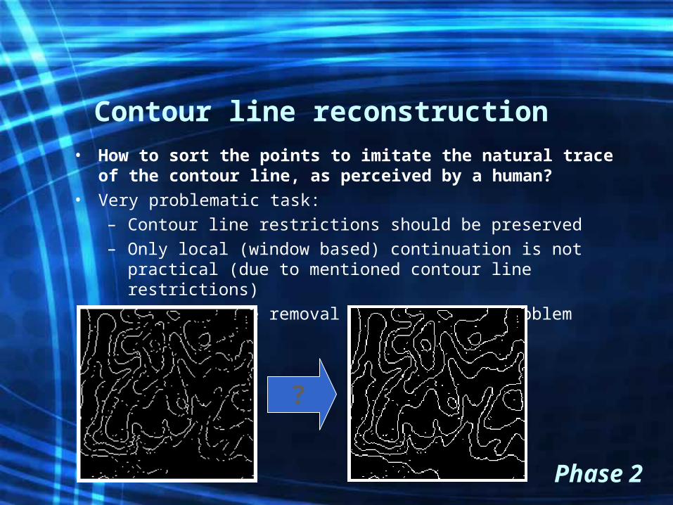
Contour line reconstruction• How to sort the points to imitate the natural trace of
the contour line, as perceived by a human?• Very problematic task:
– Contour line restrictions should be preserved– Only local (window based) continuation is not practical (due
to mentioned contour line restrictions)– Earlier noise removal may expand the problem
Phase 2
?
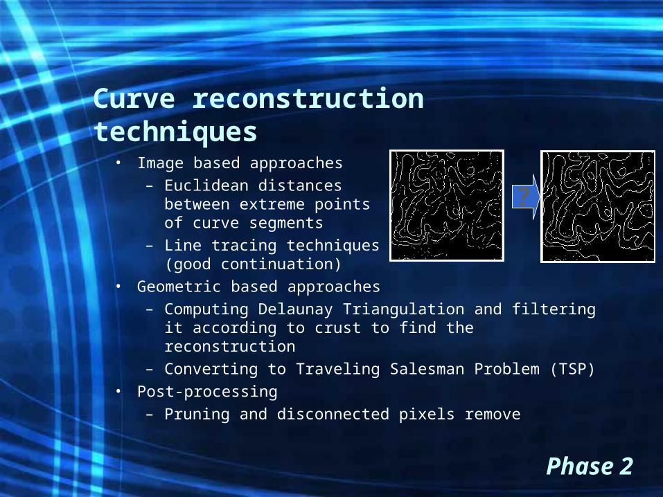
Curve reconstruction techniques
• Image based approaches– Euclidean distances
between extreme points of curve segments
– Line tracing techniques(good continuation)
• Geometric based approaches– Computing Delaunay Triangulation and filtering it
according to crust to find the reconstruction– Converting to Traveling Salesman Problem (TSP)
• Post-processing – Pruning and disconnected pixels remove
Phase 2
?
Curve reconstruction techniques (cont.)
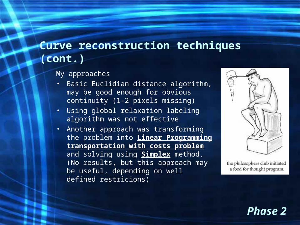
My approaches• Basic Euclidian distance algorithm,
may be good enough for obvious continuity (1-2 pixels missing)
• Using global relaxation labeling algorithm was not effective
• Another approach was transforming the problem into Linear Programming transportation with costs problem and solving using Simplex method. (No results, but this approach may be useful, depending on well defined restricions)
Phase 2
Phase 3 - Estimating contour lines heights
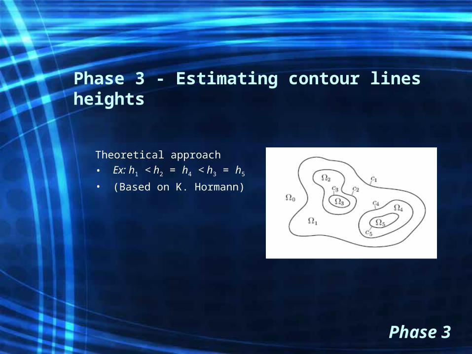
Theoretical approach
• Ex: h1 < h2 = h4 < h3 = h5
• (Based on K. Hormann)
Phase 3
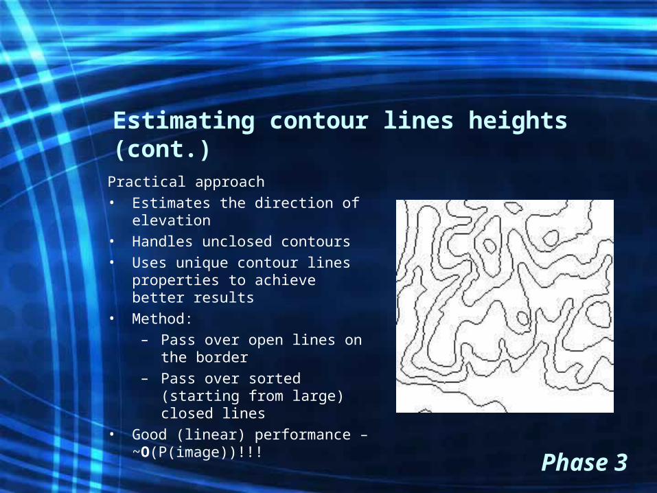
Estimating contour lines heights (cont.)
Practical approach• Estimates the direction of
elevation• Handles unclosed contours• Uses unique contour lines
properties to achieve better results
• Method:– Pass over open lines on the
border– Pass over sorted (starting
from large) closed lines• Good (linear) performance –
~O(P(image))!!!
Phase 3
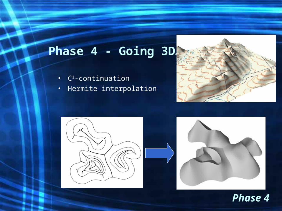
Phase 4 - Going 3D…
• C1-continuation• Hermite interpolation
Phase 4
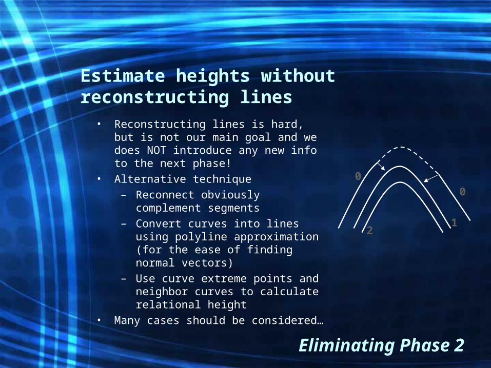
Estimate heights without reconstructing lines
• Reconstructing lines is hard, but is not our main goal and we does NOT introduce any new info to the next phase!
• Alternative technique– Reconnect obviously complement
segments– Convert curves into lines using
polyline approximation(for the ease of finding normal vectors)
– Use curve extreme points and neighbor curves to calculate relational height
• Many cases should be considered…
Eliminating Phase 2
0
0
12
Results and Conclusions
• Selected conclusions– Better scans can improve the computer results, even the
the human can have the same result with poor conditions– “Smarter” algorithms which can handle complicated input
can have better results (for example: eliminating threshold step and letting reconstruction alg. handle not binary data)
• Results– Proposal of practical and efficient method for estimation
of complete contour lines relative heights– Proposal of an alternative method for finding heights of
sparse contour lines– MATLAB code for 70% of the processing pipeline
Thank you!
Bibliography• Articles
– S. Salvatore, P. Guitton – Contour line recognition from scanned topographic maps (2003)
– K. Hormann, S. Spinello, P. Schroder - C1-continuous terrain reconstruction from sparse contours
– N. Amenta, M. Bern, D. Eppstein - The Crust and the -Skeleton combinatorial curve reconstruction (1997)
– T. Tversky, W. Geisler, J. Perry - Contour grouping: closure effects are explained by good continuation and proximity (2004)
• Books– G. Ritter, J. Wilson – Handbook of Computer Vision Algorithms in
Image Algebra. Second Edition (2001)• Web
– Wikipedia.org– Peter’s functions for Computer Vision -
www.csse.uwa.edu.au/~pk/research/matlabfns/– Nina Amenta’s publications -
www.cs.utexas.edu/users/amenta/pubs/pubs.html– Geometric Calculations for MATLAB
http://www.scs.fsu.edu/~burkardt/m_src/geometry/geometry.html