Embed Size (px)
DESCRIPTION
Tectonic boundaries and hot spots. A useful reference. http://www.learner.org/interactives/dynamicearth/sitemap.html. http://pubs.usgs.gov/gip/dynamic/dynamic.html#anchor19309449. Types of Plate Boundaries. Divergent - Pull apart- Mid Ocean Ridges - PowerPoint PPT Presentation
Citation preview
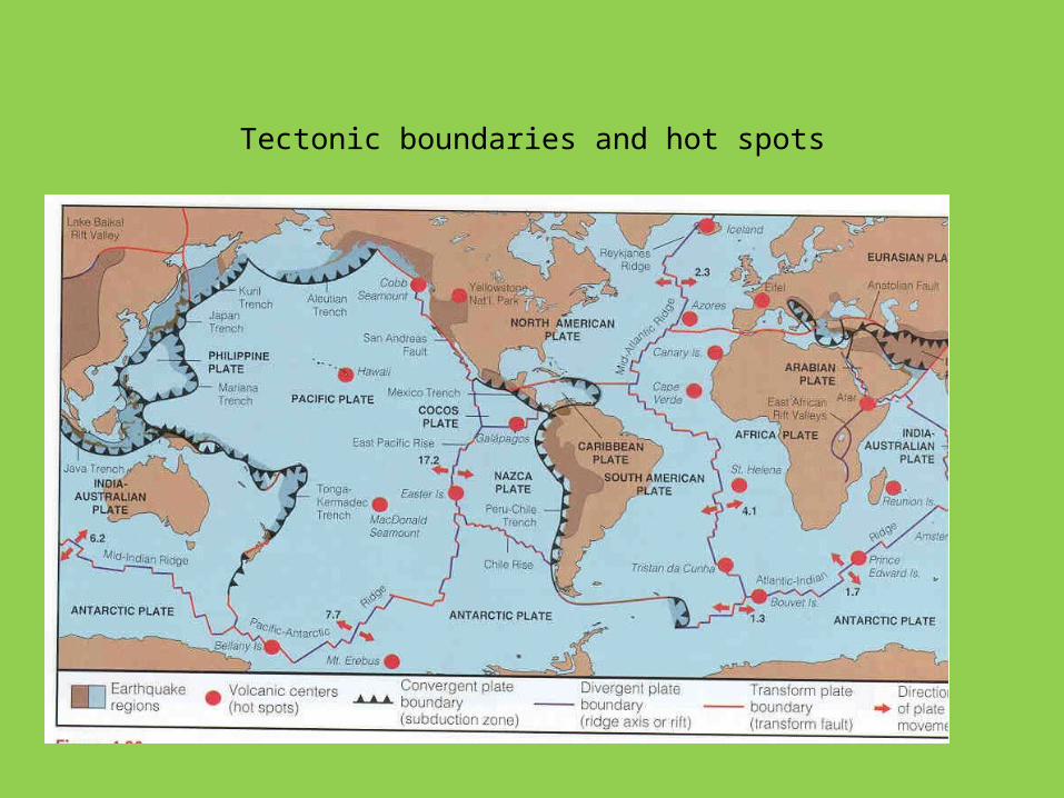
Tectonic boundaries and hot spots

A useful reference
http://www.learner.org/interactives/dynamicearth/sitemap.html
http://pubs.usgs.gov/gip/dynamic/dynamic.html#anchor19309449
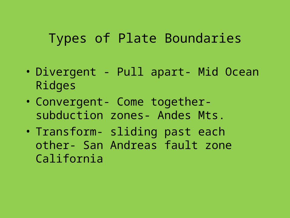
Types of Plate Boundaries
• Divergent - Pull apart- Mid Ocean Ridges• Convergent- Come together- subduction zones-
Andes Mts.• Transform- sliding past each other- San Andreas
fault zone California
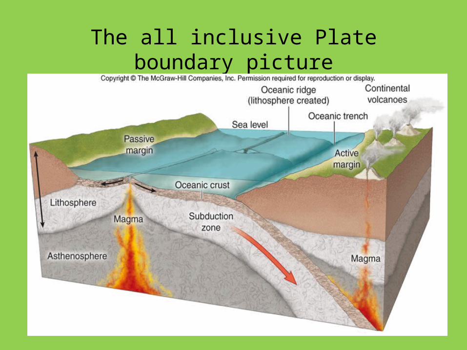
The all inclusive Plate boundary picture
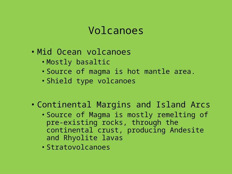
Volcanoes
• Mid Ocean volcanoes • Mostly basaltic• Source of magma is hot mantle area.• Shield type volcanoes
• Continental Margins and Island Arcs• Source of Magma is mostly remelting of pre-
existing rocks, through the continental crust, producing Andesite and Rhyolite lavas
• Stratovolcanoes
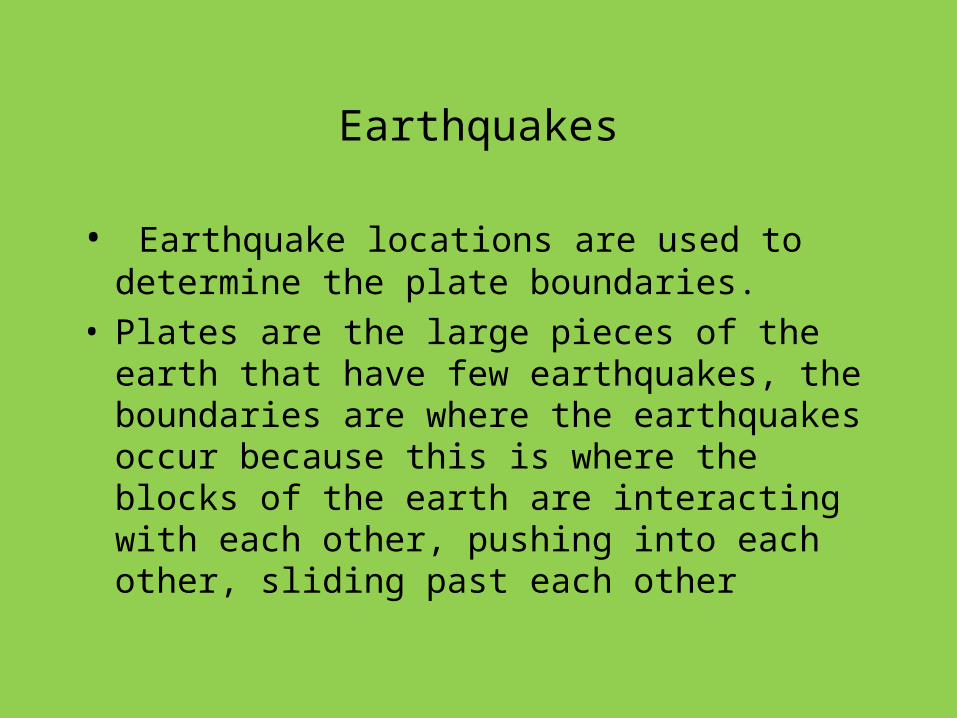
Earthquakes
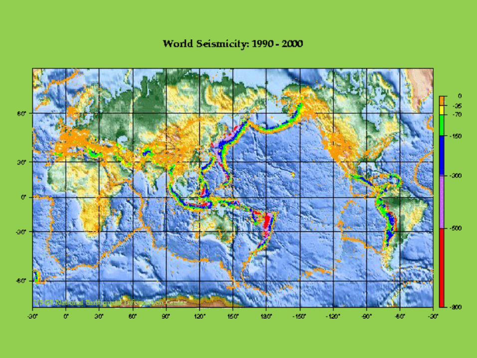
• Earthquake locations are used to determine the plate boundaries.
• Plates are the large pieces of the earth that have few earthquakes, the boundaries are where the earthquakes occur because this is where the blocks of the earth are interacting with each other, pushing into each other, sliding past each other

Tectonic boundaries and hot spots
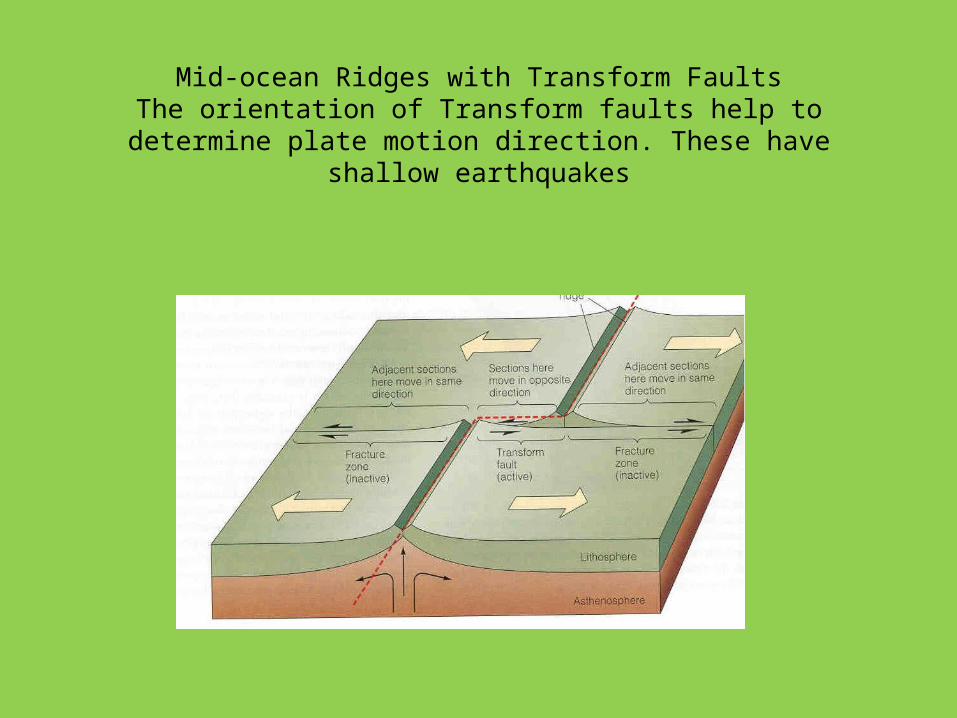
Mid-ocean Ridges with Transform FaultsThe orientation of Transform faults help to determine plate motion
direction. These have shallow earthquakes

Trenches at Island ArcsThese have shallow to deep earthquakes and usually rhyolitic flows
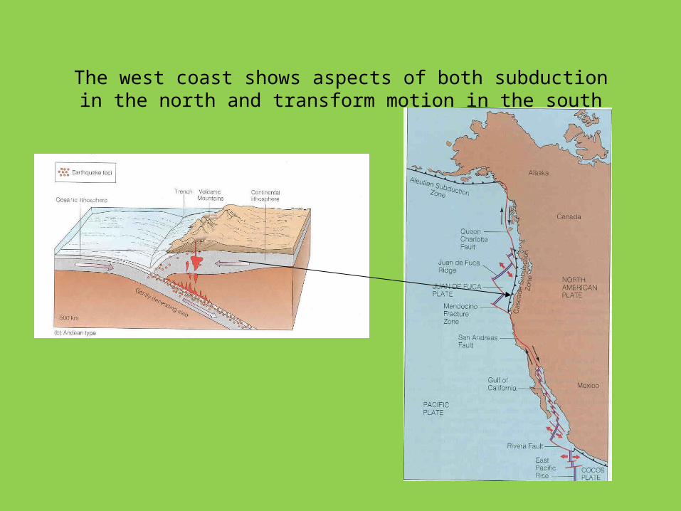
The west coast shows aspects of both subduction in the north and transform motion in the south
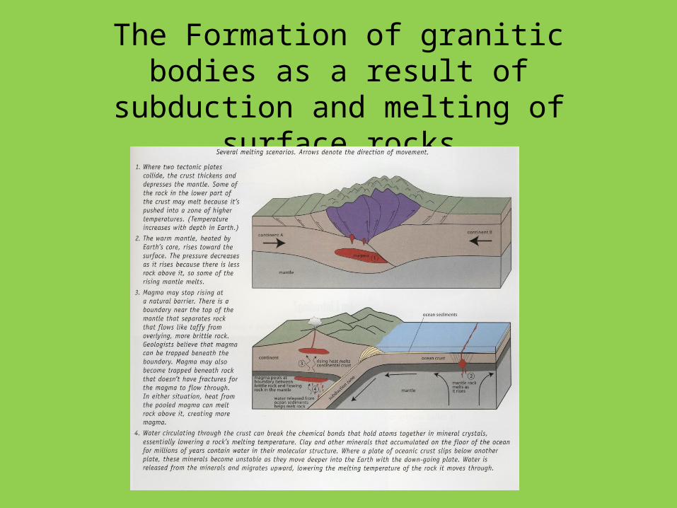
The Formation of granitic bodies as a result of subduction and melting of surface rocks
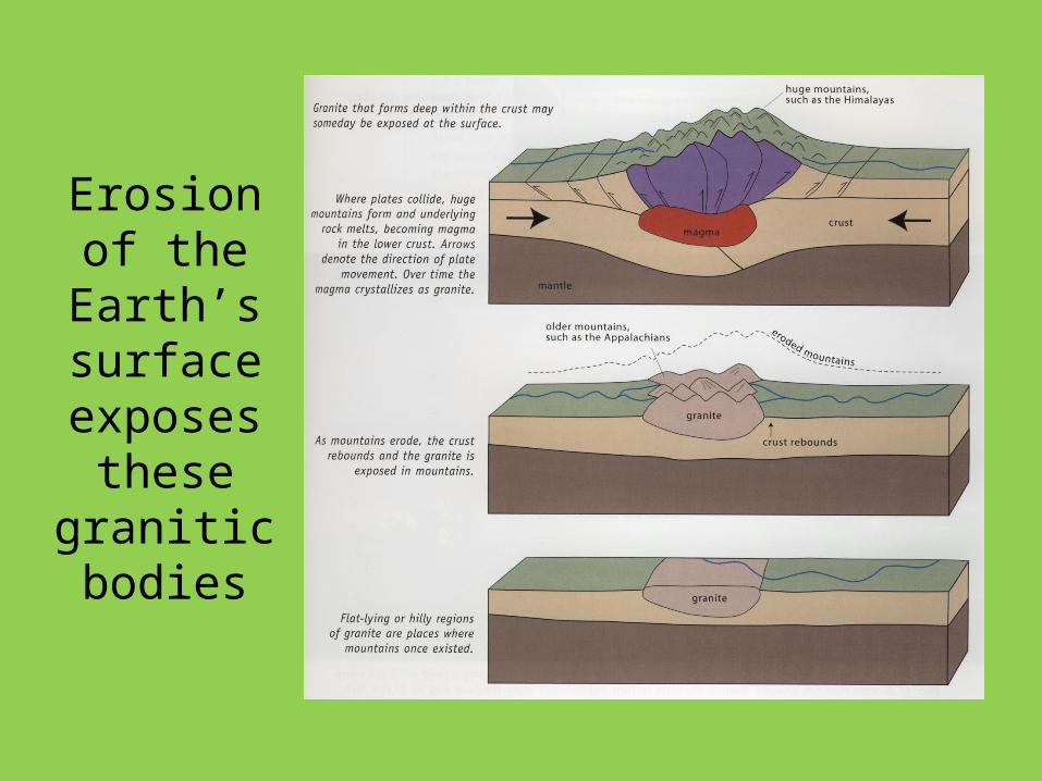
Erosion of the Earth’s
surface exposes
these granitic bodies
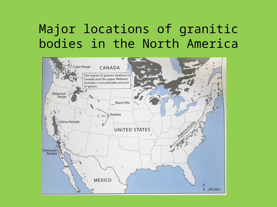
Major locations of granitic bodies in the North America
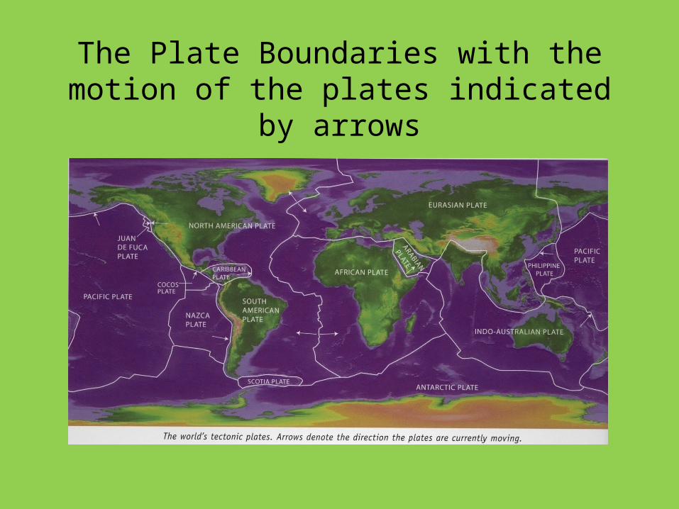
The Plate Boundaries with the motion of the plates indicated by arrows
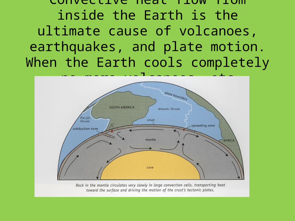
Convective heat flow from inside the Earth is the ultimate cause of volcanoes, earthquakes,
and plate motion. When the Earth cools completely –no more volcanoes etc.
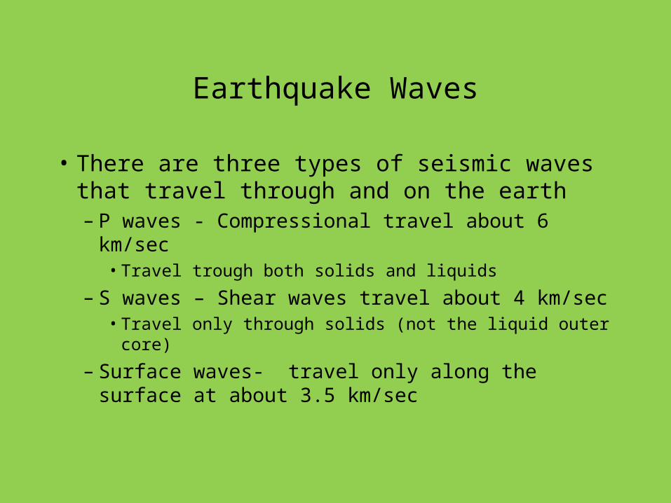
Earthquake Waves
• There are three types of seismic waves that travel through and on the earth– P waves - Compressional travel about 6 km/sec
• Travel trough both solids and liquids
– S waves – Shear waves travel about 4 km/sec• Travel only through solids (not the liquid outer core)
– Surface waves- travel only along the surface at about 3.5 km/sec
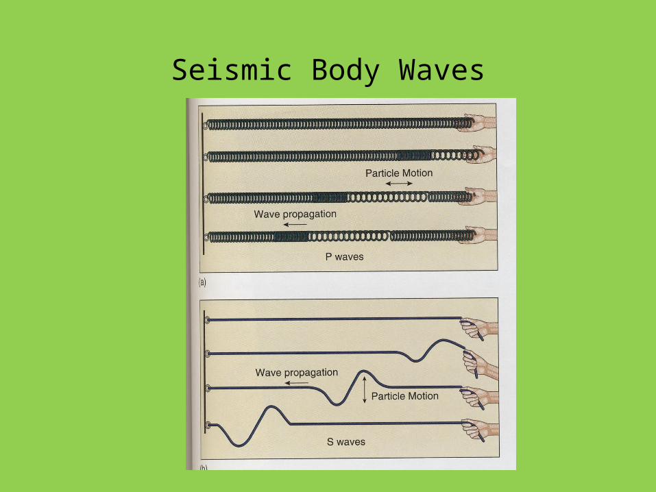
Seismic Body Waves
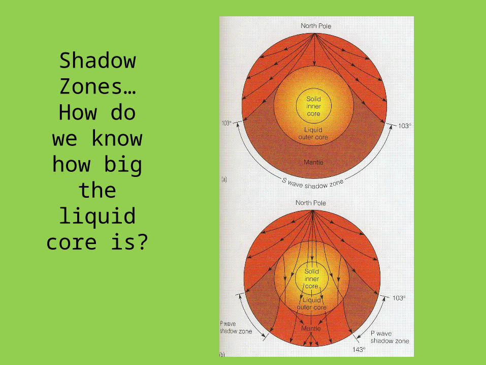
Shadow Zones…
How do we know how
big the liquid core
is?
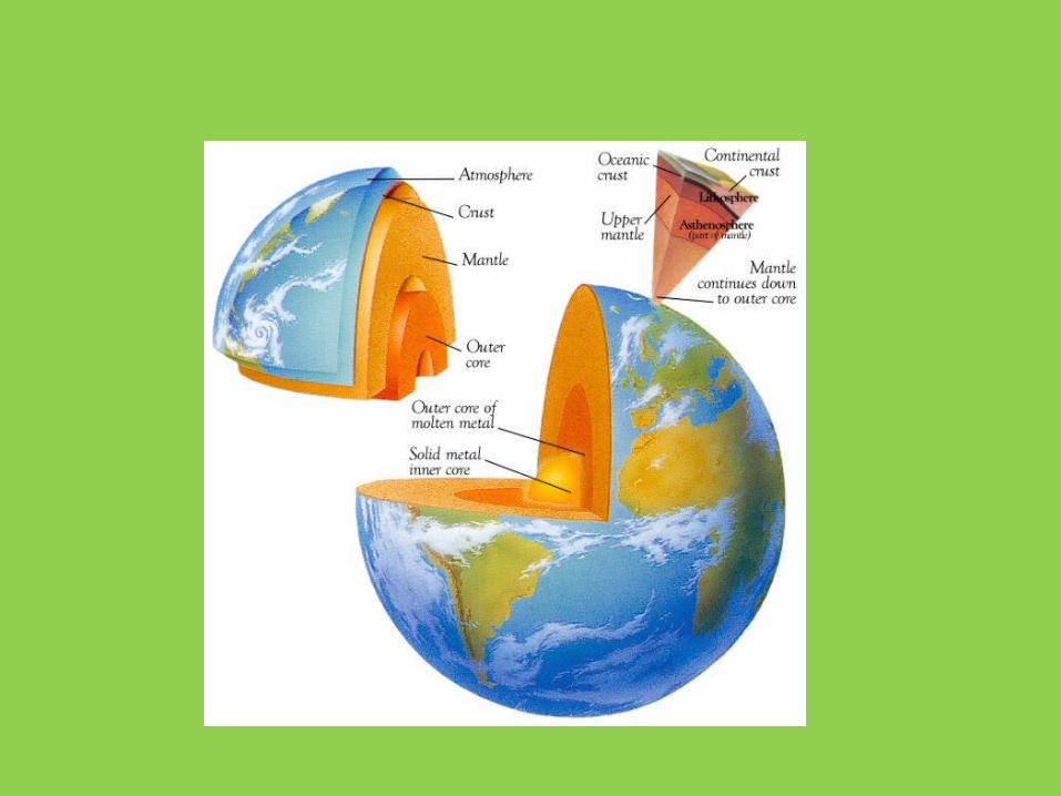
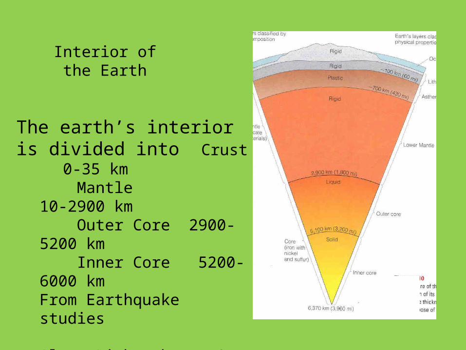
Interior of the Earth
The earth’s interior is divided into Crust 0-35 km
Mantle 10-2900 km Outer Core 2900-5200 km Inner Core 5200-6000 km From Earthquake studies
Also: Lithosphere 0-100 km Asthenosphere 100-700
kmBased on rigid vs. plastic
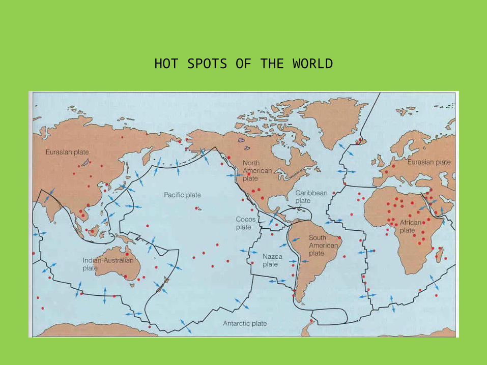
HOT SPOTS OF THE WORLD
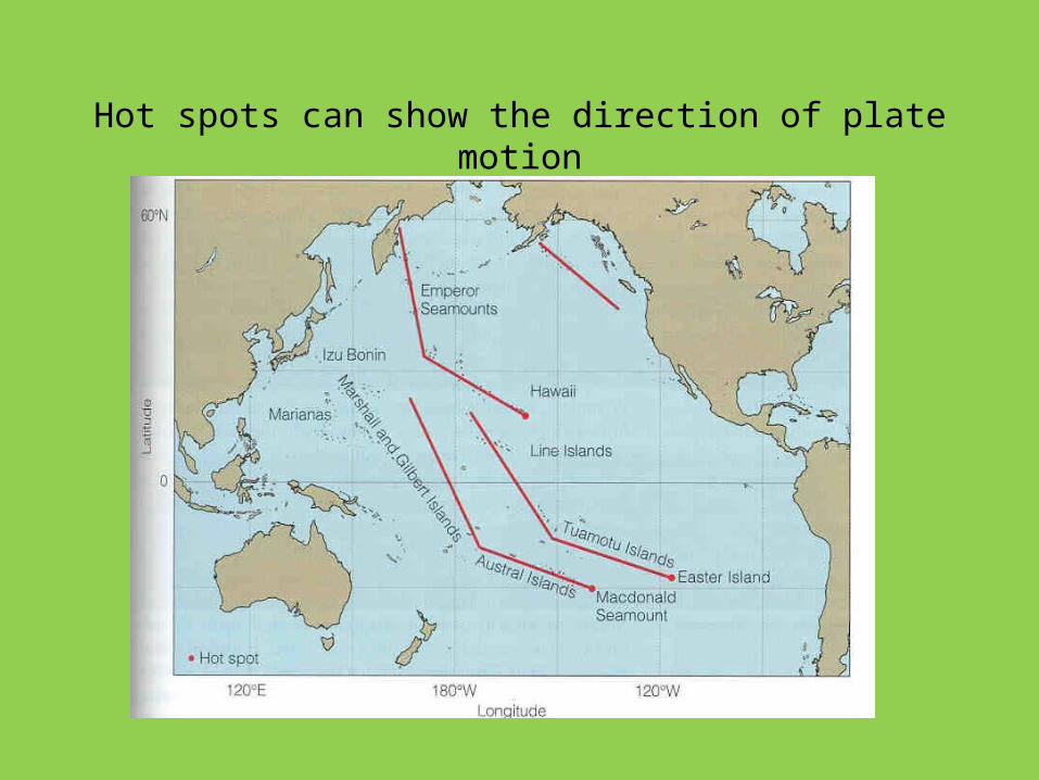
Hot spots can show the direction of plate motion

Problems Not solved
• Driving Mechanism
• Why Hot Spots
• How deep does convection take place
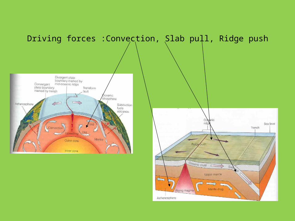
Driving forces :Convection, Slab pull, Ridge push
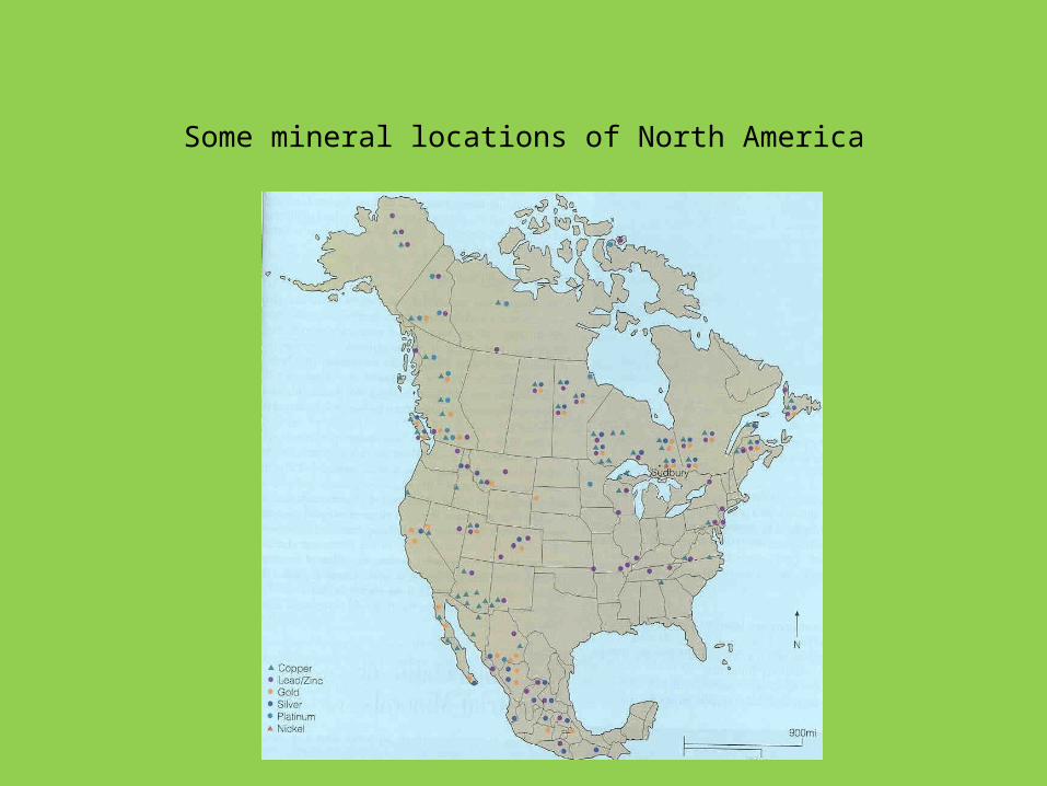
Some mineral locations of North America
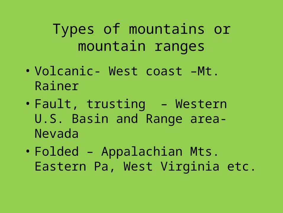
Types of mountains or mountain ranges
• Volcanic- West coast –Mt. Rainer
• Fault, trusting – Western U.S. Basin and Range area- Nevada
• Folded – Appalachian Mts. Eastern Pa, West Virginia etc.
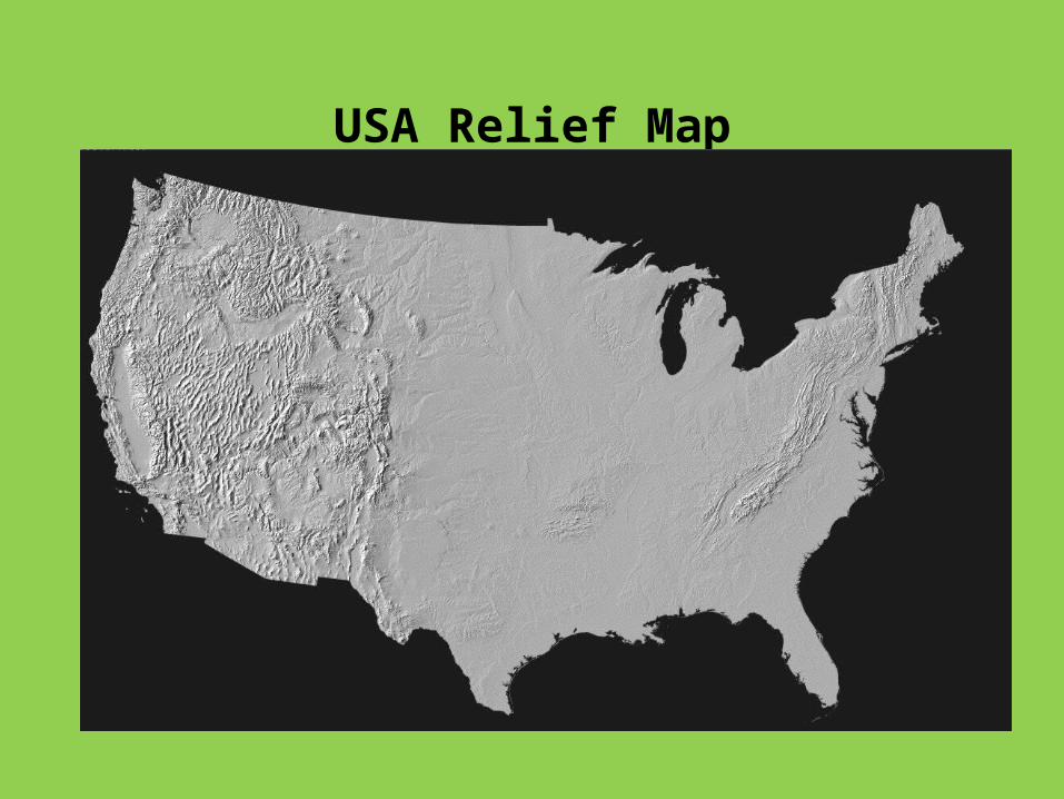
USA Relief Map
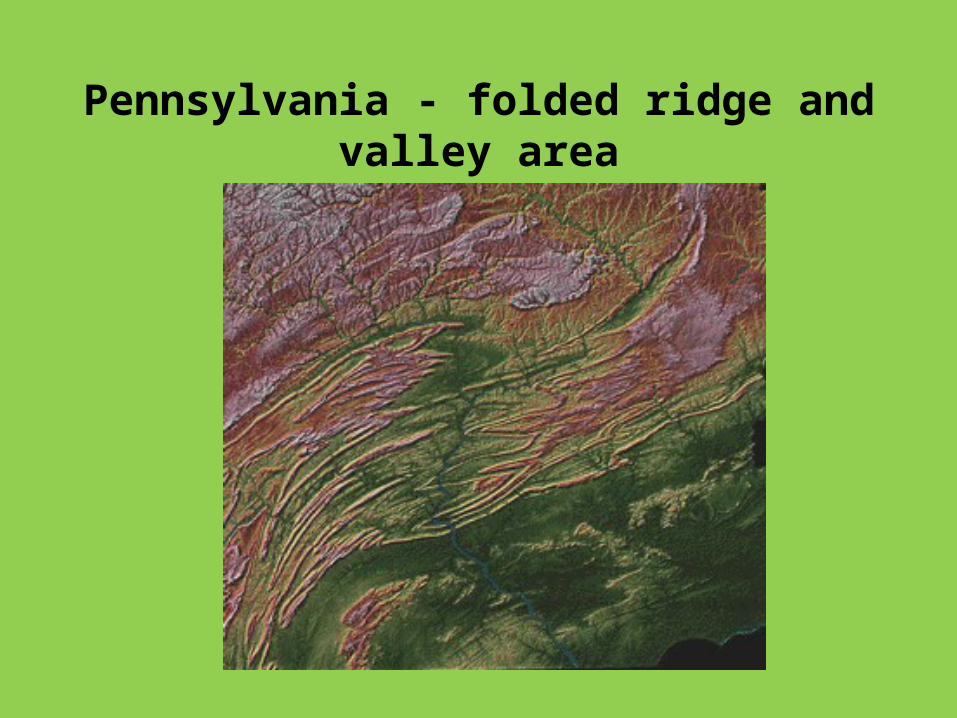
Pennsylvania - folded ridge and valley area
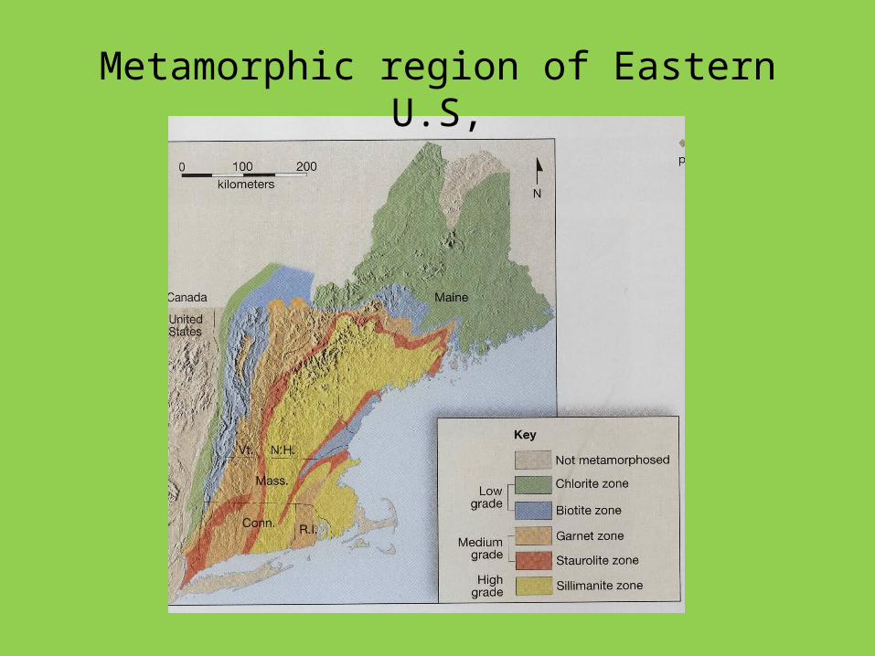
Metamorphic region of Eastern U.S,
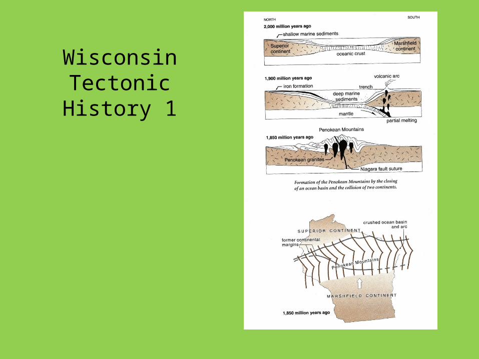
Wisconsin Tectonic History
1
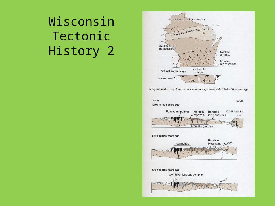
Wisconsin Tectonic History 2
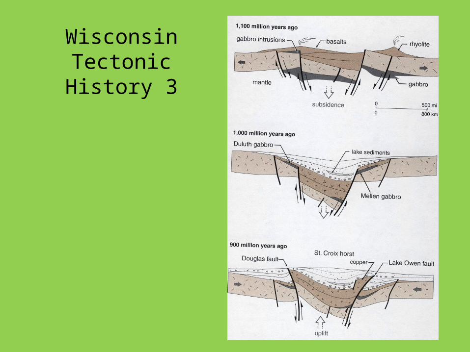
Wisconsin Tectonic History 3
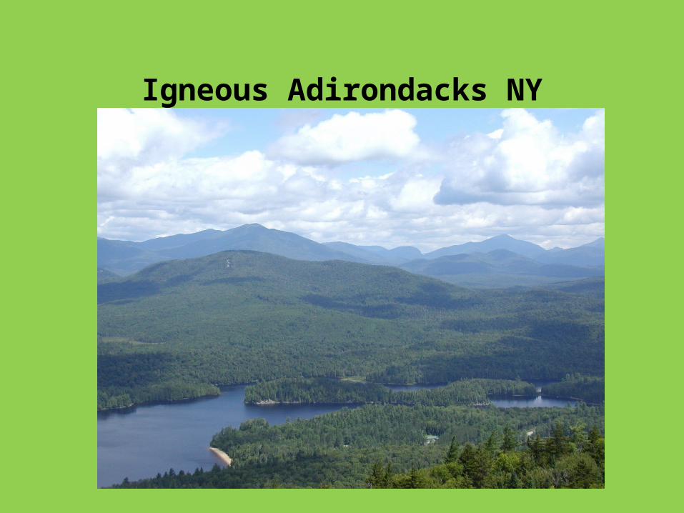
Igneous Adirondacks NY
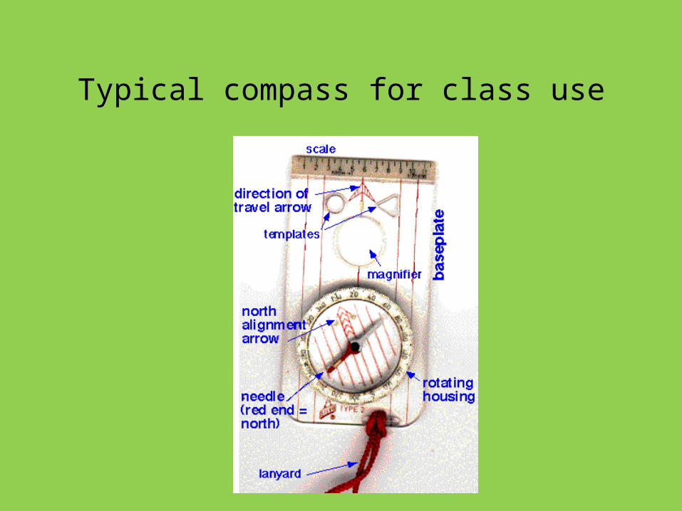
Typical compass for class use
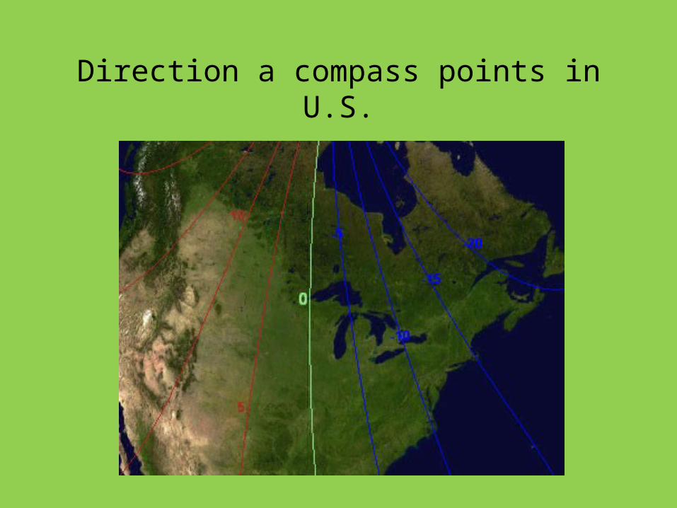
Direction a compass points in U.S.
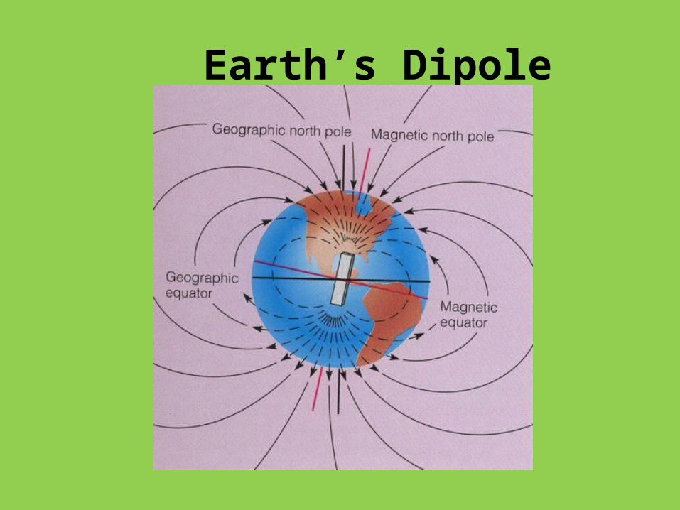
Earth’s Dipole Magnetic Field
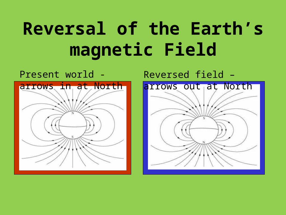
Reversal of the Earth’s magnetic Field
Present world - arrows in at North
Reversed field – arrows out at North
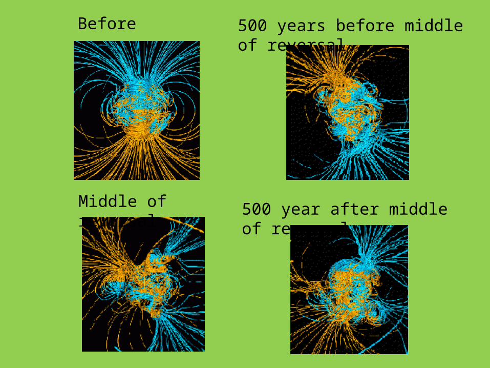
Before 500 years before middle of reversal
Middle of reversal 500 year after middle of reversal
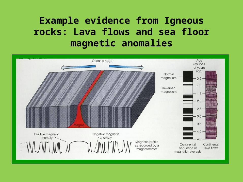
Example evidence from Igneous rocks: Lava flows and sea floor magnetic anomalies
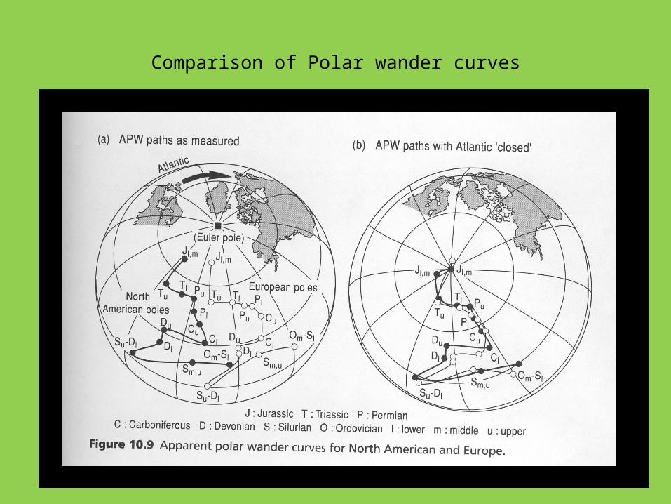
Comparison of Polar wander curves
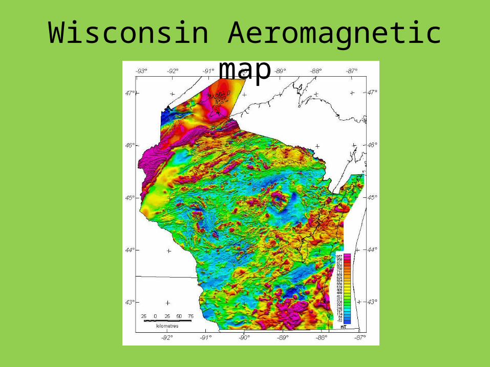
Wisconsin Aeromagnetic map
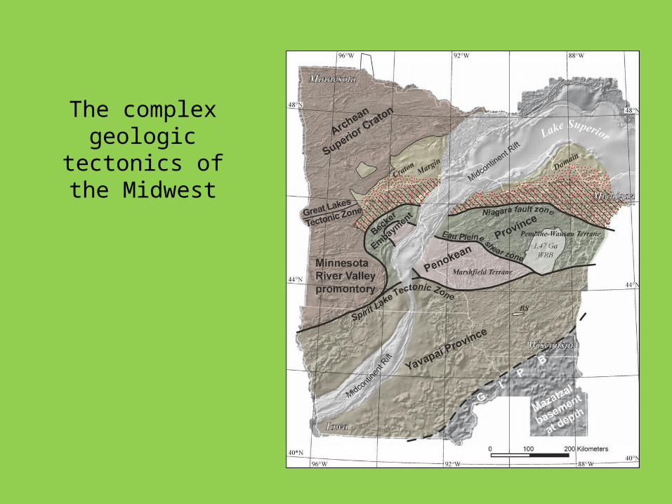
The complex geologic tectonics
of the Midwest