Embed Size (px)
Citation preview
Technical advances in satellite imagery: Keeping up-
to-date in an increasingly complex landscape
Richard Burren, Director of NPA Satellite Mapping
ESRI European Petroleum GIS Conference – 1st November 2017

Imaging from space today
2 © CGG | NPA Satellite Mapping
https://www.youtube.com/watch?v=cvJYSmplzXc&list=LLYChevwGmPl8AJhYSljR3fw&index=114

A lot has changed over the past 45 years….
3
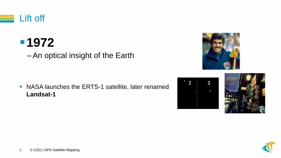
Lift off
1972 – An optical insight of the Earth
NASA launches the ERTS-1 satellite, later renamed
Landsat-1
4 © CGG | NPA Satellite Mapping

INTEGRATE LANDSAT image
5 © CGG | NPA Satellite Mapping User Seminar – Houston 2017

Lift off
1991 – All weather imaging
ESA launches the ERS-1 synthetic aperture radar
satellite
6 © CGG | NPA Satellite Mapping

INTEGRATE ERS image
7 © CGG | NPA Satellite Mapping User Seminar – Houston 2017 © ESA 1993

Aiming higher
1999 – A more detailed optical view…
Spacing Imaging launches the first commercial
high spatial resolution satellite, IKONOS
8 © CGG | NPA Satellite Mapping
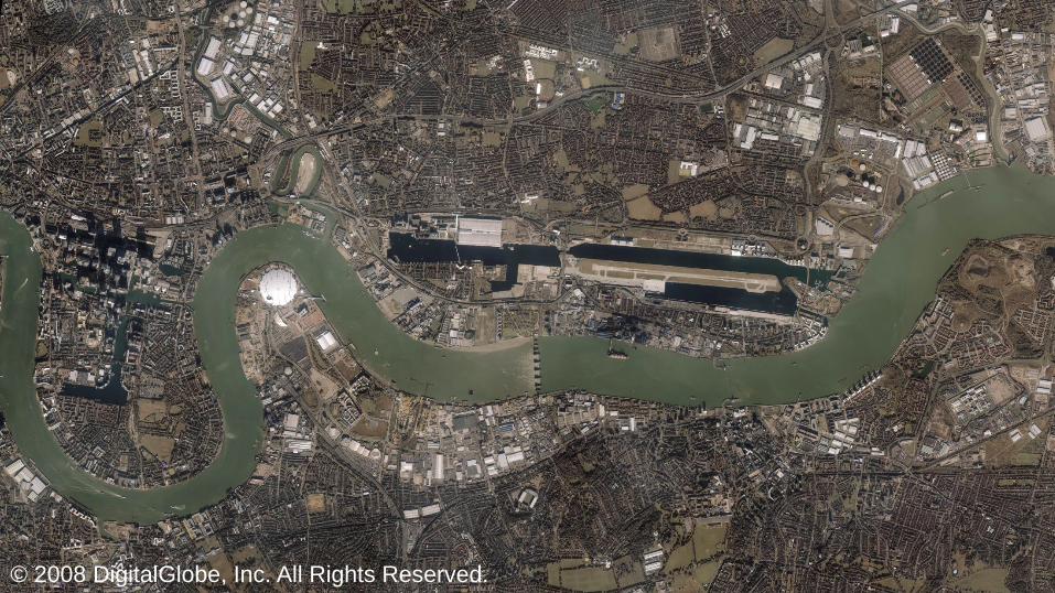
INTEGRATE IKONOS image
9 © CGG | NPA Satellite Mapping User Seminar – Houston 2017 © 2008 DigitalGlobe, Inc. All Rights Reserved.

Aiming higher
1999 – …and an increased spectral view!
NASA launch the Terra satellite, which hosts the
Japanese multi-spectral ASTER instrument
10 © CGG | NPA Satellite Mapping

INTEGRATE ASTER image
11 © CGG | NPA Satellite Mapping User Seminar – Houston 2017

Aiming higher
2007 – A more detailed, and frequent, radar view
DLR and EADS Astrium launch TerraSAR-X and the
Italian Space Agency/Italian MoD launch the first of four
COSMO-SkyMed satellites
12 © CGG | NPA Satellite Mapping

INTEGRATE TSX image stack & WorldDEM example
13 © CGG | NPA Satellite Mapping User Seminar – Houston 2017 © 2016 Airbus Defence and Space / Infoterra GmbH

Relax the rules – Increase the detail
2015 – US government restrictions eased
Digital Globe’s WorldView-3 satellite delivers 31cm
spatial resolution imagery
14 © CGG | NPA Satellite Mapping Seminar

INTEGRATE WorldView-3 image (before and after)
15 © CGG | NPA Satellite Mapping User Seminar – Houston 2017 © 2015 DigitalGlobe, Inc. All Rights Reserved.

Space boom!
Today – Smallsat revolution…
Planet launch 88 more Dove satellites
16 © CGG | NPA Satellite Mapping Seminar

17 © CGG | NPA Satellite Mapping User Seminar – Houston 2017
March 9, 2016
Image © 2016 Planet Lab Inc. All Rights Reserved

18 © CGG | NPA Satellite Mapping User Seminar – Houston 2017
March 14, 2016
Image © 2016 Planet Lab Inc. All Rights Reserved

19 © CGG | NPA Satellite Mapping User Seminar – Houston 2017
March 15, 2016
Image © 2016 Planet Lab Inc. All Rights Reserved

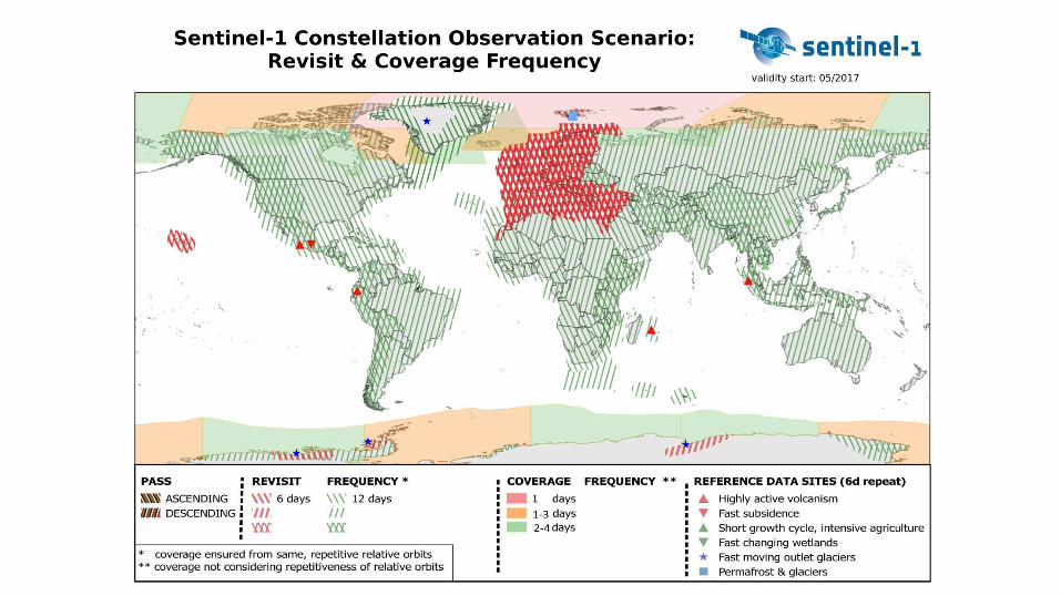
Space boom!
Today – …and open-access revolution
EC and ESA continue to roll out the Sentinel
family of satellites
20 © CGG | NPA Satellite Mapping Seminar

Many more on the horizon!
Tomorrow – An increasingly complex landscape…
WorldView Scout & Legion, Urthedaily, EiX2,
BlackSky, Landmapper…
PAZ, SAOCOM, RADARSAT Constellation Mission,
OptiSAR, MicroSAR, ASNARO-2, ICEYE, Copella…
22 © CGG | NPA Satellite Mapping Seminar

23
More is good, yeah?

Unequivocally, yes
24 © CGG | NPA Satellite Mapping
More
choice Long-term
continuity
High-frequency
collection
Bigger, better
global archives
Increased
agility
More flexible
tasking
More competitive
pricing??
Persistent
collection
25
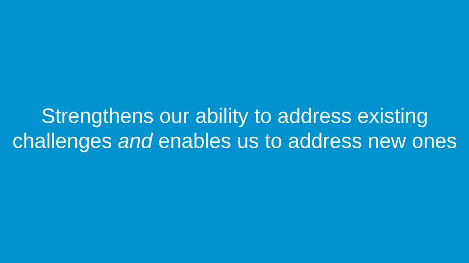
Strengthens our ability to address existing
challenges and enables us to address new ones

Challenges remain…
26 © CGG | NPA Satellite Mapping
Usage
terms Data quality
Cost
Weather
Data access
Processing
power
You only know
what you know
Data size
Deciphering the
marketing
Rules of
physics
Viewing
geometry

27
So, where to start?
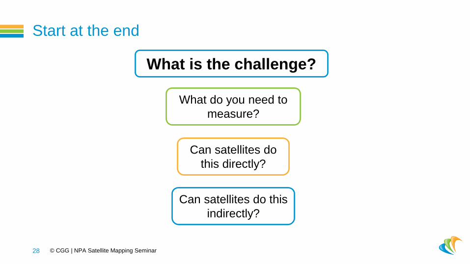
Start at the end
28 © CGG | NPA Satellite Mapping Seminar
What is the challenge?
What do you need to
measure?
Can satellites do
this directly?
Can satellites do this
indirectly?

Start at the end
29 © CGG | NPA Satellite Mapping Seminar – Houston 2017
SS:MM:HH:DD:MM:YY
Appropriate
scale
Frequency of
change
Budget

30
The art of the science is matching these to
available options

Conclusion
Dramatic changes in satellite imaging capabilities and options
Do better
Do more
Comprehensive (impartial) knowledge to connect an application to the
right imagery
31 © CGG | NPA Satellite Mapping

Thank you Website: www.cgg.com/npa
LinkedIn: ‘NPA Satellite Mapping’
Follow us on Twitter: @CGGNPA