Embed Size (px)
Citation preview

Page | 1
TCEQ Permit No. 2378
Permit Application by Post Oak Clean Green, Inc. for Municipal Solid Waste Permit No. 2378
§ § § §
Before the Texas Commission on
Environmental Quality
Executive Director’s Response to Public Comments
The Executive Director of the Texas Commission on Environmental Quality (the
Commission or TCEQ) files this Response to Public Comments (Response) on an
application received from Post Oak Clean Green, Inc. (Applicant) for a new Municipal
Solid Waste (MSW) landfill under Permit Application Number 2378 (Application) and
on the Executive Director’s preliminary decision. As required by Title 30 Texas
Administrative Code (TAC), Section(§) 55.156, before an application is approved, the
Executive Director prepares a response to all timely, relevant and material, or
significant comments. The Office of the Chief Clerk received timely written comments,
as well as oral comments at public meetings held on April 24, 2012, and March 6, 2014.
Attachment A provides a list of approximately 220 individuals who provided
timely written and oral comments in support of the proposed facility. Reasons for their
support include a need for a disposal facility in the area and the benefit of associated
jobs and recycling activities. These comments are acknowledged, and no further
response will be provided.
Attachment B lists the approximately 215 individuals who provided timely
written and oral comments in opposition, or noted concerns over the proposed facility.
A petition was provided by Mr. Jim Watts at the April 24, 2012, public meeting on
behalf of a protestant group, Stop Post Oak Dump (SPOD). The petition was signed by
over 1,300 individuals. The comments provided by the petition are addressed in this
Response, but these parties are not listed individually in this Response.
State Senator Judith Zaffirini, State Senator Donna Campbell, State
Representative John Kuempel, past Schertz Mayor Pro Tem David Scagliola, and past

Page | 2
Seguin Mayor Betty Ann Matthies expressed opposition to the proposed facility. State
Senator Jeff Wentworth expressed concern over the proposed location.
Representatives for various organizations provided comments in opposition to or
concern over the proposed facility. The representatives are included within
Attachment B. The organizations include the Alamo Area Council of Governments, the
Alamo Soil and Water Conservation District No. 330, the Association of Texas Soil and
Water Conservation Districts, the Bastrop County Soil and Water Conservation District
No. 40, Burleson County Soil and Water Conservation District No. 358, Canyon
Regional Water Authority, Cibolo Valley Local Government Corporation, Comal-
Guadalupe Soil and Water Conservation District #306, DeWitt County Soil and Water
Conservation District, Gonzales County Soil and Water Conservation District No. 338,
Gonzales County Underground Water Conservation District, Gonzales County Water
Supply Corporation, Green Valley Special Utility District, Guadalupe County
Commissioners Court, Guadalupe County Groundwater Conservation District,
Guadalupe County Farm Bureau, Hays Caldwell Public Utility Agency, Independent
Cattlemen’s Association of Texas, Luling Foundation, Plum Creek Conservation District,
San Antonio Water System, City of Schertz, Schertz/Seguin Local Government
Corporation (SSLGC), City of Seguin, Texas Railroad Commission (TRRC), Seguin Area
Chamber of Commerce, Water Protection Association, and Wilson County Farm Bureau.
A letter from the TRRC Regional Office initially opposed the Application, but this
opposition was withdrawn by a subsequent letter from the TRRC Central Office. This
subsequent letter maintained concerns, which are addressed in this Response, but
withdrew opposition.
This Response addresses all timely public comments received, whether or not
withdrawn, regarding the Application. If you need more information about this
Application or the municipal solid waste permitting process, please call the TCEQ Public
Education Program at 1-800-687-4040. General information about the TCEQ can be
found at our website at www.tceq.texas.gov/.

Page | 3
I. Background
A. Description of Facility
Post Oak Clean Green applied to the TCEQ for an MSW permit to construct and
operate the Post Oak Municipal Solid Waste Landfill, which would include a new Type I
MSW landfill; a recyclables, used oil, and lead battery storage area; a scrap tire storage
area; a large items and white goods storage area; a reusable materials staging area; and
a citizens convenience area. The facility would be located approximately 12 miles east of
Seguin, Texas and 3.1 miles east-southeast of the intersection of Interstate 10 and FM
1104 in Guadalupe County, Texas. The total permitted area would include about 1,003
acres of land, of which approximately 331 acres would be used for a waste disposal unit.
The final elevation of the landfill final cover material would be 692 feet above mean sea
level (MSL), which is approximately 232 feet above natural grade. Solid waste to be
disposed of would primarily consist of municipal solid waste resulting from, or
incidental to, municipal, community, commercial, institutional, recreational and
industrial activities, including garbage, putrescible wastes, rubbish, ashes, brush, street
cleanings, dead animals, abandoned automobiles, construction-demolition waste,
vegetative waste, Class 2 nonhazardous industrial solid waste, Class 3 nonhazardous
industrial solid waste, and special waste. The proposed landfill would not be authorized
to accept waste materials other than those mentioned above for disposal. Furthermore,
waste streams that are expressly prohibited by 30 TAC §330.15 could not be accepted.
B. Procedural Background
Parts I and II of the Application were received by the TCEQ on December 28,
2011, and declared administratively complete on January 6, 2012. The Notice of Receipt
of Application for Land Use Compatibility Determination for a New Municipal Solid
Waste Permit was published in English and in Spanish in the Seguin Gazette on
January 18, 2012. The Notice of Public Meeting was published in the Seguin Gazette on
April 4, 2012; April 11, 2012; and April 18, 2012. A public meeting was held on April 24,
2012, at the Seguin-Guadalupe County Coliseum, located at 950 South Austin Street,
Seguin, Texas. The Executive Director completed the technical review of Parts I and II of

Page | 4
the Application on April 4, 2013, and prepared a Draft Order. The Notice of Application
and Preliminary Decision on Land Use Compatibility Determination for a Municipal
Solid Waste Permit was published in English and in Spanish in the Seguin Gazette on
June 4, 2013.
On October 14, 2013, the Applicant submitted Parts III and IV of the Application
to the TCEQ. In a letter dated October 18, 2013, the Applicant clarified their desire to
consolidate the Application into one complete four-part application . Consolidation of
the Application (Parts I through IV) was allowed as an amendment of the original
application, as allowed with new notice under 30 TAC §281.23(a). Parts III and IV of the
Application were declared administratively complete on October 23, 2013. On
November 13, 2013, the TCEQ received an updated, consolidated Application, which
included changes to Parts I and II. The Notice of Public Meeting was published in the
Seguin Gazette on February 12, 2014; February 19, 2014; and February 26, 2014. A
second public meeting was held on March 6, 2014, at the Seguin-Guadalupe County
Coliseum, located at 950 South Austin Street, Seguin, Texas. The Executive Director
completed the technical review of the consolidated Application on January 12, 2015, and
prepared a Draft Permit.
On January 23, 2015, the Applicant requested that the Application be referred
directly to the State Office of Administrative Hearings for a contested case hearing. A
Notice of Hearing was issued on February 25, 2015. The Notice of Application and
Preliminary Decision was issued March 3, 2015, and published on April 3, 2015. A
preliminary SOAH hearing was held April 6, 2015.
The comment period ended on May 4, 2015. This Application was
administratively complete on or after September 1, 1999; therefore, this Application is
subject to the procedural requirements adopted pursuant to House Bill 801, 76th
Legislature, 1999.
C. Access to Rules, Laws, and Records
Please consult the following websites to access the rules and regulations
applicable to this permit.
• to access the Secretary of State website: www.sos.state.tx.us

Page | 5
• for TCEQ rules in Title 30 of the Texas Administrative Code:
www.sos.state.tx.us/tac/ (select “View the current Texas Administrative Code” on the
right, then “Title 30 Environmental Quality”)
• for Texas statutes: www.statutes.legis.state.tx.us/
• to access the TCEQ website: www.tceq.texas.gov (to download rules in Adobe PDF
format, select “Rules” on the left side of the page, then “Current TCEQ Rules” then
“Download TCEQ Rules”)
• for Federal rules in Title 40 of the Code of Federal Regulations (CFR):
www.epa.gov/lawsregs/regulations/
• for Federal environmental laws: www.epa.gov/lawsregs/index.html
TCEQ records for the facility are available for viewing and copying at the TCEQ
Central Office in Austin, 12100 Park 35 Circle, Building E, Room 103 (Central File
Room), and at the TCEQ Region 13 Office in San Antonio at 14250 Judson Road, San
Antonio, TX 78233-4480. The technically complete Application is also available for
review and copying at the Guadalupe County Courthouse, 211 West Court Street, Seguin,
Guadalupe County, Texas, and online at www.postoakcleangreen.net/Documents.html.
II. Comments and Responses
Comment 1: Location in Aquifer Recharge Zone and Groundwater Quality
Most commenters opposed to the Application indicated concern over the
proposed location within the recharge zone of the Carrizo-Wilcox aquifer and the
possibly detrimental effects that leaks from the proposed landfill could cause to the
aquifer. Several individuals indicated that the Carrizo-Wilcox aquifer deserves to be
protected the same way that the Edwards Aquifer is protected. Some people noted that
the Application is in conflict with a resolution from the Texas State Soil and Water
Conservation Board. Two people indicated that if the landfill contaminated the
underlying aquifer, it could never be remediated.
Page | 6
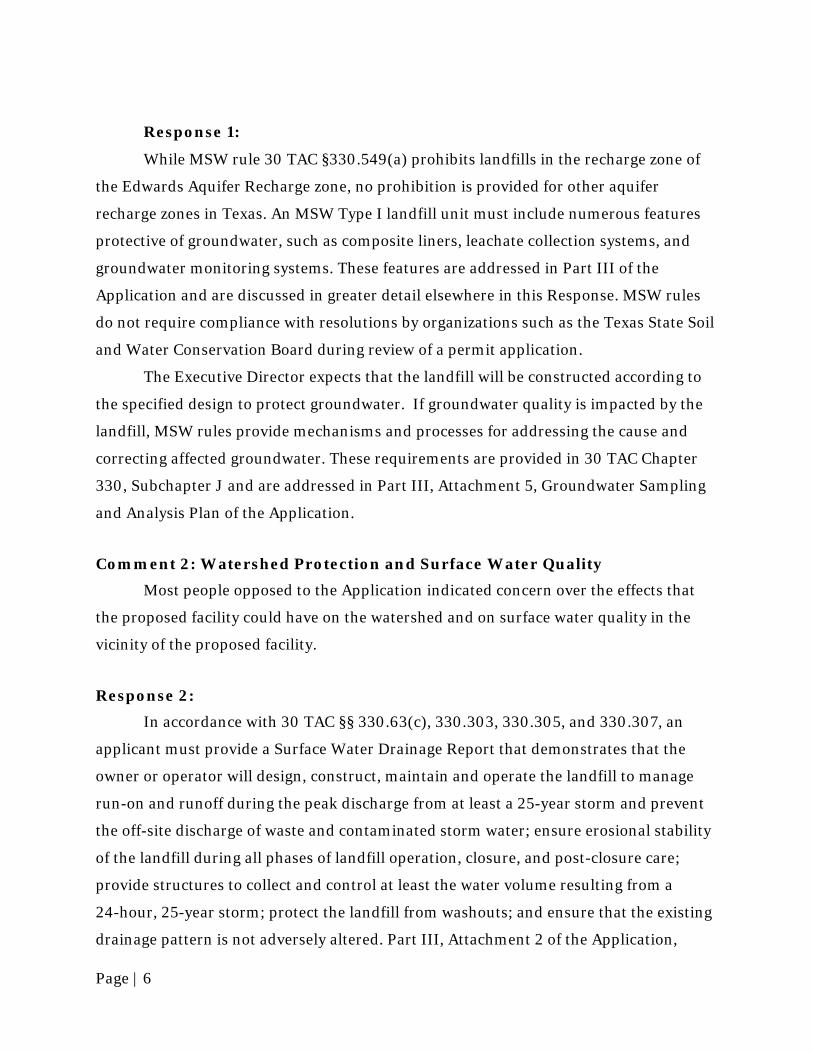
Response 1:
While MSW rule 30 TAC §330.549(a) prohibits landfills in the recharge zone of
the Edwards Aquifer Recharge zone, no prohibition is provided for other aquifer
recharge zones in Texas. An MSW Type I landfill unit must include numerous features
protective of groundwater, such as composite liners, leachate collection systems, and
groundwater monitoring systems. These features are addressed in Part III of the
Application and are discussed in greater detail elsewhere in this Response. MSW rules
do not require compliance with resolutions by organizations such as the Texas State Soil
and Water Conservation Board during review of a permit application.
The Executive Director expects that the landfill will be constructed according to
the specified design to protect groundwater. If groundwater quality is impacted by the
landfill, MSW rules provide mechanisms and processes for addressing the cause and
correcting affected groundwater. These requirements are provided in 30 TAC Chapter
330, Subchapter J and are addressed in Part III, Attachment 5, Groundwater Sampling
and Analysis Plan of the Application.
Comment 2: Watershed Protection and Surface Water Quality
Most people opposed to the Application indicated concern over the effects that
the proposed facility could have on the watershed and on surface water quality in the
vicinity of the proposed facility.
Response 2:
In accordance with 30 TAC §§ 330.63(c), 330.303, 330.305, and 330.307, an
applicant must provide a Surface Water Drainage Report that demonstrates that the
owner or operator will design, construct, maintain and operate the landfill to manage
run-on and runoff during the peak discharge from at least a 25-year storm and prevent
the off-site discharge of waste and contaminated storm water; ensure erosional stability
of the landfill during all phases of landfill operation, closure, and post-closure care;
provide structures to collect and control at least the water volume resulting from a
24-hour, 25-year storm; protect the landfill from washouts; and ensure that the existing
drainage pattern is not adversely altered. Part III, Attachment 2 of the Application,

Page | 7
Surface Water Drainage, provides discussions and detailed designs, calculations, and
operational considerations for the collection, control, and discharge of storm water from
the landfill as required by the cited rules.
The drainage system described in the Application consists of drainage swales,
downchutes, perimeter channels, detention ponds and outlet structures. The landfill is
designed to prevent discharge of pollutants into waters in the state or waters of the
United States, as defined by the Texas Water Code and the Federal Clean Water Act,
respectively. The Application contains a certification statement in Part II, Attachment 7
indicating that the Applicant will obtain the appropriate Texas Pollutant Discharge
Elimination System (TPDES) coverage, as required by Section 402 of the Federal Clean
Water Act, for the proposed facility to assure that storm water discharges are in
compliance with applicable regulations.
According to Section 5.0 of Part III, Attachment 2, the proposed post-
development surface water management design will include final cover and a system of
intercept berms, drainage terraces, rundown channels, perimeter ditches, and ponds.
Surface water runoff from the final cover will sheet flow and be intercepted in drainage
terraces constructed at 40 foot intervals down the sideslopes. Terraces discharge to
lined, flat-bottom rundown channels that discharge to a perimeter ditch. This ditch
discharges to ponds. Ponds discharge to existing natural drainage channels that join
together and exit the permit boundary. The system is designed to convey the 25-year
peak flow rate from the developed landfill consistent with TCEQ regulations. In
addition, the perimeter channels are designed to convey the runoff from a 100-year
rainfall event, as noted in Section 5.2. Detention ponds are designed in accordance with
MSW rules to provide the necessary storage and outlet control to mitigate impacts to the
receiving channels downstream of the Landfill. A demonstration that existing permitted
drainage patterns will not be adversely altered is provided under Part III, Appendix 2A,
as required. The details of this demonstration are provided in the Exhibits of Appendix
2A.
MSW rules are protective of surface water features, even when those features are
proximate to the waste disposal unit. Only uncontaminated storm water will be allowed
to discharge at the various discharge points at the landfill boundary. Contaminated
water management is discussed in greater detail in responses below.
Page | 8
The Application complies with all applicable requirements regarding storm water
and contaminated water management.
Comment 3: Adequacy of Access Roads, Traffic Impacts, and Traffic Safety
Many of the individuals opposed to the Application expressed concern that the
facility would create traffic congestion or traffic hazards and could damage the roads in
the vicinity of the proposed landfill. Some asked how costs would be paid to address
damages caused by vehicles serving the facility.
Response 3:
In accordance with 30 TAC §330.61(i), an application for an MSW landfill permit
must include data on access roads for the proposed facility, including: availability and
adequacy of roads that the owner or operator will use to access the site; volume of
vehicular traffic on access roads within one mile of the proposed facility, both existing
and expected, during the expected life of the facility; and projections on the volume of
traffic expected to be generated by the facility on the access roads within one mile of the
proposed facility. The required traffic data is provided in the Application in Part II,
Section 2.6 and summarized in Part II, Figure 9.
When reviewing permit applications, the Executive Director defers to the Texas
Department of Transportation (TxDOT) for recommendations on roadway
improvements needed to handle expected traffic. Coordination documents with TxDOT,
required under 30 TAC §330.61(i)(4), are provided in Part II, Appendix 4A. TxDOT
required improvements at the intersections of IH-10 and FM 1104, FM 1104 and FM
1150, and FM 1150 and State Highway 80, and on FM 1150 at the proposed facility
entrance. In an email dated December 4, 2012, TxDOT indicates that once the roadway
improvements are completed, “the roads used to access the facility should be adequate
for the expected traffic volumes for the expected life of the facility.”
Concerning the comment on compensation for damages to public roads resulting
from proposed landfill activities, MSW rules do not provide for consideration of how

Page | 9
costs would be paid to address roadway damages caused by vehicles serving a proposed
facility.
The Application complies with all applicable requirements regarding availability
and adequacy of roads and traffic impact and safety.
Comment 4: Review Process
Attorneys on behalf of SPOD indicated that a bifurcated process (initial submittal
of Parts I and II and subsequent submittal of Parts III and IV) should not have been
allowed. One argued that a determination is required by the Executive Director as to the
appropriateness of a bifurcated process, that no determination has been made, and that
the bifurcated process should not be allowed because “much of what is contained in Part
II of the application depends on the contents of Parts III and IV of the application.”
Comments were submitted regarding the process followed during technical
review of the Application. Specifically, it was suggested that the Commission violated its
rules by failing to limit review to 75 days and for issuing more than two Notice of
Deficiency letters. Some commented that the review violated statements made at the
Sunset Commission hearings for the TCEQ. Others noted that the Executive Director
issued new deficiency comments after the declaration that Parts I and II of the
Application were technically complete.
Response 4:
A complete MSW permit application contains Parts I through IV. Parts I and II
contain information related to the applicant, existing site conditions, and the general
characteristics of the facility and surrounding area. Parts III and IV contain more
detailed information related to the site, such as design information, subsurface
investigation reports, and operating plans. In accordance with 30 TAC § 330.57(a),
applicants for MSW permits have the option to submit what is referred to as a bifurcated
application, as was done in this case. The Executive Director determined that it was
appropriate to process this bifurcated Application. To receive a permit, the Applicant
must also provide Parts III and IV of the Application for review. As noted above in
Section I.B, the Applicant delivered Parts III and IV of the Application to the TCEQ on
October 14, 2013, and requested to consolidate (into one complete, four-part

Page | 10
application) the Application in a letter dated October 18, 2013. The Executive Director
then agreed to process the consolidated Application.
Regarding the suggestion that the Commission did not comply with the 75-day
limit under 30 TAC §281.19(a) for technical review. When additional information is
needed to resolve outstanding application deficiencies, the review period is routinely
extended beyond the 75-day limit, as allowed by 30 TAC §§ 281.19 and 281.20, to allow
the applicant additional time to provide the information in accordance with Commission
rules, as was done in this case.
Regarding the comment that the Executive Director should not have allowed
more than two opportunities to respond to deficiencies, Commission rules do not limit
the number of notice of deficiencies that may be used in reviewing a landfill application.
Commission policy is to try to resolve deficiencies within two attempts, but the
Executive Director decided that it would be appropriate to require additional
information in this case.
While the issuance of no more than two NOD letters continues to be a goal of the
MSW Permits Section, neither the number of NOD letters nor the number of
deficiencies identified during review is limited by statute or rule. The Executive Director
strives to determine whether all applicable Commission rules are met in each
application during technical review. Notices of deficiency are an expected outcome of
this process as we question information that is being provided to determine whether it
meets the required standards.
The Executive Director agrees that technical deficiencies were issued on Parts I
and II after those parts were declared technically complete. This resulted from changes
that the Applicant made to Parts I and II in their November 13, 2013 submittal. The
Executive Director reviewed these changes and issued new deficiencies.
Comment 5: Faulting, Oil and Gas Activity, Subsidence
Numerous individuals and the TRRC indicated that natural and man-made
subsurface conditions, such as faulting, oil and gas activity, and subsidence, in the
vicinity of the proposed facility increase the risk of contamination to the underlying
groundwater aquifer and that these conditions indicate that the proposed location is

Page | 11
inappropriate. One comment noted that proper plugging and abandonment of known oil
and gas wells, as required under 30 TAC §330.61(l)(2), has not been performed.
Response 5:
In accordance with 30 TAC §330.61(j)(2), applicants for MSW permits must
provide data on fault areas in accordance with 30 TAC §330.555. In Part II, Section 2.7.4
of the Application, the Applicant provided information demonstrating that there are no
active faults within 200 feet of the proposed facility. The closest known fault is located
approximately one half mile north of the proposed facility. According to published
literature cited in the Application, the fault (Darst Creek Fault) has not had
displacement in Holocene time; therefore, the information provided in the Application,
specifically regarding the Darst Creek Fault, satisfies the requirements for 30 TAC
§330.555(a).
In accordance with 30 TAC §330.61(l)(2), any and all existing or abandoned on-
site wells under the jurisdiction of the TRRC must be identified in an application. This
rule also states that a permittee must provide the Executive Director with written
certification that these wells have been properly capped, plugged, and closed in
accordance with applicable rules at the time of application. The Applicant has identified
all known onsite wells in the Application, but has not provided the certification of
proper capping, plugging and closure, and so this requirement has been addressed
through Special Provision 2 in the Draft Permit. If the Permit is issued, the provision
will require that the certification be provided before physical construction of the facility
may commence.
In accordance with 30 TAC §330.555(b), applications submitted for the operation
of sites located in areas experiencing withdrawal of crude oil, natural gas, sulfur, etc.,
must be investigated for the possibility of differential subsidence or faulting that could
adversely affect the integrity of landfill liners. Part II, Section 7.4 of the Application
provides information pertaining to differential subsidence and geologic faulting in the
vicinity of the proposed facility. The information provided by the Applicant indicates
that no structural damage to roadways or scarps in natural ground exist on or near the
proposed facility. The Application further indicates that a site reconnaissance identified
the presence of ponded water, linear features, and structural control of natural streams;
Page | 12
however, all identified features are associated with natural drainage structures at the
proposed facility and are not considered to be associated with geologic faulting. Changes
in vegetation at the proposed facility were also observed during the site reconnaissance;
however, these changes appear to be the result of clearing of pasture lands, growth of
excess vegetation along existing fence lines, and the presence of additional water that
supports dense vegetation along creeks and streams, and do not appear to be related to
geologic faulting at the proposed facility.
The Application indicates that based on field observations and available data,
crude oil and natural gas accumulation has occurred south of the Darst Creek Fault.
Since development of the Darst Creek oil field, seismic activities have not been recorded
along the Darst Creek Fault. In Part II, Figure 11, the Applicant provides a geologic
cross-section of the subsurface near the proposed facility. This figure was generated
using electrical spontaneous potential and resistivity logs to create stratigraphic
representation of the subsurface strata and possible anomalies (faults). The Darst Creek
Fault is identified in this figure. No other faults near the proposed facility are identified.
The Application further indicates that changes in elevation of established
benchmarks at the proposed facility were not observed.
A comprehensive geologic investigation is provided in Part III, Attachment 4,
Geology Report, of the Application.
Comment 6: Property Values
Many people noted concern that the proposed facility, if constructed, would
negatively affect their property value. Some indicated that the facility has already
negatively affected their property value.
Response 6:
TCEQ jurisdiction is established by the Legislature, and is limited to the issues set
forth in statute and rules. TCEQ has not been given authority to consider effects on
property values when determining whether to approve or deny a permit application.

Page | 13
Comment 7: Livestock and Wildlife
Many comments noted concern over the negative effect that the proposed facility
would have on livestock and wildlife.
Response 7:
Under 30 TAC § 330.63(b)(1), the Applicant must describe how access will be
controlled for the facility, such as the type and location of fences or other suitable means
of access control to prevent the entry of livestock. Also, 30 TAC §330.61(n) requires the
Applicant to consider the impact of the proposed MSW facility on endangered and
threatened species, and prohibits the destruction or adverse modification of critical
habitat of endangered or threatened species, or to cause or contribute to the taking of
any endangered or threatened species. MSW rules do not address other wildlife or
livestock; however, the Executive Director believes that if the facility is constructed and
operated in accordance with the Application and Chapter 330, local wildlife and
livestock will be adequately protected.
Comment 8: Better Location
Many people indicated that there must be a better location for this facility. One
comment indicated that common sense would indicate that the proposed location is
inappropriate.
Response 8:
As noted previously, TCEQ jurisdiction is established by the Legislature, and is
limited to the issues set forth in statute and rules. TCEQ has not been given authority to
identify more appropriate locations or to suggest alternative locations to those proposed
by the Applicant. The Executive Director must review the Application as proposed for
compliance with all applicable rules.
Comment 9: Enjoyment of Life
Some comments indicated that the proposed facility, if constructed, would
decrease their enjoyment of life.

Page | 14
Response 9:
As noted previously, TCEQ jurisdiction is established by the Legislature, and is
limited to the issues set forth in statute and rules. There is no specific rule protecting the
enjoyment of life, but the rule requirements are intended to implement the state’s policy
to safeguard the health, welfare and physical property of the people.
Comment 10: Inadequate Land Use and Growth Information
A few people indicated that the land use and growth assessment information
provided in the Application is inadequate.
Response 10:
In order to assist the Commission in evaluating the impact of a proposed MSW
facility on the surrounding area, applicants must provide information regarding the
likely impacts of the facility on cities, communities, groups of property owners, or
individuals by analyzing the compatibility of land use, zoning in the vicinity, community
growth patterns, and other factors associated with the public interest. Specifically, an
applicant must provide certain information, including an available published zoning
map for the facility and within two miles of the facility for the county or counties in
which the facility will be located; information about the character of the surrounding
land uses within one mile of the proposed facility; information about growth trends
within five miles of the facility with directions of major development; information on the
proximity of the facility to residences, business establishments, and other uses within
one mile, such as schools, churches, cemeteries, historic structures and sites,
archaeologically significant sites, and sites having exceptional aesthetic quality;
information regarding all known wells within 500 feet of the site; and any other
information requested by the Executive Director.
The required information is provided primarily in Part II, Section4.1, and
illustrated on Figure 7, Land Use Map. The Application indicates that surrounding land
use within one mile of the proposed permit boundary is 74.5% agricultural rangeland,
23.9% oil and gas production, and 1.6% residential. There is one cemetery. There are no
schools, licensed day-care facilities, churches, hospitals, lakes, commercial or
recreational areas, archaeological sites, historical sites, or sites with exceptional

Page | 15
aesthetic qualities. Part II, Section 4.1 indicates that there is no zoning within 2 miles of
the proposed facility.
Growth trends are discussed in Part II, Section 2.4.3. Conclusions were based
primarily on U.S. Census data from 2000 and 2010, population projections from the
Alamo Area Council of Governments for Guadalupe County, and a breakdown of census
data from the Golden Crescent Regional Planning Commission for Gonzales County.
The analysis concludes that for areas within five miles of the proposed facility there are
no major development trends and the area of greatest growth is anticipated to be four to
five miles southwest of the proposed facility.
The Application includes adequate information on land use and growth trends.
Comment 11: Inadequate Endangered Species Assessment
Many comments indicated that an inadequate endangered species assessment
was provided by the Applicant.
Response 11:
In accordance with 30 TAC §330.61(n)(2), an application for a landfill located in
the range of endangered or threatened species must include a biological assessment
prepared by a qualified biologist. An “Assessment of Potential for Occurrence of State
and Federally Listed Threatened and Endangered Species for the Proposed Post Oak
Clean Green Project” (Assessment) was performed by SWCA Environmental
Consultants and is provided in Part II, Appendix 6 and discussed in Part II, Section 2.11.
The report concludes that no potential habitat for federally listed threatened or
endangered species occurs on the property and no federally listed threatened or
endangered species have been observed on the property. The report further concludes
that no state listed threatened or endangered species have been observed on the
property and the property contains only marginally suitable habitat for two species,
Texas horned lizard and Texas tortoise, neither of which have been observed on the
property on any of the associated site surveys.
The Applicant accessed United States Fish and Wildlife Service (USFWS) online
information on Federal threatened and endangered species. A printout of this search is
provided in the Assessment. The Assessment was provided to the Texas Parks and

Page | 16
Wildlife Department (TPWD) for locations and specific data related to any state listed
endangered and threatened species in the area. Their response is provided in Part II,
Appendix 6, pages 6-77 through -80 and provides developmental and operational
recommendations for the proposed facility. The Applicant’s responses to these
recommendations are provided in Part II, Appendix 6, pages 6-74 through -76.
The Application complies with all applicable requirements regarding endangered
or threatened species.
Comment 12: Applicant Experience
Nine comments stated that the Applicant has inadequate experience to operate a
landfill.
Response 12:
In accordance with 30 TAC §330.59(f), the Applicant must list all Texas solid
waste sites that the Applicant has owned or operated within the last ten years; list all
solid waste sites in all states, territories, or countries in which the Applicant has a direct
financial interest; state that a licensed solid waste facility supervisor shall be employed
before commencing facility operation; list the names of the principals and supervisors of
the owner’s or operator’s organizations together with previous affiliations with other
organizations engaged in solid waste activities; show landfilling and earthmoving
experience, and other pertinent experience or licenses possessed by key personnel as
well as list the number and size of each type of equipment to be dedicated to facility
operation. Part I, Section F of the Application provides discussions on the evidence of
competency. The Applicant does not own or operate any other solid waste facilities in
Texas or elsewhere. The Applicant states that a properly licensed solid waste facility
supervisor will be hired prior to commencing the operation of the facility.
The evidence of competency information provided in the Application meets the
requirements of the rule cited above.
Comment 13: Wetlands
Some commenters were concerned that the proposed facility would negatively
affect wetlands, or that the Application provides inadequate information regarding the

Page | 17
effects that the proposed facility would have on wetlands. One person indicated that the
proposed facility would violate 30 TAC §279.11, which disallows discharges where a
practicable alternative would have less adverse impact on the aquatic ecosystem.
Response 13:
TCEQ rules require applicants for MSW landfills to provide a wetlands
determination in Part II of the application to meet the requirements of 30 TAC
§330.61(m). As noted in Part II, Section 2.10 of the Application, wetlands and waters of
the United States were assessed within the proposed permit boundary by Medina
Consulting Company and by SWCA Environmental Consultants. Reports documenting
these assessments are provided in Part II, Appendix 5. The assessments identified
approximately 4.7 acres of wetland areas.
The Applicant submitted its findings to the U.S. Army Corp of Engineers
(USACE) and provided information regarding the requirements of 30 TAC
§330.553(b)(1)-(5). Final determination from the USACE has not been provided. Special
Provision 3 in the Draft Permit ensures that the facility may not commence construction
prior to the USACE Section 404 permit approval.
A commenter noted that 30 TAC §279.11 prohibits certification of a 404 Permit
activity if there is a practicable alternative to the proposed discharge that would have
less adverse impact on the aquatic ecosystem. The Application includes an Alternatives
Analysis in Part II, Appendix 5D-1. This analysis was provided in the 404 Permit
application to the USACE. The Executive Director will defer to the USACE with respect
to the 404 Permit, which would include the review of the Alternatives Analysis.
The Application, along with the Draft Permit (which specifies final approval of
the 404 Permit must be provided by the USACE before commencement of physical
construction), contains sufficient information regarding wetlands delineation.
Comment 14: Waste Acceptance
Some comments shared concern that the proposed facility could receive
hazardous waste. One indicated that the facility would accept out of state nuclear waste.
Others suggested that the proposed facility should be limited to waste that is generated
in Guadalupe County.

Page | 18
Response 14:
An applicant for an MSW permit must submit a waste acceptance plan (WAP)
with Part II of the application in accordance with 30 TAC §330.61(b). The WAP must
identify the sources and characteristics of waste, provide a brief description of the
general sources and generation areas contributing wastes to the facility, and estimate
the maximum annual waste acceptance rate for the facility for five years. Part II, Section
2.1 of the Application provides the proposed WAP and adequately addresses the sources
and characteristics of wastes in accordance with 30 TAC §330.61(b). This section of the
Application characterizes wastes to be accepted at the facility as household waste,
vegetative waste, commercial waste, construction and demolition waste, Class 2
industrial waste, Class 3 industrial waste, and special wastes. Special wastes that could
be accepted include, but are not limited to, municipal hazardous waste from
conditionally exempt small-quantity generator (CESQG), wastes from out of state that
are industrial or would be otherwise special, grease and grit trap wastes, and liquid
wastes. This section also indicates that the facility proposes to serve “any county in
Texas and occasionally, wastes generated outside of Texas.” Based on the Application,
the proposed facility would be able to accept municipal hazardous wastes from CESQGs.
MSW Type I landfills are allowed to accept CESQG municipal hazardous waste in
accordance with 30 TAC §330.171(c)(6). The facility would be prohibited from disposing
of regulated hazardous waste, as defined by 30 TAC §330.3(126),and prohibited by 30
TAC §330.15(e)(7).
While out of state waste could be accepted with special handling requirements
dependent on the waste (this information is discussed in Part IV of the Application),
radioactive waste, as defined in 30 TAC Chapter 336, is specifically prohibited in the
WAP and by 30 TAC §330.15(e)(9).
The TCEQ does not have authority to restrict the area a landfill serves or to
consider the service area in deciding whether to issue a permit.
Comment 15: Contradictions from Early Notice of Deficiency Comments
Four individuals indicated that the Application contains contradictions from
information provided to address early notice of deficiency comments.
Page | 19
Response 15:
The Executive Director is unable to address perceived contradictions without
specific examples; however, possible examples may have occurred when the Applicant’s
final engineer of record removed information provided by the first engineer of record in
response to deficiencies identified by staff. The Executive Director’s technical staff
reviews an application for compliance with 30 TAC Chapter 330 and other rules. Where
the final engineer of record removed or replaced information provided by the first
engineer of record, the changes were reviewed to ensure that applicable rules were still
met.
The final Application contains sufficient information to comply with all
requirements.
Comment 16: Inadequate Geological and Hydrogeological Information
Several comments suggested that the Application contains inadequate
information on geology and hydrogeology.
Response 16:
In accordance with 30 TAC §330.61(j) and (k), the Applicant provided a general
geology and soils statement and information related to groundwater and surface water
in Part II of the Application. More detailed information on site-specific geology and
hydrogeology is provided in Part III of the Application.
As required in Part III of an application, and in accordance with 30 TAC
§330.63(e), an applicant must provide a geology report, including the results of
investigations of subsurface conditions at a site, with information derived from a
sufficient number of borings that are deep enough to allow identification of the
uppermost aquifer and underlying hydraulically interconnected aquifers, and to
establish subsurface stratigraphy and geotechnical properties of the soils and rocks
beneath the facility. Rules 30 TAC §§ 330.63(e)(5)(C) through (F) require that an
application include information about aquifers and groundwater beneath the facility.
To characterize the geology and hydrogeology at the site, the Applicant conducted
a subsurface investigation following a soil boring plan that met the requirements of
30 TAC § 330.63(e)(4). The methods and results of the subsurface investigation are

Page | 20
described in Part III, Section 4 of Attachment 4, which includes a detailed discussion of
the site stratigraphy. Boring logs are provided in Appendix 4B of Attachment 4, and
geologic cross sections are provided in Figures 4-10 through 4-16. Section 5 of
Attachment 4 provides information about the geotechnical properties of the subsurface
materials, and documents three distinct clay units and three distinct sand units.
Laboratory geotechnical test results are documented in Appendices 4C and 4D. The clay
units are described as fat clay to lean clay with hydraulic conductivity ranging from 9.00
x 10-9 to 1.35 x 10⁻⁷ cm/sec. Boring logs and geologic cross sections all indicate that the
soils and strata are consistent beneath the proposed landfill footprint.
Section 1.1 of Part III, Attachment 5 (Groundwater Sampling and Analysis Plan)
describes the site hydrogeology. Section 2.2 (Design Criteria) to Part III, Attachment 5
and Section 5 (Geotechnical Data) Attachment 4 (Geology Report) summarize the
geotechnical properties of the soils, including a detailed discussion of aquifers and
groundwater beneath the site. Tests related to groundwater are documented in detail in
Appendices 4C and 4F of Attachment 4.
The Geology Report and proposed Groundwater Sampling and Analysis Plan
meet the requirements of 30 TAC §330.63(e) and (f).
Comment 17: Effect of an Earthquake on the Proposed Landfill
Some comments asked what effect an earthquake would have on the proposed
landfill.
Response 17:
In accordance with 30 TAC §330.557, an applicant must determine whether a
proposed facility is located in a seismic impact zone, which is defined as an area with
10% or greater probability that the maximum horizontal acceleration in lithified earth
material, expressed as a percentage of the earth’s gravitational pull, will exceed 0.10g in
250 years. If the proposed facility is located in a seismic impact zone, the applicant must
demonstrate that all containment structures, including liners, leachate collection
systems, and surface water control system, are designed to resist the maximum
horizontal acceleration in lithified earth material for the site. The Application indicates
that according to the United States Geologic Society (USGS) website for Earthquakes

Page | 21
Hazards Program, the calculated probability of exceedance for a maximum horizontal
acceleration of 0.1 g in 250 years is 3.4% for the proposed location, which is less than
the 10% level at which the rule defines a seismic impact zone. The Application provides
this information in Part II, Section 7.5. Based on the information provided, the proposed
facility would not be located in a seismic impact zone.
Comment 18: Factual Errors at the Public Meeting and in the Application
Some comments suggested that there were factual errors in the Application and
in information presented at the public meeting.
Response 18:
It is unclear what factual errors the commenters believe may have been presented
at the public meeting. The Executive Director is unable to address perceived factual
errors in the Application without specific examples. Any information in the Application
that is used to meet a rule requirement would be subject to consideration during a
contested case hearing.
Comment 19: Adverse Effect on Growth
Some comments stated concern for the effect that the proposed facility would
have on growth of the surrounding community.
Response 19:
In performing the technical review of an application, the Executive Director
makes certain that all land use information is provided in accordance with 30 TAC
§330.61. This includes information about growth trends within five miles of the facility
in accordance with 30 TAC §330.61(h)(3) which has been reviewed. The Application
contains sufficient information for a land use compatibility determination. The land use
information submitted, including the growth trend information, does not support a
determination that the landfill would be an incompatible land use.

Page | 22
Comment 20: Complete and Accurate Landowner Information
One person indicated that the Application does not include complete and
accurate landowner information.
Response 20:
It is unclear what specific incorrect or missing information is suggested by the
comment. The information on land ownership within one-quarter mile of the proposed
facility boundary, provided in Figure 5, meets the requirements of 30 TAC
§330.59(c)(3). The property owner information submitted for the facility property
complies with 30 TAC §330.59(d).
Comment 21: Mineral Interests
Some commenters indicated that the information provided in the Application on
mineral interests is incorrect.
Response 21:
In accordance with 30 TAC §330.59(c)(3), the Application must identify mineral
interest ownership under the facility. The information provided in Figure 5 of the
Application meets this requirement. The Applicant represented that this information
was obtained from the Guadalupe County Appraisal District 2012 tax records in
accordance with this rule.
Comment 22: Insufficient Information on Pipeline Easements
Some comments indicated that the information provided in the Application on a
pipeline easement on the proposed facility is inadequate.
Response 22:
The Application discusses easements in Part II, Section 2.14. In Part II, Appendix
1B the Applicant has provided a copy of a Right of Way Grant, on which Item 2 indicates
that the right of way reverts to the grantor upon one year of non-transmittal of product.
The Applicant, who is also the land owner for the proposed facility, has attested, with
three other individuals, that the pipeline has not been in service for at least one year.

Page | 23
Non-transmittal for one year results in the right of way reverting to the grantor, the land
owner. The information provided in the Application indicating that this easement
terminated adequately addresses the requirements of 30 TAC §330.543.
Comment 23: Retention Ponds are an Environmental Hazard
One comment indicated that retention ponds to be used by the proposed facility
are an environmental hazard.
Response 23:
The Executive Director is challenged to address this comment when no specific
hazard concern was provided. Retention ponds are storm water drainage features. They
are an important feature for landfills, as they control storm water release rates.
Retention ponds at MSW landfills are not designed to receive contaminated water. In
accordance with 30 TAC §330.63(c) and 30 TAC Chapter 330, Subchapter G, the
Applicant must provide a surface water drainage report that demonstrates that the
owner or operator will design, construct, maintain and operate the facility to manage
storm water run-on and runoff during the peak discharge from a 25-year/24-hr storm
and to prevent the off-site discharge of waste and contaminated storm water. Prevention
of discharge of contaminated storm water includes berms or other controls around areas
where waste is exposed to prevent run-on into this active area and to contain the
contaminated water that is generated. All water that has come into contact with waste
must be treated as contaminated water.
A detailed surface water management plan (discussions, designs, calculations,
and operational considerations for the collection, control, and discharge of storm water
from the facility as required by the above-referenced rules) is included in Part III of the
Application.
Comment 24: Possible Permit Transfer
One commenter expressed a concern that the facility permit, if issued, would be
transferred to another owner.

Page | 24
Response 24:
In accordance with 30 TAC § 305.64(a), a permit may only be transferred with
the approval of the Commission; however, the Commission cannot prohibit a permittee
from applying for and transferring their permit.
Comment 25: Inadequate Archaeological Survey
Some comments indicated that the archaeological survey provided in the
Application is inadequate.
Response 25:
In accordance with 30 TAC §330.61(o), an applicant must submit a review letter
from the Texas Historical Commission (THC) to document compliance with the Natural
Resources Code, Chapter 191, Texas Antiquities Code. This is discussed in the
Application in Part II, Section 2.12 and documented in Part II, Appendix 4C. In
response to an initial coordination, the THC requested additional investigation. This
investigation was performed by SWCA Environmental Consultants in July 2011 and
November 2012. In a letter dated January 9, 2013, the THC acknowledged the
investigation report and indicated that the project “may proceed without further
consultation with” the THC. While the Executive Director confirms that coordination
with the THC has occurred and documentation of compliance has been provided, the
Executive Director defers to the THC’s determination, after submittal of the Intensive
Cultural Resources Survey of the Post Oak Clean Green Project in Guadalupe County,
Texas, that “no further work is required” and that “this project may proceed without
further consultation with [THC], provided that no significant archeological deposits are
encountered during construction and development of the property.”
The information provided in the Application adequately addresses the
requirements of 30 TAC §330.61(o).
Comment 26: Violation of Guadalupe County Groundwater Conservation District Rule 8.1
Some comments indicated that the proposed landfill would be a violation of Rule
8.1 from the Guadalupe County Groundwater Conservation District (GCGCD).

Page | 25
Response 26:
The Application is subject to, and reviewed for compliance with, applicable
statutes and Commission rules. The referenced GCGCD rule has not been incorporated
into Commission rules. The Commission is not authorized to determine whether the
landfill would violate the GCGCD rule.
Comment 27: Claims of Environmental Conscience
One commenter indicated that the name “Post Oak Clean Green” is not justified
by the proposed facility and that public discussions of a wildlife preserve and an
environmental center are not proposed at the facility.
Response 27:
The Commission has no authority over the naming of facilities or applicant
organizations. A wildlife preserve and environmental center may have been mentioned
by the Applicant in public discussions, but these are not requirements of 30 TAC
Chapter 330 and are not part of the Application.
Comment 28: Commission Responsibility to Protect Texas
One comment asked whether the Commission is tasked with protecting the
environment in Texas and whether issuance of a permit for this Application would
constitute protection.
Response 28:
The Commission is authorized to safeguard the health, welfare, and physical
property of the people and to protect the environment. The Commission’s permitting
rules are intended to protect the environment consistent with the underlying authority
provided by state statutes. All applicable rules are adequately addressed by the
Application, and so human health and the environment are expected to be protected if
the landfill is constructed and operated in compliance with the Draft Permit.

Page | 26
Comment 29: Consistency with Regional Waste Management Plan
One person raised the concern that the Application does not conform to the
provisions of the Regional Waste Management Plan (RWMP) of the Alamo Area Council
of Governments (AACOG).
Response 29:
In accordance with 30 TAC § 330.61(p), the Applicant must provide
documentation showing that the Application was submitted for review to the applicable
council of government for compliance with the RWMP. Part II, Section 2.13 of the
Application indicates that Parts I and II were submitted to AACOG. A response letter
from AACOG, dated January 27, 2011, indicates that AACOG had concluded that the
Application is in conformance with the RWMP. This response letter is provided in
Appendix 4B of the Application.
It should be noted that during the public comment period the Executive Director
received a second letter from the AACOG, dated July 6, 2012. The July 6, 2012 letter
requests withdrawal of the AACOG letter dated January 27, 2011, and supports the
resolution of the Guadalupe County Commissioner’s Court, which is considered in this
Response. The July 6, 2012 letter concludes that “local support is more important than
consistency with its plan.” This statement implies that the conclusion of consistency has
not changed, as no general statement implies contradiction and no specific example of
contradiction is provided. It is clear from the letter that AACOG now opposes the
proposed facility. This opposition has been noted in this Response.
The information provided in the Application demonstrates that the landfill is
compatible with AACOG’s regional solid waste plan.
Comment 30: Floodplain/Washout
A few people stated concern that the landfill is located in the floodplain and that
flood waters could lead to washout of waste.
Response 30:
In accordance with 30 TAC §330.63(c)(2), an application must identify whether a
site is located within a 100-year floodplain. A Flood Insurance Rate Map of the facility is

Page | 27
provided as Part II, Appendix 8B, Figure 8-1. This figure indicates that the 100-year
floodplain does not extend into the facility.
Section 30 TAC § 330.547(b) requires that an application include a
demonstration that a waste disposal unit will not restrict the flow of the 100-year flood,
reduce the temporary water storage capacity of the floodplain, or result in washout of
solid waste if the unit is located within the 100-year floodplain. Figure 8-1 illustrates
that the facility is not located within the 100-year flood, and so no further
demonstration is required to demonstrate compliance with these rules.
Comment 31: Public Notice
One comment questioned whether proper notices of the Application and hearing
were provided, including signs at the site and newspaper publication.
Response 31:
Notice is required for MSW permit applications in accordance with 30 TAC
Chapter 39, Subchapters H, I and Chapter 330. These rules specify that notices of the
receipt of an application and of a preliminary decision are made to, among others listed
in 30 TAC §39.413, landowners named on the application map. Rule 30 TAC
§330.59(c)(3)(A) limits this map to include land ownership within one quarter-mile of
the proposed facility. Rule 30 TAC §330.57(i) requires applicants to post notice signs at
the proposed site.
The Applicant provided the notice required by the rules.
Comment 32: Texas Railroad Commission (TRRC)
Two people noted that the Railroad Commission opposed the Application.
Response 32:
A letter from the TRRC Regional Office initially opposed the Application, but this
opposition was withdrawn by a subsequent letter from the TRRC Central Office. This
subsequent letter maintained concerns, which are addressed in this Response, but
withdrew opposition.
Page | 28
Comment 33: Guadalupe County Underground Water District (GCUWD)
One comment shared dismay that the Commission did not include the GCUWD
on the list of contacts for input on the Application.
Response 33:
The comment appears to intend to reference the Guadalupe County Groundwater
Conservation District (GCGCD), as no record could be found for a GCUWD. Regardless,
the list of organizations for which an application must demonstrate coordination are
provided in 30 TAC Chapter 330, primarily in 30 TAC §330.61, and addressed in Part II
of the Application. MSW rules require some coordination with specified agencies,
including, for example, TxDOT, THC, TPWD, and USACE; however, there is no
requirement in Chapter 330 to coordinate with GCGCD. The Executive Director did,
however, provide notice and receive comment from the GCGCD. Their opposition to the
Application is noted in the opening section of this Response and their specific concerns
are addressed within this Response.
Comment 34: Public Education and Price Reduction
One comment expressed a concern that the Application “fails to describe any real
program to systematically address efforts to curtail illegal dumping, litter abatement
and waste reduction programs, public education programs, or how this proposed landfill
will lower consumer pricing and commercial hauler tipping fees for waste collection.”
Response 34:
Public education programs and waste service price reductions for communities
where landfills are located are not requirements to obtain a landfill permit under
Chapter 330. The Executive Director is not authorized to require them of the Applicant.
Comment 35: Significant Change to Drainage Patterns
One comment indicated that the proposed facility would create a significant
alteration of natural drainage patterns. The comment further stated that runoff volume
would significantly increase and that the design of the proposed facility diverts storm
water from its natural pathway.
Page | 29
Response 35:
In accordance with 30 TAC § 330.63(c) and 30 TAC Chapter 330, Subchapter G,
an applicant must provide a Surface Water Drainage Report to demonstrate that the
existing drainage pattern is not adversely altered. The drainage pattern evaluation is
performed at points where storm water is discharged from the permit boundary. Please
note that the comment claimed a significant change, while the rule prohibits an adverse
change.
Part III, Attachment 2 of the Application, Surface Water Drainage, provides the
required demonstration. Appendix 2A, Existing and Post-development Storm Water
Runoff Comparison, discusses the demonstration. As can be seen in Figures 2A-1 and
2A-2, discharge points from the property, A, B, and C, are not proposed to change from
pre- to post-development. As the Table in Appendix 2A, Section 3 indicates, discharge
points A and C are unchanged, while B would experience about a 3% decrease in peak
flow rate and a 0.3% increase in discharge volume. These changes do not represent an
adverse change.
Comment 36: Liner and Leachate Collection System
Many individuals shared concerns over the liner system and leachate collection
system. Several asserted that the United States Environmental Protection Agency (EPA)
has indicated that all landfill liners will fail. Others were concerned that waste would
puncture the liner, that clay liner tie-ins present a preferential pathway for leachate, and
that there is inadequate quality assurance/quality control (QA/QC) for liner installation.
Response 36:
The MSW rules specify liner system design requirements in 30 TAC Chapter 330,
Subchapter H, for the protection of groundwater. For waste disposal units that will
receive household waste like this one, these rules require a composite liner or an
alternative liner. A composite liner is, from bottom to top, at least two feet of re-
compacted soil with a hydraulic conductivity of no more than 10-7 cm/sec, a minimum
30-mil geomembrane (if the geomembrane is high-density polyethylene, it must be at
least 60 mils thick). Composite liners must then be overlain by protective cover soil and
a leachate collection system that is adequate to control leachate over the liner. Liner

Page | 30
details are provided on Figures 3-9 and 3-10 in Part III, Attachment 3 in the
Application. Leachate collection system details are provided on Figure 3-11 in Part III,
Attachment 3 in the Application. The proposed composite liner and leachate collection
system meet applicable requirements.
The Application also proposes an alternative liner which replaces the clay
component of the composite liner with a geosynthetic clay liner (GCL) with a hydraulic
conductivity of no more than 5 x 10⁻⁹ cm/sec. A GCL is a layer of bentonite held between
two geotextiles. Alternative liners are allowed under 30 TAC §330.331(a)(1), but require
a demonstration to show that constituent concentrations in 30 TAC §330.331(a)(1),
Table 1, are not exceeded in the uppermost aquifer at the point of compliance. This
demonstration is provided in Part III, Appendix 3D, Exhibit 3D-3. This demonstration
is adequate to authorize the proposed alternative liner, should the permit be issued.
The EPA stated, in the preamble to proposed rules (see the Federal Register,
Volume 53, Number 166, August 30, 1988), that “even the best liner and leachate
collection systems will ultimately fail due to natural deterioration, and recent
improvements in [Municipal Solid Waste Landfill] containment technologies suggest
that releases may be delayed by many decades at some landfills.” This proposed rule
would have required a “second, less intensive phase of [post-closure] care,” but this
proposed requirement was never adopted. The MSW rules meet the requirements of the
adopted federal program.
As illustrated in the liner detail figures, both the composite and alternative liners
will include a two-foot-thick layer of protective cover soil. This layer protects the
geomembrane and underlying liner components from being punctured by the initial
overlying waste.
QA/QC for liner installation is established by MSW regulations in 30 TAC
§§330.337 and 339, and by the Commission’s Liner Construction and Testing
Handbook (Liner Handbook) published in 1994. Other resources may be used, such as
publications from the Geosynthetic Institute. For constructed soil liner tie-ins, the Liner
Handbook recommends either a sloped transition or a stair-step transition. Part III,
Attachment 3, Appendix 3D, Figure 3D1-3 of the Application proposes tie-in details for
constructed soil liners that mimic the recommendations of the Liner Handbook. The
proposed Soils and Geosynthetics Construction Quality Control Plan in Part III,

Page | 31
Attachment 3, Apptendix 3D, Exhibit 3D-1 complies with the MSW rules and is
consistent with appropriate guidance.
Comment 37: Landfill Gas Control
Some comments indicated a concern that the proposed facility would have
inadequate landfill gas control.
Response 37:
MSW rule 30 TAC §330.63(g) requires the owner or operator of a landfill unit to
monitor landfill gases in accordance 30 TAC §330.371. This rule requires the owner or
operator to monitor and control landfill gas because it contains methane, which can
cause odors and create an explosive hazard if it were to migrate into buildings,
subsurface vaults, utilities, or any other areas where potential gas buildup would be of
concern.
Part III, Attachment 6 of the Application contains the proposed Landfill Gas
Management Plan (LGMP) for the facility. Section 3 of the LGMP indicates that
monitoring will be accomplished by a system of 17 gas monitoring probes around the
perimeter of the landfill, to be installed in phases as construction of the landfill
progresses. Each proposed probe is designed to monitor the soil strata above the lowest
planned future elevation of waste, or the lowest seasonal groundwater level, within
1,000 feet of the probe. The spacing between probes will be a maximum of 1,000 feet.
Probe locations in relation to the waste footprint and facility appurtenances are shown
on Drawing 6-1 of Attachment 6.
Section 6 of the LGMP indicates that as the site develops, gas extraction wells will
be installed as needed to collect landfill gas and control landfill gas emissions. Blowers,
flares, and piping will be installed as needed to provide the vacuum and capacity to
manage the landfill gas.
The proposed LGMP meets the requirements of 30 TAC § 330.371.

Page | 32
Comment 38: Groundwater Monitoring System
Some people were concerned that the proposed facility would have an inadequate
groundwater monitoring system. Others were concerned that the system might miss a
contaminant plume.
Response 38:
In accordance with 30 TAC § 330.403(e), the Application must provide a
groundwater monitoring system, including the number, spacing, and depths of
monitoring wells or other sampling points, that is designed and certified by a qualified
groundwater scientist. Well spacing may not exceed 600 feet without an applicable site-
specific technical demonstration, as required by 30 TAC § 330.403(a)(2). The
Groundwater Sampling and Analysis Plan is signed and sealed by Mr. Edward E.
Hughes, P.G., Texas Licensed Professional Geoscientist No. 10021, as the qualified
groundwater scientist.
The proposed groundwater monitoring system consists of 96 groundwater
monitoring wells. Thirty-eight wells will be installed in the upper sand unit (425 Sand),
29 in the middle sand unit (395 Sand), and 29 in the lower sand unit (325 Sand). The
spacing of downgradient wells in the 395 Sand and 425 Sand is 600 feet between wells.
The spacing of downgradient wells in the 425 Sand is 300 feet between wells.
Section 4.3 of Attachment 4 and Section 1.1 of Attachment 5 indicate that
groundwater occurs in three distinct sand layers (425 Sand, 395 Sand, and 325 Sand)
underlying the facility. All three sand layers are demonstrated to be separated by clay
layers and not interconnected. The Applicant has chosen to monitor all three sand
layers beneath the facility.
The proposed groundwater monitoring system complies with the requirements
for groundwater monitoring.
Comment 39: Landfill Would be 20 Feet from the Underlying Aquifer
Some comments noted that the waste disposal unit is only 20 feet above
groundwater in the aquifer.

Page | 33
Response 39:
Groundwater levels were updated in the October 22, 2014 submittal. On July 22,
2014, the groundwater elevation in piezometer PZ-45 was measured to be at 434.09 feet
above mean sea level (ft msl). The proposed excavation depth at this point is 433.6 ft
msl. The proposed excavation depth at PZ-45 is approximately 6 inches below the
seasonal high groundwater table (SHGT).
MSW rule 30 TAC §330.337 establishes requirements for waste disposal units
that extend below the SHGT. This rule requires a demonstration that the liner system
will not undergo uplift from hydrostatic forces during its construction by one of the
methods itemized in 30 TAC §330.337(b)(1) through (4). The Application discusses this
requirement in Part III, Attachment 3, Appendix 3D, Exhibit 3D-1, Soils and
Geosynthetics Construction Quality Control Plan, Section 11.1. The Application provides
a ballasting evaluation, an option under 30 TAC §330.337(b)(1), in Exhibit 3D-2. The
demonstration complies with the requirement for a demonstration that the liner will not
undergo uplift from hydrostatic forces during its construction and operation.
Comment 40: Provisions for Closure and Post-Closure Care
One comment suggested that provisions for closure and post-closure care are
inadequate.
Response 40:
Closure and post-closure care requirements are established in 30 TAC Chapter
330, Subchapter K. These requirements have been adequately addressed by the
Application in Part III, Attachments 7 and 8.
Comment 41: Financial Assurance
Comments asserted that Applicant has failed to show the capability of paying
projected costs of closing the landfill, providing post-closure care, and addressing
potential corrective action.
Page | 34
Response 41:
In accordance with 30 TAC §330.503(b), the owner or operator of any MSW unit
must establish financial assurance for closure of the unit in accordance with 30 TAC
Chapter 37, Subchapter R. In accordance with 30 TAC §330.507(b), financial assurance
must also address post-closure care costs. Part IV of the Draft Permit states that
authorization to operate the facility is contingent upon maintenance of financial
assurance. Within 60 days prior to the initial receipt of waste, a permittee must provide
financial assurance instrument(s) for demonstration of closure and post-closure care.
For this Application, closure costs were estimated to be $3,310,349 (2014 dollars) and
post-closure care costs were estimated to be $8,141,148 (2014 dollars). A facility may
not begin accepting waste without providing adequate financial assurance. Please note
that financial assurance for any corrective action costs is not required at the time of
application for a new facility. Should the need for remediation be identified in the
future, a corrective action cost estimate and associated financial assurance would be
required in accordance with 30 TAC §330.509.
Comment 42: Buffer Zones
A comment indicated that the facility would have inadequate buffer zones.
Response 42:
Buffer zones for Type I landfill units are established at 125 feet by 30 TAC
§330.543(b)(2)(A). No solid waste unloading, storage, disposal, or processing may occur
within any buffer zone. This requirement is addressed in Part IV, Section 10.0 and
illustrated on Part III, Attachment 1, Figure 1-1. The Application provides for buffer
zones as required under this rule.
Comment 43: Final Cover System
A comment asserted that the Application has not met requirements for the final
cover system.

Page | 35
Response 43:
A final cover system on a new landfill must meet the design requirements of 30
TAC §330.457(a). The Application proposes, from top to bottom, a two-foot soil erosion
layer (top 6 inches capable of sustaining native plants), a geocomposite drainage layer, a
40-mil linear low density polyethylene (LLDPE) geomembrane, and an 18-inch
compacted clay layer (hydraulic conductivity ≤ 10-5 cm/s). This design is illustrated in
Part III, Attachment 3, Appendix 3D, Figure 3D1-2. Final cover installation QA/QC is
addressed in Part III, Attachment 3, Appendix 3D-1, Soils and Geosynthetics
Construction Quality Control Plan in the Application. The proposed design meets
applicable rules for design of the final cover system.
Comment 44: Slope Stability
A comment stated that information in the Application regarding slope stability
was insufficient because the minimum factor of safety is inadequate.
Response 44:
Information regarding the stability of waste disposal units is required under
30 TAC § 330.337(e). Information to address this requirement is provided in Part III,
Attachment 3, Appendix 3B, Geotechnical Calculation Package (GCP). Sources for
minimum factors of safety were requested by the Executive Director in his notice of
deficiency letter dated February 26, 2014. The Applicant addressed the deficiency by
adding Section 1.1, Methods for Calculating Factors of Safety in Stability Analyses, to the
GCP. This information indicates that target safety factors were based on TCEQ
Technical Guideline No. 3 and on USACE recommendations for levees as outlined in EM
1110-2-1913, “Design and Construction of Levees.” The information in the Application
regarding slope stability is adequate to meet rule requirements.
Comment 45: Erosion Control
A comment indicated that the Application provides inadequate erosion control,
improper structural controls for capturing sediment before it leaves the proposed
facility, and inadequate requirements for re-vegetation of disturbed areas.

Page | 36
Response 45:
Cover erosion control requirements are required under 30 TAC §330.305(d), and
addressed in TCEQ document, “Guidance for Addressing Erosional Stability During All
Phases of Landfill Operation,” dated February 14, 2007. This document explains that the
Soil Conservation Service Universal Soil Loss Equation (USL) or other equivalent or
better method must be used to demonstrate that soil losses from final cover slopes will
not exceed 3 tons per acre per year (tons/acre-yr) and soil losses from intermediate
cover surfaces will not exceed 50 tons/acre-yr. Typically, maximum allowable flow
distances are calculated for top dome and side slope surfaces that take into account the
design slopes and vegetative cover, among other parameters. Designs are provided for
benches, terraces, berms, swales or other features that will prevent these surfaces from
exceeding the appropriate limit.
In addition, an application must demonstrate that peak flow velocities do not
exceed permissible, non-erodible velocities under similar conditions. “Similar
conditions” indicates similar soil, vegetation, topography, and slope as the evaluated
surface. These velocity limits are determined through published sources that must be
documented in an application.
Erosion control for final cover surfaces is addressed in Part III, Attachment 2,
Appendix 2B, Exhibit 2B-1. A final cover plan is provided on Figure 2B1-0, while details
for final cover features, such as berms, swales, and channels, are provided on Figures
2B1-1 and 2B1-2. Soil loss estimates for the final cover are provided in Annex 2B-1A.
Sheet flow velocity estimates for the final cover are provided in Annex 2B-1B. Annex
2B-1A utilizes the USL and indicates final cover erosion losses of 0.67 tons/acre-yr on
top dome surfaces and 2.7 tons/acre-yr on side slopes. The Applicant has assumed 90%
vegetative cover. Annex 2B-1B uses the Rational Method to estimate the 25-year peak
flow rate, determines flow depth with Manning’s equation, and concludes peak
velocities on final cover surfaces of 1.5 feet per second (ft/s) on top domes and 1.78 ft/s
on side slopes. These velocities are below the values (5 ft/s on top domes and 4 ft/s on
side slopes) chosen by the Applicant for easily eroded soil from the National
Engineering Handbook, Table 8-6. The Application provides required information
regarding erosion control from final cover surfaces.

Page | 37
Erosion control for intermediate cover surfaces is addressed in Part III,
Attachment 2, Appendix 2C. A conceptual plan illustrating the partially filled landfill,
including intermediate cover surfaces, is provided on Figure 2C-1, while details for final
cover features, such as berms, swales, and channels, are provided on Figures 2C-2 and
2C-3. Soil loss estimates for the final cover are provided in Exhibit 2C-1, while sheet flow
velocity estimates for the final cover are provided in Exhibit 2C-2. Exhibit 2C-1 utilizes
the USL and indicates final cover erosion losses of 6.3 tons/acre-yr on top dome
surfaces and 46.9 tons/acre-yr on side slopes. The Applicant has assumed 60%
vegetative cover. Exhibit 2C-2 uses the Rational Method to estimate the 25-year peak
flow rate, determines flow depth with Manning’s equation, and concludes peak
velocities on final cover surfaces of 1.99 ft/s on top domes and 2.36 ft/s on side slopes.
These velocities are below the values (4 ft/s on top domes and 3 ft/s on side slopes)
chosen by the Applicant for easily eroded soil from the National Engineering Handbook,
Table 8-6. The Application provides required information regarding erosion control
from intermediate cover surfaces.
While the facility has proposed a storm water detention pond which will reduce
sediment from storm water runoff, limits for erosion rates are for the eroding surfaces,
not for storm water effluent. Practices that control erosion rates on eroding surfaces will
also limit suspended solids concentrations in storm water and reduce the amount
sediment leaving the facility. Any specific limitations on storm water effluent would be
addressed through storm water discharge permitting, which is handled through the
TPDES program. The Applicant certifies that the facility will obtain the proper TPDES
permit coverage in Part II, Attachment 7.
As noted above, vegetation is a requirement for intermediate and final cover
surfaces. In accordance with 30 TAC §330.457(a)(3), final cover must be seeded or
sodded immediately following the application of the final cover. Intermediate cover
must be seeded or sodded following its application, as required by 30 TAC §330.165(c).
Repairs to final and intermediate cover, including re-vegetation, must follow these same
requirements. These rules have been adequately addressed in Part III, Attachment 7 for
final cover and in Part III, Attachment 2, Appendix 2C, Section3.2 and Part IV, Section
22.2 for intermediate cover.
Page | 38
Comment 46: Odors
Many comments indicated a concern that the facility will produce nuisance odors
or that the Odor Management Plan is inadequate.
Response 46:
MSW rules under 30 TAC § 330.149 require that an application include an Odor
Management Plan that must identify wastes and activities that are more likely to cause
odors and how odors will be mitigated. This information is provided in Part IV,
Section 14.0. This information meets the cited rule.
Nuisances, which are defined by 30 TAC § 330.3(95) to include odors, are
prohibited under 30 TAC § 330.15(a)(2). If activities from the facility create odors or
other nuisances, please report the problem to the TCEQ Region 13 office in writing or in
person at 14250 Judson Road, San Antonio, Texas 78233-4480, or by telephone at (210)
490-3096 or toll-free at 1-888-777-3186. Citizen complaints may also be filed online at
www.tceq.texas.gov/complaints.
Comment 47: Windblown Waste and Roadside Trash
Many of the comments expressed a concern over windblown waste and trash
along roads in the vicinity of the proposed facility.
Response 47:
Part IV, Sections 9.0 and 12.0 provide procedures for control of windblown solid
waste and litter, and for control and cleanup of materials along the route to the site, as
required by 30 TAC §§ 330.139 and 145, respectively. The Applicant would be
responsible for picking up litter scattered throughout the site, along fences and access
roads, at the gate, and along and within the right-of-way of public access roads serving
the landfill for a distance of two miles from the entrance (including any waste illegally
dumped within the right-of-way). Cleanup must occur at least once a day on days that
the landfill is in operation.
The Application complies with the requirements of 30 TAC §§ 330.139 and 145. If
the Landfill is operated in accordance with the SOP, the Executive Director expects that

Page | 39
windblown trash and materials along the route to the Landfill will be adequately
controlled.
Comment 48: Noise
Numerous comments noted that the proposed facility would be a noise nuisance.
Response 48:
The TCEQ’s rules do not include any specific limits on noise caused by landfill
operations. The basis for a nuisance prohibited by 30 TAC §330.15(a)(2) does not
include noise. The Executive Director is not aware of information to justify restricting
the proposed operations or operating hours to reduce noise.
Comment 49: Air Emissions and Effects on Health
Numerous comments shared a concern over air emissions, including dust, from
the proposed landfill and the effect that these emissions would have on the health of
people in the vicinity.
Response 49:
As waste degrades in a waste disposal unit, landfill gas is produced. Landfill gas is
mostly methane and carbon dioxide, with some moisture and trace constituents,
including volatile organic compounds and hydrogen sulfide. Rules in 30 TAC
§§ 330.63(g) and 330.371 require control of landfill gas to prevent possible explosive
hazards due to migration and accumulation of methane. These rules are addressed in
Part III, Attachment 6.
Emissions from stationary sources and particulate matter from roads and
excavations at a landfill facility must be controlled in accordance with a standard air
permit under 30 TAC, Chapter 330, Subchapter U. In accordance with 30 TAC
§ 330.55(a), the construction and operation of waste management facilities must comply
with Subchapter U or other approved air authorizations. Emissions of air pollutants
from the landfill itself are regulated under federal rules in 40 C.F.R., Part 60, Subpart
WWW (Standards of Performance for Municipal Solid Waste Landfills), adopted by
reference by the state, which require an active gas collection and control system (GCCS),

Page | 40
monitoring of conditions in the GCCS and of emissions at the surface of the landfill, and
corrective action as needed to ensure compliance.
Under 30 TAC §330.153(b), Part IV of the Application must address concerns
regarding dust from on-site and other access roadways. Part IV, Section 16.0 of the
Application addresses this rule and indicates that a water truck will be provided to water
the on-site roads as needed to control dust.
If activities from a permitted facility create odors or other nuisances, please
report the problem to the TCEQ Region 13 office in writing or in person at 14250 Judson
Road, San Antonio, Texas 78233, or by telephone at (512) 339-2929 or toll-free at 1-
888-777-3186. Citizen complaints may also be filed online at
www.tceq.texas.gov/complaints or by phone at 1-888-777-3186.
Comment 50: Vectors
Numerous comments expressed the concern that the proposed landfill would
attract disease vectors.
Response 50:
MSW rules under 30 TAC § 330.151 require control of on-site populations of
disease vectors using proper compaction and daily cover procedures, and the use of
other approved methods when needed. This information is provided in Part IV, Section
15.0. This section concludes that if the methods described in daily operations do not
control vectors, a licensed professional will apply pesticides to ensure that proper
chemicals are used and that they are properly applied. The Application meets
requirements for vector control.
Comment 51: Fire Protection
Some comments noted the risk of fires associated with landfills or indicated that
the fire protection controls in the Application are inadequate.
Response 51:
In accordance with 30 TAC § 330.129, an application must include calculations
demonstrating that the operator can cover any waste received for disposal that has not

Page | 41
been covered with six inches of earthen material within one hour of detecting a fire. This
requires sufficient on-site equipment and an adequate supply of soil located near the
active waste disposal area. Part IV of the Application must contain a Fire Protection
Plan that identifies the fire protection standards to be used at the facility and how
personnel are trained.
This Fire Protection Plan, including the required demonstration that the active
face may be covered within one hour, is included in Part IV, Section 4.0. The Application
satisfies the rule requirements regarding fire protection.
Comment 52: Leachate and Contaminated Water Management
A comment stated that the Application contains inadequate information on water
that has contacted waste, does not address treatment of contaminated water, and
provides inadequate information on leachate storage.
Response 52:
Contaminated water is defined by 30 TAC § 330.3(36) as leachate, gas
condensate, or water that has come into contact with waste. Leachate is produced as
water percolates through waste to the liner system. Some contaminated water is
generated at the active waste disposal area where rain falls directly on or runoff travels
to exposed waste. Condensate is a result of landfill gas reaching the surface through
collection systems, cooling, and dropping out the moisture it contains. As noted in the
comments, contaminated water may contain any contaminant that is found in the
landfill, or any biodegradation byproduct of these contaminants. For this reason, MSW
rules include provisions concerning contaminated water management. These include
prohibition of unauthorized discharges of contaminated water under 30 TAC §
330.15(h)(1) and (2) and requirements to divert runoff from active portions of the
landfill and containment of contaminated water from active portions of the landfill in
accordance with 30 TAC § 330.305(b) and (c).
Requirements for contaminated water management also include limiting the
depths of leachate on the liner system, minimizing generation of water contacting waste,
containing water that has contacted waste, requirements for covering waste each

Page | 42
operating day, and a liner system with a leachate collection system designed in
accordance with 30 TAC § 330.333.
As noted in Part III, Attachment 3, Appendix 3C, Leachate and Contaminated
Water Management, Section 1.0, contaminated water may not be discharged. Section
2.0 indicates that contaminated water will be collected and placed in leachate
evaporation ponds (discussed in greater detail below) or transported to an off-site
wastewater treatment facility. Part IV, Section 28.7 clarifies that these management
procedures for contaminated water also apply to wastewater from the Citizen
Convenience area. The Leachate and Contaminated Water Management plan for the
facility addresses generation, collection, containment, storage, and disposal of
contaminated water, including leachate and condensate. The information provided in
this plan and elsewhere in the Application adequately addresses requirements for
contaminated water management.
Leachate storage will be in leachate evaporation ponds, as described in Part III,
Attachment 3, Appendix 3C, Exhibit 3C-5, Evaporation Pond Design. Ponds will provide
4.25 or 8.5 acre-feet of storage. Design drawings for each pond option are provided on
Figure 3C5-1. The ponds will be lined with two feet of compacted clay (hydraulic
conductivity of 10-7 cm/sec or less) overlain by a 60-mil high-density polyethylene
(HDPE) liner that is installed with the same QA/QC requirements as the waste disposal
unit liner.
Comment 53: Access Control of Scavenging
One comment indicated that the proposed facility would have inadequate access
control to prevent scavenging.
Response 53:
Scavenging is prohibited by 30 TAC §330.155, and requirements for access
control are provided by 30 TAC § 330.131. Public access to all MSW facilities must be
controlled by means of artificial barriers, natural barriers, or a combination.
Uncontrolled access must be prevented. Provisions for access control must be provided
in the SOP, which must also include an inspection and maintenance schedule and
notification requirements as specified in the rule. The rule indicates that fences and

Page | 43
gates are the preferred method of landfill access and control, but does not provide
specifications for these features.
Part IV, Section 5.1 indicates that access will be controlled by a 4-foot barbed wire
fence at the permit boundary. Access from FM 1150 is limited to the entrance road
through the gatehouse area where a gate attendant controls access and monitors all
vehicles entering and exiting the site. Part IV, Section 17.0 notes that scavenging is
prohibited. The information provided meets the requirements for site access control and
scavenging.
Comment 54: On-site Roads
A comment stated that the Application fails to provide adequate information for
the use of all-weather roads and the removal of mud tracked onto public roads.
Response 54:
Part III, Attachment 3, Figure 3-15 provides an illustration of the entrance area of
the proposed landfill. Figure 3-14 provides details of the entrance road (from the gate on
FM 1150, past the scales to the second gate) and the landfill access road (past the second
gate). The entrance road will be hot mix asphalt or reinforced concrete pavement, while
the landfill access road will be surfaced with crushed stone, gravel, concrete or asphalt
rubble, or wood chips). These proposed roads adequately address all-weather access
roads required under 30 TAC §330.63(d)(4)(A).
In accordance with 30 TAC § 330.153(a), tracked mud and associated debris at
the access to the facility on the public roadway must be removed at least once per day on
days when mud and associated debris are being tracked onto the public roadway. This
has been adequately addressed in Part IV, Section 16.0 of the Application.
Comment 55: Ponded Water
A comment suggested that measures in the Application to address ponded water
are inadequate.

Page | 44
Response 55:
Rule 30 TAC § 330.167 notes that the ponding of water over waste on a landfill
must be prevented. Ponded water must be eliminated and the area in which the ponding
occurred must be filled in and regraded within seven days of the occurrence. A ponding
prevention plan must be provided in the SOP that identifies: techniques to be used at a
landfill to prevent the ponding of water over waste, an inspection schedule to identify
potential ponding sites, corrective actions to remove ponded water, and general
instructions to manage water that has come into contact with waste.
Part IV, Section 23.0 addresses ponded water. This section indicates that ponded
water will be prevented by proper grading, and that ponded water over waste will be
removed and the depression filled in and graded within seven days of the occurrence.
Inspection frequencies for daily, intermediate, and final cover are provided in Part IV,
Section 3.3. Daily cover will be inspected daily while intermediate and final cover will be
inspected after placement, weekly, and within 72 hours of a 0.5-inch or greater rainfall
event. Inspections specifically for ponded water will occur within 72 hours of a 0.5-inch
or greater rainfall event.
The information provided to address prevention of ponded water meets rule
requirements.
Comment 56: Visual Screening
A comment indicated that the Application fails to provide adequate visual
screening required under 30 TAC §330.175.
Response 56:
Section 30 TAC § 330.175 requires that an applicant provide visual screening of
deposited waste materials where the Executive Director determines that screening is
necessary or as required by the permit. Part IV, Section 26.0 indicates that the waste
unit is location about one-quarter mile or more from public roads except on the
northeastern side of the waste unit. In this area a 125-foot buffer is maintained adjacent
to FM 1150. In this area along FM 1150 the facility will maintain an earthen berm and/or
vegetation as a visual screen. This is illustrated in Part III, Attachment 3, Figure 3-1. The
Executive Director has not determined that any additional screening should be required

Page | 45
under the above-cited rules and has concluded that the Application complies with
requirements for visual screening of waste.
The Application and Draft Permit comply with all applicable regulatory and
statutory permitting requirements. No changes were made to the Draft Permit in
response to comments received.
Respectfully submitted,
Texas Commission on Environmental Quality Richard A. Hyde Executive Director
Robert Martinez, Director Environmental Law Division _______________________ Steven Shepherd, Staff Attorney Environmental Law Division State Bar No. 18224200 P.O. Box 13087, MC 173 Austin, Texas 78711-3087 Phone (512) 239-0464, Fax: (512) 239-0606
REPRESENTING THE EXECUTIVE DIRECTOR OF THE TEXAS COMMISSION ON ENVIRONMENTAL QUALITY

Post Oak Clean Green, Inc. Proposed Permit No. 2378
Attachment A Support
Aguilar, Mercy Arp, Dustin Avila, Mari Bagby, Todd Banda, Maricela Barrientos, Santos Barton, Caleb Bell, Randy Bloch, Lydia Bodkin, Jack Bohmler, Steve Bonds, Anthony Boone, Aaron Bronder, Bryan Brookhart, Ann Campos, Joey V. Canell, Robert Chavez, Saul Clark, David Coleman, Rodney Colung, Richard Cortinas, Andre Costa, Nate Cottingham, Colin Crawford, Debbie Danforth, Michael Davis, Will P. Degn, Amanda Driggers, Angelica Driggers, David Driggers, Scott Duke, J. D. Eastwood, Jordan Eastwood, Kenneth Eicher, Brent Espinosa, Antonio Evans, Leonard Fennell, Callie Flores, Hilario Ford, Max Franklin, Ray French, Mare Funderburg, Dorothy
G, Laura Galvan, Ramiro Garcia, Marco Garcia, Pilar Gerhurst, Chris Gibbs, Sand Gonzales, Mari Gonzalez, Jose Green, Mack Green, Mozell Green, Torrey Guerra, Richardo – (Pres, League of United Latin American Citizens Council 682) Guerrero, Irma Guillen, Jesse Guillen, Theresa Gutierrez, Debra H, Arler D. H, Julie Harboth, Stanley Harrell, Candace Harrell, Jerry Harrell, Scott Harrell, Tina Harrison, Justin Hathaway, Eliana Hathaway, Matthew Haugen, Calvin Heidemeyer, Deonna Herman, Daniel J. Hernandez, A.J. Hernandez, Adrian Hernandez, Ashley Hernandez, Cuca Hernandez, Isable Herrera, Javier Hill, Daniel Hill, William Hill, Yvonne Hinds, Ben Horacefield, Hope
Hull, Kristi Jackson, Kimberly Jahs, Dustin Jahs, Jamie Jaroszewski, Joan Jarvi, Rick Jeffrey, Felicia Johnson, Martha A. Jones, Larry – (Guadalupe County Judge) Karm, Basil G. Karm, Marie Karm, Ronald Kline, Syble Koebig, Alfred Koehler, Kelyn Lara, Jack Lara, Jacob Lara, Jon Lara, Kwin Laster, Angela Laster, Stephen Lawrence, Cristian Laymon, John F. Lockwood, Bill Long, James R. Longoria, Janie C. Longoria, Josephine C. Longoria, Mary Longoria, Pantaleon Longoria, Paula N. Lopez, Tony Lovelace, Tracy-Lou Lozano, Alfred Ludewig, Shaun Luera, Anthony Luna, Many Machado, Joe Maleika, Volkmar W. Mancha, Rudy Manning, Tom Marty, Emilio

Post Oak Clean Green, Inc. Proposed Permit No. 2378
Attachment A Support
Mata, Joseph Matthews, Clarence McCann, Paul McKinney, Michael McLaughlin, Patty Medina, Rudy Mendoza, Edgar Mendoza, Ernesto Mewboarn, Jason Miller, Greg Molina, Kim Montoya, Jessie Moreno, Jesse Morgan, James Mueller, Jake Mueller, Misty Nall, Greg Nall, Trisha Ochoa, A.D. Pape, Leroy Parra, Crystal Parra, Krystal Patterson, Joe L. Pena, Kristen A. Pereira, Adam Pereira, Wesley Perez, Alicia Perrera, Adam Perrera, Suzanne Phillips, Bill Phillips, Doris Phillips, Rebecca Phillips, William Pontoya, Joey Reid, Kirk Reyes, Jose Reynolds, Daniel Ridgeway, Austin Ridgeway, Kaci Rigney, Phia Rodriguez, Juan Rodriguez, Mia Rodriguez, Vanessa Schneider, Eileen Schneider, Wayne
Scott, P.J. Seibert, Richard L. Slaton, Robert Smith, Gus Smith, Jason Sosa, Jaime Spears, Aaron Stephenson, Patricia Stephenson, Ron Stidham, James Stiles, Jerry F. Strain, J.W. Strain, Joey W. Sutton, Bart Sutton, Niesha Taft, Clint Thornton, Darla Thornton, Sarah Toms, Larry Torres, Chris Tovar, Victor Trueblood, Eloise Trueblood, Scott Urdiales, Erminiia Vecera, Kristen Vecera, Trent Vincent, Vardy Waldrop, Diann Washburn, Charlie Washburn, Isable Wehmeyer, Dusty Welty, Greg Whitaker, Richard White, Alyssa Wickersham, Matt Williams, Barry N. Williams, Melvin Wilson, Darrell Woods, Jonathan Wright, Tom Yglacias, Rene Young, Laci Young, Lori Zwicke, Aaron Zwicke, Angela
13 Concerned Citizens

Post Oak Clean Green, Inc. Proposed Permit No. 2378
Attachment B Opposed
Abat, Paul H. Ahrens, Charles E. – (V. Pres., Water Resource and Conserv., San Antonio Water System) Alex, Jamie Allen, Janet V. Allen, Pat – (Gen Mgr., Green Valley Special Utility Dist.) Armstrong, Kelly Evans Ayotte, Brenda Ayotte, Kyle Ayotte, Nancy Bading, Russell - (Chairman, Comal-Guadalupe Soil and Water Conservation District #306) Baker, Emmet, Jr.- (Pres., Gonzales County Underground Water Conserv. District) Baker, Becky Baker, Dennis G. Baker, Randall W. Baker, Robin Baker, Ronald W. Baker, Shad Baker, Staci Bettis, Sharon J. Blackburn, Sheri Bode, Ken Boehnke, Annie L. Bond, Mike Brady, Donald R. Braune, Gary - (Pres Guadalupe County Farm Bureau) Breitschopf, Phil - (CoB, Gonzales County Soil & Water Conserv. District #338) Broadway, Robert Royce Cabello, Tina Louise Caffey, Gerry D. Campbell, Donna - (State Senator, District 25)
Cheatham, Jimmie M. & Irving R. Cheshire, Amanda A. Cheshire, Billy & Frances Cheshire, Kent A. Chott, Merle & John Clark, William D. Cockerell, Rex Alan - (Gen Mgr., Schertz-Seguin Local Gvt. Corp) Cordova, Eduardo Cowan, Joel A. - (Chairman, Burleson County Soil & Water Cons District 358) Crawford, Doug L. Dahl, Brian Danos, Dean J. - (Exec Dir., Alamo Area Council Of Govt) Dansfiell, William B. Davenport, David J. - (Gen Mgr., Canyon Regional Water Authority) Davis, Ralph E. & Judy A. Dennison, Kathy Dickman, Stephen C. - (Atty. for SPOD) Dietz, Tuddy Durkin, Debora Dwyer, Robin V. Edwards, Kirsten English, Molly E. Evans, Alan Evans, Alan R. Evans, Colby Evans, Derrick Evans, James Evans, Jamie Evans, John Adna Evans, Kelly D. Evans, Pattie A. Evans, Shantea Evans, Stephanie Evans, Winnie Flowers, Wayne T. Floyd, Jean
Foerg, Steven Folmar, Sharie Fralick, Phyllis S. - (On behalf of Fran & Bill Cheshire, 621 Nixon Road) Galvan, Frank Garza, Joannie K. Gay, Michelle Ann Geoffray, Rachel Goebel, Arlen - (Chairman, DeWitt County Soil & Water Conserv. District) Gonzalez, Paul - Atty. for Schertz-Seguin Local Gov. Corp Greenwald, Ken - (Pres. Schertz-Seguin Local Gvt. Corp) Hale, Megan Halliburton, Johnie - (Exec Mgr., Plum Creek Conservation District) Ham, Zina Hartman, Nancy J. Hoegenauer, Lavonne & Glenn Hollub, Nancy & Bobby Holmes, Ken Hyman, William V. – (Exec Dir., Indep. Cattlemen's Assoc. of TX, Inc.) Jackson, Darell Jackson, Elbert Wayne Jackson, June Jackson, Reba Jackson, Wayne Johnson, Stephen E. Jones, Vernelle F. Jones, William E. - (Dir, Guadalupe County Groundwater Conserv. District #4) Kalil, Pamela Klemt, William B. - (Guadalupe County Groundwater Conserv. District)

Post Oak Clean Green, Inc. Proposed Permit No. 2378
Attachment B Opposed
Kollaus, Wanda Kuck, Michael - (Gen Mgr., Luling Foundation) Kuempel, John - (State Representative, District # 44) Larsen, Donald Lindner, Patrick W. - (Atty. Schertz-Seguin Local Gov. Corp) Lowerre, Richard - (Atty. SPOD) Lunsford, Billy Joe Matthies, Betty Ann - (Mayor, City of Seguin) Maxwell, Boyd & Ardis May, John May, Lavern McMurren, Sandra Medina, Rojelio S. Mercer, David S. Mergele, Clint Blaine Mergele, Logan Mergele, Richard & Carla Miller, Barry - (Gonzales County Water Supply Corp.) Mizanin, Richard Mondor, Rebecca M. Mooney, Terry Moore, Graham - ( Mgr., Hays Caldwell Pub. Utility Agency) Moses, Christin Najvar, Michael Nash, Claudia Cheshire
Naumann, Ronald - (Pres. Guadalupe County Groundwater Conserv. District) Nesbit, David Ortmann, Tom - (Pres. Wilson County Farm Bureau) Parker, Doug Perales, Marisa - (Atty. SPOD and Guadalupe Groundwater Conserv. District) Ploeger, Mark - (Pres., Water Protection Association) Powers, Scott Allen Puente, Robert R. - (Pres/CEO San Antonio Water System) Quinn, Justin Ramos, Humberto Rice, Kristen Elizabeth Richmond, Jule - (Pres., Assoc. Texas Soil & Water Conserv. Districts) Rodriguez, Arturo D. - (Atty. for Cibolo Valley Local Gov. Corp) Roecker, Annette Roecker, Cleburn Roecker, Randy Ruppert, Charles Ryan, Robert L. Sachnik, Betty Sachnik, Gregory J. Sachnik, Margaret
Sagebiel, Craig Saliger, Fran Scagliola, David - (Mayor Pro Tem, City of Schertz) Schiemenz, Terri Schott, Gary - (Chairman, Alamo Soil & Water Conserv. District # 330) Schraub, Donald Sengelmann, Greg - (for Gonzales County Underground Water Conserv. District) Sowell, Anne Sowell, Dennis Sparks, Charles G. Sparks, Patricia Renee Spence, Gary W. Stolz, Doug Tamayo, Monica Eileen Thorson, Cory Thorson, John A. Tieken, Greg - (Pres., Gonzales County Water Supply Corp.) Walker, Robin Wallace, Trudy N. Walther, Mary Claire Watts, Clifford Watts, D’Lacy Watts, James - (Stop Post Oak Dump) Watts, Louise
Watts, Wayne Wentworth, Jeff - (State Senator, District 25) Westbrook, John White, Alice Reneau Whittle, Melissa Winkelmann, Zachary K. Wood, Carl G. Wood, Rebecca L. Wood, Sarah C. Wosnig, Donna
Wundt, James Young, Edward Zaffirini, Judith - (State Senator, District #21) Zetka, Norman - (Chairman, Bastrop County Soil & Water Conserv. District # 40) Zunker, Mary Ann