Embed Size (px)
Citation preview
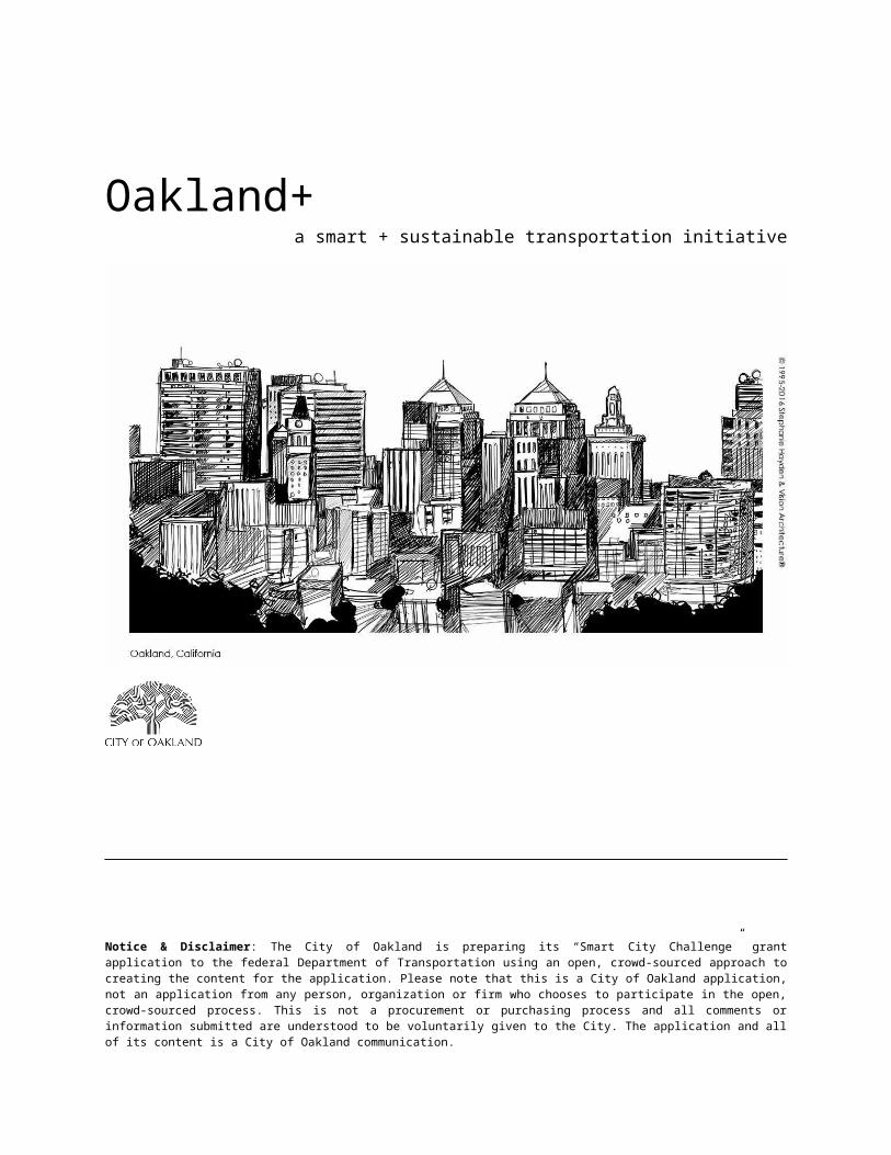
Oakland+a smart + sustainable transportation initiative
A response proposal to the U.S. Dept. of Transportation’s Beyond Traffic: The Smart City ChallengeNotice of Funding Opportunity Number DTFH6116RA00002
February 4, 2016
Oakland, CA
Notice & Disclaimer: The City of Oakland is preparing its “Smart City Challenge” grant application to the federal Department of Transportation using an open, crowd-sourced approach to creating the content for the application. Please note that this is a City of Oakland application, not an application from any person, organization or firm who chooses to participate in the open, crowd-sourced process. This is not a procurement or purchasing process and all comments or information submitted are understood to be voluntarily given to the City. The application and all of its content is a City of Oakland communication.
TABLE OF CONTENTS
Introduction
1. Vision: Oakland 20451.1 Oakland Plus: A Smart & Sustainable Transportation Initiative
1.1.1 Connect and Empower People1.1.2 Engineer an Innovative Business Model for Smart Cities1.2.3 Lead Self-Driving Vehicle Enabler Group1.2.4 Help Bring Clean, Efficient Freight Movement to Port of Oakland1.2.5 Promote Safe, Active Transportation Using Solar Sidewalks1.2.6 Share Equitable and Resilient Mobility Hubs1.2.7 Make Oakland’s Transit Services Even Smarter1.2.8 Add by Subtracting with Smart Land Use Planning
1.3 Oakland Plus Approach: Platform, Projects & Program s 1.4 Oakland Proud
2. Population Characteristics3. Other Characteristics4. Demonstration Site Map5. Project Approach & Alignment to Elements6. Risk Assessment & Mitigation Plans7. Project Partners and Governance Processes8. Existing Transportation Infrastructure9. Data: Collection, Sharing and Security10. Cooperative Approach to Demonstration11. Goals & Objectives12. Commitment and Capacity13. Cost share, in-kind donations and partnering opportunities
References
www.oakland.plus Table of Contents DRAFT - Page 1
Introduction“We are not just talking about streaming movies, email, social media
or Internet sales. We are talking about regional security, housing, law enforcement, fire, safety, transportation, health care and, as Cisco
advertises, the ‘Internet of Everything’...when everything is connected to everything else ‘transforming cities’.”1
– John M. Eger, San Diego State University
When the U.S. Department of Transportation (USDOT) issued its Beyond Traffic: The Smart City Challenge notice of funding opportunity on December 7, 2015, the City of Oakland and other mid-size cities around the country found themselves at a crossroads: over the holiday and in a relatively short amount of time, use tried and true means to produce a competitive grant submission; or – at the risk of not responding at all – open up the idea generation and proposal development process to the entire Oakland community, using free, web-based tools, to promote connected communities and ensure that the proposal would truly reflect the vision and needs of all of Oakland.
Oakland’s vision for a Smart City detailed in this proposal is the product of an open, crowdsourced initiative called Smart Oakland (www.smartoakland.net). This initiative was an important first step in producing a smart city deployment model that promises to address Oakland’s present and anticipated challenges, and provide a process model and set of
innovative initiatives that can be replicated in or extended to other U.S. cities.
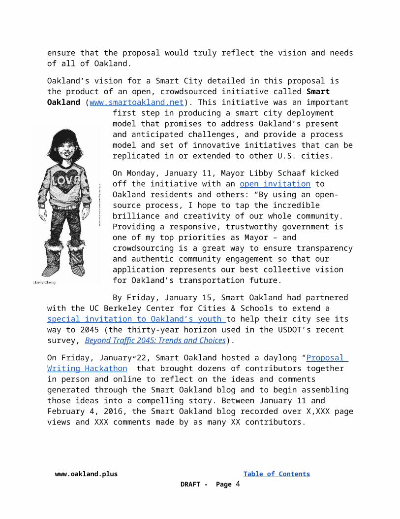
On Monday, January 11, Mayor Libby Schaaf kicked off the initiative with an open invitation to Oakland residents and others: “By using an open-source process, I hope to tap the incredible brilliance and creativity of our whole community. Providing a responsive, trustworthy government is one of my top priorities as Mayor – and crowdsourcing is a great way to ensure transparency and authentic community engagement so that our application represents our best collective vision for Oakland’s transportation future.”
By Friday, January 15, Smart Oakland had partnered with the UC Berkeley Center for Cities & Schools to extend a special invitation to Oakland’s youth to help their city see its way to 2045 (the thirty-year horizon used in the USDOT’s recent survey, Beyond Traffic 2045: Trends and Choices).
On Friday, January 22, Smart Oakland hosted a daylong “Proposal Writing Hackathon” that brought dozens of contributors together in person and online to reflect on the ideas and comments generated through the Smart Oakland blog and to begin assembling those ideas into a compelling story.
1 http://www.huffingtonpost.com/john-m-eger/smart-cities-its-more-tha_b_7006764.html
www.oakland.plus Table of Contents DRAFT - Page 2
Between January 11 and February 4, 2016, the Smart Oakland blog recorded over X,XXX page views and XXX comments made by as many XX contributors.
Our proposed Smart City demonstration project is called Oakland Plus (Oakland+). Oakland + aspires to be a smart and sustainable transportation initiative. By “smart,” we mean carefully designed, technology-enabled and continuously improving; by “sustainable,” we mean socially equitable, environmentally friendly and economically sound.
While focused on transportation and responding directly to the USDOT’s priorities or “Vision Elements,” this initiative is effectively paving the way for a larger, more encompassing Smart City development effort. The “Plus” (+) in Oakland+ refers not only to “transportation + housing + law enforcement + fire + safety + health care + other essential local services,” but also to “Oakland + Other Public Agency Partners,” “Oakland + Strategic Private Partners,” and “Oakland + Other Bay Area Cities + Other California Cities + Cities Across America”. Our “Plus Approach” (+Approach) to the proposed demonstration project ultimately aims to transform Oakland and other municipalities into “smart city data platforms”.2
Here, Oakland+ takes the form of a holistic, integrated response to both pressing needs and anticipated challenges. It consists of eight projects that build directly on or around many other initiatives, transportation-specific or otherwise, that aim to improve safety, enhance access to mobility and address climate change. Together, the following list of solutions represents the Oakland community’s best effort to respond to the USDOT’s Smart City Challenge using bold and innovative thinking:
❏ Open, crowdsourced idea generation and development initiative❏ Innovative business model to support ongoing smart city development❏ Community-centered autonomous vehicle program development❏ Intelligent freight movement❏ Solar sidewalks that promote safe, active transportation for those who need it most❏ Smart transit❏ Equitable and resilient mobility hubs❏ Smart land use planning
Following the USDOT’s instructions, our complete vision narrative is presented in thirteen sections. In the first, “Vision” section, future Oakland Mayor Liberty Cheng uses her October, 2045 “State of the City” address to remind her constituents and herself of Oakland’s response to the USDOT’s challenge back in 2016 and how that response came to be so much more than just a model to be replicated. In doing so, she enlists the help of eight City staffers who are in the best position to help her tell her story.
The remaining twelve sections provide the technical details behind her story.
2 By “smart city data platform” we mean the same technology-enabled capacity described by Smart City Council enablers as “Community System” (Qualcomm) and “Smart City Framework” (AT&T). See §1.3 for more details.
www.oakland.plus Table of Contents DRAFT - Page 3
1. Vision: Oakland 2045
“Through transportation, we can help ensure that the rungs on the ladder of opportunity aren’t so far apart—and that the American dream is still within reach for those who are willing to work for it.”3
– Secretary Anthony Foxx, US Dept. of Transportation
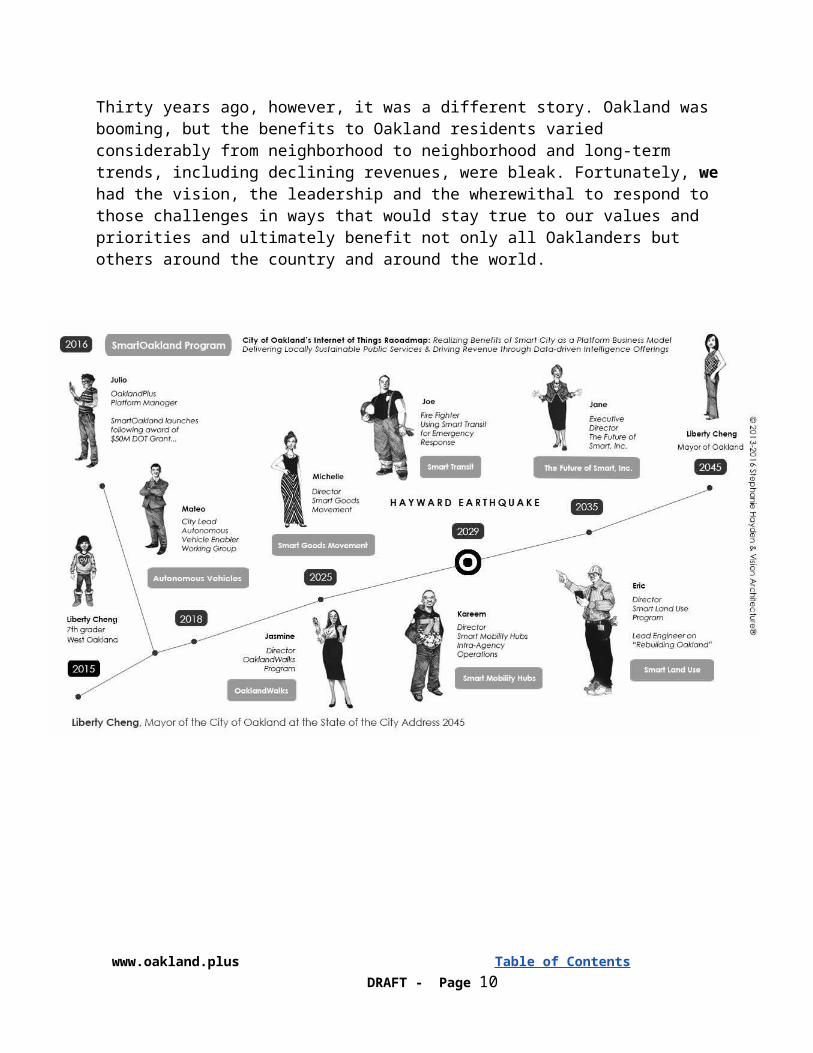
Tuesday, October 24, 2045, City of Oakland Mayor Liberty Cheng, State of the City Address (Official Transcript): “This is an amazing time for Oakland.” Thirty years ago his week, the Honorable Mayor Libby Schaaf began her first state of the city address with these very words and I have elected to do the same as I begin my own account of where our city stands at this important point in history.
Today, Oakland is world-renown as a smart, resilient, city that is thriving in the face of adversity. We continue to recover from the long-predicted earthquake of ‘29 along the Hayward fault,4 the effects of climate change are everywhere and our population has grown and aged as expected; yet, because of a series of actions and investments initiated decades ago, doomsday scenarios have largely be averted.
Originally, scientists had predicted that an earthquake of this magnitude would cause significant damage in Oakland, including the ignition of massive fires. The earthquake had been expected to cause liquefaction, a phenomenon in which soil loses its strength, stiffness and ability to support buildings. The flat-land areas of Oakland had been at the highest risk of liquefaction, which also overlap with the location of much of the
critical transportation infrastructure and emergency operations facilities for the City. These areas were also home to many low-income and vulnerable residents. While the Hayward earthquake lived up to the predictions in terms of magnitude, the impact was far less due to innovative investments in technology and infrastructure initiated under Mayor Schaaf.5
Climate change has also unfolded as predicted by scientists, but also without the devastating impacts initially projected. Waters in the San Francisco Bay were rising quickly and on track to reach the upward bounds of projections made in 2015, which had ranged from 12 inches to two feet by 2050. As expected, the frequency and extent of temporary coastal flooding increased until permanent daily tidal inundation occurred in low-lying coastal residential areas, the Port of
3 https://www.transportation.gov/ladders4The Hayward Fault ruptured in the 7.0 earthquake long-predicted by the United States Geological Survey, with ground shaking that was sometimes ten times stronger than in the 1989 Loma Prieta earthquake.5 Source: http://earthquake.usgs.gov/regional/nca/ucerf/
www.oakland.plus Table of Contents DRAFT - Page 4
Oakland, the former Oakland Army Base, and a variety of low-lying areas near the Coliseum, Airport, and Interstate 880.6 Water from the sky, not just the sea, is now a regular challenge, as heavy rains and storms have increased in frequency and intensity. Scientists had projected that the combination of higher tides and larger storms with Oakland’s aging stormwater drainage systems would lead to significant increases in both coastal and urban flooding and flood damage.
A 2015 survey completed by the USDOT found, “[If] we don’t change, in 2045, the transportation system that powered our rise as a nation will instead slow us down. Transit systems will be so backed up that riders will wonder not just when they will get to work, but if they will get there at all. At the airports, and on the highway, every day will be like Thanksgiving is today.” Moreover, exactly as that report predicted, today 81 million Americans older than 65 make up 21 percent of the population. That is nearly twice as many older Americans as there were in 2015. Meeting the travel needs of our growing population of older Americans have strained transportation systems that were already facing multiple challenges as older Americans are more likely to have physical limitations that affect their ability to drive. Moreover, many of those same disabilities also limit older American’s ability to travel on other modes of transportation. The independence of older Americans and their access to critical services is also limited.
While sea level rise, climate change and demographic predictions have all come true, Oakland has not only survived but thrived due to “smart” infrastructure and transportation investments that enabled the city to prepare for a radically different world.
Oakland’s transportation technology advancements, initially funded by a USDOT’s challenge grant, allowed for an open and transparent sharing of raw-sourced data that is actively being used by community organizations, advocacy groups, private technology startups, entrepreneurs, as well as local governments, who use this data to measure topics such as linking childhood health and safety to walking trips to schools, or the success of speed reduction on arterial corridors as the result of installation of (recently- legislated) speed enforcement cameras, to the seasonal fluctuation of people shopping at the local West Oakland farmers markets, and how to encourage more people to show up during the colder winter months.
For nearly thirty years, Oakland has provided cities around the country with both the leadership and the tools to replicate its successes. This evening, I would like to take this opportunity to remind each of you and myself how we took advantage of that unique opportunity in our history to make sure that innovation and prosperity were enjoyed by all Oaklanders and to play a leading role in the coming “smart cities revolution”.7 Such a story is best heard from more than one voice, so I have invited others to help me much like Mayor Schaaf invited others to help her when our city was challenge to envision a smart and sustainable future for itself and others.
1.1 Oakland Plus: A Smart & Sustainable Transportation InitiativeToday, Oakland residents move safely and seamlessly between energy-efficient, convenient travel modes within the city and across the Bay Area region. From all neighborhoods and income
6 The National Oceanic and Atmospheric Administration, the Bay Conservation and Development Commission has conducted mapping exercises documenting the projected impact of sea level rise on the City http://coast.noaa.gov/slr/7 http://smartcitiescouncil.com/article/are-you-ready-cognitive-era-see-what-cities-madrid-are-doing-already
www.oakland.plus Table of Contents DRAFT - Page 5
levels, they come by reliable transit, by bicycle, and by using shared mobility platforms to reach high-quality jobs. Oaklanders live in affordable housing near jobs and transit; engaging in a shared experience of racial and social equity through improved mobility, access and opportunities for all.
Thirty years ago, however, it was a different story. Oakland was booming, but the benefits to Oakland residents varied considerably from neighborhood to neighborhood and long-term trends, including declining revenues, were bleak. Fortunately, we had the vision, the leadership and the wherewithal to respond to those challenges in ways that would stay true to our values and priorities and ultimately benefit not only all Oaklanders but others around the country and around the world.
www.oakland.plus Table of Contents DRAFT - Page 6
1.1.1 Connect and Empower PeopleSmart Oakland: An Open, Crowdsourced Idea Generation & Development Initiative
I emphasize “we” for a very good reason. In 2015, my family and I lived in an apartment complex on the corner of Mandela Parkway and 10th Street in West Oakland and I was a 7th grader at West Oakland Middle School.
It is hard to imagine today, but back then West Oakland was considered to be one of the most dangerous, polluted and least desirable places to live and work in the Bay Area. Even so, my parents had moved to our two-bedroom apartment when I was five so they could be close to work and I could attend Cole Elementary School, located just around the corner from our home. While I never had a brother or sister, I did have a lot of good friends. I was on the short-side but still captain of my basketball team and I really enjoyed school.
My mother, who grew up in East Oakland in a predominately African American neighborhood, started working as an intern at the Port of Oakland right out of high school and spent the next thirty-five years in the Port’s Human Resources Department. My father, who immigrated from China and moved to Oakland after completing high school in Los Angeles, started working as a forklift operator at the Wholesale Produce Market in Jack London Square and is now the assistant manager at the old Sprouts Farmer’s Market on Broadway.
As my friends and I returned to school after the holiday break in January 2016, everything was much like it had been in previous years. Then one afternoon near the middle of the month, my science teacher started class by holding a piece of paper above her head and saying, “I found this flyer in my inbox this morning. The U.S. Department of Transportation is planning to give $50 million to one city to demonstrate how new ‘smart’ technologies can help make our street and sidewalks safer and our trips to school and work easier while fighting this thing we’ve been learning about called “climate change”. Our mayor thinks that Oakland can be that one city, but only by inviting everyone to help. This flyer is a special invitation for you and other Oakland students to help their city see its way to a smarter future.”
“The reason I am taking this seriously is that the City is not just asking for suggestions. This invitation is part of a larger effort called ‘Smart Oakland’ and city staff have developed a website and are using free web-based tools to lead an open, crowdsourced response to the USDOT’s Smart City Challenge. Moreover, Smart Oakland has teamed up with UC Berkeley’s Center for Cities and Schools (CC+S). CC+S has been working with students, teachers, city and transportation planners and city officials all around the Bay Area and across the country for more than a decade. As such, I think we have everything we need to turn this open invitation into a lesson plan that deserves some classroom time, a walking field trip or two, and some research. In the end, each of you can decide what you would like to create in order to help the city see its way to 2045: an essay, painting, map, video--whatever makes the most sense to you after going through a transportation planning process together. The city has given us until April 1st to submit
www.oakland.plus Table of Contents DRAFT - Page 7
the results of our work and then plans to hold a meeting later that month at City Hall. Your work will be broadcast over the Internet and on KTOP and the Mayor is planning to be there and may even award prizes for the best work.”
Back then, the Smart Oakland crowdsourced response to the federal grant opportunity was unprecedented. Of course, my classmates and I didn’t see it that way. As far as we were concerned, the Mayor needed our help and, thanks to our science teacher, we felt like we were in a good position to give it. As part of my research, I interviewed my mom and some of her friends from work. I created a map showing how the giant ships at the Port would someday be connected to places inside and outside of Oakland so that there was no longer freight containers lining our neighborhood streets and noisy trucks idling outside our classroom windows. I wasn’t sure how all these things would work together, but I felt like my map could help the city traffic engineer who came to visit our class.
Even though my map didn’t win a prize, I wasn’t upset. I thought it was a good map. More importantly, I look back now and realize that the opportunity to be a part of Smart Oakland changed my life forever. I already knew that I was a very special member of a special family, a special circle of friends, a special basketball team and a special school. And I loved them all very much. What Smart Oakland helped me realize is that I was a special member of something even bigger, something that I understood then as my neighborhood and my community. From that time until this very moment, I have never stopped loving a very special place, your city and mine, Oakland. To continue our story, I would like to introduce another Oaklander...
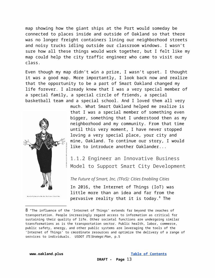
1.1.2 Engineer an Innovative Business Model to Support Smart City Development
The Future of Smart, Inc. (TFoS): Cities Enabling Cities
In 2016, the Internet of Things (IoT) was little more than an idea and far from the pervasive reality that it is today.8 The USDOT’s Smart City Challenge led Oakland and many other cities to think about not only the transportation challenges they were facing or expected to face in the coming years, but about other challenges that were less about “smart technology” and more about the implications of IoT on public policy and finances. Many questions were already being raised that could not be ignored: How can Oakland and other municipalities afford to make significant investments in smart city technologies? How can they do this in a sustainable way when those very investments threaten to undermine important sources of revenue such as gas taxes, parking citations and parking meter fees.9
8 “The influence of the ‘Internet of Things’ extends far beyond the reaches of transportation. People increasingly regard access to information as critical for sustaining their quality of life. Other societal functions are undergoing similar transformations as is the transportation sector. Public health, labor, commerce, public safety, energy, and other public systems are leveraging the tools of the ‘Internet of Things’ to coordinate resources and optimize the delivery of a range of services to individuals.” USDOT ITS Strategic Plan, p.5
www.oakland.plus Table of Contents DRAFT - Page 8
The same open process that led Mayor Cheng and I to help our city see its way to the future also opened up a space in which Oakland could imagine a sustainable business model that did not rely on grant funded projects (like the USDOT Smart City Challenge) nor traditional franchise agreements (such as the Waste Management agreement that had been executed the previous summer in Oakland or the LinkNYC agreement in New York City that had been executed back in 2014 and was only then being implemented that very month). Grant funding may work well for projects but is problematic for ongoing operations and programs, pits city against city, and ignores the benefits of the sharing economy. Franchise agreements are used to deliver valuable or even essential services to the community in efficient ways, and often generate revenue for the city in the form of royalty or franchise fees. However, these same agreements grant the franchisee rights and privileges that allow it to profit as an owner and limit the city’s ability to control the level and quality of services.
Beyond these two options, Smart Oakland began to see smart city development as analogous to the decades-long effort that had already gone into the creation and maintenance of another important community asset, the city’s off-street parking program. In 2016, that program consisted of twenty parking garages and lots with over five thousand parking spaces that generated around $10 million in fees and taxes annually. That program was made possible when Oakland voters added Article XXVII to the City of Oakland Charter in 1955.
Drawing this parallel, Smart Oakland asked how Article XXVII could empower the City to finance, construct, operate, maintain and continuously improve an “open network and platform” capable of supporting “smart city applications,” beginning with transportation solutions and then extending to include other innovative solutions that address public security, housing, law enforcement, fire, safety, healthcare and other challenges. Moreover, it began to imagine how that same platform could and should be used for non-essential applications that are developed and sourced by private-sector parties (like Pandora). Much like a municipal parking facility that has more parking stalls than the City requires for its own vehicles, the surplus capacity of a smart city platform and the data that it generates can be made available to the public on an occasional or regular basis for a fee or some other consideration as determined by the City Council.
Today, of course, we know that this insight led to the creation of one of the most successful city-to-city partnerships the world has ever known. As a member-benefit not-for-profit corporation, The Future of Smart, Inc. (TFoS) has the same mission today that it had when it was conceived decades ago: support its members as they strive to become, apart and together, the smartest cities in the world. TFoS now has hundreds of municipal-members that benefit from their organization’s collective buying power, standards-based approach to smart city data platform and application development, implementation and maintenance, policy and finance assistance, expert
9 “Google, Uber and Tesla are all testing cars in which powerful software, not humans, operates the vehicles. It’s not hard to foresee the danger these self-driving cars pose to automobile sales, which is one reason why General Motors last week decided to invest $500 million in San Francisco on-demand car service Lyft. Smart move, since GM officials seem to be getting ahead of what could be the mother of all disruptions. Mayors and governors should adopt GM’s forward thinking because driverless cars will inevitably drain hundreds of millions of dollars of revenue from public coffers each year. Reduced car ownership will mean fewer automobile sales to tax. But perhaps more important, cops and meter maids will write a lot fewer tickets because smart cars presumably won’t double park, change lanes without signaling or bust through the speed limit. Since cars sit empty about 95 percent of time, self-driving cars can greatly increase efficiency by constantly being in use,” Self-driving cars to drain millions from city, state coffers, San Francisco Chronicle (1/10/16)
www.oakland.plus Table of Contents DRAFT - Page 9
support through certified private partners, world-class training and development and so much more.
Oakland and other cities have realized financial returns on their investment by embracing the Smart-City-as-a-Platform program, partnering with the Private Sector to manage the change and disruption required for municipalities to modernize their aging infrastructure and connect their constituency with commercial-grade technologies, intelligence, and actionable information. This unprecedented access and contextual awareness made available to every constituent, and every visitor to Oakland, is what eventually propelled Oakland’s Smart City offerings into the world of Private Sector Investment and demonstrable shareholder value and we continue to discover and derive new city revenue streams via our crowd-defined, data-driven, intelligence offerings.
1.2.3 Self-Driving Vehicle Enabler GroupOakland Autonomous Vehicle (AV) Working Group: A community-centered autonomous vehicle program development initiative
We began the AV Enabler Working Group to ensure no single controlling interest could add their vehicles or data into the Smart City data platform without addressing constituency impacts including: 1) public safety, 2) health, 3) environment, and 4) equitable access. Ten years after the group saw the successful introduction of AV into and embraced by the community the results are: 1) 80% drop in vehicle-related fatalities; 2) 50% drop in stress-related illness and healthcare costs; 3) 50% reduction in air pollution; and 4) 40% reduction in K-12 student sick days and low test scores for constituents living near Oakland roadways.
In 2030, the City also achieved its objective of leveraging smart transportation to reduce vehicle miles traveled. In the 2010s, transportation experts warned that while automation has great potential
to increase transportation efficiency, poor policies and planning could lead to greater vehicle miles traveled if driverless mobile salons became the new social norm. The City partnered with transit innovators to develop affordable shuttle services with on-demand smart routes that matched shuttles with riders in real time. These services greatly improved the rider experience by reducing wait times, transfers, and walking distances to public transit. These services also enabled more efficient routes and fewer empty seats. As a result, both ridership and efficiency of public transit got a boost. Riding on the autonomous shuttle that now drives all around East Oakland and hits major destinations for those that live there, it is easy to forget all of the hard work that was need to bring self-driving or autonomous vehicle (AV) and connected vehicles (CV) to Oakland’s streets.
With the full support of the USDOT, Oakland took the lead through its demonstration project on the assessment of automated transportation applications and systems for the movement of goods and people. Absent this leadership, cities like Oakland were understandably reluctant to put
www.oakland.plus Table of Contents DRAFT - Page 10

policies and programs in place to allow for and support AV/CV. During the previous couple of years, the City and AC Transit had been engaged in the development of the East Bay Bus Rapid Transit, which represented a major change for many neighborhoods. Initial opposition was eventually turned around by the project team by listening to constituents and addressing their issues in a progressive way to get a win-win outcome.
In an era of rapid technological changes, many of promise to profoundly affect urban life, local governments are typically well behind industry. In recognizing the near-term impact of automated and connected vehicles, we are acutely aware that U.S. cities need to be far more active players in creating a nimble regulatory framework for the development and management of this city-changing frontier. As the BRT example illustrates, Oakland was prepared to play a leading role with our neighboring cities, CalTrans and others, to work through the many urban and regional policy and operational issues.
As part of the demonstration, Oakland convened an AV/CV Public Policy Working Group with a mandate to consider the safety implications, operations, public involvement requirements, liability, social equity, and cross-jurisdictional issues that needed to be crafted in order for autonomous vehicles to move forward in a significant way.
The Oakland and San Francisco Mayor’s Offices had already been in discussions of the complex governance issues related to piloting operator-assisted express bus service on the San Francisco Bay Bridge. The AV/CV Enabler Group worked closely with the private sector on the development of demonstration projects in Oakland, initially at the Port of Oakland, Oakland International Airport, and Oakland Army Base, and eventually on city streets. Where necessary, "experimental" approvals were obtained to ensure the demonstration project moved in a direction that remained productive and avoided any “blind alleys”.
Out of this sustained effort came a review and approval process for project submittals from the AV/CV industry that eventually allowed for the use of Oakland public Rights-of-Way. The same group developed the standards for technical specifications, public approval, liability, and reasonable fees. Applications will be invited for freight, transit, urban goods delivery and personal transportation vehicle projects.
The SF Bay Area already a well-developed Regional ITS Architecture, to which items specific to autonomous vehicles were added through appropriate consultation and approval processes. Throughout the demonstration project, the group maintained close cooperation with the US DOT, Caltrans and the relevant AV standards working groups. Perhaps explain how pro-active leadership by the City will be used to develop a groundswell of support (rather than suffer from the traditional knee-jerk opposition to change suggested from above). This could then be used to get appropriate approvals and support from regional, state and federal agencies that may be needed to allow the AV demonstrations described elsewhere.
www.oakland.plus Table of Contents DRAFT - Page 11
1.2.4 Help Bring Clean, Efficient Freight Movement to Port of OaklandOakland Smart Goods Movement
Goods movement plays a critical role in providing employment and economic vitality in Northern California. Goods movement-dependent industries provide over 1.1 million jobs, a third of all employment in the region. By 2012, more than $953 billion in freight moved to and from the megaregion and, as expected, that figure grew to $2.6 trillion by 2040.
Back in 2015, truck turn times from the Port entrance gate to exit gate had risen to more than 60 minutes for up to half of all trucks, while outside the gates, truckers are reportedly waiting two to four hours.
Beginning in 2016, the City began to design and eventually implemented a last mile delivery rule that limited the use of diesel for freight within 5 miles of the city’s border. After a pilot and testing stages which began in
2018, the city began to enforce its rule in 2030. From that time on, the emissions from freight were monitored using state-of-the-art GPS technology, which indicated approaching freight and its switch to approved alternative propulsion (i.e. electricity and hydrogen propulsion) during its travel through the City.10
Oakland went on to support the development of policy that assures that all rail systems (freight, passenger, transit, and other MD/HD modes)11 that operate within the boundaries of the City are to do so using no carbon. This has promoted rail systems to adopt both hybrid rail technologies, as well as electrified catenary systems, to meet Oakland’s policy. To achieve this, Oakland has supported the conversion of existing freight rail networks to electrified rail systems. As for those systems already operating electrified systems, Oakland has supported these modes and agencies as they transitioned to 100% renewable energy strategies.
Deploy software and hardware to manage truck arrival distribution and queuing to minimize waiting time and idling in West Oakland neighborhood streets.
The demonstration focused on the Marine Terminal Appointment System, including software and reconfiguration of existing systems to smooth peak congestion for trucks and reducing emissions from queuing. We reduced peak period truck queues using the USDOT’s Freight Advanced Traveler Information System (FRATIS). The concept includes integration of a web-based software system that provides terminal operators with a “prenotification” of trucks arriving at the Port for a specific load and allows trucking companies with “automated handshakes” to
10 The state is currently considering the development of last mile delivery strategies: http://www.arb.ca.gov/planning/sip/2016sip/2016mobsrc_dd.pdf11 From the ZEV Action Plan: “ Freight, rail and other medium- and heavy-duty applications are central to goods and passenger movement in California and advancing zero-emission technologies in these areas will help to meet the Governor’s petroleum reduction goal, as well as reducing localized pollution and greenhouse gas emissions.” Website Access: https://www.gov.ca.gov/docs/DRAFT_2015_ZEV_Action_Plan_042415.pdf
www.oakland.plus Table of Contents DRAFT - Page 12
establish specific appointment times. Vehicle sensors provide continuous queue measurements at each terminal which would enable a new Port-area traffic operations system to adapt scheduling and recommended truck routing. The system includes a Traffic Management Center linkage with the City of Oakland and Caltrans, network backbone, sensors, cameras, signal interconnect, and dynamic message signs.
Today, we have in place the first end-to-end, fully automated, Smart Goods Movement System connecting international trade through the Port of Oakland and out to distribution hubs throughout the U.S. increasing industry-wide productivity by 90% and decreasing losses by 75%. Oakland’s Smart City infrastructure provided the data platform, network, and intelligence systems we used to connect: 1) maritime traffic and cargo ships to port cranes and loading docks; 2) shipping containers to trucks, weighing stations to air pollution monitoring and mitigation systems; 3) loaded trucks with inventory sensors for freeway load balancing to traffic signals and automated traffic demand management systems; 4) and all this is mapped to GIS variables including Oakland airport arrival and departure information and Coliseum event traffic; and so
much more.
1.2.5 Promote Safe, Active Transportation with Solar SidewalksOaklandWalks
When you visit Oakland you’ll see rich cultural and ethnic diversity, community life and arts, nightlife and restaurants and neighborhoods in transition. We’re passionate people, informed by what we’ve experienced, and we’re committed and ready to stand up for our freedom and ability to live and move safely throughout our neighborhoods without fear. We built OaklandWalks, the City’s model solar sidewalk program elements of which have been replicated around the world, to promote walking as a truly feasible transit mode, by illuminating the way for each constituent as they move throughout their neighbors and our city.
2045 marks the beginning of the five year period during which California will meet our long term clean energy objectives12 and the checkpoint at which the City of Oakland now leads the nation in
Transportation Technology Integration and has accelerated the transition to a world powered by clean energy with major success stories in almost all areas of transportation. We were able to achieve this milestone in part through reimagining our active transportation systems. With the full support of the USDOT and with the help of our public agency and private sector partners, Oakland secured the initial infrastructure projects needed to achieve our long term transportation sustainability objectives. The primary goals behind Oakland’s integrated transportation technology policy were to empower Oakland’s residents, starting out from those with the greatest needs, with access to integrated services, including a combination of clean energy solutions that
12 This is emergent policy to be codified per SB-32 California Global Warming Solutions Act of 2006 (2015/16 session)
www.oakland.plus Table of Contents DRAFT - Page 13

benefit the grid as well as provide community & environmental benefits. Following the USDOT-sponsored demonstration project, Oakland prioritized and revitalized corridors consistent with goals that it established in 2020 to promote walking as the first and ideal option throughout the city.
Safety concerns in many neighborhoods throughout parts of Oakland discourage residents from walking and bicycling, depriving them of important health benefits and leaving them reliant on passenger vehicles instead of walking to transit systems such as BART and AC Transit bus stops.
Oakland+ used specially designed solar panels to pave sidewalks and bike paths in select areas of the city. In 2020, new paving technologies were coming online that effectively lit up sidewalks, parking lots, playgrounds and even entire roadways. The sidewalks were created in modular blocks which contained an array of photovoltaic cells, fiber optic communication cables, electric power cable, L.E.D. lighting, and a host of add-in options. The use of solar sidewalks helped reduce crime and promote walking and bicycling. The latest iteration of these solar paving systems is now used to provide low cost electrical service for the growing number of EV used by Oaklanders. These systems helped to reduce the overall carbon footprint for businesses and consumers. More recently, the City of Oakland struck a deal with PG&E to install and maintain the solar sidewalks and streets as part of their power grid. Using connected vehicle technology, it is now possible to get personalized driving directions to nearby store or parking area. The solar paving panels are networked and can provide individualized visual and audible directions to destinations by guiding autonomous vehicles via “least congested” routes.
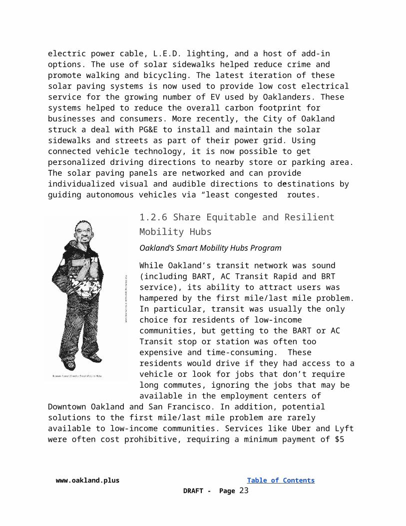
1.2.6 Share Equitable and Resilient Mobility HubsOakland’s Smart Mobility Hubs Program
While Oakland’s transit network was sound (including BART, AC Transit Rapid and BRT service), its ability to attract users was hampered by the first mile/last mile problem. In particular, transit was usually the only choice for residents of low-income communities, but getting to the BART or AC Transit stop or station was often too expensive and time-consuming. These residents would drive if they had access to a vehicle or look for jobs that don’t require long commutes, ignoring the jobs that may be available in the employment centers of Downtown Oakland and San Francisco. In addition, potential solutions to the first mile/last mile problem are rarely available to low-income communities. Services like Uber and Lyft were often cost prohibitive, requiring a minimum payment of $5 one-way. Point-to-point carshare, such as Car2Go, and bikeshare/e-bike stations, are rarely installed in low-income communities because of market projections of low demand. While low-income communities arguably have the most to benefit from shared mobility services, there are a host of structural, informational
and financial barriers that keep vulnerable populations from accessing these services. Great organizations like TransForm led campaigns that included multilingual outreach and education
www.oakland.plus Table of Contents DRAFT - Page 14
so that disadvantaged communities were not continually the afterthought of tech-enabled mobility solutions. With these and other structural issues in mind, Smart Oakland proposed to build on a recent study completed by students at UC Berkeley that identified seventy locations throughout Oakland using equity and resilience as the determining factors. Additional research identified locations in East Oakland, West Oakland and Downtown Oakland to install smart mobility to provide seamless transfer between modes like transit, bikeshare, carshare and on-demand taxi service. Much like the students had envisioned but ultimately enabled by Oakland’s smart city platform, these hubs offered these neighborhoods safe and convenient access to multiple modes of clean transportation including: public transit service, including rail transit stations or bus stops; bike share dock stations; designated white curb space for passenger pickup and drop off for ride share services and taxis; designated parking spots for car share vehicles; and designated parking spots for scooter share vehicles.
Since 2017, Oakland has supported the expansion of a path and charging network for E-Bikes, including storage and charging for e-bikes at all major transit and rail stations. This interoperability has encouraged major mobility shifts and promoted seamless interconnectivity between transportation modes. In addition, all 300 of Oakland’s neighborhoods now have “e-
bike hubs” which acts as both a physical hub for E-Bike, as well as a community gathering center.
1.2.7 Make Oakland’s Transit Services Even SmarterOakland’s Smart Transit Program
In 2030, the City also achieved its objective of leveraging smart transportation to significantly reduce vehicle miles traveled. In the 2010s, transportation experts warned that while automation had great potential to increase transportation efficiency, poor policies and planning could lead to greater vehicle miles traveled if driverless mobile salons became the new social norm.
The City partnered with transit innovators to develop affordable shuttle services with on-demand smart routes that matched shuttles with riders in real time. These services greatly improved the rider experience by reducing wait times, transfers, and walking distances to public transit. These services also enabled more efficient routes and fewer empty seats. As a result, both ridership and efficiency of public transit got a boost.
Vehicle Assist and Automation, or VAA, was implemented on the recently completed East Bay Bus Rapid Transit (BRT) route, enabling buses to stop in fixed locations every time and enable
buses to achieve rail-like quality of service and improved operational efficiencies through tighter scheduling. VAA assists bus drivers with a degree of automated steering control and precision bus docking, making it possible for BRT vehicles to dock so precisely at stations that disabled
www.oakland.plus Table of Contents DRAFT - Page 15

riders using wheelchairs will be able roll on or off the buses with a only very small gap between the bus floor and the loading platform at the station.13
Oakland partnered with AC Transit, UCPATH, and USDOT’s Federal Transit Administration (FTA) and the ITS Joint Program Office for its Smart Transit demonstration project, completing field operational tests to demonstrate the technical feasibility of the VAA system.
Oakland and AC Transit share information on headway separation between transit vehicles between bus operators. This information informs driver decision-making and aids teamwork on the high-frequency, high-capacity East Bay BRT transit line. An AC Transit V2V program also provides V2V communication between BRT vehicles and buses on intersecting AC Transit routes to provide real-time, on-board information for drivers and passengers to improve bus transfers. A “hold bus” message is sent to operators of connecting local lines to wait for the BRT bus, reducing frustrating missed connections. This Smart Transfer system approximates timed transfers, without the cost and system-wide ripple effect of conventional timed transfers. Beyond this, we installed Adaptive traffic signals and Transit Signal Priority (TSP) for the AC Transit express bus services including those traversing the heavily traveled San Francisco-Oakland Bay Bridge and Freight Signal Priority (FSP) on key access routes to the Port of Oakland. Automatic bus lane enforcement using License Plate Recognition detection system was adopted systemwide and passengers could pay fare using smartphones enabled by a universal payment platform (with payment verification being displayed on the passenger’s phone for both visual and electronic confirmation by fare inspectors).
All buses, bus stops and mobility hubs, beginning with routes serving disadvantaged communities, were equipped with Wi-Fi. This reduced pressure on low income passengers’ data plans and eliminate the primary reason why low-income riders are forced to give up their smart phones. Wi-Fi points on buses, bus stops and mobility hubs was used to pick out a stream of cellphone/smartphone data to separately analyze transit ridership.
Initiate Flex pilots in low density, job-rich industrial areas like the Hegenberger and San Leandro Street corridors. Phone apps were designed to seamlessly include other frequently used languages such as Spanish, Chinese, Tagalog, Korean, Arabic, Russian, Khmer and Vietnamese. These same Flex services were then extended into other low-density residential areas in Montclair in the Oakland Hills. To reduce the costs of deploying the system, AC Transit partnered with and leveraged VTA’s existing Flex pilot (www.vta.org/flex) operational concepts and applications developed by RideCell (ridecell.com).
In the 2010s, California electric grid operators expressed concern that increasing reliance on solar energy could result in a mismatch between when energy is generated and when consumers use it, and suggested investing in gas-fired power plants to smooth out the differences. Further, grid operators warned that electrification of transportation could increase this mismatch between electric supply and demand. Oakland’s leadership and commitment to avoid adding capacity
13 In recent testing in Eugene, Oregon, the accuracy of the bus docking was within 1.5 cm centimeters. VAA can also offer BRT passengers a smoother, more rail-like ride by improving lateral ride smoothness, providing more even acceleration and deceleration, and ensure more precise stop location within their station area. Field tests show tracking errors of 10 cm or less, including the sharp turn when getting in and out of the stations.
www.oakland.plus Table of Contents DRAFT - Page 16
from gas-fired power plants resulted in a plan whereby local and regional public transportation incorporated energy storage, distributed solar and other energy management solutions into transit electrification projects, reducing reliance on the electric grid to meet power needs. Conversion of diesel to electric buses began on routes serving West Oakland in the vicinity of the Port and Army Base and East Oakland, including support for induction charging in roadway and fast charging technology at termini.
1.2.8 Add By Subtracting with Smart Land Use PlanningConnect Oakland: I-980 Removal Project
As early as 2030, the City accomplished its transportation electrification objectives including providing adequate charging and refueling for all Oakland residents. This was primarily achieved through integrated transportation solutions -- such as charging electric vehicles with energy generated from the sun, which was captured using solar PV, and stored in energy batteries. Oakland also provided electric vehicle charging access at 100% of the nearly 400 city-owned locations, and partnered with local developers and parking facility owners to assure access at 75% of all parking locations.
This is a bold vision to transform a segment of Interstate 980 into an at-grade boulevard to reconnect West Oakland neighborhoods into the fabric of the City. The construction of the freeway resulted in significant dislocation, effectively sealing off and surrounding West Oakland and its primarily African-American residents with freeways.
The project has the potential to open up approximately 17 net acres of new publicly-controlled land by creating 13 new city blocks for development. The transformation of the freeway into an at-grade multi-way boulevard will reconnect 12 city streets and reducing the block-to-block connection distance from 560 feet to a maximum of
132 feet.
The project also provides an alignment and infrastructure for a second Transbay Tunnel rail crossing to meet the region’s core capacity needs. The current below-grade I-980 ROW would house a new BART line under the boulevard, with new BART stations at 14th Street, Jack London/Howard Terminal and Alameda Point. It could also connect Caltrain and High Speed Rail to Downtown Oakland and north to Sacramento.
www.oakland.plus Table of Contents DRAFT - Page 17
1.3 Oakland Plus Approach: Platform & Program Development+Platform: Oakland’s Smart City Data Framework or Community System
Following a transparency policy initiative begun in Oakland 2020, as of 2025, all data organized by these transportation sectors was centrally housed in a database that is uniform, easily understood, and downloadable by the public. Fundamentally, the City prioritizes the release of data that can inform Oakland residents and other cities of how to achieve long term greenhouse gas reductions goals, maximize grid benefits, while maximizing community and environmental benefits. As such, all data on Oakland’s transportation infrastructure is made public to the extent possible.
That policy codified what had begun as the Oakland Plus Approach: building new connections, connecting people, connecting vehicles, connecting all things transportation, breaking down technological barriers and institutional silos and building new and stronger relationships--this is the +Approach that Oakland applied to the
development of its platform and smart city program demonstration project and its ongoing smart transportation program.
1.3.1 Smart City Data PlatformIn true IoT fashion, Oakland+ proposed and delivered significant value by not only making current services better, but by leveraging information from disparate systems, bringing the information together, and creating new and innovative services – way beyond transportation. Oakland recognized that cities throughout Europe had already taken this approach and succeeded. It understood that being really “Smart” means extracting as much value as you can from the existing legacy infrastructure.
This was accomplished by designing and implementing a smart city data platform and came to be know as the “Plus Platform” (+Platform). The +Platform was an open standards based unifying environment in which seamless and rapid integration of existing resources and new resources are brought together. The capacity to maximize the reuse of existing resources combined with the most rapid integration of new and existing resources delivered on the promise of economic feasibility (“Affordable Innovation”). Uniquely architected to not only support horizontal but vertical scalability, the +Platform enabled a highly scalable and resilient environment. Multi-tenancy, strict data ownership and control capabilities ensured the highest security standards. As a technology agnostic framework, +Platform proved to be highly adaptable then as it is now.
www.oakland.plus Table of Contents DRAFT - Page 18
1.3.2 Project Management & Program DevelopmentOakland tackled the USDOT opportunity with a truly unique business collaborative approach that combined pragmatism and innovation (TFoS). This is something industry insiders had not seen in the U.S. or in any other part of the world. The +Approach meant making sure that the Oakland+ demonstration project, from beginning to end, was engineered to become a self-sustaining program.
1.4 Oakland ProudThanks to Mayor Schaaf and Oakland+, many of the challenges that faced our city in 2016 have been met and overcome and, today, Oakland continues to be a sizzling hot center of urban development and an awesome place to live, work and play. As we face new and awing inspiring challenges, I am confident that Oakland will rise to the occasion as it once did thirty years ago, now buoyed by the very systems and capabilities that Oakland+ brought to us and other cities across the country and around the world. Thanks to Oakland+, we can all be Oakland proud!
2. Population CharacteristicsSituated in the rapidly growing San Francisco Bay Area, Oakland is the county seat and largest city in Alameda County with a population of 413,775, making it the eighth largest city in California. Oakland represents 12% of the population of the San Francisco--Oakland Urban Area.14 Oakland is growing more rapidly than California as a whole; between 2010 and 2014, Oaklands population grew 5.9%, while the state’s population grew 4.2%.
Oakland has a large footprint of 56 square miles. The City of Oakland is comprised of 50 distinct and dynamic neighborhoods, 17 commercial districts, a thriving downtown, and world-class arts, entertainment and recreational amenities. While Oakland is blessed with significant open space, coastline and large industrial areas, it is also quite densely populated, with 7,004 people per square mile.
The City of Oakland is also one of the most ethnically diverse major cities in the nation, with major representation from Hispanic and Latino, Asian, African-American and Caucasian residents speaking over 125 languages and dialects, as well as one of the country’s largest lesbian, gay, bisexual and transgender communities. Located on the San Francisco Bay, six miles east of San Francisco, Oakland is framed by 19 miles of San Francisco Bay coastline to the west and rolling hills to the east.
14 In the 2010 Census, Oakland had a population of 390,724, and the the San Francisco--Oakland, California Urban Area (UA 78904) contained a reported 3,281,212 residents. (Federal Register, Vol. 77, No. 59 March 27, 2012: Qualifying Urban Areas for the 2010 Census) We recognize that Oakland’s percentage of its Local Urban Area is less than the 15% that the USDOT considers ideal. We ask, however, that the USDOT recognize that this calculation conceals the fact that Oakland is the largest and most important city in the East Bay and, as explained below, at the intersection of every major mode of transportation.
www.oakland.plus Table of Contents DRAFT - Page 19
3. Other Characteristics“Communities around the country are looking for smart,
creative transportation solutions like the East Bay Bus Rapid Transit line to better manage traffic congestion and offer
residents a reliable, convenient transit option for getting to work, school, and other opportunities.”
Secretary Anthony Foxx, US Dept. of Transportation
Oakland is the nexus of the Bay Area’s rail, highway and freight networks, making it central to the region’s economy. Oakland manages 806 miles of streets, 677 signalized intersections; 7,900 metered parking spaces, 200 miles of bike facilities, and 1,100 miles of sidewalks and pedestrian pathways. All four lines of Bay Area Rapid Transit (BART) pass through Oakland, which hosts eight multimodal stations within its city limits. The city is also served by Amtrak’s Capitol Corridor line, several intercity bus services, and the Alameda/Oakland Ferry. The Alameda-Contra Costa Transit (AC Transit) bus services carries 192,000 riders each day, using a network of 1,813 bus stops, 586 buses and 140 lines, including the East Bay BRT, currently under construction. Nine major federal Interstate and state highways travel through the city. The Oakland International Airport moves over 10.3 million passengers and 1.1 billion pounds of air freight each year. The Port of Oakland is the fifth busiest in the United States handling 99% of the containerized goods moving through Northern California.
As an employment center, regional destination and due to its geographic location on the Bay, Oakland carries a disproportionately high share of trip ends and throughput traffic resulting in a ranking among America’s worst traffic bottlenecks. As a regional employment center, Oakland’s transportation system experiences impacts because of the approximately 135,000 workers that travel to Oakland from various parts of the region; 110,000 residents of Oakland workers travel out of Oakland; and 41,000 residents of Oakland work in the city. Although these numbers do not capture the modes of travel, a report by the advocacy organization SPUR pointed out that only 24% of downtown workers take transit to and from work, meaning that the vast majority of employees still commute by automobiles. Oakland is the gateway from East Bay cities into the employment center in San Francisco. The auto and truck throughput traffic in Oakland significantly impacts the region’s economy, growth, air quality and the environment. Since Oakland serves as a key contributor to Bay Area jobs and housing, Oakland’s transportation system needs to be high-performing and sustainable in order to optimally facilitate the mobility of employees and residents in the region. Moreover, the regional throughput traffic through Oakland puts a strain on the city’s provision of local transportation services. The constant need for local road maintenance directly impacts Oakland’s ability to fund for and provide multimodal transportation services such as enhanced public transportation, and bike and pedestrian infrastructure. Oakland estimates that it has a $443 million (and growing) shortfall in deferred street maintenance and over $30 million in needed sidewalk repairs.15
15 According to MTC-ABAG’s Plan Bay Area 2040 projections, San Francisco, San Jose, and Oakland will accommodate 42 percent of housing growth and 38 percent of total job growth by 2040. Among these top three cities, Oakland is projected to have the highest percentage of job growth as shown in the below. However, the OBAG program does not take jobs into consideration
www.oakland.plus Table of Contents DRAFT - Page 20
According to 2013 Longitudinal Employer-Household Dynamics (LEHD) data, Oakland held 192,485 jobs with the top five industries of HealthCare and Social Assistance (21%), Public Administration (9%), Transportation and Warehousing (9%), Educational Services (8%), and Professional, Scientific, and Technical Services (7%). These socioeconomic and employment characteristics are not uniform over the city and vary by geography (e.g. North, East, West Oakland and downtown) and physical environment (e.g. lowlands and hills). Travel characteristics of Oakland residents are reflective of the City’s multimodal transportation system and proximity to regional destinations outside the City, including San Francisco and San Jose. Travel diary survey data from the 2010–2012 California Household Travel Survey (CHTS) revealed that the weighted mean distance of all trips associated with Oakland during that time period was 6.95 miles, while the weighted median was 1.33 miles. Automobile and walking were the two most popular modes of travel, accounting for 51 and 32 percent of all trips made, respectively. Public transit (e.g. AC Transit and BART) accounted for 11 percent and bicycling accounted for 2 percent. These results are indicative of two dominant types of trips being made: 1) short-distance, walkable trips of one mile or less within City boundaries, and 2) longer, regional trips by automobile or public transit on the 10–20 mile order of magnitude to job centers outside the City.
3.2 Benefits of Demonstrating Proposed Strategies in Oakland● Historically working class city, lack of interest and investment from others until recently,
strong sense of civic pride● City is growing, lots of new investment and economic activity= opportunities for policy,
innovation, and holistic planning● Creative arts, technology, and science-minded, “Do it Yourself”, and, “Maker Culture”, is
thriving in Oakland demonstrated by crucible-like activity and creative disruption opportunity to learn from mistakes of neighboring areas and “do it better”
● multi-modal city- people use all forms of transportation to move themselves and their goods- port and roads for goods; cars, rail, buses, ferries, bikes, and pedestrians
● Diverse city- different income levels, multiple generations, diverse cultures = need for multiple options for connectivity
● Oakland's suitability to leverage energy from the tech industry and to put it into practice with diverse, often underrepresented communities. We are among the innovators of innovators here, and we also have people of every income and ethnic spectrum as our neighbors who can work with the innovation we create. Oakland is the perfect cosmopolitan location to build effective innovations that will work not just across the nation, but around the globe.
3.3 Oakland’s Strong History of LeadershipThe political leadership of Oakland is fully committed to this proposal. Mayor Libby Schaaf has completed the the first year of her four-year term, and remains very popular. In November 2015, a citywide poll showed that the Mayor had a 68 percent approval rating among registered voters, the highest for an Oakland mayor since 1999, when California Governor Jerry Brown held the post. Mayor Schaaf’s top four priorities, around which she has structured her administration are
in its funding formula. Thus, a major employment hub such as Oakland, which stands to carry a disproportionate amount of trip destination traffic, would also be disproportionately strained in its provision of transportation services.
www.oakland.plus Table of Contents DRAFT - Page 21
holistic community safety, equitable jobs and housing, sustainable infrastructure, and responsive, trustworthy government. These priorities are very well aligned with the Smart Cities Challenge, and direct connections between Oakland policies and the U.S. DOT’s will be underlined throughout this proposal. Oakland’s FY2015-2017 budget invests over $70 million in infrastructure repairs and improvements, including $25.5 million for streets and sidewalks and $8.6 million for traffic improvements.
The city already has shown a strong ability to carry out innovative transportation projects in partnership with local transit agencies, as well as regional, state, and federal partners. Recent examples of projects include the Oakland Airport Connector (BART), East Bay Bus Rapid Transit (AC Transit), Smart Corridor Project, the I-80 ICM (Caltrans), and Green Pavement Bike Experiment (with approval of Federal Highway Administration).
3.4 Embracing the Sharing Economy16
Oakland is committed to not only participating in the sharing economy, but finding or creating new opportunities to promote and play a leading role in it. Smart Oakland is just the latest example of Oakland commitment to and capacity for assuming this leadership role. Peer-2-Peer (P2P) vehicle sharing is another important example: ZipCar and City CarShare together operate approximately 100 vehicles in Oakland and other vehicle providers like GetAround, RelayRides, and Spinlister (bicycles) have entered the city as well. In 2015, the city adopted official policy to support the continued growth of P2P vehicle sharing systems.
3.5 Commitment to Open, Machine-Readable DataThe City of Oakland is committed to making public data as broadly accessible and usable by humans and machines, free of any technological, legal, or usability barriers. Proactively disclosing public data is a foundation of Open Government and is consistent with laws regarding residents' right to access public information as well as privacy laws that have been outlined by the California Public Records Act (Gov. Code §6250, et seq.) and the Oakland Sunshine Ordinance (Oakland Municipal Code §2.20.180.C).
16 See Policies for Shareable Cities, Section 1, “Shareable Transportation”.
www.oakland.plus Table of Contents DRAFT - Page 22
4. Demonstration Site Map
www.oakland.plus Table of Contents DRAFT - Page 23
5. Project Approach & Alignment to ElementsOakland+ is the product of a holistic, integrated and tiered approach to addressing Oakland’s challenges and its transportation challenges in particular. The following table depicts each of the eight solutions of our proposed demonstration project, the enabling technologies behind each of these and how each one aligns to the USDOT’s twelve Vision Elements.
www.oakland.plus Table of Contents DRAFT - Page 24
6. Risk Assessment & Mitigation PlansIn terms of technical risk, Oakland realizes that many ITS projects are usually difficult and often unsuccessful, especially when they involve new technology, new software, new communications, or new partnerships. Because we are proposing multiple project elements with high degrees of innovation, elements of our proposal fits the definition of “High-Risk ITS ”. In order to mitigate
www.oakland.plus Table of Contents DRAFT - Page 25
the risk of failure, and avoid wasting taxpayer funds, Oakland+ proposes to produce a Project Study Report, submit a Systems Engineering Review Form (SERF), prepare a Concept of Operations, and develop a Systems Engineering Management Plan (SEMP) for USDOT approval to guide the project. Oakland staff have recent experience developing a SEMP with FHWA that led to a successful system design and project implementation.
The first three of our proposed solutions are non-technical in nature and involve policy or institutional risks; or, rather, they are themselves mitigation plans designed to address the risks associated with the smart city revolution.
Solutions Policy & Institutional Risks Plans for Mitigation
Smart Oakland
Sometimes stakeholders fail to engage sufficiently in a self-starting manner.
The City plays an incubator role, establishing forums that bring stakeholders together so their synergy develops. Smart Oakland is perhaps the best and most recent example of such a forum
The Future of Smart, Inc.
A minimum amount of resources would be at risk in the City’s efforts to create this third option for itself and other American cities. Perhaps the biggest risk to the success of this idea is not gaining enough momentum because of the inherent difficulties of getting multiple agencies with elected boards to agree on the details and to get on board.
Ensure that TFoS has a sophisticated education program aimed at agency officials and elected representatives, and a structured process to encourage agreement and participation in a step-by-step process.
City AV Enabler Working Group
Demonstrations are slowed down by local community opposition and/or slow approvals from regulating agencies.
Outreach campaigns, grassroots organizing and education programs, which Oakland and its partners have demonstrated capacity to do with constituents at a local level (e.g., Smart Oakland and BRT project with AC Transit)
7. Project Partners and Governance ProcessesThe success of Oakland+ will depend in large measure on the City of Oakland’s capacity to lead a diverse group of partners drawn from the public, private and not-for-profit sectors.
www.oakland.plus Table of Contents DRAFT - Page 26
7.1 Public Sector PartnersPort of Oakland, Alameda County Transportation Commission (ACTC), AC Transit CalTrans, Metropolitan Transportation Commission (MTC), California Office of Policy and Research, California Strategic Growth Council, UC Berkeley Center for Cities & School, UC Berkeley PATH, UC Berkeley Transportation, Sustainability Research Center, California PUC, UC Transportation Center. Governance processes will often involve a memorandum of understanding but will ultimately be determined on a partner-by-partner and project-by-project basis.
7.2 Private and Not-for-Profit Sector Partners
8. Existing Transportation InfrastructureOakland has made significant strategic investments in developing its transportation and ITS network. Oakland developed its first ITS Strategic Plan in 2003 and most recently updated it in 2014. During that decade, the City successfully delivered several high profile ITS projects, including the installation of a Traffic Management Center (TMC). Oakland’s ITS Network consists of various hubs, project corridors and field elements connected into an integrated system. The TMC operates an NTCIP-compliant central system software (ATMS.now by Trafficware) and Emergency Operations Center (EOC). Field equipment includes Type 2070 traffic signal controllers (many with transit signal priority), cameras (for detection and monitoring), arterial Changeable Message Signs (CMS), and trailblazer signs. The City operates over 600 traffic signals in Oakland, nearly 200 of which will be connected via high-speed Ethernet to the TMC over miles of 144-strand fiber optic trunk cables. The City currently operates nearly 50 cameras (either fixed video or moveable monitoring cameras) from their TMC. See the demonstration project map in §4 for the planned full build-out of the City’s ITS network.
Oakland sits in the heart of the SF Bay Area, surrounded by other Cities and Counties with their own ITS projects, all interconnected via a regional ITS Architecture managed by MTC . The Bay Area ITS Architecture is the blueprint for ITS project coordination and integration in the San Francisco Bay Area, and Oakland has no intention of veering from that blueprint.
The City of Oakland, as an active DOE Workplace Charging Challenge participant and advocate and founding member of the West Coast Electric Fleets project, has embarked on EV charging initiatives and has in place fleet, workplace, and general public no-cost EV charging infrastructure. An additional workplace and public charging project featuring a DC fast Charger has recently been approved and will be completed in second quarter 2016, while a comprehensive grant proposal to install 44 Level 2 and 8 DC fast Chargers at high density public parking facilities throughout the City has recently been submitted. The City is committed to making EV charging available to all communities in the City, including low income and Multi
www.oakland.plus Table of Contents DRAFT - Page 27
Unit dwellings. An internal advisory panel has been assembled to gather information and broadly solicit input from all stakeholders including residents, local businesses, utilities, industry, and government. The City is working diligently to synchronize solar voltaic projects with EV charging, and is exploring other possible strategies to address peak demand such as vehicle to grid and onsite energy storage. The City also expects to have Building Code amended within the next year to include more stringent requirements for EV-ready new development and also streamlined EVSE permitting requirements for existing structures.
9. Data: Collection, Sharing and SecurityData Security is of extreme importance to the +Platform. As it relates to collection, the Data is collected and transported in a secure method towards the cloud. All the legs will be properly secured from the device through the edge towards the cloud, in a bidirectional way. As it relates to Data sharing and integration, each actor will be properly identified, authorized, and tracked so that the actor will only have access to the proper resources. Furthermore, a capillary KPI system will track every single interaction of each actor, to collect statistical behavior, to provide monitoring and controlling of SLAs, and to support auditing.
9.1 Data Collection & SecurityDuring the procurement of project partners, Oakland will require strict data security standards to protect the 1) privacy of users and 2) ensure the security of user information and protect against theft and fraud. At a minimum, the vendors and the city will be required to:
● Limit access to, and require authentication of, users of the Data Dashboard and Common Payment Platforms;
● Minimize amount of Personally Identifiable Information (PII) collected / required;● Minimize copies of PII maintained, distributed as little as possible, held by fewest
number of entities possible;● Must few copies must be retained, must be carefully protected in secure systems, meeting
standard of the Payment Card Industry Data Security Standard (PCI-DSS) ( and other standards as applicable);
● All other data that is collected will be anonymized to the maximum amount possible, e.g. individual trips will be aggregated, individual PII will be disassociated with trips.
9.2 Data SharingData will be made available through a variety of formats and channels so that different actors with different requirements, are able to consume the data. In order to provide an efficient, scalable, and cost effective approach, the same data can be made available for different perspectives, use cases, and audiences. To accomplish this, the +Platform provides a normalized Semantic data model to which different actors can attach different pieces of information. The output model can be presented in variety of formats for consumption by participating parties.
www.oakland.plus Table of Contents DRAFT - Page 28
9.3 Data IntegrationThe +Platform will enable communication to take place across different players, regardless of standard. For this need, it has the capability to receive inputs coming from a variety of standards, while providing the capability to output the information on a different standard. At the same time, custom and legacy communications strategies are supported as well, both as inputs and outputs. This is mandatory to comply with a service level agreement and required QoS, while providing the flexibility to onboard future technologies that today may be unforeseen – enabling the +Platform’s future proof capabilities. Therefore, there are no limits to which transportation data can integrate with.
Data Policy: Existing and ProposedInherent in the +Platform architecture is the capability to comply with existing or heretofore unknown regulations, policies, or ordinances including data retention and appropriate use policies. Implementation and enforcement of compliance can be accomplished by adding new business logic to any module or interface.
10. Cooperative Approach to DemonstrationThe +Platform will enable communication to take place across different players, regardless of standard. For this need, it has the capability to receive inputs coming from a variety of standards, while providing the capability to output the information on a different standard.
10.1 Standards-Based ApproachOur goal is to maintain open and transparent databases; this in no way results in lack of focus on the need to adhere to network and data standards. Regionally, the City will adhere to standards set forth in the regional ITS Architecture to ensure our data can be shared by regional ITS programs such as Integrated Corridor Mobility programs on I-880 and I-80, and the East Bay Smart Corridor. This includes adherence to NTCIP protocols for traffic data transfer and transfer of SPAT data for connected vehicle applications.
The city will leverage key partner participation in and understanding of standards and certification from around the world – with particular use of IEEE 802.11, IEEE 1609 WG, SAE DSRC TC – to ensure that our National Architecture- and CVRIA-compliant and documented architectures are or can be compliant to existing and proposed standards. Our partners have leadership positions in standards development and certification of many of the proposed technologies; This positions us well to collaborate in all aspects of the familiar standards and certification ecosystem to the benefit of our proposed project approach and to the benefit of Connected Vehicle and Smart Cities deployments across the United States.
10.2 Documentation PlansOakland+ aims to leverage the valuable experience and insight from others working in the same domain. That means, for example, that we share our experiences with regional working groups such as MTC’s Next Generation Arterial Operations Program. At the national level, we and our partners will share our experiences with the AASHTO Connected Vehicle Deployment
www.oakland.plus Table of Contents DRAFT - Page 29

Coalition. The +Approach recognizes that becoming a world-class Smart City means combining our own innovations with the experiences of others.
11. Goals & ObjectivesOakland will agree to a set of performance goals and metrics with the USDOT, which will be reported via quarterly progress reports or at the USDOT’s request. A critical part of this project will be data collection of statistics and user feedback to allow the city to adjust each element as needed. At minimum, these performance goals and metrics will include:
● Development stage of each element (planning, approvals, design, implementation, monitoring)
● Change in number of users by mode or application (if applicable)● User satisfaction ratings and feedback (bi-annually)● Number of stations or lane-miles implemented (if applicable)● Change in travel time by mode (if applicable)● Change in VMT (annual)● Annual GHG reductions● Multi-modal crash rates (including vehicle, bike, and pedestrian)● Annual multi-modal trip rates (by survey)● Housing units and jobs within ½ mile of connected, complete bicycle, pedestrian, and
transit networks, with demographic considerations (bi-annual)
12. Commitment and Capacity12.1 CommitmentThe political leadership of Oakland is fully committed to realizing the Oakland+ vision. Mayor Libby Schaaf has completed the first year of her four-year term, and her top four priorities are holistic community safety, equitable jobs and housing, sustainable infrastructure, and responsive, trustworthy government.
Oakland also has strong, committed transportation leadership in the Alameda County Transportation Commission (ACTC). In 2014, ACTC passed Measure BB, a transportation sales tax extension and augmentation that will generate an estimated $8 billion over the next 30 years. Measure BB passed with 70% approval, with Oakland voters as a critical element, as every district voted over 66.6 percent in favor.
The San Francisco Bay Area Metropolitan Transportation Commission (MTC), the region’s MPO, is also a key partner for Oakland’s effort. MTC has provided committed, stable leadership in many arenas that combine transportation and technology. Of equal importance is MTC’s leadership in Plan Bay Area, the long range planning document for transportation and land use, and their resulting greenhouse gas emissions, in adopting performance goals for improving equity and reducing transportation costs burden for low-income residents.
www.oakland.plus Table of Contents DRAFT - Page 30
12.2 CapacityThe city has shown the capacity to support and carry out innovative transportation projects, especially in partnership with regional, state, and federal partners. Just a few recent notable efforts include:
● Provide a seamless passenger rail-air connection with automated, driverless trains for the Oakland Airport Connector, a 3.2-mile BART extension from the Coliseum/Oakland Airport BART Station to the Oakland International Airport that opened in November 2014;
● Together with AC Transit, implementing the $174 million East Bay Bus Rapid Transit Project, a 9.5-mile full BRT between downtown Oakland and San Leandro;
● Partnered with FHWA, Caltrans, and local transportation agencies to help make the $79 million I-80 SMART Corridor Integrated Corridor Mobility project one of the most comprehensive Intelligent Transportation Systems in the nation;
● Since 2014, nearly 3.2 miles of new buffered bike lanes were installed to encourage separation between cars and bikes;
● In 2015, Oakland was awarded a $1.3 million CMAQ grant by MTC to carry out an ambitious program that combines demand-responsive parking and Transportation Demand Management.
13. Cost share, in-kind donations and partnering opportunitiesThe Federal resources available through the USDOT’s Smart City Challenge grant would enable the City of Oakland to both build on existing opportunities and create new opportunities for cost sharing, in-kind donations, and partnering. Realizing the Oakland+ vision will not be possible without developing broad partnerships across an array of vendors, consultants, and other professional groups in order to harness the best ideas but also ensure that the community is invested in the project, figuratively and literally. The following is an incomplete list of firms and vendors that have already offered partnerships and financial support to our proposed demonstration project.
Technology Partners
Shared Mobility Providers Lyft, Uber, Zoox
Bikeshare Providers Swiftmile, Bay Area Bikeshare
Scooter share Gogoro, Scoot, URB-E
Autonomous vehicle hardware/software nutonomy, Auro Robotic, EasyMile, MobilEye, Google X
www.oakland.plus Table of Contents DRAFT - Page 31
Electric Bus Proterra, WAVE
Transportation Data Aggregation Software MetroTech, Iteris, INRIX, Streetlight Data
Smart City Platform Software OSIsoft, Xerox, Cubic, Assurenet, Esri
Connected Vehicle Hardware/Software Arada Systems, Savari, Veniam
Sensors and Wireless Hardware Qualcomm, Sensys, Sentry Control, AMS, 3DR
Mapping / Navigation Waze, Google, Bing!, HERE, TomTom
Solar paving Solar Roadways
www.oakland.plus Table of Contents DRAFT - Page 32