Embed Size (px)
Citation preview
System Modernization of our Precious ResourceGIS Implementation Project
San Juan Water District – HDR Inc.
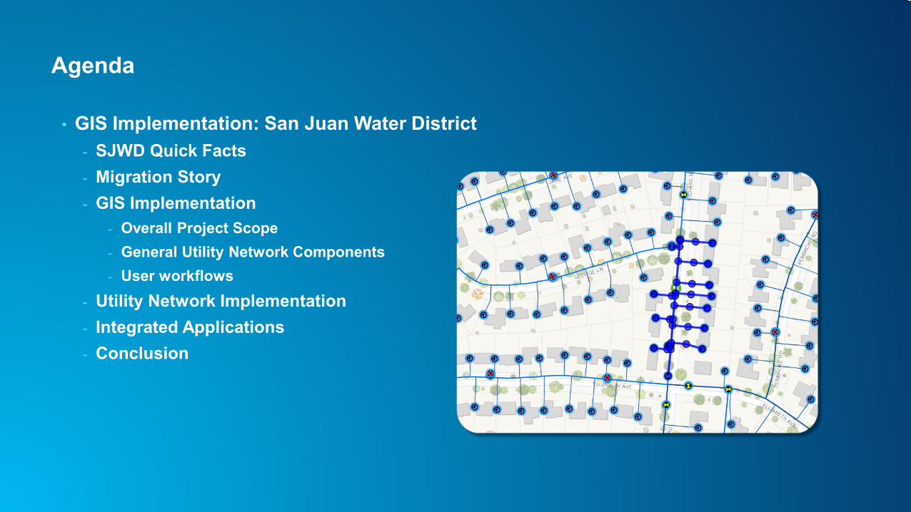
Agenda
• GIS Implementation: San Juan Water District- SJWD Quick Facts- Migration Story- GIS Implementation
- Overall Project Scope- General Utility Network Components- User workflows
- Utility Network Implementation- Integrated Applications- Conclusion
San Juan Water District – Quick facts
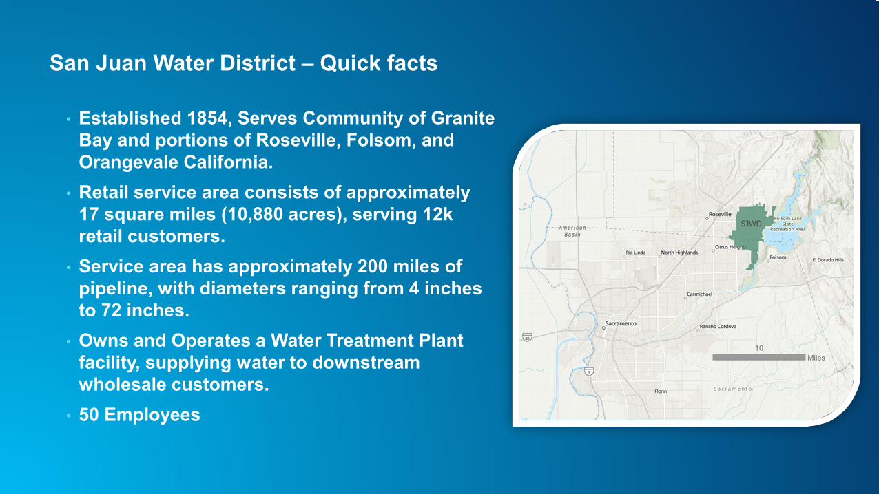
• Established 1854, Serves Community of Granite Bay and portions of Roseville, Folsom, and Orangevale California.
• Retail service area consists of approximately 17 square miles (10,880 acres), serving 12k retail customers.
• Service area has approximately 200 miles of pipeline, with diameters ranging from 4 inches to 72 inches.
• Owns and Operates a Water Treatment Plant facility, supplying water to downstream wholesale customers.
• 50 Employees
Migration Story - CAD to GIS
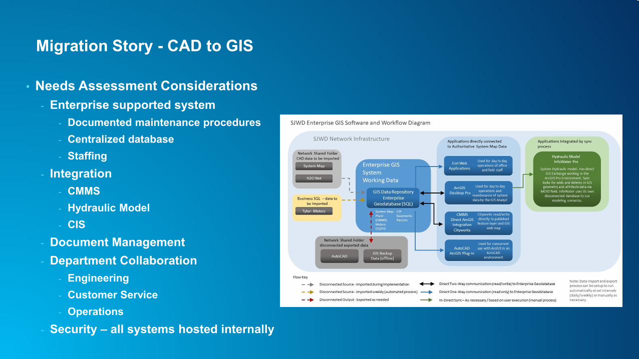
• Needs Assessment Considerations- Enterprise supported system
- Documented maintenance procedures- Centralized database- Staffing
- Integration- CMMS- Hydraulic Model - CIS
- Document Management- Department Collaboration
- Engineering- Customer Service- Operations
- Security – all systems hosted internally
HDR Company Description
• Employee-owned global AEC firm (founded 1917)• Gold level business partner with Esri (20 years)• Over 120 GIS professionals, 20 + developers• 2020 Esri Partner award for Platform Adoption• Esri Utility Network Management and AGOL Specialty
Partner• In House Integration Experts
- Hydraulic Modeling- CMMS/UMS
What - GIS Implementation Project Highlights
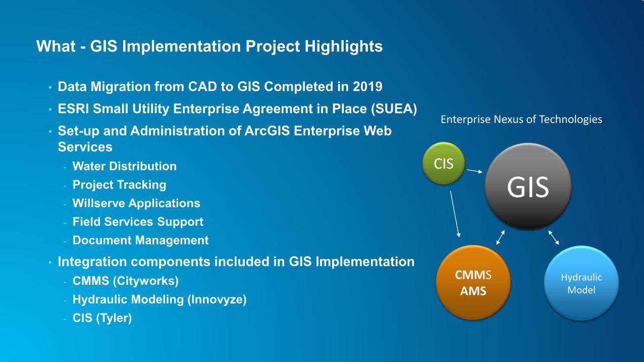
• Data Migration from CAD to GIS Completed in 2019• ESRI Small Utility Enterprise Agreement in Place (SUEA)• Set-up and Administration of ArcGIS Enterprise Web
Services- Water Distribution- Project Tracking- Willserve Applications- Field Services Support- Document Management
• Integration components included in GIS Implementation- CMMS (Cityworks)- Hydraulic Modeling (Innovyze)- CIS (Tyler)
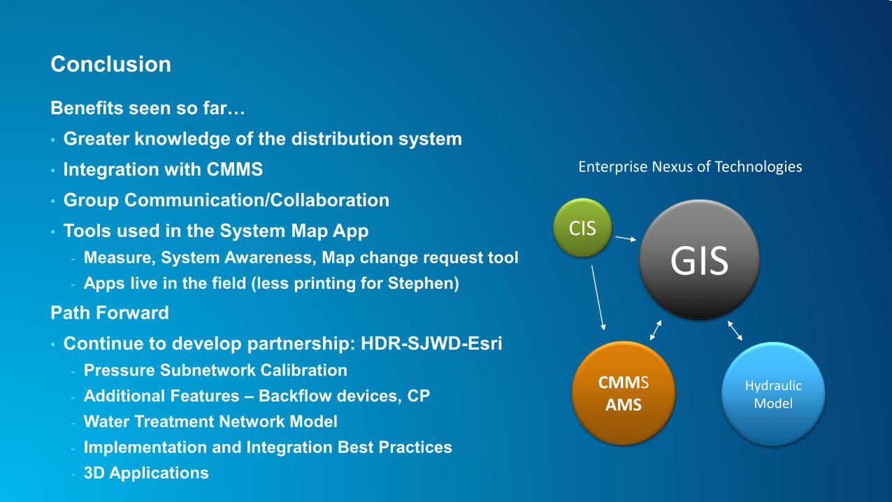
GISCIS
CMMSAMS
Hydraulic Model
Enterprise Nexus of Technologies
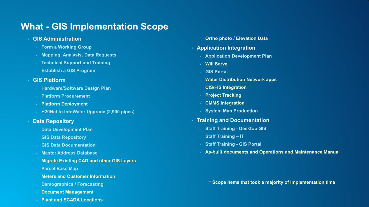
What - GIS Implementation Scope• GIS Administration
- Form a Working Group- Mapping, Analysis, Data Requests- Technical Support and Training- Establish a GIS Program
• GIS Platform- Hardware/Software Design Plan- Platform Procurement- Platform Deployment- H20Net to InfoWater Upgrade (2,900 pipes)
• Data Repository- Data Development Plan- GIS Data Repository- GIS Data Documentation- Master Address Database- Migrate Existing CAD and other GIS Layers- Parcel Base Map- Meters and Customer Information- Demographics / Forecasting- Document Management- Plant and SCADA Locations
- Ortho photo / Elevation Data
• Application Integration- Application Development Plan- Will Serve- GIS Portal- Water Distribution Network apps- CIS/FIS Integration- Project Tracking- CMMS Integration- System Map Production
• Training and Documentation- Staff Training - Desktop GIS- Staff Training – IT- Staff Training - GIS Portal- As-built documents and Operations and Maintenance Manual
* Scope Items that took a majority of implementation time
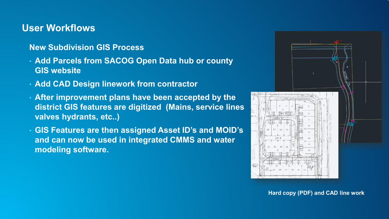
User Workflows
New Subdivision GIS Process• Add Parcels from SACOG Open Data hub or county
GIS website• Add CAD Design linework from contractor• After improvement plans have been accepted by the
district GIS features are digitized (Mains, service lines valves hydrants, etc..)
• GIS Features are then assigned Asset ID’s and MOID’s and can now be used in integrated CMMS and water modeling software.
Hard copy (PDF) and CAD line work
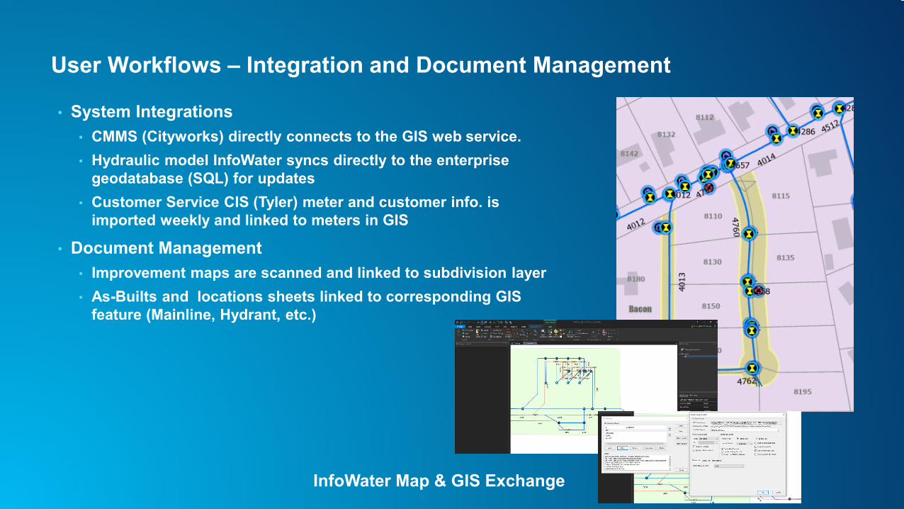
User Workflows – Integration and Document Management
• System Integrations• CMMS (Cityworks) directly connects to the GIS web service.• Hydraulic model InfoWater syncs directly to the enterprise
geodatabase (SQL) for updates• Customer Service CIS (Tyler) meter and customer info. is
imported weekly and linked to meters in GIS
• Document Management• Improvement maps are scanned and linked to subdivision layer• As-Builts and locations sheets linked to corresponding GIS
feature (Mainline, Hydrant, etc.)
InfoWater Map & GIS Exchange
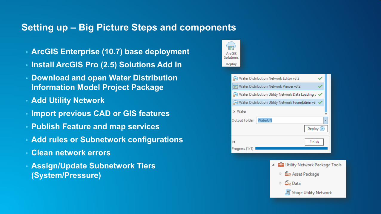
Setting up – Big Picture Steps and components
• ArcGIS Enterprise (10.7) base deployment• Install ArcGIS Pro (2.5) Solutions Add In• Download and open Water Distribution
Information Model Project Package• Add Utility Network • Import previous CAD or GIS features• Publish Feature and map services• Add rules or Subnetwork configurations• Clean network errors• Assign/Update Subnetwork Tiers
(System/Pressure)
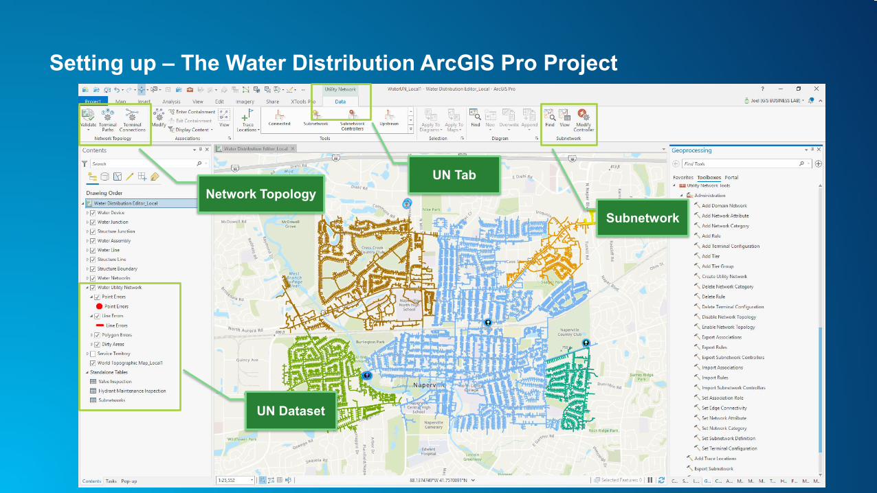
Setting up – The Water Distribution ArcGIS Pro Project
UN Tab
UN Dataset
Network Topology
Subnetwork
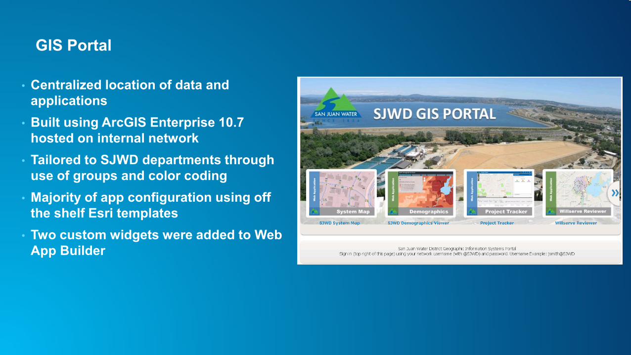
GIS Portal
• Centralized location of data and applications
• Built using ArcGIS Enterprise 10.7 hosted on internal network
• Tailored to SJWD departments through use of groups and color coding
• Majority of app configuration using off the shelf Esri templates
• Two custom widgets were added to Web App Builder
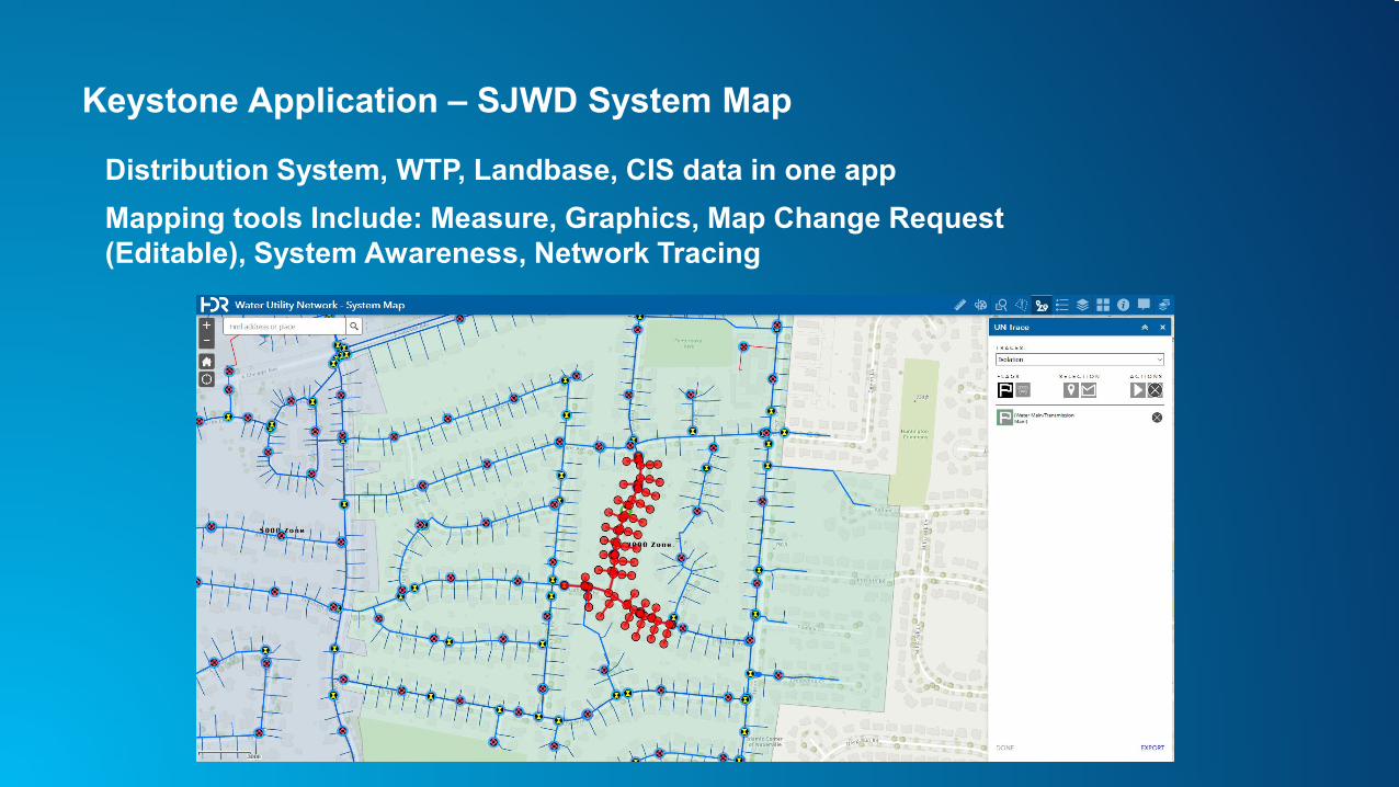
Keystone Application – SJWD System Map
Distribution System, WTP, Landbase, CIS data in one appMapping tools Include: Measure, Graphics, Map Change Request (Editable), System Awareness, Network Tracing
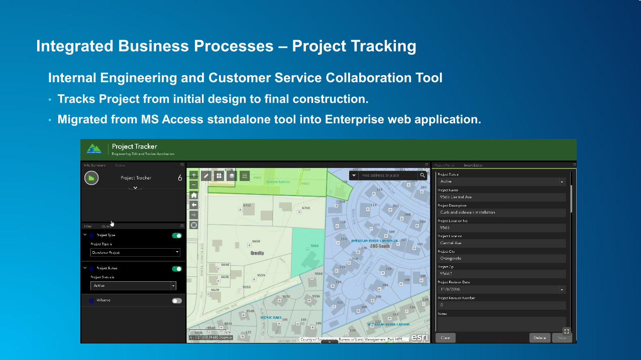
Integrated Business Processes – Project Tracking
Internal Engineering and Customer Service Collaboration Tool• Tracks Project from initial design to final construction.• Migrated from MS Access standalone tool into Enterprise web application.
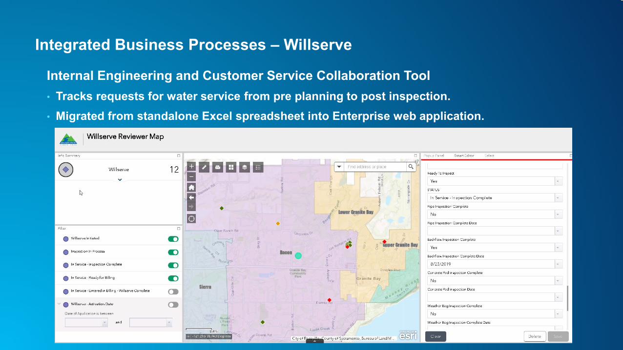
Integrated Business Processes – Willserve
Internal Engineering and Customer Service Collaboration Tool• Tracks requests for water service from pre planning to post inspection.• Migrated from standalone Excel spreadsheet into Enterprise web application.
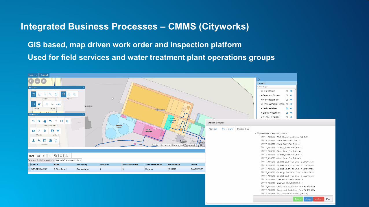
Integrated Business Processes – CMMS (Cityworks)
GIS based, map driven work order and inspection platformUsed for field services and water treatment plant operations groups
Conclusion
Benefits seen so far…• Greater knowledge of the distribution system• Integration with CMMS• Group Communication/Collaboration• Tools used in the System Map App
- Measure, System Awareness, Map change request tool- Apps live in the field (less printing for Stephen)
Path Forward• Continue to develop partnership: HDR-SJWD-Esri
- Pressure Subnetwork Calibration- Additional Features – Backflow devices, CP- Water Treatment Network Model - Implementation and Integration Best Practices- 3D Applications
GISCIS
CMMSAMS
Hydraulic Model
Enterprise Nexus of Technologies