Embed Size (px)
Citation preview
SyllabusSyllabus
Introduction to Remote SensingInstructor: Dr. Cheng-Chien Liu
Department of Earth Sciences
National Cheng Kung University
Last updated: 29 September 2004
Chapter 0Chapter 0
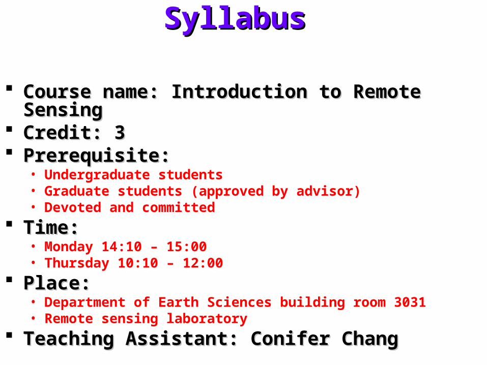
Syllabus Syllabus
Course name: Introduction to Remote SensingCourse name: Introduction to Remote Sensing Credit: 3Credit: 3 Prerequisite: Prerequisite:
• Undergraduate students• Graduate students (approved by advisor)• Devoted and committed
Time:Time:• Monday 14:10 – 15:00• Thursday 10:10 – 12:00
Place:Place:• Department of Earth Sciences building room 3031• Remote sensing laboratory
Teaching Assistant: Conifer ChangTeaching Assistant: Conifer Chang
ObjectivesObjectives
Introduce students the fundamental concepts of remote Introduce students the fundamental concepts of remote sensing, as well as its limitation, characteristics and sensing, as well as its limitation, characteristics and applicationsapplications
Raising student’s interest in this subject, some video Raising student’s interest in this subject, some video clips will be played in the class and an open discussion clips will be played in the class and an open discussion will be held afterwardswill be held afterwards
Encouraging students to ask questions and seek the Encouraging students to ask questions and seek the answers as more as they cananswers as more as they can
Students are expected to complete some take-home Students are expected to complete some take-home questions and present the material they found in the questions and present the material they found in the class every weekclass every week
Providing a roadmap for further study in the general Providing a roadmap for further study in the general field of Remote Sensingfield of Remote Sensing
TextbookTextbook
Remote sensing and image interpretation, 5th edition, Remote sensing and image interpretation, 5th edition, T.M. Lillesand, R.W. Kiefer. and J. W. Chipman, John T.M. Lillesand, R.W. Kiefer. and J. W. Chipman, John Wiley & Sons, 2004 (textbook)Wiley & Sons, 2004 (textbook)
Introduction to remote sensing, 3rd edition, J.B. Introduction to remote sensing, 3rd edition, J.B. Campbell, Taylor & Francis, 2002.Campbell, Taylor & Francis, 2002.
Physical principles of remote sensing, 2nd edition, W.G. Physical principles of remote sensing, 2nd edition, W.G. Rees, Cambridge University Press, 2001.Rees, Cambridge University Press, 2001.
Introductory remote sensing - principles and concepts, Introductory remote sensing - principles and concepts, 1st edition, P.J. Gibson and C.H. Power, Routledge, 1st edition, P.J. Gibson and C.H. Power, Routledge, 2000.2000.
Introductory remote sensing - digital image processing, Introductory remote sensing - digital image processing, 1st edition, P.J. Gibson and C.H. Power, Routledge, 20001st edition, P.J. Gibson and C.H. Power, Routledge, 2000
Schedule – FoundationSchedule – Foundation
Introduction Introduction Space platform and orbitSpace platform and orbit SensorSensor Digital dataDigital data Ground truthGround truth PhotogrammetryPhotogrammetry Digital image processingDigital image processing Geographic information systemGeographic information system Passive remote sensingPassive remote sensing Active remote sensingActive remote sensing
Schedule – ApplicationSchedule – Application
MappingMapping Water resourceWater resource Hydrology and oceanographyHydrology and oceanography Land useLand use AgricultureAgriculture Environmental assessmentEnvironmental assessment Natural disaster assessmentNatural disaster assessment

Some questionsSome questions
Who am I?Who am I?• http://myweb.ncku.edu.tw/~ccliu88/
Why are we here?Why are we here?• You and I, …
Why exams?Why exams?• Acquire knowledge, …
Why taking lectures?Why taking lectures?• Save time and efforts, …
Why doing a project?Why doing a project?• An interactive way of studying, …
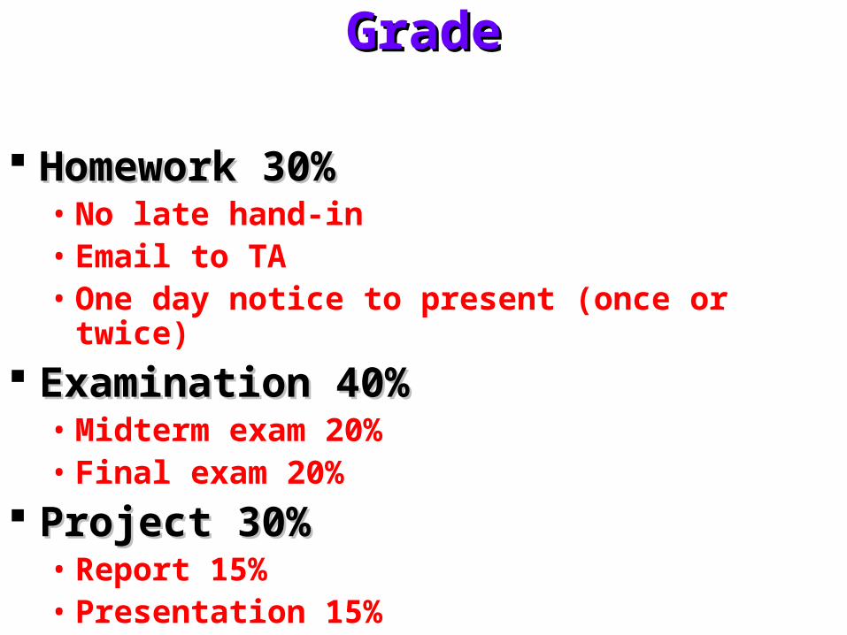
GradeGrade
Homework 30%Homework 30%• No late hand-in• Email to TA• One day notice to present (once or twice)
Examination 40%Examination 40%• Midterm exam 20%• Final exam 20%
Project 30%Project 30%• Report 15%• Presentation 15%

Office hoursOffice hours
Monday: 15:00 – 17:00Monday: 15:00 – 17:00 Friday: 10:00 – 12:00Friday: 10:00 – 12:00 Anytime if necessaryAnytime if necessary
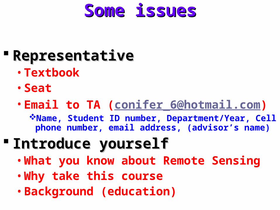
Some issuesSome issues
RepresentativeRepresentative• Textbook• Seat• Email to TA ([email protected])
Name, Student ID number, Department/Year, Cell phone number, email address, (advisor’s name)
Introduce yourselfIntroduce yourself• What you know about Remote Sensing• Why take this course• Background (education)
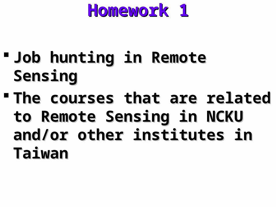
Homework 1Homework 1
Job hunting in Remote SensingJob hunting in Remote Sensing The courses that are related to Remote The courses that are related to Remote
Sensing in NCKU and/or other Sensing in NCKU and/or other institutes in Taiwaninstitutes in Taiwan
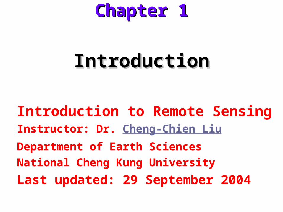
IntroductionIntroduction
Introduction to Remote SensingInstructor: Dr. Cheng-Chien Liu
Department of Earth Sciences
National Cheng Kung University
Last updated: 29 September 2004
Chapter 1Chapter 1
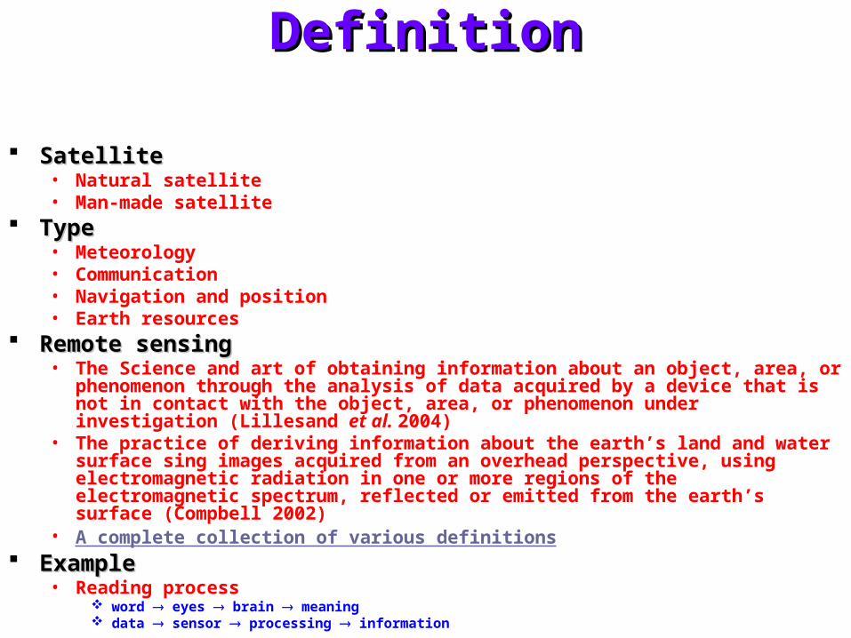
DefinitionDefinition
SatelliteSatellite• Natural satellite• Man-made satellite
TypeType• Meteorology• Communication• Navigation and position• Earth resources
Remote sensingRemote sensing• The Science and art of obtaining information about an object, area, or phenomenon through
the analysis of data acquired by a device that is not in contact with the object, area, or phenomenon under investigation (Lillesand et al. 2004)
• The practice of deriving information about the earth’s land and water surface sing images acquired from an overhead perspective, using electromagnetic radiation in one or more regions of the electromagnetic spectrum, reflected or emitted from the earth’s surface (Compbell 2002)
• A complete collection of various definitions ExampleExample
• Reading process word eyes brain meaning data sensor processing information
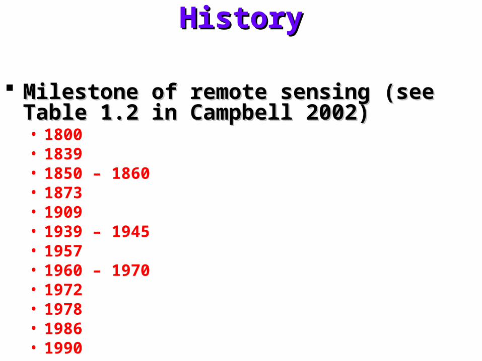
HistoryHistory
Milestone of remote sensing (see Table 1.2 in Milestone of remote sensing (see Table 1.2 in Campbell 2002)Campbell 2002)• 1800• 1839• 1850 – 1860• 1873• 1909• 1939 – 1945• 1957• 1960 – 1970• 1972• 1978• 1986• 1990
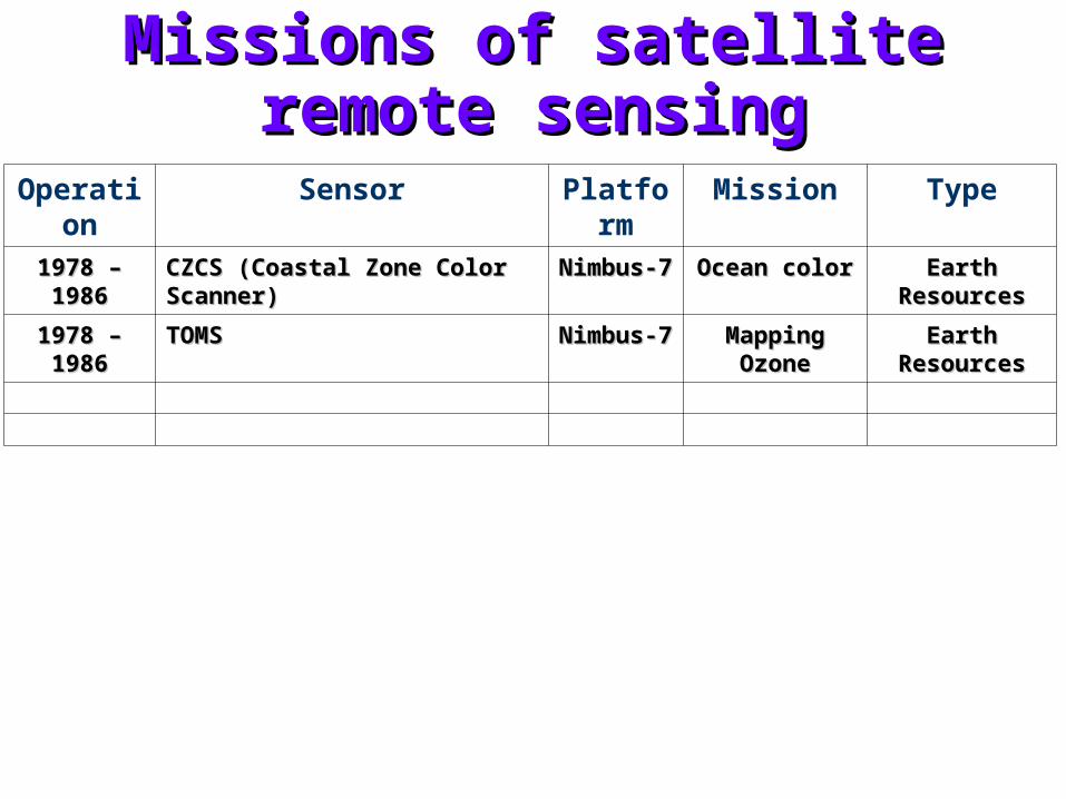
Missions of satellite remote sensingMissions of satellite remote sensing
Operation
Sensor Platform
Mission Type
1978 – 19861978 – 1986 CZCS (Coastal Zone Color Scanner)CZCS (Coastal Zone Color Scanner) Nimbus-7Nimbus-7 Ocean colorOcean color Earth ResourcesEarth Resources
1978 – 19861978 – 1986 TOMSTOMS Nimbus-7Nimbus-7 Mapping OzoneMapping Ozone Earth ResourcesEarth Resources
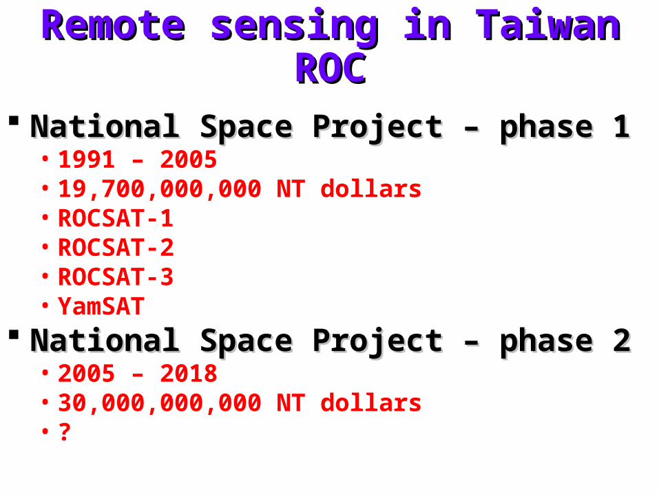
Remote sensing in Taiwan ROCRemote sensing in Taiwan ROC
National Space Project – phase 1National Space Project – phase 1• 1991 – 2005• 19,700,000,000 NT dollars• ROCSAT-1• ROCSAT-2• ROCSAT-3• YamSAT
National Space Project – phase 2National Space Project – phase 2• 2005 – 2018• 30,000,000,000 NT dollars• ?
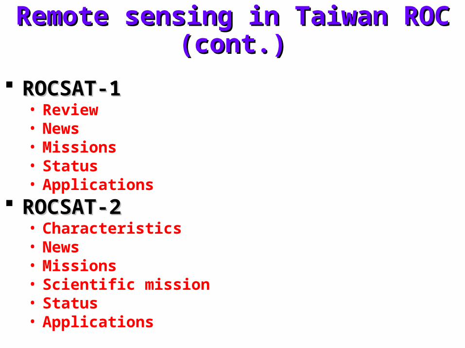
Remote sensing in Taiwan ROC (cont.)Remote sensing in Taiwan ROC (cont.)
ROCSAT-1ROCSAT-1• Review• News• Missions• Status• Applications
ROCSAT-2ROCSAT-2• Characteristics• News• Missions• Scientific mission• Status• Applications
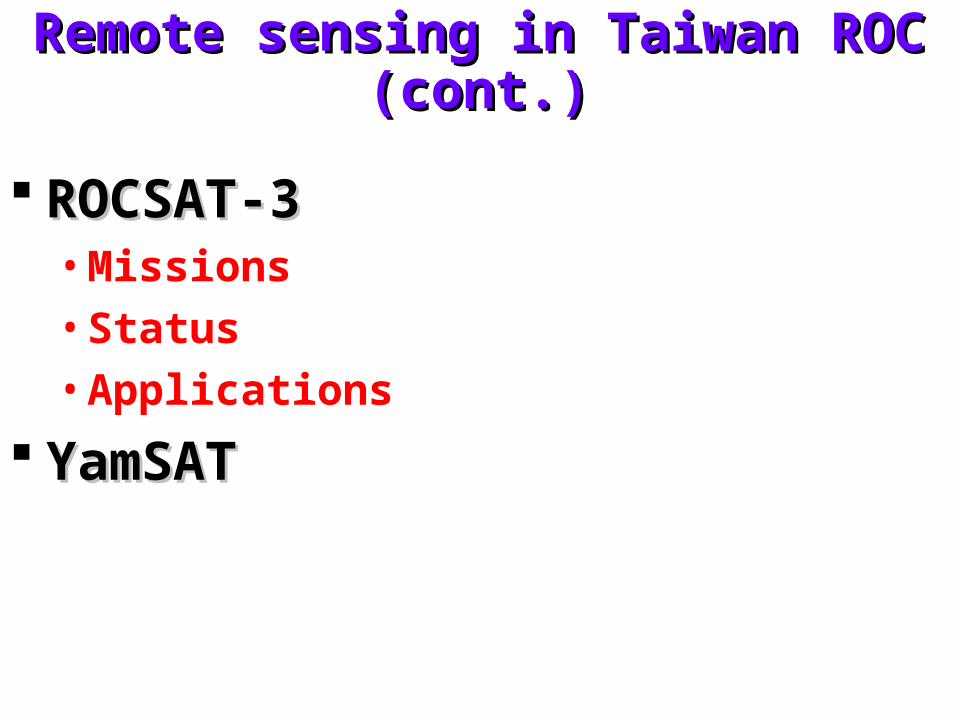
Remote sensing in Taiwan ROC (cont.)Remote sensing in Taiwan ROC (cont.)
ROCSAT-3ROCSAT-3• Missions
• Status
• Applications
YamSATYamSAT
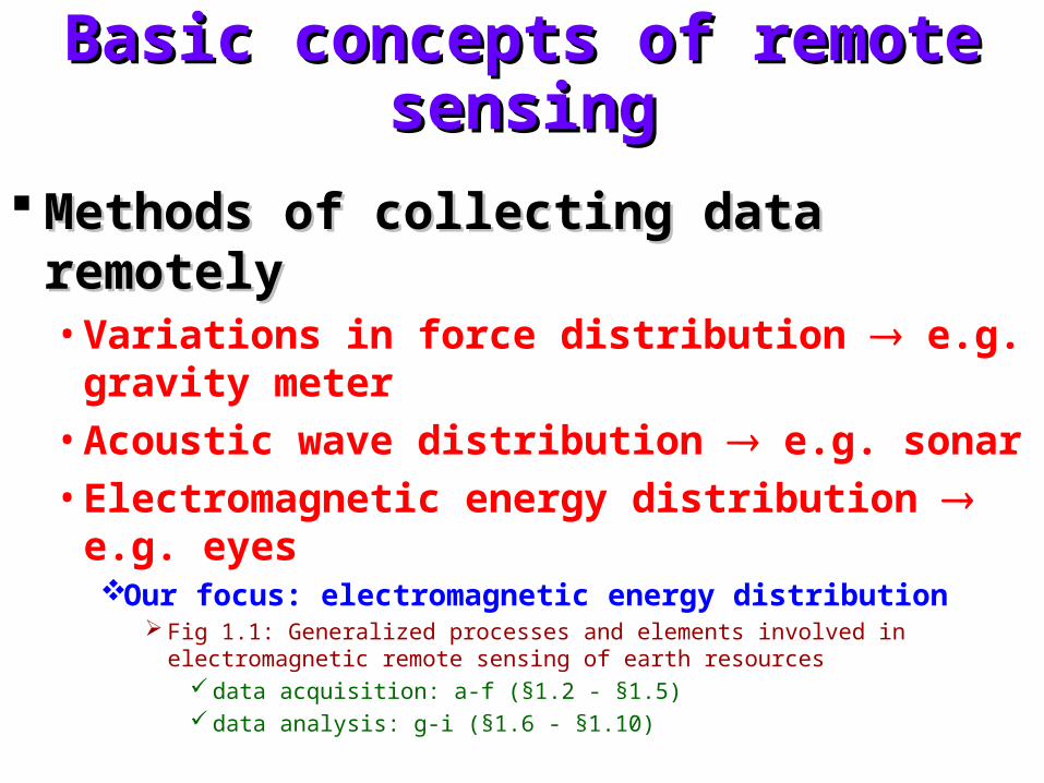
Basic concepts of remote sensingBasic concepts of remote sensing
Methods of collecting data remotelyMethods of collecting data remotely• Variations in force distribution e.g. gravity
meter
• Acoustic wave distribution e.g. sonar
• Electromagnetic energy distribution e.g. eyesOur focus: electromagnetic energy distribution
Fig 1.1: Generalized processes and elements involved in electromagnetic remote sensing of earth resources
data acquisition: a-f (§1.2 - §1.5) data analysis: g-i (§1.6 - §1.10)
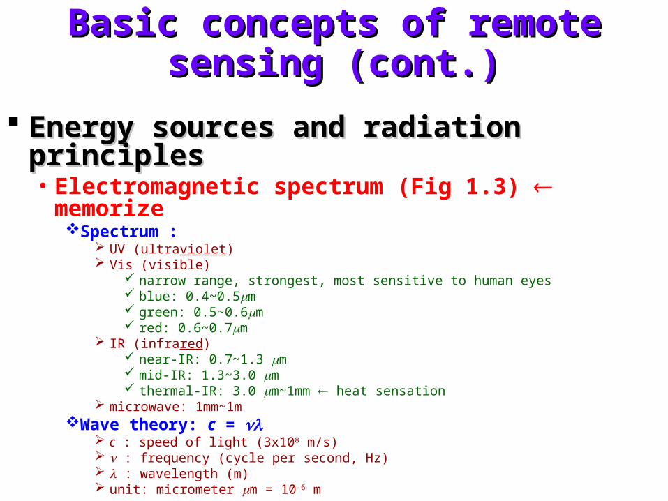
Basic concepts of remote sensing (cont.)Basic concepts of remote sensing (cont.)
Energy sources and radiation principlesEnergy sources and radiation principles• Electromagnetic spectrum (Fig 1.3) memorize
Spectrum : UV (ultraviolet) Vis (visible)
narrow range, strongest, most sensitive to human eyes blue: 0.4~0.5m green: 0.5~0.6m red: 0.6~0.7m
IR (infrared) near-IR: 0.7~1.3 m mid-IR: 1.3~3.0 m thermal-IR: 3.0 m~1mm heat sensation
microwave: 1mm~1mWave theory: c =
c : speed of light (3x10⁸ m/s) : frequency (cycle per second, Hz) : wavelength (m) unit: micrometer m = 10-6 m
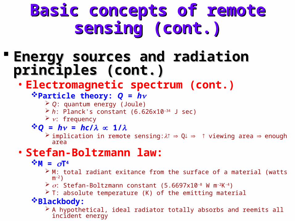
Basic concepts of remote sensing (cont.)Basic concepts of remote sensing (cont.)
Energy sources and radiation principles Energy sources and radiation principles (cont.)(cont.)• Electromagnetic spectrum (cont.)
Particle theory: Q = h Q: quantum energy (Joule) h: Planck's constant (6.626x10⁻³⁴ J sec) : frequency
Q = h = hc/ 1/ implication in remote sensing:Q viewing areaenough area
• Stefan-Boltzmann law:M = T4
M: total radiant exitance from the surface of a material (watts m-2) : Stefan-Boltzmann constant (5.6697x10⁻⁸ W m-2K-4) T: absolute temperature (K) of the emitting material
Blackbody: A hypothetical, ideal radiator totally absorbs and reemits all incident energy
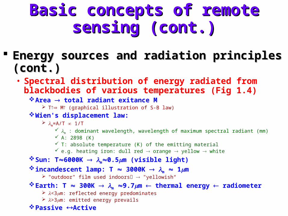
Basic concepts of remote sensing (cont.)Basic concepts of remote sensing (cont.)
Energy sources and radiation principles (cont.)Energy sources and radiation principles (cont.)• Spectral distribution of energy radiated from blackbodies of
various temperatures (Fig 1.4)Area total radiant exitance M
T M (graphical illustration of S-B law)
Wien's displacement law: m=A/T 1/T
m : dominant wavelength, wavelength of maximum spectral radiant (mm) A: 2898 (K) T: absolute temperature (K) of the emitting material e.g. heating iron: dull red orange yellow white
Sun: T6000K m0.5m (visible light) incandescent lamp: T 3000K m 1m
"outdoor" film used indoors "yellowish“
Earth: T 300K m 9.7m thermal energy radiometer <3m: reflected energy predominates >3m: emitted energy prevails
Passive Active
Basic concepts of remote sensing (cont.)Basic concepts of remote sensing (cont.)
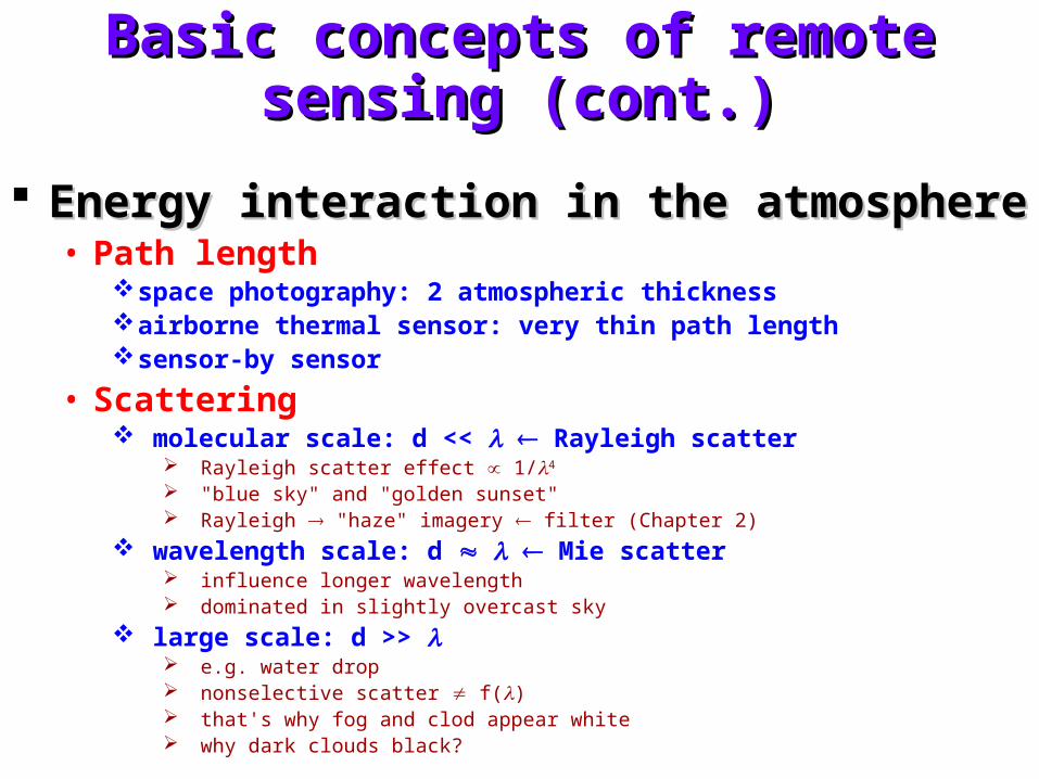
Energy interaction in the atmosphereEnergy interaction in the atmosphere• Path length
space photography: 2 atmospheric thickness airborne thermal sensor: very thin path length sensor-by sensor
• Scattering molecular scale: d << Rayleigh scatter
Rayleigh scatter effect 1/4
"blue sky" and "golden sunset" Rayleigh "haze" imagery filter (Chapter 2)
wavelength scale: d Mie scatter influence longer wavelength dominated in slightly overcast sky
large scale: d >> e.g. water drop nonselective scatter f() that's why fog and clod appear white why dark clouds black?
Basic concepts of remote sensing (cont.)Basic concepts of remote sensing (cont.)
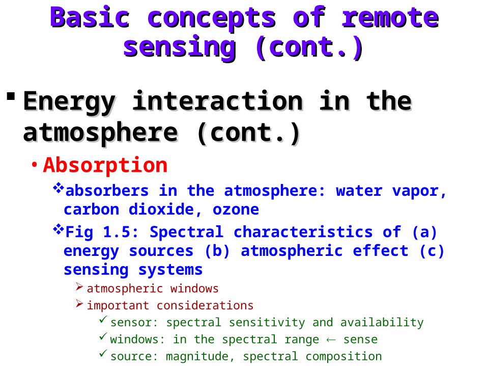
Energy interaction in the atmosphere Energy interaction in the atmosphere (cont.)(cont.)• Absorption
absorbers in the atmosphere: water vapor, carbon dioxide, ozone
Fig 1.5: Spectral characteristics of (a) energy sources (b) atmospheric effect (c) sensing systems
atmospheric windows important considerations
sensor: spectral sensitivity and availability windows: in the spectral range sense source: magnitude, spectral composition
Basic concepts of remote sensing (cont.)Basic concepts of remote sensing (cont.)
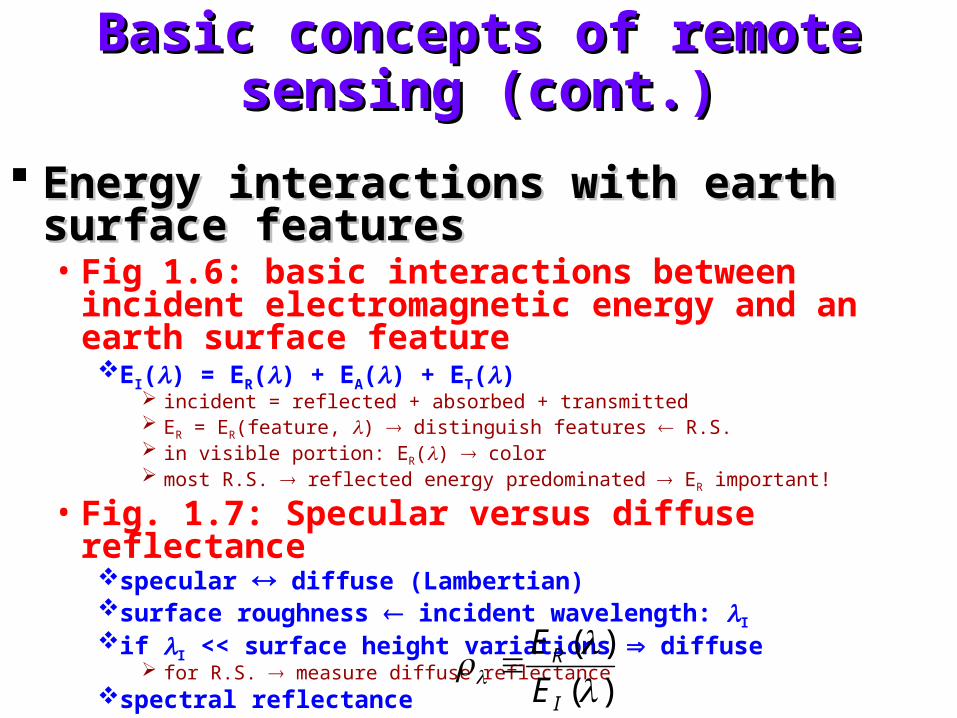
Energy interactions with earth surface Energy interactions with earth surface featuresfeatures• Fig 1.6: basic interactions between incident
electromagnetic energy and an earth surface featureEI() = ER() + EA() + ET()
incident = reflected + absorbed + transmitted ER = ER(feature, ) distinguish features R.S. in visible portion: ER() color most R.S. reflected energy predominated ER important!
• Fig. 1.7: Specular versus diffuse reflectancespecular diffuse (Lambertian) surface roughness incident wavelength: I
if I << surface height variations diffuse for R.S. measure diffuse reflectance
spectral reflectance )(
)(
I
R
E
E
Basic concepts of remote sensing (cont.)Basic concepts of remote sensing (cont.)
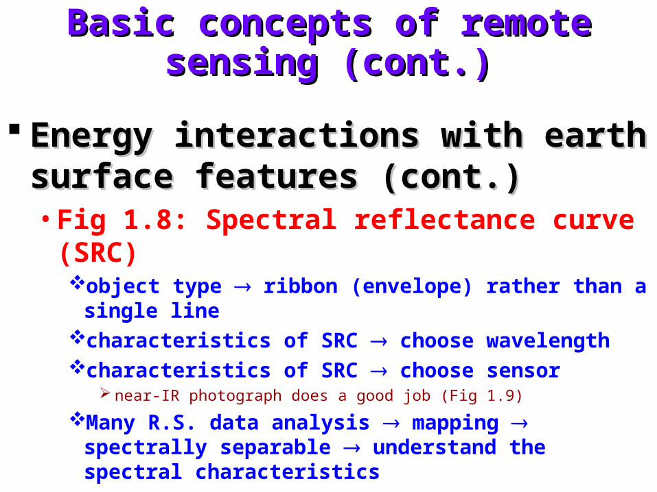
Energy interactions with earth surface Energy interactions with earth surface features (cont.)features (cont.)• Fig 1.8: Spectral reflectance curve (SRC)
object type ribbon (envelope) rather than a single line characteristics of SRC choose wavelength characteristics of SRC choose sensor
near-IR photograph does a good job (Fig 1.9)
Many R.S. data analysis mapping spectrally separable understand the spectral characteristics
Basic concepts of remote sensing (cont.)Basic concepts of remote sensing (cont.)
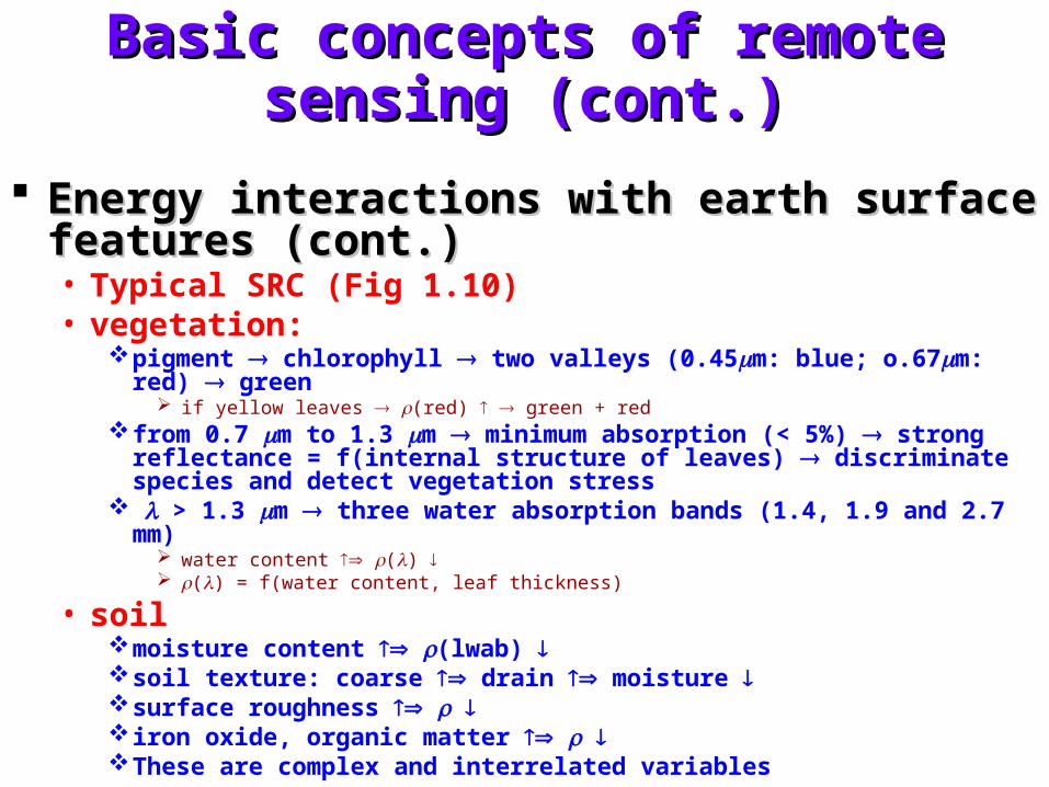
Energy interactions with earth surface features Energy interactions with earth surface features (cont.)(cont.)• Typical SRC (Fig 1.10)• vegetation:
pigment chlorophyll two valleys (0.45m: blue; o.67m: red) green if yellow leaves (red) green + red
from 0.7 m to 1.3 m minimum absorption (< 5%) strong reflectance = f(internal structure of leaves) discriminate species and detect vegetation stress
> 1.3 m three water absorption bands (1.4, 1.9 and 2.7 mm) water content () () = f(water content, leaf thickness)
• soilmoisture content (lwab) soil texture: coarse drain moisture surface roughness iron oxide, organic matter These are complex and interrelated variables
Basic concepts of remote sensing (cont.)Basic concepts of remote sensing (cont.)
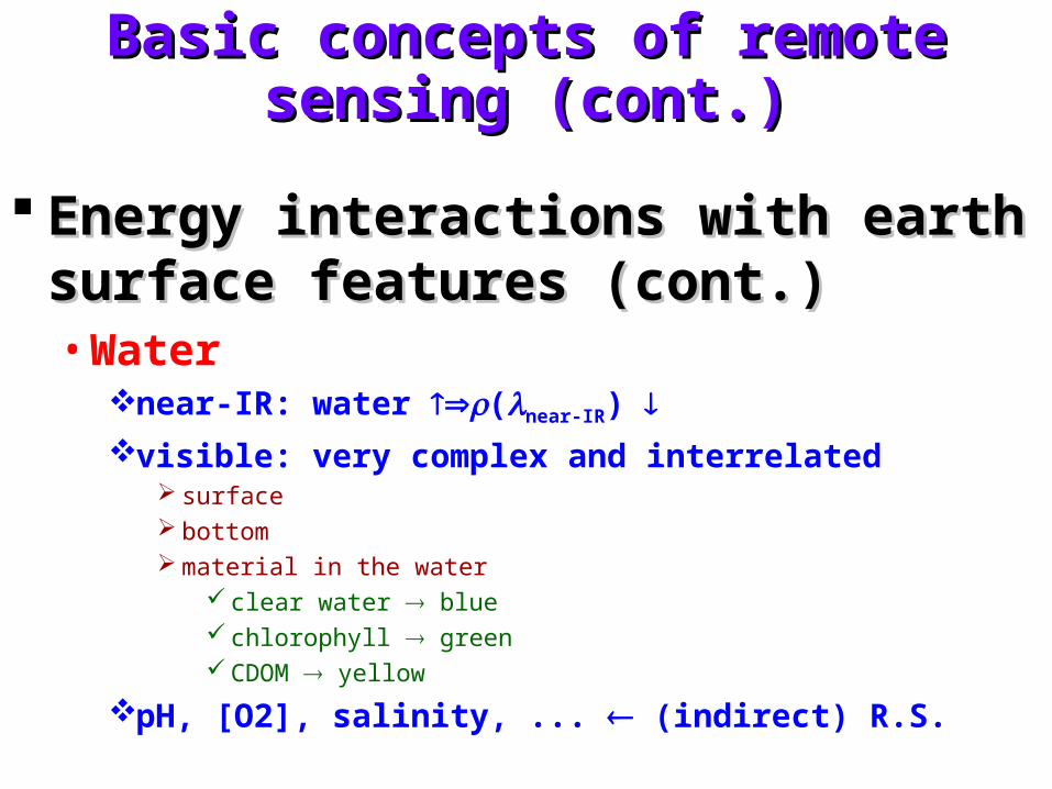
Energy interactions with earth surface Energy interactions with earth surface features (cont.)features (cont.)• Water
near-IR: water (near-IR) visible: very complex and interrelated
surface bottom material in the water
clear water blue chlorophyll green CDOM yellow
pH, [O2], salinity, ... (indirect) R.S.
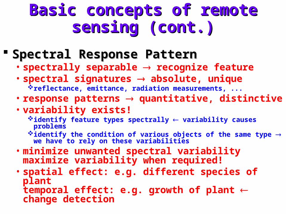
Basic concepts of remote sensing (cont.)Basic concepts of remote sensing (cont.)
Spectral Response PatternSpectral Response Pattern• spectrally separable recognize feature • spectral signatures absolute, unique
reflectance, emittance, radiation measurements, ...
• response patterns quantitative, distinctive • variability exists!
identify feature types spectrally variability causes problems identify the condition of various objects of the same type we have to
rely on these variabilities
• minimize unwanted spectral variabilitymaximize variability when required!
• spatial effect: e.g. different species of planttemporal effect: e.g. growth of plant change detection
Trends of remote sensingTrends of remote sensing
TechnologyTechnology ApplicationApplication Job marketJob market
• Case 1
• Case 2
• Case 3
Organization of this courseOrganization of this course
Image acquisitionImage acquisition Image processing and analysisImage processing and analysis ApplicationsApplications
ResourcesResources
Periodical journalsPeriodical journals• IEEE transaction on geosciences and remote
sensing
• International Journal of remote sensing
• Remote sensing of environment
Web sitesWeb sites
Data/imageData/image
ResourcesResources
BooksBooks• Remote sensing and image interpretation, 5th edition, T.M.
Lillesand, R.W. Kiefer. and J. W. Chipman, John Wiley & Sons, 2004 (textbook)
• Introduction to remote sensing, 3rd edition, J.B. Campbell, Taylor & Francis, 2002.
• Physical principles of remote sensing, 2nd edition, W.G. Rees, Cambridge University Press, 2001.
• Introductory remote sensing - principles and concepts, 1st edition, P.J. Gibson and C.H. Power, Routledge, 2000.
• Introductory remote sensing - digital image processing, 1st edition, P.J. Gibson and C.H. Power, Routledge, 2000