Embed Size (px)
Citation preview
Sven Michaelis & Kathrin Bögelsack, Norwegian Mapping Authority
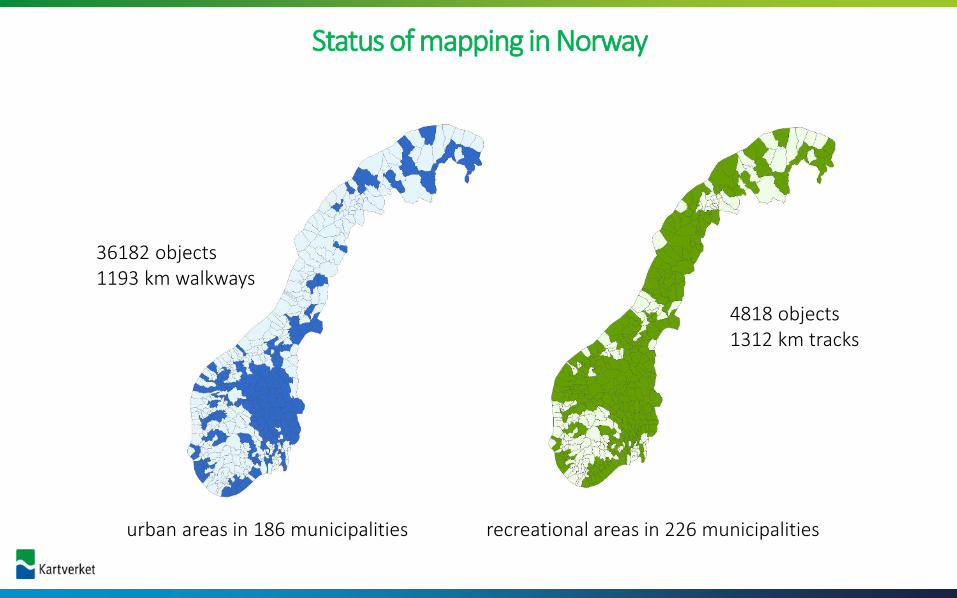
Status of mapping in Norway
4818 objects 1312 km tracks
36182 objects 1193 km walkways
urban areas in 186 municipalities recreational areas in 226 municipalities
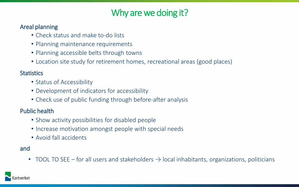
Areal planning
• Check status and make to-do lists
• Planning maintenance requirements
• Planning accessible belts through towns
• Location site study for retirement homes, recreational areas (good places)
Statistics
• Status of Accessibility
• Development of indicators for accessibility
• Check use of public funding through before-after analysis
Public health
• Show activity possibilities for disabled people
• Increase motivation amongst people with special needs
• Avoid fall accidents
and
• TOOL TO SEE – for all users and stakeholders → local inhabitants, organizations, politicians
Why are we doing it?


Preconditions
• Low user treshhold
− Easy to use
− No requirement for expensive equipment
• Validation relies on quantifiable values
• Objects have geometri
• Representative data
• Free access to data
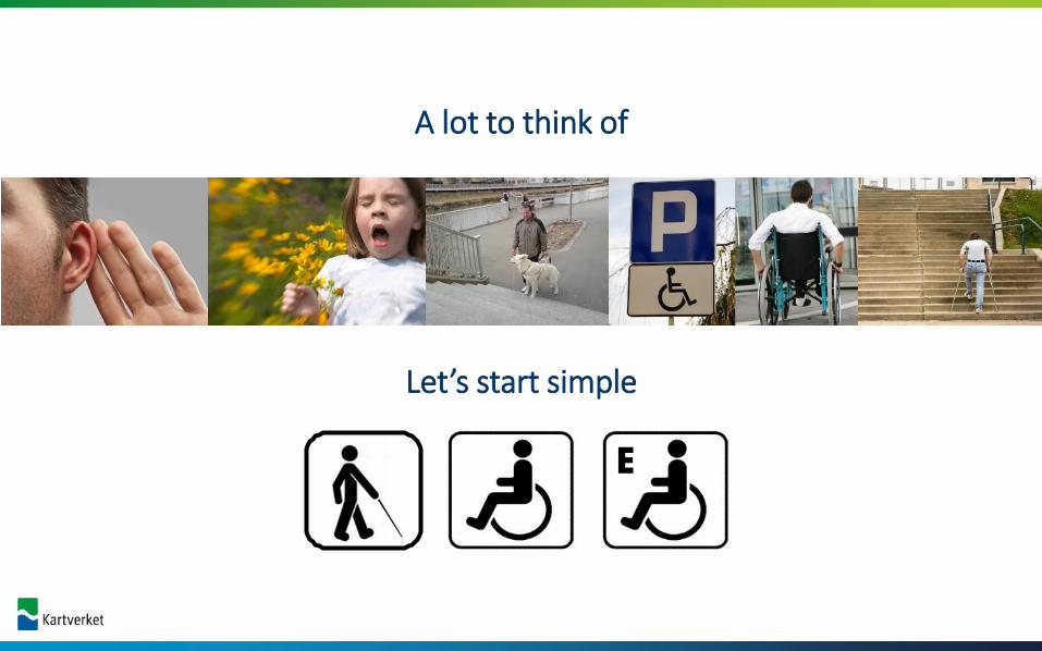
A lot to think of
Let’s start simple
E

«tilgjengelighets-App» - a mapping tool for the field

Ministry of Local Government & Regional Development
Ministry of Children, Equality & Social Inclusion
Mapping in:
Towns and district centers Recreational areas
Funded by: Carried out by:
Federal/municipal authorities,associations
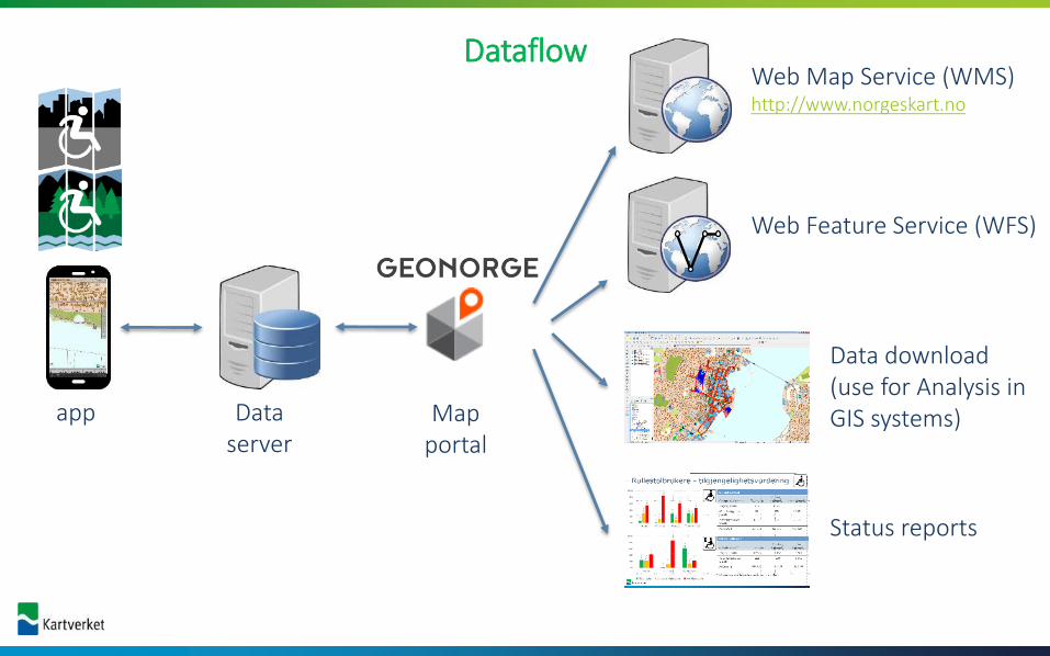
DataflowWeb Map Service (WMS)http://www.norgeskart.no
Web Feature Service (WFS)
Data download(use for Analysis in GIS systems)
Status reports
app Data server
Map portal

Validation of accessibility
Problem: How to create comparible data over a long time span following a standardized method?
Solution: map values and automate the validation of accessibility and error checks
=

Advantages
• Adjustment to future changes in standards/technology
• Validation can be calculated automatically from the measured values
• The database can be expanded
Validation of accessibility
Problem: How to create comparible data over a long time span following a standardized method?
Solution: map values and automate the validation and automatic error checks
=
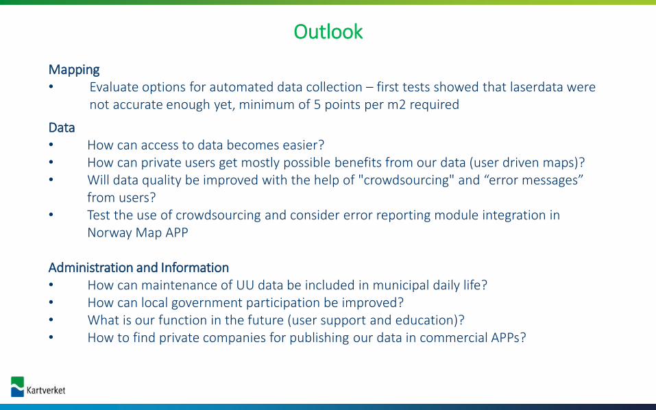
Outlook
Mapping• Evaluate options for automated data collection – first tests showed that laserdata were
not accurate enough yet, minimum of 5 points per m2 required
Data• How can access to data becomes easier?• How can private users get mostly possible benefits from our data (user driven maps)?• Will data quality be improved with the help of "crowdsourcing" and “error messages”
from users?• Test the use of crowdsourcing and consider error reporting module integration in
Norway Map APP
Administration and Information• How can maintenance of UU data be included in municipal daily life?• How can local government participation be improved?• What is our function in the future (user support and education)?• How to find private companies for publishing our data in commercial APPs?

Problems
Time
Knowledge
Communication
Prioritisation
Technical challenges
Economy


• Mapping: town center and surrounding recreational areas
• Result: “Strategy for Universal Design” and counselling group to implement National Goal for Norway in district planning.
• Activities: A walkway along the river is made accessible for wheelchairs. All results are published on the municipalities website.
Hønefoss - Along the river “Elvelengs”– a walking trail for alle

Arendal - a web solution for public information
• Mapping: town center and surrounding recreational areas
• Result: a web map service to presents the data to the public, and publishes it on the municipality’s website sing ArcGIS Online
• Activities: make priority lists in cooperation with the council for people with disabilities

Haugesund - a recreation area for all close to town
• Mapping: town center and surrounding recreational areas
• Result: Improve accessibility in a popular recreational area and create connection between town center and recreational area
• Activities: Widening and levelling of tracks, improve lighting

Trondheim - snarveier (shortcuts)
• Mapping: town center and surrounding recreational areas
• Result: Trondheim has long-term focus on creating a better living environment and increase the town’s accessibility. The mapping is a contribution to a set of base data for local planning e.g. locate problems like lack of lighting, uneven surfaces and steep slopes, requirement for benches
• Activities: improve cover and lighting of paths and walkways that make up an important part of the continuous network of walkways, set up more benches

• Kyststi – more pictures and information comes later
Akershus - “Kyststi”- the coastal walkway

Ålesund – update for a city center• Mapping: town center
• Result: Ålesund an old Art Nouveu city has long-term focus on creating a better living environment and increase the town’s accessibility. The mapping is a contribution to a set of base data for local planning e.g. locate problems like lack of marking, uneven surfaces and steep slopes
• Activities: improve cover and marking of paths and walkways step by step through the whole city
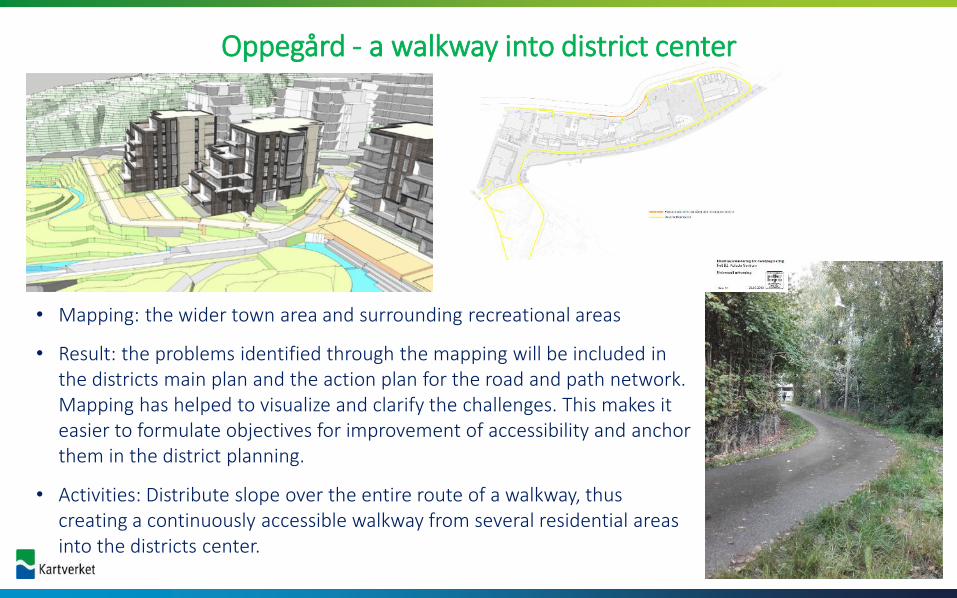
• Mapping: the wider town area and surrounding recreational areas
• Result: the problems identified through the mapping will be included in the districts main plan and the action plan for the road and path network. Mapping has helped to visualize and clarify the challenges. This makes it easier to formulate objectives for improvement of accessibility and anchor them in the district planning.
• Activities: Distribute slope over the entire route of a walkway, thus creating a continuously accessible walkway from several residential areas into the districts center.
Oppegård - a walkway into district center


website
https://www.kartverket.no/geodataarbeid/universell-utforming/

• Norway’s online kartportal
• improved for mobile and tablet
http://www.norgeskart.no
Norgeskart – web map server (WMS)
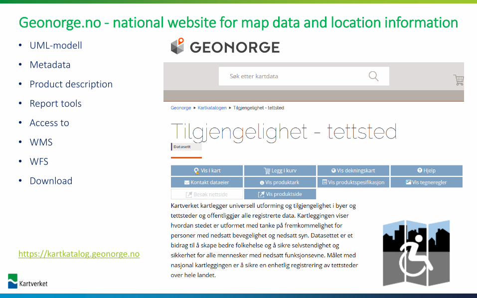
• UML-modell
• Metadata
• Product description
• Report tools
• Access to
• WMS
• WFS
• Download
https://kartkatalog.geonorge.no
Geonorge.no - national website for map data and location information

Film link – how to make ppt reports

Entrance HC parkingspot
Parking area Walkway
accessible partiallyaccessible
not accessible
• regional/ national situation

Entrance HC parkingspot
Parking area
Walkway
Distance to entrance
Size Marking
• feature analysis –
What are the problems?
• regional/ national situation

Entrance HC parkingspot
Parkingarea
Walkway
accessible partiallyaccessible
not accessible
Dist. to entrance
Size Marking
• regional/ national situation
• feature analysis –
What are the problems?
• Spatial analysis-
Where are the problems?

• Negative examples – more pictures and information comes later

• QGIS – short presentation of analysis options
• Available HC parking spots

• Develop a QGIS GUI based on the WFS with a simple user-interface
• Film?

Thank you for
your attention!