Embed Size (px)
Citation preview
Why the Lake Naivasha Basin?The Lake Naivasha basin is diverse both in terms of ecosystems and economic activities, all of which depend on having enough water of good quality. Over the last 30 years the basin has undergone several economic transformations that threaten both water quality and quantity.
The basin is relatively small and ranges from highlands in the north east and west, to semi-arid rangelands in the south and south east. The lake itself ranges from 100 to 150km2, but is listed as a Ramsar Site (a wetland of international importance), as well as an Important Bird Area and the second largest freshwater lake in Kenya. The basin is home to three National Parks (Aberdares, Longonot and Hell’s Gate), as well as at least six privately-owned wildlife sanctuaries. The lake’s natural beauty, rich biodiversity and mild climate alone attracts up to 1.8 million visitors annually (Pegasys, 2010. Shared risk and
opportunity in water resources: Seeking a sustainable future for Lake Naivasha).
The basin is also the heart of Kenya’s horticulture industry, and although the basin’s population is estimated at 750,000 people (Kissinger, Gabrielle. “Case Study: Imarisha Naivasha, Kenya,” in Financing Strategies for Integrated Landscape
Investment. Seth Shames, ed. Washington, DC: EcoAgriculture Partners, on behalf of the Landscapes for People, Food and
PARTNERING TO SECURE THE FUTURE OF THE LAKE NAIVASHA BASIN: The Integrated Water Resource Action Plan Programme (IWRAP)
Sustainability
AUGUST BROCHURE
2015
From the shores of Lake Naivasha to its upper catchment
©S
.SA
RK
AR
/WW
F
Nature Initiative. 2014) , which is approximately �����RI�.HQ\D¶V�WRWDO�SRSXODWLRQ��LWV�ÀRULFXOWXUH�industry alone (covering about 20km2 mostly around the lake) contributes 9% to the country’s total foreign exchange earnings (Pegasys, 2010).
The upper and middle catchment contributes VLJQL¿FDQWO\�WR�WKH�GRPHVWLF�IUHVK�SURGXFH�market (potatoes, peas, carrots, cabbage, kales, and increasingly fruits). The freshwater in the lake also supports a domestic and commercial ¿VKHU\��WKH�ODWWHU�KDYLQJ�DQ�DQQXDO�SURGXFWLRQ�of approximately 75 tons. Aquaculture is also practiced within the basin, supplying the local markets.
Geothermal energy production on a large scale within the Hell’s Gate National Park is an increasingly important economic activity. There are currently 4 geothermal power stations with a capacity of 430 MW from over 200 wells, and one well head with a capacity of 2.5 MW located adjacent to the Eburru forest to the west of the lake. It is estimated that this electricity will eventually account for up to 30% of the country’s national power supply (OlKaria Goethermal
Project – Brochure produced by KenGen).
It is generally agreed that water quality is driven by incorrect land use practices on the slopes of the catchment, deforestation, as well as the poorly functioning sewage treatment facilities within the town of Naivasha. The main drivers for water quantity are large abstractors around the lake (farms and geothermal) and a major pipeline on one of Naivasha’s rivers supplying water to an adjacent town.
What is IWRAP?In response to a major drought in 2009, when Lake Naivasha receded to levels not seen since the 1940’s, a study on the shared risks of poor water management and the shared interest for sustainable development for all stakeholders, was facilitated by WWF (funded by the Netherlands). This study prompted the basin’s stakeholders to come together to develop a common vision for the basin. This in turn led to the development of the unique and ambitious Public Private Partnership People Programme (PPPP) – IWRAP- that is implemented by all relevant partners in the basin.
7KH�,:5$3�SURJUDPPH�ZDV�RFLDOO\�ODXQFKHG�LQ�-DQXDU\������DQG�LV�IXQGHG�E\�WKH�(PEDVV\�RI�WKH�.LQJGRP�RI�the Netherlands in Nairobi. It is led and coordinated by WWF Kenya and involves three other Kenyan partners;the Water Resources Management Authority (WRMA), Imarisha Naivasha, and Kenya Flower Council (KFC) and 3 Dutch partners - University of Twente’s Faculty of Geoinformation Science and Earth Observation (ITC), and two Water Authorities: Waterschap Noorderzijlvest (NZV) and Hoogheemraadschap De Stichtse Rijnlanden (Hdsr). Each of the Kenyan partners’ implements one or two of the seven result areas, with technical and advisory support from the Dutch partners.
This partnership brings together the government, private sector, civil society as well as the people living in this basin with a common goal of ensuring long-term sustainable development with a focus on improving land use practices and management of water resources.
.#0#947#
/#4+$#�947#
/-70)+A-+6+4+�947#
-#4#6+A.10)1016�947#
/+&&.'A/#.'9#�947#
722'4A674#5*#�947#
9#0,1*+�947#
-+#0,1)7�947#
722'4A/#.'9#�947#
.19'4A)+.)+.�947#.19'4A/#.'9#�947#
- KVKTK
)KNIKN
-CTCVK
6WTCUJC
/CNGY
C
5CUKPK
/WTWCMK
0[CKTQMQ
-CJWTW
9CPLQJK
/WTKPFCVK
1NMCNCW
/CTO
QPGV
-KOWT
W
4W
OC
TW
0CPFCTC
UK
0L CPIK TK
0
[CODWIK
'PFQ
TQJT
-CKO
DCIC
/
C J KU KOKV K
/GMCTQ
5KO
DC
)KVJCK
-KCPLQ
IW
'PICTG�5[CPC
'PICTG�-KPLC
1NQT
QP[Q
-KCPLQIW
0[CKTQ
MQ 9CPLQJK
9CPLQ
JK
/CNG
YC
)KNIKN
9C PLQJK
/CNGYC1NMCNCW
9CPLQ JK
/CNGY
C
)+6#
'TGTK
9'0&1
/7$#7
474++
-GPVQP
/#)7/7
/+*#61
)+6#4'
-#)7/7
6+)10+
0;#-+1
4+410+
-+4+/#
)++)+.
/CYKPIQ
%CRVCKP
5JCOCVC
/#*+0&7
674#5*#
-#)10)1
/#9+0)1
9#0,1*+
/1+&#$+
-10)10+
0#4#5*#
)#610&1
5+.#0)#
0,#$+0+
5CMWVKGM
0#+8#5*#
(.;�18'4
56'/�5%*
-+0;#66#
2#55'0)#
1.�-#.#7
)+6*+141
'0)+0''4
0#+8#5*#
.10)1016
1N�/QIQIQ
-#0;+4+4+
-9#�0,1/#
/7470)#47
)9#�-#*++
-9#�*#4#-#
-9#�*#4#-#
-+0)(+5*'4
)#6*7#�&#/
-KLCDG�*KNN
1UKTWC�(CTO
6WTCUJC�&CO
/6�.10)1016
1UGTKCP�(CTO
-QPIQPK�(CTO
0&70;7�0,'47
0)1410)1�&#/
/WP[W�5VCVKQP
(NCOKPIQ�(CTO
0#+$14�#,+,+-
/74'4#0,#7�5%*
.QPIQPQV�5EJQQN
(KUEJGT�U�6QYGT
*+)*.#0&�(.19'45
2GB04
2GC042GC012GA03
2GC102GC06
2GC052GB01
2GC08
2GA012GC09
2GA05
2GC07
2GD02
2GD07
2GD06
������
������
������
������
������
������
������
������
�������
�������
�������
�������
�������
�������
�������
�������
�������
�������
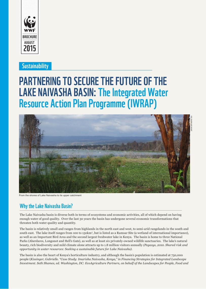
.#-'�0#+8#5*#�$#5+0�947#5�Ü
LegendROADS
2.#%'5
4+8'45
lake_naivasha_2008
WRUAS
WRUA_NAME
KARATI_LONGONOT WRUA
KIANJOGU WRUA
LANAWRUA
LOWER_GILGIL WRUA
LOWER_MALEWA WRUA
MARIBA WRUA
MIDDLE_MALEWA WRUA
MKUNGI_KITIRI WRUA
UPPER_GILGIL WRUA
UPPER_MALEWA WRUA
UPPER_TURASHA WRUA
WANJOHI WRUA
0 2.5 5 7.5 101.25
Kilometers
PREPARED BY: MUCHUGIA G. K. (2010)
Projection:Linear Unit:
Datum:
Transverse_MercatorMeterD_Arc_1960
722'4�)+.)+.
Lake Naivasha Basin is divided into 12 WRUAS; Total area 3400km2
Programme Purpose
7R�FUHDWH�HVVHQWLDO�HQDEOLQJ�FRQGLWLRQV�IRU�HHFWLYH�ZDWHU�UHJXODWLRQ�DQG�JRYHUQDQFH��VXVWDLQDEOH�ODQG�DQG�QDWXUDO�UHVRXUFH�XVH�and sustainable development in the Lake Naivasha Basin
Result Areas 1 and 2: Increasing the organizational, governance, and technical capacity in water resource management (WRM) for relevant WRM institutions in the basin
Implementing Partners: WRMA, ITC, HDSR and NZV
%HQH¿FLDULHV� WRMA, Water Resources Users Associations (WRUAs)
The Water Resources Management Authority (WRMA) is the government agency mandated to manage surface and groundwater resources in Kenya.
7KH�:50$�VXE�UHJLRQDO�RFH�EDVHG�LQ�1DLYDVKD��ZKLFK�RYHUVHHV�WKH�1DLYDVKD��(OPHQWDLWD�DQG�1DNXUX�EDVLQV��KDV�EHQH¿WHG�through a rehabilitated and improved monitoring network for ground and surface water. Data collection, storage and analyses capabilities are also being improved through the use of open source IT solutions. Modelling and forecasting scenarios for the basin’s water resources are being developed on the back of these improvements. The water allocation plan (2011-2014) is also going to be reviewed based on this information. Communication to the stakeholder and client on water resource status are being developed through an improved website and data sharing platform. The water quality lab has been rehabilitated (partially funded by Post Code Lottery through WWF Sweden). Financial management of water use levies and the linkage between permitting, billing, and enforcement are being strengthened.
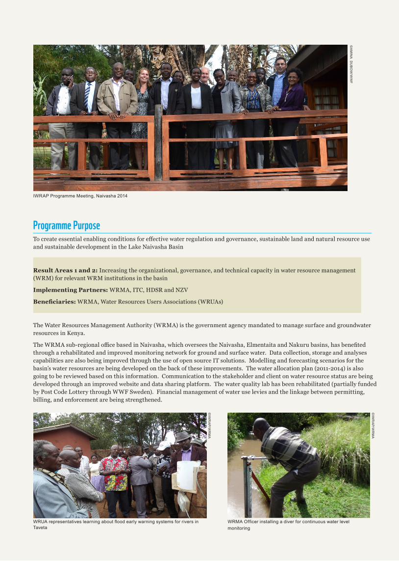
:58$�UHSUHVHQWDWLYHV�OHDUQLQJ�DERXW�ÀRRG�HDUO\�ZDUQLQJ�V\VWHPV�IRU�ULYHUV�LQ�Taveta
:50$�2I¿FHU�LQVWDOOLQJ�D�GLYHU�IRU�FRQWLQXRXV�ZDWHU�OHYHOmonitoring
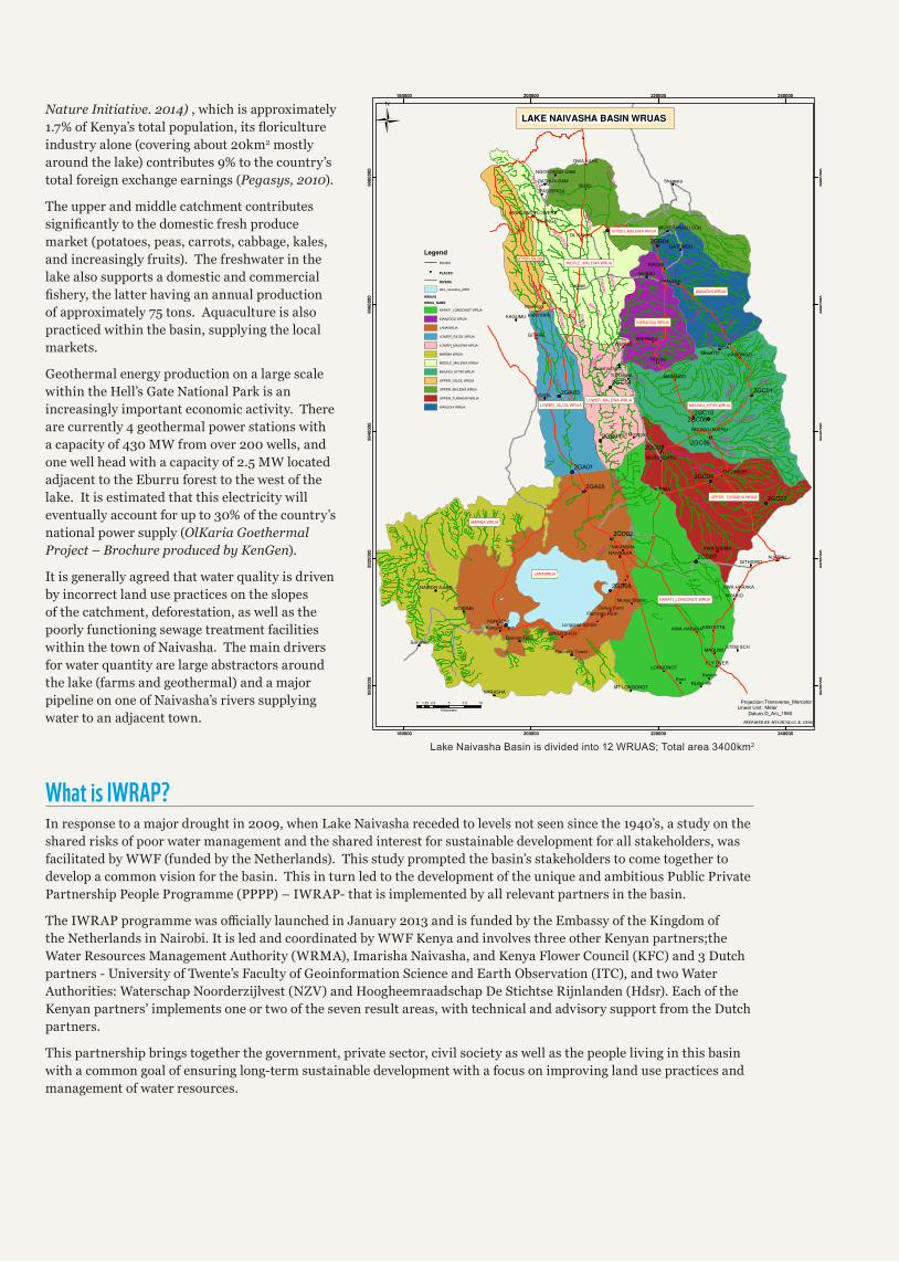
IWRAP Programme Meeting, Naivasha 2014
©A
MIN
A D
UB
OW
/WW
F
©IW
RA
P/W
RM
A
©IW
RA
P/W
RM
A
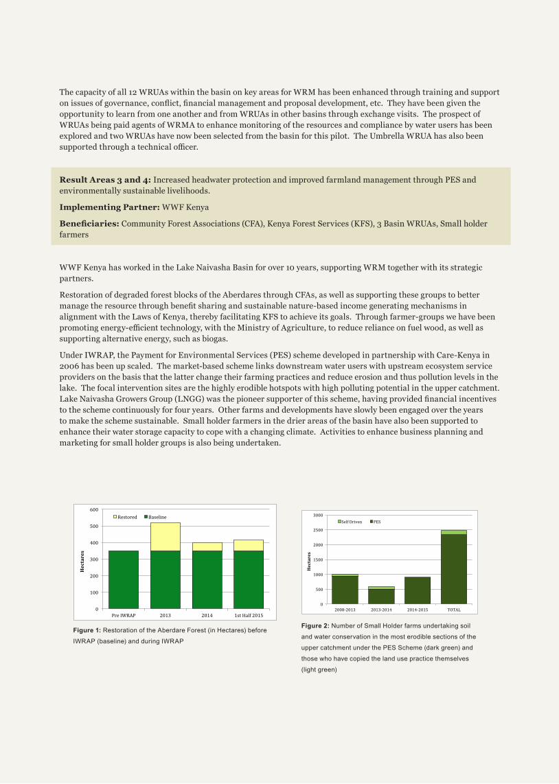
The capacity of all 12 WRUAs within the basin on key areas for WRM has been enhanced through training and support RQ�LVVXHV�RI�JRYHUQDQFH��FRQÀLFW��¿QDQFLDO�PDQDJHPHQW�DQG�SURSRVDO�GHYHORSPHQW��HWF���7KH\�KDYH�EHHQ�JLYHQ�WKH�opportunity to learn from one another and from WRUAs in other basins through exchange visits. The prospect of WRUAs being paid agents of WRMA to enhance monitoring of the resources and compliance by water users has been explored and two WRUAs have now been selected from the basin for this pilot. The Umbrella WRUA has also been VXSSRUWHG�WKURXJK�D�WHFKQLFDO�RFHU�
Result Areas 3 and 4: Increased headwater protection and improved farmland management through PES and environmentally sustainable livelihoods.
Implementing Partner: WWF Kenya
%HQH¿FLDULHV� Community Forest Associations (CFA), Kenya Forest Services (KFS), 3 Basin WRUAs, Small holder farmers
WWF Kenya has worked in the Lake Naivasha Basin for over 10 years, supporting WRM together with its strategic partners.
Restoration of degraded forest blocks of the Aberdares through CFAs, as well as supporting these groups to better PDQDJH�WKH�UHVRXUFH�WKURXJK�EHQH¿W�VKDULQJ�DQG�VXVWDLQDEOH�QDWXUH�EDVHG�LQFRPH�JHQHUDWLQJ�PHFKDQLVPV�LQ�alignment with the Laws of Kenya, thereby facilitating KFS to achieve its goals. Through farmer-groups we have been SURPRWLQJ�HQHUJ\�HFLHQW�WHFKQRORJ\��ZLWK�WKH�0LQLVWU\�RI�$JULFXOWXUH��WR�UHGXFH�UHOLDQFH�RQ�IXHO�ZRRG��DV�ZHOO�DV�supporting alternative energy, such as biogas.
Under IWRAP, the Payment for Environmental Services (PES) scheme developed in partnership with Care-Kenya in 2006 has been up scaled. The market-based scheme links downstream water users with upstream ecosystem service providers on the basis that the latter change their farming practices and reduce erosion and thus pollution levels in the lake. The focal intervention sites are the highly erodible hotspots with high polluting potential in the upper catchment. /DNH�1DLYDVKD�*URZHUV�*URXS��/1**��ZDV�WKH�SLRQHHU�VXSSRUWHU�RI�WKLV�VFKHPH��KDYLQJ�SURYLGHG�¿QDQFLDO�LQFHQWLYHV�to the scheme continuously for four years. Other farms and developments have slowly been engaged over the years to make the scheme sustainable. Small holder farmers in the drier areas of the basin have also been supported to enhance their water storage capacity to cope with a changing climate. Activities to enhance business planning and marketing for small holder groups is also being undertaken.
���
����
����
����
����
����
����
���������� ����� ����� �������������
���������
�������� ���� ���
���
����
�����
�����
�����
�����
�����
���������� ���������� ���������� ����
���������
� �������� ����
Figure 1: Restoration of the Aberdare Forest (in Hectares) before
IWRAP (baseline) and during IWRAP
Figure 2: Number of Small Holder farms undertaking soil
DQG�ZDWHU�FRQVHUYDWLRQ�LQ�WKH�PRVW�HURGLEOH�VHFWLRQV�RI�WKH�
upper catchment under the PES Scheme (dark green) and
WKRVH�ZKR�KDYH�FRSLHG�WKH�ODQG�XVH�SUDFWLFH�WKHPVHOYHV�
(light green)
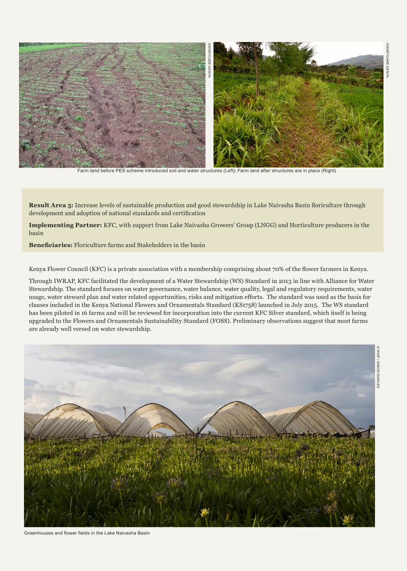
)DUP�ODQG�EHIRUH�3(6�VFKHPH�LQWURGXFHG�VRLO�DQG�ZDWHU�VWUXFWXUHV��/HIW���)DUP�ODQG�DIWHU�VWUXFWXUHV�DUH�LQ�SODFH��5LJKW��
©W
WF/C
AR
E K
EN
YA
©W
WF/C
AR
E K
EN
YA
Result Area 5: ,QFUHDVH�OHYHOV�RI�VXVWDLQDEOH�SURGXFWLRQ�DQG�JRRG�VWHZDUGVKLS�LQ�/DNH�1DLYDVKD�%DVLQ�ÀRULFXOWXUH�WKURXJK�GHYHORSPHQW�DQG�DGRSWLRQ�RI�QDWLRQDO�VWDQGDUGV�DQG�FHUWL¿FDWLRQ
Implementing Partner: KFC, with support from Lake Naivasha Growers’ Group (LNGG) and Horticulture producers in the basin
%HQH¿FLDULHV� Floriculture farms and Stakeholders in the basin
.HQ\D�)ORZHU�&RXQFLO��.)&��LV�D�SULYDWH�DVVRFLDWLRQ�ZLWK�D�PHPEHUVKLS�FRPSULVLQJ�DERXW�����RI�WKH�ÀRZHU�IDUPHUV�LQ�.HQ\D�
Through IWRAP, KFC facilitated the development of a Water Stewardship (WS) Standard in 2013 in line with Alliance for Water Stewardship. The standard focuses on water governance, water balance, water quality, legal and regulatory requirements, water XVDJH��ZDWHU�VWHZDUG�SODQ�DQG�ZDWHU�UHODWHG�RSSRUWXQLWLHV��ULVNV�DQG�PLWLJDWLRQ�HRUWV���7KH�VWDQGDUG�ZDV�XVHG�DV�WKH�EDVLV�IRU�FODXVHV�LQFOXGHG�LQ�WKH�.HQ\D�1DWLRQDO�)ORZHUV�DQG�2UQDPHQWDOV�6WDQGDUG��.6������ODXQFKHG�LQ�-XO\��������7KH�:6�VWDQGDUG�has been piloted in 16 farms and will be reviewed for incorporation into the current KFC Silver standard, which itself is being upgraded to the Flowers and Ornamentals Sustainability Standard (FOSS). Preliminary observations suggest that most farms are already well versed on water stewardship.
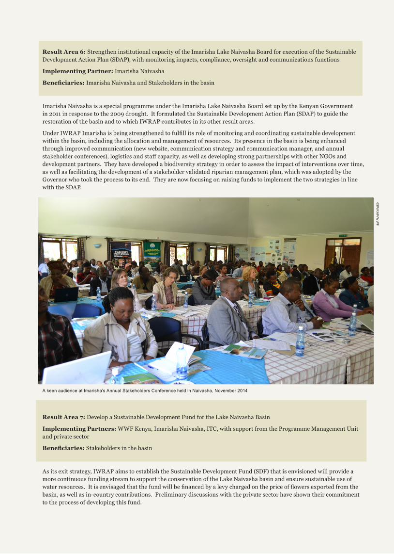
*UHHQKRXVHV�DQG�ÀRZHU�¿HOGV�LQ�WKH�/DNH�1DLYDVKD�%DVLQ�
© W
WF / S
IMO
N R
AW
LES
Result Area 6: Strengthen institutional capacity of the Imarisha Lake Naivasha Board for execution of the Sustainable Development Action Plan (SDAP), with monitoring impacts, compliance, oversight and communications functions
Implementing Partner: Imarisha Naivasha
%HQH¿FLDULHV��Imarisha Naivasha and Stakeholders in the basin
Imarisha Naivasha is a special programme under the Imarisha Lake Naivasha Board set up by the Kenyan Government in 2011 in response to the 2009 drought. It formulated the Sustainable Development Action Plan (SDAP) to guide the restoration of the basin and to which IWRAP contributes in its other result areas.
8QGHU�,:5$3�,PDULVKD�LV�EHLQJ�VWUHQJWKHQHG�WR�IXO¿OO�LWV�UROH�RI�PRQLWRULQJ�DQG�FRRUGLQDWLQJ�VXVWDLQDEOH�GHYHORSPHQW�within the basin, including the allocation and management of resources. Its presence in the basin is being enhanced through improved communication (new website, communication strategy and communication manager, and annual VWDNHKROGHU�FRQIHUHQFHV���ORJLVWLFV�DQG�VWD�FDSDFLW\��DV�ZHOO�DV�GHYHORSLQJ�VWURQJ�SDUWQHUVKLSV�ZLWK�RWKHU�1*2V�DQG�development partners. They have developed a biodiversity strategy in order to assess the impact of interventions over time, as well as facilitating the development of a stakeholder validated riparian management plan, which was adopted by the Governor who took the process to its end. They are now focusing on raising funds to implement the two strategies in line with the SDAP.
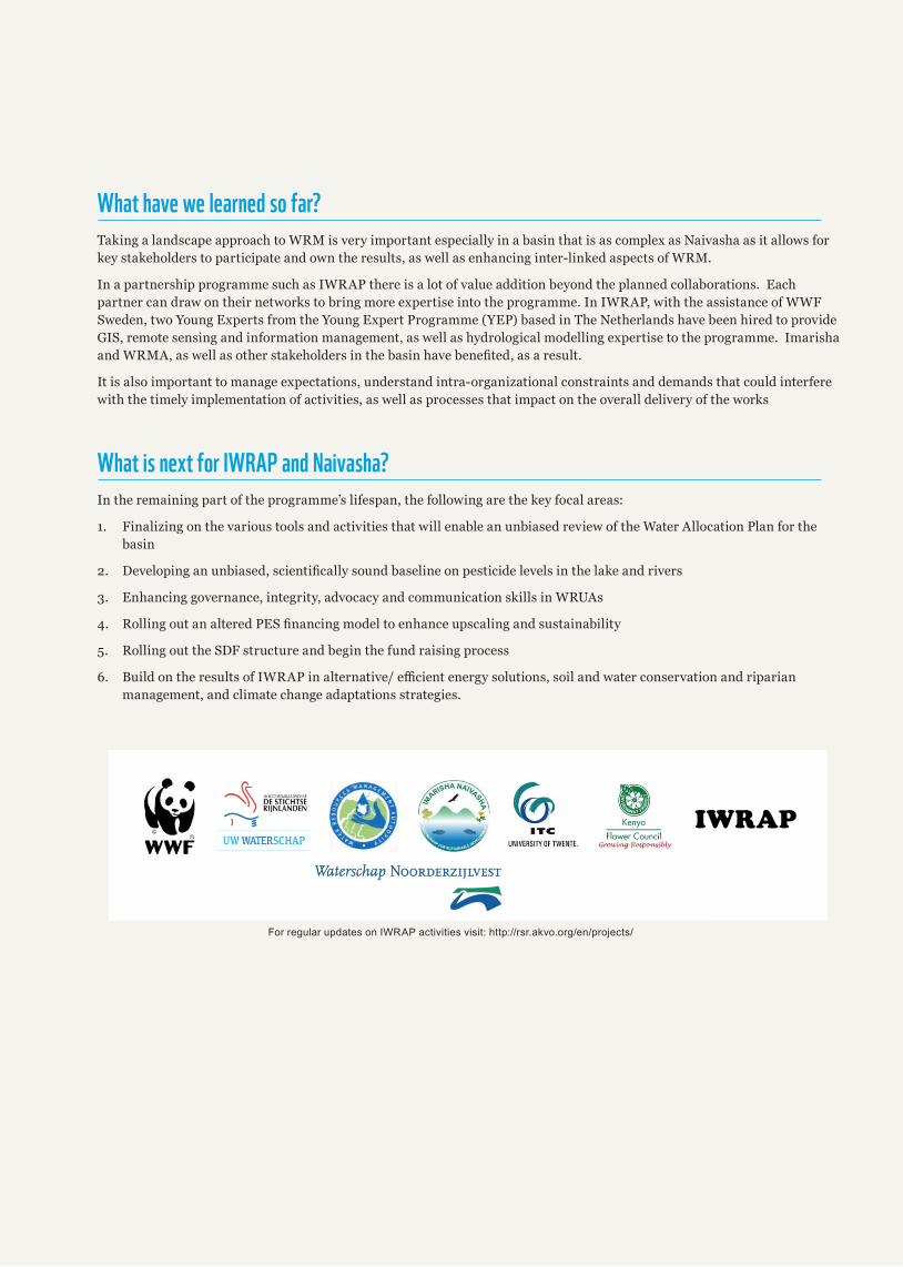
A keen audience at Imarisha’s Annual Stakeholders Conference held in Naivasha, November 2014
©IW
RA
P/W
WF
Result Area 7: Develop a Sustainable Development Fund for the Lake Naivasha Basin
Implementing Partners: WWF Kenya, Imarisha Naivasha, ITC, with support from the Programme Management Unit and private sector
%HQH¿FLDULHV��Stakeholders in the basin
As its exit strategy, IWRAP aims to establish the Sustainable Development Fund (SDF) that is envisioned will provide a more continuous funding stream to support the conservation of the Lake Naivasha basin and ensure sustainable use of ZDWHU�UHVRXUFHV���,W�LV�HQYLVDJHG�WKDW�WKH�IXQG�ZLOO�EH�¿QDQFHG�E\�D�OHY\�FKDUJHG�RQ�WKH�SULFH�RI�ÀRZHUV�H[SRUWHG�IURP�WKH�basin, as well as in-country contributions. Preliminary discussions with the private sector have shown their commitment to the process of developing this fund.
What have we learned so far?Taking a landscape approach to WRM is very important especially in a basin that is as complex as Naivasha as it allows for key stakeholders to participate and own the results, as well as enhancing inter-linked aspects of WRM.
In a partnership programme such as IWRAP there is a lot of value addition beyond the planned collaborations. Each partner can draw on their networks to bring more expertise into the programme. In IWRAP, with the assistance of WWF Sweden, two Young Experts from the Young Expert Programme (YEP) based in The Netherlands have been hired to provide GIS, remote sensing and information management, as well as hydrological modelling expertise to the programme. Imarisha DQG�:50$��DV�ZHOO�DV�RWKHU�VWDNHKROGHUV�LQ�WKH�EDVLQ�KDYH�EHQH¿WHG��DV�D�UHVXOW�
It is also important to manage expectations, understand intra-organizational constraints and demands that could interfere with the timely implementation of activities, as well as processes that impact on the overall delivery of the works
What is next for IWRAP and Naivasha?In the remaining part of the programme’s lifespan, the following are the key focal areas:
1. Finalizing on the various tools and activities that will enable an unbiased review of the Water Allocation Plan for the basin
���� 'HYHORSLQJ�DQ�XQELDVHG��VFLHQWL¿FDOO\�VRXQG�EDVHOLQH�RQ�SHVWLFLGH�OHYHOV�LQ�WKH�ODNH�DQG�ULYHUV
3. Enhancing governance, integrity, advocacy and communication skills in WRUAs
���� 5ROOLQJ�RXW�DQ�DOWHUHG�3(6�¿QDQFLQJ�PRGHO�WR�HQKDQFH�XSVFDOLQJ�DQG�VXVWDLQDELOLW\
5. Rolling out the SDF structure and begin the fund raising process
���� %XLOG�RQ�WKH�UHVXOWV�RI�,:5$3�LQ�DOWHUQDWLYH��HFLHQW�HQHUJ\�VROXWLRQV��VRLO�DQG�ZDWHU�FRQVHUYDWLRQ�DQG�ULSDULDQ�management, and climate change adaptations strategies.
IWRAP
For regular updates on IWRAP activities visit: http://rsr.akvo.org/en/projects/
PARTNERING TO SECURE THE FUTURE OF THE LAKE NAIVASHA BASINPANDA.ORG/KENYA
WWF Kenya .:|:. 5th Floor, ACS Plaza, Lenana Road, Nairobi, .HQ\D��3�2��%R[����������������7HO���������������������.HQ\D�LQIR#ZZINHQ\D�RUJ���_���ZZI�SDQGD�RUJ�.HQ\D
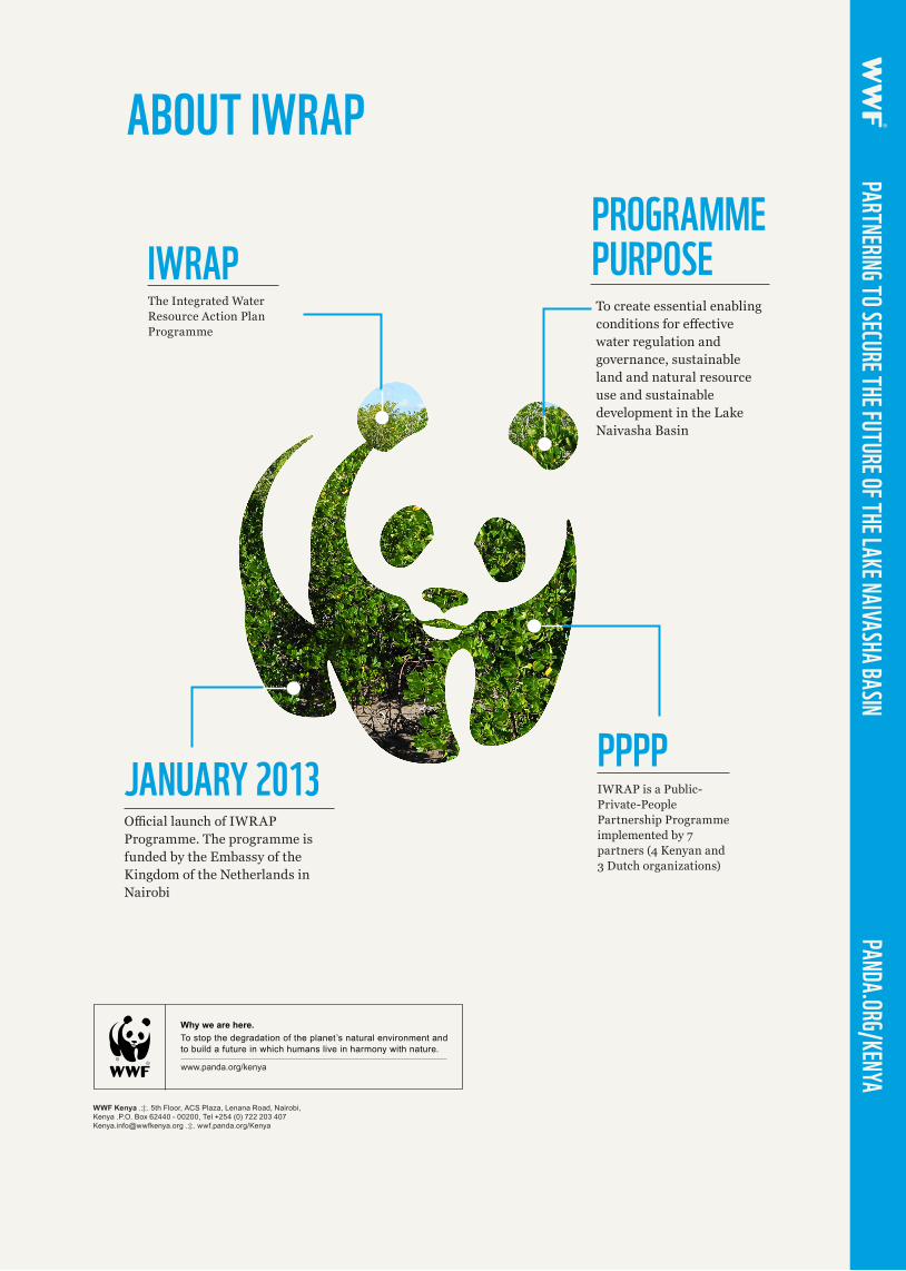
IWRAPThe Integrated Water Resource Action Plan Programme
ABOUT IWRAPPROGRAMME PURPOSE
JANUARY 2013 PPPP
To create essential enabling FRQGLWLRQV�IRU�HHFWLYH�water regulation and governance, sustainable land and natural resource use and sustainable development in the Lake Naivasha Basin
2FLDO�ODXQFK�RI�,:5$3�Programme. The programme is funded by the Embassy of the Kingdom of the Netherlands in Nairobi
IWRAP is a Public-Private-People Partnership Programme implemented by 7 partners (4 Kenyan and 3 Dutch organizations)
Why we are here.
www.panda.org/cea
To stop the degradation of the planet’s natural environment andto build a future in which humans live in harmony with nature.
ZZZ�SDQGD�RUJ�NHQ\D