Embed Size (px)
Citation preview
Engineers • Planners • Surveyors • Landscape Architects • Environmental Scientists
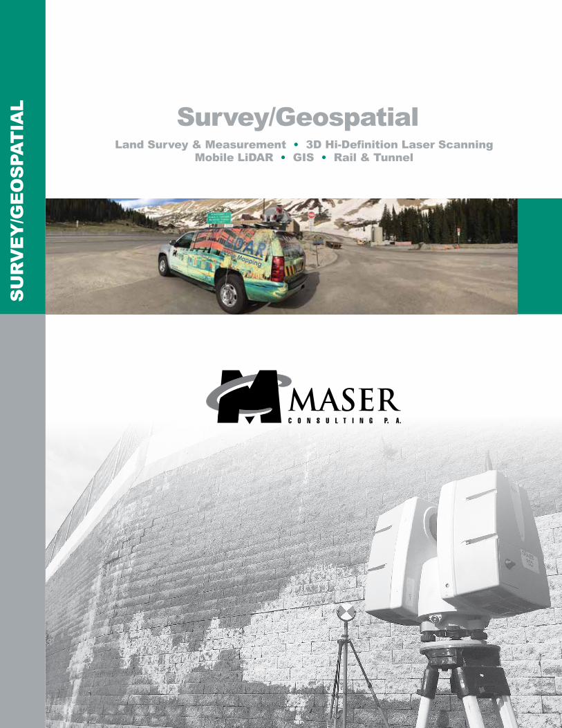
Survey/GeospatialLand Survey & Measurement • 3D Hi-Definition Laser Scanning
Mobile LiDAR • GIS • Rail & Tunnel
SU
RV
EY
/GE
OS
PAT
IAL
Maser Consulting P.A. is a multi-discipline engineering and design firm with a unique balance of public and private experience with a network of offices nationwide.
For a full listing of our office locations, please visit our website
www.maserconsulting.com1.877.627.3772
Civil/Site • Traffic/Transportation • Municipal • Survey/Geospatial Infrastructure • Geotechnical/Environmental • Telecommunications
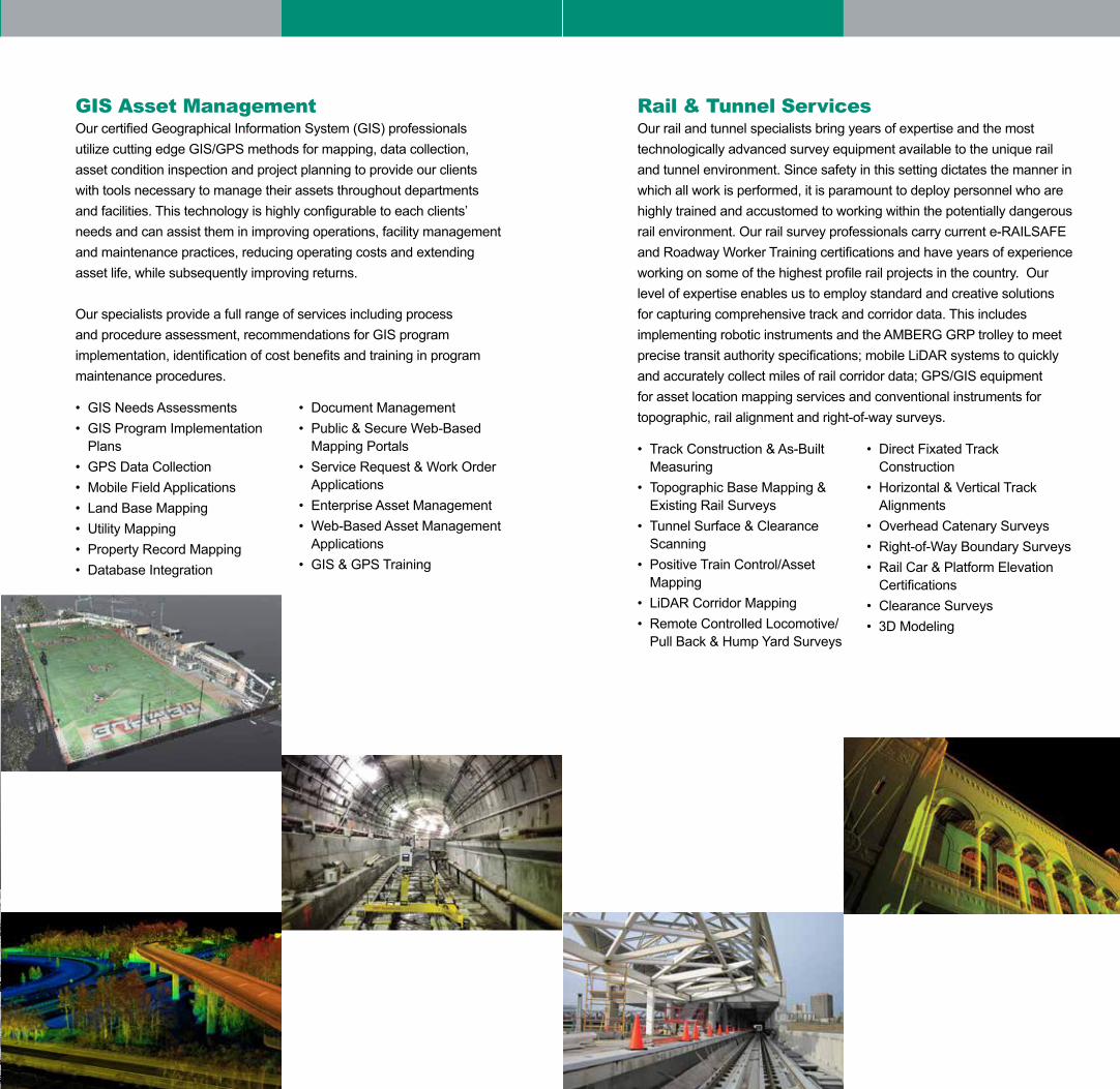
Rail & Tunnel ServicesOur rail and tunnel specialists bring years of expertise and the most technologically advanced survey equipment available to the unique rail and tunnel environment. Since safety in this setting dictates the manner in which all work is performed, it is paramount to deploy personnel who are highly trained and accustomed to working within the potentially dangerous rail environment. Our rail survey professionals carry current e-RAILSAFE and Roadway Worker Training certifications and have years of experience working on some of the highest profile rail projects in the country. Our level of expertise enables us to employ standard and creative solutions for capturing comprehensive track and corridor data. This includes implementing robotic instruments and the AMBERG GRP trolley to meet precise transit authority specifications; mobile LiDAR systems to quickly and accurately collect miles of rail corridor data; GPS/GIS equipment for asset location mapping services and conventional instruments for topographic, rail alignment and right-of-way surveys. • Track Construction & As-Built
Measuring• Topographic Base Mapping &
Existing Rail Surveys• Tunnel Surface & Clearance
Scanning• Positive Train Control/Asset
Mapping• LiDAR Corridor Mapping• Remote Controlled Locomotive/
Pull Back & Hump Yard Surveys
• Direct Fixated Track Construction
• Horizontal & Vertical Track Alignments
• Overhead Catenary Surveys• Right-of-Way Boundary Surveys• Rail Car & Platform Elevation
Certifications• Clearance Surveys• 3D Modeling
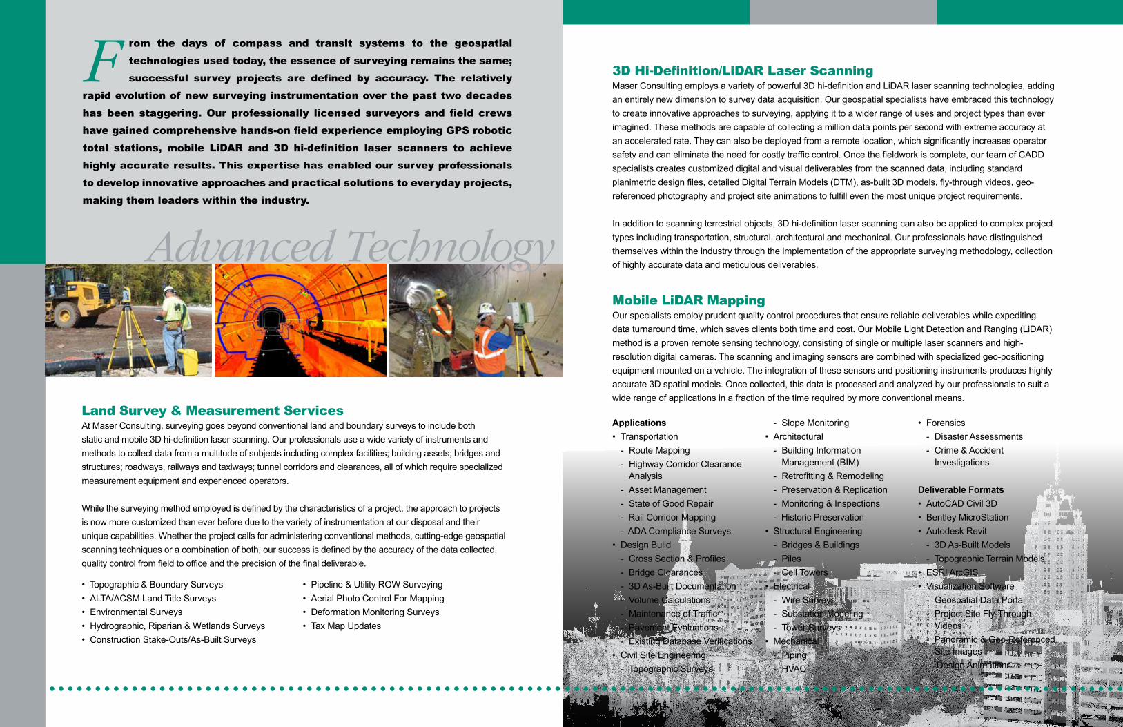
Land Survey & Measurement ServicesAt Maser Consulting, surveying goes beyond conventional land and boundary surveys to include both static and mobile 3D hi-definition laser scanning. Our professionals use a wide variety of instruments and methods to collect data from a multitude of subjects including complex facilities; building assets; bridges and structures; roadways, railways and taxiways; tunnel corridors and clearances, all of which require specialized measurement equipment and experienced operators.
While the surveying method employed is defined by the characteristics of a project, the approach to projects is now more customized than ever before due to the variety of instrumentation at our disposal and their unique capabilities. Whether the project calls for administering conventional methods, cutting-edge geospatial scanning techniques or a combination of both, our success is defined by the accuracy of the data collected, quality control from field to office and the precision of the final deliverable.
• Topographic & Boundary Surveys• ALTA/ACSM Land Title Surveys• Environmental Surveys• Hydrographic, Riparian & Wetlands Surveys• Construction Stake-Outs/As-Built Surveys
• Pipeline & Utility ROW Surveying• Aerial Photo Control For Mapping• Deformation Monitoring Surveys• Tax Map Updates
3D Hi-Definition/LiDAR Laser ScanningMaser Consulting employs a variety of powerful 3D hi-definition and LiDAR laser scanning technologies, adding an entirely new dimension to survey data acquisition. Our geospatial specialists have embraced this technology to create innovative approaches to surveying, applying it to a wider range of uses and project types than ever imagined. These methods are capable of collecting a million data points per second with extreme accuracy at an accelerated rate. They can also be deployed from a remote location, which significantly increases operator safety and can eliminate the need for costly traffic control. Once the fieldwork is complete, our team of CADD specialists creates customized digital and visual deliverables from the scanned data, including standard planimetric design files, detailed Digital Terrain Models (DTM), as-built 3D models, fly-through videos, geo-referenced photography and project site animations to fulfill even the most unique project requirements. In addition to scanning terrestrial objects, 3D hi-definition laser scanning can also be applied to complex project types including transportation, structural, architectural and mechanical. Our professionals have distinguished themselves within the industry through the implementation of the appropriate surveying methodology, collection of highly accurate data and meticulous deliverables.
Mobile LiDAR MappingOur specialists employ prudent quality control procedures that ensure reliable deliverables while expediting data turnaround time, which saves clients both time and cost. Our Mobile Light Detection and Ranging (LiDAR) method is a proven remote sensing technology, consisting of single or multiple laser scanners and high-resolution digital cameras. The scanning and imaging sensors are combined with specialized geo-positioning equipment mounted on a vehicle. The integration of these sensors and positioning instruments produces highly accurate 3D spatial models. Once collected, this data is processed and analyzed by our professionals to suit a wide range of applications in a fraction of the time required by more conventional means.
Applications• Transportation
- Route Mapping- Highway Corridor Clearance
Analysis- Asset Management- State of Good Repair- Rail Corridor Mapping- ADA Compliance Surveys
• Design Build- Cross Section & Profiles- Bridge Clearances- 3D As-Built Documentation- Volume Calculations- Maintenance of Traffic- Pavement Evaluations- Existing Database Verifications
• Civil Site Engineering- Topographic Surveys
- Slope Monitoring• Architectural
- Building Information Management (BIM)
- Retrofitting & Remodeling- Preservation & Replication- Monitoring & Inspections- Historic Preservation
• Structural Engineering- Bridges & Buildings- Piles- Cell Towers
• Electrical- Wire Surveys- Substation Modeling- Tower Surveys
• Mechanical- Piping - HVAC
• Forensics- Disaster Assessments- Crime & Accident
Investigations
Deliverable Formats • AutoCAD Civil 3D• Bentley MicroStation• Autodesk Revit
- 3D As-Built Models- Topographic Terrain Models
• ESRI ArcGIS• Visualization Software
- Geospatial Data Portal- Project Site Fly-Through
Videos- Panoramic & Geo-Referenced
Site Images- Design Animations
F rom the days of compass and transit systems to the geospatial technologies used today, the essence of surveying remains the same; successful survey projects are defined by accuracy. The relatively
rapid evolution of new surveying instrumentation over the past two decades has been staggering. Our professionally licensed surveyors and field crews have gained comprehensive hands-on field experience employing GPS robotic total stations, mobile LiDAR and 3D hi-definition laser scanners to achieve highly accurate results. This expertise has enabled our survey professionals to develop innovative approaches and practical solutions to everyday projects, making them leaders within the industry.
Advanced Technology
GIS Asset ManagementOur certified Geographical Information System (GIS) professionals utilize cutting edge GIS/GPS methods for mapping, data collection, asset condition inspection and project planning to provide our clients with tools necessary to manage their assets throughout departments and facilities. This technology is highly configurable to each clients’ needs and can assist them in improving operations, facility management and maintenance practices, reducing operating costs and extending asset life, while subsequently improving returns.
Our specialists provide a full range of services including process and procedure assessment, recommendations for GIS program implementation, identification of cost benefits and training in program maintenance procedures. • GIS Needs Assessments• GIS Program Implementation
Plans• GPS Data Collection• Mobile Field Applications• Land Base Mapping• Utility Mapping• Property Record Mapping• Database Integration
• Document Management• Public & Secure Web-Based
Mapping Portals• Service Request & Work Order
Applications• Enterprise Asset Management• Web-Based Asset Management
Applications • GIS & GPS Training
Engineers • Planners • Surveyors • Landscape Architects • Environmental Scientists
Survey/GeospatialLand Survey & Measurement • 3D Hi-Definition Laser Scanning
Mobile LiDAR • GIS • Rail & Tunnel
SU
RV
EY
/GE
OS
PAT
IAL
Maser Consulting P.A. is a multi-discipline engineering and design firm with a unique balance of public and private experience with a network of offices nationwide.
For a full listing of our office locations, please visit our website
www.maserconsulting.com1.877.627.3772
Civil/Site • Traffic/Transportation • Municipal • Survey/Geospatial Infrastructure • Geotechnical/Environmental • Telecommunications
Rail & Tunnel ServicesOur rail and tunnel specialists bring years of expertise and the most technologically advanced survey equipment available to the unique rail and tunnel environment. Since safety in this setting dictates the manner in which all work is performed, it is paramount to deploy personnel who are highly trained and accustomed to working within the potentially dangerous rail environment. Our rail survey professionals carry current e-RAILSAFE and Roadway Worker Training certifications and have years of experience working on some of the highest profile rail projects in the country. Our level of expertise enables us to employ standard and creative solutions for capturing comprehensive track and corridor data. This includes implementing robotic instruments and the AMBERG GRP trolley to meet precise transit authority specifications; mobile LiDAR systems to quickly and accurately collect miles of rail corridor data; GPS/GIS equipment for asset location mapping services and conventional instruments for topographic, rail alignment and right-of-way surveys. • Track Construction & As-Built
Measuring• Topographic Base Mapping &
Existing Rail Surveys• Tunnel Surface & Clearance
Scanning• Positive Train Control/Asset
Mapping• LiDAR Corridor Mapping• Remote Controlled Locomotive/
Pull Back & Hump Yard Surveys
• Direct Fixated Track Construction
• Horizontal & Vertical Track Alignments
• Overhead Catenary Surveys• Right-of-Way Boundary Surveys• Rail Car & Platform Elevation
Certifications• Clearance Surveys• 3D Modeling