Embed Size (px)
Citation preview
Survey of Potential Historic Landmarks and Preservation Areas in East Charlotte*
August 2013
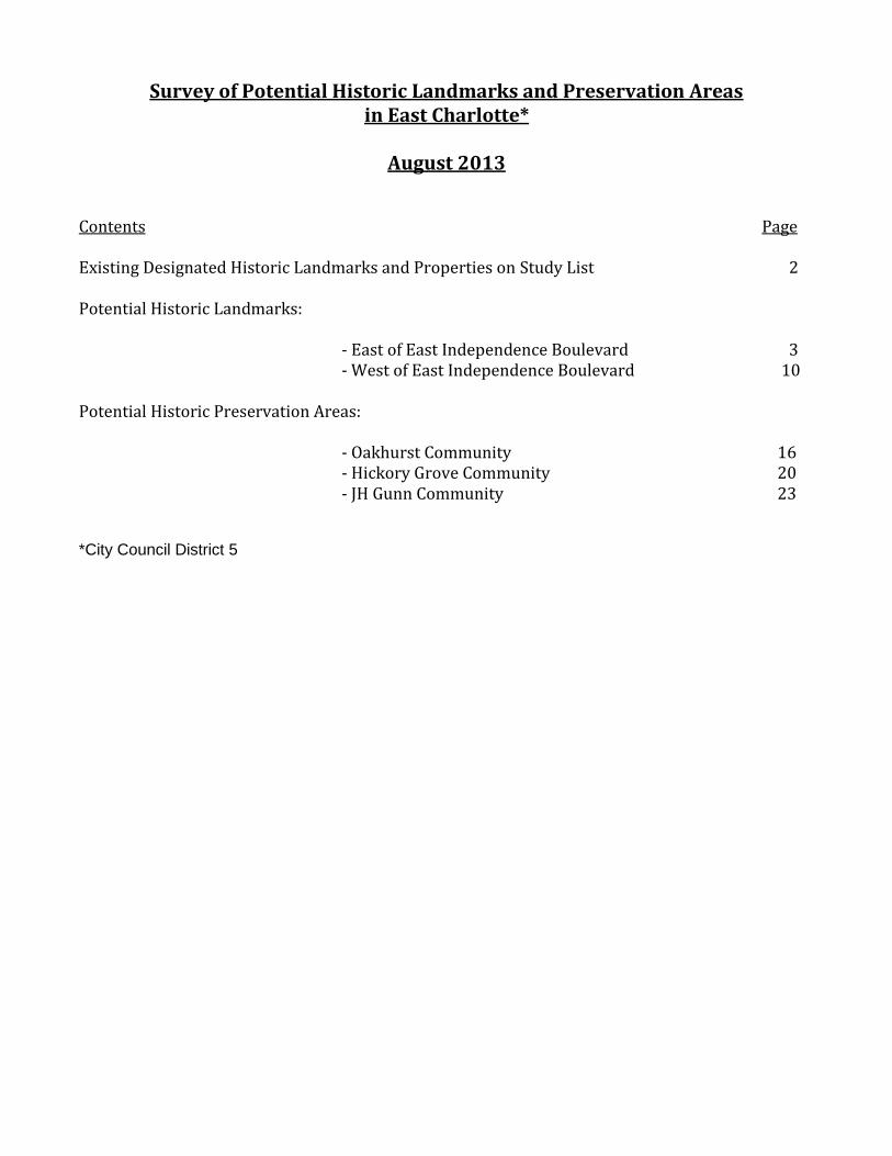
Contents Page Existing Designated Historic Landmarks and Properties on Study List 2 Potential Historic Landmarks: - East of East Independence Boulevard 3 - West of East Independence Boulevard 10 Potential Historic Preservation Areas: - Oakhurst Community 16 - Hickory Grove Community 20 - JH Gunn Community 23 *City Council District 5
2
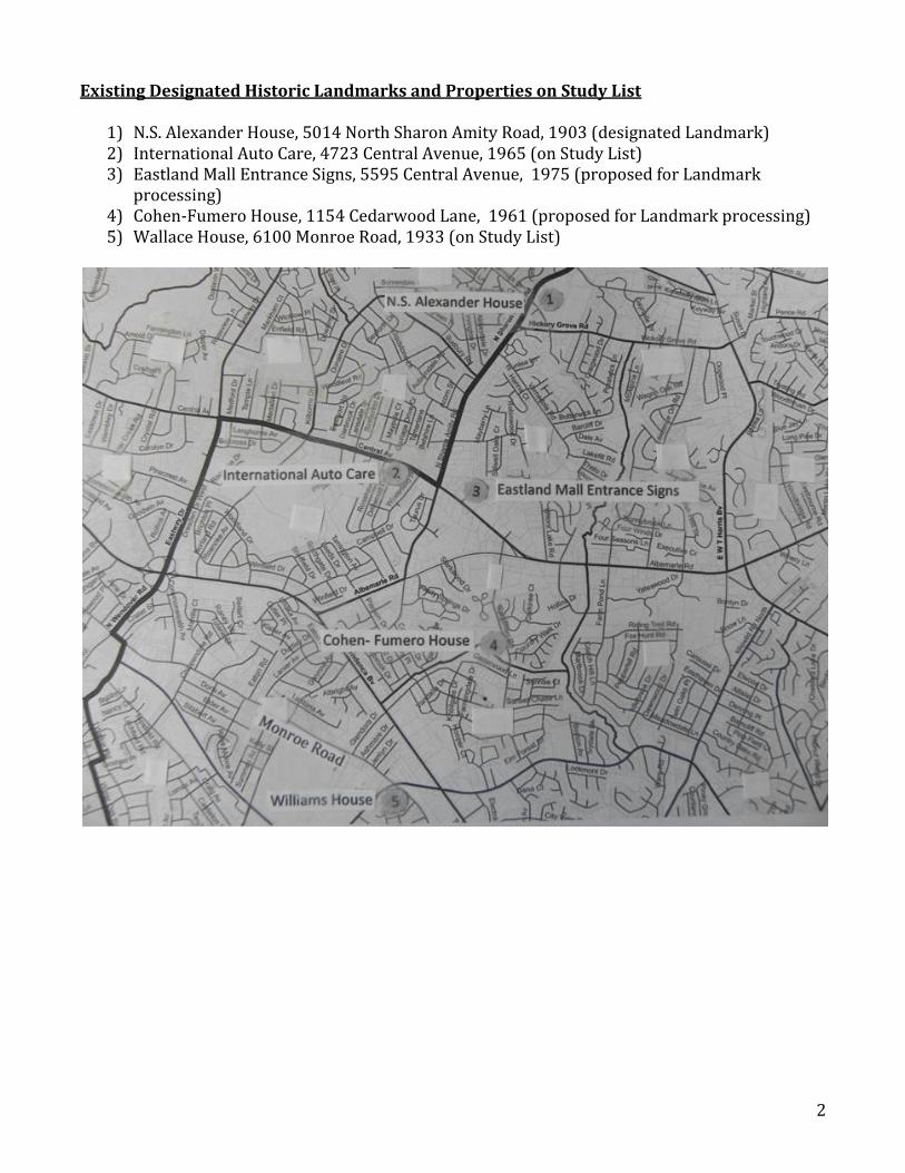
Existing Designated Historic Landmarks and Properties on Study List
1) N.S. Alexander House, 5014 North Sharon Amity Road, 1903 (designated Landmark) 2) International Auto Care, 4723 Central Avenue, 1965 (on Study List) 3) Eastland Mall Entrance Signs, 5595 Central Avenue, 1975 (proposed for Landmark
processing) 4) Cohen-Fumero House, 1154 Cedarwood Lane, 1961 (proposed for Landmark processing) 5) Wallace House, 6100 Monroe Road, 1933 (on Study List)
3
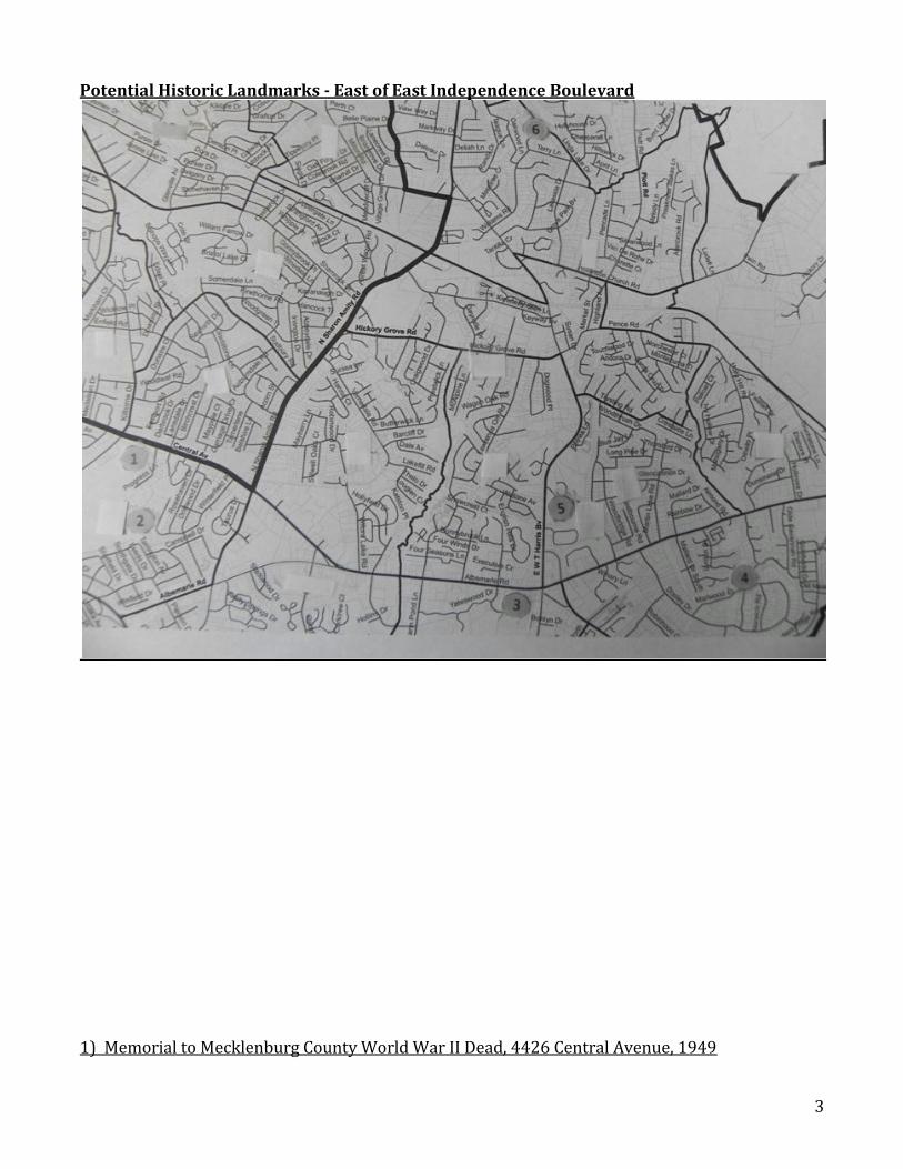
Potential Historic Landmarks - East of East Independence Boulevard
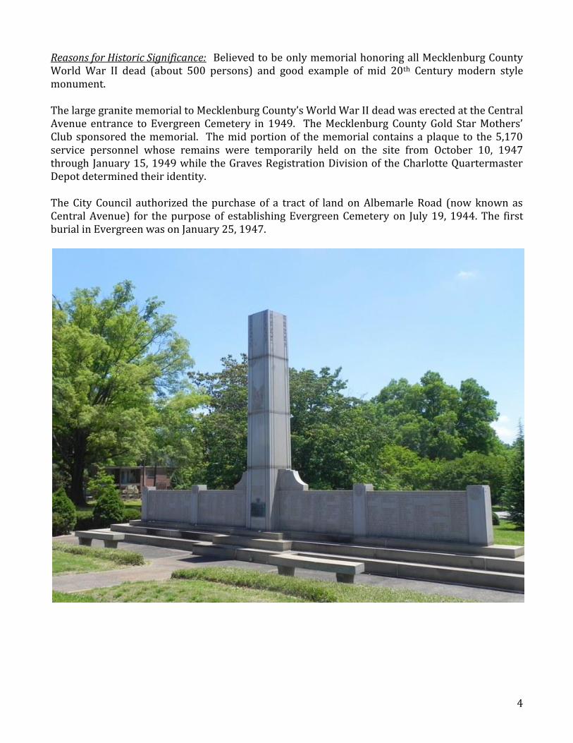
1) Memorial to Mecklenburg County World War II Dead, 4426 Central Avenue, 1949
4
Reasons for Historic Significance: Believed to be only memorial honoring all Mecklenburg County World War II dead (about 500 persons) and good example of mid 20th Century modern style monument. The large granite memorial to Mecklenburg County’s World War II dead was erected at the Central Avenue entrance to Evergreen Cemetery in 1949. The Mecklenburg County Gold Star Mothers’ Club sponsored the memorial. The mid portion of the memorial contains a plaque to the 5,170 service personnel whose remains were temporarily held on the site from October 10, 1947 through January 15, 1949 while the Graves Registration Division of the Charlotte Quartermaster Depot determined their identity. The City Council authorized the purchase of a tract of land on Albemarle Road (now known as Central Avenue) for the purpose of establishing Evergreen Cemetery on July 19, 1944. The first burial in Evergreen was on January 25, 1947.
5
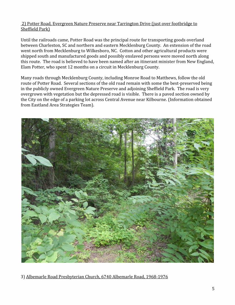
2) Potter Road, Evergreen Nature Preserve near Tarrington Drive (just over footbridge to Sheffield Park) Until the railroads came, Potter Road was the principal route for transporting goods overland between Charleston, SC and northern and eastern Mecklenburg County. An extension of the road went north from Mecklenburg to Wilkesboro, NC. Cotton and other agricultural products were shipped south and manufactured goods and possibly enslaved persons were moved north along this route. The road is believed to have been named after an itinerant minister from New England, Elam Potter, who spent 12 months on a circuit in Mecklenburg County. Many roads through Mecklenburg County, including Monroe Road to Matthews, follow the old route of Potter Road. Several sections of the old road remain with some the best-preserved being in the publicly owned Evergreen Nature Preserve and adjoining Sheffield Park. The road is very overgrown with vegetation but the depressed road is visible. There is a paved section owned by the City on the edge of a parking lot across Central Avenue near Kilbourne. (Information obtained from Eastland Area Strategies Team).
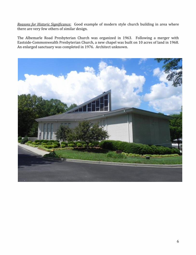
3) Albemarle Road Presbyterian Church, 6740 Albemarle Road, 1968-1976
6
Reasons for Historic Significance: Good example of modern style church building in area where there are very few others of similar design. The Albemarle Road Presbyterian Church was organized in 1963. Following a merger with Eastside-Commonwealth Presbyterian Church, a new chapel was built on 10 acres of land in 1968. An enlarged sanctuary was completed in 1976. Architect unknown.
7
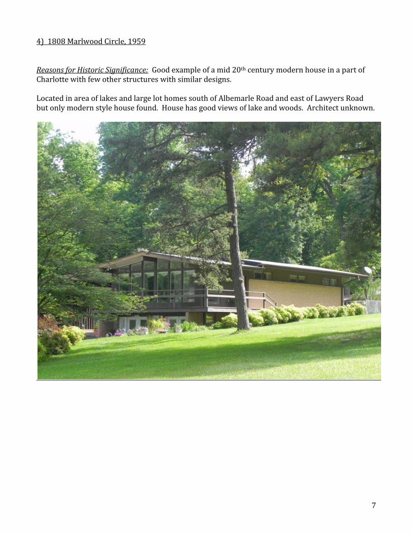
4) 1808 Marlwood Circle, 1959 Reasons for Historic Significance: Good example of a mid 20th century modern house in a part of Charlotte with few other structures with similar designs. Located in area of lakes and large lot homes south of Albemarle Road and east of Lawyers Road but only modern style house found. House has good views of lake and woods. Architect unknown.
8
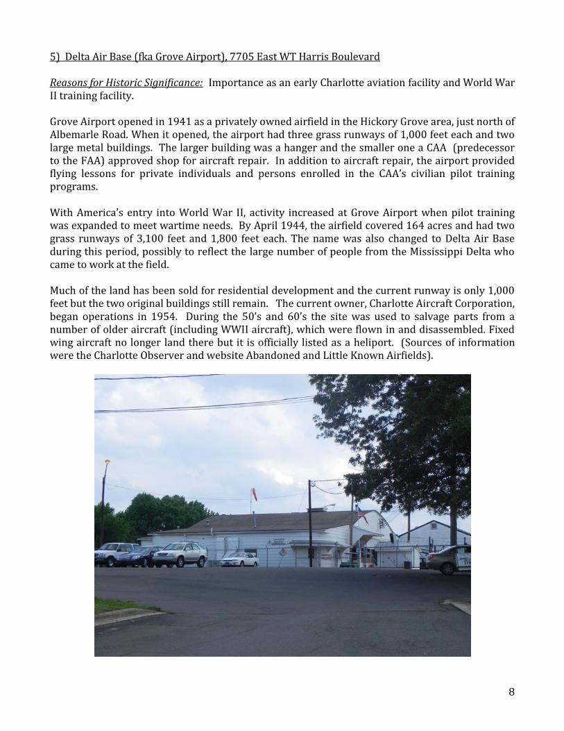
5) Delta Air Base (fka Grove Airport), 7705 East WT Harris Boulevard Reasons for Historic Significance: Importance as an early Charlotte aviation facility and World War II training facility. Grove Airport opened in 1941 as a privately owned airfield in the Hickory Grove area, just north of Albemarle Road. When it opened, the airport had three grass runways of 1,000 feet each and two large metal buildings. The larger building was a hanger and the smaller one a CAA (predecessor to the FAA) approved shop for aircraft repair. In addition to aircraft repair, the airport provided flying lessons for private individuals and persons enrolled in the CAA’s civilian pilot training programs. With America’s entry into World War II, activity increased at Grove Airport when pilot training was expanded to meet wartime needs. By April 1944, the airfield covered 164 acres and had two grass runways of 3,100 feet and 1,800 feet each. The name was also changed to Delta Air Base during this period, possibly to reflect the large number of people from the Mississippi Delta who came to work at the field. Much of the land has been sold for residential development and the current runway is only 1,000 feet but the two original buildings still remain. The current owner, Charlotte Aircraft Corporation, began operations in 1954. During the 50’s and 60’s the site was used to salvage parts from a number of older aircraft (including WWII aircraft), which were flown in and disassembled. Fixed wing aircraft no longer land there but it is officially listed as a heliport. (Sources of information were the Charlotte Observer and website Abandoned and Little Known Airfields).
9
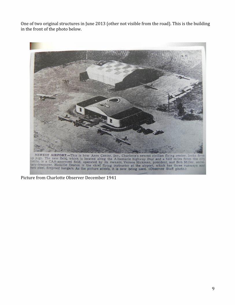
One of two original structures in June 2013 (other not visible from the road). This is the building in the front of the photo below.
Picture from Charlotte Observer December 1941
10
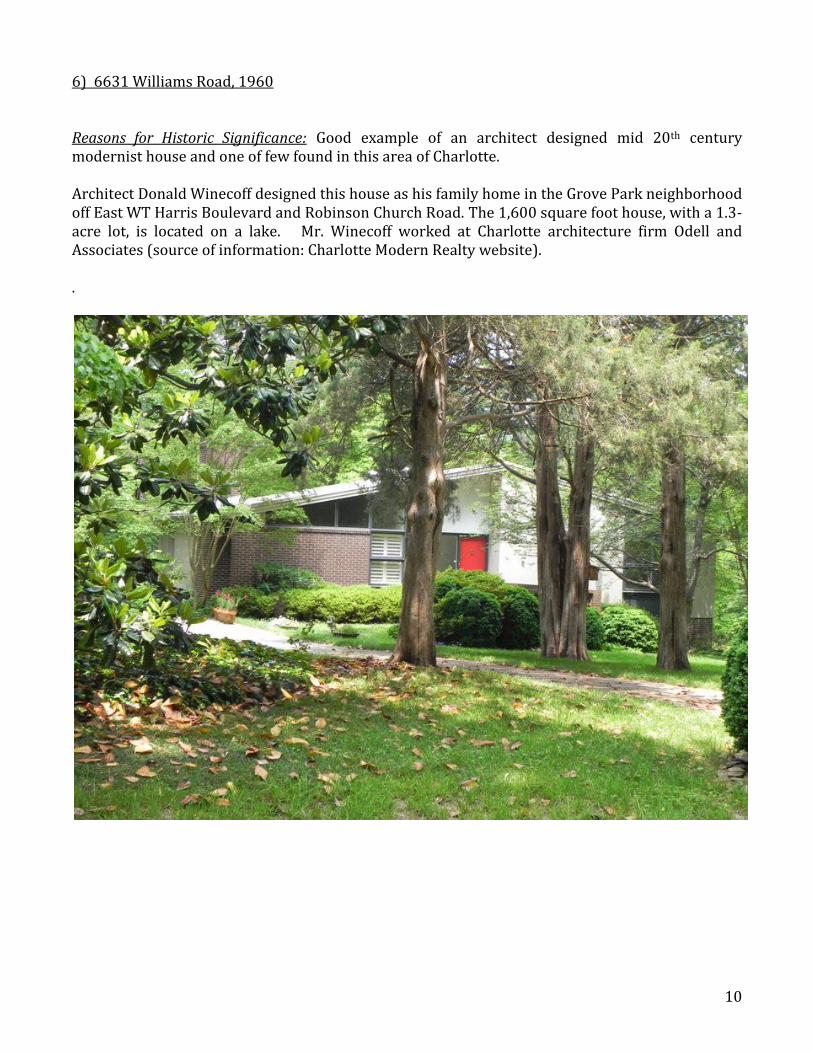
6) 6631 Williams Road, 1960 Reasons for Historic Significance: Good example of an architect designed mid 20th century modernist house and one of few found in this area of Charlotte. Architect Donald Winecoff designed this house as his family home in the Grove Park neighborhood off East WT Harris Boulevard and Robinson Church Road. The 1,600 square foot house, with a 1.3-acre lot, is located on a lake. Mr. Winecoff worked at Charlotte architecture firm Odell and Associates (source of information: Charlotte Modern Realty website). .
11
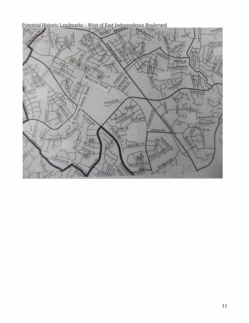
Potential Historic Landmarks – West of East Independence Boulevard
12
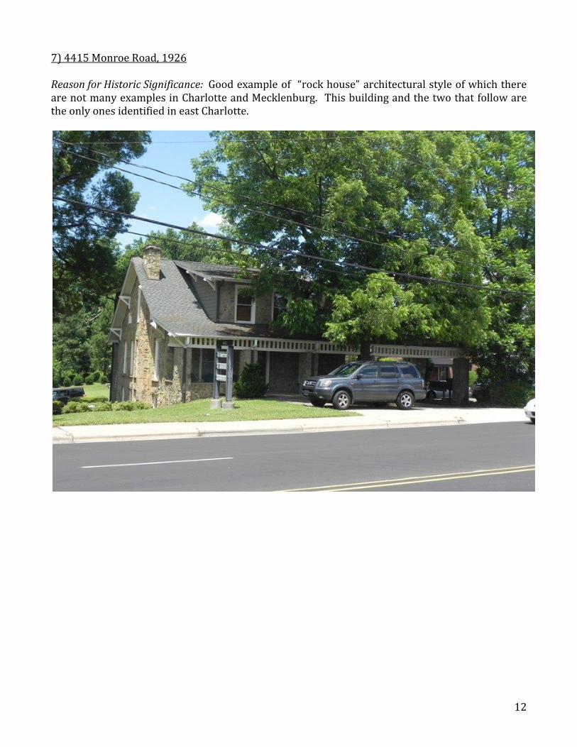
7) 4415 Monroe Road, 1926 Reason for Historic Significance: Good example of “rock house” architectural style of which there are not many examples in Charlotte and Mecklenburg. This building and the two that follow are the only ones identified in east Charlotte.
13
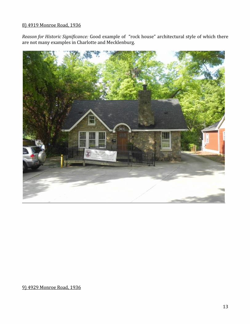
8) 4919 Monroe Road, 1936 Reason for Historic Significance: Good example of “rock house” architectural style of which there are not many examples in Charlotte and Mecklenburg.
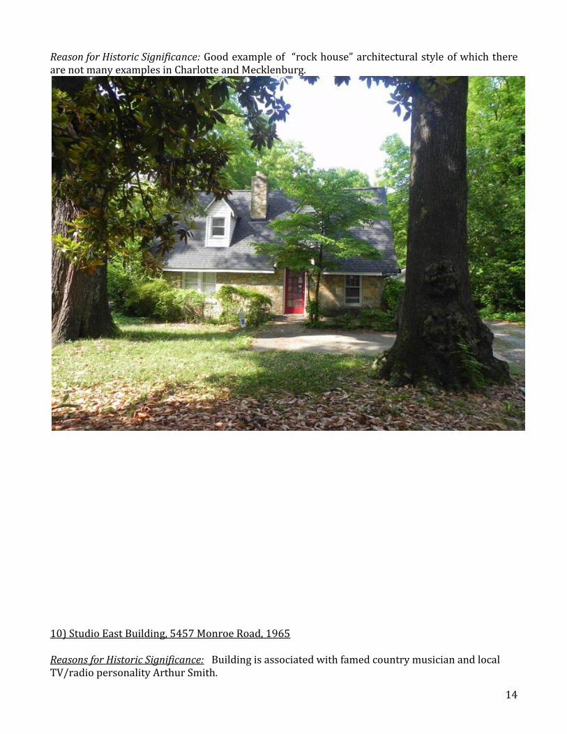
9) 4929 Monroe Road, 1936
14
Reason for Historic Significance: Good example of “rock house” architectural style of which there are not many examples in Charlotte and Mecklenburg.
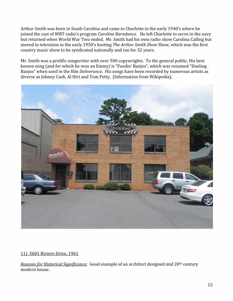
10) Studio East Building, 5457 Monroe Road, 1965 Reasons for Historic Significance: Building is associated with famed country musician and local TV/radio personality Arthur Smith.
15
Arthur Smith was born in South Carolina and came to Charlotte in the early 1940’s where he joined the cast of WBT radio’s program Carolina Barndance. He left Charlotte to serve in the navy but returned when World War Two ended. Mr. Smith had his own radio show Carolina Calling but moved to television in the early 1950’s hosting The Arthur Smith Show Show, which was the first country music show to be syndicated nationally and ran for 32 years. Mr. Smith was a prolific songwriter with over 500 copywrights. To the general public, His best known song (and for which he won an Emmy) is “Fuedin’ Banjos”, which was renamed “Dueling Banjos” when used in the film Deliverance. His songs have been recorded by numerous artists as diverse as Johnny Cash, Al Hirt and Tom Petty. (Information from Wikipedia).
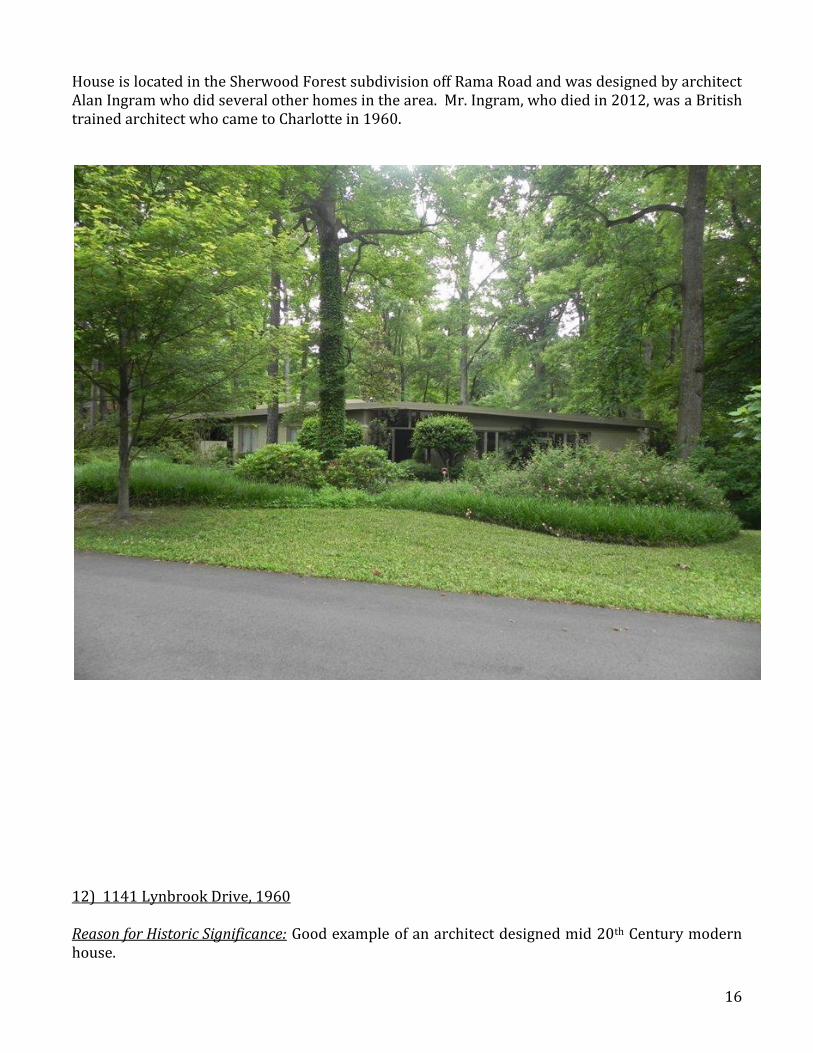
11) 5601 Riviere Drive, 1961 Reasons for Historical Significance: Good example of an architect designed mid 20th century modern house.
16
House is located in the Sherwood Forest subdivision off Rama Road and was designed by architect Alan Ingram who did several other homes in the area. Mr. Ingram, who died in 2012, was a British trained architect who came to Charlotte in 1960.
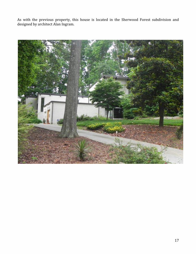
12) 1141 Lynbrook Drive, 1960 Reason for Historic Significance: Good example of an architect designed mid 20th Century modern house.
17
As with the previous property, this house is located in the Sherwood Forest subdivision and designed by architect Alan Ingram.
18
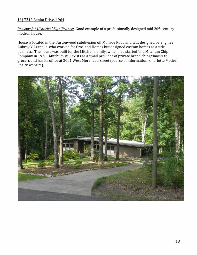
13) 7212 Benita Drive, 1964 Reasons for Historical Significance: Good example of a professionally designed mid 20th century modern house.
House is located in the Burtonwood subdivision off Monroe Road and was designed by engineer Aubrey Y Arant, Jr. who worked for Crosland Homes but designed custom homes as a side business. The house was built for the Mitchum family, which had started The Mitchum Chip Company in 1936. Mitchum still exists as a small provider of private brand chips/snacks to grocers and has its office at 2001 West Morehead Street (source of information: Charlotte Modern Realty website).
19
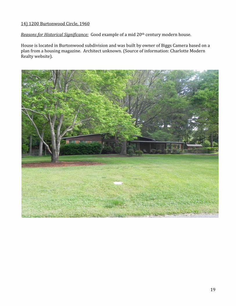
14) 1200 Burtonwood Circle, 1960 Reasons for Historical Significance: Good example of a mid 20th century modern house. House is located in Burtonwood subdivision and was built by owner of Biggs Camera based on a plan from a housing magazine. Architect unknown. (Source of information: Charlotte Modern Realty website).
20
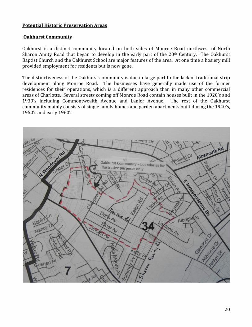
Potential Historic Preservation Areas Oakhurst Community Oakhurst is a distinct community located on both sides of Monroe Road northwest of North Sharon Amity Road that began to develop in the early part of the 20th Century. The Oakhurst Baptist Church and the Oakhurst School are major features of the area. At one time a hosiery mill provided employment for residents but is now gone. The distinctiveness of the Oakhurst community is due in large part to the lack of traditional strip development along Monroe Road. The businesses have generally made use of the former residences for their operations, which is a different approach than in many other commercial areas of Charlotte. Several streets coming off Monroe Road contain houses built in the 1920’s and 1930’s including Commontwealth Avenue and Lanier Avenue. The rest of the Oakhurst community mainly consists of single family homes and garden apartments built during the 1940’s, 1950’s and early 1960’s.
21
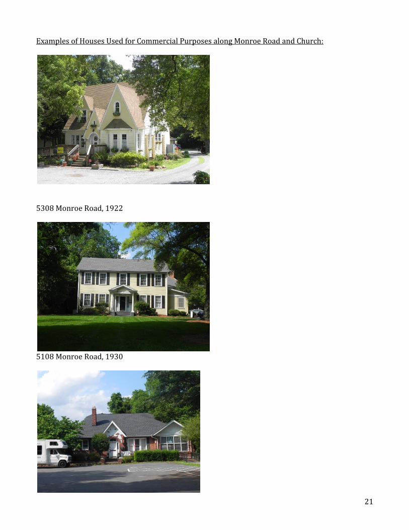
Examples of Houses Used for Commercial Purposes along Monroe Road and Church:
5308 Monroe Road, 1922
5108 Monroe Road, 1930
22
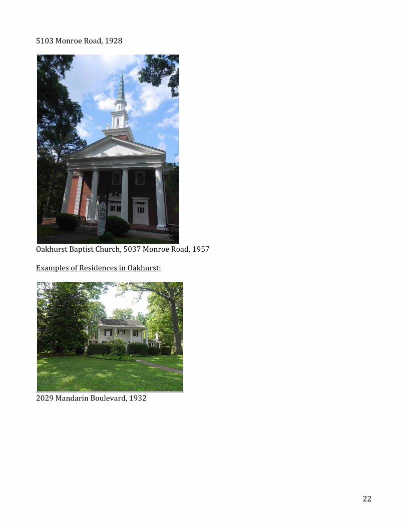
5103 Monroe Road, 1928
Oakhurst Baptist Church, 5037 Monroe Road, 1957 Examples of Residences in Oakhurst:
2029 Mandarin Boulevard, 1932
23
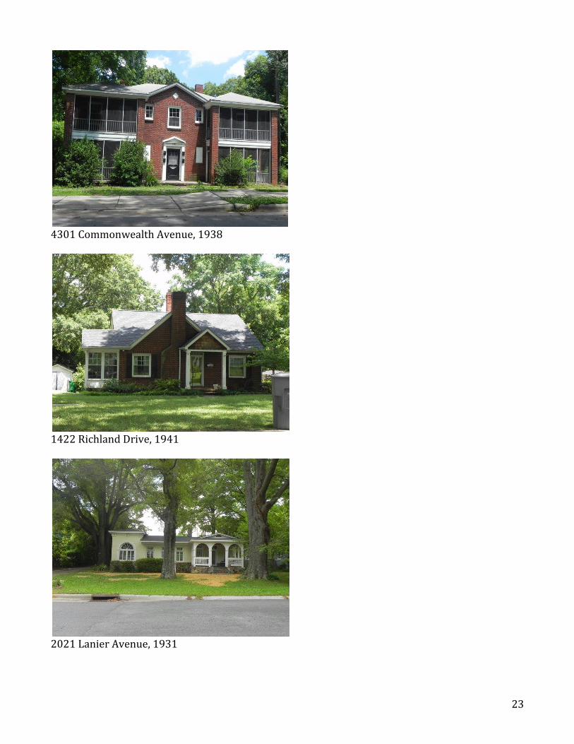
4301 Commonwealth Avenue, 1938
1422 Richland Drive, 1941
2021 Lanier Avenue, 1931
24
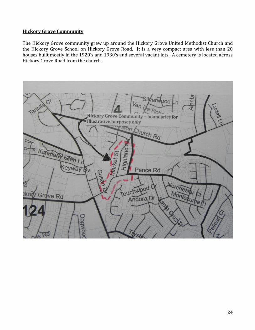
Hickory Grove Community The Hickory Grove community grew up around the Hickory Grove United Methodist Church and the Hickory Grove School on Hickory Grove Road. It is a very compact area with less than 20 houses built mostly in the 1920’s and 1930’s and several vacant lots. A cemetery is located across Hickory Grove Road from the church.
25
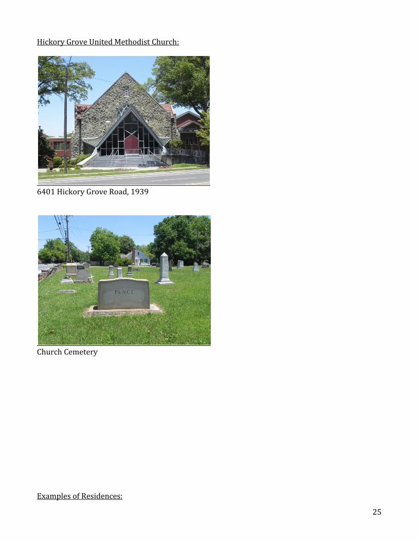
Hickory Grove United Methodist Church:
6401 Hickory Grove Road, 1939
Church Cemetery Examples of Residences:
26
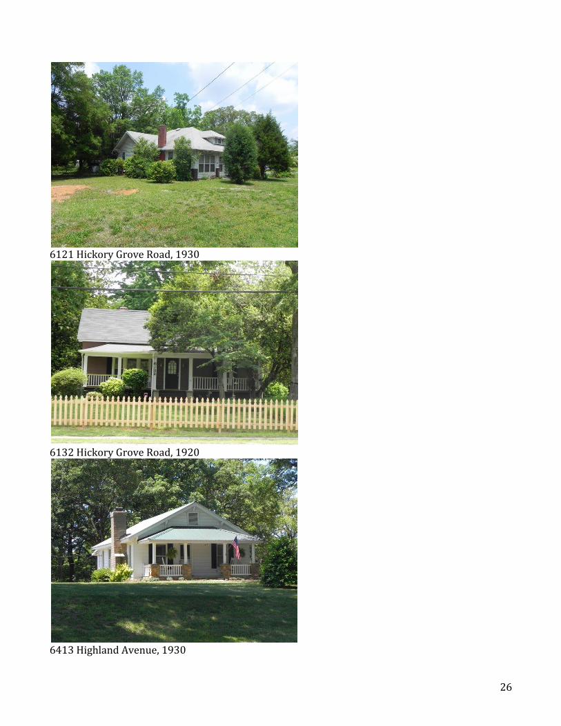
6121 Hickory Grove Road, 1930
6132 Hickory Grove Road, 1920
6413 Highland Avenue, 1930
27
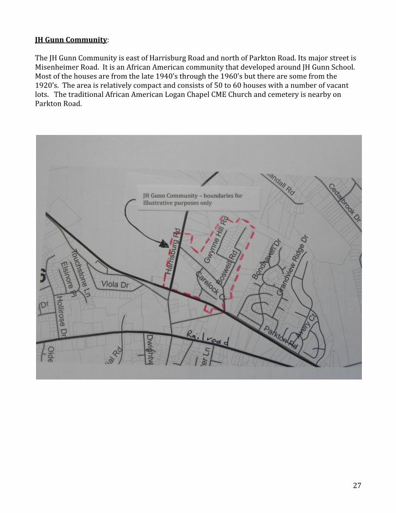
JH Gunn Community: The JH Gunn Community is east of Harrisburg Road and north of Parkton Road. Its major street is Misenheimer Road. It is an African American community that developed around JH Gunn School. Most of the houses are from the late 1940’s through the 1960’s but there are some from the 1920’s. The area is relatively compact and consists of 50 to 60 houses with a number of vacant lots. The traditional African American Logan Chapel CME Church and cemetery is nearby on Parkton Road.
28
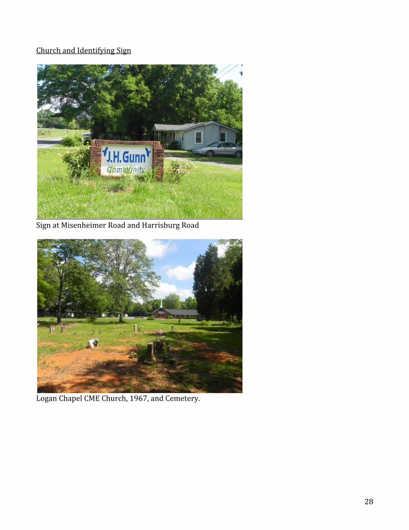
Church and Identifying Sign
Sign at Misenheimer Road and Harrisburg Road
Logan Chapel CME Church, 1967, and Cemetery.
29
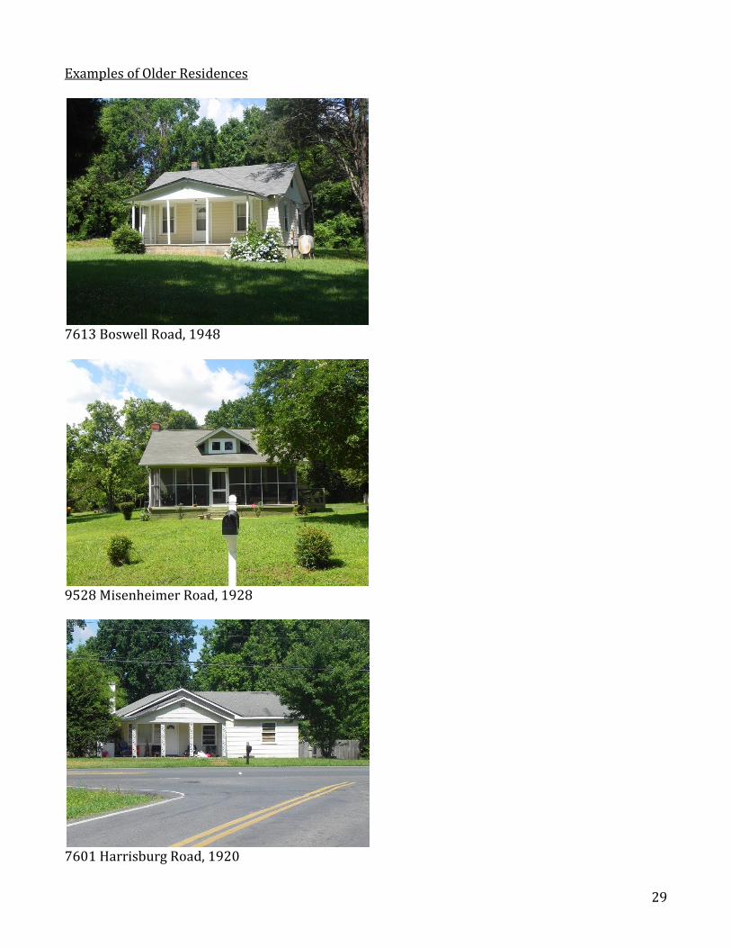
Examples of Older Residences
7613 Boswell Road, 1948
9528 Misenheimer Road, 1928
7601 Harrisburg Road, 1920