Embed Size (px)
Citation preview
Subsea Groundwater for Desalination
Feedwater Supply
Case Study: Feasibility of Using Subsurface
Intake Systems in the Marina/Moss Landing
Area of California
Brian Villalobos, CHG, CEG
GEOSCIENCE Support Services, Inc.
American Water Works Association
California-Nevada Section
Reno, Nevada
October 1, 2014
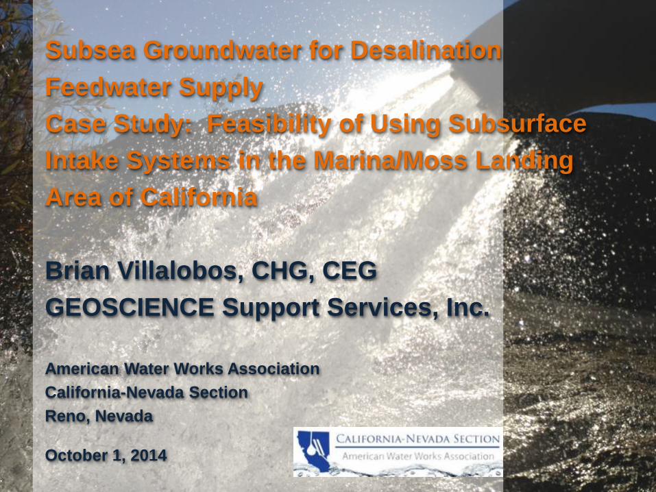
IntroductionSubsurface intakes for Desalination are favored among regulatory agencies (e.g. Cal-SWRCB Ocean Plan
Amendment, 2014) because of:
(1) No Ocean Construction Impacts,
(2) Avoidance of Entrainment and Impingement Impacts to Marine Organisms, and
(3) No Permanent Visual Impacts to Coastal Areas.
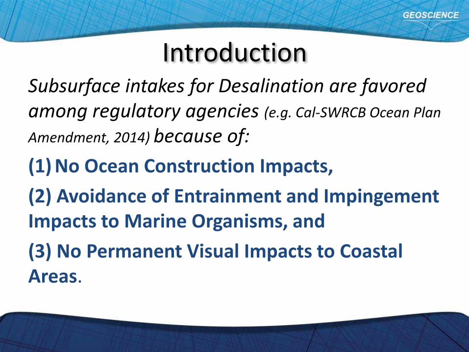
Additionally, subsurface intakes are beneficial to plant operations by:
(1) elimination or reduction of costly pretreatment,
(2) protection from high turbidity storm surge and red tide events by natural filtration and pretreatment from ocean floor sediments, and
(3) minimal growth of marine organisms that occurs inside the intake pipeline
Introduction
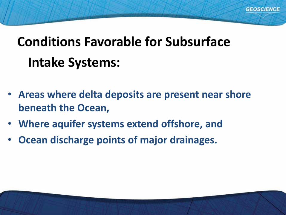
• Areas where delta deposits are present near shore beneath the Ocean,
• Where aquifer systems extend offshore, and
• Ocean discharge points of major drainages.
Conditions Favorable for Subsurface
Intake Systems:
5
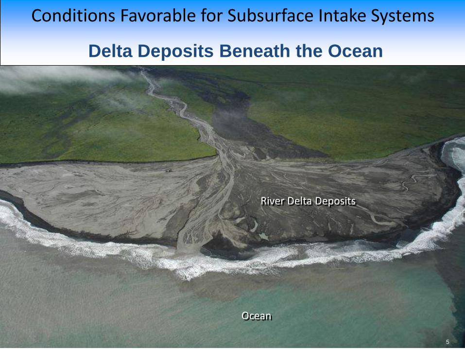
Conditions Favorable for Subsurface Intake Systems
5
Delta Deposits Beneath the Ocean
Ocean
River Delta Deposits

6
Conditions Favorable for Subsurface Intake Systems
Aquifer Systems Extending Offshore
Ocean
Land
Oceanside
Carlsbad
Pal
a
Los
AngelesSanta
Monica
San
Bernardi
no
Palos
Verdes
Dana
Point
Riverside
Santa
Fe
Dam
Prado
Dam
Santa
Catalina
Is.San Nicolas
Is.
Santa Cruz
Is.
Oxnard
Point
Dume
-1160-1170-1180-1190-1200
330
340
350
Lake
Henshaw
0 50 mi
Big Bear L.L. Arrowhead
N
Claremon
t
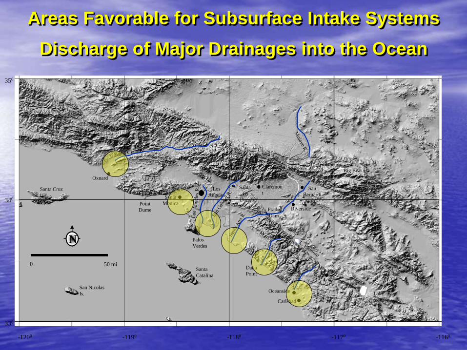
Areas Favorable for Subsurface Intake Systems
Discharge of Major Drainages into the Ocean
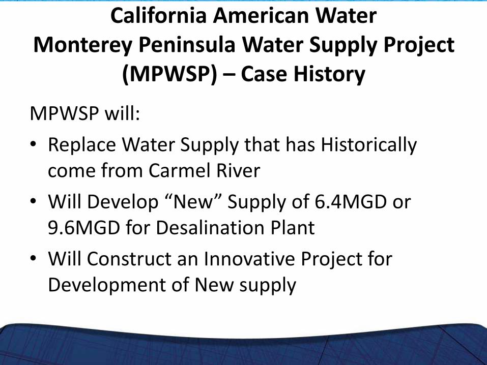
MPWSP will:
• Replace Water Supply that has Historically come from Carmel River
• Will Develop “New” Supply of 6.4MGD or 9.6MGD for Desalination Plant
• Will Construct an Innovative Project for Development of New supply
California American WaterMonterey Peninsula Water Supply Project
(MPWSP) – Case History
MPWSP – Case History
The slant well subsurface intake system is a primary consideration for this project because:
The system allows for feedwater supply to be obtained from ocean sources
(i.e., vertical leakage through the sea floor and horizontal recharge from offshore aquifers).

MPWSP:
• Adds New Water Supply to the Region
• Does Not Interfere with Existing Water Rights
• Will Result in Local Halting even Reversal of Seawater Intrusion
MPWSP – Case History
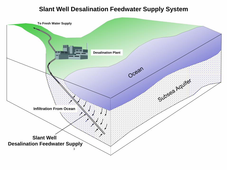
Slant Well Desalination Feedwater Supply System
Slant Well
Desalination Feedwater Supply
Desalination Plant
Infiltration From Ocean
To Fresh Water Supply
3
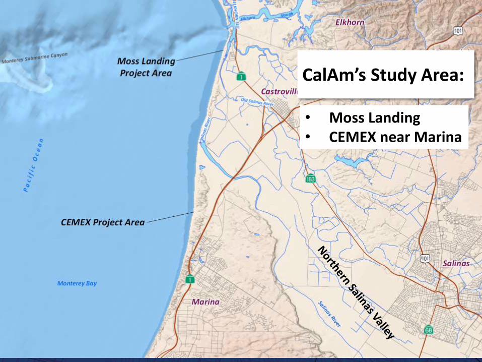
CalAm’s Study Area:
• Moss Landing• CEMEX near Marina
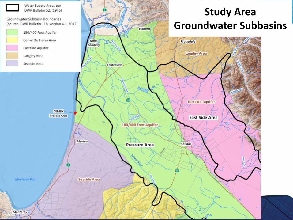
Study Area Groundwater Subbasins
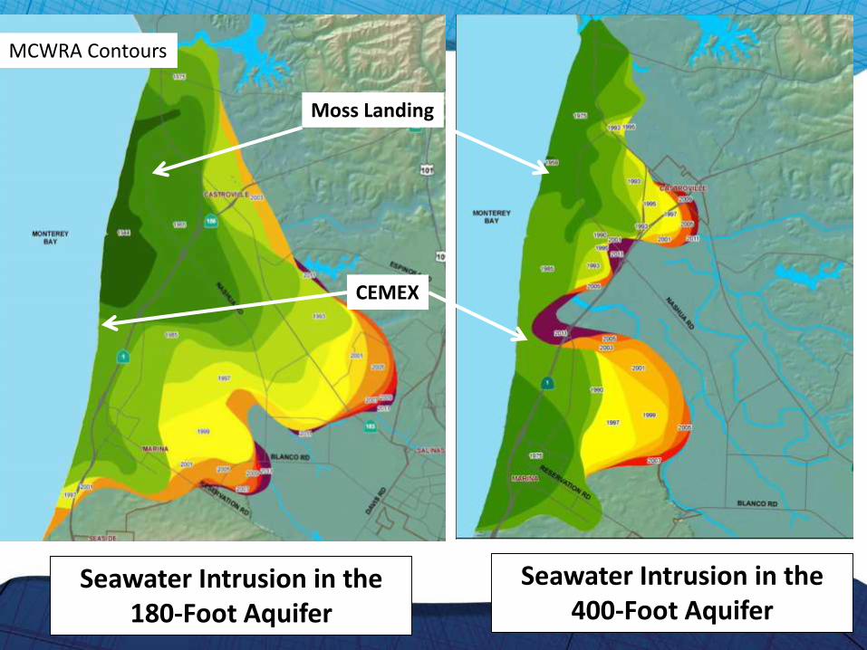
Seawater Intrusion in the 180-Foot Aquifer
Seawater Intrusion in the 400-Foot Aquifer
CEMEX
Moss Landing
MCWRA Contours

Regional Geology
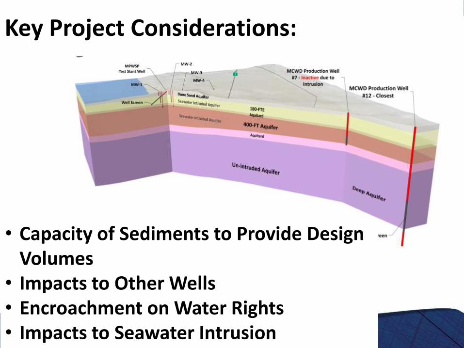
Key Project Considerations:
• Capacity of Sediments to Provide Design Volumes
• Impacts to Other Wells• Encroachment on Water Rights• Impacts to Seawater Intrusion
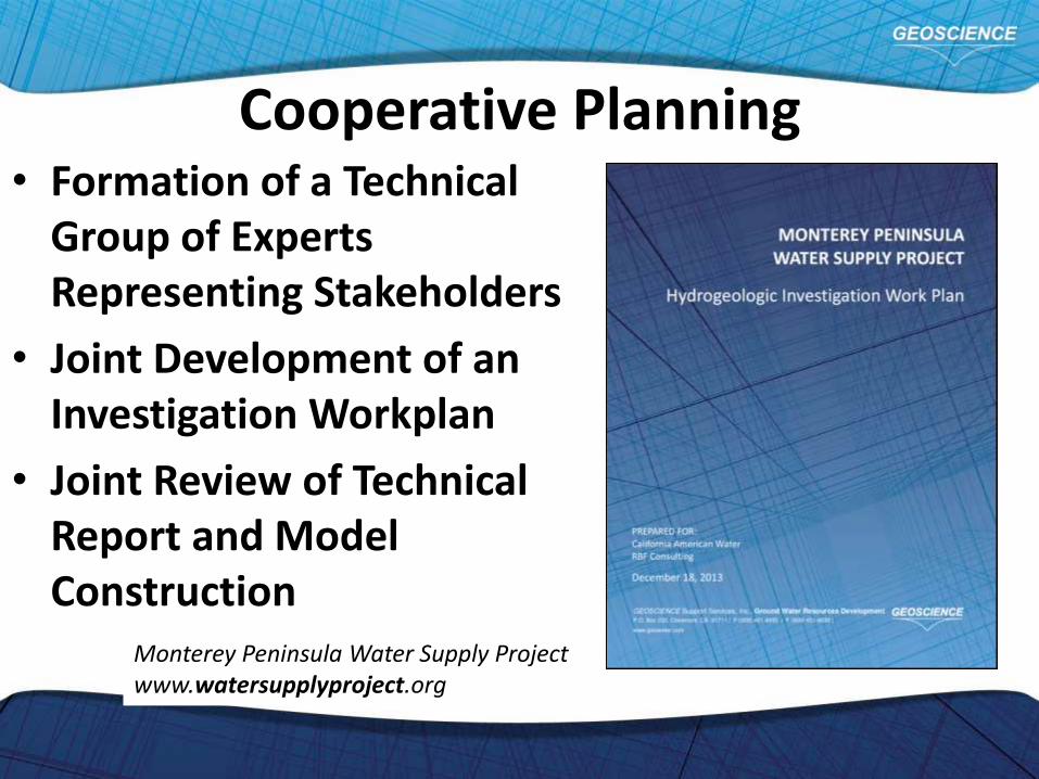
Cooperative Planning• Formation of a Technical
Group of Experts Representing Stakeholders
• Joint Development of an Investigation Workplan
• Joint Review of Technical Report and Model Construction
Monterey Peninsula Water Supply Projectwww.watersupplyproject.org
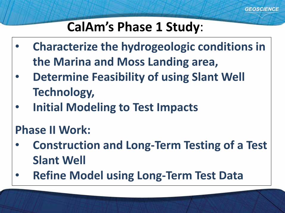
• Characterize the hydrogeologic conditions in the Marina and Moss Landing area,
• Determine Feasibility of using Slant Well Technology,
• Initial Modeling to Test Impacts
Phase II Work:• Construction and Long-Term Testing of a Test
Slant Well• Refine Model using Long-Term Test Data
CalAm’s Phase 1 Study:
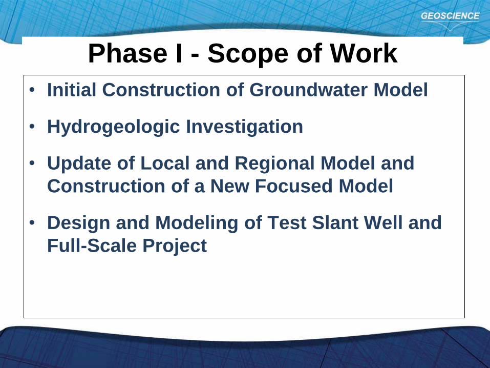
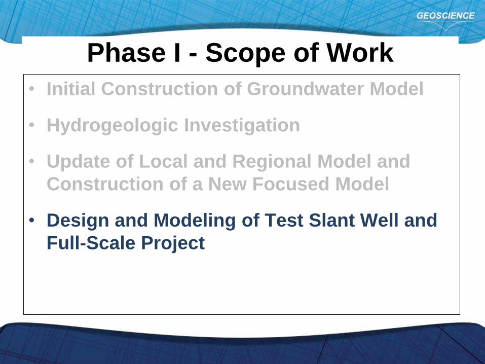
Phase I - Scope of Work
• Initial Construction of Groundwater Model
• Hydrogeologic Investigation
• Update of Local and Regional Model and
Construction of a New Focused Model
• Design and Modeling of Test Slant Well and
Full-Scale Project
Phase I - Scope of Work
• Initial Construction of Groundwater Model
• Hydrogeologic Investigation
• Update of Local and Regional Model and
Construction of a New Focused Model
• Design and Modeling of Test Slant Well and
Full-Scale Project
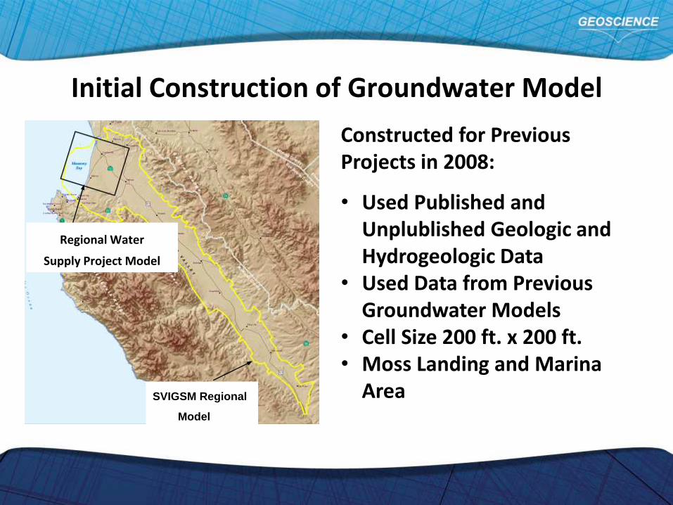
Initial Construction of Groundwater Model
SVIGSM Regional
Model
Regional Water
Supply Project Model
Constructed for Previous Projects in 2008:
• Used Published and Unplublished Geologic and Hydrogeologic Data
• Used Data from Previous Groundwater Models
• Cell Size 200 ft. x 200 ft.• Moss Landing and Marina
Area
Phase I - Scope of Work
• Initial Construction of Groundwater Model
• Hydrogeologic Investigation
• Update of Local and Regional Model and
Construction of a New Focused Model
• Design and Modeling of Test Slant Well and
Full-Scale Project

Hydrogeologic Investigation
• Collection of Site Specific Geologic and Hydrogeologic Data
• Confirm or Modify Existing Hydrologic Conceptual Model
• Provide data to Refine and Update Groundwater Model
• Use Refined and Updated Model to Evaluate Project Impacts

• Field Work conducted between September 2013 to April 2014
• 13 – Sonic Boreholes 200 to 347 feet in Depth with Continuous Soil Cores
• Geophysical Logging of all Boreholes
Hydrologic Investigation Data Collection
Sonic Core
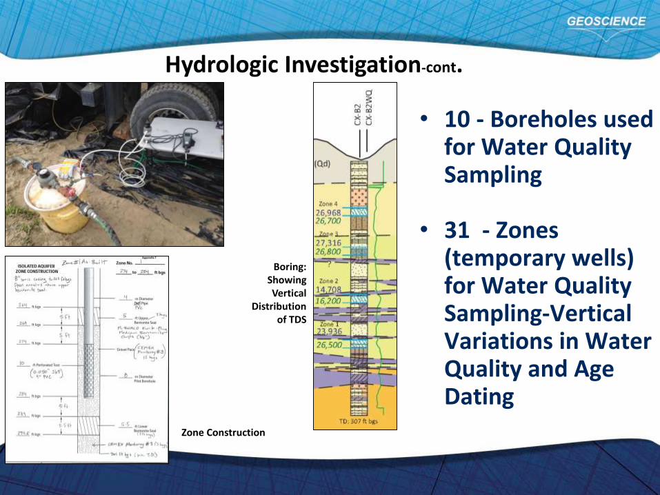
• 10 - Boreholes used for Water Quality Sampling
• 31 - Zones (temporary wells) for Water Quality Sampling-Vertical Variations in Water Quality and Age Dating
Boring: Showing Vertical
Distribution of TDS
Zone Construction
Hydrologic Investigation-cont.
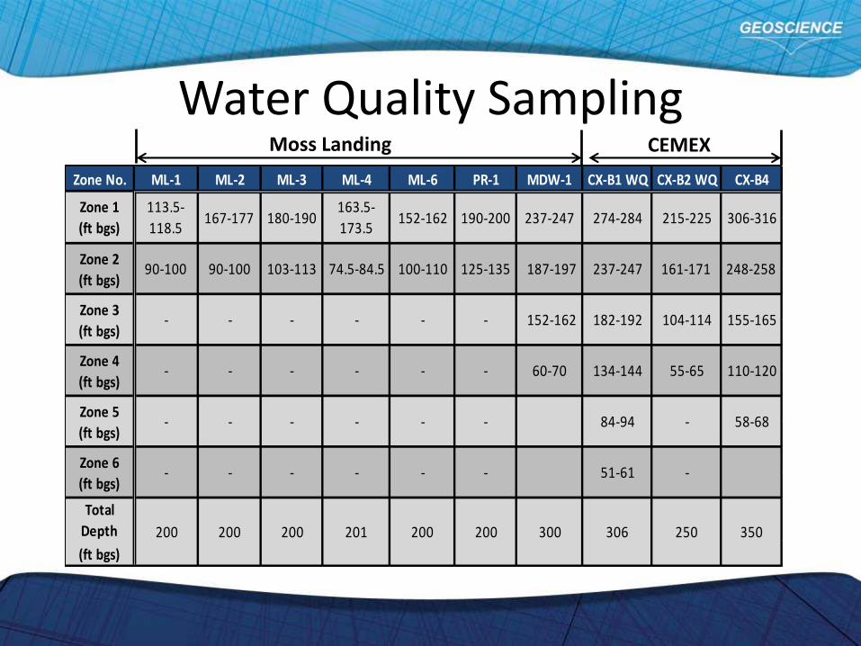
Water Quality Sampling
Zone No. ML-1 ML-2 ML-3 ML-4 ML-6 PR-1 MDW-1 CX-B1 WQ CX-B2 WQ CX-B4
Total
Depth
(ft bgs)
350
237-247
187-197
152-162
60-70
300
306-316
248-258
155-165
110-120
58-68
51-61 -
200 200 200 201 200 200 306 250
- 84-94 -
Zone 6
(ft bgs)- - - - - -
Zone 5
(ft bgs)- - - - -
104-114
Zone 4
(ft bgs)- - - - - - 134-144 55-65
237-247 161-171
Zone 3
(ft bgs)- - - - - - 182-192
190-200 274-284 215-225
Zone 2
(ft bgs)90-100 90-100 103-113 74.5-84.5 100-110 125-135
Zone 1
(ft bgs)
113.5-
118.5167-177 180-190
163.5-
173.5152-162
Moss Landing CEMEX

78 - Mechanical Grading Analysis for Initial Evaluation of Hydraulic Conductivity (K)
Mechanical Grading Plot
Estimated Hydraulic Conductivities
Hydrologic Investigation-cont.
Krumbein-Monk
Kozeny-Carman
Hazen Approximation

Age Dating using Tritium and Hydrogen/Oxygen Isotope Analysis
Hydrologic Investigation-cont.
Hydrogen/Oxygen Isotope plot to left show Groundwater at CEMEX is Intruded Seawater
Tritium Results above: Upper Aquifers show Recharge with more Recent Water
Phase I - Scope of Work
• Initial Construction of Groundwater Model
• Hydrogeologic Investigation
• Update of Local and Regional Model and
Construction of a New Focused Model
• Design and Modeling of Test Slant Well and
Full-Scale Project
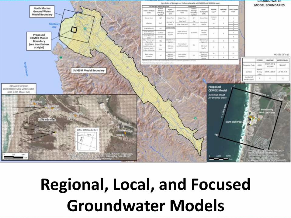
Regional, Local, and Focused Groundwater Models
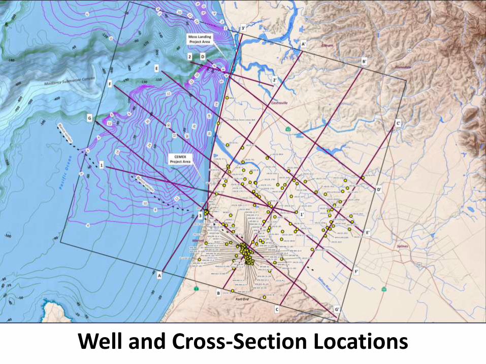
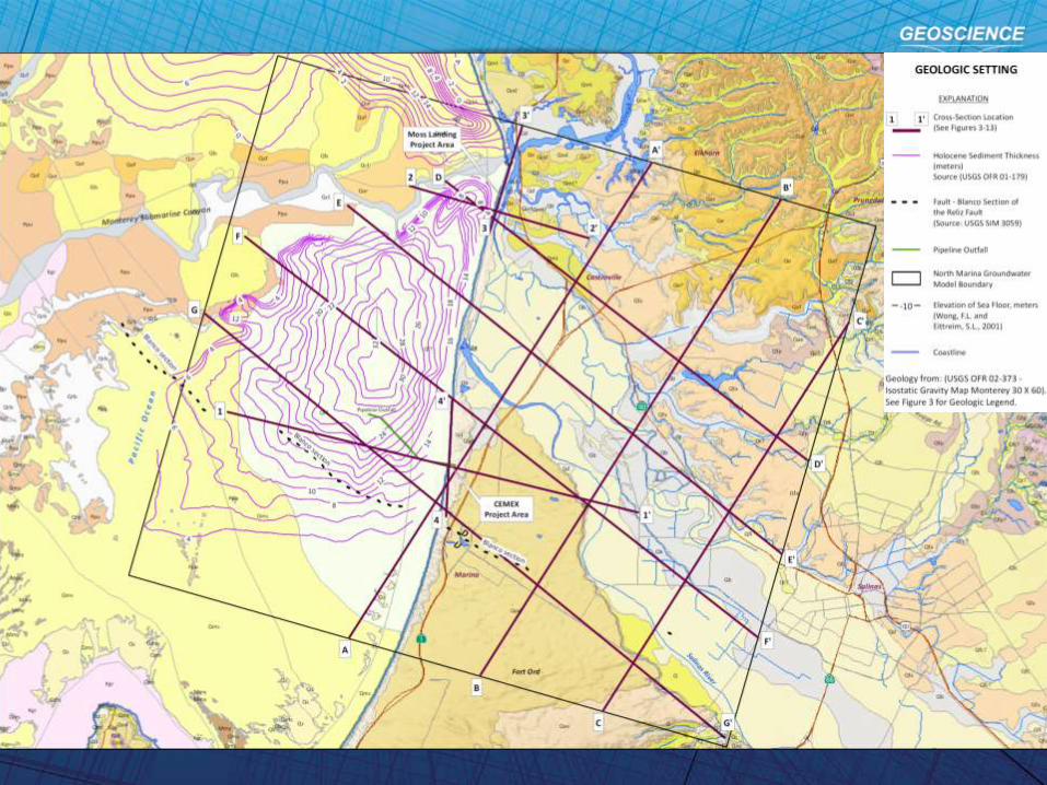
Well and Cross-Section Locations
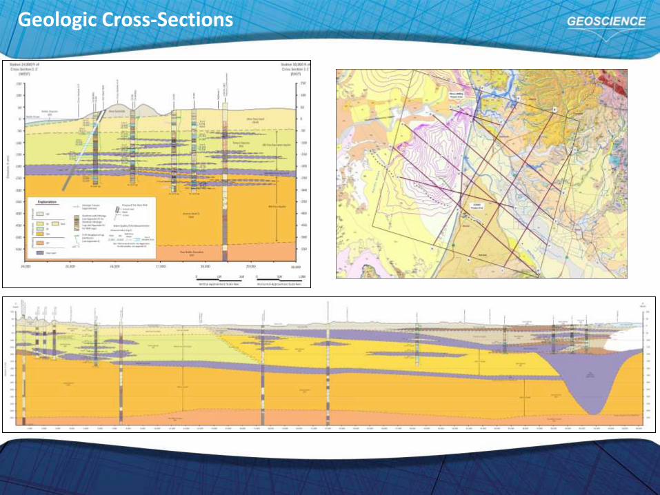
Geologic Cross-Sections
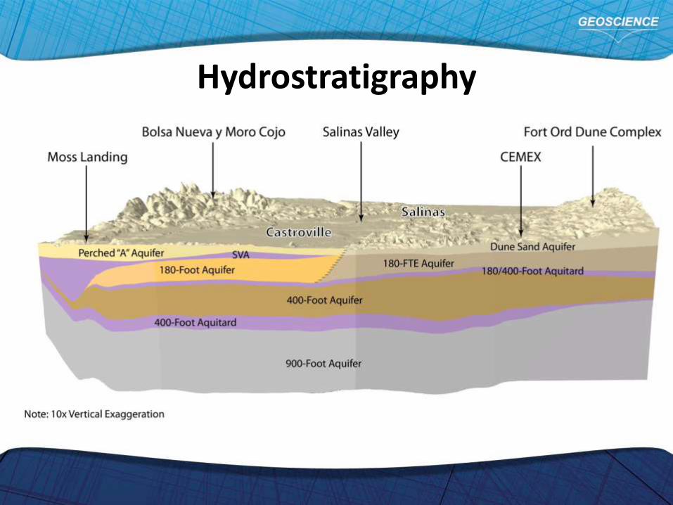
Hydrostratigraphy
Phase I - Scope of Work
• Initial Construction of Groundwater Model
• Hydrogeologic Investigation
• Update of Local and Regional Model and
Construction of a New Focused Model
• Design and Modeling of Test Slant Well and
Full-Scale Project
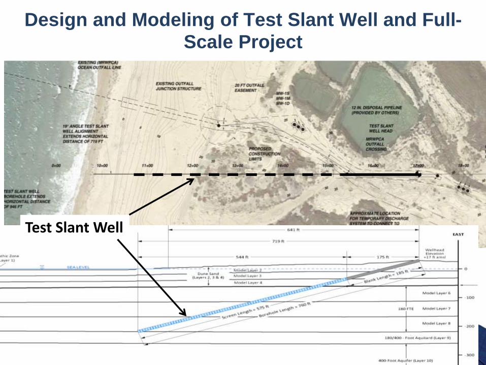
Design and Modeling of Test Slant Well and Full-Scale Project
Test Slant WellTest Slant Well

Design and Modeling of Test Slant Well and Full-Scale Project
Full-Scale System
Modeling Results are Progress to Complete In October
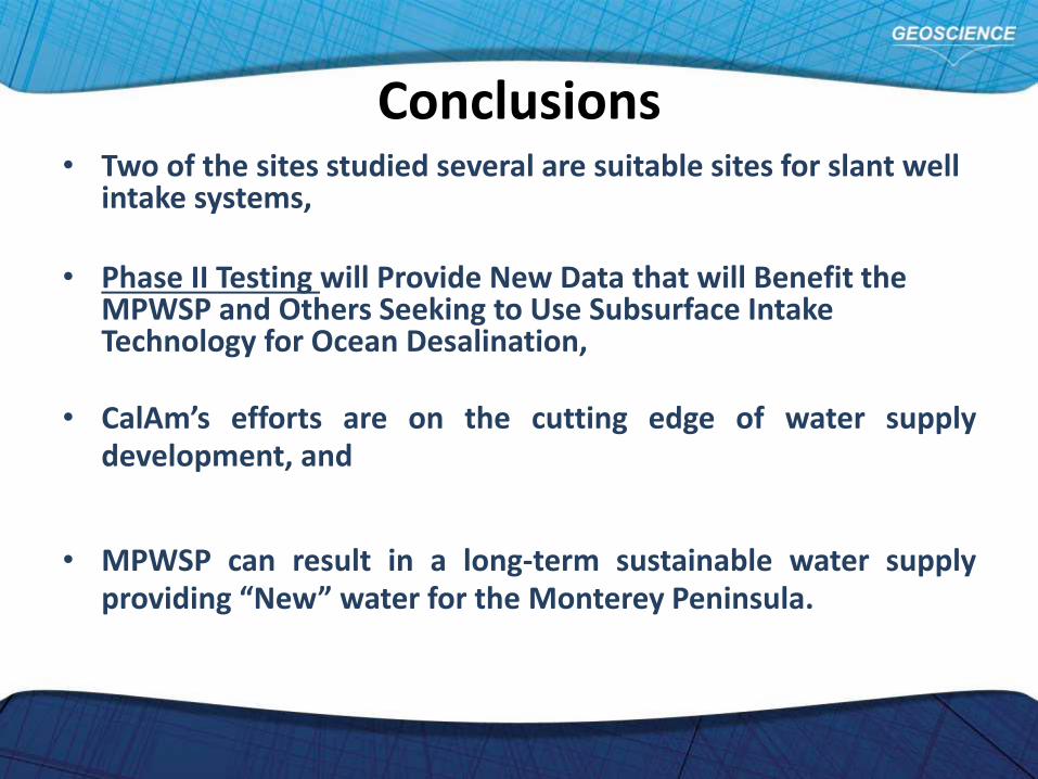
Conclusions• Two of the sites studied several are suitable sites for slant well
intake systems,
• Phase II Testing will Provide New Data that will Benefit the MPWSP and Others Seeking to Use Subsurface Intake Technology for Ocean Desalination,
• CalAm’s efforts are on the cutting edge of water supplydevelopment, and
• MPWSP can result in a long-term sustainable water supplyproviding “New” water for the Monterey Peninsula.

Questions?