Embed Size (px)
Citation preview

Earth’s Structure

• Earth Science is one of the three main
branches of science.
• Geology, (study of rocks), meteorology,
(study of weather), and vulcanology,
(study of volcanoes), are all types of earth
sciences.
• This unit will cover some of the basics of
many branches of earth science.

What does the Earth look like
inside?

What does the Earth look like
inside?
• No one can say with
100% accuracy what
the Earth looks like
under the crust, but
we can make a few
good guesses.
• Scientists use the vibrations
from earthquakes to predict
earth’s structure because
vibrations travel differently
through solids and liquids.

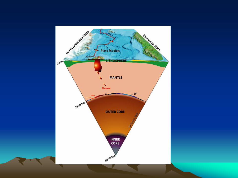
• The earth is
divided into
four main
layers: the
inner core,
outer core,
mantle, and
crust.

Inner Core Facts: • Composed mostly
of iron (Fe) with a
small amount of
nickel (Ni).
• It is about 750-800
miles thick.
• Its temperature is
estimated to be
between 3000 and
10,000 degrees F!!

More inner core facts • Even though the
core is liquid,
extreme pressure
squeezes it so
much that it can't
move around and
acts like a solid.

Outer Core Facts: • The inner core intense
heat forces the outer core to melt into a liquid.
• Composed primarily of Iron, nickel, sulfur, and oxygen.
• It is believed to be between 1400 and 1500 miles thick.
• Temperature is about 7200 - 9000 ºF

The Mantle: Facts • Most of the Earth's
mass is in the mantle.
• It is composed of iron
(Fe), magnesium (Mg),
aluminum (Al), silicon
(Si)/ oxygen (O)
compounds.
• The temperature range
from 2500 – 5400 0 F.

More Mantle
Facts • The mantle is somewhere between a solid and a liquid phase – usually called “plastic”
• Because of this, heat can travel from the lower mantle to the upper mantle by slowly moving convection currents.
• These currents are responsible for the movement of the crust.

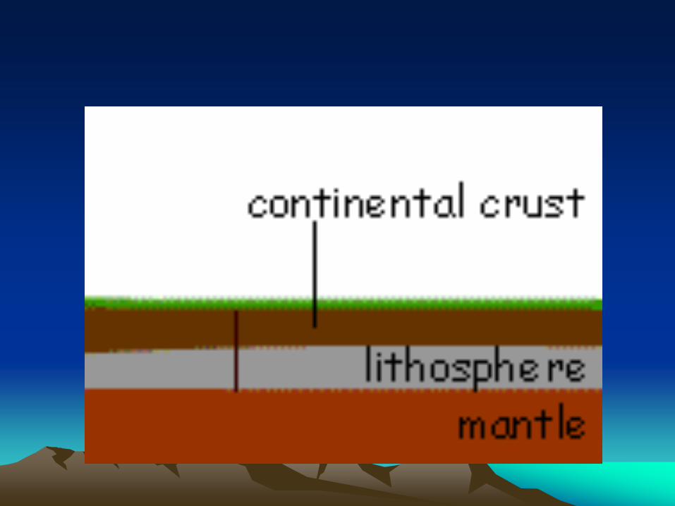
The Crust: Facts • The crust is much thinner than any of the other layers.
• The crust can be broken into two parts: continental crust made up of mostly granite and oceanic crust made of basalt.
• The most common mineral in both is quartz SiO2, Minerals containing Al, Ca, K, Na, (such as the Feldspars) are very common.
• Being relatively cold, the crust is rocky and brittle, so it can fracture in earthquakes.
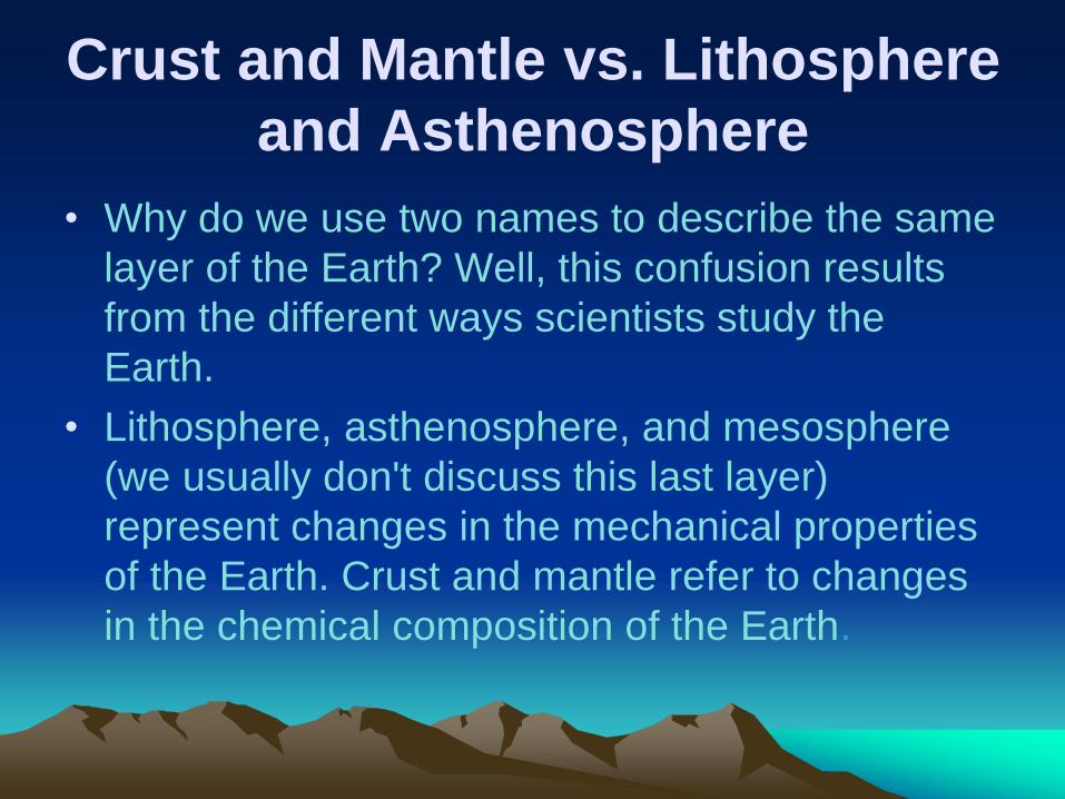
Crust and Mantle vs. Lithosphere
and Asthenosphere
• Why do we use two names to describe the same
layer of the Earth? Well, this confusion results
from the different ways scientists study the
Earth.
• Lithosphere, asthenosphere, and mesosphere
(we usually don't discuss this last layer)
represent changes in the mechanical properties
of the Earth. Crust and mantle refer to changes
in the chemical composition of the Earth.

What we need to know:
• The lithosphere lower portion of the crust
which is broken up into the continental and
oceanic plates.
• The asthenosphere is the upper portion of
the mantle that is weak and easily
deformed. The convection currents here
cause the plates to move.


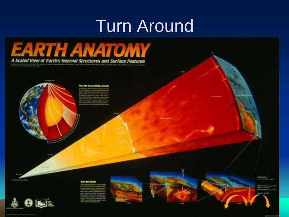
Turn Around

The ground is Moving!!
• In the 1960s geologists began to uncover
proof that the continents travel, or drift,
around Earth.
• If you take a good look at a World map,
you can see that the continents "fit into"
one another.
• Today, scientists know that continents are
moving a few centimeters every year.

• Earth has many geologic mysteries that
befuddled scientists.
• One example is the fact the rocks of the exact
same chemical makeup are found on different
continents.
• Another is that there are fossils of fish at the
top of Mt. Everest….and fish rarely climb
mountains.
• Most geologists came up with many ideas as
to why things like these occurred…some
unusual and some crazy.
Almost there!!

History of Plate
Tectonics • The theory was first advanced
by Alfred Wegener.
• It said that Earth's continents
were originally one land mass.
Pieces of the land mass split off
into separate ‘plates’ and
migrated to form the continents.
• This theory is known as the
Continental Drift Theory.

What are plates? • As we said, the crust is
made up of a thin layer
of solid rock.
• This rock is cracked like
a broken egg shell. Each
broken shell is called a
plate.
• There are 13 major
plates and some smaller
ones.

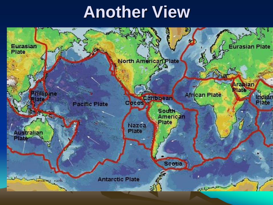
Another View
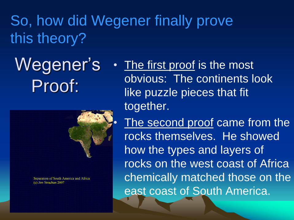
Wegener’s
Proof:
• The first proof is the most
obvious: The continents look
like puzzle pieces that fit
together.
• The second proof came from the
rocks themselves. He showed
how the types and layers of
rocks on the west coast of Africa
chemically matched those on the
east coast of South America.
So, how did Wegener finally prove
this theory?

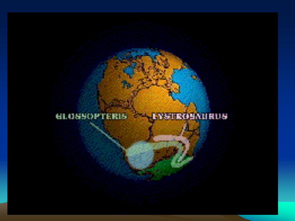
• In addition to the second proof, the chemical composition of coal beds in Europe and North America also matched.
• A third proof was that fossils of the extinct reptile mesosaurus were found on both South America and Africa. A similar fossil connection exists between Africa and Australia.


• A fourth proof also involved fossils – of plants. A fossilized plant is found on South America, Australia, Africa, India, and Antarctica. This indicates that these areas were connected and all had a similar climate.
• Although these arguments are convincing, Wegener lacked a way for moving the continents. This theory was not proved until the discovery of the mid-Atlantic ridge in the 1950’s.

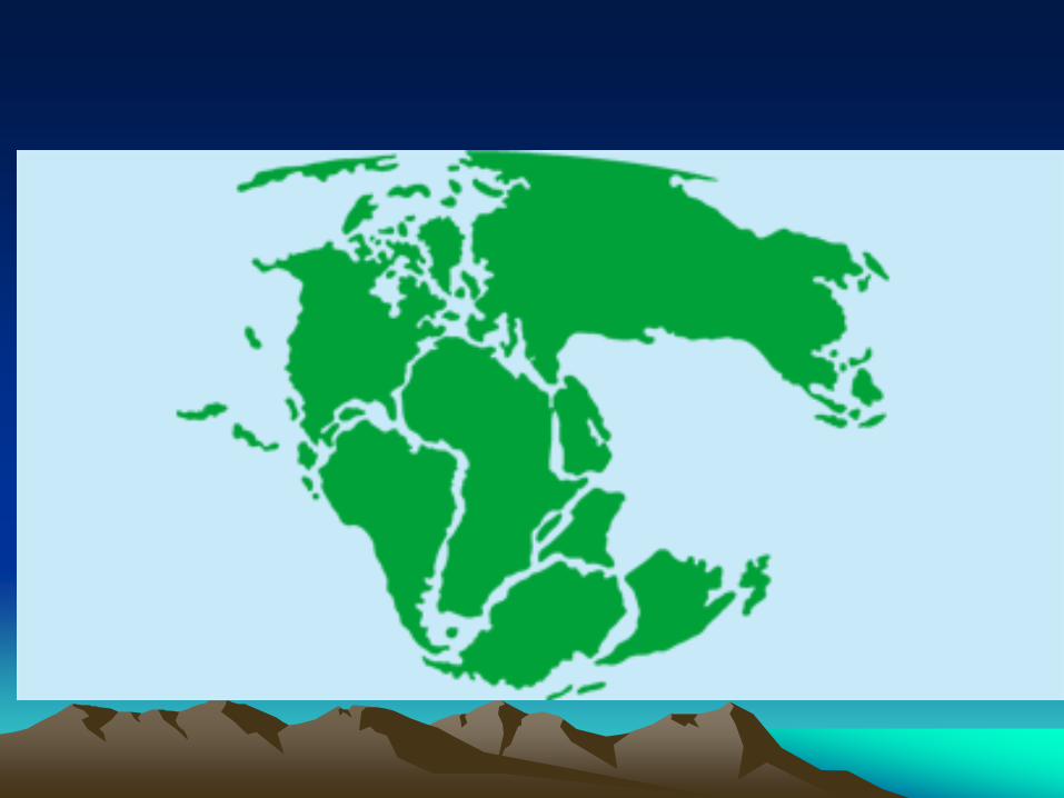
Let’s reverse time for a minute:
• The next slide begins with view of Earth
with continents in their present positions,
2) continents move back in time to reunite
as Pangaea, 3) Pangaea label appears, 4)
Locations of stratigraphic and fossil
evidence that Wegener used to argue in
favor of continental drift is added.


Moving forward….
• Let’s move forward again with this rock
evidence highlighted now.

• The
birth of
North
America

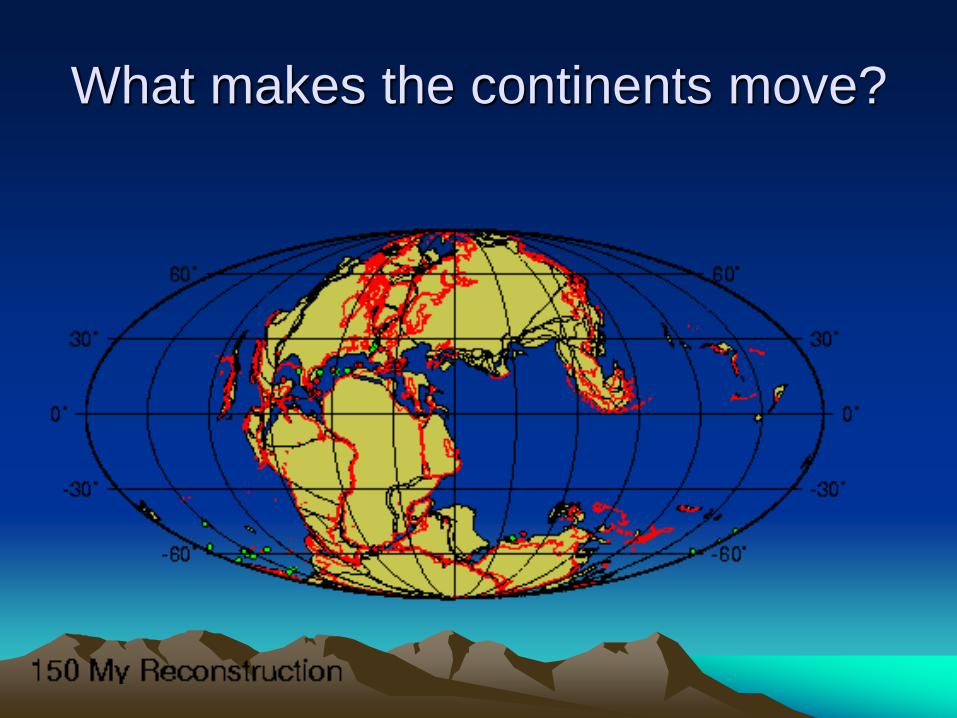
What makes the continents move?
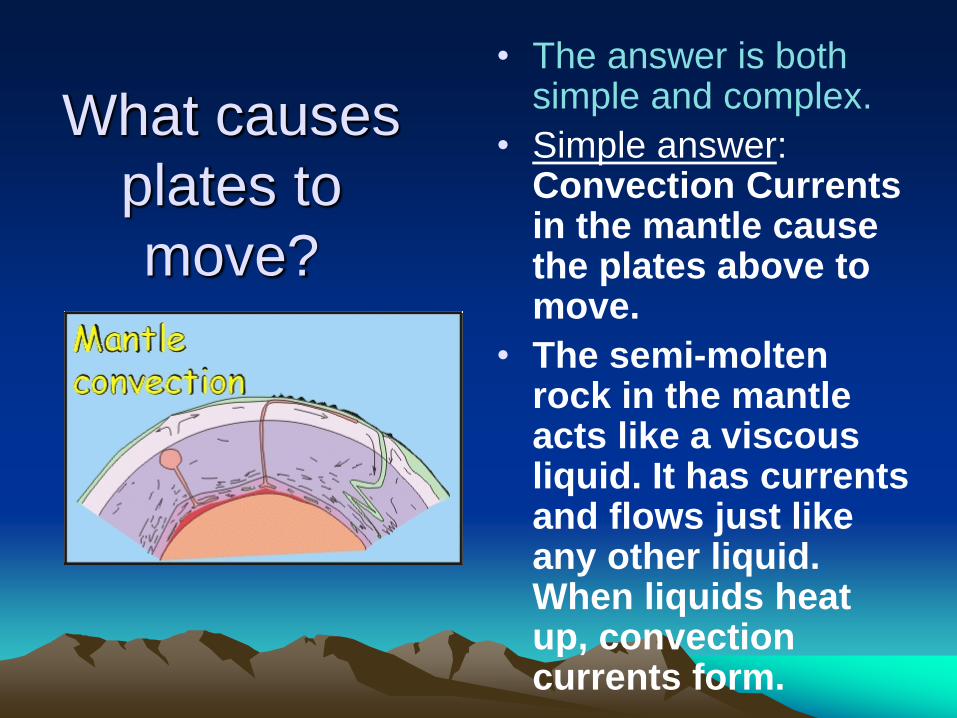
What causes
plates to
move?
• The answer is both simple and complex.
• Simple answer: Convection Currents in the mantle cause the plates above to move.
• The semi-molten rock in the mantle acts like a viscous liquid. It has currents and flows just like any other liquid. When liquids heat up, convection currents form.

• As the magma is heated by the core it rises. This forces the cooler rock at the top to sink. (Convection!!)
• The rock moves like the conveyor belt at a Walmart checkout line. This causes the plates on top of the mantle to move just like your purchases move toward the cashier.

• The plates on top of these currents
being moved along in the direction of
the current.
•
What causes plates to move?


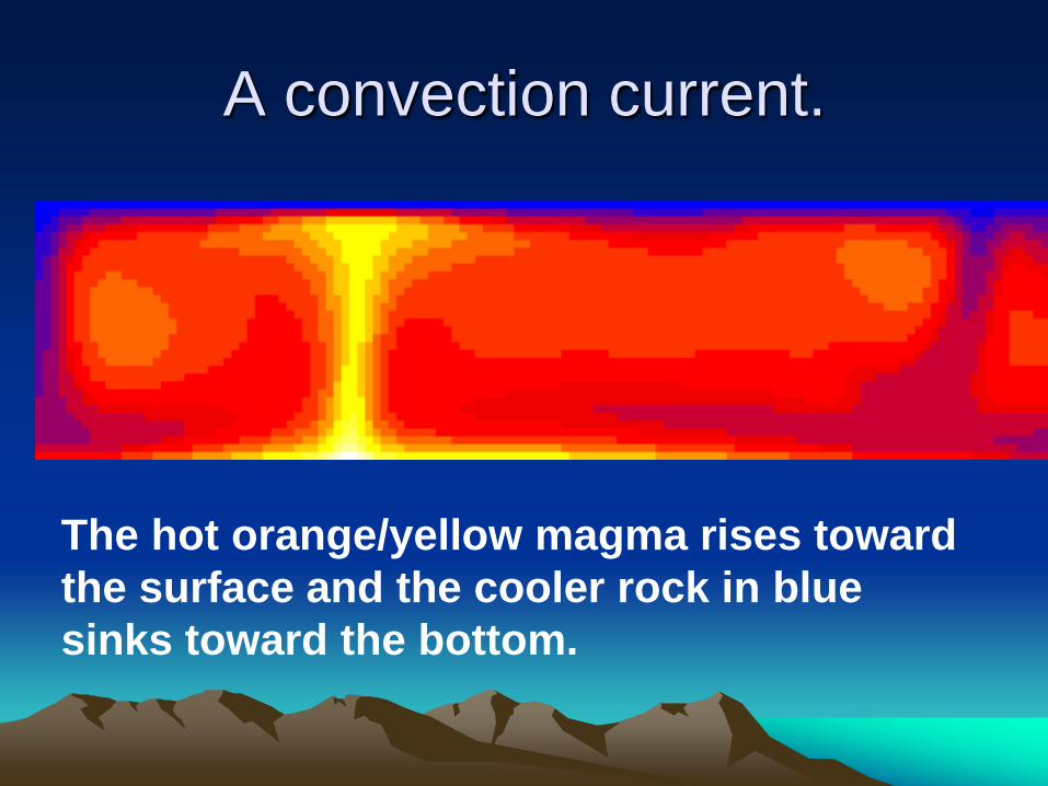
A convection current.
The hot orange/yellow magma rises toward
the surface and the cooler rock in blue
sinks toward the bottom.

Convection currents
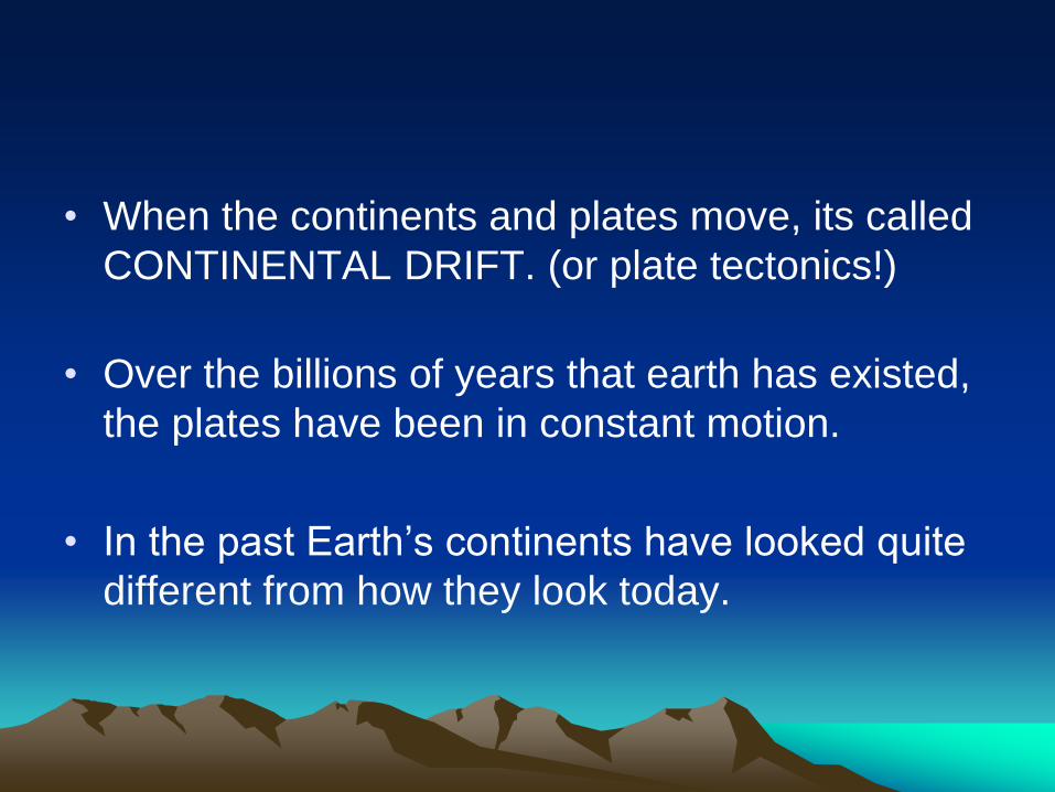
• When the continents and plates move, its called
CONTINENTAL DRIFT. (or plate tectonics!)
• Over the billions of years that earth has existed,
the plates have been in constant motion.
• In the past Earth’s continents have looked quite
different from how they look today.

Watch the position of Southern California
from 550 million years ago to the present.
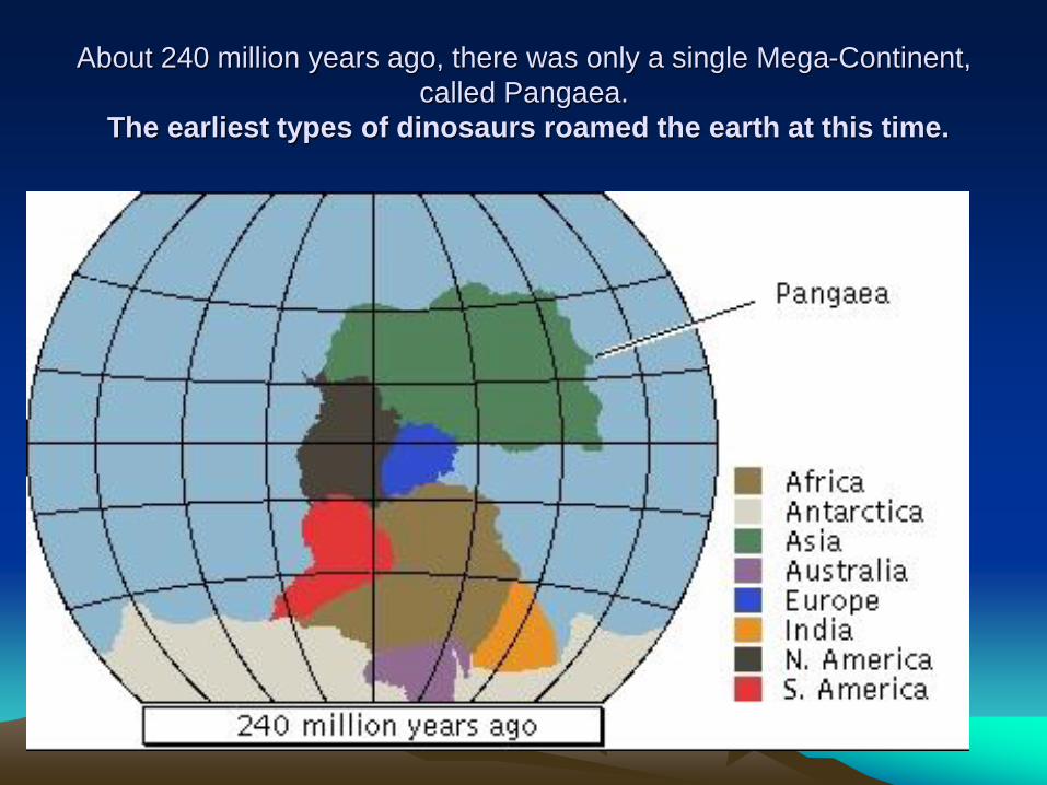
About 240 million years ago, there was only a single Mega-Continent,
called Pangaea.
The earliest types of dinosaurs roamed the earth at this time.
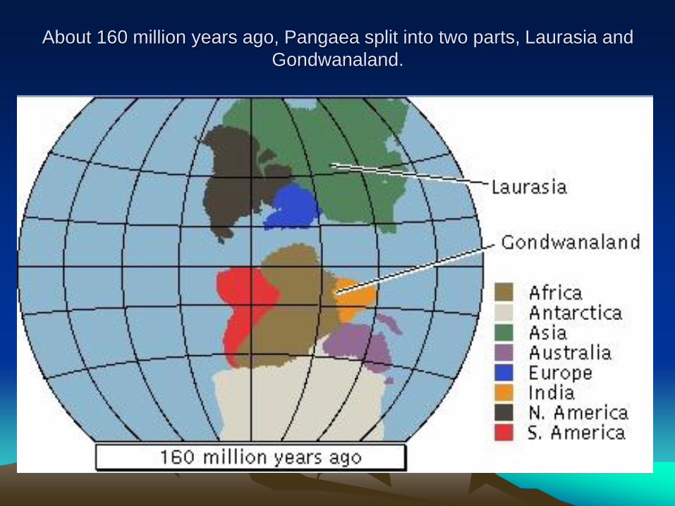
About 160 million years ago, Pangaea split into two parts, Laurasia and
Gondwanaland.

About 140 million years ago, India separated from Gondwanaland and
stated moving northwards.

As we see today, all the continents fit into each other. They have
achieved this state after millions of years of movement.
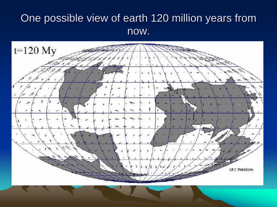
One possible view of earth 120 million years from
now.
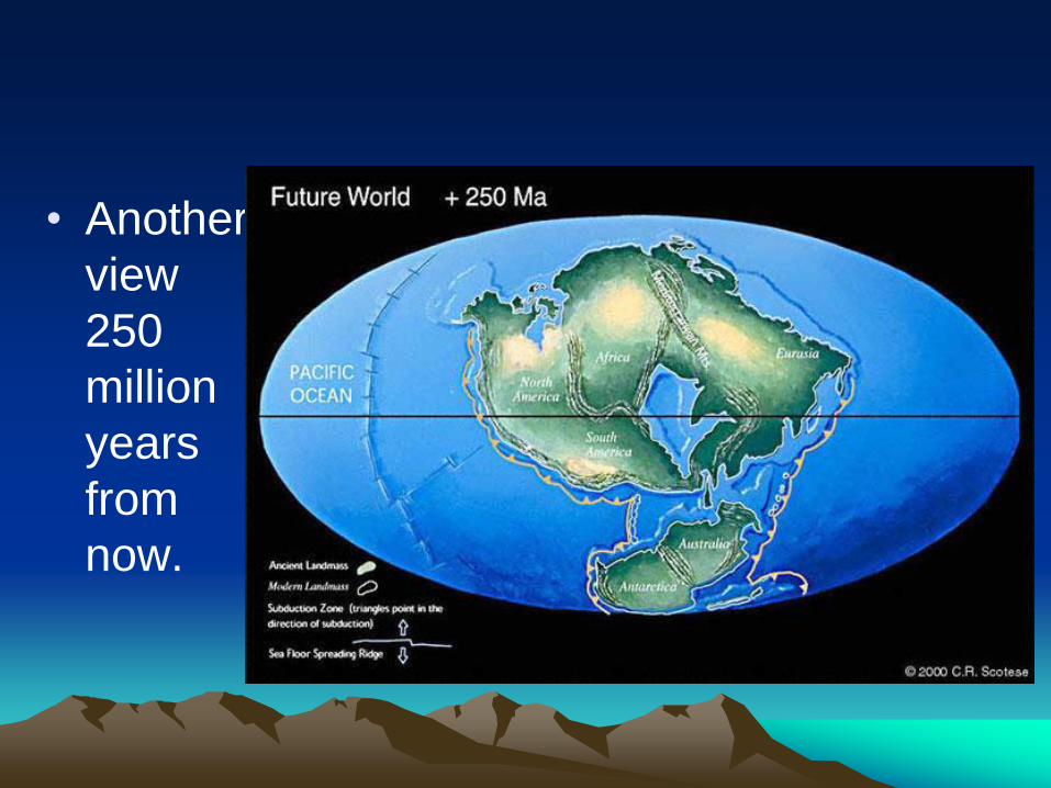
• Another
view
250
million
years
from
now.

Earth at the time that the dinosaurs died
65 million years ago.
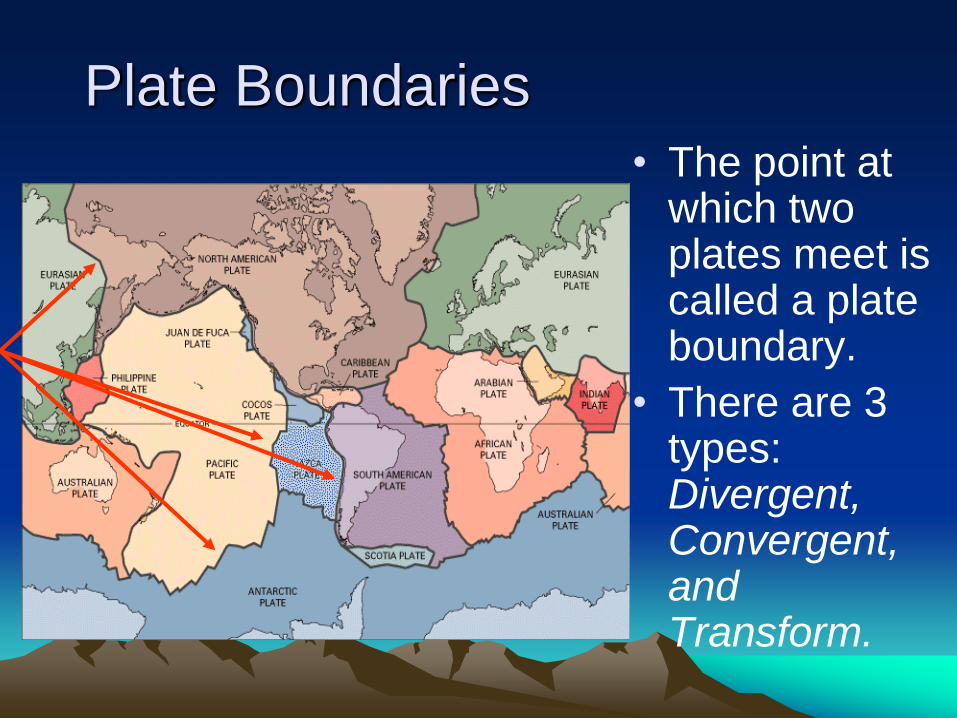
Plate Boundaries
• The point at which two plates meet is called a plate boundary.
• There are 3 types: Divergent, Convergent, and Transform.


Divergent boundaries:
• Divergent boundaries form where two plates are spreading apart from each other.
• When the plates move apart, they leave a space between them. This space becomes filled with magma that rises up from the mantle.
• The mid-ocean ridges are areas in which this sea floor spreading takes place.

A divergent boundary

For more on the Mid-oceanic ridge, see
the ‘volcanoes’ portion of this presentation

The Mid-Atlantic Ridge
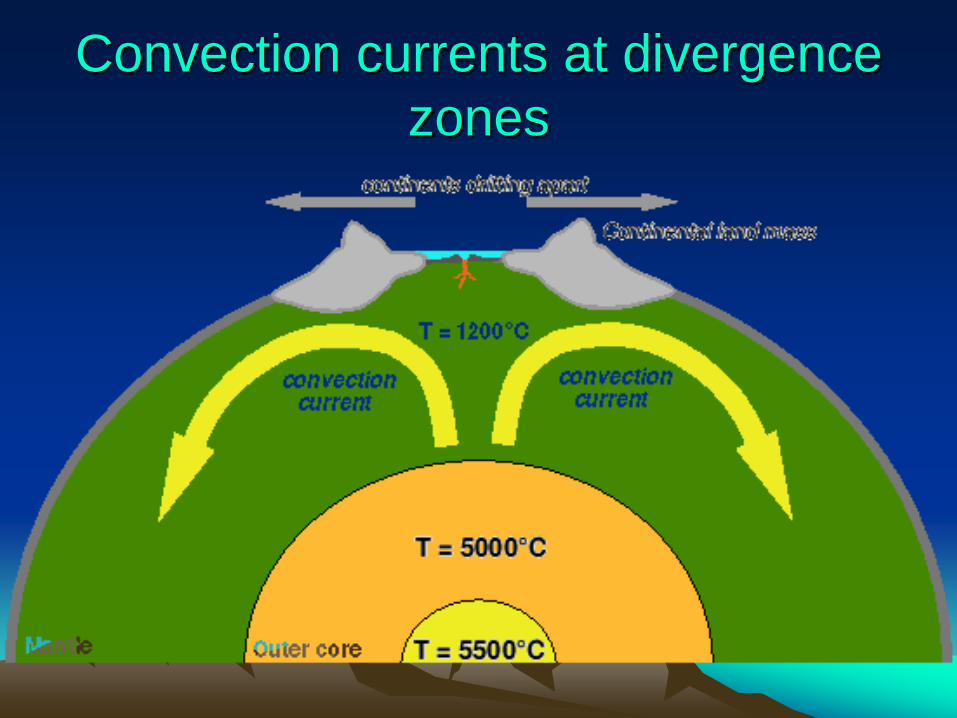
Convection currents at divergence
zones

• Bridge between continents in Reykjanes peninsula, southwest Iceland across the Alfagja rift valley, the boundary of the Eurasian and North American continental tectonic plates.

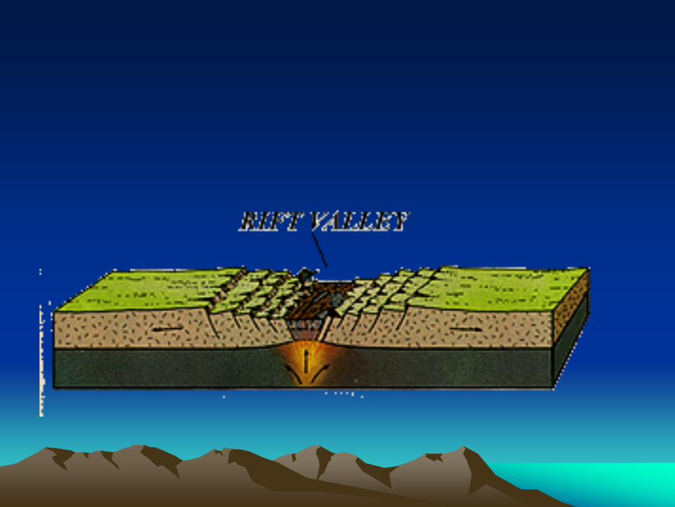
Landforms associated with
Divergent Zones • Rift
Valleys
• Mid
Atlantic
Ridge
Convergent boundaries
• When two plates push into each
other the place where they meet
is called a convergent
boundary.
• Convergent Boundaries are
broken into three types: Oceanic-Continental,
Oceanic-Oceanic,
Continental-Continental.
Convergent #1 Oceanic-Continental &
Oceanic-Oceanic
• When an oceanic plate meets another oceanic
plate or it meets a continental plate, a
subduction zone is formed. Subduction is when
the denser plate, (oceanic plate), gets forced
underneath the less dense plate, (continental
plate).
• The friction caused by the plates moving past
each other causes the rock to melt into magma.
This causes volcanoes to form.

A subduction zone


Landforms found at Subduction Zones #1
Deep Underwater Trenches
• When two oceanic plates meet,
a trench forms where the thicker
plate plunges beneath the
thinner one.
• The great pressure at the
colliding plates causes
earthquakes. These open up
cracks to the hot, molten magma
so it can push through making
volcanoes.

Landforms found at Subduction Zones (2):
Volcanic Island Arcs.
• These volcanoes surround the
Pacific ocean and are known as
the Ring of Fire.
• Examples: the Aleutians in Alaska,
the Kuriles, Japan, and the
Philippines.

• Japan is formed by volcanoes marking the
junction of three plates.

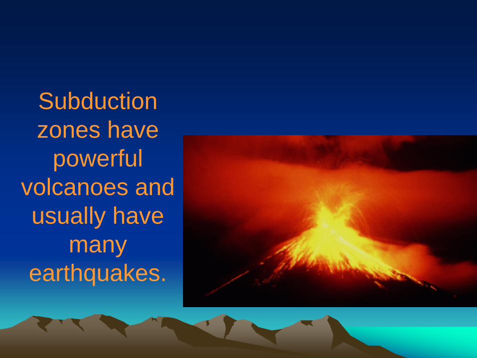
Subduction
zones have
powerful
volcanoes and
usually have
many
earthquakes.

Convergence # 2
Continental Collisions • When two continental plates
converge, they buckle and thicken and usually move upwards.
• Think of two cars in a head-on collision. When they hit, both fronts of the cars are usually crushed upwards.
• When continental plates collide, mountains are made!


The Appalachian Mountains were formed when
Europe collided with the N. American plate.
Mt. Washington, NH.
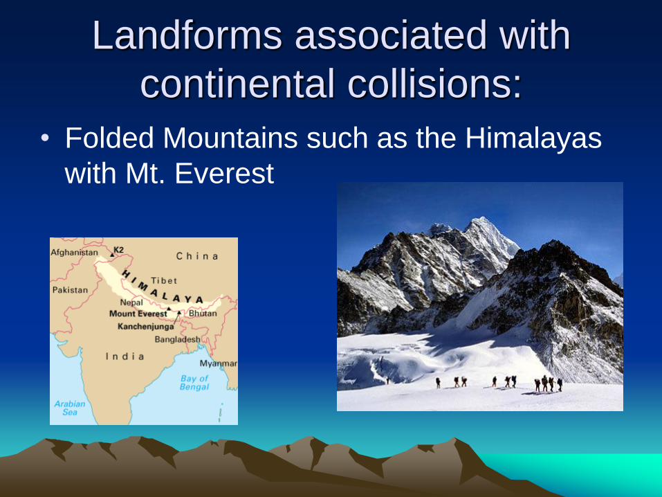
Landforms associated with
continental collisions:
• Folded Mountains such as the Himalayas
with Mt. Everest
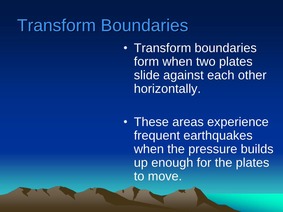
Transform Boundaries
• Transform boundaries form when two plates slide against each other horizontally.
• These areas experience frequent earthquakes when the pressure builds up enough for the plates to move.
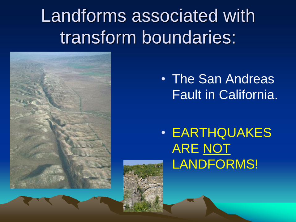
Landforms associated with
transform boundaries:
• The San Andreas
Fault in California.
• EARTHQUAKES
ARE NOT
LANDFORMS!
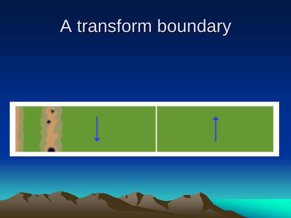
A transform boundary

The San Andreas Fault

These fences
used to be
connected.
They were built
across a fault
line.
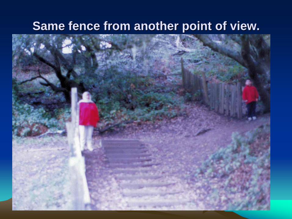
Same fence from another point of view.

This road
was built
across a
fault line.
Oops!

A speed bump broken by moving
plates.

Sometimes, the plates move up or down as
they slide past each other.

Mountains made by stretching or
compressing • As a plate is streched due to the movement of divergent and
convergent zones, cracks or faults appear in the surface rock.
• Normal faults are caused by horizontal tension. Part of the crust is uplifted, and part of it moves downward. This happens at the line where the rock is broken, called the fault plane. In an area where there are many faults, mountain ranges can form. These mountains are called fault-block mountains. Fault-block mountains often occur where plates are moving apart. The movement causes the rocks to be stretched. Temperatures are low and the rocks are brittle. Instead of folding, they break into large blocks.

• Tilted blocks are common in the Basin and Range region of the western United States. Level blocks lead to the horst and graben terrain seen in northern Europe. Fault block mountains commonly accompany rifting and are indicators of tensional tectonic forces.
• Block Mountains can also be referred to as a horst. It is a steep-sided mountain, formed where a block of the earth's crust has been squeezed upward between two parallel fault lines. Two types of block mountains are lifted and tilted. Lifted type block mountains have two steep sides exposing both sides scarps. Tilted type block mountains have one gently sloping side and one steep side with an exposed scarp.
• Two examples of fault block mountains that are forming today are the Andes and Sierra Nevada mountain ranges.

Mountains made by stretching or
compressing
• As the plate is stretched, it cracks allowing
portions to slide downward.

A fault visible in the rock


Mixed Boundaries
• Mixed Boundaries
• Mixed plate boundaries tend to occur
where the margins and relative motions of
the two plates involved fail to align neatly.
• In California, the Pacific-North American
boundary is mixed.


Summary of what you need to
know:
• Earth Structure: – 4 parts: Inner core, Outer Core, Mantle, Crust
• Know facts about each layer
• Plate Tectonics: – Wegener and his evidence.
– Convection currents in the mantle are the driving force.
• Plate Boundaries: – 3 boundaries: Convergent, Divergent, Transform
– Facts about each and landforms associated with them.


![[PPT]1. Atomic Structure - Mr. Slater's Science Class - Homemrslaterscience.weebly.com/.../1._atomic_foldable.ppt · Web viewTitle 1. Atomic Structure Subject GCSE Additional Science](https://img.pdfslide.us/doc/110x75/5ae074317f8b9a8f298e3679/ppt1-atomic-structure-mr-slaters-science-class-viewtitle-1-atomic-structure.jpg)