Embed Size (px)
Citation preview
Journal of Resources Development and Management www.iiste.org
ISSN 2422-8397 An International Peer-reviewed Journal
Vol.44, 2018
67
Stream Ordering As a Tool For Effective River Basin
Development: Examples From Komadugu –Yobe River Basin,
Nigeria
Bukar Abba Gana1*, Adamu Isa Harir 2, Audu Gani Bogoro2 and Rasheed O. Oladosu2
1Department of Environmental Management Technology, Faculty of Environmental Technology, Abubakar TafawaBalewa University, Bauchi, Nigeria.
2Department of Urban and Regional Planning, Faculty of Environmental Technology, Abubakar TafawaBalewa University, Bauchi, Nigeria.
* [email protected] – Corresponding Author
ABSTRACT
This study assessed the existing structure/delineation of the areas of coverage of the River Basin Development Authorities (RBDAs) in Nigeria using RBDAs sharing the largest inland drainage system, Komadugu – Yobe River System, covering Hadeja Jama’are River Basin Development Authority and Chad Basin Development Authority. The main aim is to identify structural defects if any, and show the resulting operational challenges
that the defects posed to development of the Komadu – Yobe Basin area. Stream Ordering method was used as a theoretical framework to assess the delineation of the areas of jurisdiction of the RBDAs. Data was obtained from downloaded satellite images of the Basin Areas, using ArcGIS version 10.0 and Erdas Imagine 9.2 software, as well as information from topographic and hydrological maps of the study area. The analyses showed
that the delineation of the RBDAs in Nigeria was neither based on the hydrological regions of the country nor on the basis of the principles of stream ordering for integrated development in River Basin Areas. Secondary data were also used to gather information on the impact of RBDAs operations on the River Basin Areas. The results further revealed many operational challenges such as poor coordination in water resource utilization, water loss,
loss in production, loss of local dry season shadoof farming opportunities and worsening conditions of living of farmers at project sites and fishermen in downstream areas. It is established that application of stream ordering in a nested hierarchy of sizes as demonstrated on the Komadugu – Yobe river system covering the basin areas of rivers Hadeija, Chalawa and jama’are serves as guide for overcoming the structural/operational challenges and
improve the RBDAs performance in realizing their set objectives. It is recommended that the existing 12 RBDAs structure be collapsed into the 8 Hydrological Zones in the country, and project implementation takes into account the principles of stream ordering for effective performance. Key Words: River Basin, River Basin Development, Stream Ordering, River Komadugu-Yobe Basin,
operational challenges.
1.0 Introduction
A river basin is the area of land drained by a river and its branches. River Basins are important natural resource base for the provision of water for domestic, agricultural and industrial uses, and invariably facilitate the development of hydropower, inland water transport, large scale irrigation farming, fishing and site attraction. River Basins also provide basis for diversion of water for augmentation action to areas of shortage. However, the growing human population and improvements in production techniques over the years have exerted enormous
pressure on River Basin resources by stepping up the magnitude of their exploitation to the extent that some authors (Molle, 2006; Goes, 2005; Barker and Molle, 2003; Kikuchi et al, 2002; Molden, 2001 b; Keller 2000; Keller et al, 1998; Hayami et al, 1976; and Rostow, 1962), warn on the risk of “Social Scarcity” (meaning scarcity of relevant skills to develop basin resources to cope with the resources demand by the growing
population), which could lead to “physical scarcity” (meaning scarcity of water and drainage basin associated resources) and even “basin closure”, (meaning breakdown of symbiosis in the value chain of the basin system). They express fear with great strength, of water scarcity in basin areas, causing conflicts, and calling for elicited adjustments in the techniques for water supply augmentation and water use efficiency.
Modern approach to River Basin Development was first mooted in the United States of America in 1916, but comprehensive approach started in 1933, when President F.D Roosevelt of the United State of America directed for development of his county’s most devastated basin area, the Tennessee River Basin. The Tennessee valley Authority (TVA) was constituted and assigned the responsibility for development of the river Tennessee basin.
The TVA was given full control over the 64,000Km2 basin area for comprehensive development, (Paterson, J. H., 1975). Prior to the scheme, the militating problems were soil erosion, river siltation, and large scale flooding, which caused damages to lives and property, rendering the region devastated and the population poverty
brought to you by COREView metadata, citation and similar papers at core.ac.uk
provided by International Institute for Science, Technology and Education (IISTE): E-Journals
Journal of Resources Development and Management www.iiste.org
ISSN 2422-8397 An International Peer-reviewed Journal
Vol.44, 2018
68
stricken. To overcome these environmental problems a comprehensive River Basin Development Strategy was considered. The TVA experiment had succeeded in realizing most of its objectives; many industries operate in the Tennessee valley region today, making chemicals, fertilizers, farm machineries, as well as electrical
apparatus utilizing hydro-electricity developed from the many tributaries, as well as the main stream of the Tennessee River. Irrigation schemes have also been established (Paterson, J. H, 1975). The success recorded by the TVA was heralded by a rapid spread of the strategy to other parts of the world. Examples in this regard include the Danube Valley Authority (DVA) in Europe; the Jordan Valley Authority (JVA) in Jordan; the Damodar River Development (DRD) in India; the Rhone River Development (RRD) in France; the Volga Valley Development (VVD) in the USSR; the Haiho River Project (HRP) in China; the Volta River Basin Development in Ghana; the Agusan River Basin Development in the Philippines, etc. Applications have produced varying degrees of success in objective realization.
2.0 Theoretical Framework for River Basin Development
2.1 River Basin
A river basin is the area of land over which snow melt or rain water flows into a particular river. It is the portion of land drained by a river and its tributaries covering the entire land surface drained by many streams that flow
downhill into one another, and eventually into one river, Molle, (2007). The final destination is a lake, a sea or an ocean. A river basin collects all the water falling on the basin area into a central river.
2.1 River Basin Development
River Basin Development is a strategy for integrated development of basin areas. It calls for breakaway from disaggregated water sector investments, to one that is holistic. River Basin Development Strategy appreciates the complex links of physical and socio-economic variables operating within a River Basin resource system, (Charley, 1969; Adeoti, 2010). The strategy envisages promoting integrated investments that are efficient in water supply and sanitation, development of irrigation, hydropower, fishery, flood control and watershed management, and, organised information gathering, planning, monitoring and advisory services to local and
national authorities, rehabilitating degraded land as well as involving communities in capacity building for effective resource monitoring and management, on a River Basin basis, (Molle, 2006). These are achievable through application of Stream ordering technique in basin resource utilization.
2.2 Stream ordering
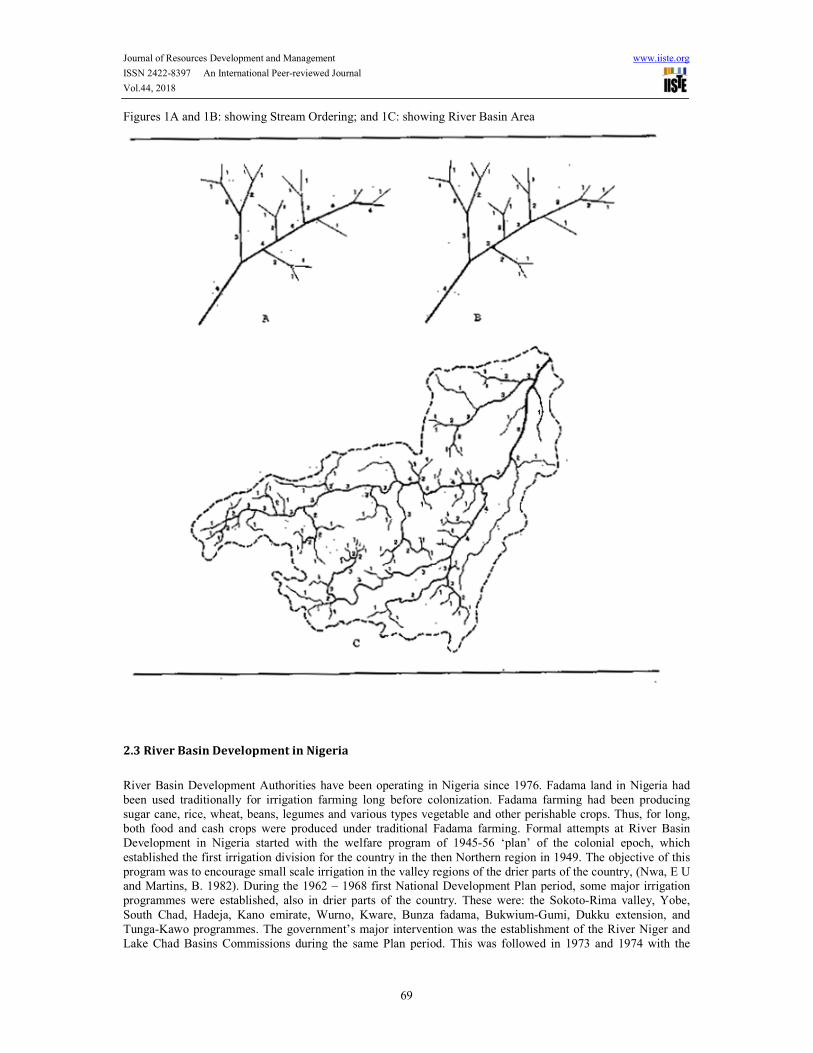
This is a river basin development technique in which each river basin area is viewed as an entity separated topographically from adjacent basins by a ridge, hill or mountain which is known as water-divide or water-shed, as shown in figure 1c. Each drainage area is a system of equilibrium which involves complex links of physical and socio-economic variables (precipitation, slope, lithology, vegetation, population, land use etc) operating within the basin area, (Chorley, 1969. Faniran, 1989; Molle 2006). Any change in the equilibrium status is felt throughout the system in one form or another (Faniran, 1972). Forest clearing for instance in the upper stream will encourage river siltation, flooding and destruction of farmlands, lives and properties in the downstream. Therefore a River Basin is a system which covers not only the river, but also the basin area it drains as well as
the physical and human elements interacting within the entire basin area. Stream Ordering in River Basin Development (see figures 1A, 1B and 1C) involves arranging rivers, and indeed their basin areas, into a nested hierarchy of sizes, covering all tributaries as well as the mainstream, from source to mouth, for effective
coordination of development projects (Adeoti, 2010; Goes, 2005; Faniran, 1984). Projects based on the streams, tributaries or the main river, are carefully coordinated such that the impact of development in the upstream will not adversely affect downstream projects. Where rivers are large, application of stream ordering often prompts technological innovations, adjustments, and interventions both in institutions and in the economy, (Molle, 2006).
It also calls for a central administrative body to coordinate both plans and implementation of the many development projects in the basin areas, (Goes, 2005).
Journal of Resources Development and Management www.iiste.org
ISSN 2422-8397 An International Peer-reviewed Journal
Vol.44, 2018
69
Figures 1A and 1B: showing Stream Ordering; and 1C: showing River Basin Area
2.3 River Basin Development in Nigeria
River Basin Development Authorities have been operating in Nigeria since 1976. Fadama land in Nigeria had been used traditionally for irrigation farming long before colonization. Fadama farming had been producing sugar cane, rice, wheat, beans, legumes and various types vegetable and other perishable crops. Thus, for long, both food and cash crops were produced under traditional Fadama farming. Formal attempts at River Basin Development in Nigeria started with the welfare program of 1945-56 ‘plan’ of the colonial epoch, which
established the first irrigation division for the country in the then Northern region in 1949. The objective of this program was to encourage small scale irrigation in the valley regions of the drier parts of the country, (Nwa, E U and Martins, B. 1982). During the 1962 – 1968 first National Development Plan period, some major irrigation programmes were established, also in drier parts of the country. These were: the Sokoto-Rima valley, Yobe,
South Chad, Hadeja, Kano emirate, Wurno, Kware, Bunza fadama, Bukwium-Gumi, Dukku extension, and Tunga-Kawo programmes. The government’s major intervention was the establishment of the River Niger and Lake Chad Basins Commissions during the same Plan period. This was followed in 1973 and 1974 with the
Journal of Resources Development and Management www.iiste.org
ISSN 2422-8397 An International Peer-reviewed Journal
Vol.44, 2018
70
establishment of Sokoto-Rima and Chad Basin Authorities, (Handidu, J. A. 1990). By the third national development plan (1975-80), comprehensive River Basin Development had become accepted by the central government as a medium for regional planning and development (Baba, 1985). It was during this plan period
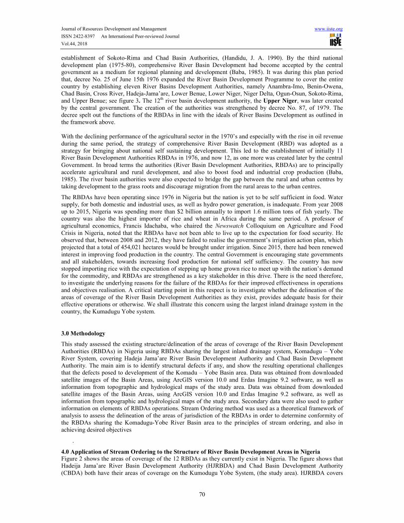
that, decree No. 25 of June 15th 1976 expanded the River Basin Development Programme to cover the entire country by establishing eleven River Basins Development Authorities, namely Anambra-Imo, Benin-Owena, Chad Basin, Cross River, Hadeja-Jama’are, Lower Benue, Lower Niger, Niger Delta, Ogun-Osun, Sokoto-Rima, and Upper Benue; see figure 3. The 12th river basin development authority, the Upper Niger, was later created by the central government. The creation of the authorities was strengthened by decree No. 87, of 1979. The decree spelt out the functions of the RBDAs in line with the ideals of River Basins Development as outlined in the framework above. With the declining performance of the agricultural sector in the 1970’s and especially with the rise in oil revenue
during the same period, the strategy of comprehensive River Basin Development (RBD) was adopted as a strategy for bringing about national self sustaining development. This led to the establishment of initially 11 River Basin Development Authorities RBDAs in 1976, and now 12, as one more was created later by the central
Government. In broad terms the authorities (River Basin Development Authorities, RBDAs) are to principally accelerate agricultural and rural development, and also to boost food and industrial crop production (Baba, 1985). The river basin authorities were also expected to bridge the gap between the rural and urban centres by taking development to the grass roots and discourage migration from the rural areas to the urban centres.
The RBDAs have been operating since 1976 in Nigeria but the nation is yet to be self sufficient in food. Water supply, for both domestic and industrial uses, as well as hydro power generation, is inadequate. From year 2008 up to 2015, Nigeria was spending more than $2 billion annually to import 1.6 million tons of fish yearly. The country was also the highest importer of rice and wheat in Africa during the same period. A professor of agricultural economics, Francis Idachaba, who chaired the Newswatch Colloquium on Agriculture and Food
Crisis in Nigeria, noted that the RBDAs have not been able to live up to the expectation for food security. He observed that, between 2008 and 2012, they have failed to realise the government’s irrigation action plan, which projected that a total of 454,021 hectares would be brought under irrigation. Since 2015, there had been renewed
interest in improving food production in the country. The central Government is encouraging state governments and all stakeholders, towards increasing food production for national self sufficiency. The country has now stopped importing rice with the expectation of stepping up home grown rice to meet up with the nation’s demand for the commodity, and RBDAs are strengthened as a key stakeholder in this drive. There is the need therefore, to investigate the underlying reasons for the failure of the RBDAs for their improved effectiveness in operations and objectives realisation. A critical starting point in this respect is to investigate whether the delineation of the areas of coverage of the River Basin Development Authorities as they exist, provides adequate basis for their effective operations or otherwise. We shall illustrate this concern using the largest inland drainage system in the country, the Kumadugu Yobe system.
3.0 Methodology
This study assessed the existing structure/delineation of the areas of coverage of the River Basin Development
Authorities (RBDAs) in Nigeria using RBDAs sharing the largest inland drainage system, Komadugu – Yobe River System, covering Hadeja Jama’are River Basin Development Authority and Chad Basin Development Authority. The main aim is to identify structural defects if any, and show the resulting operational challenges that the defects posed to development of the Komadu – Yobe Basin area. Data was obtained from downloaded
satellite images of the Basin Areas, using ArcGIS version 10.0 and Erdas Imagine 9.2 software, as well as information from topographic and hydrological maps of the study area. Data was obtained from downloaded satellite images of the Basin Areas, using ArcGIS version 10.0 and Erdas Imagine 9.2 software, as well as information from topographic and hydrological maps of the study area. Secondary data were also used to gather information on elements of RBDAs operations. Stream Ordering method was used as a theoretical framework of analysis to assess the delineation of the areas of jurisdiction of the RBDAs in order to determine conformity of the RBDAs sharing the Komadugu-Yobe River Basin area to the principles of stream ordering, and also in achieving desired objectives
.
4.0 Application of Stream Ordering to the Structure of River Basin Development Areas in Nigeria Figure 2 shows the areas of coverage of the 12 RBDAs as they currently exist in Nigeria. The figure shows that Hadeija Jama’are River Basin Development Authority (HJRBDA) and Chad Basin Development Authority
(CBDA) both have their areas of coverage on the Kumodugu Yobe System, (the study area). HJRBDA covers

Journal of Resources Development and Management www.iiste.org
ISSN 2422-8397 An International Peer-reviewed Journal
Vol.44, 2018
71
the whole of Kano and Jigawa States, and thirteen out of the 20 Local Governments in Bauchi state. Figure 2 further shows that HJRBDA controls most of the streams and the upper basin of the main river while CBDA operates in the lower basin area. This structural pattern requires application of stream ordering for coordination
of both plans and developmental activities between the two adjoining Authorities that share the common basin area.
Figure 2: showing the delineation of the 12 RBDAs
Source: Author, 2018 More so because, in the upper stream, there are twenty-two dams with a catchment area of 31,303 square kilometres (NEAZDP 1990,16). There are three major dams in the upstream region of the Yobe Basin. These
include Tiga, Challawa and Bagauda. Chad Basin covers Borno and Yobe states, and parts of Adamawa State covering Mincika – Shuwa - Madagali Local Areas. Upper Benue Basin Development Authority covers seven local Governments of southern senatorial zone of Bauchi state, Adamawa State excluding Minchika – Shuwa – Madagali Local Areas, and the whole of Taraba state. Delineation of the areas neither complied with the
principles of stream ordering, nor did it in conform to the 8 hydrological zones in the country as depicted in figure 3. The criterion applied in delineating the areas of coverage of the RBDAs is not clear.
Journal of Resources Development and Management www.iiste.org
ISSN 2422-8397 An International Peer-reviewed Journal
Vol.44, 2018
72
Figure 3 showing major rivers and the 8 hydrological areas of Nigeria
Source: Nigeria Hydrological Services Agency, 2013
5.0 Application of Stream Ordering to the Kumodugu – Yobe Basin (KYB) – The Study Area
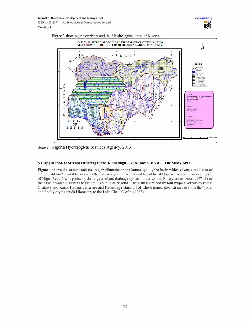
Figure 4 shows the streams and the major tributaries in the komadugu – yobe basin which covers a total area of 178,790.44 km2 shared between north eastern region of the Federal Republic of Nigeria and south eastern region of Niger Republic. It probably the largest inland drainage system in the world. Ninety seven percent (97 %) of the basin’s water is within the Federal Republic of Nigeria. The basin is drained by four major river sub-systems;
Chalawa and Kano, Hadeja, Jama’are and Komadugu Gana all of which joined downstream to form the Yobe, and finally drying up 80 kilometers to the Lake Chad, Olofin, (1983).
Journal of Resources Development and Management www.iiste.org
ISSN 2422-8397 An International Peer-reviewed Journal
Vol.44, 2018
73
Figure 4: Streams and major tributaries of the Komadugu – Yobe River system of Norh Eastern Nigeria
Source: Author, 2018
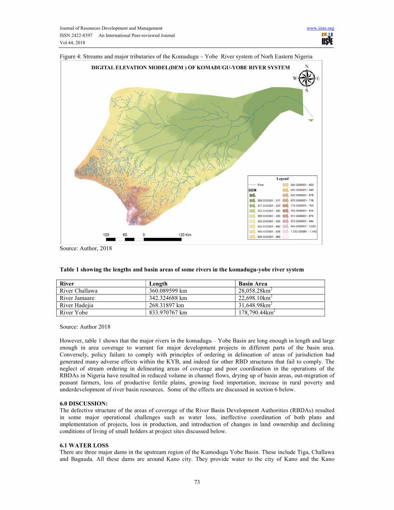
Table 1 showing the lengths and basin areas of some rivers in the komadugu-yobe river system
River Length Basin Area
River Challawa 360.089599 km 28,058.28km2
River Jamaare 342.324688 km 22,698.10km2
River Hadejia 268.31897 km 31,648.98km2
River Yobe 833.970767 km 178,790.44km2
Source: Author 2018 However, table 1 shows that the major rivers in the komadugu – Yobe Basin are long enough in length and large enough in area coverage to warrant for major development projects in different parts of the basin area. Conversely, policy failure to comply with principles of ordering in delineation of areas of jurisdiction had
generated many adverse effects within the KYB, and indeed for other RBD structures that fail to comply. The neglect of stream ordering in delineating areas of coverage and poor coordination in the operations of the RBDAs in Nigeria have resulted in reduced volume in channel flows, drying up of basin areas, out-migration of
peasant farmers, loss of productive fertile plains, growing food importation, increase in rural poverty and underdevelopment of river basin resources. Some of the effects are discussed in section 6 below.
6.0 DISCUSSION:
The defective structure of the areas of coverage of the River Basin Development Authorities (RBDAs) resulted in some major operational challenges such as water loss, ineffective coordination of both plans and implementation of projects, loss in production, and introduction of changes in land ownership and declining conditions of living of small holders at project sites discussed below.
6.1 WATER LOSS There are three major dams in the upstream region of the Kumodugu Yobe Basin. These include Tiga, Challawa and Bagauda. All these dams are around Kano city. They provide water to the city of Kano and the Kano
Journal of Resources Development and Management www.iiste.org
ISSN 2422-8397 An International Peer-reviewed Journal
Vol.44, 2018
74
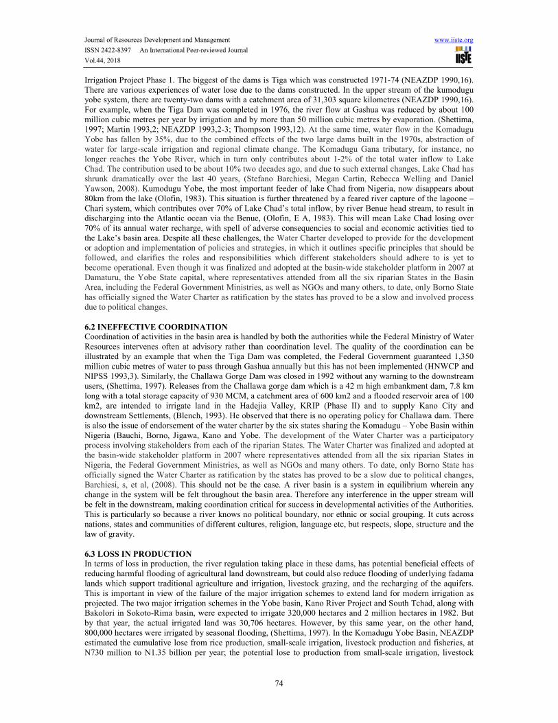
Irrigation Project Phase 1. The biggest of the dams is Tiga which was constructed 1971-74 (NEAZDP 1990,16). There are various experiences of water lose due to the dams constructed. In the upper stream of the kumodugu yobe system, there are twenty-two dams with a catchment area of 31,303 square kilometres (NEAZDP 1990,16).
For example, when the Tiga Dam was completed in 1976, the river flow at Gashua was reduced by about 100 million cubic metres per year by irrigation and by more than 50 million cubic metres by evaporation. (Shettima, 1997; Martin 1993,2; NEAZDP 1993,2-3; Thompson 1993,12). At the same time, water flow in the Komadugu Yobe has fallen by 35%, due to the combined effects of the two large dams built in the 1970s, abstraction of water for large-scale irrigation and regional climate change. The Komadugu Gana tributary, for instance, no longer reaches the Yobe River, which in turn only contributes about 1-2% of the total water inflow to Lake Chad. The contribution used to be about 10% two decades ago, and due to such external changes, Lake Chad has shrunk dramatically over the last 40 years, (Stefano Barchiesi, Megan Cartin, Rebecca Welling and Daniel Yawson, 2008). Kumodugu Yobe, the most important feeder of lake Chad from Nigeria, now disappears about
80km from the lake (Olofin, 1983). This situation is further threatened by a feared river capture of the lagoone – Chari system, which contributes over 70% of Lake Chad’s total inflow, by river Benue head stream, to result in discharging into the Atlantic ocean via the Benue, (Olofin, E A, 1983). This will mean Lake Chad losing over
70% of its annual water recharge, with spell of adverse consequencies to social and economic activities tied to the Lake’s basin area. Despite all these challenges, the Water Charter developed to provide for the development or adoption and implementation of policies and strategies, in which it outlines specific principles that should be followed, and clarifies the roles and responsibilities which different stakeholders should adhere to is yet to become operational. Even though it was finalized and adopted at the basin-wide stakeholder platform in 2007 at Damaturu, the Yobe State capital, where representatives attended from all the six riparian States in the Basin Area, including the Federal Government Ministries, as well as NGOs and many others, to date, only Borno State has officially signed the Water Charter as ratification by the states has proved to be a slow and involved process due to political changes.
6.2 INEFFECTIVE COORDINATION
Coordination of activities in the basin area is handled by both the authorities while the Federal Ministry of Water
Resources intervenes often at advisory rather than coordination level. The quality of the coordination can be illustrated by an example that when the Tiga Dam was completed, the Federal Government guaranteed 1,350 million cubic metres of water to pass through Gashua annually but this has not been implemented (HNWCP and NIPSS 1993,3). Similarly, the Challawa Gorge Dam was closed in 1992 without any warning to the downstream users, (Shettima, 1997). Releases from the Challawa gorge dam which is a 42 m high embankment dam, 7.8 km long with a total storage capacity of 930 MCM, a catchment area of 600 km2 and a flooded reservoir area of 100 km2, are intended to irrigate land in the Hadejia Valley, KRIP (Phase II) and to supply Kano City and downstream Settlements, (Blench, 1993). He observed that there is no operating policy for Challawa dam. There is also the issue of endorsement of the water charter by the six states sharing the Komadugu – Yobe Basin within
Nigeria (Bauchi, Borno, Jigawa, Kano and Yobe. The development of the Water Charter was a participatory process involving stakeholders from each of the riparian States. The Water Charter was finalized and adopted at the basin-wide stakeholder platform in 2007 where representatives attended from all the six riparian States in
Nigeria, the Federal Government Ministries, as well as NGOs and many others. To date, only Borno State has officially signed the Water Charter as ratification by the states has proved to be a slow due to political changes, Barchiesi, s, et al, (2008). This should not be the case. A river basin is a system in equilibrium wherein any change in the system will be felt throughout the basin area. Therefore any interference in the upper stream will
be felt in the downstream, making coordination critical for success in developmental activities of the Authorities. This is particularly so because a river knows no political boundary, nor ethnic or social grouping. It cuts across nations, states and communities of different cultures, religion, language etc, but respects, slope, structure and the law of gravity.
6.3 LOSS IN PRODUCTION
In terms of loss in production, the river regulation taking place in these dams, has potential beneficial effects of reducing harmful flooding of agricultural land downstream, but could also reduce flooding of underlying fadama
lands which support traditional agriculture and irrigation, livestock grazing, and the recharging of the aquifers. This is important in view of the failure of the major irrigation schemes to extend land for modern irrigation as projected. The two major irrigation schemes in the Yobe basin, Kano River Project and South Tchad, along with Bakolori in Sokoto-Rima basin, were expected to irrigate 320,000 hectares and 2 million hectares in 1982. But
by that year, the actual irrigated land was 30,706 hectares. However, by this same year, on the other hand, 800,000 hectares were irrigated by seasonal flooding, (Shettima, 1997). In the Komadugu Yobe Basin, NEAZDP estimated the cumulative lose from rice production, small-scale irrigation, livestock production and fisheries, at N730 million to N1.35 billion per year; the potential lose to production from small-scale irrigation, livestock
Journal of Resources Development and Management www.iiste.org
ISSN 2422-8397 An International Peer-reviewed Journal
Vol.44, 2018
75
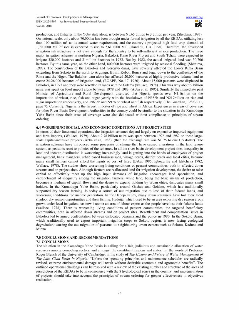
production, and fisheries in the Yobe state alone, is between N1.65 billion to 3 billion per year, (Shettima, 1997). On national scale, only about 70,000ha has been brought under formal irrigation by all the RBDAs, utilizing less than 100 million m3 as its annual water requirement, and the country’s projected high food crop demand of
1,700,000 MT of rice is expected to rise to 2,610,000 MT. (Handidu, J A, 1990). Therefore, the developed irrigation infrastructure is not even enough for the country to be self-sufficient in rice production. The three major irrigation schemes in northern Nigeria, Bakolori, Kano River Project and South Tchad, were expected to irrigate 320,000 hectares and 2 million hectares in 1982. But by 1982, the actual irrigated land was 30,706 hectares. By this same year, on the other hand, 800,000 hectares were irrigated by seasonal flooding, (Shettima, 1997). The construction of the Bakolori and Goronyo dams, have severely affected the Lower Rima Basin extending from Sokoto in the north to Argungu, Birnin Kebbi, Bunza and Jega, down to the confluence of the Rima and the Niger. The Bakalori dam alone has affected 20,000 hectares of highly productive fadama land to create 24-26,000 hectares of irrigation land, (ROAPE, No. 17, 1980). About 15,000 peasants were displaced in
Bakolori, in 1977 and they were resettled in lands with no fadama (wallace, 1978). This was why about 9 billion naira was spent on food import alone between 1978 and 1983, (Abba et al, 1985). Similarly the immediate past Minister of Agriculture and Rural Development disclosed that Nigeria spends over N1.1trilion on the
importation of wheat, rice, fish and sugar yearly with the breakdown of N356b and N217billion on rice and sugar importation respectively, and N635b and N97b on wheat and fish respectively, (The Guardian, 12/9/2011, page 7). Currently, Nigeria is the largest importer of rice and wheat in Africa. Experiences in areas of coverage for other River Basin Development Authorities in the country could be similar to the situation in the Kumodugu Yobe Basin since their areas of coverage were also delineated without compliance to principles of stream ordering.
6.4 WORSENING SOCIAL AND ECONOMIC CONDITIONS AT PROJECT SITES
In terms of their functional operations, the irrigation schemes depend largely on expensive imported equipment
and farm imports, (Wallace, 1979). About 2.78 billion naira was spent between 1976 and 1982 on these large-scale capital-intensive projects (Abba et al, 1985), (then the exchange rate was N0.75 to one US dollar). The irrigation schemes have introduced some processes of change that have caused alterations in the land tenure
system, as peasants react to policies of the schemes. In all the river basin development project sites, inequality in land and income distribution is worsening; increasingly land is getting into the hands of employees of project management, bank managers, urban based business men, village heads, district heads and local elites, because many small farmers cannot afford the inputs or cost of hired (Baba, 1985; Igbozurihe and Idatchava 1982; Wallace, 1978). The studies show worsening living conditions of peasant communities, both in affected down streams and on project sites. Although farmers are reallocated land for irrigation development, the desire to raise capital to effectively meet up the high input demands of irrigation encourages land speculation, and entrenchment of inequality among the irrigation farmers, while land, being the basic means of production, becomes a medium of capital flows and the desire to expand holding by urban elites, dislocates many small
holders. In the Kumodugu Yobe Basin, particularly around Gashua and Geidam, which has traditionally supported dry season farming, is today a source of out migration due to lose of their fadama lands, and worsening conditions for income generation. In the Hadeja valley, many down streamers have lost their local
shadoof dry season opportunities and their fishing. Hadeija, which used to be an area exporting dry season crops grown under local irrigation, has now become an area of labour export as the people have lost their fadama lands (wallace, 1978). There is worsening living conditions of peasant communities, the targeted beneficiary communities, both in affected down streams and on project sites. Resettlement and compensation issues in
Bakolori led to armed confrontation between dislocated peasants and the police in 1980. In the Sokoto Basin, which traditionally used to export important irrigation crops to Sokoto region, is now facing ecological degradation, causing the out migration of peasants to neighbouring urban centers such as Sokoto, Kaduna and Minna.
7.0 CONCLUSIONS AND RECOMMENDATIONS
7.1 CONCLUSIONS The situation in the Komadugu Yobe Basin is calling for a fair, judicious and sustainable allocation of water
resources among competing sectors, and amongst the constituent regions and states. In the words of Professor Roger Blench of the University of Cambridge, in his study of The History and Future of Water Management of
The Lake Chad Basin In Nigeria: “Unless the operating principles and maintenance schedules are radically revised, extreme environmental damage will result without desirable economic and agronomic benefits”. The
outlined operational challenges can be resolved with a review of the existing number and structure of the areas of jurisdiction of the RBDAs to be in consonance with the 8 hydrological zones in the country, and implementation of projects should take into account the principles of stream ordering for greater effectiveness in objectives realisation.

Journal of Resources Development and Management www.iiste.org
ISSN 2422-8397 An International Peer-reviewed Journal
Vol.44, 2018
76
7.2 RECOMMENDATIONS Development in the upstream of the komadugu Yobe System should involve effective coordination in projects implementation, as well as prompting of technological innovations and adjustments to achieve the articulated
RBD objectives as follows; - Examples of such interventions are shown in figure 6 with reference to Chalawa/kano, Hadeja and
Jama’are River Basins Development - Projects based on the streams, tributaries or the main river, are carefully coordinated such that the
impact of development in the upstream will not adversely affect downstream projects. - Where rivers are large, as in the case of the Komadugu Yobe River System, application of stream
ordering is necessary to provide basis for prompting technological innovations, adjustments, and interventions both in institutions and in the economy so as to achieve RBD objectives. See examples in figure 5 for Chalawa, Hadeja and Jama’are River Basins Development
- The Water Charter developed should be endorsed by all the riparian states for effective coordination of projects and conservation of Basin Resources
- River Basin Development Authorities should be restructured in line with the 8 hydrological zones in the
country as shown in figure 3, while project implementation within each zone to be in conformity with the principles of stream ordering for effective and result oriented project implementation throughout the zones.
FIGURE 5 NESTED STRAEMS AND RIVERS ON KOMADUGU – YOBE RIVER SYSTEM
Source: Author, 2018
REFERENCES
Adeoti, o (2010) “Development of River Basin Organizations in Nigeria” in Research Journal of Soil and Water
Management, Volume: 1,No. 3, Pg 91-100
Amended Report of the Nigeria Hydrological Services Agency (2013 Flood Outlook)
Amori, A. A. ; Eruola, A. O. ; Makinde A. A., and Ufoegbune, G. C. (2012) Assessment of Problems Affecting
Public Water Distribution in a Humid Tropical Zone, A. O., International Journal of Hydraulic
Engineering, 1(3): 21-24
Ayoade; J.O. and Oyebande, B.L. (1983) “Water Resources” in Oguntoyinbo et al A Geography of Nigerian

Journal of Resources Development and Management www.iiste.org
ISSN 2422-8397 An International Peer-reviewed Journal
Vol.44, 2018
77
Development Fast Print, Ibadan P. 71-87
Baba, J.M. (1985) Nigeria’s Conditional Rural Development strategies and the problem of Rural inequality: A
case study of Kano River Project Phase I. Unpublished Paper presented at the Common Wealth
Geographical Bureau Workshop on spatial inequalities in the developing world, at B.U.K, Kano
September 1985.
EE Emeghara (2010) “Evaluation of the Impact of Anambra Imo River Basin and Rural Development Authority
on Agricultural and Rural Development of Southeastern Nigeria”, International Journal of Tropical
Agriculture and Food Systems - Vol 4, No 4
Faniran, A. (1983). New Approach to Water Supply in Developing Countries: Cases from the Nigerian Situation.
Natural Resources Forum 7(3), 271-273
FANIRAN, Adetoye (1972) River Basins as Planning Units. Chapter IX in: Planning for Nigeria: A
Geographical Approach, (ed.) K. M. Barbour, Ibadan University Press, pp. 128-154.
Drainage Basin Development and Political Boundaries in Africa, Nigerian Journal of Eco. And Soc. Studies,
Vol. 16, No. 3, pp. 445-459.
On the Definition of Planning Regions: A Case of River Basins in Developing Countries. Singapore Journal,
Trop. Geog. 1(1) 9-15
Irrigation Projects and Environmental protection in Nigeria, in: A. O. Sanda and S. B. Ayo (eds.) Impact of
Irrigation Projects on Nigeria’s Environment Fact Finders International, Ibadan, pp. 9-39.
Fmwr-Iucn-Ncf Komadugu Yobe Basin Project 2006
Catchment Management Plan For Integrated Natural Resource Management Of Komadugu Yobe Basin
François Molle 2003 Development Trajectories of River Basins: A Conceptual Framework Research Report
7International Water Management Institute Colombo, Sri Lanka
François Molle et al (2007), River Basin Development and Management online
http://www.iwmi.cgiar.org/assessment/Water accessed 2/4/2018
Goes, Bart J.M. (2005) The Komadugu-Yobe Basin Project (IUCN - The World Conservation Union, Federal
Ministry of Water Resources and Nigerian Conservation Foundation)
Kano, Nigeria.
Handidu, J.A. (1990). National Growth, Water Demand and Supply Strategies in Nigeria in the 1960‘s. Water
Resources. 1(1), 1-7
Handidu, J. A. (1991), “National Growth, Water Demand and Supply Strategies in the 1960s”. Journal of the
Nigerian Association of Hydrogeologists. Vol. 2 No. 1 pp 18-25.
HNWCP (Hadejia-Nguru Wetlands Conservation Project), and NIPSS (National Institute for Policy and
Strategic Studies). 1993.
Workshop on the Management of the Water Resources of the Komadugu-Yobe Basin.Kuru: NIBS.
John, D.M. (1972) “The Haiho River Project” in The Journal of Geography, Vol. 25 No. 1 and 2.
Kimmage, Kevin, and W.M. Adams.1992. "Wetland Agricultural production and River Basin Development in
the Hadejia-Jama'are Valley, Nigeria." Geographical Journal 158, no. 1,l-12.
Martin, Alice. 1993. "Lake Chad in Danger of Disappearing." New Nigerian on Sunday (May 2): 7-8.
NEAZDP (North East Arid Zone Development Program). 1990. Water Resources Report. Damaturu: NEAZDP.
- 1992. Water Resources in the NEAZDPArea. Gashua: NEAZDP.
"Report to the Committee on Water Management in the Komadugu Yobe Basin." Darnaturu: NEAZDP.
Nwa, E.U. and Ehrtins, B. (1992) “Irrigation Development in Nigeria” in proceedings on international
commission on irrigation and Drainage, Vol. 1 P.5.
Olayide, S. (1980) perspectives on Benin – O Wenna River Basin Development, University of Ibadan, Ibadan P.
2.
Olofin, E.A. (1983). “Physical constraints to Rural Water Development in the Nigerian Sahel Zone” in
Unpublished paper presented at the 26th Annual NGA. Conference, University of Ilorin, Ilorin P. 9
Paterson, J.H. (1975) North America. Oxford University Press London.
Roger Blench (1993) The History and Future of Water Management of The Lake Chad Basin in Nigeria
Shettima, K A, (1997) Dam Politics in Northern Nigeria: The Case of the Kafin Zaki Dam Refuge, VoL 16, No.
3 (August 1997)
Stefano Barchiesi, Megan Cartin, Rebecca Welling and Daniel Yawson (2008) University of Cambridge, Water
and Nature Initiative, Komadugu Yobe Basin, Upstream of Lake Chad, Nigeria, International Union for
Conservation of Nature (IUCN)
Wallace, T. (1978). Planning for Agricultural Development: A consideration of some of the theoretical and
Practical issues “involve” in the Nigerian Journal of Political affairs, Kola S. 1978, 1978/79 P. 62.

Journal of Resources Development and Management www.iiste.org
ISSN 2422-8397 An International Peer-reviewed Journal
Vol.44, 2018
78
World Bank. 1990. Towards the Development of an Environmental Action Plan for Nigeria. Washington: The
World Bank.
Yusuf, R. (1986) “Effects of farming on Rivers Hadeja – Jama’are and Kumodugu Gana,” unpublished paper
presented at the third annual conference of Nigerian Sociological and Anthropological Association,
University of Maiduguri P. 9. WEBSITES
www.fao/docrep Accessed December 15, 2017
www.arjournals.annualreviews.org Accessed December 15, 2017 www.theworldchallenge.co.uk Accessed January 04, 2018 www.scholar.google.com Accessed January 04, 2018 www.pringerlink.com Accessed February 10, 2018 www.scielosphp.com Accessed March 18, 2018 www.geography.learnontheinternet.co.uk Accessed April 17, 2018 www.britannica.com/place/Chad-Basin Accessed April 17, 2018