Embed Size (px)
Citation preview

StratigraphyCourse of Strat igraphy G301 Second Semester (October 2016- January 2017) Department of Geology Col lege of Science /University of Basrah Instructor: Dr. Nawrast S. Abd Alwahab
1

Definition
Stratigraphy: is the science of rock strata.
What does that mean? ➢Stratigraphy is concerning with age relationships
of strata. ➢Successions of beds, local and worldwide
correlation of strata. ➢Stratigraphic order and chronological
arrangement of beds in the geological column.
2

3
CRETACEOUS STAGE BOUNDARIESCOPENHAGEN 1983
Simmons, M. D., Sharland, P.R., Casey, D.M., Davies , R.P., and Sutcliffe, O.E., (2007). Arabian Plate sequence stratigraphy: Potential implications for global l GeoArabia, Vol. 12, No. 4, 2007.
Cartoon by Tove Birklund, showing two geoscientists arguing about the different merits of two fossil groups for defining a Cretaceous stage boundary.
Important of Stratigraphy
➢Stratigraphy gives you techniques for working out earth history. ➢How earth and its life forms evolved? ➢Test ideas on how varying combinations of process
affect the plants through time? ➢Together, history and process let you work out how,
when, and why environments changed through time. ➢Stratigraphy also helps you to understand how many
economic materials formed and got distributed in the way they did- and so will help you find more.
4

Phases of study
➢Phase 1: Basic
➢Phase 2: Tracing environments in space and time.
➢Phase 3: Interpreting geologic history.
5

Basic
6
● The basic needed before any stratigraphic studies, involve first being able to:
1. Identify and classify minerals, rocks, and fossils accurately.
2. Infer the processes that formed the minerals, rocks, and fossils from field and laboratory studies.
3. Recognize the ancient depositional (and rarely non-depositional) environments.
4. Map the obtained data on maps and sections of various types.

Tracing environments in space and time
● Tracing environments in space and time requires four steps:
1. An overview of the area studied. 2. The description of local sections. 3. The correlation of local sections in space
and time. 4. The reconstruction of sedimentary basin
history.
7

Interpreting geologic history
● Interpreting geologic history involves:
Evaluating the effects of controlling processes such as tectonics, sea level changes, climate, and biology (the effect of organism) on sedimentary basin history.
8

Dynamic Stratigraphy(after Aigner, 1985).
9

Development of Startigraphy10
(from Maill, 2010)

Categories and ranks of stratigraphic units
11

Lithostratigraphy● In lithostratigraphy rock units are considered in terms of the
lithological characteristic of the strata and their relative stratigraphic positions.
● The relative stratigraphic positions of rock units can be determined by considering geometric and physical relationships that indicate which beds are older and which ones are younger.
● The main purpose to stratigraphic division is to make it easier to understand the strata.
● Lithological subdivisions are usually made on characteristic observable in the field, such as:
● - rock type ● - fossil content ● - color… etc.
12

Nature of Lithostratigraphic Units
● A lithostratigraphhic unit is a defined body of sedimentary, extrusive igneous, metasedimentary, or metacolcanic strata that is distunguished and delimited on the basis of lithic characteristics and stratigraphic position.
● A lithostratigraphic unit generally conforms to the law of superposition and commonly is stratified and tabular in form.
13

Ranks of Lithostratigraphic Units● The basic lithostratigraphic unit of subdivision is the FORMATION. ● 1- Formation: is a homogeneous rock unit, or an association of
distinct interbedded rock units, which are separated from the rock units above and below, and which can be shown on a geological map of at least 1:50 000 scale.
● Contacts: are the formation boundaries, and are normally placed where marked changes in rock types occur, or at an arbitrary marker bed in a gradational succession.
● Formations are named after TYPE SECTION.
● Type Section: is the locality where formation is particularly well exposed, and where its character is best seen.
● Example: ● - The type section of Nahr Umr Formation (Cretaceous) is Nahr
Umr-2 well. The formation occur between drilled depths 2,648.8-2,841.8 m). It is 193 meter thick, and is named after the well.
14

● 2- Group: is larger rock complexes, which assembled many formations.
● 3- Member: is a laterally persistent rock unit within a formation.
● 4-Tongue: is a rock unit that dies out laterally in one direction. ● 5- Lens: is a rock unit that dies out in both directions. ● 6- Flow: is the smallest formal lithostratigraphic unit of
volcanic flow rocks.
15
Member, tongue, and lens of sandstone in a mixed sandstone-shale formation (Brookfield, 2004)

Kirkuk Group (Oligocene)
❑ Lower Sequence: ● 1- Basinal (Palani and Tarjil
formations). ● 2- Reef-forereef (Sheikh Alas
Formation). ● 3- Reef (Shurua Formation). ❑ Upper Sequence: ● 1- Basinal (Ibrahim
Formation). ● 2- Reef-forereef (Baba and
Azkand formations). ● 3- Reef-backreef (Bajawan
Formation). ● 4- Reef (Anah Formation).
16
● Oligocene Paleogeography (Jassim and Buday, 2006)

• LITHODEMIC UNITS• Nature and Boundaries
• A lithodemic unit is a defined body of predominantly intrusive, highly deformed, and/or highly metamorphosed rock, distinguished and delimited on the basis of rock characteristics.
• In contrast to lithostratigraphic units, a lithodemic unit generally does not conform to the Law of Superposition. Its contacts with other rock units may be sedimentary, extrusive, intrusive, tectonic, or metamorphic.
• Recognition and definition
• Lithodemic units are defined and recognized by observable rock characteristics. They are the practical units of general geological work in terranes in which rock bodies generally lack primary stratification; in such terranes they serve as the foundation for studying, describing, and delineating lithology, local and regional structure, economic resources, and geologic history.
• Boundaries
• Boundaries of lithodemic units are placed at positions of lithic change. They may be placed at clearly distinguished contacts or within zones of gradation. Boundaries, both vertical and lateral, are based on the lithic criteria that provide the greatest unity and practical utility. Contacts with other lithodemic and lithostratigraphic units may be depositional, intrusive, metamorphic, or tectonic.
17

18

• Ranks of Lithodemic Units
• Lithodeme. The lithodeme is the fundamental unit in lithodemic classification. A lithodeme is a body of intrusive, pervasively deformed, or highly metamorphosed rock, generally non-tabular and lacking primary depositional structures, and characterized by lithic homogeneity. It is mappable at the Earth’s surface and traceable in the subsurface.
• Suite. A suite (metamorphic suite, intrusive suite, plutonic suite) is the lithodemic unit next higher in rank to lithodeme. It comprises two or more associated lithodemes of the same class (e.g., plutonic, metamorphic).
• Supersuite. A supersuite is the unit next higher in rank to a suite. It comprises two or more suites or complexes having a degree of natural relationship to one another, either in the vertical or the lateral sense.
• Complex. An assemblage or mixture of rocks of two or more genetic classes, i.e., igneous, sedimentary, or metamorphic, with or without highly complicated structure, may be named a complex.
19

20

• Misuse of ‘‘Series’’ for Suite, Complex, or Supersuite
• The term ‘‘series’’ has been employed for an assemblage of lithodemes or an assemblage of lithodemes and suites, especially in studies of the Precambrian. This practice now is regarded as improper; these assemblages are suites, complexes, or supersuites. The term ‘‘series’’ also has been applied to a sequence of rocks resulting from a succession of eruptions or intrusions. In these cases a different term should be used; ‘‘group’’ should replace ‘‘series’’ for volcanic and low-grade metamorphic rocks, and ‘‘intrusive suite’’ or ‘‘plutonic suite’’ should replace ‘‘series’’ for intrusive rocks of group rank.
21
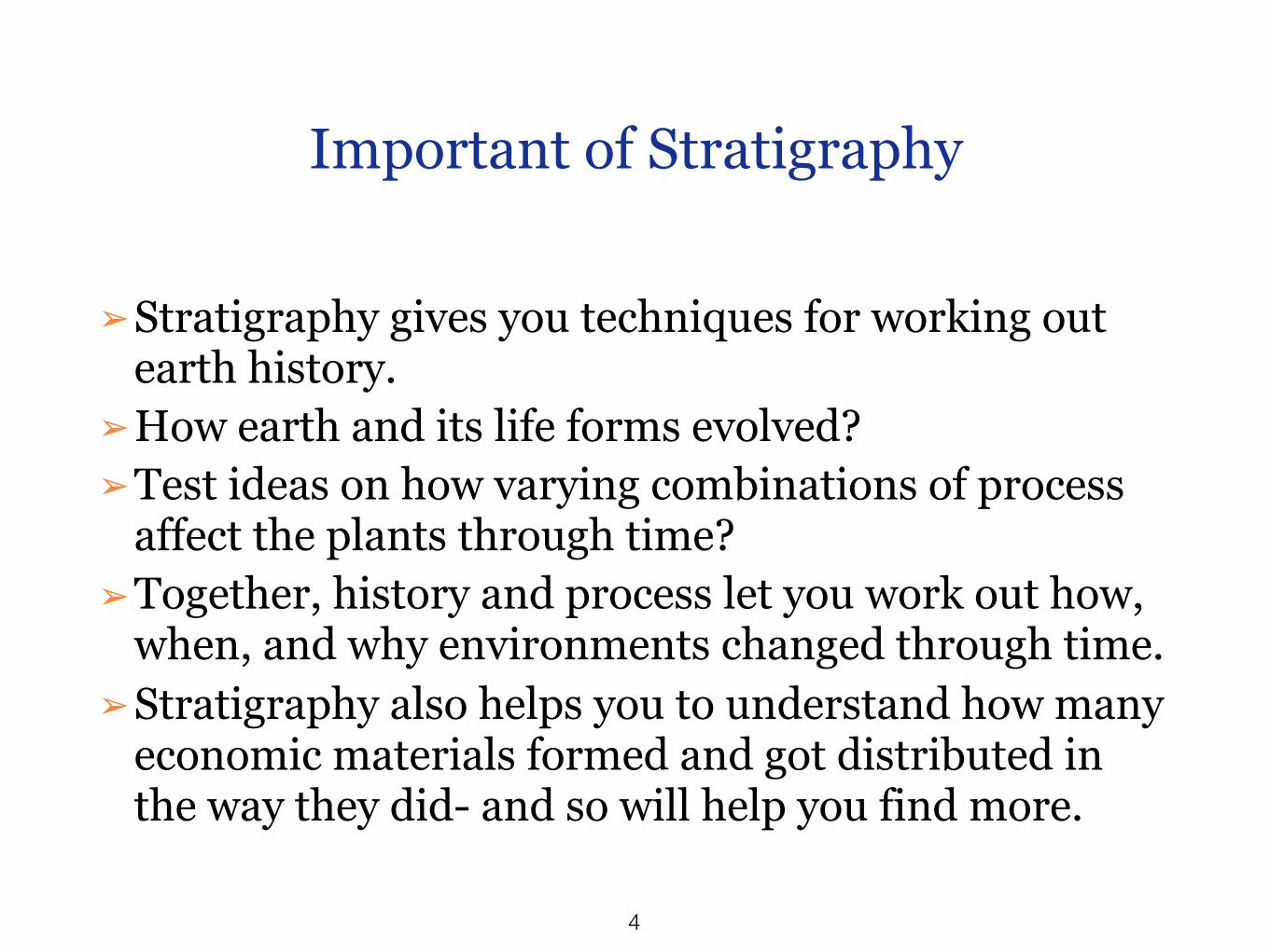
Boundaries (0r the Contacts)
➢Boundaries of lithostratigraphic units are placed at positions of lithic change.
➢Boundaries are placed at distinct contacts or may be selected at some arbitrary level within zones of gradation.
➢ Both vertical and lateral boundaries are based on the lithic criteria that provide the greatest unity and utility.
22

Breaks in the record
● Unconformities or Diastems, mark pauses in sedimentation or local erosion. Both are caused by relative change in the base level of erosion.
● Unconformities involve relatively uplift and erosion followed by renewed deposition, often under different environmental condition
23

Types of Unconformity 1- Nonconformity
24
Nonconformity: has sedimentary rock on an igneous and/or metamorphic basement.

25
Types of Unconformity 2- Angular Unconformity
Angular unconformity: has sedimentary rock on tilted, truncated, layered rocks.

26
Formation of Angular Unconformity

27
Types of Unconformity 3- DisconformityDisconformity: has sedimentary rock on a rolling eroded surface.

28
Formation of disconformity

29
Diastems
● Diastems are supposedly more minor time breaks due to variation in the normal processes in an environment, and these are of several scales and types.
● Example: flooded of river, shifts of delta lenses.
● Non-depositional and erosional diastems are caused by changes in the Base level of erosion or aggradation, due to fluctuations in the environment.

30
Boundaries
Diagrammatic examples of lithostratigraphic boundaries and classification.
AAPG Bulletin, v. 89, no. 11 (November 2005), pp. 1547–1591.

31
Boundaries
Diagrammatic examples of lithostratigraphic boundaries and classification.
AAPG Bulletin, v. 89, no. 11 (November 2005), pp. 1547–1591.

32
Key Beds
➢A key or marker beds is a thin bed of distinctive rock that is widely distributed. Such beds may be named, but usually are considered informal units.
➢Key beds may be used as boundaries for a formal lithostratigraphic unit where the internal lithic characteristics of the unit remain reatively constant.
➢Note/ key beds may be very informative and useful, especially in subsurface work where the key beds may be recognized by their geophysical signatures.

33
Key beds used for boundaries
Diagrammatic examples of lithostratigraphic boundaries and classification.
AAPG Bulletin, v. 89, no. 11 (November 2005), pp. 1547–1591.

34
NE- SW cross- section of Upper Ashgill- Upper Devonian, Megasequence AP3 in Akkas Field and Khleisia-1 well (Abd Alwahab, 2013).
Ex: Key beds in Akkas Field, Western Iraq.
The key bed in this diagram is thin black shale bed, which also represent the maximum flooding surface (MFS 10) of Lower Silurian Sequence in Arabian Plate.

References
35
● This lecture is based on the following references:
● Brookfield, M.F.,2004. Principles of Stratigraphy. Blackwell Publishing, 340P.
● North American Stratigraphic Code. , 2005. AAPG Bulletin, v. 89, no. 11, pp. 1547–1591.