Embed Size (px)
Citation preview
Draft April 29, 2005
Strategic Management Plan Rte 3 Corridor and Trenton Village
Trenton, Maine
Prepared for
The Maine Department of Transportation
16 State House Station Augusta, Maine 04333 - 0016
and
The Town of Trenton
Trenton, Maine
Prepared by
Coplon Associates Landscape Architecture and Planning
112 Cottage Street Bar Harbor, Maine 04609
In association with
Terence J DeWan and Associates
121 West Main St. Yarmouth, ME 04096
Gorrill-Plamer Consulting Engineers
P.O. Box 1237 22 Shake Rd.
Gray, ME 04309
Hancock County Planning Commission 395 State Street
Ellsworth, ME 04605

TABLE OF CONTENTS
I. Introduction 3 II. Background Data
A. Historic Development 5 B. Comprehensive Plan and Existing Zoning 5 C. Environmental Characteristics 6 D. Existing Corridor Features / Land Use 6 E. Existing Corridor Traffic Conditions 10
III. Recommendations
A. Rte 3 Corridor Management 15 B. Scenic By-Way 21 C. Trenton Village 22 1. Village Road network 22 2. Village Structure 24 3. Village Zoning 26
IV. Implementation Strategies 29 Appendix
T r e n t o n V i l l a g e a n d R t e 3 C o r r i d o r S t u d y
DRAFT Page 2

I. INTRODUCTION
Beginning in 2002, The Maine Department of Transportation (MDOT), undertook a significant planning effort to explore alternatives for how visitors travel to the Acadia - Downeast regions of the state. The town of Trenton lies at the strategic terminus of this corridor and as a result has a remarkable opportunity to re-think and possibly re-shape the future appearance and function of the town. To better understand the potentials and pitfalls facing the town in the future, Trenton and the Maine Department of Transportation collaborated on examining ways in which the Rte 3 corridor and village center area can be managed to ensure long term sustainable growth. By articulating a clear direction for its future, Trenton can affect the decisions of other agencies and jurisdictions that might influence land-use and transportation improvements within the community. The assessments and recommendations that follow are the result of a collaborative planning effort to shape a clear, manageable and sustainable vision for Trenton’s Rte 3 corridor. The study area (Figure 1) consisted of the Rte 3 corridor (the roadway and it’s adjacent land uses), extending from the Ellsworth line in the north to the causeway leading to Mt. Desert Island in the south. Currently characterized by a blend of open spaces and intermittent pockets of commercial development, the corridor is experiencing high traffic volumes, degradation of road surface and a stagnation of new development opportunities. To address these issues and how they impact Trenton’s future, several criteria were establised to guide this planning effort:
• Preserve/ enhance Rte 3 highway capacity; • Anticipate and accommodate alternative modes of transportation; • Enhance corridor traveler experience; • Promote Trenton as a destination; • Promote a greater sense of community for the citizens of Trenton
This study is divided into three general sections: background data, addressing information relevant to the study area; recommendations for access management along the Rte 3 corridor and opportunities for village development; and strategies for phased implementation of these recommendations. This study continues the efforts of the Maine State Planning Office Smart Growth Challenge Grant awarded to the Town of Trenton and authored by the Hancock County Planning Commission (HCPC) in 2002. The assessments and recommendations contained in this report were the result of a collaborative effort between the consultant team, The Town of Trenton, HCPC, and the Office of Planning, Maine Department of Transportation. To facilitate public input into both the analysis and recommendations phase of the project, several public workshops were held at the Trenton elementary school. Summary notes from those meetings can be found in Appendix A. The Challenge Grant Steering committee compromised of members of the Trenton community, oversaw this study and met periodically in a forum open to the public to review the development of the study.
T r e n t o n V i l l a g e a n d R t e 3 C o r r i d o r S t u d y
DRAFT Page 3

`
Figure 1- Study Area
T r e n t o n V i l l a g e a n d R t e 3 C o r r i d o r S t u d y
DRAFT Page 4

II. BACKGROUND DATA
The following is a brief overview of existing conditions that are germane to the corridor study. This information and the associated mapping was derived from information compiled for the 1992 Trenton Comprehensive Plan with updated demographic and environmental data from HCPC. High-resolution aerial photography (2003) was made available by the MaineDOT.
A. Historical Development:
Trenton has historically developed along the Rte 3 Corridor. Early mapping illustrates structures developed close to the road, as is typical of settlements centered on primary thoroughfares. This remains the pattern of development today, modified somewhat by recent subdivision activity extending westward from Rte 3. Due to it’s focus along the corridor, Trenton did not develop a traditional center based on a network of local streets. The land use patterns within the corridor we see today have evolved over time, shifting from primarily agricultural / residential to commercial / residential. Rte 3 remains a two-lane road though it has evolved from an unpaved country lane to today’s heavily traveled arterial.
Figures 2 and 3 – Rte 3 Circa 1925, 1946 USGS mapping
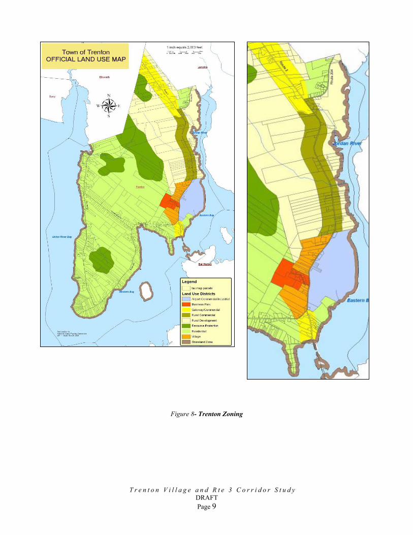
B. Comprehensive Plan and Existing Zoning The 1992 Comprehensive Plan outlined the planned growth strategies for Trenton over a ten year period. Based on the vision expressed in the comprehensive plan, the town adopted it’s current zoncommercial and residential districts and areas for resodistricts along Rte 3 consist of the gateway, rural and criteria for development are intended to promote safetencourage rational and attractive growth. The village dgreater density and promote pedestrian oriented develroots as a traditional New England town”. However, t
T r e n t o n V i l l a g e a n d R t e 3 C o r
DRAFT Page 5
ing ordinance establishing several urce protection. The zoning village commercial districts whose y, protect rural character, and istrict is intended to accommodate
opment “in keeping with Trenton’s he standards (lot size, setbacks etc.)
r i d o r S t u d y
for this district are not necessarily tailored to development of the traditional village model envisioned in the comprehensive plan.
C. Environmental Characteristics
1. Wetlands – The National Wetland Inventory (NWI) mapping indicates there are few significant wetlands within the corridor study area. (Figure 4) This mapping likely does not include all wetlands within the corridor defined and regulated by Sect 404 of the Clean Water Act. Detailed wetlands delineations for site specific development projects will be required to meet local and state regulatory approvals.
2. Soils Suitability for Development – Due to high clay content, soils in Trenton are generally characterized as having a very low to moderate potential for supporting low density residential development (on site septic disposal and building foundation stability). As illustrated in Figure 5, soils within the Rte 3 corridor are characterized as being marginally suitable for development. The detailed assessments required for development approvals will generally identify some potential for on-site disposal on individual sites. Additionally, new sewage disposal technologies (pretreatment, congregate systems, etc.) combined with updated regulatory criteria may permit areas rated with low potentials to support moderate levels of development.
3. Critical Natural Resources – As illustrated in Figure 6 there do not appear to be significant or mapped natural resources and critical habitats in the study area.
4. Scenic Vistas – The Rte 3 corridor south of the intersection of Rte 204 is characterized by several high quality vistas eastward across the Jordan River and southeast to Mt. Desert Island. The quality of these long-range vistas are enhanced by the undeveloped fields, pastures and open space in the foreground. As noted in the 1992 Comprehensive plan, these signature vistas, few of which remain open are a priceless local asset. The value of these vistas and the subsequent interest in their protection is the basis for attempts to designate Rte 3 a Scenic Byway under the Federal Scenic By-way program. Figure 7 is a summary vista assessment complied for the 1992 Comprehensive Plan.
D. Existing Corridor Features / Land Use
The Rte 3 corridor in Trenton is distinguished by several notable features. The northern gateway to Trenton abuts a growing commercial area of Ellsworth, with established roadside commercial development framing the northern edges of the corridor. Intermittent commercial, residential and institutional uses (Life Christian Academy) edge the corridor southward to the intersection of Rte 204 with Rte 3. South of this intersection, the landscape changes, with open fields and the airport framing views eastward to the Jordan River and MDI. The Trenton Elementary School marks the northern boundary of the “village district” with clustered commercial uses predominating along Rte 3 for approximately 2 miles to the Rte 3 / 230 intersection. Notable among these commercial uses are Carroll’s Store, the Hancock County Airport and The Trenton Industrial Park. Community institutions such as the Trenton Grange and the Baptist Church are located in the village area as well. The town office is located outside of the village commercial district, approx. ½ mile west on Rte 230.
T r e n t o n V i l l a g e a n d R t e 3 C o r r i d o r S t u d y
DRAFT Page 6
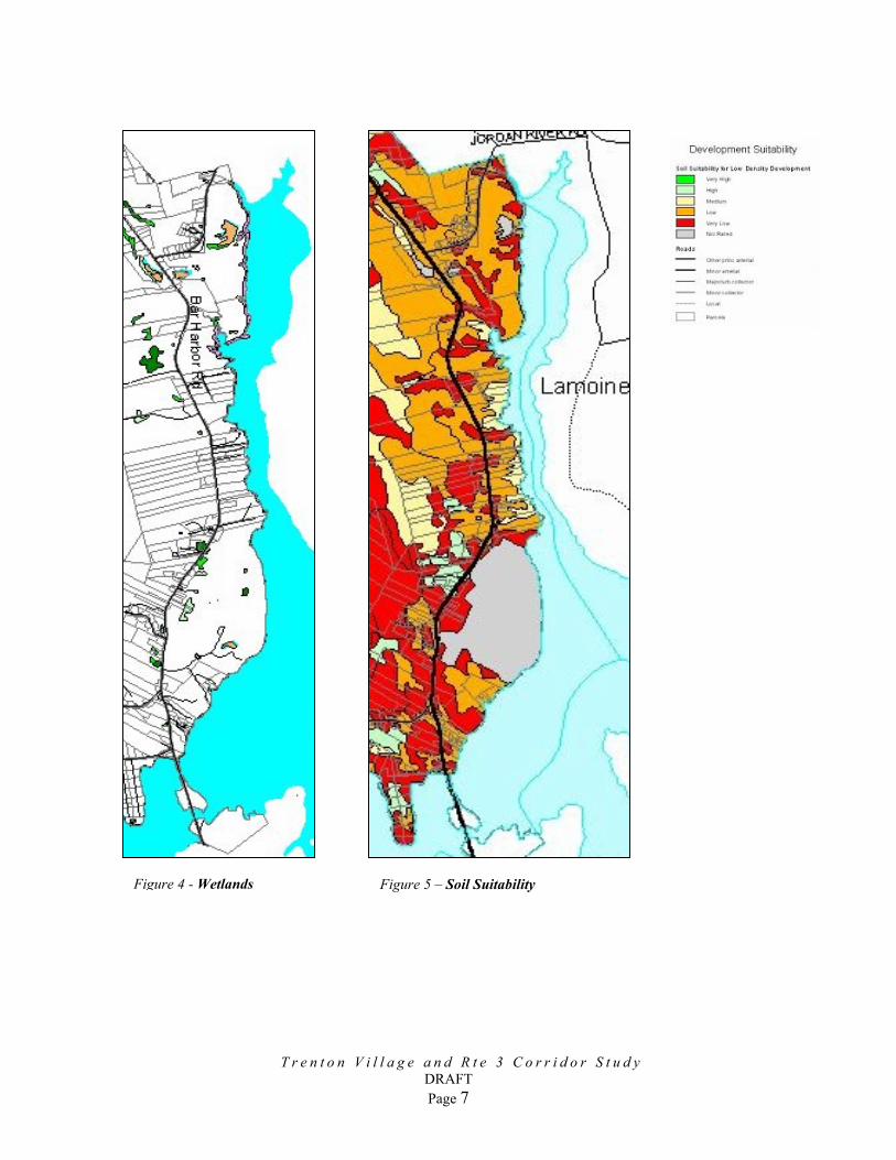
Figure 5 – Soil Suitability
Figure 4 - WetlandsT r e n t o n V i l l a g e a n d R t e 3 C o r r i d o r S t u d y
DRAFT Page 7

T r e n t o n V i l l a g e a n d R t e 3 C o r r i d o r S t u d y
DRAFT Page 8
Figure 6 – Critical Habitat Figure 7– Scenic Vistas
T r e n t o n V i l l a g e a n d R t e 3 C o r r i d o r S t u d y
DRAFT Page 9
Figure 8- Trenton Zoning
Current trends illustrate both turnover and modest growth in the traditional roadside commercial development. The business park has been successfully completed and a new conventional residential subdivision has recently been developed west of Rte 3 in the village area. The Maine Department of Transportation has recently completed a study focusing on transportation alternatives to the Downeast-Acadia region. The study concluded that Routes 1A and 3 will remain the primary arterials for access to the region for the foreseeable future and that a transportation hub serving the region should be developed in Trenton. The study concluded the most appropriate site for this hub would be the Nokuchi Property bordering Crippens Brook on the west side of Rte 3, approximately one mile north of the village area.
E. Existing Corridor Traffic Conditions
Route 3 within Trenton is approximately seven miles long and is the primary access route to Bar Harbor and Mount Desert Island from all points. It is primarily a two lane roadway with 12 foot travel lanes and 6 foot paved shoulders. Most of the roadway utilizes ditches for drainage with curbing limited to a few area of denser commercial development. The roadway is largely rural in nature, with pockets of strip commercial development primarily in the vicinity of the Ellsworth and Bar Harbor town lines. The posted speed limit along the corridor varies from 40 to 50 miles per hour. There are two significant intersecting roadways within the corridor - Route 204 that provides access to the coastal areas of Lamoine and Route 230 (Bayside Road) providing coastal access in Trenton serving also as a back way to Ellsworth. Hancock County Airport is accessed from Route 3 to the west of the Route 230 intersection. As Route 3 has been identified by the MaineDOT as a retrograde arterial corridor, it will be important to maintain capacity and improve the safety of the corridor. As a result more emphasis will be placed on access management. Today, many of the existing curb cuts (driveways) for the businesses along the corridor are overly wide and often not aligned with the driveways on the opposite side of the roadway. There is very limited sharing of driveways along the corridor. These factors contribute to traffic delays and issues of safety along the corridor. There are no sidewalks or pedestrian facilities along the corridor as development is spread out and vehicular-oriented. Bicycles are accommodated on the existing six-foot paved shoulders. There are several locations along the corridor where parking occurs on the shoulders, which sometimes leads to congestion, particularly at the easterly end of the corridor near the Bridge to MDI.
1. Traffic Data
T r e n t o n V i l l a g e a n d R t e 3 C o r r i d o r S t u d y
DRAFT Page 10
Existing traffic volume data on file with the Maine DOT was utilized as a basis for evaluation of traffic capacity conditions along the corridor. Turning movement counts were available for the intersections of Route 3 with Routes 204 and 230. Additionally,

the MaineDOT has a permanent traffic recorder on Route 3 near the Bar Harbor Town line. This data clearly shows the seasonal variations in daily traffic volume as well as the hourly variations on a summer day. The following two charts depict these trends.
2002 Average Daily TrafficThompson Island Bridge (Rt. 3)
Trenton, Maine
0
5000
10000
15000
20000
25000
Janu
ary
Februa
ryMarc
hApri
l May
June Ju
ly
Augus
t
Septem
ber
Octobe
r
Novem
ber
Decem
ber
Volu
me
(Veh
icle
s)
Total Hourly Volumes for FridayThompson Island Bridge (Rt. 3)
Trenton, Maine
0
500
1000
1500
2000
2500
6-7 A
M
7-8 A
M
8-9 A
M
9-10 A
M
10-11
AM
11-12
PM
12-1
PM
1-2 P
M
2-3 P
M
3-4 P
M
4-5 P
M
5-6 P
M
6-7 P
M
7-8 P
M
Volu
me
(Veh
icle
s)
August 16. 2002 April 26, 2002
Based on the available information it was determined that the Average Annual Daily Traffic (AADT) for the corridor was 14,200 vehicles in 2002, versus an August ADT of 23,100. The historic traffic growth rate is 2.5% per year.
T r e n t o n V i l l a g e a n d R t e 3 C o r r i d o r S t u d y
DRAFT Page 11

2. Sight Line Analysis
The Maine Department of Transportation has guidelines for sight distances at driveways along retrograde arterial corridors. These sight line standards are given in the following table:
MaineDOT Standards for Sight Distance
Sight Distance Speed (mph) Retrograde Arterial
25 300 30 380 35 480 40 580 45 710 50 840 55 990
Gorrill-Palmer Consulting Engineers, Inc. has evaluated the available sight lines along the corridor in accordance with MaineDOT standards. The MaineDOT standards are as follows: Roadway observation point: 10 feet off major street travelway Height of eye at roadway: 3 ½ feet above ground Height of approaching vehicle: 4 ¼ feet above road surface The speed used for the purpose of analysis is the posted speed limit varying along the corridor from 40 to 50 miles per hour. Based on these criteria and conditions, Gorrill-Palmer Consulting Engineers Inc. (GP) completed a preliminary review to identify potential concerns for locations with sight distance constraints. Based on this review, we determined that existing driveways along Route 3 in the vicinity of “Old Dutch Treat/Acadia World Traders” do not meet minimum standards and should be relocated to the extent practical. Additionally, several areas along the corridor would not be suitable for driveways based on the horizontal and vertical curvature of the road. These locations are identified on the corridor access management plan, which is appended to this report.
3. Crash Information
GP obtained the crash history from the MaineDOT for the period of 2000 through 2002.
In order to evaluate whether a location has a crash problem, MaineDOT uses two criteria to define High Crash Location (HCL). Both criteria must be met in order to be classified as an HCL.
T r e n t o n V i l l a g e a n d R t e 3 C o r r i d o r S t u d y
DRAFT Page 12

• A critical rate factor of 1.00 or more for a three-year period. (A Critical Rate Factor {CRF} compares the actual accident rate to the rate for similar intersection in the state. A CRF of less that 1.00 indicates a rate of less than average) and:
• A minimum of 8 accidents over a three-year period. The following tables illustrate the crash history for the study area:
MaineDOT Crash Data for 2000-2002: Intersections
Node Intersection # of
Collisions
CRF HCL?
7199 Route 3 at Route 204 10 1.92 Yes
7456 Route 3 at Trenton Elementary School Driveway 1 0.19 No
7638 Route 3 at Industrial Way 3 0.58 No
7464 Route 3 at Hancock County Airport Access Road 1 0.19 No
7195 Route 3 at Route 230 6 1.03 No
MaineDOT Crash Data for 2000-2002: Road Segments
Nodes Street From To
# of Collision
s CRFHCL
? 7199-7200 Route 3 Ellsworth Town Line Route 204 29 0.75 No 7199-8999 Route 3 Route 204 Riverfield Road 35 0.87 No 7198-8999 Route 3 Riverfield Road Kart Land 7 0.34 No
7198-7456 Route 3 Kart Land Trenton Elementary Drive 3 0.33 No
7197-7456 Route 3 Trenton Elementary Drive
Airport Road (Glider Rides) 3 0.33 No
7196-7197 Route 3 Airport Road (Glider Rides) East of Exxon/IGA 7 0.60 No
7196-7638 Route 3 East of Exxon/IGA Industrial Way 1 0.36 No 7464-7638 Route 3 Industrial Way Airport Access Road 6 0.63 No 7195-7464 Route 3 Airport Access Road Route 230 5 0.78 No
7194-7195 Route 3 Route 230 Thompson’s island Visitors Center 15 0.51 No
7193-7194 Route 3 Thompson’s island Visitors Center
Trenton/Bar Harbor TL 13 1.34 Yes
Based on the published history, two locations within the study area are considered High Crash Locations. GP obtained copies of the collision reports for these locations
T r e n t o n V i l l a g e a n d R t e 3 C o r r i d o r S t u d y
DRAFT Page 13
as well as two other locations with a high number of crashes, and prepared collision diagrams, which are attached. We have completed an analysis of these diagrams as summarized below: Route 3 from Ellsworth/Trenton Town line to Route 204 This location is also not currently a high crash location. However, it has a critical rate factor of 0.75 with 29 collisions occurring between the years 2000-2002. Based on the collision diagram included in Appendix A, three apparent collision types exist along this roadway section. The first collision type occurs when a vehicle collides with an animal crossing the road or when a vehicle stops for an animal is rear-ended by a following vehicle. Six collisions of this nature occurred between 2000-2002. The second type of collision occurred when vehicles making a turn into Vokes Drive were struck from behind by a following vehicle. Five collisions of this nature occurred between 2000-2002. The third type of collision occurred when drivers lost control of their vehicle due to excessive speed or slippery roadway conditions and either left the roadway or collided with oncoming traffic. Seven collisions of this nature occurred between 2000-2002. However, the location of the collisions along the roadway was random and did not suggest collisions were the result of roadway geometry. The remainder of the collisions were random in nature and did not present an apparent pattern. Based on the apparent collision patterns, Gorrill-Palmer Consulting Engineers, Inc. recommends that signs be posted warning drivers of animal crossings and turning vehicles. The rear end collisions could be addressed by providing a two-way center left turn lane. Route 3 at Route 204 This intersection is an HCL with a critical rate factor of 1.92 and 10 collisions occurring between 2000-2002. Based on the collision diagram included in Appendix C, there are three apparent types of collisions occurring at this intersection. The first type of collision occurs when vehicles turning left out of Route 204 collide with vehicles headed north on Route 3. Four collisions of this nature occurred between 2000-2002. The second type of collision occurred when a vehicle making a left out of Route 204 collided with a vehicle making a left from Route 3 onto Route 204. The third collision type occurred when vehicles waiting to make a left turn were struck from behind by a following vehicle. This location currently has a left turn bypass lane for eastbound traffic. No other measures are recommended. Route 3 from Route 204 to Riverfield Road
T r e n t o n V i l l a g e a n d R t e 3 C o r r i d o r S t u d y
DRAFT Page 14
This location is currently not a high crash location. However, it has a critical rate factor of 0.87 with 35 collisions occurring in the years 2000-2002. Based on the collision diagram included in Appendix C of this report, there are three apparent collision types at this location. The first collision type occurs when vehicles collide with an animal crossing the road or they stop for an animal crossing the road and are rear-ended by a following vehicle. Eight such collisions occurred from 2000 to 2002, and all of these collisions occurred on the S-curve to the north of Romer’s Store. A second type of collision also occurred on the S-curve in which drivers lost control of their vehicle and left the roadway due to either high speeds or slippery roadway

conditions. Four collisions of this nature occurred on the S-curve. Two more collisions of this nature occurred south of Romer’s Store. A third collision type occurred when vehicles waiting to make a left turn or in the process of making a right turn into driveways were rear-ended by a following vehicle. Three such collisions occurred at Romer’s Store, four such collisions occurred at Drive-In Lane, and three such collisions occurred at Romer’s Lane. The remainder of the collisions were random in nature and did not present any apparent patterns. Based on the collision patterns above, Gorrill-Palmer Consulting Engineers, Inc. recommends that signs be posted warning drivers of animal crossings, turning vehicles and sharp turns. Signs should be posted in advance of the S-curve warning of slippery roadway conditions. Installation of roadway lighting along and between these curves should be considered. Route 3 from Thompson’s Island Visitors Center to Trenton/Bar Harbor Town line This location is an HCL with a critical rate factor of 1.34 and 13 collisions occurring during the years 2000-2002. Based on the collision diagram included in Appendix C, there are three apparent collision types occurring on this roadway section. The first collision type occurs when vehicles making a left turn out of driveways collide with oncoming traffic. The second type of collision occurred when drivers lost control of their vehicle due to slippery roadway conditions and left the roadway. The third type of collision occurred when vehicles stopped in traffic were rear-ended by a following vehicle. Based on these collision patterns, Gorrill-Palmer Consulting Engineers, Inc. recommends evaluating the potential for installation of an activated flashing warning light system to alert southbound traffic to stopped traffic ahead.
4. Capacity Analyses
Gorrill-Palmer Consulting Engineers, Inc. did not complete formal evaluations of capacity for the intersections within the study area. However, given the high summer traffic volumes, it is apparent that left turns out of the intersecting roadways and numerous driveways onto Route 3 would be very difficult. Left turns into driveways are also difficult and cause delays to through traffic in peak summer periods. The monthly ADTs in July and August exceed 20,000 vehicles, which is typically beyond the capacity of a two lane roadway.
Summary of Existing Traffic Deficiencies
The following is a summary of the deficiencies along the Route 3 corridor in Trenton. • There are an excessive number of curb cuts grouped in areas of commercial
development. • There are no turn lanes on Route 3 for left turning traffic • There is a high incidence of crashes along the corridor, including two high crash
locations. One is at the Route 204 intersection and the other is along the roadway link just north of the Bar Harbor town line.
• There are sight distance restrictions at some driveways, particularly in the vicinity of the “S” curve just east of the Acadia Zoo and in the dip just west of the Acadia Zoo.
T r e n t o n V i l l a g e a n d R t e 3 C o r r i d o r S t u d y
DRAFT Page 15
• Parking is allowed on the shoulders in locations that causes congestion and safety issues.
III. RECOMMENDATIONS
A. Route 3 Corridor Management Trenton is distinguished by the function and appearance of the Rte 3 corridor. Proper management of the corridor and regulation of land uses along it has implications to the economic success of the community. The study explored ways in which vehicle management could be improved along the existing corridor to better facilitate traffic flow and minimize conflicts and potential hazards. One of the most important factors to consider in preserving the safety and maximizing the capacity of a roadway is access management. The goal of access management is to minimize the number of driveways to the extent practical and locate driveways in a manner to minimize interruption and potential safety concerns for through traffic. In addition to these factors, access management criteria should seek to minimize vehicle miles traveled and reduce response times by emergency vehicles by promoting connectivity between adjacent commercial properties and adjacent residential subdivisions. Two primary sources of information have been reviewed and compared to establish a recommended practice for access management: the MaineDOT Entrance and Driveway rules and the Institute of Transportation Engineers’ publication Transportation and Land Development, second edition. The purpose of this part of the study is to provide recommendations for performance standards for Trenton’s Rte 3 Corridor. However, it is not intended to provide specific language or be all encompassing. It is recommend that following the update of the comprehensive plan, the ordinance review committee develop specific corridor management language for adoption by the Town following review by the Town’s attorney. The criteria of concern for access management include the following:
• Connectivity to adjacent streets and businesses • Number of driveways serving a site • Intersection sight distance for exiting traffic • Stopping sight distance for traffic approaching the driveway along the street • Separation from adjacent driveways • Separation from adjacent street intersections, signalized and unsignalized • Grade of the driveway • Width of the driveway • Angle of intersection of the driveway with the street • Auxiliary lanes (left or right turn lanes) on the street • Intersection lighting • Pedestrian circulation
T r e n t o n V i l l a g e a n d R t e 3 C o r r i d o r S t u d y
DRAFT Page 16

The MaineDOT criteria generally cover most of these issues to a degree. The town may consider modeling it’s criteria on the MaineDOT criteria with minor modifications. The Town’s rules could be simplified and kept up to date by referencing the current edition of the MaineDOT rules with exceptions for certain criteria that may be more restrictive. The MaineDOT access management rules for driveways and entrances are available on their web site (http://www.maine.gov/mdot/planning-process-programs/access-mngmnt.php). Each of the issues is discussed below including recommendations for revisions where appropriate.
1. Definition of a Driveway vs. Entrance or Street
The MaineDOT rules define a driveway as an access generating up to 50 trip ends per day (the equivalent of 5 houses). It is recommended that the Town use up to 30 trips a day to define a driveway and that anything more be considered an entrance or street. It is recommended the performance standards below apply to driveways, entrances and streets except for the grade criteria where a distinction is noted.
2. Connectivity:
A review of the aerial photography for many Maine communities reveals a disturbing trend from a transportation standpoint; a proliferation of unconnected adjacent subdivisions or other land uses with dead end roadways. Many developers, particularly of residential subdivisions, maintain that their clients want to be on dead-end streets and therefore lots in these types of developments have a higher value. However, the net effect on the transportation system tends to be that the arterials carry a disproportionate burden of trips. Conversely, interconnecting adjacent subdivisions, as well as other adjacent uses, improves the efficiency of the overall transportation system by providing for travel between neighborhoods as well as to other streets in the area, improves emergency response times, reduces vehicle miles traveled and reduces congestion along the arterial and adjacent roadways. While neighborhoods can be concerned with cut through traffic and speeding, these issues can be somewhat mitigated through design and traffic calming features. While there will be increased traffic levels in some neighborhoods, the end result is a more balanced and safer transportation system, and a more equitable distribution of the traffic.
T r e n t o n V i l l a g e a n d R t e 3 C o r r i d o r S t u d y
DRAFT Page 17
The project team recommends that the Town implement a requirement that all subdivisions and development proposals allow for a connection to adjacent uses or vacant land unless the proposed interconnection is not feasible due to environmental impacts or topographic constraints. A private property owner should be required to allow the cross access without cost to the abutting property owner, but a primary access would be a matter of private negotiation. Proposed interconnections should be designed to minimize speed and provide safe pedestrian facilities. However, increased traffic through a residential neighborhood should not be a reason to waive the interconnection. We also recommend consideration be given to implementing provisions within the zoning ordinance to help facilitate cooperation in achieving connectivity by providing a density bonus or other incentives.

We strongly recommend that provisions for connections to future adjacent land uses be clear in the subdivision or site plan approval and that the proposed connection be built to the abutting property line as part of the approved development.
3. Number of Access Points
The majority of crashes nation wide occur at intersections and driveways and therefore reducing the number of driveways can have a significant affect on the safety of a roadway. The Maine DOT rules limit the number of driveways on retrograde arterial corridors, which includes Route 3, to one two-way or two one way entrances. It is recommended that the Town adopt this standard town wide, with the exception of uses with significant truck traffic, and consider relief in the ordinance to developers that forego a driveway in lieu of a connection with another site. The ordinance will need to consider the phase-in of shared driveways as may be necessary to accommodate RV traffic in and out of driveways. For instance, an isolated site may initially require two driveways to allow RV or large truck circulation. The site plan approval should include provisions to require removal of one driveway when an abutting parcel is developed, at which time the abutting parcel will create a single driveway. The two abutting sites will then share the two driveways to facilitate large vehicle circulation.
4. Sight Distance
It is recommended that the sight distance criteria utilize the MaineDOT and American Association of State Transportation Official’s (AASHTO) standards. Intersection sight distance for vehicles exiting driveways and entrances along Route 3 should meet the Mobility Standard, while driveways and entrances in other locations should meet the basic safety standard. A vehicle approaching a driveway or entrance may need to stop for a vehicle waiting to make a turn. Therefore, adequate stopping sight distance must be provided for approaching traffic. These criteria are tabulated below:
MaineDOT Standards for Sight Distance
Sight Distance (Feet) Posted Speed (mph) Basic Safety Standard
Mobility Standard Stopping
25 200 300 150 30 250 380 200 35 305 480 225 40 360 580 275 45 425 710 325 50 495 840 400 55 570 990 450
T r e n t o n V i l l a g e a n d R t e 3 C o r r i d o r S t u d y
DRAFT Page 18

5. Separation from Adjacent Access Points
Table 3 of the MaineDOT rules presents minimum spacing criteria for mobility corridors which apply to all portions of Route 3 within the Town. It is recommended that the Town adopt these standards as a goal for all entrances on all but local roadways. However, lesser separations should be considered by the Town if an engineering study shows it is not feasible to obtain the desired distances. These distances are as follows:
MaineDOT Driveway/Entrance Spacing Standards
Posted Speed (mph) Separation Distance (Feet)
25 90 30 105 35 130 40 175 45 265 50 350 55 525
6. Separation from Adjacent Street Intersections, Signalized and Unsignalized MaineDOT standards require that a driveway to a lot adjacent to an intersection be located a minimum of 125 edge to edge from the intersection and that access to a corner lot be provided off the side street whenever practicable. However, a greater distance or turning movement restrictions should be provided, if necessary, based on the results of a vehicle queuing analysis at the intersection.
7. Grade of the Driveway/Entrance
MaineDOT criteria indicate that the maximum grade within 75 feet of an intersection not exceed 3%. This standard should be utilized for entrances, but 5% would be acceptable for driveways.
8. Width of the Driveway/Entrance
The MaineDOT criteria suggest a range of driveway/entrance widths. It is recommended that a driveway width be 12 to 15 feet excluding radii and that a two way entrance width be a minimum of 22 feet with a maximum of 30 feet unless otherwise recommended by an engineering study. The driveway or entrance radii should be designed to accommodate vehicles commonly expected to utilize the driveway.
9. Angle of Intersection of the Driveway with the Street
T r e n t o n V i l l a g e a n d R t e 3 C o r r i d o r S t u d y
DRAFT Page 19

MaineDOT recommends that the intersection angle be perpendicular to the extent practical. It is recommended that the minimum be increased to 75 degrees for both two way and one way operations.
10. Auxiliary Lanes
Auxiliary turning lanes should be provided as appropriate as determined by a traffic study. The MaineDOT Highway Design Guide contains graphs that provide criteria to assess when left or right turn lanes should be considered on the roadway to serve traffic turning into the site.
11. Lighting
MaineDOT criteria require that overhead lighting shall be provided, if not existing, to illuminate the intersection. Overhead lighting shall have an average of 0.6 to 1.0 foot candles, with the maximum to minimum lighting ratio of not more than 10:1 and an average to minimum light level of not more than 4:1. It is recommended that these levels be provided in the driveway at the street intersection.
12. Pedestrian Facilities
The Town’s Ordinances should be amended to include specific language requiring construction of pedestrian facilities both within and connecting to adjacent site plans and subdivisions. The ordinance re-write should address desired connections, (i.e., adjacent commercial developments, neighborhoods, public facilities, points of interest, etc), sidewalk construction requirements of properties fronting Route 3, standards for pedestrian sidewalks, both public and private (i.e., public sidewalk width, materials, lighting, esplanade requirement, etc.), and standards for multi-use path connections (path width, ownership, maintenance, lighting, etc.)
T r e n t o n V i l l a g e a n d R t e 3 C o r r i d o r S t u d y
DRAFT Page 20

B. Scenic Byway
1. Background The Town of Trenton launched a drive in 1997 to designate Rte 3 as a National Scenic Byway. The National Scenic Byways Program is managed by the U.S. Department of Transportation, Federal Highway Administration. This program was established to recognize, preserve and enhance selected roads throughout the United States. Since 1992, the National Scenic Byways Program has provided funding for almost 1,500 state and nationally designated byway projects in 48 states. Designation as All-American Roads or National Scenic Byways is based on having unique archeological, cultural, historic, natural, recreational and scenic qualities. In 1998 the Maine Scenic Byway Committee granted eligibility status for the proposed Acadia Byway beginning at the Thompson Island Bridge and extending through Bar Harbor along Route 3. A voluntary corridor advocacy group worked with the Hancock County Planning Commission to develop a Corridor Management Plan. In 2000 the Town of Trenton voted to append the Corridor Management Plan to their Comprehensive Plan This document was accepted by the State Scenic Byway Committee, granting state designation in 2000. The Acadia Byway documents were submitted to the Federal Highway Administration that year and the Acadia Byway was awarded status as an All American Road. The Corridor Management Plan is available online at www.hcpcme.org/sb3/sb3cmp.html. A segment of the original proposed byway passing through Trenton was not ruled eligible in 1998 due to existing signage and other conditions and thus was not included in the final designation. The Town of Trenton has expressed interest over the ensuing years in achieving designation from the Thompson Island Bridge north to town boundary with Ellsworth to the greatest extent possible. Over the past several years Town of Trenton adopted several new zoning and development permiting regulations that have encouraged preservation of open space and the viewshed on the Route 3 corridor. In 2005 Trenton has been awarded a grant from the Maine State Planning Office to update the comprehensive plan.
2. Benefits of Designation
Designation of Rte 3 as Scenic Byway has been consistently supported by the Town of Trenton for the following reasons: • Trenton is the gateway community for Acadia National Park. More than 3 million
visitors pass through Trenton every year, creating opportunities and challenges for the community. The town will benefit greatly by both the tangible and intangible resources that are available to scenic byway communites.
• Trenton hopes to be a partner in managing tourism, benefiting from the resulting economic opportunities and while preserving the communities intrinsic values.
• Trenton’s role as an intermodal transportation center serving Mount Desert Island is expected to grow significantly in the future.
T r e n t o n V i l l a g e a n d R t e 3 C o r r i d o r S t u d y
DRAFT Page 21

• Scenic Byway designation will help to create a sense of arrival for visitors, providing information, services and a host of options that are best explored before the highway divides just after the Thompson Island Bridge.
• Trenton possesses a number of significant natural resource and scenic assets along Route 3. They wish to leverage these assets to make Trenton a part of the Acadia destination and not merely a highway and parking lot.
3. Conditions for Designation
The State Scenic Byways Committee will consider expanding byway designation to part or all of Trenton in the future, provided Rte 3 meets criteria for scenic designation. This criteria addresses opportunities for scenic vistas, landscape quality, development impact including signage, etc. Currently, several conditions which can be upgraded influence the opportunities for designating Rte 3 a scenic by-way: • In several locations commercial signage is large, imposing and obstructs views.
Trenton should consider ways to reduce the visual impact of these signs and assure that future signage will be regulated.
• The level of commercial development is not unacceptably high, but the signage, parking and building facades reduces or obstructs scenic views and lack natural landscaping. Trenton may want to pursue changes that will provide more continuity to design of businesses and their parking facilities, with greater use of natural landscaping, hidden utilities and other aesthetic improvements.
• The frequency of curb cuts reduces efficiency of movement along Route 3, reduces safety for pedestrians and bicyclists and creates a cluttered environment. As noted herein Trenton should consider consolidating parking areas, provide access roads and by other means reduce the number and irregularity of curb cuts.
• Trenton has adopted some progressive commercial land use controls that are consistent with Scenic Byway objectives. There may be additional ways to encourage development that is screened using natural landscaping, conforms to local design standards in function and form. Scenic Byway designation depends on the strength of long-range planning and land use controls. Trenton has demonstrated their commitment to these processes in the past.
T r e n t o n V i l l a g e a n d R t e 3 C o r r i d o r S t u d y
DRAFT Page 22

C. Trenton Village
Current real estate trends combined with the potential for the development of a regional transit and visitor center in Trenton will likely create pressure for additional commercial development leading to significant changes in the appearance and function of the community. By anticipating and planning for these trends Trenton can ensure that new development materially benefit the town and minimize the impacts upon it. Trenton’s vision for the appropriate structure for growth, expressed as early as 1992 in its comprehensive plan, was to encourage development in a village setting. For Trenton, the key to development of the village environment is the creation of an expanded local road system. A local road network will promote connections between existing facilities, provide access alternatives to Rte 3; create opportunities for new development and improve overall traffic flow. By addressing the needs of the town and improving local access and circulation, a village road system will reinforce efforts at the state level to improve management of regional traffic and upgrades to the Rte 3 arterial. 1. Village Road Network
The village road network will greatly enhance traffic flow and circulation of local traffic. The majority of Trenton residents live west of Rte 3, along the Bayside, Oak Point and Goose Cove Roads. Connections to “center” of town including the elementary school, and Carroll’s Store necessitate access off Rte 3. This local traffic combined with turning movements from the business park and airport create problems of local congestion and higher traffic hazards particularly during the peak traffic periods of May through October. The development of a network of roads that separates local traffic from movement along the Rte 3 arterial will significantly improve local access, alleviate a number of traffic conflicts and create a host of new development opportunities. As illustrated in Figure 9, the local road network concept would realign Rte 230 to intersect Rte 3 north of the existing location so as to meet a realigned airport entrance road on the east side of Rte 3. This new intersection would have the opportunity to be signalized to better manage traffic during peak periods. A local service road could be developed west of and running roughly parallel to Rte 3. This road would connect with Rte 230 near the current location of the town office and return to Rte 3 just north of Carroll’s store. An additional spur paralleling Rte 3 could be built north of Carroll’s store to access the school. This would allow the residents located west of Rte 3 to access the school without entering Rte 3. Future connections to a regional transportation / visitor center to the north of the village area could be comfortably accommodated. It is important to note that the proposed alignments for the village road system illustrated in the accompanying diagrams are conceptual and approximate – detailed planning will be required to determine the best locations with respect to land ownership and physical conditions.
T r e n t o n V i l l a g e a n d R t e 3 C o r r i d o r S t u d y
DRAFT Page 23
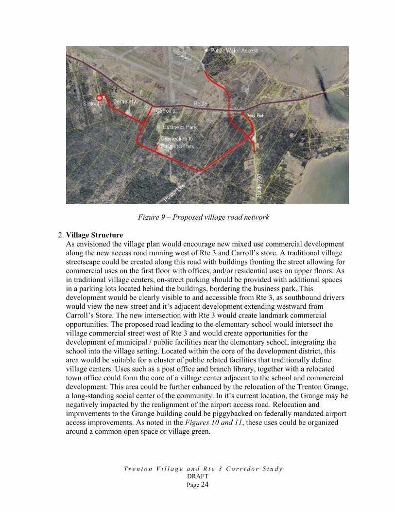
Figure 9 – Proposed village road network 2. Village Structure
As envisioned the village plan would encourage new mixed use commercial development along the new access road running west of Rte 3 and Carroll’s store. A traditional village streetscape could be created along this road with buildings fronting the street allowing for commercial uses on the first floor with offices, and/or residential uses on upper floors. As in traditional village centers, on-street parking should be provided with additional spaces in a parking lots located behind the buildings, bordering the business park. This development would be clearly visible to and accessible from Rte 3, as southbound drivers would view the new street and it’s adjacent development extending westward from Carroll’s Store. The new intersection with Rte 3 would create landmark commercial opportunities. The proposed road leading to the elementary school would intersect the village commercial street west of Rte 3 and would create opportunities for the development of municipal / public facilities near the elementary school, integrating the school into the village setting. Located within the core of the development district, this area would be suitable for a cluster of public related facilities that traditionally define village centers. Uses such as a post office and branch library, together with a relocated town office could form the core of a village center adjacent to the school and commercial development. This area could be further enhanced by the relocation of the Trenton Grange, a long-standing social center of the community. In it’s current location, the Grange may be negatively impacted by the realignment of the airport access road. Relocation and improvements to the Grange building could be piggybacked on federally mandated airport access improvements. As noted in the Figures 10 and 11, these uses could be organized around a common open space or village green.
T r e n t o n V i l l a g e a n d R t e 3 C o r r i d o r S t u d y
DRAFT Page 24

Figure 10 – Proposed Village Center development diagram
The local road network would provide an alternative (western) access for the business park allowing for exiting traffic to enter Rte 3 at the controlled Rte 230/3 intersection. The road system will allow for greater flexibility in business park expansion and by providing access to larger interior land holdings, can create new housing opportunities in proximity to commercial and municipal services. Depending upon site specific infrastructure opportunities residential development of varying densities and housing types could be developed radiating from the village center.
Local Access Road
Municipal center and village green
Rte 3
Business Park
l
Carroll’s Store
Commercial core
Figure11- Proposed Village Center
T r e n t o n V i l l a g e a n d R t e 3 C o r r i d o r S t u d y
DRAFT Page 25
To Schoo

3. Village Zoning
To promote opportunities for the development of a village center, the town of Trenton should consider revising and updating its current land use and subdivision ordinances. Although the current land use ordinance supports the concept of a village envisioned by the comprehensive plan “by promoting (sic) a mixed use activity area that concentrates pedestrian intensive commercial and residential uses with the scale and intensity of the existing uses found in the area. New streets and pedestrian links with school, town office, fire station and grocery stores are to be emphasized and encouraged”, the standards set for development of the village district (lot size, setback, etc.) do not necessarily support it’s stated purpose or promote village scaled development. To foster the opportunities originally envisioned by the comprehensive plan and further articuilated by this study, the town may consider further defining the village area into three districts, each addressing existing conditions and future opportunities: • Village Corridor District, to compasses the Rte 3 corridor from the school to the
bridge gateway; • Village Center District, to include the commercial areas around Carroll’s store; • Village Residential District, to include areas surrounding he village core; • Business Park Overlay District, to cover areas surrounding the existing business
park. The business park abuts both the proposed commercial core of the village and residential areas. Modest expansion of the business park to south and west in a manner that does not compromise the integrity of the other districts should be anticipated in revisions to the ordinance.
Figure 12 Village District Zoning (IMAGE TO BE REVISED)
T r e n t o n V i l l a g e a n d R t e 3 C o r r i d o r S t u d y
DRAFT Page 26
The following outlines the goals and criteria for each of the proposed districts illustrated in
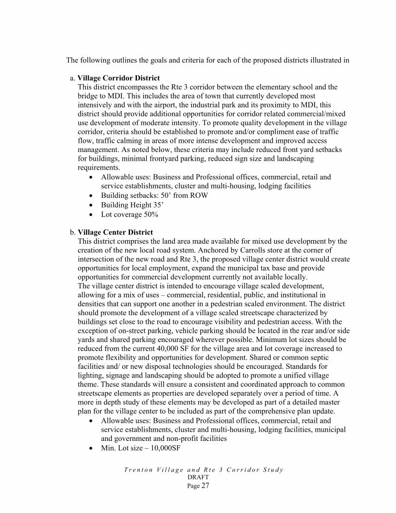
a. Village Corridor District
This district encompasses the Rte 3 corridor between the elementary school and the bridge to MDI. This includes the area of town that currently developed most intensively and with the airport, the industrial park and its proximity to MDI, this district should provide additional opportunities for corridor related commercial/mixed use development of moderate intensity. To promote quality development in the village corridor, criteria should be established to promote and/or compliment ease of traffic flow, traffic calming in areas of more intense development and improved access management. As noted below, these criteria may include reduced front yard setbacks for buildings, minimal frontyard parking, reduced sign size and landscaping requirements.
• Allowable uses: Business and Professional offices, commercial, retail and service establishments, cluster and multi-housing, lodging facilities
• Building setbacks: 50’ from ROW • Building Height 35’ • Lot coverage 50%
b. Village Center District
This district comprises the land area made available for mixed use development by the creation of the new local road system. Anchored by Carrolls store at the corner of intersection of the new road and Rte 3, the proposed village center district would create opportunities for local employment, expand the municipal tax base and provide opportunities for commercial development currently not available locally. The village center district is intended to encourage village scaled development, allowing for a mix of uses – commercial, residential, public, and institutional in densities that can support one another in a pedestrian scaled environment. The district should promote the development of a village scaled streetscape characterized by buildings set close to the road to encourage visibility and pedestrian access. With the exception of on-street parking, vehicle parking should be located in the rear and/or side yards and shared parking encouraged wherever possible. Minimum lot sizes should be reduced from the current 40,000 SF for the village area and lot coverage increased to promote flexibility and opportunities for development. Shared or common septic facilities and/ or new disposal technologies should be encouraged. Standards for lighting, signage and landscaping should be adopted to promote a unified village theme. These standards will ensure a consistent and coordinated approach to common streetscape elements as properties are developed separately over a period of time. A more in depth study of these elements may be developed as part of a detailed master plan for the village center to be included as part of the comprehensive plan update.
• Allowable uses: Business and Professional offices, commercial, retail and service establishments, cluster and multi-housing, lodging facilities, municipal and government and non-profit facilities
• Min. Lot size – 10,000SF
T r e n t o n V i l l a g e a n d R t e 3 C o r r i d o r S t u d y
DRAFT Page 27
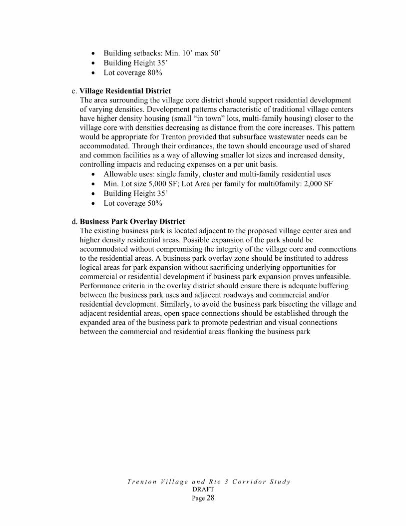
• Building setbacks: Min. 10’ max 50’ • Building Height 35’ • Lot coverage 80%
c. Village Residential District
The area surrounding the village core district should support residential development of varying densities. Development patterns characteristic of traditional village centers have higher density housing (small “in town” lots, multi-family housing) closer to the village core with densities decreasing as distance from the core increases. This pattern would be appropriate for Trenton provided that subsurface wastewater needs can be accommodated. Through their ordinances, the town should encourage used of shared and common facilities as a way of allowing smaller lot sizes and increased density, controlling impacts and reducing expenses on a per unit basis.
• Allowable uses: single family, cluster and multi-family residential uses • Min. Lot size 5,000 SF; Lot Area per family for multi0family: 2,000 SF • Building Height 35’ • Lot coverage 50%
d. Business Park Overlay District
The existing business park is located adjacent to the proposed village center area and higher density residential areas. Possible expansion of the park should be accommodated without compromising the integrity of the village core and connections to the residential areas. A business park overlay zone should be instituted to address logical areas for park expansion without sacrificing underlying opportunities for commercial or residential development if business park expansion proves unfeasible. Performance criteria in the overlay district should ensure there is adequate buffering between the business park uses and adjacent roadways and commercial and/or residential development. Similarly, to avoid the business park bisecting the village and adjacent residential areas, open space connections should be established through the expanded area of the business park to promote pedestrian and visual connections between the commercial and residential areas flanking the business park
T r e n t o n V i l l a g e a n d R t e 3 C o r r i d o r S t u d y
DRAFT Page 28
T r e n t o n V i l l a g e a n d R t e 3 C o r r i d o r S t u d y
DRAFT Page 29
IV. IMPLEMENTATION STRATEGIES
Implementation of the recommendation outlined in this report will be a multi-staged process. The first step is to update the town-wide comprehensive plan and land use zoning ordinances incorporating these and other recommendations into practical concepts for Trenton’s future. The adoption of these instruments will ensure that both private and public investment will be directed toward achieving a common vision for the town’s future. In summary, updates to comprehensive plan and land use ordinances should:
• Adopt corridor management strategies • Protect identified scenic resources • Adopt village master plan; establish development criteria • Redefine village zoning
Improvements to the Rte 3 Corridor will be contingent upon MaineDOT funding. The town should work closely with MaineDOT to ensure needed improvements to intersections, road alignment, and road bed renovation /surfacing are included in biannual MaineDOT budgeting. The Town of Trenton should work closely with MaineDOT and its legislative delegation to ensure project requests are made on a timely basis. The updated comprehensive plan and zoning ordinance may provide adequate support for scenic preservation / enhancement to encourage reconsideration of an extension of the Acadia All American Road. Designation of the Rte 3 as a Scenic Byway may assist in securing federal assistance. Similarly with MaineDOT, FHA / FTA participation in the proposed multi-modal center, Trenton may look to leverage their position in this process for to Rte 3 enhancements and opportunities for local roadway and related infrastructure improvements. Development of Trenton Village will likely result from private development guided by the comprehensive plan and zoning ordinance. As part of the update to the comprehensive plan, a more detailed master plan of the village center should be created, illustrating development opportunities and specific guidelines to be included in the revised zoning ordinance. Upon adoption of the plan, the town may work with private landowners to issue a Request for Proposals to developers for implementation of the village center concept. This may include roads, utilities, and specific parcels for development. The town may participate in necessary capital improvements and/or create a Tax Increment Finance (TIF) District to allow future tax revenues to be re-invested in village center development.