Embed Size (px)
Citation preview
STATEMENT OF QUALIFICATIONS
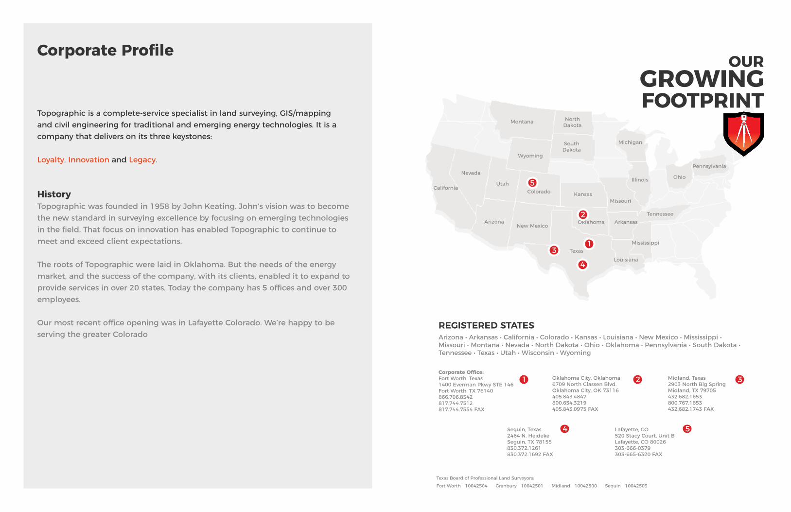
Topographic is a complete-service specialist in land surveying, GIS/mapping and civil engineering for traditional and emerging energy technologies. It is a company that delivers on its three keystones: Loyalty, Innovation and Legacy.
HistoryTopographic was founded in 1958 by John Keating. John’s vision was to become the new standard in surveying excellence by focusing on emerging technologies in the field. That focus on innovation has enabled Topographic to continue to meet and exceed client expectations.
The roots of Topographic were laid in Oklahoma. But the needs of the energy market, and the success of the company, with its clients, enabled it to expand to provide services in over 20 states. Today the company has 5 offices and over 300 employees.
Our most recent office opening was in Lafayette Colorado. We’re happy to be serving the greater Colorado
Corporate ProfileOUR
GROWINGFOOTPRINT
REGISTERED STATESArizona • Arkansas • California • Colorado • Kansas • Louisiana • New Mexico • Mississippi • Missouri • Montana • Nevada • North Dakota • Ohio • Oklahoma • Pennsylvania • South Dakota • Tennessee • Texas • Utah • Wisconsin • Wyoming
Corporate Office: Fort Worth, Texas1400 Everman Pkwy STE 146Fort Worth, TX 76140 866.706.8542817.744.7512817.744.7554 FAX
Oklahoma City, Oklahoma6709 North Classen Blvd.Oklahoma City, OK 73116405.843.4847800.654.3219405.843.0975 FAX
Seguin, Texas 2464 N. Heideke Seguin, TX 78155 830.372.1261830.372.1692 FAX
Texas Board of Professional Land Surveyors:Fort Worth - 10042504 Granbury - 10042501 Midland - 10042500 Seguin - 10042503
Midland, Texas2903 North Big SpringMidland, TX 79705432.682.1653800.767.1653432.682.1743 FAX
Lafayette, CO520 Stacy Court, Unit BLafayette, CO 80026303-666-0379303-665-6320 FAX
TexasLouisiana
Tennessee
Mississippi
New MexicoArizona
California
Nevada
UtahColorado
Wyoming
Montana North Dakota
SouthDakota
Michigan
Illinois Ohio
Pennsylvania
Oklahoma
KansasMissouri
Arkansas
1
2
3
321
4 5
5
4
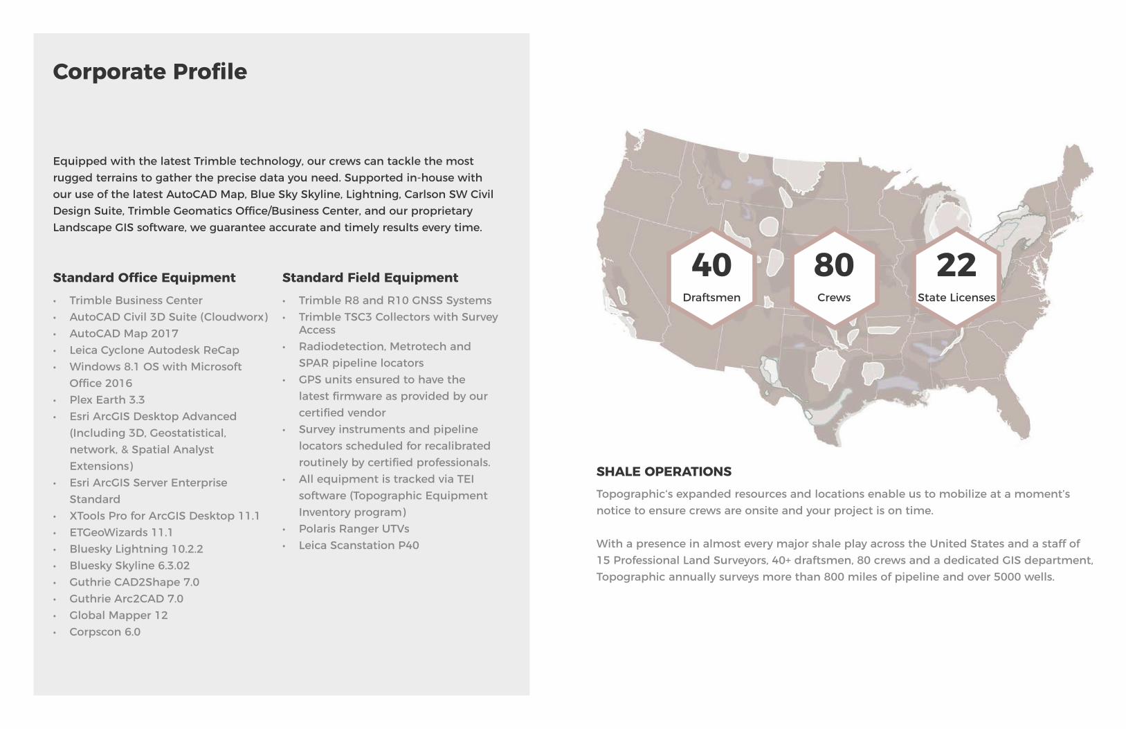
Equipped with the latest Trimble technology, our crews can tackle the most rugged terrains to gather the precise data you need. Supported in-house with our use of the latest AutoCAD Map, Blue Sky Skyline, Lightning, Carlson SW Civil Design Suite, Trimble Geomatics Office/Business Center, and our proprietary Landscape GIS software, we guarantee accurate and timely results every time.
Draftsmen Crews State LicensesStandard Office Equipment• Trimble Business Center• AutoCAD Civil 3D Suite (Cloudworx)• AutoCAD Map 2017• Leica Cyclone Autodesk ReCap• Windows 8.1 OS with Microsoft
Office 2016• Plex Earth 3.3• Esri ArcGIS Desktop Advanced
(Including 3D, Geostatistical, network, & Spatial Analyst Extensions)
• Esri ArcGIS Server Enterprise Standard
• XTools Pro for ArcGIS Desktop 11.1• ETGeoWizards 11.1• Bluesky Lightning 10.2.2• Bluesky Skyline 6.3.02• Guthrie CAD2Shape 7.0• Guthrie Arc2CAD 7.0• Global Mapper 12• Corpscon 6.0
Standard Field Equipment• Trimble R8 and R10 GNSS Systems • Trimble TSC3 Collectors with Survey
Access• Radiodetection, Metrotech and
SPAR pipeline locators• GPS units ensured to have the
latest firmware as provided by our certified vendor
• Survey instruments and pipeline locators scheduled for recalibrated routinely by certified professionals.
• All equipment is tracked via TEI software (Topographic Equipment Inventory program)
• Polaris Ranger UTVs• Leica Scanstation P40
SHALE OPERATIONSTopographic‘s expanded resources and locations enable us to mobilize at a moment’s notice to ensure crews are onsite and your project is on time.
With a presence in almost every major shale play across the United States and a staff of 15 Professional Land Surveyors, 40+ draftsmen, 80 crews and a dedicated GIS department, Topographic annually surveys more than 800 miles of pipeline and over 5000 wells.
Corporate Profile
40 80 22

The leadership team at Topographic brings a wide array of experience in the energy services, surveying and mapping industries. From their many years with the company, to their passion to operationalizing the latest in surveying technology, together, they embody the company values of loyalty, innovation and legacy.
Leadership
Robert Keating, Chairman of the Board
Robert began his career in surveying at Laughlin-Simmons in 1975. In 1977, he joined Topographic at the urging of his father and Topographic founder, John Keating, to move the company forward with the adoption of computerization. Beginning with the Wang computer, Robert spearheaded the implementation of Topographic’s accounting system to a computerized platform. Later, he would do the same in the creation of programs to incorporate survey functions to the Wang system. The emergence of the personal computer years
later would revolutionize the business environment and again, Robert would be at the forefront in implementing new strategies to incorporate field work into the latest technology. The results would include the formation of Topographic Mapping Company where Robert would serve as President. Through this division, Topographic mapped thousands of miles of pipeline for the newly created Texas Excavation Safety System (“Call Before You Dig” Program) and developed land grid products that became the foundation for digital maps still used today. Later, the inclusion of AutoCad, GPS and further technology would find its place in Topographic under Robert’s leadership as President of Topographic, Inc. Today, Robert serves as the Chairman of the Board of Topographic and is the embodiment of one of our most important core values, Innovation. Robert’s vision and passion to deliver the best products and services through the latest technology continues to redefine our value and commitment to our customers.
Brian Krafft, CEO
Brian Krafft is the Chief Executive Officer of Topographic, Inc. Brian previously served as Topographic’s Chief Operating Officer after holding the positions of Director of Pipeline Operations and Project Manager. During Brian’s 10 years of service, he has overseen the growth of Topographic’s Pipeline Division, company expansion through the acquisition of multiple locations, and most recently, the addition of Engineering to Topographic’s portfolio of offerings. Brian’s understanding of
Topographic’s core business and customer relationships help guide the company’s daily operations and the future needs of our customers. Brian received his MBA from Texas Christian University, holds a Bachelor of Science in Marketing from Oklahoma State University and a post Baccalaureate Certification in Geomatics from Texas A&M, Corpus Christi. Brian is a Registered Professional Land Surveyor in Texas with 10 years of experience in boundary, topographic, construction and route surveys.

Leadership
Susan Blueher, President, Oklahoma Division
Susan joined the firm in 1987 after a successful career with an oilfield servicing company. Using her previous experience, Susan quickly established herself within Topographic and began interfacing with clients on a daily basis. With a focus on customer service, Susan quickly progressed within the organization culminating in her being named President of Topographic Land Surveyors of Oklahoma in 1992. As President, Susan manages
all facets of the Oklahoma group and plays a leading role in pursuing company growth through her unique vision and unwavering devotion to customer service.
Julio Silva, Director of Operations
Julio joined the firm in 1993 as a draftsman in Topographic’s Midland office. Julio’s structural thinking, analytical assessment and level-headed leadership style propelled him into several increasing roles of responsibility including his current position of Director of Operations. Under Julio’s direction, Topographic opened its largest location in Fort Worth, TX, and consolidated the operational functions of its Pampa, Seguin,
and El Paso locations. In doing so, Julio has streamlined the daily functions of Topographic resulting in efficiency increases that reduce turnaround time and maximize project results. Julio has 20 years of experience in ALTA/ACSM Surveys; Wells and Units; Route and Survey Power Lines; Topographic Surveys; Volume/Quantity Surveys; Drainage and Utility Staking; Coordinated with multiple Cities and Municipalities on pipeline routing and permitting.

Leadership
Sage Earnest, Director of Pipeline Services
As the Director of Pipeline Operations, Sage is responsible for managing Topographic’s Pipeline division across all business units. Over the last 3 years, Sage has overseen Topographic’s pipeline growth to more than 800 miles surveyed annually. Prior to assuming his duties as the Director of Pipeline Operations, Sage served 5 years as a Project Manager and Lead Project Manager at Topographic. Sage’s project management style is a
perfect balance of getting the job done in a timely fashion, while maintaining the dignity of the final product. Sage’s leadership style and understanding of customers’ needs, coupled with his experience in the following areas, position him to continue the success of our Pipeline division and the value we bring to our customers. Sage received his Bachelor of Science in Finance from Oklahoma State University and post Baccalaureate Certification in Geomatics from Texas A&M, Corpus Christi. Sage is a registered professional land surveyor in Texas with 8 years of experience in route design, completing construction permitting requirements for state and local entities, environmental and archeological safeguard practices, boundary surveys for compressor sites, cryogenic plants, and fractionator plants, layout plans of plants, Wells and Units; Route and Survey Power lines; Topographic Surveys; Wells and Units; Route and Survey Power lines; Topographic Surveys.
Bill Keating, Director of Midland Operations
Bill Keating continues the legacy began by his father more than 50 years ago. After a childhood spent learning the intricacies of surveying for oil and gas, Bill joined Topographic’s Midland location as a Junior Party Chief in 1987. By the early 1990’s, Bill’s extensive field experience led him to the task of moving the company into the adoption of the newly emerging GPS technology. Under Bill’s guidance, Topographic adopted and refined the
technology enabling expansion into areas beyond oil and gas. In 1995, Bill became the Director of Operations for Topographic’s Midland location and expanded its services to include civil and municipal surveying. Topographic’s growth in Midland would continue east and help launch our largest location in Fort Worth, Texas. With over 20 years of experience in surveying contributing to more than 20,000 wells staked and countless miles of pipelines, Bill’s hands-on approach remains the same today as it was in 1987.

Leadership
Dave Costner, Director of Colorado Operations
Dave studied Forestry and Surveying at Oklahoma State University and obtained his PLS in Colorado in 1988. In 1991, he co-founded GeoSurv, Inc. Over the next 23 years, through his leadership, GeoSurv proudly served the Front Range and Rocky Mountain regions of Colorado and Wyoming. Dave was instrumental in the implementation of the latest surveying technologies and has extensive experience in boundary, route, topographic design,
hydrographic and heavy construction surveys. As the Colorado Branch Manager for Topographic Land Surveyors, Dave strives to continue the high standard of surveying excellence he’s established in over 25 years of service to the greater Colorado area.
Lisa Gregg, Director of Information Technology
Lisa is the Director of Information Technology (IT) at Topographic, Inc. She provides leadership for the creation and implementation of technology and security initiatives throughout the company. Prior to joining Topographic, Lisa’s career included building and leading global multi-level organizations for Fortune 500 companies and large government agencies within the oil and gas, airline, defense, consulting and transportation industries. Lisa has held several technical leadership positions
including Manager of Sales Automation with American Airlines, Service Delivery Executive with Electronic Data System (EDS), Director of IT, as well as Regional Operations Center Director with Texas Department of Transportation and most recently as IT Security and Infrastructure Leader with KBR, Inc., during an international assignment within the Middle East. Lisa is an energetic and client-focused leader with a balance of technical, financial and managerial abilities. She has extensive experience in strategizing and defining security and infrastructure standards, compliance/governance policies and procedures. Lisa has a Master of Science degree in Engineering Management from Southern Methodist University (SMU) and Bachelor of Science in Electrical Engineering from Prairie View A&M University with certifications in Information Technology Infrastructure Library (ITIL), Certified Information Security Manager (CISM), Enterprise Management, and Financial Management.

Key Personnel
Experience: not just a word but a quality earned over 60 years in the surveying and mapping industry. Below are some of our most prominent project managers from Topographic ready to serve a wide range of regions spanning the U.S.
Thomas Lee Howell – 35 years surveying experience; PLS (Oklahoma) since 1995; 32 years with Topographic.
Lee Goss – 24 years surveying experience; RPLS (California, Oklahoma, Kansas and Arkansas); 5 years with Topographic; Member of the Oklahoma Society of Land Surveyors and Kansas Society of Land Surveyors.
Eric Dumas – 22 years surveying experience; RPLS (Texas); 4 years with Topographic; Member of the Texas Society of Professional Land Surveyors.
Eric Baze – 17 years surveying experience; RPLS, PLS (Arkansas, Arizona, Kansas, North Dakota, Oklahoma, Texas, Wisconsin); 8 years with Topographic; Member of the Oklahoma Society of Land Surveyors, Kansas Society of Land Surveyors, National Society of Professional Surveyors, Arizona Society of Professional Land Surveyors, Texas Society of Professional Land Surveyors and Wisconsin Society of Land Surveyors.
John Anderson – 16 years surveying experience; RPLS (Texas); 3 year with Topographic; Member of the Texas Society of Professional Surveyors and the National Society of Professional Surveyors.
T. Wayne Fisch – 37 years surveying experience; PLS (Oklahoma, Kansas); 39 years with Topographic; Member of the Oklahoma Society of Land Surveyors, Kansas Society of Land Surveyors and National Society of Land Surveyors.
Jeff Leuders – 7 years surveying experience; RPLS (Texas); 9 years with Topographic; Member of the Texas Society of Professional Surveyors
Mike Brown – 17 years surveying experience; RPLS, PLS (Texas, New Mexico, Colorado, Arizona, Utah, Nevada, Kansas, North Dakota, Louisiana, Wyoming); 12 years with Topographic; Certified Federal Land Surveyor; Member of the Texas Society of Professional Land Surveyors, Arizona Society of Professional Land Surveyors, Kansas Society of Land Surveyors, New Mexico Society of Professional Surveyors and National Society of Professional Surveyors.
Pat Fox – 41 years of surveying experience; RPLS, PLS (Texas, Louisiana, Arkansas Mississippi, Wisconsin); 13 years with Topographic; Member of the Texas Society of Professional Surveyors and Louisiana Society of Professional Surveyors.
Joel Vogt – 19 years of surveying experience;PLS (Colorado); 20 years with Topographic.
Stan W. Lloyd – 34 years surveying experience; RPLS, PLS (Arizona, Colorado, Kansas, Missouri, New Mexico, Oklahoma, North Dakota, Pennsylvania, South Dakota, Texas, Utah and Wyoming) 1 year with Topographic;Member of the Texas Society of Professional Surveyors, Kansas Society of Land Surveyors and National Society of Land Surveyors. Affiliate Member, Oklahoma Society of Land Surveyors and Pennsylvania Society of Land Surveyors.
Robert Stokes – 14 years of GIS experience;GISP; Part 107 sUAS Pilot, Esri Desktop Professional, 10 years with Topographic;Geospatial Member of the Texas Society of Professional Surveyors, GITA, URISA, AUVSI, SCAUG.
Dennis Dierolf – 32 years of surveying experience;PLS (Pennsylvania), 1 year with Topographic.
Courtney Coates – 13 years of engineering experience;PE (Texas, Colorado, New Mexico, North Dakota, Utah), CFM (Texas), 1 year with Topographic; Member of American Public Works Association, Texas Floodplain Managers Association.
Zach Keating – 5 years of surveying experience;RPLS (Texas), 5 years with Topographic; Member of the Texas Society of Professional Surveyors.

Topographic is dedicated to the prevention and elimination of injuries to our employees, harm to the environment, and damage to property. The HSE management system enables us to target and identify potential hazards in order to mitigate these hazards through policy and training. Our goal is to achieve and sustain a positive safety culture with zero accidents. In addition, we are focused on preserving a drug-free work environment and strive to ensure that commitment with an aggressive drug and alcohol screening program.
Topographic‘s HSE management system is audited annually and meets the most stringent qualifying criteria from the following national agencies:
ISNetworld (Drug & Alcohol Testing/ES&H) (Operator Qualifications)PEC/Premier Safety Management (Drug & Alcohol Testing/ES&H) (Safeland Training)PICS (Contractor Prequalification/Contractor Management Services)DISA (Drug & Alcohol Testing/ES&H)National Compliance Management Service (Drug & Alcohol Testing/ES&H) Veriforce (Drug & Alcohol Testing/ES&H) (Operator Qualifications)Axiom Medical (Medical Case Management Consulting)FC Background (Drug & Alcohol Testing/ES&H)
Safety
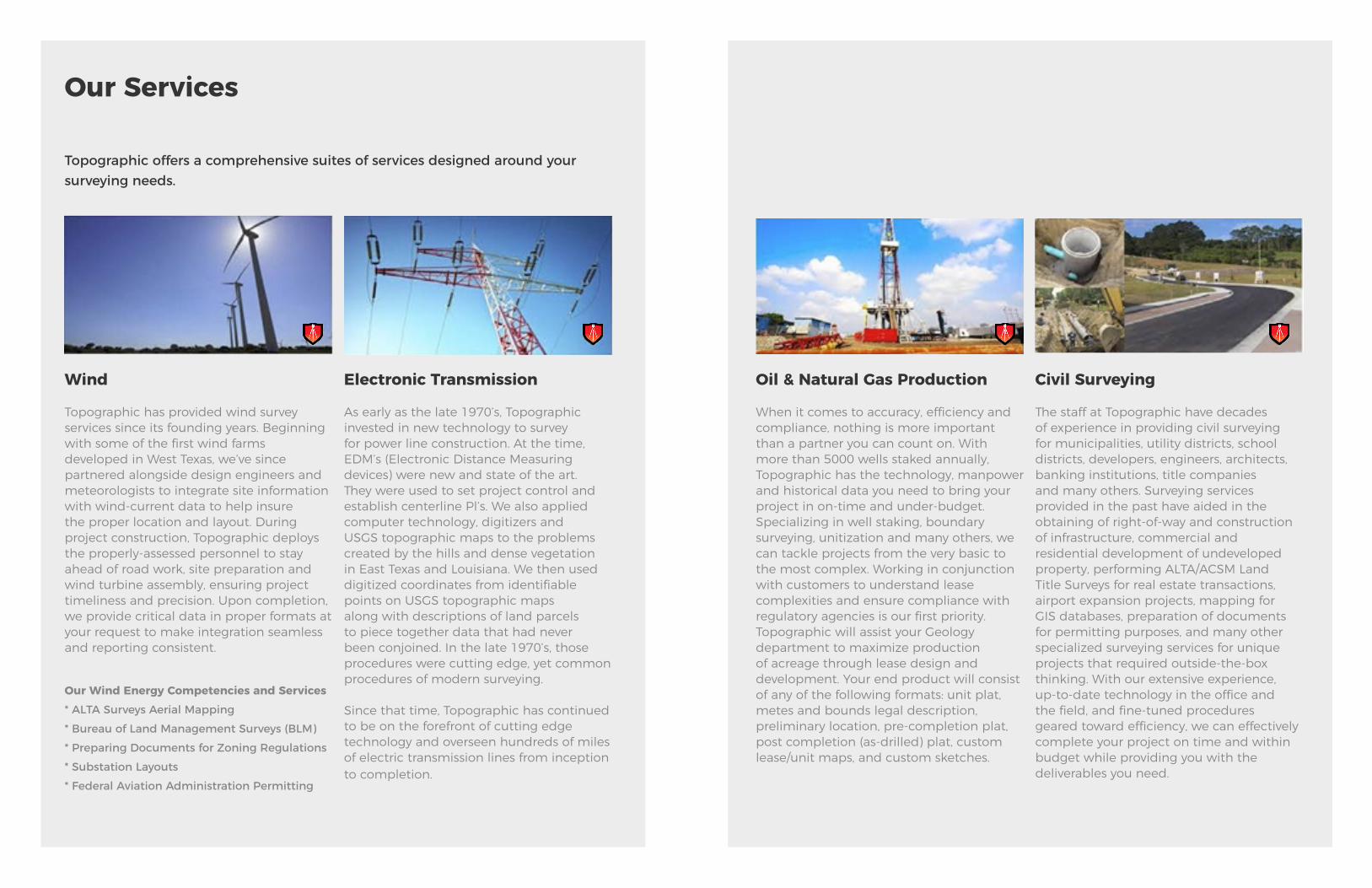
Topographic offers a comprehensive suites of services designed around your surveying needs.
Wind
Topographic has provided wind survey services since its founding years. Beginning with some of the first wind farms developed in West Texas, we’ve since partnered alongside design engineers and meteorologists to integrate site information with wind-current data to help insure the proper location and layout. During project construction, Topographic deploys the properly-assessed personnel to stay ahead of road work, site preparation and wind turbine assembly, ensuring project timeliness and precision. Upon completion, we provide critical data in proper formats at your request to make integration seamless and reporting consistent.
Our Wind Energy Competencies and Services* ALTA Surveys Aerial Mapping* Bureau of Land Management Surveys (BLM) * Preparing Documents for Zoning Regulations * Substation Layouts* Federal Aviation Administration Permitting
Electronic Transmission
As early as the late 1970’s, Topographic invested in new technology to survey for power line construction. At the time, EDM’s (Electronic Distance Measuring devices) were new and state of the art. They were used to set project control and establish centerline Pl’s. We also applied computer technology, digitizers and USGS topographic maps to the problems created by the hills and dense vegetation in East Texas and Louisiana. We then used digitized coordinates from identifiable points on USGS topographic maps along with descriptions of land parcels to piece together data that had never been conjoined. In the late 1970’s, those procedures were cutting edge, yet common procedures of modern surveying.
Since that time, Topographic has continued to be on the forefront of cutting edge technology and overseen hundreds of miles of electric transmission lines from inception to completion.
Our Services
Oil & Natural Gas Production
When it comes to accuracy, efficiency and compliance, nothing is more important than a partner you can count on. With more than 5000 wells staked annually, Topographic has the technology, manpower and historical data you need to bring your project in on-time and under-budget. Specializing in well staking, boundary surveying, unitization and many others, we can tackle projects from the very basic to the most complex. Working in conjunction with customers to understand lease complexities and ensure compliance with regulatory agencies is our first priority. Topographic will assist your Geology department to maximize production of acreage through lease design and development. Your end product will consist of any of the following formats: unit plat, metes and bounds legal description, preliminary location, pre-completion plat, post completion (as-drilled) plat, custom lease/unit maps, and custom sketches.
Civil Surveying
The staff at Topographic have decades of experience in providing civil surveying for municipalities, utility districts, school districts, developers, engineers, architects, banking institutions, title companies and many others. Surveying services provided in the past have aided in the obtaining of right-of-way and construction of infrastructure, commercial and residential development of undeveloped property, performing ALTA/ACSM Land Title Surveys for real estate transactions, airport expansion projects, mapping for GIS databases, preparation of documents for permitting purposes, and many other specialized surveying services for unique projects that required outside-the-box thinking. With our extensive experience, up-to-date technology in the office and the field, and fine-tuned procedures geared toward efficiency, we can effectively complete your project on time and within budget while providing you with the deliverables you need.
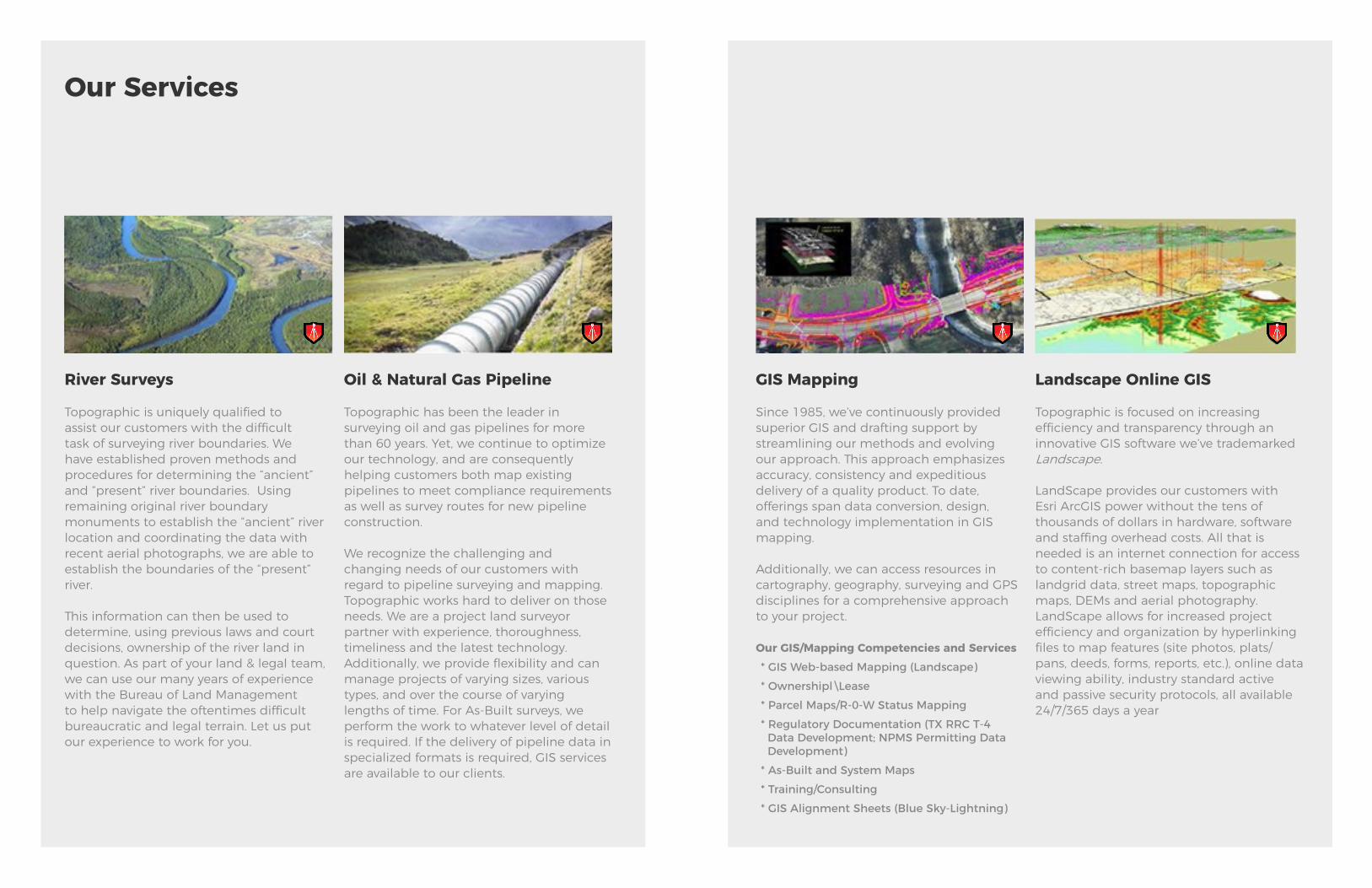
River Surveys
Topographic is uniquely qualified to assist our customers with the difficult task of surveying river boundaries. We have established proven methods and procedures for determining the “ancient” and “present” river boundaries. Using remaining original river boundary monuments to establish the “ancient” river location and coordinating the data with recent aerial photographs, we are able to establish the boundaries of the “present” river.
This information can then be used to determine, using previous laws and court decisions, ownership of the river land in question. As part of your land & legal team, we can use our many years of experience with the Bureau of Land Management to help navigate the oftentimes difficult bureaucratic and legal terrain. Let us put our experience to work for you.
Oil & Natural Gas Pipeline
Topographic has been the leader in surveying oil and gas pipelines for more than 60 years. Yet, we continue to optimize our technology, and are consequently helping customers both map existing pipelines to meet compliance requirements as well as survey routes for new pipeline construction.
We recognize the challenging and changing needs of our customers with regard to pipeline surveying and mapping. Topographic works hard to deliver on those needs. We are a project land surveyor partner with experience, thoroughness, timeliness and the latest technology. Additionally, we provide flexibility and can manage projects of varying sizes, various types, and over the course of varying lengths of time. For As-Built surveys, we perform the work to whatever level of detail is required. If the delivery of pipeline data in specialized formats is required, GIS services are available to our clients.
Our Services
GIS Mapping
Since 1985, we’ve continuously provided superior GIS and drafting support by streamlining our methods and evolving our approach. This approach emphasizes accuracy, consistency and expeditious delivery of a quality product. To date, offerings span data conversion, design, and technology implementation in GIS mapping.
Additionally, we can access resources in cartography, geography, surveying and GPS disciplines for a comprehensive approach to your project.
Our GIS/Mapping Competencies and Services * GIS Web-based Mapping (Landscape) * Ownershipl\Lease * Parcel Maps/R-0-W Status Mapping* Regulatory Documentation (TX RRC T-4 Data Development; NPMS Permitting Data Development)* As-Built and System Maps * Training/Consulting* GIS Alignment Sheets (Blue Sky-Lightning)
Landscape Online GIS
Topographic is focused on increasing efficiency and transparency through an innovative GIS software we’ve trademarked Landscape.
LandScape provides our customers with Esri ArcGIS power without the tens of thousands of dollars in hardware, software and staffing overhead costs. All that is needed is an internet connection for access to content-rich basemap layers such as landgrid data, street maps, topographic maps, DEMs and aerial photography. LandScape allows for increased project efficiency and organization by hyperlinking files to map features (site photos, plats/pans, deeds, forms, reports, etc.), online data viewing ability, industry standard active and passive security protocols, all available 24/7/365 days a year
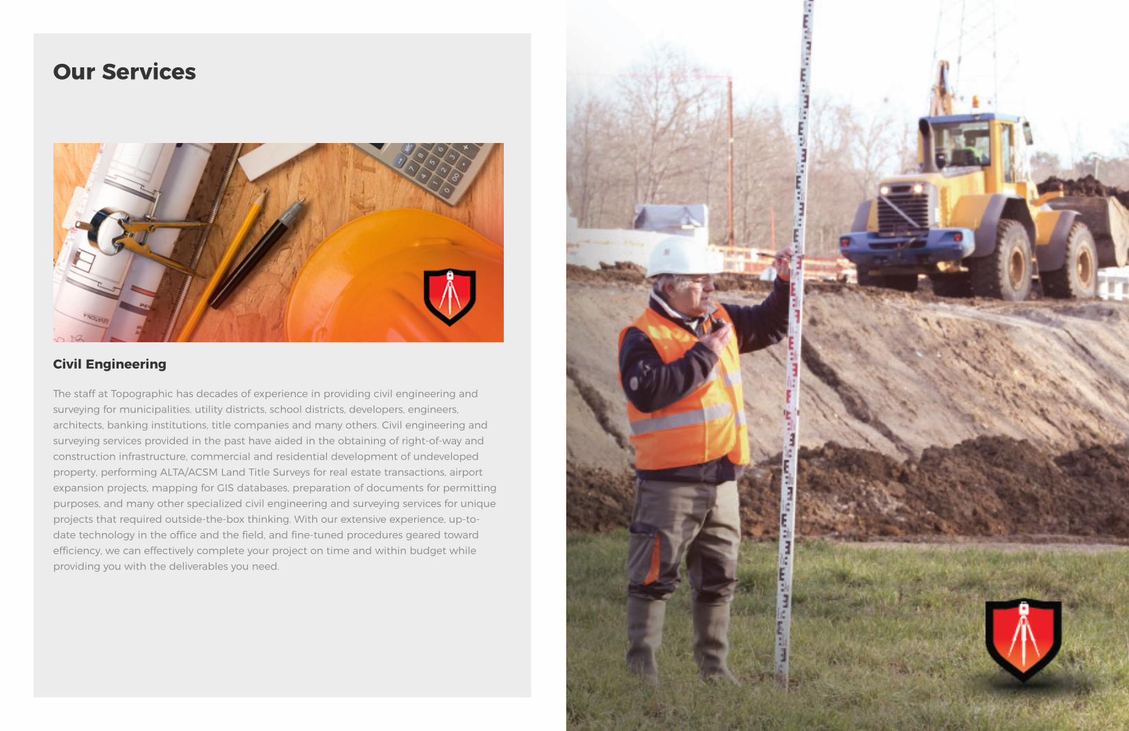
Civil Engineering
The staff at Topographic has decades of experience in providing civil engineering and surveying for municipalities, utility districts, school districts, developers, engineers, architects, banking institutions, title companies and many others. Civil engineering and surveying services provided in the past have aided in the obtaining of right-of-way and construction infrastructure, commercial and residential development of undeveloped property, performing ALTA/ACSM Land Title Surveys for real estate transactions, airport expansion projects, mapping for GIS databases, preparation of documents for permitting purposes, and many other specialized civil engineering and surveying services for unique projects that required outside-the-box thinking. With our extensive experience, up-to-date technology in the office and the field, and fine-tuned procedures geared toward efficiency, we can effectively complete your project on time and within budget while providing you with the deliverables you need.
Our Services
Efficiency and Cost Control
Topographic has moved from a fixed asset location structure to a mobile crew location form. The nomadic nature of the business and company expansion into over 20 states identified a need to house crews closer to project locations. The ability to set up mobile offices and utilize our fixed-office locations has made mobilization and demobilization more efficient and cost-effective. Topographic will utilize crews that are the closest in proximity to particular projects to increase uptime and limit expenses such as per diem and mileage. The end result is value to our customers.
Project Management
Topographic establishes teams assigned to specific projects. Each division of the organization is represented including Project Management, Drafting, Safety, Field and Quality Control. These teams meet on a weekly basis to go over all active projects and identify the following: overall status, project summary, key issues, identified risks, next steps, future dates, actual cost, budgeted cost and customer communication. Externally, Topographic follows the reporting procedure unique to each project/company as defined in the kickoff meetings prior to the beginning of the project. The same criteria is examined with the added use of the resource loaded schedule to ensure the project is moving forward as agreed.
QA/QC
Topographic has put in place a process stipulating the flow of information and subsequent deliverables beginning with the receipt of data from the field through delivery of the final product. Each step must be completed and signed-off on before the next one may begin. These safeguards ensure our customers receive the highest quality while maximizing efficiency for quick turnaround times. In addition, with more than 40 drafters on-staff throughout our 5 locations, Topographic has the flexibility to route our workflow as needed to meet tight time constraints. Our policies are uniform across all locations ensuring the same level of quality and consistency in the final product.
Best Practices
Management Philosophy
Topographic‘s management philosophy focuses on quality, safety and continual improvement. Training is the key factor in the success of our management philosophy, spearheaded by the Directors of each department. Specific to survey, each of our 15 RPLS’s and PLS’s are required to complete CEU’s (Continuing Education Units) per year and act as “trainers” for the field personnel. Topographic’s RPLS’s work with field crews to establish the proper steps for collecting boundary data, advising party chiefs in regards to what to look for and how to tie down important information, and the appropriate client code lists to utilize per job and in accordance with specific states.
Field Operations Managers train crews on the appropriate procedures for data collection as well as the use of field notes and isometric drawings. Party Chiefs train individual field crews on how to operate survey grade equipment and ensure courses on accurately locating pipe and sweeping construction areas are completed. Multiple crews are educated on specific customer requirements per job to ensure little flow downtime in the event of turnover.
Topographic‘s large pool of drafters ensures a quick turnaround time on deliverables for multiple projects. New hires are given current examples and Topographic’s CAD standards on their first day. During the first month of employment, drafters work closely with the CAD Manager and our “power users” to develop a fluency in procedures. Upon completion of the first month, drafters are able to work independently while continuing to turn in deliverables for management review. Monthly drafting meetings are held to discuss varying topics including peer-to-peer training, client standards and types of deliverables. Upper level users attend training seminars and conferences enabling them to “trickle down” their knowledge to other drafters. Adherence to our Quality Management Process ensures a consistent product regardless of the drafter on a specific project.

TEAK MIDSTREAMLaSalle, McMullen, Karnes, Bee and Refugio Counties, TX
Services Rendered:Boundary and Topographic Survey Critical Areas StudyEngineering Plan preparation Construction StakingAs-Built plan preparation Final Plat preparation
2011
Topographic was tasked with several major lines broken up into 12 phases, for a total of 186 miles of 24” and 20” lines. Served as the primary surveyor beginning with routing through As-Builts for the project. The job required the creation of a major 300-acre site to set the nexus for a Teak and Texstar system of lines. The project spanned LaSalle, McMullen, Karnes, Bee, and Refugio, Texas, counties. 12 sites were placed and provided the central hub of communication between Environmental, ROW, Construction, Clients, and Legal.
Work Experience
Experience, not just a word but a quality earned over 50 years in the surveying and mapping industry. Below are some of our most prominent project managers from Topographic ready to serve a wide range of regions spanning the U.S.
NUSTAR ENERGYOakville, TX
2012
Project consisted of a 56.6 acre storage facility site. Topographic was contracted to take over surveying activities for the site after the site’s ALTA survey had been completed. The project required Topographic to reestablish and incorporate new facility horizontal and vertical control (benchmarks). Management tasks included calculations and staking design for: rough and final grading cut/fill, storm water drainage, facility roadways and entrance ramps, containment dikes, electric utilities; storage tank, pipe rack, main/auxiliary pumps, and office building and shop foundations. Modifications to design in the field by contractors and/or engineers had to be surveyed, mapped, and reviewed for conflicts with other components for the facility. As-Built surveys for volume computations, piping and fabrication components were conducted and processed for the client’s reporting and archiving. All work was performed in conjunction with L-Con, Inc. (contracted engineering firm), NuStar Energy and the contracted Construction Inspector.
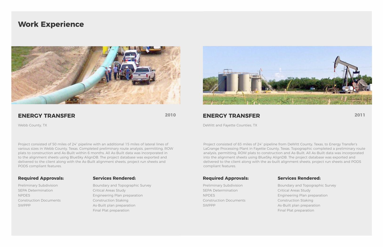
ENERGY TRANSFERWebb County, TX
2010
Project consisted of 50 miles of 24” pipeline with an additional 15 miles of lateral lines of various sizes in Webb County, Texas. Completed preliminary route analysis, permitting, ROW plats to construction and As-Built within 6 months. All As-Built data was incorporated in to the alignment sheets using BlueSky AlignDB. The project database was exported and delivered to the client along with the As-Built alignment sheets, project run sheets and PODS compliant features.
Work Experience
Required Approvals:Preliminary Subdivision SEPA Determination NPDESConstruction Documents SWPPP
Services Rendered:Boundary and Topographic Survey Critical Areas StudyEngineering Plan preparation Construction StakingAs-Built plan preparation Final Plat preparation
Experience, not just a word but a quality earned over 50 years in the surveying and mapping industry. Below are some of our most prominent project managers from Topographic ready to serve a wide range of regions spanning the U.S.
Project consisted of 83 miles of 24” pipeline from DeWitt County, Texas, to Energy Transfer’s LaGrange Processing Plant in Fayette County, Texas. Topographic completed a preliminary route analysis, permitting, ROW plats to construction and As-Built. All As-Built data was incorporated into the alignment sheets using BlueSky AlignDB. The project database was exported and delivered to the client along with the as-built alignment sheets, project run sheets and PODS compliant features.
Required Approvals:Preliminary Subdivision SEPA Determination NPDESConstruction Documents SWPPP
Services Rendered:Boundary and Topographic Survey Critical Areas StudyEngineering Plan preparation Construction StakingAs-Built plan preparation Final Plat preparation
ENERGY TRANSFERDeWitt and Fayette Counties, TX
2011
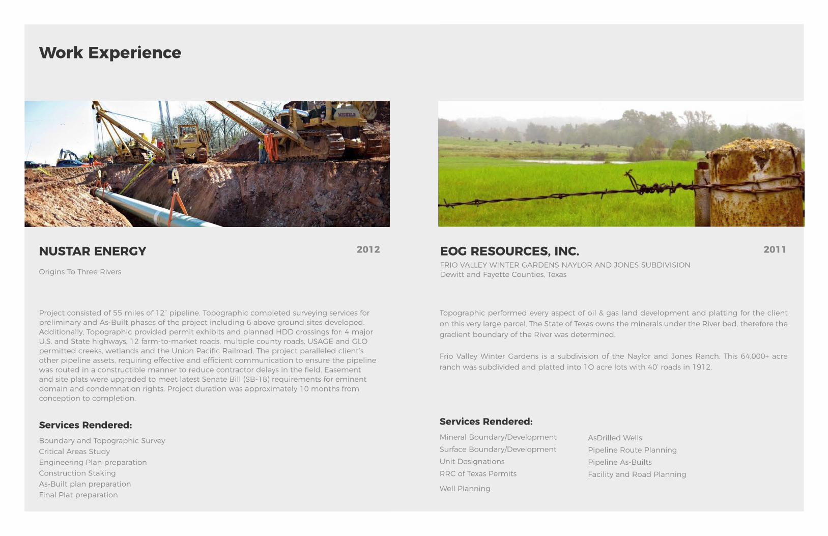
NUSTAR ENERGYOrigins To Three Rivers
2012
Project consisted of 55 miles of 12” pipeline. Topographic completed surveying services for preliminary and As-Built phases of the project including 6 above ground sites developed. Additionally, Topographic provided permit exhibits and planned HDD crossings for: 4 major U.S. and State highways, 12 farm-to-market roads, multiple county roads, USAGE and GLO permitted creeks, wetlands and the Union Pacific Railroad. The project paralleled client’s other pipeline assets, requiring effective and efficient communication to ensure the pipeline was routed in a constructible manner to reduce contractor delays in the field. Easement and site plats were upgraded to meet latest Senate Bill (SB-18) requirements for eminent domain and condemnation rights. Project duration was approximately 10 months from conception to completion.
Work Experience
Services Rendered:Boundary and Topographic Survey Critical Areas StudyEngineering Plan preparation Construction StakingAs-Built plan preparation Final Plat preparation
Experience, not just a word but a quality earned over 50 years in the surveying and mapping industry. Below are some of our most prominent project managers from Topographic ready to serve a wide range of regions spanning the U.S.
Topographic performed every aspect of oil & gas land development and platting for the client on this very large parcel. The State of Texas owns the minerals under the River bed, therefore the gradient boundary of the River was determined.
Frio Valley Winter Gardens is a subdivision of the Naylor and Jones Ranch. This 64,000+ acre ranch was subdivided and platted into 1O acre lots with 40’ roads in 1912.
Services Rendered:Mineral Boundary/Development Surface Boundary/Development Unit DesignationsRRC of Texas Permits
Well Planning
AsDrilled WellsPipeline Route Planning Pipeline As-BuiltsFacility and Road Planning
EOG RESOURCES, INC.FRIO VALLEY WINTER GARDENS NAYLOR AND JONES SUBDIVISIONDewitt and Fayette Counties, Texas
2011
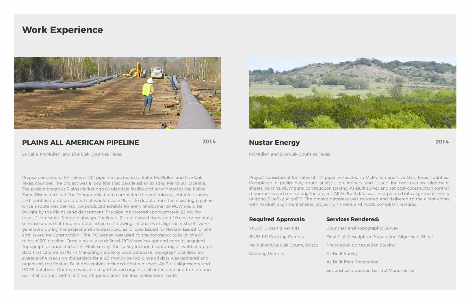
PLAINS ALL AMERICAN PIPELINELa Salle, McMullen, and Live Oak Counties, Texas
2014
Project consisted of 67 miles of 20” pipeline located in La Salle, McMullen and Live Oak, Texas, counties. The project was a loop line that paralleled an existing Plains 20” pipeline. The project began at Plains Marketing’s Gardendale facility and terminated at the Plains Three Rivers terminal. The Topographic team completed the preliminary centerline survey and identified problem areas that would cause Plains to deviate from their existing pipeline. Once a route was defined, we produced exhibits for every landowner so ROW could be bought by the Plains Land department. The pipeline crossed approximately 22 county roads, 1 interstate, 3 state highways, 1 railroad, 2 state owned rivers, and 10 environmentally sensitive areas that required detailed permit drawings. 3 phases of alignment sheets were generated during the project and are described as follows: Issued for Review, Issued for Bid and Issued for Construction . The IFC version was used by the contractor to build the 67 miles of 20” pipeline. Once a route was defined, ROW was bought and permits acquired. Topographic conducted an As-Built survey. The survey included capturing all weld and pipe data that catered to Plains Marketing’s BlueSky pods database. Topographic utilized an average of 4 crews on this project for a 3.5 month period. Once all data was gathered and organized, the final As-Built deliverables included: final run sheet, As-Built alignments, and PODS database. Our team was able to gather and organize all of the data and turn around our final product within a 2 month period after the final welds were made.
Work Experience
Experience, not just a word but a quality earned over 50 years in the surveying and mapping industry. Below are some of our most prominent project managers from Topographic ready to serve a wide range of regions spanning the U.S.
Project consisted of 53 miles of 12” pipeline located in McMullen and Live Oak, Texas, counties. Completed a preliminary route analysis, preliminary and Issued for construction alignment sheets, permits, ROW plats, construction staking, As-Built survey and set post-construction control monuments each mile along the project. All As-Built data was incorporated into alignment sheets utilizing BlueSky AlignDB. The project database was exported and delivered to the client along with As-Built alignment sheets, project run sheets and PODS compliant features.
Services Rendered:Boundary and Topographic Survey
Final Plat-Description Preparation Alignment Sheet
Preparation Construction Staking
As-Built Survey
As-Built Plan Preparation
Set post construction Control Monuments
Nustar EnergyMcMullen and Live Oak Counties, Texas
Required Approvals:TXDOT Crossing Permits
BNSF RR Crossing Permits
McMullen/Live Oak County Roads
Crossing Permits
2014
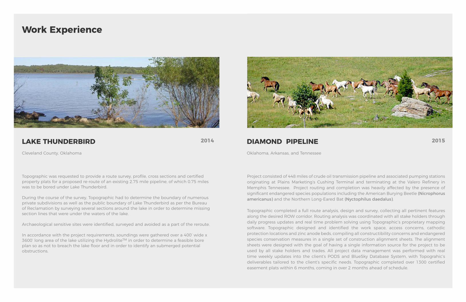
LAKE THUNDERBIRDCleveland County, Oklahoma
2014
Topographic was requested to provide a route survey, profile, cross sections and certified property plats for a proposed re-route of an existing 2.75 mile pipeline, of which 0.75 miles was to be bored under Lake Thunderbird.
During the course of the survey, Topographic had to determine the boundary of numerous private subdivisions as well as the public boundary of Lake Thunderbird as per the Bureau of Reclamation by surveying several sections around the lake in order to determine missing section lines that were under the waters of the lake.
Archaeological sensitive sites were identified, surveyed and avoided as a part of the reroute.
In accordance with the project requirements, soundings were gathered over a 400’ wide x 3600’ long area of the lake utilizing the Hydrolite TM in order to determine a feasible bore plan so as not to breach the lake floor and in order to identify an submerged potential obstructions.
Work Experience
Experience, not just a word but a quality earned over 50 years in the surveying and mapping industry. Below are some of our most prominent project managers from Topographic ready to serve a wide range of regions spanning the U.S.
Project consisted of 448 miles of crude oil transmission pipeline and associated pumping stations originating at Plains Marketing’s Cushing Terminal and terminating at the Valero Refinery in Memphis Tennessee. Project routing and completion was heavily affected by the presence of significant endangered species populations including the American Burying Beetle (Nicrophorus americanus) and the Northern Long-Eared Bat (Nyctophilus daedalus).
Topographic completed a full route analysis, design and survey, collecting all pertinent features along the desired ROW corridor. Routing analysis was coordinated with all stake holders through daily progress updates and real time problem solving using Topographic’s proprietary mapping software. Topographic designed and identified the work space, access concerns, cathodic protection locations and zinc anode beds, compiling all constructibility concerns and endangered species conservation measures in a single set of construction alignment sheets. The alignment sheets were designed with the goal of having a single information source for the project to be used by all stake holders and trades. All project data management was performed with real time weekly updates into the client’s PODS and BlueSky Database System, with Topograhic’s deliverables tailored to the client’s specific needs. Topographic completed over 1300 certified easement plats within 6 months, coming in over 2 months ahead of schedule.
DIAMOND PIPELINEOklahoma, Arkansas, and Tennessee
2015