Embed Size (px)
Citation preview

Providing Land Surveying Services in the State of Washington
Established in 1994
Company Statement of Qualifications
Alpha Subdivision Pro’s, Inc.
4532-B Evergreen Way
Everett, WA 98203
Phone: (425) 252-1884
Fax: (425) 339-0269
Table of Contents Section 1 General Information
• Firm Profile • Quality Commitment • Qualifications • Equipment
Section 2 Surveying and Planning Services
• Construction Surveys • Boundary Surveys • Feasibility Studies • Site Plans • Subdivisions – Short Plats, Plats, Rural Clusters & Testamentary • Condominium Surveys • Binding Site Plans • Boundary Line Adjustments & Agreements • FEMA Elevation Certificates & LOMA Surveys • A.L.T.A. Surveys • Control/Topographic Surveys • Horizontal & Vertical Monitoring Surveys • GPS Control Surveys • Municipal Projects • School Projects • Transportation Projects
Section 3 Key Personnel and References
• Key Personnel • References
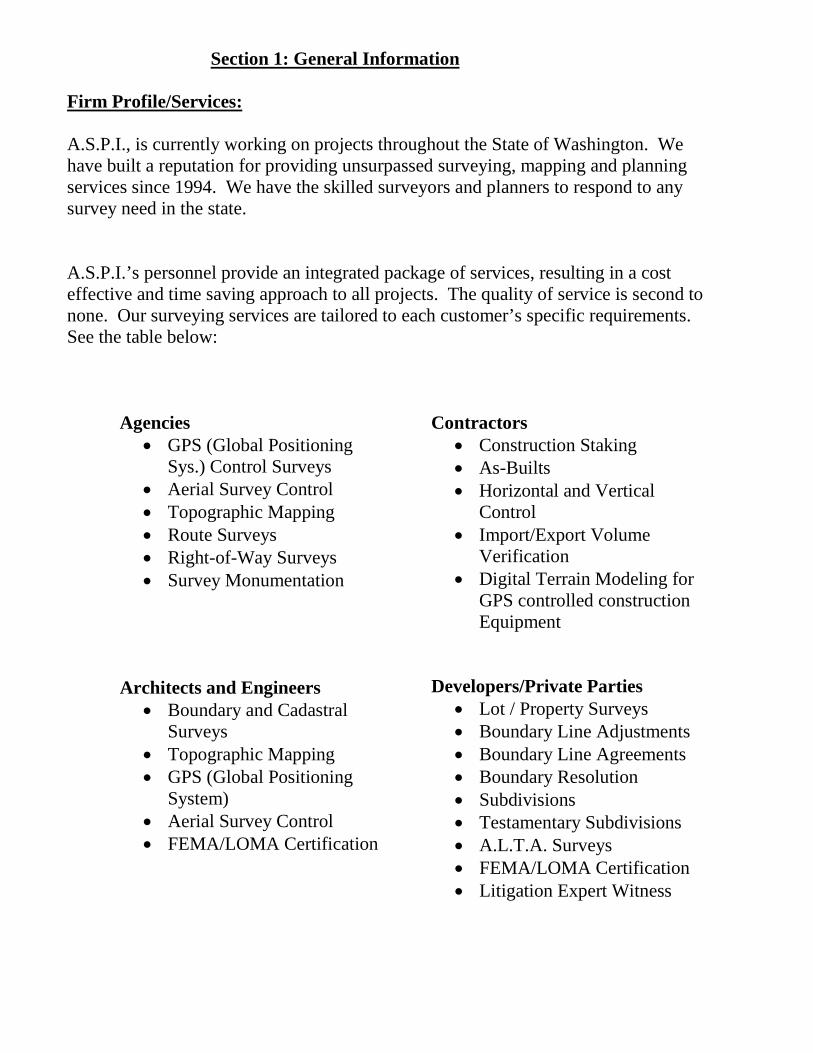
Section 1: General Information Firm Profile/Services: A.S.P.I., is currently working on projects throughout the State of Washington. We have built a reputation for providing unsurpassed surveying, mapping and planning services since 1994. We have the skilled surveyors and planners to respond to any survey need in the state. A.S.P.I.’s personnel provide an integrated package of services, resulting in a cost effective and time saving approach to all projects. The quality of service is second to none. Our surveying services are tailored to each customer’s specific requirements. See the table below:
Agencies • GPS (Global Positioning
Sys.) Control Surveys • Aerial Survey Control • Topographic Mapping • Route Surveys • Right-of-Way Surveys • Survey Monumentation
Architects and Engineers
• Boundary and Cadastral Surveys
• Topographic Mapping • GPS (Global Positioning
System) • Aerial Survey Control • FEMA/LOMA Certification
Contractors • Construction Staking • As-Builts • Horizontal and Vertical
Control • Import/Export Volume
Verification • Digital Terrain Modeling for
GPS controlled construction Equipment
Developers/Private Parties
• Lot / Property Surveys • Boundary Line Adjustments • Boundary Line Agreements • Boundary Resolution • Subdivisions • Testamentary Subdivisions • A.L.T.A. Surveys • FEMA/LOMA Certification • Litigation Expert Witness
Quality Commitment A.S.P.I. subscribes to the process control method for maintaining the highest level of quality and service. Written policies and checklists are implemented to control the process of every project. By following this system we are able to maintain the highest quality possible with the least amount of project difficulties. We can offer our customers a product free from errors or omissions. Our ability to react quickly with quality and service sets us apart from our colleagues. Our personnel are empowered to make decisions to insure your project does not experience unnecessary delays. Our experienced staff is well versed in training and mentoring our new staff members. Training is the backbone of integration into the “A.S.P.I. Way”. Qualifications Our surveyors and planners have an incredibly diverse industry background and are able to utilize that background to meet the surveying and mapping needs of our customers. You will always have a Licensed Surveyor working on your project. At A.S.P.I. we believe in multi-talented, multi-skilled individuals. Our staff is trained on all the latest equipment from GPS systems, Robotic Total Stations and field to finish data collection. We can do it all and do it better than most.
“What This Means to You”
Project Efficiency
Unsurpassed Quality
Timely Receipt of work product
Competitive Pricing
WA
Stat
e R
egis
tratio
n or
N
atio
nal C
ertif
icat
ion
Boun
dary
and
Cad
astra
l
A.L.
T.A.
Sur
veys
Topo
grap
hic
Con
stru
ctio
n
Rig
ht o
f Way
Sur
veys
As-B
uilts
and
Util
ity L
ocat
es
Hig
hway
and
Brid
ge
Con
stru
ctio
n
Rai
lroad
Sur
veys
Tran
smis
sion
/Util
ity L
ine
Surv
eys
Aeria
l Con
trol S
urve
ys
Dep
artm
ent o
f Def
ense
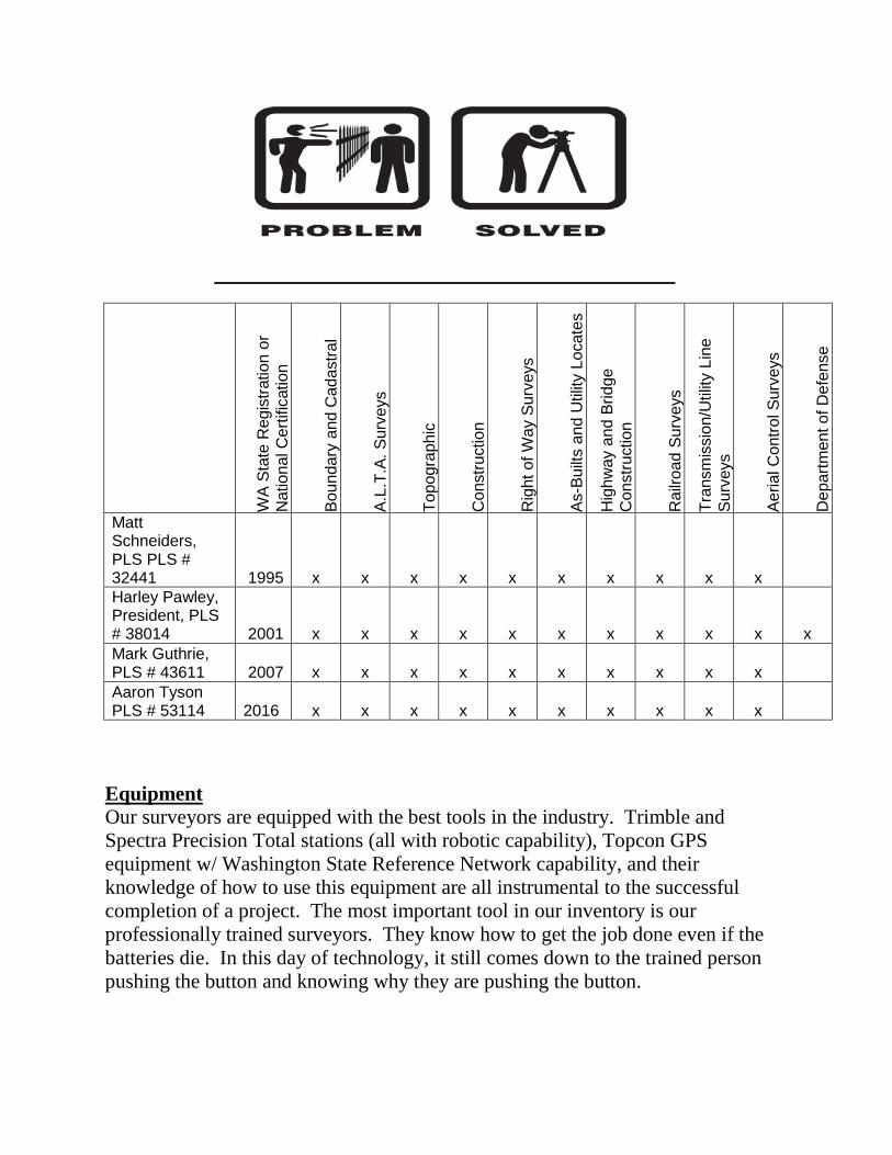
Matt Schneiders, PLS PLS # 32441 1995 x x x x x x x x x x Harley Pawley, President, PLS # 38014 2001 x x x x x x x x x x x Mark Guthrie, PLS # 43611 2007 x x x x x x x x x x Aaron Tyson PLS # 53114
2016 x x x x x x x x x x
Equipment Our surveyors are equipped with the best tools in the industry. Trimble and Spectra Precision Total stations (all with robotic capability), Topcon GPS equipment w/ Washington State Reference Network capability, and their knowledge of how to use this equipment are all instrumental to the successful completion of a project. The most important tool in our inventory is our professionally trained surveyors. They know how to get the job done even if the batteries die. In this day of technology, it still comes down to the trained person pushing the button and knowing why they are pushing the button.
Section 2: Surveying and Mapping Services
CONSTRUCTION PROJECTS
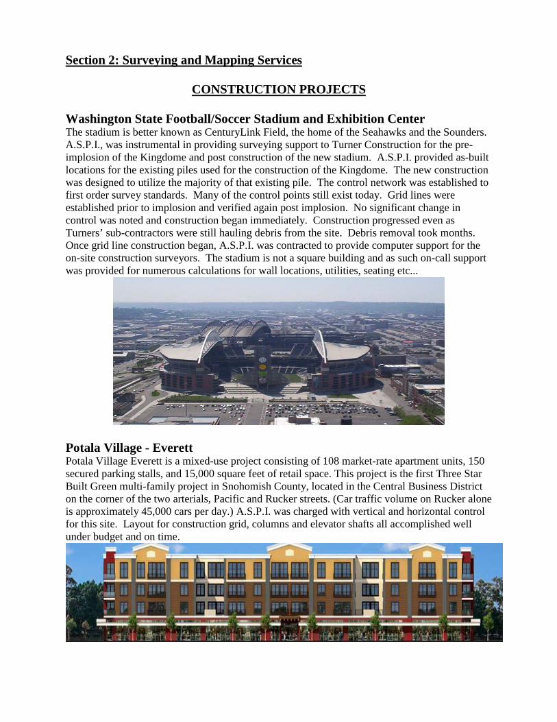
Washington State Football/Soccer Stadium and Exhibition Center The stadium is better known as CenturyLink Field, the home of the Seahawks and the Sounders. A.S.P.I., was instrumental in providing surveying support to Turner Construction for the pre-implosion of the Kingdome and post construction of the new stadium. A.S.P.I. provided as-built locations for the existing piles used for the construction of the Kingdome. The new construction was designed to utilize the majority of that existing pile. The control network was established to first order survey standards. Many of the control points still exist today. Grid lines were established prior to implosion and verified again post implosion. No significant change in control was noted and construction began immediately. Construction progressed even as Turners’ sub-contractors were still hauling debris from the site. Debris removal took months. Once grid line construction began, A.S.P.I. was contracted to provide computer support for the on-site construction surveyors. The stadium is not a square building and as such on-call support was provided for numerous calculations for wall locations, utilities, seating etc...
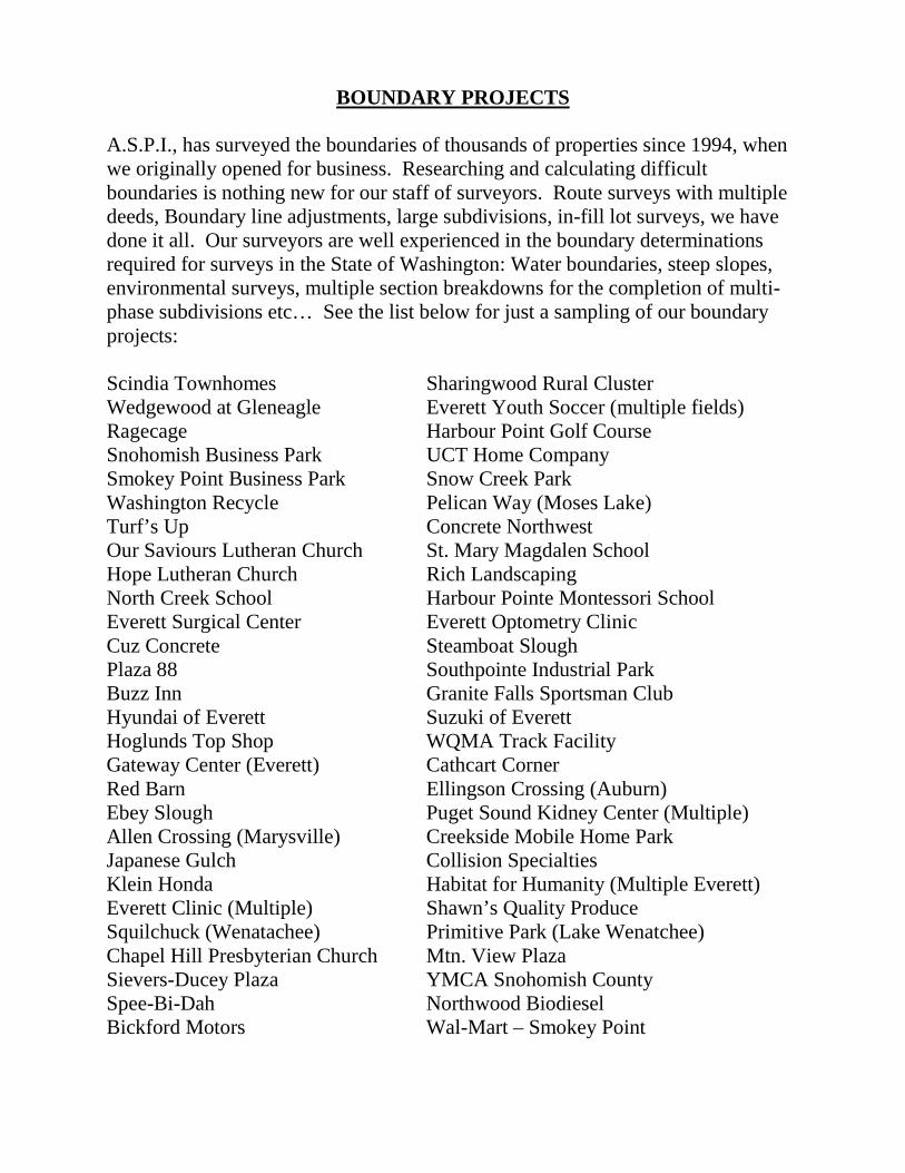
Potala Village - Everett Potala Village Everett is a mixed-use project consisting of 108 market-rate apartment units, 150 secured parking stalls, and 15,000 square feet of retail space. This project is the first Three Star Built Green multi-family project in Snohomish County, located in the Central Business District on the corner of the two arterials, Pacific and Rucker streets. (Car traffic volume on Rucker alone is approximately 45,000 cars per day.) A.S.P.I. was charged with vertical and horizontal control for this site. Layout for construction grid, columns and elevator shafts all accomplished well under budget and on time.
BOUNDARY PROJECTS
A.S.P.I., has surveyed the boundaries of thousands of properties since 1994, when we originally opened for business. Researching and calculating difficult boundaries is nothing new for our staff of surveyors. Route surveys with multiple deeds, Boundary line adjustments, large subdivisions, in-fill lot surveys, we have done it all. Our surveyors are well experienced in the boundary determinations required for surveys in the State of Washington: Water boundaries, steep slopes, environmental surveys, multiple section breakdowns for the completion of multi-phase subdivisions etc… See the list below for just a sampling of our boundary projects: Scindia Townhomes Sharingwood Rural Cluster Wedgewood at Gleneagle Everett Youth Soccer (multiple fields) Ragecage Harbour Point Golf Course Snohomish Business Park UCT Home Company Smokey Point Business Park Snow Creek Park Washington Recycle Pelican Way (Moses Lake) Turf’s Up Concrete Northwest Our Saviours Lutheran Church St. Mary Magdalen School Hope Lutheran Church Rich Landscaping North Creek School Harbour Pointe Montessori School Everett Surgical Center Everett Optometry Clinic Cuz Concrete Steamboat Slough Plaza 88 Southpointe Industrial Park Buzz Inn Granite Falls Sportsman Club Hyundai of Everett Suzuki of Everett Hoglunds Top Shop WQMA Track Facility Gateway Center (Everett) Cathcart Corner Red Barn Ellingson Crossing (Auburn) Ebey Slough Puget Sound Kidney Center (Multiple) Allen Crossing (Marysville) Creekside Mobile Home Park Japanese Gulch Collision Specialties Klein Honda Habitat for Humanity (Multiple Everett) Everett Clinic (Multiple) Shawn’s Quality Produce Squilchuck (Wenatachee) Primitive Park (Lake Wenatchee) Chapel Hill Presbyterian Church Mtn. View Plaza Sievers-Ducey Plaza YMCA Snohomish County Spee-Bi-Dah Northwood Biodiesel Bickford Motors Wal-Mart – Smokey Point
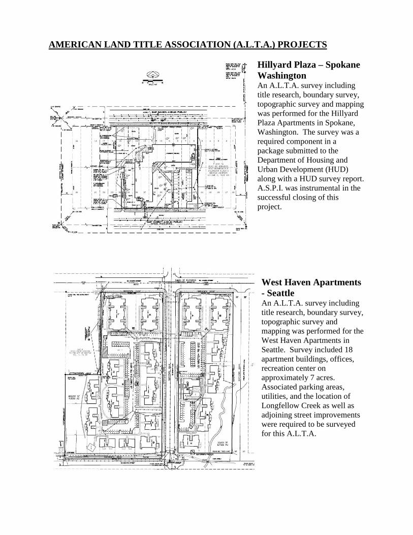
AMERICAN LAND TITLE ASSOCIATION (A.L.T.A.) PROJECTS Hillyard Plaza – Spokane Washington An A.L.T.A. survey including title research, boundary survey, topographic survey and mapping was performed for the Hillyard Plaza Apartments in Spokane, Washington. The survey was a required component in a package submitted to the Department of Housing and Urban Development (HUD) along with a HUD survey report. A.S.P.I. was instrumental in the successful closing of this project.
West Haven Apartments - Seattle An A.L.T.A. survey including title research, boundary survey, topographic survey and mapping was performed for the West Haven Apartments in Seattle. Survey included 18 apartment buildings, offices, recreation center on approximately 7 acres. Associated parking areas, utilities, and the location of Longfellow Creek as well as adjoining street improvements were required to be surveyed for this A.L.T.A.
CONTROL/TOPOGRAPHIC PROJECTS
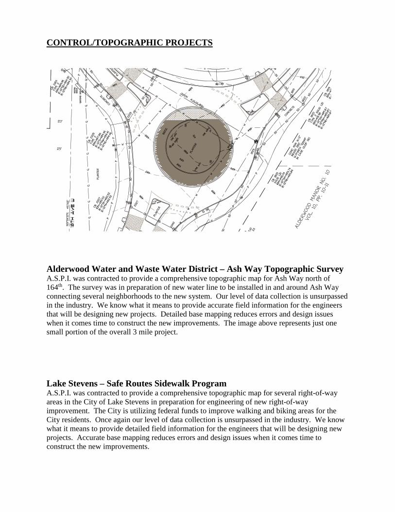
Alderwood Water and Waste Water District – Ash Way Topographic Survey A.S.P.I. was contracted to provide a comprehensive topographic map for Ash Way north of 164th. The survey was in preparation of new water line to be installed in and around Ash Way connecting several neighborhoods to the new system. Our level of data collection is unsurpassed in the industry. We know what it means to provide accurate field information for the engineers that will be designing new projects. Detailed base mapping reduces errors and design issues when it comes time to construct the new improvements. The image above represents just one small portion of the overall 3 mile project. Lake Stevens – Safe Routes Sidewalk Program A.S.P.I. was contracted to provide a comprehensive topographic map for several right-of-way areas in the City of Lake Stevens in preparation for engineering of new right-of-way improvement. The City is utilizing federal funds to improve walking and biking areas for the City residents. Once again our level of data collection is unsurpassed in the industry. We know what it means to provide detailed field information for the engineers that will be designing new projects. Accurate base mapping reduces errors and design issues when it comes time to construct the new improvements.
TRANSPORTATION PROJECTS
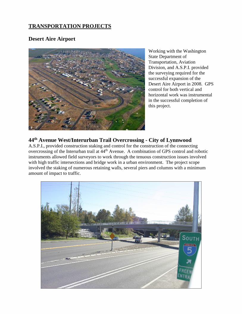
Desert Aire Airport Working with the Washington State Department of Transportation, Aviation Division, and A.S.P.I. provided the surveying required for the successful expansion of the Desert Aire Airport in 2008. GPS control for both vertical and horizontal work was instrumental in the successful completion of this project.
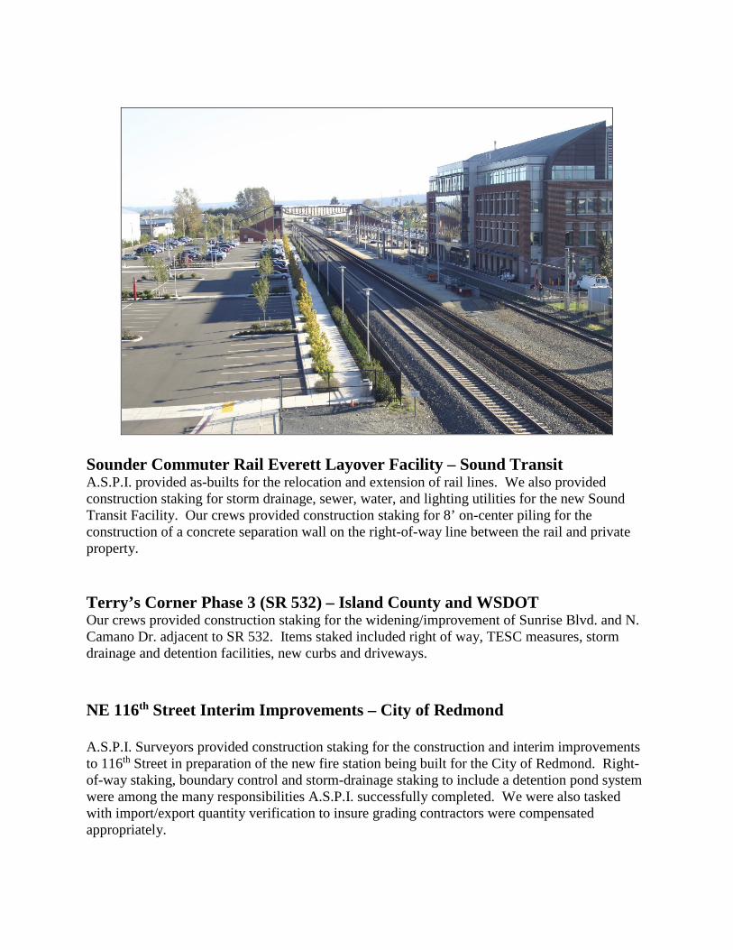
44th Avenue West/Interurban Trail Overcrossing - City of Lynnwood A.S.P.I., provided construction staking and control for the construction of the connecting overcrossing of the Interurban trail at 44th Avenue. A combination of GPS control and robotic instruments allowed field surveyors to work through the tenuous construction issues involved with high traffic intersections and bridge work in a urban environment. The project scope involved the staking of numerous retaining walls, several piers and columns with a minimum amount of impact to traffic.
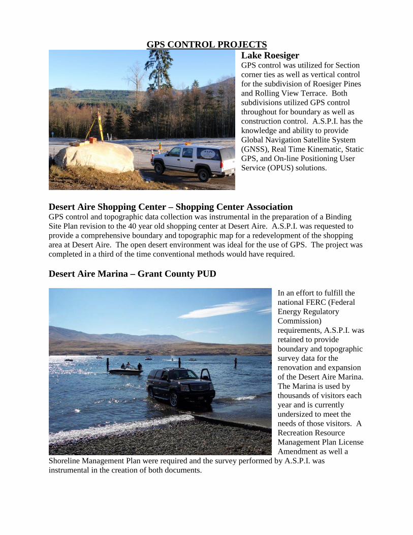
Sounder Commuter Rail Everett Layover Facility – Sound Transit A.S.P.I. provided as-builts for the relocation and extension of rail lines. We also provided construction staking for storm drainage, sewer, water, and lighting utilities for the new Sound Transit Facility. Our crews provided construction staking for 8’ on-center piling for the construction of a concrete separation wall on the right-of-way line between the rail and private property. Terry’s Corner Phase 3 (SR 532) – Island County and WSDOT Our crews provided construction staking for the widening/improvement of Sunrise Blvd. and N. Camano Dr. adjacent to SR 532. Items staked included right of way, TESC measures, storm drainage and detention facilities, new curbs and driveways. NE 116th Street Interim Improvements – City of Redmond A.S.P.I. Surveyors provided construction staking for the construction and interim improvements to 116th Street in preparation of the new fire station being built for the City of Redmond. Right-of-way staking, boundary control and storm-drainage staking to include a detention pond system were among the many responsibilities A.S.P.I. successfully completed. We were also tasked with import/export quantity verification to insure grading contractors were compensated appropriately.
GPS CONTROL PROJECTS Lake Roesiger GPS control was utilized for Section corner ties as well as vertical control for the subdivision of Roesiger Pines and Rolling View Terrace. Both subdivisions utilized GPS control throughout for boundary as well as construction control. A.S.P.I. has the knowledge and ability to provide Global Navigation Satellite System (GNSS), Real Time Kinematic, Static GPS, and On-line Positioning User Service (OPUS) solutions.
Desert Aire Shopping Center – Shopping Center Association GPS control and topographic data collection was instrumental in the preparation of a Binding Site Plan revision to the 40 year old shopping center at Desert Aire. A.S.P.I. was requested to provide a comprehensive boundary and topographic map for a redevelopment of the shopping area at Desert Aire. The open desert environment was ideal for the use of GPS. The project was completed in a third of the time conventional methods would have required. Desert Aire Marina – Grant County PUD
In an effort to fulfill the national FERC (Federal Energy Regulatory Commission) requirements, A.S.P.I. was retained to provide boundary and topographic survey data for the renovation and expansion of the Desert Aire Marina. The Marina is used by thousands of visitors each year and is currently undersized to meet the needs of those visitors. A Recreation Resource Management Plan License Amendment as well a
Shoreline Management Plan were required and the survey performed by A.S.P.I. was instrumental in the creation of both documents.
MUNICIPAL PROJECTS Mukilteo Community Center Designed by ARC Architects, the $8.5 million, 2-story, 29,000-square-foot building occupies a prominent site in Old Town Mukilteo, formerly the home of the Rosehill School. To respect the site’s original use, the stone archway from the school will be preserved and remain where it has stood for the last 81 years, welcoming the community to the new building. A.S.P.I., is providing all surveying control on this site and is working closely with the lead contractor to preserve the historic nature of this site.
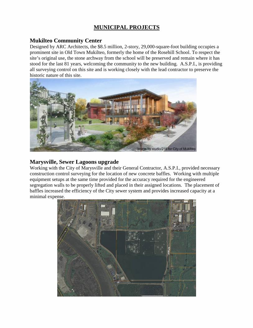
Marysville, Sewer Lagoons upgrade Working with the City of Marysville and their General Contractor, A.S.P.I., provided necessary construction control surveying for the location of new concrete baffles. Working with multiple equipment setups at the same time provided for the accuracy required for the engineered segregation walls to be properly lifted and placed in their assigned locations. The placement of baffles increased the efficiency of the City sewer system and provides increased capacity at a minimal expense.
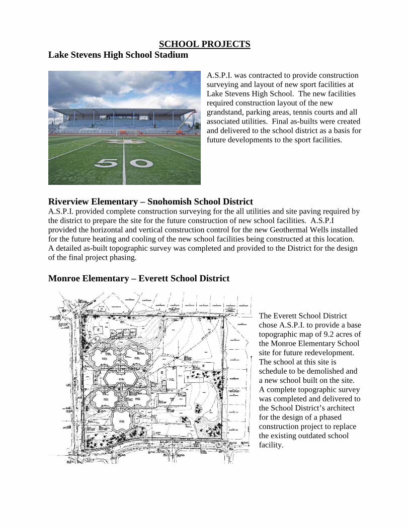
SCHOOL PROJECTS Lake Stevens High School Stadium
A.S.P.I. was contracted to provide construction surveying and layout of new sport facilities at Lake Stevens High School. The new facilities required construction layout of the new grandstand, parking areas, tennis courts and all associated utilities. Final as-builts were created and delivered to the school district as a basis for future developments to the sport facilities.
Riverview Elementary – Snohomish School District A.S.P.I. provided complete construction surveying for the all utilities and site paving required by the district to prepare the site for the future construction of new school facilities. A.S.P.I provided the horizontal and vertical construction control for the new Geothermal Wells installed for the future heating and cooling of the new school facilities being constructed at this location. A detailed as-built topographic survey was completed and provided to the District for the design of the final project phasing. Monroe Elementary – Everett School District
The Everett School District chose A.S.P.I. to provide a base topographic map of 9.2 acres of the Monroe Elementary School site for future redevelopment. The school at this site is schedule to be demolished and a new school built on the site. A complete topographic survey was completed and delivered to the School District’s architect for the design of a phased construction project to replace the existing outdated school facility.
FEMA/LOMA PROJECTS
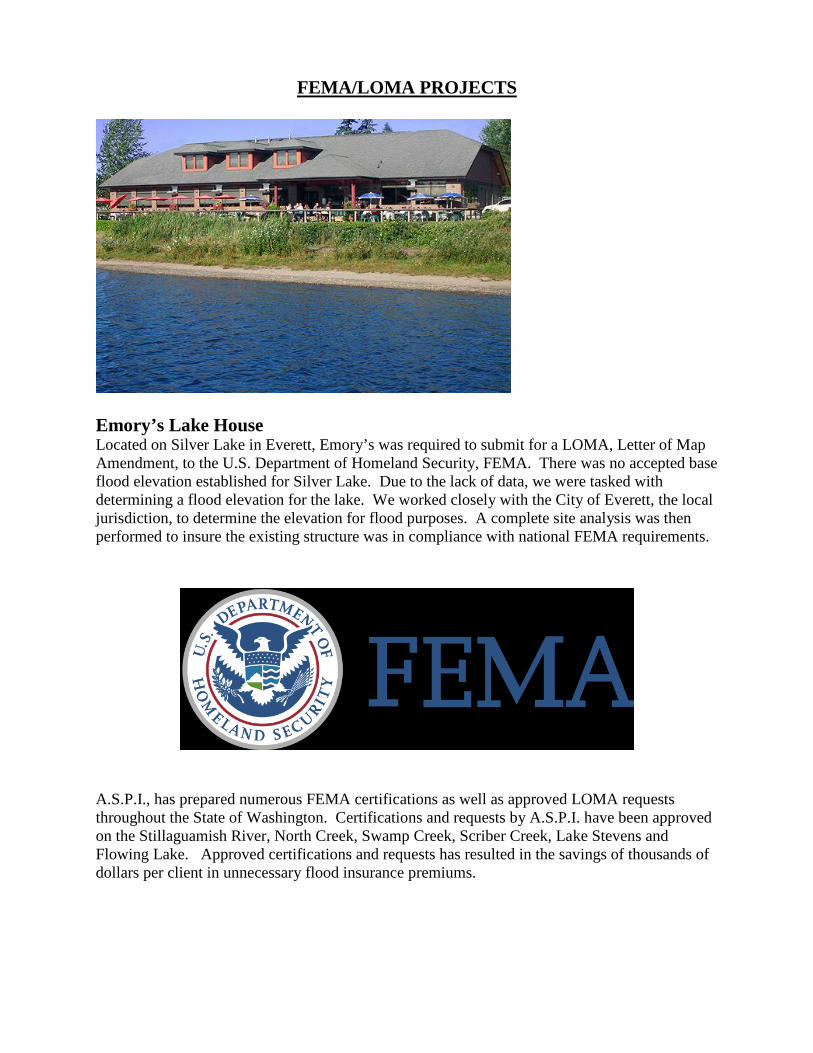
Emory’s Lake House Located on Silver Lake in Everett, Emory’s was required to submit for a LOMA, Letter of Map Amendment, to the U.S. Department of Homeland Security, FEMA. There was no accepted base flood elevation established for Silver Lake. Due to the lack of data, we were tasked with determining a flood elevation for the lake. We worked closely with the City of Everett, the local jurisdiction, to determine the elevation for flood purposes. A complete site analysis was then performed to insure the existing structure was in compliance with national FEMA requirements.
A.S.P.I., has prepared numerous FEMA certifications as well as approved LOMA requests throughout the State of Washington. Certifications and requests by A.S.P.I. have been approved on the Stillaguamish River, North Creek, Swamp Creek, Scriber Creek, Lake Stevens and Flowing Lake. Approved certifications and requests has resulted in the savings of thousands of dollars per client in unnecessary flood insurance premiums.
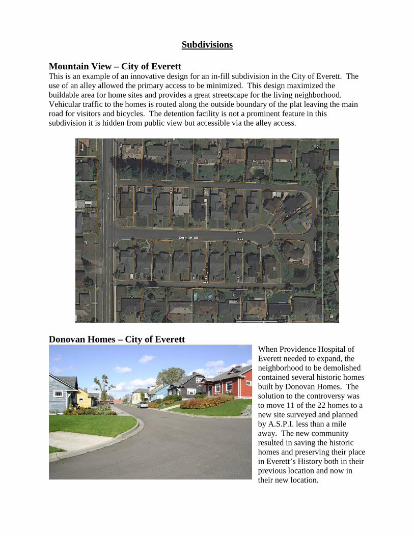
Subdivisions Mountain View – City of Everett This is an example of an innovative design for an in-fill subdivision in the City of Everett. The use of an alley allowed the primary access to be minimized. This design maximized the buildable area for home sites and provides a great streetscape for the living neighborhood. Vehicular traffic to the homes is routed along the outside boundary of the plat leaving the main road for visitors and bicycles. The detention facility is not a prominent feature in this subdivision it is hidden from public view but accessible via the alley access.
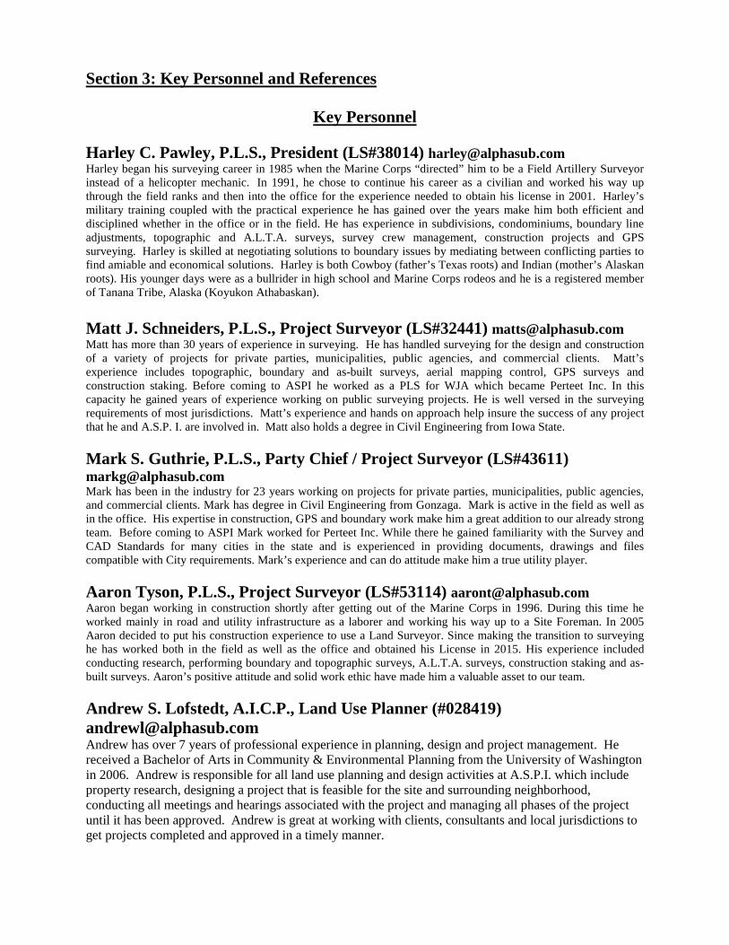
Donovan Homes – City of Everett
When Providence Hospital of Everett needed to expand, the neighborhood to be demolished contained several historic homes built by Donovan Homes. The solution to the controversy was to move 11 of the 22 homes to a new site surveyed and planned by A.S.P.I. less than a mile away. The new community resulted in saving the historic homes and preserving their place in Everett’s History both in their previous location and now in their new location.
Section 3: Key Personnel and References
Key Personnel Harley C. Pawley, P.L.S., President (LS#38014) [email protected] Harley began his surveying career in 1985 when the Marine Corps “directed” him to be a Field Artillery Surveyor instead of a helicopter mechanic. In 1991, he chose to continue his career as a civilian and worked his way up through the field ranks and then into the office for the experience needed to obtain his license in 2001. Harley’s military training coupled with the practical experience he has gained over the years make him both efficient and disciplined whether in the office or in the field. He has experience in subdivisions, condominiums, boundary line adjustments, topographic and A.L.T.A. surveys, survey crew management, construction projects and GPS surveying. Harley is skilled at negotiating solutions to boundary issues by mediating between conflicting parties to find amiable and economical solutions. Harley is both Cowboy (father’s Texas roots) and Indian (mother’s Alaskan roots). His younger days were as a bullrider in high school and Marine Corps rodeos and he is a registered member of Tanana Tribe, Alaska (Koyukon Athabaskan). Matt J. Schneiders, P.L.S., Project Surveyor (LS#32441) [email protected] Matt has more than 30 years of experience in surveying. He has handled surveying for the design and construction of a variety of projects for private parties, municipalities, public agencies, and commercial clients. Matt’s experience includes topographic, boundary and as-built surveys, aerial mapping control, GPS surveys and construction staking. Before coming to ASPI he worked as a PLS for WJA which became Perteet Inc. In this capacity he gained years of experience working on public surveying projects. He is well versed in the surveying requirements of most jurisdictions. Matt’s experience and hands on approach help insure the success of any project that he and A.S.P. I. are involved in. Matt also holds a degree in Civil Engineering from Iowa State. Mark S. Guthrie, P.L.S., Party Chief / Project Surveyor (LS#43611) [email protected] Mark has been in the industry for 23 years working on projects for private parties, municipalities, public agencies, and commercial clients. Mark has degree in Civil Engineering from Gonzaga. Mark is active in the field as well as in the office. His expertise in construction, GPS and boundary work make him a great addition to our already strong team. Before coming to ASPI Mark worked for Perteet Inc. While there he gained familiarity with the Survey and CAD Standards for many cities in the state and is experienced in providing documents, drawings and files compatible with City requirements. Mark’s experience and can do attitude make him a true utility player. Aaron Tyson, P.L.S., Project Surveyor (LS#53114) [email protected] Aaron began working in construction shortly after getting out of the Marine Corps in 1996. During this time he worked mainly in road and utility infrastructure as a laborer and working his way up to a Site Foreman. In 2005 Aaron decided to put his construction experience to use a Land Surveyor. Since making the transition to surveying he has worked both in the field as well as the office and obtained his License in 2015. His experience included conducting research, performing boundary and topographic surveys, A.L.T.A. surveys, construction staking and as-built surveys. Aaron’s positive attitude and solid work ethic have made him a valuable asset to our team. Andrew S. Lofstedt, A.I.C.P., Land Use Planner (#028419) [email protected] Andrew has over 7 years of professional experience in planning, design and project management. He received a Bachelor of Arts in Community & Environmental Planning from the University of Washington in 2006. Andrew is responsible for all land use planning and design activities at A.S.P.I. which include property research, designing a project that is feasible for the site and surrounding neighborhood, conducting all meetings and hearings associated with the project and managing all phases of the project until it has been approved. Andrew is great at working with clients, consultants and local jurisdictions to get projects completed and approved in a timely manner.
Lee A. Michaelis, AICP [email protected] Mr. Michaelis has over 9 years of staff management, project management and permitting experience in the private sector. He entered the field of consulting in 2005 as the Planning Director of Alpha Subdivision Pro’s Inc. (a survey and land use consulting firm in Everett, WA). Since then, he has gained extensive permitting knowledge and established many relationships in the development industry and the various regulatory agencies throughout Western Washington.
Prior to founding Puget Sound Planning in 2004, Mr. Michaelis was employed as a planner with the Cities of Lynnwood and North Bend for 9 years, where he served as an assistant and associate planner. It was during this period that Mr. Michaelis reviewed and approved land use and building permit applications and ascertained a breadth of knowledge needed to maneuver and understand the government process. It was also during this time, that Mr. Michaelis acquired the technical skills of Computer Aided Drafting and Geographical Information Systems. Two mapping systems used today in land use analysis.

References
Eric Schneider, PE, Snohomish County PUD 425 783-8624 Boundary and Topographic survey services for PUD projects. Joe Smeby, PE, Omega Engineering. 425-387-3820
Provide a wide range of survey services in support of plat, short plat, binding site plan and commercial engineering plans.
David Macdonald, Alderwood Water and Wastewater District 425-743-4605 Doug Lageson (retired), QWEST Field- Turner Construction 360-494-2224 Mary Fears, Habitat for Humanity, 425-258-2289 Tyson Lashbrook, SCI Infrastructures, 253-218-0444 Sunshine Vanover, Gamut360, 425-212-2210 Tom Hood, PE, City of Everett, 425-257-8809 Grace Kane, PE, City of Everett, 425-257-8800 Boundary and topographic survey services for City of Everett projects. Shawn Smith, City of Marysville, 360-363-8100 Boundary survey services for City properties and Rights of way. Tim Twietmeyer, Principal, Dykeman Architects 425-259-3161 Boundary and topographic survey services, Monroe Elementary. Bruce Crawford, BE Crawford and Assoc. 360-659-8228
Boundary and topographic surveying, land use design, preliminary plat, short plat and civil permit processing by jurisdictions statewide, construction staking, as-builts, final plat, short plat and binding site plan preparation and processing.
Tom Rochon, Owner, Designs Northwest 360-629-3441
Boundary and topographic survey to support architectural and engineering design projects.
Steve Hager, Donovan Homes, (425) 770-5335 Planning and surveying for the relocation of historic Everett homes. James Curdy, Desert Aire Water, Desert Aire Homeowners Association 509-932-5202
Boundary and topographic survey services. Hal Beumal, Everett School District 425-385-4190