Embed Size (px)
Citation preview
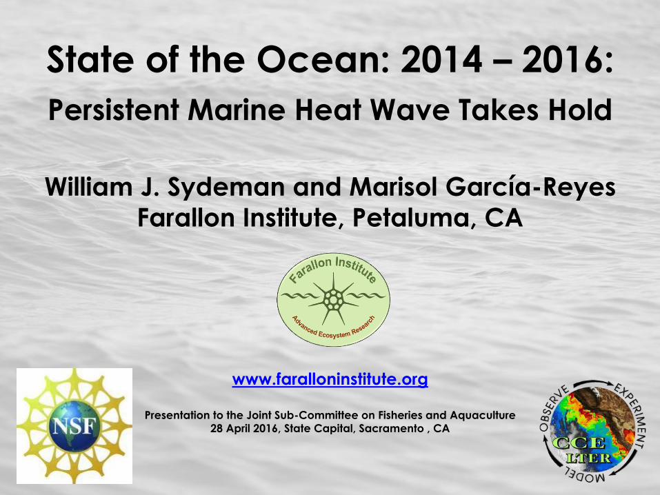
State of the Ocean: 2014 – 2016:
Persistent Marine Heat Wave Takes Hold
William J. Sydeman and Marisol García-Reyes
Farallon Institute, Petaluma, CA
www.faralloninstitute.org
Presentation to the Joint Sub-Committee on Fisheries and Aquaculture
28 April 2016, State Capital, Sacramento , CA
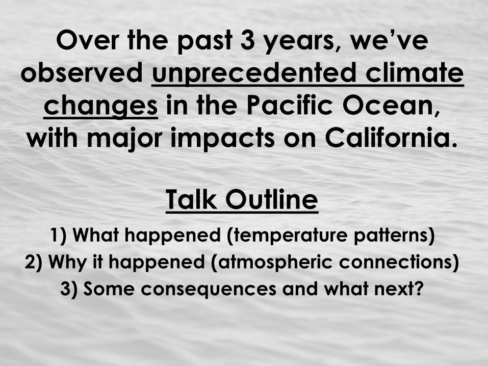
Over the past 3 years, we’ve
observed unprecedented climate
changes in the Pacific Ocean,
with major impacts on California.
Talk Outline
1) What happened (temperature patterns)
2) Why it happened (atmospheric connections)
3) Some consequences and what next?

What Happened?
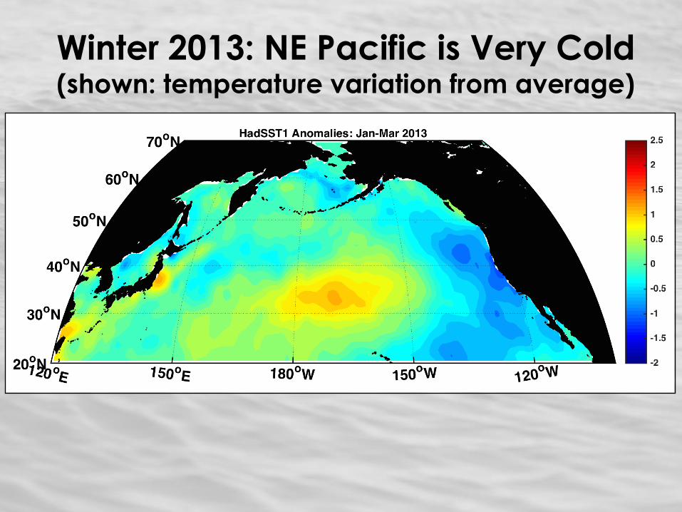
Winter 2013: NE Pacific is Very Cold (shown: temperature variation from average)
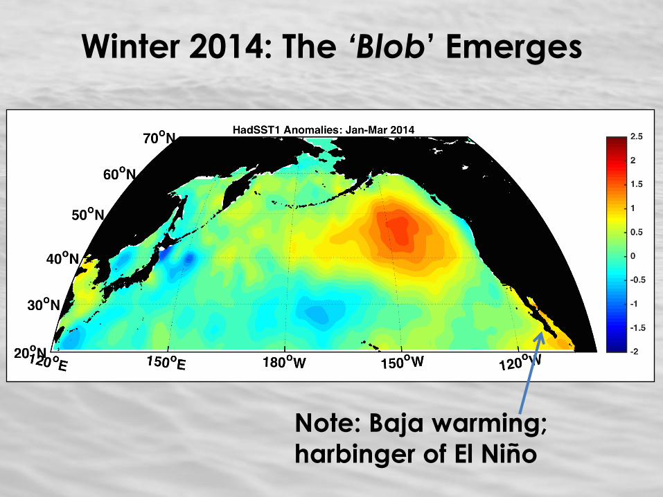
Winter 2014: The ‘Blob’ Emerges
Note: Baja warming;
harbinger of El Niño
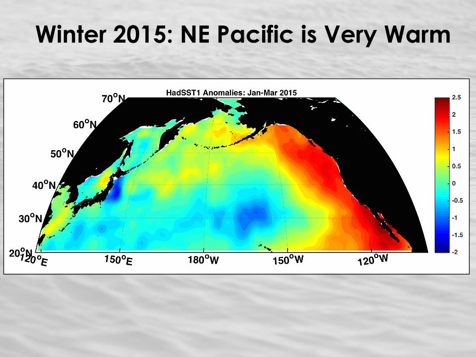
Winter 2015: NE Pacific is Very Warm
Why Did This Happen?
2 reasons
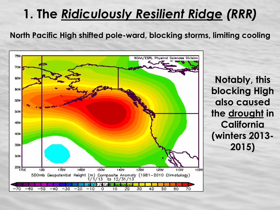
1. The Ridiculously Resilient Ridge (RRR)
North Pacific High shifted pole-ward, blocking storms, limiting cooling
Notably, this
blocking High
also caused
the drought in
California
(winters 2013-
2015)
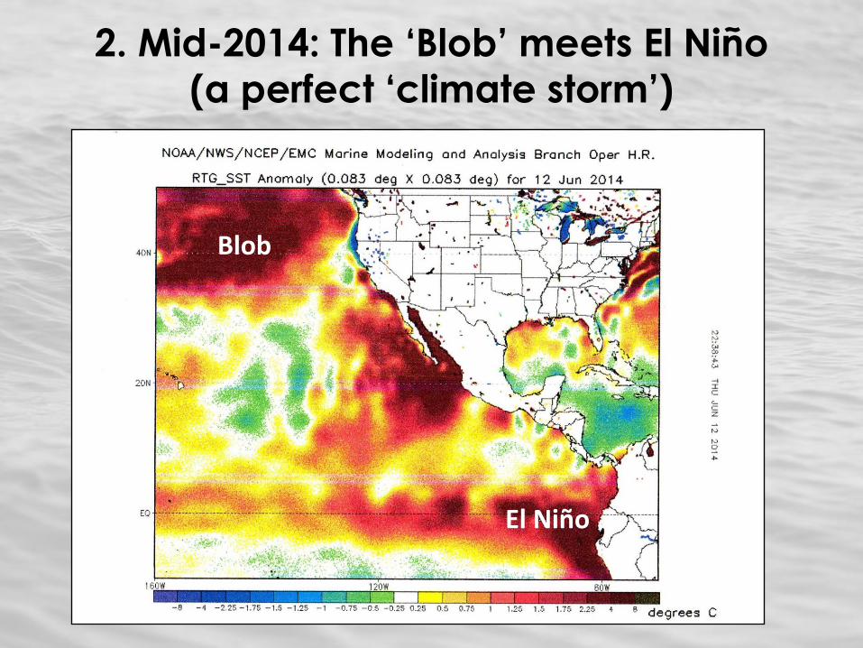
2. Mid-2014: The ‘Blob’ meets El Niño
(a perfect ‘climate storm’)
Blob
El Niño
Consequences
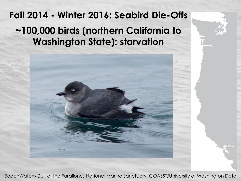
Fall 2014 - Winter 2016: Seabird Die-Offs
~100,000 birds (northern California to
Washington State): starvation
BeachWatch/Gulf of the Farallones National Marine Sanctuary, COASST/University of Washington Data
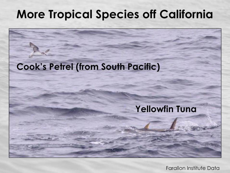
More Tropical Species off California
Cook’s Petrel (from South Pacific)
Yellowfin Tuna
Farallon Institute Data
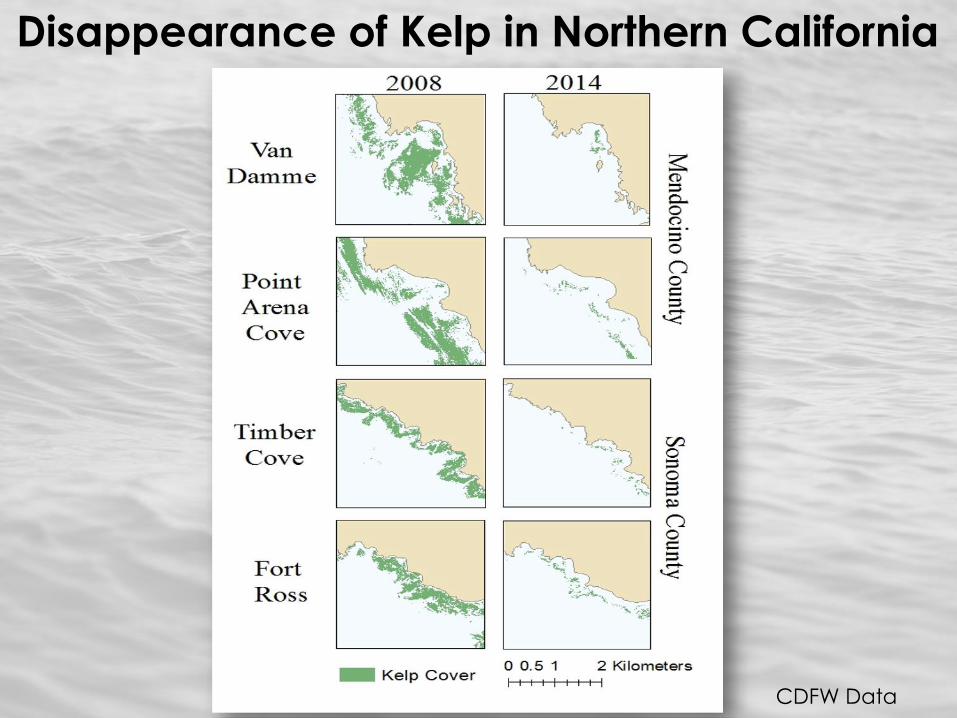
Disappearance of Kelp in Northern California
CDFW Data

What Next?
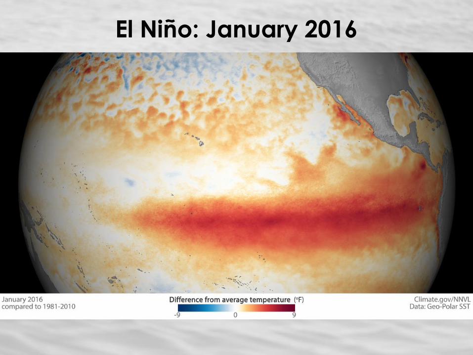
El Niño: January 2016
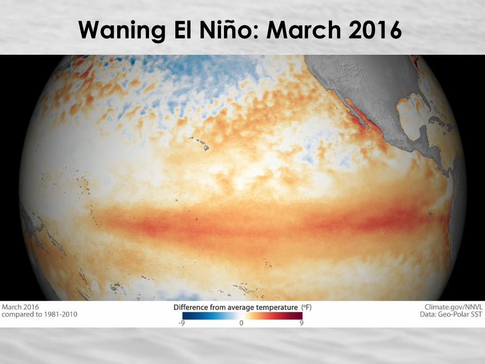
Waning El Niño: March 2016
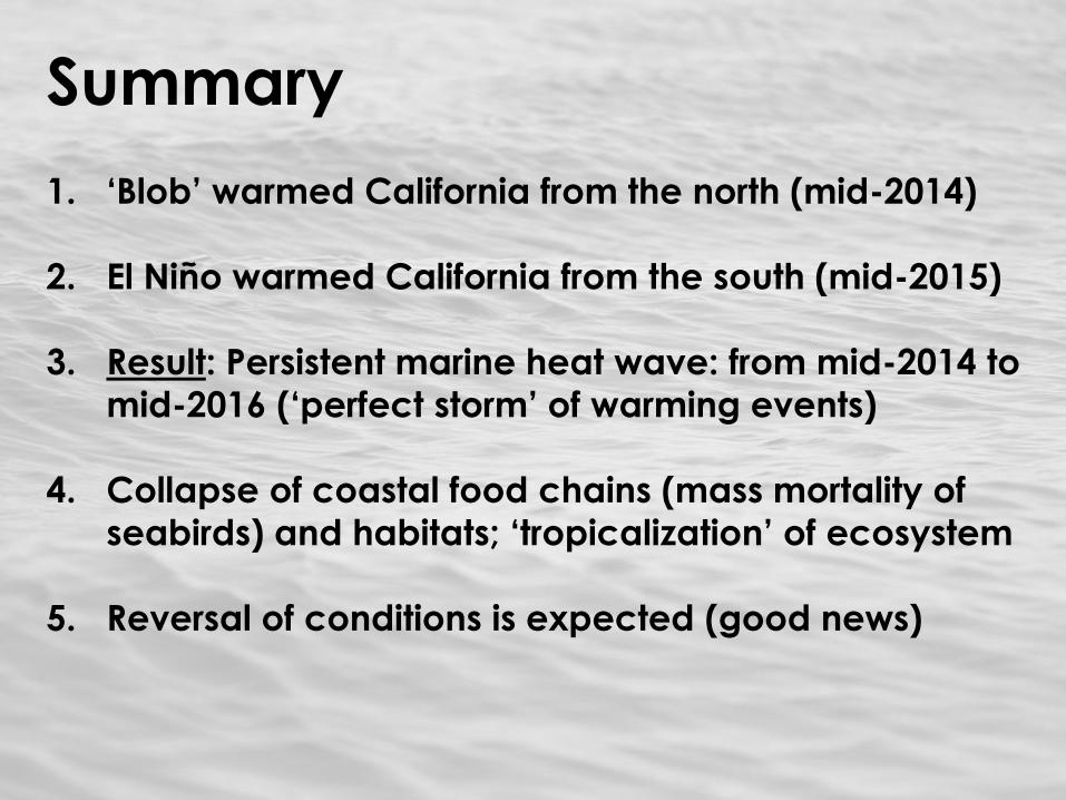
Summary 1. ‘Blob’ warmed California from the north (mid-2014)
2. El Niño warmed California from the south (mid-2015)
3. Result: Persistent marine heat wave: from mid-2014 to
mid-2016 (‘perfect storm’ of warming events)
4. Collapse of coastal food chains (mass mortality of
seabirds) and habitats; ‘tropicalization’ of ecosystem
5. Reversal of conditions is expected (good news)
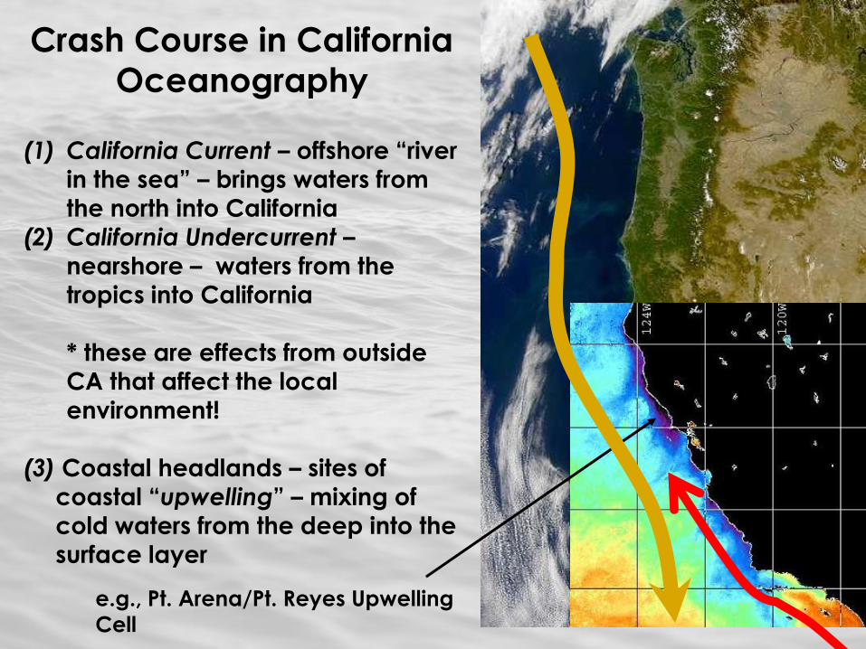
Crash Course in California
Oceanography
(1) California Current – offshore “river
in the sea” – brings waters from
the north into California
(2) California Undercurrent – nearshore – waters from the
tropics into California
* these are effects from outside
CA that affect the local
environment!
(3) Coastal headlands – sites of
coastal “upwelling” – mixing of
cold waters from the deep into the
surface layer
e.g., Pt. Arena/Pt. Reyes Upwelling
Cell
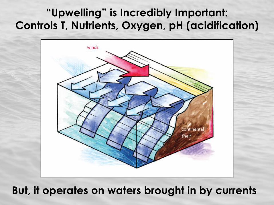
“Upwelling” is Incredibly Important:
Controls T, Nutrients, Oxygen, pH (acidification)
But, it operates on waters brought in by currents
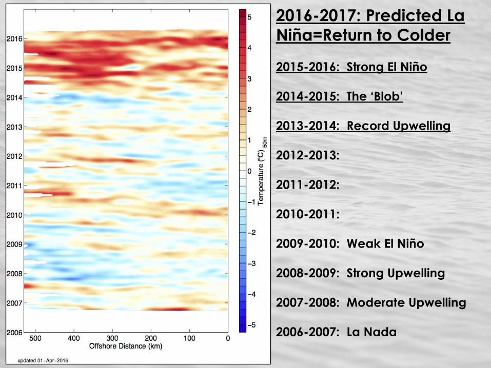
2016-2017: Predicted La
Niña=Return to Colder
2015-2016: Strong El Niño
2014-2015: The ‘Blob’
2013-2014: Record Upwelling
2012-2013:
2011-2012:
2010-2011:
2009-2010: Weak El Niño
2008-2009: Strong Upwelling
2007-2008: Moderate Upwelling
2006-2007: La Nada
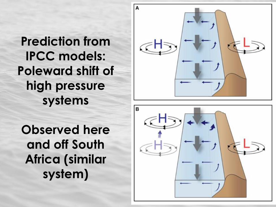
Prediction from
IPCC models:
Poleward shift of
high pressure
systems
Observed here
and off South
Africa (similar system)
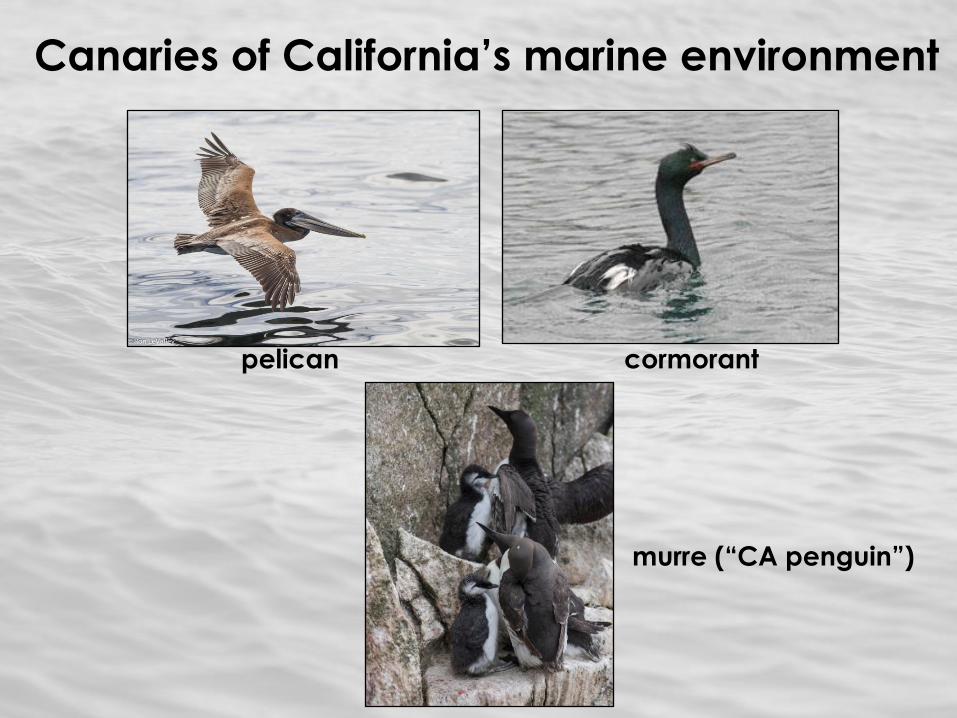
Canaries of California’s marine environment
pelican cormorant
murre (“CA penguin”)
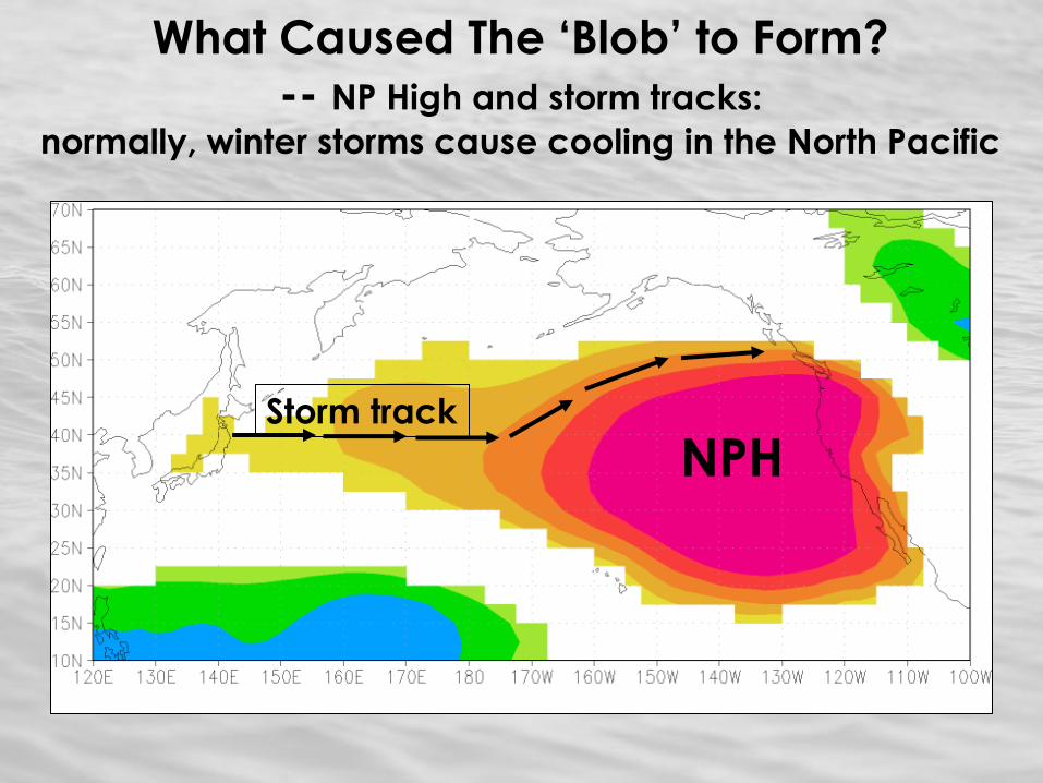
What Caused The ‘Blob’ to Form?
-- NP High and storm tracks:
normally, winter storms cause cooling in the North Pacific
NPH Storm track